Embed Size (px)
Citation preview
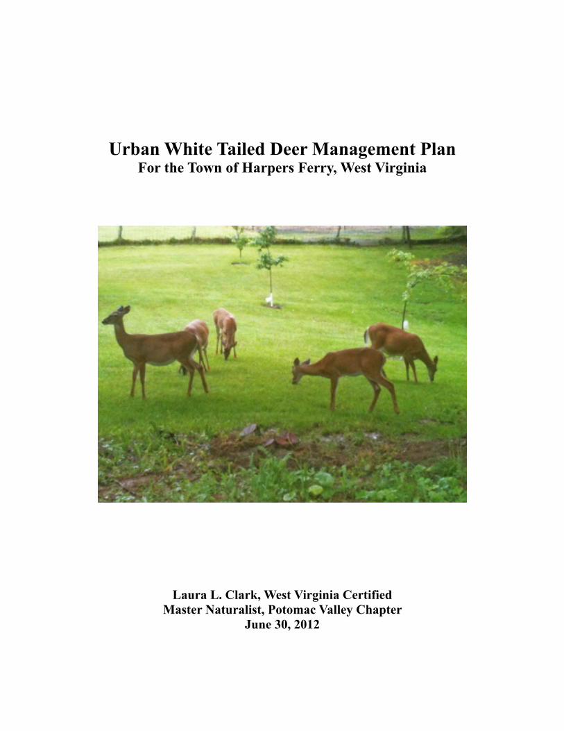
Urban White Tailed Deer Management PlanFor the Town of Harpers Ferry, West Virginia
Laura L. Clark, West Virginia Certified Master Naturalist, Potomac Valley Chapter
June 30, 2012
Table of Contents
Part I Background
A. Historical Overview 3 B. Current Population Levels 3 C. Local and State Involvement 4
Part II Current Assessment
A. Study Area 5 B. Wildlife Camera Survey 6 C. Community Survey 8D. Deer Plant Preference Assessment 10E. Impact on Forested Areas 12
Part III Management Program
A. Program Goals and Objectives 13 B. Regulated Hunt 14 C. Ordinance Revision 14
Credits for Project Assistance and References 15
Attachments 1. Study Plan 2. Camera Survey results and specific site data 3. Community Survey Form 4. Urban Landscape Plant Survey 5. Hunter Requirements and Rules of the Urban Archery Hunt 6. Harpers Ferry Proposed Ordinance Revision 7. Community Newsletter Articles – Public Education
2

Part 1
White Tailed Deer Management Plan: Background
A. Historical Overview
The population of the White Tailed Deer, a native to the North American continent, has varied over time. Data on population levels before colonization is limited, but we know Native Americans relied on deer for food, shelter, clothing and tools. Prior to European settlement the population estimates were 8 to 11 per square mile. (McCabe and McCabe 1984.) (1)
With the arrival of the Eastern Europeans, the landscape of North America changed. Early settlers relied on deer to sustain themselves and had unregulated harvests. They eradicated the White Tailed Deer’s natural predators, including the Eastern Timber Wolf and Cougar in the eastern United States by the turn of the 20th century. In addition, deforestation took place during the 19th and early 20th century. The natural habitat of the White Tailed Deer changed and deer conservation strategies were established by 1930, including the reintroduction of deer in the Mid Atlantic region. (2)
The landscape of North America continues to evolve. Since 1980, the White Tailed Deer population has rebounded and conflicts between humans and deer have risen. The habitat currently found in Harpers Ferry, West Virginia, is a mix of forest, open field, residential housing and National Historical Park. The forest, park and open fields, as well as agricultural areas, provide an ideal habitat for deer. The deer are continuing to adapt to urban residential settings. Not only are there no predators in their natural habitat, they have learned that urban areas are safe from hunting and have more attractive food sources.
B. Current Population Levels
The town of Harpers Ferry is surrounding by the Harpers Ferry National Historical Park which provides many benefits including protection and preservation of the area surrounding the town. But, with this resource comes an abundance of White Tailed Deer. Population estimates provided by the National Park Service for this region vary considerably. Acceptable deer densities, according to the Park Service range from 15 to 35 per square mile.
Harpers Ferry National Historical Park Service estimates for 2011 (based on pellet counts, thermal imaging and other techniques) for Harpers Ferry area are as follows:
Maryland Heights 90Loudoun Heights 57
Bolivar/Elk Run 80Short Hill 25
3
Estimates of deer per square mile from 2011 from other National Parks in the region are as follows: Valley Forge National Historical Park (PA) 241 Antietam National Battlefield Park (MD) 130 Manassas National Battlefield Park (VA) 172 Monocacy National Battlefield Park (MD) 235
A more exact deer population within the town limits of Harpers Ferry would be very difficult to establish, given the movement of the deer in and around the town and the seasonality of the deer behavior. A wildlife camera survey was done in April of 2012, to document the movement of the deer within town limits. Thermal imaging to provide a more accurate count was originally planned, but not done. However, documentation from the Camera Survey, the Harpers Ferry National Park Service information, and the Resident Survey results were more than adequate for identifying the problems in this management plan.
C. Local and State Involvement
A study plan (see Attachment A) for doing a White Tailed Deer Management Plan was submitted to Harpers Ferry Town Council at the March 2012 meeting. The author gave a brief presentation and the Council approved going forward with the Plan (and authorized an thermal imaging survey of the deer population.)
After receiving Council approval to proceed, the author arranged a meeting with local bow hunters who had volunteered to assist in the Wildlife Camera Survey. One of the hunters was especially helpful in that he'd been involved in similar deer management programs in problem areas of northern Virginia.
West Virginia Department of National Resources has guidelines for Deer Management that includes both harvest and habitat management. The Department has found that deer herds will increase 30 to 40 percent each year when protected and under good habitat conditions. In their experience, the only economically practical method of deer harvest management is through regulated hunting.
The Department has specific guidelines for Urban Deer Management, including an extended season, designating the number of deer harvested per hunter, and an archery-only program.
In preparing this management plan, the author also met several times with staff of the Harpers Ferry National Historical Park. They share the concern that deer over-population is causing significant damage to the natural resource balance within the Park. (It should be emphasized that hunting is forbidden within the national parks. The Park is managing their resources as required by federal mandate. Extensive environmental review is required before the Park would be able to proceed with a similar program.)
4
PART II
Current Assessment
Part 2 documents the problems associated with the current deer population levels within the town of Harpers Ferry.
A. Study Area
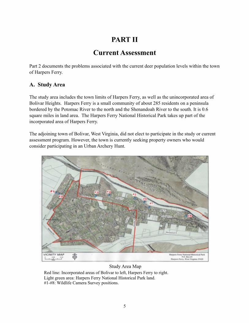
The study area includes the town limits of Harpers Ferry, as well as the unincorporated area of Bolivar Heights. Harpers Ferry is a small community of about 285 residents on a peninsula bordered by the Potomac River to the north and the Shenandoah River to the south. It is 0.6 square miles in land area. The Harpers Ferry National Historical Park takes up part of the incorporated area of Harpers Ferry.
The adjoining town of Bolivar, West Virginia, did not elect to participate in the study or current assessment program. However, the town is currently seeking property owners who would consider participating in an Urban Archery Hunt.
Study Area Map Red line: Incorporated areas of Bolivar to left, Harpers Ferry to right. Light green area: Harpers Ferry National Historical Park land. #1-#8: Wildlife Camera Survey positions.
5
B. Wildlife Camera Survey
Procedure Description
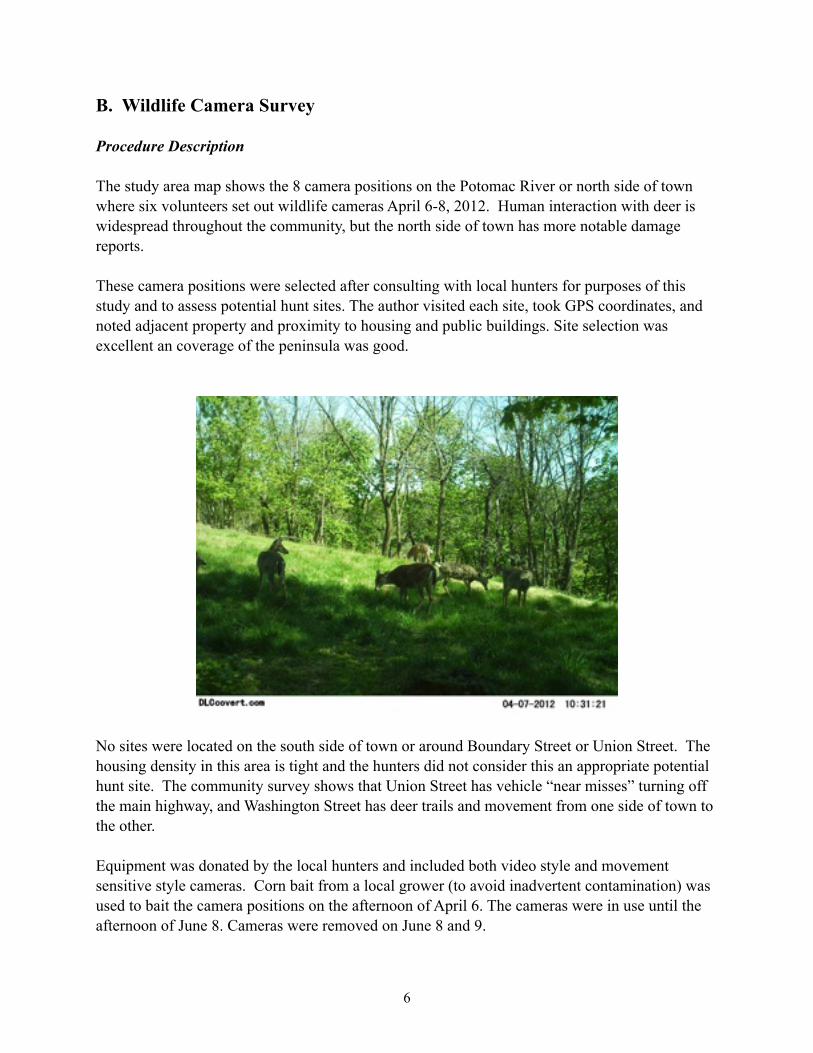
The study area map shows the 8 camera positions on the Potomac River or north side of town where six volunteers set out wildlife cameras April 6-8, 2012. Human interaction with deer is widespread throughout the community, but the north side of town has more notable damage reports.
These camera positions were selected after consulting with local hunters for purposes of this study and to assess potential hunt sites. The author visited each site, took GPS coordinates, and noted adjacent property and proximity to housing and public buildings. Site selection was excellent an coverage of the peninsula was good.
No sites were located on the south side of town or around Boundary Street or Union Street. The housing density in this area is tight and the hunters did not consider this an appropriate potential hunt site. The community survey shows that Union Street has vehicle “near misses” turning off the main highway, and Washington Street has deer trails and movement from one side of town to the other.
Equipment was donated by the local hunters and included both video style and movement sensitive style cameras. Corn bait from a local grower (to avoid inadvertent contamination) was used to bait the camera positions on the afternoon of April 6. The cameras were in use until the afternoon of June 8. Cameras were removed on June 8 and 9.
6
Ideal study conditions would have been during the fall months, with antlered deer, and when the deer are most active. But, the program got underway during the spring months, and to facilitate a program being implemented in 2012, the camera survey was done in April.
Results
Volunteers and the author reviewed hundreds of photos. A spreadsheet, set up with the time and date and camera position for each photo, showed simultaneous hits, and deer movement from one position to another. Within the first hours of the cameras being placed, six of the seven camera positions had simultaneous hits with a total count 26 deer at the six cameras. Five camera positions typically had six deer photographed at one time during the 3-day period. Position 6, off Putnam Street, showed nine deer bedded down the afternoon of June 7.
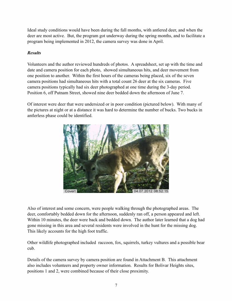
Of interest were deer that were undersized or in poor condition (pictured below). With many of the pictures at night or at a distance it was hard to determine the number of bucks. Two bucks in antlerless phase could be identified.
Also of interest and some concern, were people walking through the photographed areas. The deer, comfortably bedded down for the afternoon, suddenly ran off, a person appeared and left. Within 10 minutes, the deer were back and bedded down. The author later learned that a dog had gone missing in this area and several residents were involved in the hunt for the missing dog. This likely accounts for the high foot traffic.
Other wildlife photographed included raccoon, fox, squirrels, turkey vultures and a possible bear cub.
Details of the camera survey by camera position are found in Attachment B. This attachment also includes volunteers and property owner information. Results for Bolivar Heights sites, positions 1 and 2, were combined because of their close proximity.
7
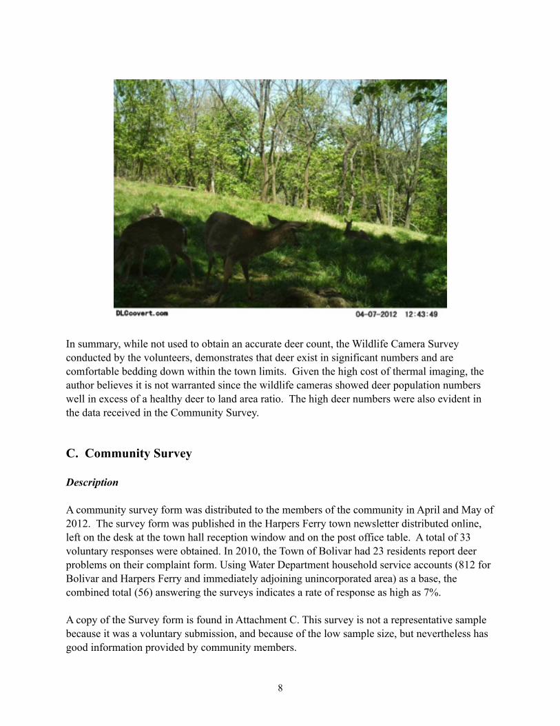
In summary, while not used to obtain an accurate deer count, the Wildlife Camera Survey conducted by the volunteers, demonstrates that deer exist in significant numbers and are comfortable bedding down within the town limits. Given the high cost of thermal imaging, the author believes it is not warranted since the wildlife cameras showed deer population numbers well in excess of a healthy deer to land area ratio. The high deer numbers were also evident in the data received in the Community Survey.
C. Community Survey
Description
A community survey form was distributed to the members of the community in April and May of 2012. The survey form was published in the Harpers Ferry town newsletter distributed online, left on the desk at the town hall reception window and on the post office table. A total of 33 voluntary responses were obtained. In 2010, the Town of Bolivar had 23 residents report deer problems on their complaint form. Using Water Department household service accounts (812 for Bolivar and Harpers Ferry and immediately adjoining unincorporated area) as a base, the combined total (56) answering the surveys indicates a rate of response as high as 7%.
A copy of the Survey form is found in Attachment C. This survey is not a representative sample because it was a voluntary submission, and because of the low sample size, but nevertheless has good information provided by community members.
8
Results: Incidence of Lyme Disease
Eleven households reported 13 cases of Lyme disease within the last two years on the 2012 Community Survey. In other words, 33% of the households participating in the survey have been treated for Lyme disease.
The Center for Disease Control publishes data on confirmed cases that are reported to them. For 2010, there were 7.3 confirmed cases per 100,000 population nationally. The local health department does not have data on Lyme disease.
In 2011, the Center for Disease Control came to Harpers Ferry National Historical Park and collected and tested 13 ticks in six different parts of the Park. None of the ticks tested positive for Lyme. It is not possible to determine where our residents are contracting Lyme. But, the incidence rate is high in our community, and we do have a public health issue in Harpers Ferry.
The Center for Disease Control's website shows the White Tailed Deer as a host of the tick that carries Lyme disease and states that the risk of greatest human infection is in late spring and summer, prime outdoor times for humans in this area.
Results – Deer in Yards
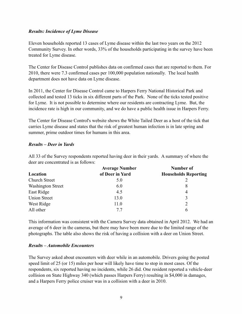
All 33 of the Survey respondents reported having deer in their yards. A summary of where the deer are concentrated is as follows: Average Number Number ofLocation of Deer in Yard Households Reporting Church Street 5.0 2Washington Street 6.0 8East Ridge 4.5 4Union Street 13.0 3West Ridge 11.0 2All other 7.7 6
This information was consistent with the Camera Survey data obtained in April 2012. We had an average of 6 deer in the cameras, but there may have been more due to the limited range of the photographs. The table also shows the risk of having a collision with a deer on Union Street.
Results – Automobile Encounters
The Survey asked about encounters with deer while in an automobile. Drivers going the posted speed limit of 25 (or 15) miles per hour will likely have time to stop in most cases. Of the respondents, six reported having no incidents, while 26 did. One resident reported a vehicle-deer collision on State Highway 340 (which passes Harpers Ferry) resulting in $4,000 in damages, and a Harpers Ferry police cruiser was in a collision with a deer in 2010.
9
State Farm Insurance reports on deer-vehicle collisions annually. As headlined on their website (www.statefarm.com) in October, 2011, "U.S. Deer-Vehicle Collisions Fall 7 Percent; Mishaps Most Likely in November And in West Virginia." West Virginia, according to their report, leads the nation for the fifth year in a row, for where an individual driver is most likely to run into a deer.
Lastly, Survey comments on automobile encounters in this area included the following: “Deer stand in road and face cars down.”
“Ran in front of me and glanced off bumper.”“Dodged them running across Washington Street.”“Two near misses on Washington Street.”“We observe many close calls on Union Street.”
Results – General Comments
The Survey form included blank lines at the bottom for open comments. The possibility of having a hunt to reduce the herd was not mentioned, but 7 of 33 respondents said specifically that they were in favor of such a program, while one was not. Generally, the following comments summarize the current culture regarding deer in Harpers Ferry:
“The deer are a part of the charm of our community.”“As much as I like to see the deer, there are too many for the area.”
There are a few individuals who spoke to the author against an urban hunt program, and there are also residents who are angry and frustrated over the loss of expensive and carefully tended gardens to hungry deer. One resident, after learning of another resident being knocked out by a spooked deer in his yard, said she no longer walked after dark on West Ridge Street for fear of being hit by a running deer.
D. Deer Plant Preference Assessment
The community reported 62 varieties of urban plants being browsed by deer. Rutgers University and the New Jersey Agricultural Experimental Station have developed a Deer Browsing Desirability Rating Chart to indicate plant preference by browsing deer. Plants range from A, least desirable and rarely damaged by deer browsing, to D, most desirable and most often damaged by deer browsing.
10
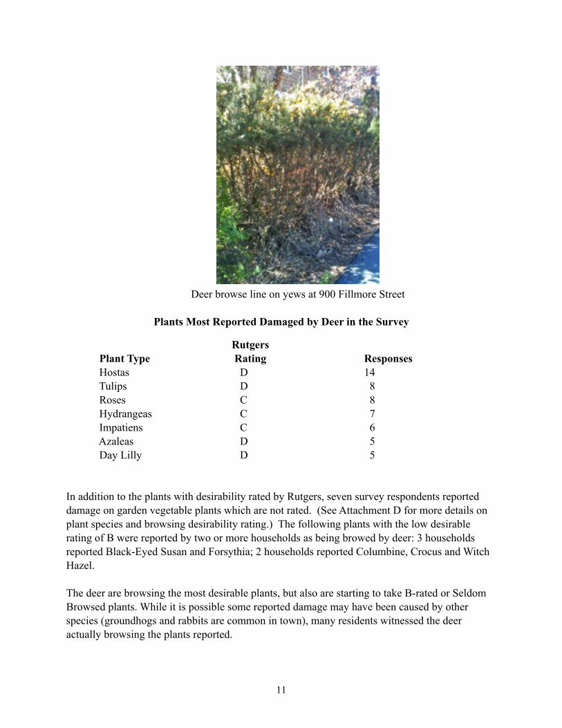
Deer browse line on yews at 900 Fillmore Street
Plants Most Reported Damaged by Deer in the Survey
Rutgers Plant Type Rating Responses Hostas D 14 Tulips D 8 Roses C 8 Hydrangeas C 7 Impatiens C 6 Azaleas D 5 Day Lilly D 5
In addition to the plants with desirability rated by Rutgers, seven survey respondents reported damage on garden vegetable plants which are not rated. (See Attachment D for more details on plant species and browsing desirability rating.) The following plants with the low desirable rating of B were reported by two or more households as being browed by deer: 3 households reported Black-Eyed Susan and Forsythia; 2 households reported Columbine, Crocus and Witch Hazel.
The deer are browsing the most desirable plants, but also are starting to take B-rated or Seldom Browsed plants. While it is possible some reported damage may have been caused by other species (groundhogs and rabbits are common in town), many residents witnessed the deer actually browsing the plants reported.
11
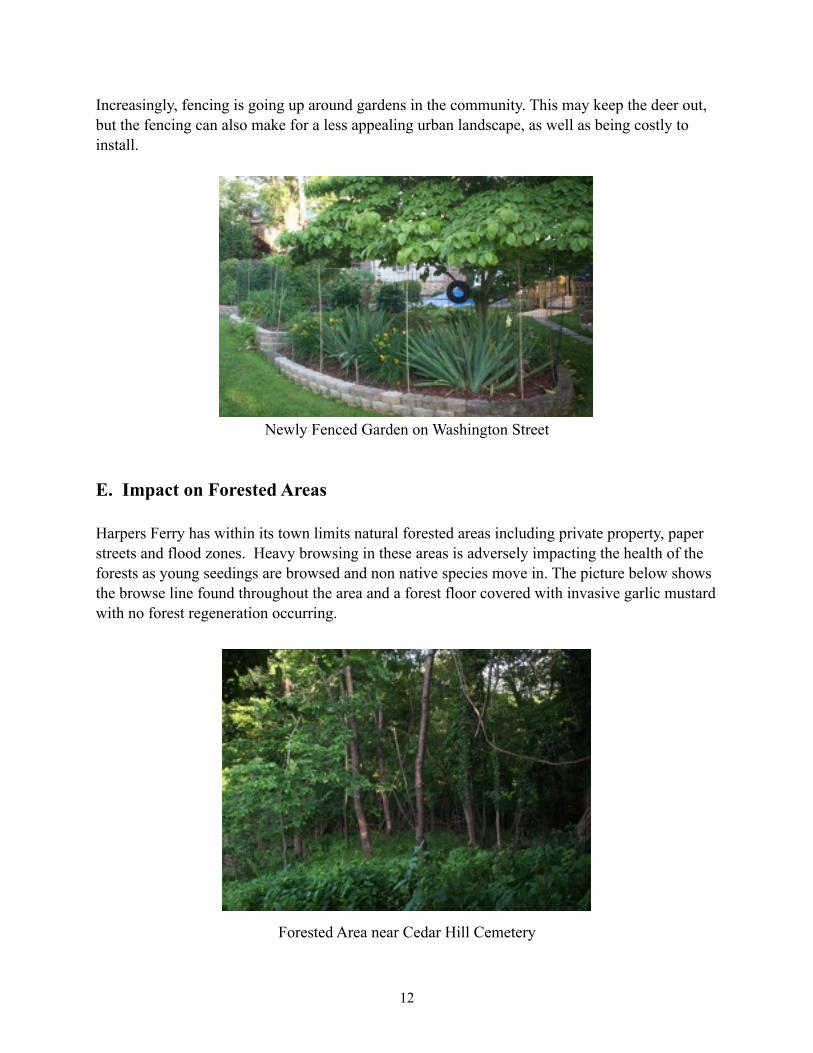
Increasingly, fencing is going up around gardens in the community. This may keep the deer out, but the fencing can also make for a less appealing urban landscape, as well as being costly to install.
Newly Fenced Garden on Washington Street
E. Impact on Forested Areas
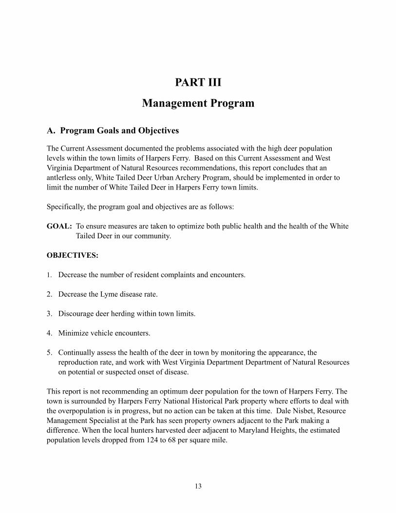
Harpers Ferry has within its town limits natural forested areas including private property, paper streets and flood zones. Heavy browsing in these areas is adversely impacting the health of the forests as young seedings are browsed and non native species move in. The picture below shows the browse line found throughout the area and a forest floor covered with invasive garlic mustard with no forest regeneration occurring.
Forested Area near Cedar Hill Cemetery
12
PART III
Management Program
A. Program Goals and Objectives
The Current Assessment documented the problems associated with the high deer population levels within the town limits of Harpers Ferry. Based on this Current Assessment and West Virginia Department of Natural Resources recommendations, this report concludes that an antlerless only, White Tailed Deer Urban Archery Program, should be implemented in order to limit the number of White Tailed Deer in Harpers Ferry town limits.
Specifically, the program goal and objectives are as follows:
GOAL: To ensure measures are taken to optimize both public health and the health of the White Tailed Deer in our community.
OBJECTIVES:
1. Decrease the number of resident complaints and encounters.
2. Decrease the Lyme disease rate.
3. Discourage deer herding within town limits.
4. Minimize vehicle encounters.
5. Continually assess the health of the deer in town by monitoring the appearance, the reproduction rate, and work with West Virginia Department Department of Natural Resources on potential or suspected onset of disease.
This report is not recommending an optimum deer population for the town of Harpers Ferry. The town is surrounded by Harpers Ferry National Historical Park property where efforts to deal with the overpopulation is in progress, but no action can be taken at this time. Dale Nisbet, Resource Management Specialist at the Park has seen property owners adjacent to the Park making a difference. When the local hunters harvested deer adjacent to Maryland Heights, the estimated population levels dropped from 124 to 68 per square mile.
13
B. Regulated Hunt
The Hunter Requirements and Rules (see Attachment E) of the hunt were developed by our local hunters based on the rules used by Morgantown, West Virginia Urban Hunt Program, and the Rules and Regulations used by Suburban Whitetailed Management of Northern Virginia, a non profit group of archery hunters assisting landowners in Northern Virginia with deer management since 1997. The goal of the requirements and rules are to insure the utmost care is taken for the safety of the community, and to insure that only qualified hunters are participating.
The hunter requirements and rules of the hunt were also reviewed by West Virginia Department of Natural Resources which found the proposed requirements and rules to be strict and likely to reduce the number of hunters willing to participate in the hunt. The hunt will be limited to residents of Harpers Ferry and property owner designees during the first season. With Town Council approval of the program, the Urban Archery Hunt is expected to begin in the fall of 2012. The requirements and rules will be re-evaluated after the first season to see if changes are needed.
These rules were also reviewed and approved by both the Harpers Ferry Police Chief and the Chief Ranger of Harpers Ferry National Historical Park. Since many of the hunting zones are in close proximity to Harpers Ferry National Historical Park, Park assistance may be necessary for track and retrieval of deer shot within the established hunting zones that fall on Park property. Hunting is NOT permitted in Harpers Ferry National Historical Park.
C. Harpers Ferry Ordinance Revision
As currently written, Section 505.05 of the Harpers Ferry Town Code prohibits hunting within the limits of Harpers Ferry. An ordinance revision has been drafted to allow for an Urban Deer Management Program. (See Attachment F.)
Public comment is currently being solicited and a public meeting is scheduled for July 2 to educate the community on the program and receive comments. First reading of the proposed ordinance is scheduled for July 9.
14
Credits for Project Assistance
Rich Rogers, West Virginia DNR, District Wildlife BiologistJosh Vance, West Virginia DNR, Wildlife ManagerDale Nisbet, Resource Manager, Harpers Ferry National Historical ParkJohn Brown, Harpers Ferry Police ChiefJeff Woods, Chief Ranger, Harpers Ferry National Historical ParkChristy Huddle, Resident
Management Program Objective Development and author Regulations and Rules of Hunt, and the Draft Ordinance, proofing and submittal Community Newsletter Articles
Roger Harris, Wildlife Camera Survey, Development of Requirements and Rules of the HuntWildlife Camera Survey Volunteers Ray Dillow James Woods Bart Wheatly Dick Potteiger Wayne BishopWildlife Camera Equipment Donors Mark Gauntner Rodger HarrisWildlife Camera Survey Photo Review and Data Summary Joan Goody David ArcherPlant Survey Summary, Technical Assistance, Proof Reading Pamela Sheets
References
(1) Valley Forge National Historical Park White Tailed Deer Management Plan Dec 2008(2) State of Maryland White Tailed Deer Management Plan 2009 – 2018
15