Embed Size (px)
Citation preview
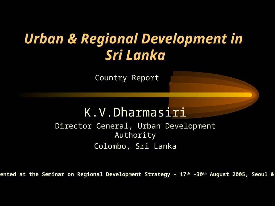
Urban & Regional Development in Sri Lanka
K.V.DharmasiriDirector General, Urban Development Authority
Colombo, Sri Lanka
A Paper Presented at the Seminar on Regional Development Strategy – 17 th –30th August 2005, Seoul & Anyang City
Country Report
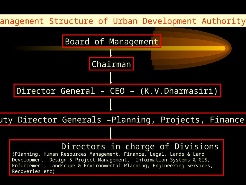
Management Structure of Urban Development Authority
Board of Management
Chairman
Director General – CEO – (K.V.Dharmasiri)
Deputy Director Generals –Planning, Projects, Finance
Directors in charge of Divisions(Planning, Human Resources Management, Finance, Legal, Lands & Land Development, Design & Project Management, Information Systems & GIS, Enforcement, Landscape & Environmental Planning, Engineering Services, Recoveries etc)
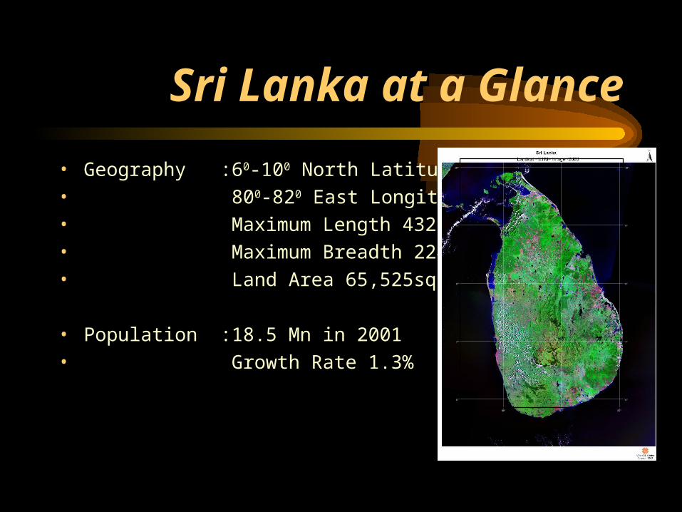
Sri Lanka at a Glance
• Geography :60-100 North Latitude
• 800-820 East Longitude
• Maximum Length 432Km
• Maximum Breadth 224Km
• Land Area 65,525sq.km
• Population :18.5 Mn in 2001
• Growth Rate 1.3%
6° 6°
7° 7°
8° 8°
9° 9°
10° 10°
80°
80°
81°
81°
82°
82°
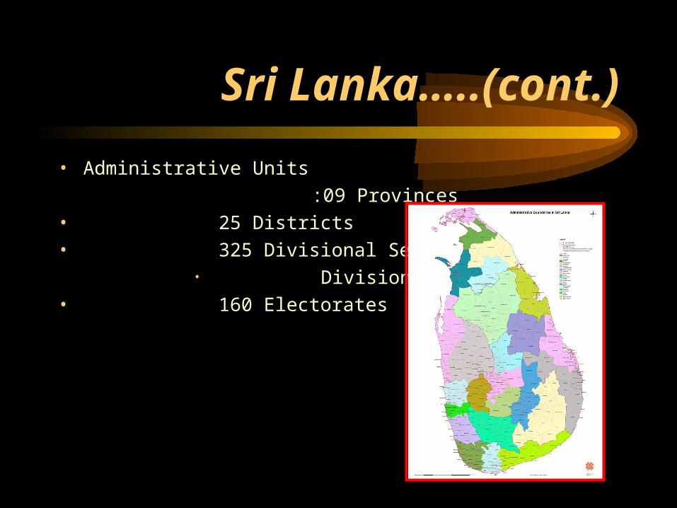
Sri Lanka…..(cont.)
• Administrative Units
:09 Provinces
• 25 Districts
• 325 Divisional Secretary• Divisions
• 160 Electorates
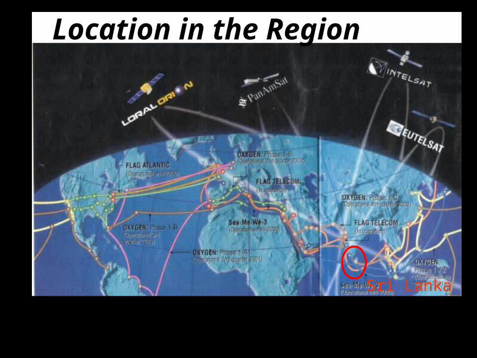
Location in the Region
Sri Lanka
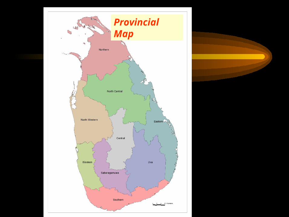
Provincial Map
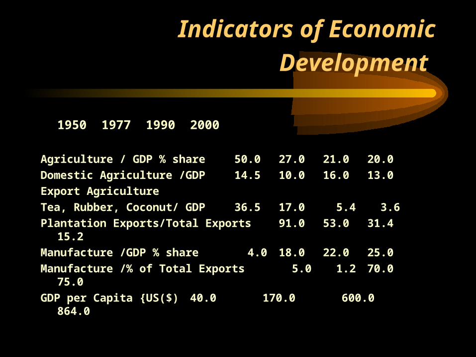
Indicators of Economic Development
1950 1977 1990 2000
Agriculture / GDP % share 50.0 27.0 21.0 20.0
Domestic Agriculture /GDP 14.5 10.0 16.0 13.0
Export Agriculture
Tea, Rubber, Coconut/ GDP 36.5 17.0 5.4 3.6
Plantation Exports/Total Exports 91.0 53.0 31.4 15.2
Manufacture /GDP % share 4.0 18.0 22.0 25.0
Manufacture /% of Total Exports 5.0 1.2 70.0 75.0
GDP per Capita {US($) 40.0 170.0 600.0 864.0
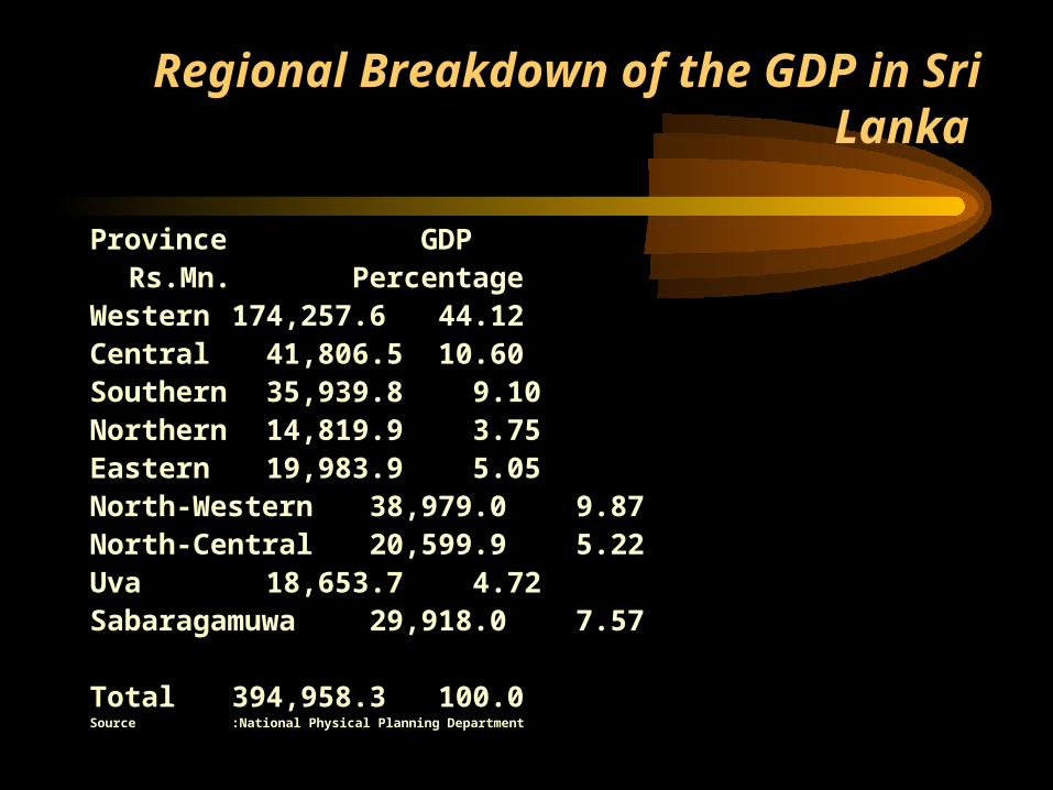
Regional Breakdown of the GDP in Sri Lanka
Province GDPRs.Mn. Percentage
Western 174,257.6 44.12Central 41,806.5 10.60Southern 35,939.8 9.10Northern 14,819.9 3.75Eastern 19,983.9 5.05North-Western 38,979.0 9.87North-Central 20,599.9 5.22Uva 18,653.7 4.72Sabaragamuwa 29,918.0 7.57
Total 394,958.3 100.0Source:National Physical Planning Department
Issues on Regional Development
• Convert Sectoral Planning process in to a Regional Planning process
• Link the Regional Development with the potential and resources available in the region.
• Guide and direct the investments both by private and public sectors in the regions.
• Link inter and intra regions with the major infrastructure networks.• How to absorb IT facilities for the Regional Development.• Buildup linkages between Sri Lanka and other Asia Pacific
Countries.
Issues on Urban Development
• Comparatively among the other Asian Countries, Sri Lanka has shown a vast disparity among the 1st Order City and other Cities in terms of population and other infrastructure developments, 2nd order cities do not appear to be in the Urban Hierarchical order
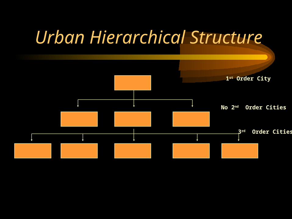
Urban Hierarchical Structure
1st Order City
No 2nd Order Cities
3rd Order Cities
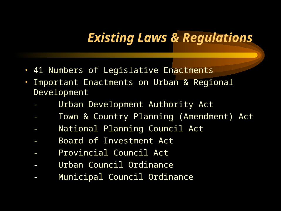
Existing Laws & Regulations
• 41 Numbers of Legislative Enactments
• Important Enactments on Urban & Regional Development
- Urban Development Authority Act
- Town & Country Planning (Amendment) Act
- National Planning Council Act
- Board of Investment Act
- Provincial Council Act
- Urban Council Ordinance
- Municipal Council Ordinance
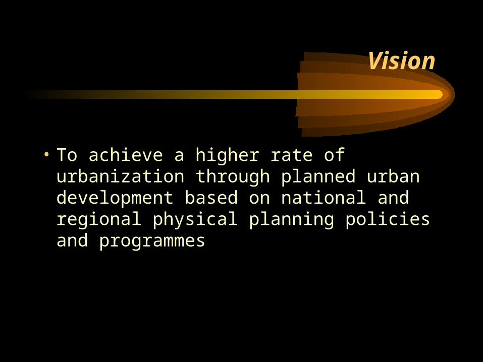
Vision
• To achieve a higher rate of urbanization through planned urban development based on national and regional physical planning policies and programmes
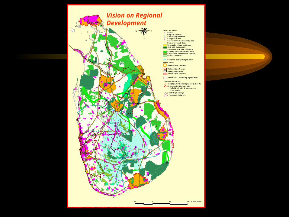
PROPOSED SPATIAL STRUCTURE
Other Uses - Including Agriculture
Environmentally Fragile Area
Forest ReservesProposed Conservation ForestsExisting Conservation Forests
Wild Life Reserves & Proposed Wild Life Corridors
Tourist Development Areas
% Lesser Known Archaeological, Nature & Scenic Sites
W Archaeological Area
Ú Religious Place
ÿ Major Waterfalls$ Peaks
Protected Areas
Metropolitan Area
Urban Areas
Transport Network
Proposed Railways Existing Railways
- Including Major Improvements to A Routes
Proposed Highway Links Existing National Highways (Class A)
Other Urban Centres
Metro Urban Centres
Metropolitan Region
Prepared by Research and Information & GIS Unit -National Physical Planning Department
%
%
%%
%
%
%
%
% %
%
%
%
%
%
%
%
%%
%
%%
%U
%U%U
%U
%U
W
W Ú
Ú
W
Ú
WÚ
ÚWWÚ
ÚW
W
ÚW
Ú
W
W
WÚÚ
ÚW
Ú W ÚW
ÚW Ú
Ú
Ú
ÚWW
Ú
ÚÚ
WÚÚ
ÚÚ
WW Ú
Ú
Ú
Ú
W
W
Ú
W
W
Ú
W
Ú
Ú
W
Ú
W
W
Ú
Ú
W
Ú
Ú
Ú
Ú
Ú
Ú
W
Ú
$
$
$
$
$
$
$
$
$
$
$
$
$
$
ÿÿ
ÿÿ
ÿ
ÿÿ ÿ
ÿ
ÿ
ÿ
60 0 60 120 Kilometers
N
EW
S
Vision on Regional Development
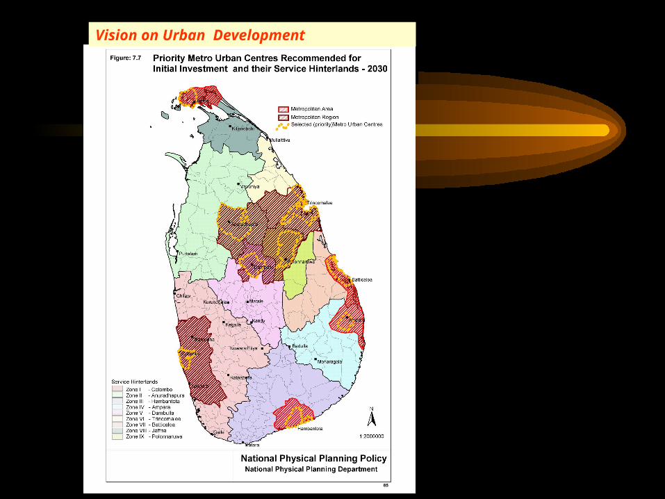
Vision on Urban Development