Embed Size (px)
Citation preview
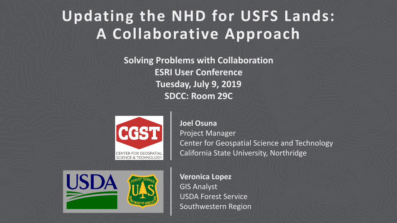
Updating the NHD for USFS Lands: A Collaborative Approach
Solving Problems with CollaborationESRI User ConferenceTuesday, July 9, 2019
SDCC: Room 29C
Veronica LopezGIS AnalystUSDA Forest ServiceSouthwestern Region
Joel OsunaProject ManagerCenter for Geospatial Science and TechnologyCalifornia State University, Northridge
Presentation Overview• NHD and Its Importance
• USFS Region 3 and NHD
• Building Collaboration
• Scope and Work Specifics
• Results and Outcomes
• Benefits
• Q&A
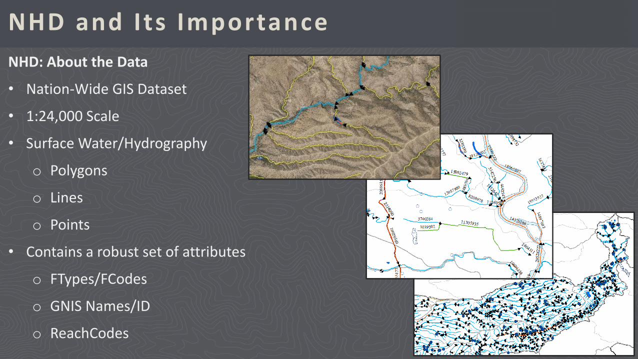
NHD and Its ImportanceNHD: About the Data
• Nation-Wide GIS Dataset
• 1:24,000 Scale
• Surface Water/Hydrography
o Polygons
o Lines
o Points
• Contains a robust set of attributes
o FTypes/FCodes
o GNIS Names/ID
o ReachCodes
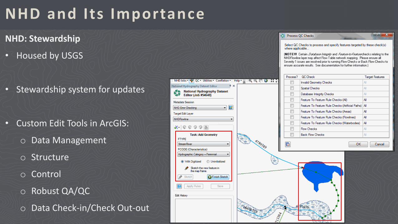
NHD and Its ImportanceNHD: Stewardship
• Housed by USGS
• Stewardship system for updates
• Custom Edit Tools in ArcGIS:
o Data Management
o Structure
o Control
o Robust QA/QC
o Data Check-in/Check Out-out
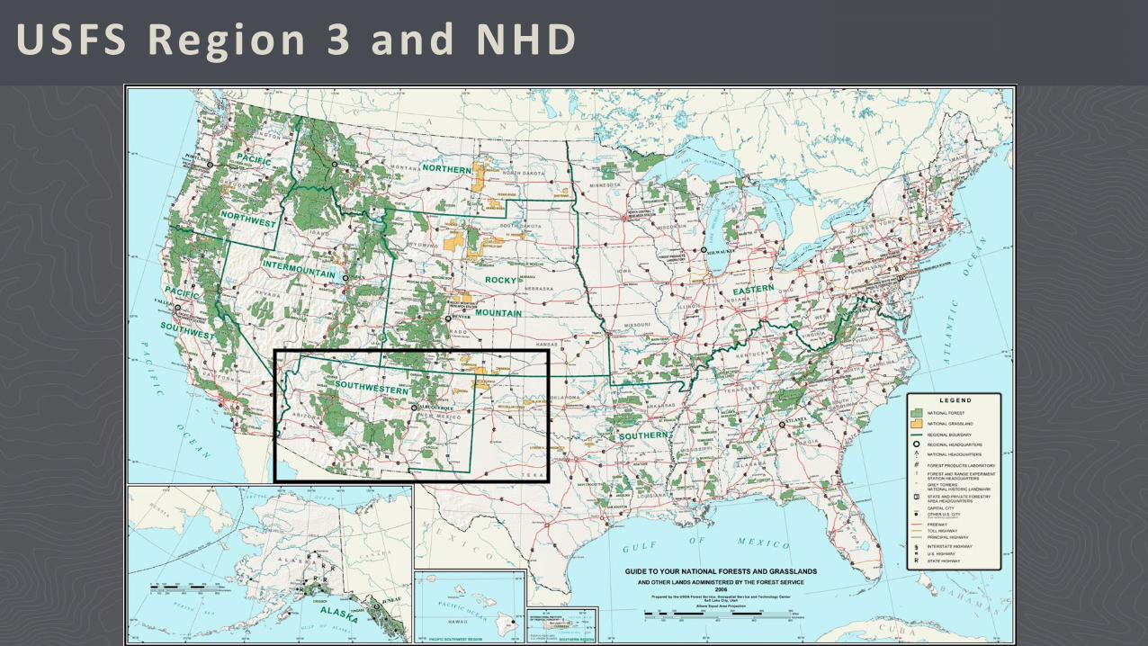
USFS Region 3 and NHD
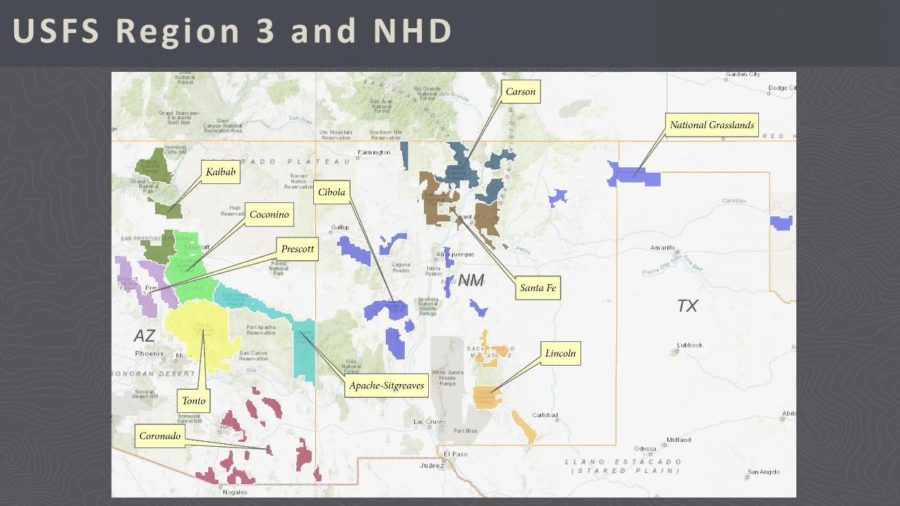
USFS Region 3 and NHD
AZ
NMTX
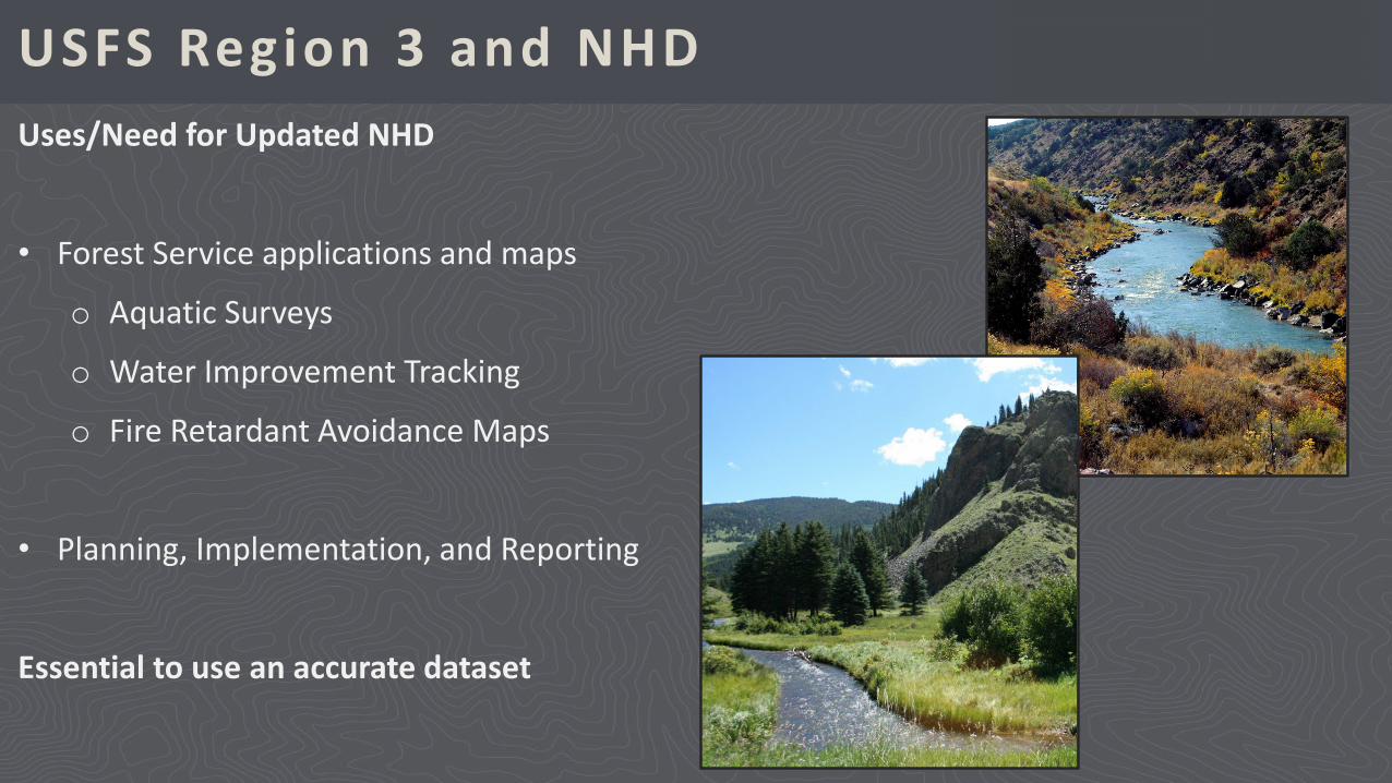
USFS Region 3 and NHDUses/Need for Updated NHD
• Forest Service applications and maps
o Aquatic Surveys
o Water Improvement Tracking
o Fire Retardant Avoidance Maps
• Planning, Implementation, and Reporting
Essential to use an accurate dataset
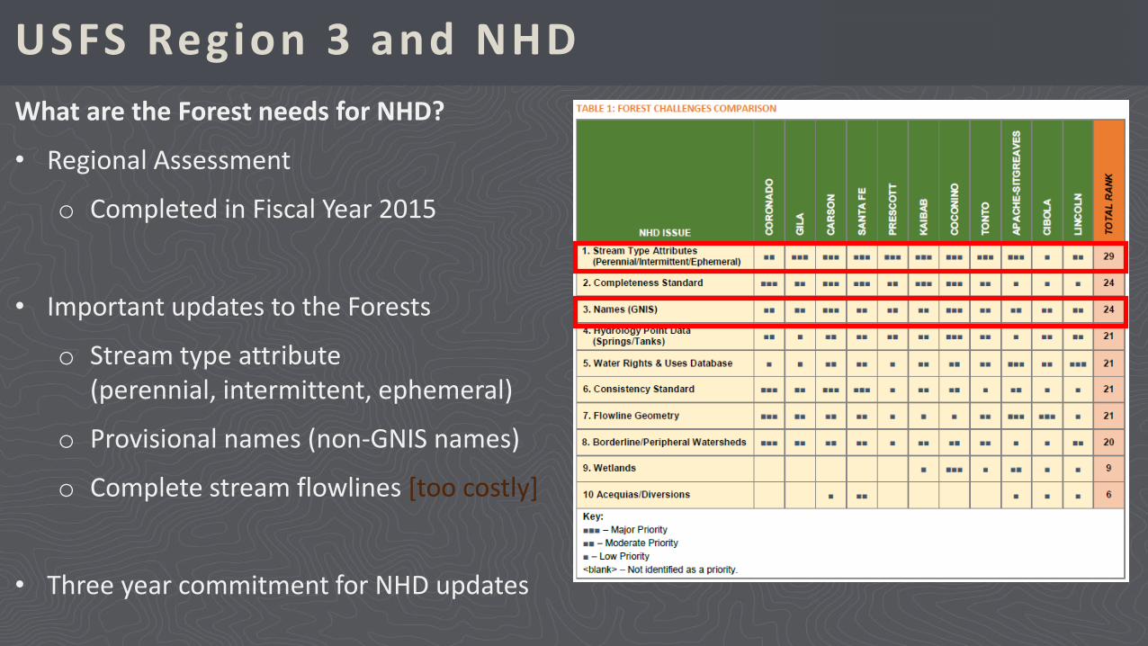
USFS Region 3 and NHDWhat are the Forest needs for NHD?
• Regional Assessment
o Completed in Fiscal Year 2015
• Important updates to the Forests
o Stream type attribute (perennial, intermittent, ephemeral)
o Provisional names (non-GNIS names)
o Complete stream flowlines [too costly]
• Three year commitment for NHD updates
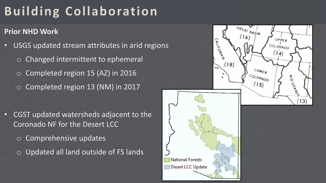
Building Col laborationPrior NHD Work
• USGS updated stream attributes in arid regions
o Changed intermittent to ephemeral
o Completed region 15 (AZ) in 2016
o Completed region 13 (NM) in 2017
• CGST updated watersheds adjacent to the Coronado NF for the Desert LCC
o Comprehensive updates
o Updated all land outside of FS lands
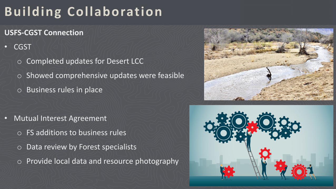
Building Col laborationUSFS-CGST Connection
• CGST
o Completed updates for Desert LCC
o Showed comprehensive updates were feasible
o Business rules in place
• Mutual Interest Agreement
o FS additions to business rules
o Data review by Forest specialists
o Provide local data and resource photography
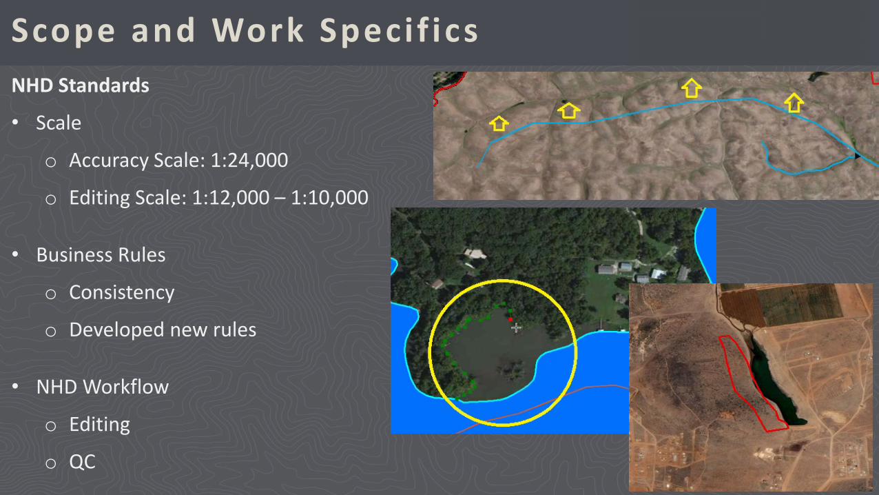
Scope and Work Specif icsNHD Standards
• Scale
o Accuracy Scale: 1:24,000
o Editing Scale: 1:12,000 – 1:10,000
• Business Rules
o Consistency
o Developed new rules
• NHD Workflow
o Editing
o QC
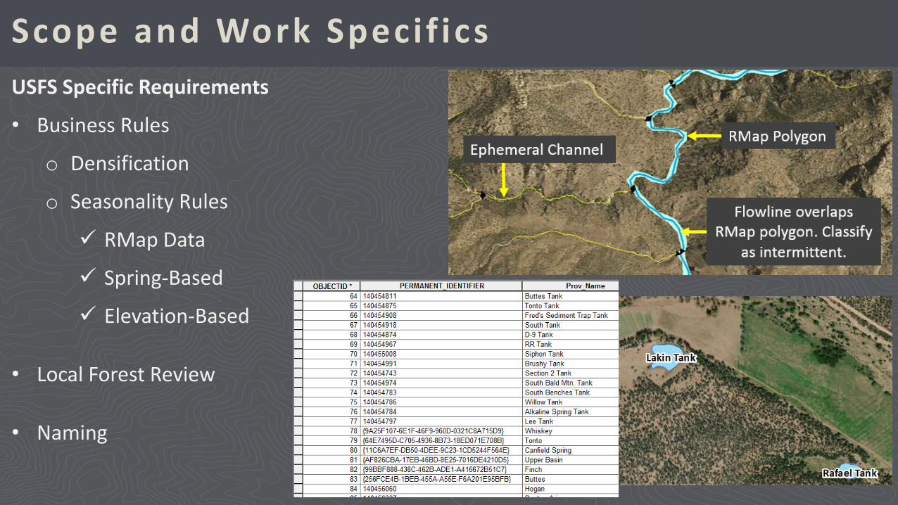
Scope and Work Specif icsUSFS Specific Requirements
• Business Rules
o Densification
o Seasonality Rules
RMap Data
Spring-Based
Elevation-Based
• Local Forest Review
• Naming
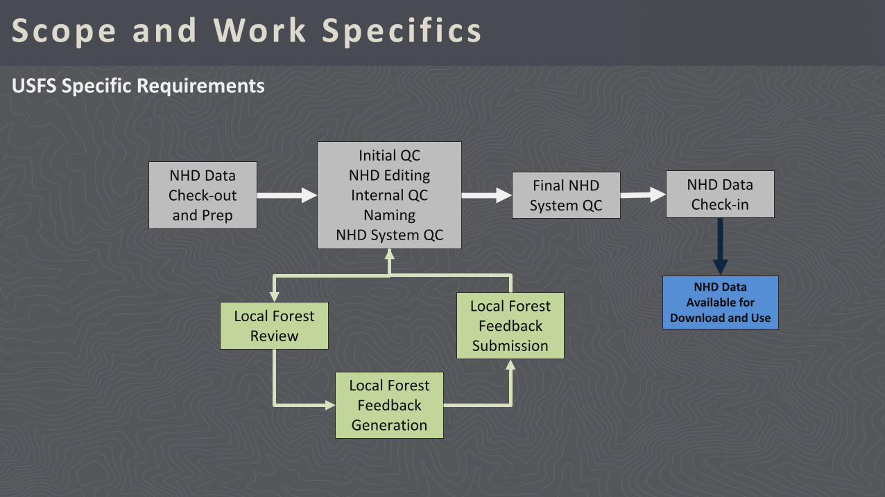
Scope and Work Specif icsUSFS Specific Requirements
NHD Data Check-out and Prep
Initial QCNHD EditingInternal QC
NamingNHD System QC
Final NHD System QC
NHD Data Check-in
Local Forest Review
Local Forest Feedback
Generation
Local Forest Feedback
Submission
NHD Data Available for
Download and Use
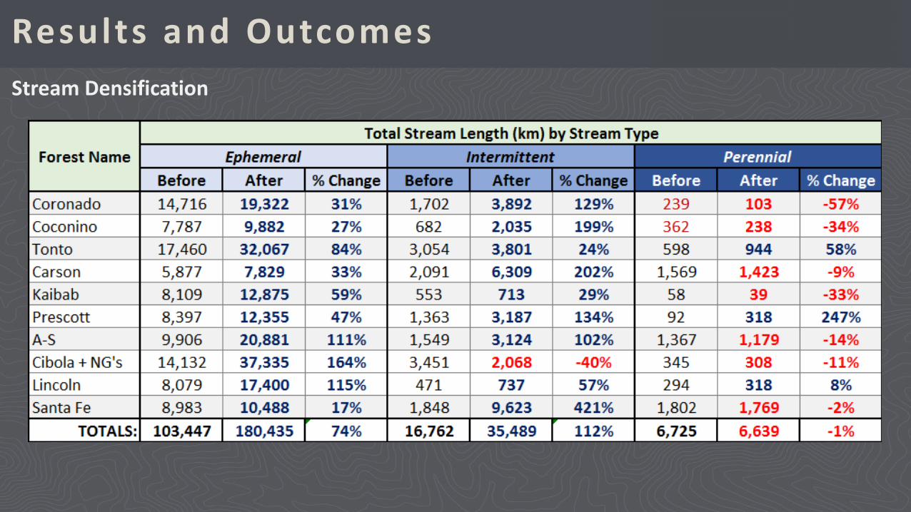
Results and OutcomesStream Densification
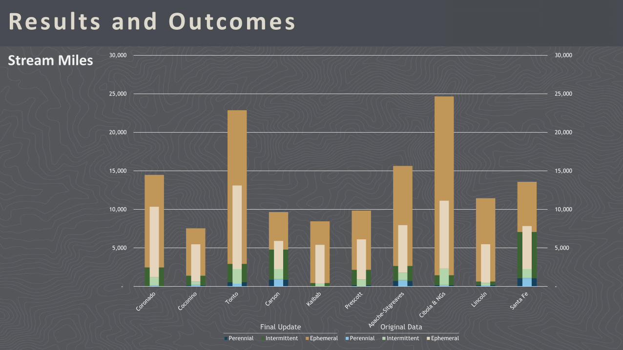
Results and OutcomesStream Miles
-
5,000
10,000
15,000
20,000
25,000
30,000
-
5,000
10,000
15,000
20,000
25,000
30,000
Perennial Intermittent Ephemeral Perennial Intermittent Ephemeral
Original DataFinal Update
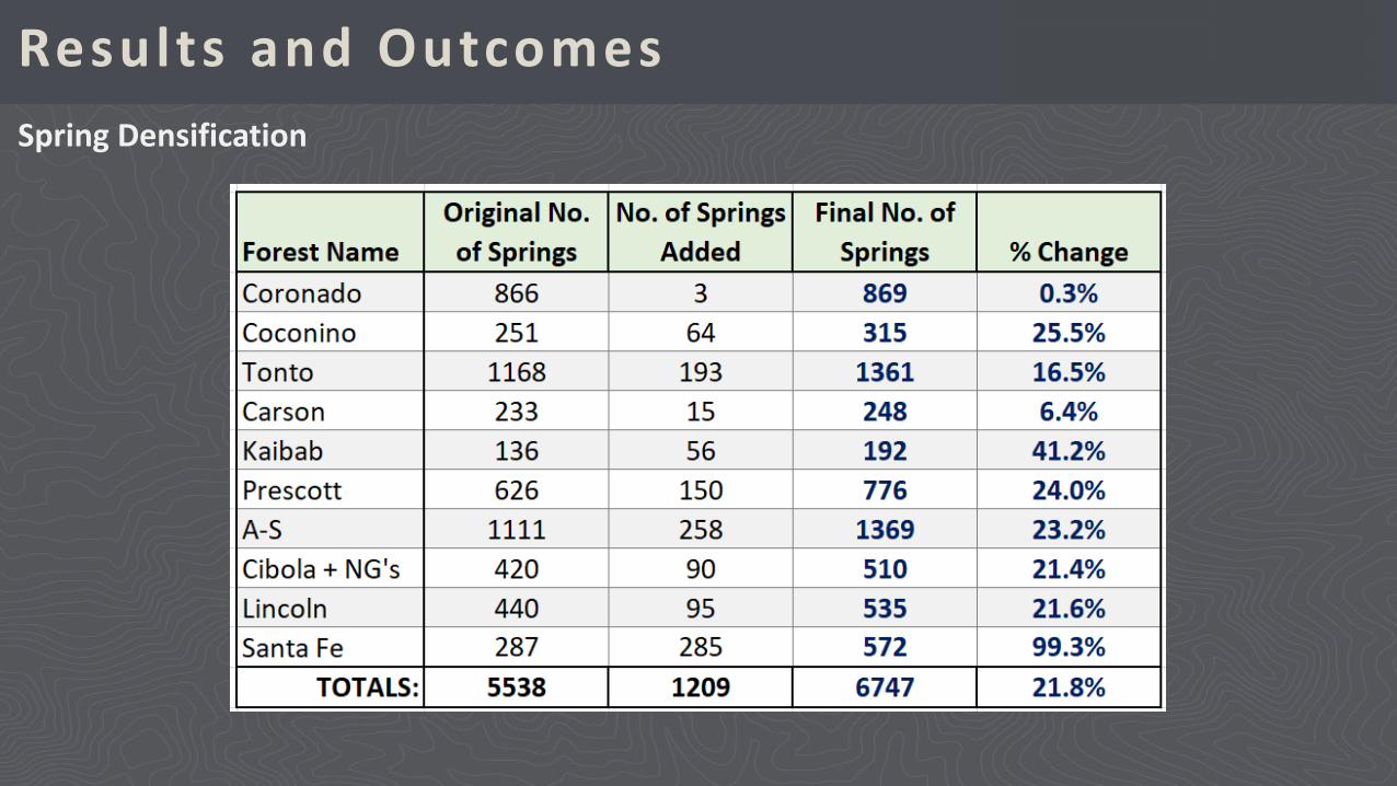
Results and OutcomesSpring Densification
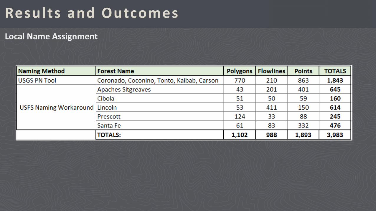
Results and OutcomesLocal Name Assignment
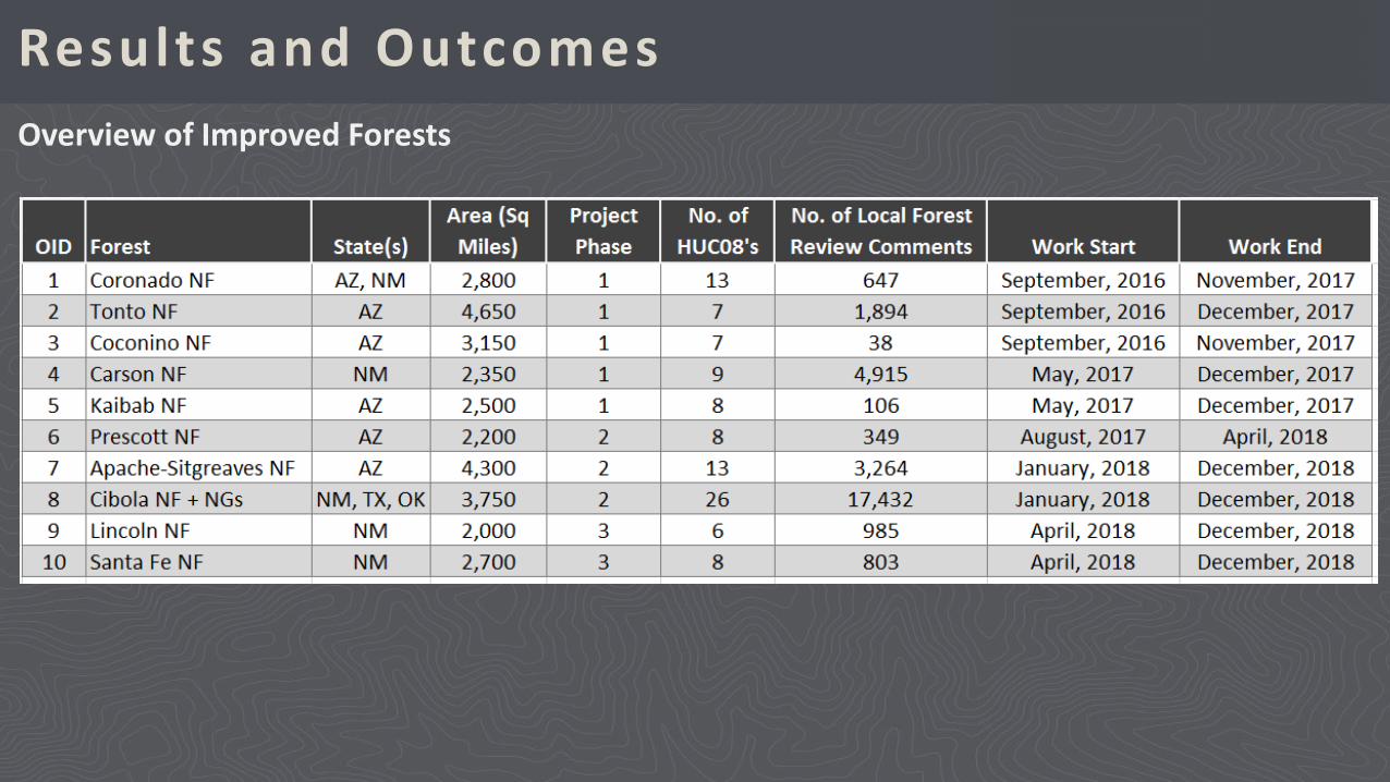
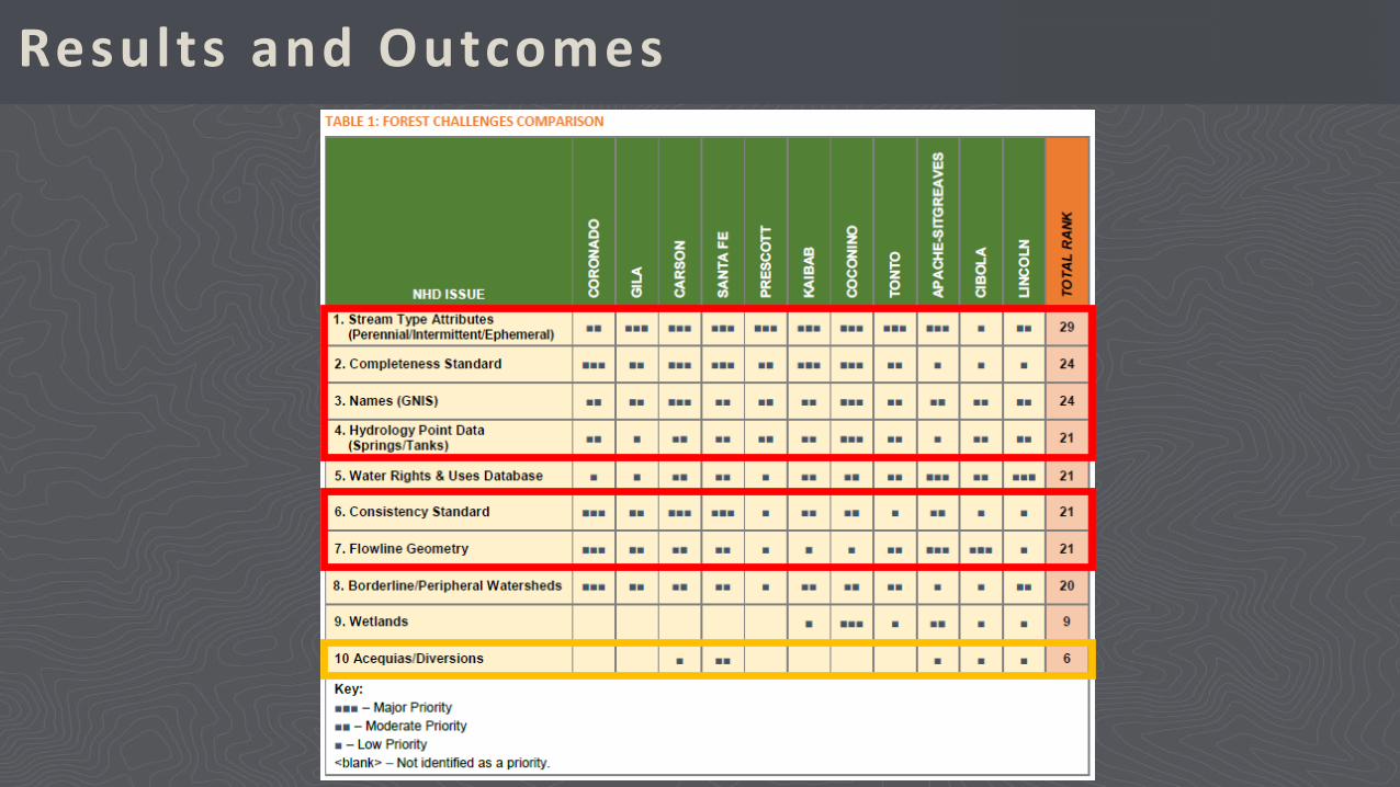
Results and OutcomesOverview of Improved Forests
Results and Outcomes
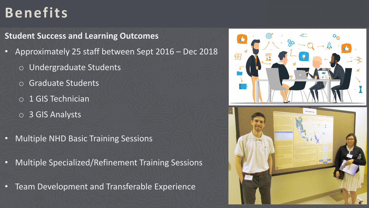
BenefitsStudent Success and Learning Outcomes
• Approximately 25 staff between Sept 2016 – Dec 2018
o Undergraduate Students
o Graduate Students
o 1 GIS Technician
o 3 GIS Analysts
• Multiple NHD Basic Training Sessions
• Multiple Specialized/Refinement Training Sessions
• Team Development and Transferable Experience
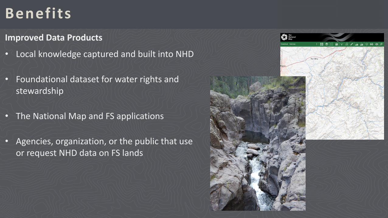
BenefitsImproved Data Products
• Local knowledge captured and built into NHD
• Foundational dataset for water rights and stewardship
• The National Map and FS applications
• Agencies, organization, or the public that use or request NHD data on FS lands
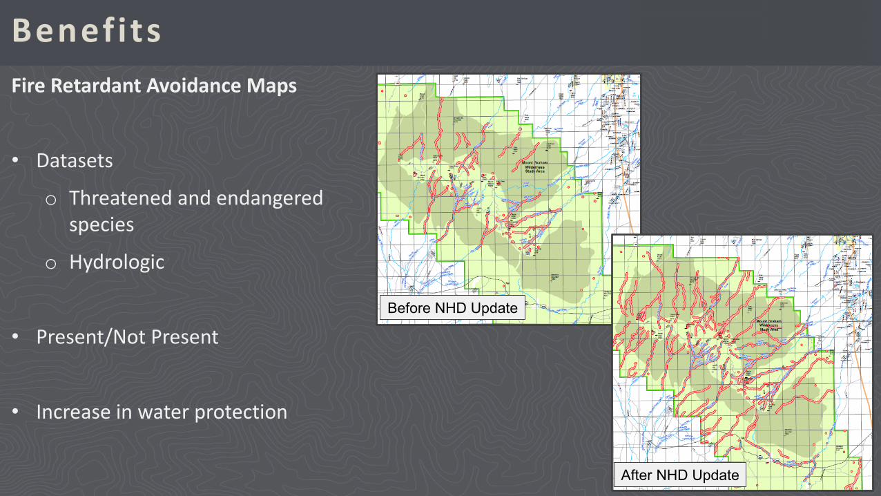
BenefitsFire Retardant Avoidance Maps
• Datasets
o Threatened and endangered species
o Hydrologic
• Present/Not Present
• Increase in water protection
Before NHD Update
After NHD Update
Q&A Session
Veronica [email protected]
GIS AnalystUSDA Forest Service
Southwestern Region
Joel [email protected]
Project ManagerCenter for Geospatial Science and Technology
California State University, Northridge