Embed Size (px)
Citation preview

UNIVERSITI TEKNOLOGt MARA
SLOPE RISK ASSESSMENTUS1NG GIS TECHNiQUE:
STUDY AREA - SECTION UIO SHAH ALAM,SELANGOR
SHAMIRUDDIN BIN MAHAMMAD AZAMI
Thesis submitted in fulfillment of the requirementsfor the degree of
Master of Science in Civil Engineering
Faculty of Civil Engineering
June 2009
CANDIDATE'S DECLARATION
I declare that the work in this thesis was carried out in accordance with theregulations of Universiti Teknologi MARA. It is original and is the result of my ownwork . unless otherwise indicated or acknowledged as referenced work . This topic hasnot been submitted to any other academic institution or non-academic institution forany other or qualification.
In the event that my thesis be found to violate the conditions mentioned above , Ivoluntarily waive the right of conferment if my degree and agree to be subjected tothe disciplinary rules and regulations ofUniversiti Teknologi MARA.
Name of Candidate
Candidate's ID No
Programme
Faculty
Thesis Title
Signature of Candidate
Date
Shamiruddin Bin Mahammad Azami
2005220557
Master of Science in Civil Engineering
Faculty of Civil Engineering
Slope Risk Assessment Using GIS Technique: StudyArea - Section U10 Shah Alam. Selangor
..................~: .
.l9_1mJ~.~QQ9.. __ _ .

ABSTRACT
There are many factors that cause slope failures such as rock mass discontinuities,weathering , mass stratification , water seepage, surface cover and erosion. Theexisting legislations and guidelines on residential development either on or near hillyterrain are defective to produce an acceptable and reasonable safety measures. Theaim of this study is to innovate a georisk management system which is capable ofmitigating risk to life and economic loss due to slope failures. The main objectives ofthis research are, firstly to identify and determine slope risk rating parameters.Secondly to produce georisk map for the selected site as case study and finallyproduce Real Time Georisk Slope Management System (RTG-SMS) using GIStechnique. Most practitioners still prefer and are accustomed to conventionalapproach of slope stability analysis which is inadequate to guarantee zero risk toslope failure. A comprehensive literature study concluded that none of the previousstudies in Malaysia focused on the consequences of the risk elements due to slopehazards such as residential areas and public roads. Therefore, this study proceed thealternative solution through three phases of methodologies: (i) literature review, (ii)produce georisk map, (iii) develop Real Time Georisk Slope Management System(RTG-SMS). This study focuses on the general physical of sedimentary groundformation and slope rating system approach modified from Slope Management andRisk Tracking (SMART). However, comparison studies with other slope ratingsystems do not constrain with this study. This study has also revealed that residents inSection UID, Shah Alam were almost exposed to slope failures. Through RTG-SMS,Section UID, Shah Alam requires further monitoring and proper slopes managementbound to the residential area in the near future to prevent any loss of life and propertydamages. This study successfully proved that RTG-SMS is a useful system to be usedfor slope maintenance and suitable for engineers, planners, geologist and localauthorities to determine the safety level of the slope. The system created also can beused to monitor the existing, current or future hilly terrain development areas whichabsolutely will benefit the local authorities as a decision maker supporter to approveany future hilly terrain developments that have been proposed.
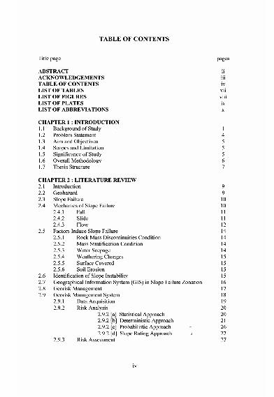
TABLE OF CONTENTS
Title page
ABSTRACTACKNOWLEDGEMENTSTABLE OF CONTENTSLIST OF TABLESLIST OF FIGURESLIST OF PLATESLIST OF ABBREVIATIONS
CHAPTER 1 : INTRODUCTION1.1 Background of Study1.2 Problem Statement1.3 Aim and Objectives1.4 Scopes and Limitation1.5 Significance of Study1.6 Overall Methodology1.7 Thesis Structure
pages
iiiiiivviiviiiixx
CHAPTER 2 : LITERATURE REVIEW2.1 Introduction 92.2 Geohazard 92.3 Slope Failure 102.4 Mechanics of Slone Failure 10
2.4.1 Fall - 112.4 .2 Slide 112.4 .3 Flow 12
2.5 Factors Induce Slone Failure 142.5.1 Rock M~ss Discontinuities Condition 142.5.2 Mass Stratification Condition 142.5.3 Water Seepage 142.5.4 Weatherinz Chanzes 152.5.5 Surface C;vered - 152.5 .6 Soil Erosion 15
2.6 Identification ofSlope Instability 152.7 Geographical Information System (GIS) in Slope Failure Zonation 162.8 Georisk Management 172.9 Georisk Management System 18
2.9 .1 Data Acquisition 192.9.2 Risk Analysis 20
2.9.2 [a] Statistical Approach 202.9.2 [b] Deterministic Approach 212.9.2 [c] Probabilistic Approach 262.9.2 [d] Slope Rating Approach 27
2.9.3 Risk Assessment 27
iv

CHAPTERl
INTRODUCTION
1.1 Background of Study
Nowadays, development on hilly terrains is being gazette as way of a life style in
urban area. However, public tend to be subjected to safety and risk of geohazard
related to slope failure. Slope failure is commonly triggered by natural environment
causes such as rain, flood and loss of vegetation due to wildlife or by human
activities (i.e. terrain cutting and filling, grading, irrigation, septic system and
changes in drainage) (Westen, 1994).
Residential area development near or on hilly terrains most likely is subjected to high
risk to slope failure hazards especially to the loss of lives and economic lost. The
urban development near or on hilly terrains requires sound knowledge and
experience on slope engineering in order to mitigate and ensure public safety. To
quantify the prime parameters such as site topography, geology, rock to soil mass
characteristic and ground water condition are the challenges. Besides that, climate
change is reported as one of the factors, which has been a norm during the monsoon
weather. Scientifically, it is reported that such failure is due to strength deterioration
of rock or soil mass from continuous rainfall (Floris & Bozzano, 2007; Tohari &
Rahardjo, 2006).
Malaysia has advanced her physical infrastructure development from near to on
highland for the past 20 years due to depleted flat land especially in Klang Valley.
Table 1.1 shows the reported slope failure incidences in some states in ~alaysia. The
state of Penang, Pahang, Perak, Selangor, Sarawak, Sabah, Johor and Kuala Lumpur