Embed Size (px)
Citation preview
Two NSF Data Services Projects
Rick Hooper, PresidentConsortium of Universities for the
Advancement of Hydrologic Science, Inc.
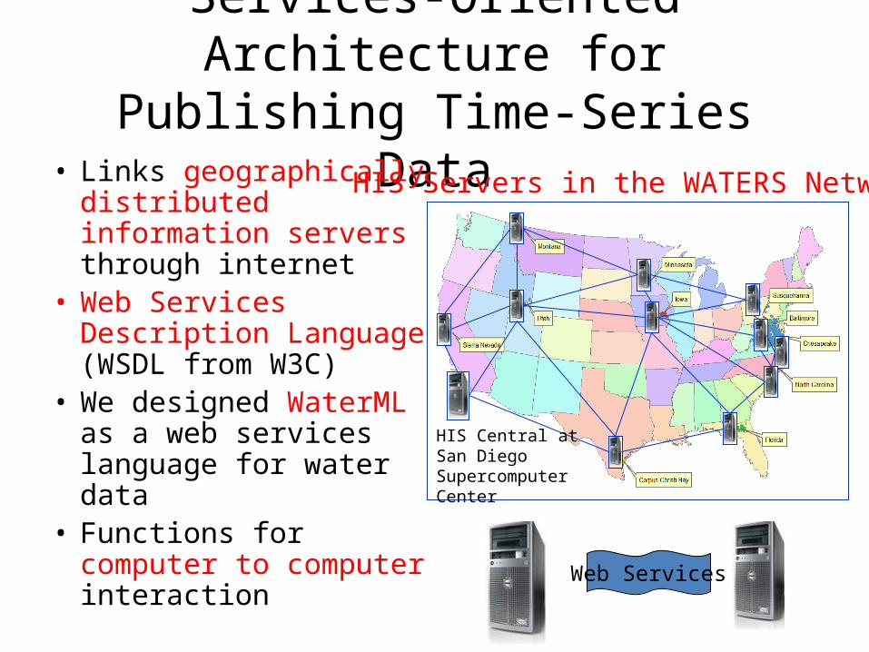
Services-Oriented Architecture for Publishing Time-Series Data
• Links geographically distributed information servers through internet
• Web Services Description Language (WSDL from W3C)
• We designed WaterML as a web services language for water data
• Functions for computer to computer interaction
HIS Servers in the WATERS Network
HIS Central at San Diego Supercomputer Center
Web Services

National Water Metadata
Catalog
Synthesis and communication of the nation’s water data http://his.cuahsi.org
Hydroseek WaterML
Government Water Data Academic Water Data

CUAHSI National Water Metadata CatalogIndexes:• 50 observation networks• 1.75 million sites• 8.38 million time series• 342 million data values
NWIS
STORET
TCEQ

Hydroseek: Data Access
Federal Agencies, State Agencies, and Academic Researchers
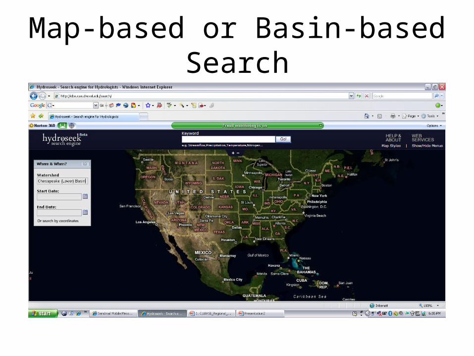
Map-based or Basin-based Search
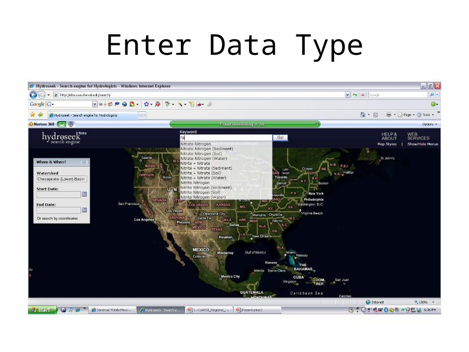
Enter Data Type
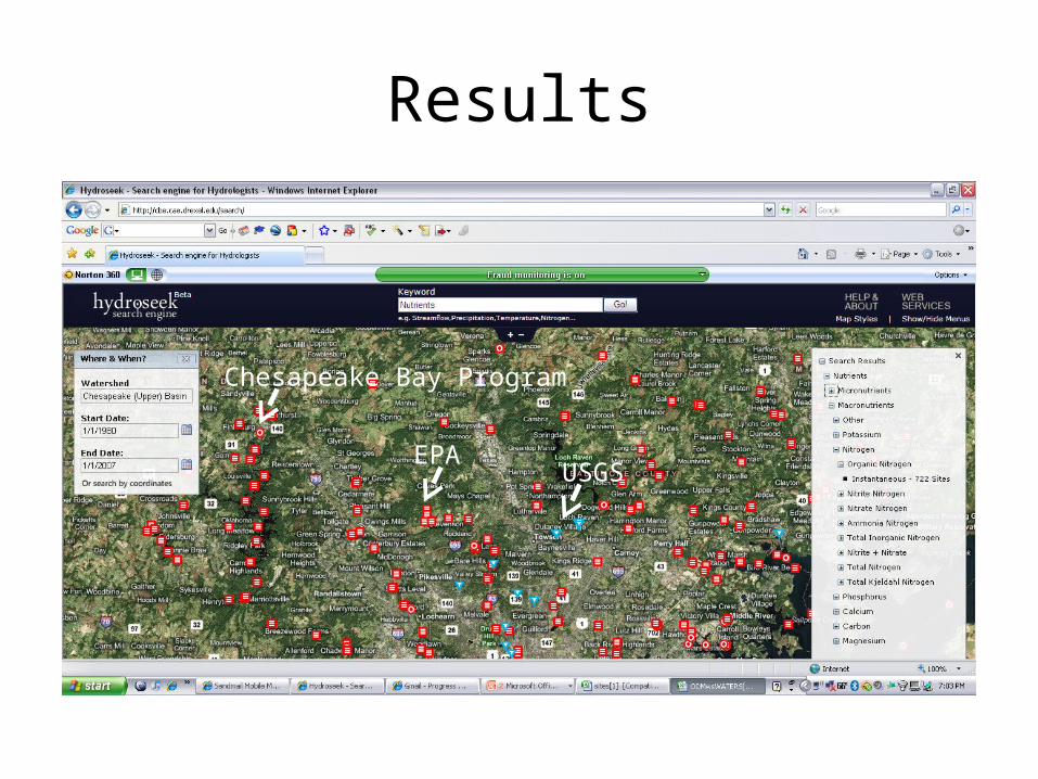
Results
USGSEPA
Chesapeake Bay Program

Get Data with one request!
Data Cart
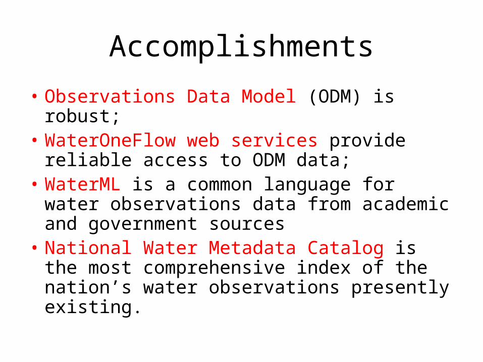
Accomplishments
• Observations Data Model (ODM) is robust;• WaterOneFlow web services provide reliable
access to ODM data;• WaterML is a common language for water
observations data from academic and government sources
• National Water Metadata Catalog is the most comprehensive index of the nation’s water observations presently existing.
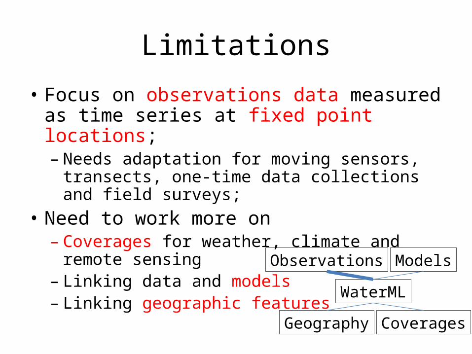
Limitations
• Focus on observations data measured as time series at fixed point locations;– Needs adaptation for moving sensors, transects,
one-time data collections and field surveys;• Need to work more on
– Coverages for weather, climate and remote sensing
– Linking data and models– Linking geographic features WaterML
Observations
Geography
Models
Coverages

CUAHSI and Federal Agencies
• Signed CRADA with US Geological Survey on instrumentation
• Signed MoU with USGS and National Climatic Data Center (NOAA) on data services
• Developing MoU with EPA Office of Water on data services
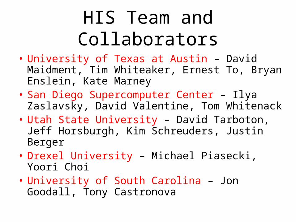
HIS Team and Collaborators
• University of Texas at Austin – David Maidment, Tim Whiteaker, Ernest To, Bryan Enslein, Kate Marney
• San Diego Supercomputer Center – Ilya Zaslavsky, David Valentine, Tom Whitenack
• Utah State University – David Tarboton, Jeff Horsburgh, Kim Schreuders, Justin Berger
• Drexel University – Michael Piasecki, Yoori Choi• University of South Carolina – Jon Goodall, Tony
Castronova

HIS Overview Report
• Summarizes the conceptual framework, methodology, and application tools for HIS version 1.1
• Shows how to develop and publish a CUAHSI Water Data Service
• Available at:
http://his.cuahsi.org/documents/HISOverview.pdf
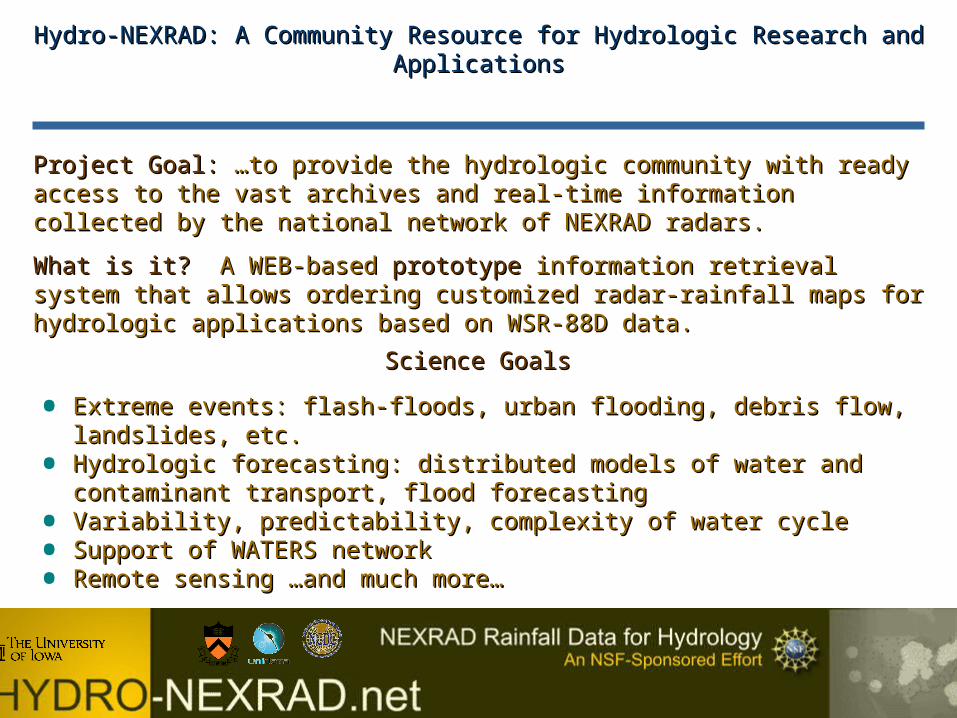
Hydro-NEXRAD: A Community Resource for Hydrologic Research and ApplicationsHydro-NEXRAD: A Community Resource for Hydrologic Research and Applications
Project Goal:Project Goal: …to provide the hydrologic community with ready access to the vast …to provide the hydrologic community with ready access to the vast archives and real-time information collected by the national network of NEXRAD archives and real-time information collected by the national network of NEXRAD radars.radars.
What is it?What is it? A WEB-based A WEB-based prototypeprototype information retrieval system that allows information retrieval system that allows ordering customized radar-rainfall maps for hydrologic applications based on WSR-ordering customized radar-rainfall maps for hydrologic applications based on WSR-88D data.88D data.
• Extreme events: flash-floods, urban flooding, debris flow, landslides, etc.Extreme events: flash-floods, urban flooding, debris flow, landslides, etc.
• Hydrologic forecasting: distributed models of water and contaminant transport, Hydrologic forecasting: distributed models of water and contaminant transport, flood forecastingflood forecasting
• Variability, predictability, complexity of water cycleVariability, predictability, complexity of water cycle
• Support of WATERS networkSupport of WATERS network
• Remote sensing …and much more…Remote sensing …and much more…
Science GoalsScience Goals
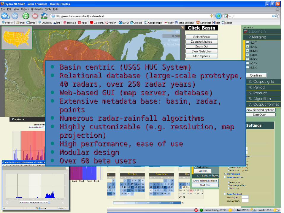
• Basin centric (USGS HUC System)Basin centric (USGS HUC System)
• Relational database (large-scale prototype, 40 radars, Relational database (large-scale prototype, 40 radars, over 250 radar years)over 250 radar years)
• Web-based GUI (map server, database)Web-based GUI (map server, database)
• Extensive metadata base: basin, radar, pointsExtensive metadata base: basin, radar, points
• Numerous radar-rainfall algorithmsNumerous radar-rainfall algorithms
• Highly customizable (e.g. resolution, map projection)Highly customizable (e.g. resolution, map projection)
• High performance, ease of useHigh performance, ease of use
• Modular designModular design
• Over 60 beta usersOver 60 beta users

Updates, Plans & ChallengesUpdates, Plans & Challenges
• Handling super resolution data and producing sub kilometer Handling super resolution data and producing sub kilometer resolution rainfall products (resolution rainfall products (under testing and evaluationunder testing and evaluation))
• Adaptation to real-time service for the community (Adaptation to real-time service for the community (working working prototype existsprototype exists))
• Expanding to full national coverage (NCDC? CUAHSI?)Expanding to full national coverage (NCDC? CUAHSI?)
• Expanding to multisensor (rain gauge, satellite data) Expanding to multisensor (rain gauge, satellite data) capability (capability (planned, algorithms existplanned, algorithms exist))
• Comprehensive performance evaluation (Comprehensive performance evaluation (in progressin progress))
• Dynamic and modular nature of the system: ready for Dynamic and modular nature of the system: ready for implementation of new ideas (implementation of new ideas (fundamental design featurefundamental design feature) )
• Facing the question “What’s next?”Facing the question “What’s next?” Upkeep, growth, Upkeep, growth, architecture: central or distributed, etc. etc. architecture: central or distributed, etc. etc.