Embed Size (px)
Citation preview

Tsunami Warning System ElementsIOC Assessment Mission to
Indonesia
29 August-1 September 2005
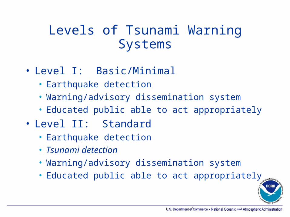
Levels of Tsunami Warning Systems
• Level I: Basic/Minimal• Earthquake detection• Warning/advisory dissemination system• Educated public able to act appropriately
• Level II: Standard• Earthquake detection• Tsunami detection• Warning/advisory dissemination system• Educated public able to act appropriately

Levels of Tsunami Warning Systems
• Level III: Advanced• Earthquake detection• Tsunami detection• Tsunami forecast• Warning/advisory dissemination system• Educated public able to act appropriately
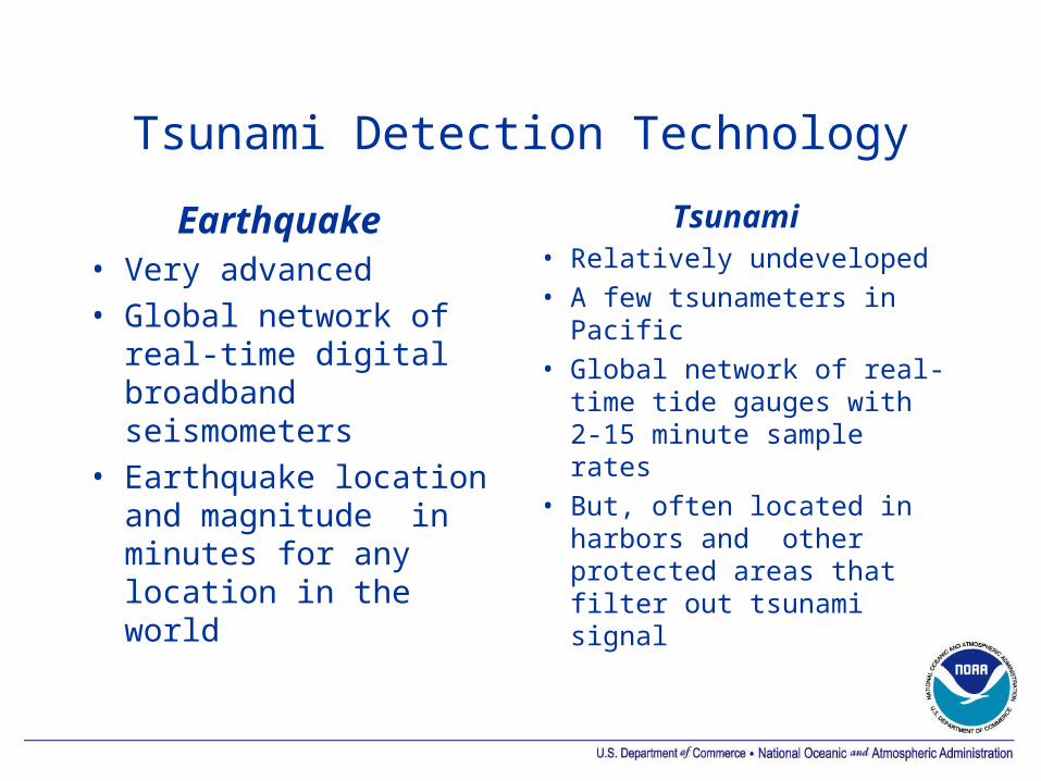
Tsunami Detection Technology
Earthquake • Very advanced• Global network of
real-time digital broadband seismometers
• Earthquake location and magnitude in minutes for any location in the world
Tsunami• Relatively undeveloped• A few tsunameters in
Pacific• Global network of real-
time tide gauges with 2-15 minute sample rates
• But, often located in harbors and other protected areas that filter out tsunami signal

DART Technology development effort one of four key issues in the US National Tsunami Hazard Mitigation Program 1996 Implementation Plan:
Quickly confirm potentially destructive tsunamis and reduce false alarms.
(NTHMP Steering Group, 1996)
Deep-ocean Assessment and Reporting of Tsunamis
DART I

DART II Concept
• Bottom Pressure Recorder (BPR) measures small changes in pressure at the seafloor. Data sent acoustically to surface buoy, then via satellite (Iridium) to the Warning Centers.
• Normal transmissions: Hourly reporting of 15 minute data to confirm system readiness.
• Two Event Modes:• Automatic: Triggered by seismic or tsunami
wave• Request: Warning Center triggers data stream
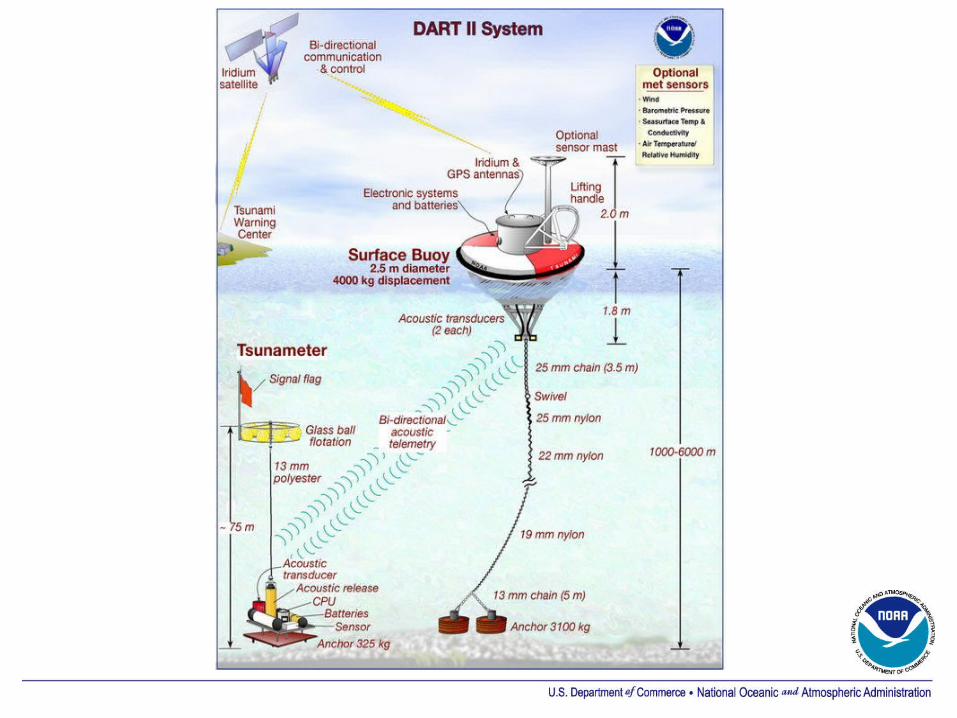

Pressure Transducer(heart of the system)
• Manufactured by Paroscientific, Inc. in Redmond, Washington, USA
• Operates in depths from 0 –6850 meters
• Piezoelectric sensor yields high resolution with low noise.
• DART system resolution is 0.2 cm of sea water

BPR Instrument and Platform
Acoustic Release
Anchor
Acoustic modem transducer
BPR
Battery case
Transducer

One Hour Impact Zone
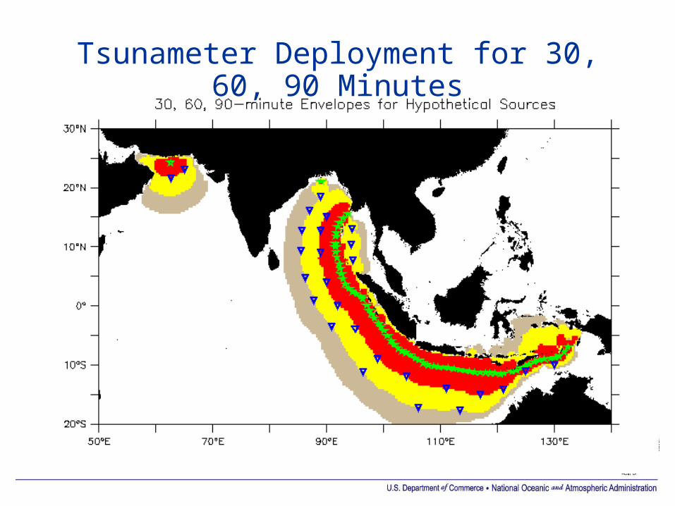
Tsunameter Deployment for 30, 60, 90 Minutes
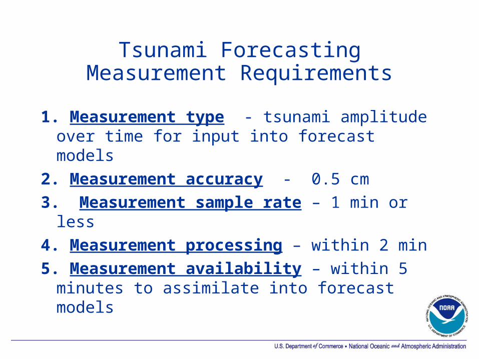
Tsunami ForecastingMeasurement Requirements
1. Measurement type - tsunami amplitude over time for input into forecast models
2. Measurement accuracy - 0.5 cm3. Measurement sample rate – 1 min or
less4. Measurement processing – within 2 min5. Measurement availability – within 5
minutes to assimilate into forecast models
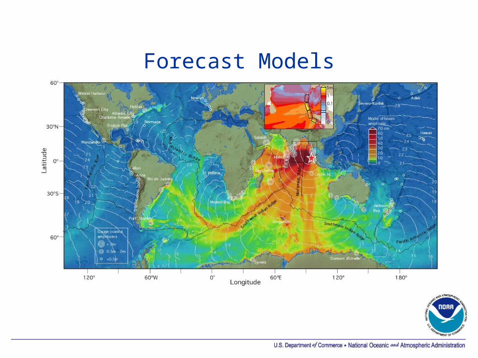
Forecast Models

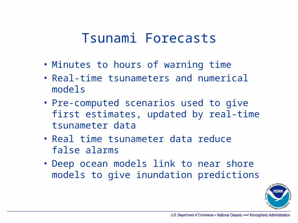
Tsunami Forecasts
• Minutes to hours of warning time• Real-time tsunameters and numerical
models• Pre-computed scenarios used to give
first estimates, updated by real-time tsunameter data
• Real time tsunameter data reduce false alarms
• Deep ocean models link to near shore models to give inundation predictions

Operational Tsunami Forecasting
• Detection: Tsunami detection networks in critical areas
• Modeling: Vast ocean areas with no tsunami measurements requires modeling
• Forecast: Effective operational forecasts must integrate real time measurement and modeling• Measurement: DART buoys• Forecast: Tsunami Forecast Model
(Propagation and inundation)

Approach and Example: Distant Tsunami
Hilo, HI 17 November 2003

Model database
Unit sources for pre-computed tsunami propagation scenarios

NOAA Tsunami Forecast
Mw=7.5
3cm
-3
3cm
-3
Seismic dataDART data
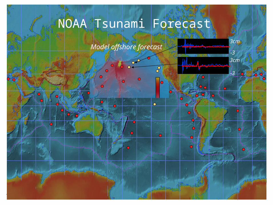
NOAA Tsunami Forecast3cm
-3
3cm
-3
Model offshore forecast
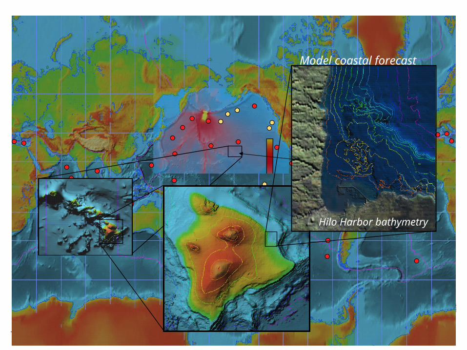
Model coastal forecast
QuickTime™ and aCinepak decompressor
are needed to see this picture.
Hilo Harbor bathymetry

Tsunami Forecast at Hilo

Approach and Example: Local Tsunami
Crescent City, CA 14 June 2005
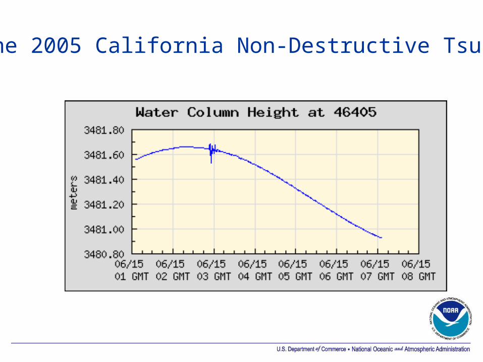
14 June 2005 California Non-Destructive Tsunami
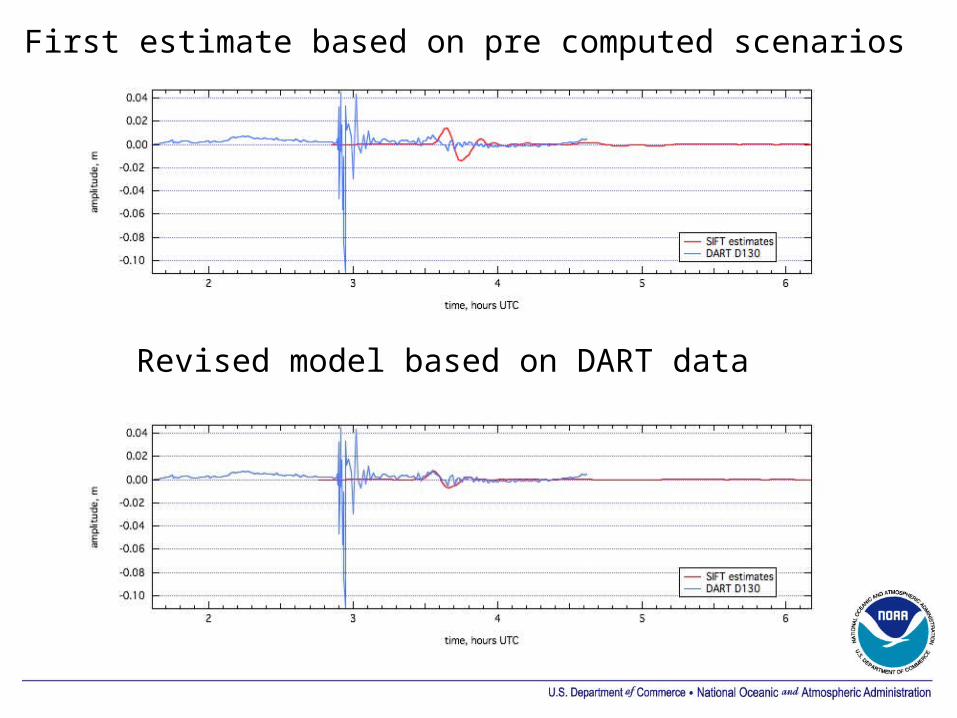
First estimate based on pre computed scenarios
Revised model based on DART data
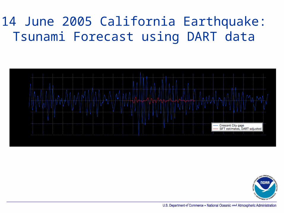
14 June 2005 California Earthquake:Tsunami Forecast using DART data

Indian Ocean Tsunami Warning System
• Intergovernmental Oceanographic Commission• Perth ICG working groups on:
• Seismic networks• Tide stations• DART Operators Group• Modeling• Hazard and Risk Analysis• Regional Center Interoperability
• Context for multi-lateral cooperation and assistance