Embed Size (px)
Citation preview
Tsunami Response and the Enhance PTWC Alerts
Ken Gledhill
GeoNet Project Director
Chair, Intergovernmental Coordination Group, Pacific Tsunami Warning and Mitigation System (PTWS)
GNS Science

GNS Science
Overview
1. GNS Science Procedures
2. Why Enhanced PTWC Products?
3. Event timeline for the Enhanced Products
4. Examples of the Enhanced Products
5. Example: Japan 2011
GNS Science
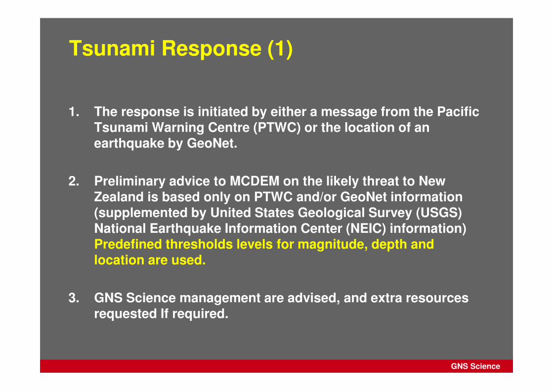
Tsunami Response (1)
1. The response is initiated by either a message from the Pacific Tsunami Warning Centre (PTWC) or the location of an earthquake by GeoNet.
2. Preliminary advice to MCDEM on the likely threat to New Zealand is based only on PTWC and/or GeoNet information (supplemented by United States Geological Survey (USGS) National Earthquake Information Center (NEIC) information) Predefined thresholds levels for magnitude, depth and location are used.
3. GNS Science management are advised, and extra resources requested If required.
GNS Science
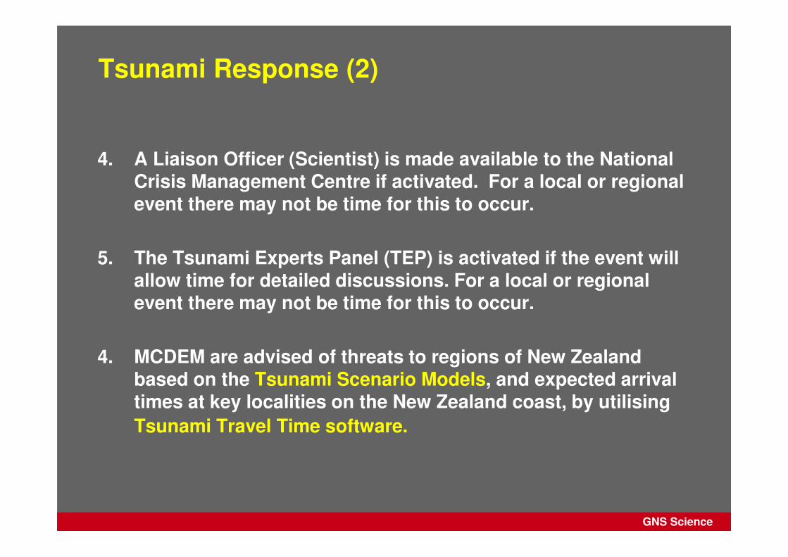
Tsunami Response (2)
4. A Liaison Officer (Scientist) is made available to the National Crisis Management Centre if activated. For a local or regional event there may not be time for this to occur.
5. The Tsunami Experts Panel (TEP) is activated if the event will allow time for detailed discussions. For a local or regional event there may not be time for this to occur.
4. MCDEM are advised of threats to regions of New Zealand based on the Tsunami Scenario Models, and expected arrival times at key localities on the New Zealand coast, by utilising
Tsunami Travel Time software.
GNS Science
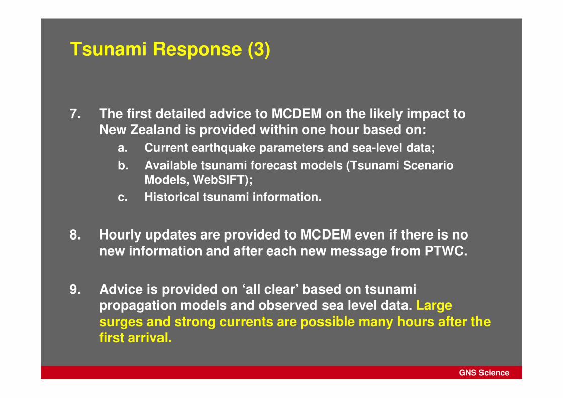
Tsunami Response (3)
7. The first detailed advice to MCDEM on the likely impact to New Zealand is provided within one hour based on:
a. Current earthquake parameters and sea-level data;
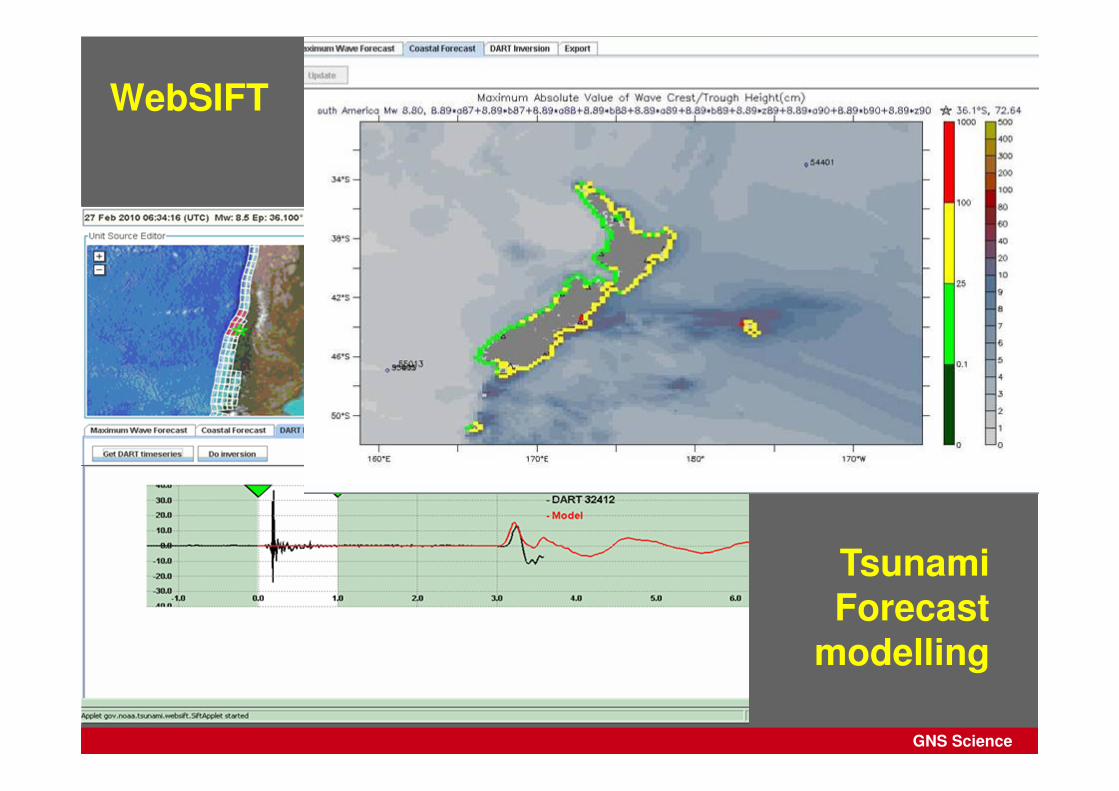
b. Available tsunami forecast models (Tsunami Scenario Models, WebSIFT);
c. Historical tsunami information.
8. Hourly updates are provided to MCDEM even if there is no new information and after each new message from PTWC.
9. Advice is provided on ‘all clear’ based on tsunami propagation models and observed sea level data. Large surges and strong currents are possible many hours after the first arrival.

GNS Science
Tsunami Experts Panel
• The role of the Tsunami Experts Panel (TEP) is to support the GeoNet Duty Team in its provision of authoritative scientific advice to MCDEM on the likely impacts of tsunami.
• The TEP is comprised of 14 New Zealand resident scientists
� Expertise in seismology, plate tectonics, historical tsunami impacts, water modelling, or inundation.
� Temperament to allow working collegially and under pressure
GNS Science
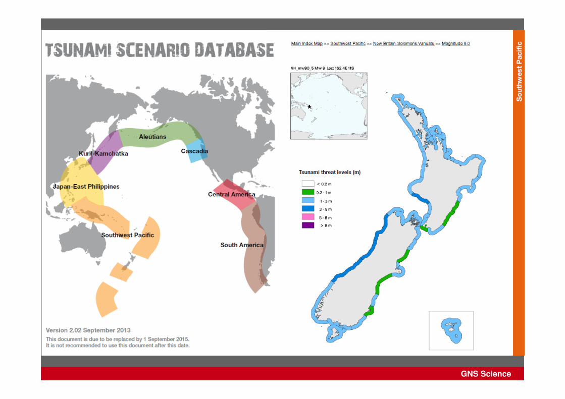
Tsunami Scenario Database
GNS Science
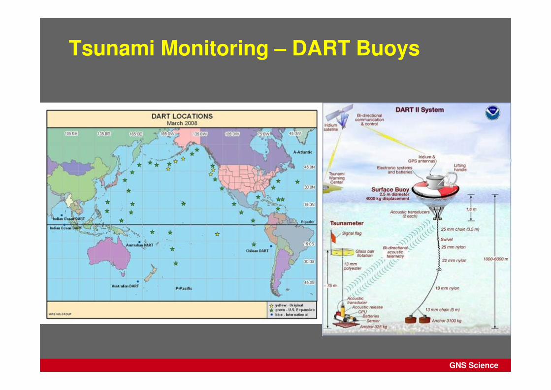
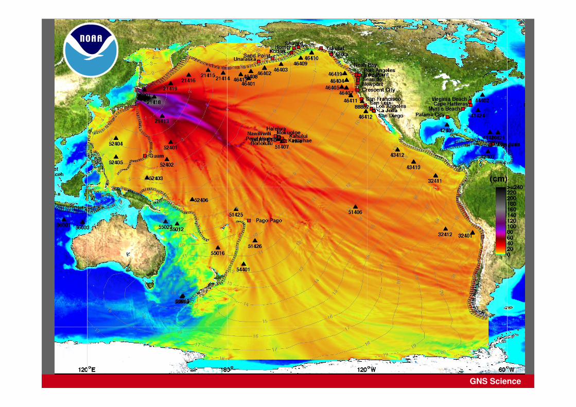
Tsunami Monitoring – DART Buoys
GNS Science
WebSIFT
Tsunami Forecast
modelling

GNS Science
Overview
1. GNS Science Procedures
2. Why Enhanced PTWC Products?
3. Event timeline for the Enhanced Products
4. Examples of the Enhanced Products
5. Example: Japan 2011
GNS Science
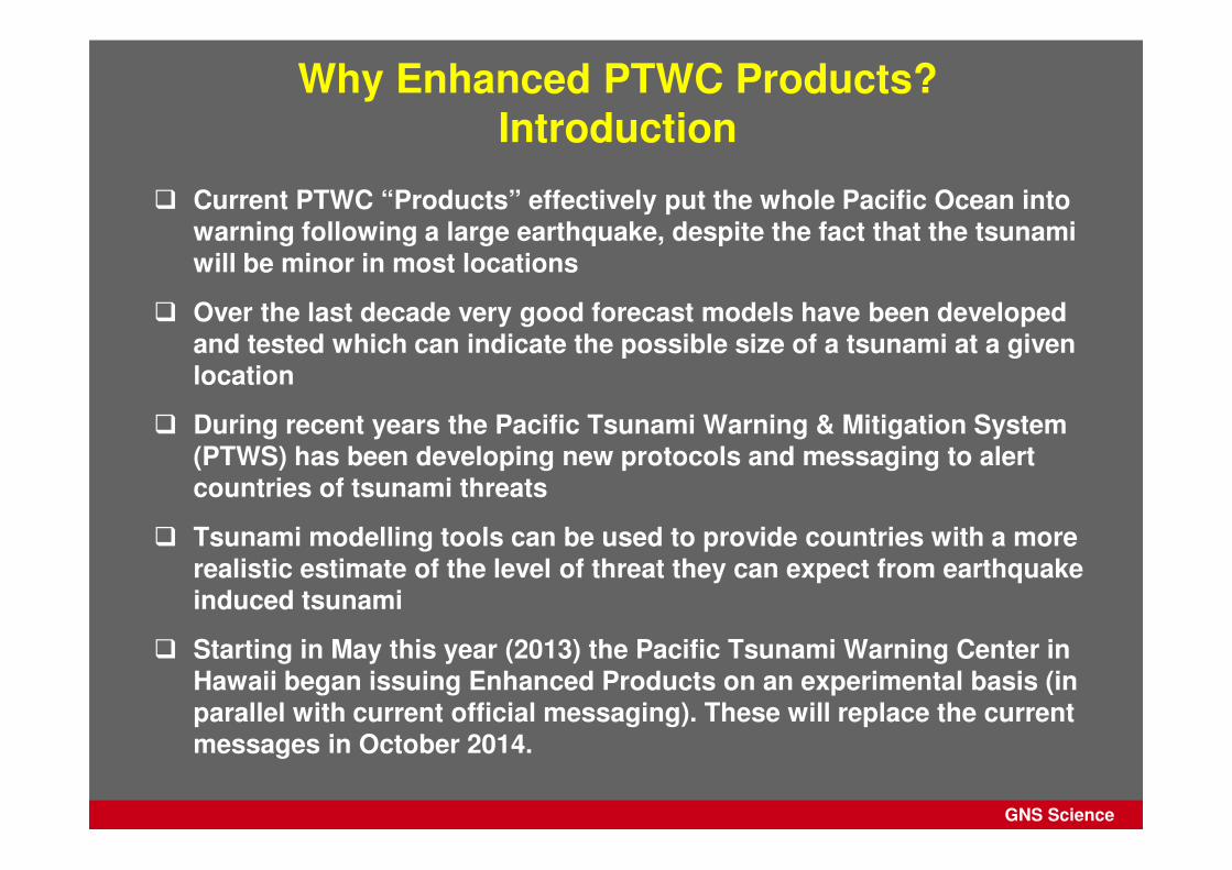
Why Enhanced PTWC Products? Introduction
� Current PTWC “Products” effectively put the whole Pacific Ocean into warning following a large earthquake, despite the fact that the tsunami will be minor in most locations
� Over the last decade very good forecast models have been developed and tested which can indicate the possible size of a tsunami at a given location
� During recent years the Pacific Tsunami Warning & Mitigation System (PTWS) has been developing new protocols and messaging to alert countries of tsunami threats
� Tsunami modelling tools can be used to provide countries with a more realistic estimate of the level of threat they can expect from earthquake induced tsunami
� Starting in May this year (2013) the Pacific Tsunami Warning Center in Hawaii began issuing Enhanced Products on an experimental basis (in parallel with current official messaging). These will replace the current messages in October 2014.
GNS Science
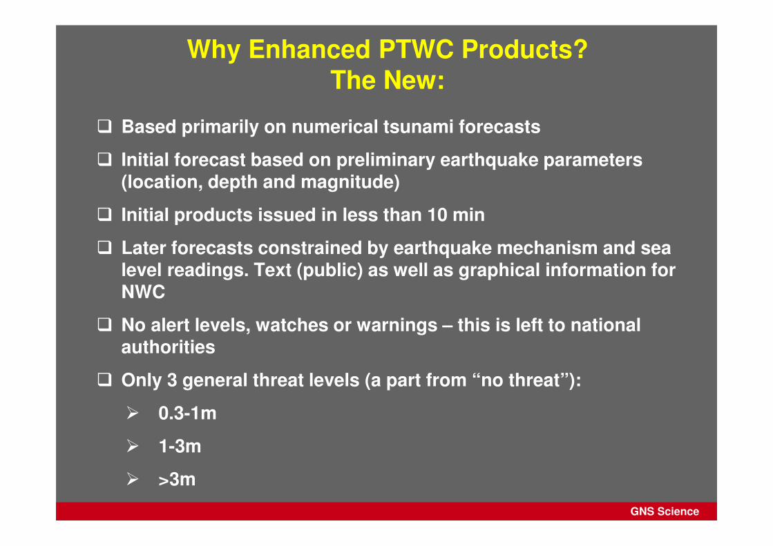
� Based primarily on numerical tsunami forecasts
� Initial forecast based on preliminary earthquake parameters (location, depth and magnitude)
� Initial products issued in less than 10 min
� Later forecasts constrained by earthquake mechanism and sea level readings. Text (public) as well as graphical information for NWC
� No alert levels, watches or warnings – this is left to national authorities
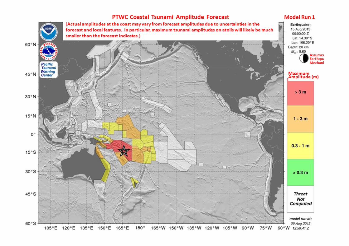
� Only 3 general threat levels (a part from “no threat”):
� 0.3-1m
� 1-3m
� >3m
Why Enhanced PTWC Products? The New:
GNS Science
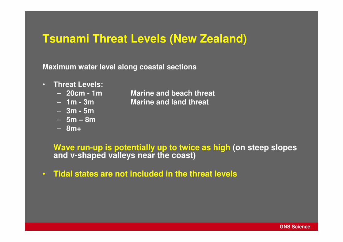
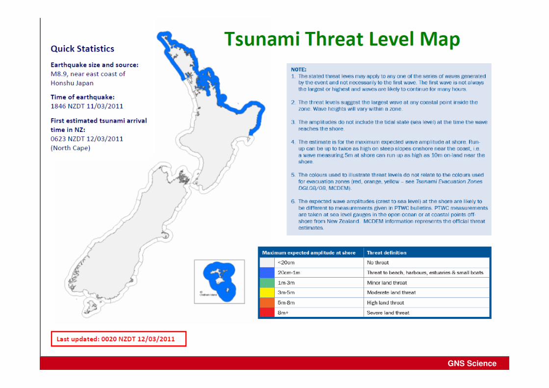
Tsunami Threat Levels (New Zealand)
Maximum water level along coastal sections
• Threat Levels:– 20cm - 1m Marine and beach threat– 1m - 3m Marine and land threat– 3m - 5m– 5m – 8m– 8m+
Wave run-up is potentially up to twice as high (on steep slopes and v-shaped valleys near the coast)
• Tidal states are not included in the threat levels

GNS Science
Overview
1. GNS Science Procedures
2. Why Enhanced PTWC Products?
3. Event timeline for the Enhanced Products
4. Examples of the Enhanced Products
5. Example: Japan 2011
GNS Science
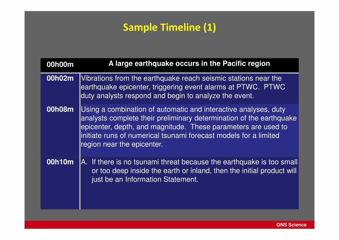
Sample Timeline (1)
00h00m A large earthquake occurs in the Pacific region
00h02m Vibrations from the earthquake reach seismic stations near the
earthquake epicenter, triggering event alarms at PTWC. PTWC
duty analysts respond and begin to analyze the event.
00h08m Using a combination of automatic and interactive analyses, duty
analysts complete their preliminary determination of the earthquake
epicenter, depth, and magnitude. These parameters are used to
initiate runs of numerical tsunami forecast models for a limited
region near the epicenter.
00h10m A. If there is no tsunami threat because the earthquake is too small
or too deep inside the earth or inland, then the initial product will
just be an Information Statement.
GNS Science
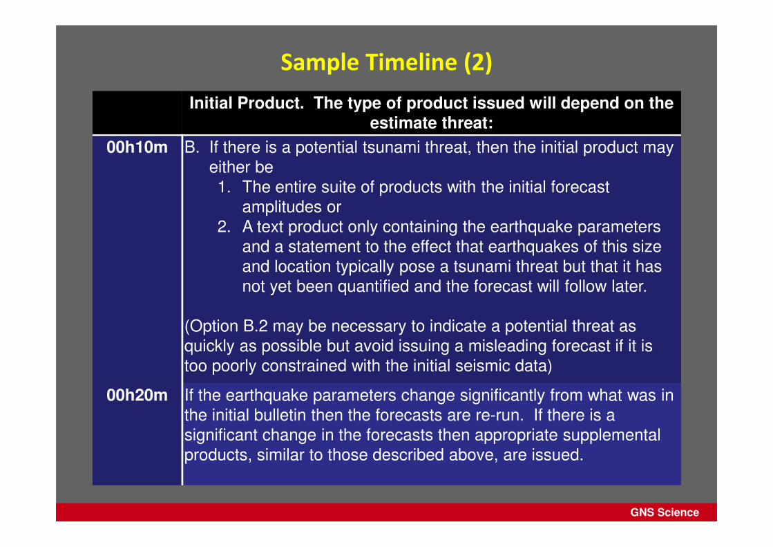
Sample Timeline (2)
Initial Product. The type of product issued will depend on the estimate threat:
00h10m B. If there is a potential tsunami threat, then the initial product may
either be
1. The entire suite of products with the initial forecast
amplitudes or
2. A text product only containing the earthquake parameters
and a statement to the effect that earthquakes of this size
and location typically pose a tsunami threat but that it has
not yet been quantified and the forecast will follow later.
(Option B.2 may be necessary to indicate a potential threat as
quickly as possible but avoid issuing a misleading forecast if it is
too poorly constrained with the initial seismic data)
00h20m If the earthquake parameters change significantly from what was in
the initial bulletin then the forecasts are re-run. If there is a
significant change in the forecasts then appropriate supplemental
products, similar to those described above, are issued.
GNS Science
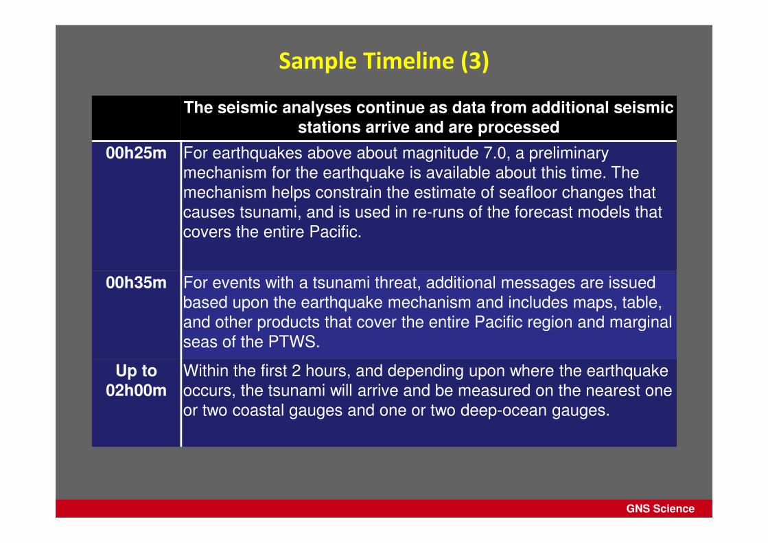
Sample Timeline (3)
The seismic analyses continue as data from additional seismic stations arrive and are processed
00h25m For earthquakes above about magnitude 7.0, a preliminary
mechanism for the earthquake is available about this time. The
mechanism helps constrain the estimate of seafloor changes that
causes tsunami, and is used in re-runs of the forecast models that
covers the entire Pacific.
00h35m For events with a tsunami threat, additional messages are issued
based upon the earthquake mechanism and includes maps, table,
and other products that cover the entire Pacific region and marginal
seas of the PTWS.
Up to02h00m
Within the first 2 hours, and depending upon where the earthquake
occurs, the tsunami will arrive and be measured on the nearest one
or two coastal gauges and one or two deep-ocean gauges.

GNS Science
Sample Timeline (4)
Sea level data is used to refine the modeling and messages
01h00mto
03h00m
As observations of tsunami waves become available, they will be
used to compare with existing forecasts and to adjust those
forecasts when necessary. Updates will be provided at least once
per hour.
Typically, the forecast will become stable after a few readings from
deep-ocean gauges and not require further adjustment. Products
will be issued at least once an hour with any updated forecasts.
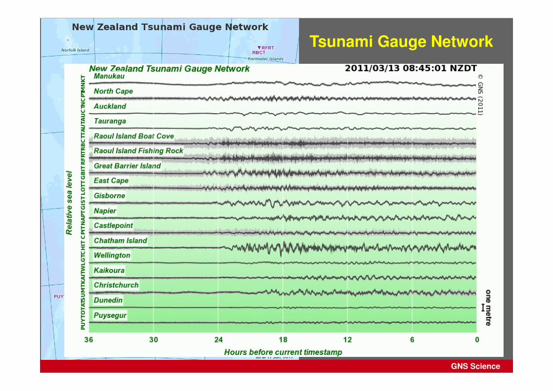
Beyond 3h The tsunami is monitored on coastal and deep-ocean sea-level
gauges as it advances. Reports from Member States and the
media may also be received.
When it is clear there is no longer a significant tsunami threat or the
tsunami has crossed the entire Pacific then a final product is
issued. This is not an “all clear” but will just state it is the last
message for this event – it is up to countries to provide the “all
clear” for their citizens

GNS Science
Overview
1. GNS Science Procedures
2. Why Enhanced PTWC Products?
3. Event timeline for the Enhanced Products
4. Examples of the Enhanced Products
5. Example: Japan 2011
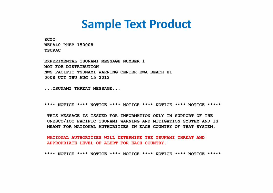
Sample Text ProductZCZC
WEPA40 PHEB 150008
TSUPAC
EXPERIMENTAL TSUNAMI MESSAGE NUMBER 1
NOT FOR DISTRIBUTION
NWS PACIFIC TSUNAMI WARNING CENTER EWA BEACH HI
0008 UCT THU AUG 15 2013
...TSUNAMI THREAT MESSAGE...
**** NOTICE **** NOTICE **** NOTICE **** NOTICE **** NOTICE *****
THIS MESSAGE IS ISSUED FOR INFORMATION ONLY IN SUPPORT OF THE
UNESCO/IOC PACIFIC TSUNAMI WARNING AND MITIGATION SYSTEM AND IS
MEANT FOR NATIONAL AUTHORITIES IN EACH COUNTRY OF THAT SYSTEM.
NATIONAL AUTHORITIES WILL DETERMINE THE TSUNAMI THREAT AND
APPROPRIATE LEVEL OF ALERT FOR EACH COUNTRY.
**** NOTICE **** NOTICE **** NOTICE **** NOTICE **** NOTICE *****
Sample Text Product
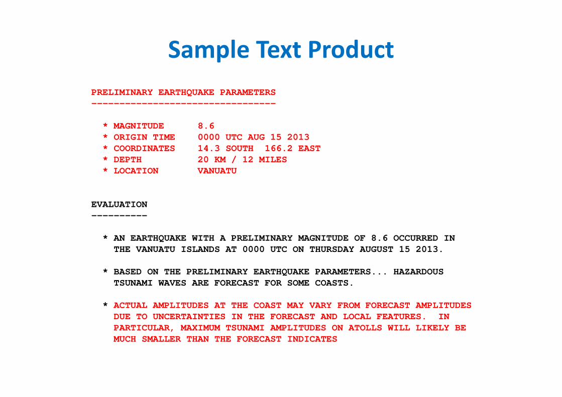
PRELIMINARY EARTHQUAKE PARAMETERS
---------------------------------
* MAGNITUDE 8.6
* ORIGIN TIME 0000 UTC AUG 15 2013
* COORDINATES 14.3 SOUTH 166.2 EAST
* DEPTH 20 KM / 12 MILES
* LOCATION VANUATU
EVALUATION
----------
* AN EARTHQUAKE WITH A PRELIMINARY MAGNITUDE OF 8.6 OCCURRED IN
THE VANUATU ISLANDS AT 0000 UTC ON THURSDAY AUGUST 15 2013.
* BASED ON THE PRELIMINARY EARTHQUAKE PARAMETERS... HAZARDOUS
TSUNAMI WAVES ARE FORECAST FOR SOME COASTS.
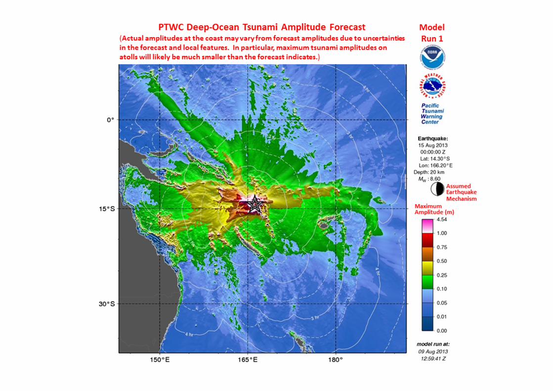
* ACTUAL AMPLITUDES AT THE COAST MAY VARY FROM FORECAST AMPLITUDES
DUE TO UNCERTAINTIES IN THE FORECAST AND LOCAL FEATURES. IN
PARTICULAR, MAXIMUM TSUNAMI AMPLITUDES ON ATOLLS WILL LIKELY BE
MUCH SMALLER THAN THE FORECAST INDICATES
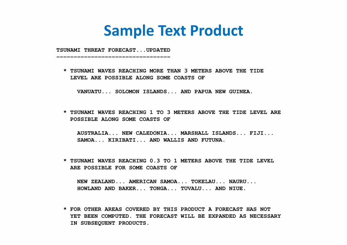
Sample Text ProductTSUNAMI THREAT FORECAST...UPDATED
---------------------------------
* TSUNAMI WAVES REACHING MORE THAN 3 METERS ABOVE THE TIDE
LEVEL ARE POSSIBLE ALONG SOME COASTS OF
VANUATU... SOLOMON ISLANDS... AND PAPUA NEW GUINEA.
* TSUNAMI WAVES REACHING 1 TO 3 METERS ABOVE THE TIDE LEVEL ARE
POSSIBLE ALONG SOME COASTS OF
AUSTRALIA... NEW CALEDONIA... MARSHALL ISLANDS... FIJI...
SAMOA... KIRIBATI... AND WALLIS AND FUTUNA.
* TSUNAMI WAVES REACHING 0.3 TO 1 METERS ABOVE THE TIDE LEVEL
ARE POSSIBLE FOR SOME COASTS OF
NEW ZEALAND... AMERICAN SAMOA... TOKELAU... NAURU...
HOWLAND AND BAKER... TONGA... TUVALU... AND NIUE.
* FOR OTHER AREAS COVERED BY THIS PRODUCT A FORECAST HAS NOT
YET BEEN COMPUTED. THE FORECAST WILL BE EXPANDED AS NECESSARY
IN SUBSEQUENT PRODUCTS.
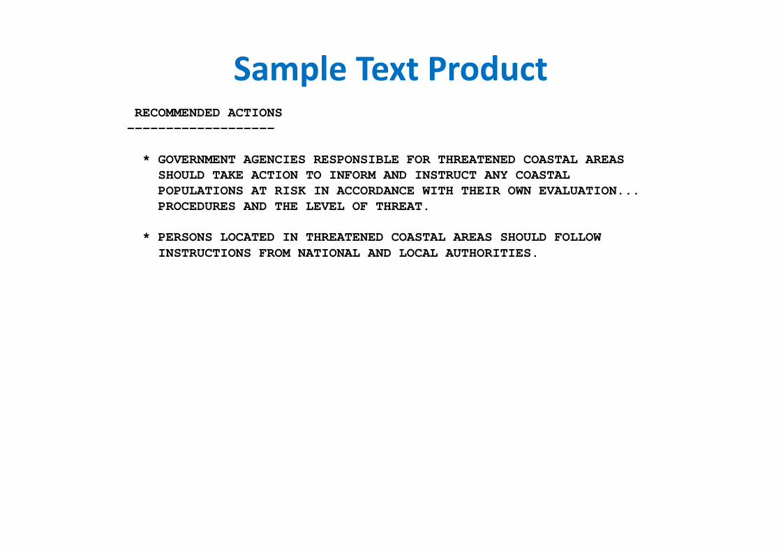
Sample Text ProductRECOMMENDED ACTIONS
-------------------
* GOVERNMENT AGENCIES RESPONSIBLE FOR THREATENED COASTAL AREAS
SHOULD TAKE ACTION TO INFORM AND INSTRUCT ANY COASTAL
POPULATIONS AT RISK IN ACCORDANCE WITH THEIR OWN EVALUATION...
PROCEDURES AND THE LEVEL OF THREAT.
* PERSONS LOCATED IN THREATENED COASTAL AREAS SHOULD FOLLOW
INSTRUCTIONS FROM NATIONAL AND LOCAL AUTHORITIES.
Sample Text Product
Sample Text Product
GNS Science
Overview
1. GNS Science Procedures
2. Why Enhanced PTWC Products?
3. Event timeline for the Enhanced Products
4. Examples of the Enhanced Products
5. Example: Japan 2011
GNS Science
GNS Science
GNS Science
Tsunami Gauge Network
GNS Science
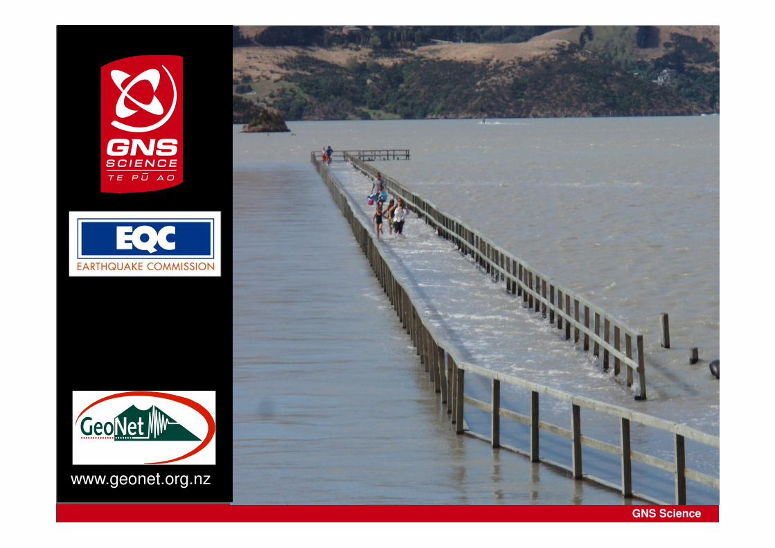
www.geonet.org.nz