Embed Size (px)
Citation preview
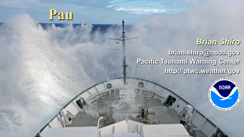
Brian Shiro NOAA Pacific Tsunami Warning Center
SOI R/V Falkor 22 May 2014
Tsunami Warning at PTWC
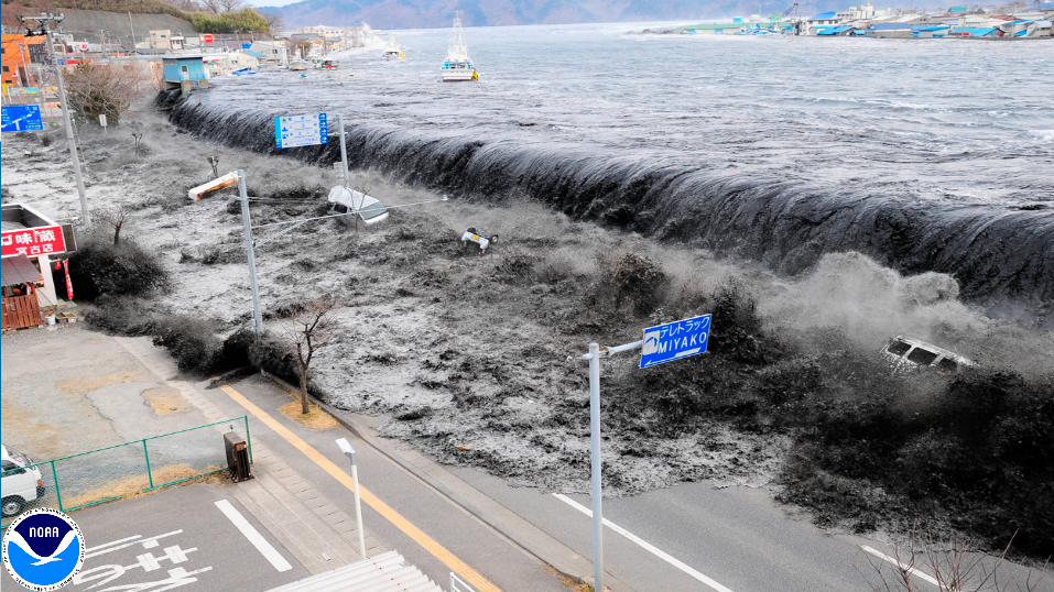
Japan – 11 March 2011
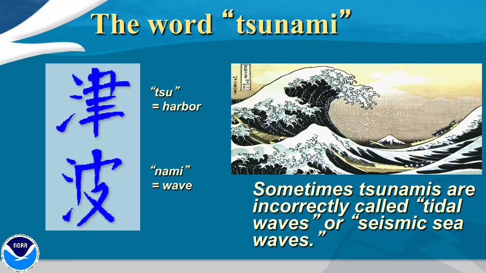
The word “tsunami”
Sometimes tsunamis are incorrectly called “tidal waves” or “seismic sea waves.”
“tsu” = harbor
“nami” = wave
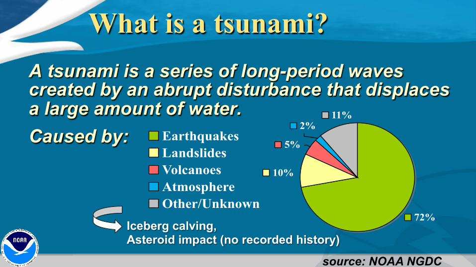
What is a tsunami? A tsunami is a series of long-period waves created by an abrupt disturbance that displaces a large amount of water. Caused by:
72%
2%
10%
11%
5%EarthquakesLandslidesVolcanoesAtmosphereOther/Unknown
source: NOAA NGDC
Iceberg calving, Asteroid impact (no recorded history)
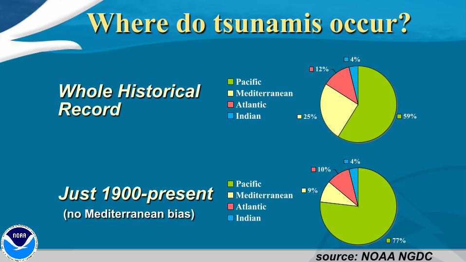
59%
12%
25%
4%
PacificMediterraneanAtlanticIndian
Where do tsunamis occur?
Whole Historical Record
77%
10%
9%
4%
PacificMediterraneanAtlanticIndian
Just 1900-present (no Mediterranean bias)
source: NOAA NGDC

Earthquakes (1900-2006)
source: USGS NEIC
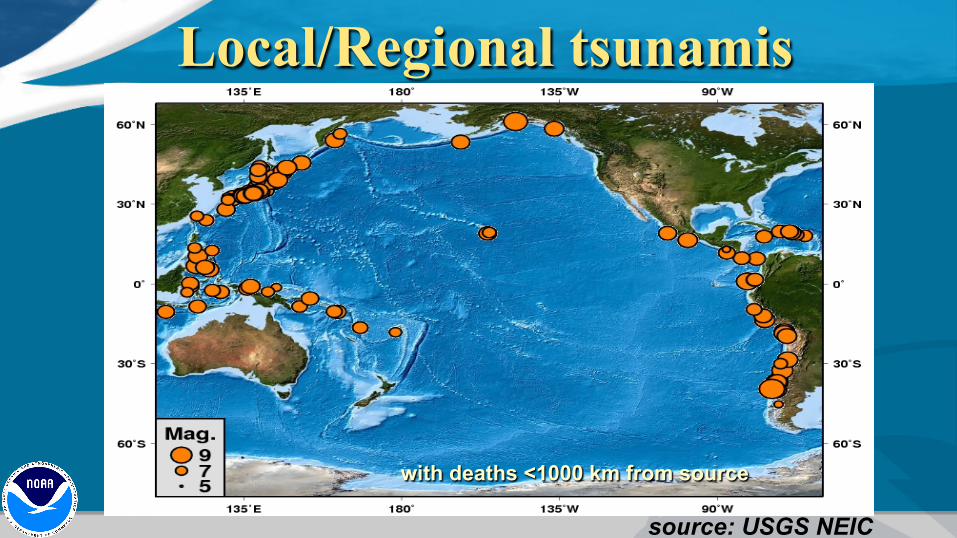
Local/Regional tsunamis
with deaths <1000 km from source
source: USGS NEIC
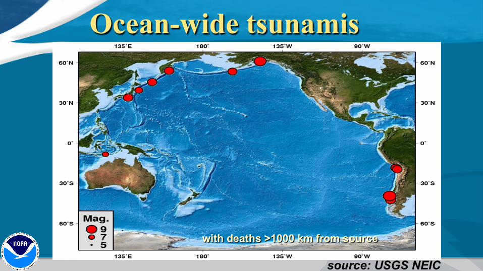
Ocean-wide tsunamis
with deaths >1000 km from source
source: USGS NEIC
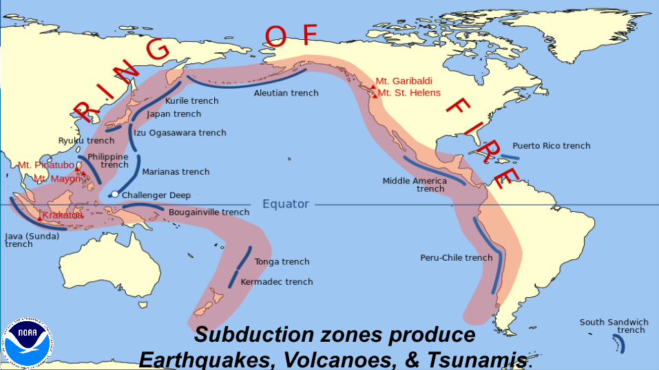
Ring of Fire
Subduction zones produce Earthquakes, Volcanoes, & Tsunamis.
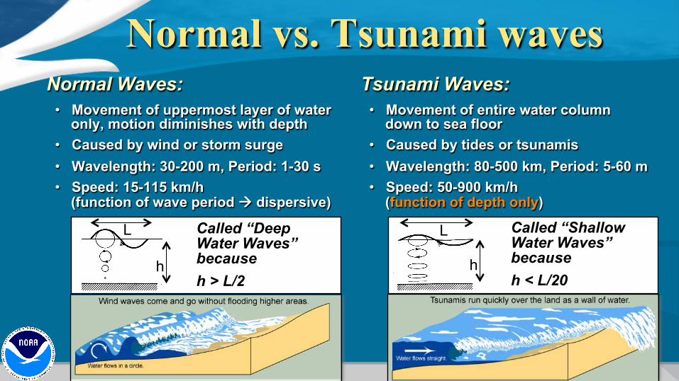
Normal vs. Tsunami waves Normal Waves:
• Movement of uppermost layer of water only, motion diminishes with depth
• Caused by wind or storm surge • Wavelength: 30-200 m, Period: 1-30 s • Speed: 15-115 km/h
(function of wave period à dispersive)
Tsunami Waves: • Movement of entire water column
down to sea floor • Caused by tides or tsunamis • Wavelength: 80-500 km, Period: 5-60 m • Speed: 50-900 km/h
(function of depth only)
h
Called “Deep Water Waves” because h > L/2
L
h h
Called “Shallow Water Waves” because h < L/20
L
h

Tsunami waves are fast …
about 900 km/hr
The deeper the water, the faster the tsunami. V = sqrt(g*h)
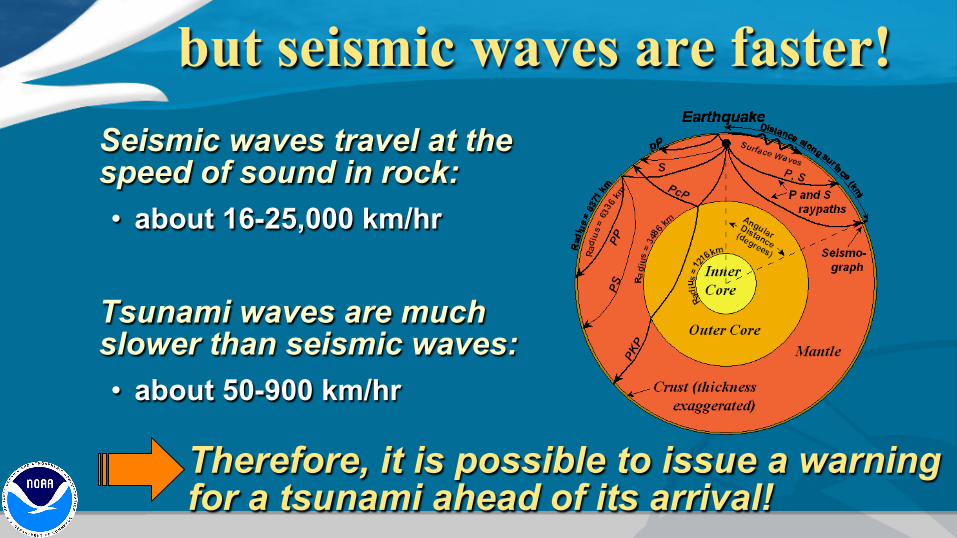
but seismic waves are faster! Seismic waves travel at the speed of sound in rock: • about 16-25,000 km/hr
Tsunami waves are much slower than seismic waves: • about 50-900 km/hr
Therefore, it is possible to issue a warning for a tsunami ahead of its arrival!
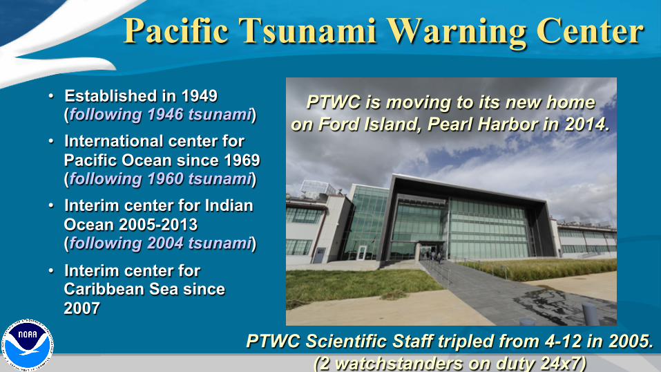
Pacific Tsunami Warning Center • Established in 1949
(following 1946 tsunami) • International center for
Pacific Ocean since 1969 (following 1960 tsunami)
• Interim center for Indian Ocean 2005-2013 (following 2004 tsunami)
• Interim center for Caribbean Sea since 2007
PTWC Scientific Staff tripled from 4-12 in 2005. (2 watchstanders on duty 24x7)
PTWC is moving to its new home on Ford Island, Pearl Harbor in 2014.
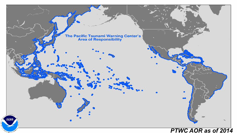
PTWC AOR as of 2014
Alarm!
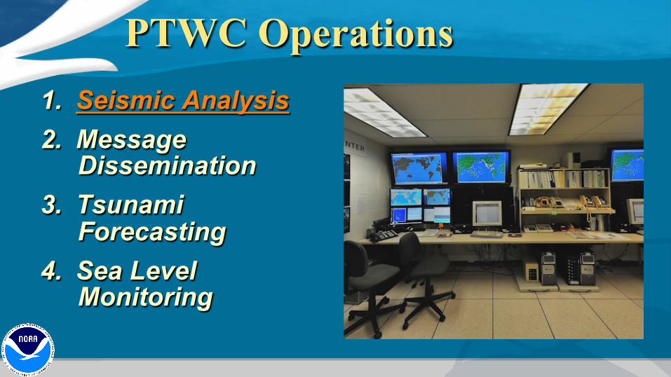
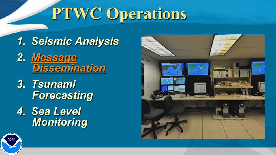
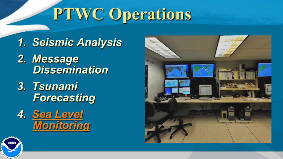
PTWC Operations 1. Seismic Analysis 2. Message
Dissemination 3. Tsunami
Forecasting 4. Sea Level
Monitoring
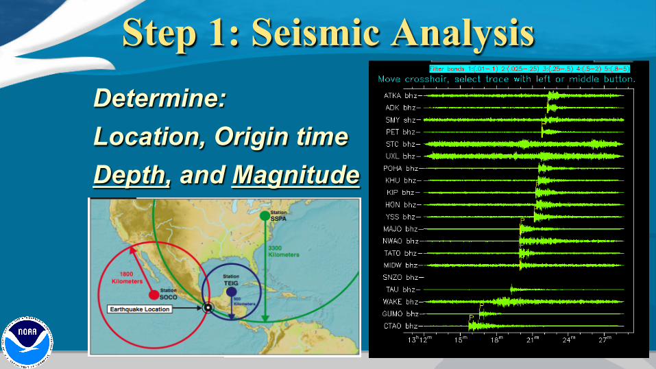
Step 1: Seismic Analysis Determine: Location, Origin time Depth, and Magnitude

Sources: IRIS, USGS, IMS, etc.
Seismic Network
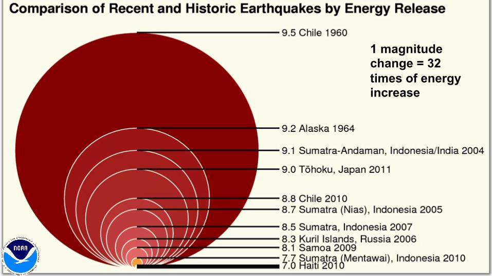
Earthquake Magnitude 1 magnitude change = 32 times of energy increase
PTWC Operations 1. Seismic Analysis 2. Message
Dissemination 3. Tsunami
Forecasting 4. Sea Level
Monitoring
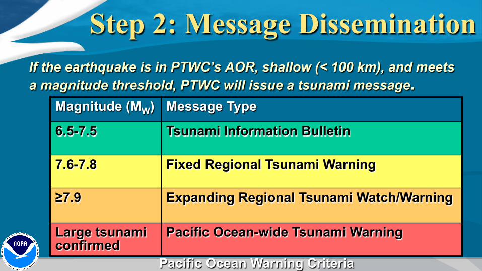
Step 2: Message Dissemination If the earthquake is in PTWC’s AOR, shallow (< 100 km), and meets a magnitude threshold, PTWC will issue a tsunami message. Magnitude (MW) Message Type
6.5-7.5 Tsunami Information Bulletin
7.6-7.8 Fixed Regional Tsunami Warning
≥7.9 Expanding Regional Tsunami Watch/Warning
Large tsunami confirmed
Pacific Ocean-wide Tsunami Warning
Pacific Ocean Warning Criteria
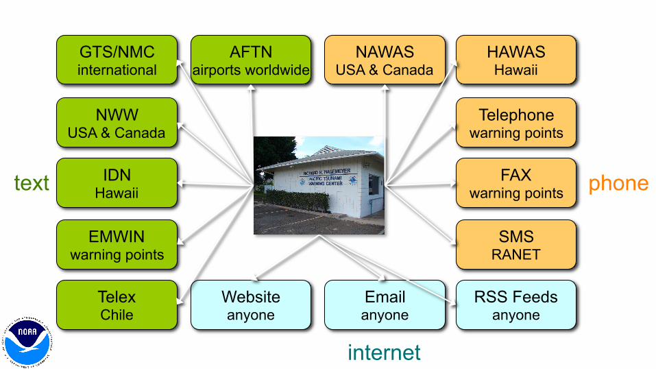
Message Pathways AFTN
airports worldwide GTS/NMC international
NWW USA & Canada
Telex Chile
IDN Hawaii
HAWAS Hawaii
NAWAS USA & Canada
Telephone warning points
FAX warning points
Website anyone
Email anyone
RSS Feeds anyone
EMWIN warning points
SMS RANET
text phone
internet
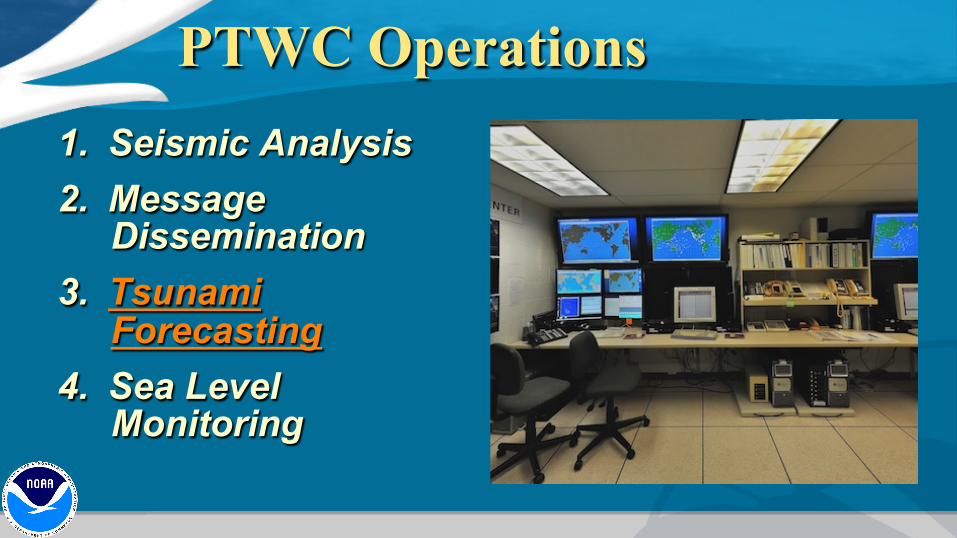
PTWC Operations 1. Seismic Analysis 2. Message
Dissemination 3. Tsunami
Forecasting 4. Sea Level
Monitoring
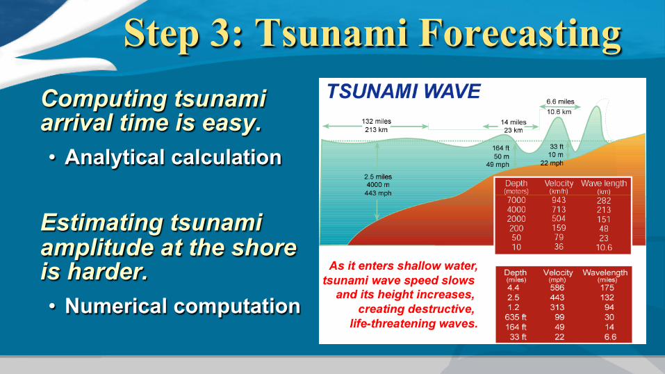
Step 3: Tsunami Forecasting Computing tsunami arrival time is easy. • Analytical calculation
Estimating tsunami amplitude at the shore is harder. • Numerical computation

Scenario: M9 in Kuril Islands
Hypothetical Scenario Illustrates PTWC’s new RIFT model-based products coming in late 2014
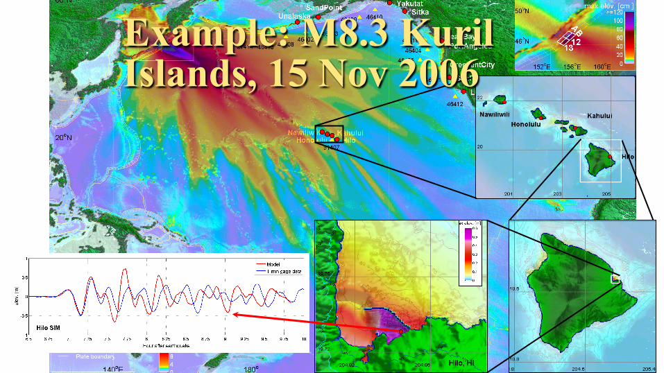
Example: M8.3 Kuril Islands, 15 Nov 2006
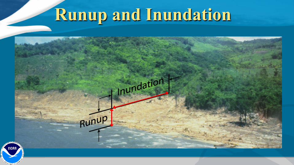
Runup and Inundation
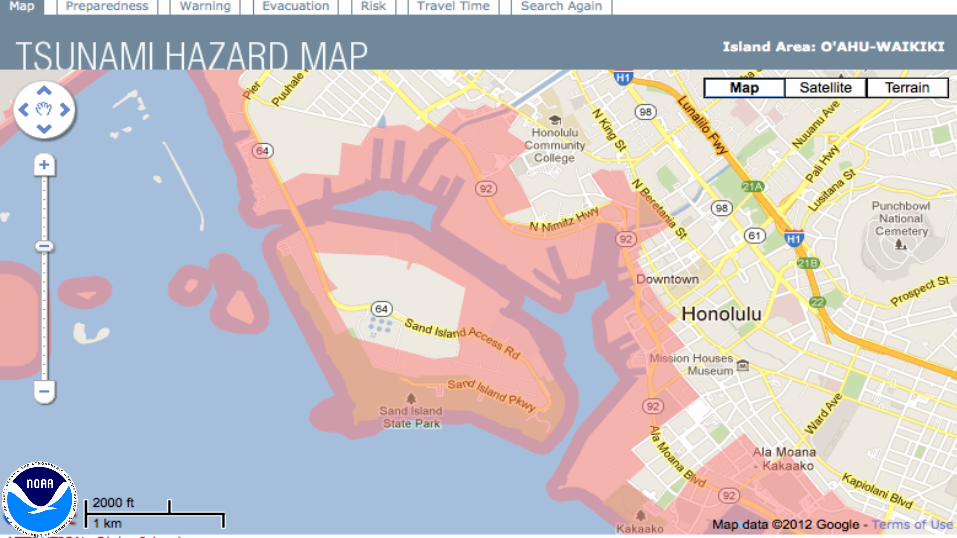
Inundation Zone Maps
PTWC Operations 1. Seismic Analysis 2. Message
Dissemination 3. Tsunami
Forecasting 4. Sea Level
Monitoring
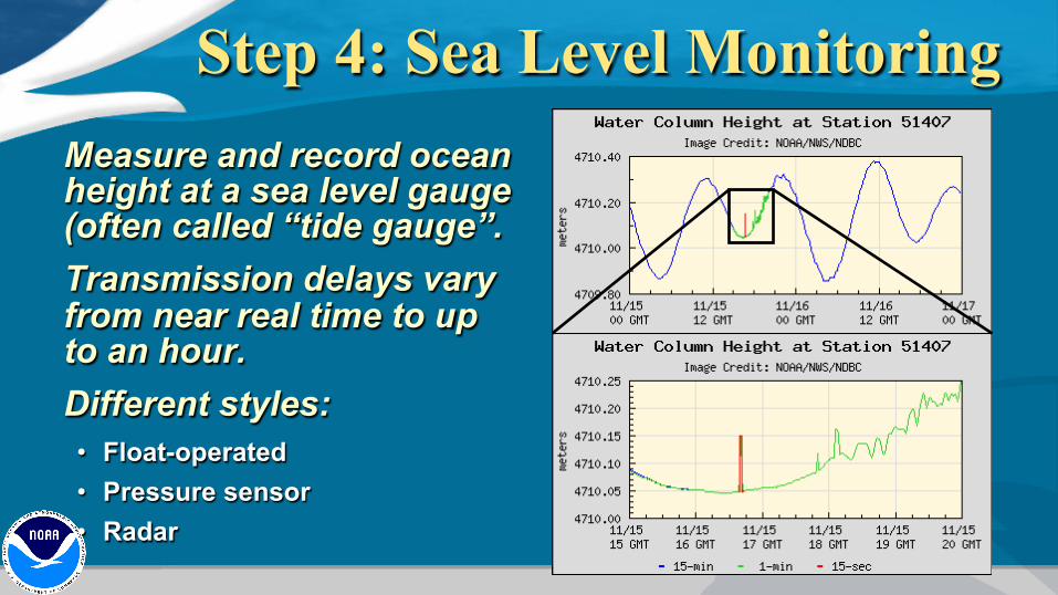
Step 4: Sea Level Monitoring Measure and record ocean height at a sea level gauge (often called “tide gauge”. Transmission delays vary from near real time to up to an hour. Different styles: • Float-operated • Pressure sensor • Radar

Sources: GLOSS, NOAA, UHSLC, etc.
Sea Level Network
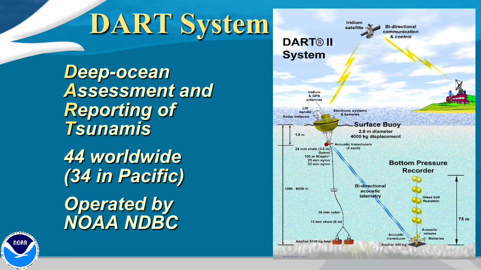
DART System Deep-ocean Assessment and Reporting of Tsunamis 44 worldwide (34 in Pacific) Operated by NOAA NDBC

The future
(Smith et al 2005) (Occhipinti et al 2008)
satellite altimetry ionospheric TEC
GPS, over-the-horizon radar, infrasound, and …

Tsunami Safety for Boaters

Extra Slides
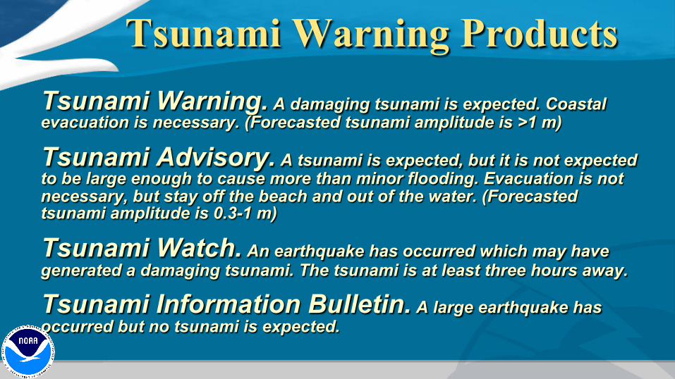
Tsunami Warning Products Tsunami Warning. A damaging tsunami is expected. Coastal evacuation is necessary. (Forecasted tsunami amplitude is >1 m)
Tsunami Advisory. A tsunami is expected, but it is not expected to be large enough to cause more than minor flooding. Evacuation is not necessary, but stay off the beach and out of the water. (Forecasted tsunami amplitude is 0.3-1 m)
Tsunami Watch. An earthquake has occurred which may have generated a damaging tsunami. The tsunami is at least three hours away.
Tsunami Information Bulletin. A large earthquake has occurred but no tsunami is expected.

Education save lives

Come visit us!