Embed Size (px)
DESCRIPTION
http://www.thmcf.org/downloads/Trackway_talk_notes.pdf
Citation preview

A Neolithic Trackway on Hatfield Moors – a significant discovery
Dr Henry Chapman & Dr Benjamin Gearey
Institute of Archaeology and Antiquity, University of Birmingham (formerly WAERC, University of Hull)
The 2005 Stephen Warburton Memorial Lecture
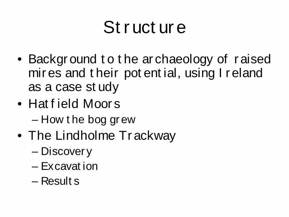
Structure• Background to the archaeology of raised
mires and their potential, using Ireland as a case study
• Hatfield Moors– How the bog grew
• The Lindholme Trackway– Discovery– Excavation– Results
Background to raised mires and their archaeological and
palaeoenvironmental potential
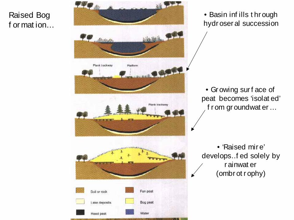
• Basin infills through hydroseral succession
• Growing surface of peat becomes ‘isolated’
from groundwater…
• ‘Raised mire’ develops…fed solely by
rainwater (ombrotrophy)
Raised Bog formation…
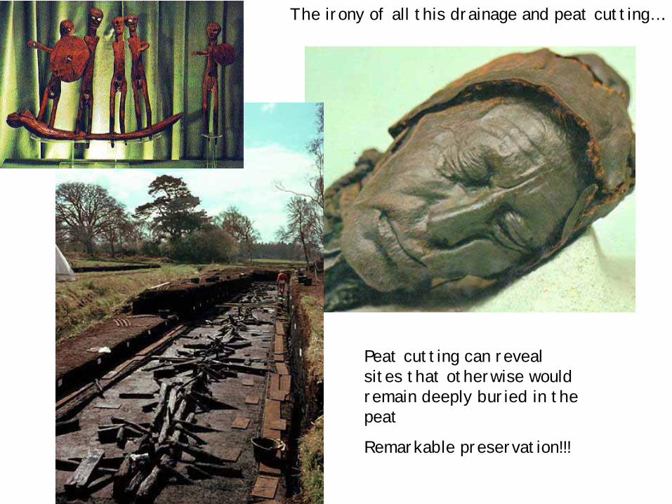
The irony of all this drainage and peat cutting….
Peat cutting can reveal sites that otherwise would remain deeply buried in the peat
Remarkable preservation!!!
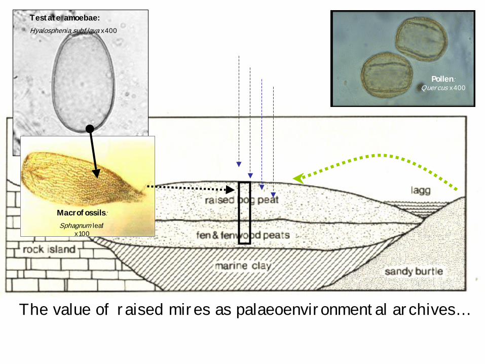
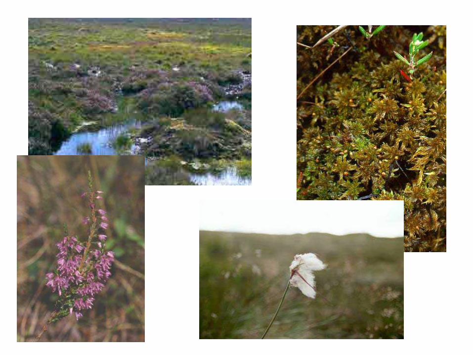
The value of raised mires as palaeoenvironmental archives…
Pollen: Quercus x400
Testate amoebae:Hyalosphenia subflava x400
Macrofossils:Sphagnum leaf
x100
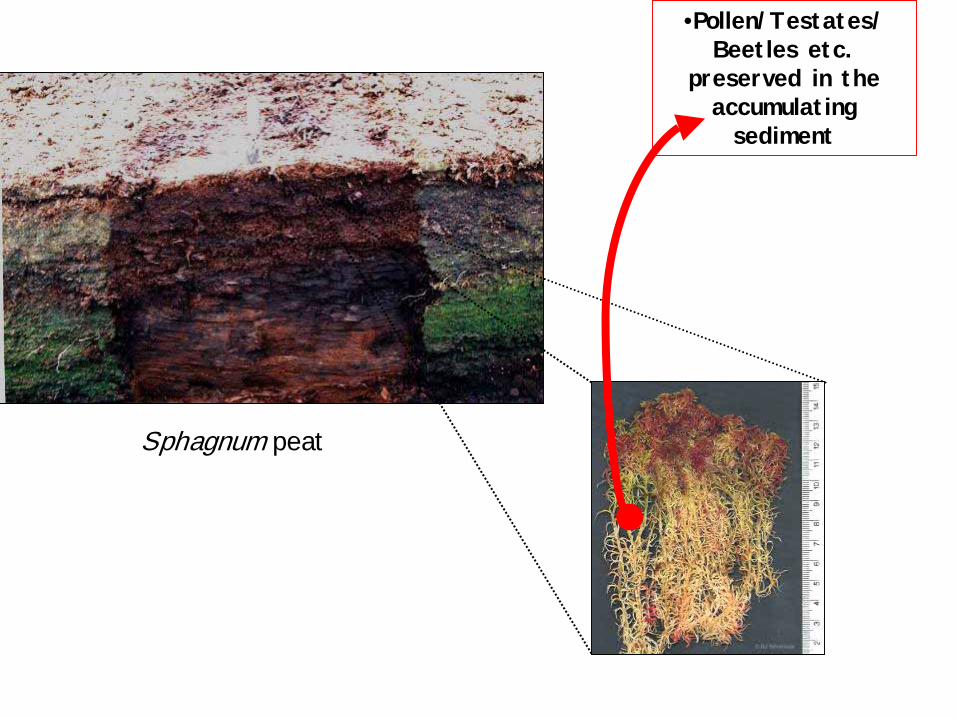
•Pollen/Testates/ Beetles etc.
preserved in the accumulating
sediment
Sphagnum peat
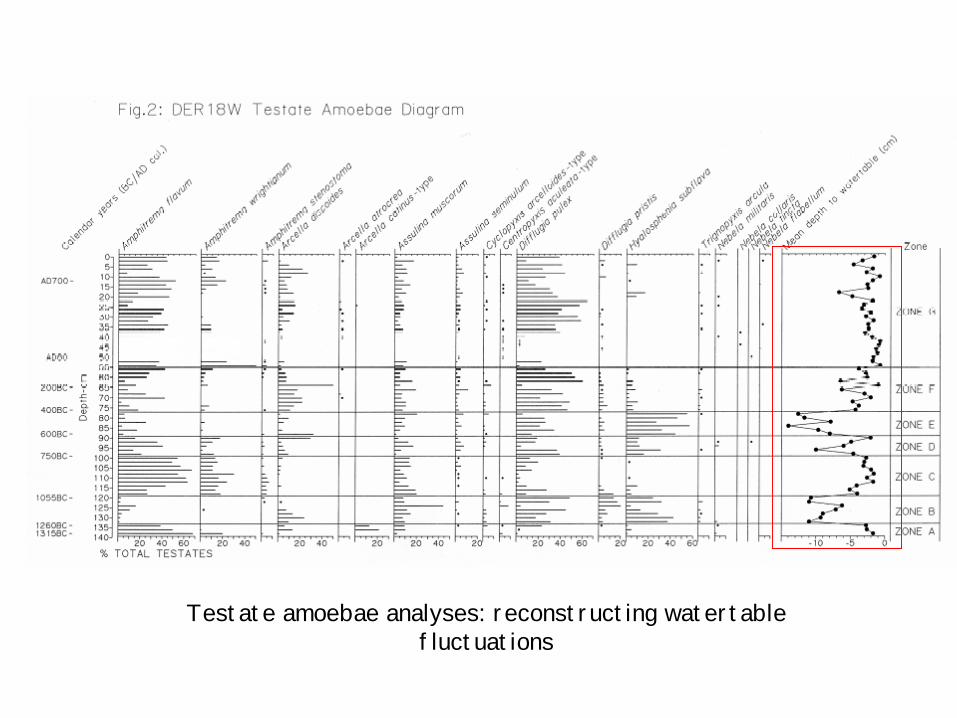
Testate amoebae analyses: reconstructing watertable fluctuations
So… raised mires may preserve both archaeological and
palaeoenvironmental material (archaeoenvironmental record)

Ireland: lots of bogs…
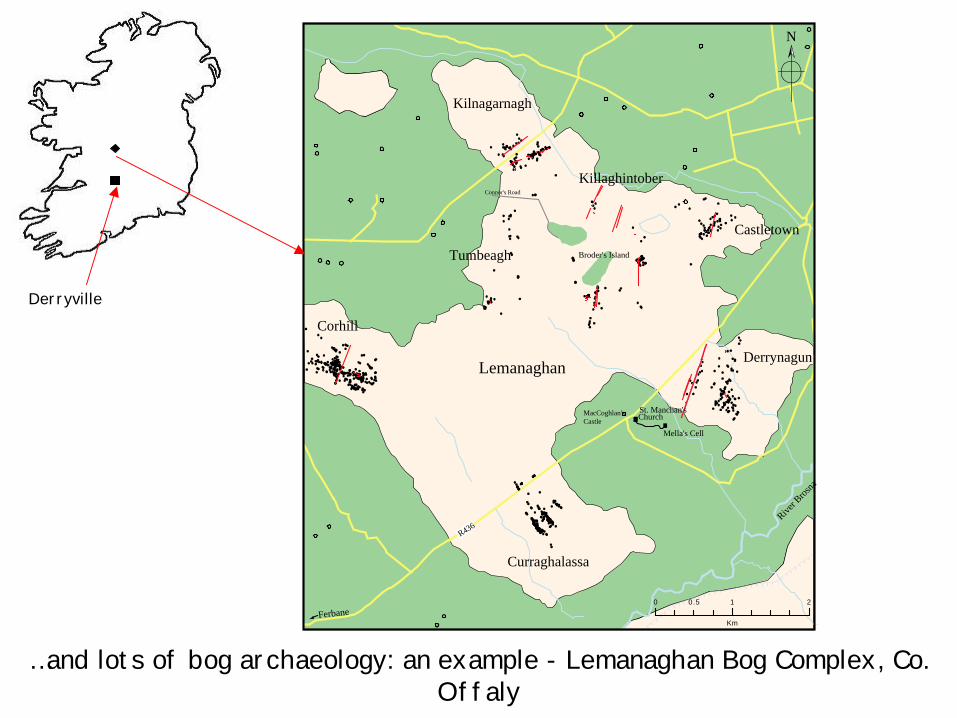
Lemanaghan
Kilnagarnagh
Curraghalassa
Castletown
Corhill
Killaghintober
Ferbane
River B
rosna
St. Manchan's
Mella's Cell
MacCoghlan'sCastle Church
R436
Connor's Road
Tumbeagh Broder's Island
Derrynagun
20 10.5
Km
N
…and lots of bog archaeology: an example - Lemanaghan Bog Complex, Co. Offaly
Derryville
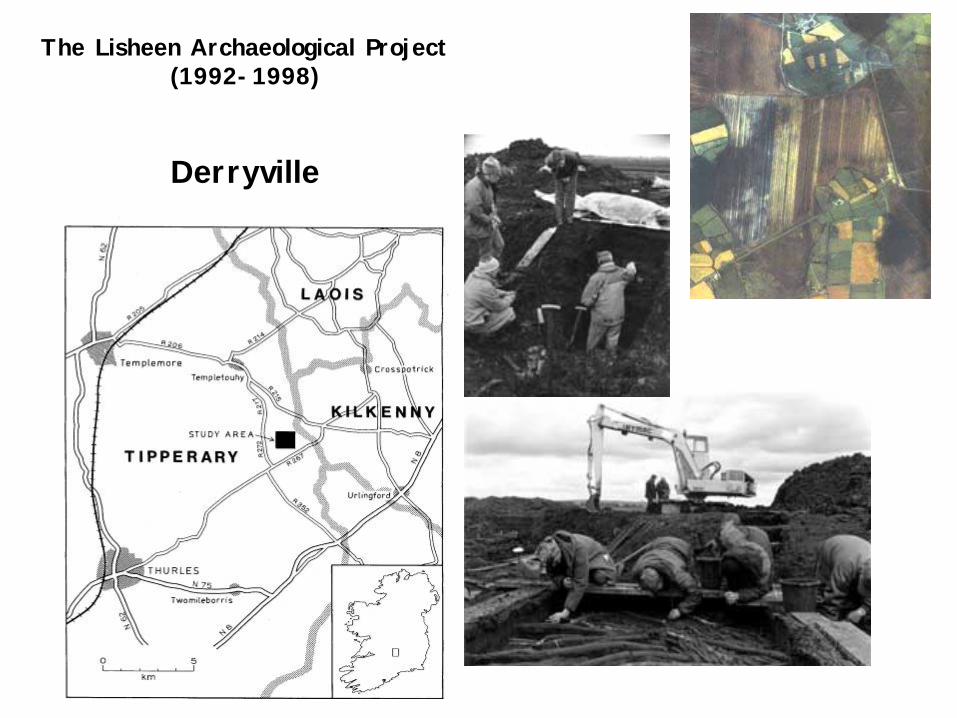
The Lisheen Archaeological Project (1992-1998)
Derryville
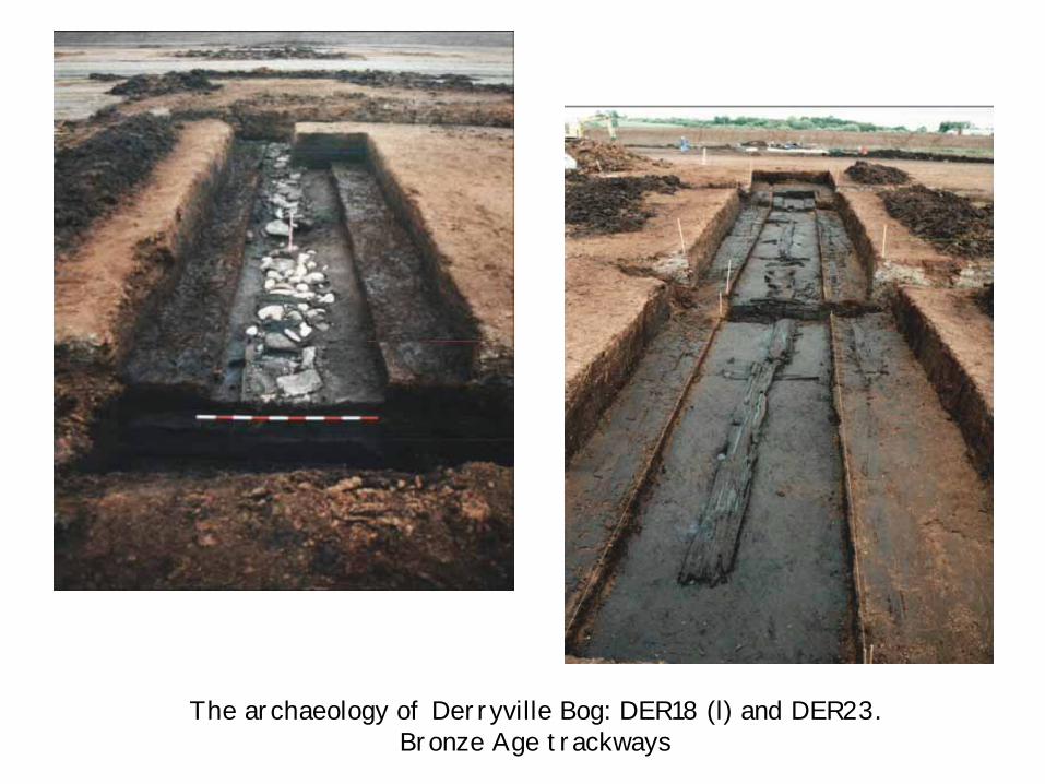
The archaeology of Derryville Bog: DER18 (l) and DER23. Bronze Age trackways
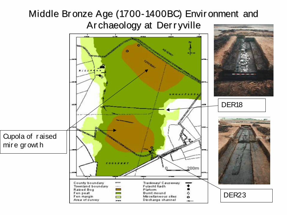
Middle Bronze Age (1700Middle Bronze Age (1700--1400BC) Environment and 1400BC) Environment and Archaeology at DerryvilleArchaeology at Derryville
Cupola of raised mire growth
DER23
DER18

Hatfield Moors
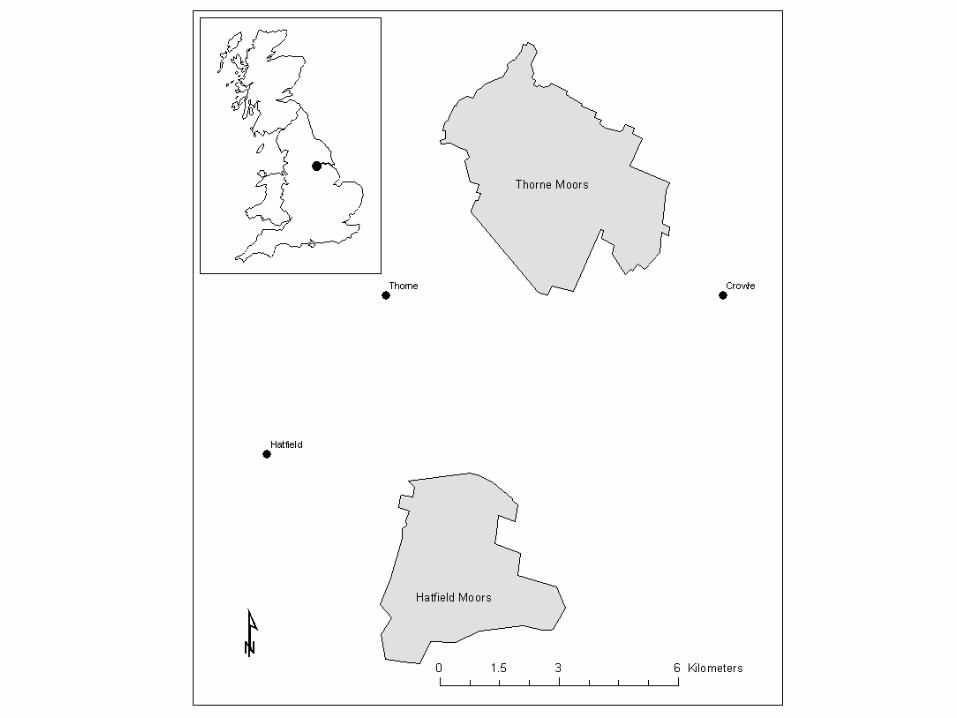
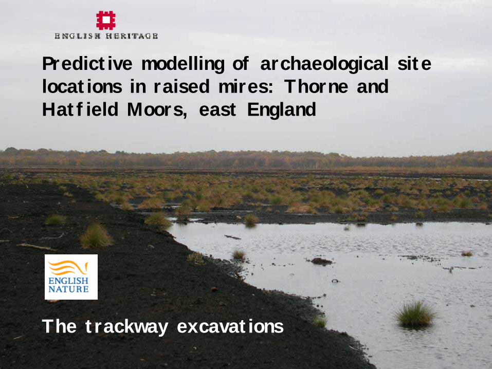
Predictive modelling of archaeological site locations in raised mires: Thorne and Hatfield Moors, east England
The trackway excavations
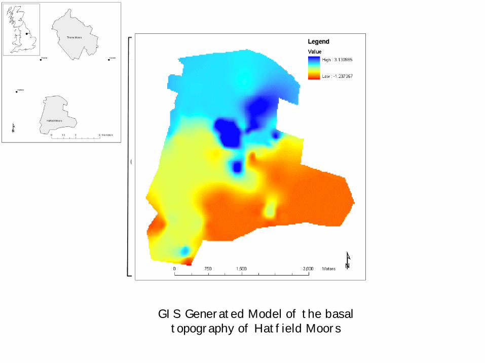
GIS Generated Model of the basal topography of Hatfield Moors
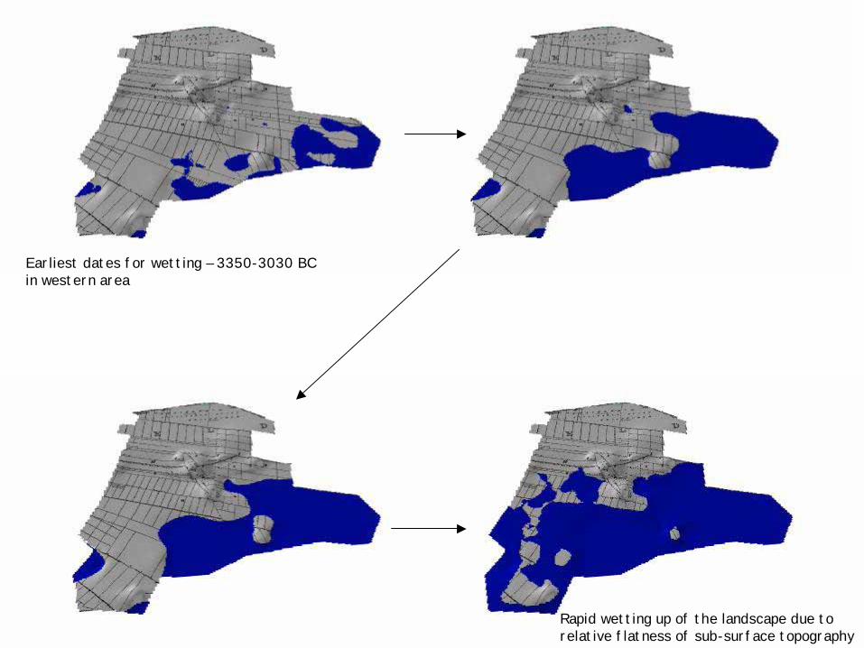
Earliest dates for wetting – 3350-3030 BC in western area
Rapid wetting up of the landscape due to relative flatness of sub-surface topography
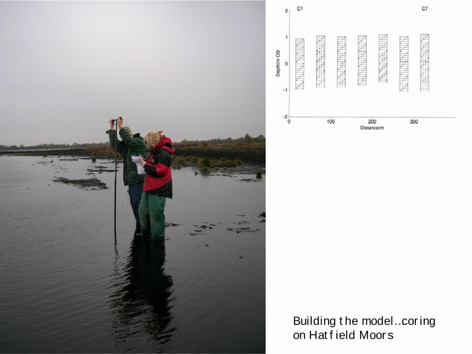
Building the model…coring on Hatfield Moors
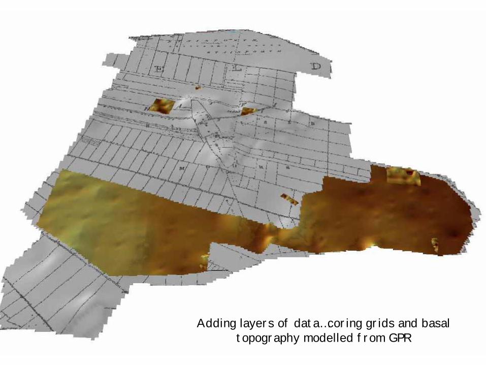
Adding layers of data…coring grids and basal topography modelled from GPR
The Trackway
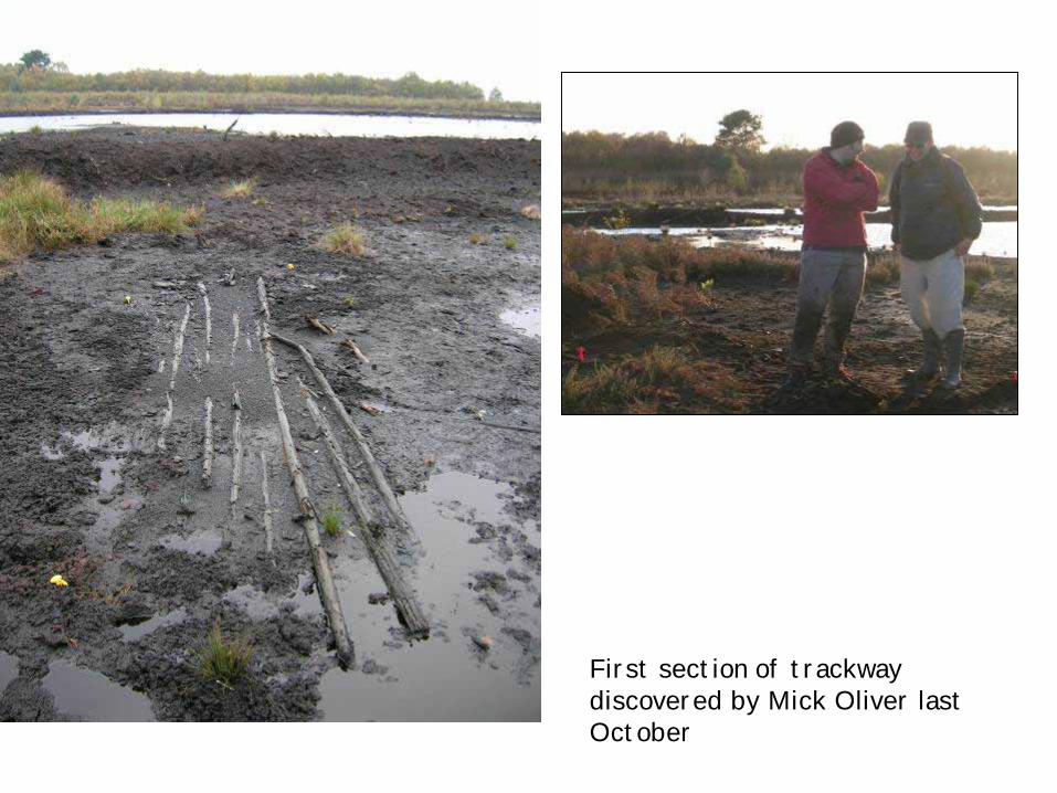
First section of trackway discovered by Mick Oliver last October
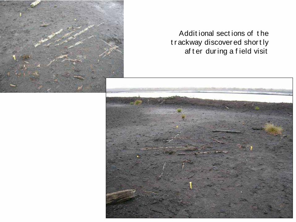
Additional sections of the trackway discovered shortly
after during a field visit
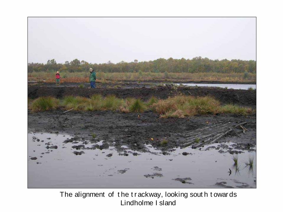
The alignment of the trackway, looking south towards Lindholme Island
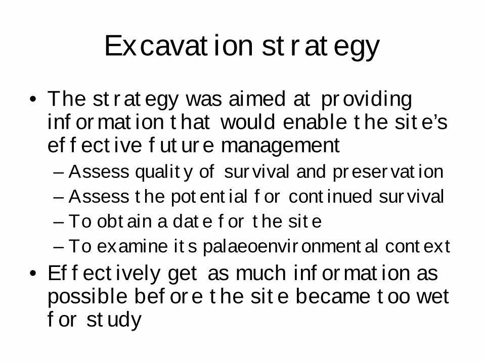
Excavation strategy• The strategy was aimed at providing
information that would enable the site’s effective future management– Assess quality of survival and preservation– Assess the potential for continued survival– To obtain a date for the site– To examine its palaeoenvironmental context
• Effectively get as much information as possible before the site became too wet for study
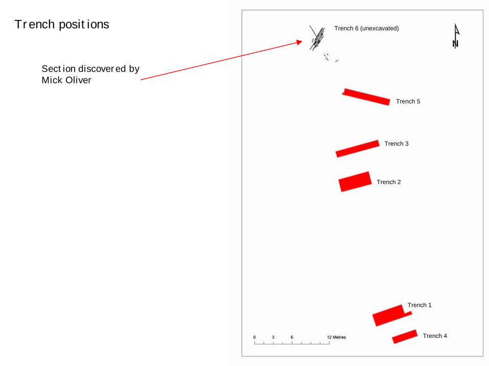
Section discovered by Mick Oliver
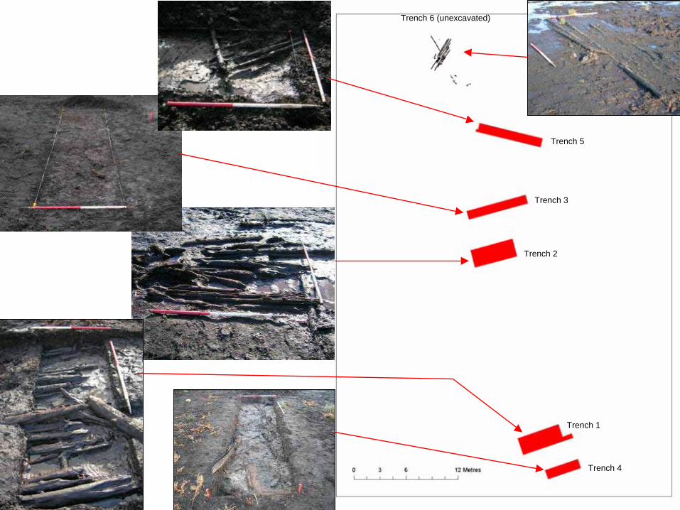
Trench positions
Trench 1
Trench 4
Trench 2
Trench 3
Trench 5
Trench 6 (unexcavated)
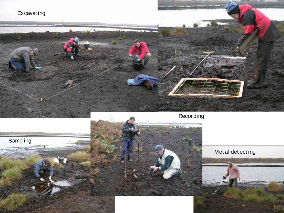
Excavating
Sampling
Metal detecting
Recording
Trench 1
Trench 4
Trench 2
Trench 3
Trench 5
Trench 6 (unexcavated)
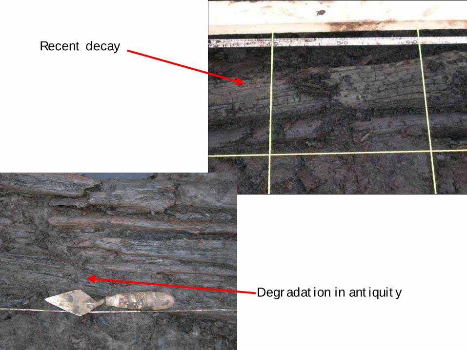
Degradation in antiquity
Recent decay
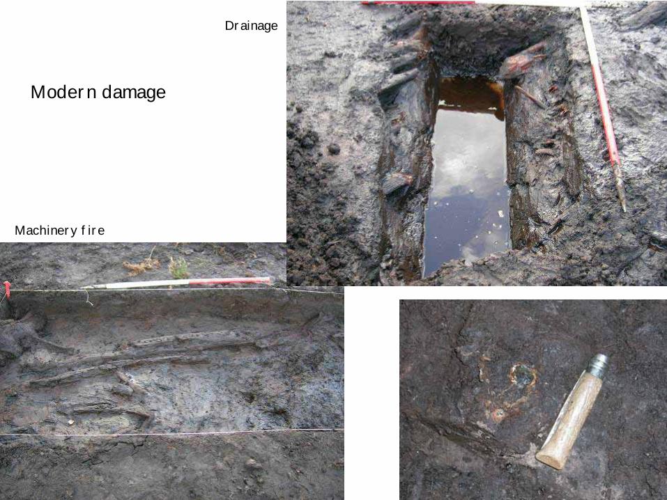
Modern damage
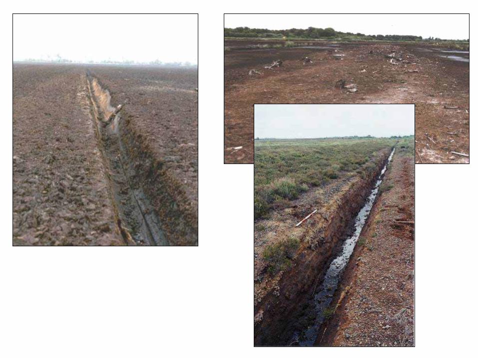
Drainage
Machinery fire
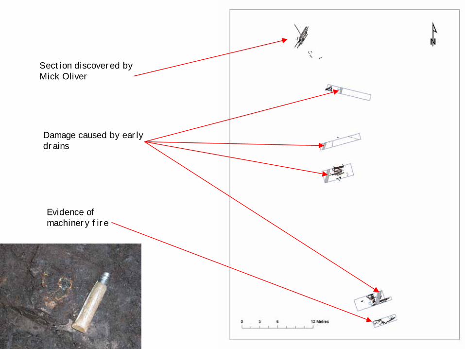
Section discovered by Mick Oliver
Damage caused by early drains
Evidence of machinery fire
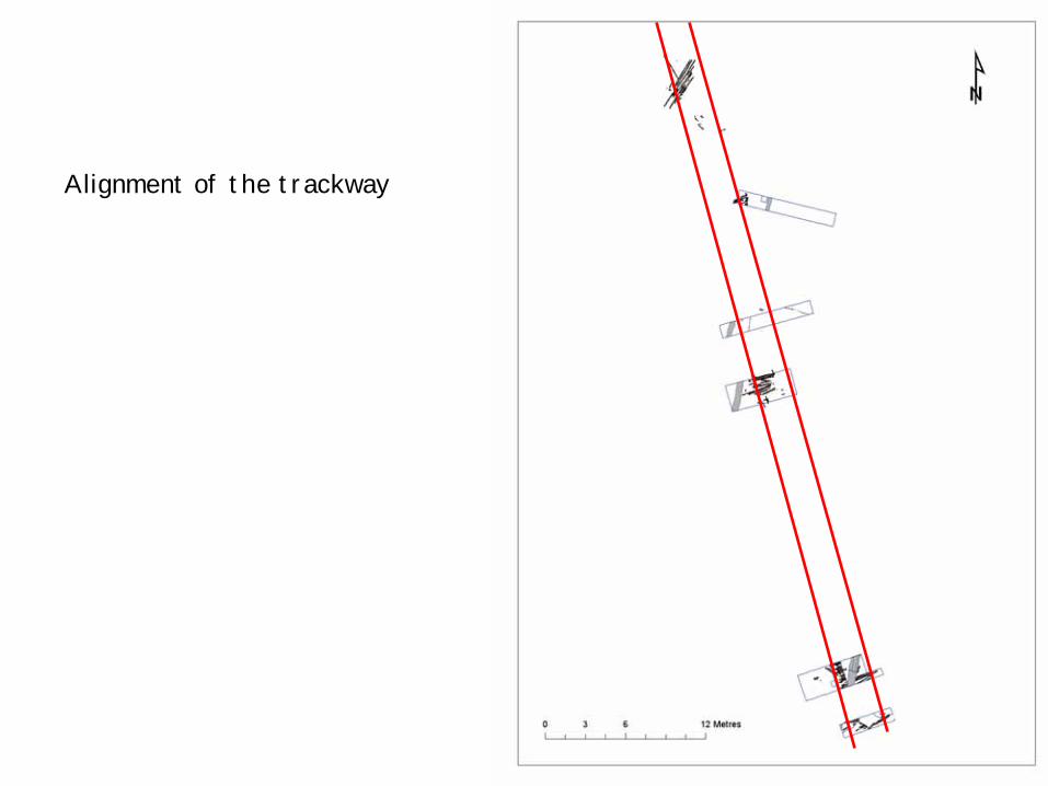
Alignment of the trackway
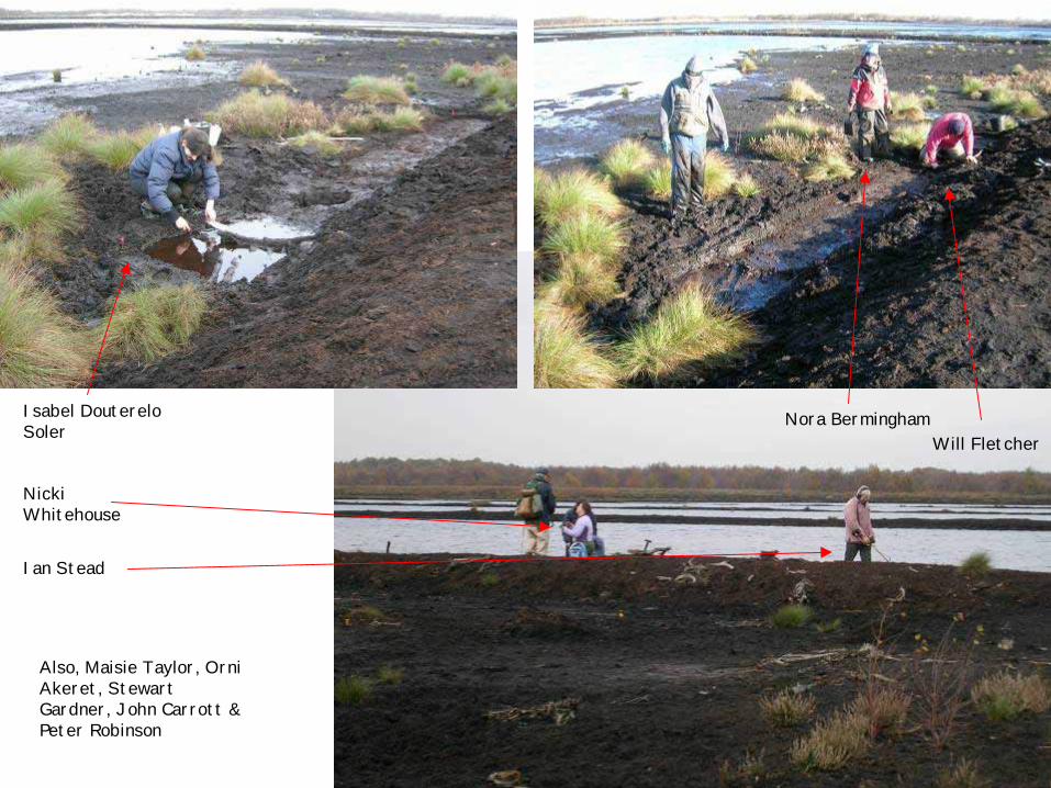
Nicki Whitehouse
Ian Stead
Isabel Douterelo Soler
Nora BerminghamWill Fletcher
Also, Maisie Taylor, Orni Akeret, Stewart Gardner, John Carrott & Peter Robinson
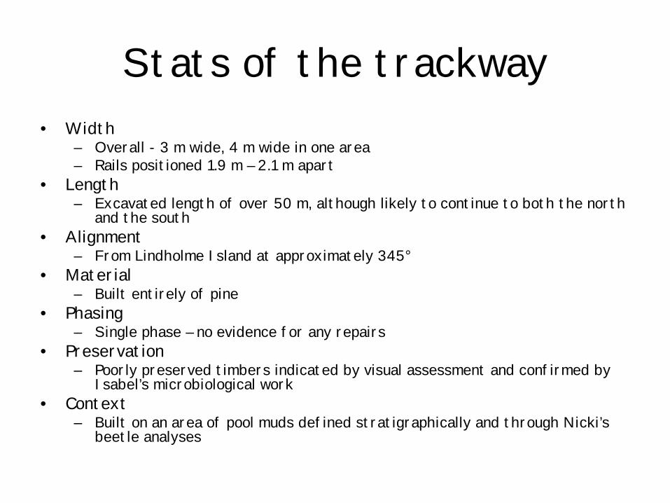
Stats of the trackway• Width
– Overall - 3 m wide, 4 m wide in one area– Rails positioned 1.9 m – 2.1 m apart
• Length– Excavated length of over 50 m, although likely to continue to both the north
and the south• Alignment
– From Lindholme Island at approximately 345°• Material
– Built entirely of pine• Phasing
– Single phase – no evidence for any repairs• Preservation
– Poorly preserved timbers indicated by visual assessment and confirmed by Isabel’s microbiological work
• Context– Built on an area of pool muds defined stratigraphically and through Nicki’s
beetle analyses
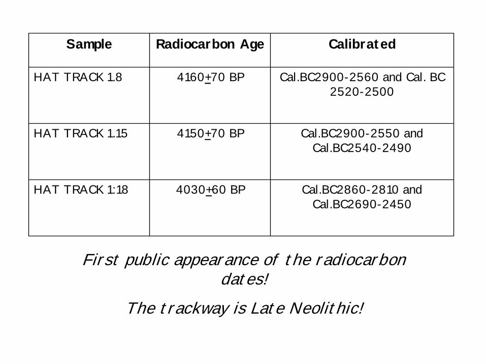
Sample Radiocarbon Age Calibrated
HAT TRACK 1.8 4160+70 BP Cal.BC2900-2560 and Cal. BC 2520-2500
HAT TRACK 1.15 4150+70 BP Cal.BC2900-2550 and Cal.BC2540-2490
HAT TRACK 1:18 4030+60 BP Cal.BC2860-2810 and Cal.BC2690-2450
First public appearance of the radiocarbon dates!
The trackway is Late Neolithic!
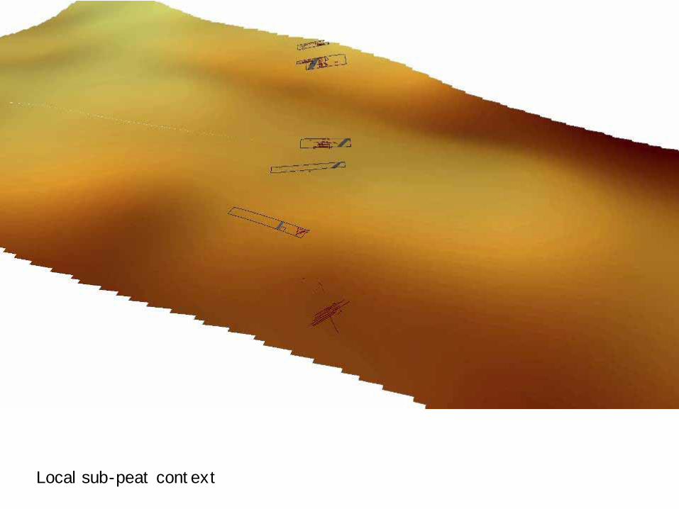
Local sub-peat context

Conclusions, context and significance
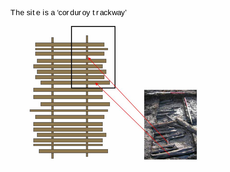
The site is a ‘corduroy trackway’
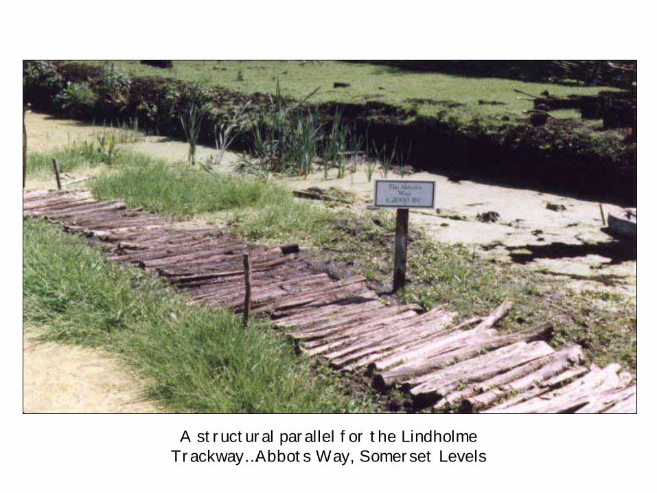
A structural parallel for the Lindholme Trackway…Abbots Way, Somerset Levels
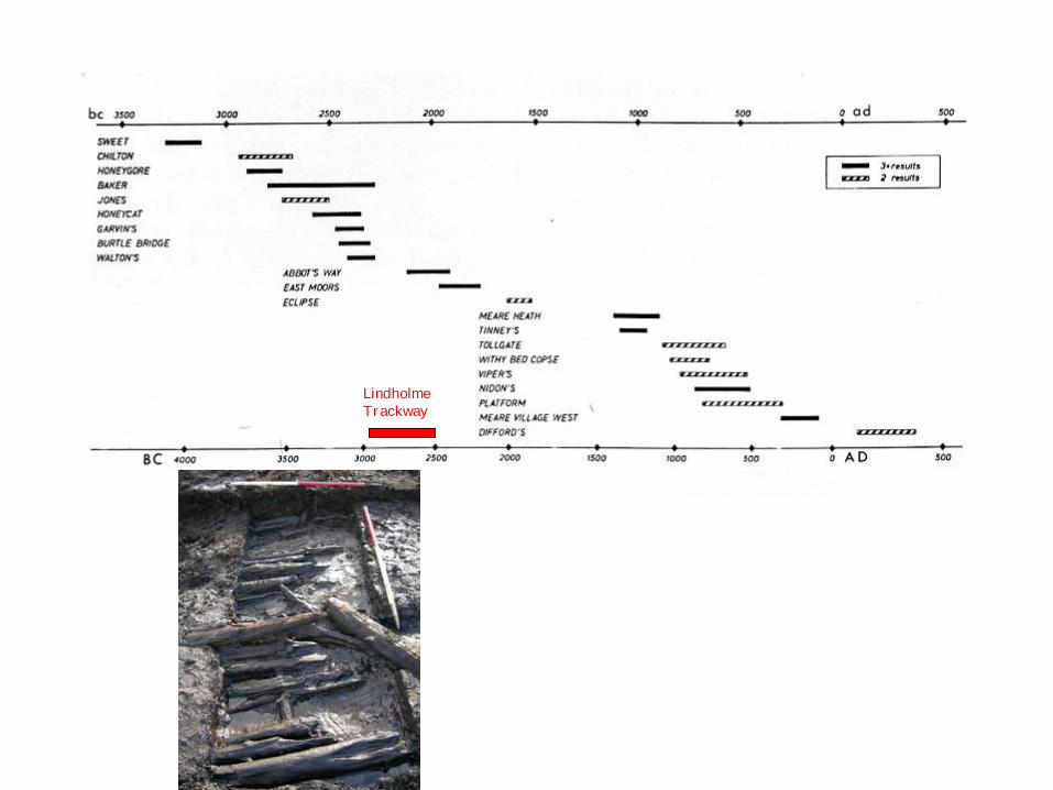
Lindholme Trackway
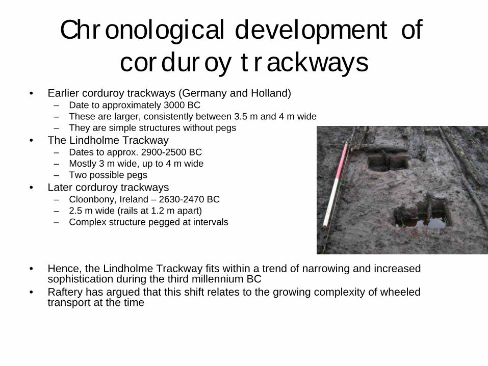
Chronological development of corduroy trackways
• Earlier corduroy trackways (Germany and Holland) – Date to approximately 3000 BC– These are larger, consistently between 3.5 m and 4 m wide– They are simple structures without pegs
• The Lindholme Trackway– Dates to approx. 2900-2500 BC– Mostly 3 m wide, up to 4 m wide– Two possible pegs
• Later corduroy trackways– Cloonbony, Ireland – 2630-2470 BC– 2.5 m wide (rails at 1.2 m apart)– Complex structure pegged at intervals
• Hence, the Lindholme Trackway fits within a trend of narrowing and increased sophistication during the third millennium BC
• Raftery has argued that this shift relates to the growing complexity of wheeled transport at the time

Why was it built?
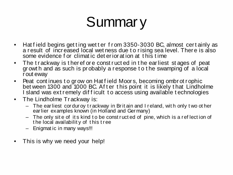
Summary• Hatfield begins getting wetter from 3350-3030 BC, almost certainly as
a result of increased local wetness due to rising sea level. There is also some evidence for climatic deterioration at this time
• The trackway is therefore constructed in the earliest stages of peat growth and as such is probably a response to the swamping of a local routeway
• Peat continues to grow on Hatfield Moors, becoming ombrotrophic between 1300 and 1000 BC. After this point it is likely that Lindholme Island was extremely difficult to access using available technologies
• The Lindholme Trackway is: – The earliest corduroy trackway in Britain and Ireland, with only two other
earlier examples known (in Holland and Germany)– The only site of its kind to be constructed of pine, which is a reflection of
the local availability of this tree– Enigmatic in many ways!!!
• This is why we need your help!


