Embed Size (px)
Citation preview

TOWARDS AN AUTOMATED GEOREFERENCING AND ORTHORECTIFICATION OFARCHAEOLOGICAL AERIAL PHOTOGRAPHS
M. Doneus, G. Verhoeven, W. Karel, C. Briese, N. Pfeifer, C. Ressl
1. INTRODUCTION
Aerial photography is one of the oldest archaeological prospec-tion methods. Although it is highly efficient in detecting sites,its full potential (i.e. the detailed mapping of archaeologicaland palaeoenvironmental structures) can only be used when thephotographs are georeferenced, (ortho)rectified, interpreted andmapped. Georeferencing, also known as image orientation orregistration, assigns spatial information to the imagery to ex-plicitly define their location and rotation in respect to a specificEarth-fixed coordinate frame. This enables their transcription toa map, a process that obviously involves the archaeological inter-pretation of the detected structures and/or features in relation toother available georeferenced data sets (Palmer, 2000). Whenexecuted repetitively, several multi-temporal observations canbe mosaicked into an extensive overall view of an archaeolog-ical region, which will be used as basic information for furtherprospection, excavation, protection measures, and spatial analy-sis.
Irrespective of the method applied, the georeferencingof the images is commonly determined with ground controlpoints (GCPs), whose measurement and identification is a time-consuming operation (that is only partly reduced in photogram-metric packages by using automatic tie points and a block ad-justment for multiple images). Especially in large-scale archae-ological projects with thousands of images, this is currently con-sidered to be the biggest bottleneck. Along with specialised soft-ware, reference data, photogrammetric skills and experience arerequired. Therefore, aerial archaeology often does not go be-yond the data acquisition stage. As a result, millions of aerialphotographs (APs) are currently stored in archives that oftenonly allow a very limited geometric access of the imagery. Thesearchives contain an enormous amount of valuable optical in-formation for detecting and documenting archaeological land-scapes, which cannot be exploited efficiently.
2. THE PROJECT
Hence, automated techniques for the georeferencing of archae-ological APs are highly desirable. In order to allow an absolutegeoreferencing, this approach can be based on the available geo-referenced reference data (orthophoto and digital terrain modelor DTM). Within this workflow, however, several issues of typi-cal archaeological APs have to be considered:
• both vertical and oblique images are acquired• different non-metric (uncalibrated) cameras are used• oblique photographs often lack a high number and/or
good distribution of possible ground control points• oblique APs are often shot from an extremely oblique
viewpoint• often, even rough georeferencing is missing [e.g. posi-
tion information by a hand-held GNSS (global navigationsatellite system) receiver].
Since March 2012, the Austrian Science Fund (FWF) is sup-porting the project "Automated Georeferencing and Orthorecti-fication of Archaeological Aerial Photographs (ARAP)". Threeinternational partner organisations (Vienna Institute of Archae-ological Science of the University of Vienna, LBI for Archae-ological Prospection and Virtual Archaeology based on an in-ternational partnership, and Research Groups of Photogramme-try and Remote Sensing of TU-Vienna) are co-operating withinthe project. They have long-term experience in archaeologicalprospection, especially aerial archaeology and photogrammetry.The general aim of the proposed project is to create solutionsfor the automated georeferencing and orthophoto generation ofarchaeological APs. The resulting workflow should allow theefficient processing of both newly generated and previously ac-quired aerial images based on available reference data.
In order to fulfil these requirements, the project will (1) eval-uate a calibrated digital still camera (DSC) with an attachedpositioning and orientation system (POS) for archaeologicalprospection and automated orthophoto production = "hardwareapproach"; (2) develop a workflow including software for auto-matic orientation of APs without accurate initial positioning androtation information = "software approach".
Both approaches will be implemented in the conventionalaerial reconnaissance work from a small aeroplane as well as inan innovative method using an unmanned aerial vehicle (UAV)to acquire aerial imagery completely autonomously and beingindependent of conventional aircrafts.
3. HARDWARE APPROACH
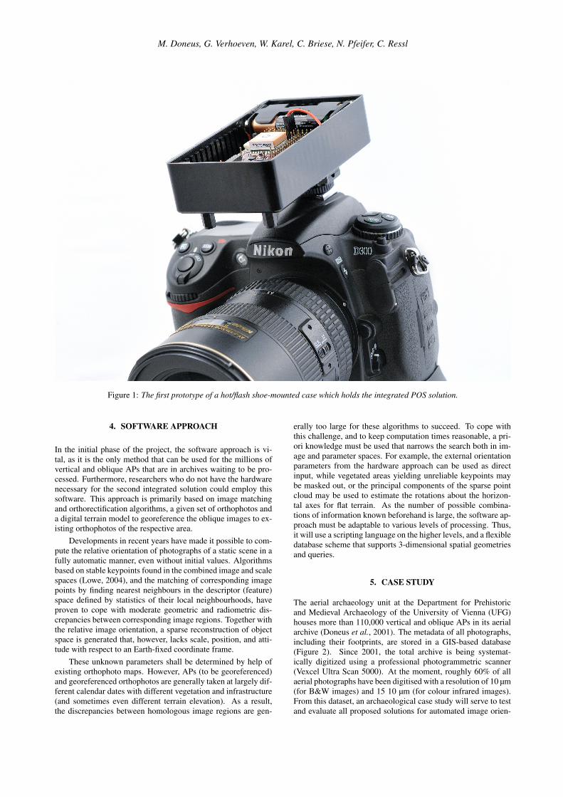
This approach aims at creating a hand-held calibrated DSC withan attached positioning and orientation system (POS). By com-bining a low-cost IMU (inertial measurement unit) and a GNSSreceiver, the POS observes the external orientation parameters asinput for the previously outlined software approach. Currently,several affordable IMU solutions (prices around C200) are beingtested for their accuracy, tendency to drift and consistent perfor-mance. In addition, they should allow easy integration with low-cost GNSS receivers, enable sub-second camera synchronisationand data logging (on the same board or using a third hardwarecomponent) while featuring low power consumption. Finally,the integrated POS solution must be robust enough to be takenin the air and small enough to fit in a case that is easily mountableon a camera’s hot/flash shoe (Figure 1). Within the outlined soft-ware workflow (during the bundle block adjustment), the POSdata will be used as initial values resp. as weighted observationsof the exterior orientation of the photograph. This will allow re-ducing the effort for estimating these initial values. However, inorder to increase the absolute accuracy of the final georeferenc-ing, the usage of available high quality DTM and orthophotoswill be essential.
M. Doneus, G. Verhoeven, W. Karel, C. Briese, N. Pfeifer, C. Ressl
Figure 1: The first prototype of a hot/flash shoe-mounted case which holds the integrated POS solution.
4. SOFTWARE APPROACH
In the initial phase of the project, the software approach is vi-tal, as it is the only method that can be used for the millions ofvertical and oblique APs that are in archives waiting to be pro-cessed. Furthermore, researchers who do not have the hardwarenecessary for the second integrated solution could employ thissoftware. This approach is primarily based on image matchingand orthorectification algorithms, a given set of orthophotos anda digital terrain model to georeference the oblique images to ex-isting orthophotos of the respective area.
Developments in recent years have made it possible to com-pute the relative orientation of photographs of a static scene in afully automatic manner, even without initial values. Algorithmsbased on stable keypoints found in the combined image and scalespaces (Lowe, 2004), and the matching of corresponding imagepoints by finding nearest neighbours in the descriptor (feature)space defined by statistics of their local neighbourhoods, haveproven to cope with moderate geometric and radiometric dis-crepancies between corresponding image regions. Together withthe relative image orientation, a sparse reconstruction of objectspace is generated that, however, lacks scale, position, and atti-tude with respect to an Earth-fixed coordinate frame.
These unknown parameters shall be determined by help ofexisting orthophoto maps. However, APs (to be georeferenced)and georeferenced orthophotos are generally taken at largely dif-ferent calendar dates with different vegetation and infrastructure(and sometimes even different terrain elevation). As a result,the discrepancies between homologous image regions are gen-
erally too large for these algorithms to succeed. To cope withthis challenge, and to keep computation times reasonable, a pri-ori knowledge must be used that narrows the search both in im-age and parameter spaces. For example, the external orientationparameters from the hardware approach can be used as directinput, while vegetated areas yielding unreliable keypoints maybe masked out, or the principal components of the sparse pointcloud may be used to estimate the rotations about the horizon-tal axes for flat terrain. As the number of possible combina-tions of information known beforehand is large, the software ap-proach must be adaptable to various levels of processing. Thus,it will use a scripting language on the higher levels, and a flexibledatabase scheme that supports 3-dimensional spatial geometriesand queries.
5. CASE STUDY
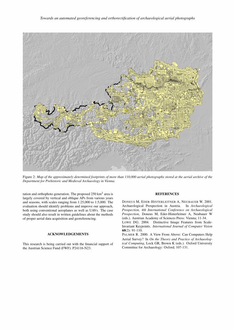
The aerial archaeology unit at the Department for Prehistoricand Medieval Archaeology of the University of Vienna (UFG)houses more than 110,000 vertical and oblique APs in its aerialarchive (Doneus et al., 2001). The metadata of all photographs,including their footprints, are stored in a GIS-based database(Figure 2). Since 2001, the total archive is being systemat-ically digitized using a professional photogrammetric scanner(Vexcel Ultra Scan 5000). At the moment, roughly 60% of allaerial photographs have been digitised with a resolution of 10 µm(for B&W images) and 15 10 µm (for colour infrared images).From this dataset, an archaeological case study will serve to testand evaluate all proposed solutions for automated image orien-
Towards an automated georeferencing and orthorectification of archaeological aerial photographs
Figure 2: Map of the approximately determined footprints of more than 110,000 aerial photographs stored at the aerial archive of theDepartment for Prehistoric and Medieval Archaeology in Vienna.
tation and orthophoto generation. The proposed 250 km2 area islargely covered by vertical and oblique APs from various yearsand seasons, with scales ranging from 1:25,000 to 1:5,000. Theevaluation should identify problems and improve our approach,both using conventional aeroplanes as well as UAVs. The casestudy should also result in written guidelines about the methodsof proper aerial data acquisition and georeferencing.
ACKNOWLEDGEMENTS
This research is being carried out with the financial support ofthe Austrian Science Fund (FWF): P24116-N23.
REFERENCES
DONEUS M, EDER-HINTERLEITNER A, NEUBAUER W. 2001.Archaeological Prospection in Austria. In ArchaeologicalProspection, 4th International Conference on ArchaeologicalProspection, Doneus M, Eder-Hinterleitner A, Neubauer W(eds.). Austrian Academy of Sciences Press: Vienna; 11-34.LOWE DG. 2004. Distinctive Image Features from Scale-Invariant Keypoints. International Journal of Computer Vision60(2): 91-110.PALMER R. 2000. A View From Above: Can Computers HelpAerial Survey? In On the Theory and Practice of Archaeolog-ical Computing, Lock GR, Brown K (eds.). Oxford UniversityCommittee for Archaeology: Oxford; 107-131.