Embed Size (px)
Citation preview
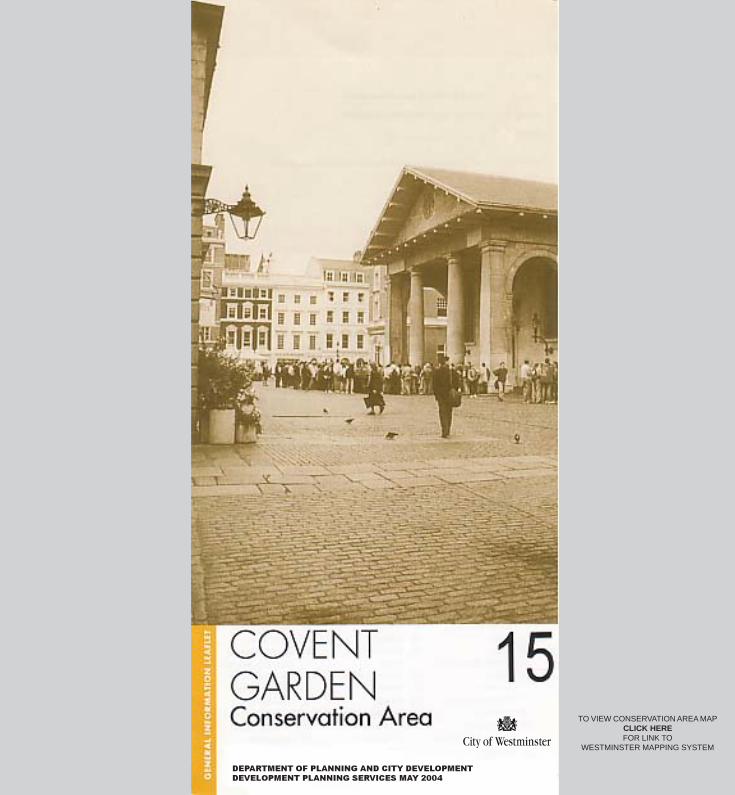
DEPARTMENT OF PLANNING AND CITY DEVELOPMENT
DEVELOPMENT PLANNING SERVICES MAY 2004
TO VIEW CONSERVATION AREA MAPCLICK HEREFOR LINK TO
WESTMINSTER MAPPING SYSTEM
Designation: First designated in 1971; extended in 1974, 1978 and lastly in1987 when the west end of Long Acre, the Theatre Royal, Drury Lane,Dryden Street and parts of Chandos Place, Agar Street and Bedford Streetwere all included.
Historical Background: Covent Garden comprises the area on the northside of the Strand which developed as the link between the settlements ofthe City of London and Westminster/Thorney Island. In medieval times theStrand was lined with large houses and palaces set in substantial gardens.On the north side of the Strand were Craven House (site at the south end ofDrury Lane), Bedford House (site south of the Piazza) and Exeter House(site opposite the Savoy) as well as the Garden of the Convent, whichprovided food for Westminster Abbey. In 1553 the Garden was given to SirJohn Russell by the Crown. In the 1630’s the Russell family began todevelop the estate with the Piazza (by Inigo Jones), St Paul’s on the westside and terraced houses with arcaded ground floors on the north and eastsides. The south side of the Piazza was not developed due to the locationof the garden wall to Bedford House. In 1670 a small fruit and vegetablemarket was established on the south side of the Piazza. This grew todominate the whole area, resulting in the original residents moving out. Thearea became characterised by bawdy-houses, taverns, coffee houses andprostitutes. In 1790 St. Paul’s burnt down and a facsimile replacement wasbuilt by Hardwick. In the 19th century a number of major building schemesresulted in changes to the character of the area including the CoventGarden Opera House (Smirke, 1808) which replaced an earlier theatre, theDrury Lane Theatre (Wyatt, 1811) the fifth theatre on the site, the CentralMarket Building (Charles Fowler, 1830), the current Royal Opera Houseand the Floral Hall (E.M. Barry 1857-8), the Flower Market (1887 - 91) andBedford Chambers (1880). The latter development on the north west cornerof the Piazza is in a similar form to and replaced the last surviving part ofInigo Jones’ scheme. Warehouses linked to the market function wereconstructed north of the Piazza such as in Floral Street and Shelton Street.The market moved to Nine Elms in 1974 but, following considerable publicopposition, plans for comprehensive redevelopment of the area wereabandoned. Subsequent development in the area has been steered by theCovent Garden Action Area Plan (1978) which covers both those parts ofCovent Garden in the City of Westminster and London Borough ofCamden. The area has now become a popular shopping and entertainmentlocation.
Listed Buildings: The Royal Opera House, St. Paul’s Church and theTheatre Royal, Drury Lane are listed Grade I. The Central Market Building,Nos. 37 & 43 King Street, the Garrick Club, Lyceum Theatre, Nos. 26-27Southampton Street and Zimbabwe House, 429 Strand are listed Grade II*.There are over 150 Grade II listed buildings in the Conservation Area.
Key Features: At the heart of the Conservation Area is the Piazza,dominated by the Central Market Building and St. Paul’s Church. Around thePiazza the 17th century and 18th century street pattern survives andimportant buildings from that period can be found in King Street, HenriettaStreet (to the west) and Southampton Street (to the south). The otherstreets leading to the Piazza, James Street (to the north) and Russell Street(to the east) provide important views of the Piazza. St. Paul’s Churchyardprovides a secluded green oasis in the midst of this densely developedarea. The southern part of the Conservation Area between Maiden Laneand the Strand is characterised by buildings occupying long thin medievalplots, divided by historic alleyways such as Exchange Court and Bull InnCourt. The northern part of the Conservation Area, including Long Acre,Floral Street and Shelton Street contains a mix of Victorian warehouses andcommercial buildings.
The Royal Opera House and Bow Street Police Station dominate the northend of Bow Street. Broad Court forms a quiet residential passageway offBow Street whilst the Theatre Royal comprises the majority of the streetblock of Catherine Street, Russell Street and Drury Lane. Important groupsof 18th century buildings are found in Tavistock Street, Wellington Streetand Exeter Street. To the west of the Piazza in St. Martin’s Lane are anumber of theatres such as Wyndham’s and the Albery, and pedestrianisedalleyways running through to Charing Cross Road. Garrick Street isdominated by the Garrick Club whilst New Row and Goodwin’s Courtcontain terraces of 18th century buildings. The whole area is a popularshopping and tourist destination comprising a mixture of retail,entertainment, restaurant, office and residential uses.
Adjacent Conservation Areas: The Covent Garden Conservation Area isbounded by the Strand Conservation Area to the south and east, the Savoyand Adelphi Conservation Areas to the south, the Trafalgar SquareConservation Area to the south west and the Leicester SquareConservation Area to the west. The London Borough of Camden is locatedto the north.
Strategic Views: Not affected.
Areas of Special Archaeological Priority: Within the Lundenwic &Thorney Island area of special archaeological priority.
Article 4 Directions: None.
Regulation 7 Directions: The whole area is affected by the requirementthat any advertisement for the sale or letting of land (including estateagents’ boards advertising shops, houses, flats or offices) must be givenconsent by the City Council as local planning authority. Displaying anadvertisement without having first obtained consent is a criminal offence.
Design Guides and Planning Briefs: No specific Design Guides. ‘TheEnvironmental Study for Central Covent Garden’ was approved in April1997.
Spaces protected by the London Squares Act 1931: None.
Registered Historic Parks and Gardens: None
Contacts:Built EnvironmentWestminster City CouncilCity Hall, 64 Victoria Street, London, SW1 E 6QPTel: (020) 7641 2513 [email protected]