Embed Size (px)
Citation preview
architecture
town planning
interior design
urban design
Proposed relocation of The Thomas Alleyne School to land at Great Ashby, Stevenage
Supporting Planning Statement June 2009
prepared by Vincent and Gorbing
SUPPORTING PLANNING
STATEMENT
in respect of
PROPOSALS TO RELOCATE
AND EXPAND THE THOMAS
ALLEYNE SCHOOL
to
LAND AT GREAT ASHBY,
STEVENAGE

RP/4682
JUNE 2009
STERLING COURT NORTON ROAD STEVENAGE HERTS SG1 2JY
T: 01438 316331 F: 01438 722035
LAND AT GREAT ASHBY, STEVENAGE
RP/4682/JUNE 2009
LAND AT GREAT ASHBY, STEVENAGE SUPPORTING PLANNING STATEMENT CONTENTS
PAGE
PART 1- INTRODUCTION
1
1.0 BACKGROUND
2
2.0 PLANNING POLICY CONTEXT
4
PART 2- THE GREEN BELT CASE OF VERY SPECIAL CIRCUMSTANCES
3.0 SUMMARY OF CASE 13
4.0 THE PRESSING NEED FOR THE TRANSFORMATION OF SECONDARY EDUCATION IN STEVENAGE
16
5.0 THE NEED FOR ADDITIONAL SECONDARY SCHOOL CAPACITY IN STEVENAGE OVER THE PERIOD TO 2031
20
6.0 THE COUNTY COUNCIL’S STRATEGY FOR EDUCATIONAL TRANSFORMATION
23
7.0 THE NEED FOR A SECONDARY SCHOOL IN NORTH EAST STEVENAGE
28
8.0 LIMITATIONS OF THE EXISTING THOMAS ALLEYNE SCHOOL SITE
31
9.0 SITE SEARCH EXERCISE 34
10.0 GREEN BELT IMPACT 40
11.0 THE URGENT NEED FOR AN EARLY DECISION
42
PART 3 – OTHER MATERIAL PLANNING CONSIDERATIONS
12.0 SUSTAINABILITY APPRAISAL 49
LAND AT GREAT ASHBY, STEVENAGE
RP/4682/JUNE 2009
13.0 ENVIRONMENTAL IMPACT 53
14.0 TRANSPORT IMPACT 58
PART 4 - IMPLEMENTATION
15.0 IMPLEMENTATION
63
16.0 SUMMARY AND CONCLUSIONS 72
DRAWINGS 1 Site Location Plan
2 Site Identification Plan
3 Local Plan Proposals
4 SNAP Action Plan Study Area
5 Location of existing secondary schools
6 BSF proposals for Stevenage
7 Existing Thomas Alleyne School site
8 Planning Constraints and Site Search Options
9 Relationship between existing and proposed residential
areas
APPENDICES
1 List of Technical Studies

LAND AT GREAT ASHBY, STEVENAGE
RP/4682/JUNE 2009 PAGE NO. 1
PART 1 - INTRODUCTION
LAND AT GREAT ASHBY, STEVENAGE
RP/4682/JUNE 2009 PAGE NO. 2
1.0 BACKGROUND
1.1 This Supporting Planning Statement relates to an outline planning
application that has been submitted on behalf of the County
Council’s Children, Schools and Families Service.
The application proposals
1.2 In summary, the application proposal is for the expansion (to 8
forms-of-entry) of The Thomas Alleyne School and its relocation to
a new site on the urban fringe of Stevenage at Great Ashby.
1.3 The application site and the application proposals are described
and illustrated in detail in the accompanying Design and Access
Statement.
1.4 The location of the application site is shown on the attached Plans 1 and 2.
Related applications
1.5 The application is part of a comprehensive package of proposals
that is aimed at providing a better distribution of secondary school
facilities in the Stevenage area whilst providing additional
secondary educational capacity to meet the town’s locally
generated needs over the period to 2021 (and beyond).
1.6 The proposals will be funded as part of the ‘Building Schools for the
Future’ programme and are described in more detail in the report
‘The Overarching Case in Support of Individual Planning
Application Proposals’.
This statement
1.7 In this Supporting Planning Statement, we consider the planning
policy context for The Thomas Alleyne School relocation and
LAND AT GREAT ASHBY, STEVENAGE
RP/4682/JUNE 2009 PAGE NO. 3
expansion proposal and appraise the proposal in the light of
prevailing planning policies and guidance.
Related documentation
1.8 A number of related documents are referred to in this statement and
have been submitted in support of the planning application, namely
• Design and Access Statement.
• Transport Assessment.
• Environmental Statement.
• Appendices to the Environmental Statement.
1.9 The Appendices to the Environmental Statement contain a number
of detailed technical studies, as itemised at Appendix 1.
LAND AT GREAT ASHBY, STEVENAGE
RP/4682/JUNE 2009 PAGE NO. 4
2.0 PLANNING POLICY CONTEXT
NATIONAL PLANNING POLICY GUIDANCE
2.1 The Government’s policies on different aspects of planning are set
out in Planning Policy Guidance Notes (PPG’s) and Planning
Policy Statements (PPS’s), which will gradually replace PPG’s over
time. Planning Circulars also contain government guidance on
planning. Both PPG’s and PPS’s are a material consideration in
the determination of planning applications, particularly where they
post-date the development plan, as are planning Circulars.
2.2 PPG’s, PPS’s and Circulars containing guidance of particular
relevance to the Great Ashby site are set out below.
2.3 PPS1 Delivering Sustainable Development sets out the
Government’s national policies on different aspects of planning. It
outlines the overarching planning policies on the delivery of
sustainable development, and other aspects of planning including
high quality and inclusive design. It states that community
involvement is an essential element in delivering sustainable
development and creating sustainable and safe communities. It
promotes economic development to secure higher living standards
while protecting and enhancing the environment, and a more
efficient use of land through higher density, mixed use
development and the use of previously developed land and
buildings.
2.4 PPG2 Green Belts states that the fundamental aim of Green Belt
policy is to prevent urban sprawl by keeping land permanently
open and that the most important attribute of Green Belts is their
openness. It sets out a general presumption against inappropriate
development in Green Belts and states that such development
should not be approved, save in very special circumstances.
LAND AT GREAT ASHBY, STEVENAGE
RP/4682/JUNE 2009 PAGE NO. 5
2.5 PPG 13 Transport sets out guidance aimed at facilitating the
Government’s main transport objectives, which are
• To promote more sustainable transport choices for both
people and moving freight.
• To promote accessibility to jobs, shopping, leisure facilities
and services by public transport, walking and cycling.
• To reduce the need to travel, especially by car.
DEVELOPMENT PLAN
2.6 Section 38 (6) of the Planning and Compulsory Purchase Act 2004
states that
‘If regard is to be had to the development plan for the purpose of
any determination under the planning Acts, the determination must
be made in accordance with the plan unless material
considerations indicate otherwise’.
2.7 The current development plan framework for the Great Ashby site
is provided by -
• The East of England Plan - The Revision to the Regional
Spatial Strategy for the East of England (Adopted May 2008).
• The North Hertfordshire District Plan No 2 with Alterations
(Adopted April1996).
EAST OF ENGLAND PLAN
2.8 The East of England Plan, which was published in May 2008, sets
out the regional strategy for planning and development in the East
of England to the year 2021 and beyond.
LAND AT GREAT ASHBY, STEVENAGE
RP/4682/JUNE 2009 PAGE NO. 6
2.9 In the plan, Stevenage is defined as a ‘Key Centre for
Development and Change’ with a strategy for the town defined as
follows
‘To deliver a new vision for Stevenage as a regional employment
and housing growth point twinned with transformational physical,
social and economic regeneration of the original new town to
create a self-contained, sustainable and balanced community’.
2.10 A minimum of 16,000 additional dwellings are proposed within and
on the edges of the town over the period 2001-2021, of which
9,600 are expected to be within North Hertfordshire district.
2.11 A number of generic policies in the East of England Plan contain
advice and guidance of relevance to the application proposals,
including
• Policy SS1 – Achieving Sustainable Development
• Policy SS3 – Key Centres for Development and Change
• Policy SS7 – Green Belt
• Policy SS8 – The Urban Fringe
• Policy H1 – Regional Housing Provision 2001 to 2021
• Policy T1 – Regional Transport Strategy Objectives and
Outcomes
• Policy T2 – Changing Travel Behaviour
• Policy T3 – Managing Travel Demand
• Policy T4 – Urban Transport
• Policy T8 – Local Roads
LAND AT GREAT ASHBY, STEVENAGE
RP/4682/JUNE 2009 PAGE NO. 7
• Policy T9 – Walking and Cycling and other Non-Motorised
Transport
• Policy T13 – Public Transport Accessibility
• Policy T14 – Parking
• Policy ENV1 – Green Infrastructure
• Policy ENV2 – Landscape Conservation
• Policy ENV3 - Biodiversity and Earth Heritage
• Policy ENV4 – Agricultural Land and Soils
• Policy ENV5 – Woodlands
• Policy ENV6 – The Historic Environment
• Policy ENV7 – Quality in the Built Environment
• Policy ENG1 – Carbon Dioxide Emissions and Energy
Performance
• Policy WAT 2 – Water Infrastructure
• Policy WAT 4 – Flood Risk Management
• Policy WM 6 – Waste Management in Development
• Policy SV 1 – Stevenage Key Centre for Development and
Change
LAND AT GREAT ASHBY, STEVENAGE
RP/4682/JUNE 2009 PAGE NO. 8
NORTH HERTFORDSHIRE DISTRICT LOCAL PLAN NO.2 WITH ALTERATIONS
Site specific policies and designations (Plan 3)
2.12 On the Proposals Map of the adopted North Hertfordshire Local
Plan, the proposed school site and New Spring Woodland are
identified as being within the Green Belt (Policy 2).
2.13 Policy 2 Green Belt aims to keep the uses of land in the Green Belt
open. Proposals will only be granted permission in very special
circumstances or which would not result in significant visual impact.
2.14 However, the access corridor and the open space replacement land
are identified as part of the North-East Stevenage development
area, which is excluded from the Green Belt (Policy 4).
2.15 Policy 4 North-East Stevenage allows for the development of a new
neighbourhood north-east of Stevenage, including housing and
other appropriate uses (i.e. Great Ashby). The policy states that
development should relate well to the surrounding countryside and
reinforce the Green Belt boundary.
2.16 The proposed school site and New Spring Woodland are also
identified as being within a Countryside Area (Policy 13) and a
Landscape Conservation Area (Policy 12). However, under
paragraph 1(3) of Schedule 8 to the Planning and Compulsory Act
2004, policies in the Local Plan were due to expire on 27
September 2007, unless the Council requested their extension from
the Secretary of State for Communities and Local Government. By
direction of the Secretary of State, a number of the policies in the
adopted Local Plan have not been ‘saved’, and are therefore no
longer material considerations. These include Policies 12 and 13.
LAND AT GREAT ASHBY, STEVENAGE
RP/4682/JUNE 2009 PAGE NO. 9
General policies
2.17 Other saved policies containing advice and guidance of relevance
to the application proposals include
• Policy 14 – Nature Conservation
• Policy 16 - Areas of Archaeological Significance and other
Archaeological Areas
• Policy 51 – Development Effects and Planning Gain
LOCAL DEVELOPMENT FRAMEWORK / SNAP ACTION PLAN
2.18 Both North Hertfordshire District Council and Stevenage Borough
Councils are at the early stages of preparing Local Development
Frameworks (LDF). The LDFs will contain a suite of documents
that will take the place of the existing adopted Local Plans.
2.19 In response to the East of England Plan’s strategic proposal for an
additional 9,600 dwellings at north and west Stevenage over the
period 2001-2021, the two are jointly producing the Stevenage and
North Hertfordshire Action Plan (SNAP), which will comprise part
of their respective LDFs.
2.20 A SNAP ‘Key Issues and Options’ consultation document was
published in November 2007. The proposed school site was
included within the SNAP study area boundary (Plan 4) and,
together with extensive areas of similar agricultural land to the
north and east, was included within a possible ‘area of search for
housing development’. It was suggested in the document that this
area could be served by a new strategic road link from the A1(M)
Corey’s Mill junction, running around the northern fringe of
Stevenage.
LAND AT GREAT ASHBY, STEVENAGE
RP/4682/JUNE 2009 PAGE NO. 10
2.21 The current Local Development Schemes published by the two
local authorities envisage the adoption of the SNAP Action Plan in
July 2011.
2.22 However, this timetable is now out-of-date and we understand that
the next stage of consultation on the SNAP Action Plan will not
take place until Spring 2010 at the earliest. The main reason for
this delay is that a Stevenage Urban Transport Plan (UTP) has
been commissioned, covering the entire Stevenage urban area
together with that part of North Hertfordshire lying within the SNAP
boundary. The UTP is considered to be essential to the testing of
growth options for Stevenage and the final UTP report is not
expected to be completed until September 2009.
2.23 As a result, we would not now anticipate the SNAP Action Plan
being adopted until Autumn 2012 at the earliest and possibly not
until 2013 or even 2014.
DETERMINING PLANNING ISSUES
2.24 Based on our review of the prevailing development plan and national
planning policy guidance, we have identified the following key
planning issue raised by the application proposals, namely
Whether the planning and educational case for the expansion and
relocation of The Thomas Alleyne School constitutes the ‘very
special circumstances’ required to justify the development of a
Green Belt site.
2.25 We consider this key issue in Part 2 of this statement.
2.26 In addition, the following planning issues are considered to be of
material significance to the planning application proposals
LAND AT GREAT ASHBY, STEVENAGE
RP/4682/JUNE 2009 PAGE NO. 11
• Whether the development proposals are in conformity with the
principles of sustainable development.
• Whether the development proposals would have a harmful
impact on the environment of the surrounding area.
• Whether the existing transport infrastructure of the Great Ashby
area could accommodate the new school development.
2.27 We consider these issues in Part 3 of this statement.
LAND AT GREAT ASHBY, STEVENAGE
RP/4682/JUNE 2009 PAGE NO. 12
PART 2 – THE GREEN BELT CASE OF VERY SPECIAL
CIRCUMSTANCES
LAND AT GREAT ASHBY, STEVENAGE
RP/4682/JUNE 2009 PAGE NO. 13
3.0 SUMMARY OF CASE
3.1 Prevailing development plan and national planning policies require
the demonstration of very special circumstances in order to justify
inappropriate development in the Green Belt.
3.2 The very special circumstances that are considered to support the
proposed relocation and expansion of The Thomas Alleyne School
to the application site are set out below.
1. There is a pressing need to transform secondary school
educational provision in Stevenage in order to improve the
attainment of the town’s secondary schools and make them
fit for the 21st century.
2. At the same time, there is a need to increase secondary
school capacity in Stevenage in order to accommodate the
number of pupils forecast to be generated by existing,
permitted and proposed housing in the town over the period
to 2031.
3. Hertfordshire County Council’s agreed strategy for the
transformation of secondary education and the
accommodation of the town-wide mainstream capacity
requirement includes the closure of one existing mainstream
secondary school (Heathcote School) and the expansion to
8 FE of the town’s five remaining non-denominational
mainstream schools.
4. The strategy also includes the relocation of the Thomas
Alleyne School site to the application site at Great Ashby in
reflection of the fact that the north-eastern part of Stevenage,
to the north of Martin’s Way, does not currently contain a
LAND AT GREAT ASHBY, STEVENAGE
RP/4682/JUNE 2009 PAGE NO. 14
secondary school despite the recent and committed housing
growth in this location.
5. The decision to relocate the Thomas Alleyne School rather
than any other school reflects the fact that there is an over-
provision of secondary school capacity in the Old Town area
of Stevenage. The school’s relocation will thus help to rectify
a geographical imbalance of provision in the town. It also
reflects the limitations of the existing Thomas Alleyne School
site and the consequent difficulties in expanding the school
on its current site.
6. A site search exercise has established that are no suitable,
available or deliverable non-Green Belt sites in the north-
eastern part of Stevenage, to the north of Martin’s Way, on
which to site a relocated and expanded Thomas Alleyne
School. The site search exercise has also indicated that are
no more suitable, available or deliverable Green Belt sites
around the north-eastern fringe of the Stevenage urban area
on which to site a relocated and expanded Thomas Alleyne
School.
7. Whilst it is acknowledged that the new school proposal will
initially represent an urban encroachment into the Green Belt
and will thus have an impact on the openness of the Green
Belt in this location, the Indicative Layout proposals indicate
that the impact of a new secondary school on the subject site
on the openness of the Green Belt can be minimised by
containing built development in the western part of the site
where it will be visually contained by existing woodland
areas.
8. In the medium-term, following the development of the
proposed housing site to the immediate east of the
LAND AT GREAT ASHBY, STEVENAGE
RP/4682/JUNE 2009 PAGE NO. 15
application site, the site will no longer play a significant role
in maintaining the openness of the Green Belt in this
location.
9. The relocation and expansion of the Thomas Alleyne School
is a key component in the County Council’s transformation
strategy, enabling several other components of the strategy
to be realised, including the expansion of the Barclay School
and its co-location with the North Herts College Skills Centre.
Awaiting the adoption of the SNAP Action Plan before
making a decision on the Thomas Alleyne School’s
relocation and expansion would have undesirable
consequences for the Stevenage secondary schools
transformation strategy as a whole.
3.3 These factors are considered in more detail in the following sections
and are considered to constitute in combination the very special
circumstances required under the terms of prevailing Green Belt
policy to justify the relocation and expansion of the Thomas Alleyne
School to the application site at Great Ashby.
LAND AT GREAT ASHBY, STEVENAGE
RP/4682/JUNE 2009 PAGE NO. 16
4.0 THE PRESSING NEED FOR THE TRANSFORMATION
OF SECONDARY EDUCATION IN STEVENAGE
4.1 There are currently seven mainstream secondary schools in
Stevenage (Plan 5), namely
• The Thomas Alleyne School
• The Barclay School
• The Nobel School
• Marriotts School
• Heathcote School
• Barnwell School
• John Henry Newman School
4.2 The first six of these schools are non-denominational community
schools whilst the John Henry Newman School is a voluntary-aided
Roman Catholic school. The Barnwell School is currently operating
on a split site basis, utilising the former Collenswood School site
(Collenswood School having closed in July 2006).
Education Support Centre
4.3 In addition to, and in support of, the above mainstream schools, an
Education Support Centre (ESC) is located in temporary premises
within the grounds of Camps Hill Primary School.
Special Schools
4.4 There are also three special schools in the town catering for children
of secondary school age, namely
LAND AT GREAT ASHBY, STEVENAGE
RP/4682/JUNE 2009 PAGE NO. 17
• Lonsdale School, for children with physical and neurological
impairments (PNI).
• Greenside School, for children with severe learning difficulties
(SLD).
• The Valley School, for children with moderate learning difficulties
(MLD).
North Herts Strategic Area Partnership
4.5 The mainstream schools, special schools and ESC in Stevenage all
work very closely together as part of the North Herts Strategic Area
Partnership. The Partnership also includes the local further
education college, North Hertfordshire College, which offers a
range of post-16 academic and vocational courses from its modern
Stevenage Centre premises in Monkswood Way and from its Skills
Centre located in temporary premises in Fulton Close.
Educational attainment levels
4.6 Notwithstanding the best efforts of the various schools and bodies
involved, educational attainment levels in Stevenage have been
consistently lower than the county average.
4.7 Whilst there are many indicators of educational attainment, the
Department of Education’s Secondary School Achievement and
Attainment tables for 2008 show the following position in terms of
the number of pupils gaining 5 or more grades A* - C including
Maths and English
• The Thomas Alleyne School - 38%
• The Barclay School - 40%
• The Nobel School - 45%
LAND AT GREAT ASHBY, STEVENAGE
RP/4682/JUNE 2009 PAGE NO. 18
• Marriotts School – 37%
• Heathcote School – 45%
• Barnwell School - 33%
• John Henry Newman School - 71%
4.8 With the exception of the John Henry Newman School, all the
schools are thus currently below the county average (58.0%) and
most are below the national average (47.6%).
4.9 Other indicators indicate a need to transform educational provision
in Stevenage. For instance
• Stevenage has the lowest sixth form stay-on rate in
Hertfordshire (45% compared with the county average of
nearly 60%). This reflects the perceived poor quality of
provision in the schools.
• In terms of the key indicator of post-16 Level 3 Standards
(essentially A level), Stevenage has the lowest average point
score (APS) of any district in Hertfordshire – 196.1
compared with the county average of 210.1.
• Stevenage has the second highest percentage (6.65%) of
young people not in education, employment or training in the
county. The county average is 4.76%.
• Stevenage has the highest unemployment rate in
Hertfordshire (2.5% compared with 1.7% for the county as a
whole.
4.10 As a result, Stevenage has been prioritised in the County Council’s
submissions to Central Government for funding under the ‘Building
Schools for the Future’ programme. The County Council’s main

LAND AT GREAT ASHBY, STEVENAGE
RP/4682/JUNE 2009 PAGE NO. 19
Outline Business Case for Private Finance Initiative funds to
transform the provision of secondary education in Stevenage has
now been approved by Partnerships for Schools and the County
Council is in the process of selecting a development partner to
implement the approved scheme.
LAND AT GREAT ASHBY, STEVENAGE
RP/4682/JUNE 2009 PAGE NO. 20
5.0 THE NEED FOR ADDITIONAL SECONDARY SCHOOL
CAPACITY IN STEVENAGE OVER THE PERIOD TO
2031
Existing capacity
5.1 The seven mainstream secondary schools in Stevenage had a
school roll of 7,514 pupils in 2008, the equivalent of 43 forms-of-
entry (FE). (Note: 1 form-of-entry equals 30 pupils).
5.2 The individual school rolls are set out below
• The Thomas Alleyne School - 776 pupils – 5.5 FE
• The Barclay School - 1,110 pupils – 6.5 FE
• The Nobel School - 1,161 pupils – 6 FE
• Marriotts School - 838 pupils – 5.5 FE
• Heathcote School - 817 pupils – 5 FE
• Barnwell School - 1,442 pupils – 7.5 FE
• John Henry Newman School - 1,370 pupils – 7 FE
Housing forecasts
5.3 The Regional Plan for the East of England (RSS 14) provides for
16,000 new dwellings to be built at Stevenage over the period
2001-2021 and for a continuation of the same building rate over the
period 2021-2031.
Pupil forecasts
5.4 Based on this requirement and a provisional housing trajectory that
has been agreed with Stevenage Borough Council, the County
LAND AT GREAT ASHBY, STEVENAGE
RP/4682/JUNE 2009 PAGE NO. 21
Council has forecast the number of pupils at the town’s mainstream
secondary schools as follows
• 2008 – 7,514 pupils
• 2011 – 7,380 pupils
• 2016 – 7,668 pupils
• 2021 – 8,318 pupils
• 2026 – 9,027 pupils
• 2031 – 9,686 pupils
Audit Commission allowance
5.5 The Audit Commission recommends that there should be a surplus
of spaces of between 5 and 10% to allow for parental preference to
be met satisfactorily.
5.6 Based on the 10% figure, the number of places required at the
town’s mainstream secondary schools has been estimated as
follows
• 2011 – 8,118 places
• 2016 – 8,435 places
• 2021 – 9,150 places
• 2026 – 9,930 places
• 2031 – 10,654 places
Capacity requirement
5.7 On the basis of this analysis, whilst accepting that it is difficult to be
precise on matters relating to pupil forecasts and school capacities,

LAND AT GREAT ASHBY, STEVENAGE
RP/4682/JUNE 2009 PAGE NO. 22
the County Council has assessed a need for up to 48 FE of
secondary school capacity in Stevenage by 2021, rising to 54 FE
by 2031.
LAND AT GREAT ASHBY, STEVENAGE
RP/4682/JUNE 2009 PAGE NO. 23
6.0 THE COUNTY COUNCIL’S STRATEGY FOR
EDUCATIONAL TRANSFORMATION
Public consultation
6.1 In the light of the need to improve educational attainment and
increase capacity, the County Council in May 2007 carried out a
wide-ranging public consultation into the future pattern of
secondary school provision in Stevenage.
6.2 The views of key stakeholders and the general public were sought
(inter alia) upon alternative options for the future distribution and
size of mainstream schools in the town.
Agreed strategy
6.3 Having considered the representations made by interested bodies
as part of this consultation, the County Council agreed to
reorganise secondary school provision in the town to include the
following new and enhanced facilities
• A relocated and expanded (to 8 FE) Thomas Alleyne School on
a new Green Belt site at Great Ashby.
• A refurbished and expanded (to 8 FE) Barclay School on its
existing site plus part of the adjacent Thomas Alleyne School
site.
• A refurbished and expanded (to 8 FE) Nobel School on its
existing site with a detached playing field being provided at the
former Thomas Alleyne School site.
• A relocated and expanded (to 8 FE) Marriotts School on its
existing site plus the adjacent Ridgemond Park site.
LAND AT GREAT ASHBY, STEVENAGE
RP/4682/JUNE 2009 PAGE NO. 24
• A refurbished and expanded (to 8 FE) Barnwell School on the
existing Heathcote School site with a detached playing fields
being provided on the existing Barnwell School site and at the
former Collenswood School site.
• A refurbished John Henry Newman School on its existing site
with a detached playing fields being provided at Burymead
(formerly part of The Thomas Alleyne School site).
6.4 The agreed strategy also included;
• The closure of the Heathcote School.
• The co-location of the three existing special schools onto
mainstream school sites, with Lonsdale School being co-located
with Marriotts School and Greenside and Valley Schools being
co-located with Barnwell School.
• The relocation of the Education Support Centre to the former
Collenswood School site.
• Provision for the relocation of the North Herts College Skills
Centre onto the residual area of the existing Thomas Alleyne
School site.
• Provision for the East and North Herts Primary Care trust’s
Enhanced Primary Care Centre for the South Stevenage area to
be co-located onto the new Barnwell School site.
• The disposal of the residual areas of the former Collenswood
School, Valley School and Lonsdale School sites with the funds
arising being recycled into the BSF project.
6.5 In the longer term, the strategy also allowed for further capacity to
be provided within the proposed West Stevenage development.
LAND AT GREAT ASHBY, STEVENAGE
RP/4682/JUNE 2009 PAGE NO. 25
Rationale
6.6 Important considerations in the formulation of this strategy were
• The County Council’s desire to provide a more even distribution
of secondary school facilities in the town in order to reflect the
recent changes in population and housing distribution.
• The County Council’s view that there are clear educational
advantages in expanding existing schools rather than starting up
new schools.
• The County Council’s preference for larger secondary schools
(up to 8 FE) since they are considered to be more cost effective,
more able to sustain 6th forms of a sufficient size to enable a
broad range of options, and provide more flexibility in meeting
changes to the curriculum, including the new system of diplomas
for 14-19 year olds.
• The County Council’s view that there are clear educational and
community advantages in co-locating special schools with
mainstream schools.
• The County Council’s view that there are clear educational
advantages in integrating (wherever possible) secondary
schools with further education facilities and community health
facilities.
Role of new and refurbished buildings in transforming education
6.7 The new and refurbished school buildings to be provided through
the BSF programme will assist in transforming education and
attainment in Stevenage in a number of ways.
LAND AT GREAT ASHBY, STEVENAGE
RP/4682/JUNE 2009 PAGE NO. 26
• The new and refurbished buildings will allow more money to be
spent on the core activity of teaching rather than on maintaining
buildings. Most of the schools in Stevenage are 50 – 60 years
old and are tired, expensive to maintain and a drain on school
budgets. The buildings are cold in winter, hot in summer and not
conducive to quality learning.
• Most of the existing schools have been enlarged incrementally
and in a piecemeal way since they first opened, leading to a
disorganised structure that is difficult to manage and does not
lead to good organisation or management of students’
behaviour.
• Tired, old, buildings make it hard to attract and retain quality
staff whilst modern, attractive, buildings make attraction and
retention far easier.
• School curricula and understanding about how students learn
has progressed significantly over the last 40 years and it is now
recognised that young people need to have a more independent
approach to learning. This approach requires flexible spaces
that can accommodate a variety of group sizes and the
traditional ‘standard’ classroom is now not considered to be the
most appropriate learning space.
• Modern schools need to be Information Technology rich
throughout and this is difficult to achieve in older buildings.
• Schools are now responsible for much more than subject
knowledge. The ‘Every Child Matters’ policy of central
government now requires schools to work more closely with
other agencies such as PCT’s, social care and the police.
Additionally, schools are expected to take on an extended
community provision and need to be designed to be more

LAND AT GREAT ASHBY, STEVENAGE
RP/4682/JUNE 2009 PAGE NO. 27
outward looking and facing so that their facilities can be better
accessed by the community to extend learning opportunities
beyond the traditional school day. Schools of the future,
therefore, are likely to have medical centres, community rooms,
sports facilities, libraries etc that are open to the public and need
to be planned accordingly.
LAND AT GREAT ASHBY, STEVENAGE
RP/4682/JUNE 2009 PAGE NO. 28
7.0 THE NEED FOR A SECONDARY SCHOOL IN NORTH-
EAST STEVENAGE
7.1 As mentioned in the previous section, an important consideration in
the formulation of the County Council’s strategy was a desire to
provide a more even distribution of secondary school facilities in the
town in order to reflect the recent changes in population and
housing distribution.
7.2 As illustrated at Plan 5, the existing mainstream schools in
Stevenage are currently concentrated in the south and central parts
of the town, whilst the more recent developments in the northern
and north-eastern parts of the town are relatively poorly served.
7.3 The County Council’s strategy therefore included the closure of the
Heathcote School in the south of the town and the relocation and
expansion to 8 FE of the Thomas Alleyne School from the Old
Town to a new Green Belt site at Great Ashby.
7.4 As Plan 6 shows, these proposals will ensure a much more even
distribution of schools so that all parts of the town will be within
approximately one mile of a mainstream secondary school.
Existing and committed development in north-east Stevenage
7.5 The area of north-east Stevenage that lies to the north of Martin’s
Way currently comprises
• Some 4,000 dwellings in the St Nicholas and Woodside
wards, built largely in the 1970’s.
• Some 1,700 dwellings at Great Ashby (which falls within
North Hertfordshire district), built or committed since 1999.
LAND AT GREAT ASHBY, STEVENAGE
RP/4682/JUNE 2009 PAGE NO. 29
7.6 The County Council’s records show that some 1040 secondary
school pupils currently live in this area, representing some 6FE of
capacity. These children at present travel out to other secondary
schools in the town as follows. Given the distances involved, it is
likely that a significant number travel by private motor car.
• The Thomas Alleyne School – 253.
• Marriotts School – 222.
• The Barclay School – 204.
• The Nobel School – 144.
• John Henry Newman School – 77.
• Barnwell School – 42.
• Heathcote School – 17.
• Special schools – 22.
• Other schools - 59
7.7 Moreover the number is rising. GP records show that 217 children
were born between September 2006 and August 2007 to parents
living in the north-east Stevenage area. These children, who will be
of secondary school age in 2018, will together require 7FE of
capacity.
Additional development proposals
7.8 The Stevenage and North Hertfordshire Councils are currently
preparing an Action Plan (SNAP) in order to define appropriate
locations for the additional 9,600 dwellings required by way of
urban extensions at north and west Stevenage to meet the housing
requirements of the East of England Plan.
LAND AT GREAT ASHBY, STEVENAGE
RP/4682/JUNE 2009 PAGE NO. 30
7.9 The Strategic Housing Land Availability Assessment (SHLAA)
produced by the two Councils in September 2008 indicates that
some 3,150 of the dwellings required in the SNAP area over the
period to 2021 could be built on ‘suitable, available and deliverable’
land adjacent to the Great Ashby development.
7.10 In addition, sites are defined which could accommodate a further
2,125 dwellings at north-east Stevenage post-2021.
7.11 The land at north-east Stevenage to the north of Martin’s Way is
thus expected to contain some 8,850 dwellings by 2021 and
ultimately some 11,000 dwellings. In quantitative terms, a
development of this scale would generate sufficient secondary
school pupils to support an 8 FE school assuming a net balance of
in and outflows.
LAND AT GREAT ASHBY, STEVENAGE
RP/4682/JUNE 2009 PAGE NO. 31
8.0 LIMITATIONS OF THE EXISTING THOMAS ALLEYNE
SCHOOL SITE
8.1 The existing Thomas Alleyne School is located in Stevenage Old
Town, immediately to the east of the historic High Street.
8.2 The County Council’s main reasons for proposing to relocate The
Thomas Alleyne School (rather than any other existing school) to
Great Ashby were as follows
• There is an over supply of secondary school capacity in the
Old Town area, with The Thomas Alleyne and Barclay
Schools being located on adjacent sites.
• Whilst The Barclay School is located on a single coherent
site with the potential for an improved access, The Thomas
Alleyne School site is sub-divided into three separate parts.
• The Thomas Alleyne School site is located within the Old
Town Conservation Area and includes a number of listed
buildings / Scheduled Ancient Monuments.
• The Thomas Alleyne School site’s sole vehicular access is
constrained and there is no realistic potential to improve this
access.
• The latter considerations in combination would make the
expansion of the school on its existing site extremely difficult
even if such an expansion were to be considered desirable.
Over supply of capacity
8.3 The Thomas Alleyne and Barclay Schools are located side-by-side
in the Old Town area of Stevenage for historical reasons.
LAND AT GREAT ASHBY, STEVENAGE
RP/4682/JUNE 2009 PAGE NO. 32
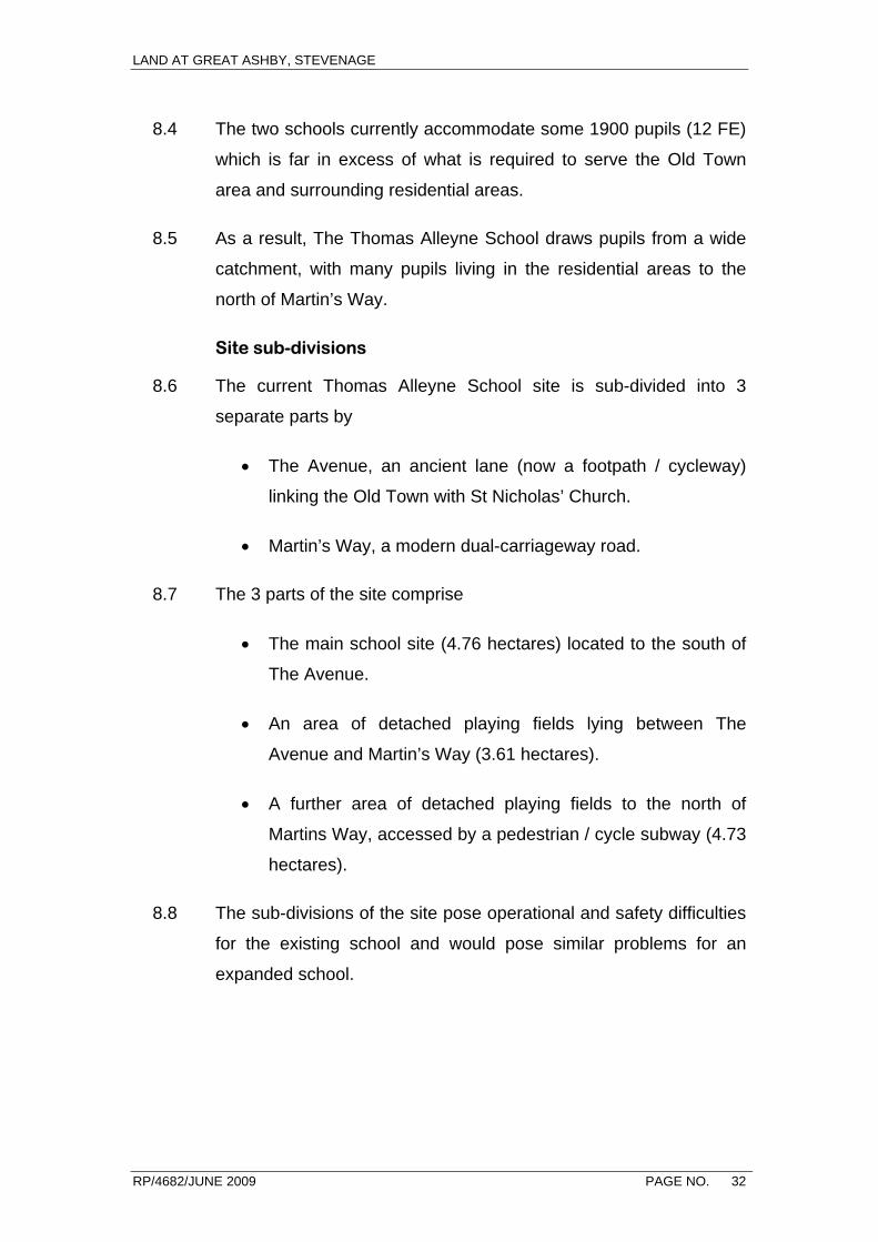
8.4 The two schools currently accommodate some 1900 pupils (12 FE)
which is far in excess of what is required to serve the Old Town
area and surrounding residential areas.
8.5 As a result, The Thomas Alleyne School draws pupils from a wide
catchment, with many pupils living in the residential areas to the
north of Martin’s Way.
Site sub-divisions
8.6 The current Thomas Alleyne School site is sub-divided into 3
separate parts by
• The Avenue, an ancient lane (now a footpath / cycleway)
linking the Old Town with St Nicholas’ Church.
• Martin’s Way, a modern dual-carriageway road.
8.7 The 3 parts of the site comprise
• The main school site (4.76 hectares) located to the south of
The Avenue.
• An area of detached playing fields lying between The
Avenue and Martin’s Way (3.61 hectares).
• A further area of detached playing fields to the north of
Martins Way, accessed by a pedestrian / cycle subway (4.73
hectares).
8.8 The sub-divisions of the site pose operational and safety difficulties
for the existing school and would pose similar problems for an
expanded school.
LAND AT GREAT ASHBY, STEVENAGE
RP/4682/JUNE 2009 PAGE NO. 33
Conservation Area / Listed Buildings
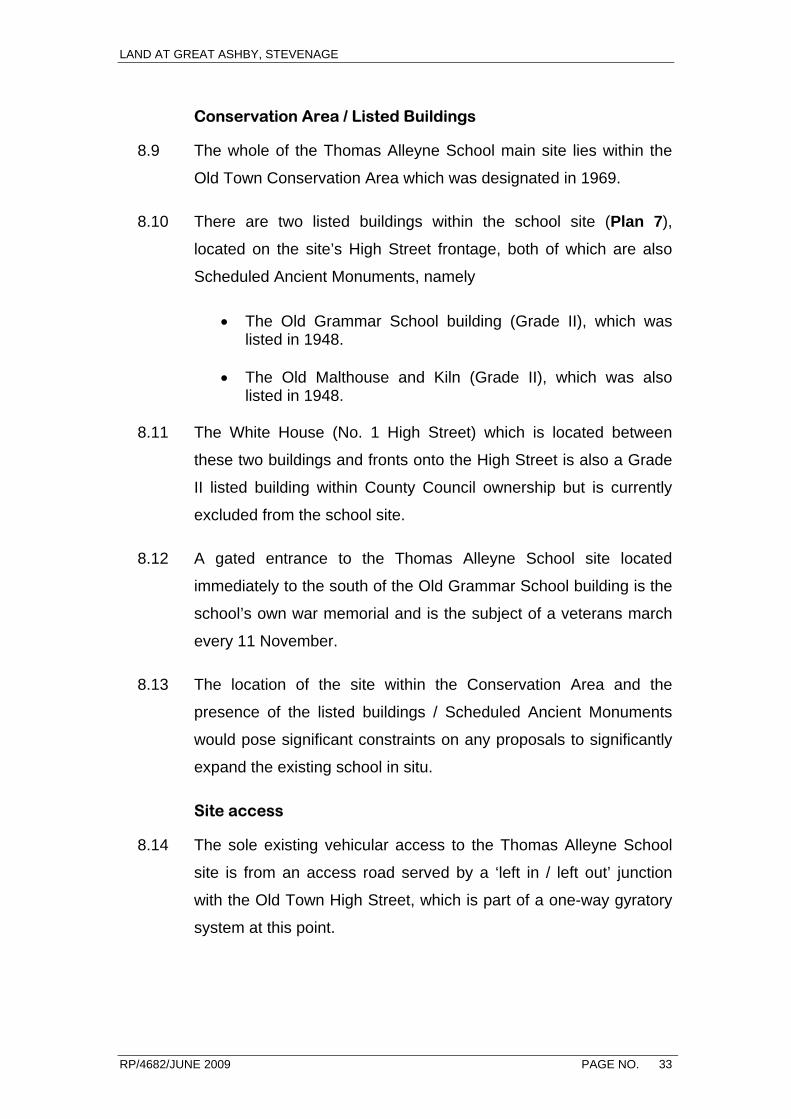
8.9 The whole of the Thomas Alleyne School main site lies within the
Old Town Conservation Area which was designated in 1969.
8.10 There are two listed buildings within the school site (Plan 7),
located on the site’s High Street frontage, both of which are also
Scheduled Ancient Monuments, namely
• The Old Grammar School building (Grade II), which was listed in 1948.
• The Old Malthouse and Kiln (Grade II), which was also
listed in 1948.
8.11 The White House (No. 1 High Street) which is located between
these two buildings and fronts onto the High Street is also a Grade
II listed building within County Council ownership but is currently
excluded from the school site.
8.12 A gated entrance to the Thomas Alleyne School site located
immediately to the south of the Old Grammar School building is the
school’s own war memorial and is the subject of a veterans march
every 11 November.
8.13 The location of the site within the Conservation Area and the
presence of the listed buildings / Scheduled Ancient Monuments
would pose significant constraints on any proposals to significantly
expand the existing school in situ.
Site access
8.14 The sole existing vehicular access to the Thomas Alleyne School
site is from an access road served by a ‘left in / left out’ junction
with the Old Town High Street, which is part of a one-way gyratory
system at this point.

LAND AT GREAT ASHBY, STEVENAGE
RP/4682/JUNE 2009 PAGE NO. 34
8.15 The access road is a cul-de-sac and, in addition to the school, the
road also serves a number of modern residential properties in Olde
Swann Court plus garages to the rear of No 3 High Street.
8.16 The current junction of the access road with the High Street has
capacity limitations and physical improvements to the access
would be difficult because the two buildings located either side of
the access are both listed buildings, namely No 3 High Street
(Grade II) and No 5 (The Grange) High Street (Grade II*).
8.17 The only potential alternative access to the school would be direct
from Martins Way. This would involve a new roundabout junction or
‘left in, left out’ arrangement. This option has been tested and
rejected for two principal reasons
• Martins Way is designated as a principal road and, as such,
the highway authority would normally discourage any new
access.
• Additionally, any access road into the site from a new
Martin’s Way junction would also need to cross the school
playing field which is a designated Green Link in the
adopted District Plan in which such development would
normally be discouraged. It would also have to cross the
ancient lane, The Avenue, which would also be
unacceptable in conservation terms.
8.18 Site access considerations would thus pose a further significant
constraint on any proposals to expand the existing school in situ.

LAND AT GREAT ASHBY, STEVENAGE
RP/4682/JUNE 2009 PAGE NO. 35
9.0 SITE SEARCH EXERCISE
9.1 Having taken the decision to relocate The Thomas Alleyne School
to a new site at north-east Stevenage and expand its capacity to
8FE, a site search exercise was carried out on behalf of the County
Council.
Land use requirement
9.2 For the purposes of the site search exercise, it was assumed
(based upon the guidance set out in DfES Building Bulletin 98
‘Briefing Framework for Secondary School Projects’) that the site
area requirement for an 8 FE school would be in the order of 10
hectares.
9.3 It was recognised, however, that the actual site area required for an
8FE secondary school could vary for a variety of reasons, including
• Physical factors e.g. site shape and topography.
• Planning factors e.g. building heights, car parking provision.
• Whether or not an all-weather pitch is provided.
• The extent to which the school incorporates community
facilities.
• The need to provide a high quality access to the existing
adopted road network.
9.4 Also based on Building Bulletin 98, it was assumed that a ‘school
building zone’ for an 8FE school would be around 4.0 hectares. In
addition to the school buildings themselves, this zone would include
a floodlit all-weather pitch, games courts, informal play areas, car
parks and habitat areas.
LAND AT GREAT ASHBY, STEVENAGE
RP/4682/JUNE 2009 PAGE NO. 36
Sequential approach
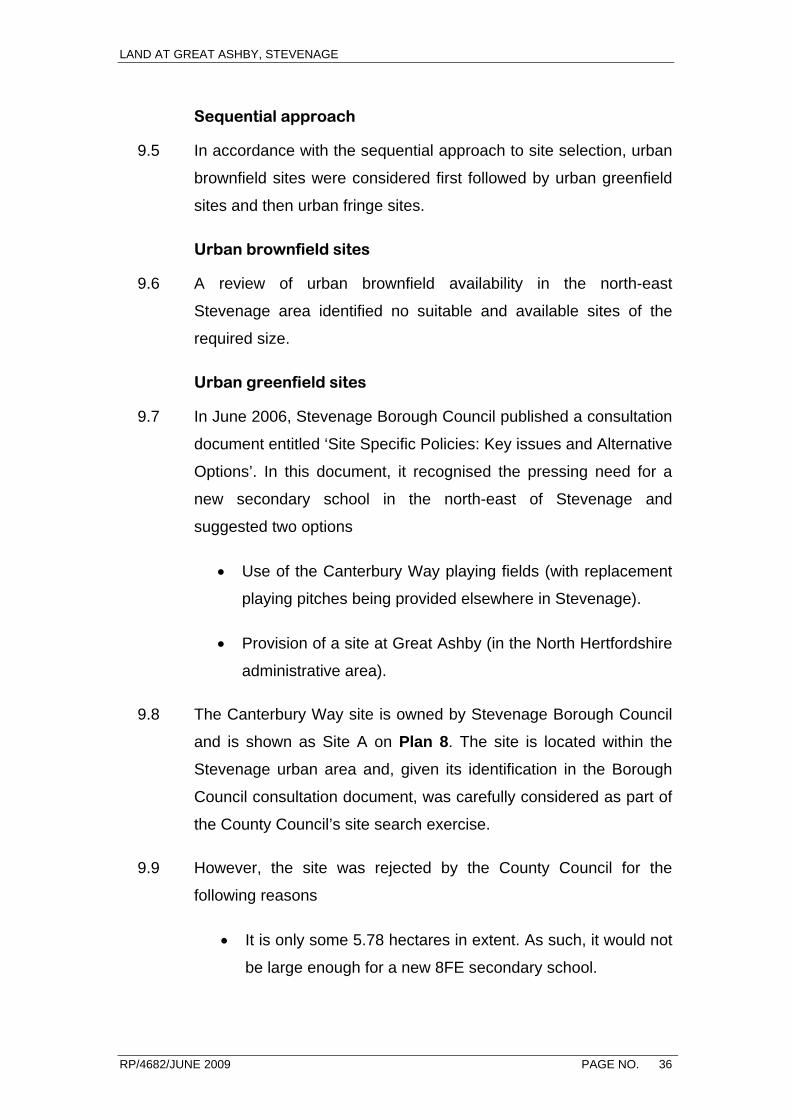
9.5 In accordance with the sequential approach to site selection, urban
brownfield sites were considered first followed by urban greenfield
sites and then urban fringe sites.
Urban brownfield sites
9.6 A review of urban brownfield availability in the north-east
Stevenage area identified no suitable and available sites of the
required size.
Urban greenfield sites
9.7 In June 2006, Stevenage Borough Council published a consultation
document entitled ‘Site Specific Policies: Key issues and Alternative
Options’. In this document, it recognised the pressing need for a
new secondary school in the north-east of Stevenage and
suggested two options
• Use of the Canterbury Way playing fields (with replacement
playing pitches being provided elsewhere in Stevenage).
• Provision of a site at Great Ashby (in the North Hertfordshire
administrative area).
9.8 The Canterbury Way site is owned by Stevenage Borough Council
and is shown as Site A on Plan 8. The site is located within the
Stevenage urban area and, given its identification in the Borough
Council consultation document, was carefully considered as part of
the County Council’s site search exercise.
9.9 However, the site was rejected by the County Council for the
following reasons
• It is only some 5.78 hectares in extent. As such, it would not
be large enough for a new 8FE secondary school.

LAND AT GREAT ASHBY, STEVENAGE
RP/4682/JUNE 2009 PAGE NO. 37
• It is located on the edge of the north-east Stevenage area,
thus limiting its accessibility by walk and cycle.
9.10 The site search concluded that the only urban greenfield site of
sufficient size for a new secondary school in north-east Stevenage
would be St Nicholas District Park, which is 12.34 hectares in
extent. The site is indicated as Site B on Plan 8 and is located
centrally within the north-east Stevenage area.
9.11 St Nicholas District Park is a very well used public park owned by
Stevenage Borough Council and contains playing pitches, bowling
green, children’s play areas and informal open space. Preliminary
discussions with Borough Council officers indicated a resistance to
the idea of a new school being located on this site (with the park
being reprovided on Green Belt land on the urban fringe) and was
thus not pursued.
Urban fringe sites
9.12 The site search thus turned to greenfield sites on the urban fringe
of north-east Stevenage. Since all the open land on the urban
fringe of north-east Stevenage is located within the Green Belt, this
naturally meant that any chosen site would be in the Green Belt.
9.13 Only urban fringe sites lying within the SNAP Action Plan area were
considered, all other sites being considered to be too remote. In
order to define possible sites, planning constraints around the
fringe were plotted (see Plan 8). These constraints included
• Major woodland areas.
• Sites of ecological importance.
• Sites of archaeological importance.
• Conservation areas.
LAND AT GREAT ASHBY, STEVENAGE
RP/4682/JUNE 2009 PAGE NO. 38
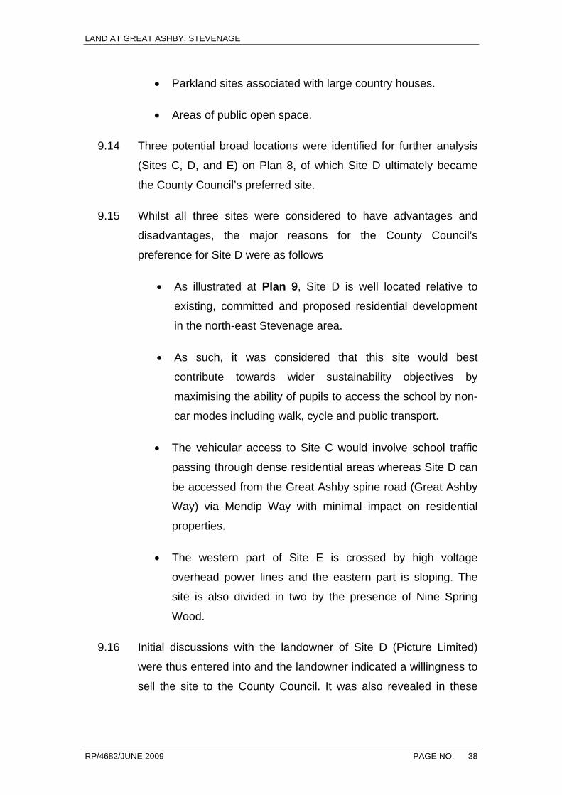
• Parkland sites associated with large country houses.
• Areas of public open space.
9.14 Three potential broad locations were identified for further analysis
(Sites C, D, and E) on Plan 8, of which Site D ultimately became
the County Council’s preferred site.
9.15 Whilst all three sites were considered to have advantages and
disadvantages, the major reasons for the County Council’s
preference for Site D were as follows
• As illustrated at Plan 9, Site D is well located relative to
existing, committed and proposed residential development
in the north-east Stevenage area.
• As such, it was considered that this site would best
contribute towards wider sustainability objectives by
maximising the ability of pupils to access the school by non-
car modes including walk, cycle and public transport.
• The vehicular access to Site C would involve school traffic
passing through dense residential areas whereas Site D can
be accessed from the Great Ashby spine road (Great Ashby
Way) via Mendip Way with minimal impact on residential
properties.
• The western part of Site E is crossed by high voltage
overhead power lines and the eastern part is sloping. The
site is also divided in two by the presence of Nine Spring
Wood.
9.16 Initial discussions with the landowner of Site D (Picture Limited)
were thus entered into and the landowner indicated a willingness to
sell the site to the County Council. It was also revealed in these
LAND AT GREAT ASHBY, STEVENAGE
RP/4682/JUNE 2009 PAGE NO. 39
discussions that Picture Limited was the owner of Site C and was in
advanced negotiations with North Hertfordshire District Council
regarding a planning application for residential development on the
site and would thus be unwilling to sell this site to the County
Council.
Summary
9.17 The application site was chosen by the County Council as its
preferred site for the relocation and expansion of The Thomas
Alleyne School following a sequential site search of the north-east
Stevenage area.
9.18 Subsequent detailed technical studies and preliminary discussions
with Stevenage Borough Council, North Hertfordshire District
Council, Hertfordshire Highways and other statutory bodies have
confirmed that this is the most suitable, available and deliverable
site for the school.
LAND AT GREAT ASHBY, STEVENAGE
RP/4682/JUNE 2009 PAGE NO. 40
10.0 GREEN BELT IMPACT
10.1 The requirement to provide a new Green Belt boundary at north-
east Stevenage, thereby releasing land for the Great Ashby
development, was set out in the 1986 Hertfordshire County
Structure Plan Review (approved 1988).
10.2 In defining the new Green Belt boundary in the North Herts District
Local Plan Review No. 2 (April 2006), North Hertfordshire District
Council paid great regard to the presence of major woodland areas.
The Great Ashby development is thus largely bounded to the north
and east by established woodland areas, together with more recent
planting belts that link these areas.
10.3 Insofar as the proposed new school site lies outside of the existing
woodland ‘girdle’ surrounding the Great Ashby site, the school
buildings, car parks and hard play areas (together with associated
lighting) will represent an urban encroachment and will inevitably
have an impact on the openness of the Green Belt in this location.
10.4 As indicated on the Illustrative Layout drawing and in the
Landscape and Visual Impact Assessment, however, such an
impact can be lessened (but not eliminated) by locating the built
elements of the school in the western part of the application site
where they will be screened from a number of long views by
existing woodland areas.
10.5 As indicated in Section 9 (above), this situation is expected to
change radically in the medium-term as a result of the proposal in
the East of England Plan for an additional 9,600 dwellings to be
built on the north and western fringes of Stevenage over the period
to 2021.
LAND AT GREAT ASHBY, STEVENAGE
RP/4682/JUNE 2009 PAGE NO. 41
10.6 Whilst the precise location of the new housing areas has yet to be
finalised as part of the SNAP Action Plan process, the recent
Strategic Housing Land Availability Assessment (SHLAA) produced
jointly by Stevenage and North Hertfordshire Councils has provided
a good indication of likely locations.
10.7 As indicated on Plan 9, the application site lies within a more
extensive area of land that is considered in the SHLAA to be
‘suitable, available and deliverable’ for housing development in the
period to 2021.
10.8 There is thus a very realistic prospect that the land to the
immediate north and east of the proposed relocated and expanded
Thomas Alleyne School will be developed for housing in the period
to 2021. As a result, a new Green Belt boundary will need to be
defined with the current application site becoming part of the
expanded Stevenage urban area.
Summary
10.9 Whist the planning application proposals will inevitably have an
immediate short-term impact upon the openness of the Green Belt,
the potential exists to limit the scale of the impact by careful design.
10.10 In the medium-term, it is likely that the school site and adjacent
land to the east and north will be removed from the Green Belt as a
result of the emerging proposals of the SNAP Action Plan, which
will implement the housing requirements of the East of England
Plan.
LAND AT GREAT ASHBY, STEVENAGE
RP/4682/JUNE 2009 PAGE NO. 42
11.0 THE URGENT NEED FOR AN EARLY DECISION
11.1 The proposal for the relocation and expansion of the Thomas
Alleyne School to the application site at Great Ashby is a critical
component of the County Council’s BSF strategy for the
transformation of secondary education provision in Stevenage.
11.2 The decision to promote the relocation and expansion of the school
by way of a planning application in advance of an appropriate land
allocation within the SNAP Action Plan has been taken in
recognition of the urgent need for an early decision on the
acceptability of the relocation and expansion proposal.
SNAP Action Plan timetable
11.3 As set out in Section 2 of this statement, the Stevenage and North
Hertfordshire Action Plan (SNAP) is currently being prepared jointly
by the Stevenage and North Hertfordshire Councils as part of their
emerging Local Development Frameworks.
11.4 A primary purpose of the SNAP Action Plan is to make land-use
allocations for the additional 9,600 dwellings required over the
period to 2021 by the East of England Plan at north and west
Stevenage.
11.5 The defined SNAP Study Area includes the planning application
site at Great Ashby area and discussions with planning officers at
the two Councils has established support for a new secondary
school at north-east Stevenage. However, the preparation of the
SNAP Action Plan has been delayed and the next stage of
consultation on the plan is not expected to take place until Spring
2010 at the earliest.
11.6 On this basis, we would not expect the plan to be submitted to
Government Office until mid 2011. Considerable potential clearly
LAND AT GREAT ASHBY, STEVENAGE
RP/4682/JUNE 2009 PAGE NO. 43
exists for further slippage and we would not now expect the plan to
be adopted until Autumn 2012 and possibly not until 2013 or even
2014.
11.7 As elaborated below, awaiting the adoption of the SNAP Action
Plan would have important implications not just for the Thomas
Alleyne relocation proposal but also for a number of other schemes
within the overall Stevenage BSF ‘package’ and for the ‘package’
as a whole.
Implications for the Barclay School proposals
11.8 The Stevenage BSF Outline Business Case (OBC) comprises
‘main’ and ‘supplementary’ elements in recognition of the current
planning uncertainty in respect of the Thomas Alleyne relocation
proposals.
11.9 The ‘supplementary’ OBC encompasses
• The relocation and expansion of the Thomas Alleyne School
to Great Ashby and
• The refurbishment and expansion of the Barclay School.
11.10 The inclusion of the Barclay School in the supplementary OBC
recognises that
• The expansion of the Barclay School to 8 FE is reliant upon
the expanded school having use of the playing field on the
Thomas Alleyne School main school site.
• There are a number of important inter-relationships between
the existing Barclay School and Thomas Alleyne School
sites in transport, drainage and service terms that require
the future of the two sites to be resolved in tandem.
LAND AT GREAT ASHBY, STEVENAGE
RP/4682/JUNE 2009 PAGE NO. 44
11.11 Awaiting the adoption of the SNAP Action Plan would thus delay
the BSF proposals for the Barclay School as well as for the Thomas
Alleyne School.
11.12 Under the current terms of the supplementary OBC, the
construction of the new Thomas Alleyne School at Great Ashby is
due to commence in 2013 with completion in 2015. The
refurbishment and expansion of the Barclay School is also due to
take place during 2013.
11.13 Awaiting the adoption of the SNAP Action Plan in 2013 or 2014
would thus set these projects back by 2+ years with the completion
of the new Thomas Alleyne School unlikely until 2017. In its own
right, this would be a major set-back for the County Council’s
proposed transformation of secondary education in Stevenage and
the improvements in educational attainment that are urgently
required.
11.14 More significantly, the delay could result in a loss of Central
Government funding for the supplementary OBC, which is
dependent upon planning permission for the relocation and
expansion of The Thomas Alleyne School being secured by
December 2010 at the latest in order to enable the supplementary
OBC to be approved by the end of March 2011. If this were to
occur, it could be many more years before the necessary funding
could be secured as part of the BSF or any other Government
programme.
Other school expansions
11.15 The County Council’s BSF strategy also includes use (as off-site
facilities) of parts of the current Thomas Alleyne School playing
field by the Nobel, Marriotts and John Henry Newman Schools.
LAND AT GREAT ASHBY, STEVENAGE
RP/4682/JUNE 2009 PAGE NO. 45
11.16 All these schools upon will require off-site playing facilities in order
to meet their statutory requirements because insufficient on-site
facilities will remain following their expansion.
11.17 Whilst awaiting the adoption of the SNAP Action Plan in 2013 or
2014 would not prevent these expansions going ahead as part of
the ‘main’ OBC, alternative off-site playing fields would need to be
found in the interim. In all likelihood, any such alternative facilities
would be in much less accessible locations.
North Herts College Skills Centre
11.18 The proposed relocation of the North Herts College (NHC)
Technical Skills Centre to the existing Thomas Alleyne School main
school site is a further major part of the transformation proposals
that is dependent upon the early relocation of the Thomas Alleyne
School to Great Ashby.
11.19 The NHC Technical Skills Centre opened in May 2008 in temporary
industrial premises at Fulton Close in the Gunnels Wood Road
Employment Area. The centre provides construction, technology
and engineering training and is managed and funded through North
Hertfordshire College and the Learning Skills Council. The centre
houses state-of-the-art training facilities and offers a wide range of
courses, including apprenticeships and diplomas, in areas
including; automotive technology; brickwork; carpentry;
engineering; electrical installation plastering; and plumbing.
11.20 Whilst adequate in the short-term, the existing premises (given their
industrial environment) are not able to offer the wider student
support and college experience that is an integral part of the
learning process. As student numbers grow, the conflicts with
adjoining users are likely to increase.
LAND AT GREAT ASHBY, STEVENAGE
RP/4682/JUNE 2009 PAGE NO. 46
11.21 It has thus been agreed that, in the longer term, a more appropriate
permanent home would be on the Thomas Alleyne School site,
once vacated. On this site, the centre will be highly accessible from
the whole of the town by sustainable modes (walk, cycle, bus) and
will complement the adjacent Barclay School, which is leading on
the Engineering Diploma. The Barclay School’s links with its
sponsor (MBDA) are already providing opportunities for students to
learn about robotics. It is intended that Barclay School and the NHC
Skills Centre will share expertise in developing this area and
encourage links with Hertfordshire University.
11.22 Working in collaboration, North Hertfordshire College and the six
schools will provide a range of vocational and diploma courses
available to all young people in the 14 to 19 age range across the
town. In educational terms this is an exciting and innovative plan,
unique in its vision and boldness and will serve to drive up
standards of attainment in the area to meet the very challenging
targets the schools and college have agreed for themselves.
11.23 Awaiting a move of the Skills Centre until the Thomas Alleyne
School has been vacated in (say) 2017 would not be a practical
proposition for North Herts College. It would thus be faced with
taking long-term investment decisions in respect of its current
temporary site or finding an alternative site.
11.24 Whichever is the case, the educational benefits of a side-by-side
location with the Barclay School would have been lost for good.
Summary
11.25 A decision on the Thomas Alleyne School’s relocation is thus
urgently required and significant undesirable educational
consequences are likely to flow from any requirement to await the
adoption of the SNAP Action Plan.

LAND AT GREAT ASHBY, STEVENAGE
RP/4682/JUNE 2009 PAGE NO. 47
PART 3 – OTHER MATERIAL CONSIDERATIONS
LAND AT GREAT ASHBY, STEVENAGE
RP/4682/JUNE 2009 PAGE NO. 48
12.0 SUSTAINABILITY APPRAISAL
12.1 The Government’s Planning Policy Statement 1 (Delivering
Sustainable Development) states at paragraph 3
‘Sustainable development is the core principle underpinning
planning. At the heart of sustainable development is the simple
idea of ensuring a better life for everyone, now and for future
generations.’
12.2 In recognition of this fact, most local planning authorities now
require planning applications to be accompanied by a
demonstration of how the development proposals would achieve
sustainable development.
12.3 Accordingly, we set out below a Sustainability Appraisal of the
planning application proposals.
Building and site layout / design
12.4 Whilst the detailed design of the new school will be the
responsibility of the County Council’s development partner, it is
anticipated that the development will incorporate
• The use of low and zero carbon technologies.
• A building design and orientation to allow for the maximum
use of natural daylight and solar gain.
• Solar shading to key elevations to avoid mechanical cooling
requirements.
• The use of renewable energy sources such as solar water
heating systems, wind turbines, biomass boilers and ground
source heat pumps.
LAND AT GREAT ASHBY, STEVENAGE
RP/4682/JUNE 2009 PAGE NO. 49
• High standards of heat and noise insulation for all buildings
including (where appropriate) green roofs.
• The use of Sustainable Urban Drainage Systems (SUDS)
including soakaways, swales, permeable pavements and
balancing ponds.
• Rain water recycling and water conservation e.g. low flush
WCs.
• A design of building and playing field levels so as to minimise
the amount of imported and exported fill material.
• The use of locally sourced, environmentally friendly, low
embodied energy materials including recycled materials.
• The use of low maintenance construction components.
• On-site central refuse recycling.
12.5 A high standard of environmental design will be ensured by the fact
that all new school building projects funded under the Building
Schools for the Future (BSF) programme are required to achieve a
BREEAM Schools ‘very good’ rating.
12.6 BREEAM (the Building Research Establishment’s Environmental
Assessment Method) is the world’s most widely used environmental
assessment method for buildings. It sets out standards for best
practice in sustainable development and demonstrates a level of
achievement. It has become the de facto measure of a buildings
environmental performance.
12.7 BREEAM Schools was supported and funded by the Department
for Education and Skills (DfES) and assesses school buildings
against a diverse range of environmental issues covering the
LAND AT GREAT ASHBY, STEVENAGE
RP/4682/JUNE 2009 PAGE NO. 50
impacts of buildings on the environment at global, regional, local
and indoor levels.
12.8 For each issue there are ‘credits’ available where specific levels of
performance or process are achieved. Overall, more than 100
credits are available covering a wide range of environmental
impacts. The levels of performance required to achieve credits is
generally above the regulatory minimum. No credits are mandatory
although compliance with statutory requirements under Part L of
the Buildings Regulations is necessary before a BREEAM rating
can be awarded.
Energy performance
12.9 Whilst energy performance is an important part of the BREEAM
process, it is recognised that Policy ENG 1 of the East of England
Plan (Carbon Dioxide Emissions and Renewable Energy) sets a
specific target for large schemes such as the application proposals
of securing ‘at least 10% of their energy from decentralised and
renewable or low-carbon sources, unless this is not feasible or
viable’.
12.10 This minimum target – which is expected to be exceeded at the
new school – may be secured by planning condition.
Accessibility by sustainable modes of transport
12.11 As set out in Section 7 above, the north-east Stevenage area to the
north of Martin’s Way is expected to contain some 8,850 dwellings
by 2021 and ultimately some 11,000 dwellings once the Regional
Plan requirements have been implemented. The large majority of
the secondary school pupils living in the north-east Stevenage area
are expected to attend the relocated and expanded Thomas
Alleyne School.
LAND AT GREAT ASHBY, STEVENAGE
RP/4682/JUNE 2009 PAGE NO. 51
12.12 The majority of the pupils attending the school will thus live within a
one to two mile radius (see Plans 6 and 9). Accessibility to the new
school by walk / cycle will be enabled by
• The existing network of footpath and cycleways in the north-
east area of Stevenage that already provide good linkages
to Great Ashby Way / Mendip Way (see Transport
Assessment Appendix D).
• The complementary linkages proposed as part of the
application proposals, particularly the new footpath /
cycleway to the school entrance from Botany Bay Lane via
Mendip Way.
• A proposed improvement to the off-site footpath / cycleway
link through St Nicholas Park to Great Ashby Way.
• Further linkages to be incorporated into the proposed new
housing areas to the north and east of the school site once
they come on stream.
12.13 The main bus service currently serving the north-east Stevenage
area is route SB 7 (formerly 17) which is a circular service that runs
anti-clockwise along Great Ashby Way. Whilst the present service
will be only be of limited assistance to pupils attending the new
school, the potential exists to enhance this and other services in the
future as the new school and additional housing development come
on stream.
Use of previously-developed land
12.14 Insofar as the planning application proposals will result in the
irreversible loss to development of some areas of land currently in
agricultural and woodland use, the proposals could be considered
to be contrary to the principles of sustainable development.
LAND AT GREAT ASHBY, STEVENAGE
RP/4682/JUNE 2009 PAGE NO. 52
12.15 In recognition, however, that the loss of some greenfield land will
always be justified by development requirements, national and local
planning policy guidance sets out a requirement for a sequential
approach to site selection in which the availability of previously-
developed (‘brownfield’) in urban areas is thoroughly explored
before the use of greenfield sites is contemplated.
12.16 In seeking a site at north-east Stevenage on which to meet the
urgent requirement for a secondary school, the County Council has
followed the sequential approach to site selection.
12.17 As set out in Section 9 above, this site search has indicated that
there are no suitable or available previously-developed sites within
the north-east Stevenage urban area capable of accommodating a
secondary school.
12.18 The site search has also indicated that there are no more
preferable greenfield sites on the north-east Stevenage urban
fringe on which the urgent educational need can be met.
Conclusion
12.19 Overall, therefore, despite the application site’s greenfield location,
we consider that the application proposals are generally in
accordance with the aims and objectives of sustainable
development since the BREEAM ‘very good’ rating will ensure that
the school will be built to high environmental standards and the
location of the new school will be within walk / cycle distance of the
majority of its pupil catchment.
LAND AT GREAT ASHBY, STEVENAGE
RP/4682/JUNE 2009 PAGE NO. 53
13.0 ENVIRONMENTAL IMPACT
13.1 In accordance with the response of the County Council’s
Development Unit to a submitted request for a Screening Opinion,
an Environmental Impact Assessment has been carried out of the
application proposals.
Technical investigations
13.2 The results of the Environmental Impact Assessment are contained
in the accompanying Environmental Statement and draw upon a
large number of detailed investigations carried out by a team of
specialist consultants.
13.3 These investigations have assessed the environmental conditions
and features present on the site and its surroundings and have
assessed the impact of the proposed development on these
conditions and features. They have also assessed the impact of
these conditions and features on the development proposals.
Mitigation measures
13.4 As part of the iterative Environmental Impact Assessment process,
the application proposals have been designed and adjusted to take
account of the findings of the detailed investigations and
incorporate a range of measures to help minimise the impact of
development on the environment, including:
• Limiting the height of the proposed school building to 2
storeys.
• Positioning the school building between existing woodlands
to minimise its impact on the more open countryside.
LAND AT GREAT ASHBY, STEVENAGE
RP/4682/JUNE 2009 PAGE NO. 54
• Retaining most of the existing trees and hedges on the site
and on the boundaries of the site and incorporating
measures to help ensure that they can be retained.
• Setting back the building, parking areas, multi-use games
area and all-weather pitches (including lights) away from
footpaths, hedges and woodland.
• Incorporating new tree and hedge planting to help screen
and soften the impact of development as well as enhancing
its wildlife interest.
• Balancing the cut and fill necessary to create level areas for
the building, car park, hard playing surfaces and playing
fields, including avoiding artificial retaining walls.
• Limiting the school access road, footway/cycleway and
services to a restricted corridor through New Spring Wood
and incorporating measures to minimise the impact on trees,
dormice and other importance features.
• Incorporating measures to minimise the potential impact on
wildlife, in particular bats, badgers, farmland birds, and
dormice, and incorporating measures to enhance the wildlife
interest of the site.
• Incorporating measures to minimise the risk of
contamination, including during the construction period.
• Minimising the risk of flooding of the site and surrounding
area through a sustainable drainage system (including
minimising the risk of pollutants entering water courses).
• Minimising the impact on the listed buildings at Tilekiln Farm
by locating the school buildings, access, car park, all-
LAND AT GREAT ASHBY, STEVENAGE
RP/4682/JUNE 2009 PAGE NO. 55
weather pitch and multi-use games area outside of the
immediate setting of the buildings.
• Mitigating the impact of development on archaeology by the
carrying out of a geophysical survey and evaluation
trenching.
• Minimising the impact on adjoining properties in Merrick
Close by the retention of the recently planted boundary
screening.
• Minimising the impact of traffic and use of private cars by
incorporating measures to encourage more environmentally
friendly (or sustainable) modes of transport.
• Minimising the impact on the rights of way network by
devising a network of retained, diverted and new footpaths
within green footpath corridors.
• Incorporating measures to minimise the impact of
development during construction, minimise the use of natural
resources and encourage the re-use of materials.
Residual impacts
13.5 Notwithstanding these mitigation measures, the application
proposals will still have an impact of the application site and its
surroundings, as set out below.
• The proposed development will significantly change the
visual character of the existing site. The visual changes
relate to the change in land use, quality and character of the
existing landscape against the proposed building mass.
LAND AT GREAT ASHBY, STEVENAGE
RP/4682/JUNE 2009 PAGE NO. 56
• The proposed development will be a moderate to significant
new feature within the existing landscape as viewed from
existing properties and by users of public footpaths.
• The proposed new floodlighting will be a new visually
intrusive source of lighting when viewed from the north and
east.
• The proposals will result in the loss of a section of New
Spring Wood (Local Wildlife Site / County Wildlife Site) to
create an access to the school, which will affect dormouse
habitats and possibly dormouse themselves, as well as
bluebells.
• The proposals will have an indirect impact on other nature
conservation interests, including bats, badgers and farmland
birds.
• The proposals will have a direct and an indirect impact on
the footpath network and on individual footpaths on the site.
• The proposals will have an indirect impact on the wider
settings of a number of listed buildings at Tile Kiln Farm.
• The proposals will result in the loss of some archaeological
features on the site, due to changes in site levels and
groundworks.
• The proposals will result in the loss of some agricultural land.
• The proposals will inevitably have an effect on adjacent
residential properties in terms of noise and disturbance,
particularly during the construction phase.
LAND AT GREAT ASHBY, STEVENAGE
RP/4682/JUNE 2009 PAGE NO. 57
Conclusion
13.6 With the implementation of the mitigation measures described in full
in the accompanying Environmental Statement, we consider that
the overall impact of the development proposals can be
successfully contained.
13.7 To the extent that residual impacts will inevitably remain, we
believe that these are more than outweighed by the wider
educational benefits of the application proposals.
LAND AT GREAT ASHBY, STEVENAGE
RP/4682/JUNE 2009 PAGE NO. 58
14.0 TRANSPORT IMPACT
14.1 The Transport Assessment carried out by Wormald Burrows has
considered the impact of development proposals on the local
transport infrastructure of the area and has made proposals for a
number of mitigation measures.
Vehicular access
14.2 The Transport Assessment contains a detailed appraisal of the
impact of the relocated / expanded Thomas Alleyne School on the
existing highway infrastructure of the Great Ashby area.
14.3 The two main recommendations in the assessment in respect of the
highway network have been incorporated into the application
proposals, namely
• The construction of a new roundabout on Mendip Way to
serve the development.
• The construction of a car and coach set-down / pick-up area
immediately to the east of the roundabout.
14.4 In respect of all the other existing junctions and local infrastructure
in the vicinity of the site, Wormald Burrows has concluded that they
have sufficient spare capacity to accommodate the proposed
school without the need for further improvements.
Car parking
14.5 The adopted North Hertfordshire District Plan No. 2 does not
contain car parking standards for new schools. However, in 2006,
the District Council adopted a draft Supplementary Planning
Document on Vehicle Parking at New Development. On the basis
of this standard, it has been estimated that an 8 FE school would
be permitted a maximum of around 250 car parking spaces.

LAND AT GREAT ASHBY, STEVENAGE
RP/4682/JUNE 2009 PAGE NO. 59
14.6 The planning application proposals make provision for some 150
spaces on the school site itself, intended largely for staff and
visitors (including mini-bus and disabled spaces). This represents
around 60% of the maximum that would be allowable under the
standards.
14.7 In addition to this provision, Wormald Burrows has recommended
the provision of additional spaces within the vicinity of the car and
coach set-down / pick-up area. It has been assessed that some 67
car parking spaces could be accommodated in this area. Wormald
Burrows considers that such provision would reduce the likelihood
of on-street parking by school pupils. This provision would still fall
within the maximum standard.
Public transport
14.8 Wormald Burrows has also recommended improvements to public
transport provision, including
• The provision of improved scheduled bus services to Great
Ashby and the possible detour of services via the proposed
school facility during start and finish times in order to help
minimise the number of pupils travelling by car.
• The modification of existing school bus services in the north-
east Stevenage area so as to include the new school site.
• The provision of bus shelters at existing bus stops in the
area.
Footpath / cycleway provision
14.9 In order to maximise the number of pupils and staff choosing to
walk or cycle to work, Wormald Burrows has recommended a
number of improvements to the local footpath / cycleway network.
LAND AT GREAT ASHBY, STEVENAGE
RP/4682/JUNE 2009 PAGE NO. 60
14.10 Most of these improvements have been incorporated in the
application proposals, including the new segregated footpath /
cycleway from Botany Bay Lane to the site entrance, with links to
the existing footpaths and cycleways in Mendip Way and Great
Ashby Way.
14.11 In addition, however, Wormald Burrows has proposed the
improvement of the existing off-site footpath / cycleway link through
St Nicholas Park to Great Ashby Way by
• Improving the condition of the path, which is currently wet
and muddy.
• Increasing the width of the path to enable pedestrian and
cycle use simultaneously.
• Increasing the overall corridor width to improve visibility.
• Improving lighting to increase the safety of the link.
School Travel Plan
14.12 In order to maximise the use of the improved walk, cycle and public
transport facilities, Wormald Burrows has recommended the
preparation, implementation and monitoring of a School Transport
Plan incorporating targets for the use of these facilities.
Conclusions
14.13 Assuming the implementation of the recommended mitigation
measures, Wormald Burrows has concluded that the planning
application proposals can be accommodated by the local transport
infrastructure of the Great Ashby area.
14.14 The Children, Schools and Families Service have accepted the
Wormald Burrows’ recommendations with one proviso. In respect of
the additional 67 parking spaces in the car and coach set-down /

LAND AT GREAT ASHBY, STEVENAGE
RP/4682/JUNE 2009 PAGE NO. 61
pick-up area, it is willing to make this extra provision if required by
the highway authority and it forms part of the planning application
proposals. However, it recognises that car parking provision can
actually encourage car use, which is contrary to the aims of
sustainable development. It has thus proposed that the land for the
additional car parking area be held in reserve, as open grassland
and landscaping, and only developed for car parking if monitoring
of the School Travel Plan indicates a need for additional car parking
spaces.

LAND AT GREAT ASHBY, STEVENAGE
RP/4682/JUNE 2009 PAGE NO. 62
PART 4 – IMPLEMENTATION
LAND AT GREAT ASHBY, STEVENAGE
RP/4682/JUNE 2009 PAGE NO. 63
15.0 IMPLEMENTATION
DEVELOPMENT PROGRAMME
15.1 The County Council’s current Building Schools for the Future
development programme for Stevenage is structured into two
phases as follows
• The first phase, for which an Outline Business Case has now
been approved by central government, comprises the
proposals for the Nobel, Marriotts, Heathcote / Barnwell and
John Henry Newman school sites.
• The second phase, for which an Outline Business Case has
yet to be submitted to central government, comprises the
relocation and expansion of The Thomas Alleyne School to
Great Ashby and the expansion in situ of The Barclay
School.
15.2 The programme has been structured in this way in the light of the
planning risks and uncertainties in respect of the Great Ashby and
Barclay School sites.
15.3 The current outline planning application is part of the process for
reducing this uncertainty and proposals are also in hand (involving
the submission and approval of a Planning Brief) aimed at reducing
the planning uncertainty in respect of the Barclay School site.
15.4 In parallel to these planning submissions, two other procedures are
in hand to enable the implementation of the development proposals
for the Great Ashby site, namely
• The promotion of a Compulsory Purchase Order in respect
of the land and rights required to implement the planning
application proposals.
LAND AT GREAT ASHBY, STEVENAGE
RP/4682/JUNE 2009 PAGE NO. 64
• The submission of applications under the terms of the
Highways Act to divert the public rights of way that currently
run through the site.
15.5 Upon the completion of all these procedures, a Supplementary
Outline Business Case will be submitted to central government in
respect of the Great Ashby and Barclay School sites. This is
provisionally programmed for December 2010 with approval by
central government anticipated in April 2011.
15.6 Implementation of the Great Ashby proposals will be the
responsibility of the County Council’s development partner, who will
be chosen following the completion of the necessary P.F.I.
procurement procedures. At the present time, it is anticipated that
the development partner will be appointed towards the end of 2010.
15.7 In respect of the Great Ashby site, one of the first tasks of the
development partner will be to prepare and submit a detailed /
reserved matters planning application for approval. This application
is likely to be submitted towards the end of 2011, with approval in
early 2012. Other approvals (e.g. Building Regulations) will then be
sought.
15.8 Assuming all goes well, construction of the new Thomas Alleyne
School is currently programmed to begin in early 2013 and take 24
months to complete. The new school will thus be ready for
occupation by the start of 2015.
DEVELOPMENT SEQUENCE
15.9 Whilst it will be for the development partner to determine the
construction sequence, it is anticipated that the first construction
activity will be the relocation of the existing children’s play area and
open space area within the access land to the land on the opposite
side of Mendip Way.
LAND AT GREAT ASHBY, STEVENAGE
RP/4682/JUNE 2009 PAGE NO. 65
15.10 Construction of an access road to the main school site will then
follow, with a construction compound probably being established on
the access land to the east of Mendip Way.
15.11 Thereafter, the development proposals will be implemented as a
single contract, with the full 8FE school and related facilities being
constructed in one phase, save for the contingent car parking area
within the car and coach set-down / pick-up area.
PLANNING CONDITIONS
15.12 It is acknowledged that a large and complex development proposal
such as this will need to be carefully regulated by planning
conditions in order to ensure that the community and environmental
impacts are successfully mitigated and that the overall educational
and community benefits of the proposals are fully realised.
15.13 Planning conditions are anticipated dealing with the following
matters
• The submission and approval of all reserved matters prior to
the commencement of development.
• A requirement for the approved access to be in accordance
with the approved access drawing E/1678/18/G.
• A requirement for the remainder of the development to be in
accordance with the Development Parameters set out in the
Design and Access Statement.
• A requirement for the construction of the replacement
children’s play area / open space area prior to the
commencement of the main school development.
• A requirement for the construction of the approved access
roundabout on Mendip Way and associated highway works,
LAND AT GREAT ASHBY, STEVENAGE
RP/4682/JUNE 2009 PAGE NO. 66
access roads and parking areas prior to the occupation of
the development.
• A requirement for a scheme of off-site footpath and
cycleway improvements to be implemented in the vicinity of
the site, including an improvement of the existing footpath /
cycleway link through St Nicholas Park, prior to the
occupation of the development.
• A requirement for a scheme of public transport
improvements to be implemented prior to the occupation of
the development.
• A requirement for the preparation and implementation of an
agreed School Transport Plan prior to the occupation of the
development.
• A requirement for the preparation and implementation of an
agreed Car Parking and Traffic Management Plan for the
site prior to the occupation of the development.
• A requirement for all buildings to achieve (at least) the
Building Research Establishment’s BREEAM ‘very good’
standard.
• A requirement for at least 10% of the energy used by the
new buildings to be from decentralised and renewable or
low-carbon sources.
• A requirement for the preparation and implementation of an
agreed Community Use and Management Agreement in
respect of the sport and recreation facilities on the site in a
form acceptable to Sport England.
LAND AT GREAT ASHBY, STEVENAGE
RP/4682/JUNE 2009 PAGE NO. 67
• A requirement for the preparation and implementation of an
agreed lighting scheme, including the floodlighting of the all-
weather pitch and games court areas.
• A requirement for the implementation of an agreed
Biodiversity Conservation Management Plan prior to the
occupation of the development.
• A requirement for an Arboricultural Method Statement
relating to the protection of trees and hedgerows during
construction.
• A requirement for the implementation of a detailed
landscaping scheme within the first available planting
season.
• A requirement for the implementation of an agreed
programme of archaeological works prior to the
commencement of the development.
• A requirement for a detailed ground investigation prior to the
commencement of the development.
• A requirement for the implementation of an agreed strategy
for the discharge of foul and surface water (including the
use of Sustainable Urban Drainage Systems such as green
roofs, soakaways and balancing ponds) prior to the
occupation of the development.
• A requirement for the preparation and implementation of an
agreed scheme for the attenuation of noise from buildings
and mechanical service plant prior to the occupation of the
development.
LAND AT GREAT ASHBY, STEVENAGE
RP/4682/JUNE 2009 PAGE NO. 68
• A requirement for the preparation and implementation of a
scheme for the provision of fire hydrants prior to the
occupation of the development.
• A requirement for the preparation and implementation of an
agreed Construction Code of Conduct.
• A requirement for the preparation and implementation of an
agreed Environmental Management Plan to provide a
methodology for managing environmental protection during
the construction process.
School Transport Plan
15.14 It is anticipated that the School Transport Plan will cover items
including
• Details of the person(s) responsible for the monitoring and
updating of the Plan.
• Details of the walking, cycling and public transport facilities to
be provided prior to the opening of the new school.
• Details of the measures to be implemented to encourage use
of the walking, cycling and public transport facilities.
• Targets for staff and pupil use of the walking, cycling and
public transport facilities.
• Further measures to be introduced if targets are not achieved
within the anticipated timescales.
Car Parking and Traffic Management Plan
15.15 It is anticipated that the Car Parking and Traffic Management Plan
will cover items such as
LAND AT GREAT ASHBY, STEVENAGE
RP/4682/JUNE 2009 PAGE NO. 69
• Use of the main school car park by staff, visitors and
disabled pupils during school hours.
• Use of the main school car park by community users outside
of school hours.
• Access by service vehicles during and outside of school
hours.
• Parking and unloading of school buses and coaches.
• Waiting and unloading of parents’ cars.
• Off-site parking of students’ vehicles.
15.16 It is also envisaged that the Car Parking and Traffic Management
Plan will set out the criteria that will trigger the provision of the
contingent car parking area within the car and coach set-down /
pick-up area.
Community Use and Management Agreement
15.17 It is anticipated that the Community Use and Management
Agreement will be developed in consultation with Sport England
and will cover items including
• The school facilities to be made available for use by the
general public.
• The management arrangements for the community use of
the school facilities.
• The hours of use that these facilities will be made available
for use by the general public.
• The conditions of use of the school facilities by the general
public.
LAND AT GREAT ASHBY, STEVENAGE
RP/4682/JUNE 2009 PAGE NO. 70
Biodiversity Conservation Management Plan
15.18 It is anticipated that the Biodiversity Conservation Management
Plan will be developed in consultation with the Hertfordshire
Biological Records Centre, the Hertfordshire and Middlesex Wildlife
Trust and Natural England and will cover items including
• Avoidance of tree and shrub removal or pruning at an
inappropriate time of year for resident wildlife populations.
• Removal (translocation) of protected and other species
affected by construction and development, particularly those
located in the proposed access corridor.
• Avoidance of indirect construction and development impacts
e.g. light spillage adjacent to woodlands.
• Compensation for the direct and indirect impacts on important
ecosystems with the aim of achieving an overall net increase
in biodiversity.
• Measures to encourage the retention and spread of the
dormice population including a program of coppicing and
thicket encouragement in New Spring Wood, provision of
nesting boxes and construction of a ‘green bridge‘ over the
school access road.
• Provision of badger gates in the school perimeter fencing to
allow for the continued access to foraging and feeding
habitat.
Construction Code of Conduct / Environmental Management Plan
15.19 It is anticipated that the Construction Code of Conduct /
Management Plan will cover items including
LAND AT GREAT ASHBY, STEVENAGE
RP/4682/JUNE 2009 PAGE NO. 71
• Details of a single point of contact for local residents.
• A scheme of working hours for construction and other site
works, including deliveries.
• A scheme of traffic management at the site access from
Mendip Way.
• Details of construction compounds, material storage areas
and haul routes and provision for their reinstatement once
construction is completed.
• A scheme of chassis and wheel cleaning for construction
vehicles and cleaning of affected public highways.
• A scheme of parking for contractors’ vehicles.
• A routing scheme for large construction vehicles.
• A scheme for the monitoring and control of noise, air and
water pollution.
LAND AT GREAT ASHBY, STEVENAGE
RP/4682/JUNE 2009 PAGE NO. 72
16.0 SUMMARY AND CONCLUSIONS
16.1 This report contains background and supporting information in
respect of a proposal by the Children, Schools and Families
Service for the relocation of the Thomas Alleyne School to a new
greenfield site at Great Ashby in Stevenage.
16.2 The proposal forms an integral part of the County Council’s
proposals for a reorganisation of secondary school provision in
Stevenage, funded through the Building Schools for the Future
programme.
16.3 In summary, it is proposed that -
• The new school will be expanded in size to accommodate
around 1,600 pupils (8 forms-of-entry) compared with 776
currently.
• The school buildings will be two storeys in height and will have a
maximum floorspace of 14,500 square metres GEA.
• The buildings will be supported initially by 150 car parking
spaces with contingent provision for a further 67 spaces.
• The new school will contain a range of facilities that will be
available for use by the local community, in accordance with the
government’s extended schools agenda. These facilities will
include the school’s sports hall, multi-use games area and grass
playing pitches.
• The school will be accessed via a new road link running from
Mendip Way which will pass over an area of unused land
underneath overhead power lines before swinging through New
Spring Wood.
LAND AT GREAT ASHBY, STEVENAGE
RP/4682/JUNE 2009 PAGE NO. 73
16.4 Given that the proposed school site is located within the Green
Belt, it is acknowledged that very special circumstances will need to
be demonstrated for its development. Such a case of very special
circumstances is set out in this statement.
16.5 The planning, transport and environmental impact of the proposals
has also been carefully considered in this statement. It has been
concluded that, with appropriate mitigation measures, the proposals
will not result in any significant harm to interests of acknowledged
importance. Any harm that does arise will be more than outweighed
by the educational and community benefits arising from the
proposals.
16.6 The planning application is commended to the County Council’s
Development Control Committee for approval, subject to referral to
the Government Office for the East of England.

LAND AT GREAT ASHBY, STEVENAGE
RP/4682/JUNE 2009 PAGE NO. 74
APPENDIX 1
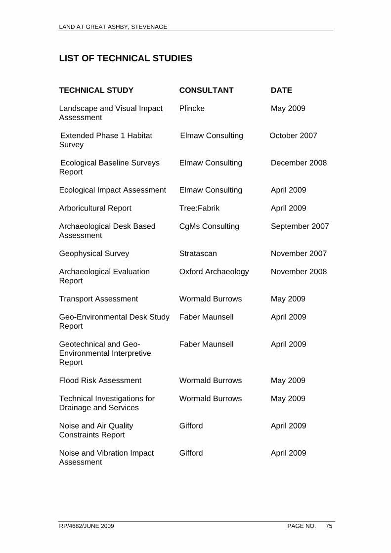
LAND AT GREAT ASHBY, STEVENAGE
RP/4682/JUNE 2009 PAGE NO. 75
LIST OF TECHNICAL STUDIES
TECHNICAL STUDY
CONSULTANT
DATE
Landscape and Visual Impact Assessment
Plincke May 2009
Extended Phase 1 Habitat Survey
Elmaw Consulting October 2007
Ecological Baseline Surveys Report
Elmaw Consulting December 2008
Ecological Impact Assessment
Elmaw Consulting April 2009
Arboricultural Report
Tree:Fabrik April 2009
Archaeological Desk Based Assessment
CgMs Consulting September 2007
Geophysical Survey
Stratascan November 2007
Archaeological Evaluation Report
Oxford Archaeology November 2008
Transport Assessment
Wormald Burrows May 2009
Geo-Environmental Desk Study Report
Faber Maunsell April 2009
Geotechnical and Geo-Environmental Interpretive Report
Faber Maunsell April 2009
Flood Risk Assessment
Wormald Burrows May 2009
Technical Investigations for Drainage and Services
Wormald Burrows May 2009
Noise and Air Quality Constraints Report
Gifford April 2009
Noise and Vibration Impact Assessment
Gifford April 2009
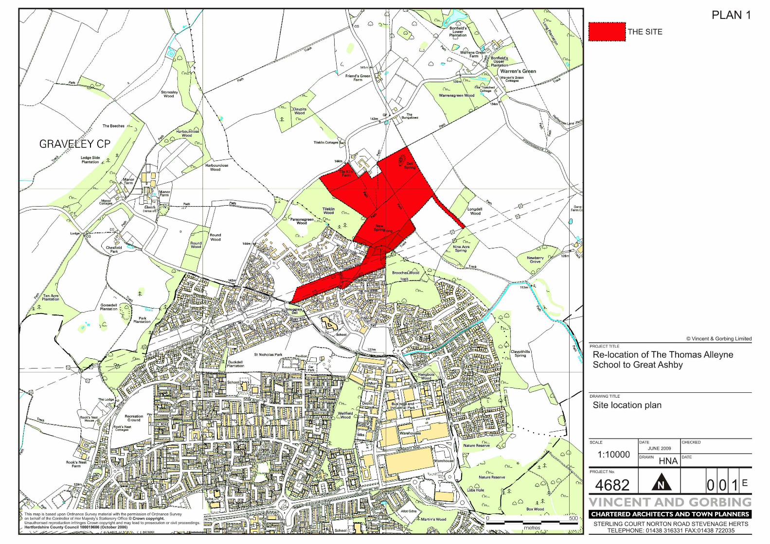
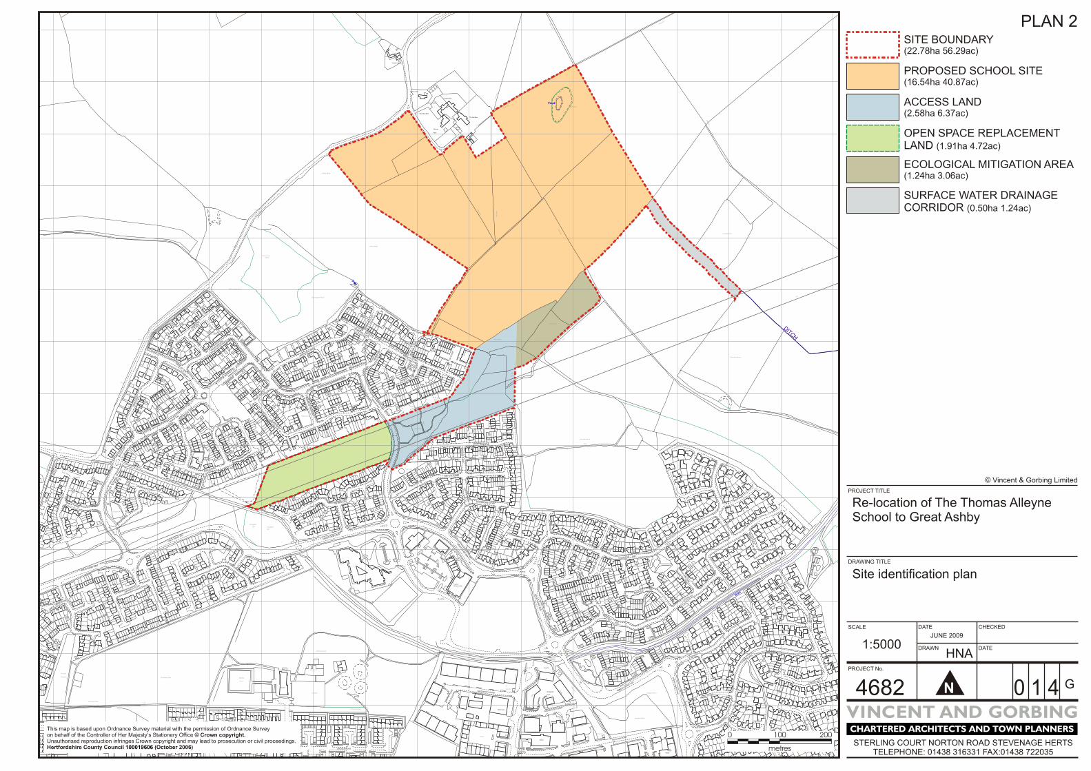
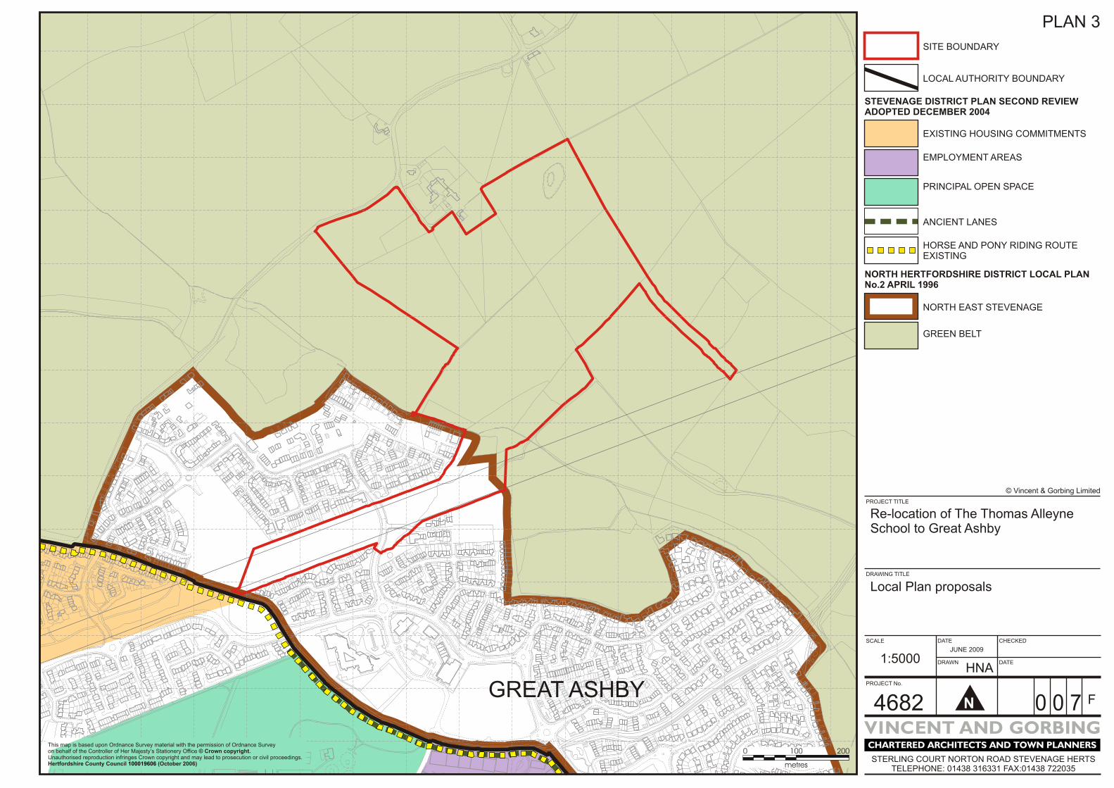
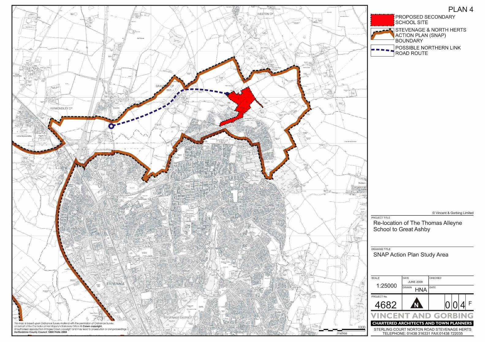
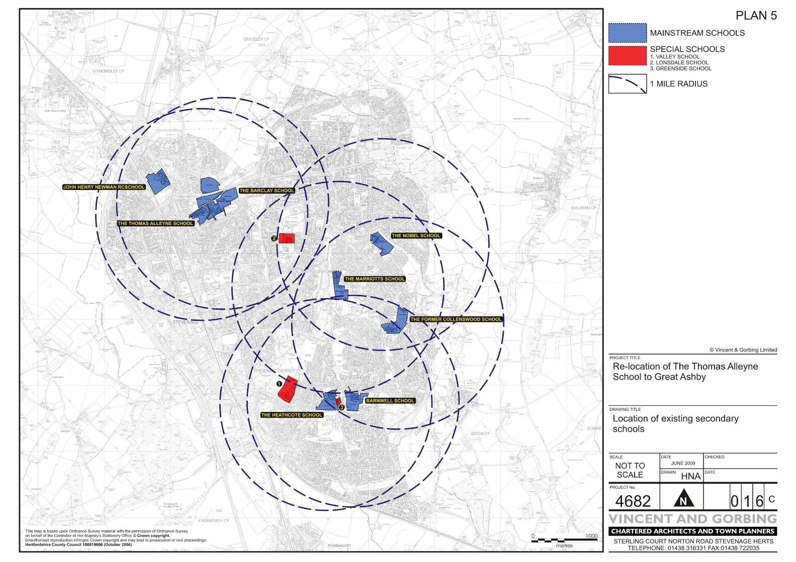

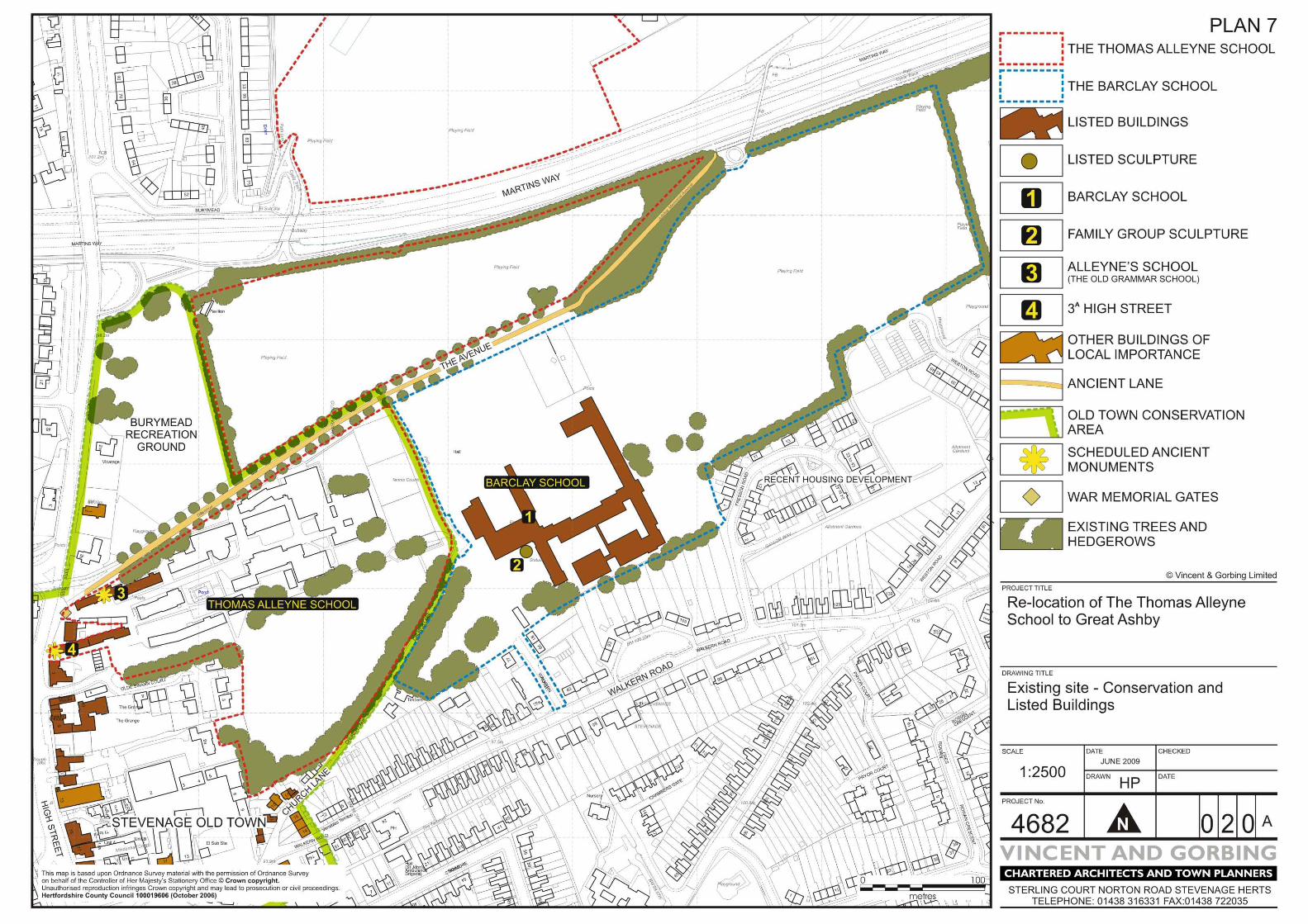
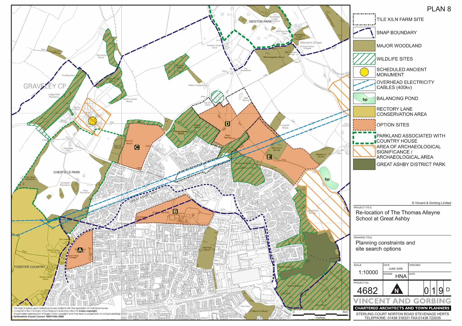


Vincent and GorbingSterling CourtNorton Road
Stevenage SG1 2JY
t: 01438 316 331f: 01438 722 035
www.vincent-gorbing.co.uk
Richard Parsons associate director