Embed Size (px)
Citation preview

TJORITJA / WEST MACDONNELL
NATIONAL PARKJOINT MANAGEMENT PLAN
MARCH 2018

WORKING TOGETHER TO LOOK AFTER CULTURE AND COUNTRY “ All countries, peoples and dreamings stay strong,
respected, healthy and connected.”
The Traditional Owners and Parks and Wildlife Commission of the Northern Territory (PWCNT) present the Joint Management Plan for Tjoritja / West MacDonnell National Park. As Joint Management Partners, we have developed this Plan with support, assistance and advice from the Central Land Council and other stakeholders including tourism industry representatives. The Plan defines our shared vision, objectives and strategies to deliver effective joint management, care for culture and country and support exciting, memorable and safe visitor experiences.
Spoken by the Traditional Owners throughout this document
ii TJORITJA / WEST MACDONNELL NATIONAL PARK

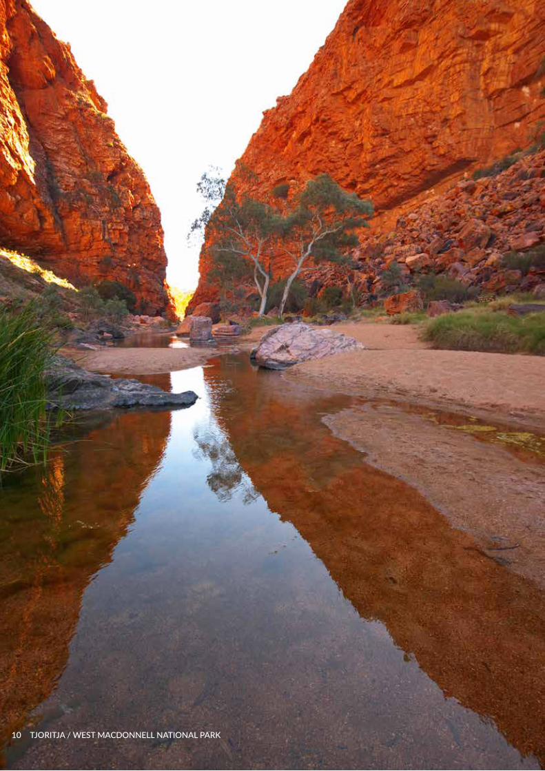
Cover: Tjoritja / West MacDonnell National Park
Published by the Parks and Wildlife Commission ISBN 978-1743501436.
CONTENTSExecutive Summary 3Vision, Approach and Purpose 4Park Significance and Values 4The Traditional Owners of Tjoritja / West MacDonnell National Park
8
Theme 1: Making Joint Management Work
11
Decision Making Structure 13
Objective and Strategies 15
Theme 2: Looking after Culture and Country
16
Objective and Strategies 20
Theme 3: Visitor Experiences 23Objective and Strategies 25
Information Sources 26Appendix 1 - Threatened flora
28
Appendix 2 - Threatened fauna
29
JOINT MANAGEMENT PLAN FEBRUARY 2018 1

2 TJORITJA / WEST MACDONNELL NATIONAL PARK

EXECUTIVE SUMMARY “ Old people are very special, they
show us the way”
Tjoritja / West MacDonnell National Park is a majestic landscape featuring ancient mountain ranges, gorges and chasms, permanent waterholes, unique plants and animals and incredible mountain scapes. The Park is one of Australia’s premier national parks, covering over 2000km2 stretching westwards from the township of Alice Springs for 160kms.
Visitors enjoy Tjoritja in many ways, from walking through towering gorge walls, swimming in waterholes, sighting Black-footed rock wallabies as they graze, being mesmorised by the colours of ancient ochre mines, to camping under a blanket of stars. Tjoritja also has a network of walking trails and bike paths where adventurers can spend days connecting with this amazing landscape.
As Joint Management Partners the Traditional Owners and the Parks and Wildlife Commission are responsible for managing Tjoritja together. They care for the country by respectfully sharing cultural and scientific knowledge – recognising the importance of ’both ways’. The Partners want people to enjoy and learn about the Park as they work towards the goals of effective management, protecting the Park’s natural and cultural assets and creating inspiring, memorable and safe visitor experiences. Central to achieving these goals is supporting the economic development and social wellbeing of local Aranda people. The priorities for Park Management are:
1. Making Joint Management work – As Partners, the Traditional Owners and PWCNT work together. This means practicing respectful communication and good governance, learning new ways and working with stakeholders and the community to achieve the objectives of joint management.
Joint management of the Park provides an opportunity to reconcile the past and share responsibility for the Park’s future care. The Joint Management Committee has the overarching responsibility for implementing this Plan. They will make decisions for the Park, oversee the delivery of outcomes, support training, employment and commercial enterprise development, with support from various agencies.
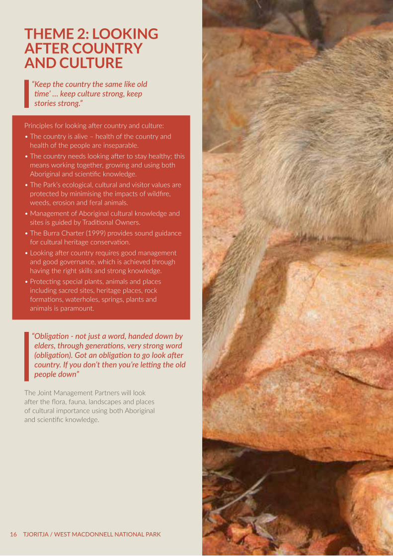
2. Culture and country - The Partners are responsible for looking after the outstanding cultural and natural values of Tjoritja / West MacDonnell National Park including the places of cultural and historical importance, the flora, fauna and dynamic landscapes. The Park is home to places of cultural importance and significance. Under Aboriginal Law, the Traditional Owners are obligated to care for the Park and pass on their knowledge to successive generations.
Using old and new knowledge, the Partners will keep the country healthy to protect flora and fauna and their habitat. The Park’s Healthy Country Plan / Integrated Conservation Strategy will guide the Partners in caring for the Park’s natural values.
3. Visitor experiences - The Partners are committed to providing a range of exciting, authentic and engaging experiences for visitors to enjoy, supporting commercial development and opportunities for Aranda people. They seek to ensure the Park thrives as a key tourist attraction and driver of the region’s economy.
Tjoritja / West MacDonnell National Park truly embodies the character of Australia’s Red Centre, providing visitors with a range of authentic outback bush experiences. About 170,000 visitors (2016) from around the world visit the Park each year, taking home life-long memories as they explore the area by air, on a bike, on short day walks, or longer more epic walks along the Larapinta Trail. Traditional Owners welcome visitors to connect and learn about their land. They want visitors to have an enjoyable and safe visit, and to share the story of Tjoritja with family and friends.
The Park’s outstanding attractions represent opportunities for high quality commercial enterprises, to further enhance the visitor experience and encourage longer stays in the Park. Tourism also creates opportunities for Traditional Owners to work on country by providing immersive cultural experiences as independent businesses or in partnerships with established tour operators. Together with the tourism industry a Visitor Experience Development Plan will be developed to drive the Park’s sustainable tourism growth.
JOINT MANAGEMENT PLAN FEBRUARY 2018 3
VISION, APPROACH AND PURPOSEShared Vision All countries, peoples and dreamings stay strong, respected, healthy and connected.
Shared ApproachWe recognise, respect and help each other. Together we all share responsibility for Tjoritja’s past, its wellbeing today and its future.
Shared PurposeWe will:• Work together by sharing, knowledge and
learning from each other. • Protect and preserve the Park’s natural and
cultural values.• Welcome visitors to experience the incredible
beauty and learn about the ancient living history of Tjoritja, while benefiting the Park, Traditional Owners and the regional economy.
PARK SIGNIFICANCE AND VALUES “ We see them children and grandchildren as
future leaders, following our grandfathers and mothers’ footsteps and moving forward”.
Tjoritja / West MacDonnell National Park (2568 km2) is in the heart of Australia, stretching 160kms west from the edge of Alice Springs (Figure 1). Internationally recognised for its stunning landscapes and as a place of cultural importance, the Park contributes substantially to biodiversity conservation and regional tourism.
Culture – Traditional Owners maintain strong ties and obligations to their country, following and teaching cultural and ecological knowledge from the Dreaming to their children and grandchildren. There are many places of cultural importance in the Park. These include archaeological sites and sacred places. The ancient rock carvings found in the Park are impressive evidence of a long history of Aboriginal occupation. Cultural tradition also provides employment opportunities through caring for country programs and tourism.
Country - The Park lies within the MacDonnell Ranges bioregion; one of 85 bioregions identified nationally. The Greater MacDonnell Ranges are recognised as an international Site of Conservation Significance for their threatened species, endemic species, floral diversity, geological formations and wetland values. Tjoritja is worthy of the best conservation management that can be afforded.
Tourism – Tjoritja is one of the premier tourist experiences in Central Australia. It is part of the Red Centre Way that links the regional attractions of Watarrka, Uluru-Kata Tjuta National Parks and Alice Springs. The Park caters for visitors seeking a wild, rugged and remote experience through to those preferring higher comforts. Tjoritja presents genuine prospects for tourism growth, providing opportunities for both Aboriginal culture-based enterprise and regional economic development. Iconic experiences like the Larapinta Trail have received international acclaim. The Park continues to offer a wide range of nature-based activities centred on the landscape of colourful ranges and gorges, oasis waterholes and sandy, tree-lined riverbeds.
Common Boundaries
4 TJORITJA / WEST MACDONNELL NATIONAL PARK
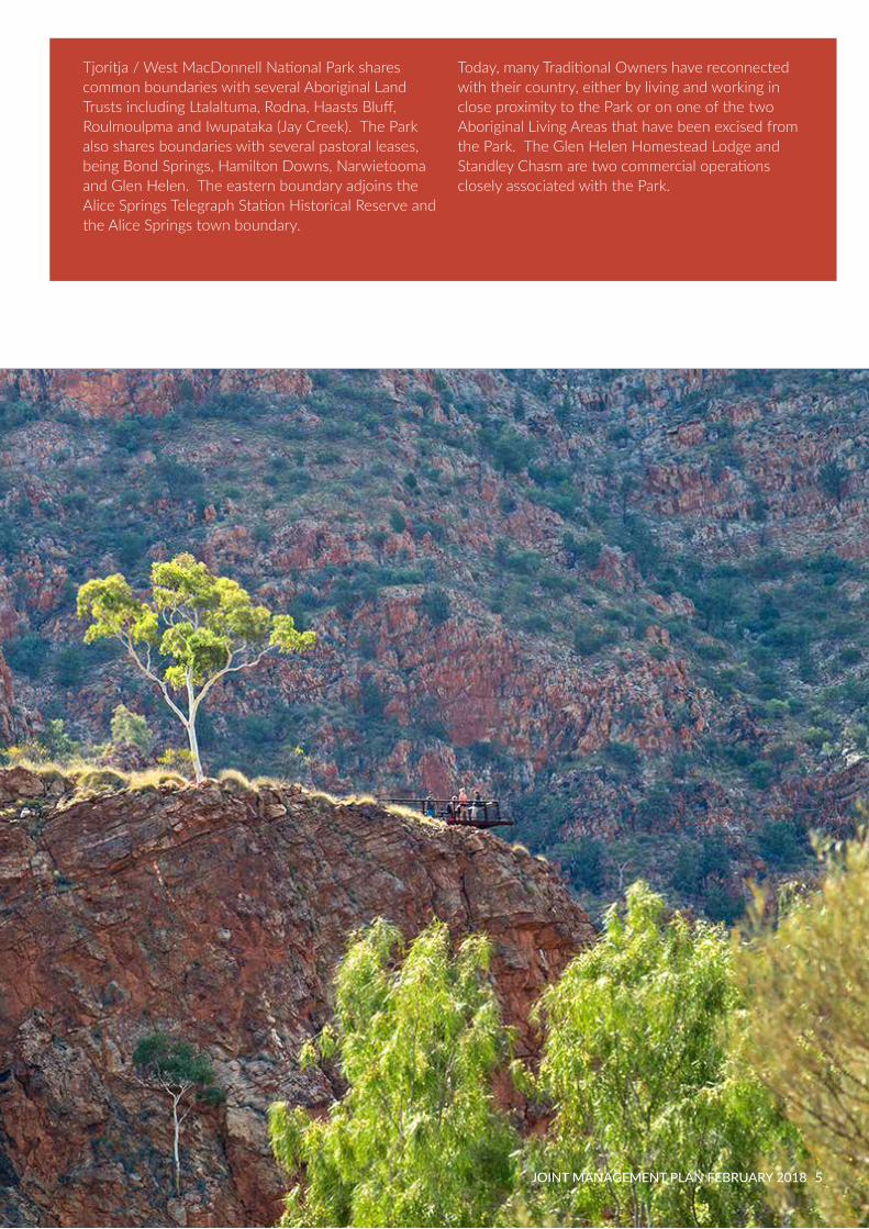
Tjoritja / West MacDonnell National Park shares common boundaries with several Aboriginal Land Trusts including Ltalaltuma, Rodna, Haasts Bluff, Roulmoulpma and Iwupataka (Jay Creek). The Park also shares boundaries with several pastoral leases, being Bond Springs, Hamilton Downs, Narwietooma and Glen Helen. The eastern boundary adjoins the Alice Springs Telegraph Station Historical Reserve and the Alice Springs town boundary.
Today, many Traditional Owners have reconnected with their country, either by living and working in close proximity to the Park or on one of the two Aboriginal Living Areas that have been excised from the Park. The Glen Helen Homestead Lodge and Standley Chasm are two commercial operations closely associated with the Park.
JOINT MANAGEMENT PLAN FEBRUARY 2018 5

! ! !!
!
! !!
!! !
!
!
!
! !
! !!! !! ! ! !
!
!
!
!!
! ! ! !
!
!! !
!!!
!! !
! ! ! !!
!
!!
!!
!
!
!!!
!!
!
!
!!!
!
! !
!!
!!!
!!
!!
!!!
!
!!
!!! !!
! !!
!
!
! ! !
!! !
! !!
!! !
!
!
!
!
!
!!
!!
!!!
!!!!
! !!
! !!
!
!
!
!!!!!
!!
!!
!
!
!!!!!
!!!
!
!
!
! !!
! ! ! !!
! ! !
!
! !
!!
!!
!
!
! ! !!
!
!!
!! ! !
!
!
!
!!
!
! !! !
!
!
!!
!!
! !! !!!!
!
!
! !! !!! !
!!
!!!
!
!!!
!!!
!!
!! !! !! !!
!!
!
!!
!
!!
!! !!
!!
!
!!
!
!
!
!!!
!!
!!!
!!
!!
!!
!!
! !
!
!
!
!
!!!!
!
!!
!!
!
!
!
!!! ! !! !! !!
!
!
!
! ! !
!
!! !! !! !! !!!
!
!
!!
!! !
!!
!
!
! ! !!!!!!
!
!
!
! !
!!
!
!!
!
!!
!!
!
!!
!
!!
!!
!!
!
!
!!
!
!
!
!!
!
!
!!
!!
!! !!
!
!!
!!
!
!
!
! !! !!
!
!
!!!
!
!
!!!
!
! !
!!! !! !
!!
!!!
!
!
!
!!
!!
!!!!!
!
!!!!!!!
!
!!
!! !!!!!!
! !!!!
!
!
!!!! !!!
!
!
!
!!
! !
!
!!
!
!
!
!
!
! !!
!
!
!
!!!!!!!
!
!
! !
! !! !
!
!
!!!!!
! !!!!!!!!!
!
!!!!!!!!!! !!
!!
!!!!
!
!
!
!!
!!! !!!
!!!!!
!
!!!
!
!! !!!! ! !!
!!
!
!
!
!
!! !
!!
!!!!!!!
!!
!
!
! !!!
! !!
!
!
!!!!!
!!
!
!
!!!!
!
!!!
!
!!
!!!! !
!!!!!!
!!!
!!!!!!
!
! !!!
!!!!
!
!!!
!
!
!
!
! !!
!!
!
!!!
!!!!
!!!!!!!
!
!
!
!
!!
!!
!
!!
!!
! !
!!!!
!!
!!
! !!
!
!!!!!!!
!
!!
!
!!!
!
!
!!
!!
!!!! !
!
!
! !!!!
!!!!
!!!!!!
!!!
!
!!
!!!!!
!!!
!!!
!!!!!!!!!!
!!!!!!!
!
!
/
/
/
///
/
/
/
/
#
#
#
#
#
#
ALICESPRINGS
0 10 205
Kilometres
To Darwin
Tnorala(Gosse Bluff)Conservation
Reserve
Palm Valley
FINKE GORGENATIONAL PARK
OWEN SPRINGS RESERVE
TJORITJA / WEST MACDONNELL NATIONAL PARK
To Adelaide
To Halls Creek (WA)
To Watarrka (Kings Canyon) via Larapinta Drive
Mt Zeil
Mt Razorback
Mt Giles
MtGillen
Stuart
Highway
Stua
rtH
ighw
ay
Tanami
Road
Larapinta
Drive
NamatjiraDrive
DriveLarapinta
/!/!/!
Hermannsburg
Drive
Larapinta
Fink
e
Eller
y
Meals
Drinks
Accommodation
Caravan sites
Medical Clinic
Fuel
Wheelchair Access
No Fires
Camping
Short Walks
Overnight Walks
Lookouts
Swimming
Bicycle Path
Wood BBQs
Gas BBQs
Drinking Water
Picnic Facilities
Toilets
Parking Areas!j
Ranger Station
Information
Darwin
Yulara
Katherine
Alice Springs
Tennant Creek
.© Northern Territory of Australia
The Northern Territory of Australia does not warrant that theproduct or any part of it is correct or complete and will not beliable for any loss, damage or injury suffered by any personas a result of its inaccuracy or incompleteness.
DATA SOURCE:Cadastral, Topographic, Road Centreline data sourced fromInformation Services Section, Department of Infrastructure,Planning and Logistics
ALOS image product supplied by Geoscience Australia. Image © Japan Aerospace Exploration Agency ("JAXA") 2008
NO
RTH
ER
NTE
RR
ITOR
YWE
STE
RN
AU
STR
ALI
A
NO
RTH
ER
NTE
RR
ITO
RY
QU
EE
NS
LAN
D
NORTHERN TERRITORYSOUTH AUSTRALIA
Legend! ! ! ! ! ! Larapinta Trail
! ! ! ! ! ! ! ! ! ! ! ! Bike Path
Watercourse
Tjoritja / West Macdonnell NP
Cadastre
Sealed Road
Unsealed
4WD Track
Red Centre Way
Simpsons GapBicycle Path
/!
/!
/!
/! /! /!
/!
/!
/!
/!
/! /!
/!
/!
Mt Sonder
Alice SpringsDesert Park
Davenport
Orm
isto
nC
reek
¿¿
¿
¿
F I G U R E 1 T J O R I T J A / W E S T M A C D O N N E L L N A T I O N A L P A R K
Namatjira
Drive
Alice SpringsTelegraphStationHistoricalReserve
John Flynn'sGraveHistoricalReserve
Crawfo
rdC
reek
Creek
Red
bank
Creek
Hall ee m
Charle
y
Cre
ek
Am
burla
Creek
Ambu
rlaC
reek
Creek
2 Mile 4WDCamping
Gilb
ert
Cre
ek
CreekRudalls
Creek
Creek
Pioneer
CreekJerimah
Creek
Mueller
River
Cre
ek
Jay
Hugh
Creek
RoeRiver
Todd
Serpentine Chalet
Serpentine GorgeEllery Creek
Big Hole
Ochre Pits
Glen HelenMt SonderLookout
Tylers PassLookout
Redbank Gorge Ormiston Gorge
Simpsons GapRanger Station
Standley Chasm
Und andita Creek
Rive
r
Finke
Riv
er
Creek
Sixteen
Mile
CreekPalm
Simpsons Gap
6 TJORITJA / WEST MACDONNELL NATIONAL PARK

! ! !!
!
! !!
!! !
!
!
!
! !
! !!! !! ! ! !
!
!
!
!!
! ! ! !
!
!! !
!!!
!! !
! ! ! !!
!
!!
!!
!
!
!!!
!!
!
!
!!!
!
! !
!!
!!!
!!
!!
!!!
!
!!
!!! !!
! !!
!
!
! ! !
!! !
! !!
!! !
!
!
!
!
!
!!
!!
!!!
!!!!
! !!
! !!
!
!
!
!!!!!
!!
!!
!
!
!!!!!
!!!
!
!
!
! !!
! ! ! !!
! ! !
!
! !
!!
!!
!
!
! ! !!
!
!!
!! ! !
!
!
!
!!
!
! !! !
!
!
!!
!!
! !! !!!!
!
!
! !! !!! !
!!
!!!
!
!!!
!!!
!!
!! !! !! !!
!!
!
!!
!
!!
!! !!
!!
!
!!
!
!
!
!!!
!!
!!!
!!
!!
!!
!!
! !
!
!
!
!
!!!!
!
!!
!!
!
!
!
!!! ! !! !! !!
!
!
!
! ! !
!
!! !! !! !! !!!
!
!
!!
!! !
!!
!
!
! ! !!!!!!
!
!
!
! !
!!
!
!!
!
!!
!!
!
!!
!
!!
!!
!!
!
!
!!
!
!
!
!!
!
!
!!
!!
!! !!
!
!!
!!
!
!
!
! !! !!
!
!
!!!
!
!
!!!
!
! !
!!! !! !
!!
!!!
!
!
!
!!
!!
!!!!!
!
!!!!!!!
!
!!
!! !!!!!!
! !!!!
!
!
!!!! !!!
!
!
!
!!
! !
!
!!
!
!
!
!
!
! !!
!
!
!
!!!!!!!
!
!
! !
! !! !
!
!
!!!!!
! !!!!!!!!!
!
!!!!!!!!!! !!
!!
!!!!
!
!
!
!!
!!! !!!
!!!!!
!
!!!
!
!! !!!! ! !!
!!
!
!
!
!
!! !
!!
!!!!!!!
!!
!
!
! !!!
! !!
!
!
!!!!!
!!
!
!
!!!!
!
!!!
!
!!
!!!! !
!!!!!!
!!!
!!!!!!
!
! !!!
!!!!
!
!!!
!
!
!
!
! !!
!!
!
!!!
!!!!
!!!!!!!
!
!
!
!
!!
!!
!
!!
!!
! !
!!!!
!!
!!
! !!
!
!!!!!!!
!
!!
!
!!!
!
!
!!
!!
!!!! !
!
!
! !!!!
!!!!
!!!!!!
!!!
!
!!
!!!!!
!!!
!!!
!!!!!!!!!!
!!!!!!!
!
!
/
/
/
///
/
/
/
/
#
#
#
#
#
#
ALICESPRINGS
0 10 205
Kilometres
To Darwin
Tnorala(Gosse Bluff)Conservation
Reserve
Palm Valley
FINKE GORGENATIONAL PARK
OWEN SPRINGS RESERVE
TJORITJA / WEST MACDONNELL NATIONAL PARK
To Adelaide
To Halls Creek (WA)
To Watarrka (Kings Canyon) via Larapinta Drive
Mt Zeil
Mt Razorback
Mt Giles
MtGillen
Stuart
Highway
Stua
rtH
ighw
ay
Tanami
Road
Larapinta
Drive
NamatjiraDrive
DriveLarapinta
/!/!/!
Hermannsburg
Drive
Larapinta
Fink
e
Eller
y
Meals
Drinks
Accommodation
Caravan sites
Medical Clinic
Fuel
Wheelchair Access
No Fires
Camping
Short Walks
Overnight Walks
Lookouts
Swimming
Bicycle Path
Wood BBQs
Gas BBQs
Drinking Water
Picnic Facilities
Toilets
Parking Areas!j
Ranger Station
Information
Darwin
Yulara
Katherine
Alice Springs
Tennant Creek
.© Northern Territory of Australia
The Northern Territory of Australia does not warrant that theproduct or any part of it is correct or complete and will not beliable for any loss, damage or injury suffered by any personas a result of its inaccuracy or incompleteness.
DATA SOURCE:Cadastral, Topographic, Road Centreline data sourced fromInformation Services Section, Department of Infrastructure,Planning and Logistics
ALOS image product supplied by Geoscience Australia. Image © Japan Aerospace Exploration Agency ("JAXA") 2008
NO
RTH
ER
NTE
RR
ITOR
YWE
STE
RN
AU
STR
ALI
A
NO
RTH
ER
NTE
RR
ITO
RY
QU
EE
NS
LAN
D
NORTHERN TERRITORYSOUTH AUSTRALIA
Legend! ! ! ! ! ! Larapinta Trail
! ! ! ! ! ! ! ! ! ! ! ! Bike Path
Watercourse
Tjoritja / West Macdonnell NP
Cadastre
Sealed Road
Unsealed
4WD Track
Red Centre Way
Simpsons GapBicycle Path
/!
/!
/!
/! /! /!
/!
/!
/!
/!
/! /!
/!
/!
Mt Sonder
Alice SpringsDesert Park
Davenport
Orm
isto
nC
reek
¿
¿
¿
¿
F I G U R E 1 T J O R I T J A / W E S T M A C D O N N E L L N A T I O N A L P A R K
Namatjira
Drive
Alice SpringsTelegraphStationHistoricalReserve
John Flynn'sGraveHistoricalReserve
Crawfo
rdC
reek
Creek
Red
bank
Creek
Hall ee m
Charle
y
Cre
ek
Am
burla
Creek
Ambu
rlaC
reek
Creek
2 Mile 4WDCamping
Gilb
ert
Cre
ek
CreekRudalls
Creek
Creek
Pioneer
CreekJerimah
Creek
Mueller
River
Cre
ek
Jay
Hugh
Creek
RoeRiver
Todd
Serpentine Chalet
Serpentine GorgeEllery Creek
Big Hole
Ochre Pits
Glen HelenMt SonderLookout
Tylers PassLookout
Redbank Gorge Ormiston Gorge
Simpsons GapRanger Station
Standley Chasm
Und andita Creek
Rive
r
Finke
Riv
er
Creek
Sixteen
Mile
CreekPalm
Simpsons Gap
JOINT MANAGEMENT PLAN FEBRUARY 2018 7

The Traditional Owners of Tjoritja / West MacDonnell National ParkTo the Traditional Owners of the West MacDonnell National Park, their country is sacred and is of major importance for keeping Aboriginal religion and law strong. Many creation stories and traditions are connected to Tjoritja. To reflect and promote their continuing living connection with the country, in 2014 the Traditional Owners re-named the West MacDonnell National Park to recognise the country’s original name, Tjoritja.
Under Aboriginal Law the Traditional Owners of the West MacDonnell National Park belong to sixteen countries or estates.
Sharing Our Story
In the Creation Time called Tnangkara2, our Ancestors created the physical and cultural landscape, inscribing on it our obligations, our beliefs and social order - a charter for life and of the Law. The West MacDonnell National Park covers a large part of country that is called Tjoritja. The Aranda people belonging to Tjoritja sometimes call themselves Tjoritja-rinya, which means ‘belonging to Tjoritja’. Tjoritja is a living cultural landscape. The stories of our Ancestors remind us of the importance of our sacred totemic sites. Traditional Owners remain connected to the Ancestors who still live in the most important sites across Tjoritja.
While there are many aspects of Aranda traditions that we are happy to share, some stories and religious practices are restricted to men only, and some for women only. This information is referred to as the ‘inside story’, which means that according to traditional Law and custom it should not be heard by anyone but senior and the appropriate initiated people.
2 called Tnangkara in Western Aranda, Altyerre in Central Arrernte and Tjukurrpa in Luritja.
8 TJORITJA / WEST MACDONNELL NATIONAL PARK

History of Joint Management
The Park is situated on Aboriginal freehold land held by the Tyurretye Aboriginal Land Trust as per the Aboriginal Land Rights (Northern Territory) Act 1976 (Cwlth). In July 2012 grant of title for Tjoritja / West MacDonnell National Park was given to the Traditional Owners. The Park was then leased to the Northern Territory for 99 years. The terms of joint management have authority in law under the TPWC Act, the Park Lease and an Indigenous Land Use Agreement (2005) registered under the Native Title Act. The name ‘Tjoritja / West MacDonnell National Park’ was published in the NT Gazette 15 October 2014. The previous name, West MacDonnell will be removed once the new name is widespread and in common use.
JOINT MANAGEMENT PLAN FEBRUARY 2018 9
10 TJORITJA / WEST MACDONNELL NATIONAL PARK

THEME 1: MAKING JOINT MANAGEMENT WORK “ Working together and supporting each other.”
Principles for making Joint Management work:• Good communication is the foundation for a strong
partnership.• Clear roles and responsibilities are essential for joint
management to ensure ‘good governance’.• We acknowledge our differences and benefit from
caring for country ‘both ways’.• Respecting Traditional Owners rights to continue
to practice tradition, caring for country and keeping their culture strong.
• Engagement, training and employment of local Aboriginal people is central to joint management success.
• Progress is dependant on competent, well trained Parks staff suitably qualified to undertake responsibilities.
• Decision-making and accountability should be equally shared and Aboriginal decision-making processes must be respected.
• Time spent together on country is vital for developing mutual trust and respect between the Partners and an understanding of the roles each play.
• Resources are limited and must be efficiently used. Management priorities will be guided by the Park’s key values.
• Risks are identified and actions are put in place to minimise them.
• Joint management has to be checked to see that it is working well. It is important to keep improving.
• Public support and engagement is very important for joint management.
• All disputes are well handled through appropriate resolution processes.
• Joint management is an ongoing learning process requiring an adaptive approach.
JOINT MANAGEMENT PLAN FEBRUARY 2018 11

Joint management is about Traditional Owners and the Parks and Wildlife Commission looking after Tjoritja / West MacDonnell National Park in ways that meet the aspirations of both Partners. If the partnership is working well, outcomes will include equitable and efficient decision-making leading to healthy culture and country, visitors continuing to have safe and enjoyable experiences and the broader community being well informed and involved. Joint management contributes towards economic, social and wellbeing benefits for Traditional Owners and their families, through direct and indirect employment and training opportunities in a diverse range of fields.
The TPWC Act defines the Joint Management Partners as the Traditional Aboriginal Owners of the Park and the Territory. The Act further defines the objective to jointly establish an equitable partnership to manage and maintain the Park as part of a comprehensive and representative system of parks and reserves so that Traditional Owners and the wider community benefits, biodiversity is protected and community needs for education and enjoyment are well served.
The TPWC Act also establishes the requirements of joint management plans and the role of the Central Land Council (CLC) in assisting joint management by representing the interests of the Traditional Owners.
“ Through a good partnership we will build a deeper understanding of the country for rangers, visitors and the young”
Our Roles:
The Parks and Wildlife Commission resource, finance and implement the Park’s ongoing day-to-day management, interpretation, planning and infrastructure programs. Parks and Wildlife Commission officers represent the Northern Territory in the joint management partnership and contribute to setting the management direction.
Traditional Owners are vital in the direction and management of the Park. Core members of landholding groups have responsibilities for decision-making and overseeing cultural protocol. Traditional Owners are responsible to, and for the land, their Law and culture. They are responsible for managing traditional knowledge and passing it on to the right people, looking after the land and its resources, maintaining sacred sites and keeping the country alive.
The broader community is also interested in the good management of the Park. Successful park management depends on a wide range of individuals and organisations, both private and public, committing to resource and protect the values of the Park. It is important for the Partners to foster positive relationships with the community.
The Partners recognise that joint management is a learning process, requiring an adaptive approach that respects the principles above. A Joint Management Committee (JMC) consists of Traditional Owners and Parks and Wildlife Commission staff. The Partners follow the Decision - Making Structure (see Figure 2), which incorporates principles of traditional decision-making. The Decision - Making Framework (Table 1) provides clear roles of the Partners.
12 TJORITJA / WEST MACDONNELL NATIONAL PARK

Decision Making Structure
Shared decision making and planning
Joint Management Plan An agreement between the Joint Management Partners about managing the Park together.
Traditional Owners The full Traditional Owner group will be consulted for large, complex and culturally sensitive proposals or those that cannot be approved by the Joint Management Committee.
Joint Management Committee West / Central / East (JMC)The JMC representative decision making body that will meet to approve local guidelines and criteria to guide decision making and approve Strategic Plans.
Central Land Council Central Land Council is responsible for consulting with and protecting the interests of Traditional Owners.
Operational Plans Are developed to acheive outcomes defined by the Partners and may require input from working group/s.
Parks OperationsSenior Park staff will approve standard permits that require no special access and are consistent with Traditional Owner’s wishes.
Action Rangers and Traditional Owners carry out agreed management under the Joint Management and Operational Plans.
1
5
2
4
6
7
Figure 2
Joint Management PartnershipThe TPWCA defines the Partners as the Park's Traditional Aboriginal Owners and the Territory. The Parks and Wildlife Commission represents the Northern Territory.
3
4
5
6
7
Joint Management Committee West / Central / East
Seperation of Roles
21
Strategic PlansVisitor Experience Development Plans, Cultural Heritage Plans, Healthy Country Plan/Integrated Conservation Strategies and other strategies are developed by expert advisory groups which include Traditional Owners, Tourism Industry and other stakeholders.
8 8
9 9
3
JOINT MANAGEMENT PLAN FEBRUARY 2018 13

Table 1: Decision-making Framework
Role of the Joint Management Committee Role of Park Staff
• Hold responsibility and accountability as outlined in the Decision-Making Structure.
• Take advice from the wider Traditional Owner group and consult with community stakeholders.
• Delegate agreed tasks and decisions to advisory or working groups.
• Set strategic direction, develop and approve management strategies, including cultural heritage, healthy country/conservation and visitor development.
• Approve policy and guidelines that apply to Tjoritja / West MacDonnell National Park.
• Establish direction and decision-making criteria to evaluate permits, contracts, licences, development and unique proposals.
• Assess and endorse development proposals, changes to infrastructure and access.
• Assess and endorse proposals for new and unique commercial activities, third party interests, licensing, sub-leasing, Park extensions, living areas, and other proposals not specified in this Plan.
• Monitor and evaluate management performance.
• Undertake day-to-day park management operations such as patrols, maintenance, visitor services, compliance, community relations and search and rescue.
• Implement operational programs in line with approved management strategies including fire, weed and feral animal programs, cultural programs, visitor experience, heritage conservation and community engagement.
• Issue permits consistent with legislation, policy, guidelines and decision-making criteria approved by the JMC.
• In conjunction with relevant government agencies, issue works contracts, such as those for maintaining, replacing, repairing or improving existing infrastructure and new works.
• Maximise on-ground participation of Traditional Owners in management of the Park.
• Monitor management effectiveness and adjust management according to new information, improved procedures, new technology and new issues or opportunities.
• Report progress to meetings of the Partners.
14 TJORITJA / WEST MACDONNELL NATIONAL PARK

Objective and Strategies Effective governance and a strong and equitable partnership protects Tjoritja / West MacDonnell National Park’s natural and cultural values.
• The JMC will oversee strategic direction of the Park and follow the decision making structure, adapting and improving governance as required.
• Meetings on country and dedicated country camps will help Traditional Owners’ connection to country, help the Partners understand the land, present issues and share knowledge.
• The Decision-Making Framework will be the basis of planning and operational Park management.
• Governance training will be provided to the Partners to give them the tools and skills required to work effectively in the partnership. A monitoring and evaluation program will inform actions to maintain healthy governance.
• Flexible career development, employment and training opportunities will be provided to local Aranda people to participate in on-the-ground park management.
• Cross-cultural training for staff will be developed and delivered.
• Proposals for research, expansion of the Park or those not otherwise dealt with in this Plan will be openly considered by the Partners.
• The JMC will be the means by which this Plan addresses matters under section 25AE (3) of the TPWC Act, unless this Plan states otherwise.
JOINT MANAGEMENT PLAN FEBRUARY 2018 15
THEME 2: LOOKING AFTER COUNTRY AND CULTURE “ Keep the country the same like old
time’ … keep culture strong, keep stories strong.”
Principles for looking after country and culture: • The country is alive – health of the country and
health of the people are inseparable.• The country needs looking after to stay healthy; this
means working together, growing and using both Aboriginal and scientific knowledge.
• The Park’s ecological, cultural and visitor values are protected by minimising the impacts of wildfire, weeds, erosion and feral animals.
• Management of Aboriginal cultural knowledge and sites is guided by Traditional Owners.
• The Burra Charter (1999) provides sound guidance for cultural heritage conservation.
• Looking after country requires good management and good governance, which is achieved through having the right skills and strong knowledge.
• Protecting special plants, animals and places including sacred sites, heritage places, rock formations, waterholes, springs, plants and animals is paramount.
“ Obligation - not just a word, handed down by elders, through generations, very strong word (obligation). Got an obligation to go look after country. If you don’t then you’re letting the old people down”
The Joint Management Partners will look after the flora, fauna, landscapes and places of cultural importance using both Aboriginal and scientific knowledge.
16 TJORITJA / WEST MACDONNELL NATIONAL PARK

Looking after culture. The Traditional Owners of the Park are responsible for Tjoritja. Under traditional law they are obligated to protect their land from physical and spiritual harm. This requires people to respect the land and its spirits, the guardians of the land. The landscape may not be interfered with or damaged, as this disturbs the Law and spirits that dwell on, or in the land. Law is reciprocal and looking after country will in turn keep people healthy and culture strong.
Traditional use. For Traditional Owners, looking after the country involves visiting and watching it, moving appropriately on it and protecting it from damage. Knowledge is shared about the land and special places, including how to use the country’s resources in culturally appropriate ways. Children practice their language, learn the names of places, where to go, how to behave on the country of their Ancestors, continue to learn how to hunt and gather bush foods and are inducted gradually into the songs and rituals of the Law. Under the TPWC Act, Traditional Owners hold the right to hunt wildlife and gather bush foods and medicines including within the Park.
Aboriginal Heritage Sites. The rock engravings found across the Park form one of the largest, most complex and significant engraving sites in Central Australia. The Ochre Pits are the only Aboriginal quarry for ochre within Central Australia that is open to visitors. Traditional ochre collection still occurs.
Shared Heritage Sites. The remains of pastoralism from the early 1870s and the beginning of the tourism industry are evident in the Park today. Some Historic sites across the Park include:• The Ormiston Creek homestead, the first built in
Central Australia.• Serpentine Dam and Chalet, remains from the start
of the region’s tourism industry. • The wooden stock yards at Giles Yard Springs and
Pioneer Creek.• A lone grave of Jim Cummings buried 1911 near
Ellery Creek.• The sheep yards and stone hut ruins north of
Bowmans Gap.• Timber remains of a well at the junction of
Davenport and Redbank Creeks .• Raggatt’s Structure – NT Heritage Registar 2017.
“ Building relationships and working alongside Aboriginal People, ‘us rangers’ see ourselves as stewards – being there to care and manage all the Park values for the benefit of others” – Ranger
JOINT MANAGEMENT PLAN FEBRUARY 2018 17

Water resources. The permanent and semi-permanent watercourses, waterholes and groundwater in the Park support a significant percentage of the aquatic and terrestrial biodiversity within the region, including species that are found nowhere else in arid Australia. Permanent water sources in the gorges, were invaluable to Traditional Owners in the past, and continue to retain cultural importance. Several visitor sites concentrate on the gorges and their waterholes and support activities such as swimming, bush walking, camping, nature study and scenic appreciation.
Plants. The flora of the Park is species-rich, with the biophysical mapping in 2010 recording about 700 native species within 39 vegetation communities. The MacDonnell Ranges is recognised as one of Australia’s top 12 centres of plant species abundance. Several plant species of special conservation status have been recorded and are provided in Appendix 1.
Five localities, either wholly or partly in the Park are recognised for their botanical significance; Mt Zeil, the Chewings Range, Glen Helen, Simpsons Gap and Ilparpa. The most significant vegetation communities are high mountain-peak communities, sheltered freshwater spring and seepage communities and mound spring communities.
Animals. The West MacDonnell Ranges support a healthy and varied fauna. The first scientific survey of the area’s fauna was undertaken by the Horn
Scientific Expedition of 1894. As of 2017, native fauna of the West MacDonnell Ranges includes:• Fish: Nine species of native fish are known to occur
in the Finke River catchment, and the Park contains all nine of these species.
• Reptiles and Amphibians: about 76 species of reptiles and six species of frogs have been recorded.
• Birds: 152 bird species have been recorded. Major creek systems and tall shrublands support the richest avifauna.
• Mammals: 19 terrestrial mammal species and nine bat species currently occur in the Park. At least 42 native mammals (31 terrestrial and 11 bat species) are known to have once inhabited the West MacDonnell Ranges.
• Invertebrates: Over 30 species of land snails adapted to cope with the arid environment, and various aquatic macroinvertebrates including the water penny (Sclerocyphon fuscus).
• The Park protects a significant number of threatened and near-threatened animal species. Over 30% of native mammal species have become extinct in arid Australia within the past 100 years. Nationally significant fauna species occurring in the Park include:
• Central Rock-rat Zyzomys pendunculatus – endangered
18 TJORITJA / WEST MACDONNELL NATIONAL PARK

• Black-footed rock-wallaby, MacDonnell Ranges race Petrogale lateralis – vulnerable
• Princess Parrot Polytelis alexandrae - vulnerable• Desert Sand Skipper Croitana aestiva - endangered• Slater’s Skink Liopholis slateri - endangered
The Park is scheduled to be assessed by the Australian Heritage Council for National Heritage listing. The Park may also meet IUCN criteria for World Heritage listing.
“ Fire is important to manage country. We might say ok to burn that area, ‘cause we need fresh grass to grow.”
Managing threats. Large wildfires are the greatest threat to the Park. There have been two major wildfire events in the past 20 years that may have been very damaging to the Park’s wildlife. Today, park staff work together with Traditional Owners, combining traditional and scientific fire management practices. Prescribed burning plays an important role and is used to keep ecosystems healthy, aid traditional hunting and protect the country from damaging hot wildfire, which can occur after big rainfall years due to increased fuel loads.
Buffel grass (Cenchrus ciliaris) is a major threat, mainly through increased fire frequency and intensity from greater fuel loads. The extent of infestation and ecological impact varies throughout the Park. The
highest concentrations occur along watercourses and areas frequented by visitors, feral animals and stock. Couch grass (Cynodon dactylon) is also a significant threat that increases fuel loads in most river systems.
Introduced animals include cattle, horses, camels, donkeys, cats, foxes, rabbits and European bees. Cattle, horses and camels cause extensive environmental impacts. They seriously alter and degrade native vegetation, pollute and consume scarce water resources, disturb and erode fragile soils, and introduce weeds. They also detract from visitor impressions of the Park and its management. Cattle, horses and camels enter the Park through breaches in boundary fences which can become damaged after flood events and from adjoining lands where no common boundary fence exists. Conservation management does not stop at the Park boundary. It is imperative that the Park’s neighbours are included in land management programs.
The Park’s Healthy Country Plan / Integrated Conservation Strategy (ICS) describes the most important conservation values and how they will be protected and maintained by managing key threats. Involving Traditional Owners and applying their ecological knowledge is central to this Strategy and its implementation.
Systematic fauna surveys and targeted monitoring is conducted in partnership with the Department of Environment and Natural Resources. This monitoring aligns with the ICS and provides valuable data to
JOINT MANAGEMENT PLAN FEBRUARY 2018 19

inform adaptive and effective management programs. Partnerships with research institutions can also add substantial value to our understanding of the landscape and ongoing adaptive management.
In 2008 the Park was reserved from exploration and mining Under the Minerals Title Act (NT) and the Petroleum Act (NT). Additional protection is provided to the Park being Aboriginal freehold land, Traditional Owners have the right to refuse exploration and mining on their lands. The Traditional Owners feel strongly that mining is not consistent with the scenic, cultural and environmental values of the Park.
Objective and StrategiesThe Park’s natural and cultural values are protected and Aboriginal knowledge and interests are incorporated into management programs.
• The Partners will learn from each other and share knowledge, using both tradition and science in conservation programs.
• PWCNT will ensure Park staff and Traditional Owners have the capabilities required to implement management programs.
• Respect will be given to the directions and decisions from Traditional Owners on cultural matters. Cultural knowledge shared will always belong to the Traditional Owners and will only be used as directed by them, consistent with Aboriginal Cultural and Intellectual Property Policy.
• The Healthy Country Plan / Integrated Conservation Strategy (ICS) will be reviewed every five years. It will be a public document and include systematic research, monitoring and reporting of the Park’s biological resources. As per the ICS, fire management will be given high priority with increased effort to follow high rainfall years when fuel loads increase.
20 TJORITJA / WEST MACDONNELL NATIONAL PARK

• A Cultural Heritage Management Plan and program for the Park will be developed with advice and support from the CLC. The program will include “back to country” activities and cultural awareness programs for rangers and tourism operators.
• A hunting and gathering policy will be developed by the Partners, supporting traditional land use. The Policy will identify areas for hunting and firearm use, with the underlying goal of keeping country healthy and visitors’ safe.
• Sacred sites will be properly protected, supported by the CLC and Aboriginal Areas Protection Authority as required. The CLC will have primary responsibility for consulting Traditional Owners for proposed works.
• Soil and gravel extraction for soil conservation or other purposes will be subject to the approval of the Partners. Traditional Owner’s right to extract ochre will continue to be upheld under the TPWC Act.
• The Partners will work with the local community and stakeholders to ensure a coordinated approach to land management across tenures and neighbouring properties. Cooperative natural resource management will be encouraged with community ranger groups and adjoining landowners.
JOINT MANAGEMENT PLAN FEBRUARY 2018 21
22 TJORITJA / WEST MACDONNELL NATIONAL PARK

THEME 3: VISITOR EXPERIENCES “ Couldn’t be more impressed! NT Parks do a
great job with the facilities for visitors. The National Park really is run with visitors in mind – it is fantastic! Plus, it is stunningly beautiful!” Visitor Feedback –Trip Advisor
Principles for Visitor Experiences: • Delivery and development of rewarding and diverse
visitor experiences aligns with the needs of the Territory’s tourism economy.
• Visitors enjoy Tjoritja / West MacDonnell National Park and leave feeling connected to the Park. This leads to positive promotion and more visitors enjoying the park with benefits for the Park, the regional economy and Traditional Owners.
• The tourism industry must be involved in developing high quality experiences that are responsive to changing visitor interests and expectations.
• Tourism fosters cultural awareness through sharing of traditional practices, encouraging joint ventures, generating income, creating employment for local Aranda people and supporting delivery of the Park’s objectives.
• Understanding visitors and their interests helps grow and enhance tourism.
• Well-designed facilities that are sensitive to the natural and cultural environment contribute to enjoyable, educational and safe visitor experiences.
• Visitor safety is paramount. Traditional Owners welcome visitors and want to ensure they have a safe and memorable experience.
A visit to Tjoritja / West MacDonnell National Park is an unforgettable experience. The spectacular sunburned mountain vistas contrasts with sandy riverbeds, waterholes and colourful ochre pits and is home to a variety of wildlife. Easily accessible, close to the township of Alice Springs and part of the Red Centre Way tourist drive, the Park is an attractive destination to a wide range of visitors. A sense of remoteness and lack of human disturbance are highly valued in today’s fast paced world by domestic and international visitors alike. Visitors can sit back and enjoy a cappuccino and wifi at key visitor nodes in the Park. Growth in visitor numbers creates exciting opportunities for the regional tourism economy.
JOINT MANAGEMENT PLAN FEBRUARY 2018 23

Through future visitor experience planning with the tourism industry, the Partners aim to enhance existing experiences, improve access and infrastructure, create new activities and grow the Park’s domestic and international profile to attract more visitors.
Why do visitors come to Tjoritja / West MacDonnell National Park? The West MacDonnell Ranges have been magnificently captured in photography and art, the area made famous by the renowned Aranda watercolour artist, Albert Namatjira. The grandeur of Mount Sonder, Mount Giles, and Mount Razorback greet travellers as they pass, inviting them to explore. Visitor activities include camping, swimming, mountain biking, bushwalking, four wheel driving and bush camping. There are areas popular for rock climbing and abseiling, and sites close to Alice Springs provide birdwatching, photography, cycling, jogging and picnicing. Future opportunities to enrich visitor experiences include face-to-face cultural tourism activities and digital interpretation.
Sightseeing and picnicking are possibly the most popular activities. Driving through the Park is a wonderful journey for many visitors. Several visually outstanding parts of the range are accessible along the roads and on walking tracks throughout the Park. Most visitors to the Park take day trips from Alice Springs, visiting Simpsons Gap, Serpentine Gorge, the Ochre Pits, Ellery Creek Big Hole, Ormiston Gorge, Glen Helen and Redbank Gorge.
Bushwalking is a very popular activity. During the cooler months (May – September) almost 90 percent of all visitors take a walk. Walks range from long and challenging multi-day hikes to short and easy walks designed for wheel-chair access.
The Larapinta Trail extends over 230 km (see the Larapinta Trail). Beyond the walking trails, adventurous, self-reliant bushwalkers and small commercial bushwalking groups explore remote areas beyond the walking trails.
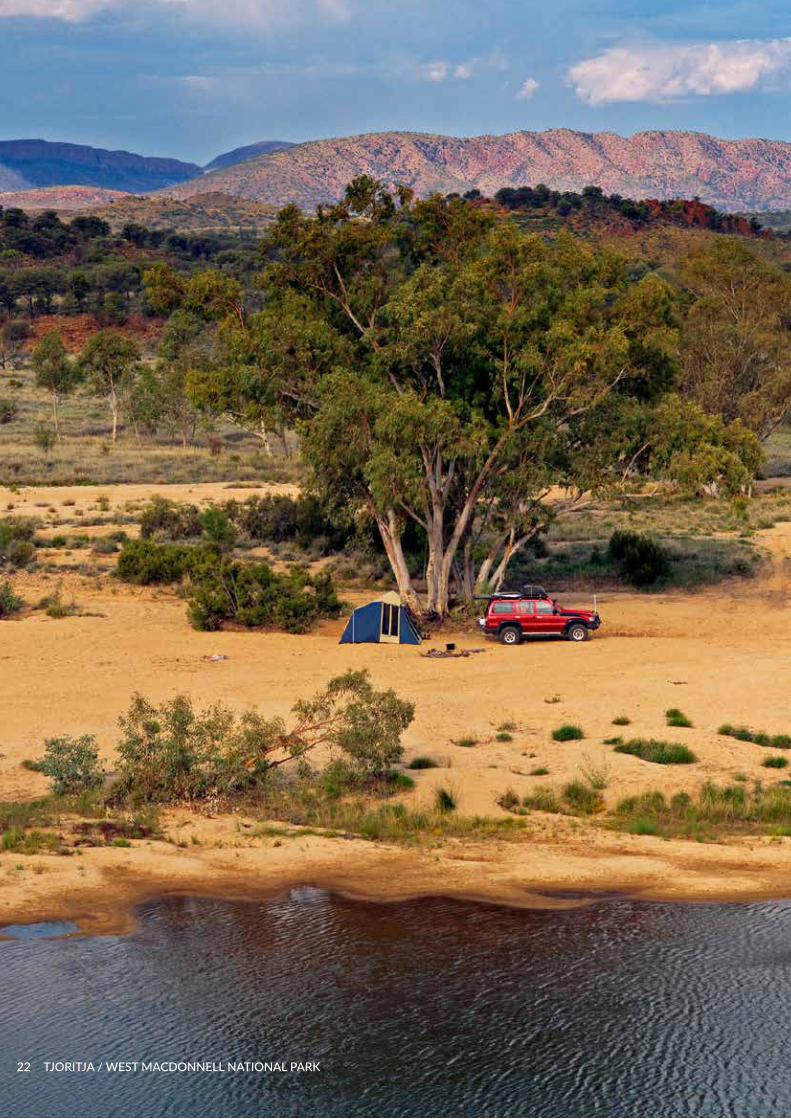
Camping in the Park is a highlight with a range of camping experiences on offer. Bush camping is by four-wheel drive access and is available at Finke Two-Mile, along the Hugh River and at Serpentine Chalet Bush camp. Basic camping facilities are provided at Serpentine Chalet and more developed camping and visitor facilities that are two-wheel drive accessible are provided at Ellery Creek Big Hole, Redbank Gorge and Ormiston Gorge.
Commercial camping is available outside the Park at Glen Helen Homestead Lodge, Standley Chasm, Hamilton Downs Youth Camp, Hermannsburg and Alice Springs.
Additional camping and accommodation options will be encouraged, either within or near the Park.
Cycling and mountain biking opportunities have been developed at the eastern end of the Park close to Alice Springs. The Simpsons Gap Bicycle Path meanders for 17 kilometres through woodland covered flats and low hills from Flynn’s Grave (on Larapinta Drive) to Simpsons Gap.
The 21 kilometre West MacDonnell Mountain Bike Trail will be part of the Alice Springs trail network, linking with the Alice Springs Telegraph Station and the Alice Springs Desert Park. Mountain bike riding is growing in popularity and the Park’s trail has been used for mountain bike events. The Partners will explore the development of new tracks and trails, including a multi-day mountain biking experience for families and / or mountain biking enthusiasts.
Swimming in natural waterholes is a hugely appealing activity for visitors to refresh and cool off, particularly in hot weather. Swimming is available for visitors at Ellery Creek Big Hole, Redbank, Ormiston, Hugh River, Finke Two Mile and Glen Helen Gorges.
The Larapinta Trail
The Larapinta Trail is an internationally renowned long distance walking trail, traversing some of the iconic attractions of the West MacDonnell Ranges and providing links to other walking tracks. Beginning at the Alice Springs Telegraph Station, the Trail passes through many gaps and sheltered gorges, climbing steeply over the rugged ranges, providing stunning views and opportunities to admire the spectacular landscape which ends at Mt Sonder, the highest point of the Trail.
The Trail has 12 stages, each a 1-2-day walk. Itineraries for visitors seeking longer walks in relative safety and comfort are also catered for. Camping is permitted for walkers at all trailheads and designated sites along the Trail.
Use of the Larapinta Trail has grown among commercial operators. Offering guided experiences and “glamping” options, visitors can participate in walking tours inclusive of safari camp style accommodation at private sites with basic facilities and meals, without having to carry a heavy backpack. The Trail is described by Australian Geographic as “one of the world’s best long distance arid zone walks”.
24 TJORITJA / WEST MACDONNELL NATIONAL PARK
Sharing Culture Market research tell us that many visitors seek authentic and engaging experiences with local Aboriginal people to learn about their lives, history and heritage, culture, lifestyle and art. Spending time with Traditional Owners fosters an appreciation of the living Aboriginal culture of Tjoritja / West MacDonnell and encourages visitors to enjoy the Park with due respect.
Some Traditional Owners are interested in the opportunities tourism can provide. Local Aranda people have the opportunity to develop their own tour operations and share their stories with visitors. This could be done through personal contact with Aboriginal guides, cultural story-telling, bush tucker tours and other cultural activities such as art and crafts. A strategic regional approach and a partnership between the tourism industry and Aboriginal communities is required to develop Aboriginal tourism products.
Understanding visitor needs It is vitally important for the Joint Management Partners to stay abreast of, and be responsive to trends in nature-based tourism and recreation. The global tourism market seeks a mix of active, adventurous, fun, exciting and unique holidays. There is real demand for immersive, life-changing experiences including interactive, authentic cultural experiences with Traditional Owners on country. Counting visitor numbers, monitoring visitor patterns and trends and measuring satisfaction is essential to inform sound planning of services, facilities and experiences.
Developing Quality Experiences The Parks and Wildlife Commission is committed to developing Visitor Experience Development Plans for its major parks, including Tjoritja. The Plan will set the direction for investing in outstanding visitor experiences and be informed by the partners, the local tourism industry and the needs and interests of the nature-based tourism market.
Objective and StrategiesManage and develop safe, sustainable and outstanding world-class experiences that connect visitors to the Park and its people.
• Develop a Visitor Experience Development Plan to identify new and improved visitor experiences that reflect visitor trends and support regional economic development. The Plan will:
» Be developed by the Partners in close collaboration with the tourism industry.
» Reflect the needs of visitors including immersive cultural experiences, unique events, accommodation, extended walks, mountain bike trails, bush camping, four-wheel driving and innovative interpretation.
» Balance cultural and environmental sustainability while providing benefits to both the Park and Traditional Owners.
» Encourage and support growth of Aboriginal tourism enterprises and cultural experiences, including joint ventures supported by the tourism industry.
» Engage the community and provide opportunities for ongoing feedback and adaptive management.
» Be reviewed every five years and as required to ensure currency with marketing trends and visitor satisfaction.
• Work collaboratively with the tourism marketing arm of the NT Government and the tourism industry to promote the Park as a “must-do” visitor destination.
• Maintain the highest standards of visitor safety with ongoing monitoring, maintenance, education and risk assessment for park facilities and visitor management practices.
• Pursue external resourcing opportunities such as tourism industry grants programs and initiatives to support the delivery of visitor experiences.
• Develop a cultural awareness and education program for tour operators, the broader tourism industry and independent travellers to encourage supportive relationships, sharing of appropriate cultural stories and Park values with visitors.
• Improve understanding of our visitors through targeted data collection and research to ensure their comfort, enjoyment and safety.
• Protect the Park’s natural character and aesthetic value and ensure that development is carefully sited and sustainably designed.
JOINT MANAGEMENT PLAN FEBRUARY 2018 25
INFORMATION SOURCESAustralia ICOMOS. (1999). The Burra Charter.
Bridges, A, and Hall, T. (1992). Historic Site Conservation Strategy Tjoritja / West MacDonnell National Park. Parks and Wildlife Commission of the Northern Territory.
Brock, C. and Healy, S. (2008). Draft Buffel Grass (Cenchrus ciliaris) Management Strategy for Tjoritja / West MacDonnell National Park.
Central Land Council. (2008). Report on the Aboriginal Land Use and Cultural Values of Tjoritja / West MacDonnell National Park. Report for the Department of Natural Resources, Environment and the Arts.
Davis, J.A., Harrington, SA., and Friend, JA. (1995). Invertebrate Communities of Relict Streams in the Arid Zone: the George Gill Range, Central Australia. Aust J. Mar Freshwater Res., 1993, 44., 483-505.
Davis, J. (1997). Conservation of Aquatic Invertebrate Communities in Central Australia. Memoirs of the Museum of Victoria. 56 (2): 491-503.
Department of Natural Resources, Environment and the Arts. Strategic Objectives (2007-2014).
Duguid, A., Brock, C. and Albrecht, D. (2008). Vascular Plants of Tjoritja / West MacDonnell National Park.
Frederick, U. K. (1997). Drawing in Differences: Changing Social contexts of Rock Art Production in Tjoritja / West MacDonnell (Kings Canyon) National Park, Central Australia. Unpublished MA Thesis, Australian National University.
Frederick, U. K. (1999). At The Centre of It All: Constructing Contact Through The Rock Art Of Tjoritja / West MacDonnell National Park, Central Australia. Archaeology in Oceania 34: 132-144.
Gregory, R., Dewar, M., Mitchell, S., Murray, D., and Murray P. (2007). The Cultural Values of the Central Ranges – A Preliminary report.
Latz, PK., Johnson, KA. & Gillam, MW. (1981). A Biological Survey of the Kings Canyon Area of the George Gill Range. Internal Report, Conservation Commission of the Northern Territory.
Pearce, H. (1985). Kings Canyon (Tjoritja / West MacDonnell) National Park - Historic Sites Assessment. Internal Report. Conservation Commission of the Northern Territory.
Pitts, B. and Matthews, D. V. (2000). Biophysical Mapping in Parks: a park management manual for Central Australia, using GIS and survey data for management support in National Parks.
Puckey, H.L., Brock, C. P. and Yates C. P. (2008). Improving the landscape scale management of Buffel Grass Cenchrus ciliaris using aerial survey, predictive modelling, and a geographic information system. Pacific Conservation Biology. Vol13, no 3.
Ross, J. (2003). Rock Art, Ritual and Relationships: An archaeological analysis of rock art from the central Australian arid zone. Unpublished PhD thesis, University of New England, Armidale.
Ross, J. (2008). Prehistory of the Tjoritja / West MacDonnell Plateau. Short Report for the Northern Territory Parks and Wildlife Service.
Sanmor Consulting Group. (2006). Red Centre Way – Draft Visitor Experience Strategy. Report for the Department of Natural Resources, Environment and the Arts.
Smith, M. A. and Rosenfeld, A. (1992). Archaeological Sites in Tjoritja / West MacDonnell National Park: The Northern Plateau Sector of the Plateau. Australian National University.
Tremblay, P. and Carson, D. (2007). Tourism and the Economic Value of Parks and Protected Areas – Tjoritja / West MacDonnell National Park, Northern Territory.
White, M., Albrecht, D., Duguid, A., Latz, P. ,and Hamilton, M. (2000). Plant species and sites of botanical significance in the southern bioregions of the Northern Territory. A report to the Australian Heritage Commission from the Arid Lands Environment Centre, Alice Springs.
Winstanley, K., and Edgoose, C. (1994). The Land Resources of Tjoritja / West MacDonnell National Park. Conservation Commission of the Northern Territory.
26 TJORITJA / WEST MACDONNELL NATIONAL PARK

JOINT MANAGEMENT PLAN FEBRUARY 2018 27

APPENDIX 1Threatened flora
SCIENTIFIC NAME COMMON NAME CONSERVATION STATUS
“EPBC Act” Cwlth*1
“TPWC Act” *2
APIACEAE Actinotus schwarzii. F.Muell.
Desert Flannel Flower VU VU
ASTERACEAE Minuria tridens (D.A.Cooke) Lander.
Minnie Daisy VU VU
ASTERACEAE Olearia macdonnellensis D.A.Cooke.
(A daisy) EN VU
CYPERACEAE Carex fascicularis Sol. ex Boott.
- - VU
EUPHORBIACEAE Ricinocarpos gloria-medii J.H.Willis.
Glory-of-the-Centre VU NT
PTERIDACEAE Adiantum capillus-veneris L.
Venus-Hair Fern - VU
LAMIACEAE Prostanthera schultzii F.Muell. ex Tate.
- VU VU
MYRTACEAE Babingtonia behrii (Schltdl.) A.R.Bean.
- - VU
RANUNCULACEAE Clematis decipiens H.Eichler ex Jeanes.
- - VU
ZAMIACEAE Macrozamia macdonnellii (F.Muell. ex Miq.) A.DC.
MacDonnell Ranges Cycad VU NT
As at July 2017 there are approximately 700 Flora species recorded in Tjoritja / West MacDonnell National Park. For a complete list refer to NR Maps: www.nrmaps.nt.gov.au/
28 TJORITJA / WEST MACDONNELL NATIONAL PARK

APPENDIX 2Threatened fauna
SCIENTIFIC NAME COMMON NAME CONSERVATION STATUS
“EPBC Act” Cwlth*1
“TPWC Act” *2
Zyzomys pedunculatus Central Rock-rat EN EN
Petrogale lateralis Black-footed rock wallaby, VU NT
Polytelis alexandrae Princess Parrot VU VU
Croitana aestiva Desert Sand Skipper EN -
Liopholis slateri Slater’s Skink EN VU
Trichosurus vulpecula vulpecula Common Brushtail Possum - EN
Chalmydogobius japalpa Finke Goby - VU
Bothriembryon spenceri Bulimulidae Land Snail - VU
Semotrachia winneckiana Camaenidae Land Snail - VU
Semotrachia elleryi Camaenidae Land Snail - VU
Semotrachia runutjirbana Camaenidae Land Snail - VU
Species no longer occurring in the MAC Bioregion: Cinclosoma castaneothorax marginatum - Chestnut-breasted Quail-thrush, Leipoa ocellata - Malleefowl, Pezoporus occidentalis - Night Parrot, Erythrotriorchis radiatus - Red Goshawk, Dasycercus blythi– Brush-tailed Mulgara, Isoodon auratus auratus - Golden Bandicoot, Lagorchestes conspicillatus leichardti - Spectacled Hare-wallaby, Macroderma gigas - Ghost Bat, Macrotis lagotis - Greater Bilby, Rattus tunneyi - Pale Field-rat, Liopholis Kintorei - Great Desert Skink.
Nationally extinct, extinct in the NT, or extinct in the wild, fauna which once occurred in the MAC Bioregion (cultural significance): Bettongia lesueur graii (inland) - Burrowing Bettong, Bettongia penicillata - Brush-tailed Bettong, Chaeropus ecaudatus -Pig-footed Bandicoot, Dasyurus geoffroi geoffroi -Western Quoll, Lagorchestes asomatus - Central Hare-wallaby, Lagorchestes hirsutus (central mainland form) - Rufous Hare-wallaby or Mala, Leporillus apicalis - Lesser Stick-nest Rat, Macrotis leucura - Lesser Bilby, Myrmecobius fasciatus – Numbat, Notomys amplus - Short-tailed Hopping-mouse, Notomys longicaudatus - Long-tailed Hopping-mouse, Onychogalea lunata - Crescent Nailtail Wallaby, Perameles eremiana - Desert Bandicoot, Phascogale calura- Red-tailed Phascogale, Pseudomys fieldi - Alice Springs Mouse, Amytornis modestus modestus - Thick-billed Grasswren (MacDonnell Ranges subsp.).
July 2017 there are 279 recorded fauna species in Tjoritja / West MacDonnell National Park. For the complete records refer to NR Maps: www.nrmaps.nt.gov.au/
*1 Environment Protection and Biodiversity Conservation Act (Commonwealth)
EN – Endangered VU – Vulnerable CR – Critically Endangered
*2 Territory Parks and Wildlife Conservation Act (Northern Territory)
VU – Vulnerable EN - Endangered EX – Extinct NT – Near Threatened
JOINT MANAGEMENT PLAN FEBRUARY 2018 29
WWW.DTC.NT.GOV.AU
30 TJORITJA / WEST MACDONNELL NATIONAL PARK