Embed Size (px)
DESCRIPTION
In this mapping assignment for my Visual Rhetoric and Multimodal Composition graduate course I asked former residents, friends, and girlfriends to map the duplex they spent time in during the 2009-2010 academic year.
Citation preview
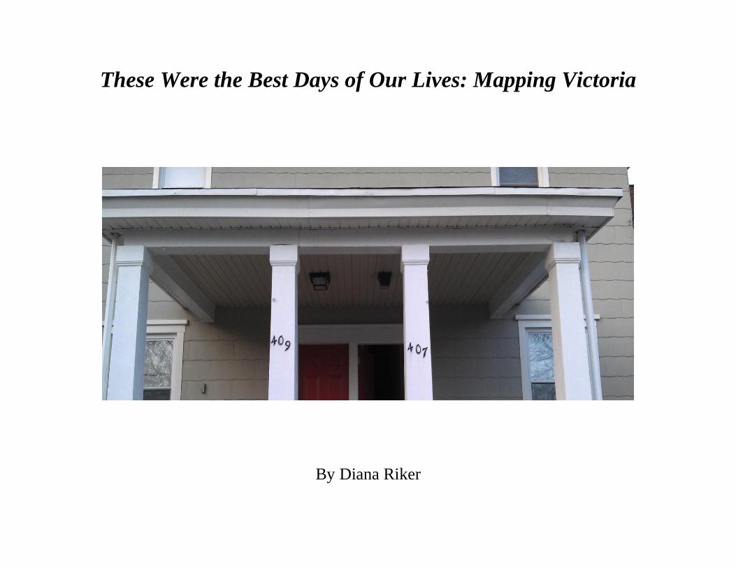
These Were the Best Days of Our Lives: Mapping Victoria
By Diana Riker
In Denis Wood’s book, Everything Sings: Maps for a Narrative Atlas, he asserts that “Denied by science, resisted by modern
art, the narrative reading is inescapable. Make the most of it!” (11). He then applies this notion to a variety of texts, specifically maps,
which he believes can be used to tell a story about a place. He demonstrates this through the multiple maps that he constructs of
Boylan Heights, a neighborhood in North Carolina. His maps create a narrative of the area, revealing the qualities of its location and
its inhabitants. I sought to create my own narrative atlas through the location that I chose and the time period in which I specified.
In June of 2009 my boyfriend Mike and five other males moved into a duplex in Glassboro, home of Rowan University, on
Victoria St. Three males on lived on each side of the house. The sides were known by their house numbers, 407 and 409. Both sides
maintained an open door policy and people were constantly walking into each other’s sides. Only one side of the house, 409, had a
television, so people usually congregated in that living room. Friends were constantly over and four of the guys had girlfriends, two of
whom (including myself), practically lived there as well. Upon undergraduate graduation in May 2010 three of the guys moved out of
the house. Two (Mike included) stayed for graduate school and one still had another year left of undergraduate. Since two of the
remaining three lived on the 407 side of the duplex Mike moved over to that side and the other side was rented to other people.
I asked all six of the occupants of the Victoria Street duplex along with two friends and two girlfriends (including myself) to
draw maps of the house as they remembered it. Using the work of Sean Hall, Denis Wood, and Peter Turchi in the discussion that
follows, I examine how the creators or cartographers of these maps form a narrative based on their selection of objects, labels, and
descriptions. I also seek to analyze how these choices facilitate the transmission of the maps’ many messages. This investigation also
seeks to demonstrate how the details in the maps give readers a sense of what the house appeared like, what had transpired within it,
and of the creators themselves. Through the maps the reader can detect a yearning for a past college life, filled with friends and time
spent with one another.
The creation of the maps elicited a nostalgic response from many of those who participated, as well as a determination to
represent the house correctly. The subjective viewpoints of the creators belied their personal connections to the place. It is essential for
readers to acknowledge the subjectivity of the maps as a result of the creators’ personal bias and their familiarity with the house. As
Wood states “After all, objectivity does not consist in suppressing an unavoidable subjectivity. It is achieved by acknowledging its
intrusion so that the reader is relieved of the necessity of ferreting it out” (11, Sings). Reading with an awareness of the map creators’
connections to this place facilitates a deeper understanding of the map as a narrative.
The maps themselves provide guides as to what the duplex was like during the 2009-2010 school year. However, much
attention must be paid to what the cartographers have chosen to include. As Peter Turchi explains in his chapter, “Metaphor of the
Map”, “We must recognize, too, how the unavoidable act of selectivity affects the map” (88). The objects that the cartographers of the
Victoria Street duplex chose to include were selected because they were deemed important to the creators. They made an impact on
their time spent there and reflect their opinions of the place. Their selections transform the map into a subjective narrative, which tells
a story of both the creator and the residence itself. Turchi asserts that “This is why it’s important for all of us realists, damned by that
word ‘conventional,' to remember, always, that we have chosen a particular projection—one that seems to minimize distortion and to
speak powerfully. This is our choice (90). These cartographers or senders have made deliberate choices in their map creation in order
to achieve clarity in the transmission of their maps to the receivers.
All of the maps exhibited the type of rule following that Sean Hall explains in his book This Means This, This Means That: A
User’s Guide to Semiotics in their creation. Even though some of the maps only included certain parts of the house, all of the creators
used the stereotypical floor plan style when constructing them. Their decision to use this stereotype supports Hall’s assertion that are
success in following rules “depends on hidden assumptions, social customs, cultural norms, kinds of conformity, forms of training,
traditions of use, and educated propensities” (126). The creator’s use of the stereotypical aerial floor plan shows their familiarity with
this form in various other mapping examples such as blue prints of houses or floor maps that one might see at a mall. Individuals
mimic what they see in order to effectively communicate their message to the receiver.
Though all of the cartographers used the common floor plan in their map, there were variations in its presentation. Mike used
two sheets of paper, front and back, using a side for each floor. Jason S. put both floors on one sheet of paper. The concern he
expressed to me about his map being to scale is probably due to his engineering background.
Casey, Dan, Devyn, and Jason V. used one a separate side or sheet of paper for the upstairs and the downstairs of the house.
Traci, Jason S., Kenny, James, and I drew the entire map on one side of a page. Eight of the map creators drew their maps vertically.
This could be due to the fact that the floor space in a duplex is narrow but extends far back to the end of the house. Traci and I were
the only one who drew the house horizontally. However, Traci chose to place the front entrance at the top of her page whereas I placed
it on the bottom.
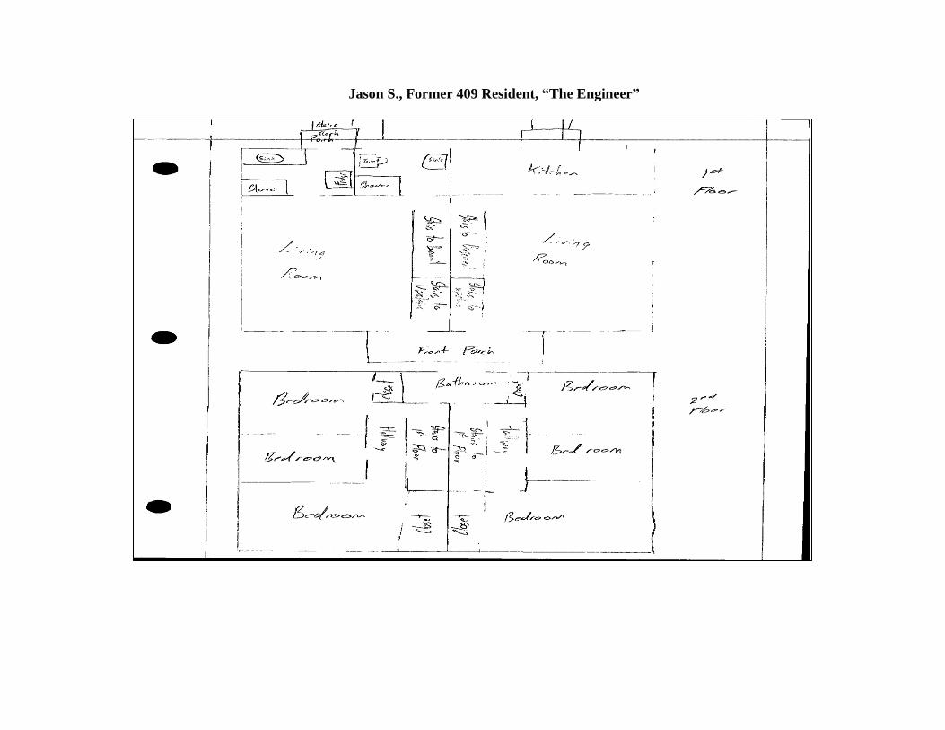
Jason S., Former 409 Resident, “The Engineer”
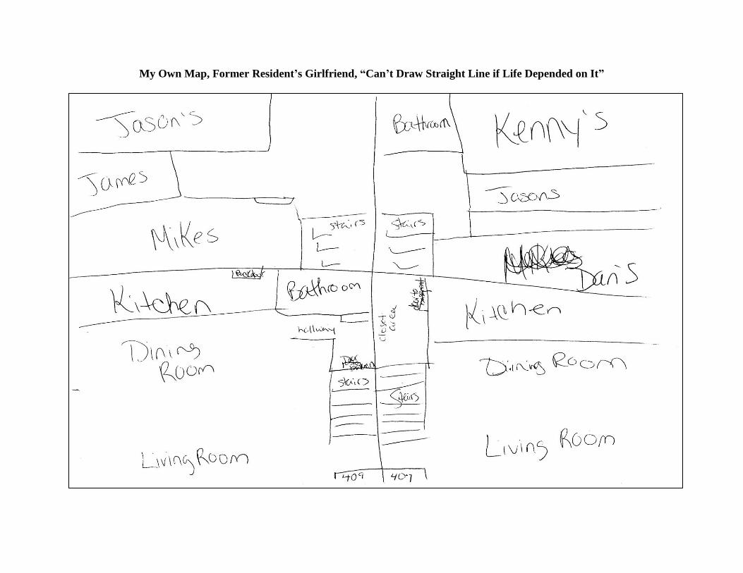
My Own Map, Former Resident’s Girlfriend, “Can’t Draw Straight Line if Life Depended on It”
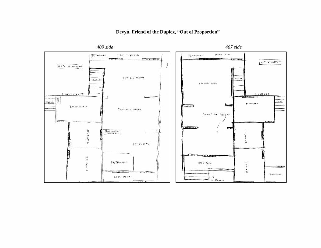
Devyn, Friend of the Duplex, “Out of Proportion”
409 side 407 side
All but one of the map cartographers split the sides and levels of the duplex by using distinct lines, different sides of the paper,
or in James’ case different rectangles. Devyn’s map was the only one in which the upstairs of the house was not proportional to the
downstairs of the house.
The creators of the maps used common symbols for areas and objects in the house. A rectangle represented doors. An oval
represented a table. Readers can recognize these images as such because they are aware that they are looking at a map of a house
which, as stated before, usually uses an aerial floor plan. These representations of furniture and readers’ identification of them
encompass Hall’s idea that the description of a place determines readers’ viewer position and subsequent interpretation of an image
(76).
The symbols that these cartographers used in their maps must follow a code in order for them to be understood. The choices
that the creators made in their drawings supports the idea of a code that Wood discusses in his chapter, “The Interest is Embodied in
the Map in Signs and Myths”. Wood asserts that “all meaning, all significance derives from codes, all intelligibility depends on them”
(108). The creators of these maps used an inherent code to render their maps intelligible to the receivers of them. This adherence to the
code can be seen in the depiction of the dinner table in the maps. The table is not labeled in all but one of the maps. However, all of
the cartographers chose to label the ping pong table which once occupied most of the living room and dining room in 407. It can be
surmised that the cartographers made this decision because a dinner table is easily recognizable in a house, especially in the dining
area, whereas a ping pong table is not commonly located there. An example of this distinction is shown in Kenny’s map. Kenny
simply drew an oval with four slanted lines around it to represent chairs to signify the table in 409, but in 407 he labeled the ping pong
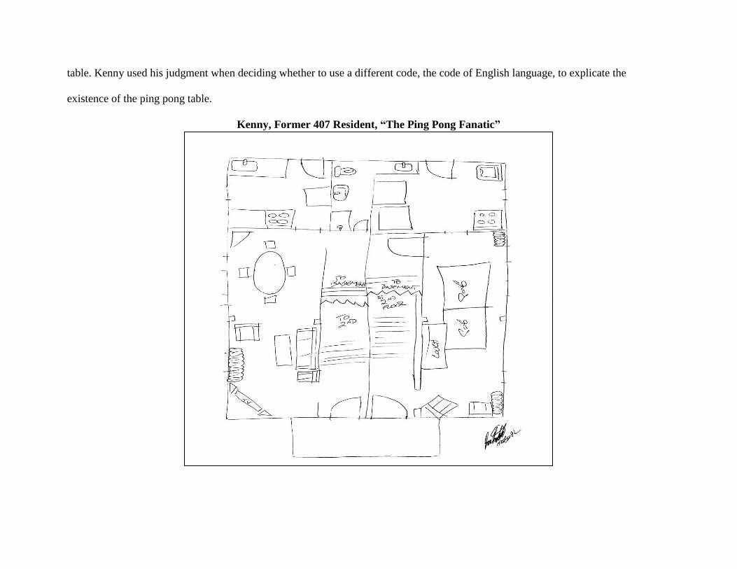
table. Kenny used his judgment when deciding whether to use a different code, the code of English language, to explicate the
existence of the ping pong table.
Kenny, Former 407 Resident, “The Ping Pong Fanatic”
If the senders or creators of the map did not feel that their images or symbols would be interpreted correctly by the reader or
receivers they added text to support them, such as in the case of the ping pong table. These cartographers wanted to avoid noise in
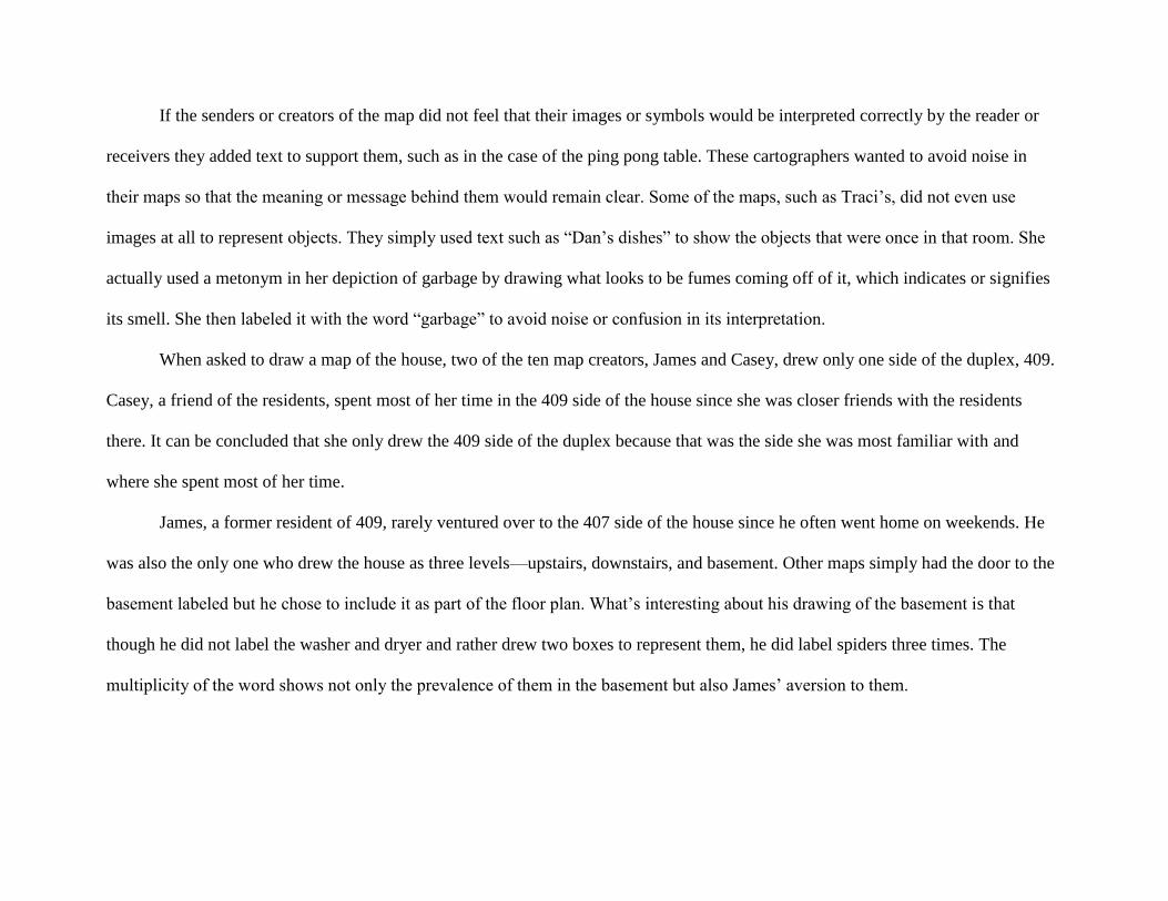
their maps so that the meaning or message behind them would remain clear. Some of the maps, such as Traci’s, did not even use
images at all to represent objects. They simply used text such as “Dan’s dishes” to show the objects that were once in that room. She
actually used a metonym in her depiction of garbage by drawing what looks to be fumes coming off of it, which indicates or signifies
its smell. She then labeled it with the word “garbage” to avoid noise or confusion in its interpretation.
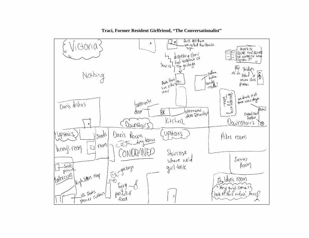
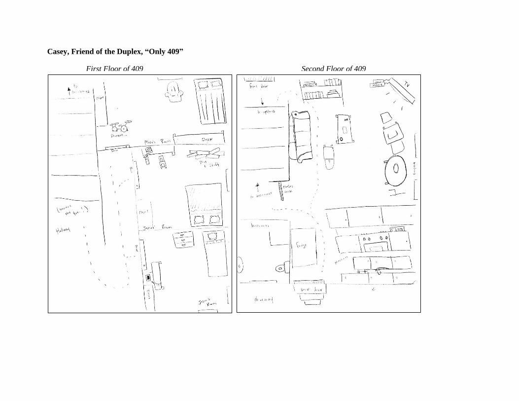
When asked to draw a map of the house, two of the ten map creators, James and Casey, drew only one side of the duplex, 409.
Casey, a friend of the residents, spent most of her time in the 409 side of the house since she was closer friends with the residents
there. It can be concluded that she only drew the 409 side of the duplex because that was the side she was most familiar with and
where she spent most of her time.
James, a former resident of 409, rarely ventured over to the 407 side of the house since he often went home on weekends. He
was also the only one who drew the house as three levels—upstairs, downstairs, and basement. Other maps simply had the door to the
basement labeled but he chose to include it as part of the floor plan. What’s interesting about his drawing of the basement is that
though he did not label the washer and dryer and rather drew two boxes to represent them, he did label spiders three times. The
multiplicity of the word shows not only the prevalence of them in the basement but also James’ aversion to them.
Traci, Former Resident Girlfriend, “The Conversationalist”
Casey, Friend of the Duplex, “Only 409”
First Floor of 409 Second Floor of 409
James, Former 409 Resident, “Arachnophobia”
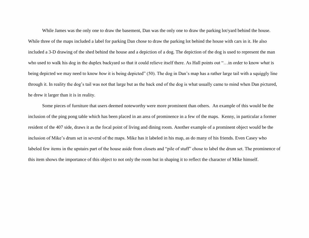
While James was the only one to draw the basement, Dan was the only one to draw the parking lot/yard behind the house.
While three of the maps included a label for parking Dan chose to draw the parking lot behind the house with cars in it. He also
included a 3-D drawing of the shed behind the house and a depiction of a dog. The depiction of the dog is used to represent the man
who used to walk his dog in the duplex backyard so that it could relieve itself there. As Hall points out “…in order to know what is
being depicted we may need to know how it is being depicted” (50). The dog in Dan’s map has a rather large tail with a squiggly line
through it. In reality the dog’s tail was not that large but as the back end of the dog is what usually came to mind when Dan pictured,
he drew it larger than it is in reality.
Some pieces of furniture that users deemed noteworthy were more prominent than others. An example of this would be the
inclusion of the ping pong table which has been placed in an area of prominence in a few of the maps. Kenny, in particular a former
resident of the 407 side, draws it as the focal point of living and dining room. Another example of a prominent object would be the
inclusion of Mike’s drum set in several of the maps. Mike has it labeled in his map, as do many of his friends. Even Casey who
labeled few items in the upstairs part of the house aside from closets and “pile of stuff” chose to label the drum set. The prominence of
this item shows the importance of this object to not only the room but in shaping it to reflect the character of Mike himself.

Dan, Former 407 Resident, “Dog Lover”
First Floor, both sides of house Second Floor, both sides of house
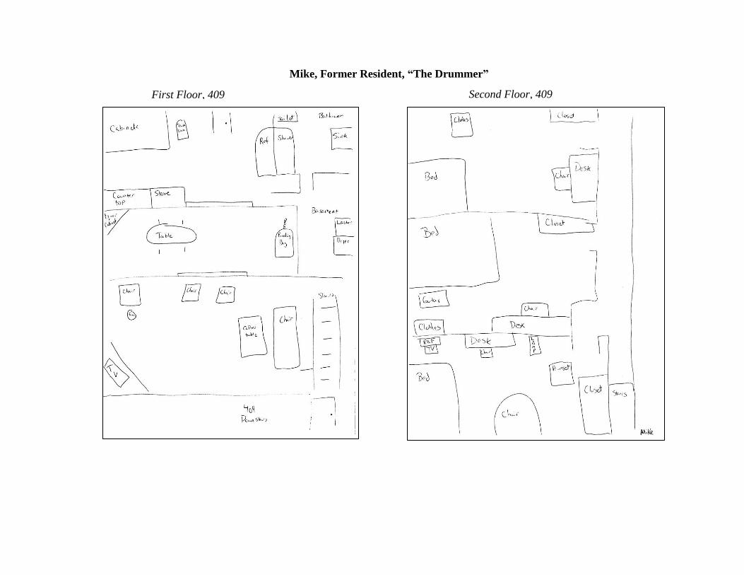
Mike, Former Resident, “The Drummer”
First Floor, 409 Second Floor, 409
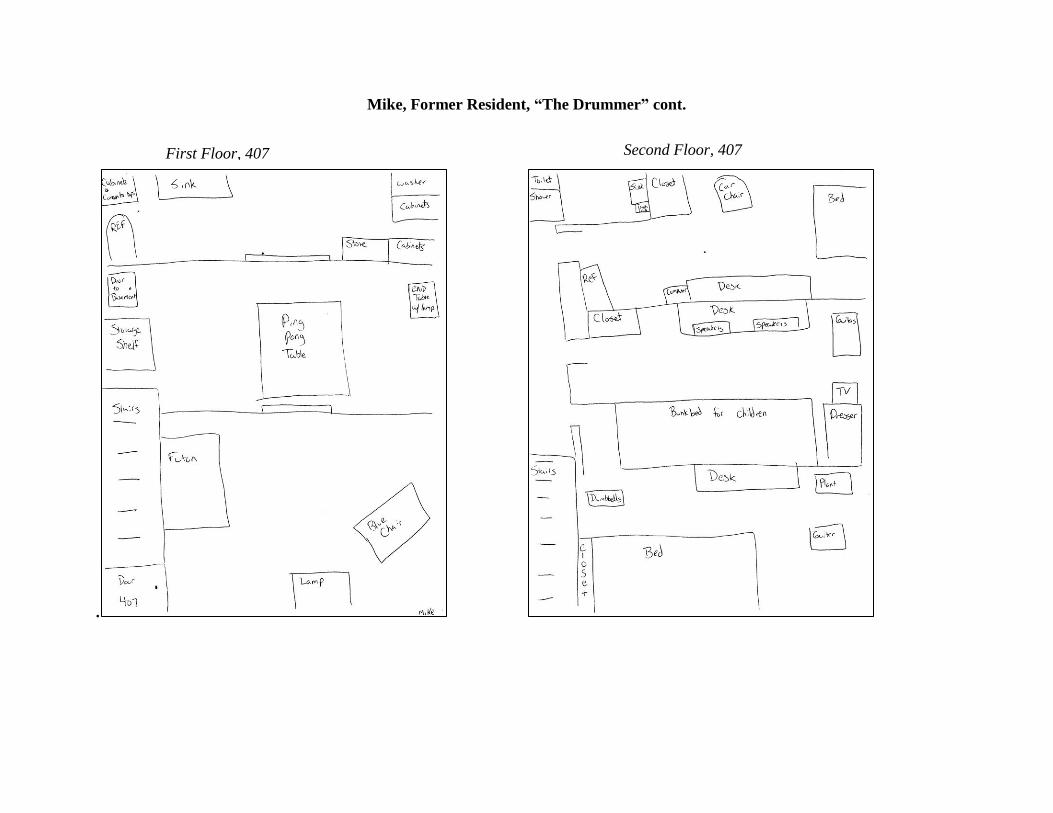
Mike, Former Resident, “The Drummer” cont.
.
First Floor, 407 Second Floor, 407
The attention to detail in the maps reveals the life that was once lived behind those walls. While some, like myself, focused on
just simply identifying where rooms were located, others told a story about the house through narrations and labels that accompanied
rooms and furniture. One creator, Traci, even included dialogue in her map in addition to her labels of rooms and furniture to transmit
a message about the former residents of the house. For instance in Jason S.’s room, or Sheldon’s as she labels it, she drew a stick
figure with a dialogue blurb exclaiming “Hey guys come look at this video!” This is in reference to the fact that the resident
continually found videos online and beckoned those in the house to come look at it. The dialogue and labels that Traci and other
creators like Jason V. uses is intended to remind viewers or receivers of inside jokes and particular items, such as Skull vodka or the
shower curtain that had a picture of the United States on it, that were important in the past. It can be assumed that Traci intended those
who had previous knowledge of the house, such as myself, to be the receivers of her map’s message.
The intention of some of the maps, including Traci’s, was humor as well. In Jason V’s he chose to identify pieces of furniture
and items in the house with labels describing how he saw them. His desk is labeled “big executive desk” because that’s how he saw
the rather large desk he once had while another desk, Mike’s, is labeled “middle management desk” since it was smaller. He even
chose to include descriptions of couches to inject humor such as “God awful couch” and “shitty couch." If receivers were unaware that
Jason V. was a former resident of this house they might believe that his descriptions of it are unkind because as Hall explains our
judgments are influenced by what we believe is the intention behind a message (22). However, the fact that we know Jason V. once
lived in this house, two years, allows us to make the assumption that his intention in his labels was humorous rather than malicious on
the basis that he had first-hand knowledge of its inhabitants.
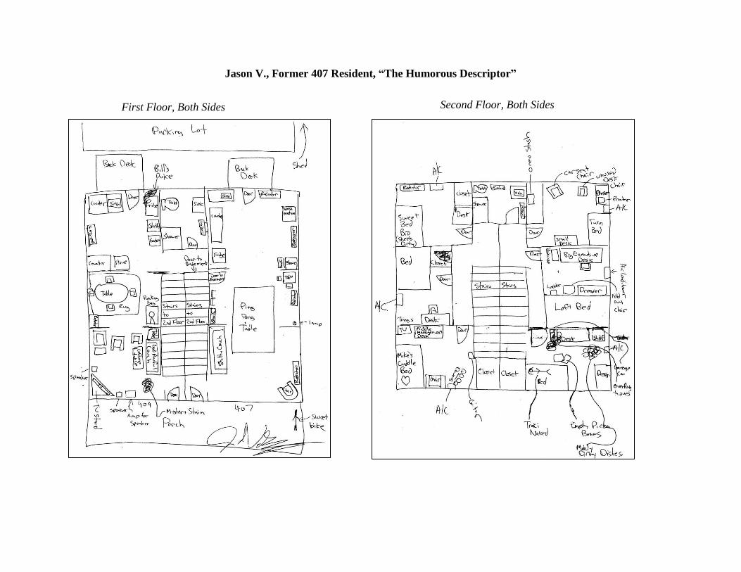
Jason V., Former 407 Resident, “The Humorous Descriptor”
First Floor, Both Sides Second Floor, Both Sides
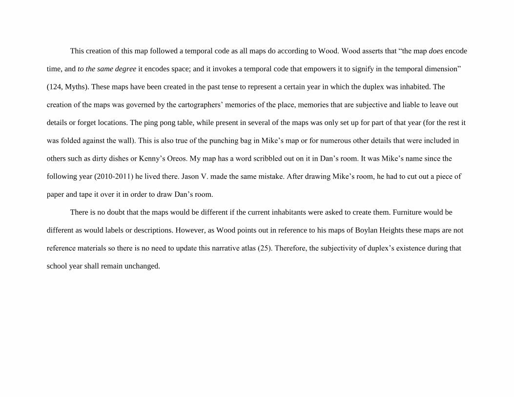
This creation of this map followed a temporal code as all maps do according to Wood. Wood asserts that “the map does encode
time, and to the same degree it encodes space; and it invokes a temporal code that empowers it to signify in the temporal dimension”
(124, Myths). These maps have been created in the past tense to represent a certain year in which the duplex was inhabited. The
creation of the maps was governed by the cartographers’ memories of the place, memories that are subjective and liable to leave out
details or forget locations. The ping pong table, while present in several of the maps was only set up for part of that year (for the rest it
was folded against the wall). This is also true of the punching bag in Mike’s map or for numerous other details that were included in
others such as dirty dishes or Kenny’s Oreos. My map has a word scribbled out on it in Dan’s room. It was Mike’s name since the
following year (2010-2011) he lived there. Jason V. made the same mistake. After drawing Mike’s room, he had to cut out a piece of
paper and tape it over it in order to draw Dan’s room.
There is no doubt that the maps would be different if the current inhabitants were asked to create them. Furniture would be
different as would labels or descriptions. However, as Wood points out in reference to his maps of Boylan Heights these maps are not
reference materials so there is no need to update this narrative atlas (25). Therefore, the subjectivity of duplex’s existence during that
school year shall remain unchanged.
Works Cited
Hall, Sean. This Means This, This Means That: A User’s Guide to Semiotics. London: Lawrence King, 2007. Print.
Turchi, P. Maps of the Imagination: The Writer as Cartographer. San Antonio, TX: Trinity University Press, 2004. 73-98. PDF.
Wood, D. “The Interest is Embodied in the Map in Signs and Myths”. The Power of Maps, New York: The Guilford Press, 1992. 95-
142. PDF.
Wood, D. Everything Sings. Los Angeles, CA: Siglio, 2010. 8-26. PDF.