Embed Size (px)
Citation preview
Walking Tube in Central London | Cross River Partnership 1
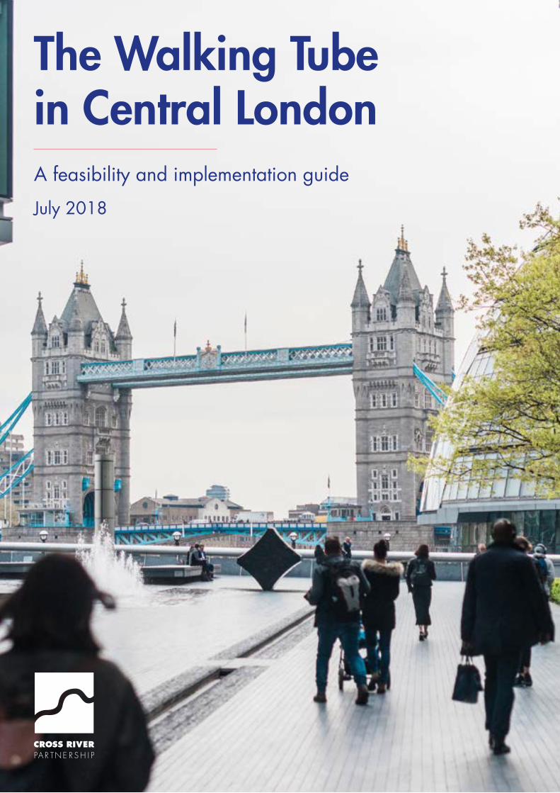
The Walking Tube in Central LondonA feasibility and implementation guide
July 2018
Walking Tube in Central London | Cross River Partnership2
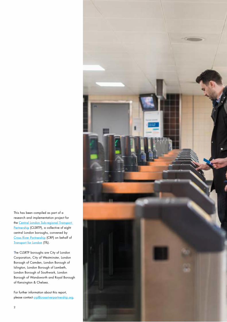
This has been compiled as part of a
research and implementation project for
the Central London Sub-regional Transport
Partnership (CLSRTP), a collective of eight
central London boroughs, convened by
Cross River Partnership (CRP) on behalf of
Transport for London (TfL).
The CLSRTP boroughs are City of London
Corporation, City of Westminster, London
Borough of Camden, London Borough of
Islington, London Borough of Lambeth,
London Borough of Southwark, London
Borough of Wandsworth and Royal Borough
of Kensington & Chelsea.
For further information about this report,
please contact [email protected].
Walking Tube in Central London | Cross River Partnership 3
Executive summary .................................................................................................. 04
Introduction ............................................................................................................ 06
Benefits of ‘walking tube’ interventions ........................................................................ 08
Changing perceptions .............................................................................................. 12
Walking Tube Link Examples ..................................................................................... 14
Example 1: City of London/Chancery Lane area .......................................................... 15
Example 2: Paddington-Euston corridor ....................................................................... 16
Example 3: Waterloo-Elephant & Castle-London Bridge triangle ...................................... 16
Walking Tube Intervention Types ................................................................................ 18
Promoting out of station interchanges ......................................................................... 20
Low Pollution Walking Routes .................................................................................... 24
Tranquil Places and Street Types ................................................................................ 26
Working with local Business Improvement Districts (BIDs) ............................................... 28
Bringing existing lines above ground .......................................................................... 30
Wayfinding ............................................................................................................. 32
Deciding what to sign .............................................................................................. 34
Colour coded street furniture ..................................................................................... 35
Engage. Animate. Transform (E.A.T.) .......................................................................... 35
Legible London ........................................................................................................ 36
Station signage ....................................................................................................... 36
Public Art & Culture ................................................................................................. 37
Wayfinding technology ............................................................................................ 37
Next Steps for the Walking Tube ................................................................................ 38
Step by step guide ................................................................................................... 39
Sources and Further Reading ..................................................................................... 40
Maps ..................................................................................................................... 42
Contents
Walking Tube in Central London | Cross River Partnership4
Executive summary
Cross River Partnership has been commissioned by the Central London Sub-regional Transport Partnership (CLSRTP), a collective of transport officers from central London’s eight local authorities, to undertake a study into promoting walking as a means to alleviate an overcrowded and heavily used tube network. The CLSRTP boroughs are City of London Corporation, City of Westminster, London Borough of Camden, London Borough of Islington, London Borough of Lambeth, London Borough of Southwark , London Borough of Wandsworth and Royal Borough of Kensington & Chelsea.
The main objective of this study is to provide a palette of interventions that promote the ‘walking tube’ approach, promoting walking between some of the busiest tube stations in central London to alleviate overcrowding.
The interventions range from changing perceptions of the network to using wayfinding technology to encourage walking trips. These identified interventions will be shared with the CLSRTP borough partners, Transport for London, Business Improvement Districts (BID), town centre managers and other interested parties that could lead on delivering on these interventions.
A recent TfL study showed that 3.6 million of the 13 million trips made using motorised modes could be walked, at least in part. The potential health benefits delivered by London’s streets go beyond the physical activity that people get from walking in the city. For further information, contact
Walking Tube in Central London | Cross River Partnership 5
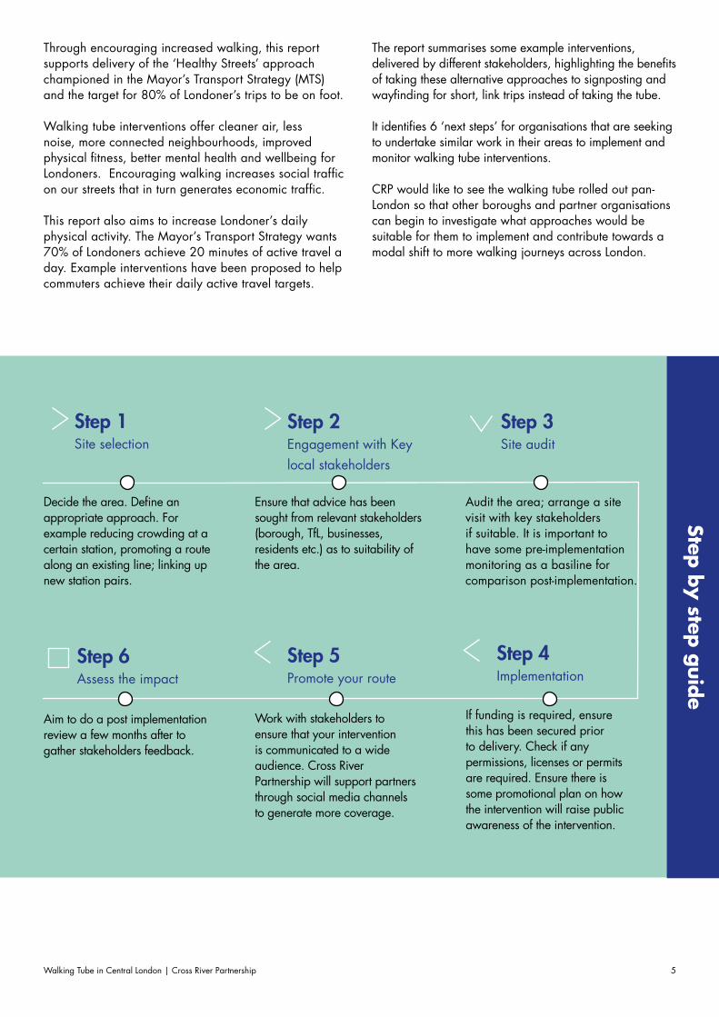
Through encouraging increased walking, this report supports delivery of the ‘Healthy Streets’ approach championed in the Mayor’s Transport Strategy (MTS) and the target for 80% of Londoner’s trips to be on foot.
Walking tube interventions offer cleaner air, less noise, more connected neighbourhoods, improved physical fitness, better mental health and wellbeing for Londoners. Encouraging walking increases social traffic on our streets that in turn generates economic traffic.
This report also aims to increase Londoner’s daily physical activity. The Mayor’s Transport Strategy wants 70% of Londoners achieve 20 minutes of active travel a day. Example interventions have been proposed to help commuters achieve their daily active travel targets.
The report summarises some example interventions, delivered by different stakeholders, highlighting the benefits of taking these alternative approaches to signposting and wayfinding for short, link trips instead of taking the tube.
It identifies 6 ‘next steps’ for organisations that are seeking to undertake similar work in their areas to implement and monitor walking tube interventions.
CRP would like to see the walking tube rolled out pan-London so that other boroughs and partner organisations can begin to investigate what approaches would be suitable for them to implement and contribute towards a modal shift to more walking journeys across London.
Step 2 Engagement with Key local stakeholders
Step 5 Promote your route
Step 3 Site audit
Step 1 Site selection
Step b
y step g
uide
Decide the area. Define an appropriate approach. For example reducing crowding at a certain station, promoting a route along an existing line; linking up new station pairs.
Ensure that advice has been sought from relevant stakeholders (borough, TfL, businesses, residents etc.) as to suitability of the area.
Work with stakeholders to ensure that your intervention is communicated to a wide audience. Cross River Partnership will support partners through social media channels to generate more coverage.
Audit the area; arrange a site visit with key stakeholders if suitable. It is important to have some pre-implementation monitoring as a basiline for comparison post-implementation.
Step 4 Implementation
If funding is required, ensure this has been secured prior to delivery. Check if any permissions, licenses or permits are required. Ensure there is some promotional plan on how the intervention will raise public awareness of the intervention.
Step 6 Assess the impact
Aim to do a post implementation review a few months after to gather stakeholders feedback.
Walking Tube in Central London | Cross River Partnership6
Introduction
In central London, over 100 journeys between underground stations are actually quicker when made on foot compared to other modes1.
In addition, walking is a great way of exploring London.
Walking makes it easier for visitors, workers and residents to visit businesses, reduce exposure to air pollution and keep them fit and healthy.
Walking Tube in Central London | Cross River Partnership 7
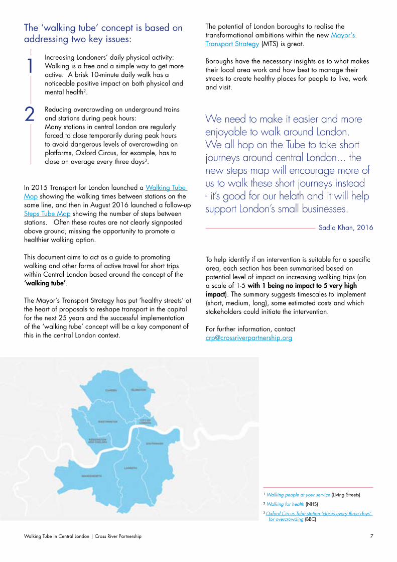
The ‘walking tube’ concept is based on addressing two key issues:
Increasing Londoners’ daily physical activity:Walking is a free and a simple way to get more active. A brisk 10-minute daily walk has a noticeable positive impact on both physical and mental health2.
Reducing overcrowding on underground trains and stations during peak hours:Many stations in central London are regularly forced to close temporarily during peak hours to avoid dangerous levels of overcrowding on platforms, Oxford Circus, for example, has to close on average every three days3.
In 2015 Transport for London launched a Walking Tube Map showing the walking times between stations on the same line, and then in August 2016 launched a follow-up Steps Tube Map showing the number of steps between stations. Often these routes are not clearly signposted above ground; missing the opportunity to promote a healthier walking option. This document aims to act as a guide to promoting walking and other forms of active travel for short trips within Central London based around the concept of the ‘walking tube’.
The Mayor’s Transport Strategy has put ‘healthy streets’ at the heart of proposals to reshape transport in the capital for the next 25 years and the successful implementation of the ‘walking tube’ concept will be a key component of this in the central London context.
1 Walking people at your service (Living Streets)
2 Walking for health (NHS)
3 Oxford Circus Tube station ‘closes every three days’ for overcrowding (BBC)
1
2 We need to make it easier and more enjoyable to walk around London. We all hop on the Tube to take short journeys around central London... the new steps map will encourage more of us to walk these short journeys instead - it’s good for our helath and it will help support London’s small businesses.
Sadiq Khan, 2016
The potential of London boroughs to realise the transformational ambitions within the new Mayor’s Transport Strategy (MTS) is great.
Boroughs have the necessary insights as to what makes their local area work and how best to manage their streets to create healthy places for people to live, work and visit.
To help identify if an intervention is suitable for a specific area, each section has been summarised based on potential level of impact on increasing walking trips (on a scale of 1-5 with 1 being no impact to 5 very high impact). The summary suggests timescales to implement (short, medium, long), some estimated costs and which stakeholders could initiate the intervention.
For further information, [email protected]
Walking Tube in Central London | Cross River Partnership8
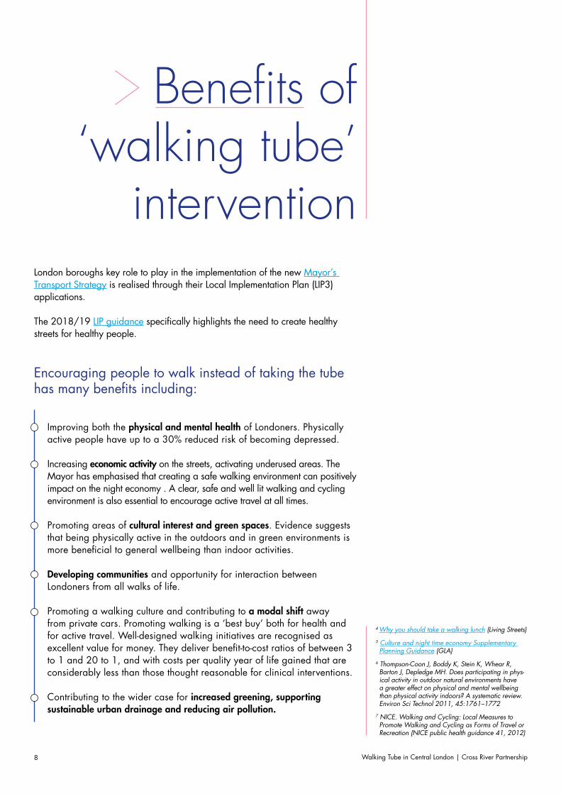
Benefits of ‘walking tube’
interventionLondon boroughs key role to play in the implementation of the new Mayor’s Transport Strategy is realised through their Local Implementation Plan (LIP3) applications.
The 2018/19 LIP guidance specifically highlights the need to create healthy streets for healthy people.
Encouraging people to walk instead of taking the tube has many benefits including:
Improving both the physical and mental health of Londoners. Physically active people have up to a 30% reduced risk of becoming depressed.
Increasing economic activity on the streets, activating underused areas. The Mayor has emphasised that creating a safe walking environment can positively impact on the night economy . A clear, safe and well lit walking and cycling environment is also essential to encourage active travel at all times.
Promoting areas of cultural interest and green spaces. Evidence suggests that being physically active in the outdoors and in green environments is more beneficial to general wellbeing than indoor activities.
Developing communities and opportunity for interaction between Londoners from all walks of life.
Promoting a walking culture and contributing to a modal shift away from private cars. Promoting walking is a ‘best buy’ both for health and for active travel. Well-designed walking initiatives are recognised as excellent value for money. They deliver benefit-to-cost ratios of between 3 to 1 and 20 to 1, and with costs per quality year of life gained that are considerably less than those thought reasonable for clinical interventions.
Contributing to the wider case for increased greening, supporting sustainable urban drainage and reducing air pollution.
4 Why you should take a walking lunch (Living Streets)
5 Culture and night time economy Supplementary Planning Guidance (GLA)
6 Thompson-Coon J, Boddy K, Stein K, Whear R, Barton J, Depledge MH. Does participating in phys-ical activity in outdoor natural environments have a greater effect on physical and mental wellbeing than physical activity indoors? A systematic review. Environ Sci Technol 2011, 45:1761–1772
7 NICE. Walking and Cycling: Local Measures to Promote Walking and Cycling as Forms of Travel or Recreation (NICE public health guidance 41, 2012)
Walking Tube in Central London | Cross River Partnership 9
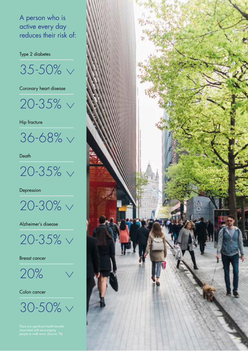
There are significant health benefits associated with encouraging people to walk more. (Source: TfL)
A person who is active every day reduces their risk of:
20 -35%Death
35 -50%Type 2 diabetes
20 -35%Coronary heart disease
36 - 68%Hip fracture
30 -50%Colon cancer
20 -30%Depression
20 -35%Alzheimer’s disease
20%Breast cancer
Walking Tube in Central London | Cross River Partnership10
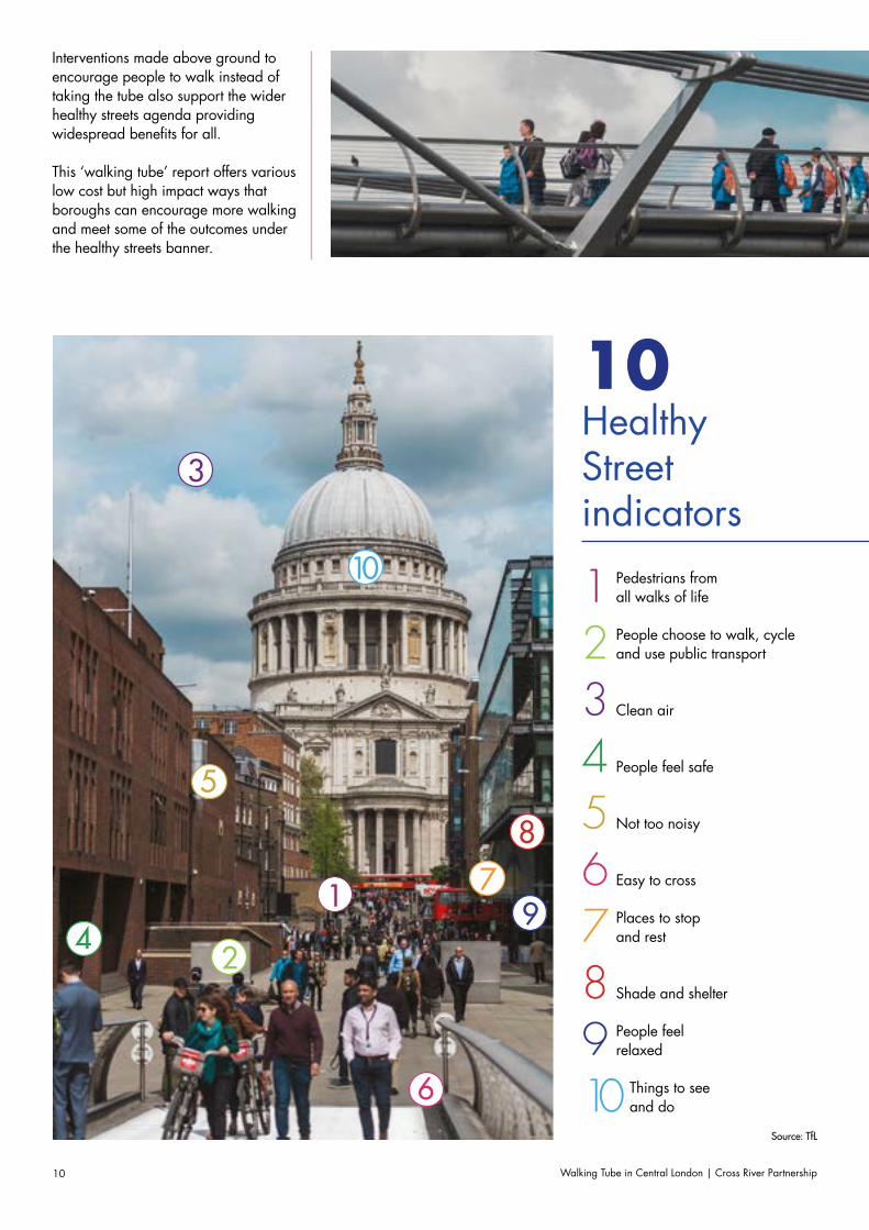
Interventions made above ground to encourage people to walk instead of taking the tube also support the wider healthy streets agenda providing widespread benefits for all.
This ‘walking tube’ report offers various low cost but high impact ways that boroughs can encourage more walking and meet some of the outcomes under the healthy streets banner.
Source: TfL
10 Healthy Street indicators
1 Pedestrians from all walks of life
5 Not too noisy
3 Clean air
7 Places to stop and rest
9 People feel relaxed
2 People choose to walk, cycle and use public transport
6 Easy to cross
4 People feel safe
8 Shade and shelter
10 Things to see and do
1
24
5
6
8
9
10
7
3

Walking Tube in Central London | Cross River Partnership 11
Mayor’s Transport StrategyStrategic Drivers/Policies
Traffic Reduction and Changing Mode Share
TfL outcomes
Active ConnectedSpace
EfficientService Quality
Safe AccessibleGreen Unlocking Sustainable
Healthy Streets and Healthy People A Good Public Transport Experience New Homes & Jobs
London’s streets will be healthy and more Londoners will travel actively
More people will travel on an expanded public transport network
London’s transport system will be safe & secure
Public transport will be affordable and accessible to all
London’s streets will be used more efficiently & have less traffic
Journeys by public transport will be pleasant, fast and reliable
London’s streets will be clean and green
Transport investment will unlock the delivery of new homes & jobs
Sustainable travel will be the best option in new development
70% Londoners do at least 20 minutes active travel a day by 2041
80% Londoners trips on foot, by cycle and public transport by 2041
80% Londoners have access to safe and pleasant cycle network by 2041
10-15% reduction in volume of car traffic by 2041
10% reduction in freight trips in Central London by 2026
250,000 fewer cars owned by 2041
72% reduction in CO2
emissions from transport (excluding aviation) by 2041
94% reduction in road transport NOx emissions by 2041
47% reduction in road transport PM2.5 and 35% reduction in PM10 emissions by 2041
Zero deaths and zero injuries from road collisions by 2041
Increase to 14-16 million trips made by public transport daily in 2041
10-15% improvement in bus speeds by 2041
Reduce travel time difference between total and step free network by 50% by 2041
Outcome indicators
Source: LIP Guidance (TfL) – Outcomes and Indicators
Outcomes and Indicators
Walking Tube in Central London | Cross River Partnership12
Changing perceptions
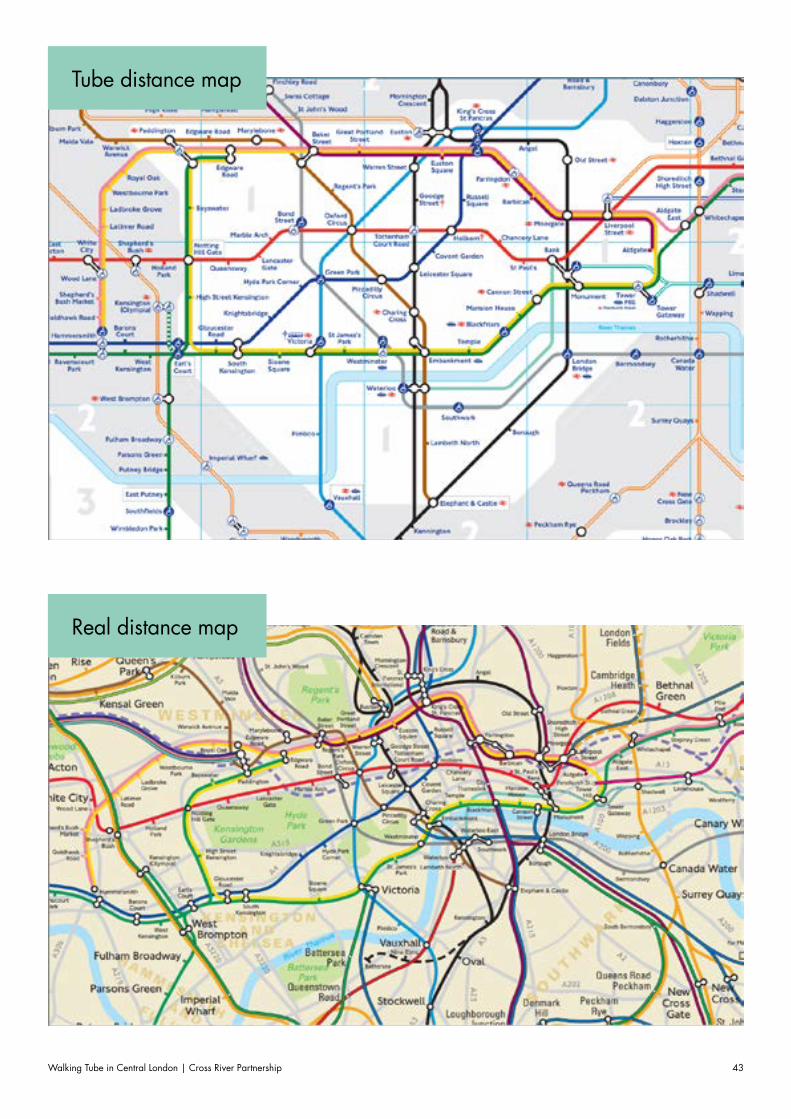
The Tube map is iconic to London’s identity, and tube and rail stations act as key anchors for both visitors and Londoners alike to visualise and mentally map the city.
However, the Tube map can in some cases be misleading for travellers about the distances between stations, which are sometimes easily walkable.
Walking Tube in Central London | Cross River Partnership 13
In many cases, station names influence peoples’ perception of a particular area such as High Street Kensington, West Hampstead or Clapham Junction8. The simplicity of the Tube map, based on underground lines and interchanges, allows people to navigate across the city by Tube with relative ease. Nevertheless, the misrepresentation of stations in relation to their true above ground locations – particularly in their geographic relation to one another – acts as a hindrance to promoting short walking trips in Central London.
On the traditional Tube map, zones 1 and 2 appear disproportionately large. In Central London the distance between stations, particularly those on different lines, often appears much greater than it is. The current ‘walking tube’ map provides information on the walking times and number of steps between stations on the same Tube line, but does not link surrounding stations on different lines.
There are many potentially successful ‘walking tube’ interventions which could join up stations on different lines, going beyond simply encouraging someone to walk a stop or two along an existing line. Whilst many regular commuters and residents may know that certain stations are very walkable, despite their placing on the Tube map, highlighting this to the occasional visitor has the potential to greatly increase short walking trips that would otherwise be made by Tube. Furthermore, there exists the possibility to ‘create’ completely new walking links between Tube stations on several different lines when encouraging people to walk above ground.
In addition to the great health and transport outcomes, promoting the walking tube could also deliver the following outcomes:
Increased footfall and pedestrian safety in previously under visited areas
More visibility and sales for businesses along the route
Reduced air pollution exposure from use of the underground
Increased community cohesion
More opportunities for urban realm improvements; cultural development and social interactions.
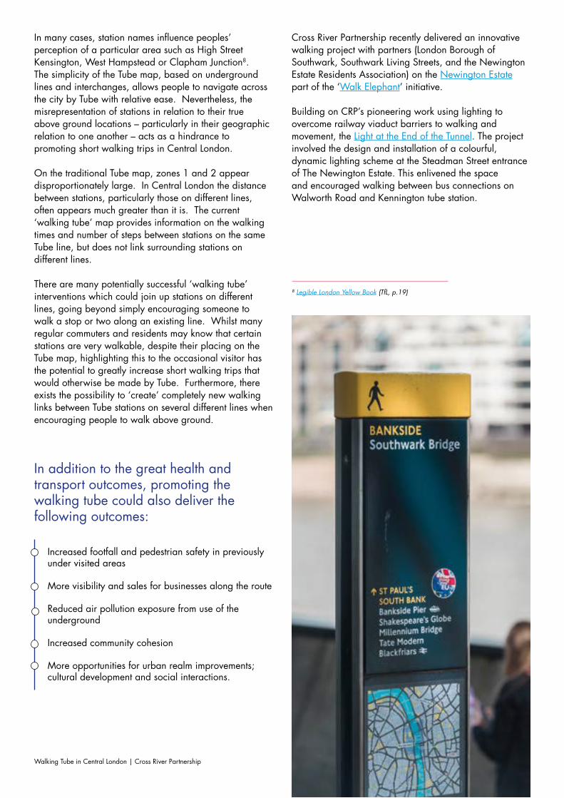
Cross River Partnership recently delivered an innovative walking project with partners (London Borough of Southwark, Southwark Living Streets, and the Newington Estate Residents Association) on the Newington Estate part of the ‘Walk Elephant’ initiative.
Building on CRP’s pioneering work using lighting to overcome railway viaduct barriers to walking and movement, the Light at the End of the Tunnel. The project involved the design and installation of a colourful, dynamic lighting scheme at the Steadman Street entrance of The Newington Estate. This enlivened the space and encouraged walking between bus connections on Walworth Road and Kennington tube station.
8 Legible London Yellow Book (TfL, p.19)
Walking Tube in Central London | Cross River Partnership14
Walking Tube Link Examples
Local Authority officers delivering local schemes in their boroughs can use the ‘real
distance tube map’ to identify walking routes by linking up stations on different Tube lines.
Such opportunities are particularly prevalent, but by no means exclusive to, the areas used as examples in this section; the City of London/Chancery Lane area, the Paddington to Euston corridor, and stations in Waterloo-Elephant & Castle-London Bridge triangle. TfL have also published a useful document of stations where it is quicker to walk than take the tube, which also highlights 50 station pairs that are quicker to walk between than taking the Tube, or Overground, many ‘linking’ Overground stations to nearby tube lines.
Walking Tube in Central London | Cross River Partnership 15
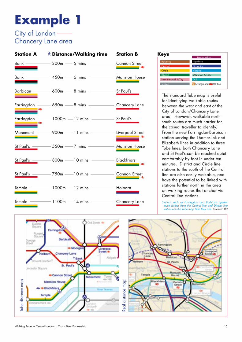
Example 1 City of LondonChancery Lane area
The standard Tube map is useful for identifying walkable routes between the west and east of the City of London/Chancery Lane area. However, walkable north-south routes are much harder for the casual traveller to identify. From the new Farringdon-Barbican station serving the Thameslink and Elizabeth lines in addition to three Tube lines, both Chancery Lane and St Paul’s can be reached quiet comfortably by foot in under ten minutes. District and Circle line stations to the south of the Central line are also easily walkable, and have the potential to be linked with stations further north in the area on walking routes that anchor via Central line stations.
Bank
Bank
Barbican
Farringdon
Farringdon
Monument
St Paul’s
St Paul’s
St Paul’s
Temple
Temple
Station A Station BDistance/Walking time
5 mins
6 mins
8 mins
8 mins
12 mins
11 mins
7 mins
10 mins
10 mins
12 mins
14 mins
300m
450m
600m
650m
1000m
900m
550m
800m
750m
1000m
1100m
Cannon Street
Mansion House
St Paul’s
Chancery Lane
St Paul’s
Liverpool Street
Mansion House
Blackfriars
Cannon Street
Holborn
Chancery Lane
KeysBakerloo
Central
Circle
District
Hammersmith &City
Jubilee
Metropolitan
Northern
Piccadilly
Victoria
Waterloo & City
DLR
Overground TFL Rail
Tube
dist
ance
map
Real
dist
ance
map
Stations such as Farringdon and Barbican appear much further from the Central line and District line stations on the Tube map than they are. (Source: TfL)
Walking Tube in Central London | Cross River Partnership16
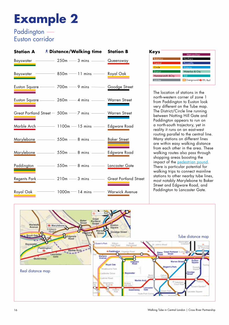
Example 2 PaddingtonEuston corridor
The location of stations in the north-western corner of zone 1 from Paddington to Euston look very different on the Tube map. The District/Circle line running between Notting Hill Gate and Paddington appears to run on a north-south trajectory, yet in reality it runs on an east-west routing parallel to the central line. Many stations on different lines are within easy walking distance from each other in the area. These walking routes also pass through shopping areas boosting the impact of the pedestrian pound.There is particular potential for walking trips to connect mainline stations to other nearby tube lines, most notably Marylebone to Baker Street and Edgware Road, and Paddington to Lancaster Gate.
Bayswater
Bayswater
Euston Square
Euston Square
Great Portland Street
Marble Arch
Marylebone
Marylebone
Paddington
Regents Park
Royal Oak
Station A Station BDistance/Walking time
3 mins
11 mins
9 mins
4 mins
7 mins
15 mins
8 mins
8 mins
8 mins
3 mins
14 mins
250m
850m
700m
260m
500m
1100m
550m
550m
550m
210m
1000m
Queensway
Royal Oak
Goodge Street
Warren Street
Warren Street
Edgware Road
Baker Street
Edgware Road
Lancaster Gate
Great Portland Street
Warwick Avenue
KeysBakerloo
Central
Circle
District
Hammersmith &City
Jubilee
Metropolitan
Northern
Piccadilly
Victoria
Waterloo & City
DLR
Overground TFL Rail
Tube distance map
Real distance map
Walking Tube in Central London | Cross River Partnership 17
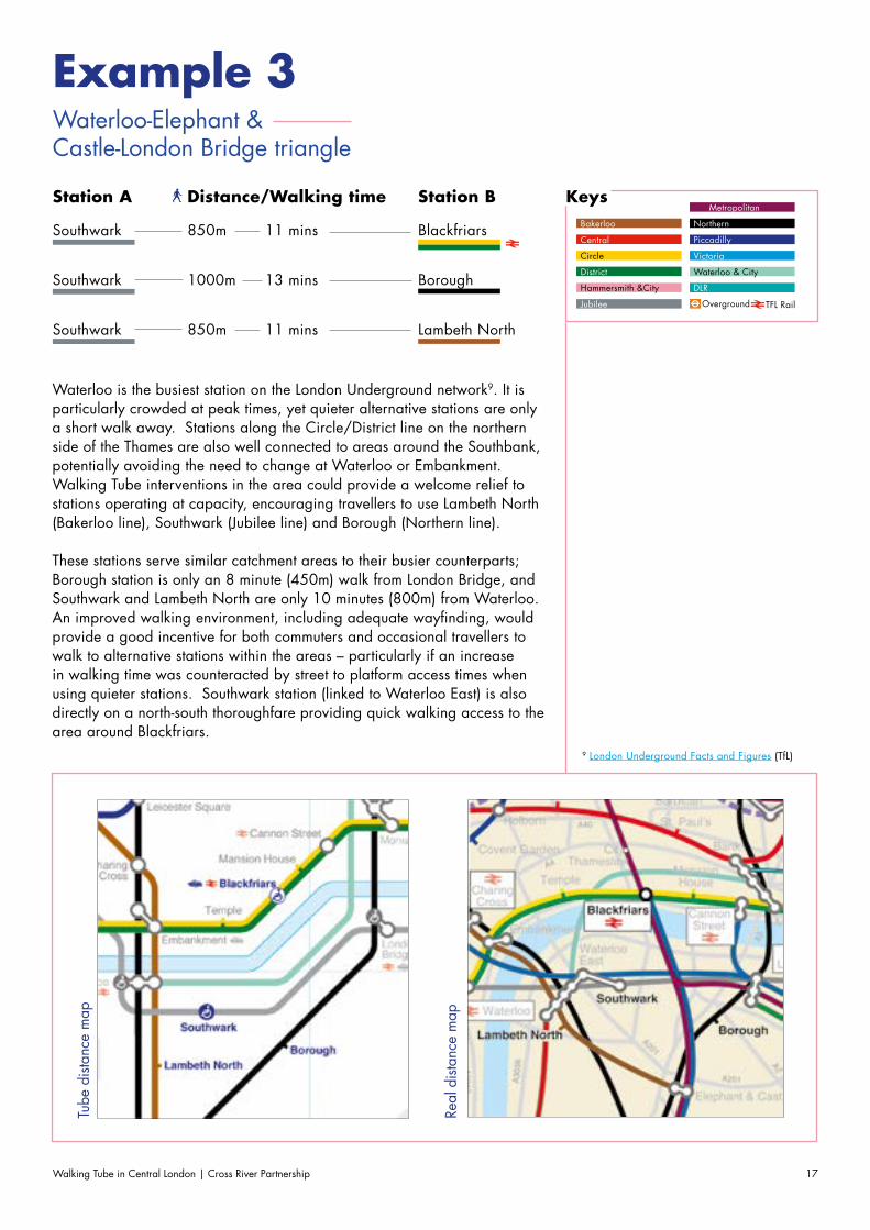
Example 3 Waterloo-Elephant & Castle-London Bridge triangle
Southwark
Southwark
Southwark
Station A Station BDistance/Walking time
11 mins
13 mins
11 mins
850m
1000m
850m
Blackfriars
Borough
Lambeth North
KeysBakerloo
Central
Circle
District
Hammersmith &City
Jubilee
Metropolitan
Northern
Piccadilly
Victoria
Waterloo & City
DLR
Overground TFL Rail
Tube
dist
ance
map
Real
dist
ance
map
Waterloo is the busiest station on the London Underground network9. It is particularly crowded at peak times, yet quieter alternative stations are only a short walk away. Stations along the Circle/District line on the northern side of the Thames are also well connected to areas around the Southbank, potentially avoiding the need to change at Waterloo or Embankment. Walking Tube interventions in the area could provide a welcome relief to stations operating at capacity, encouraging travellers to use Lambeth North (Bakerloo line), Southwark (Jubilee line) and Borough (Northern line).
These stations serve similar catchment areas to their busier counterparts; Borough station is only an 8 minute (450m) walk from London Bridge, and Southwark and Lambeth North are only 10 minutes (800m) from Waterloo. An improved walking environment, including adequate wayfinding, would provide a good incentive for both commuters and occasional travellers to walk to alternative stations within the areas – particularly if an increase in walking time was counteracted by street to platform access times when using quieter stations. Southwark station (linked to Waterloo East) is also directly on a north-south thoroughfare providing quick walking access to the area around Blackfriars.
9 London Underground Facts and Figures (TfL)
Walking Tube in Central London | Cross River Partnership18
Walking Tube Intervention Types
Interventions based around the ‘walking tube’ can have a variety of different purposes, and once an area has been selected the next step should be to find a suitable walking route which can be implemented and promoted.
Walking Tube in Central London | Cross River Partnership 19
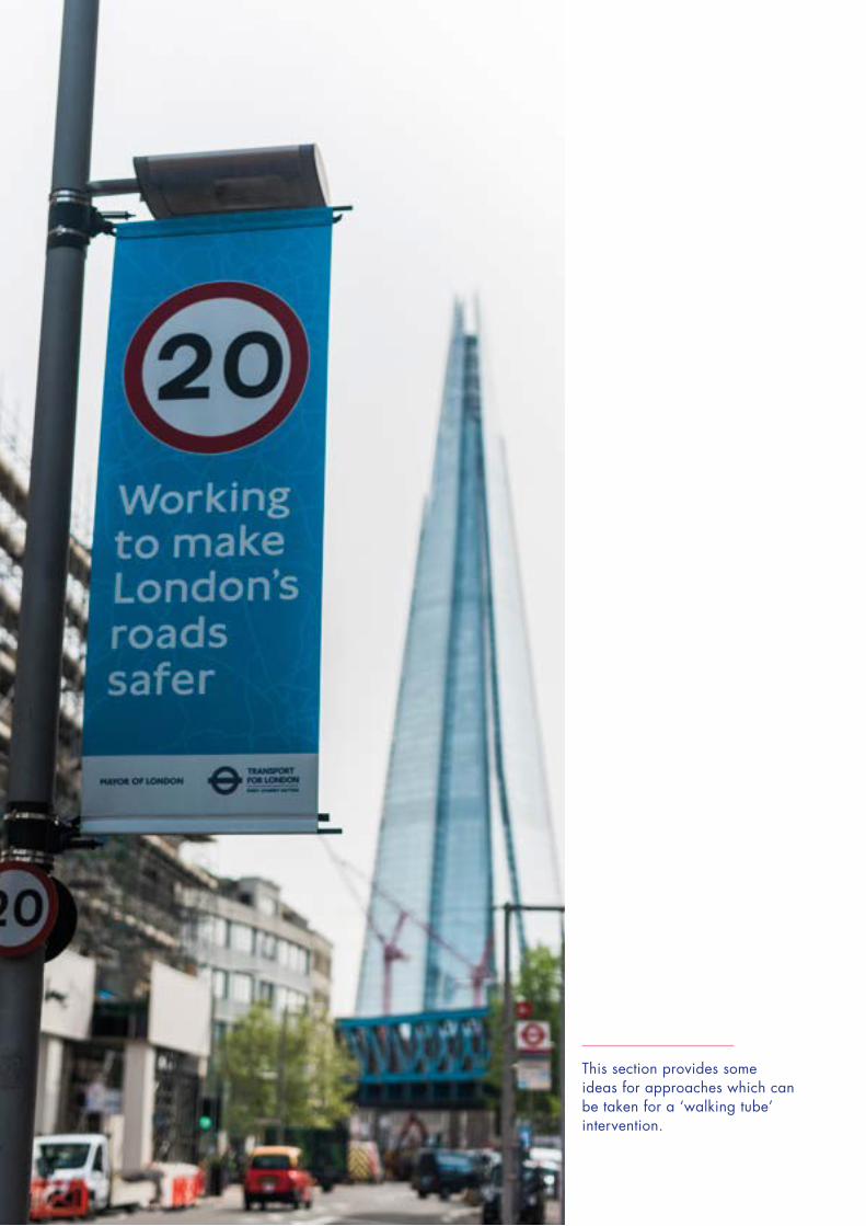
This section provides some ideas for approaches which can be taken for a ‘walking tube’ intervention.
Walking Tube in Central London | Cross River Partnership20
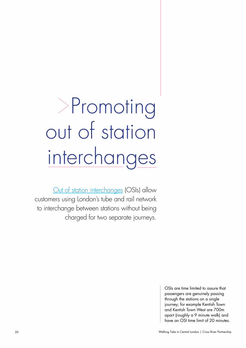
Promoting out of station interchanges
Out of station interchanges (OSIs) allow customers using London’s tube and rail network to interchange between stations without being
charged for two separate journeys.
OSIs are time limited to assure that passengers are genuinely passing through the stations on a single journey; for example Kentish Town and Kentish Town West are 700m apart (roughly a 9 minute walk) and have an OSI time limit of 20 minutes.
Walking Tube in Central London | Cross River Partnership 21
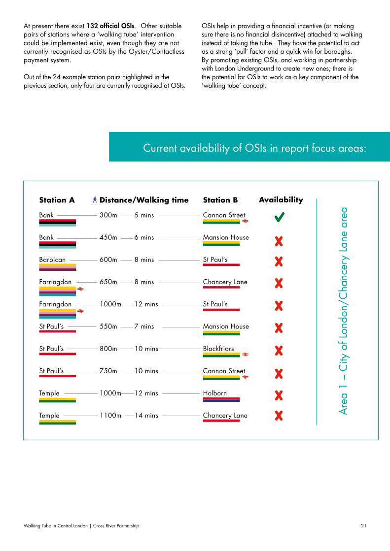
At present there exist 132 official OSIs. Other suitable pairs of stations where a ‘walking tube’ intervention could be implemented exist, even though they are not currently recognised as OSIs by the Oyster/Contactless payment system.
Out of the 24 example station pairs highlighted in the previous section, only four are currently recognised at OSIs.
OSIs help in providing a financial incentive (or making sure there is no financial disincentive) attached to walking instead of taking the tube. They have the potential to act as a strong ‘pull’ factor and a quick win for boroughs. By promoting existing OSIs, and working in partnership with London Underground to create new ones, there is the potential for OSIs to work as a key component of the ‘walking tube’ concept.
Are
a 1
– C
ity o
f Lon
don/
Cha
ncer
y La
ne a
rea
Bank
Bank
Barbican
Farringdon
Farringdon
St Paul’s
St Paul’s
St Paul’s
Temple
Temple
Station A Station BDistance/Walking time
5 mins
6 mins
8 mins
8 mins
12 mins
7 mins
10 mins
10 mins
12 mins
14 mins
300m
450m
600m
650m
1000m
550m
800m
750m
1000m
1100m
Cannon Street
Mansion House
St Paul’s
Chancery Lane
St Paul’s
Mansion House
Blackfriars
Cannon Street
Holborn
Chancery Lane
Availability
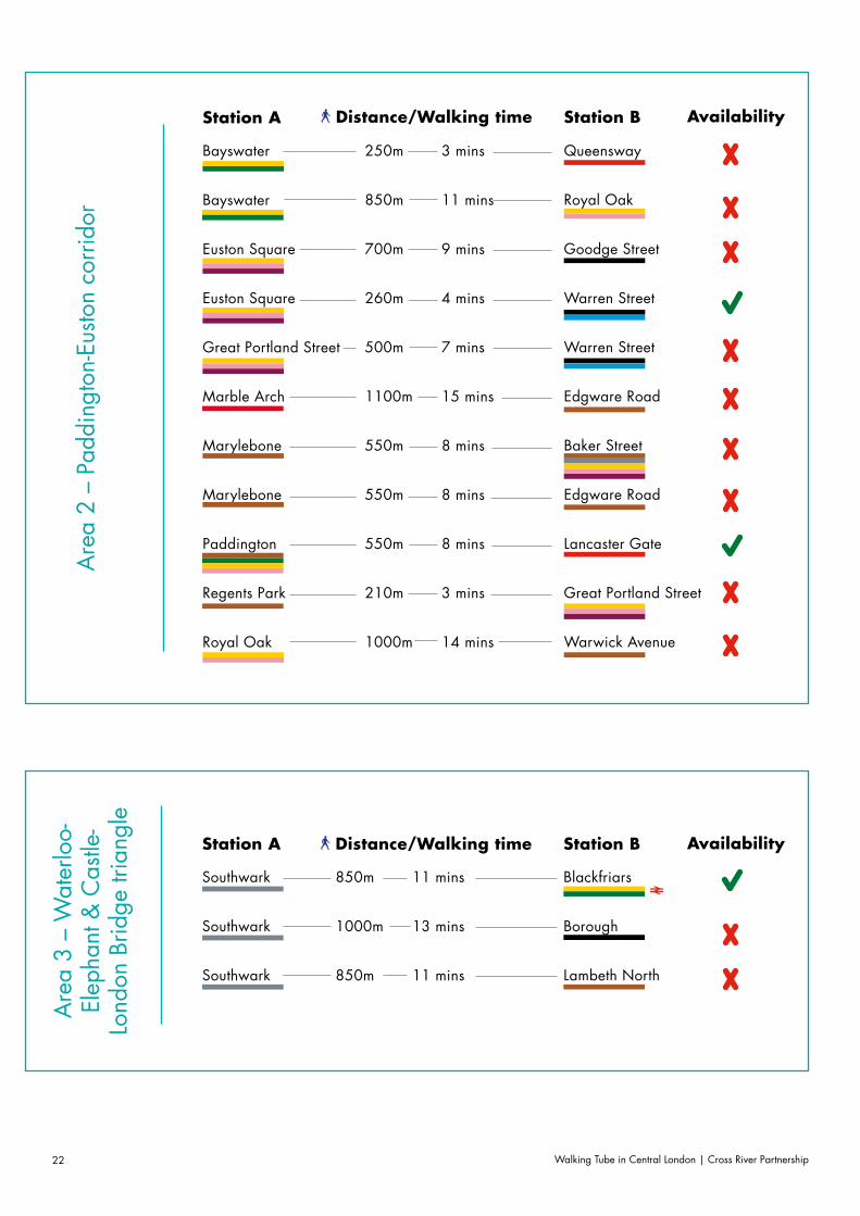
Current availability of OSIs in report focus areas:
Walking Tube in Central London | Cross River Partnership22
Are
a 3
– W
ater
loo-
Elep
hant
& C
astle
-Lo
ndon
Brid
ge tr
iang
leAvailability
Bayswater
Bayswater
Euston Square
Euston Square
Great Portland Street
Marble Arch
Marylebone
Marylebone
Paddington
Regents Park
Royal Oak
Station A Station BDistance/Walking time
3 mins
11 mins
9 mins
4 mins
7 mins
15 mins
8 mins
8 mins
8 mins
3 mins
14 mins
250m
850m
700m
260m
500m
1100m
550m
550m
550m
210m
1000m
Queensway
Royal Oak
Goodge Street
Warren Street
Warren Street
Edgware Road
Baker Street
Edgware Road
Lancaster Gate
Great Portland Street
Warwick Avenue
Availability
Southwark
Southwark
Southwark
Station A Station BDistance/Walking time
11 mins
13 mins
11 mins
850m
1000m
850m
Blackfriars
Borough
Lambeth North
Are
a 2
– Pa
ddin
gton
-Eus
ton
corr
idor
Walking Tube in Central London | Cross River Partnership 23
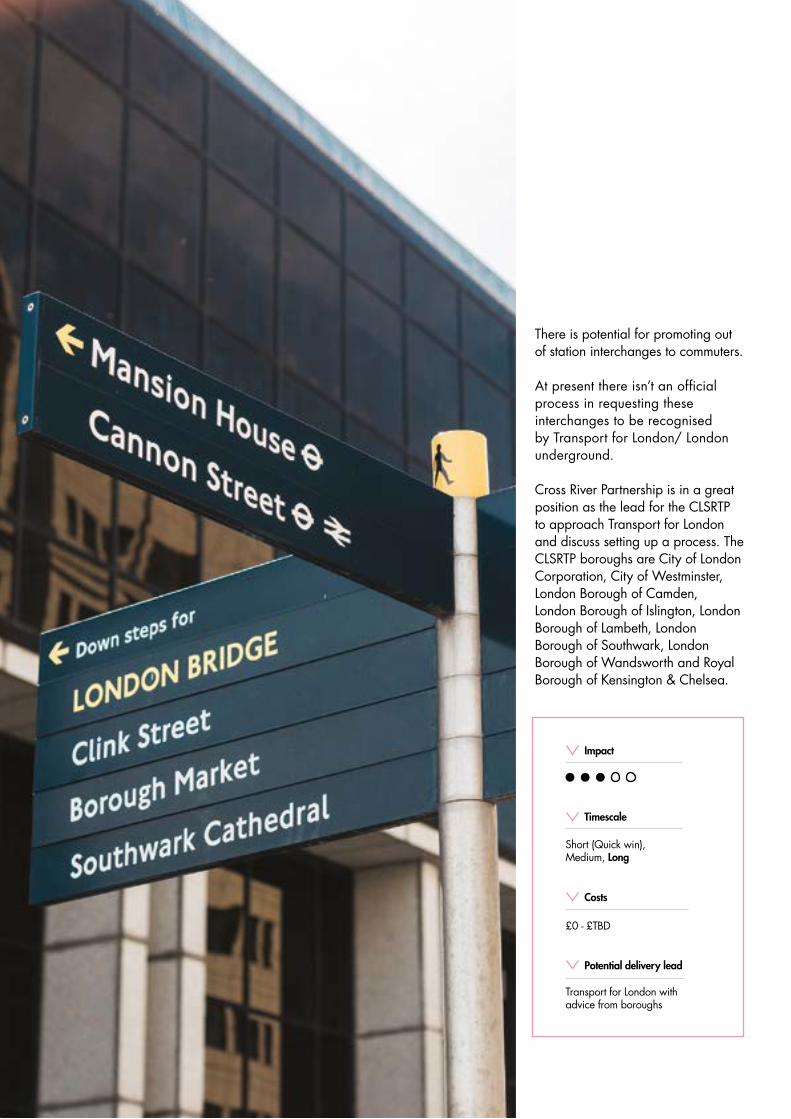
There is potential for promoting out of station interchanges to commuters.
At present there isn’t an official process in requesting these interchanges to be recognised by Transport for London/ London underground.
Cross River Partnership is in a great position as the lead for the CLSRTP to approach Transport for London and discuss setting up a process. The CLSRTP boroughs are City of London Corporation, City of Westminster, London Borough of Camden, London Borough of Islington, London Borough of Lambeth, London Borough of Southwark, London Borough of Wandsworth and Royal Borough of Kensington & Chelsea.
Costs
£0 - £TBD
Timescale
Short (Quick win), Medium, Long
Potential delivery lead
Transport for London with advice from boroughs
Impact
Walking Tube in Central London | Cross River Partnership24
Low Pollution
Walking RoutesOn key routes where high footfall already exists between stations (e.g. between Kings Cross St
Pancras and Euston) the onus of a ‘walking tube intervention’ may be to provide a safe, legible
walking route which also reduces the individual’s exposure to harmful pollutants, particularly for routes
which experience high levels of vehicular traffic.
Tools such as Walkit’s Urban Walking Route Finder and can be used to identify the least polluted routes between stations which may be suitable for a ‘walking tube’ intervention.
Walking Tube in Central London | Cross River Partnership 25
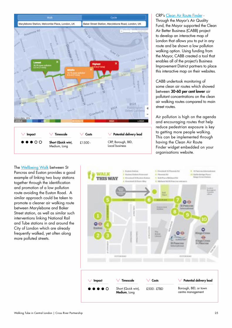
CRP’s Clean Air Route Finder - Through the Mayor’s Air Quality Fund, the Mayor supported the Clean Air Better Business (CABB) project to develop an interactive map of London that allows you to put in any route and be shown a low pollution walking option. Using funding from the Mayor, CABB created a tool that enables all of the project’s Business Improvement District partners to place this interactive map on their websites.
CABB undertook monitoring of some clean air routes which showed between 30-60 per cent lower air pollutant concentrations on the clean air walking routes compared to main street routes.
Air pollution is high on the agenda and encouraging routes that help reduce pedestrian exposure is key to getting more people walking. This can be implemented through having the Clean Air Route Finder widget embedded on your organisations website.
Costs
£1500 -
Timescale
Short (Quick win), Medium, Long
Potential delivery lead
CRP, Borough, BID, Local business
Impact
The Wellbeing Walk between St Pancras and Euston provides a good example of linking two busy stations together through the identification and promotion of a low pollution route avoiding the Euston Road. A similar approach could be taken to promote a cleaner air walking route between Marylebone and Baker Street station, as well as similar such interventions linking National Rail and Tube stations in and around the City of London which are already frequently walked, yet often along more polluted streets.
Costs
£500 - £TBD
Timescale
Short (Quick win), Medium, Long
Potential delivery lead
Borough, BID, or town centre management
Impact
Walking Tube in Central London | Cross River Partnership26
Tranquil Places and
Street TypesEncouraging Londoners to de-stress, and discover tranquil places in Central London has the potential
to be an important driver in promoting the ‘walking tube’. Tranquil City’s Tranquil Pavement tool, maps the city based on noise levels and tranquillity, and encourages users to upload and share photos of
tranquil spaces.
Walking Tube in Central London | Cross River Partnership 27
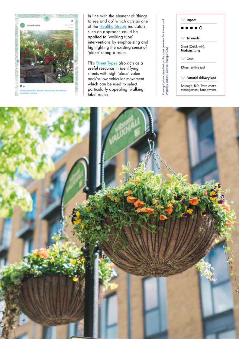
In line with the element of ‘things to see and do’ which acts as one of the Healthy Streets indicators, such an approach could be applied to ‘walking tube’ interventions by emphasising and highlighting the existing sense of ‘place’ along a route.
TfL’s Street Types also acts as a useful resource in identifying streets with high ‘place’ value and/or low vehicular movement which can be used to select particularly appealing ‘walking tube’ routes. A
tran
quil
plac
e id
entifi
ed o
n th
e ro
ute
betw
een
Sout
hwar
k an
d W
ater
loo
statio
ns (S
ourc
e: T
ranq
uil C
ity)
Costs
£Free - online tool
Timescale
Short (Quick win), Medium, Long
Potential delivery lead
Borough, BID, Town centre management, Landowners
Impact
Walking Tube in Central London | Cross River Partnership28
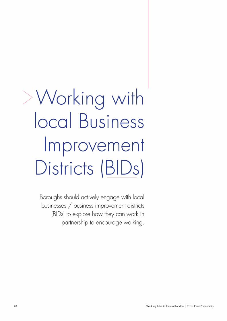
Working with local Business Improvement
Districts (BIDs)Boroughs should actively engage with local businesses / business improvement districts
(BIDs) to explore how they can work in partnership to encourage walking.
Walking Tube in Central London | Cross River Partnership 29
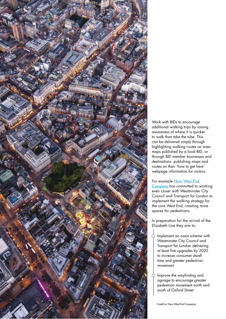
Work with BIDs to encourage additional walking trips by raising awareness of where it is quicker to walk than take the tube. This can be delivered simply through highlighting walking routes on area maps published by a local BID, or through BID member businesses and destinations publishing maps and routes on their ‘how to get here’ webpage information for visitors.
For example New West End Company has committed to working even closer with Westminster City Council and Transport for London to implement the walking strategy for the core West End, creating more spaces for pedestrians.
In preparation for the arrival of the Elizabeth Line they aim to:
Implement an oasis scheme with Westminster City Council and Transport for London delivering at least five upgrades by 2020 to increase consumer dwell time and greater pedestrian movement
Improve the wayfinding and signage to encourage greater pedestrian movement north and south of Oxford Street
Credit to: New West End Company
Walking Tube in Central London | Cross River Partnership30
Bringing existing lines
above groundAlongside identifying new station pairs, bringing existing Tube lines to life above
ground is a very effective way of increasing walking trips in Central London, building
upon existing links and lines which are already familiar and recognisable to visitors
as well as Londoners.
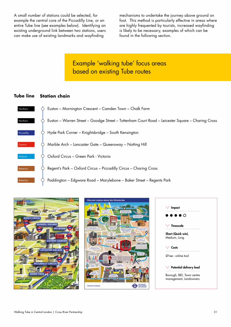
Walking Tube in Central London | Cross River Partnership 31
A small number of stations could be selected, for example the central core of the Piccadilly Line, or an entire Tube line (see examples below). Identifying an existing underground link between two stations, users can make use of existing landmarks and wayfinding
mechanisms to undertake the journey above ground on foot. This method is particularly effective in areas where are highly frequented by tourists, increased wayfinding is likely to be necessary, examples of which can be found in the following section.
Euston – Mornington Crescent – Camden Town – Chalk Farm
Euston – Warren Street – Goodge Street – Tottenham Court Road – Leicester Square – Charing Cross
Hyde Park Corner – Knightsbridge – South Kensington
Marble Arch – Lancaster Gate – Queensway – Notting Hill
Oxford Circus – Green Park - Victoria
Regent’s Park – Oxford Circus – Piccadilly Circus – Charing Cross
Paddington – Edgware Road – Marylebone – Baker Street – Regents Park
Station chain
Example ‘walking tube’ focus areas based on existing Tube routes
Tube line
Northern
Northern
Piccadilly
Central
Victoria
Bakerloo
Bakerloo
Costs
£Free - online tool
Timescale
Short (Quick win), Medium, Long
Potential delivery lead
Borough, BID, Town centre management, Landowners
Impact
Walking Tube in Central London | Cross River Partnership32
Wayfinding
Each ‘walking tube’ scheme should be context specific, yet they must all include some forms of wayfinding.
This section suggests different wayfinding methods, which could be implemented as part of a ‘walking tube’ intervention.
Walking Tube in Central London | Cross River Partnership 33
Walking Tube in Central London | Cross River Partnership34
Deciding what to
signIt is important to decide what exactly to sign based
on the nature of the intervention. In some cases you may sign people to a specific location or area (e.g.
signing from Farringdon to Chancery Lane).
In other cases you may highlight an existing Tube above the ground (e.g. the Bakerloo line from Regents Park to Charing Cross). Any potential route should be audited for existing street furniture and wayfinding to avoid duplication or unnecessary confusion.
Walking Tube in Central London | Cross River Partnership 35
Most appropriate for highlighting an existing Tube route above ground.
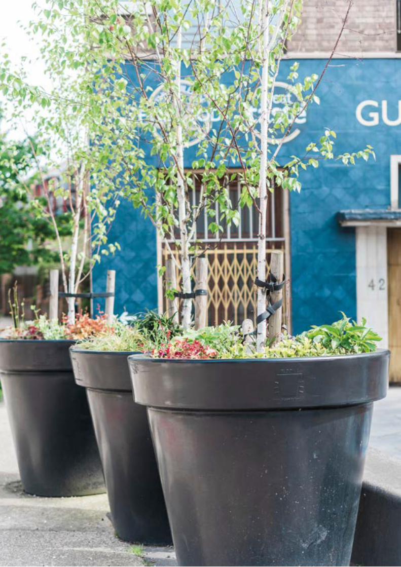
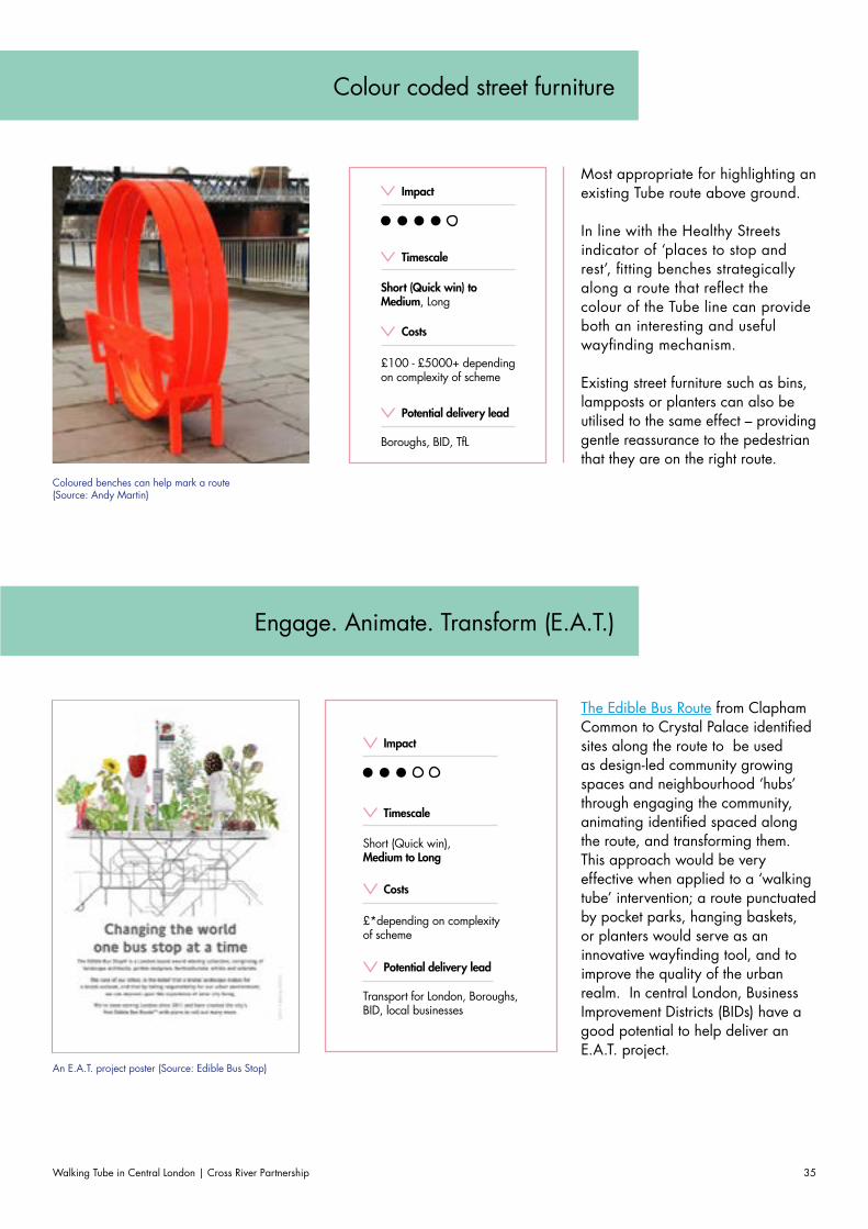
In line with the Healthy Streets indicator of ‘places to stop and rest’, fitting benches strategically along a route that reflect the colour of the Tube line can provide both an interesting and useful wayfinding mechanism.
Existing street furniture such as bins, lampposts or planters can also be utilised to the same effect – providing gentle reassurance to the pedestrian that they are on the right route.
The Edible Bus Route from Clapham Common to Crystal Palace identified sites along the route to be used as design-led community growing spaces and neighbourhood ‘hubs’ through engaging the community, animating identified spaced along the route, and transforming them. This approach would be very effective when applied to a ‘walking tube’ intervention; a route punctuated by pocket parks, hanging baskets, or planters would serve as an innovative wayfinding tool, and to improve the quality of the urban realm. In central London, Business Improvement Districts (BIDs) have a good potential to help deliver an E.A.T. project.
Coloured benches can help mark a route (Source: Andy Martin)
Costs
£100 - £5000+ depending on complexity of scheme
Costs
£*depending on complexity of scheme
Timescale
Short (Quick win) to Medium, Long
Timescale
Short (Quick win), Medium to Long
Potential delivery lead
Boroughs, BID, TfL
Potential delivery lead
Transport for London, Boroughs, BID, local businesses
Impact
Impact
Colour coded street furniture
Engage. Animate. Transform (E.A.T.)
An E.A.T. project poster (Source: Edible Bus Stop)
Walking Tube in Central London | Cross River Partnership36
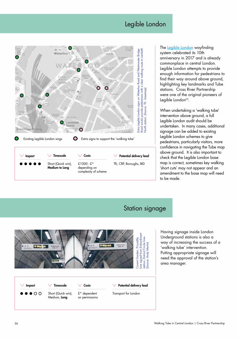
The Legible London wayfinding system celebrated its 10th anniversary in 2017 and is already commonplace in central London. Legible London attempts to provide enough information for pedestrians to find their way around above ground, highlighting key landmarks and Tube stations. Cross River Partnership were one of the original pioneers of Legible London10.
When undertaking a ‘walking tube’ intervention above ground, a full Legible London audit should be undertaken. In many cases, additional signage can be added to existing Legible London schemes to give pedestrians, particularly visitors, more confidence in navigating the Tube map above ground. It is also important to check that the Legible London base map is correct, sometimes key walking ‘short cuts’ may not appear and an amendment to the base map will need to be made.
Having signage inside London Underground stations is also a way of increasing the success of a ‘walking tube’ intervention. Putting appropriate signage will need the approval of the station’s area manager.
Extra
Leg
ible
Lon
don
signs
on
Wat
erlo
o Ro
ad a
nd W
estm
inste
r Brid
ge
Road
wou
ld p
rovi
de p
edes
trian
s w
ith a
cle
ar w
alki
ng ro
ute
to L
ambe
th
Nor
th s
tatio
n. (S
ourc
e: T
fL - b
asem
ap)
Cov
ent G
arde
n, P
icca
dilly
Lin
e sig
ned
from
Em
bank
men
t sta
tion,
Dist
rict/
Circ
le li
nes
(Sou
rce:
And
y M
artin
)
Costs
£1000 - £* depending on complexity of scheme
Costs
£* dependent on permissions
Timescale
Short (Quick win), Medium to Long
Timescale
Short (Quick win), Medium, Long
Potential delivery lead
TfL, CRP, Boroughs, BID
Potential delivery lead
Transport for London
Impact
Impact
Existing Legible London sings Extra signs to support the ‘walking tube’
Legible London
Station signage
Walking Tube in Central London | Cross River Partnership 37
Public Art & Culture
Apple Maps
Bing Maps
City Mapper
Google Maps
Moovit
TfL Journey Planner
Transit
Wikiroutes
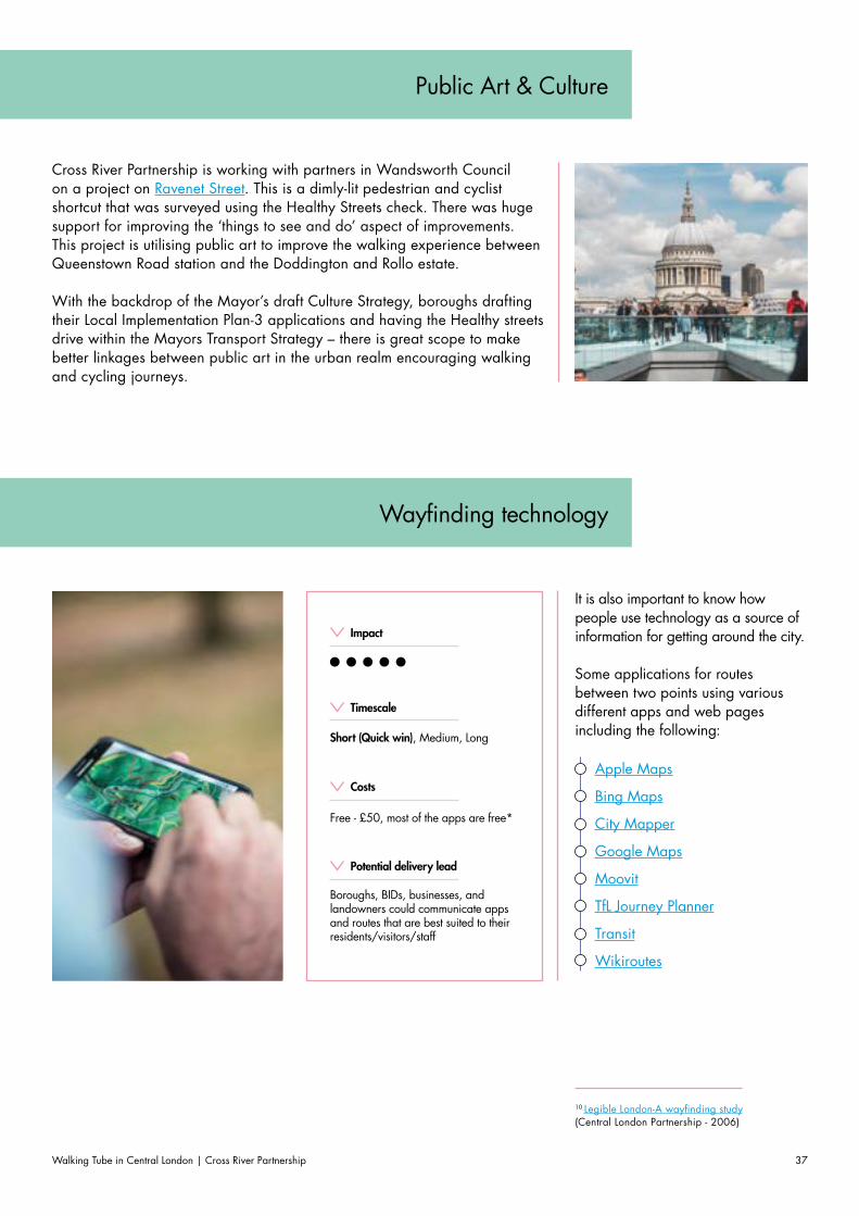
Cross River Partnership is working with partners in Wandsworth Council on a project on Ravenet Street. This is a dimly-lit pedestrian and cyclist shortcut that was surveyed using the Healthy Streets check. There was huge support for improving the ‘things to see and do’ aspect of improvements. This project is utilising public art to improve the walking experience between Queenstown Road station and the Doddington and Rollo estate.
With the backdrop of the Mayor’s draft Culture Strategy, boroughs drafting their Local Implementation Plan-3 applications and having the Healthy streets drive within the Mayors Transport Strategy – there is great scope to make better linkages between public art in the urban realm encouraging walking and cycling journeys.
It is also important to know how people use technology as a source of information for getting around the city.
Some applications for routes between two points using various different apps and web pages including the following:
Costs
Free - £50, most of the apps are free*
Timescale
Short (Quick win), Medium, Long
Potential delivery lead
Boroughs, BIDs, businesses, and landowners could communicate apps and routes that are best suited to their residents/visitors/staff
Impact
Wayfinding technology
10 Legible London-A wayfinding study (Central London Partnership - 2006)
Walking Tube in Central London | Cross River Partnership38
Next Steps for the Walking Tube
The next steps are to examine which of the suggested interventions could be trialled in your area. For example, perhaps identify an area that would benefit from a ‘Clean air walking route’ then utilise wayfinding technology to signpost visitors or employees to the best routes to walk to your site. The potential next steps have been summarised in 6 quick steps to implement your own walking tube intervention.
For further information, contact [email protected]
Walking Tube in Central London | Cross River Partnership 39
Step by step guide
Step 1 Site selection
Decide the area. Define an appropriate approach. For
example reducing crowding at a certain station, promoting a route along an existing line; linking up
new station pairs.
Step 3 Site audit
Audit the area; arrange a site visit with key
stakeholders if suitable. It is important to have some pre-implementation monitoring
as a basiline for comparison post-implementation.
Step 4 Implementation
If funding is required, ensure this has been secured prior
to delivery. Check if any permissions, licenses or permits
are required. Ensure there is some promotional plan on how the intervention will raise public awareness of the intervention.
Step 5 Promote your route
Work with stakeholders to ensure that your intervention is communicated to a wide
audience. Cross River Partnership will support partners through social media channels to generate more coverage.
Step 6 Assess the impact
Aim to do a post implementation review a
few months after to gather stakeholders feedback.
Step 2 Engagement with Key
local stakeholders
Ensure that advice has been sought from relevant stakeholders (borough, TfL,
businesses, residents etc.) as to suitability of the area.

Walking Tube in Central London | Cross River Partnership40
Sources and Further Reading
Walking Tube in Central London | Cross River Partnership 41
Walking people at your service (Living Streets)
Walking Tube Map, (TfL)
Steps Tube Map, (TfL)
Mayor’s Transport Strategy, (GLA)
Walking for health (NHS)
Oxford Circus Tube station ‘closes every three days’ for overcrowding (BBC)
Local Implementation Plan guidance 2018/19 (TfL)
Geographically accurate tube map (Mapping London)
Walking times between stations on the same line (TfL)
Guide to Healthy Streets indicator TfL)
Legible London Yellow Book (TfL)
The Pedestrian Pound (Living streets)
London Underground Facts and Figures (TfL)
Out of station interchanges (TfL)
Urban Walking Route Finder (Walk-It)
Clean Air Route Finder (Cross River Partnership)
Wellbeing Walk (Urban Partners London)
Tranquil Pavement toll (Tranquil City)
Street Types for London(TfL)
Legible London (TfL)
Analysis of walking potential (TfL)
Why you should take a walking lunch (Living Streets)
Legible London-A wayfinding study (Central London Partnership - 2006)
Culture and night time economy Supplementary Planning Guidance (GLA)
Thompson-Coon J, Boddy K, Stein K, Whear R, Barton J, Depledge MH. Does participating in physical activity in outdoor natural environments have a greater effect on physical and mental wellbeing than physical activity indoors? A systematic review. Environ Sci Technol 2011, 45:1761–1772
NICE. Walking and Cycling: Local Measures to Promote Walking and Cycling as Forms of Travel or Recreation (NICE public health guidance 41, 2012)

Walking Tube in Central London | Cross River Partnership42
Maps
Walking Tube in Central London | Cross River Partnership 43
Tube distance map
Real distance map
Walking Tube in Central London | Cross River Partnership44
02076412198 crossriverpartnership.org@[email protected]/cross-river-parthnership
Cross River Partnership5 StrandLondonWC2N 5HR