Embed Size (px)
Citation preview
1
Technology Implementation Group
Charles Brown, PE, PLSState Location & Surveys EngineerNorth Carolina DOT
Speaking for Len Sanderson, PEHighway AdministratorNorth Carolina DOT
The Use of GPS in the
Departments of Transportation
2
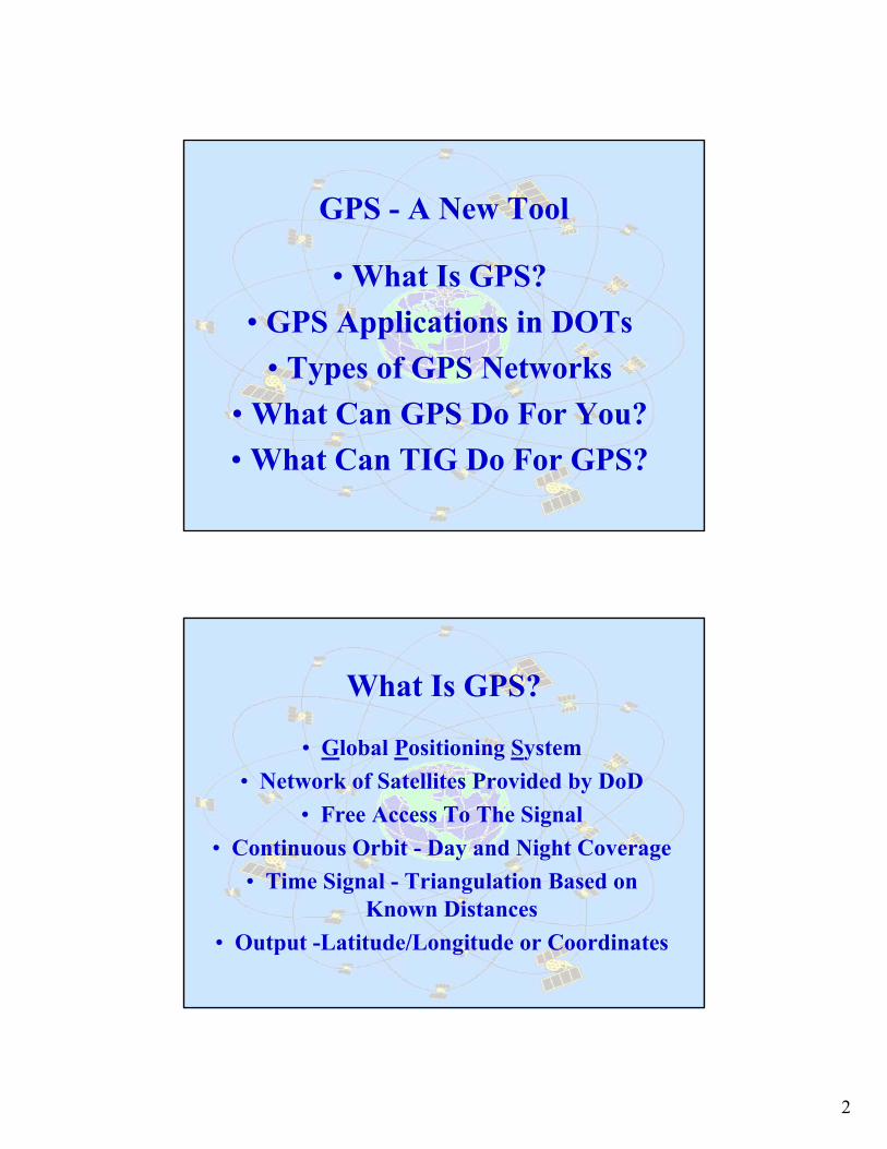
GPS - A New Tool
• What Is GPS?• GPS Applications in DOTs
• Types of GPS Networks• What Can GPS Do For You?• What Can TIG Do For GPS?
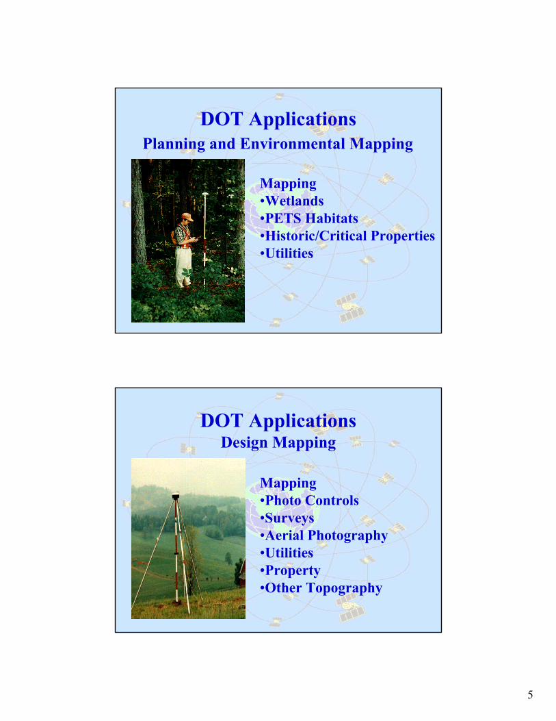
What Is GPS?
• Global Positioning System• Network of Satellites Provided by DoD
• Free Access To The Signal• Continuous Orbit - Day and Night Coverage
• Time Signal - Triangulation Based on Known Distances
• Output -Latitude/Longitude or Coordinates

3
Global Positioning System (GPS)
• Department of Defense (DoD) Creation• 27 Satellites in orbit• Transmitting Precise Time Signal to Earth• Ground-Based Receivers measure Time for Signal
to travel from Satellite to Receiver• Distance = Speed of Signal x Time Difference • GPS accurate within 10 meters
Presidential Decision DirectiveMarch, 1996
USDOT will:1 Serve as Lead Agency in US
Govt. for all Federal GPS Matters
2 Develop and Implement USGovt. Augmentations to the basic GPS for Transportation Applications

4
Presidential Decision DirectiveMarch, 1996
With DoD, State, and Commerce, USDOT will:
3 Promote Commercial Applications of GPS and Acceptance of US Govt. Augmentations as Standard
4 Coordinate US Govt.-provided GPS Civil Augmentation Systems to minimize Cost and Duplication
Some Acronyms
• RTK - Real Time Kinematic Surveys• HARN - High Accuracy Reference Network• NDGPS - National Differential GPS• NSRS - National Spatial Reference System • CORS - Continuously Operating Reference Station • OPUS - On-line Positioning User Service • VRS - Virtual Reference System
5
DOT Applications
Mapping •Wetlands•PETS Habitats•Historic/Critical Properties•Utilities
Planning and Environmental Mapping
DOT ApplicationsDesign Mapping
Mapping •Photo Controls•Surveys•Aerial Photography•Utilities•Property•Other Topography

6
DOT ApplicationsPhotogrammetry
Vehicle GuidanceBetter Definitions of Flight Plans
Airborne GPS -Photo Control with Less Ground Surveys
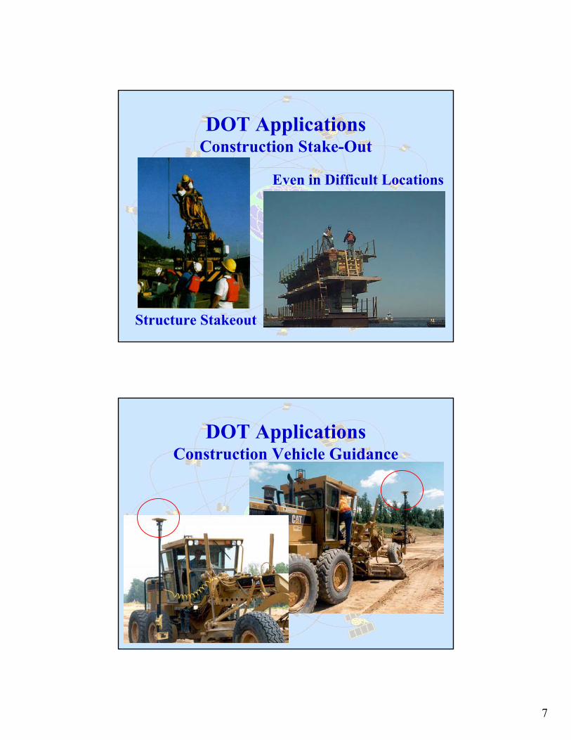
DOT ApplicationsConstruction Stake-Out
RTK Staking•Project Controls•Alignments•Slope Stakes•Utility Locations•Drainage Locations
7
DOT ApplicationsConstruction Stake-Out
Structure Stakeout
Even in Difficult Locations
DOT ApplicationsConstruction Vehicle Guidance
8
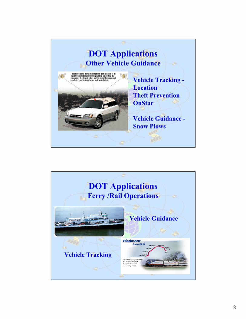
DOT ApplicationsOther Vehicle Guidance
Vehicle Tracking -LocationTheft PreventionOnStar
Vehicle Guidance -Snow Plows
DOT ApplicationsFerry /Rail Operations
Vehicle Guidance
Vehicle Tracking
9
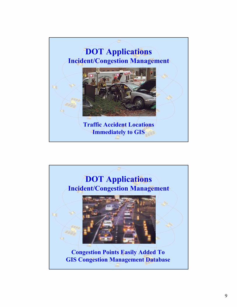
DOT ApplicationsIncident/Congestion Management
Traffic Accident LocationsImmediately to GIS
DOT ApplicationsIncident/Congestion Management
Congestion Points Easily Added To GIS Congestion Management Database
10
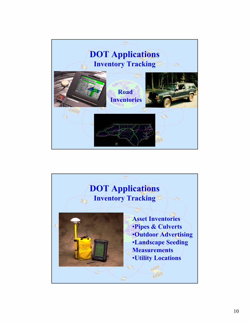
DOT ApplicationsInventory Tracking
Road Inventories
DOT ApplicationsInventory Tracking
Asset Inventories•Pipes & Culverts•Outdoor Advertising•Landscape Seeding Measurements•Utility Locations

11
Different Types of Base Station Networks
•Individual Bases Stations•VRS•CORS•NDGPS•OPUS
The Base Station provides the correction factor for accurate GPS locations
Different Types of Base Station Networks
The Project-Specific Base•Local Control Possible• Provides Local Coverage •Limited Area•Requires Base and Transmitter/Receiver•Easy Set-up and Operation•Mobile•Inexpensive

12
Different Types of Base Station Networks
VRS Network•Private or Govt. owned•Area-Wide•HARN•Several Bases in System•Cell-Phone Signal•Greater Distance from Base to Rover•Survey Grade Accuracies in Real-Time
Different Types of Base Station Networks
CORS•Govt. Owned -•State or Federal•HARN•Post-Processing Required•Highly Accurate•Wide Range•User Requires Roving Units Only
13
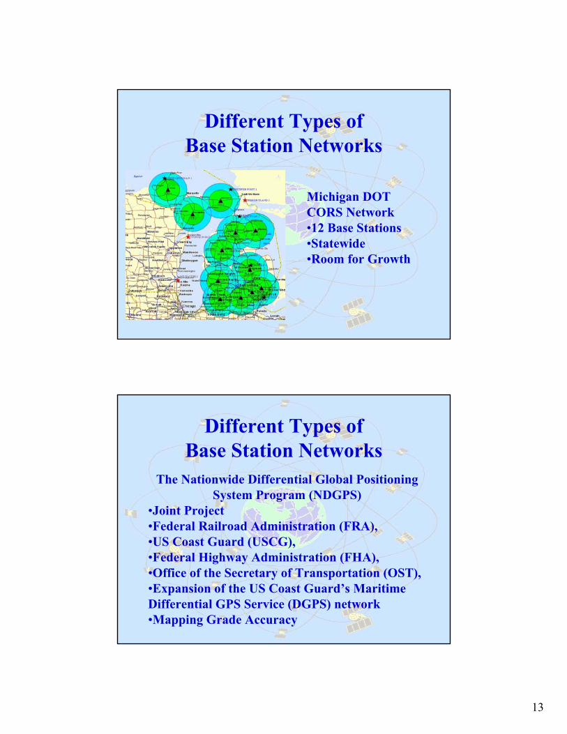
Different Types of Base Station Networks
Michigan DOT CORS Network•12 Base Stations•Statewide•Room for Growth
Different Types of Base Station Networks
The Nationwide Differential Global Positioning System Program (NDGPS)
•Joint Project•Federal Railroad Administration (FRA), •US Coast Guard (USCG), •Federal Highway Administration (FHA), •Office of the Secretary of Transportation (OST), •Expansion of the US Coast Guard’s Maritime Differential GPS Service (DGPS) network•Mapping Grade Accuracy

14
Different Types of Base Station Networks
12/02 - Approximately 85% the contiguous 48 states receive correction signal from at least one NDGPS transmitting site; 12/03- All contiguous 48 states expected to receive the signal
from at least two transmitting sites.
Different Types of Base Station Networks
OPUS•Maint. By NGS•Provides users easy access to the National Spatial Reference System (NSRS).•The service is based on data from the NCORS.•Survey Grade Accuracy

15
What Can GPS Do for You?
Some More Acronyms
MAD - More Accurate Data
BUM - Better Utilization of Manpower
MEO - More Efficient Operations
What Can TIG Do for GPS?
•Nationwide SurveyWho Uses GPS For What?
•Nationwide PromotionWhat Can GPS Do?
Video, Web Sites, Presentations•Nationwide Standards/Protocols
Accuracy Standards and Guidelines Testing and ApplicationsStandardized GPS/GIS Programs

16
What Can TIG Do for GPS?
January -•Preparation of Powerpoint program•Create GPS Usage Survey
March -•Presentation to TIG•Request for Work Plan Approval•Submit Budget Proposal for Approval
Future -•GPS!
Questions?

17
DOT ApplicationsConstruction Vehicle Guidance
Mapping •Wetlands•PETS Habitats•Historic/Critical Properties•Utilities
Different Types of Base Station Networks