Embed Size (px)
Citation preview
The Rise and Fall (and rise again?)
of Digital EarthKeith Clarke
Karl Grossner
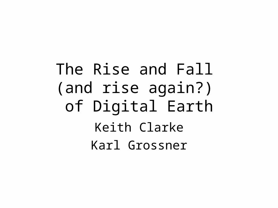
Gerhard Mercator: Terrestrial globe, Ø 41 cm, 1541© Österreichische Nationalbibliothek
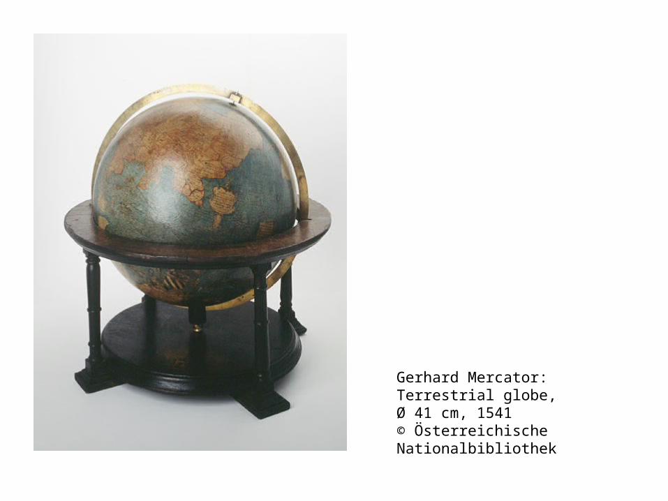
Mary Baker Eddy Library for the Betterment of Humanity 1935
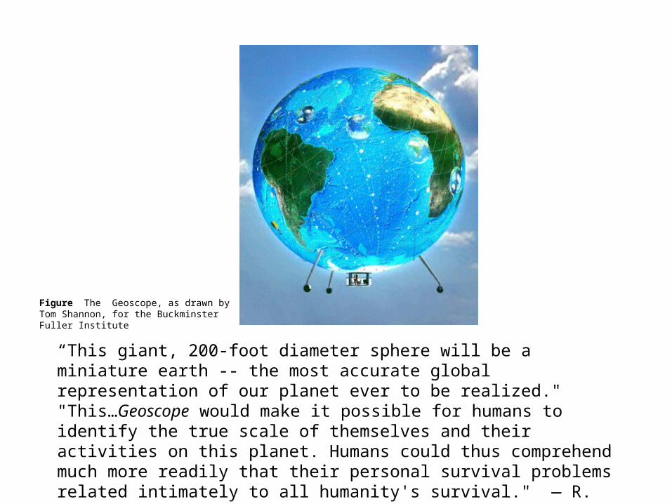
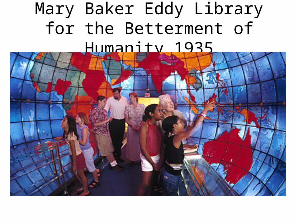
Figure The Geoscope, as drawn by Tom Shannon, for the Buckminster Fuller Institute
“This giant, 200-foot diameter sphere will be a miniature earth -- the most accurate global representation of our planet ever to be realized." "This…Geoscope would make it possible for humans to identify the true scale of themselves and their activities on this planet. Humans could thus comprehend much more readily that their personal survival problems related intimately to all humanity's survival." — R. Buckminster Fuller, 1962
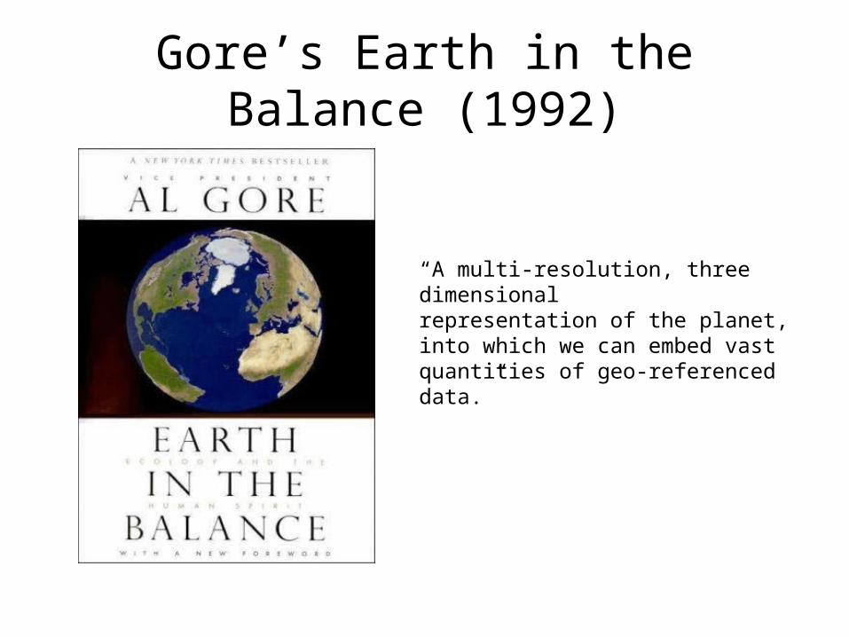
Gore’s Earth in the Balance (1992)
“A multi-resolution, three dimensionalrepresentation of the planet, into which we can embed vast quantities of geo-referenced data.”
Gore’s Digital Earth“Imagine, for example, a young child going to a Digital Earth exhibit at a local museum. After donning a head-
mounted display, she sees Earth as it appears from space. Using a data glove, she zooms in, using higher and higher levels of resolution, to see continents, then regions, countries, cities, and finally individual houses, trees, and other natural and man-made objects. Having found an area of the planet she is interested in exploring, she takes the equivalent of a ‘magic carpet ride’ through a 3-D visualization of the terrain. Of course, terrain is only one of the numerous kinds of data with which she can interact. Using the system’s voice recognition capabilities, she is able to request information on land cover, distribution of plant and animal species, real-time weather, roads, political boundaries, and population. She can also visualize the environmental information that she and other students all over the world have collected as part of the GLOBE project. This information can be seamlessly fused with the digital map or terrain data. She can get more information on many of the objects she sees by using her data glove to click on a hyperlink. To prepare for her family’s vacation to Yellowstone National Park, for example, she plans the perfect hike to the geysers, bison, and bighorn sheep that she has just read about. In fact, she can follow the trail visually from start to finish before she ever leaves the museum in her hometown. She is not limited to moving through space, but can also travel through time. After taking a virtual field-trip to Paris to visit the Louvre, she moves backward in time to learn about French history, perusing digitized maps overlaid on the surface of the Digital Earth, newsreel footage, oral history, newspapers and other primary sources. She sends some of this information to her personal e-mail address to study later. The time-line, which stretches off in the distance, can be set for days, years, centuries, or even geological epochs, for those occasions when she wants to learn more about dinosaurs.” (U.S. Vice President Al Gore, in a speech written for presentation at the California Science Museum, Los Angeles, January 1998)
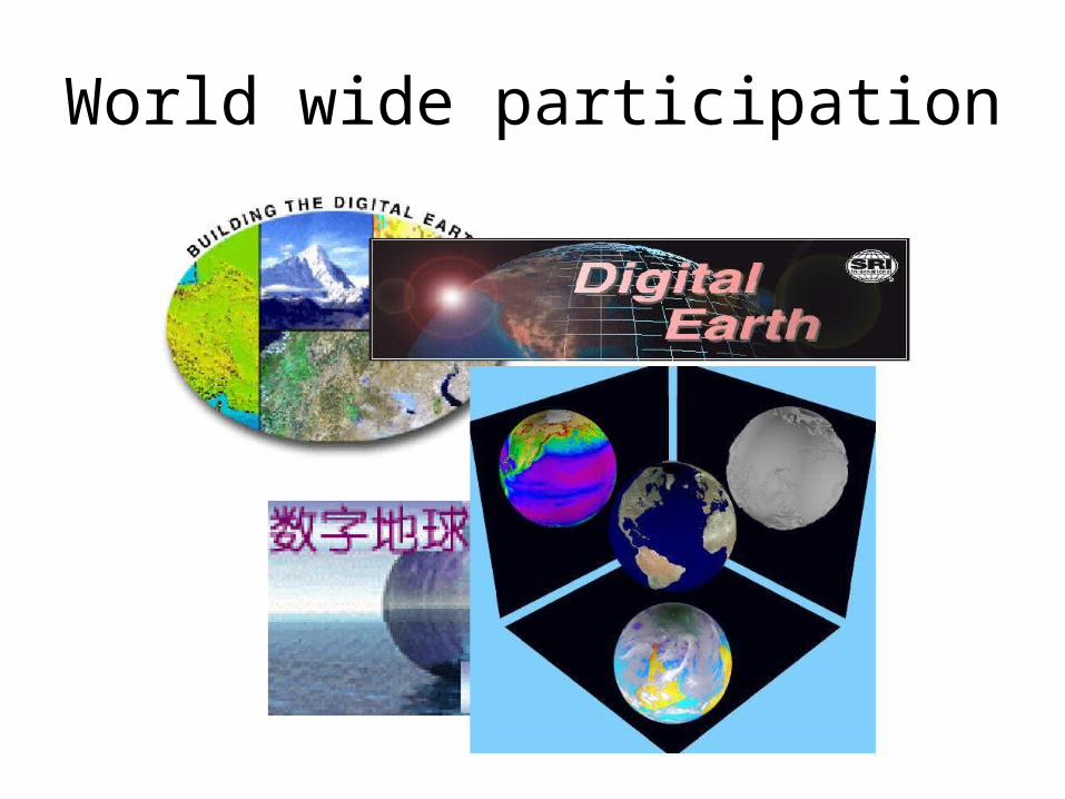
World wide participation
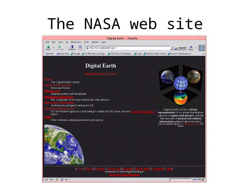
The NASA web site
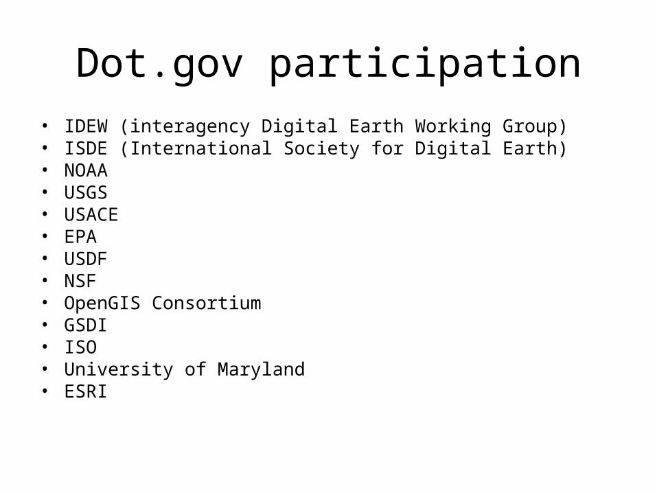
Dot.gov participation• IDEW (interagency Digital Earth Working Group)• ISDE (International Society for Digital Earth)• NOAA• USGS• USACE• EPA• USDF• NSF• OpenGIS Consortium• GSDI• ISO• University of Maryland• ESRI
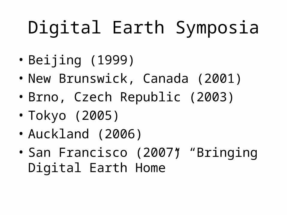
Digital Earth Symposia
• Beijing (1999)
• New Brunswick, Canada (2001)
• Brno, Czech Republic (2003)
• Tokyo (2005)
• Auckland (2006)
• San Francisco (2007) “Bringing Digital Earth Home”
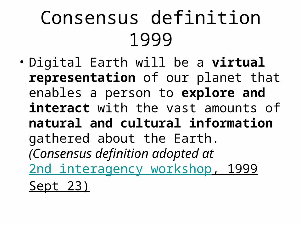
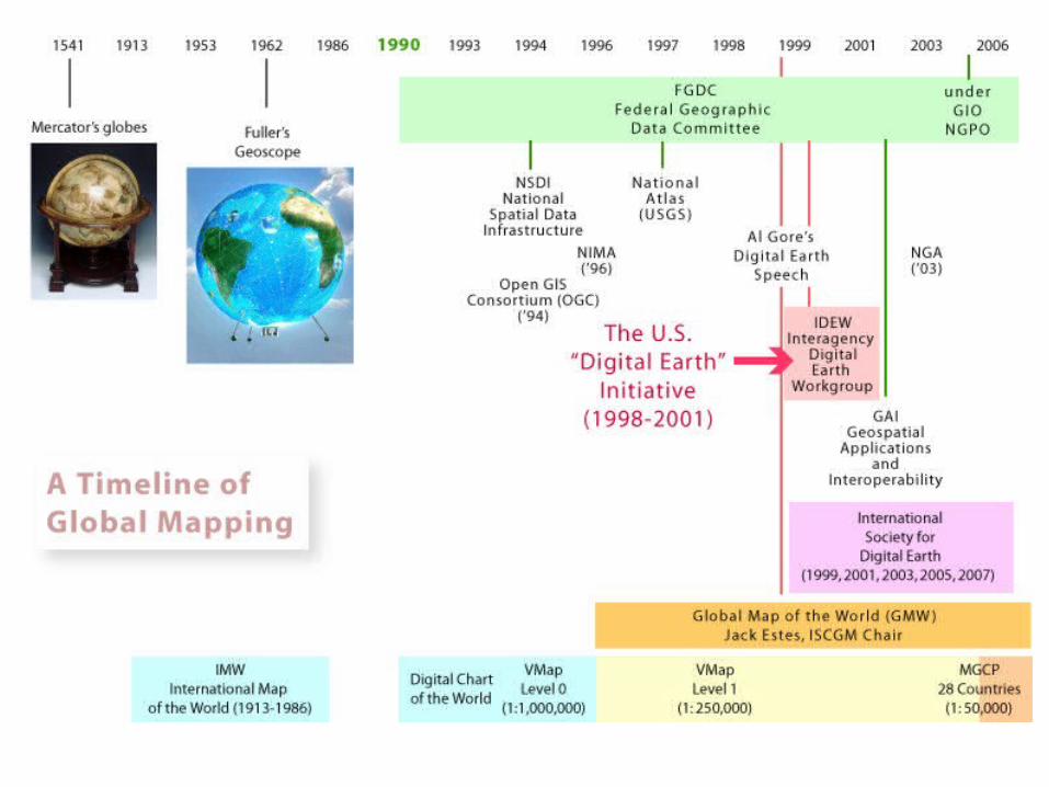
Consensus definition 1999
• Digital Earth will be a virtual representation of our planet that enables a person to explore and interact with the vast amounts of natural and cultural information gathered about the Earth.(Consensus definition adopted at 2nd interagency workshop, 1999 Sept 23)
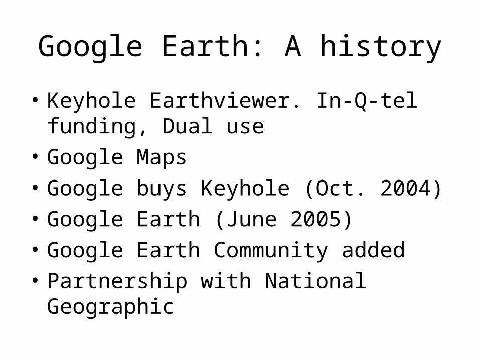
Google Earth: A history
• Keyhole Earthviewer. In-Q-tel funding, Dual use
• Google Maps
• Google buys Keyhole (Oct. 2004)
• Google Earth (June 2005)
• Google Earth Community added
• Partnership with National Geographic
Geobrowser demoKarl Grossner movie
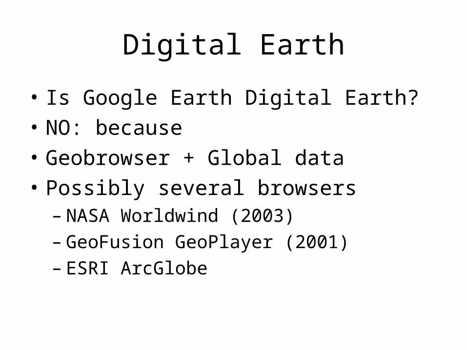
Digital Earth
• Is Google Earth Digital Earth?
• NO: because
• Geobrowser + Global data
• Possibly several browsers– NASA Worldwind (2003)– GeoFusion GeoPlayer (2001)– ESRI ArcGlobe
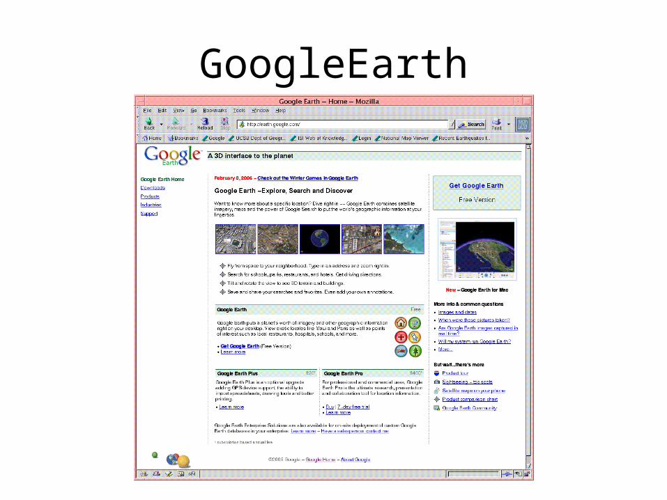
GoogleEarth
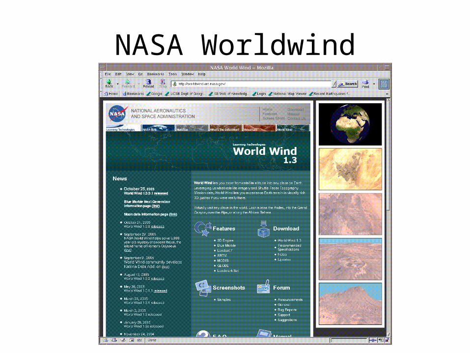
NASA Worldwind
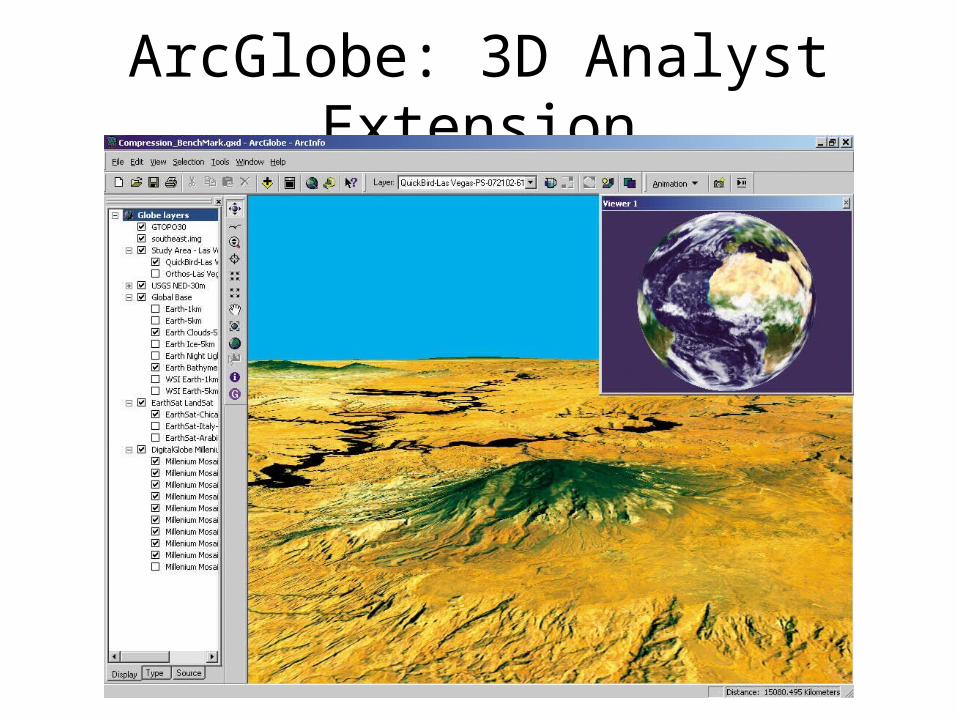
ArcGlobe: 3D Analyst Extension
Global maps
• Crosses boundary between– MAPS– IMAGERY– TOPONYMY
Global Maps
• International Millionth Map of the World
• VMAP0 (DCW)
• GlobalMap
The Millionth Map of the World Project
• German Geographer Albrecht Penck (1858-1945) was a major proponent of consistent and accurate maps to represent the entire planet, including its natural and human features.
• Penck proposed a worldwide system of maps at the Fifth International Geographical Conference in 1891.
• International Map of the World, would consist of 2500 individual maps, each at a scale of 1:1,000,000
• Each map would represent four degrees of latitude and six degrees of longitude.
• 1913, Penck's idea came to fruition when an international conference was held to establish standards for the maps, which also became known as the Millionth Map of the World due to the map series' scale.
• The 1913 standards established that maps would use the local form of each place name in the Roman alphabet (thus, languages that use other alphabets would need to transliterate their place names).
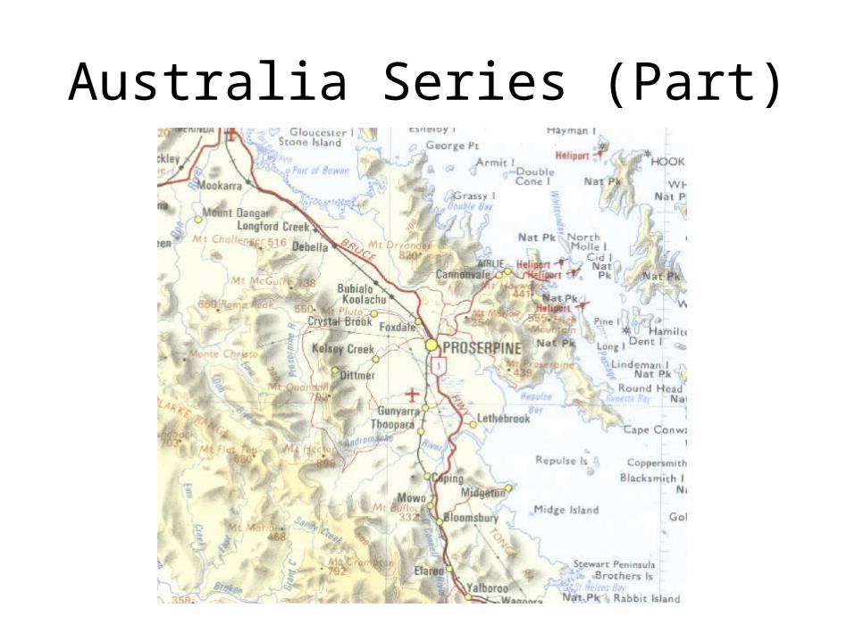
Australia Series (Part)
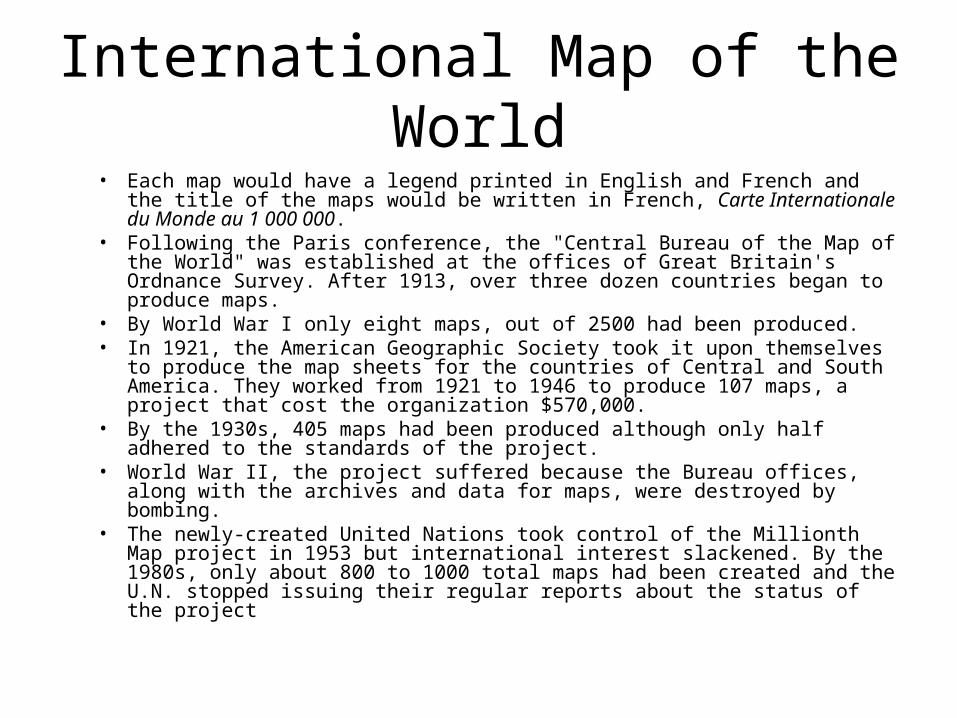
International Map of the World• Each map would have a legend printed in English and French and the
title of the maps would be written in French, Carte Internationale du Monde au 1 000 000.
• Following the Paris conference, the "Central Bureau of the Map of the World" was established at the offices of Great Britain's Ordnance Survey. After 1913, over three dozen countries began to produce maps.
• By World War I only eight maps, out of 2500 had been produced.• In 1921, the American Geographic Society took it upon themselves to
produce the map sheets for the countries of Central and South America. They worked from 1921 to 1946 to produce 107 maps, a project that cost the organization $570,000.
• By the 1930s, 405 maps had been produced although only half adhered to the standards of the project.
• World War II, the project suffered because the Bureau offices, along with the archives and data for maps, were destroyed by bombing.
• The newly-created United Nations took control of the Millionth Map project in 1953 but international interest slackened. By the 1980s, only about 800 to 1000 total maps had been created and the U.N. stopped issuing their regular reports about the status of the project
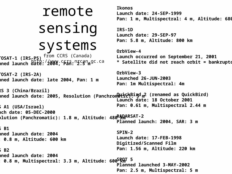
Planned remotesensing systems
from CCRS (Canada) http://www.ccrs.nrcan.gc.ca
CARTOSAT-1 (IRS-P5)Planned launch date: 2004, Pan: 2.5 m
CARTOSAT-2 (IRS-2A)Planned launch date: late 2004, Pan: 1 m
CBERS 3 (China/Brazil)Planned launch date: 2005, Resolution (Panchromatic): 5 m
EROS A1 (USA/Israel)Launch date: 05-DEC-2000Resolution (Panchromatic): 1.8 m, Altitude: 480 km
EROS B1 Planned launch date: 2004Pan: 0.8 m, Altitude: 600 km
EROS B2Planned launch date: 2004Pan: 0.8 m, Multispectral: 3.3 m, Altitude: 600 km
IkonosLaunch date: 24-SEP-1999Pan: 1 m, Multispectral: 4 m, Altitude: 680 km
IRS-1DLaunch date: 29-SEP-97Pan: 5.8 m, Altitude: 800 km
OrbView-4Launch occurred on September 21, 2001* Satellite did not reach orbit = bankruptcy!
OrbView-3Launched 26-JUN-2003 Pan: 1m Multispectral: 4m
QuickBird 2 (renamed as QuickBird)Launch date: 18 October 2001Pan: 0.61 m, Multispectral 2.44 m
RADARSAT-2Planned launch: 2004, SAR: 3 m
SPIN-2Launch date: 17-FEB-1998Digitized/Scanned FilmPan: 1.56 m, Altitude: 220 km
SPOT 5Planned launched 3-MAY-2002Pan: 2.5 m, Multispectral: 5 m
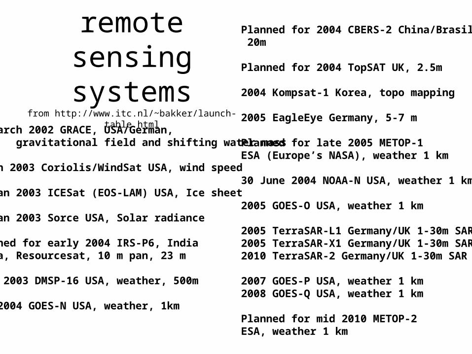
Planned remotesensing systems
from http://www.itc.nl/~bakker/launch-table.html
17 March 2002 GRACE, USA/German, gravitational field and shifting water mass
6 Jan 2003 Coriolis/WindSat USA, wind speed
13 Jan 2003 ICESat (EOS-LAM) USA, Ice sheet
25 Jan 2003 Sorce USA, Solar radiance
Planned for early 2004 IRS-P6, IndiaIndia, Resourcesat, 10 m pan, 23 m
June 2003 DMSP-16 USA, weather, 500m
Jan 2004 GOES-N USA, weather, 1km
Planned for 2004 CBERS-2 China/Brasil, 20m
Planned for 2004 TopSAT UK, 2.5m
2004 Kompsat-1 Korea, topo mapping
2005 EagleEye Germany, 5-7 m
Planned for late 2005 METOP-1 ESA (Europe’s NASA), weather 1 km
30 June 2004 NOAA-N USA, weather 1 km
2005 GOES-O USA, weather 1 km
2005 TerraSAR-L1 Germany/UK 1-30m SAR 2005 TerraSAR-X1 Germany/UK 1-30m SAR 2010 TerraSAR-2 Germany/UK 1-30m SAR
2007 GOES-P USA, weather 1 km 2008 GOES-Q USA, weather 1 km
Planned for mid 2010 METOP-2 ESA, weather 1 km
Issues
• Linking text, maps and imagery: Fusion
• Making maps and images text searchable
• Data structures
• Global grids
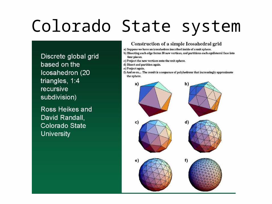
Colorado State system
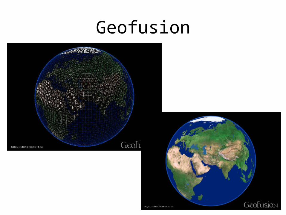
Geofusion
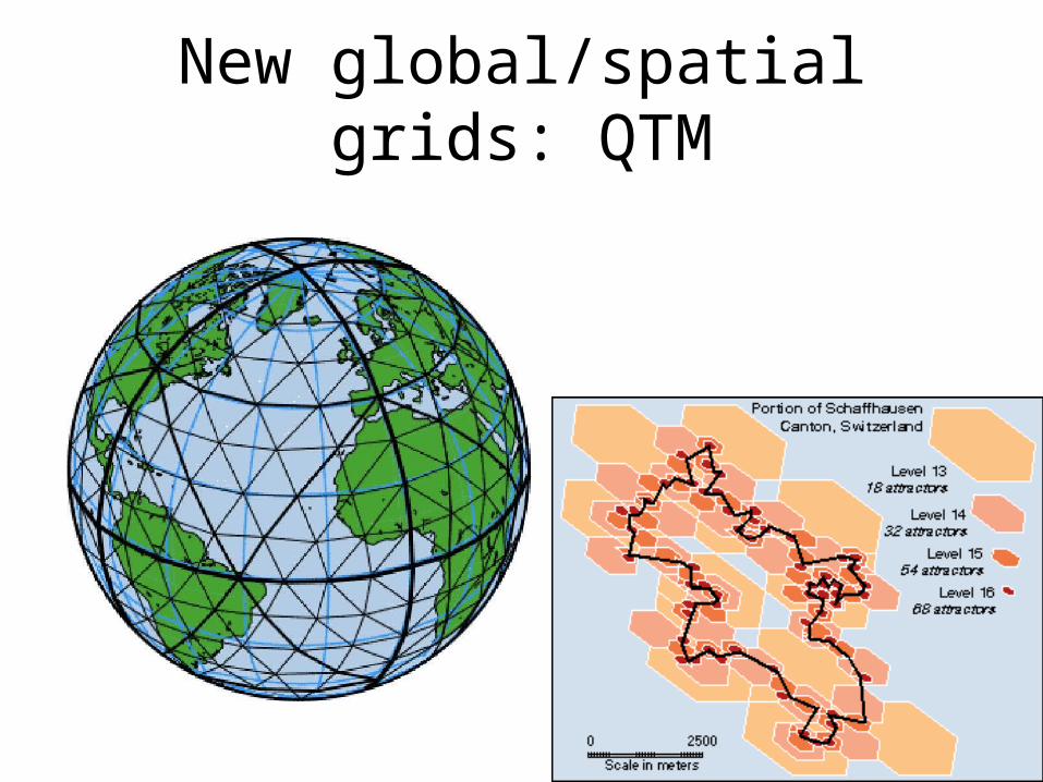
New global/spatial grids: QTM
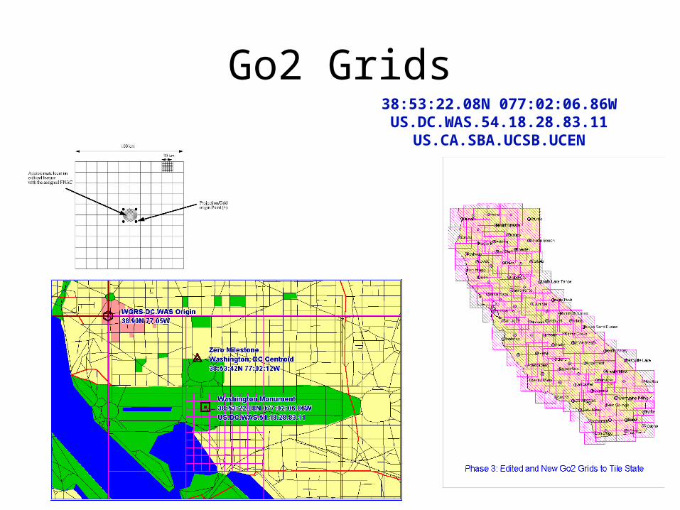
Go2 Grids38:53:22.08N 077:02:06.86WUS.DC.WAS.54.18.28.83.11US.CA.SBA.UCSB.UCEN