Embed Size (px)
Citation preview
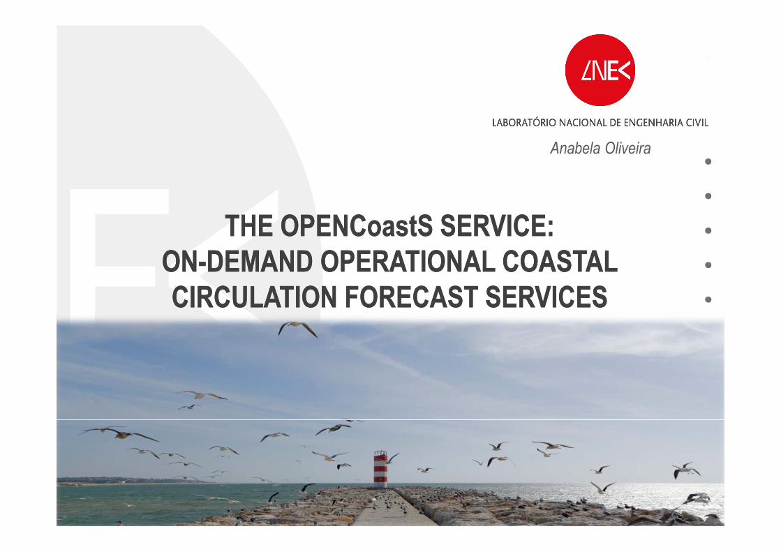
THE OPENCoastS SERVICE:
ON-DEMAND OPERATIONAL COASTAL
CIRCULATION FORECAST SERVICES
THE OPENCoastS SERVICE:
ON-DEMAND OPERATIONAL COASTAL
CIRCULATION FORECAST SERVICES
Anabela Oliveira
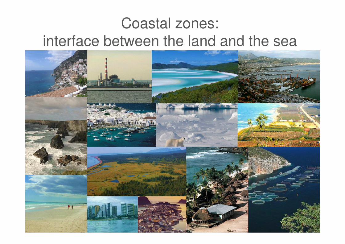
Coastal zones:
interface between the land and the sea
LNEC | 2
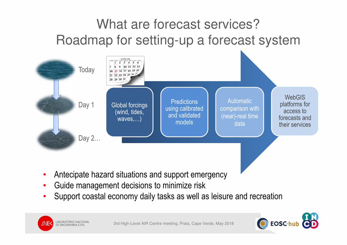
What are forecast services? Roadmap for setting-up a forecast system
• Antecipate hazard situations and support emergency
• Guide management decisions to minimize risk
• Support coastal economy daily tasks as well as leisure and recreation
Global forcings (wind, tides, waves,…)
Predictionsusing calibratedand validated
models
Automatic comparison with (near)-real time
data
WebGISplatforms for
access to forecasts andtheir services
Today
Day 1
Day 2…
3rd High-Level AIR Centre meeting, Praia, Cape Verde, May 2018
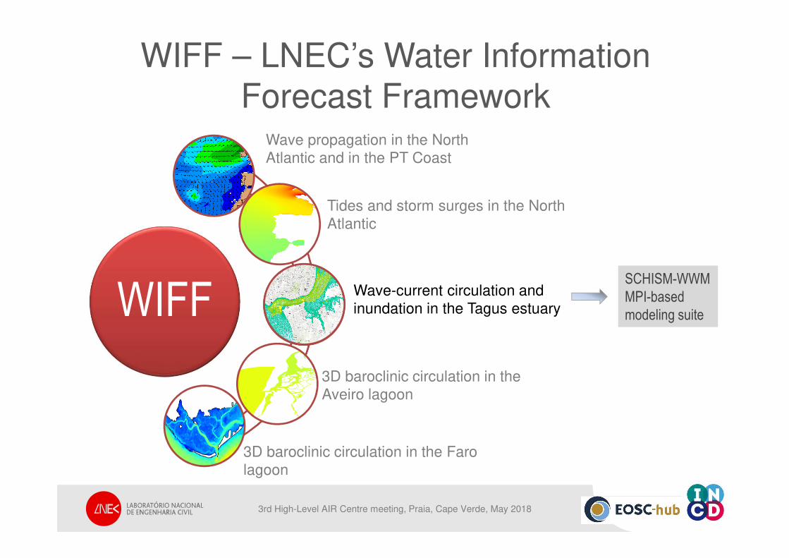
WIFF
3D baroclinic circulation in the
Aveiro lagoon
3D baroclinic circulation in the Faro
lagoon
WIFF
Wave propagation in the North
Atlantic and in the PT Coast
Tides and storm surges in the North
Atlantic
Wave-current circulation and
inundation in the Tagus estuary
SCHISM-WWM
MPI-based
modeling suite
WIFF – LNEC’s Water Information
Forecast Framework
3rd High-Level AIR Centre meeting, Praia, Cape Verde, May 2018
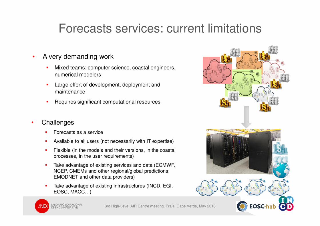
Forecasts services: current limitations
• A very demanding work
� Mixed teams: computer science, coastal engineers,
numerical modelers
� Large effort of development, deployment and
maintenance
� Requires significant computational resources
• Challenges
� Forecasts as a service
� Available to all users (not necessarily with IT expertise)
� Flexible (in the models and their versions, in the coastal
processes, in the user requirements)
� Take advantage of existing services and data (ECMWF,
NCEP, CMEMs and other regional/global predictions;
EMODNET and other data providers)
� Take advantage of existing infrastructures (INCD, EGI,
EOSC, MACC…)
3rd High-Level AIR Centre meeting, Praia, Cape Verde, May 2018
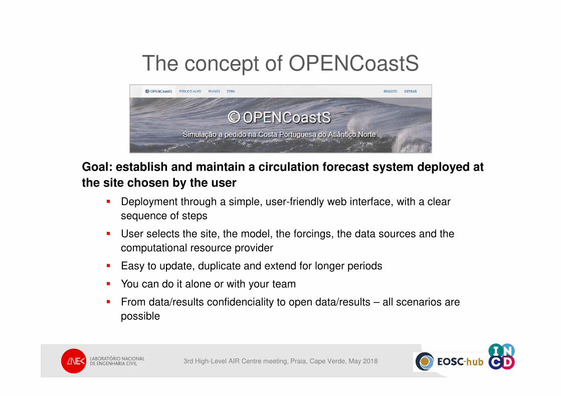
The concept of OPENCoastS
Goal: establish and maintain a circulation forecast system deployed at
the site chosen by the user
� Deployment through a simple, user-friendly web interface, with a clear
sequence of steps
� User selects the site, the model, the forcings, the data sources and the
computational resource provider
� Easy to update, duplicate and extend for longer periods
� You can do it alone or with your team
� From data/results confidenciality to open data/results – all scenarios are
possible
3rd High-Level AIR Centre meeting, Praia, Cape Verde, May 2018
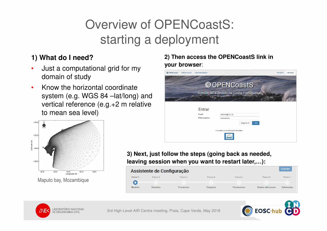
Overview of OPENCoastS: starting a deployment
1) What do I need?
• Just a computational grid for my
domain of study
• Know the horizontal coordinate
system (e.g. WGS 84 –lat/long) and
vertical reference (e.g.+2 m relative
to mean sea level)
3) Next, just follow the steps (going back as needed,
leaving session when you want to restart later,…):
2) Then access the OPENCoastS link in
your browser:
Maputo bay, Mozambique
3rd High-Level AIR Centre meeting, Praia, Cape Verde, May 2018
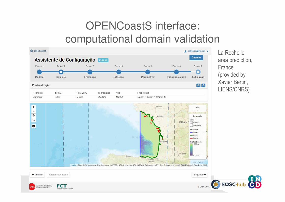
OPENCoastS interface: computational domain validation
La Rochelle
area prediction,
France
(provided by
Xavier Bertin,
LIENS/CNRS)
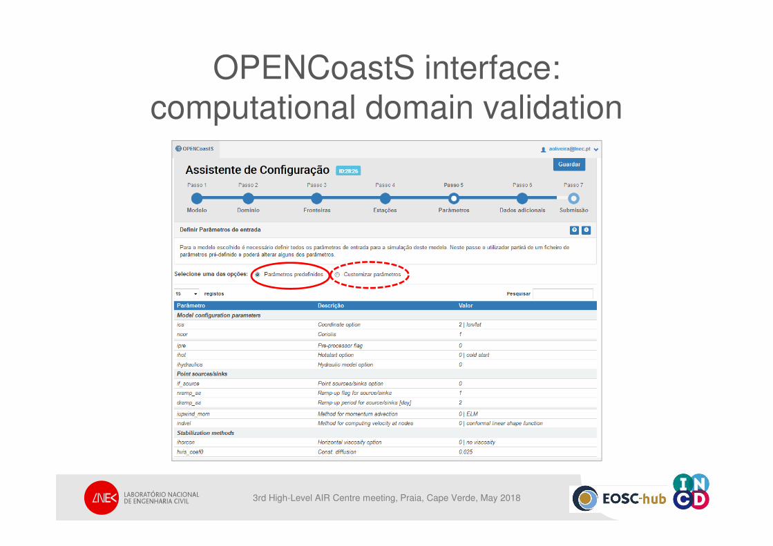
OPENCoastS interface:
computational domain validation
3rd High-Level AIR Centre meeting, Praia, Cape Verde, May 2018
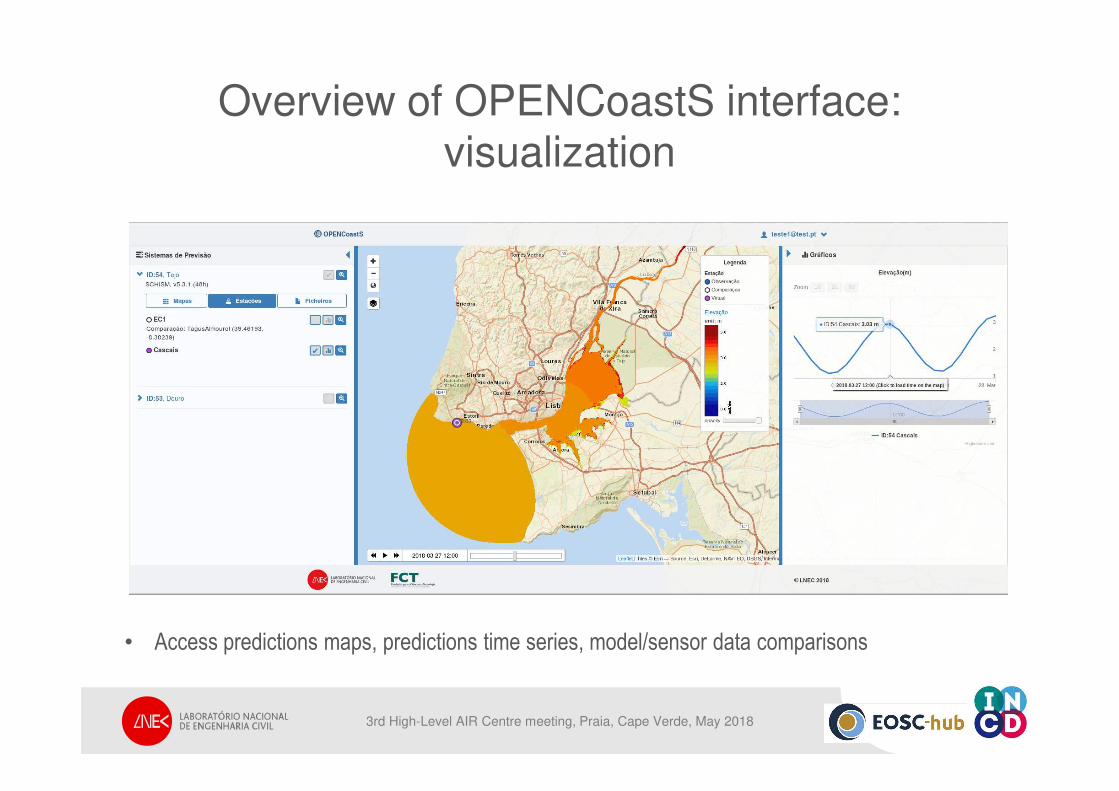
Overview of OPENCoastS interface: visualization
• Access predictions maps, predictions time series, model/sensor data comparisons
3rd High-Level AIR Centre meeting, Praia, Cape Verde, May 2018
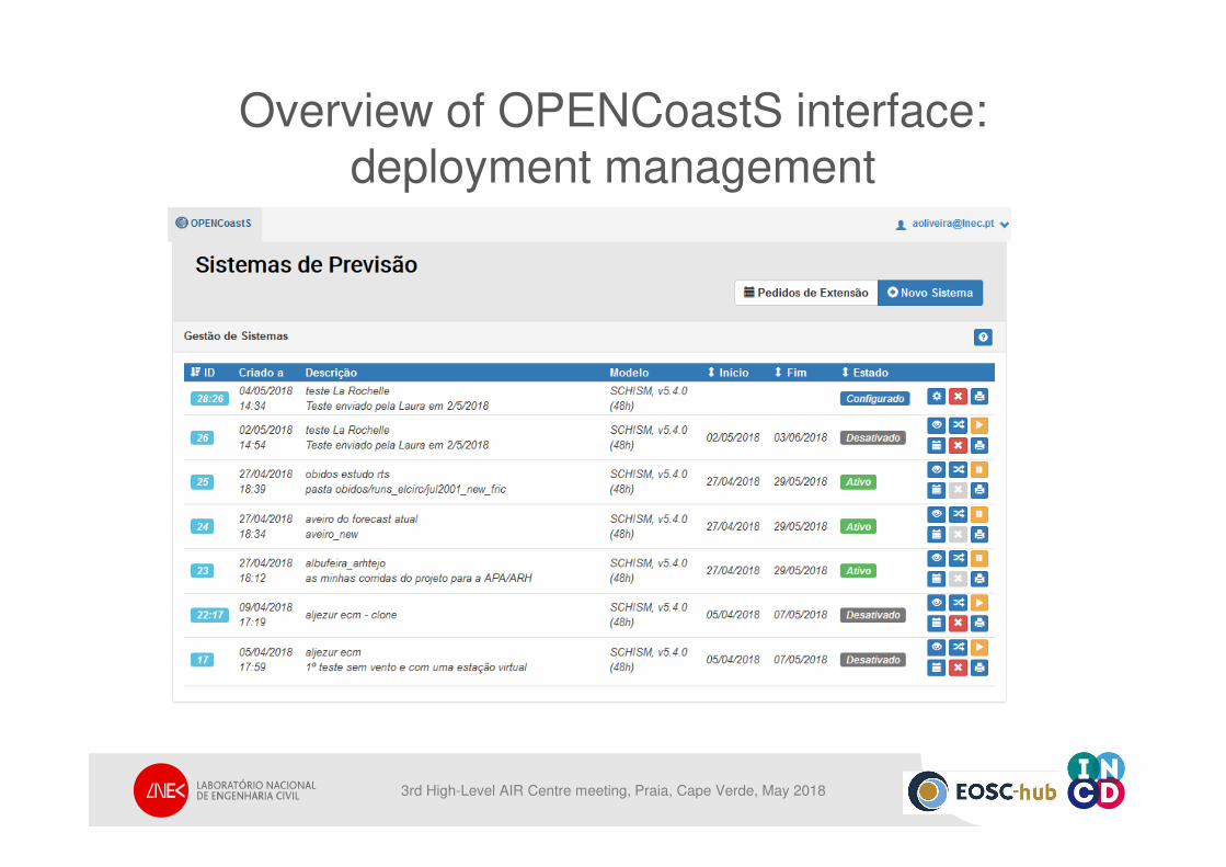
Overview of OPENCoastS interface: deployment management
3rd High-Level AIR Centre meeting, Praia, Cape Verde, May 2018
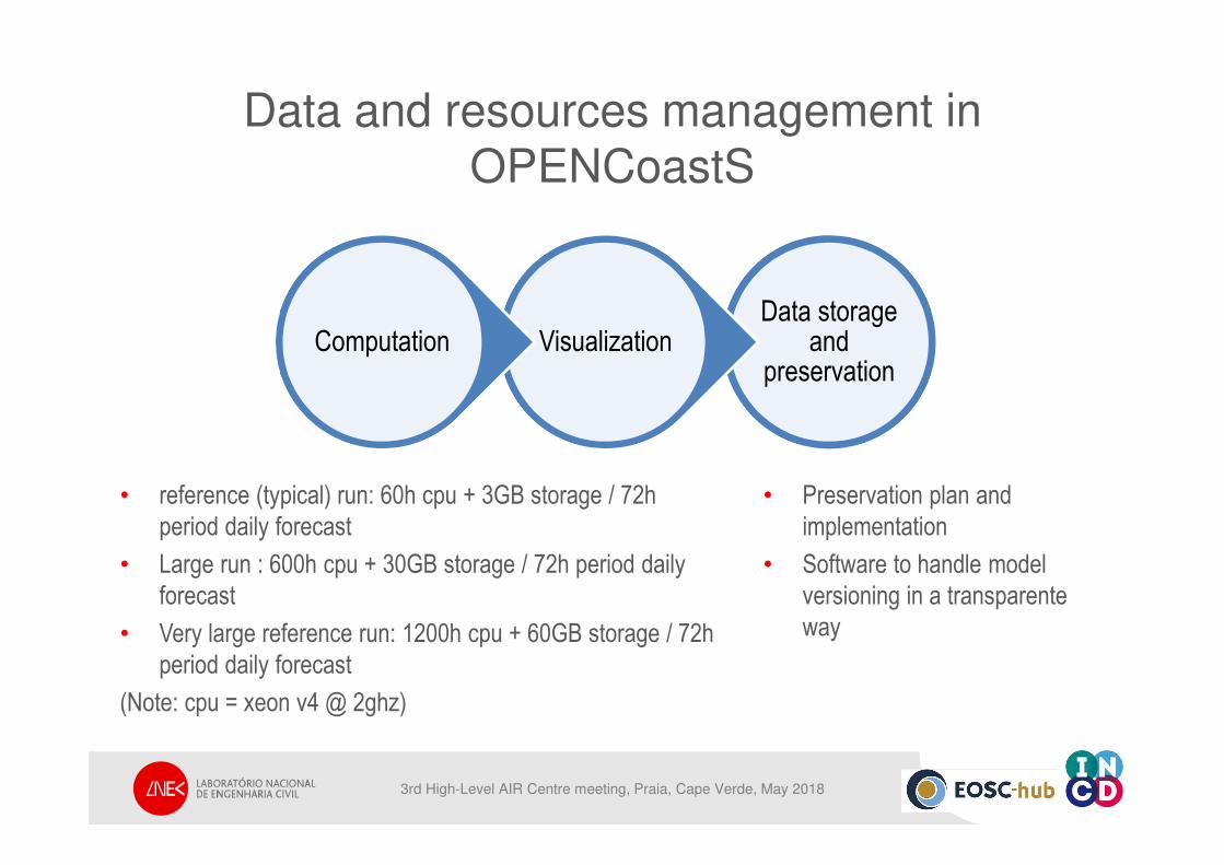
Data and resources management in OPENCoastS
Data storage and
preservationVisualizationComputation
• reference (typical) run: 60h cpu + 3GB storage / 72h
period daily forecast
• Large run : 600h cpu + 30GB storage / 72h period daily
forecast
• Very large reference run: 1200h cpu + 60GB storage / 72h
period daily forecast
(Note: cpu = xeon v4 @ 2ghz)
• Preservation plan and
implementation
• Software to handle model
versioning in a transparente
way
3rd High-Level AIR Centre meeting, Praia, Cape Verde, May 2018
Souce: NordNordWest3rd High-Level AIR Centre meeting, Praia, Cape Verde, May 2018
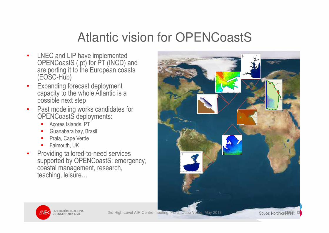
Atlantic vision for OPENCoastS
• LNEC and LIP have implementedOPENCoastS (.pt) for PT (INCD) andare porting it to the European coasts(EOSC-Hub)
• Expanding forecast deploymentcapacity to the whole Atlantic is a possible next step
• Past modeling works candidates for OPENCoastS deployments:� Açores Islands, PT
� Guanabara bay, Brasil
� Praia, Cape Verde
� Falmouth, UK
• Providing tailored-to-need servicessupported by OPENCoastS: emergency, coastal management, research, teaching, leisure…
LNEC | 13
3rd High-Level AIR Centre meeting, Praia, Cape Verde, May 2018
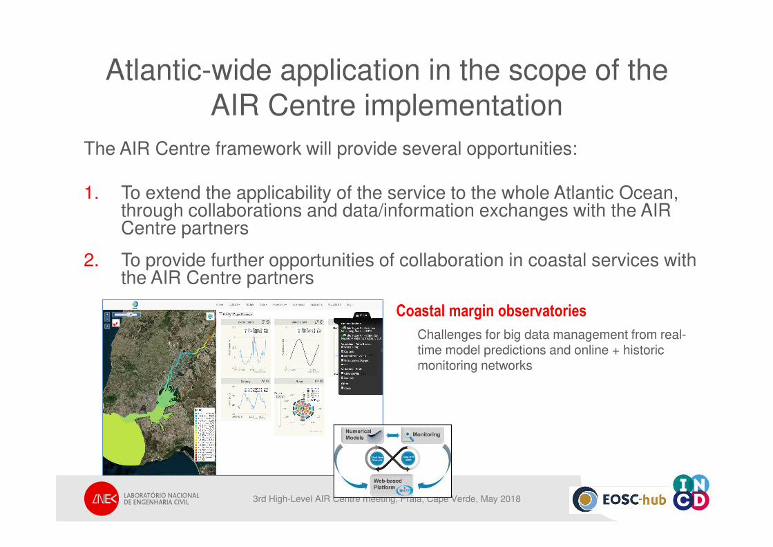
Atlantic-wide application in the scope of theAIR Centre implementation
The AIR Centre framework will provide several opportunities:
1. To extend the applicability of the service to the whole Atlantic Ocean, through collaborations and data/information exchanges with the AIR Centre partners
2. To provide further opportunities of collaboration in coastal services with the AIR Centre partners
Coastal margin observatories
Challenges for big data management from real-time model predictions and online + historic monitoring networks
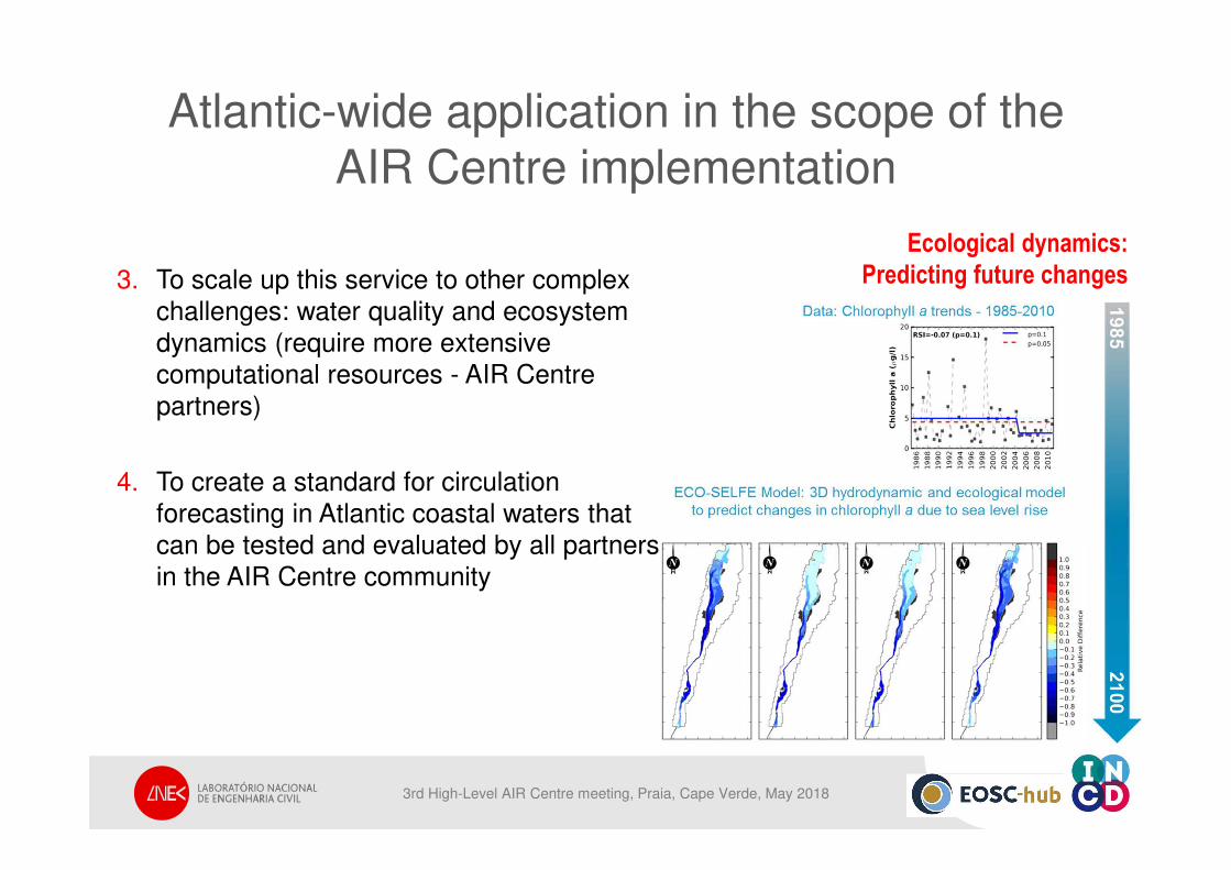
Atlantic-wide application in the scope of theAIR Centre implementation
3. To scale up this service to other complex
challenges: water quality and ecosystem
dynamics (require more extensive
computational resources - AIR Centre
partners)
4. To create a standard for circulation
forecasting in Atlantic coastal waters that
can be tested and evaluated by all partners
in the AIR Centre community
Ecological dynamics:
Predicting future changes
3rd High-Level AIR Centre meeting, Praia, Cape Verde, May 2018
THANK YOU FOR YOUR ATTENTIONTHANK YOU FOR YOUR ATTENTION
EOSC-hub receives funding from the
European Union’s Horizon 2020
research and innovation programme
under grant agreement No. 777536.
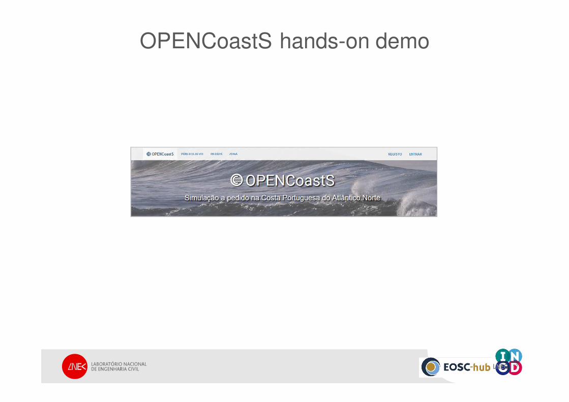
OPENCoastS hands-on demo
LNEC | 17