Embed Size (px)
Citation preview
1
THE NEEDS FOR IMPROVEMENT THE NEEDS FOR IMPROVEMENT
IN TURKISH LAND ADMINISTRATION SYSTEM: IN TURKISH LAND ADMINISTRATION SYSTEM:
LESSONS LEARNED FROM GERMAN CASELESSONS LEARNED FROM GERMAN CASE
Mehmet CETE, Mehmet CETE, HolgerHolger MAGEL and MAGEL and TahsinTahsin YOMRALIOGLUYOMRALIOGLU
Ø Introduction
Ø Land registry and cadastre (LRC) system
• Turkish LRC system
• Lessons learned from German case
Ø Topographical Mapping System
• Turkish topographical mapping system
• Lessons learned from German case
Ø Real Estate Valuation system
• Turkish real estate valuation system
• Lessons learned from German case
Ø Conclusion
ContentContent
11 // 1122
Ø Importance of effective land administration systems
Ø The aim of the study is to evaluate efficiency of present Turkish land
administration system (LAS) and to submit some proposals to develop its
efficiency.
Ø Research on efficiency of Turkish LAS
Ø Research on German LAS
Ø Lessons learned
IntroductionIntroduction
2 2 // 1122
Land Registry and Cadastre System (LRC)Land Registry and Cadastre System (LRC)
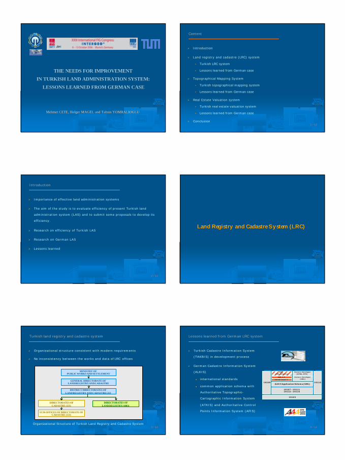
Turkish land registry and cadastre systemTurkish land registry and cadastre system
MINISTRY OF PUBLIC WORKS AND SETTLEMENT
GENERAL DIRECTORATE OF LAND REGISTRY AND CADASTRE
DISTRICT DIRECTORATES OF LAND REGISTRY AND CADASTRE (22)
DIRECTORATES OF CADASTRE (325)
SUB-OFFICES OF DIRECTORATE OF CADASTRE (133)
DIRECTORATES OF LAND REGISTRY (1003)
Organizational Structure of Turkish Land Registry and Cadastre System
Ø Organizational structure consistent with modern requirements
Ø No inconsistency between the works and data of LRC offices
3 3 // 1122
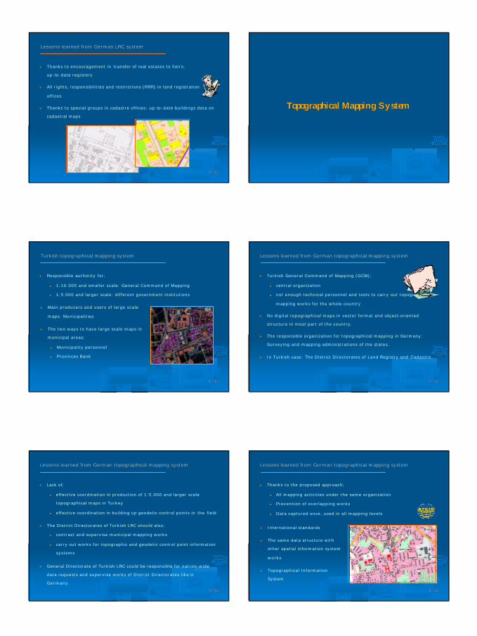
Ø Turkish Cadastre Information System
(TAKBIS) in development process
Ø German Cadastre Information System
(ALKIS)
l international standards
l common application schema with
Authoritative Topographic-
Cartographic Information System
(ATKIS) and Authoritative Control
Points Information System (AFIS)
Lessons learned from German LRC systemLessons learned from German LRC system
1910319103
1910919109
19107 –1911119112 –1911519107 –19111
19112 –19115
ALKIS Application Schema (UML)ALKIS Application Schema (UML)
19118 Level 119118 Level 1
GML 3.0GML 3.0
NAS(XML-Schema)
NAS(XML-Schema)
Feature Catalogue(XML)
Feature Catalogue(XML)
Feature Catalogue(HTML, RTF)
Feature Catalogue(HTML, RTF)
1911019110
4 4 // 1122
2
Ø Thanks to encouragement in transfer of real estates to heirs;
up-to-date registers
Ø All rights, responsibilities and restrictions (RRR) in land registration
offices
Ø Thanks to special groups in cadastre offices; up-to-date buildings data on
cadastral maps
Lessons learned from German LRC systemLessons learned from German LRC system
5 5 // 1122
Topographical Mapping SystemTopographical Mapping System
Ø Responsible authority for;
l 1:10.000 and smaller scale: General Command of Mapping
l 1:5.000 and larger scale: different government institutions
Turkish topographical mapping systemTurkish topographical mapping system
6 6 // 1122
Ø Main producers and users of large scale
maps: Municipalities
Ø The two ways to have large scale maps in
municipal areas:
l Municipality personnel
l Provinces Bank
Ø Turkish General Command of Mapping (GCM);
l central organization
l not enough technical personnel and tools to carry out topographical
mapping works for the whole country
Ø No digital topographical maps in vector format and object-oriented
structure in most part of the country.
Ø The responsible organization for topographical mapping in Germany:
Surveying and mapping administrations of the states.
Ø In Turkish case: The District Directorates of Land Registry and Cadastre.
Lessons learned from German topographical mapping systemLessons learned from German topographical mapping system
7 7 // 1122
Ø Lack of;
l effective coordination in production of 1:5.000 and larger scale
topographical maps in Turkey
l effective coordination in building up geodetic control points in the field
Ø The District Directorates of Turkish LRC should also;
l contract and supervise municipal mapping works
l carry out works for topographic and geodetic control point information
systems
Ø General Directorate of Turkish LRC could be responsible for nati on-wide
data requests and supervise works of District Directorates like in
Germany.
Lessons learned from German topographical mapping systemLessons learned from German topographical mapping system
8 8 // 1122
Ø Thanks to the proposed approach;
l All mapping activities under the same organization
l Prevention of overlapping works
l Data captured once, used in all mapping levels
Lessons learned from German topographical mapping systemLessons learned from German topographical mapping system
Ø International standards
Ø The same data structure with
other spatial information system
works
Ø Topographical Information
System
9 9 // 1122
3
Real Estate Valuation SystemReal Estate Valuation System
Ø Valuation works for taxation purpose once in 4 years by municipalities
Ø Valuation works especially for expropriation purpose by some government
institutions
Ø Each municipality and government institution has its own valuati on
committee
Ø About 15 institutions carrying out valuation works in Turkey
Turkish real estate valuation systemTurkish real estate valuation system
10 10 // 1122
Ø A specific valuation law and guidelines in which the system is clearly
defined
Ø Evaluation of purchase prices and object characteristics in valuation works
of the committees
Ø Guiding prices, annual reports and maps based on real market prices
Lessons learned from German real estate valuation systemLessons learned from German real estate valuation system
11 11 // 1122
Ø Using the valuation information provided by
the committees by all public and private
users
Ø Countries should evaluate effectiveness of their land administration
systems and adapt them to new developments.
Ø This study aims at evaluating effectiveness of Turkish LAS and submitting
some proposals for better administration of it.
Ø In defining improvement way, the experiences learned from German land
administration system have been a guide.
Ø Such case study approaches are also proposed to the other countr ies
where there are needs for reengineering or improvement in the land
administration system.
ConclusionConclusion
12 12 // 1122
thanks forthanks for your attentyour attentiionon
Mehmet Mehmet ÇÇETEETEKaradeniz Technical UniversityKaradeniz Technical UniversityDepartment of Geodesy and Photogrammetry Department of Geodesy and Photogrammetry Trabzon / TURKEYTrabzon / TURKEYTel: +90 (462) 3772794Tel: +90 (462) 3772794Fax: +90 (462) 3280918Fax: +90 (462) 3280918e e -- mail: [email protected]: [email protected]