Embed Size (px)
Citation preview
by John Dahlia
THE NATIONAL MESONETPROGRAM
FILLINGIN THEGAPS
WWW.WEATHERWISE.ORG ■ WEATHERWISE 27WWW.WEATHERWISE.ORG ■ WEATHERWISE
by John Dahlia
THIN
KSTO
CK/IS
TOCK
PHOT
O
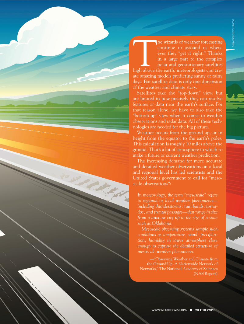
The wizards of weather forecasting continue to astound us when-ever they “get it right.” Thanks in a large part to the complex polar and geostationary satellites
high above the earth, meteorologists can cre-ate amazing models predicting sunny or rainy days. But satellite data is only one dimension of the weather and climate story.
Satellites take the “top-down” view, but are limited in how precisely they can resolve features or data near the earth’s surface. For that reason alone, we have to also take the “bottom-up” view when it comes to weather observations and radar data. All of these tech-nologies are needed for the big picture.
Weather occurs from the ground up, or in height from the equator to the earth’s poles. This calculation is roughly 10 miles above the ground. That’s a lot of atmosphere in which to make a future or current weather prediction.
The increasing demand for more accurate and detailed weather observations on a local and regional level has led scientists and the United States government to call for “meso-scale observations”:
In meteorology, the term “mesoscale” refers to regional or local weather phenomena—including thunderstorms, rain bands, torna-dos, and frontal passages—that range in size from a town or city up to the size of a state such as Oklahoma.
Mesoscale observing systems sample such conditions as temperature, wind, precipita-tion, humidity in lower atmosphere close enough to capture the detailed structure of mesoscale weather phenomena.
—“Observing Weather and Climate from the Ground Up: A Nationwide Network of
Networks,” The National Academy of Sciences (NAS Report)
WEATHERWISE ■ JULY / AUGUST 2013
happening—especially as it pertains to the pro-tection of life and property. The second reason goes back to the mathematical models that are used to forecast future weather. The greater the density of the data input, the better the initial conditions of a model.”
In response to the National Academy of Sciences 2008 report, “Observing Weather and Climate from the Ground Up: A Nationwide Network of Networks,” in 2009 the NOAA and the NWS pushed forward a new initiative called the National Mesonet Pilot Program. Global Science & Technology, Inc. has been working as the prime contractor on this program since then.
The purpose of the program was to extend sur-face-based meteorological observing capabilities to platforms—both fixed site or land-based and mobile. These observing systems sample temper-ature, wind, precipitation, and humidity in the lower atmosphere, and are spaced close enough to capture the detailed structure of weather phe-nomena. The report provides a strategy for filling gaps in the nation’s meteorological, hydrologic, and related environmental observing capabilities to improve prediction of high-impact, local-scale weather events, such as thunderstorms, snow squalls, and black ice, among others.
“The strategy,” Heppner explains, “is to lever-age existing surface-based observing networks or mesonets owned and operated by non-federal en-tities like the states, academia, and the private sector.”
A pilot project developed by the NWS built an infrastructure that extends the backbone surface-based observing capabilities to nationwide cov-erage for observations of low-level atmospheric conditions. These so-called “low-level observa-tions” are intended to help NOAA’s mission to resolve data at less than 5 kilometers spatially, every 15 minutes or less. The observations would also include soil temperature and moisture at 50 kilometers resolution or less.
“The purpose of the [National Mesonet] Pilot Program was to establish a proof of concept for a National Mesonet, not by building a new ob-serving system, but by linking together existing mesonets, operated by non-federal parties (e.g., states and private companies) in the south-central United States,” said Dr. Curtis Marshall, NWS national mesonet program manager. “The linking together was achieved partly by pro-viding a common IT framework for gathering, quality-controlling, and disseminating data from the networks to users of the data both within NWS and across the broader weather enterprise. Another important component of linking the networks together involves metadata or ‘data about the data.’”
It wasn’t very long ago that forecasters were limited to using airport weather observations to get an idea of what was going on at the surface. Although airport observations are still the back-bone of the observation network in the United States, over the years, there has been a growing body of “non-federal” networks, where weather observations are taken between airports. Simply put, these non-federal networks “densify” or fill in the gaps between the airports.
Why is that important? “The first [reason] is situational awareness,”
Global Science & Technology, Inc. meteorolo-gist and program manager Paul Heppner explains. “The more observations that are available, the more forecasters have to work with, especially when they are monitoring important storms like the recent Hurricane Sandy that ravaged parts of our nation last fall. When warnings are issued, a huge emphasis is placed on monitoring what is
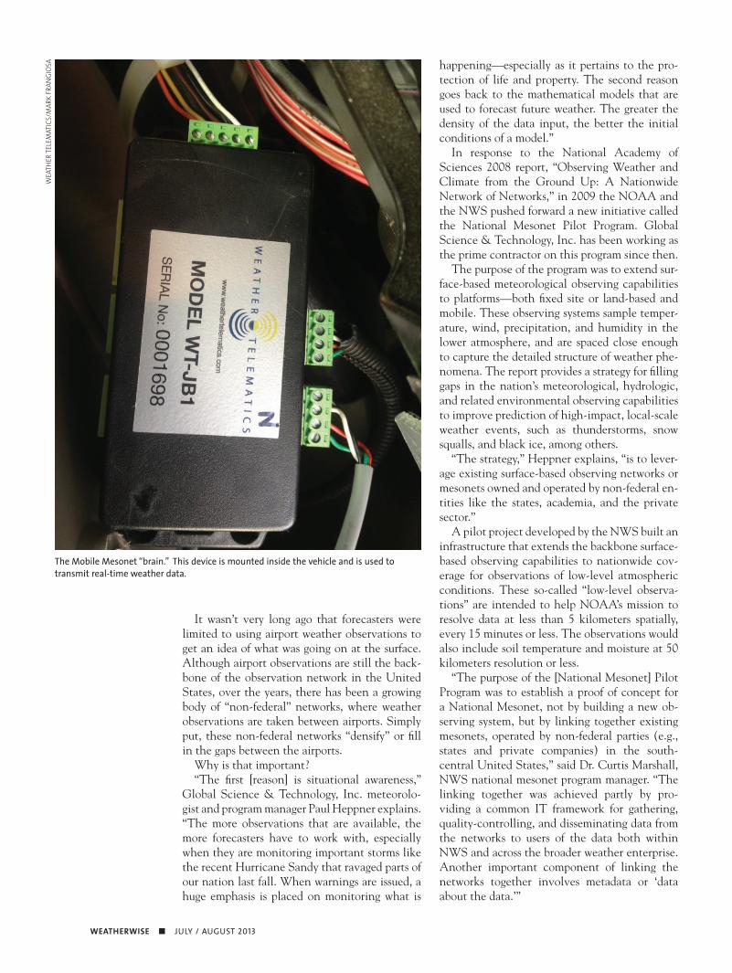
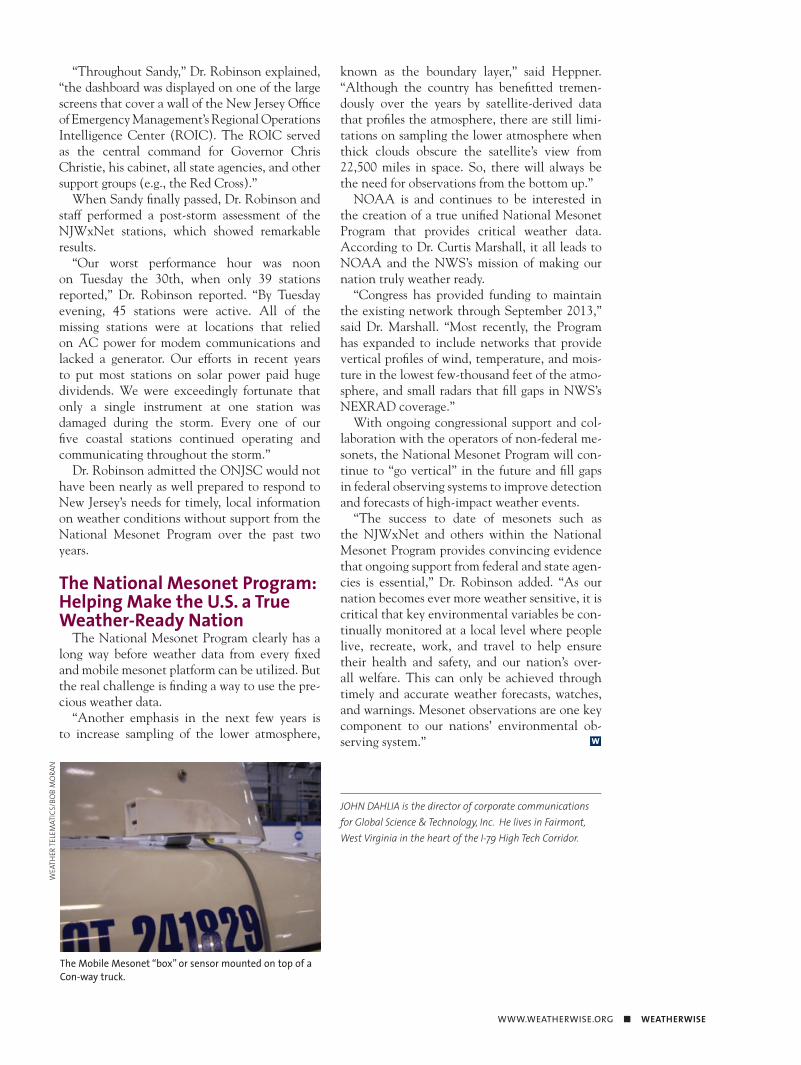
The Mobile Mesonet “brain.” This device is mounted inside the vehicle and is used to transmit real-time weather data.
WEA
THER
TELE
MAT
ICS/
MAR
K FR
ANGI
OSA
WWW.WEATHERWISE.ORG ■ WEATHERWISE
As Dr. Marshall explains, the metadata in-clude locations of individual sensors, sensor ac-curacy and calibration characteristics, and char-acteristics of the environment of the sensor (e.g., land cover). Through the pilot program, meta-data were gathered for each network and were made available to users of the data in a consistent format and content.
“As the NAS Report demonstrated, availabil-ity of metadata is key to effecting a nationwide network from numerous component networks, because the metadata permit the user to mine the underlying data and apply it in a range of ap-plications that might otherwise not be possible without the context provided by the ‘data about the data,’” Marshall said.
The Great Task Begins: Utilizing the Network of Networks
Certainly these Automated Surface Observation Stations (ASOS) at airports and Road Weather Information Systems (RWIS) along highways are accurate enough for a specific geographic location. But, even with thousands of additional “fixed site” non-federal stations at the surface, there is a tremendous amount of ge-ography that goes untouched by meteorological sampling.
What about when you’re driving in a rural or suburban area, far from an airport or fixed weather station? Ultimately, you still want weather in-formation about a cold snap which could mean black ice or a snow squall.
Enter Mobile Platforms: Trucks, Cars, Etc.
Mesoscale observations greatly benefit from the collection and analysis of mobile platform weather data. What if weather information could be gathered by trucks traveling down the road?
The goldmine of data lies in and around what the NWS has dubbed critical infrastructure, in-cluding bridges, highway interchanges, and trans-portation corridors sensitive to weather (e.g., fog, drifting snow, black ice). Weather-related accidents and delays are directly responsible for thousands of lives lost, hundreds of thousands of
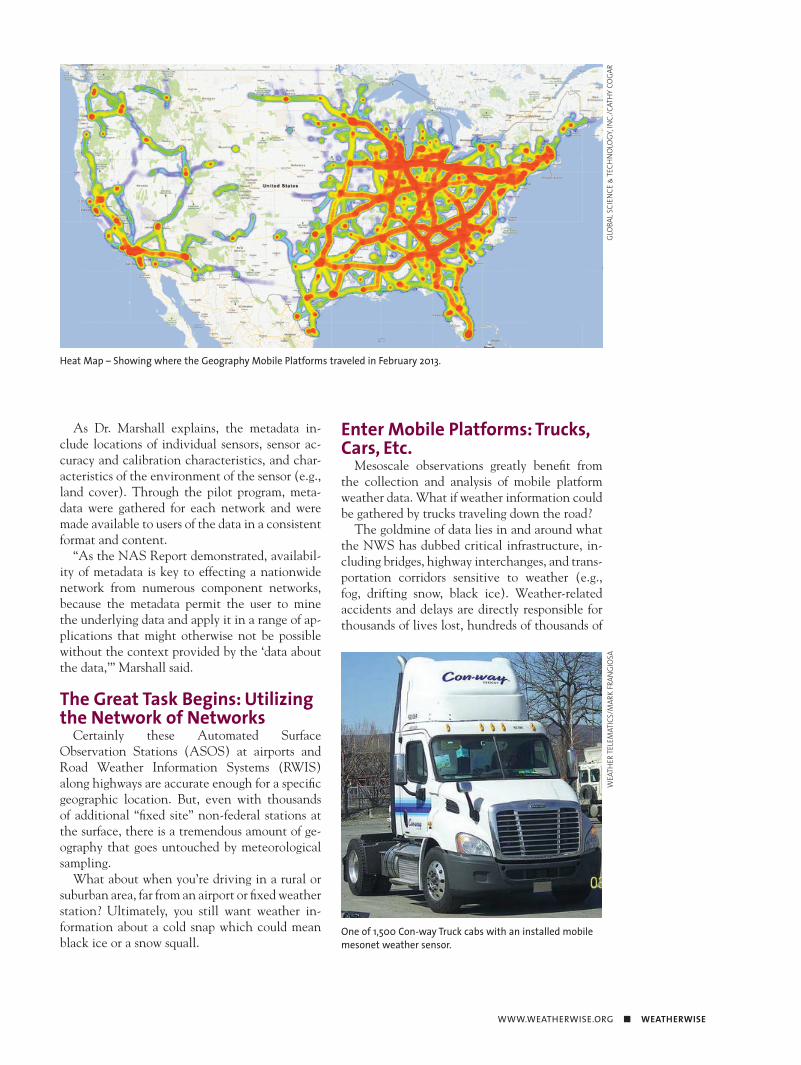
One of 1,500 Con-way Truck cabs with an installed mobile mesonet weather sensor.
WEA
THER
TELE
MAT
ICS/
MAR
K FR
ANGI
OSA
Heat Map – Showing where the Geography Mobile Platforms traveled in February 2013.
GLOB
AL S
CIEN
CE &
TECH
NOL
OGY
, INC.
/CAT
HY C
OGA
R
WEATHERWISE ■ JULY / AUGUST 2013
dated mobile data taken retrieved by commercial bus fleets that could be used as part of the NWS’s weather forecasts.
“The establishment of a mobile mesonet,” ex-plains Dr. Marshall, “is an innovative component of the program and addresses a key national need for increased and enhanced observation of the roadway environment for applications in surface transportation weather. The NAS Report clearly articulated the economic benefits of including road weather information in a nationwide “net-work of networks.”
Today, GST has successfully implemented a national capability to deliver meteorological data acquired by mobile platforms to NOAA.
“You need both—fixed site and mobile,” Heppner explained. “The fixed sites give dedi-cated observations at a particular location at reg-ular time intervals. Mobile fills in the data void between stations, but somewhat randomly. It de-pends where a given vehicle is at a given time.”
GST is partnering with Weather Telematics, who designed and provides the instrumentation that has been installed on a fleet of Con-way trucks that are operated nationally in the United
injuries, billions of dollars of property damage, and countless business disruptions on an annual basis in the United States. Furthermore, adverse weather presents logistical problems, public safety concerns, and economic disruption at both the national and local levels. Up until this point no one has come up with a workable innovation that could retrieve weather data from the road.
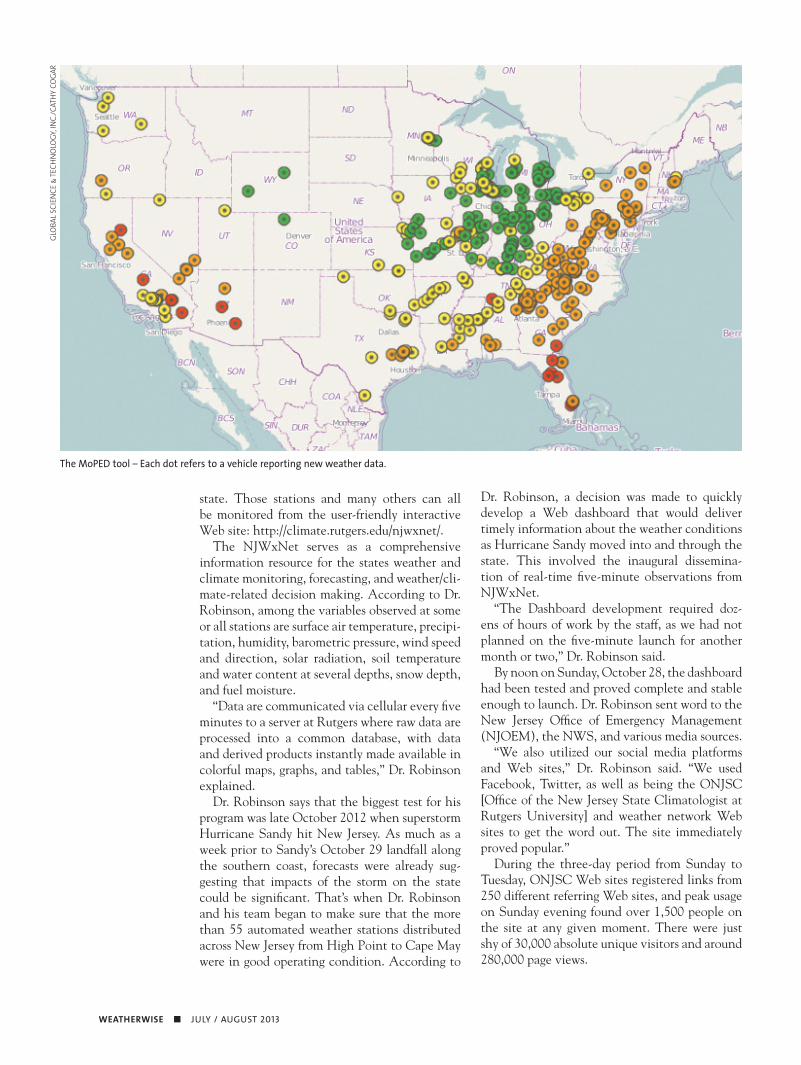
“What started out as a proof-of-concept to de-termine if meteorological data could be obtained by a traveling vehicle and successfully transmit-ted to NOAA in real-time has evolved into a real network of greater than 2 million observations daily from a fleet nationwide,” said Heppner. “This is just the beginning. In the years ahead as the fleets and coverage expands, more geography will be covered. That means more fine-scale data for weather forecasters and the ability to resolve features in between airports and fixed sites in ways that never has happened before.”
The Greenbelt, Maryland, firm Global Science & Technology (GST) won two contracts to develop a relatively new technology known as mobile platform environmental data (MoPED). MoPED was a multisystem prototype that vali-
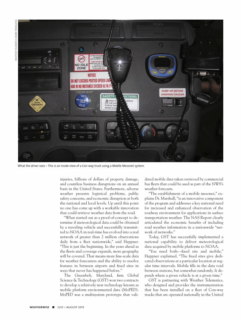
What the driver sees – This is an inside view of a Con-way truck using a Mobile Mesonet system.
WEA
THER
TELE
MAT
ICS/
MAR
K FR
ANGI
OSA
WWW.WEATHERWISE.ORG ■ WEATHERWISE
The initial stage of the National Mesonet Program was to assemble an alliance of these non-federal, surface-based observation networks located throughout the nation. That alliance, which began as a consortium known as the United States Mesonet or MesoUS, was made up of key companies, organizations, academic insti-tutions, and experts who have proven expertise in developing data systems, sensors, and observ-ing networks.
Today, the National Mesonet Alliance has grown to include Alabama, California, Colorado, Connecticut, Delaware, Florida, Georgia, Illinois, Kansas, Kentucky, Louisiana, Maine, Maryland, Massachusetts, Mississippi, Missouri, New Jersey, New York, North Carolina, Nevada, Oklahoma, Oregon, Pennsylvania, Rhode Island, South Carolina, Texas, Virginia, Washington, and the District of Columbia. The alliance also includes three corporate and 15 academic members, as well as the research center for Collaborative Adaptive Sensing of the Atmosphere (CASA) located in Amherst, Massachusetts.
Take the state of New Jersey, for example. The New Jersey Weather and Climate Network (NJWxNet) is run as a public service of the Office of the State Climatologist at Rutgers University. Led by Dr. David Robinson, the network is made up of 55 stations spread out across the entire
States. The program has become part of the na-tions’ first mobile (vehicle-based) environmental observation network.
Funded by NOAA and the NWS, GST estab-lished a foundational infrastructure for a national mobile environmental observation network that offers potential for providing real-time road weather and surface conditions for the entire country. Ultimately, MoPED’s purpose is to ac-quire mobile environmental and vehicle data to be included in the National Mesonet.
The result is the largest mobile weather obser-vation and surveillance network in the world and the second largest weather observation network in the United State, with more than 1,500 ve-hicles delivering more than two million observa-tions daily. Those observations are coming from approximately 1,500 Con-way delivery trucks that are traveling major transportation routes around the nation.
Assembling the “Network of Networks”
The biggest challenge to the NWS in regards to the National Mesonet Program was and is the prospect of linking or integrating these disparate mesonet systems. There are approximately 8,000 land-based mesonet stations located in 26 states around the nation.
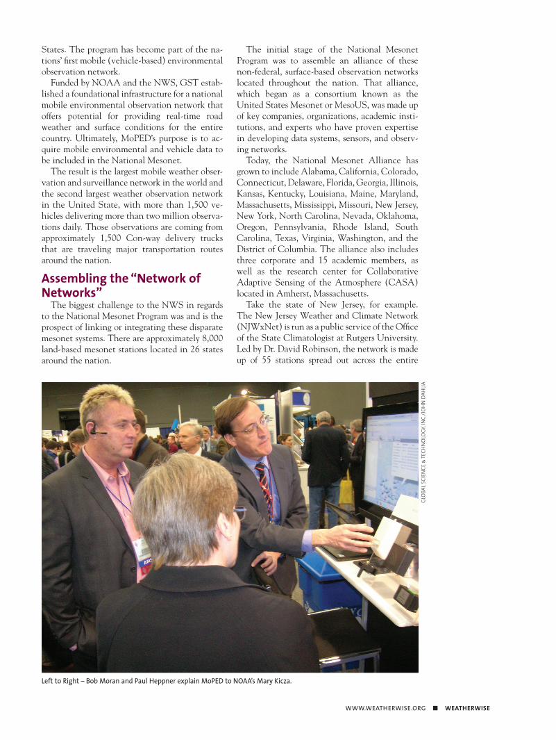
Left to Right – Bob Moran and Paul Heppner explain MoPED to NOAA’s Mary Kicza.
GLOB
AL S
CIEN
CE &
TECH
NOL
OGY
, INC.
/JOH
N D
AHLIA
WEATHERWISE ■ JULY / AUGUST 2013
Dr. Robinson, a decision was made to quickly develop a Web dashboard that would deliver timely information about the weather conditions as Hurricane Sandy moved into and through the state. This involved the inaugural dissemina-tion of real-time five-minute observations from NJWxNet.
“The Dashboard development required doz-ens of hours of work by the staff, as we had not planned on the five-minute launch for another month or two,” Dr. Robinson said.
By noon on Sunday, October 28, the dashboard had been tested and proved complete and stable enough to launch. Dr. Robinson sent word to the New Jersey Office of Emergency Management (NJOEM), the NWS, and various media sources.
“We also utilized our social media platforms and Web sites,” Dr. Robinson said. “We used Facebook, Twitter, as well as being the ONJSC [Office of the New Jersey State Climatologist at Rutgers University] and weather network Web sites to get the word out. The site immediately proved popular.”
During the three-day period from Sunday to Tuesday, ONJSC Web sites registered links from 250 different referring Web sites, and peak usage on Sunday evening found over 1,500 people on the site at any given moment. There were just shy of 30,000 absolute unique visitors and around 280,000 page views.
state. Those stations and many others can all be monitored from the user-friendly interactive Web site: http://climate.rutgers.edu/njwxnet/.
The NJWxNet serves as a comprehensive information resource for the states weather and climate monitoring, forecasting, and weather/cli-mate-related decision making. According to Dr. Robinson, among the variables observed at some or all stations are surface air temperature, precipi-tation, humidity, barometric pressure, wind speed and direction, solar radiation, soil temperature and water content at several depths, snow depth, and fuel moisture.
“Data are communicated via cellular every five minutes to a server at Rutgers where raw data are processed into a common database, with data and derived products instantly made available in colorful maps, graphs, and tables,” Dr. Robinson explained.
Dr. Robinson says that the biggest test for his program was late October 2012 when superstorm Hurricane Sandy hit New Jersey. As much as a week prior to Sandy’s October 29 landfall along the southern coast, forecasts were already sug-gesting that impacts of the storm on the state could be significant. That’s when Dr. Robinson and his team began to make sure that the more than 55 automated weather stations distributed across New Jersey from High Point to Cape May were in good operating condition. According to
GLOB
AL S
CIEN
CE &
TECH
NOL
OGY
, INC.
/CAT
HY C
OGA
R
The MoPED tool – Each dot refers to a vehicle reporting new weather data.
WWW.WEATHERWISE.ORG ■ WEATHERWISE
“Throughout Sandy,” Dr. Robinson explained, “the dashboard was displayed on one of the large screens that cover a wall of the New Jersey Office of Emergency Management’s Regional Operations Intelligence Center (ROIC). The ROIC served as the central command for Governor Chris Christie, his cabinet, all state agencies, and other support groups (e.g., the Red Cross).”
When Sandy finally passed, Dr. Robinson and staff performed a post-storm assessment of the NJWxNet stations, which showed remarkable results.
“Our worst performance hour was noon on Tuesday the 30th, when only 39 stations reported,” Dr. Robinson reported. “By Tuesday evening, 45 stations were active. All of the missing stations were at locations that relied on AC power for modem communications and lacked a generator. Our efforts in recent years to put most stations on solar power paid huge dividends. We were exceedingly fortunate that only a single instrument at one station was damaged during the storm. Every one of our five coastal stations continued operating and communicating throughout the storm.”
Dr. Robinson admitted the ONJSC would not have been nearly as well prepared to respond to New Jersey’s needs for timely, local information on weather conditions without support from the National Mesonet Program over the past two years.
The National Mesonet Program: Helping Make the U.S. a True Weather-Ready Nation
The National Mesonet Program clearly has a long way before weather data from every fixed and mobile mesonet platform can be utilized. But the real challenge is finding a way to use the pre-cious weather data.
“Another emphasis in the next few years is to increase sampling of the lower atmosphere,
known as the boundary layer,” said Heppner. “Although the country has benefitted tremen-dously over the years by satellite-derived data that profiles the atmosphere, there are still limi-tations on sampling the lower atmosphere when thick clouds obscure the satellite’s view from 22,500 miles in space. So, there will always be the need for observations from the bottom up.”
NOAA is and continues to be interested in the creation of a true unified National Mesonet Program that provides critical weather data. According to Dr. Curtis Marshall, it all leads to NOAA and the NWS’s mission of making our nation truly weather ready.
“Congress has provided funding to maintain the existing network through September 2013,” said Dr. Marshall. “Most recently, the Program has expanded to include networks that provide vertical profiles of wind, temperature, and mois-ture in the lowest few-thousand feet of the atmo-sphere, and small radars that fill gaps in NWS’s NEXRAD coverage.”
With ongoing congressional support and col-laboration with the operators of non-federal me-sonets, the National Mesonet Program will con-tinue to “go vertical” in the future and fill gaps in federal observing systems to improve detection and forecasts of high-impact weather events.
“The success to date of mesonets such as the NJWxNet and others within the National Mesonet Program provides convincing evidence that ongoing support from federal and state agen-cies is essential,” Dr. Robinson added. “As our nation becomes ever more weather sensitive, it is critical that key environmental variables be con-tinually monitored at a local level where people live, recreate, work, and travel to help ensure their health and safety, and our nation’s over-all welfare. This can only be achieved through timely and accurate weather forecasts, watches, and warnings. Mesonet observations are one key component to our nations’ environmental ob-serving system.” W
JOHN DAHLIA is the director of corporate communications for Global Science & Technology, Inc. He lives in Fairmont, West Virginia in the heart of the I-79 High Tech Corridor.
The Mobile Mesonet “box” or sensor mounted on top of a Con-way truck.
WEA
THER
TELE
MAT
ICS/
BOB
MOR
AN