Embed Size (px)
Citation preview
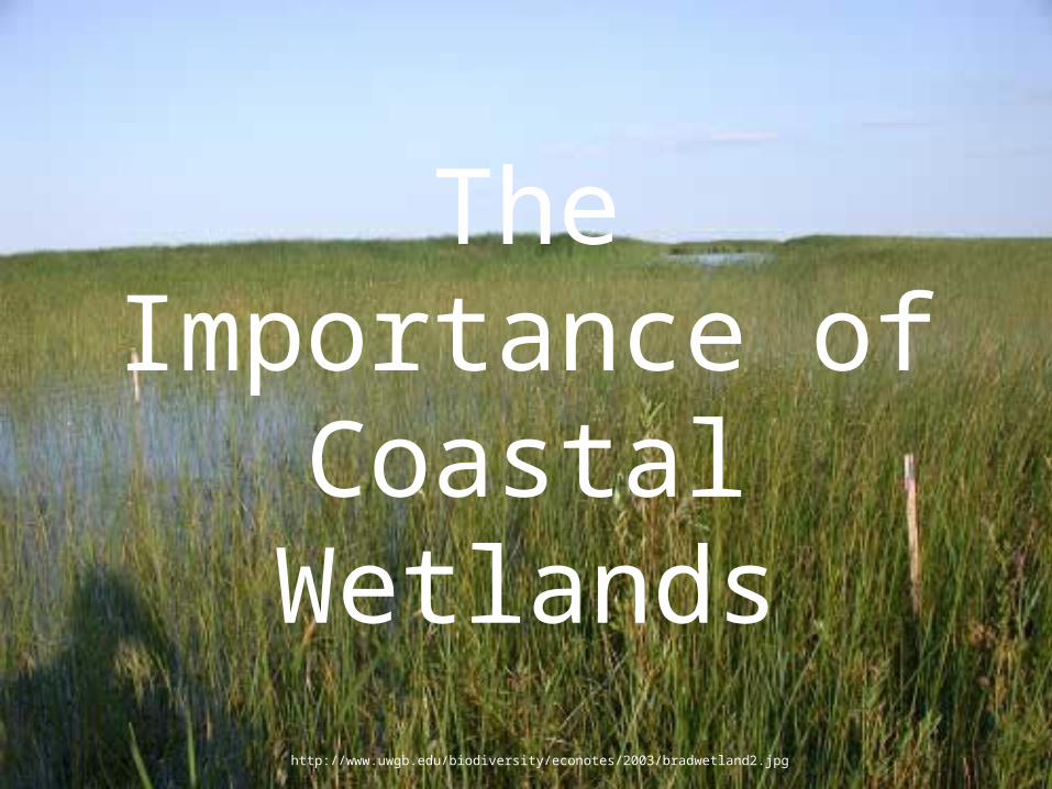
The Importance of Coastal Wetlands
http://www.uwgb.edu/biodiversity/econotes/2003/bradwetland2.jpg
The most common coastal wetlands are swamps and
marshes.
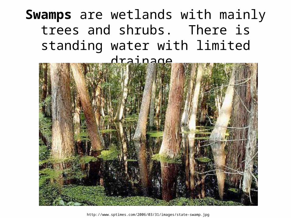
Swamps are wetlands with mainly trees and shrubs. There is standing water with limited
drainage.
http://www.sptimes.com/2006/03/31/images/state-swamp.jpg
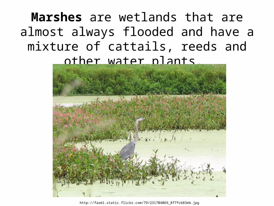
Marshes are wetlands that are almost always flooded and have a mixture of cattails, reeds and other water plants.
http://farm1.static.flickr.com/79/231704069_8f7fcb83eb.jpg
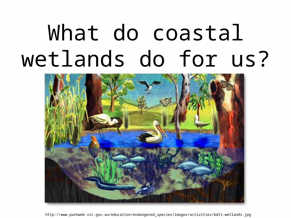
What do coastal wetlands do for us?
http://www.parkweb.vic.gov.au/education/endangered_species/images/activities/bd11-wetlands.jpg
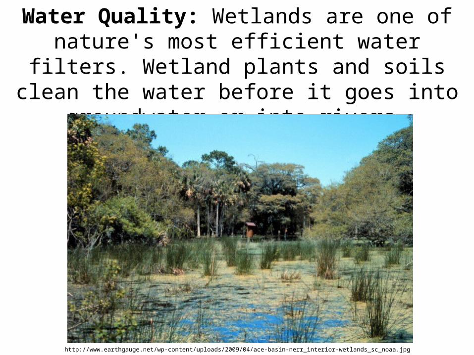
Water Quality: Wetlands are one of nature's most efficient water filters. Wetland plants and
soils clean the water before it goes into groundwater or into rivers.
http://www.earthgauge.net/wp-content/uploads/2009/04/ace-basin-nerr_interior-wetlands_sc_noaa.jpg
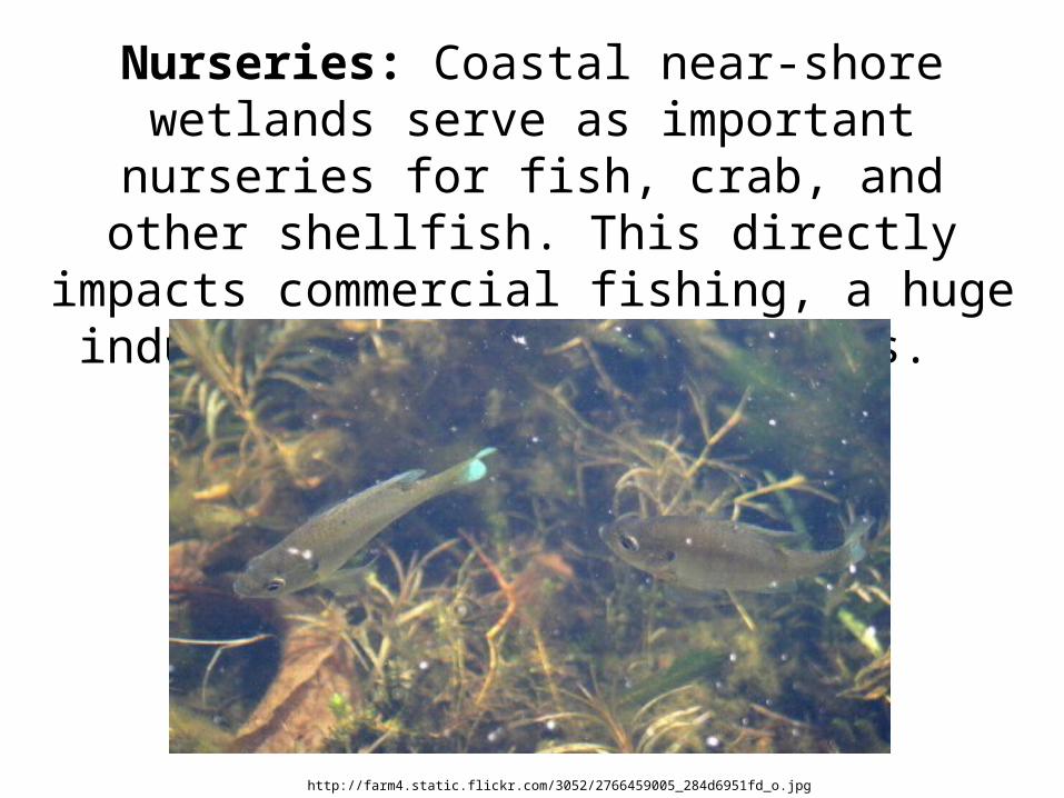
Nurseries: Coastal near-shore wetlands serve as important nurseries for fish, crab, and other shellfish. This directly impacts
commercial fishing, a huge industry in the United States.
http://farm4.static.flickr.com/3052/2766459005_284d6951fd_o.jpg
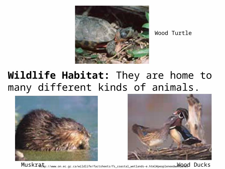
Wildlife Habitat: They are home to many different kinds of animals.
http://www.on.ec.gc.ca/wildlife/factsheets/fs_coastal_wetlands-e.html#peopleneedwetlandsMuskrat Wood Ducks
Wood Turtle
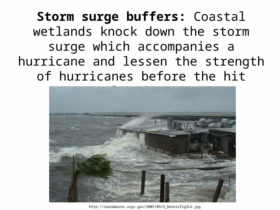
Storm surge buffers: Coastal wetlands knock down the storm surge which
accompanies a hurricane and lessen the strength of hurricanes before the hit
populated areas.
http://soundwaves.usgs.gov/2005/09/H_Dennisfig3LG.jpg
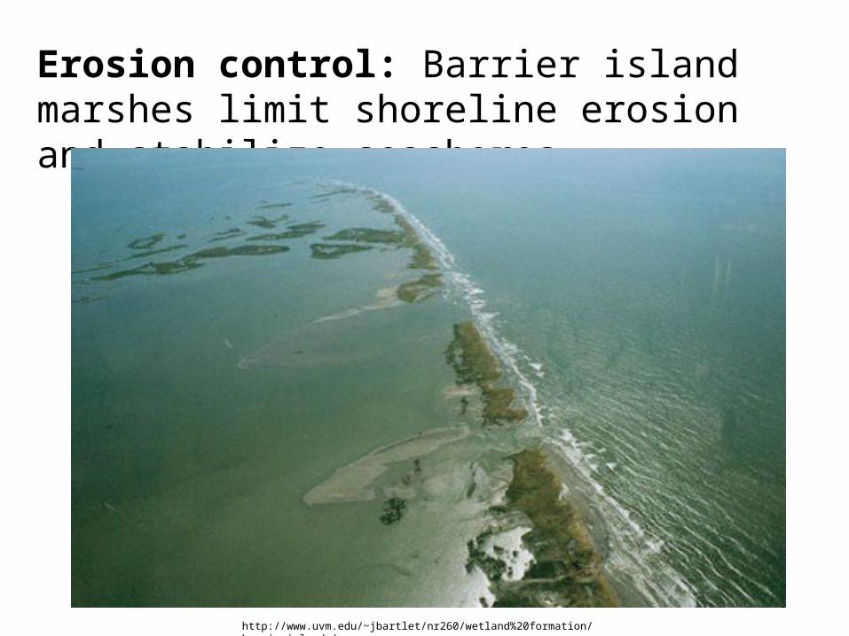
Erosion control: Barrier island marshes limit shoreline erosion and stabilize seashores.
http://www.uvm.edu/~jbartlet/nr260/wetland%20formation/barrierisland.jpg
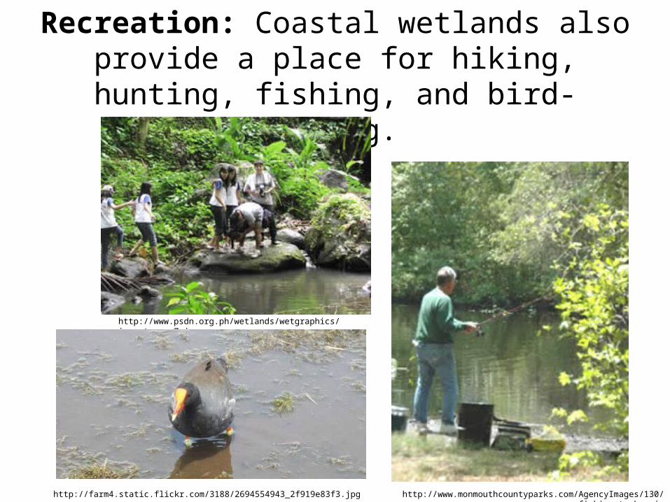
Recreation: Coastal wetlands also provide a place for hiking, hunting, fishing, and bird-
watching.
http://www.psdn.org.ph/wetlands/wetgraphics/importance_7.jpg
http://www.monmouthcountyparks.com/AgencyImages/130/fishing_turkey.jg
http://farm4.static.flickr.com/3188/2694554943_2f919e83f3.jpg
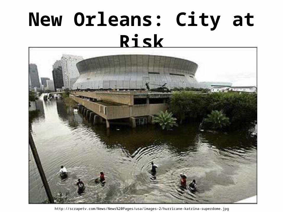
New Orleans: City at Risk
http://scrapetv.com/News/News%20Pages/usa/images-2/hurricane-katrina-superdome.jpg
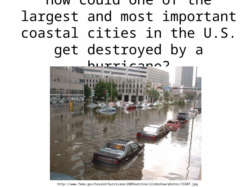
How could one of the largest and most important coastal cities in the U.S. get destroyed by a hurricane?
http://www.fema.gov/hazard/hurricane/2005katrina/slideshow/photos/15507.jpg
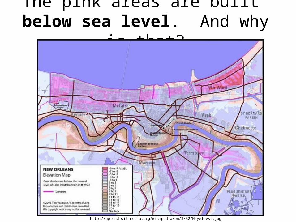
The pink areas are built below sea level. And why is that?
http://upload.wikimedia.org/wikipedia/en/3/32/Msyelevst.jpg
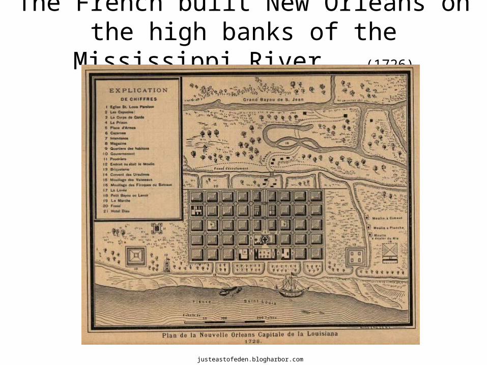
The French built New Orleans on the high banks of the Mississippi River. (1726)
justeastofeden.blogharbor.com
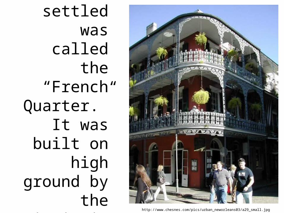
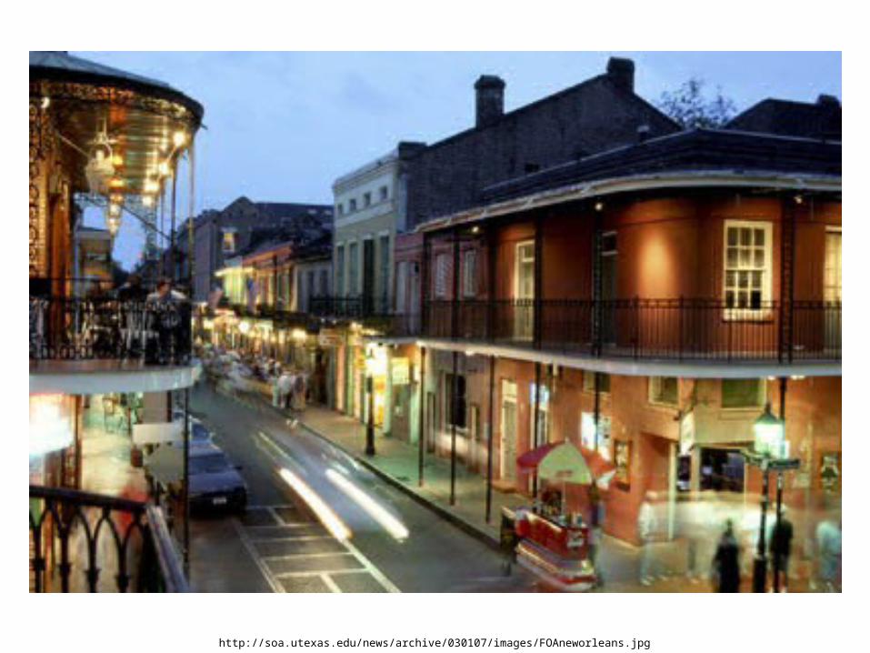
The first area settled
was called the “French Quarter.” It was built on high ground
by the Mississippi
River.http://www.chesnes.com/pics/urban_neworleans03/a29_small.jpg
http://soa.utexas.edu/news/archive/030107/images/FOAneworleans.jpg
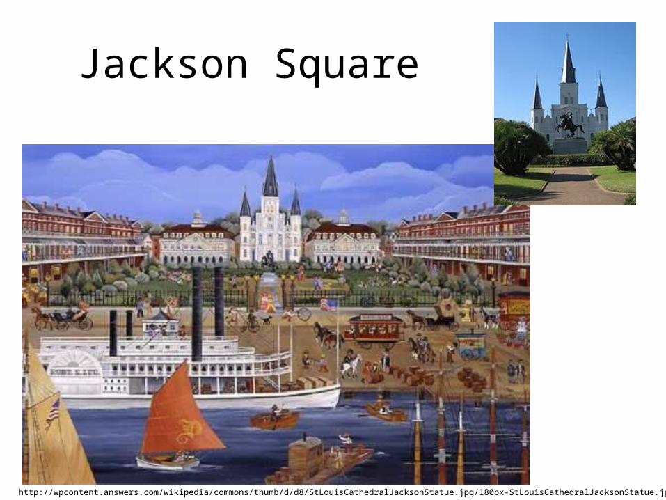
Jackson Square
http://wpcontent.answers.com/wikipedia/commons/thumb/d/d8/StLouisCathedralJacksonStatue.jpg/180px-StLouisCathedralJacksonStatue.jpg
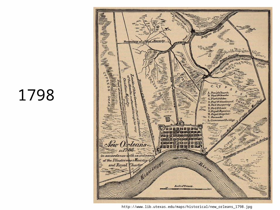
1798
http://www.lib.utexas.edu/maps/historical/new_orleans_1798.jpg
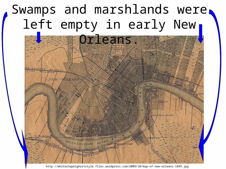
Swamps and marshlands were left empty in early New Orleans.
http://whitechapelghoststyle.files.wordpress.com/2009/10/map-of-new-orleans-1849.jpg
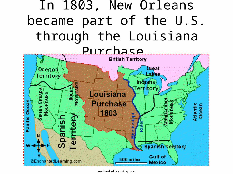
In 1803, New Orleans became part of the U.S. through the Louisiana
Purchase.
enchantedlearning.com
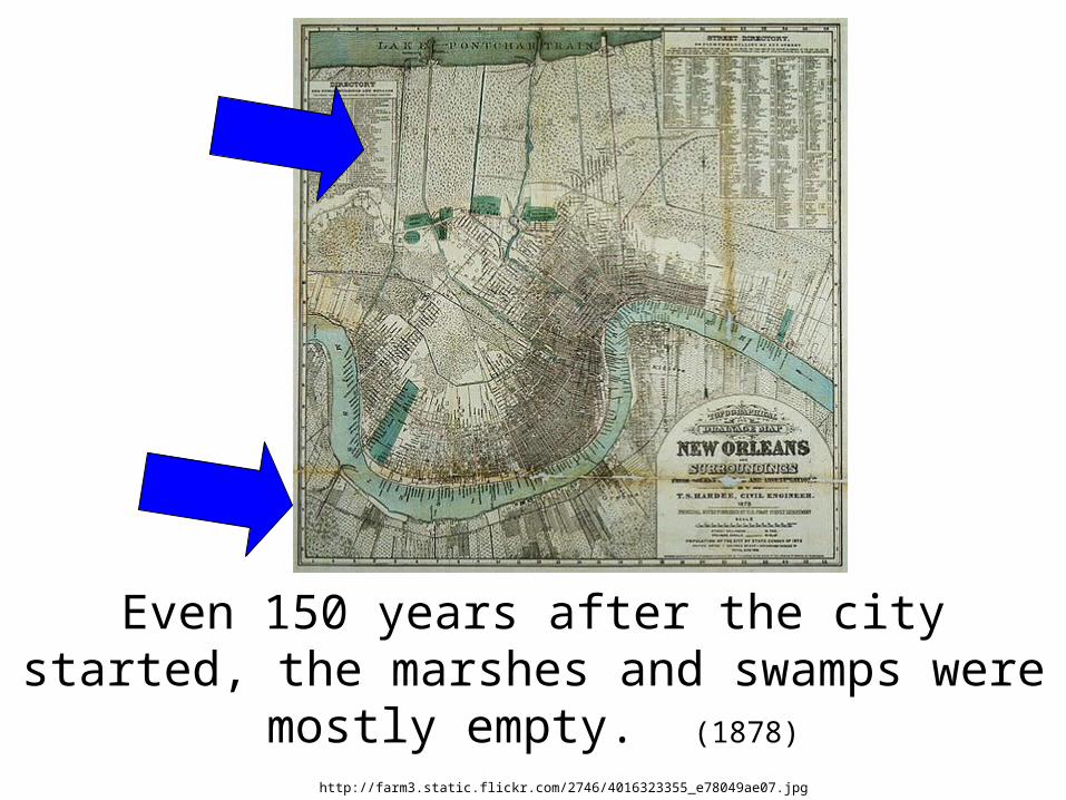
Even 150 years after the city started, the marshes and swamps were mostly empty.
(1878)
http://farm3.static.flickr.com/2746/4016323355_e78049ae07.jpg
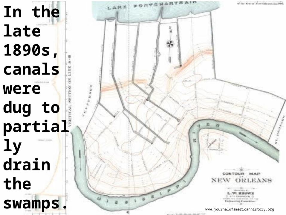
In the late 1890s, canals were dug to partially drain the swamps.
www.journalofamericanhistory.org
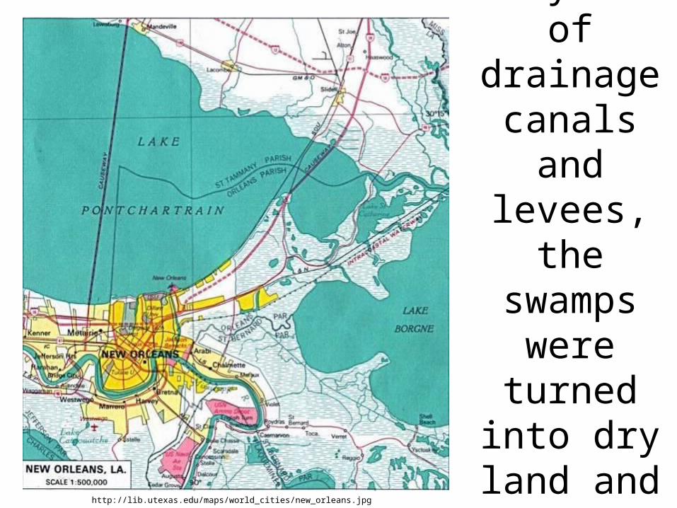
Through a system of drainage
canals and levees, the
swamps were turned
into dry land and the city grew.
http://lib.utexas.edu/maps/world_cities/new_orleans.jpg
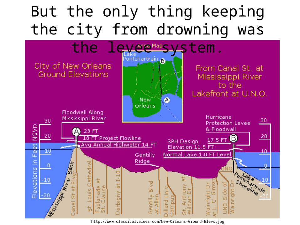
But the only thing keeping the city from drowning was the levee system.
http://www.classicalvalues.com/New-Orleans-Ground-Elevs.jpg
National Geographic
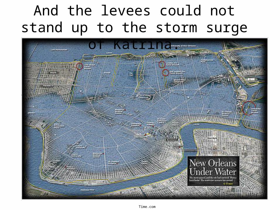
And the levees could not stand up to the storm surge of Katrina.
Time.com
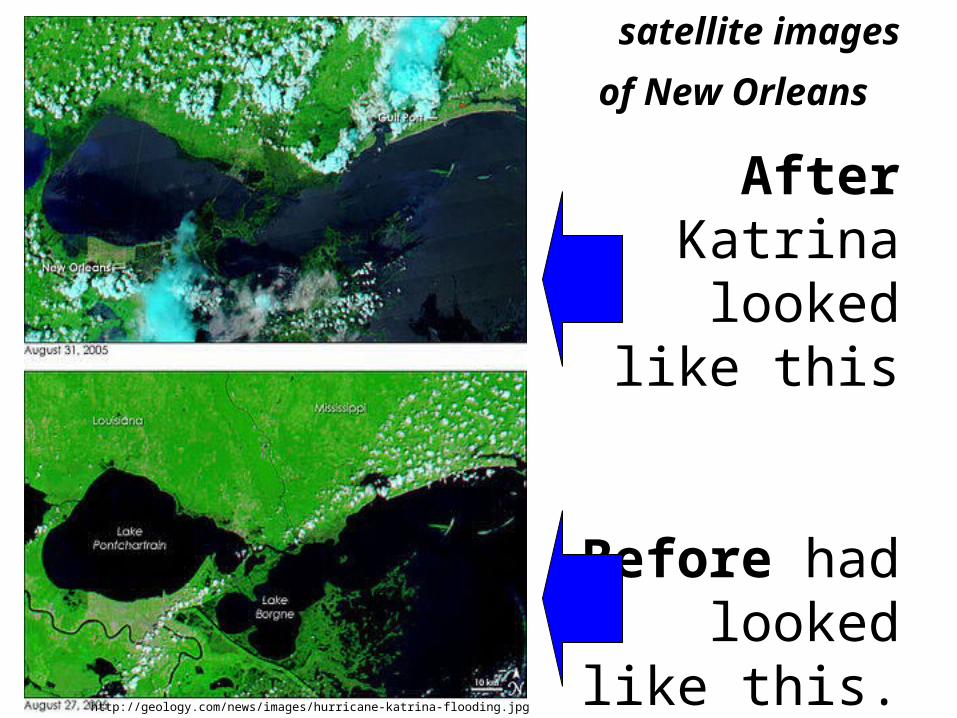
satellite images of
New Orleans
After Katrina looked like
this
Before had looked like
this. http://geology.com/news/images/hurricane-katrina-flooding.jpg
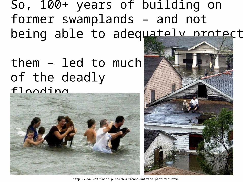
So, 100+ years of building on former swamplands – and not being able to adequately protect them – led to much of the deadly flooding.
http://www.katrinahelp.com/hurricane-katrina-pictures.html

GEOGRAPHIC LESSON:
STOP DESTROYING the natural “buffer zone” between the ocean and
the occupied land.
http://habeasindex.org/wp-content/uploads/2008/09/lead095il.gif
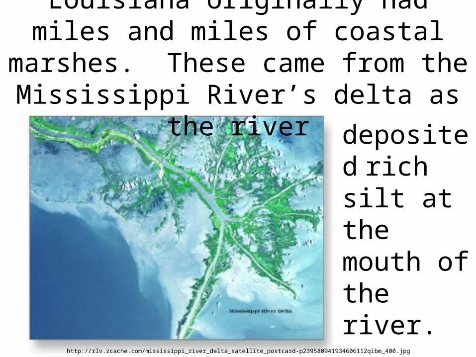
deposited
rich silt at the mouth of the river.
Louisiana originally had miles and miles of coastal marshes. These came from the Mississippi River’s delta as the river
http://rlv.zcache.com/mississippi_river_delta_satellite_postcard-p239580941934606112qibm_400.jpg
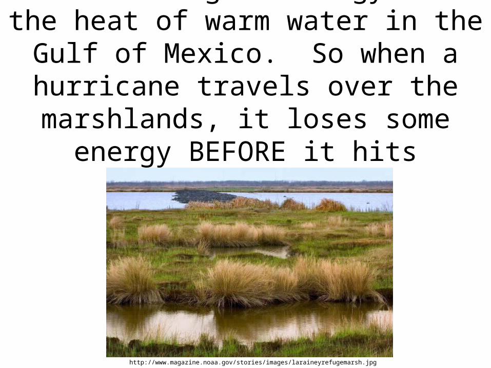
Hurricanes gain energy from the heat of warm water in the Gulf of Mexico. So
when a hurricane travels over the marshlands, it loses some energy BEFORE it hits populated areas.
http://www.magazine.noaa.gov/stories/images/laraineyrefugemarsh.jpg
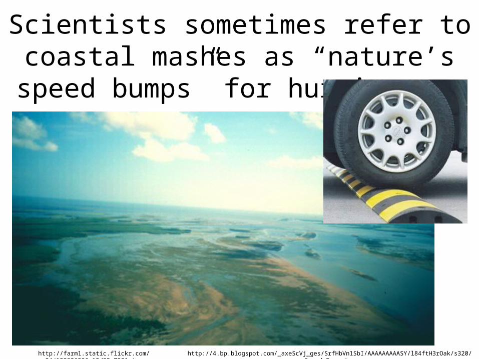
Scientists sometimes refer to coastal mashes as “nature’s speed bumps” for
hurricanes.
http://4.bp.blogspot.com/_axeScVj_ges/SrfHbVn1SbI/AAAAAAAAASY/l84ftH3rOak/s320/Speed_Bump.jpghttp://farm1.static.flickr.com/34/122926506_15d85e7381.jpg
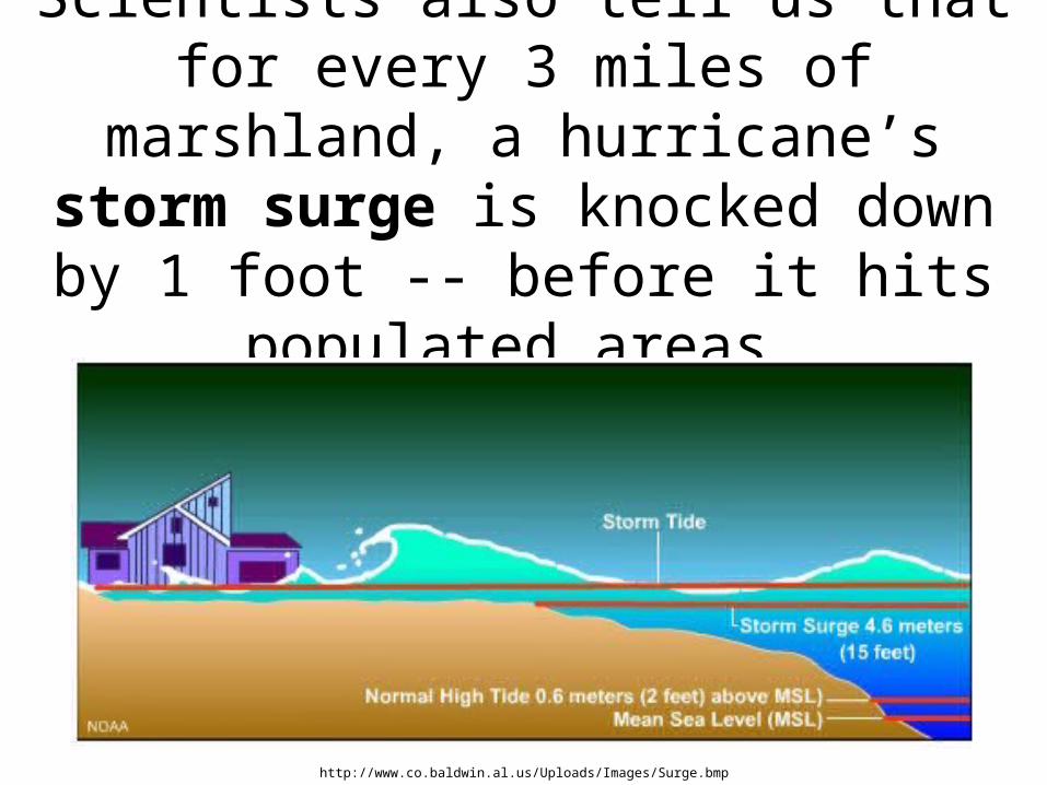
Scientists also tell us that for every 3 miles of marshland, a hurricane’s
storm surge is knocked down by 1 foot -- before it hits populated areas.
http://www.co.baldwin.al.us/Uploads/Images/Surge.bmp
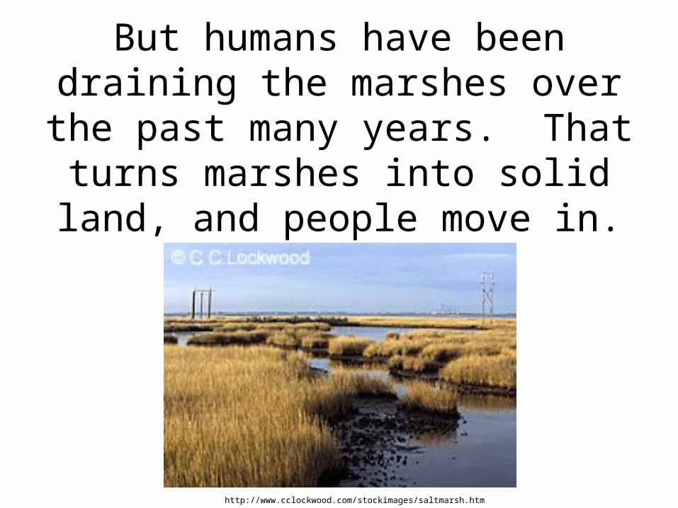
But humans have been draining the marshes over the past many years. That turns marshes into solid land,
and people move in.
http://www.cclockwood.com/stockimages/saltmarsh.htm
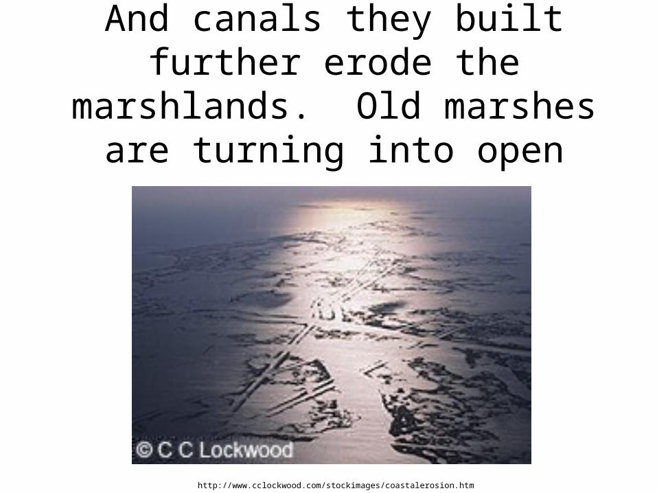
And canals they built further erode the marshlands. Old marshes are
turning into open ocean.
http://www.cclockwood.com/stockimages/coastalerosion.htm

Concrete levee systems also prevent silt from naturally rebuilding the delta.
Louisiana is losing 25 square miles a year of marshlands.http://earthobservatory.nasa.gov/images/imagerecords/15000/15425/MissDelta_TMO_2005221_lrg.jpg
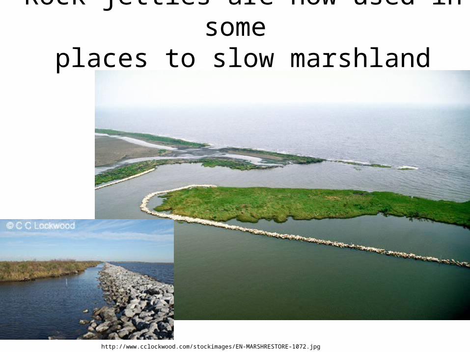
Rock jetties are now used in some places to slow marshland erosion.
http://www.cclockwood.com/stockimages/EN-MARSHRESTORE-1072.jpg
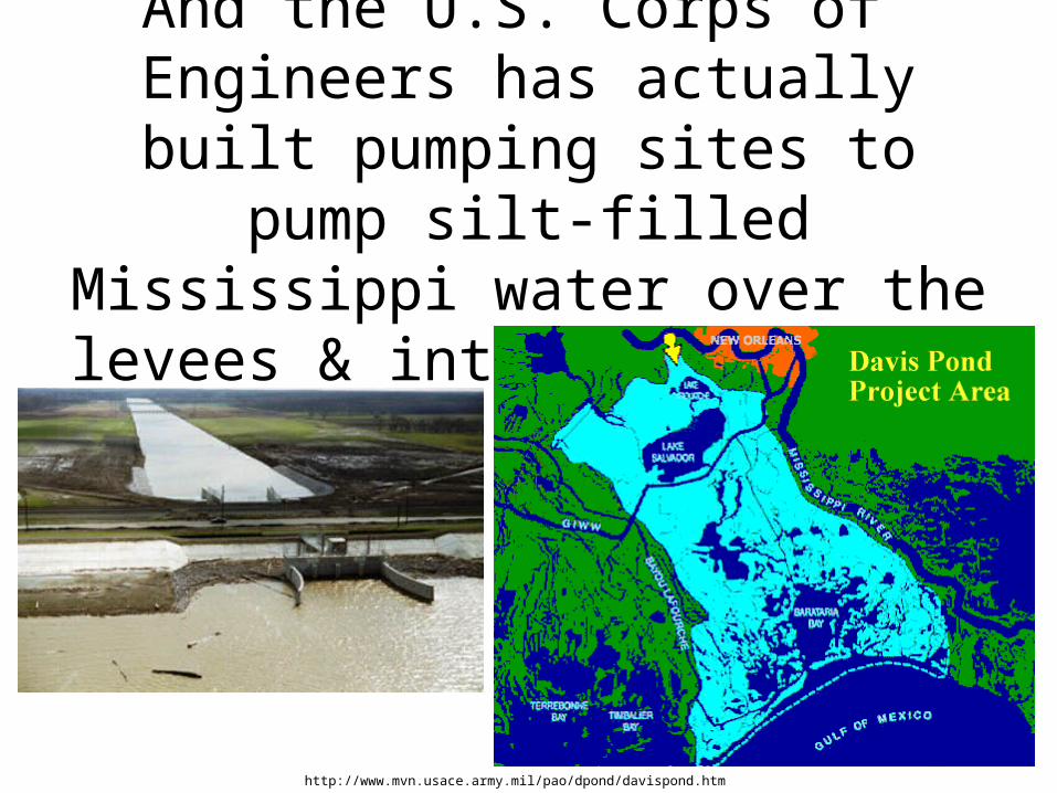
And the U.S. Corps of Engineers has actually built pumping sites to pump silt-filled Mississippi water
over the levees & into the marshes.
http://www.mvn.usace.army.mil/pao/dpond/davispond.htm
Protecting – and rebuilding – coastal wetlands will help us with water quality, erosion control, and
protection against hurricanes.