Embed Size (px)
Citation preview

witwit
this issue: ■ KOREC reports on Trimble’s
TX8 3D laser scanner
■ Trimble Dimensions event -
news and releases
■ The resurgence of
photogrammetry
The Geospatial Newsletter from KOREC
Winter 2014/15
Stop Press:
Enter the world of mobile mapping with KOREC
It sees…it senses…it interacts…and it’s coming to KOREC soon!
If anything caused a buzz at this year’s Intergeo it was senseFly’s new rotary drone, the eXom.
Designed as a fully-integrated imaging platform rather than just a remote-controlled aircraft with cameras attached, the eXom allows users to focus on their work, not on flying – something that the senseFly team was delighted to demonstrate at Intergeo by showing it ‘dancing’ to music! Find the proof at http://bit.ly/11i7mDN
On a more serious note, the eXom is the result of two years of intensive development and offers users unprecedented situational awareness.
In addition to seeing what its TripleView camera head sees, eXom’s five vision sensors also enable you to see in the direction the drone is moving for enhanced awareness and safe operation. These sensors work in harmony with eXom’s five ultrasonic sensors to ensure you always know the drone’s distance from nearby objects.
In another first for a civil drone system, the eXom’s autopilot-controlled TripleView head allows you to view and record any type of imagery required – HD video, ultra-high-resolution stills, thermal data, or all of the above. All without needing to land in order to swap cameras.
senseFly unveils the eXom
Network Rail invests in Imetrum’s award nominated Video Gauge system for rail movement monitoring
Mensura
New additions to our mobile mapping portfolio open up the market
We are delighted to announce that the KOREC mobile mapping portfolio now includes three Trimble mobile mapping systems, the MX8, the MX2 and the upcoming MX7.
Mobile mapping systems typically combine premium laser scanning, GNSS positioning and imagery technologies to collect geo-referenced point clouds and/or high-resolution imagery. Today there are many applications that demand large amounts of highly accurate, geo-referenced spatial data that can be rapidly collected and transformed into information-rich 3D infrastructure models.
At the recent excellent ICE Transport Asset Management conference, a strong theme was the adoption of “BIM techniques” by the highways and rail industries to manage their assets, leading to better informed decision making and ultimately getting more value for money invested. Whilst vital 3D laser scanners like the Trimble TX5 and TX8 can provide the framework for creating models in BIM, mobile mapping systems like the Trimble MX8 and MX2 can provide a solution to the demands for larger, linear models for the road and rail
industries, especially if they become more accessible to forward looking survey practices that are not yet ready to undertake financial commitment.
The KOREC portfolio includes:
Trimble MX7 - new mobile imaging system
Enter the world of mobile imaging with a smaller investment. KOREC is one of
...continued ...continued

The Geospatial Newsletter from KOREC
Since its head faces the front, the eXom can fly up close to target structures for sub-millimetre data resolution.
The head’s 270° vertical field of view also means the eXom can document objects directly above it; crucial for challenging tasks such as inspecting undersides of a bridge.
It’s ease of operation includes a choice of two flight modes:
• Interactive– simply click or tap the on-screen video feed to define an object of interest. eXom’s intelligent autopilot moves the drone into position and directs its TripleView head automatically.
• Autonomous mode – define the area to map using the drone’s eMotion software.
Please call your KOREC consultant for more details. nnn
just 10 Trimble dealers, worldwide, to be selected to showcase this technology. Launched at Trimble’s November Dimensions event in Las Vegas, the MX7 weighs just 3kg and is a vehicle mounted photogrammetric system designed to quickly and completely capture road, rail and site infrastructure information – see our ‘Dimension Releases’ page for full details.
Trimble MX2 – KOREC invests
We are delighted to announce that we have also invested in Trimble’s MX2 system, a flexible, portable, easy to use vehicle-mounted spatial imaging system offering accurate point cloud data combined with 360° imagery. Full details can be found inside in our KOREC news section.
Trimble MX8 – established high end technology
High accuracy, high definition and high speed. The Trimble MX8 is an advanced mobile data capture system that combines high accuracy positioning, imaging and laser scanning capabilities to produce 3D, 4D and 5D data sets for spatial imaging projects.
Trimble Trident software is used to extract and analyse the data for all these systems. nnn
All of these systems are available for purchase or hire and both the MX2 and MX8 are available as bespoke services from K-SERVICES. Please email [email protected] for details.
MX2: portable and robust
...world of mobile mapping continued...eXom continued
Using Trimble’s patented Lightning™ technology, the TX8 can measure one million points per second while capturing precise data over its full measurement range. And because Trimble Lightning™ technology is less susceptible to variation in surface types and atmospheric conditions, you can capture complete datasets from each station.
With a spec like that, the KOREC survey team was keen to give the TX8 a thorough testing and therefore spent a productive afternoon in Liverpool putting it through its paces. Here’s what they did:
Building name: Royal Liver Building
Station set ups: 2
Scan duration: 3 mins per scan – always at 1 million points per second
Range: 120m (a scan at the full 340m range was also carried out)
Accuracy: accurate to 2mm at 100m
Time spent: total time in field including data checking: under 10 minutes
Available now - TX8 camera kitShould a laser scanner have a built in camera or not? Which is fastest? Which gives the most accurate data? It’s been a popular topic of debate on industry forums. Some argue that not all scanner jobs need imaging, that there is insufficient light for a camera if scanning is done at night and that whilst getting better, traditionally on-board cameras have been poor and that low quality images are rarely worth the extra time and effort. Others argue that they really help with visualisation of the point cloud, especially for point clouds in the BIM process which will be used less by surveyors. And of course there’s the ‘cover all’ argument that it’s always better to have the choice of a camera for the times when you do need it!
Trimble has come up with its own solution. Capable of capturing one million points per second the Trimble TX8 is the most precise laser scanner in our industry and it now has a camera option to match. The Nodal Ninja R1w/RD5 1 bracket kit is capable of integrating a Nikon D5100 16.2MP digital SLR camera or a Nikon D5300 24.2 MP digital SLR camera with the TX8 to provide an option for high quality images. Call your KOREC consultant for full details. nnn
KOREC reports: Trimble TX8 3D Laser Scanner
3D points collected: at 1 million points per second for all settings we exceeded 80 million.
Back at the office: the captured point cloud data was processed using Trimble RealWorks. RealWorks offers powerful inspection tools as well as cross-section, ortho-projection and profiling features, all ideal for generating comprehensive client deliverables.
KOREC conclusion: The TX8 really delivered. Although we knew the spec from Trimble, our field work illustrated perfectly the TX8’s strengths – namely capturing high resolution data that’s super clean and noise free. It provided the clean, crisp data we have come to expect from time-of-flight scanners but at 20 times the speed! KOREC customers who’ve purchased the TX8 have cited its ability to produce high density, high quality, accurate point clouds in challenging conditions (IP54 rating) as key factors in their decision. They love its speed and accuracy, its straight forward user interface and having the confidence that all the required data has been captured.
The images shown (right) are the result of a 3 minute scan from a single location with the TX8. nnn
MX7: entry level system
MX8: high accuracy and high speed
Intensity point cloud
Measuring the wing span of the Liver bird in RealWorks
Scanning Liverpool’s Liver Building with the TX8
The KOREC team compares the performance of the Trimble TX8 (left) and TX5 (right)
Combining high-speed measurement with long range and exceptional ease of use, the Trimble TX8 laser scanner is an exciting development for KOREC customers.
Generate deliverables in Trimble RealWorks 9
Mensura | Winter 2014/15
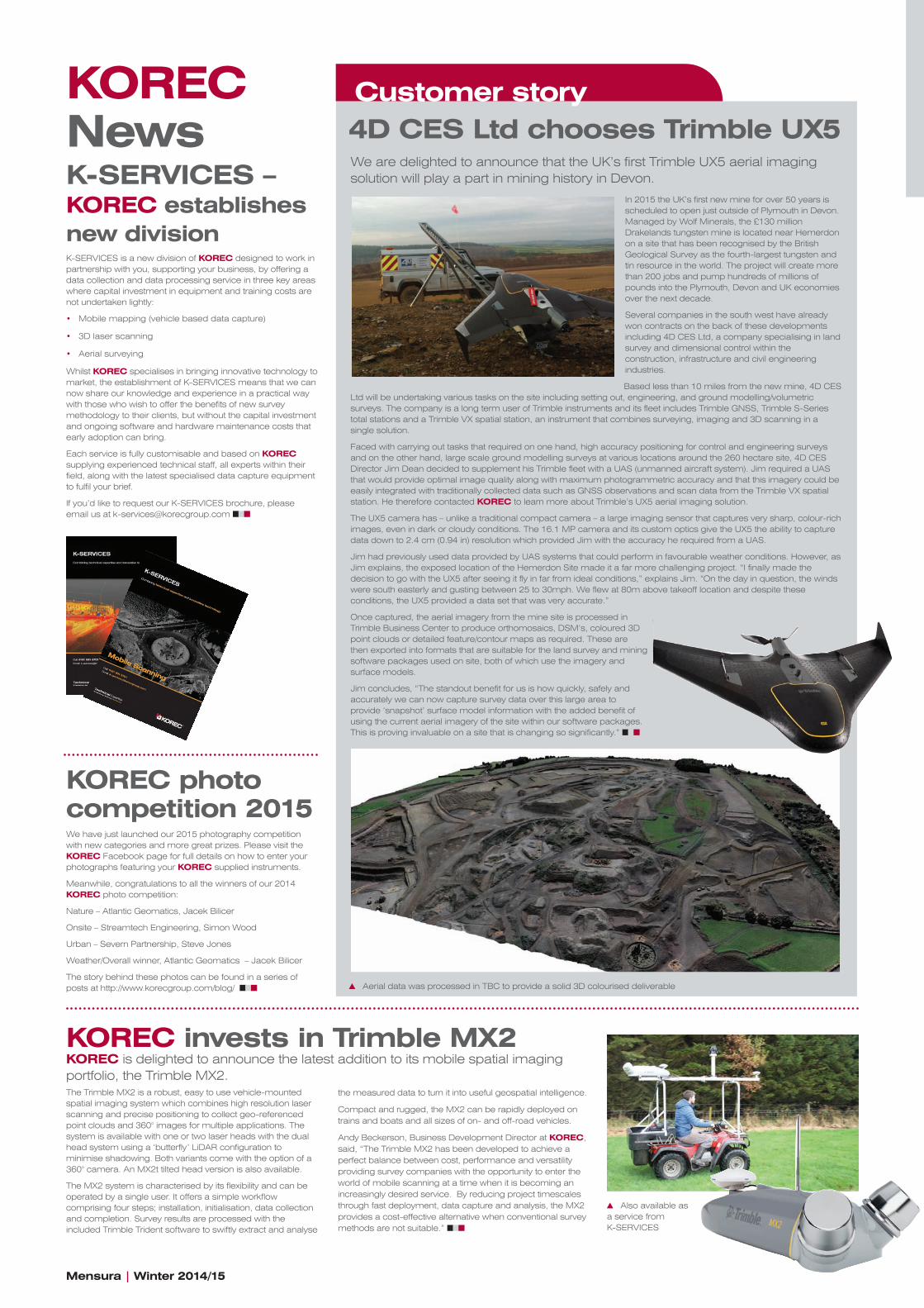
Customer story4D CES Ltd chooses Trimble UX5We are delighted to announce that the UK’s first Trimble UX5 aerial imaging solution will play a part in mining history in Devon.
In 2015 the UK’s first new mine for over 50 years is scheduled to open just outside of Plymouth in Devon. Managed by Wolf Minerals, the £130 million Drakelands tungsten mine is located near Hemerdon on a site that has been recognised by the British Geological Survey as the fourth-largest tungsten and tin resource in the world. The project will create more than 200 jobs and pump hundreds of millions of pounds into the Plymouth, Devon and UK economies over the next decade.
Several companies in the south west have already won contracts on the back of these developments including 4D CES Ltd, a company specialising in land survey and dimensional control within the construction, infrastructure and civil engineering industries.
Based less than 10 miles from the new mine, 4D CES Ltd will be undertaking various tasks on the site including setting out, engineering, and ground modelling/volumetric surveys. The company is a long term user of Trimble instruments and its fleet includes Trimble GNSS, Trimble S-Series total stations and a Trimble VX spatial station, an instrument that combines surveying, imaging and 3D scanning in a single solution.
Faced with carrying out tasks that required on one hand, high accuracy positioning for control and engineering surveys and on the other hand, large scale ground modelling surveys at various locations around the 260 hectare site, 4D CES Director Jim Dean decided to supplement his Trimble fleet with a UAS (unmanned aircraft system). Jim required a UAS that would provide optimal image quality along with maximum photogrammetric accuracy and that this imagery could be easily integrated with traditionally collected data such as GNSS observations and scan data from the Trimble VX spatial station. He therefore contacted KOREC to learn more about Trimble’s UX5 aerial imaging solution.
The UX5 camera has – unlike a traditional compact camera – a large imaging sensor that captures very sharp, colour-rich images, even in dark or cloudy conditions. The 16.1 MP camera and its custom optics give the UX5 the ability to capture data down to 2.4 cm (0.94 in) resolution which provided Jim with the accuracy he required from a UAS.
Jim had previously used data provided by UAS systems that could perform in favourable weather conditions. However, as Jim explains, the exposed location of the Hemerdon Site made it a far more challenging project. “I finally made the decision to go with the UX5 after seeing it fly in far from ideal conditions,” explains Jim. “On the day in question, the winds were south easterly and gusting between 25 to 30mph. We flew at 80m above takeoff location and despite these conditions, the UX5 provided a data set that was very accurate.”
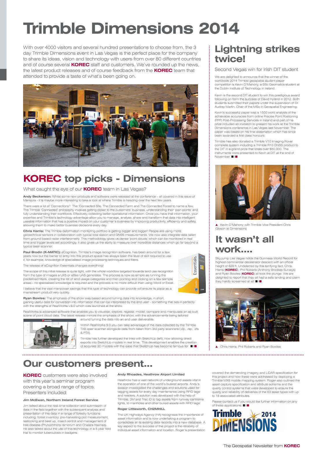
Once captured, the aerial imagery from the mine site is processed in Trimble Business Center to produce orthomosaics, DSM’s, coloured 3D point clouds or detailed feature/contour maps as required. These are then exported into formats that are suitable for the land survey and mining software packages used on site, both of which use the imagery and surface models.
Jim concludes, “The standout benefit for us is how quickly, safely and accurately we can now capture survey data over this large area to provide ‘snapshot’ surface model information with the added benefit of using the current aerial imagery of the site within our software packages. This is proving invaluable on a site that is changing so significantly.” nnn
Aerial data was processed in TBC to provide a solid 3D colourised deliverable
K-SERVICES – KOREC establishes new divisionK-SERVICES is a new division of KOREC designed to work in partnership with you, supporting your business, by offering a data collection and data processing service in three key areas where capital investment in equipment and training costs are not undertaken lightly:
• Mobile mapping (vehicle based data capture)
• 3D laser scanning
• Aerial surveying
Whilst KOREC specialises in bringing innovative technology to market, the establishment of K-SERVICES means that we can now share our knowledge and experience in a practical way with those who wish to offer the benefits of new survey methodology to their clients, but without the capital investment and ongoing software and hardware maintenance costs that early adoption can bring.
Each service is fully customisable and based on KOREC supplying experienced technical staff, all experts within their field, along with the latest specialised data capture equipment to fulfil your brief.
If you’d like to request our K-SERVICES brochure, please email us at [email protected] nnn
KOREC News
The Trimble MX2 is a robust, easy to use vehicle-mounted spatial imaging system which combines high resolution laser scanning and precise positioning to collect geo-referenced point clouds and 360° images for multiple applications. The system is available with one or two laser heads with the dual head system using a ‘butterfly’ LiDAR configuration to minimise shadowing. Both variants come with the option of a 360° camera. An MX2t tilted head version is also available.
The MX2 system is characterised by its flexibility and can be operated by a single user. It offers a simple workflow comprising four steps; installation, initialisation, data collection and completion. Survey results are processed with the included Trimble Trident software to swiftly extract and analyse
the measured data to turn it into useful geospatial intelligence.
Compact and rugged, the MX2 can be rapidly deployed on trains and boats and all sizes of on- and off-road vehicles.
Andy Beckerson, Business Development Director at KOREC, said, “The Trimble MX2 has been developed to achieve a perfect balance between cost, performance and versatility providing survey companies with the opportunity to enter the world of mobile scanning at a time when it is becoming an increasingly desired service. By reducing project timescales through fast deployment, data capture and analysis, the MX2 provides a cost-effective alternative when conventional survey methods are not suitable.” nnn
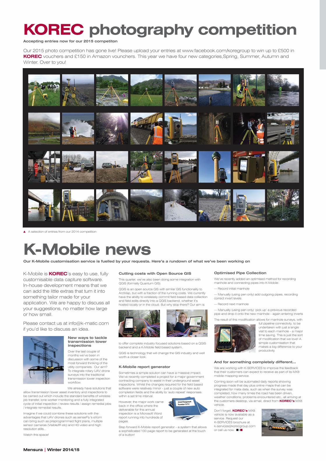
KOREC photo competition 2015We have just launched our 2015 photography competition with new categories and more great prizes. Please visit the KOREC Facebook page for full details on how to enter your photographs featuring your KOREC supplied instruments.
Meanwhile, congratulations to all the winners of our 2014 KOREC photo competition:
Nature – Atlantic Geomatics, Jacek Bilicer
Onsite – Streamtech Engineering, Simon Wood
Urban – Severn Partnership, Steve Jones
Weather/Overall winner, Atlantic Geomatics – Jacek Bilicer
The story behind these photos can be found in a series of posts at http://www.korecgroup.com/blog/ nnn
KOREC invests in Trimble MX2KOREC is delighted to announce the latest addition to its mobile spatial imaging portfolio, the Trimble MX2.
Also available as a service from K-SERVICES
The Geospatial Newsletter from KOREC
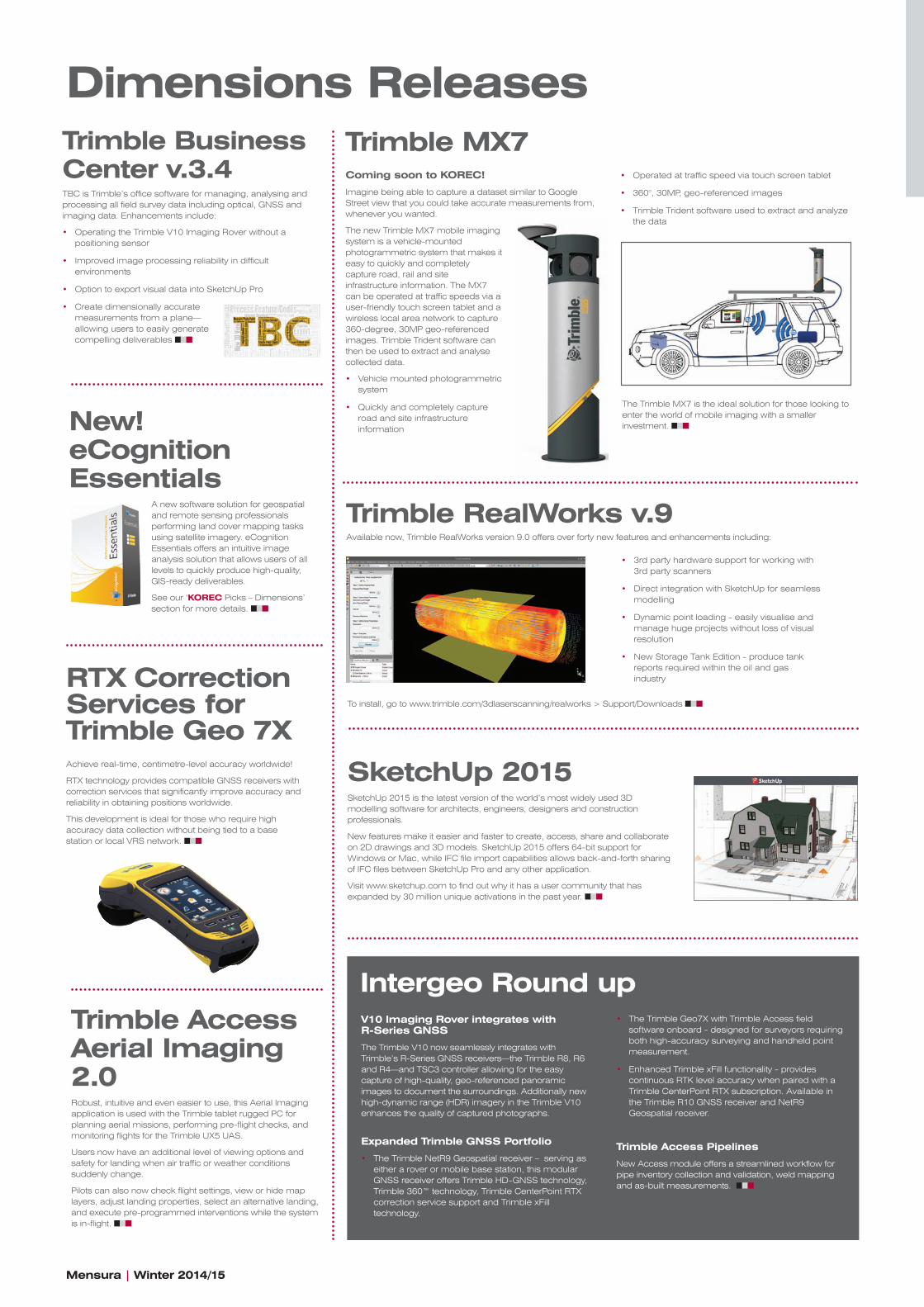
Trimble Dimensions 2014Lightning strikes twice!Second Vegas win for Irish DIT student
We are delighted to announce that the winner of the worldwide 2014 Trimble geospatial student paper competition is Kevin O’Mahony, a BSc Geomatics student at the Dublin Institute of Technology in Ireland.
Kevin is the second DIT student to win this prestigious award following on from the success of David Hyland in 2012. Both students submitted their papers under the supervision of Dr.Audrey Martin, Chair of the MSc in Geospatial Engineering.
Kevin’s successful paper was a 1500 word analysis of the achievable accuracies from online Precise Point Positioning (PPP) Post-Processing Services in Ireland and part of his prize included an invitation to present his work at the Trimble Dimensions conference in Las Vegas last November. The paper was based on his final dissertation which has since been awarded a first class honours.
Trimble has also donated a Trimble V10 Imaging Rover complete system including a Trimble R10 GNSS product to the DIT in a grand prize that totals over $50,000. The instruments were presented to Kevin at DIT at the end of November. nnn
With over 4000 visitors and several hundred presentations to choose from, the 3 day Trimble Dimensions event in Las Vegas is the perfect place for the company to share its ideas, vision and technology with users from over 80 different countries and of course several KOREC staff and customers. We’ve rounded up the news, the latest product releases and of course feedback from the KOREC team that attended to provide a taste of what’s been going on.
It wasn’t all work....SkyJump Las Vegas holds the Guinness World Record for highest commercial decelerator descent with an official height of 829 ft. Undeterred by this terrifying fact, Chris Harris (KOREC), Phil Roberts (Anthony Brookes Surveys) and Ryan Bowles (KOREC) all took the plunge. We are delighted to report that they all had a safe landing and claim they hardly screamed at all! nnn
KOREC customers were also involved with this year’s seminar program covering a broad range of topics. Presenters included:
Jim McEwan, Northern Ireland Forest Service
Jim talked about the real-time collection and submission of data in the field together with the subsequent analysis and presentation of this data in a range of forestry functions including: forest inventory, pre-harvesting plot measurement, restocking and beat up, insect control and management of tree disease (Phytophthora ramorum and Chalara fraxinea). He also talked about the use of this technology in a 5 year field trial to monitor tuberculosis in badgers.
KOREC top picks - DimensionsWhat caught the eye of our KOREC team in Las Vegas?
Andy Beckerson: Whilst some new products and software were released at the conference – all covered in this issue of Mensura - it is maybe more interesting to take a look at where Trimble is heading over the next few years.
There were a lot of ‘Connections’! The ‘Connected Site, The Connected Farm and The Connected Forest to name a few. The Trimble ‘Connected’ philosophy involves getting closer to the customers’ business, understanding their ‘pain points’ and fully understanding their workflows. Effectively, collecting better operational information. Once you have that information, your expertise and Trimble’s technology advantage allow you to manage, analyse, share and transform that data into intelligent useable information that has a positive impact on your customer’s business by improving productivity, efficiency and safety, allowing them to make better business decisions every day.
Chris Harris: The Trimble deformation monitoring portfolio is getting bigger and bigger! People are using more geotechnical sensors in collaboration with typical total station and GNSS measurements. We now also integrate data taken from ground based radar interferometry. This methodology gives us dense ‘point clouds’ which can be monitored in real time and trigger levels set accordingly. It also gives us the ability to measure over incredible distances which go far beyond a typical laser scanner.
Paul Brodin (K-MATIC): eCognition, Trimble’s image recognition software, has been around for a few years now but the barrier to entry into this product space has always been the level of skill required to use it, for example, knowledge of specialised image processing techniques and filters.
The release of eCognition Essentials changes everything!
The scope of this initial release is quite tight, with the whole workflow targeted towards land use recognition from the type of images a UX5 or eBee UAS generates. The process is now as simple as running the predefined filters, creating the list of land usage categories and then pointing and clicking on a few sample areas - no specialised knowledge is required and the process is no more difficult than using Word or Excel.
I believe that the vast manpower savings that this type of technology can provide will ensure its place as a mainstream product very quickly.
Ryan Bowles: The emphasis of the show was based around turning data into knowledge, in short, gaining useful data for conversion into information that can be interpreted by the end user – something that ties in perfectly with the strengths of RealWorks v.9.0 which was launched at the show.
RealWorks is advanced software that enables you to visualise, explore, register, model, compare and manipulate an as built scene of point cloud data. The latest release mirrors the emphasis of the show, with the advancements being tailored
around turning the data into an end user deliverable.
Within RealWorks 9.0 you can take advantage of the data collected by the Trimble TX8 laser scanner alongside data from taken from 3rd party scanners (.dp, .rsp, .zfs & PTX).
Trimble has further developed the links with SketchUp (left), now allowing direct exports into SketchUp models in real time. This development enables the creation of accurate 3D models with the ease that SketchUp has become famous for. nnn
Kevin O’Mahony with Trimble Vice President Chris Gibson at Dimensions
Andy Rhoades, Heathrow Airport Limited
Heathrow has a vast network of underground assets vital in the operation of one of the world’s busiest airports. Andy’s session investigated the challenges and solutions used for tagging assets for every day maintenance using RFID tags and readers. A solution was developed with the help of Trimble, 3M and Trac ID to tag assets from runway centreline lights, to manholes and other buried assets with RFID tags.
Roger Littleworth, CH2MHILL
The UK Highways Agency (HA) recognises the importance of asset information and is now undertaking a program to consolidate all its existing data records into a new database. A key aspect to the success of this project is the reliability of individual asset information and location. Roger’s presentation
covered the demanding imagery and LiDAR specification for this project and how these were addressed by deploying a Trimble MX8 mobile mapping system. Roger also outlined the asset capture specification and attribute schema and the quality control systems that were developed to ensure the quality and reliability of deliveries of the 63 asset types with up to 18 associated attributes.
Please contact us if you would like further information on any of these applications. nnn
Chris Harris, Phil Roberts and Ryan Bowles
Our customers present...
Mensura | Winter 2014/15
Dimensions ReleasesTrimble Business Center v.3.4TBC is Trimble’s office software for managing, analysing and processing all field survey data including optical, GNSS and imaging data. Enhancements include:
• Operating the Trimble V10 Imaging Rover without a positioning sensor
• Improved image processing reliability in difficult environments
• Option to export visual data into SketchUp Pro
• Create dimensionally accurate measurements from a plane—allowing users to easily generate compelling deliverables nnn
RTX Correction Services for Trimble Geo 7X Achieve real-time, centimetre-level accuracy worldwide!
RTX technology provides compatible GNSS receivers with correction services that significantly improve accuracy and reliability in obtaining positions worldwide.
This development is ideal for those who require high accuracy data collection without being tied to a base station or local VRS network. nnn
New! eCognition Essentials
A new software solution for geospatial and remote sensing professionals performing land cover mapping tasks using satellite imagery. eCognition Essentials offers an intuitive image analysis solution that allows users of all levels to quickly produce high-quality, GIS-ready deliverables.
See our ‘KOREC Picks – Dimensions’ section for more details. nnn
Trimble Access Aerial Imaging 2.0Robust, intuitive and even easier to use, this Aerial Imaging application is used with the Trimble tablet rugged PC for planning aerial missions, performing pre-flight checks, and monitoring flights for the Trimble UX5 UAS.
Users now have an additional level of viewing options and safety for landing when air traffic or weather conditions suddenly change.
Pilots can also now check flight settings, view or hide map layers, adjust landing properties, select an alternative landing, and execute pre-programmed interventions while the system is in-flight. nnn
Trimble MX7 Coming soon to KOREC!
Imagine being able to capture a dataset similar to Google Street view that you could take accurate measurements from, whenever you wanted.
The new Trimble MX7 mobile imaging system is a vehicle-mounted photogrammetric system that makes it easy to quickly and completely capture road, rail and site infrastructure information. The MX7 can be operated at traffic speeds via a user-friendly touch screen tablet and a wireless local area network to capture 360-degree, 30MP geo-referenced images. Trimble Trident software can then be used to extract and analyse collected data.
• Vehicle mounted photogrammetric system
• Quickly and completely capture road and site infrastructure information
Trimble RealWorks v.9Available now, Trimble RealWorks version 9.0 offers over forty new features and enhancements including:
SketchUp 2015SketchUp 2015 is the latest version of the world’s most widely used 3D modelling software for architects, engineers, designers and construction professionals.
New features make it easier and faster to create, access, share and collaborate on 2D drawings and 3D models. SketchUp 2015 offers 64-bit support for Windows or Mac, while IFC file import capabilities allows back-and-forth sharing of IFC files between SketchUp Pro and any other application.
Visit www.sketchup.com to find out why it has a user community that has expanded by 30 million unique activations in the past year. nnn
V10 Imaging Rover integrates with R-Series GNSS
The Trimble V10 now seamlessly integrates with Trimble’s R-Series GNSS receivers—the Trimble R8, R6 and R4—and TSC3 controller allowing for the easy capture of high-quality, geo-referenced panoramic images to document the surroundings. Additionally new high-dynamic range (HDR) imagery in the Trimble V10 enhances the quality of captured photographs.
Expanded Trimble GNSS Portfolio
• The Trimble NetR9 Geospatial receiver – serving as either a rover or mobile base station, this modular GNSS receiver offers Trimble HD-GNSS technology, Trimble 360™ technology, Trimble CenterPoint RTX correction service support and Trimble xFill technology.
• 3rd party hardware support for working with 3rd party scanners
• Direct integration with SketchUp for seamless modelling
• Dynamic point loading - easily visualise and manage huge projects without loss of visual resolution
• New Storage Tank Edition - produce tank reports required within the oil and gas industry
To install, go to www.trimble.com/3dlaserscanning/realworks > Support/Downloads nnn
The Trimble MX7 is the ideal solution for those looking to enter the world of mobile imaging with a smaller investment. nnn
• The Trimble Geo7X with Trimble Access field software onboard - designed for surveyors requiring both high-accuracy surveying and handheld point measurement.
• Enhanced Trimble xFill functionality - provides continuous RTK level accuracy when paired with a Trimble CenterPoint RTX subscription. Available in the Trimble R10 GNSS receiver and NetR9 Geospatial receiver.
Trimble Access Pipelines
New Access module offers a streamlined workflow for pipe inventory collection and validation, weld mapping and as-built measurements. nnn
Intergeo Round up
• Operated at traffic speed via touch screen tablet
• 360°, 30MP, geo-referenced images
• Trimble Trident software used to extract and analyze the data
The Geospatial Newsletter from KOREC
Customer story
It’s been over two years since the launch of Trimble VISION on the S6 robotic total station and the benefits of this technology on both the S6 and S8 instruments have been well documented by both Trimble and KOREC:- surveyors can remotely see and measure through a live video, they can verify their work, they can ensure that they have captured everything before leaving the job and they can easily integrate images into their survey workflows using the calibrated camera. Photo documentation also allows surveyors to complement the data they provide to clients with images of the job conditions and point attributes, making the data easier to understand.
Many S6 users are familiar with the benefits and use VISION regularly for exactly these purposes. However very few surveyors use their VISION instruments for photogrammetry and it is this area where the technology can really deliver tangible benefits. Thanks to new workflows and accessible software such as Trimble RealWorks, this area of surveying is no longer restricted to specialised photogrammetric technicians but is now a tool that can be easily mastered and exploited by survey practices looking to increase their productivity.
One company that can testify to this is Newcastle based Landform Surveys. Committed to investing in the most modern survey instrumentation in order to provide the most accurate and cost effective surveys possible, Landform is a great example of a company that is making every aspect of its technology work for it.
The company has an extensive fleet of Trimble GNSS and total stations including a Trimble S6 VISION instrument. A recent project required the Landform team to undertake a façade and elevation survey of multiple buildings over a large stretch of a Durham high
street. Keen to use a more productive way of carrying out this survey rather than the traditional method of recording each point
individually with the S6, Landform Director Eric Hinds contacted KOREC to discuss alternatives.
Following a consultation with KOREC, Eric elected to purchase Trimble’s RealWorks v.8 software to use in conjunction with his S6 VISION. This combination would create a system that would enable him to easily produce orthographic images of the multiple elevations that the job required resulting in a method that would significantly cut both field and office time.
Trimble RealWorks software enables users to register, visualise, explore and manipulate as-built or scene point cloud data collected with Trimble 3D scanning and surveying instruments. Advanced, but very easy to use, it also provides tools for data visualisation and preparation for export into common CAD applications.
Eric arranged for four of his surveyors to undertake KOREC’s RealWorks training and was particularly impressed with the streamlined workflows and the ease with which manually collected data could be integrated with the imagery from the
S6’s metric camera.
Depending on the size of each building, at least six points were taken manually to rectify the image along with any additional points to supplement photographic details such as the eaves
and ridgelines of buildings. A number of check measurements on well defined points, such as window corners, were also taken.
Factors that affect the precision of photogrammetric point measurements are mainly within the control of the surveyor. As with any survey observation, precision degrades as distance increases. At close range, individual photogrammetric observations are more precise because each pixel covers a smaller space, and the effects of poor geometry are minimized. The best results can be achieved by measuring points at close range from stations with good positions, orientations, and geometry.
Once back at the office, all the collected data can be downloaded from the Trimble TSC3 data logger into RealWorks (a simple drag and drop process) where it took just a few minutes to produce the orthophotos made up of the combined images. These orthophotos were then easily transferred into AutoCad for drawing up.
Eric reports that the accuracy of measurements taken off the images has been excellent with everything well within the 10mm tolerance they required and often as good as 3-4mm. “The benefits of using VISION on this job have been clear,” explains Eric. “We’re saving field time in a busy location and we also have the reassurance that every point our client needs has been captured – no points are missed which is vital when surveying complicated buildings with multiple pipes, vents and architectural detail. This is where we’ve really saved the field time. Office time has also been cut. With RealWorks it takes just minutes to produce orthophotos from the TSC3 logger and there is no need to edit or spend time squaring up features such as windows. The orthophotos produced are also incorporated into the deliverable supplied. We are now using VISION regularly and it’s become a matter of course for our elevation surveys. For us the end result is a productive, cost-effective job which provides our clients with a deliverable rich in detail.”
KOREC Survey Consultant Karl White agrees. “Over the last few years we have seen a growing demand for new and richer deliverables. The rapid acceptance that we’ve seen for visual data can be attributed to this and also simply to surveyors buying into the business case for it. It’s far faster for a survey team to collect a handful of images than to collect dozens, often hundreds, of individual 3D points. With Landform we undertook several manual tape measure checks and they all showed the rectified images to be spot on - that’s the sort of reassurance we need to pass on to other surveyors. Thanks to Trimble VISION technology and RealWorks’ simplified workflows, photogrammetry is now an easily achievable and cost-effective option and one that I would strongly urge KOREC customers to take a closer look at.” nnn
Perfect Vision for Landform SurveysTrimble has worked hard to make photogrammetry an accessible tool to the surveyor. With Trimble VISION surveyors can easily master the straightforward processes required to produce high quality orthographic images.
“..... I think that we will see a clear shift towards photogrammetry. Trimble invests around 12% of its revenue in R&D and continually assesses what is happening in the market place. Our recent acquisitions show a clear shift towards photogrammetry and the new release of Trimble VISION on the S6 reinforces this.”
Chris Gibson in 2012
Vice President, Trimble.
We’re always delighted to hear from our customers on how KOREC supplied systems are being used in specialist application areas so our thanks go to Trevor Pearson of English Heritage who reports below on how a recent upgrade to a Geo7 with K-Mobile software is assisting the group’s work.
“English Heritage looks after many of the most historic sites in England but it also has a role to play in discovering and recording new sites, especially in the uplands where maps of archaeological remains can be quite sketchy. For the last ten years the field teams have been using various makes of Trimble mapping-grade units for reconnaissance work starting with the 2003 GeoXT. So it was with great anticipation that the team took delivery of its first Trimble Geo7 earlier in the summer as all the specifications indicated it extends the versatility of this type of receiver.
Within a couple of days of receiving the new unit a chance came to test it out helping a former colleague locate and record a series of prehistoric stone- axe manufacturing sites on the flanks of England’s highest mountain, Scafell Pike in the Lake District. It proved straightforward to get to grips with KOREC’s new mapping software called K-Mobile and to set up the background maps and collection schema. This included setting up a simple form to record the details of each site which was created in the office version of the software and uploaded to the device via the dedicated cloud server.
The biggest concern given the remoteness of the location was the resilience of the link to VRS needed to obtain real-time corrections from the Ordnance Survey. However this worked well with the Geo7 reporting 10cm accuracy at the summit, enabling us to easily locate the manufacturing sites among the boulder fields. These archaeological sites had been mapped previously in the 1980s by a team from Lancaster University using a theodolite referenced to trig points but we left the summit under no illusion that the Geo7 is the way to do this sort of mapping from now on.
Back in the office, it took no time to master the downloading and processing of survey data in K-Desktop and it proved far easier to get the results into a GIS compared to our previous experience of using FastMap Workflow”. nnn
Upgrade to a Trimble Geo7 and K-Mobile software It couldn’t be easier and delivers even greater productivity. Trevor Pearson of English Heritage explains how.
A deliverable rich in detail
Mensura | Winter 2014/15
K-Mobile newsOur K-Mobile customisation service is fuelled by your requests. Here’s a rundown of what we’ve been working on
New ways to tackle transmission tower inspections
Over the last couple of months we’ve been in discussion with some of the most forward thinking of the utility companies. Our aim? To integrate rotary UAV drone surveys into the traditional transmission tower inspection workflow.
We already have solutions that allow transmission tower asset inventory and inspections to be carried out which include the standard benefits of wireless job transfer, lone worker monitoring and a fully integrated cycle of initial inspection / review results / assign remedial jobs / integrate remedial results.
Imagine if we could combine these solutions with the advantages that UAV drones such as senseFly’s eXom can bring such as preprogrammed flight plans, multiple sensor cameras (Visible/IR etc) and HD video and high resolution stills...
Watch this space!
Cutting costs with Open Source GIS
This quarter, we’ve also been doing some integration with QGIS (formally Quantum GIS).
QGIS is an open source GIS with similar GIS functionality to ArcMap, but with a fraction of the running costs. We currently have the ability to wirelessly commit field based data collection and field edits directly into a QGIS backend, whether it’s hosted locally or in the cloud. But why stop there? Our aim is
to offer complete industry focused solutions based on a QGIS backend and a K-Mobile field based system.
QGIS is technology that will change the GIS industry and well worth a closer look.
K-Mobile report generator
Sometimes a simple solution can have a massive impact. We’ve recently completed a project for a major government contracting company to assist in their underground asset inspections. Whilst the changes required for the field based software were relatively minor – just a couple of new auto completion fields and the ability to ‘auto repeat’ responses within a set time interval.
However, the major work came back in the office where the deliverable for this annual inspection is a Microsoft Word report running into hundreds of pages.
Step forward K-Mobile report generator - a system that allows a sophisticated 100 page report to be generated at the touch of a button!
Optimised Pipe Collection
We’ve recently added an optimised method for recording manhole and connecting pipes into K-Mobile:
— Record initial manhole
— Manually (using pen only) add outgoing pipes, recording correct invert levels
— Record next manhole
— Manually (using pen only) ‘pick up’ a previous recorded pipe and drop it onto the new manhole - again entering inverts
The result of this modification allows for manhole surveys, with full pipeline connectivity, to be undertaken with just a single visit to each manhole - a major time saving. This is just the sort of modification that we love! A simple customisation that makes a big difference to your productivity.
And for something completely different...
We are working with K-SERVICES to improve the feedback that their customers can expect to receive as part of its MX8 mobile mapping service.
Coming soon will be automated daily reports showing progress made that day plus online maps that can be integrated for meta data, such as when the survey was completed, how many times the road has been driven, weather conditions, problems encountered etc., all arriving at the customers desktop, via email, direct from KOREC’s MX8 vehicle.
Don’t forget, KOREC’s MX8 vehicle is now available as a service. Request our K-SERVICES brochure at [email protected] or call us now. nnn
A selection of entries from our 2014 competition
K-Mobile is KOREC’s easy to use, fully customisable data capture software. In-house development means that we can add the little extras that turn it into something tailor made for your application. We are happy to discuss all your suggestions, no matter how large or how small.
Please contact us at [email protected] if you’d like to discuss an idea.
KOREC photography competitionAccepting entries now for our 2015 competiton
Our 2015 photo competition has gone live! Please upload your entries at www.facebook.com/koregroup to win up to £500 in KOREC vouchers and £150 in Amazon vounchers. This year we have four new categories,Spring, Summer, Autumn and Winter. Over to you!
Contact us:Stay in Touch
KOREC Updates
T: 0845 603 1214E: [email protected] www.korecgroup.com
For further information on any of the products or services mentioned in Mensura,
please contact your nearest KOREC Sales Consultant or visit our website
IRE: 01 456 4702
Digital
Trimble’s Technology and More features Network Rail’s incredible work to achieve the first ever 80mph handback. Find out how KOREC supplied instrumentation helped them achieve this feat in our case study section at www.korecgroup.com
We’re constantly adding to the KORECGROUP YouTube channel to provide helpful tips and training guidance. Latest additions include ‘VRS TSC3 Setup with MultiNetwork SimCard’ and ‘How to connect a smart phone with a TSC2 by Wifi’.
We’ve also particularly enjoyed watching senseFly’s latest release the eXom drone, dancing to Frank Sinatra at Intergeo at http://bit.ly/11i7mDN
In Print
We ared delighted to announce that 2015 will see KOREC’s Andy Beckerson taking over our regular ‘Modern Surveying’ slot that goes out in each issue of Geoconnexion:UK. First up, Andy will be tackling the subject of how to better manage your assets with a theme of measure, monitor and manage.
•
•
•Technical newsTop Tips
• If you know that you will not be able to get a VRS link or that setting up a base station is not an option, consider the RTX service (Real-time extended). This unique technology, offered by Trimble, will send you GNSS corrections via internet or directly via L-band satellite carrier signal. You don’t always need a base anymore, even a virtual one!
• Viewing, manipulating and sharing large volumes of point cloud and imagery in an affordable cross-platform software package is becoming increasingly required these days, particularly with data from mobile mapping systems like the Trimble MX2 and MX8. Arena4D is a cutting edge software package with a very powerful point cloud engine capable of rendering and editing billions of LIDAR points data alongside other data, all within a single contextual view. As well as the point cloud, you can now see your geo-referenced CAD linework, imagery and even live streams from webcams all within one package. Arena4D runs on Windows, Apple OSX and Linux and as well as being available as a viewer, you can use the full version to create high quality videos, PowerPoint presentations and PDF’s quickly and easily. Please contact [email protected] for more information or to arrange a demonstration.
• TSC3 Phone – Tip for Switching Mobile Data Networks. If you have a T-Mobile multi-network SIM in a TSC3 and are experiencing frequent data connection problems, you can encourage the TSC3 to switch networks by turning the phone in the TSC3 off then back on again. Once the SIM has then registered onto a mobile network, a connection can be made by pressing the Connect button within Internet Setup within Trimble Access. Please contact technical support for a more detailed guide on how to do this at [email protected]
Your Regional Technical Support Contact
Our continuous office based technical support staff are Cesar Almeida and Ian Hall. Regional contacts are:
• Mapping products North : Tim Leah
• Mapping products South : Darrell Theobalds
• Survey products North West : Martin Freeman
• Survey products North East : Dominic Gregory
• Survey products South East : Alan Cliff
• Survey products South West : Tom Ridgway
New Software Releases Summary
There was lots going on at this year’s Intergeo and Dimensions! Full release notes are available on the Trimble website.
Inpho 6.0
Inpho 6.0 provides highly automated workflows for photogrammetry and remote sensing professionals so they can process thousands of airborne images with high precision. Expect increased efficiency and improved quality of deliverables via new automated and interactive tools and satellite triangulation functionality.
Trimble Trident v.7.0
Efficiently manage, interpret and extract features from digital images and point cloud data collected via land mobile systems. v.7.0 reduces the time required to transform land mobile sensor data into relevant geospatial information. Trimble Trident can be used for surface modelling, roadway sign and pole detection, lane marking detection, edge and breakline detection, road geometry and clearance measurements.
Support Contacts (office)
Please call 0151 931 6722 for survey support and 0151 931 6700 for mapping support. nnn
Many thanks to all of you who have provided information for some fabulous case studies throughout 2014 and of course to the magazines that have published them! Numerous stories have been featured in Mensura and the latest round of survey publications include our Network Rail story in Engineering Showcase and Trimble’s worldwide publication Technology and More, a double look at how Costain is using the R10 in CES, our Skanska R10 feature in GeoInformatics and courtesy of Capita, a study of their use of the Trimble Geo7 with K-Mobile customised software for a X-country pipe line survey in GIS Professional.
All these published articles can be found at www.korecgroup.com/blog
Events
The KOREC team is always out and about and many of you have visited us over the past month or so at the Commerical UAV show, GeoData, CropTec and Seeing is Believing.
Watch out for us at GeoBusiness 2015 and Railtex 2015 – we’ll keep you posted on our whereabouts at other events as soon as details are confirmed.
KOREC Calendar 2015
If you haven’t received one of our new 14 month KOREC calendars, please ask your surveying or mapping consultant. nnn
KOREC top picks for...portabilityPracticality counts for a lot and to finish this issue we’ve rounded up our five most portable geospatial instruments.
• Trimble Geo7 – Trimble’s most advanced GNSS handheld, the Geo7 packs sub metre, 10cm or cm accuracy, a 5 MP camera and a laser range finder for remote measurement, into a single unit that fits into a pocket and weighs just 1080g.
• Trimble R10 GNSS - the smallest and lightest integrated receiver in its class, the Trimble R10 system is ergonomically designed to provide the surveyor with effortless handling and operation. It also incorporates a quick release adaptor for simple and safe removal of the receiver from the range pole. Combine this with unique Trimble features such as SurePoint and xFill technology plus an HD-GNSS processing engine and it’s easy to see why surveyors love it.
• Trimble TX5 3D laser scanner - a highly versatile 3D scanning solution design to rapidly cpature 3D point cloud data, the TX5 weights justs 5kgs and packs down into a rucksack, ideal for travelling on planes and trains.
• SenseFly’s eBee – lightweight and modular, this UAV is hand launched for fast deployment. The eBee also comes with detachable wings making it easy to transport all in one box. In fact it packs into a case so small, it can be transported as cabin baggage!
• Trimble M3 total station - lightweight, compact and rugged, the Trimble M3 total station provides powerful mechanical technology alongside world-class Nikon optics. Weighing just 4.2kg it’s easy to move around on any surveying job. nnn
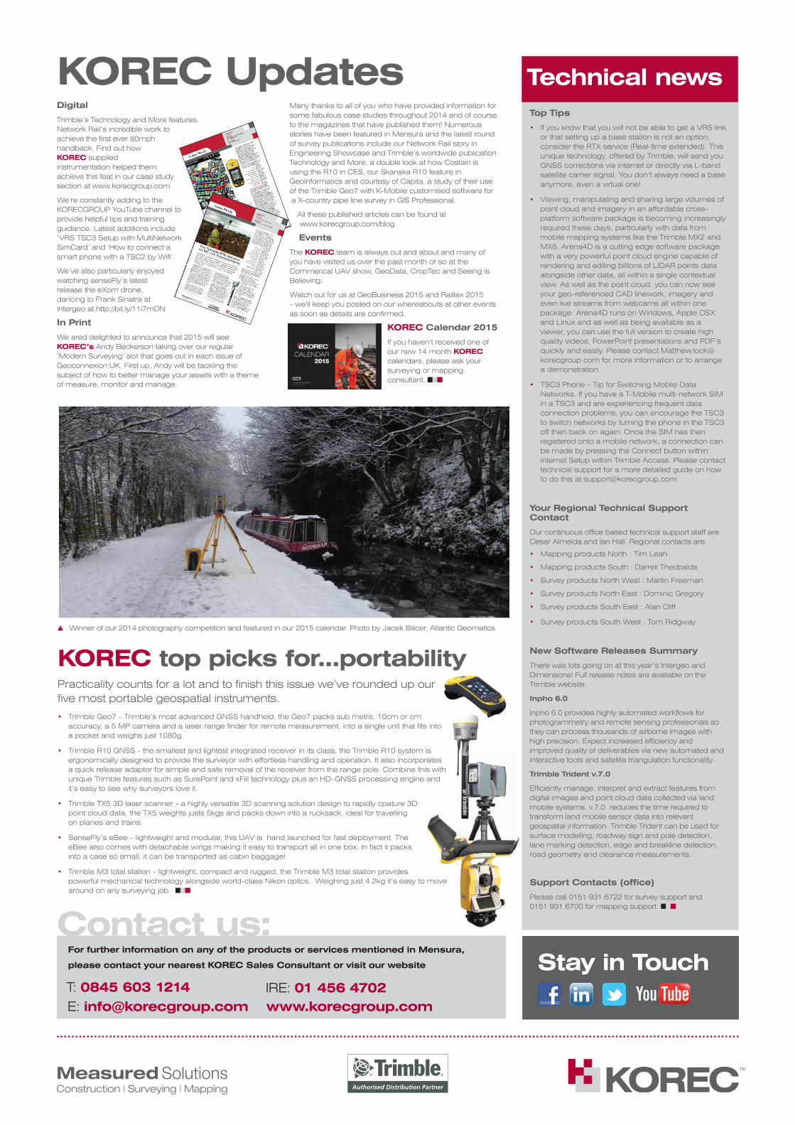
Winner of our 2014 photography competition and featured in our 2015 calendar. Photo by Jacek Bilicer, Atlantic Geomatics