Embed Size (px)
Citation preview
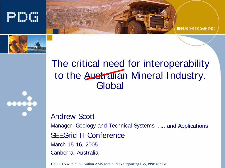
The critical need for interoperability to the Australian Mineral Industry.
Andrew ScottManager, Geology and Technical Systems
SEEGrid II ConferenceMarch 15-16, 2005Canberra, Australia
Global
….. and Applications
CoE GTS within ISG within AMS within PDG supporting IBS, PPiP and GP
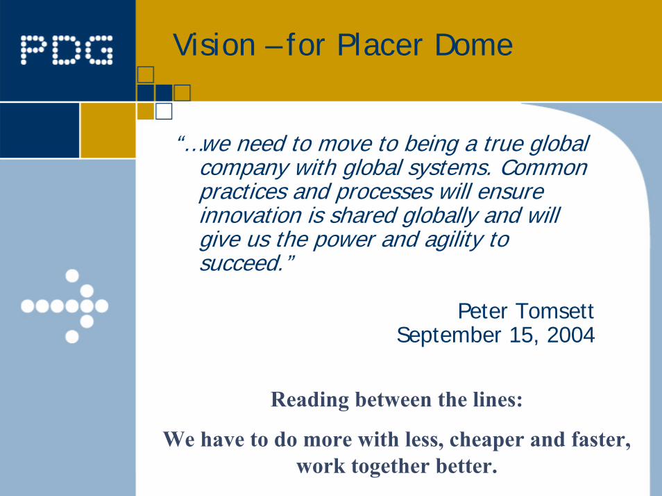
Vision – for Placer Dome
“…we need to move to being a true global company with global systems. Common practices and processes will ensure innovation is shared globally and will give us the power and agility to succeed.”
Peter TomsettSeptember 15, 2004
Reading between the lines:
We have to do more with less, cheaper and faster, work together better.
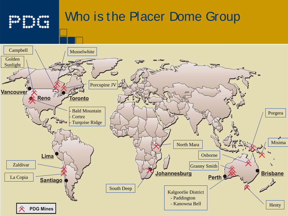
Who is the Placer Dome Group
La Copia
Zaldivar
- Bald Mountain- Cortez- Turqoise Ridge
Golden Sunlight
Campbell
Porcupine JV
Musselwhite
North Mara
South DeepKalgoorlie District
- Paddington- Kanowna Bell
Granny Smith
Henty
Porgera
Misima
Osborne
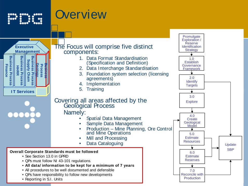
Overview
The Focus will comprise five distinct components:
1. Data Format Standardisation (Specification and Definition)
2. Data Interchange Standardisation3. Foundation system selection (licensing
agreements)4. Implementation5. Training
Covering all areas affected by the Geological Process Namely:
• Spatial Data Management• Sample Data Management• Production – Mine Planning, Ore Control
and Mine Operations• Mill and Processing• Data Cataloguing
1.0Establish
GovernanceFramework
2.0IdentifyTargets+
3.0Explore+
4.0Create
GeologicalModel
+
5.0 Estimate
Resources+
6.0 Estimate Reserves+
7.0 Reconcile with
Production+
PromulgateExploration /
ReserveIdentification
Strategy
Update SBPOverall Corporate Standards must be followed
• See Section 13.0 in GPRD • QPs must follow NI 43-101 regulations.• All data/information to be kept for a minimum of 7 years• All procedures to be well documented and defensible• QPs have responsibility to follow new developments• Reporting in S.I. Units
IT Services
Busin
ess Process
Finan
ce
Busin
ess Process
HH
RR
Busin
ess Process
Supply C
hain
Busin
ess P
rocessG
eology.
Executive Management
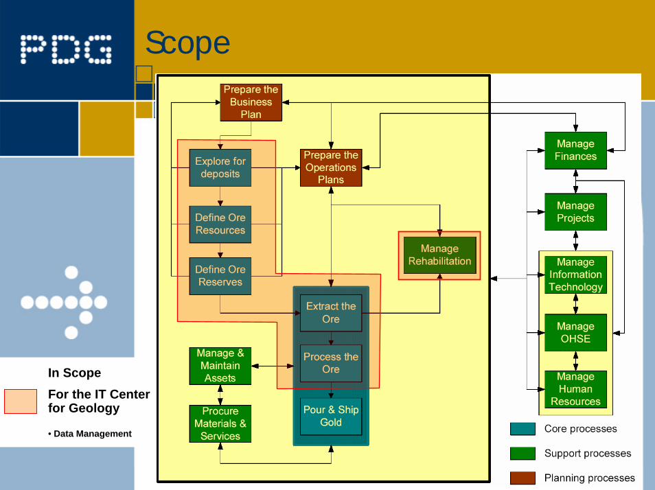
Scope
In Scope For the IT Center for Geology
• Data Management
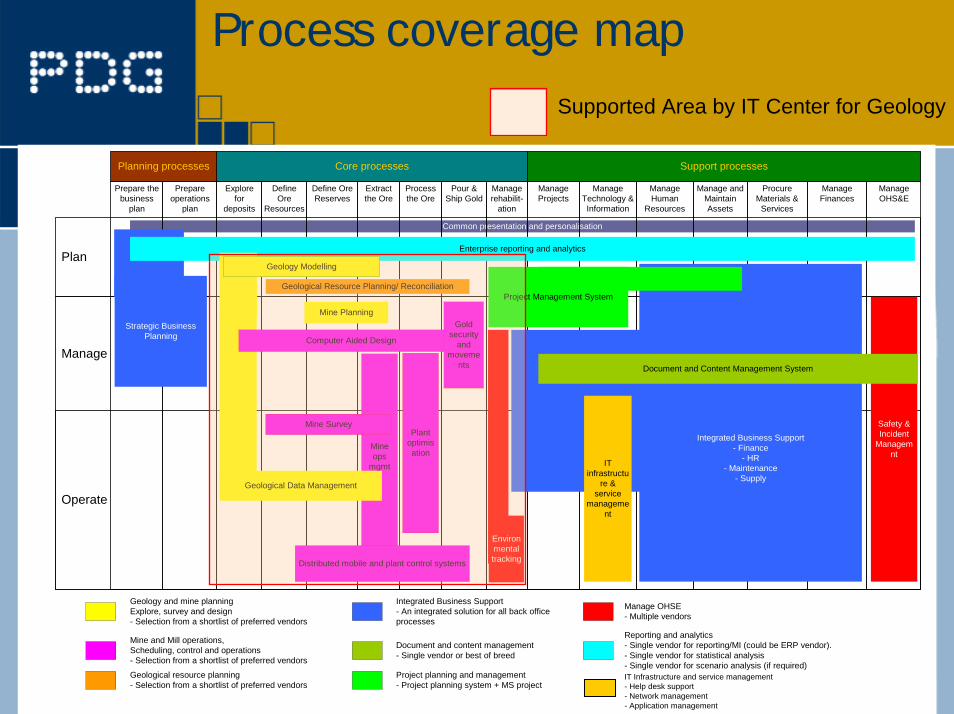
Process coverage mapSupported Area by IT Center for Geology
Geological resource planning- Selection from a shortlist of preferred vendors
Integrated Business Support- An integrated solution for all back officeprocesses
Document and content management- Single vendor or best of breed
Reporting and analytics- Single vendor for reporting/MI (could be ERP vendor).- Single vendor for statistical analysis- Single vendor for scenario analysis (if required)
Manage OHSE- Multiple vendors
Geology and mine planningExplore, survey and design- Selection from a shortlist of preferred vendors
Mine and Mill operations,Scheduling, control and operations- Selection from a shortlist of preferred vendors
Core processes Support processesPlanning processes
Manage
Plan
Operate
Common presentation and personalisation
Project planning and management- Project planning system + MS project
Safety &Incident
Managemnt
ManageHuman
Resources
ManageFinances
Manage andMaintainAssets
ProcureMaterials &
Services
ManageTechnology &Information
ManageProjects
ManageOHS&E
Define OreReserves
DefineOre
Resources
Extractthe Ore
Processthe Ore
Pour &Ship Gold
Prepareoperations
plan
Prepare thebusiness
plan
Managerehabilit-
ation
Explorefor
deposits
Geological modelling
Mineops
mgmt
Geological Data Management
Integrated Business Support- Finance
- HR- Maintenance
- Supply
Project Management System
Strategic BusinessPlanning
Document and Content Management System
Computer Aided Design
Geological Resource Planning/ Reconciliation
Mine Survey
Environmentaltracking
ITinfrastructu
re &service
management
Mine Planning
Plantoptimisation
Distributed mobile and plant control systems
Goldsecurity
andmoveme
nts
Enterprise reporting and analytics
Geology Modelling
IT Infrastructure and service management- Help desk support- Network management- Application management
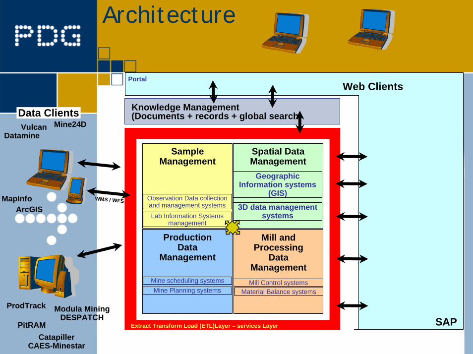
Architecture
CatapillerCAES-Minestar
Sample Management
Spatial Data Management
Production Data
Management
Mill and Processing
Data Management
Observation Data collection and management systemsLab Information Systems
management
Geographic Information systems
(GIS)
3D data management systems
Mine scheduling systemsMine Planning systems
Mill Control systemsMaterial Balance systems
SAP
Portal
Extract Transform Load (ETL)Layer – services Layer
DatamineVulcan Mine24D
ArcGISMapInfo
Data Clients
Modula Mining DESPATCH
Web Clients
WMS / WFS
Knowledge Management (Documents + records + global search)
ProdTrack
PitRAM
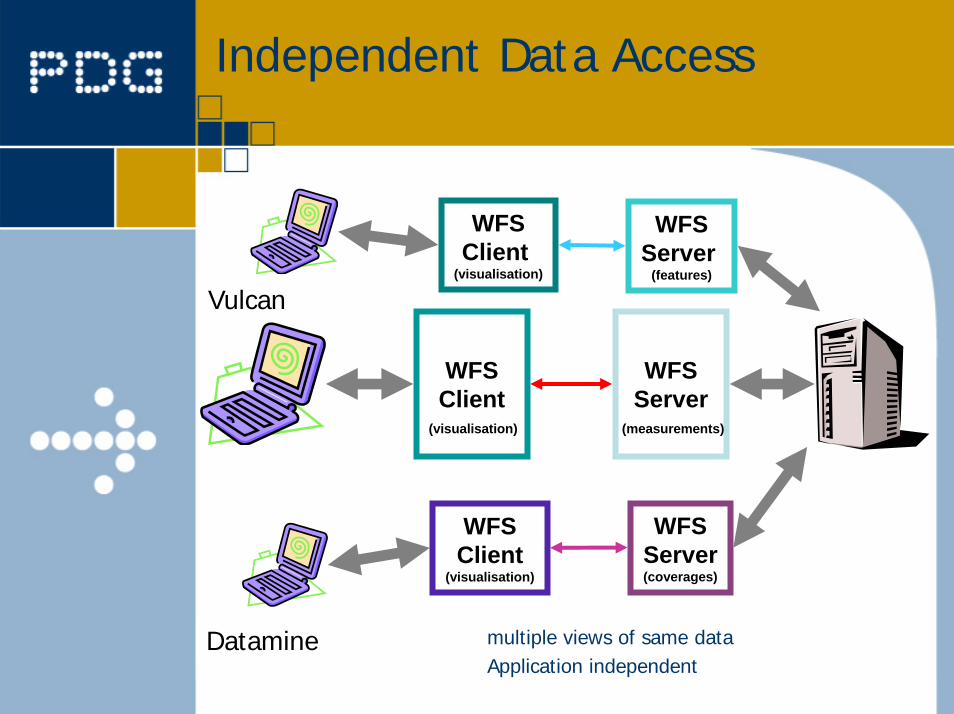
Independent Data Access
WFSClient
WFSServer
(visualisation) (measurements)
WFSClient
(visualisation)
WFSServer
(features)
WFSServer(coverages)
WFSClient
(visualisation)
ArcGISVulcan
MapInfoDatamine multiple views of same dataApplication independent
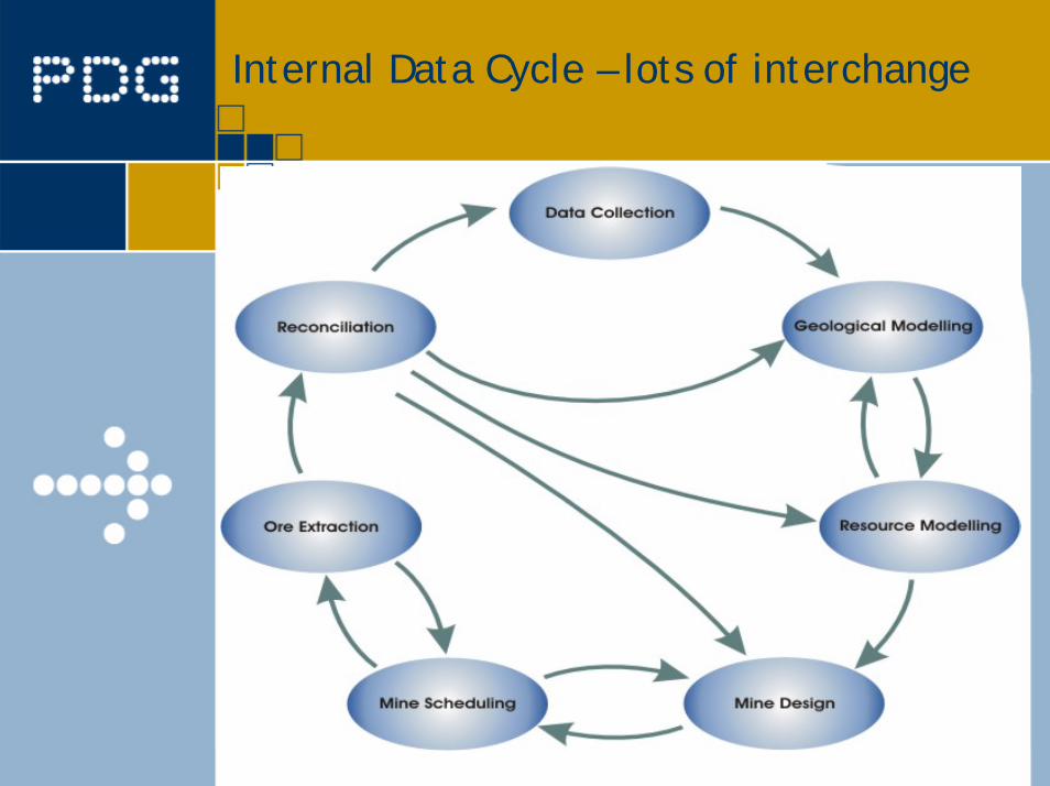
Internal Data Cycle – lots of interchange
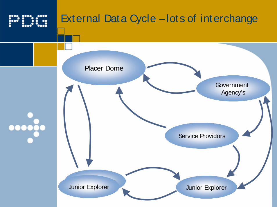
External Data Cycle – lots of interchange
Placer Dome
Junior Explorer
Government Agency’s
Junior Explorer Junior Explorer
Service Providors
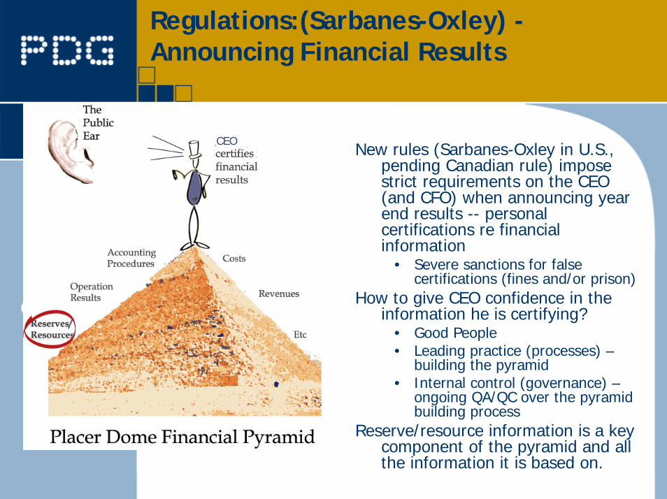
Regulations:(Sarbanes-Oxley) -Announcing Financial Results
New rules (Sarbanes-Oxley in U.S., pending Canadian rule) impose strict requirements on the CEO (and CFO) when announcing year end results -- personal certifications re financial information
• Severe sanctions for false certifications (fines and/or prison)
How to give CEO confidence in the information he is certifying?
• Good People• Leading practice (processes) –
building the pyramid• Internal control (governance) –
ongoing QA/QC over the pyramid building process
Reserve/resource information is a key component of the pyramid and all the information it is based on.
CEO

Regulations: NI 43-101 – Technical Information
New Canadian rules (NI 43-101) make the Qualified Persons (QP) responsible for technical information that the corporation reports, including reserve/resource estimates
QPs wear two hats• Personal/professional
responsibility• Assurance to CEO/CFO
(compliance with NI 43-101, reliable resource / reserve estimates – aware of data linage.
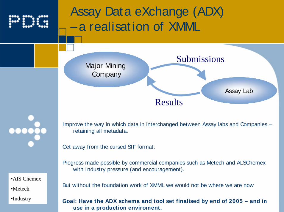
Assay Data eXchange (ADX)– a realisation of XMML
Major Mining Company
Assay Lab
Results
Submissions
Improve the way in which data in interchanged between Assay labs and Companies –retaining all metadata.
Get away from the cursed SIF format.
Progress made possible by commercial companies such as Metech and ALSChemexwith Industry pressure (and encouragement).
But without the foundation work of XMML we would not be where we are now
Goal: Have the ADX schema and tool set finalised by end of 2005 – and in use in a production enviroment.
•AlS Chemex
•Metech
•Industry
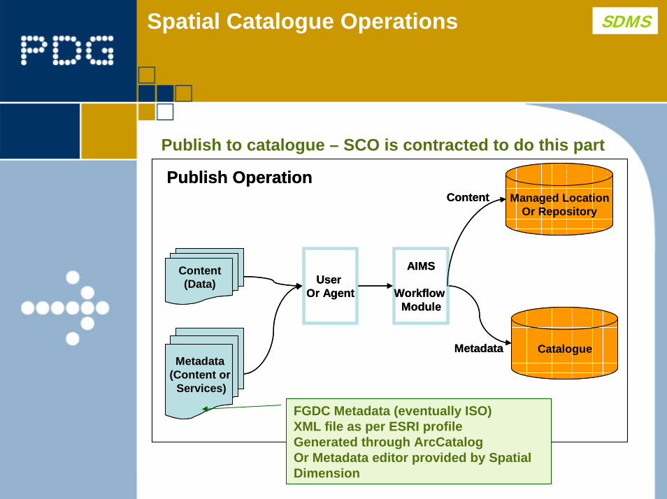
Spatial Catalogue Operations SDMS
AIMS
Workflow Module
Content(Data) User
Or Agent
Metadata(Content or
Services)
Managed LocationOr Repository
CatalogueMetadata
ContentPublish Operation
AIMS
Workflow Module
Content(Data) User
Or Agent
Metadata(Content or
Services)
Managed LocationOr Repository
CatalogueMetadata
ContentPublish Operation
Publish to catalogue – SCO is contracted to do this part
FGDC Metadata (eventually ISO)XML file as per ESRI profileGenerated through ArcCatalogOr Metadata editor provided by Spatial Dimension
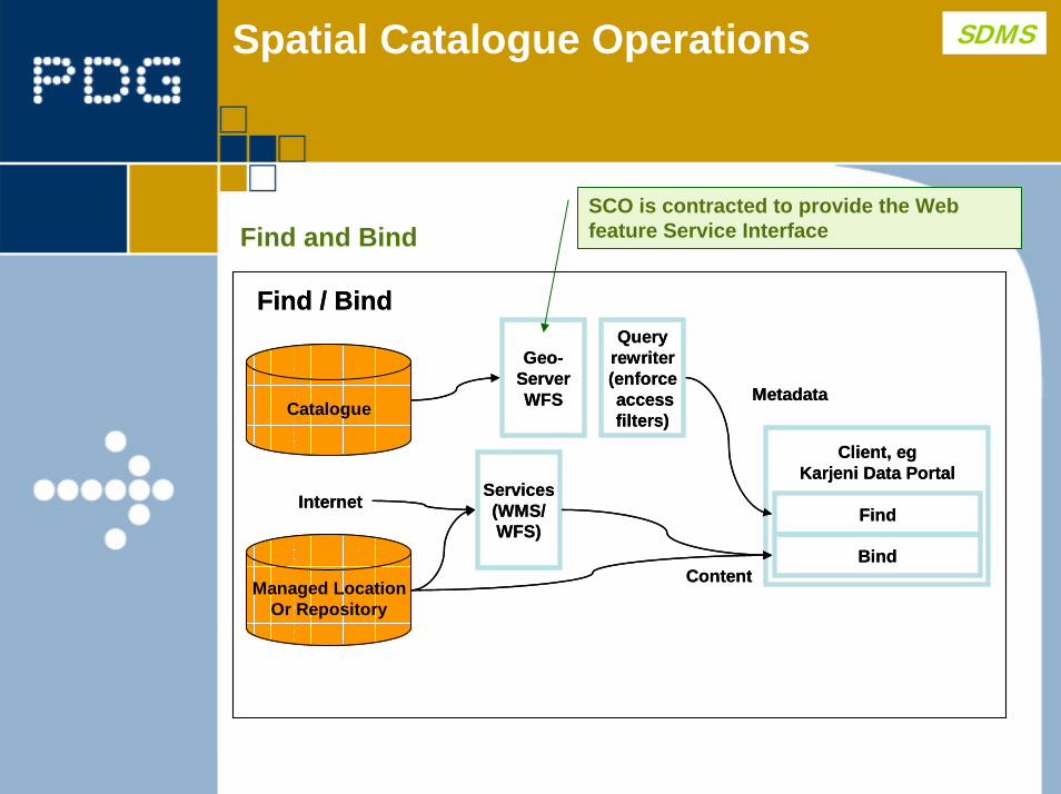
Spatial Catalogue Operations SDMS
Find and Bind
Geo-ServerWFS
Managed LocationOr Repository
CatalogueMetadata
Content
Find / Bind
Services(WMS/WFS)
Client, egKarjeni Data Portal
Find
Bind
Internet
Queryrewriter(enforceaccessfilters)
Geo-ServerWFS
Managed LocationOr Repository
CatalogueMetadata
Content
Find / Bind
Services(WMS/WFS)
Client, egKarjeni Data Portal
Find
Bind
Internet
Queryrewriter(enforceaccessfilters)
SCO is contracted to provide the Web feature Service Interface
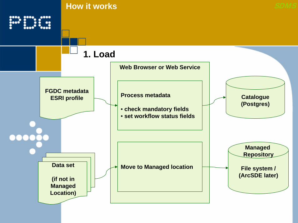
SDMSHow it works
1. LoadWeb Browser or Web Service
FGDC metadataESRI profile
Data set
(if not inManagedLocation)
Process metadata
• check mandatory fields• set workflow status fields
Catalogue(Postgres)
Managed Repository
File system /(ArcSDE later)
Move to Managed location
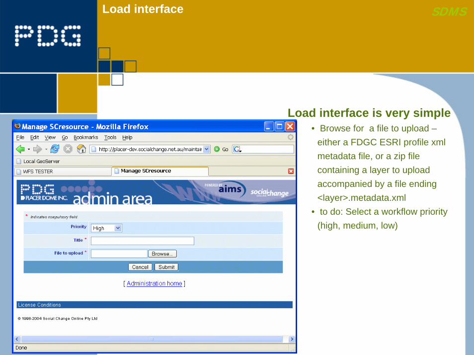
Load interface SDMS
Load interface is very simple• Browse for a file to upload –
either a FDGC ESRI profile xml metadata file, or a zip file containing a layer to upload accompanied by a file ending <layer>.metadata.xml
• to do: Select a workflow priority (high, medium, low)
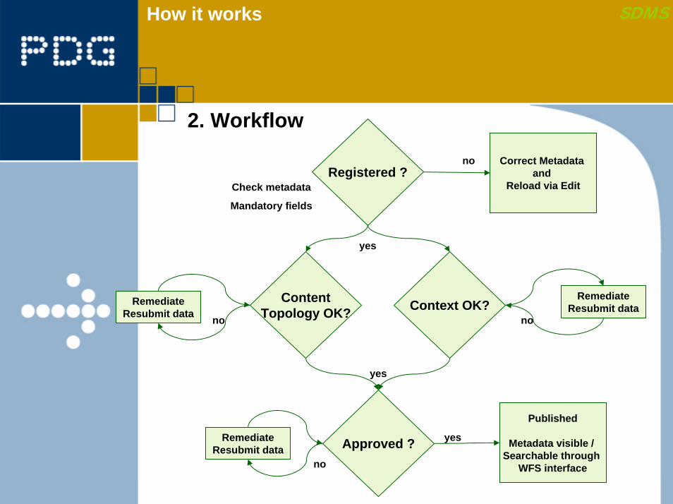
SDMSHow it works
2. Workflow
Registered ?Correct Metadata
and Reload via Edit
ContentTopology OK? Context OK?
Approved ?
yes
yes
no
RemediateResubmit data
RemediateResubmit data
RemediateResubmit data
no
no
no
Published
Metadata visible / Searchable through
WFS interface
Check metadata
Mandatory fields
yes
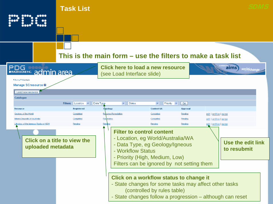
SDMSTask List
Click on a title to view the uploaded metadata
This is the main form – use the filters to make a task listClick here to load a new resource(see Load Interface slide)
Filter to control content- Location, eg World/Australia/WA- Data Type, eg Geology/Igneous- Workflow Status- Priority (High, Medium, Low)Filters can be ignored by not setting them
Use the edit linkto resubmit
Click on a workflow status to change it- State changes for some tasks may affect other tasks
(controlled by rules table)- State changes follow a progression – although can reset
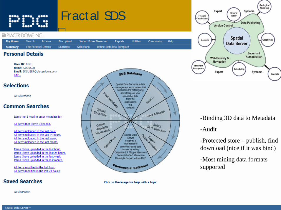
Fractal SDS
-Binding 3D data to Metadata
-Audit
-Protected store – publish, find download (nice if it was bind)
-Most mining data formats supported
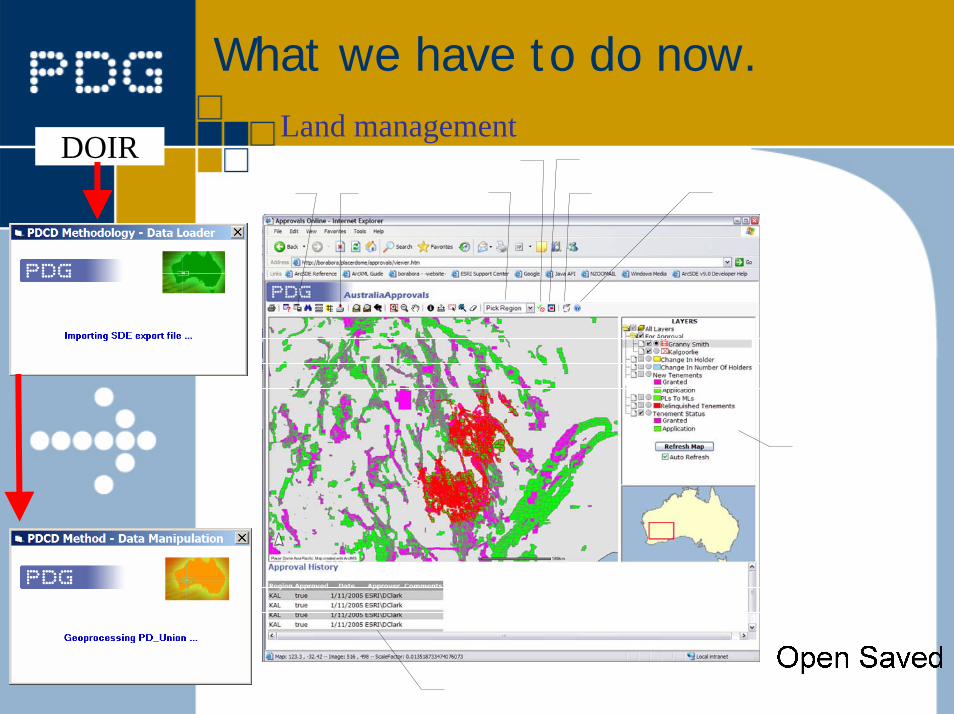
What we have to do now.
DOIRLand management
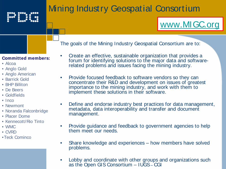
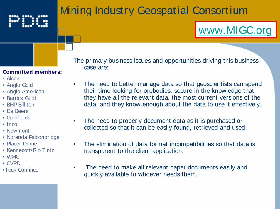
Mining Industry Geospatial Consortium
www.MIGC.org
The goals of the Mining Industry Geospatial Consortium are to:
• Create an effective, sustainable organization that provides a forum for identifying solutions to the major data and software-related problems and issues facing the mining industry.
• Provide focused feedback to software vendors so they can concentrate their R&D and development on issues of greatest importance to the mining industry, and work with them to implement these solutions in their software.
• Define and endorse industry best practices for data management, metadata, data interoperability and transfer and document management.
• Provide guidance and feedback to government agencies to help them meet our needs.
• Share knowledge and experiences – how members have solved problems.
• Lobby and coordinate with other groups and organizations such as the Open GIS Consortium – IUGS – CGI
Committed members:• Alcoa• Anglo Gold• Anglo American• Barrick Gold• BHP Billiton• De Beers• Goldfields• Inco• Newmont• Noranda Falconbridge• Placer Dome• Kennecott/Rio Tinto• WMC• CVRD•Teck Cominco
Mining Industry Geospatial Consortium
www.MIGC.org
The primary business issues and opportunities driving this business case are:
• The need to better manage data so that geoscientists can spend their time looking for orebodies, secure in the knowledge that they have all the relevant data, the most current versions of the data, and they know enough about the data to use it effectively.
• The need to properly document data as it is purchased or collected so that it can be easily found, retrieved and used.
• The elimination of data format incompatibilities so that data istransparent to the client application.
• The need to make all relevant paper documents easily and quickly available to whoever needs them.
Committed members:• Alcoa• Anglo Gold• Anglo American• Barrick Gold• BHP Billiton• De Beers• Goldfields• Inco• Newmont• Noranda Falconbridge• Placer Dome• Kennecott/Rio Tinto• WMC• CVRD•Teck Cominco
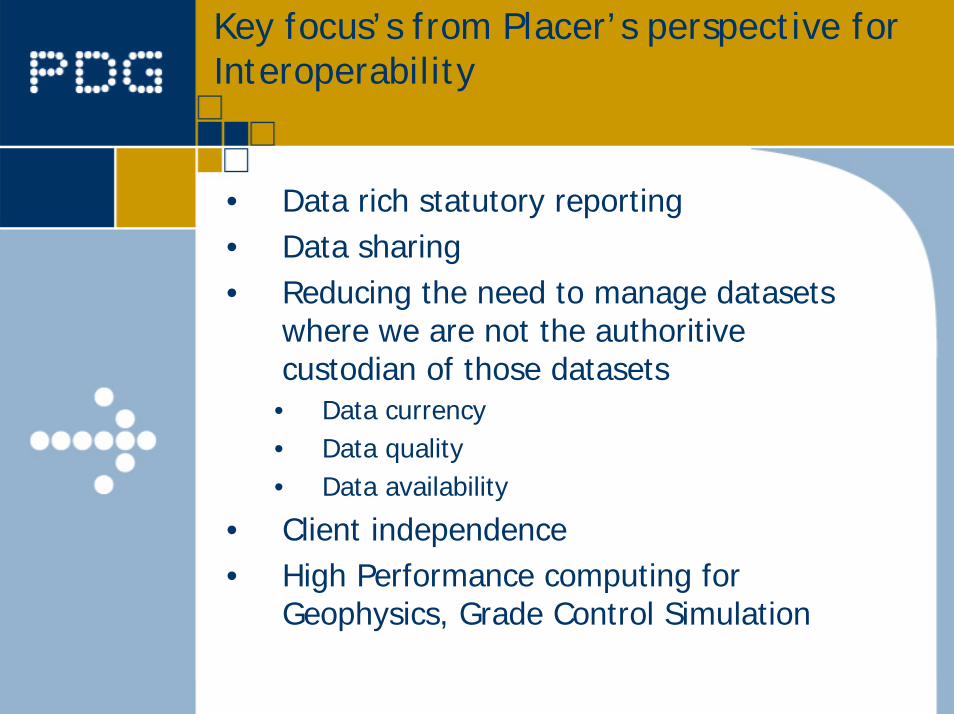
Key focus’s from Placer’s perspective for Interoperability
• Data rich statutory reporting• Data sharing• Reducing the need to manage datasets
where we are not the authoritivecustodian of those datasets• Data currency• Data quality• Data availability
• Client independence• High Performance computing for
Geophysics, Grade Control Simulation
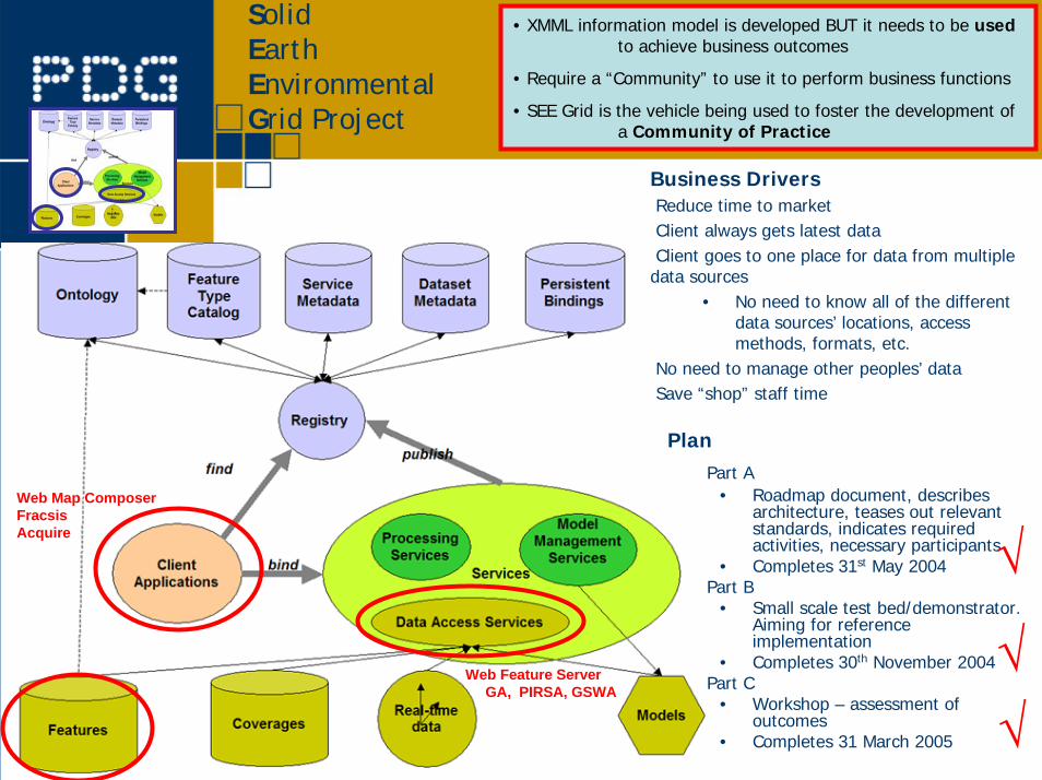
SolidEarth EnvironmentalGrid Project
• XMML information model is developed BUT it needs to be usedto achieve business outcomes
• Require a “Community” to use it to perform business functions
• SEE Grid is the vehicle being used to foster the development ofa Community of Practice
Web Map ComposerFracsisAcquire
Web Feature ServerGA, PIRSA, GSWA
Business DriversReduce time to marketClient always gets latest dataClient goes to one place for data from multiple
data sources• No need to know all of the different
data sources’ locations, access methods, formats, etc.
No need to manage other peoples’ dataSave “shop” staff time
PlanPart A
• Roadmap document, describes architecture, teases out relevant standards, indicates required activities, necessary participants
• Completes 31st May 2004Part B
• Small scale test bed/demonstrator. Aiming for reference implementation
• Completes 30th November 2004Part C
• Workshop – assessment of outcomes
• Completes 31 March 2005
√
√√
Thank you
Questions ?