Embed Size (px)
Citation preview
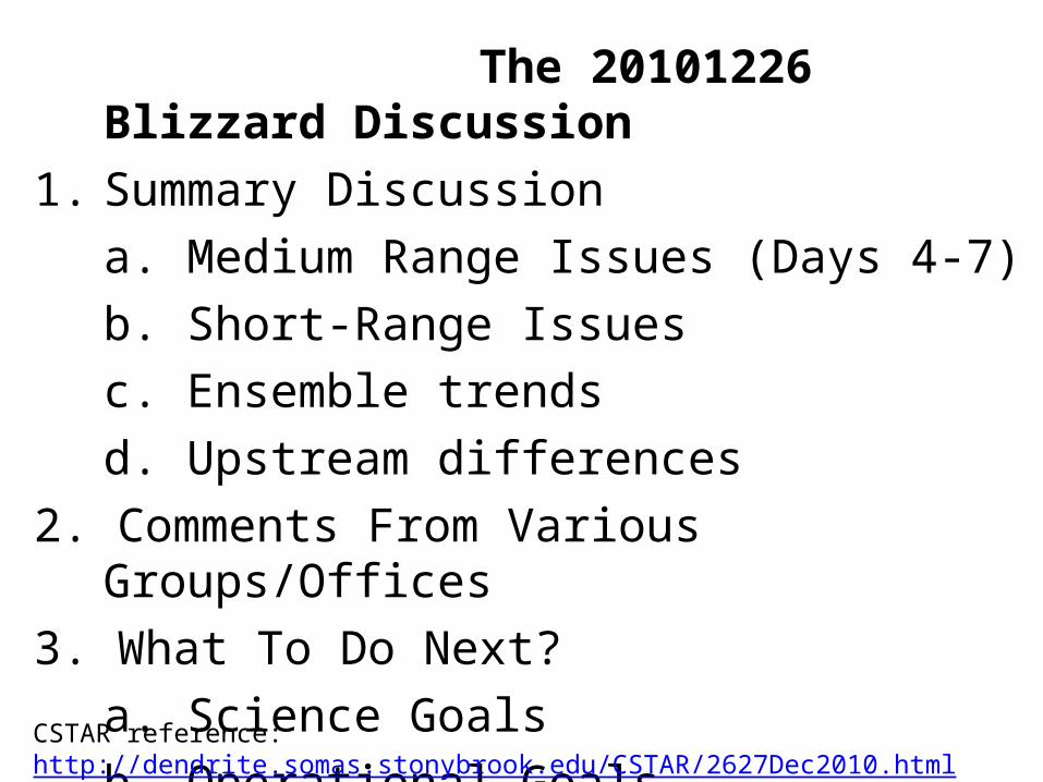
The 20101226 Blizzard Discussion1. Summary Discussion
a. Medium Range Issues (Days 4-7)b. Short-Range Issuesc. Ensemble trendsd. Upstream differences
2. Comments From Various Groups/Offices3. What To Do Next?
a. Science Goalsb. Operational Goals
CSTAR reference: http://dendrite.somas.stonybrook.edu/CSTAR/2627Dec2010.html
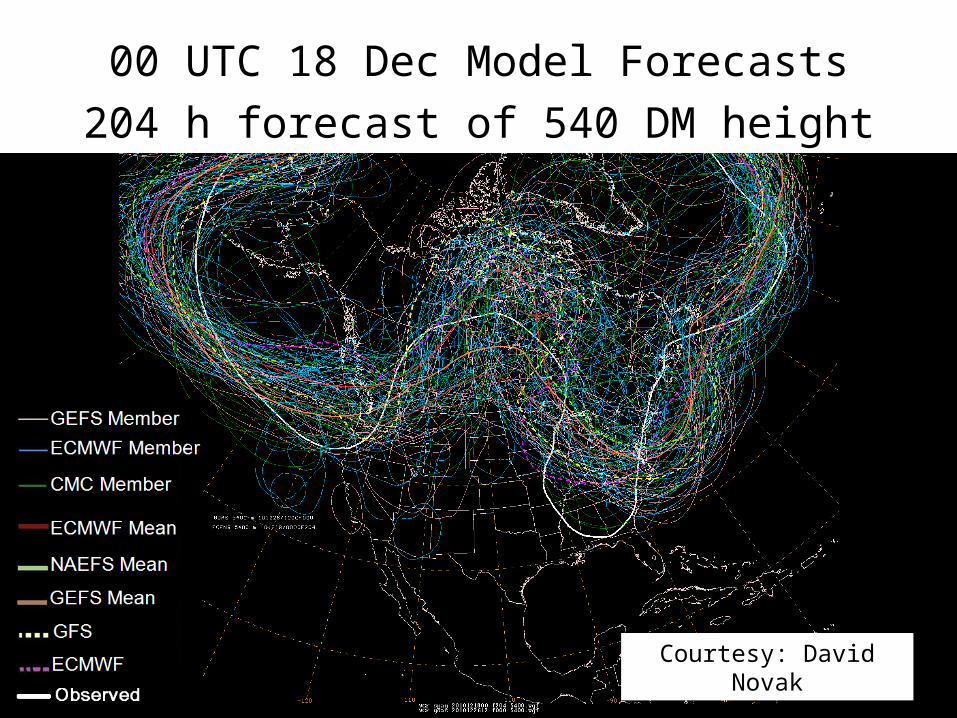
00 UTC 18 Dec Model Forecasts204 h forecast of 540 DM height valid 12 UTC 26 Dec
Courtesy: David Novak
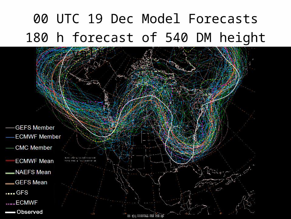
00 UTC 19 Dec Model Forecasts180 h forecast of 540 DM height valid 12 UTC 26 Dec
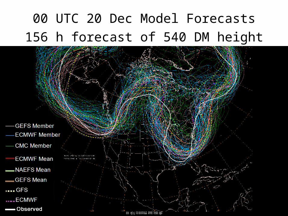
00 UTC 20 Dec Model Forecasts156 h forecast of 540 DM height valid 12 UTC 26 Dec
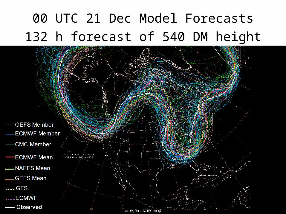
00 UTC 21 Dec Model Forecasts132 h forecast of 540 DM height valid 12 UTC 26 Dec
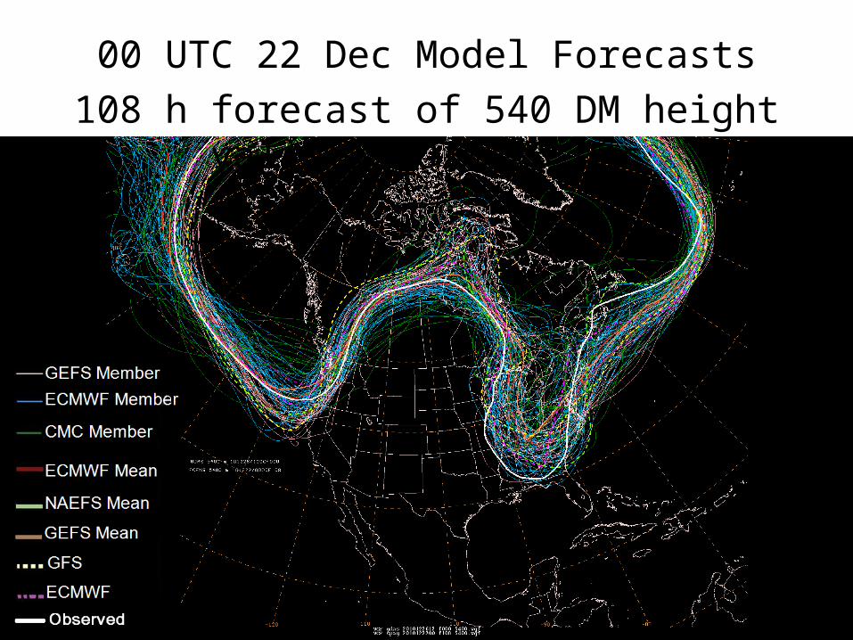
00 UTC 22 Dec Model Forecasts108 h forecast of 540 DM height valid 12 UTC 26 Dec
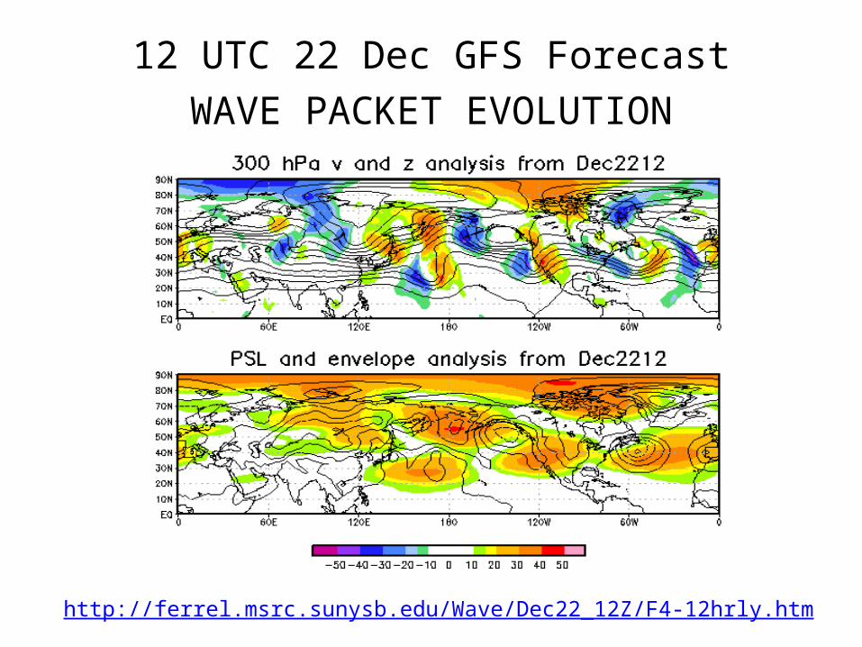
12 UTC 22 Dec GFS ForecastWAVE PACKET EVOLUTION
http://ferrel.msrc.sunysb.edu/Wave/Dec22_12Z/F4-12hrly.htm
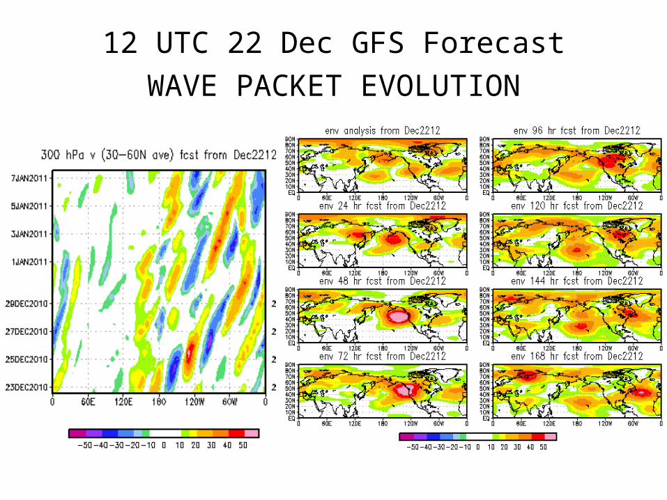
12 UTC 22 Dec GFS ForecastWAVE PACKET EVOLUTION
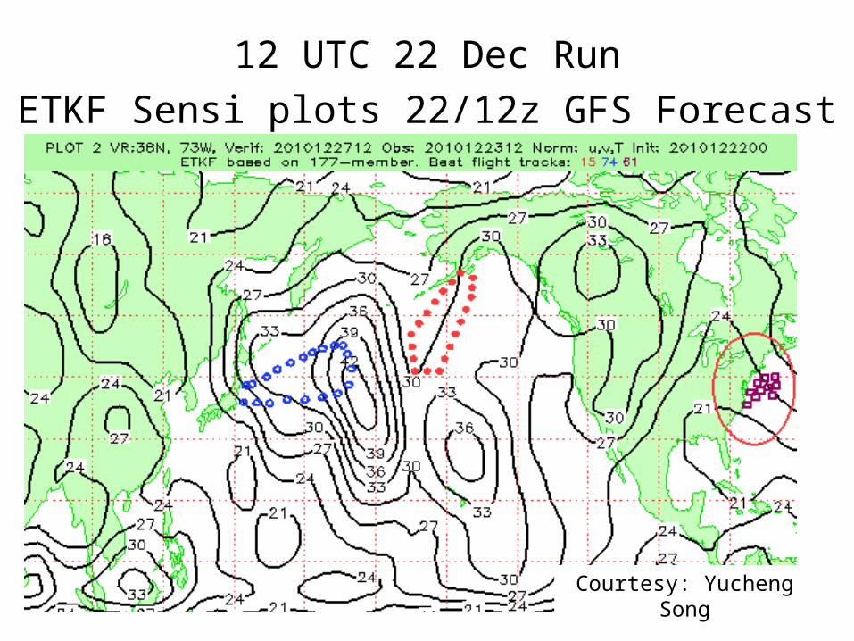
12 UTC 22 Dec RunETKF Sensi plots 22/12z GFS Forecast
Courtesy: Yucheng Song
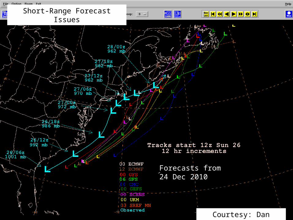
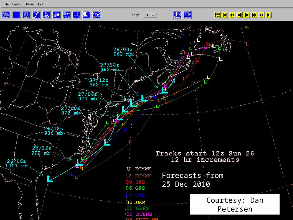
Forecasts from 24 Dec 2010
Courtesy: Dan Petersen
Short-Range Forecast Issues
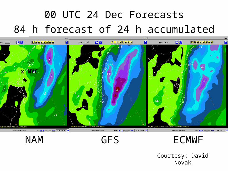
00 UTC 24 Dec Forecasts84 h forecast of 24 h accumulated precip
NAM GFS ECMWFCourtesy: David Novak
x NYC
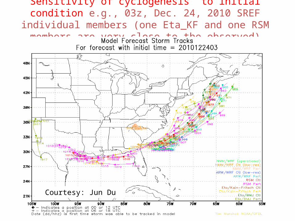
Sensitivity of cyclogenesis to initial condition e.g., 03z, Dec. 24, 2010 SREF individual members (one Eta_KF and one RSM
members are very close to the observed)
Courtesy: Jun Du
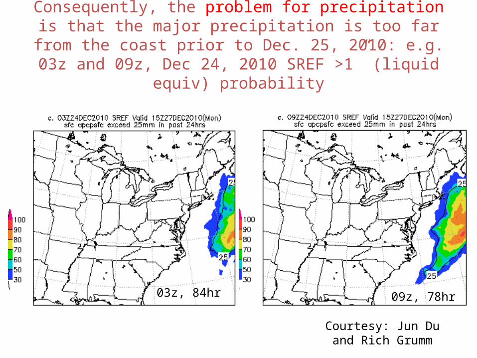
Consequently, the problem for precipitation is that the major precipitation is too far from the coast prior to Dec. 25, 2010: e.g.
03z and 09z, Dec 24, 2010 SREF >1” (liquid equiv) probability
03z, 84hr 09z, 78hr
Courtesy: Jun Du and Rich Grumm
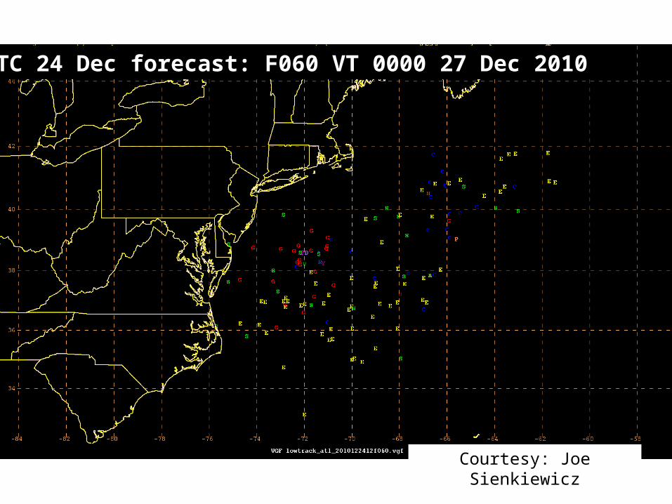
1200 UTC 24 Dec forecast: F060 VT 0000 27 Dec 2010
Courtesy: Joe Sienkiewicz
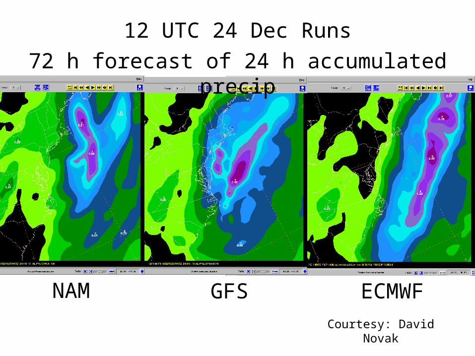
12 UTC 24 Dec Runs72 h forecast of 24 h accumulated precip
NAM GFS ECMWFCourtesy: David Novak
Forecasts from 25 Dec 2010
Courtesy: Dan Petersen
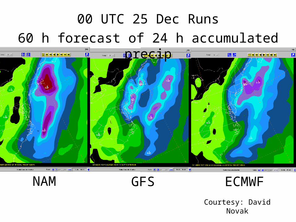
00 UTC 25 Dec Runs60 h forecast of 24 h accumulated precip
NAM GFS ECMWFCourtesy: David Novak
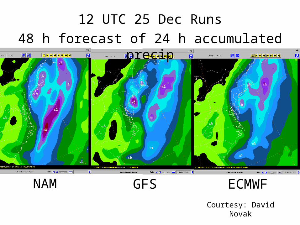
12 UTC 25 Dec Runs48 h forecast of 24 h accumulated precip
NAM GFS ECMWFCourtesy: David Novak
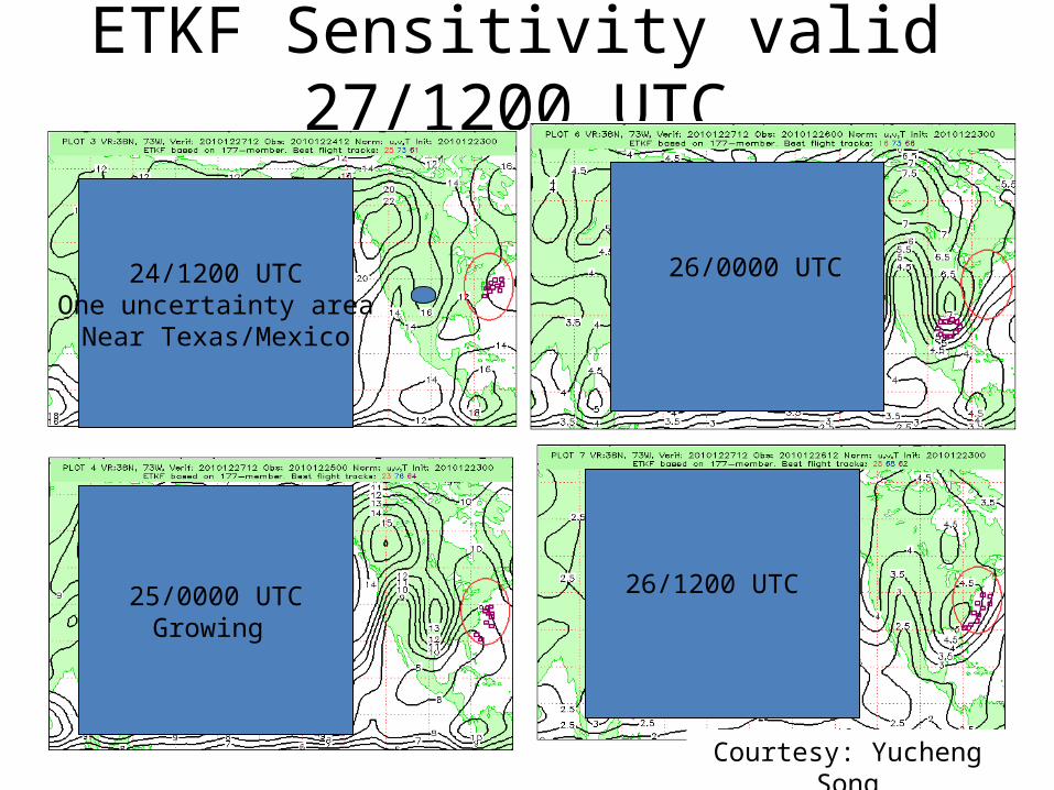
ETKF Sensitivity valid 27/1200 UTC
24/1200 UTCOne uncertainty areaNear Texas/Mexico
25/0000 UTCGrowing
Courtesy: Yucheng Song
26/0000 UTC
26/1200 UTC
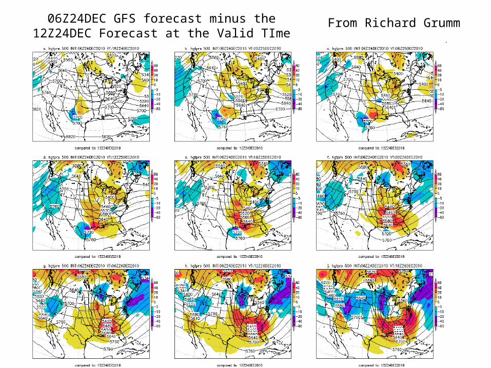
From Richard Grumm06Z24DEC GFS forecast minus the 12Z24DEC Forecast at the Valid TIme
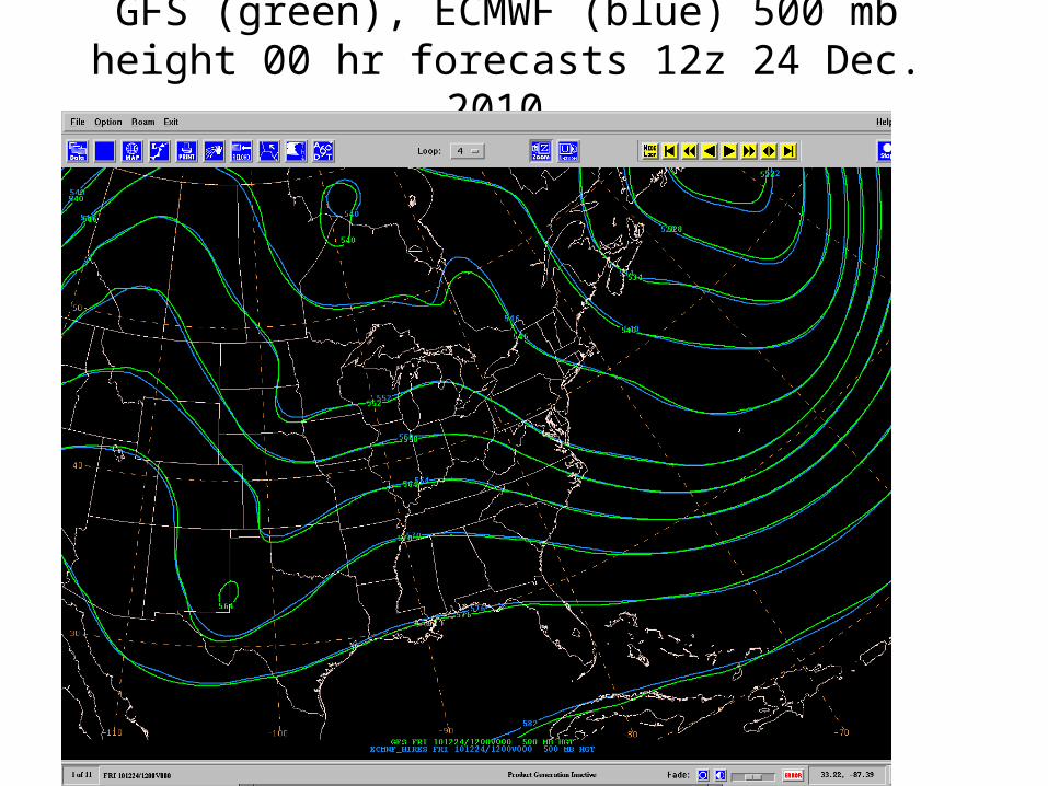
GFS (green), ECMWF (blue) 500 mb height 00 hr forecasts 12z 24 Dec. 2010
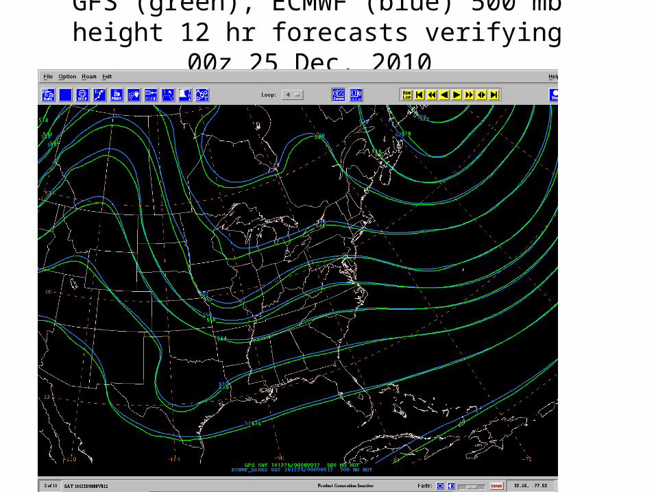
GFS (green), ECMWF (blue) 500 mb height 12 hr forecasts verifying 00z 25 Dec. 2010
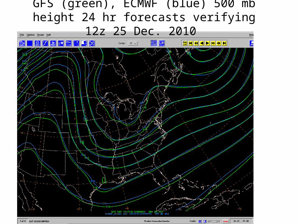
GFS (green), ECMWF (blue) 500 mb height 24 hr forecasts verifying 12z 25 Dec. 2010
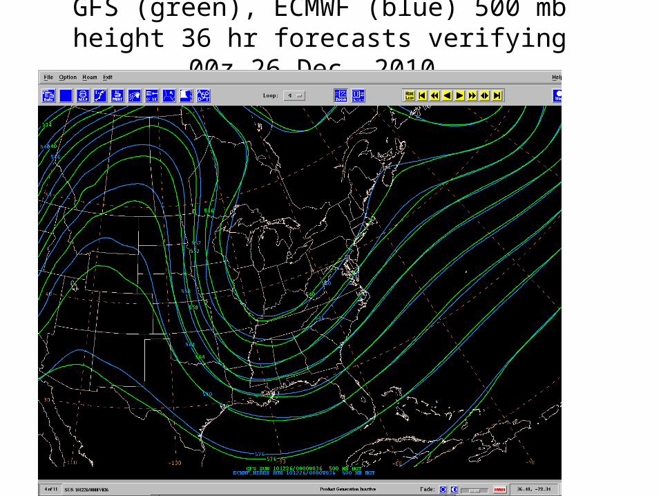
GFS (green), ECMWF (blue) 500 mb height 36 hr forecasts verifying 00z 26 Dec. 2010
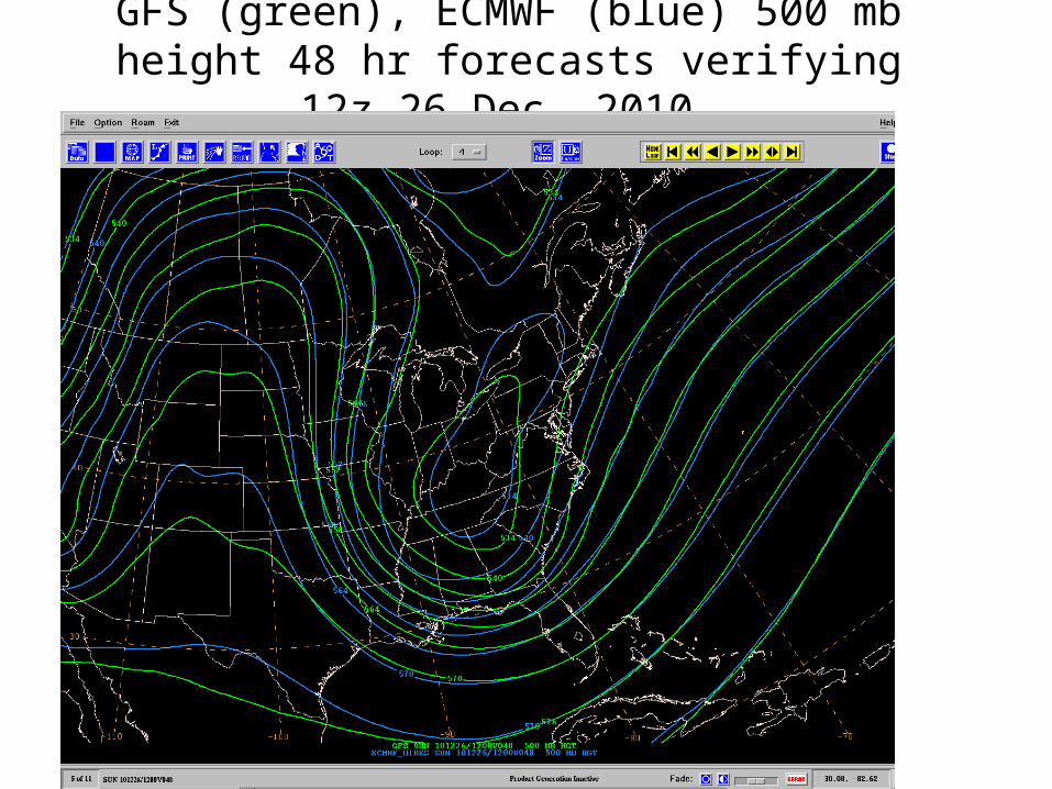
GFS (green), ECMWF (blue) 500 mb height 48 hr forecasts verifying 12z 26 Dec. 2010
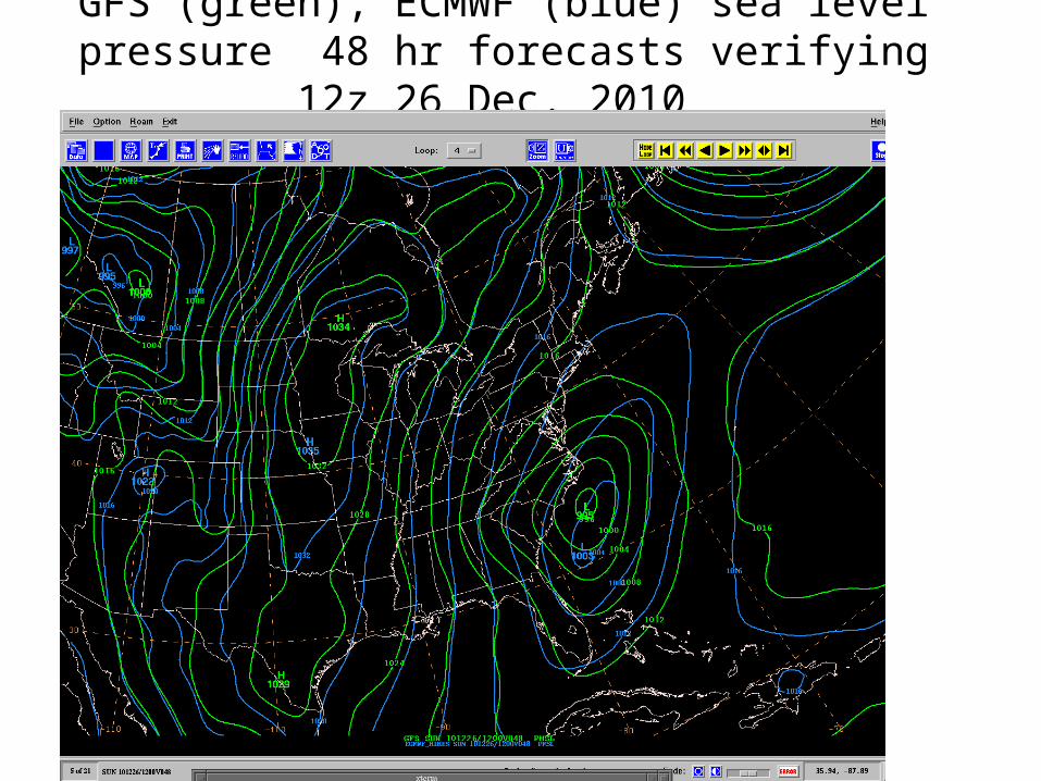
GFS (green), ECMWF (blue) sea level pressure 48 hr forecasts verifying 12z 26 Dec. 2010
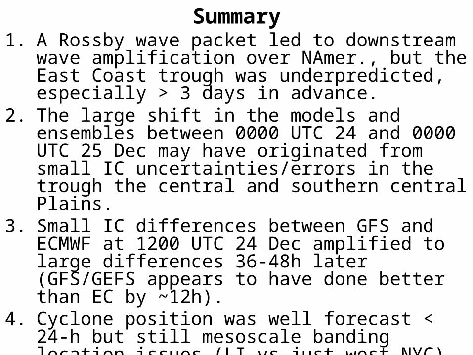
Summary1. A Rossby wave packet led to downstream wave
amplification over NAmer., but the East Coast trough was underpredicted, especially > 3 days in advance.
2. The large shift in the models and ensembles between 0000 UTC 24 and 0000 UTC 25 Dec may have originated from small IC uncertainties/errors in the trough the central and southern central Plains.
3. Small IC differences between GFS and ECMWF at 1200 UTC 24 Dec amplified to large differences 36-48h later (GFS/GEFS appears to have done better than EC by ~12h).
4. Cyclone position was well forecast < 24-h but still mesoscale banding location issues (LI vs just west NYC).
5. Difference plots between models and run cycles is a useful tool. We need more of these plotting approaches in realtime to look at ensemble/model run to run differences.
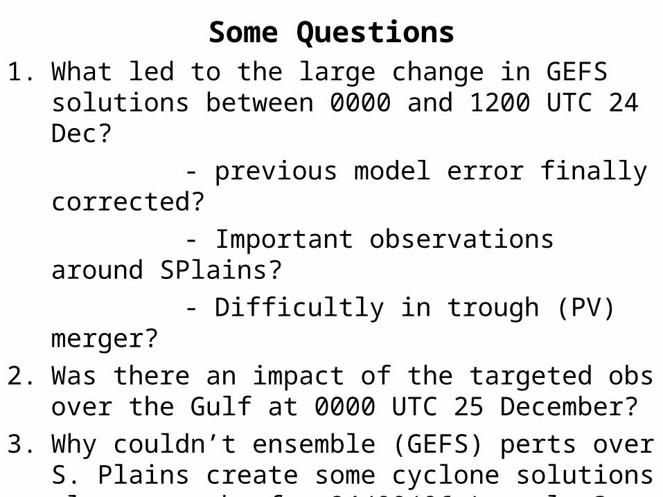
Some Questions1. What led to the large change in GEFS solutions between
0000 and 1200 UTC 24 Dec?- previous model error finally corrected?- Important observations around SPlains?- Difficultly in trough (PV) merger?
2. Was there an impact of the targeted obs over the Gulf at 0000 UTC 25 December?
3. Why couldn’t ensemble (GEFS) perts over S. Plains create some cyclone solutions closer to obs for 24/00(06z) cycles? Why did the SREF cluster offshore as well?
4. Was there a large contribution from physics uncertainty in this event?
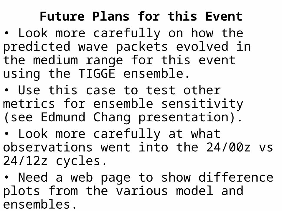
Future Plans for this Event• Look more carefully on how the predicted wave packets evolved in the medium range for this event using the TIGGE ensemble.• Use this case to test other metrics for ensemble sensitivity (see Edmund Chang presentation).• Look more carefully at what observations went into the 24/00z vs 24/12z cycles.• Need a web page to show difference plots from the various model and ensembles.• Others?