Embed Size (px)
Citation preview
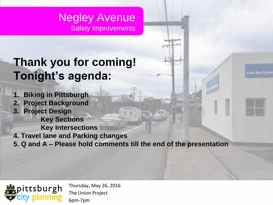
Negley Avenue Safety Improvements
Thursday, May 26, 2016
The Union Project
6pm-7pm
Thank you for coming!
Tonight’s agenda:
1. Biking in Pittsburgh
2. Project Background
3. Project Design
Key Sections
Key Intersections
4. Travel lane and Parking changes
5. Q and A – Please hold comments till the end of the presentation
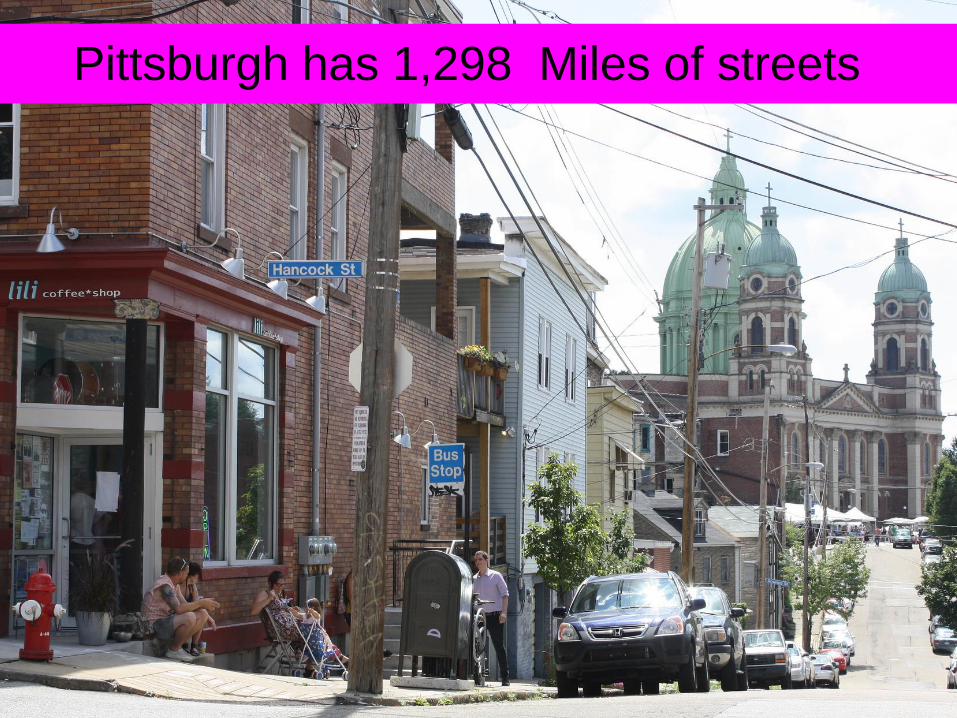
Pittsburgh has 1,298 Miles of streets

Streets are great public spaces
50% of public space
10% of the City
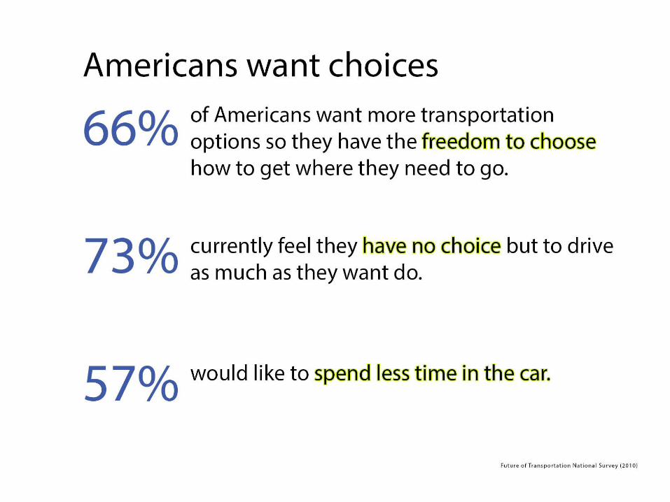

62% of all adults in Allegheny
County were obese or overweight
in 2010 and many lack access to
quality open space.
Results from the 2009-2010 Allegheny County Health Survey (ACHS): Measuring the Health of
Adult Residents. Pittsburgh: Allegheny County Health Department, The Evaluation Institute

4 Types of bicyclist Image: MASS DOT
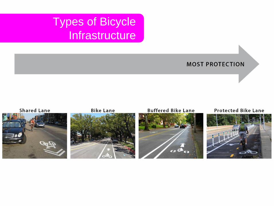
Types of Bicycle
Infrastructure
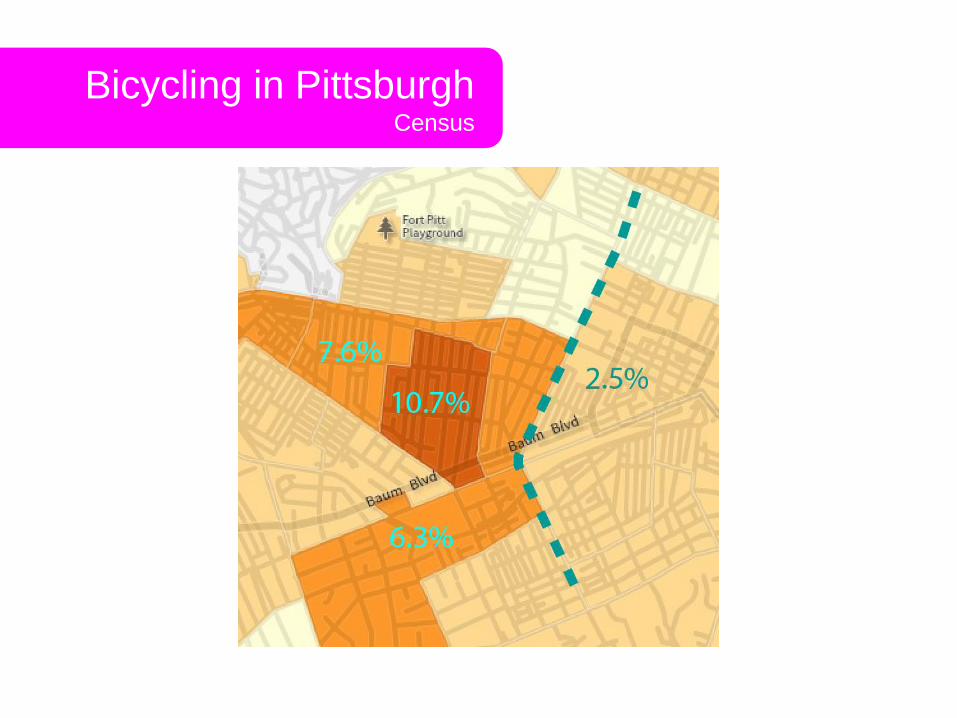
Bicycling in Pittsburgh Census

Make My Trip Count Survey
Bicycling in Pittsburgh Transportatoin Survey
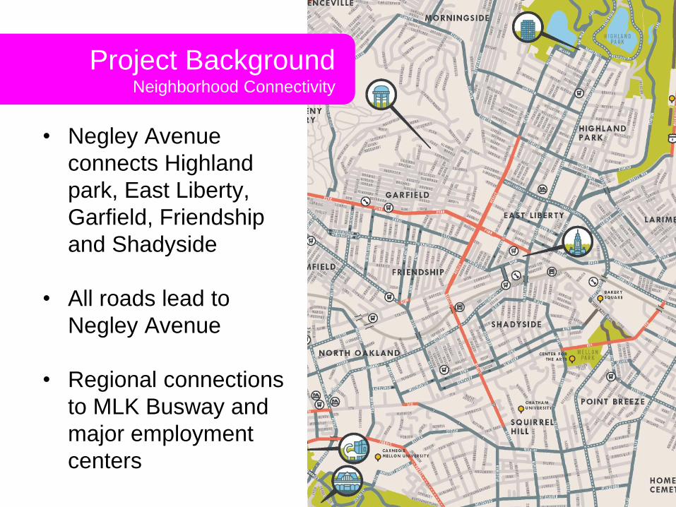
Project Background Neighborhood Connectivity
• Negley Avenue
connects Highland
park, East Liberty,
Garfield, Friendship
and Shadyside
• All roads lead to
Negley Avenue
• Regional connections
to MLK Busway and
major employment
centers
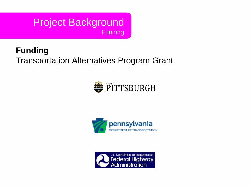
Project Background Funding
Funding
Transportation Alternatives Program Grant

Project Background Neighborhood Outreach
Past Meetings
December 2015 Highland Park / East Liberty Bicycle and
Pedestrian Committee
December 2015 Baum Center Initiative
January 2016 Highland Park Community Council
January 2016 Friendship Community Council
Upcoming….
May 26, 2016 Public Meeting (Design)
Summer 2016 Additional Stakeholder Meetings
Fall 2016 Public Meeting (Construction)
October 2016 Construction (weather dependent)

Project Goals
• Connect major bicycle
routes in Friendship,
East Liberty and
Shadyside
• Traffic calming, slower
speeds, safer vehicle
movement
• Pedestrian and bicycle
safety
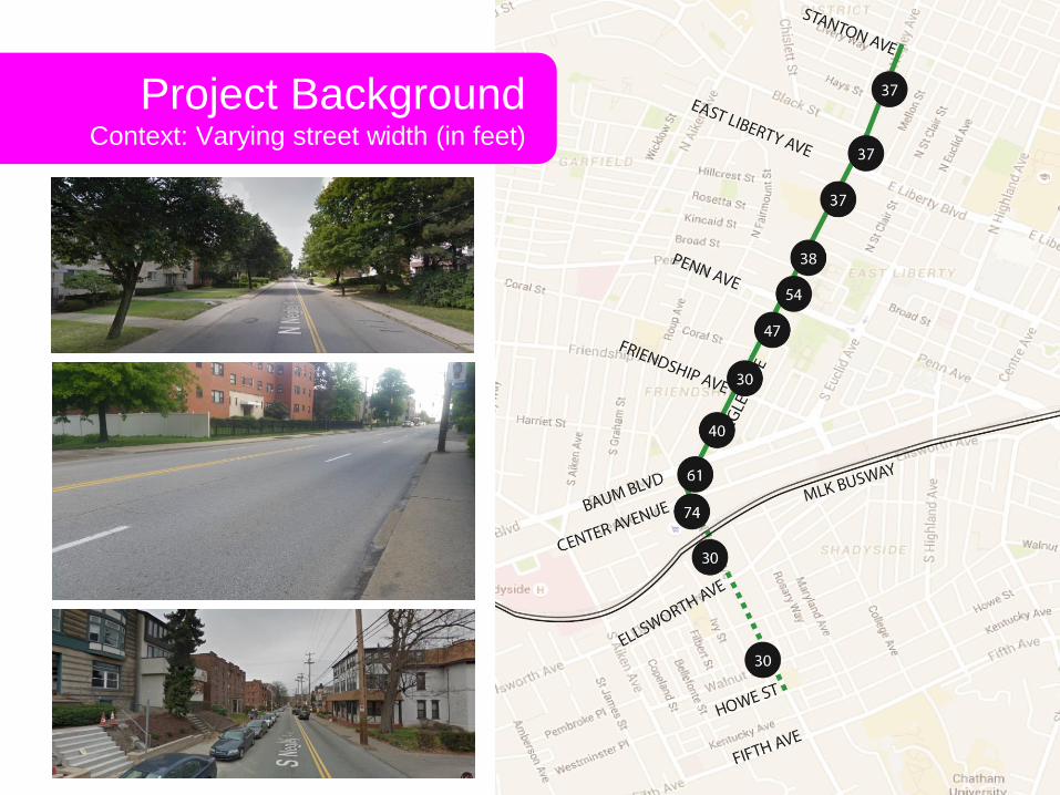
Project Background Context: Varying street width (in feet)
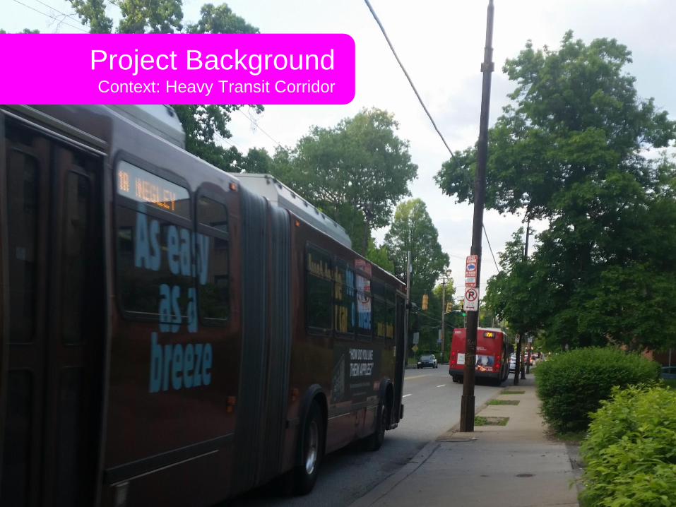
Project Background Context: Heavy Transit Corridor

Project Background Context

Project Background Context

Street Safety Bike / Ped crashes
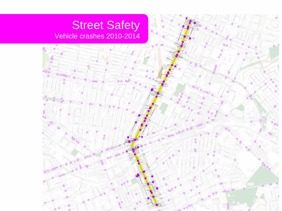
Street Safety Vehicle crashes 2010-2014

Project Sections
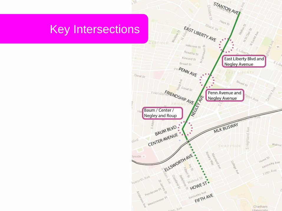
Key Intersections
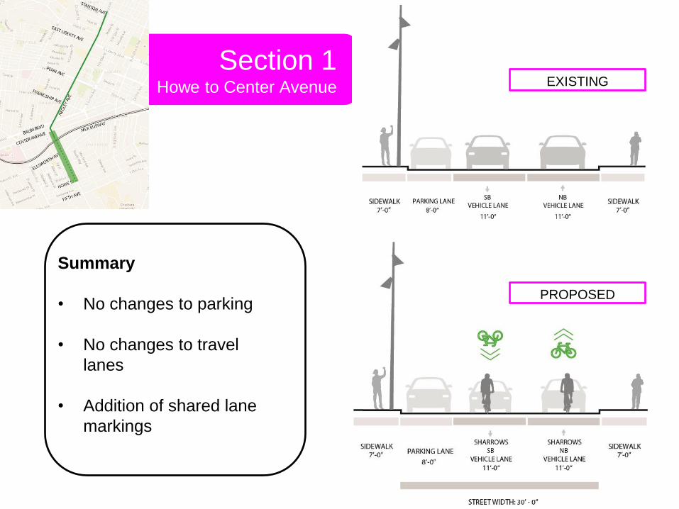
Section 1 Howe to Center Avenue
Summary
• No changes to parking
• No changes to travel
lanes
• Addition of shared lane
markings
EXISTING
PROPOSED
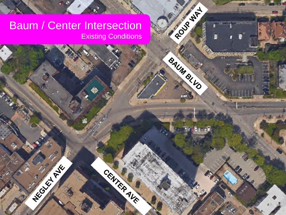
Baum / Center Intersection Existing Conditions

Baum / Center Intersection Base Improvements
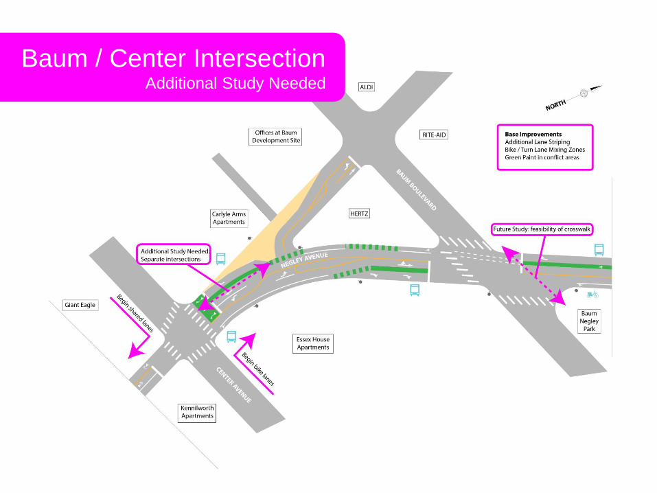
Baum / Center Intersection Additional Study Needed

Section 2 Baum Blvd to Friendship
Summary
• Addition of buffered bike
lanes
• Off-peak parking removal
EXISTING
PROPOSED

Penn Avenue Intersection

Section 3 Penn to East Liberty
Summary
• Addition of bike lanes
• Off-peak parking removal
• 4-lane road to 3-lane road
• Addition of a turn lane
EXISTING
PROPOSED
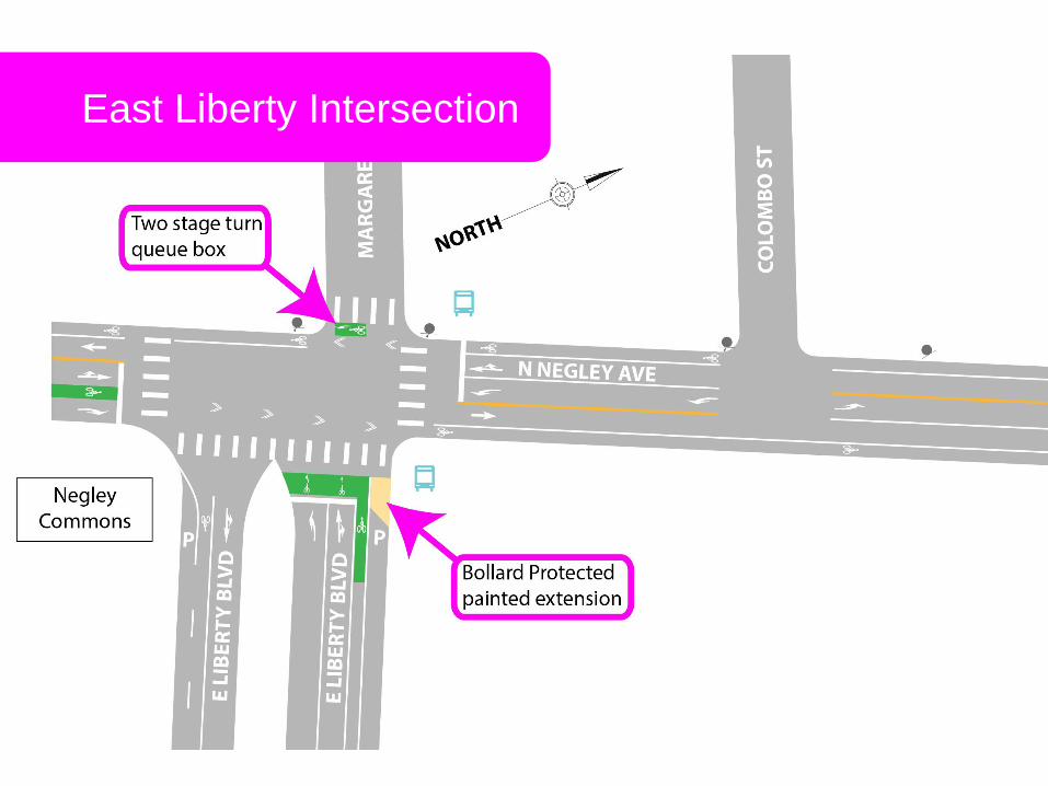
East Liberty Intersection

Section 4 E. Liberty to Stanton Ave
Summary
• Addition of bike lanes
• Off-peak parking removal
• 4-lane road to 3-lane road
• Addition of a turn lane
EXISTING
PROPOSED
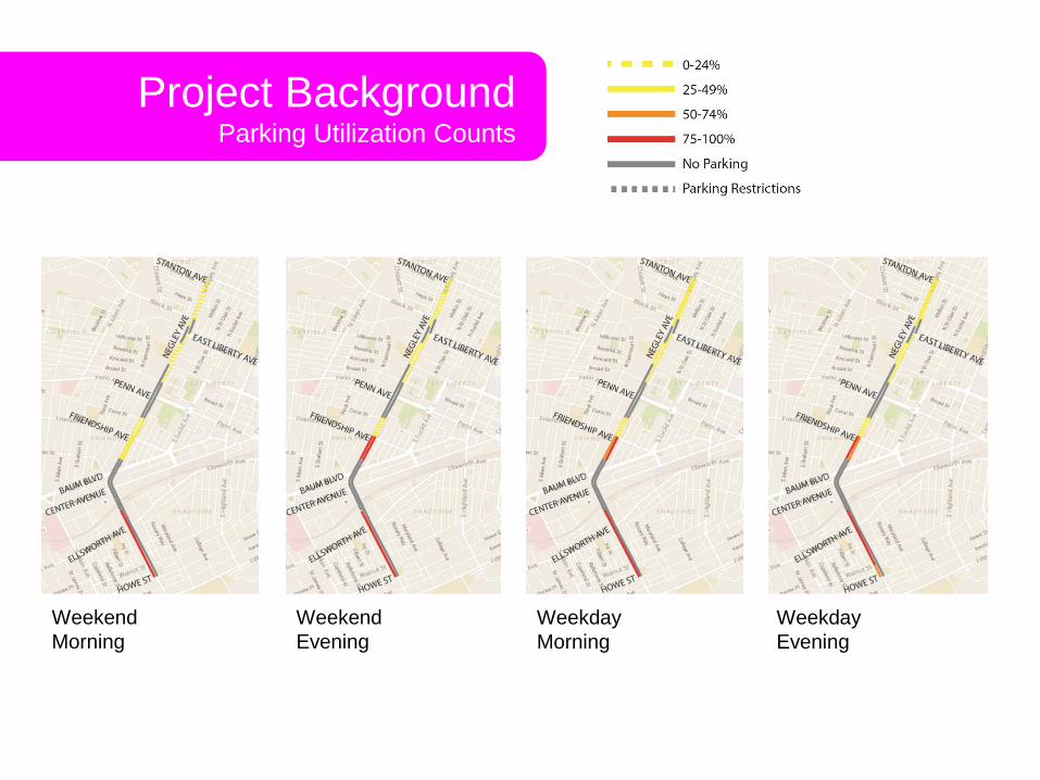
Project Background Parking Utilization Counts
Weekend
Morning
Weekend
Evening
Weekday
Morning
Weekday
Evening

Project Background Changes to on-street parking
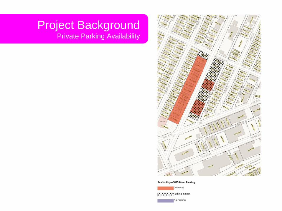
Project Background Private Parking Availability

Questions?
Thank you! Kristin Saunders
Bicycle and Pedestrian Coordinator, Department of City Planning [email protected]
412-393-0150