Embed Size (px)
Citation preview
Texas and Oklahoma Panhandles Particularly Dangerous Winter Storm Expected Tonight Through Saturday
Morning
JJ Brost
NWS Amarillo
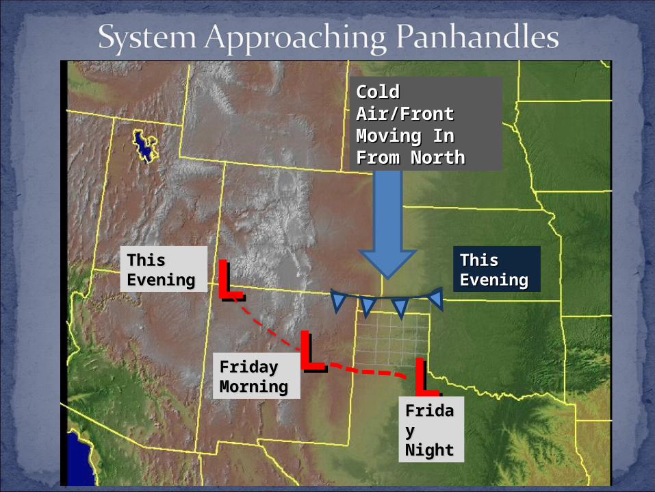
LLThis This EveningEvening
LLFriday Friday MorninMorningg
LLFridaFriday y NightNight
Cold Cold Air/Front Air/Front Moving In Moving In From NorthFrom North
This This EveningEvening
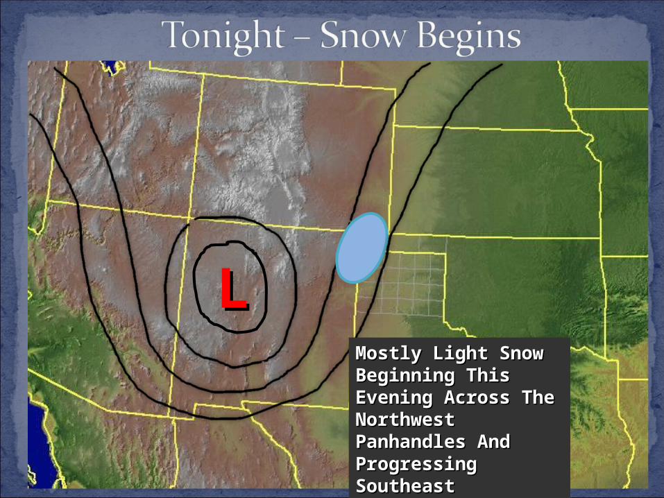
LLMostly Light Snow Mostly Light Snow Beginning This Beginning This Evening Across The Evening Across The Northwest Northwest Panhandles And Panhandles And Progressing Progressing SoutheastSoutheast
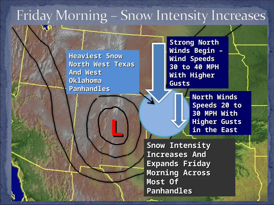
LLSnow Intensity Snow Intensity Increases And Increases And Expands Friday Expands Friday Morning Across Morning Across Most Of Most Of PanhandlesPanhandles
Heaviest Snow Heaviest Snow North West North West Texas And West Texas And West Oklahoma Oklahoma PanhandlesPanhandles
Strong North Strong North Winds Begin – Winds Begin – Wind Speeds Wind Speeds 30 to 40 MPH 30 to 40 MPH With Higher With Higher Gusts Gusts
North Winds North Winds Speeds 20 to Speeds 20 to 30 MPH With 30 MPH With Higher Gusts Higher Gusts in the Eastin the East
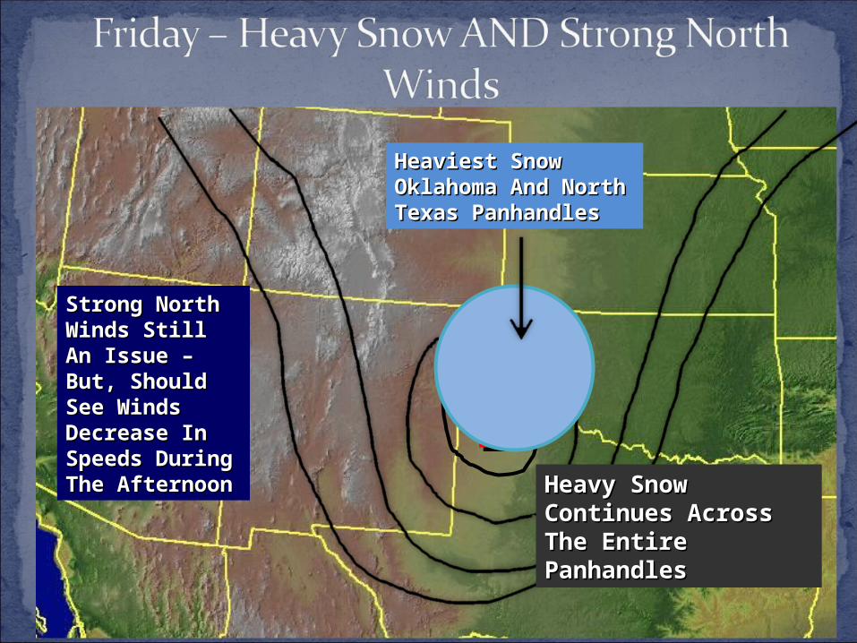
LLHeavy Snow Heavy Snow Continues Across Continues Across The Entire The Entire PanhandlesPanhandles
Heaviest Snow Heaviest Snow Oklahoma And Oklahoma And North Texas North Texas PanhandlesPanhandles
Strong North Strong North Winds Still An Winds Still An Issue – But, Issue – But, Should See Should See Winds Winds Decrease In Decrease In Speeds Speeds During The During The AfternoonAfternoon
LL
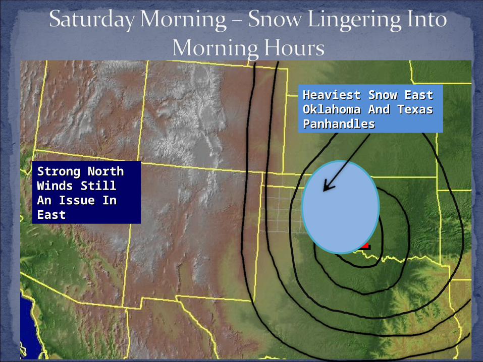
Strong North Strong North Winds Still An Winds Still An Issue In EastIssue In East
Heaviest Snow East Heaviest Snow East Oklahoma And Oklahoma And Texas PanhandlesTexas Panhandles
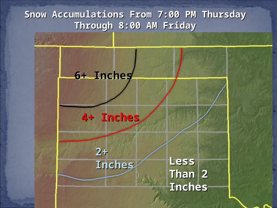
Snow Accumulations From 7:00 PM Snow Accumulations From 7:00 PM Thursday Through 8:00 AM FridayThursday Through 8:00 AM Friday
6+ Inches6+ Inches
2+ 2+ InchesInches
4+ Inches4+ Inches
Less Less Than 2 Than 2 InchesInches
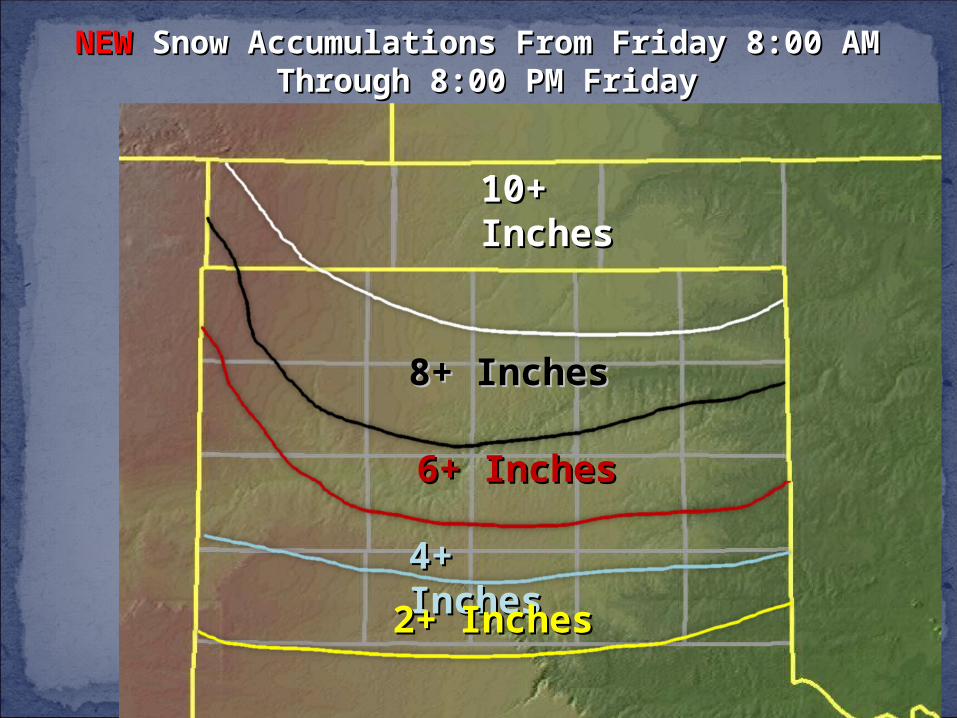
NEWNEW Snow Accumulations From Friday 8:00 AM Snow Accumulations From Friday 8:00 AM Through 8:00 PM FridayThrough 8:00 PM Friday
8+ Inches8+ Inches
6+ Inches6+ Inches
4+ 4+ InchesInches2+ Inches2+ Inches
10+ 10+ InchesInches
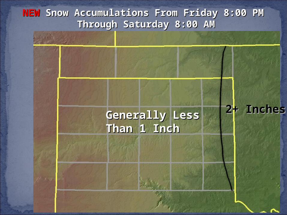
NEWNEW Snow Accumulations From Friday 8:00 PM Snow Accumulations From Friday 8:00 PM Through Saturday 8:00 AMThrough Saturday 8:00 AM
2+ Inches2+ InchesGenerally Less Generally Less Than 1 InchThan 1 Inch
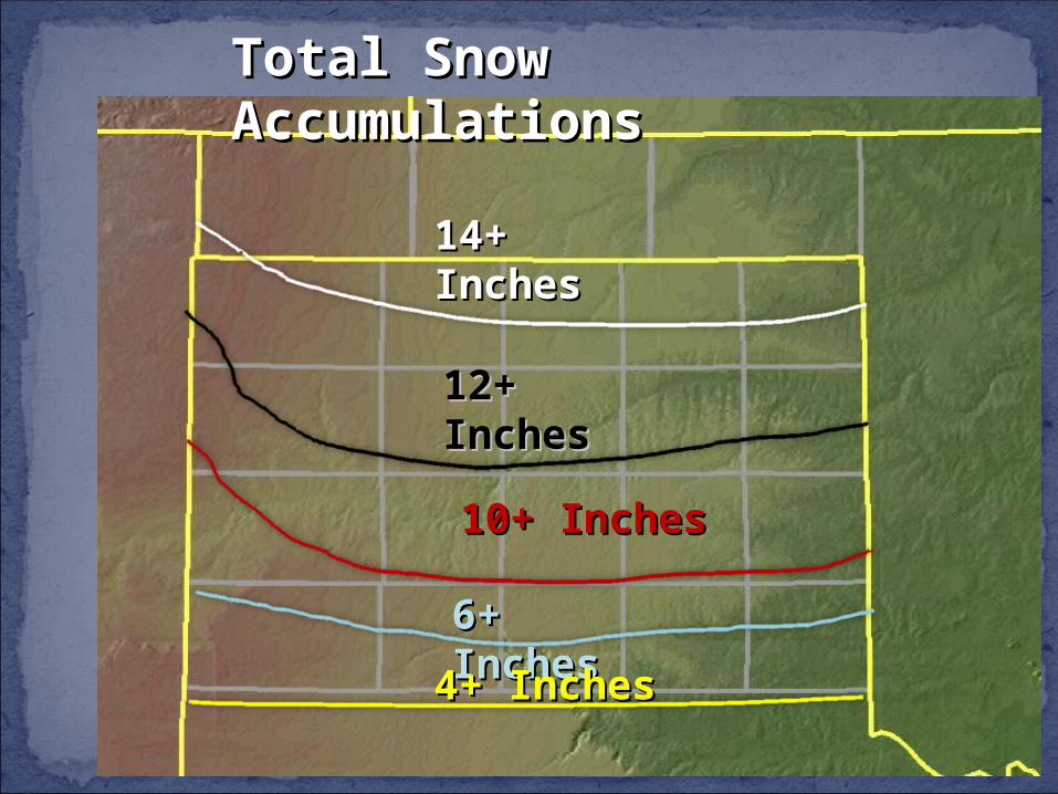
Total Snow Total Snow AccumulationsAccumulations
12+ 12+ InchesInches
10+ Inches10+ Inches
6+ 6+ InchesInches4+ Inches4+ Inches
14+ 14+ InchesInches
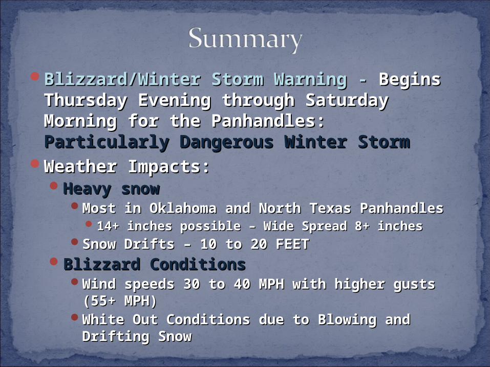
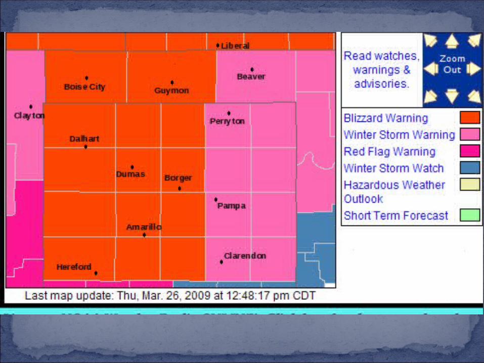
Blizzard/Winter Storm Warning - Blizzard/Winter Storm Warning - Begins Begins Thursday Evening through Saturday Thursday Evening through Saturday MorningMorning for the Panhandles: for the Panhandles: Particularly Particularly Dangerous Winter StormDangerous Winter Storm
Weather Impacts:Weather Impacts:Heavy snowHeavy snow
Most in Oklahoma and North Texas PanhandlesMost in Oklahoma and North Texas Panhandles14+ inches possible – Wide Spread 8+ inches14+ inches possible – Wide Spread 8+ inches
Snow Drifts – 10 to 20 FEETSnow Drifts – 10 to 20 FEETBlizzard ConditionsBlizzard Conditions
Wind speeds 30 to 40 MPH with higher gusts Wind speeds 30 to 40 MPH with higher gusts (55+ MPH)(55+ MPH)
White Out Conditions due to Blowing and White Out Conditions due to Blowing and Drifting SnowDrifting Snow
www.srh.noaa.gov/ama/march2009_blizzard/Will be linked from our home page:
www.srh.noaa.gov/ama