Embed Size (px)
Citation preview
usesscience for a changing world
t ** ,*
NATIONAL WATER-QUALITY ASSESSMENT PROGRAM
High Plains Regional Ground-Water StudyMAJOR WATER-QUALITY ISSUES-- High Plains Regional Ground-Water Study
The High Plains Regional Ground-Water study will increase the scientific understanding of the fac tors that affect ground-water quality. This informa tion will benefit water-resources managers who need, but often lack, the data required to implement effec tive water-quality management actions and evaluate long-term changes in water quality.
The effects of land- and water-use practices on ground-water resources is a primary concern of water-resource managers, planners, Federal, State and local governments, and the public. Many of the issues of concern relate to nonpoint sources and are
What is the National Water-Quality Assessment (NAWQA) Program?
Over the last 25 years, industry and government have made large financial invest ments aimed at improving water quality across the Nation. Significant progress has been made; however, many water-quality concerns remain. In 1991, the U.S. Geo logical Survey (USGS) began implementing a full-scale National Water-Quality Assessment Program to provide consistent and scientifically sound information for managing the Nation's water resources. The goals of the NAWQA Program are to (1) describe current water-quality conditions for a large part of the Nation's fresh water streams and aquifers, (2) describe how water quality is changing over time, and (3) improve our understanding of the primary natural and human factors affect ing water quality.
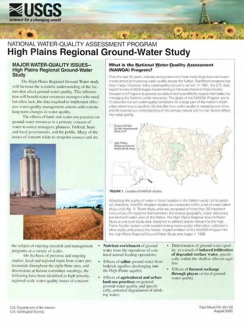
LH National Water- Quality Assessment Study Unit
D High PlainsRegional Ground Water Study Area
0
FIGURE 1. Location of NAWQA studies.
Assessing the quality of water in every location in the Nation would not be practi cal; therefore, NAWQA Program studies are conducted within a set of areas called study units (fig. 1). These study units are composed of more than 50 important river and aquifer systems that represent the diverse geography, water resources, and land and water uses of the Nation. The High Plains Regional Ground-Water Study is one such study area, designed to address issues relevant to the High Plains Aquifer system while supplementing water-quality information collected in other study units across the Nation. Implementation of the NAWQA Program for the High Plains Regional Ground-Water Study area began in 1998.
the subject of ongoing research and management programs at a variety of scales.
On the basis of previous and ongoing studies, local and regional input from water pro fessionals throughout the eight-State area, and discussions at liaison committee meetings, the following have been identified as high-priority, regional-scale water-quality issues of concern:
Nutrient enrichment of ground water from the operations of con fined animal feeding operations;
Effects of saline ground water from bedrock aquifers discharging into the High Plains aquifer;
Effects of agricultural and urban land-use practices on general ground-water quality and specifi cally, potential degradation of drink-
Deterioration of ground-water qual ity as a result of induced infiltration of degraded surface water, specifi cally within the shallow alluvial aqui fers
Effects of focused recharge through playas on local ground- water quality.
U.S. Department of the Interior U.S. Geological Survey
Fact Sheet FS-091-00 August 2000
STUDY AREA DESCRIPTION
The High Plains aquifer is a regional aquifer system that underlies 174,000 square miles (mi") in parts of eight States (fig. 2). About 27 percent of the irrigated land in the
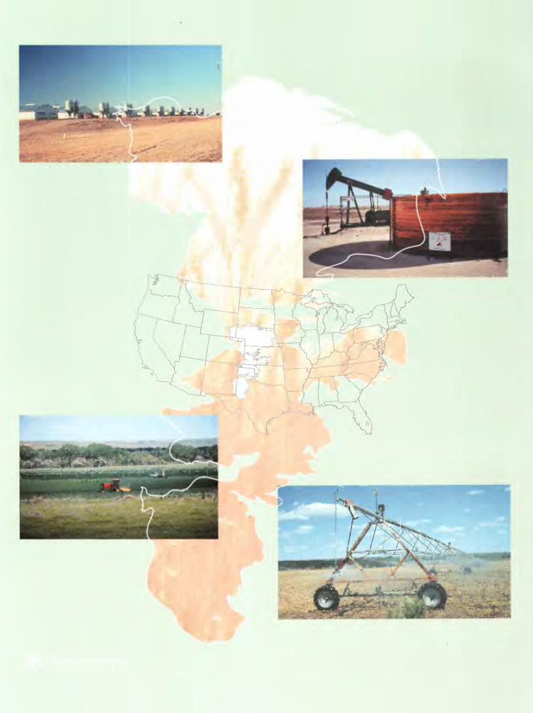
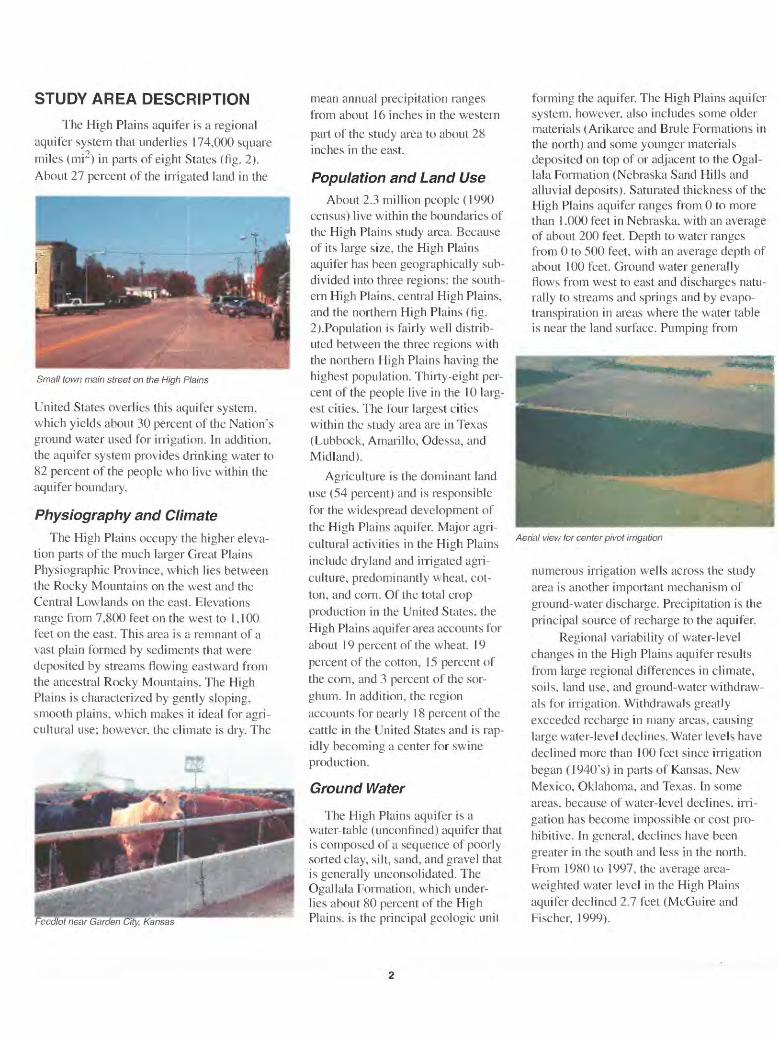
Small town main street on the High Plains
United States overlies this aquifer system, which yields about 30 percent of the Nation's ground water used for irrigation. In addition, the aquifer system provides drinking water to 82 percent of the people who live within the aquifer boundary.
Physiography and Climate
The High Plains occupy the higher eleva tion parts of the much larger Great Plains Physiographic Province, which lies between the Rocky Mountains on the west and the Central Lowlands on the east. Elevations range from 7,800 feet on the west to 1,100 feet on the east. This area is a remnant of a vast plain formed by sediments that were deposited by streams flowing eastward from the ancestral Rocky Mountains. The High Plains is characterized by gently sloping, smooth plains, which makes it ideal for agri cultural use; however, the climate is dry. The
mean annual precipitation ranges from about 16 inches in the western
part of the study area to about 28 inches in the east.
Population and Land UseAbout 2.3 million people (1990
census) live within the boundaries of the High Plains study area. Because of its large size, the High Plains aquifer has been geographically sub divided into three regions: the south ern High Plains, central High Plains, and the northern High Plains (fig. 2).Population is fairly well distrib uted between the three regions with the northern High Plains having the highest population. Thirty-eight per cent of the people live in the 10 larg est cities. The four largest cities within the study area are in Texas (Lubbock, Amarillo, Odessa, and Midland).
Agriculture is the dominant land use (54 percent) and is responsible for the widespread development of the High Plains aquifer. Major agri cultural activities in the High Plains include dryland and irrigated agri culture, predominantly wheat, cot ton, and corn. Of the total crop production in the United States, the High Plains aquifer area accounts for about 19 percent of the wheat, 19 percent of the cotton, 15 percent of the corn, and 3 percent of the sor ghum. In addition, the region accounts for nearly 18 percent of the cattle in the United States and is rap idly becoming a center for swine production.
Ground Water
The High Plains aquifer is a water-table (unconfined) aquifer that is composed of a sequence of poorly sorted clay, silt, sand, and gravel that is generally unconsolidated. The Ogallala Formation, which under lies about 80 percent of the High Plains, is the principal geologic unil
forming the aquifer. The High Plains aquifer system, however, also includes some older materials (Arikaree and Brule Formations in the north) and some younger materials deposited on top of or adjacent to the Ogal lala Formation (Nebraska Sand Hills and alluvial deposits). Saturated thickness of the High Plains aquifer ranges from 0 to more than 1.000 feet in Nebraska, with an average of about 200 feet. Depth to water ranges from 0 to 500 feet, with an average depth of about 100 feet. Ground water generally flows from west to east and discharges natu rally to streams and springs and by evapo- transpiration in areas where the water table is near the land surface. Pumping from
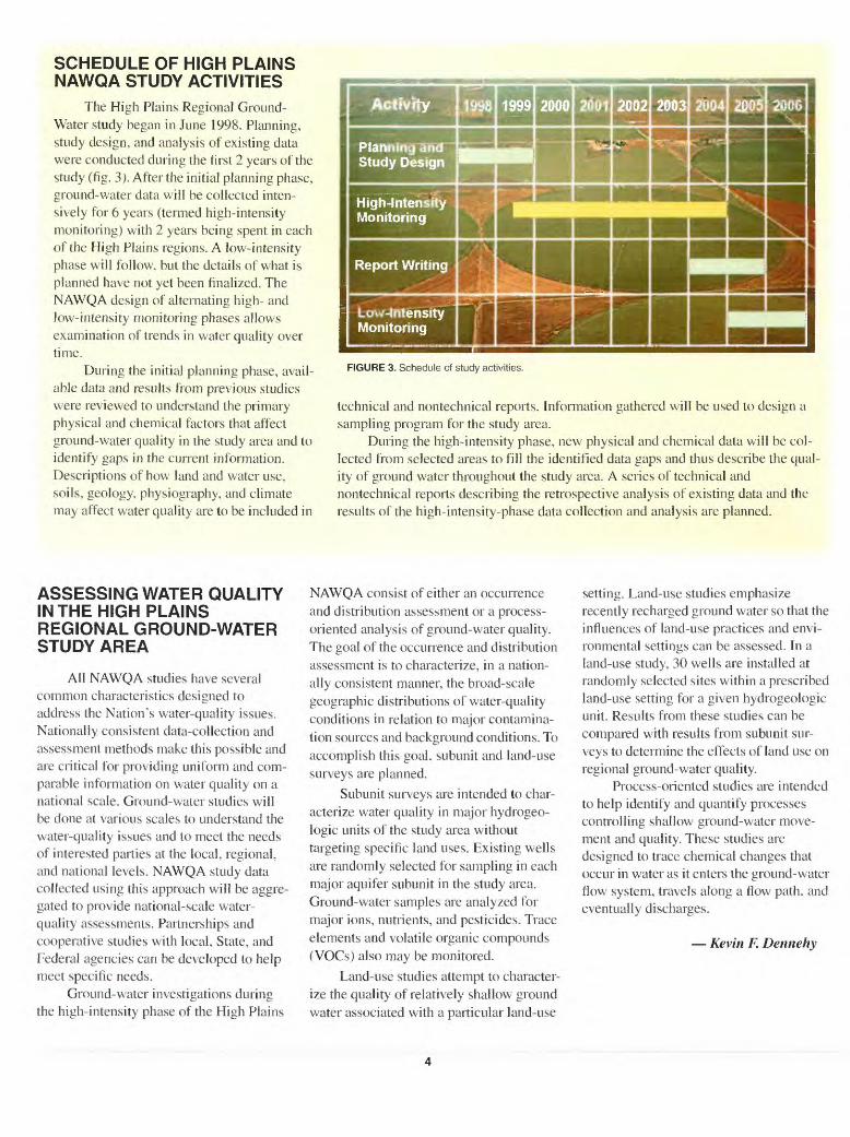
Aerial view for center pivot irrigation
numerous irrigation wells across the study area is another important mechanism of ground-water discharge. Precipitation is the principal source of recharge to the aquifer.
Regional variability of water-level changes in the High Plains aquifer results from large regional differences in climate, soils, land use, and ground-water withdraw als for irrigation. Withdrawals greatly exceeded recharge in many areas, causing large water-level declines. Water levels have declined more than 100 feet since irrigation began (1940's) in parts of Kansas, New Mexico, Oklahoma, and Texas. In some areas, because of water-level declines, irri gation has become impossible or cost pro hibitive. In general, declines have been greater in the south and less in the north. From 1980 to 1997, the average area- weighted water level in the High Plains aquifer declined 2.7 feet (McGuire and Fischer, 1999).
Surface WaterSeveral major river systems cross the
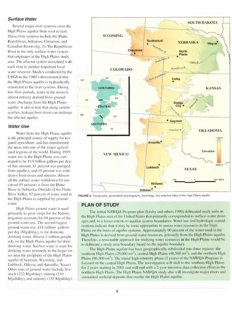
High Plains aquifer from west to east. These river systems include the Platte, Republican, Arkansas, Cimarron, and Canadian Rivers (fig. 2). The Republican River is the only surface-water system that originates in the High Plains study area. The alluvial system associated with each river is another important local water resource. Studies conducted by the USGS in the 1980's demonstrated that the High Plains aquifer is hydraulically connected to the river systems. During low-flow periods, water in the rivers is almost entirely derived from ground- water discharge from the High Plains aquifer. It also is true that along certain reaches, leakage from rivers can recharge the alluvial aquifer.
Water UseWater from the High Plains aquifer
is the principal source of supply for irri gated agriculture and has transformed the areas into one of the major agricul tural regions of the world. During 1995, water use in the High Plains was esti mated to be 19.9 billion gallons per day; of this amount, 81 percent was pumped from aquifers, and 19 percent was with drawn from rivers and streams. Almost all the surface water withdrawn for use (about 85 percent) is from the Platte River in Nebraska. Outside of the Platte River Valley, 92 percent of water used in the High Plains is supplied by ground water.
High Plains ground water is used primarily to grow crops for the Nation; irrigation accounts for 94 percent of the ground-water use. The second largest ground-water use, 418 million gallons per day (Mgal/day). is for domestic drinking water. Almost 2 million people rely on the High Plains aquifer for their drinking water. Surface water is used for drinking water primarily in the larger cit ies near the periphery of the High Plains aquifer (Cheyenne, Wyoming, and Lubbock, Odessa, and Amarillo, Texas). Other uses of ground water include live stock (222 Mgal/day), mining (210 Mgal/day), and industry (155 Mgal/day).
NEBRASKA Wayne
COLORADO
FIGURE 2. Topography, generalized physiography, hydrology, and selected cities of the High Plains aquifer.
PLAN OF STUDYThe initial NAWQA Program plan (Leahy and others, 1990) delineated study units in
the High Plains area of the United States that primarily corresponded to surface-water drain ages and, to a lesser extent, to aquifer-system boundaries. Water use and hydrologic consid erations indicate that it may be more appropriate to assess water resources in the High Plains on the basis of aquifer systems. Approximately 90 percent of the water used in the High Plains is derived from ground-water resources, primarily from the High Plains aquifer. Therefore, a reasonable approach for studying water resources in the High Plains would be to delineate a study area boundary based on the aquifer boundary.
The High Plains aquifer has been geographically subdivided into three regions: the southern High Plains (29,000 mi2), central High Plains (48,500 mi2), and the northern High Plains (96,500 mi2). The initial high-intensity phase (2 years) of the NAWQA Program is focused on the central High Plains. The investigation will shift to the southern High Plains for 2 years starting in 2001 and will end with a 2-year intensive data collection effort in the northern High Plains. The High Plains NAWQA study also will investigate major rivers and associated surficial deposits that overlie the High Plains aquifer.
SCHEDULE OF HIGH PLAINS NAWQA STUDY ACTIVITIES
The High Plains Regional Ground- Water study began in June 1998. Planning, study design, and analysis of existing data were conducted during the first 2 years of the study (fig. 3). After the initial planning phase, ground-water data will be collected inten sively for 6 years (termed high-intensity monitoring) with 2 years being spent in each of the High Plains regions. A low-intensity phase will follow, but the details of what is planned have not yet been finalized. The NAWQA design of alternating high- and low-intensity monitoring phases allows examination of trends in water quality over time.
During the initial planning phase, avail able data and results from previous studies were reviewed to understand the primary physical and chemical factors that affect ground-water quality in the study area and to identify gaps in the current information. Descriptions of how land and water use, soils, geology, physiography, and climate may affect water quality are to be included in
FIGURE 3. Schedule of study activities.
technical and nontechnical reports. Information gathered will be used to design a sampling program for the study area.
During the high-intensity phase, new physical and chemical data will be col lected from selected areas to fill the identified data gaps and thus describe the qual ity of ground water throughout the study area. A series of technical and nontechnical reports describing the retrospective analysis of existing data and the results of the high-intensity-phase data collection and analysis are planned.
ASSESSING WATER QUALITY IN THE HIGH PLAINS REGIONAL GROUND-WATER STUDY AREA
All NAWQA studies have several common characteristics designed to address the Nation's water-quality issues. Nationally consistent data-collection and assessment methods make this possible and are critical for providing uniform and com parable information on water quality on a national scale. Ground-water studies will be done at various scales to understand the water-quality issues and to meet the needs of interested parties at the local, regional, and national levels. NAWQA study data collected using this approach will be aggre gated to provide national-scale water- quality assessments. Partnerships and cooperative studies with local, State, and Federal agencies can be developed to help meet specific needs.
Ground-water investigations during the high-intensity phase of the High Plains
NAWQA consist of either an occurrence and distribution assessment or a process- oriented analysis of ground-water quality. The goal of the occurrence and distribution assessment is to characterize, in a nation ally consistent manner, the broad-scale geographic distributions of water-quality conditions in relation to major contamina tion sources and background conditions. To accomplish this goal, subunit and land-use surveys are planned.
Subunit surveys are intended to char acterize water quality in major hydrogeo- logic units of the study area without targeting specific land uses. Existing wells are randomly selected for sampling in each major aquifer subunit in the study area. Ground-water samples are analyzed for major ions, nutrients, and pesticides. Trace elements and volatile organic compounds (VOCs) also may be monitored.
Land-use studies attempt to character ize the quality of relatively shallow ground water associated with a particular land-use
setting. Land-use studies emphasize recently recharged ground water so that the influences of land-use practices and envi ronmental settings can be assessed. In a land-use study, 30 wells are installed at randomly selected sites within a prescribed land-use setting for a given hydrogeologic unit. Results from these studies can be compared with results from subunit sur veys to determine the effects of land use on regional ground-water quality.
Process-oriented studies are intended to help identify and quantify processes controlling shallow ground-water move ment and quality. These studies are designed to trace chemical changes that occur in water as it enters the ground-water flow system, travels along a flow path, and eventually discharges.
Kevin F. Dennehy
COMMUNICATION AND COORDINATION
Communication and coordination between the U.S. Geological
Survey and other scientific and land- and water-management
organizations are critical components of the NAWQA Program.
A successful study depends on the advice, cooperation, and in
formation from many Federal, State, regional, and local agen
cies and from citizens interested in water resources of the High
Plains. The High Plains Regional NAWQA study will accom
plish this in two ways. First, we will establish regional liaison
committees, where possible, that include representatives from
Federal, State, and local agencies, universities, the private sec tor, watershed organizations, and others who have water-re
sources responsibilities and interests. The High Plains NAWQA
staff also will participate in local meetings and forums, where
appropriate, to reach those who were unable to participate in re
gional liaison committee meetings. Committee and other meet
ing activities include the exchange of information about
regional and local water-quality issues, identification of sources
of data and information, assistance in site selection and in the
design and scope of study products, and the review of study
planning documents and reports. The first and second liaison
committee meetings focused on the central High Plains region
and were held in March 1999 and February 2000. respectively.
ADDITIONAL READING
Gilliom, R.J., Alley, WJV1., and Gurtz, M.E., 1995, Design of the National Water-Quality Assessment Program Occurrence and distribution of water-quality conditions: U.S. Geological Survey Circular 1112, 33 p.
Leahy, PP., Rosenshein. J.S., and Knopman, D.S.. 1990. Implemen tation plan for the National Water-Quality Assessment Program: U.S. Geological Survey Open-File Report 90-174, 10 p.
McGuire, V.L. and Fischer. B.C., 1999, Water-level changes, 1980 to 1997. and saturated thickness, 1996-1997, in the High Plains aquifer: U.S. Geological Survey Fact Sheet 124-99. 4 p.
Weeks, J.B., Gutentag, E.D., Heimes, F.J., and Luckey, R.R., 1988, Summary of the High Plains regional aquifer system analysis in parts of Colorado, Kansas, Nebraska, New Mexico, Oklahoma, South Dakota, Texas, and Wyoming: U.S. Geological Survey Professional Paper 1400-A. 30 p.
FOR MORE INFORMATION
Information on technical reports and hydrologic data related to the NAWQA Program can be obtained from:
Project Manager High Plains NAWQA U.S. Geological Survey Bldg. 53, MS 415 Denver. CO 80225 (303) 236-4882
High Plains NAWQA home page: http://co.water.usgs.gov/ nawqa/hpgw/HPGW_home.html