Embed Size (px)
Citation preview

www.nerrs.noaa.gov September 2011
SYSTEM-WIDE MONITORING PROGRAM PLAN
National Estuarine Research Reserve System
2
National Estuarine Research Reserve System
Mailing Address: Estuarine Reserves Division, N/ORM5Office of Ocean and Coastal Resource Management NOAA National Ocean Service1305 East West Highway Silver Spring, MD 20910
Phone: 301-713-3155Fax: 301-713-4012
www. nerrs.noaa.gov
September 2011
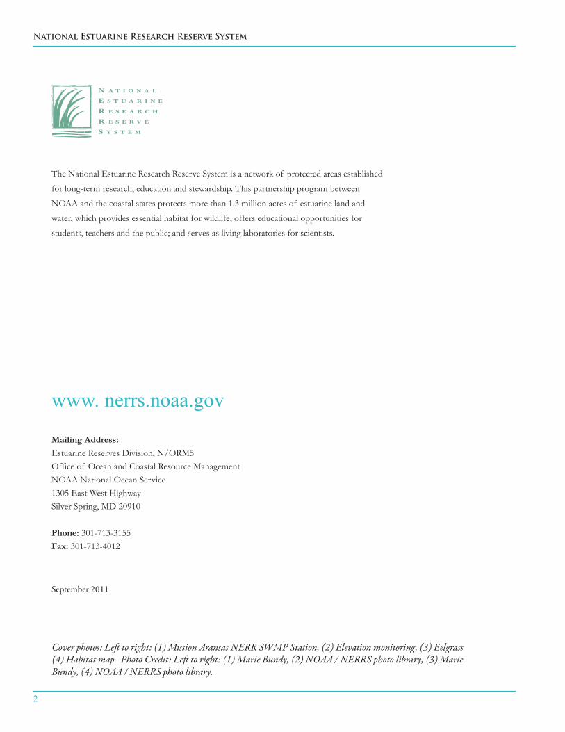
The National Estuarine Research Reserve System is a network of protected areas established
for long-term research, education and stewardship. This partnership program between
NOAA and the coastal states protects more than 1.3 million acres of estuarine land and
water, which provides essential habitat for wildlife; offers educational opportunities for
students, teachers and the public; and serves as living laboratories for scientists.
Cover photos: Left to right: (1) Mission Aransas NERR SWMP Station, (2) Elevation monitoring, (3) Eelgrass (4) Habitat map. Photo Credit: Left to right: (1) Marie Bundy, (2) NOAA / NERRS photo library, (3) Marie Bundy, (4) NOAA / NERRS photo library.

SYSTEM-WIDE MONITORING PROGRAM PLAN
3
Narragansett Bay, Rhode Island
South Slough, Oregon
Padilla Bay, Washington
Wells, Maine
Great Bay, New Hampshire
Jobos Bay, Puerto Rico
Kachemak Bay, Alaska
Waquoit Bay, Massachusetts
Old Woman Creek, Ohio
San Francisco Bay, California
Elkhorn Slough, California
Tijuana River, California
Grand Bay, Mississippi
Weeks Bay, Alabama
Apalachicola, Florida
Rookery Bay, Florida
Guana Tolomato Matanzas, Florida
Sapelo Island, Georgia
ACE Basin, South Carolina
North Inlet-Winyah Bay, South Carolina North Carolina
Chesapeake Bay,Virginia Lake Superior,Wisconsin
Chesapeake Bay, Maryland
Delaware
Jacques Cousteau, New Jersey
Hudson River, New York
Northeast
Mid Atlantic
Southeast
Gulf of Mexico
West Coast
Great Lakes
Caribbean
National Estuarine Research Reserve System
Mission-Aransas,Texas
4
National Estuarine Research Reserve System
Table of ContentsExecutive Summary................................................................................................................................................6
Glossary of Key Terms and List of Acronyms.................................................................................................8
1. Introduction......................................................................................................................................................10
1.1 The U.S. Network of National Estuarine Research Reserves 1.2 NERRS System Wide Monitoring Program Mission Statement and History
2. SWMP Conceptual Design.............................................................................................................................12
2.1 SWMP Implementation Plan........................................................................................................14 2.1.1 SWMP Elements 2.1.2 SWMP Toolkits and Application Modules
2.2. Operational Plan ...........................................................................................................................17
2.2.1 Management Principles and Business Practices 2.2.2 Roles, Responsibilities, and Decision-making
3. SWMP Toolkits................................................................................................................................................22. 3.1 Abiotic Toolkit................................................................................................................................22 3.1.1 Toolkit Description 3.1.2 Core Abiotic Elements 3.1.3 Elective Abiotic Elements 3.1.4 Current Operational Status 3.1.5 Data Management
3.2. Biotic Toolkit.................................................................................................................................25
3.2.1 Toolkit Description 3.2.2 Core Biotic Elements 3.2.3 Elective Biotic Elements 3.2.4 Current Operational Status 3.2.5 Data Management

SYSTEM-WIDE MONITORING PROGRAM PLAN
5
3.3. Mapping Toolkit............................................................................................................................28
3.3.1 Toolkit Description 3.3.2 Core Mapping Elements 3.3.3 Elective Mapping Elements 3.3.4 Current Operational Status 3.3.5 Data Management
3.4. Data Analysis and Synthesis Toolkit..........................................................................................30
3.4.1 Toolkit Description 3.4.2 Core Data Elements 3.4.3 Elective Data Elements 3.4.4 Current Operational Status 3.4.5 Data Management
3.5 Translation and Education Toolkit............................................................................................33
3.5.1 Toolkit Description 3.5.2 Core Translation and Education Elements 3.5.3 Elective Translation and Education Elements 3.5.4 Current Operational Status
4. Applications of SWMP to Coastal Management Issues (Application Modules).................................37
4.1 Concept 4.2 Examples
5. Capital Considerations..................................................................................................................................38
6. Partners............................................................................................................................................................39
7. The Future of SWMP...................................................................................................................................40
References...........................................................................................................................................................42
Appendix I – SWMP Elements List...............................................................................................................45
Appendix II – SWMP Workgroups................................................................................................................55
Appendix III –SWMP Application Module Example.................................................................................56

6
National Estuarine Research Reserve System
The National Estuarine Research Reserve System (NERRS) is a federal-state partnership authorized under the Coastal Zone Management Act to develop and maintain a network of biogeographically representative special-use areas dedicated to long-term research, monitoring, education, and stewardship activities that contribute to improvements in coastal zone management. The federal partner in this relationship is the National Oceanic and Atmospheric Administration’s (NOAA) Estuarine Reserves Division (ERD). The state partners are either a state’s department of natural resources, or similar entity, or a state academic institution or related program.
To better meet its public trust responsibilities, the NERRS has established a System-Wide Monitoring Program (SWMP) with a primary mission to:
Develop quantitative measurements of short-term variability and long-term changes in the water quality, biological systems, and land-use / land-cover characteristics of estuaries and estuarine ecosystems for the purposes of informing effective coastal zone management.
This document, titled “NERRS System-wide Monitoring Program Plan 2011” (SWMP Plan), describes SWMP and its role in supporting the NERRS mission and strategic goals, details the existing capacity in SWMP, and outlines an implementation and development plan for the program. The audience for this plan will vary depending on which of these aspects is under consideration, but includes: NERRS staff who are fundamentally responsible for SWMP equipment, instrumentation, and data collection; NERRS and NOAA personnel who are involved in coordination, development, and planning for the NERRS; coastal managers, researchers, educators, trainers, and others who may utilize SWMP products; and local, regional, and national partners
who wish to coordinate with or otherwise engage in SWMP activities. The NERRS SWMP Plan is a living document that will be revised as our system-wide knowledge and experience evolves.
Because SWMP is intended to be a robust, long term, and versatile monitoring program, with the capacity to address a comprehensive suite of coastal management issues to improve understanding and inform decisions affecting estuaries and coastal watersheds, the NERRS has identified three fundamental questions that information provided by SWMP should address:
How do environmental conditions vary ■through space and time within the network of NERRS sites?
How does ecosystem function vary ■through space and time within critical NERRS habitats?
To what extent are changes in estuarine ■ecosystems represented by the NERRS attributable to natural variability versus anthropogenic activity?
Improving understanding and informing decisions are also primary goals. This plan describes specific system-wide approaches to meet these goals:
Synthesizing and interpreting data; ■
Translating and disseminating information ■that it is useful to coastal decision makers; and
Training and educating teachers, ■students, community members, and other stakeholders in the use of SWMP data and data products.
SWMP data are collected using standardized approaches across the national system, and data collection is designed to provide a high degree
Executive Summary

SYSTEM-WIDE MONITORING PROGRAM PLAN
7
of spatial coverage and temporal resolution. The suite of standard approaches can be referred to as the SWMP portfolio, with individual protocols and parameters as “elements” within the portfolio. SWMP elements have been grouped into “toolkits” according to the nature of the parameter(s) they measure and the products they generate:
1) Abiotic2) Biotic3) Mapping4) Data Analysis and Interpretation5) Translation and Education
Certain elements have been identified as “core” to the mission of SWMP and are critical for addressing strategic research and monitoring priorities of the NERRS. Core elements that are supported with federal funding and are required components of every reserve’s operational program are considered to be “operational”, while core elements that are not yet supported with federal funds are considered to be “pending”. Pending core elements are not required until federal funding can be obtained. Other SWMP elements are “elective”, and reserves may implement them as part of their monitoring programs to address local or regional management issues.
SWMP elements from various toolkits may be packaged together into “Application Modules” to address specific management issues or to answer specific research questions. Because they employ standardized protocols, SWMP Application Modules provide a mechanism for comparing SWMP information and products across the NERRS.
Data from operational core elements are collected, managed, and served by the NERRS Centralized Data Management Office (CDMO). The CDMO ensures that SWMP data has a high level of quality assurance, is of high quality, and is easily accessible on a public website.
Planning and decisions related to development and implementation of SWMP are accomplished by several NERRS committees. The SWMP Guidance Committee (SGC), which is co-chaired by reserve and ERD staff, has responsibility for long term strategic planning and oversight of SWMP, including setting priorities for the program’s growth and development. The SGC is guided by the NERRS strategic planning, which is articulated in the NERRS Strategic Plan and in the NERRS Research and Monitoring Plan.
The 2011- 2016 NERRS Strategic Plan states that the NERRS will focus on scientific investigations that improve understanding and inform decisions affecting estuaries and coastal watersheds by:
Expanding capacity to monitor changes ■in water quality and flow rates, habitat, and biological indicators in response to changes in land use and climate;
Improving understanding of the effects ■of climate change and coastal pollution on estuarine and coastal ecology, ecosystem processes, and habitat function;
Characterizing coastal watersheds and ■estuary ecosystems and quantifying ecosystem services to support ecosystem-based management of natural and built communities;
Increasing social science research and use ■of social information to foster coastal stewards that value and protect estuaries.
To facilitate the standardized collection, synthesis, and interpretation of data and products generated by the variety of SWMP Application Modules that may be deployed, SWMP subcommittees and working groups will provide oversight of data collection and development of protocols for different SWMP toolkits. Input from the reserves and from the NERRS management, research, education, stewardship, and coastal training sectors is also integral to SWMP governance and the implementation and evolution of this SWMP Plan.

8
National Estuarine Research Reserve System
Glossary of Key Terms and List of Acronyms
Application Module – A collection of SWMP elements from various toolkits that have been packaged together to address a particular management issue at local, regional, or national scales. Application Modules provide the means of addressing a research question in a manner that can be repeated or compared in a consistent manner across the system, now and in the future.
Core Element – A NERRS monitoring activity or monitoring parameter that has associated protocols and budgets and has been fully vetted and approved by the NERRS as a fundamental component of reserve operational programs. Only core elements that are supported with federal funding and identified in federal funding guidance are required to be implemented by individual reserves. These core elements are “operational elements”. Core elements that are not supported with federal funding are not required to be implemented by individual reserves. These core elements are “pending”.
Elective Elements - A NERRS monitoring activity or monitoring parameter that has associated protocols but has not been approved by the NERRS as a fundamental component of reserve operational programs. Elective elements may be implemented by a single or a subset of reserves as part of their monitoring program to address local, regional, or national management issues.
SWMP Portfolio – The entire collection of SGC approved protocols, including all elective and core elements.
Toolkit – Groups of SWMP elements that have been categorized by the type of data collected or product generated
List of Acronyms
CDMO – Centralized Data Management Office
CICEET - Cooperative Institute for Coastal and Estuarine Environmental Technology
CO-OPS – Center for Operational Oceanographic Products and Services
CSC- Coastal Services Center
CTP- NERRS Coastal Training Program Coordinator
CZMA – Coastal Zone Management Act
DEM – Digital Elevation Map
DMC – Data Management Committee
EC- NERRS Education Coordinator
EPA – Environmental Protection Agency

SYSTEM-WIDE MONITORING PROGRAM PLAN
9
ERD – Estuarine Reserves Division
GOES – Geostationary Operational Environmental Satellite
GPS – Global Positioning System
GRF – Graduate Research Fellow
HADS - Hydrometeorological Automated Data System
IOOS – Integrated Ocean Observing System
K-12 - Kindergarten through 12th Grade
LTER – Long Term Ecosystem Research Program
NERRA - National Estuarine Research Reserve Association
NERRS – National Estuarine Research Reserve System
NGS – National Geodetic Survey
NOAA – National Oceanic and Atmospheric Administration
NODC – National Oceanographic Data Center
NOS – National Ocean Service
NPS – National Park Service
NSF – National Science Foundation
PAR- Photosynthetically Active Radiation
QA/QC- Quality Assurance and Quality Control
RC – NERRS Research Coordinator
RTK – Real Time Kinematic
SC – NERRS Stewardship Coordinator
SET –Surface Elevation Table
SGC – SWMP Guidance Committee
SLAMM- Sea Level Affecting Marshes Model
STEM - Science, Technology, Engineering, and Math
SWMP – NERRS System Wide Monitoring Program
USGS – U.S. Geological Survey
USFWS – U.S. Fish and Wildlife Service

10
National Estuarine Research Reserve System
1. Introduction
The bays, estuaries, and coastal watersheds of the United States support a broad suite of critical ecosystem functions and services. These include extremely high rates of biological production, nutrient and organic matter cycling, sediment trapping, and the provision of nursery and forage areas for a wide variety of important plants and animals. As a direct result of these ecosystem functions, estuaries provide economic and socially valuable services that include coastal water quality improvement, flood control and protection against storm inundation, and the replenishment of commercial and recreational fishery populations. However, these attributes are under continuous threat from the persistent pressures and stressors associated with human population growth, demographic shifts, and climate change.
An increased awareness of the degradation of estuaries, fueled by the environmental movement of the 1960s and 1970s, resulted in the passage of legislation aimed at protecting estuarine ecosystems. Section 315 of the Coastal Zone Management Act (CZMA) of 1972 authorized the establishment of protected areas or “estuarine sanctuaries” to augment the federal coastal zone management program, which is managed by the National Oceanic and Atmospheric Administration (NOAA) and is dedicated to comprehensive, sustainable management of the nation’s coasts. Congress re-authorized the CZMA in 1985, and the National Estuarine Sanctuary Program was renamed the “National Estuarine Research Reserve System”.
1.1 - The US Network of National Estuarine Research Reserves
The National Estuarine Research Reserve System (NERRS) (www.nerrs.noaa.gov) is a federal-state partnership to develop and maintain a network of biogeographically representative special-use areas dedicated to long-term research, monitoring, education, and stewardship activities that contribute to improvements in coastal zone management. This vision is reflected in the goals of the 2011 - 2016 NERRS Strategic Plan:
Estuaries and coastal watersheds are better ■protected and managed by implementing place-based approaches at reserves.
NERRS scientific investigations improve ■understanding and inform decisions affecting estuaries and coastal watersheds.
NERRS education and training increases ■participants’ environmental literacy and ability to make science-based decisions related to estuaries and coastal watersheds.
The long-term monitoring activities and habitat assessments that are conducted as part of the NERRS System-wide Monitoring Program (SWMP) support these goals by (1) improving our fundamental understanding of the temporal and spatial dynamics of estuarine processes and (2)
Great Bay NERR wetland (photo credit: George Cathcart)

SYSTEM-WIDE MONITORING PROGRAM PLAN
11
providing baseline information for evaluating change in ecosystem function in response to natural and human disturbances.
Virtually all data collection, management, and analyses related to SWMP are performed at the reserve level by NERRS state partners and by the NERRS Centralized Data Management Office (CDMO), while the NERRS federal partner, NOAA’s Estuarine Reserves Division (ERD) provides coordination, guidance, and support. This partnership allows SWMP to maintain rigorous national standards for addressing core management issues, while remaining flexible enough to address local and regional management concerns.
1.2 - NERRS System-Wide Monitoring Program Mission Statement and History
To better meet its public trust responsibilities and the goals described above, SWMP has a primary mission to:
Develop quantitative measurements of short-term variability and long-term changes in the meteorological, water quality, biological systems, and land-use / land -cover characteristics of estuaries and estuarine ecosystems for the purposes of informing effective coastal zone management.
SWMP was initiated in 1995 and was developed in consultation and partnership with several other national monitoring efforts including NOAA, the National Status and Trends Program, the US Environmental Protection Agency (EPA) Environmental Monitoring and Assessment Program, the National Park Service (NPS) Inventory and Monitoring Program, and the National Science Foundation (NSF) Long Term Ecological Research Program (LTER). Since then, the conceptual design for SWMP has been periodically updated and revised (e.g., in 2002 and 2007). This 2011 revision incorporates recommendations generated by the program’s first external review (SWMP External Review Panel Findings and Recommendations, 2008) and extensive comments from the NERRS community.
Great Bay NERR SWMP Data Used to Assess State of the Estuary
The nitrogen, dissolved oxygen,
and temperature water quality
data collected by the Great Bay
NERR’s SWMP program is used
regularly by the Piscataqua
Region Estuaries Partnership
to assess the environmental
status and trends of the Great
Bay estuary. Over the past five
years these data have shown
that the total nitrogen load of
the Great Bay has increased 42%.
Information like this is compiled
with environmental indicator
data from other agencies and
organizations involved in
managing and monitoring the
region’s estuaries and coastal
watersheds providing an overall
assessment of the health of the
Great Bay estuary.
Great Bay Monitoring Buoy(photo credit: Richard Langan)
12
National Estuarine Research Reserve System
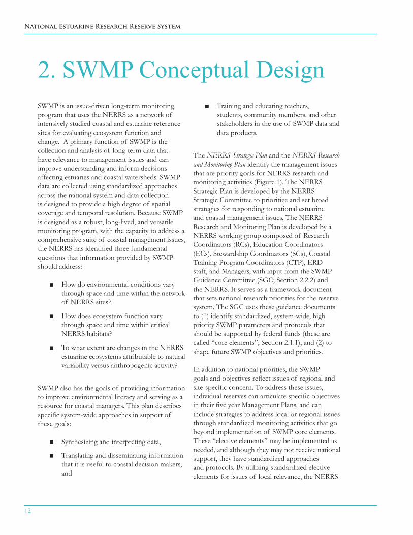
2. SWMP Conceptual DesignSWMP is an issue-driven long-term monitoring program that uses the NERRS as a network of intensively studied coastal and estuarine reference sites for evaluating ecosystem function and change. A primary function of SWMP is the collection and analysis of long-term data that have relevance to management issues and can improve understanding and inform decisions affecting estuaries and coastal watersheds. SWMP data are collected using standardized approaches across the national system and data collection is designed to provide a high degree of spatial coverage and temporal resolution. Because SWMP is designed as a robust, long-lived, and versatile monitoring program, with the capacity to address a comprehensive suite of coastal management issues, the NERRS has identified three fundamental questions that information provided by SWMP should address:
How do environmental conditions vary ■through space and time within the network of NERRS sites?
How does ecosystem function vary ■through space and time within critical NERRS habitats?
To what extent are changes in the NERRS ■estuarine ecosystems attributable to natural variability versus anthropogenic activity?
SWMP also has the goals of providing information to improve environmental literacy and serving as a resource for coastal managers. This plan describes specific system-wide approaches in support of these goals:
Synthesizing and interpreting data, ■
Translating and disseminating information ■that it is useful to coastal decision makers, and
Training and educating teachers, ■students, community members, and other stakeholders in the use of SWMP data and data products.
The NERRS Strategic Plan and the NERRS Research and Monitoring Plan identify the management issues that are priority goals for NERRS research and monitoring activities (Figure 1). The NERRS Strategic Plan is developed by the NERRS Strategic Committee to prioritize and set broad strategies for responding to national estuarine and coastal management issues. The NERRS Research and Monitoring Plan is developed by a NERRS working group composed of Research Coordinators (RCs), Education Coordinators (ECs), Stewardship Coordinators (SCs), Coastal Training Program Coordinators (CTP), ERD staff, and Managers, with input from the SWMP Guidance Committee (SGC; Section 2.2.2) and the NERRS. It serves as a framework document that sets national research priorities for the reserve system. The SGC uses these guidance documents to (1) identify standardized, system-wide, high priority SWMP parameters and protocols that should be supported by federal funds (these are called “core elements”; Section 2.1.1), and (2) to shape future SWMP objectives and priorities.
In addition to national priorities, the SWMP goals and objectives reflect issues of regional and site-specific concern. To address these issues, individual reserves can articulate specific objectives in their five year Management Plans, and can include strategies to address local or regional issues through standardized monitoring activities that go beyond implementation of SWMP core elements. These “elective elements” may be implemented as needed, and although they may not receive national support, they have standardized approaches and protocols. By utilizing standardized elective elements for issues of local relevance, the NERRS

SYSTEM-WIDE MONITORING PROGRAM PLAN
13
ensures that data and information relating to environmental conditions and impacts are comparable across multiple ecosystem types and spatial scales.
The NERRS Strategic Plan, Research and Monitoring Plan, and the SWMP Plan are all living
documents that provide the context and scientific rationale for addressing NERRS strategic priorities over a discrete planning horizon. This SWMP Plan will serve as the NERRS guiding document for long-term monitoring from 2011 onward, and will be revised as needed, with careful consideration of NERRS and NOAA strategic priorities.
NOAA Strategic Plan(Federal priorities)
NERRS Strategic Plan(Prioritizes science,
education, and outreach goals related to coastal
management)
Reserve Management Plans
(Local and regional science priorities)
NERRS Research and Monitoring Plan (Identifies and prioritizes areas of
research emphasis to be addressed by the NERRS Research and Monitoring
Programs)
Reserve Research Programs(Supported by federal, and /or state partners,
focused on questions of system-wide, regional, and local concern –may include SWMP
Applications Modules)
System-wide Monitoring Program Plan (Describes NERRS monitoring capabilities, and uses NERRS strategic planning process
to prioritize issues that will be addressed and guides development of relevant protocols)
Figure 1
Relationship of NERRS Planning Documents
14
National Estuarine Research Reserve System
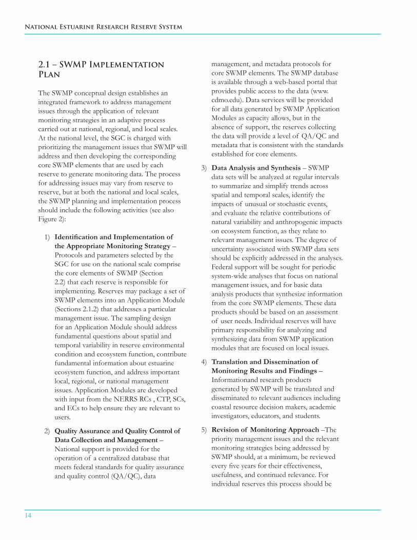
2.1 – SWMP Implementation Plan
The SWMP conceptual design establishes an integrated framework to address management issues through the application of relevant monitoring strategies in an adaptive process carried out at national, regional, and local scales. At the national level, the SGC is charged with prioritizing the management issues that SWMP will address and then developing the corresponding core SWMP elements that are used by each reserve to generate monitoring data. The process for addressing issues may vary from reserve to reserve, but at both the national and local scales, the SWMP planning and implementation process should include the following activities (see also Figure 2):
1) Identification and Implementation of the Appropriate Monitoring Strategy – Protocols and parameters selected by the SGC for use on the national scale comprise the core elements of SWMP (Section 2.2) that each reserve is responsible for implementing. Reserves may package a set of SWMP elements into an Application Module (Sections 2.1.2) that addresses a particular management issue. The sampling design for an Application Module should address fundamental questions about spatial and temporal variability in reserve environmental condition and ecosystem function, contribute fundamental information about estuarine ecosystem function, and address important local, regional, or national management issues. Application Modules are developed with input from the NERRS RCs , CTP, SCs, and ECs to help ensure they are relevant to users.
2) Quality Assurance and Quality Control of Data Collection and Management – National support is provided for the operation of a centralized database that meets federal standards for quality assurance and quality control (QA/QC), data
management, and metadata protocols for core SWMP elements. The SWMP database is available through a web-based portal that provides public access to the data (www.cdmo.edu). Data services will be provided for all data generated by SWMP Application Modules as capacity allows, but in the absence of support, the reserves collecting the data will provide a level of QA/QC and metadata that is consistent with the standards established for core elements.
3) Data Analysis and Synthesis – SWMP data sets will be analyzed at regular intervals to summarize and simplify trends across spatial and temporal scales, identify the impacts of unusual or stochastic events, and evaluate the relative contributions of natural variability and anthropogenic impacts on ecosystem function, as they relate to relevant management issues. The degree of uncertainty associated with SWMP data sets should be explicitly addressed in the analyses. Federal support will be sought for periodic system-wide analyses that focus on national management issues, and for basic data analysis products that synthesize information from the core SWMP elements. These data products should be based on an assessment of user needs. Individual reserves will have primary responsibility for analyzing and synthesizing data from SWMP application modules that are focused on local issues.
4) Translation and Dissemination of Monitoring Results and Findings – Informationand research products generated by SWMP will be translated and disseminated to relevant audiences including coastal resource decision makers, academic investigators, educators, and students.
5) Revision of Monitoring Approach –The priority management issues and the relevant monitoring strategies being addressed by SWMP should, at a minimum, be reviewed every five years for their effectiveness, usefulness, and continued relevance. For individual reserves this process should be

SYSTEM-WIDE MONITORING PROGRAM PLAN
15
National Scale
Feed
Bac
k to
NER
RS P
lann
ing Feed Back to Reserve
Conceptual Framework Local Scale
SGC identifies management issues with guidance from Research and Monitoring Plan and
NERRS Strategic Plan
Reserve develops local management questions
and incorporates into them into management
plan
Reserve, or group of reserves, develops a SWMP
Applications Module
CDMO provides support as capacity allows but reserve
retains responsibility
Reserve develops products as appropriate
Reserve-level data analysis interpretation, and
application
Strategy revisited as appropriate but at least
every five years as part of management plan revision
process
Identification and implementation of
appropriate monitoring strategy
Quality Assurance and Quality Control
of data collection and management
Data analysis, interpretation, and
application
Translation and dissemination of
monitoring results and findings
Reformulation of monitoring approach
Development of management issues
CDMO supports data management for all core
elements
National-level support for core data analysis
products
ERD working with SGC and NERRS RC, CTP, and Education Communities
Annual review by SGC based on proposal submissions and
comprehensive review every 5 years coinciding with Strategic and R&M
Plan revisions
SGC identifies Core Elements
Figure 2. Conceptual design for the development of key management questions and implementation of SWMP at local and national scales to address key management issues.

16
National Estuarine Research Reserve System
timed to coincide with the development of a revised management plan. The SGC will also review and revise the core elements list at least every five years, but may do so more frequently on the basis of annual proposals from the NERRS community.
2.1.1 –SWMP Elements
The NERRS has developed a diverse portfolio of protocols and approaches that are collectively referred to as SWMP Elements, defined as:
A NERRS monitoring activity with associated protocols, parameters, and budgets that has been fully vetted and approved by the NERRS as a fundamental component of reserve operational programs.
Only core elements that are supported with federal funding and are identified in federal funding guidance are required to be implemented by individual reserves. These core elements are “operational elements.” Core elements that are not supported with federal funding are not required to be implemented by individual reserves. These core elements are “pending.” Elective elements are those that may be implemented by a single or a subset of reserves as part of their monitoring program to address local, regional, or national management issues. Elective SWMP elements may be supported from a variety of funding sources, but all elective elements should be implemented through protocols that have been vetted and accepted by the NERRS and the SGC as established SWMP protocols. Data management for SWMP core and elective elements is a primary responsibility of the NERRS, even in the absence of federal funding support.
New elements can be proposed by the NERRS community for addition to the SWMP portfolio by submitting parameters and protocols to the SGC for approval. To add or remove elements on the core elements list, NERRS sectors or working groups will develop a list of candidate
elements that meet their planning needs, and rank them on a scale of 1 -10 according to their priority for funding. Candidate elements are then submitted to the SGC and posted on the NERRS internal website (“intranet”) for comment from the NERRS. The SGC will then determine which elements will be considered to be core or elective, taking NERRS input into consideration when making the decision. In either case of a core or an elective element, the proposal must include the rationale for the proposed element and its relevance to management issues, a comprehensive plan for data analysis, interpretation, and synthesis, as well as a cost analysis. The SGC will review the list of SWMP elements (Appendix 1) and revise as needed on a five year basis or more frequently if proposals for new elements are submitted.
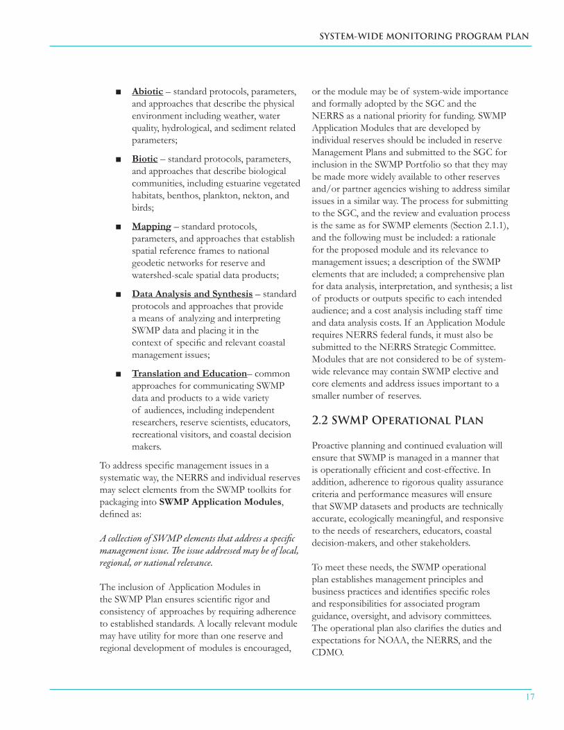
2.1.2 – SWMP Toolkits and Application Modules
SWMP elements are grouped into “toolkits” according to data type or data product:
Installing a weather station(photo credit: Chesapeake Bay VA NERR)
SYSTEM-WIDE MONITORING PROGRAM PLAN
17
Abiotic ■ – standard protocols, parameters, and approaches that describe the physical environment including weather, water quality, hydrological, and sediment related parameters;
Biotic ■ – standard protocols, parameters, and approaches that describe biological communities, including estuarine vegetated habitats, benthos, plankton, nekton, and birds;
Mapping ■ – standard protocols, parameters, and approaches that establish spatial reference frames to national geodetic networks for reserve and watershed-scale spatial data products;
Data Analysis and Synthesis ■ – standard protocols and approaches that provide a means of analyzing and interpreting SWMP data and placing it in the context of specific and relevant coastal management issues;
Translation and Education ■ – common approaches for communicating SWMP data and products to a wide variety of audiences, including independent researchers, reserve scientists, educators, recreational visitors, and coastal decision makers.
To address specific management issues in a systematic way, the NERRS and individual reserves may select elements from the SWMP toolkits for packaging into SWMP Application Modules, defined as:
A collection of SWMP elements that address a specific management issue. The issue addressed may be of local, regional, or national relevance.
The inclusion of Application Modules in the SWMP Plan ensures scientific rigor and consistency of approaches by requiring adherence to established standards. A locally relevant module may have utility for more than one reserve and regional development of modules is encouraged,
or the module may be of system-wide importance and formally adopted by the SGC and the NERRS as a national priority for funding. SWMP Application Modules that are developed by individual reserves should be included in reserve Management Plans and submitted to the SGC for inclusion in the SWMP Portfolio so that they may be made more widely available to other reserves and/or partner agencies wishing to address similar issues in a similar way. The process for submitting to the SGC, and the review and evaluation process is the same as for SWMP elements (Section 2.1.1), and the following must be included: a rationale for the proposed module and its relevance to management issues; a description of the SWMP elements that are included; a comprehensive plan for data analysis, interpretation, and synthesis; a list of products or outputs specific to each intended audience; and a cost analysis including staff time and data analysis costs. If an Application Module requires NERRS federal funds, it must also be submitted to the NERRS Strategic Committee. Modules that are not considered to be of system-wide relevance may contain SWMP elective and core elements and address issues important to a smaller number of reserves.
2.2 SWMP Operational Plan
Proactive planning and continued evaluation will ensure that SWMP is managed in a manner that is operationally efficient and cost-effective. In addition, adherence to rigorous quality assurance criteria and performance measures will ensure that SWMP datasets and products are technically accurate, ecologically meaningful, and responsive to the needs of researchers, educators, coastal decision-makers, and other stakeholders.
To meet these needs, the SWMP operational plan establishes management principles and business practices and identifies specific roles and responsibilities for associated program guidance, oversight, and advisory committees. The operational plan also clarifies the duties and expectations for NOAA, the NERRS, and the CDMO.

18
National Estuarine Research Reserve System
2.2.1 Management Principles and Business Practices
SWMP participants are committed to the following management principles and business practices:
A fully transparent and participatory ■process that includes open access to committee discussions and recommendations, program finances, and records of decisions;
User-group engagement ■ to identify applications of SWMP data to coastal management and education needs, coupled with periodic reviews and objective evaluations of data products by relevant NERRS workgroups or sectors;
Provision of data in an open- ■access environment that facilitates further development, interpretation, and capitalization by outside agencies, academia, non-governmental organizations, and stakeholders;
Technical innovation and adaptive ■program management to ensure that SWMP remains on the forefront of estuarine ecosystem assessments, and programmatic infrastructure is relevant, adaptive, and responsive to the needs of user-groups;
Sustained support of personnel ■resources and equipment to foster a long-term legacy for public-trust management and stewardship of NERRS monitoring products;
Open communication and ■collaboration with partners to develop mutual goals for estuarine ecosystem monitoring; and
Environmental responsibility for ■sustained monitoring in a manner that recognizes the ecological costs associated with intensive observations in sensitive estuarine habitats.
To ensure the long-term success of the program, the SGC and ERD will develop a SWMP business plan that contains principles and planning for the sustained operation of SWMP. The business plan will include an accounting of each component of the SWMP portfolio of human resources, equipment assets and liabilities, and partnership relationships that are required to maintain the program in its current capacity and to accommodate future growth. The immediate fiscal requirements for program operations should be identified annually by ERD in a funding analysis of ongoing NOAA cooperative agreements with the reserves. Program-wide projections for future expenses will be developed and maintained by the SGC for timeframes of 5-10 years. The business plan should also include estimates for future human resource needs, technical training, equipment modernization, data management, outreach products, program evaluation, adaptive management, and contingencies.
2.2.2 Roles, Responsibilities, and Decision-making
The framework for SWMP decision-making allows coordination and integration within the NERRS and across state and federal agency boundaries. The organizational structure associated with the operation and implementation of SWMP has evolved since the program’s inception to include a number of standing committees and workgroups with specific roles and responsibilities for strategic guidance, financial decisions, management of day-to-day operations and the SWMP database, as well as to help generate many of the protocols, procedures, and products associated with SWMP. Committees or workgroups may be chaired by ERD, NERRS staff, or a combination thereof. Workgroups and committees are populated by representatives from the NERRS sectors. SWMP committees, workgroups, and decision-making bodies are described below.
SWMP Guidance Committee (SGC)The SWMP Guidance Committee is a cross-sector committee that ensures SWMP is operated in full alignment with the NERRS Strategic Plan and broader-scale NOAA planning initiatives.

SYSTEM-WIDE MONITORING PROGRAM PLAN
19
The SGC is responsible for the SWMP design, coordination, implementation, and the integration of SWMP into other NERRS activities. Specific responsibilities include:
Development of the strategic long-term ■vision for SWMP as a legacy estuarine monitoring program;
Periodic revision of the SWMP Plan; ■
Review and establishment of the SWMP ■core elements;
Development and oversight of the process ■for the establishment of new SWMP elements;
Maintenance of the list of SWMP ■elements and Application Modules;
Establishing or modifying SWMP ■workgroups to identify appropriate parameters, protocols, procedures, and products that are necessary components of SWMP.
In addition to these responsibilities, the SGC also works directly with other SWMP workgroups to help develop NERRS strategic proposals that explore new avenues and applications for SWMP. The SGC conducts periodic evaluations of SWMP operations, and serves as the primary body for communicating SWMP priorities and activities to the NERRS and other national programs.
The SGC also works with the NERRS RCs, CTP, ECs, Managers, and other members of the NERRS community to identify and engage potential users of SWMP data, and to develop general policies and reporting formats for data synthesis and analysis products (Section 3.4). The SGC may delegate responsibilities for designing and conducting SWMP-related needs assessments to a subcommittee. This subcommittee would be charged with using the outcomes of a national-level needs assessment to identify specific data analyses and products such as templates for “State of the Reserve” reports, and would identify, analyze, and interpret important or interesting
SWMP related events (e.g., impacts of hurricanes, hypoxia, and sea level rise) that could be communicated to educators and other potential users.
The SGC is responsible for developing funding plans for SWMP over five, ten, and fifteen year time-frames and will develop and revise the SWMP business plan to include estimates of human resource needs, technical training, equipment modernization, data management upgrades, new outreach products, program evaluation criteria, and adaptive management steps that should be taken to accommodate future monitoring activities. The SGC seeks out and advances opportunities for cooperation and collaboration with programs outside of NOAA.
SWMP Data Management Committee (DMC)The SWMP Data Management Committee (DMC) is composed of a technical team of NERRS and ERD staff that works in close cooperation with the CDMO to establish priority data management and dissemination activities, and to provide guidance for CDMO operations related to SWMP. In particular, the DMC is responsible for establishment and oversight of the protocols that encompass the standard level of data management for SWMP core elements. This includes guidance on the format and operation of the SWMP database, the architecture for data
NERR committee meeting(photo credit: Elkhorn Slough NERR)

20
National Estuarine Research Reserve System
management, archival, and access, maintenance of metadata, and the establishment of protocols and techniques for data visualization.
SWMP Oversight CommitteesThree NERRS workgroups provide operational oversight for core elements within the Abiotic, Biotic, and Mapping toolkits. These SWMP Oversight Committees are composed of NERRS representatives who have expertise and experience with implementation of SWMP field operations. The Oversight Committees are sub-committees of the DMC (with some overlap in membership) and work together with reserve staff, the SGC, the various SWMP committees, and the CDMO to maintain the continuous generation of data and to ensure that each reserve meets established SWMP performance measures. The Oversight Committees provide:
technical assistance with SWMP field ■operations;
documentation and development of ■solutions to reserve-level problems, including instrument deployment issues and data loss;
review of CDMO reports of annual data ■submissions; and
granting of waivers for justifiable data ■losses.
In addition to these activities, the Biotic and Mapping Oversight Committees have the primary responsibility for QA/QC of core biotic and mapping data, whereas this role is carried out by the CDMO for core abiotic data. As pending core elements become operational, the Oversight Committees will be responsible for determining if reserves are in compliance with SWMP criteria for data submission and QA/QC of submitted data.
Centralized Data Management Office (CDMO)The CDMO has the responsibility for providing a standard level of data management and access for all SWMP core elements. Standard data management and access includes the following, in order of priority:
1. data archival and data access,
2. QA/QC procedures, and
3. data retrieval, where “retrieval” is defined as the ability to select or query data and transfer unprocessed or QA/QC-processed data to a user.
Providing a mechanism for data retrieval does not require the CDMO to manage multiple data formats, or to conduct advanced data processing beyond QA/QC procedures or visualizations, except in the case where there is an explicit agreement with another data center (e.g., U.S. Integrated Ocean Observing System (IOOS), its regional associations, or NOAA’s National Oceanographic Data Center (NODC)). Activities beyond standard data archiving and access are secondary priorities that should be deferred if the priority activities listed above are not being conducted in compliance with accepted norms that have been established by the DMC. Secondary activities that are currently provided by the CDMO include but are not limited to the development of products such as: data images, graphics, statistical analyses beyond QA/QC, time series analyses, written data summaries, and maps.
South End Creek, Sapelo Island NERR(photo credit: Brooke Vallaster)
SYSTEM-WIDE MONITORING PROGRAM PLAN
21
New activities will be evaluated on a case by case basis for relevance to the CDMO mission and potential impact on the priority activity list.
NERRS Strategic CommitteeThe NERRS Strategic Committee is a cross-sector advisory group that recommends budget priorities and strategic direction to the NERRS Managers and ERD, and serves as the primary review body for SWMP funding requests. The SGC will coordinate annually with the Strategic Committee and provide feedback on any SWMP related proposals and action items.
NOAA Estuarine Reserves Division (ERD)NOAA’s Estuarine Reserves Division is responsible for providing leadership, funding, communication support, and coordination of SWMP implementation. All SWMP standing Committees, except the Oversight Committees, should have at least two ERD representatives. ERD currently provides funding for SWMP operations through discrete tasks that are identified in annual CDMO and reserve awards.
NERRS ReservesIndividual reserves are responsible for implementing all core SWMP elements that are supported with federal funds from ERD. Field work is typically overseen by the reserve’s RC in coordination and consultation with other reserve staff, with support from one or more SWMP technical staff and GIS specialists. SWMP data interpretation, product development, identification of local management applications, and product delivery are the responsibility of the entire reserve staff including the RC, EC, SC, CTP, and the reserve Manager. In addition, reserves have a responsibility to define and document their priority management issues and to develop appropriate monitoring strategies in their reserve management plans.
SWMP WorkgroupsSeveral topical and technical NERRS workgroups (Appendix II) work with the SGC to develop new protocols and products, and to provide technical
expertise to the NERRS. This input and expertise plays a significant role in the development of SWMP.
SWMP External Review CommitteeSWMP will be reviewed periodically by a committee of external experts in order to provide input to ERD and NERRS on aspects that are working well and areas for improvement. This is not a standing committee.

22
National Estuarine Research Reserve System
3.1. Abiotic Toolkit
3.1.1 Toolkit Description
The abiotic components of SWMP provide capacity to monitor a suite of parameters related to weather, water quality, hydrology and sediments over a range of spatial scales (local, regional, national) and temporal scales (minutes, hours, days, months, years). Several pending core elements are not yet operational due to a lack of funding and are therefore not being monitored on a consistent system-wide basis (Appendix I). These high priority elements will become operational as funding becomes available.
3.1.2 Core Abiotic Elements
Description of Core Elements
Weather
Each reserve maintains at least one meteorological station to quantify atmospheric conditions. Core elements currently measured at all reserves include air temperature, relative humidity, barometric pressure, wind speed, wind direction, rainfall, and photosynthetically active radiation (PAR).
Water Quality and Water Chemistry
Each reserve deploys at least four Yellow Springs Instrument Co. (YSITM) Model 6600 and/or 6600 Extended Deployment System (EDS), and/or V2 water quality sondes (“datasondes”) for continuous monitoring of water quality parameters. Data are collected for four seconds at fifteen minute intervals, where possible. Datasondes placement is designed to characterize gradients in environmental conditions.
Core elements include water temperature, specific conductivity, percent saturation of dissolved oxygen, pressure, pH, and turbidity. Calculated values include salinity, concentration of dissolved oxygen, and pressure corrected water depth. Pending core elements include carbon dioxide partial pressure (pCO2) and high-resolution pH.
SWMP also includes monthly analyses to quantify nutrient and chlorophyll a concentrations at the same water quality monitoring stations where datasondes are located, if possible. Discrete samples are collected once monthly at specified tidal conditions at the four designated long-term monitoring stations. More intensive diel (24-hour) sampling is conducted at one water quality monitoring station each month to better understand impacts of tide and irradiance on
3. SWMP Toolkits
Lake Superior NERR monitoring (photo credit: Amy Elliot)

SYSTEM-WIDE MONITORING PROGRAM PLAN
23
nutrient cycling. Core elements currently measured at all reserves include nitrate, nitrite, ammonium, orthophosphate, and chlorophyll a. Pending core elements include total alkalinity, total dissolved nitrogen, and total dissolved phosphorous.
Hydrology
Physical processes within the water column and groundwater are becoming increasingly important in understanding patterns of tidal inundation and transport of dissolved and suspended materials. Groundwater level (elevation) and salinity are pending core elements that may be employed where appropriate.
Sediment analysis
Knowledge of sediment properties and transport processes is necessary for understanding and predicting changes in sediment elevation, inundation, and the associated vegetation communities. As part of biological monitoring activities (3.2), protocols for the measurement of sediment elevation, accretion, erosion, and pore water chemistry are in the final stages of development.
Rationale for Elements
The core abiotic elements of SWMP are not only indicative of estuarine habitat quality and condition, but they are also useful to establish health risk criteria and are indicators of human use impacts. Meteorological data provide information on conditions that can affect water quality and biological and physical processes. NERRS weather stations are placed at locations typical of local conditions or in areas where a specific need for weather data has been identified. The information they provide is used for both operational needs, such as local weather forecast models and search and rescue activities, as well as research applications. The core water chemistry elements (NO3, NO2, NH4, and PO4) include the major forms of dissolved nitrogen and phosphorus, and are measured using colorimetric
methods or ion chromatography. Measurements of total dissolved nitrogen and phosphorus provide an assessment of the bioavailable organic nutrients driving plankton dynamics and community composition. Chlorophyll a, although technically a biotic measurement, is included with the abiotic toolkit because it is an indicator of phytoplankton biomass and an important response variable in determining water quality. Pending core elements include pCO2 and high-resolution pH monitoring because of potential relationships with ocean acidification. Measuring total alkalinity would complement pCO2 and pH monitoring, and is critical for accurate characterization of carbonate chemistry. Hydrology and sediment dynamics are essential components of SWMP primarily because of their intimate connection to the structure and function of wetland plant distribution and community composition. These components also provide information about other physical processes related to tidal flushing, patterns of sediment erosion/deposition, water turbidity and contaminant availability.
Replacing a datasonde(photo credit: Rookery Bay NERR)
24
National Estuarine Research Reserve System
3.1.3 Elective Abiotic Elements
Description of Elements
The four categories of elective abiotic elements are listed below. Some of these elements are currently being measured at individual reserve sites based on their research and management priorities and/or they are related to parameters from other toolkits such as biological monitoring and mapping.
Elective weather elements include atmospheric carbon dioxide, soil temperature, soil moisture, total irradiance, and atmospheric deposition of nitrogen and mercury.
Elective water quality elements include automated monitoring of fluorescence using datasondes, additional water chemistry parameters (e.g., Si, particulate N, particulate and dissolved organic carbon, particulate P, and pCO2), and aspects of water column radiation such as light attenuation, incident light, and subtidal and intertidal PAR.
Elective hydrologic elements include groundwater chemistry and hydrodynamic processes such as freshwater stream flow, estuarine circulation, retention time, and turbulence. Protocols for hydrodynamic measurements of tidal current velocity and
volumetric flux (where appropriate) are a high priority but have not yet been developed.
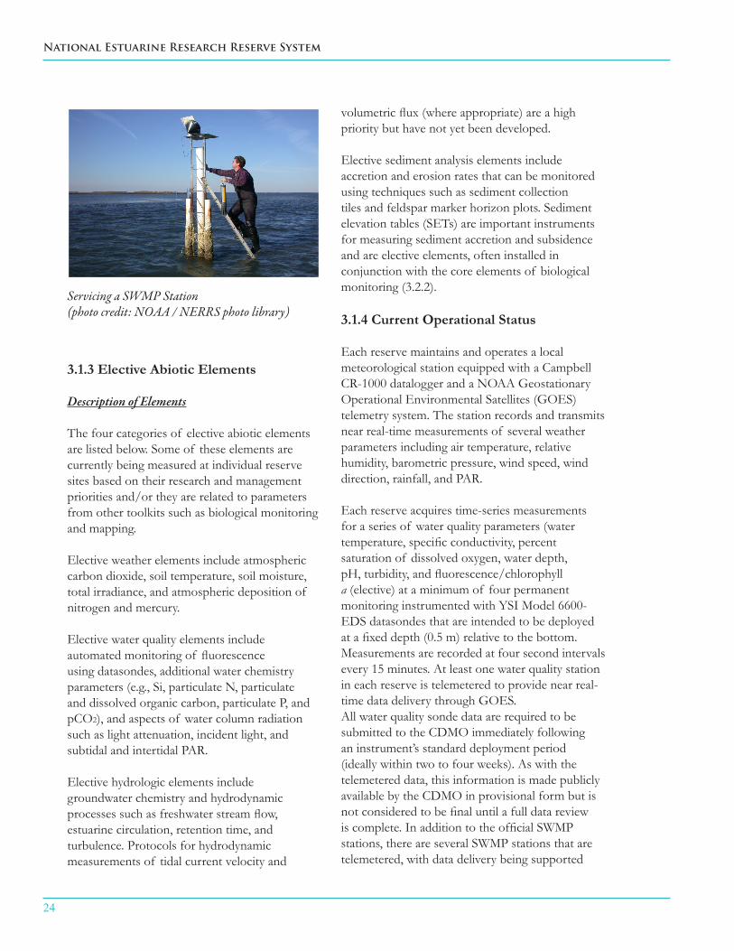
Elective sediment analysis elements include accretion and erosion rates that can be monitored using techniques such as sediment collection tiles and feldspar marker horizon plots. Sediment elevation tables (SETs) are important instruments for measuring sediment accretion and subsidence and are elective elements, often installed in conjunction with the core elements of biological monitoring (3.2.2).
3.1.4 Current Operational Status
Each reserve maintains and operates a local meteorological station equipped with a Campbell CR-1000 datalogger and a NOAA Geostationary Operational Environmental Satellites (GOES) telemetry system. The station records and transmits near real-time measurements of several weather parameters including air temperature, relative humidity, barometric pressure, wind speed, wind direction, rainfall, and PAR.
Each reserve acquires time-series measurements for a series of water quality parameters (water temperature, specific conductivity, percent saturation of dissolved oxygen, water depth, pH, turbidity, and fluorescence/chlorophyll a (elective) at a minimum of four permanent monitoring instrumented with YSI Model 6600-EDS datasondes that are intended to be deployed at a fixed depth (0.5 m) relative to the bottom. Measurements are recorded at four second intervals every 15 minutes. At least one water quality station in each reserve is telemetered to provide near real-time data delivery through GOES. All water quality sonde data are required to be submitted to the CDMO immediately following an instrument’s standard deployment period (ideally within two to four weeks). As with the telemetered data, this information is made publicly available by the CDMO in provisional form but is not considered to be final until a full data review is complete. In addition to the official SWMP stations, there are several SWMP stations that are telemetered, with data delivery being supported
Servicing a SWMP Station(photo credit: NOAA / NERRS photo library)

SYSTEM-WIDE MONITORING PROGRAM PLAN
25
through the CMDO but not archived. These stations, and any others that may come on line, are treated as standard SWMP stations with the expectation that they will eventually be fully incorporated into the system when CDMO is able to accommodate additional data streams.
Each reserve conducts monthly measurements of dissolved inorganic nutrients including nitrate, nitrite, ammonium, and orthophosphate as well as chlorophyll a and phaeopigments. Discrete samples are collected at the same four monitoring stations described above during specified tidal conditions (if possible) and separate collections are made for eleven additional water samples over the diel tidal cycle. Each reserve either processes the samples on site or contracts with a commercial analytical laboratory.
3.1.5 Data Management NERRS abiotic data are subject to three levels of QA/QC. The first level is an automated assessment of data quality (based on sensor limits and expected values) and is conducted immediately upon submission to the CDMO. These data are available to users as “provisional” data. A second, more intensive level of review is conducted by reserve staff, and results are submitted quarterly under the classification “provisional plus” data. The final level of review occurs annually by the CDMO. Once data have undergone all stages of QA/QC, they are considered to be “authoritative” data and are archived accordingly. All NERRS abiotic data can be accessed through the CDMO website (http://cdmo.baruch.sc.edu/) and the telemetered data can be accessed through either CDMO, NOAA’s National Data Buoy Center (NDBC, http://www.ndbc.noaa.gov/) or Hydrometeorological Automated Data System (HADS, http://www.weather.gov/oh/hads/), and are archived with NODC ( http://www.nodc.noaa.gov/cgi-bin/OAS/prd/text/query).
3.2. Biotic Toolkit
3.2.1 Toolkit Description
The objective of the biotic component of SWMP
is to monitor parameters that serve as indicators of changes in the composition and diversity of biotic communities within the NERRS. The biotic component builds upon the time-series data generated by monitoring abiotic parameters, and adds spatially and temporally-explicit information about the composition, status, and condition of biotic communities, including emergent and submerged vegetation, native and non-native benthic invertebrates, plankton communities, nekton, and marsh birds and shorebirds.
3.2.2 Core Biotic Elements
Description and Rationale
Submerged Aquatic and Emergent VegetationMonitoring: Changes in the ecological characteristics and aerial extent of vegetated habitats and communities can provide a sensitive indicator of the health and vitality of the estuarine ecosystem (EPA/NOAA – National Coastal Condition Report III, 2008). This element includes periodic assessments (e.g., biomass, growth, and species distribution) of estuarine plant communities at a series of representative study sites within the NERRS. In most cases, monitoring of biotic communities occurs in close association with the collection of abiotic data, and may be done in conjunction with high-resolution mapping to quantify the larger scale spatial extent of vegetative communities in the watershed. The latter is an element of the mapping toolkit. The sampling approach adopted by SWMP has been used to assess a variety of vegetative communities (Doumlele 1981; Moore et al. 1995; Moore 1996; Perry and Atkinson 1997; Perry and Hershner 1999). The National Park Service and other programs recently adopted this approach to assess and compare reference and restoration wetland sites at local and regional scales (Neckles and Dionne 2002; Roman et al. 2001). In addition, a similar protocol has been established for quantification of seasonal, annual, and longer-term changes in intertidal and subtidal vegetation communities as a component of the global SeagrassNet monitoring program (www.SeagrassNet.org; Short et al. 2002).

26
National Estuarine Research Reserve System
3.2.3 Elective Biotic Elements
Description and Rationale
Monitoring of phytoplankton and zooplankton communities, benthic community, nekton, and marsh birds and shorebirds are potential additions to the NERRS SWMP biotic monitoring toolkit. SWMP workgroups were established for each of these elements, and the workgroups were tasked with developing monitoring and assessment protocols tailored to meet the needs of the NERRS. These workgroup products include SWMP monitoring documents that identify: (1) key scientific and management questions to be addressed by the periodic assessments and field surveys; (2) optimum sampling methods and analytical techniques; (3) targeted user-group products that would be generated by the monitoring activities; (4) a coherent information management strategy for archival and access of the data and metadata; (5) estimates of programmatic costs and human-resource requirements; and (6) a strategy for implementation of the monitoring components across the NERRS network.
Phytoplankton and Zooplankton Communities
The first priority of NERR plankton monitoring efforts will be measures of phytoplankton community structure, primary production, and changes in zooplankton communities. Changes in zooplankton communities can be broadly indicative of shifting hydrodynamic regimes, and monitoring records for zooplankton communities can be coupled with information about the composition and distribution of benthic communities to infer important aspects of benthic-pelagic coupling, tidal transport processes, ocean-estuary linkages, and recruitment events. SWMP plankton and zooplankton monitoring protocols are currently being evaluated or are in development.
Native and Non-native Benthic Invertebrate Communities
Periodic assessments of benthic invertebrate communities can be used to detect changes in the abundance, composition, and diversity of
benthic assemblages in response to natural and anthropogenic stressors. Many benthic species are commercially important (e.g., shellfish and crabs), have high value as target species for recreational gatherers, or serve as food resources (e.g., amphipods and polychaetes) for other important estuarine species. Sampling activities would focus on three major benthic habitat types: soft sediments, such as mud and sand; unconsolidated hard substrates, such as shells, cobbles, and reefs; and consolidated hard substrates, such as rock faces and pier pilings. Standardized monitoring protocols across reserves would allow comparisons of invasive species distributions, as well as mapping of native species.
Nekton Communities
Nekton (i.e., aquatic organisms that can swim against currents) provide ecological links between trophic levels and among various estuarine habitats, such as marsh and open water (Cicchetti 1998). Many small estuarine nektonic fish and crustaceans are juveniles of commercially and recreationally important species. Some species of nekton provide forage for larger economically important fisheries species and for wading and other piscivorous estuarine birds (Friedland et al. 1988; Smith 1997). As part of upper estuarine trophic levels, nekton functions as an integrator of various estuarine processes and can serve as an indicator of estuarine condition (Hughes et al. 2002). In addition, many types of estuarine nekton are highly recognizable and of great interest to non-scientists, helping to facilitate the transfer of knowledge obtained from nekton monitoring programs to education, stewardship, and management programs.
The NERRS is currently exploring how best to implement a national nekton-monitoring effort as a component of SWMP, and several approaches are in development. One strategy is to develop semi-standardized protocols for monitoring with a small number of sampling gear types. Another strategy is to take advantage of nekton monitoring that is already occurring within NERR sites or in the surrounding estuaries.
SYSTEM-WIDE MONITORING PROGRAM PLAN
27
Marsh Birds and Shorebirds Populations of many marsh and shorebird species are in decline (Tate 1986, Eddleman et al. 1988, Conway et al. 1994), but there is a lack of adequate monitoring to determine status and estimate population trends. To monitor short-term variation and long-term trends in marsh bird populations throughout the NERRS, SWMP has adopted the protocol outlined in the Standardized North American Marsh Bird Monitoring Program (Conway 2005). The primary bird groups addressed through this monitoring effort include rails, bitterns, grebes, gallinules, moorhens, wrens, and sparrows.
This standardized monitoring protocol, which uses broadcast calls to elicit vocalizations, is designed to address a series of issues relating to the monitoring and conservation of marsh birds and shorebirds including:
population status and breeding ■distribution;
species-habitat associations; ■
population trends of at local, regional, ■and national geographic scales, as well as various temporal scales;
environmental factors that influence ■species distributions; and
enhancement of local volunteer (birder ■or bird-watcher) participation in research and monitoring programs.
Understanding marsh bird populations within NERRS is important because they (1) may be affected by bioaccumulation of environmental contaminants from wetland substrates, (2) are vulnerable to invasive plants, (3) potentially serve as “indicator species” for assessing wetland ecosystem quality, (4) can be used to evaluate the success of wetland restoration efforts, (5) have high recreational value because many species are highly sought-after by recreational birders, and (6) may be game species in several states.
3.2.4 Current Operational Status
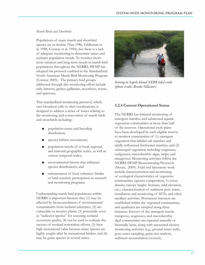
The NERRS has initiated monitoring of emergent marshes and submersed aquatic vegetation communities at more than half of the reserves. Operational work plans have been developed by each eligible reserve to monitor communities of (1) emergent vegetation that inhabit salt marshes and tidally-influenced freshwater marshes, and (2) submerged vegetation including seagrasses, surfgrasses, macrobenthic algae, kelps, and mangroves. Monitoring activities follow the NERRS SWMP Biomonitoring Protocols (Moore, 2009). Field and laboratory work include characterization and monitoring of ecological characteristics of vegetative communities (species composition, % cover, density, canopy height, biomass, tidal elevation, etc.), characterization of sediment pore water, installation and monitoring of SETs, and other ancillary activities. Permanent transects are established within the vegetated communities, and quadrants are sampled along these transects. Surveys of the emergent marsh, mangrove, seagrasses, and macrobenthic algal communities are repeated annually or biennially basis, along with associated elective monitoring activities (e.g., ground-water wells, pore-water sampling, grain-size analysis, sediment accumulation/erosion).
Seining in Sapelo Island NERR tidal creek(photo credit: Brooke Vallaster)

28
National Estuarine Research Reserve System
3.2.5 Data Management
Biological monitoring data associated with core elements will be collected and archived by each reserve that is conducting SWMP biotic monitoring. The Biotic Monitoring Oversight Committee will work with the DMC, CDMO, and the SGC to develop a standardized data template that can be used by the reserves to submit their biological monitoring data for archiving by CDMO. The Biotic Monitoring Oversight Committees will also oversee the QA/QC of core biotic data and will ensure that data are compliant with SWMP criteria for data submissions.
3.3 Mapping Toolkit
3.3.1 Toolkit Description
Data and data products that have a spatial component and define locations and/or elevations relative to a known reference datum are contained in the Mapping Toolkit. Repeated
measurements of spatial characteristics provides a means of tracking and evaluating changes in coastal and estuarine habitat over time, as they relate to changes in broad scale (watershed) land use processes and fine scale (local) processes. The main objective of the Mapping Toolkit is to determine the linkages between coastal habitat quality and environmental influences. In combination with other toolkit elements, mapping allows for the development of a more complete understanding of current conditions and future changes and offers the potential for using the NERRS as a network of reference sites for ecosystem models. The use of standard methods for spatial and temporal monitoring will allow the “status and trends” of habitat or land cover change to be assessed at local, regional, and national scales, will provide data to assess changes in habitat condition, and will help identify coastal land use practices that are best able to mitigate habitat degradation.
3.3.2 Core Mapping Elements
Description
Basic components of the mapping toolkit (both core and elective) can be broadly characterized as spatial data or data products that describe planar landscape characteristics (defined by location, x,y) and elevation (defined vertically, z).
Imagery derived planar maps
Data products describing spatial data in two dimensions (planar maps) are generally derived from the interpretation of remotely sensed imagery. The mechanism or type of imagery capture and interpretation, appropriate land cover classification at differing scales, appropriate spatial and temporal monitoring frequency, and mechanisms for assessing measurement accuracy have been described in documents generated for the NERRS. Specifically, the document titled “SWMP Phase III: Land Use, Land Cover, and Habitat Change” (Kutcher et al., 2005) provides an overview and guidance for developing appropriate planar map products. Developing
Collecting GPS data over a geodetic control marker (photo credit: Elkhorn Slough NERR)
SYSTEM-WIDE MONITORING PROGRAM PLAN
29
planar maps at two scales of spatial resolution has been suggested as a mechanism to capture the impacts of coastal processes at both watershed and local scales. Operational core elements include watershed boundary, reserve boundary, land cover, impervious surface, percent cover, and five-year change analysis at a watershed scale of resolution. Pending core elements which are not yet be available for all sites include plant species distribution and plant species composition. Reserve scale maps (with 1 m horizontal accuracy for all reserves except Alaska) are also considered pending core elements of the mapping toolkit. Reserves should develop plant species distribution, composition, and change detection maps every ten years. However, the geographic extent of individual reserve map products may vary. Reserve scale maps may incorporate the entire geographic extent of all reserve properties or only select geographic areas of perpetual interest (to include, at a minimum, all intertidal and supra-tidal areas with an additional 100 m buffer). Map products at finer scales of resolution are necessary to track and evaluate change in habitats within reserves, identify locally specific environmental influences, and address local management concerns. These pending elements will be made operational when funding becomes available. The goal of the NERRS is to produce baseline maps for all reserves by the end of fiscal year 2012 and to support re-mapping of reserve high priority habitats on a 10-year time frame to monitor for change in the spatial footprint of reserve high priority habitats. Reserve specific habitat mapping plans are intended to support biological monitoring of SAV and emergent vegetation, as well as the need to map the spatial extent of reserve habitats for broader level change analyses.
Elevation Mapping
In addition to using geographic location as a descriptor it is often necessary to characterize a point (or points) on the landscape or, alternatively, a defined area of the landscape in relation to its
vertical dimension (e.g., height, depth) relative to a known reference datum. Vertical reference datums are defined relative to sea level at a specific location on the earth or a specific local tidal stage. The National Spatial Reference System, which is managed by NOAA’s National Geodetic Survey (NGS), is the coordinate system that defines vertical reference datums. Guidance on development of specific elevation products critical to describing coastal systems is available in Kutcher et al. (2005). As with planar map products, the spatial resolution of elevation products varies depending on the scale (watershed or local) of the coastal processes being investigated. Core elements include watershed scale digital elevation maps (DEMs), local geospatial network(s), local tidal datums, study site DEMs, elevation profiles, and substrate surface elevations at permanent vegetation plots. With the exception of the watershed scale DEMs, these elements have not been implemented at all reserves. However, these pending core elements have protocols currently under development, and will become operational as funding becomes available
Rationale By comparing regional differences in watershed land use patterns and their influence on estuarine habitat, the patterns most detrimental or beneficial to estuarine habitat may be identified. In addition, differences in these relationships at each reserve may allow an examination of regional differences in the sensitivities of estuarine habitats. Recommendations can then be formulated to guide coastal land use planning and habitat restoration goals to accommodate projected future changes in the distribution of these important estuarine habitats.
Acquiring elevation data at varying spatial scales is necessary because elevation is a critical structural component of coastal systems. Elevation both drives and responds to coastal processes at the watershed scale (e.g., storm water runoff) and local scales (e.g., erosion). Repeated elevation measures can inform coastal management decisions by

30
National Estuarine Research Reserve System
providing rates of change, determining response to various coastal processes, and allow for predictive modeling in the coastal zone.
3.3.3 Elective Mapping Elements
Description and Rationale
Although protocols have been established (or are currently under development) for generating various planar and elevation mapping products, there are additional mapping products which would provide a more complete understanding of coastal and estuarine habitats and the environmental factors that influence them. Elective mapping elements include parcel boundaries, geomorphology, impervious surface, fine-scale DEMs and bathymetry. Also, many reserves have historically produced maps without funding support from the NERRS, or prior to the development of the NERRS guidance documents.
3.3.4 Current Operational Status
Through a partnership with NOAA’s Coastal Services Center (CSC) a number of core mapping elements are available at a 30 m horizontal resolution describing watershed characteristics for each reserve. With the exception of these products, none of the core elements of the mapping toolkit have been fully implemented throughout the NERRS. A number of reserves have generated reserve scale map products and all other reserves have committed to produce these products by 2012. Although protocols for the generation of many of the core/elective reserve scale maps have been established and documented, many reserves have delayed implementing these protocols due to limited resources. Staff time and staff skill sets, image acquisition and processing costs, and software acquisition and maintenance required for the production of mapping products are limiting resources that preclude full implementation. However, efforts are underway toward establishing vertical control and local tidal datums through a partnership with the National Geodetic Survey (NGS) to train staff from several reserves in the use of leveling equipment and
real-time kinematic (RTK) Geodetic Positioning Systems (GPS). ERD has also purchased equipment to support this effort.
3.3.5 Data Management
Moderate resolution maps and mapping products generated by the CSC are checked for accuracy by the CSC during their map development process and by the reserves prior to submission to the CDMO. No additional data management is required from CDMO beyond housing and distributing the data. Reserve boundary and species distribution and composition maps developed as part of the habitat mapping and change initiative are checked by the Mapping Oversight Committee and CDMO staff for compliance with existing NERRS SOPs and then are housed and distributed by the CDMO. Protocols for acquiring various elevation mapping products (currently under development) will include specifications for data format, data submission, and data management.
Operational Status
Currently the moderate resolution mapping products (30 m resolution watershed-scale data available through the CSC) are the only mapping toolkit products being housed and made available through the CDMO.
3.4. Data Analysis and Synthesis Toolkit
3.4.1 Toolkit Description
This toolkit broadly summarizes both required and suggested analyses covering a broad range of scales, but does not elaborate on specific statistical tests that may or may not be appropriate for use. A number of previous analyses and syntheses of SWMP data are available at nerrs.noaa.gov (e.g., Sanger et al. 2002, Wilde et al. 2007) and may help to inform future efforts. The process for establishing future goals and strategies for SWMP data analysis will involve input from all NERRS sectors, as well as external decision makers and stakeholders, and will be established
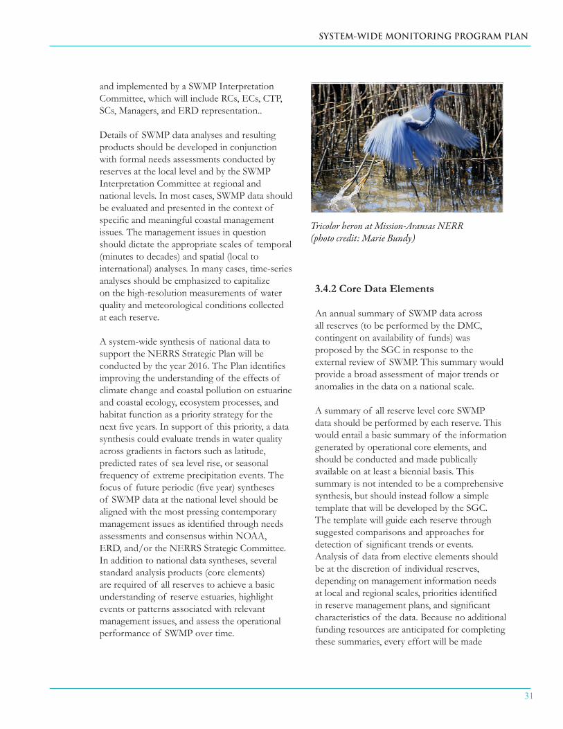
SYSTEM-WIDE MONITORING PROGRAM PLAN
31
and implemented by a SWMP Interpretation Committee, which will include RCs, ECs, CTP, SCs, Managers, and ERD representation..
Details of SWMP data analyses and resulting products should be developed in conjunction with formal needs assessments conducted by reserves at the local level and by the SWMP Interpretation Committee at regional and national levels. In most cases, SWMP data should be evaluated and presented in the context of specific and meaningful coastal management issues. The management issues in question should dictate the appropriate scales of temporal (minutes to decades) and spatial (local to international) analyses. In many cases, time-series analyses should be emphasized to capitalize on the high-resolution measurements of water quality and meteorological conditions collected at each reserve.
A system-wide synthesis of national data to support the NERRS Strategic Plan will be conducted by the year 2016. The Plan identifies improving the understanding of the effects of climate change and coastal pollution on estuarine and coastal ecology, ecosystem processes, and habitat function as a priority strategy for the next five years. In support of this priority, a data synthesis could evaluate trends in water quality across gradients in factors such as latitude, predicted rates of sea level rise, or seasonal frequency of extreme precipitation events. The focus of future periodic (five year) syntheses of SWMP data at the national level should be aligned with the most pressing contemporary management issues as identified through needs assessments and consensus within NOAA, ERD, and/or the NERRS Strategic Committee. In addition to national data syntheses, several standard analysis products (core elements) are required of all reserves to achieve a basic understanding of reserve estuaries, highlight events or patterns associated with relevant management issues, and assess the operational performance of SWMP over time.
3.4.2 Core Data Elements
An annual summary of SWMP data across all reserves (to be performed by the DMC, contingent on availability of funds) was proposed by the SGC in response to the external review of SWMP. This summary would provide a broad assessment of major trends or anomalies in the data on a national scale.
A summary of all reserve level core SWMP data should be performed by each reserve. This would entail a basic summary of the information generated by operational core elements, and should be conducted and made publically available on at least a biennial basis. This summary is not intended to be a comprehensive synthesis, but should instead follow a simple template that will be developed by the SGC. The template will guide each reserve through suggested comparisons and approaches for detection of significant trends or events. Analysis of data from elective elements should be at the discretion of individual reserves, depending on management information needs at local and regional scales, priorities identified in reserve management plans, and significant characteristics of the data. Because no additional funding resources are anticipated for completing these summaries, every effort will be made
Tricolor heron at Mission-Aransas NERR(photo credit: Marie Bundy)
32
National Estuarine Research Reserve System
to streamline the process. The utility of these summaries could be increased through the regular identification of additional funding to enable more in-depth and customized analyses.
Five year synthesis of key trends in national SWMP data should be performed by Graduate Research Fellows (GRFs), a workgroup of RC’s, ERD, or partners. As described in Section 3.4.1, periodic long-term analysis and synthesis of SWMP data should be performed and aligned with one or more management issues of broad significance to the NERRS. The scope and depth of this effort will depend on available funding support and partnership involvement. Rationale
SWMP is more than just a coordinated effort at data collection. Analyses of SWMP datasets are necessary to summarize and simplify the acquired numerical information, conduct statistical tests of inherent variability and significant differences, evaluate alternative hypotheses, determine the causes and consequences of ecological observations, and assess levels of uncertainty associated with the conclusions drawn from SWMP data. Regular analysis and synthesis of SWMP data are critically important so that data are useful and accessible to a wide range of audiences including coastal decision makers, resource managers, restoration practitioners, scientists, educators, students and other stakeholders. It is incumbent upon the NERRS to ensure that basic analyses of SWMP data are performed and made publically available. Adhering to the minimum requirements for analysis described above will: (1) allow the NERRS to promote the utility and relevance of SWMP data on a national level, (2) encourage individual reserves to inform local and regional end users of notable trends or events that may be impacting estuarine ecosystems, and (3) provide a mechanism for RCs and technicians from individual reserves to evaluate the performance and coherency of their monitoring efforts.
3.4.3 Elective Data Elements
Description
Many opportunities exist for enhancing the utility and impact of SWMP data on all spatial and temporal scales. Appropriate and timely data analysis is a key aspect of this process and all reserves should prioritize data analysis whenever possible. Following is a partial list of suggested analysis products that could be created:
monthly summaries of data from SWMP ■monitoring stations to inform ongoing, local research;
regional summaries and syntheses ■of SWMP data in relation to specific management issues;
additional summaries and reports of ■SWMP data as identified by formal needs assessments;
descriptions of significant environmental ■events, such as effects of hurricanes, prolonged droughts, hypoxic events, harmful algal blooms, etc.;
“report cards” or status reports of ■estuarine health or condition based on SWMP data; and
special issues of relevant, peer-reviewed ■journals based on topic, region, etc.
Rationale
In addition to the core data analysis elements that are required of all reserves, the NERRS also should conduct other periodic data synthesis and analysis to address specific coastal management questions and to provide analytical information that is relevant to address a variety of national, regional, and local issues. Only a few efforts have been made to determine the value and use of the SWMP data on national and regional scales since the program’s inception. Prior funding for these syntheses has been provided primarily through the Cooperative Institute for Coastal and Estuarine

SYSTEM-WIDE MONITORING PROGRAM PLAN
33
Environmental Technology (CICEET). There is a pressing need for more regular assessments of the similarities/dissimilarities among reserves and the range of abiotic and biotic conditions represented by the NERRS (e.g., severity and frequency of hypoxia, salinity ranges, tidal periods, and other habitat attributes). Regular syntheses would provide information on the status of the NERRS and any key trends occurring in the data as well as provide insight into whether the current monitoring and analysis strategies remain adequate. Additionally, incorporating ancillary data into SWMP data analyses (e.g., United States Geological Service (USGS) and LTER data, U.S. Integrated Ocean Observing System (IOOS) data, NERRS non-SWMP monitoring data) will support more comprehensive understanding of local and regional coastal and watershed conditions over time.
3.4.4 Current Operational Status
SWMP abiotic monitoring has been ongoing and expanding since 1995. Periodic syntheses of data products generated by these earliest implemented elements of SWMP are used to realign monitoring priorities, streamline operations, and evaluate program effectiveness. CICEET funded the first thorough synthesis of SWMP water quality data (Wenner et al. 2001). A second data synthesis funded by ERD was performed by Sanger et al. (2002). Subsequent analysis and synthesis of SWMP data have been conducted largely in an ad hoc fashion with a series of regional reports funded through CICEET (Brush et al. 2007, Dalton et al. 2006, O’Higgins and Rumrill 2007, Wilde et al. 2007) and a few peer-reviewed scientific publications (see www.NERRS.NOAA.gov) originating from individual reserves. Other than annual QA/QC approaches prior to archiving data with CDMO, no routine data-analysis products have been required of reserves prior to 2011.
3.4.5 Data Management
Regional and national syntheses of SWMP data will be housed on the NERRS website as for previous reports of this type (http://nerrs.noaa.
Education laboratory(photo credit: George Cathcart)
gov/RCDefault.aspx?ID=57) and published in the peer-reviewed literature when appropriate. Results of analyses completed at the reserve level should be made available on individual reserve websites and/or published in the peer-reviewed literature. In general, peer-review at all levels of data analysis would provide an additional mechanism for objective evaluation of SWMP and its resulting products. Data products and reports should be distributed widely and to appropriate audiences including decision makers, resource managers and the scientific community.
3.5. Translation and Education Toolkit
3.5.1 Toolkit Description
The translation and education toolkit is a collection of data products, such as websites, lesson plans, and land management models that use SWMP data to educate and train a diverse group of audiences about water quality, data use and analyses, and related topics. When SWMP was originally established, the primary users of SWMP data were independent researchers and reserve scientists that conduct their own data analysis and interpretation. However, SWMP data and resulting data products provide substantial added benefits for improving science, technology, engineering, and math (STEM) education at kindergarten through 12th grade (K-12)

34
National Estuarine Research Reserve System
and university levels, educating and informing recreational visitors to reserve sites, and as a potential resource for coastal decision makers. Translation and education tools also increase use of SWMP by researchers within and beyond the reserve system.
SWMP data is available immediately online at CDMO in provisional form (having undergone automated QA/QC) or at CDMO or by request in archived form after it has undergone more thorough QA/QC, which is completed on a yearly cycle. The development of data products and multiple venues for distribution and product access increases the potential for the use of SWMP data. The challenge remains to determine which data products are most appropriate for each audience and present them in a context which will allow this data to be useful.
The NERRS ECs and CTP have developed a mechanism for addressing this challenge by adopting a user-driven process that includes completing needs assessments as a prerequisite to receive funding for implementing local and system-wide program components. Many of the elements within this toolkit were identified and developed for SWMP data via this process; other elements were identified as products of SWMP monitoring efforts conducted primarily by the research and stewardship sectors.
3.5.2 Core Translation and Education Elements
Description
Elements of the translation and education toolkit have been binned into four general categories based on data product type and/or access point for the data or products: (1) SWMP websites, (2) training and education reference materials, (3) tools and models for management, and (4) data dissemination. There is potential overlap of elements between components; however, categorization provides a means to organize elements based on intended use. It should be
noted that these elements are not the only data and data products available from the NERRS, just those which were derived from SWMP.
Core elements of the translation and education toolkit include a number of SWMP data products that are appropriate to a variety of audiences and are made available in a range of venues. In large part, these are already fully operational or the plan has been established, but additional resources are needed for the element to reach operational status. The core elements are expected to be continued indefinitely into the future, but will be modified and improved to meet changing audience needs.
SWMP Websites
The CDMO archives and reviews data for quality assurance and control, and makes the data accessible through a query-able database (http://nerrsdata.org). Additional data products that can be accessed from this site include: data visualization and enhanced graphing tools, simple statistics, time series analysis, and data summary reports. Although primarily designed to support the needs of scientists, the expansion of data types housed by the CDMO and its developing capacity to provide additional services increases its utility for a broader array of users.
SWMP data and data products are also available on a NERRS website designed specifically for K-12 students and teachers (http://www.estuaries.gov). The Estuaries.Gov website includes a data graphing tool created to meet the specific needs of this target audience. Toolkit elements posted on Estuaries.Gov include the graphing tool, data FAQs and tutorials, as well as lesson plans that use SWMP data; estuaries.gov is also an appropriate venue for State of the Reserve reports and other data summaries or stories. Students have an opportunity to use SWMP data on this web-based platform as a vehicle for learning about how to manipulate, analyze, and interpret data and learn about estuarine science. They also may use SWMP data that has already been analyzed, interpreted, and packaged to answer a specific question or tell
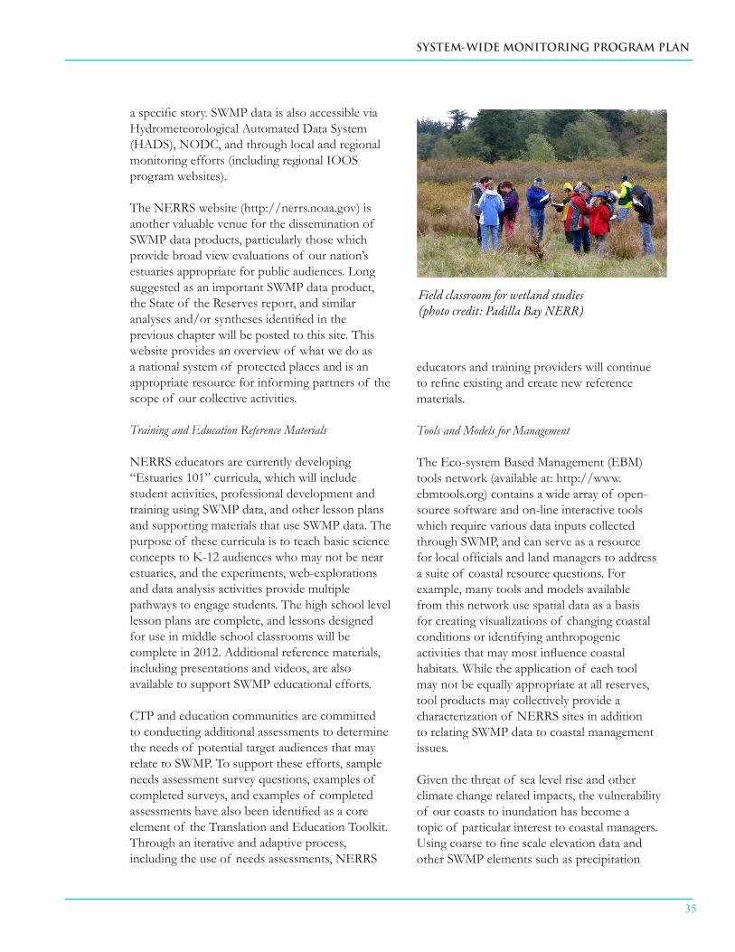
SYSTEM-WIDE MONITORING PROGRAM PLAN
35
a specific story. SWMP data is also accessible via Hydrometeorological Automated Data System (HADS), NODC, and through local and regional monitoring efforts (including regional IOOS program websites).
The NERRS website (http://nerrs.noaa.gov) is another valuable venue for the dissemination of SWMP data products, particularly those which provide broad view evaluations of our nation’s estuaries appropriate for public audiences. Long suggested as an important SWMP data product, the State of the Reserves report, and similar analyses and/or syntheses identified in the previous chapter will be posted to this site. This website provides an overview of what we do as a national system of protected places and is an appropriate resource for informing partners of the scope of our collective activities.
Training and Education Reference Materials
NERRS educators are currently developing “Estuaries 101” curricula, which will include student activities, professional development and training using SWMP data, and other lesson plans and supporting materials that use SWMP data. The purpose of these curricula is to teach basic science concepts to K-12 audiences who may not be near estuaries, and the experiments, web-explorations and data analysis activities provide multiple pathways to engage students. The high school level lesson plans are complete, and lessons designed for use in middle school classrooms will be complete in 2012. Additional reference materials, including presentations and videos, are also available to support SWMP educational efforts.
CTP and education communities are committed to conducting additional assessments to determine the needs of potential target audiences that may relate to SWMP. To support these efforts, sample needs assessment survey questions, examples of completed surveys, and examples of completed assessments have also been identified as a core element of the Translation and Education Toolkit. Through an iterative and adaptive process, including the use of needs assessments, NERRS
educators and training providers will continue to refine existing and create new reference materials.
Tools and Models for Management
The Eco-system Based Management (EBM) tools network (available at: http://www.ebmtools.org) contains a wide array of open-source software and on-line interactive tools which require various data inputs collected through SWMP, and can serve as a resource for local officials and land managers to address a suite of coastal resource questions. For example, many tools and models available from this network use spatial data as a basis for creating visualizations of changing coastal conditions or identifying anthropogenic activities that may most influence coastal habitats. While the application of each tool may not be equally appropriate at all reserves, tool products may collectively provide a characterization of NERRS sites in addition to relating SWMP data to coastal management issues.
Given the threat of sea level rise and other climate change related impacts, the vulnerability of our coasts to inundation has become a topic of particular interest to coastal managers. Using coarse to fine scale elevation data and other SWMP elements such as precipitation
Field classroom for wetland studies(photo credit: Padilla Bay NERR)

36
National Estuarine Research Reserve System
and accretion/erosion rates, models such as Sea Level Affecting Marshes Model (SLAMM) should be applied as appropriate to identify areas of particular concern and inform management decisions.
Data Dissemination
Numerous venues exist for additional dissemination of SWMP data, including articles or entire special issues of journals, presentations and conferences, professional development workshops for teachers, community education programs, and interpretive exhibits. These dissemination approaches use SWMP data to increase awareness and interest in the SWMP program and/or to improve understanding of estuaries or estuarine topics.
Rationale
The original vision for SWMP was to capture short-term variability and long-term change in specific measurable characteristics of estuaries to inform coastal zone management. Making SWMP data widely available to independent researchers and conducting in-house analyses to evaluate change in environmental conditions is only the first step in meeting this goal. It is equally important to develop SWMP data products that can be used specifically by coastal managers and coastal decision makers to make appropriate choices.
The importance of educating the K-12 students and teachers and community members about the value and importance of the nation’s estuaries is also critical although not explicitly stated in the original SWMP mission statement. Without an informed and engaged public, coastal scientists, managers and decision makers will not have the support necessary to protect and manage our nation’s estuaries.
3.5.3 Elective Translation and Education Elements
In addition to continued build-out of content and capacity of the web-based interfaces
identified as core in this document, there are other appropriate venues for the dissemination of SWMP data. These include databases such as SeagrassNet for global seagrass monitoring data collected using an approved protocol and websites devoted to specific topics such as the NOAA Restoration Portal (http://www.habitat.noaa.gov/restoration/), which contains reports on restoration projects that were evaluated using SWMP elements.
In an effort to further generate appropriate SWMP data products, conference presentations and journal articles which reference SWMP should be made available to the entire NERRS community as a resource for similar projects and for use in developing SWMP ‘stories’ which can be adapted to various audiences. An image bank of SWMP related equipment, sites, and graphics which may be used to illustrate specific environmental conditions and events, as well as a list of experts to serve as consultants, guest speakers, and field questions have also been identified as useful elements for this toolkit. Expanding ‘outreach’ products in new directions may include social networking sites, templates for press releases, estuary fact sheets, and other promotional materials.
3.5.4 Current Operational Status
The core elements of this toolkit are currently operational, although all could be augmented or improved and will require continued support.

SYSTEM-WIDE MONITORING PROGRAM PLAN
37
4. Applications of SWMP to Coastal Management Issues (Application Modules)
4.1 Concept
Application Modules provide a mechanism for individual reserves, groups of reserves, or the NERRS as a whole to meet local, regional, or national coastal management needs. Application Modules may address more specific issues and questions than those prioritized by the NERRS, and the use of standard SWMP elements allows a common research and monitoring approach to be applied across variable spatial and temporal scales throughout the NERRS. As an example, core and elective elements from each SWMP toolkit have been combined to develop a common approach for assessing the impacts of sea level change on coastal vegetated habitats. This Application Module is the NERRS Sentinel Sites Initiative for Sea Level Change and Inundation (Appendix III). In addition to existing SWMP elements, modules may also include protocols that have not yet been incorporated into the SWMP portfolio. In these cases, the new protocols will be subjected to the SGC review process, as occurs with other proposed elements.
Other modules might, for example, include combinations of elements to address questions related to storm water impacts, eutrophication, or any of a number of other issues. The use of Application Modules will assist the NERRS in identifying future core elements for SWMP, prioritizing funding for existing elective SWMP elements, and encouraging the application and use of SWMP infrastructure and data. Application Modules should be submitted to the SGC for incorporation into the SWMP portfolio, and will then be submitted to the NERRS Strategic Committee if they require federal funding (see Section 2.1.1 for submission requirements)
4.2 Examples
The example module addressing sea level change and inundation is presented in Appendix III, but there are many other possible issues and combinations of approaches for modules depending on the scale and the nature of the issue being addressed.
Coastal development (photo credit: NOAA / NERRS photo library)

38
National Estuarine Research Reserve System
At the reserve level, the staffing model for SWMP implementation typically includes a team of two technicians overseen by the reserve RC. In many cases the reserve SC and a GIS technician play large roles in coordinating and conducting monitoring activities. Primary SWMP physical infrastructure (associated with core elements) includes a minimum of:
eight YSI datasondes; ■
one Sutron telemetry package for a ■datasonde;
one Campbell CR-1000 meterological ■station plus telemetry package;
nutrient sampling equipment including one ■Teldyne-ISCO or similar automatic water sampler;
physical infrastructure associated with ■vegetation transects, if applicable; and
computer and software suitable for data ■and image analysis.
The NERRS CDMO employs a full complement of full-time and part-time employees for activities related to data management and distribution, as well those needed for supporting telemetry and annual DMC meetings and SWMP Technician Training workshops. The CDMO also maintains a Direct Receive Ground Station to obtain satellite feeds directly from GOES and enough server
and computing capacity to maintain and operate a networked relational database for SWMP current and archived datasets.
Operational support for SWMP at individual reserves is provided via a discrete task in annual reserve cooperative agreements. Support as of FY2010 was approximately $120k per reserve for abiotic toolkit components and an additional maximum of $50k per reserve provided on a one-time basis to begin biological monitoring of submersed and emergent aquatic vegetation at specific reserves. Approximately $25 K is needed on an annual basis to maintain the biological monitoring. The CDMO Operations Award was $367k in FY2011. Individual reserves and the CDMO often supplement these funds with state support or funds from other research grants. The estimated actual programmatic costs and the associated level of current national support that is provided for all core operational elements will be developed by the SGC.
An assessment of SWMP recapitalization needs and the associated costs is being conducted by ERD based on the current SWMP infrastructure age profile and manufacturer estimated equipment life spans. Estimates of datasonde recapitalization are by far the greatest current need and are based on an estimated optimal number of eight sondes per reserve (assuming one back-up sonde per monitoring site). CDMO hardware recapitalization represents a much smaller but equally critical need.
5. Capital Considerations
Seining for fish (photo credit: Sapelo Island NERR)
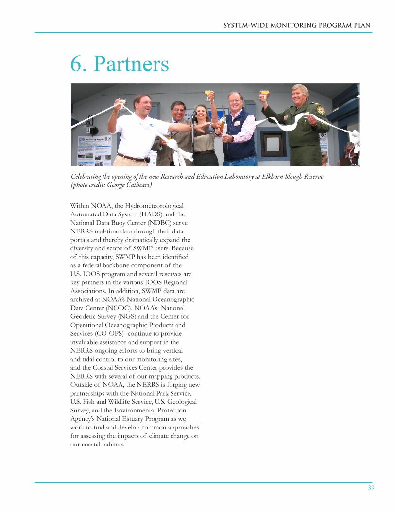
SYSTEM-WIDE MONITORING PROGRAM PLAN
39
Within NOAA, the Hydrometeorological Automated Data System (HADS) and the National Data Buoy Center (NDBC) serve NERRS real-time data through their data portals and thereby dramatically expand the diversity and scope of SWMP users. Because of this capacity, SWMP has been identified as a federal backbone component of the U.S. IOOS program and several reserves are key partners in the various IOOS Regional Associations. In addition, SWMP data are archived at NOAA’s National Oceanographic Data Center (NODC). NOAA’s National Geodetic Survey (NGS) and the Center for Operational Oceanographic Products and Services (CO-OPS) continue to provide invaluable assistance and support in the NERRS ongoing efforts to bring vertical and tidal control to our monitoring sites, and the Coastal Services Center provides the NERRS with several of our mapping products. Outside of NOAA, the NERRS is forging new partnerships with the National Park Service, U.S. Fish and Wildlife Service, U.S. Geological Survey, and the Environmental Protection Agency’s National Estuary Program as we work to find and develop common approaches for assessing the impacts of climate change on our coastal habitats.
6. Partners
Celebrating the opening of the new Research and Education Laboratory at Elkhorn Slough Reserve(photo credit: George Cathcart)

40
National Estuarine Research Reserve System
7. The Future of SWMP
In the future, as they are now, SWMP priorities and future directions will be developed in direct support of NERRS strategic planning for research. The basic principle governing SWMP operations is that consistency in data collection, synthesis, and analysis should provide a high level of comparability across the system, while also providing relevance to local and regional management issues. Historically, SWMP has been organized around a conceptual model that established the functionality of program elements over time (i.e., a “phased approach”). The 2011 SWMP Plan represents a shift from a program that is still in development to an operational program with a more functional approach. In the new model, fundamental components of SWMP are identified as core elements that, when deployed separately or combined appropriately into Application Modules, constitute a fully operational monitoring system and provide the capacity for the NERRS to “develop quantitative measurements of short-term variability and long-term changes in the water quality, biological communities, and land-use/land -cover characteristics of estuaries and estuarine ecosystems for the purposes of informing effective coastal zone management” (SWMP Mission Statement).
Future efforts will be focused on increasing and developing SWMP operational capacity to
better understand: (1) how environmental and ecological conditions and functions in NERRS sites change over time, (2) the regional and site-specific differences in the environmental and ecological conditions and functions of NERRS ecosystems, and (3) the relative contributions of natural and anthropogenic influences (including climate change impacts) on estuarine ecosystems. This holistic approach will increase the capability for SWMP to provide the functional support for research and monitoring activities that can address NERRS strategic goals and objectives and coastal management needs. To continue to develop SWMP’s capacity as a fully operational monitoring system, the core elements will require long-term support.
Funding opportunities that can support the development of SWMP operational capacity at a regional or local level may arise from sources other than the formal NERRS annual appropriations. Examples include partnerships with federal, state, or local organizations, academic relationships, and funding opportunities at the federal, state, or local level. These opportunities will allow individual reserves to enhance their capacity by adding instrumentation, expanding sampling programs, or implementing comprehensive research and monitoring programs focused on local, regional, and/or national management needs, or on topics
Hudson River NERR freshwater marsh (photo credit: Chris Bowser)
SYSTEM-WIDE MONITORING PROGRAM PLAN
41
that meet reserve-specific priorities. ERD will encourage and help promote these opportunities by identifying site-based and regional funding sources and by fostering site-based and regional activities to link NOAA technical assistance, services and products that address coastal management needs and further the NERRS and NOAA mission. ERD will also assist other NOAA and non-NOAA programs to maximize their use of NERRS science, sites, and resources.
While monitoring determines whether and how much the environment has changed over space and time, research provides an understanding of ecological complexities and helps establish causal relationships. Research is critical to the interpretation of monitoring results, for testing hypotheses generated by monitoring, and for the evolution of an effective monitoring program that can identify variability in the data and the scales at which parameters should be measured. SWMP, coupled with research programs in the NERRS, provides a robust framework for gathering and interpreting information essential to environmental protection and sound management decisions.
By expanding the recognition and utility of SWMP within and outside of the NERRS and NOAA, the potential for establishing a fully functional national framework for integration and coordination of environmental monitoring and related research can be realized. This national framework will include a process for using SWMP data and products to support formal and informal education, climate change research, coastal management decision making, and the NERRS Graduate Fellowship Program. The NERRS Science Collaborative, a relatively new NERRS program that promotes the use of collaborative research to address coastal management problems, should also benefit from increased SWMP operational capacity through better integration of research and monitoring in the NERRS. By focusing on environmental issues that reflect coastal management priorities, SWMP can evolve and mature in coordination with national and regional science planning, and will truly become a legacy program for the NERRS.
42
National Estuarine Research Reserve System
ReferencesBrush, M.J., K.A. Moore, and E.D. Condon. 2007. Synthesis of data from the National Estuarine Resaerch Reserve System-Wide Monitoring Program for the Mid-Atlantic Region. A report submitted to the NOAA/UNH Cooperative Institute for Coastal and Estuarine Environmental Technology.
Cicchetti, G. 1998. Habitat use, secondary production, and trophic export by salt marsh nekton in shallow water. Ph.D. Dissertation, The College of William and Mary, Williamsburg, VA.
Conway, C. J., W. R. Eddleman, and S. H. Anderson. 1994. Nesting success and survival of Virginia Rails and Soras. Wilson Bulletin 106: 466-473.
Conway, W.C., L. M. Smith, and J. D. Ray 2005. Shorebird Habitat Use and Nest-Site Selection in the Playa Lakes Region. The Journal of Wildlife Management. 69 (1):174-184.
Dalton, C., F. Dillon, S.D. Bricker and M. Dionne. 2006. Synthesis of SWMP Data for ASSETS Eutrophication Assessment of the North Atlantic Region NERR Systems. Final report to CICEET (grant NA04NOS4190109). 92 pp.
Doumlele, D.G. 1981. Primary production and seasonal aspects of emergent plants in a tidal freshwater marsh. Estuaries 4: 139-142.
Eddleman, W. R., F. L. Knopf, B. Meanley, F. A. Reid, and R. Zembal. 1988. Conservation of North American rallids. Wilson Bulletin 100:458-475.
EPA/NOAA – National Coastal Condition Report III. 2008.
Friedland, K.D., G.C. Garman, A.J. Bejda, and A.L. Studholme. 1988. Interannual variation in diet and condition in juvenile bluefish during estuarine residency. Transactions of the American Fisheries Society 117:474–479.
Hughes, J.B., Daily, G.C., Ehrlich, P.R., 2002. Conservation of tropical forest birds in countryside habitats. Ecology Letters 5: 121–129.
Kutcher, T.E., Garfield, N.H., & Raposa, K.B. (2005). A recommendation for a comprehensive habitat and land use classification system for the National Estuarine Research Reserve System (Draft). Silver Spring, MD: National Estuarine Research Reserve System, NOAA.
Moore, K.A., J.L. Goodman, J.C. Stevenson, L. Murray and K. Sundberg. 1995. Chesapeake Bay nutrients, light and SAV: relations between variable water quality and SAV in Field and mesocosm studies. Final Report. CB003909-02. EPA Chesapeake Bay Program, Annapolis, MD. 106pp.

SYSTEM-WIDE MONITORING PROGRAM PLAN
43
Moore, KA. 1996. Relationships between seagrass growth and survival and environmental conditions in lower Chesapeake Bay. Dissertation. University of Maryland, College Park, Maryland.
Moore, K.A. 2009. Long-term monitoring of estuarine submersed and emergentvegetation communities. National Estuarine Research Reserve Technical ReportSeries. NOAA/NOS/OCRM/ERD. Silver Spring, MD.
Neckles, H.A. and M. Dionne (eds.) 2002. Regional standards to identify and evaluate tidal wetland restoration in the Gulf of maine. Wells National Estuarine Research Reserve Technical Report, Wells, Maine. 21pp.
NOAA National Estuarine Research Reserve System, Centralized Data Management Office. 2005. CDMO NERR SWMP data management manual (v 5.2, pp. 53-58, 165-170, 277-282). Georgetown, SC: Baruch Marine Laboratory, University of South Carolina.
NOAA National Estuarine Research Reserve System research and monitoring plan (2006-2011).Silver Spring, MD: National Estuarine Research Reserve System, NOAA.
NERRS 2011-2016 Strategic Plan
O’Higgins, T., and S. S. Rumrill. 2007. Tidal and Watershed Forcing of Nutrients and Dissolved Oxygen Stress within Four Pacific Coast Estuaries: Analysis of Time-Series Data collected by the National Estuarine Research Reserve System-Wide Monitoring Program (2000-2006) within Padilla Bay (WA), South Slough (OR), Elkhorn Slough (CA) and the Tijuana River estuary (CA). Final Report submitted to The NOAA/UNH Cooperative Institute for Coastal and Estuarine Environmental Technology (CICEET) .
Perry, J.E. and R.B. Atkinson. 1997. Plant diversity along a salinity gradient of four marshes on the York and Pamunkey Rivers in Virginia. Castanea 62: 112-118.
Perry, J.E. and C.H. Hershner 1999. Temporal changes in the vegetation pattern in a tidal freshwater marsh. Wetlands 19: 90-99.
Roman, C.T., M.J. Janes-Piri and J.F. Heltshe. 2001. Monitoring salt marsh vegetation. Long-term Coastal Ecosystem Monitoring Program, Cape Cod national Seashore, Wellfleet, MA. 47 pp.
Sanger, D.M., M.D. Arendt, Y. Chen, E.L. Wenner, and A.F. Holland. 2002. A synthesis of water quality data: National Estuarine Research Reserve System-wide Monitoring Program (1995-2000). National Estuarine Research Reserve Technical Report Series 2002: 3. South Carolina Department of Natural Resources, Marine Resources Division Contribution No. 500.

44
National Estuarine Research Reserve System
Short, F.T, L.J. McKenzie, R.G. Coles and K.P. Vidler. 2002. SeagrassNet Manual for Scientific Monitoring of Seagrass Habitat. University of New Hampshire. 55 pp
Smith, J.P. 1997. Nesting season food habits of 4 species of herons and egrets at Lake Okeechobee, Florida. Colonial Waterbirds 20(2): 198-220.
Tate, JR. 1986. The blue list for 1986. Am. Birds 40:227-236.
SWMP External Review Panel Findings and Recommendations, 2008
Wenner, E.L., A.F. Holland, M.D. Arendt, Y. Chen, D. Edwards, C. Miller, M. Meece, and J. Caffrey. 2001. A synthesis of water quality data from the National Estuarine Research Reserve’s System-wide Monitoring Program. Final Report to The Cooperative Institute for Coastal and Estuarine Environmental Technology NOAA Grant No.: NA97OR0209SC. South Carolina Department of Natural Resources, Marine Resources Division, Contribution No. 459.
Wilde, S.B., D. Edwards, E.Smith, E. Wenner, and D.L. White. 2007. The Effect of Climatological Cycles and Storm Events on Water Quality in the National Estuarine Research Reserve Systems of the Southeastern U.S. Final Report Submitted to The NOAA/UNH Cooperative Institute for Coastal and Estuarine Environmental Technology (CICEET).
SYSTEM-WIDE MONITORING PROGRAM PLAN
45
SWMP Elements List
Elements in the appendix have been designated as: core; operational; associated with an approved protocol; currently receiving funding, proposed but not developed; and “in development”. Certain non-core elements have also been designated as “pending” if they would otherwise have core status but do not currently have operational support. Programmatic costs have also been provided for all core and high-priority elements.
Appendix I
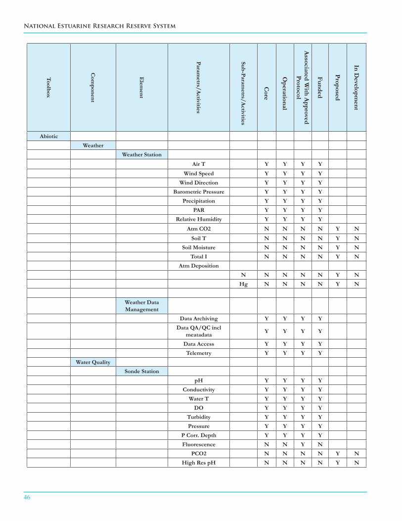
46
National Estuarine Research Reserve System
Toolbox
Com
ponent
Elem
ent
Parametrs/A
ctivities
Sub-Parametrs/A
ctivities
Core
Operational
Associated W
ith Approved
Protocol
Funded
Proposed
In Developm
ent
AbioticWeather
Weather Station
Air T Y Y Y Y
Wind Speed Y Y Y YWind Direction Y Y Y Y
Barometric Pressure Y Y Y YPrecipitation Y Y Y Y
PAR Y Y Y YRelative Humidity Y Y Y Y
Atm CO2 N N N N Y N
Soil T N N N N Y NSoil Moisture N N N N Y N
Total I N N N N Y NAtm Deposition
N N N N N Y NHg N N N N Y N
Weather Data Management
Data Archiving Y Y Y YData QA/QC incl
meatadata Y Y Y Y
Data Access Y Y Y YTelemetry Y Y Y Y
Water QualitySonde Station
pH Y Y Y YConductivity Y Y Y Y
Water T Y Y Y YDO Y Y Y Y
Turbidity Y Y Y YPressure Y Y Y Y
P Corr. Depth Y Y Y YFluorescence N N Y N
PCO2 N N N N Y NHigh Res pH N N N N Y N

SYSTEM-WIDE MONITORING PROGRAM PLAN
47
Toolbox
Com
ponent
Elem
ent
Parametrs/A
ctivities
Sub-Parametrs/A
ctivities
Core
Operational
Associated W
ith Approved
Protocol
Funded
Proposed
In Developm
ent
Abiotic (cont)Water Quality
(cont)Water Chemistry
NH4+ Y Y Y YNO3- Y Y Y YNO2- Y Y Y YPO4- Y Y Y YPCO2 N N Y N
Si N N Y NPN N N Y N
POC N N Y NDOC N N Y N
PHOSP N N Y NTDN N N N N Y NTDP N N N N Y NDIC N N N N Y N
Total Alkalinity N N N N Y NPhotosynthetic
Pigments
Chlorophyll
a Y Y Y Y
Water Column Radiation
Light Attenuation N N N N Y NIncident light N N N N Y N
PAR N N N N Y NWQ Data Management
Data Reporting Y Y Y YData Access Y Y Y Y
Data QA/QC incl metatdata Y Y Y Y
Telemetry Y Y Y Y

48
National Estuarine Research Reserve System
Toolbox
Com
ponent
Elem
ent
Parametrs/A
ctivities
Sub-Parametrs/A
ctivities
Core
Operational
Associated W
ith Approved
Protocol
Funded
Proposed
In Developm
ent
Abiotic (cont)Hydrology
Ground Water Wells Y Y Y Y
Ground Water Salinity Y Y Y Y
Pore Water Chemistry N N Y N
HydrodynamicsVelocity N N N N Y N
Volumetric Flux N N N N Y NRetention Time N N N N Y N
Turbulence N N N N Y NCirculation N N N N Y N
Stream Flow N N N N Y N
Sediment Analysis
Nutrients N N N N Y NTSS N N N N Y N
Pore Water Chemistry N N N N Y N
Accretion/Erosion rates
(SETs)N N N N Y Y
Biotic
Vegetation
Emergent Marsh Field Surveys
Species Composition Y Y Y Y%Cover Y Y Y Y
Stem Density (spp-1) Y Y Y YCanopy Height (spp-1) Y Y Y YMangrove Parameters N N N N Y Y
Biotic Productivtity N N N N Y NReproductive Capacity N N N N Y N
Grazing Pressure N N N N Y N
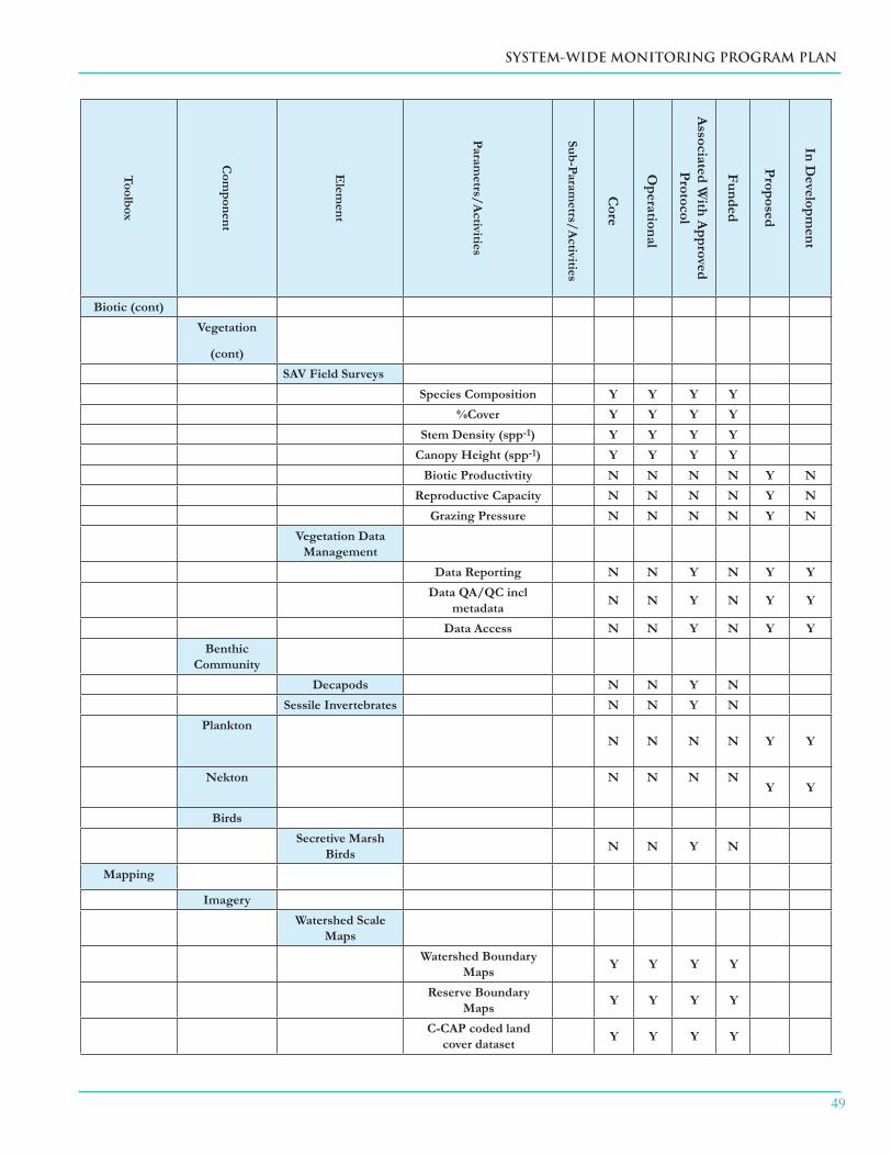
SYSTEM-WIDE MONITORING PROGRAM PLAN
49
Toolbox
Com
ponent
Elem
ent
Parametrs/A
ctivities
Sub-Parametrs/A
ctivities
Core
Operational
Associated W
ith Approved
Protocol
Funded
Proposed
In Developm
ent
Biotic (cont)Vegetation
(cont)SAV Field Surveys
Species Composition Y Y Y Y%Cover Y Y Y Y
Stem Density (spp-1) Y Y Y YCanopy Height (spp-1) Y Y Y Y
Biotic Productivtity N N N N Y NReproductive Capacity N N N N Y N
Grazing Pressure N N N N Y NVegetation Data
ManagementData Reporting N N Y N Y Y
Data QA/QC incl metadata N N Y N Y Y
Data Access N N Y N Y YBenthic
CommunityDecapods N N Y N
Sessile Invertebrates N N Y NPlankton
N N N N Y Y
Nekton N N N NY Y
BirdsSecretive Marsh
Birds N N Y N
Mapping
ImageryWatershed Scale
MapsWatershed Boundary
Maps Y Y Y Y
Reserve Boundary Maps Y Y Y Y
C-CAP coded land cover dataset Y Y Y Y
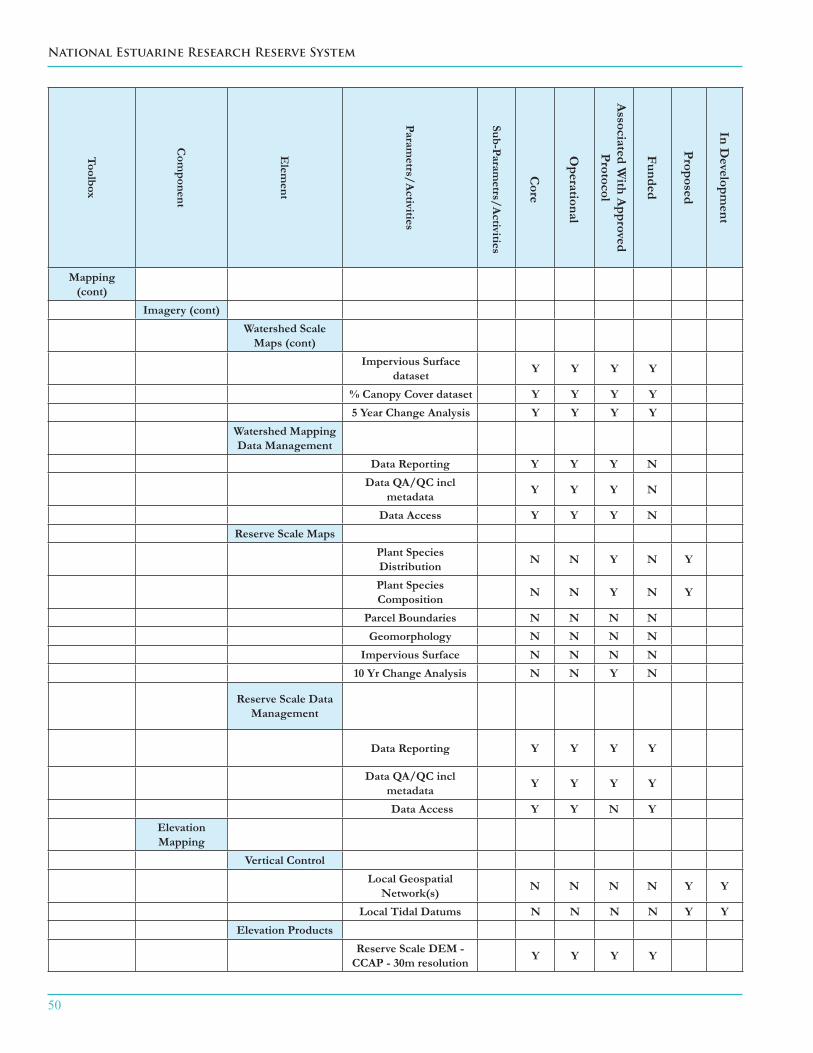
50
National Estuarine Research Reserve System
Toolbox
Com
ponent
Elem
ent
Parametrs/A
ctivities
Sub-Parametrs/A
ctivities
Core
Operational
Associated W
ith Approved
Protocol
Funded
Proposed
In Developm
ent
Mapping (cont)
Imagery (cont)Watershed Scale
Maps (cont)Impervious Surface
dataset Y Y Y Y
% Canopy Cover dataset Y Y Y Y5 Year Change Analysis Y Y Y Y
Watershed Mapping Data Management
Data Reporting Y Y Y NData QA/QC incl
metadata Y Y Y N
Data Access Y Y Y NReserve Scale Maps
Plant Species Distribution N N Y N Y
Plant Species Composition N N Y N Y
Parcel Boundaries N N N NGeomorphology N N N N
Impervious Surface N N N N10 Yr Change Analysis N N Y N
Reserve Scale Data Management
Data Reporting Y Y Y Y
Data QA/QC incl metadata Y Y Y Y
Data Access Y Y N YElevation Mapping
Vertical ControlLocal Geospatial
Network(s) N N N N Y Y
Local Tidal Datums N N N N Y YElevation Products
Reserve Scale DEM - CCAP - 30m resolution Y Y Y Y

SYSTEM-WIDE MONITORING PROGRAM PLAN
51
Toolbox
Com
ponent
Elem
ent
Parametrs/A
ctivities
Sub-Parametrs/A
ctivities
Core
Operational
Associated W
ith Approved
Protocol
Funded
Proposed
In Developm
ent
Mapping (cont)
Elevation Mapping (cont)
Elevation Products (cont)
Reserve Scale DEM - LIDAR N N N N
Bathymetry N N N NStudy Site DEM - RTK N N N N Y YElevation Profile - RTK N N N N Y Y
Substrate Surface Elevation - RTK N N N N Y Y
Vertical Control Data Management
Data Reporting N N N N Y YData QA/QC incl
metadata N N N N Y Y
Data Access N N N N Y YData Analysis and Synthesis
Annual Summary across all reserves
Y N N N Y Y
Biennial summary of
all core SWMP data at the
reserve level
Y N N N Y Y
5 year synthesis of key trends
and anomaliesY N N N Y Y
Periodic data synthesis and
analysisMonthly summaries
of data from all monitoring stations
N N N N

52
National Estuarine Research Reserve System
Toolbox
Com
ponent
Elem
ent
Parametrs/A
ctivities
Sub-Parametrs/A
ctivities
Core
Operational
Associated W
ith Approved
Protocol
Funded
Proposed
In Developm
ent
Data Analysis and Synthesis (cont)Regional summaries
and synthesis in relation to specific
management issues
N N N N
Additional summaries and reports across
multiple spatial and temporal scales
N N N N
Descriptions of significant environmental
events
N N N N
"Report Cards" of estuarine health or
conditionN N N N
Translation and Education
Tools
Web-based Graphing Tool Y Y Y Y
SWMP reference information including
parameters, sites, maps, and other
materials.
Y Y Y Y
SWMP presentations
and presentation templates
Y Y Y Y
SWMP data FAQ Y Y Y Y
Lesson plans Y Y Y Y
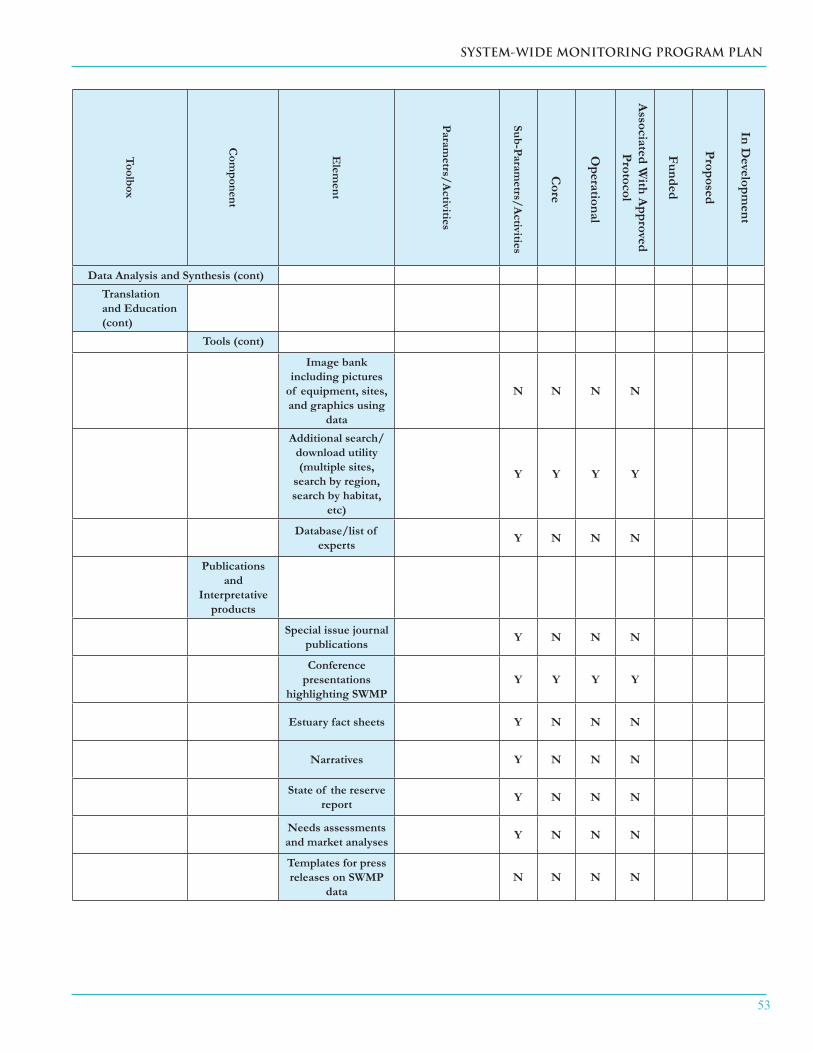
SYSTEM-WIDE MONITORING PROGRAM PLAN
53
Toolbox
Com
ponent
Elem
ent
Parametrs/A
ctivities
Sub-Parametrs/A
ctivities
Core
Operational
Associated W
ith Approved
Protocol
Funded
Proposed
In Developm
ent
Data Analysis and Synthesis (cont)Translation and Education (cont)
Tools (cont)
Image bank including pictures
of equipment, sites, and graphics using
data
N N N N
Additional search/download utility (multiple sites,
search by region, search by habitat,
etc)
Y Y Y Y
Database/list of experts Y N N N
Publications and
Interpretative products
Special issue journal publications Y N N N
Conference presentations
highlighting SWMPY Y Y Y
Estuary fact sheets Y N N N
Narratives Y N N N
State of the reserve report Y N N N
Needs assessments and market analyses Y N N N
Templates for press releases on SWMP
dataN N N N

54
National Estuarine Research Reserve System
Toolbox
Com
ponent
Elem
ent
Parametrs/A
ctivities
Sub-Parametrs/A
ctivities
Core
Operational
Associated W
ith Approved
Protocol
Funded
Proposed
In Developm
ent
Data Analysis and Synthesis (cont)Translation and Education (cont)
Reserve Staff Training
Performing and using needs
assessments for K-12 and decision-maker
audiences
Y N N N
SWMP for CTPs and coastal
decision-makersY N N N
Training in analyzing,
interpreting, and translating SWMP
data
Y N N N

SYSTEM-WIDE MONITORING PROGRAM PLAN
55
SWMP Standing Committee and Topical Workgroup List*
SWMP Guidance Committee (SGC)
SWMP Data Management Committee (DMC)
Abiotic Oversight Committee (AOC)
Biotic Oversight Committee (BOC)
Mapping Oversight Committee (MOC)
SWMP Interpretation Committee
Invasive Species Workgroup
Benthos Workgroup
Plankton Workgroup
Nekton Workgroup
Migratory Bird Workgroup
SAV/Emergent Vegetation Workgroup
SWMP Education Interface Workgroup
Other Related Workgroups
NERRS Climate Change Workgroup
NERRS Research Workgroup
Integrated Ocean Observing System (IOOS) Workgroup
*A complete list of members and documents for each committee and workgroup may be found on the NERRS Intranet site: https://www8.nos.noaa.gov/nerrsintranet/home.aspx
Appendix II
56
National Estuarine Research Reserve System
SWMP Application Module Example
Sentinel Sites for Sea Level Rise Impacts
DRAFT Guidelines for Establishing NERRS as Sentinel Sites for Understanding Climate Change (June 2011):
Background and Introduction:
In July 2008, the National Estuarine Research Reserve System (NERRS) released a strategic planning document entitled “Climate Change: Science, Education and Stewardship for Tomorrow’s Estuaries”. The document described a framework for the NERRS to build upon reserve system capabilities to address the challenges of climate change, and outlined several potential climate change impacts that were relevant to the reserves (e.g., changes in sea level, shifts in salt marsh extent, alterations in community structure, increased shoreline erosion, deteriorating water quality). The document also stressed the need to accurately measure climate impacts in order to better inform decision-making by the coastal management community. In November 2010, the NERRS established a climate change initiative, which provided a directive to better to understand, mitigate, and adapt to climate change impacts on estuaries and coastal communities.
The NERRS is currently establishing a “Sentinel Sites Program” that will leverage resources and partnerships to better understand the underlying processes and impacts of anthropogenic and natural stressors on coastal habitat and communities. The ultimate goal of this effort is to help determine reserve vulnerabilities to climate change, and to provide information that can help translate our understanding to coastal communities and coastal managers. The NERRS Sentinel Sites Network also supports a NOAA Sentinel Sites Program. The National Ocean Service, in partnership with the Climate Program Office, is developing a Sentinel Sites Initiative to address specific elements of climate change. The NOAA Sentinel Sites Programs will be initiated in locations where there are existing NOAA monitoring capabilities and where the investments of the many NOAA line offices can be leveraged most successfully.
The initial NERRS Sentinel Site Program is focused on monitoring and assessing the impacts of sea level change and inundation on coastal ecosystems. Specifically, the NERRS will link the existing long-term System-wide Monitoring Program (SWMP) to a network of specialized infrastructure that will allow precise measurements of the impacts of changing coastal water levels on key habitats (marshes and submerged vegetation) (Figure 3). It is important to note that inundation and sea level change are separate but interrelated factors that alter local water levels in coastal systems. Local sea level rise rates will vary significantly relative to the global average, and the responses of coastal habitats to the separate and combined effects of sea level changes and inundation are not well understood, because they function on different temporal scales. Inundation from storm surge, inland flooding, and shallow coastal flooding can be measured on short time scales and at the local level, while data on relative sea level trends is collected over longer time periods, and may be used in conjunction with numerical models and simulations to make predictions. However, both types of data collection require accurate linkages to local tidal and geodetic control datums.
Appendix III
SYSTEM-WIDE MONITORING PROGRAM PLAN
57
Definitions: The following definitions help frame the proposed NERRS activities:
Sentinel Site – A discrete location in coastal and marine environments that has the operational capacity for intensive study and sustained observations to detect and understand changes in the ecosystems they represent. Information and data from instruments and monitoring stations (“Sentinel Stations”) at the Site can be synthesized to provide an understanding of the ecological status and trends of the ecosystems’ structure and services within the Sentinel Site.
Sentinel Sites Network – Sets of Sentinel Sites whose integrated data and information streams provide a broad understanding of ecosystem conditions at temporal and spatial scales that are relevant to science and management priorities. Sentinel Sites Program – Collective assets and efforts that support and guide Sentinel Site or Sentinel Network priorities, concentrate and leverage capabilities and resources, and engage and support resilient coastal communities.
By these definitions, a reserve that contains essential infrastructure and programmatic support for monitoring and collecting other relevant information will serve as a sentinel site, a group of reserves that are collecting information to address the same management issue in a similar way make up a sentinel site network, and the various partners within and outside of NOAA and the NERRS that support and utilize the sentinel site network constitute a sentinel site program.
Several of the 28 reserves are well-positioned to function as sentinel sites because they have much of the necessary infrastructure and programmatic goals already in place. The challenge before us is to build a Sentinel Sites Network that will integrate the information and lessons learned at individual Sites into a cohesive product that will be useful to coastal managers and decision makers, as well as educators and others who need better information about potential climate change impacts on estuaries and coasts. Therefore it is important to develop Sentinel Sites at each reserve using a common approach and established protocols.
Required components (core elements) of a NERRS Sentinel Site: To understand how sea level change and coastal inundation affect estuarine habitats and ecosystems, the following must be developed by, or in place at a Sentinel Site reserve:
Identification of Appropriate Audiences and Management Issues: ■ Reserve staff, in collaboration with local and national stakeholders, should develop an explicit written plan and rationale for the use of the information generated by the Sentinel Site monitoring, and should clearly articulate the relevance to management issues.
Establishment of Programmatic Capacity: ■ Reserve staff must be trained to collect and analyze Sentinel Site data and ancillary information. The Sentinel Sites plan for each reserve must include planning for long-term continuous support (including funding) for Sentinel Site activities at the reserve. The plan should be incorporated into the reserve management plan.
Tidal Marsh, Mangrove, or SAV Monitoring: ■ Monitor the quantity and quality (through sampling vegetation transects) of tidal marsh vegetation in accordance with SWMP biological monitoring protocols for emergent or submersed vegetation1, and by use of appropriate habitat maps and mapping protocols2,3.
58
National Estuarine Research Reserve System
Wetland Sediment Change Measurements: ■ Measure relative elevation of wetland sediments using Surface Elevation Tables (SETs)4.
Vertical Reference System for Water Level Measurements: ■ Follow NOAA protocols and procedures for installing geospatial monitoring capacity, water level monitoring, and other elements. Working with NOAA’s National Geodetic Survey (NGS) and Center for Operational Products and Services (COOPS), Reserves will establish a local network of benchmarks tied to both local tidal datums and the National Spatial Reference System (NSRS). This local network will then be linked to SWMP monitoring locations, including vegetation monitoring transects and dataloggers5.
Ability to Detect Elevation Changes: ■ Conduct annual elevation surveys in the field at permanent vegetation transects, or produce a Digital Elevation Model (DEM) in the area of interest that is updated annually3.
Groundwater Measurements: ■ Measure water table dynamics over a selected time period (spring-neap tides), or conduct periodic spot measurements of water levels along vegetation transects1.
Water Quality Data: ■ Conduct continuous monitoring of core SWMP parameters including pH, turbidity, dissolved oxygen, and salinity6 at stations located adjacent to or within ecologically relevant proximity of sentinel site vegetation transects, and in accordance with NGS protocols for stability and data acquisition4,5.
Meteorological Data: ■ Conduct continuous monitoring of core SWMP parameters including temperature, relative humidity, barometric pressure, wind speed and direction, rainfall, and photosynthetic active radiation at stations located adjacent to or within ecologically relevant proximity of sentinel site vegetation transects6.
Data synthesis and translation: ■ The NERRS Centralized Data Management Office (CDMO) will provide support for new data related to biological monitoring studies, as well as information about sediment accretion, erosion, and subsidence (these will be associated with data from SET deployments as related to the local geodetic network elevations). Individual reserves will be required to track and maintain their local geodetic networks and associated elevations. A Sentinel Sites Oversight Committee will monitor reserve compliance6.
Potential Optional Elements (not an inclusive list)
Land Use Habitat Change Data ■
Tier 1 Vegetation Monitoring ■
Pore Water Analysis ■
Soils Analysis ■
Light Attenuation ■
Faunal Response ■
Watershed/Land Use Patterns ■
SYSTEM-WIDE MONITORING PROGRAM PLAN
59
Supporting documents:
1. Moore, K.R. (2009) NERRS SWMP Bio-Monitoring Protocol: Long-term Monitoring of Estuarine Submersed and Emergent Vegetation Communities. NERRS Technical Report.
2. SWMP Phase III: Land Use, Land Cover, and Habitat Change. (2009). NERRS Habitat Mapping and Change Technical Committee.
3. Mapping Land Use and Habitat Change in the NERRS: Standard Operating Procedures. (2009). NERRS Habitat Mapping and Change Technical Committee.
4. Accurate Elevations for Sea Level Rise Sentinel Sites. (in prep). The National Estuarine Research Reserve System, NOAA National Geodetic Survey, NOAA Center for Operational Oceanographic Products & Services.
5. Accurate Elevations in Coastal Parks: Preparing and Planning for Impacts of Climate Change (in review). The National Estuarine Research Reserve System, NOAA National Geodetic Survey, NOAA Center for Operational Oceanographic Products & Services.
6. National Estuarine Research Reserve System System-wide Monitoring Program Plan (2011). NERRS SWMP Guidance Committee.

60
National Estuarine Research Reserve System
Figure 3. Sentinel Sites Conceptual Model


62www.nerrs.noaa.gov September 2011