Embed Size (px)
Citation preview

1
Summer of ’64on the Nelson RiverPlanning northern projects for southern beneficiaries
A PERSONAL MEMOIR BY BRIAN GROVER

2
This very personal note was pre-pared initially for my family: my
siblings, children and grandchil-dren. It describes my situation half a century earlier, working during three summer months in 1964 as a young engineer in northern Mani-toba. This note is about an historic, small part of the ongoing saga of Manitoba Hydro’s planning and de-velopment of the Nelson River flows to generate electricity.
I am also glad to share this re-flection with the families of the four Cree workmen from Cross Lake, key members of our survey team, without whom we could not have undertaken this challenging task. This note is dedicated to them: Charles Osborne, Lazarus Monias, John Monias and Jack Miley McKay.
My hope is that some readers may be interested in this story and the accompanying photos from that pe-riod. Perhaps it will cause them to think anew, as I am, about the chal-lenging conditions which affect First Nations in northern Manitoba.
~ Brian Grover, April 2017
CONTENTS
About this e-book ............................................................................................. 3
A. Reflectingonthesummerof19641. Introduction ..................................................................................................... 42. Summary of 1964 hydrometric survey ...........................................................123. Personal observations in 2016 ........................................................................ 20
B.Maps1. Nelson River from Lake Winnipeg to Hudson Bay ...........................................282. Nelson River Watershed .................................................................................. 293. Hydro Development in Northern Manitoba ....................................................30
C.Excerptsfrom1964hydrometricsurveyreport .............................................31
BrianGroverin2016
3
Aboutthise-bookIt began in mid-2016 as a binder with text explaining my
old photos, written primarily for my family, as well as for the families of my Cree co-workers. Later I wrote a sev-en-page article titled “Hydrometric Surveys of the Nelson River in the 1960s”, which was published in the Spring 2017 Journal of the Manitoba Historical Society (pp. 25-30).
This e-book would not have happened without the in-spiration and support of others. My brother Richard helped awaken me to some of the envi-ronmental issues facing First Nations in northern Manitoba. He then in-troduced me to William Osborne, through whom I also met Jackson Os-borne and John Angus Monias – all descen-dents of the Cree men with whom I had en-joyed working in 1964. My sister Sheila offered encouragement and editorial advice, as did Kirby Gilman of Manito-ba First Nations Educa-tional Resource Centre. My brother Paul provided the 1990 photo of Priscilla Island (now named Ship Island). Manitoba Hydro staffers Bruce Owen and Dale Hutchison kindly provided the maps in Section B of this document. My wife Patrice offered constructive and insightful com-ments. Jim Burgoyne (coincidentally a former worker on Nelson River power projects) worked his editorial magic by converting my amateurish, personal essay into this attrac-tive e-book. Errors and omissions likely remain, however, and nobody but me is responsible for them.
This e-book can be obtained free of charge from the web-site of the Manitoba Historical Society at: www.mhs.mb.ca/docs/memoirs.

4
A. Reflectingonthesummerof’64
1. IntroductionThe drainage basin of the Nelson River is huge, more than one
million square kilometres (414,000 square miles) from four Ca-nadian provinces and two USA states. This area is slightly larger than the combined area of France and Germany. The river flows northward about 644 km (400 miles) from Lake Winnipeg to Hud-son Bay. Because of the difference in elevation between the lake and the bay (about 217 metres or 713 feet) and the large volume of water flowing (averaging about 2,300 cubic metres a second or 84,000 cubic feet a second), the river had been identified for many years as a future source of electric power.
Manitoba Hydro had already developed the Kelsey hydro plant in 1957 to provide power to an isolated mining operation and the associated town of Thompson. Surveys and studies about future
BriantriesonamooserackatthestartoftheNelsonRiversurveyinJune1964

5Water-levelviewoftheeastchannelatWhitemudFalls
ViewfromafloatplaneofWhitemudFallsintheupperNelsonRiver

6
prospective power sites along the rest of the Nelson were well un-derway in the 1950s and 1960s.
Hydrometric surveys are intended to augment planning data by exploring the profile and cross sections of the river bottom. Such surveys also measure flows, attempting to correlate flow volumes with water levels. Manitoba Hydro had been undertaking such surveys in previous years and was planning for the 1964 open water season when I learned about them.
In the summer of 1960 I had worked for Manitoba Hydro as an engineering student (third year at University of Manitoba). I was hired to work there again after graduating as a civil engineer in May 1961.
However, I left Manitoba Hydro in September 1961 because I was awarded an Athlone Fellowship for two years of post-graduate experience in the United Kingdom. I worked there during the first year (practical stages with English Electric re water turbines, and then with Binnie & Partners, consulting engineers). In my sec-ond year I studied at the London School of Economics, earning a post-graduate diploma in Business Administration.
I returned to Manitoba Hydro in 1963 and began working in the power production part of the utility, dealing with reservoir opera-tions for hydro plants on the Winnipeg and Saskatchewan Rivers.
Atcampwithpetgoose:(l-r)Peter(cook),JohnW.,JohnM,Jack,Lazarus,PeterQandCharlie
7
Concurrently I began studying again at the University of Manito-ba, taking two courses towards a Masters degree in water resourc-es engineering. I was single, living at home and reconnecting with my family and friends after being away for two years.
In early 1964, I asked my employer for the opportunity to par-ticipate in that summer’s hydrometric survey of the Nelson River, partly because of my graduate studies, and partly because I want-ed more experience. In April the head of Engineering (Jim Rettie) approved me to lead the crew, and my bosses in Production (Len Bateman, Jack Atchison and Karl Renger) agreed to transfer me to a different part of the utility for the summer.
That summer became a very important stage in my life (then age 25). I learned a lot: about the geography and cultures in my home province of Manitoba; about survey work in the challenging environment of the Nelson River; and about myself. I particularly appreciated the chance to work in northern Manitoba with four Cree boatmen whom we hired at Cross Lake as key members of that year’s hydrometric survey crew.
I recently discovered some photos from that era. Because my ten grandchildren (Sean, Colin, Sabrina, Owen, Norah, Johan, Nicole, Kirsten, Ruth and Jacquie) are all near the beginning of their own careers, I thought it might be interesting to reflect on that special
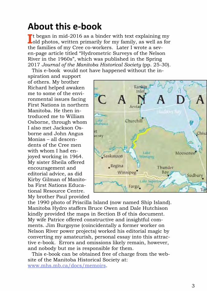
CharlieandLazarusatEve’sFallsatupperNelsonRiver
8
summer, and to share some photos and ideas — especially with the youngest generation of my family and their parents (my four children – Steven, Sharon, Barry and Colleen), and also with my siblings (Paul, Sheila, Kathy, Jane and Richard).
While researching and writing this document I learned that families of the Cree members of our crew (all since deceased) were interested in photos and stories from that period. So this reflec-tion has been explicitly prepared to be shared with them. In July 2016, I met with a few members of the Cross Lake (Pimicikamak) Cree people and provided them with copies of an earlier version of this document. It was a great pleasure for me (along with my brother Richard Grover) to meet these four individuals in Winni-peg: Jackson Osborne; William Osborne and his wife Joyce; and John Angus Monias. Jackson and William are the sons of Charles Osborne, and John Angus the son of Lazarus Monias.
My reflection (Section A of this document) continues after this introduction with two other parts. Part 2 summarizes our 1964 field work along the entire Nelson River. Part 3 comprises some emerging personal observations about what I have learned from this work along the Nelson River, a critical region of my home province, some five decades after these events took place.
The three components of this reflection are supported by my old
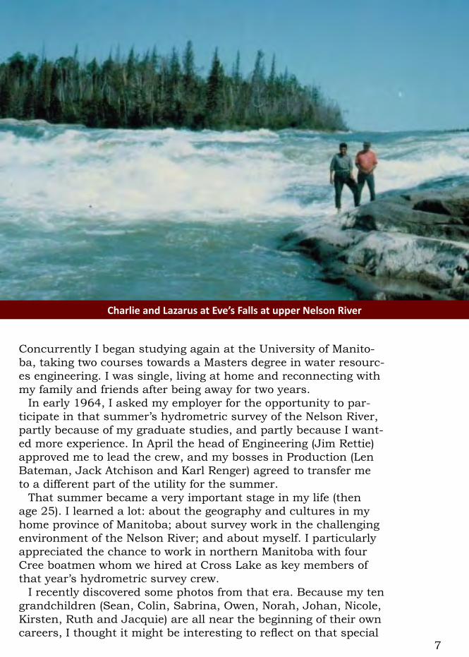
Arubberboatnavigatesthewaterabovetherapidsbeforeaportage
9
photos (originally 35mm slides), plus two background documents: a personal journal in which I had recorded facts and ideas while in the field; and a recently discovered report which I had prepared within Manitoba Hydro at the end of the 1964 hydrometric sur-vey.
Section B includes three maps, depicting the immense water-shed of the Nelson River. Also depicted on the maps, provided by Manitoba Hydro, are the northern region of Manitoba, including the Nelson River, and all existing hydro power developments.
Section C, key excerpts from my 1964 report to Manitoba Hydro completes this reflection.
That summer’s experiences have recently been interpreted by a much different Brian Grover than the young engineer who worked on the Nelson River in 1964. I am now 77 years old, having retired 17 years ago after a very satisfying career, mostly in managing and developing water resources in developing countries. My prin-cipal employers were the Canadian International Development Agency (CIDA) and the World Bank. Through the lens of my life-time experiences, I am now trying to interpret and explain what I recall from working 52 years ago on the Nelson River.
I visit Manitoba regularly because four of my five siblings still live there, but I have not myself lived in Manitoba since I moved
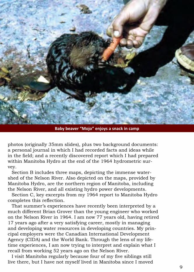
Babybeaver“Mojo”enjoysasnackincamp
10
away in 1965. I have never returned to the Nelson River. Accord-ingly I am trying to describe the 1964 survey without any experi-ence about how the northern Manitoba region has changed since then. Some of the names of locations and potential power sites are different today than they were in 1964. The place formerly known as the Cross Lake Indian Reserve, for example, is now referred to as Pimicikamak by people of the Cree First Nation who live there (population now about 8,000 — certainly much larger than when I visited in 1964).
Another change concerns the quality of the water in the Nel-son River. When I was working there the water was clear, of high quality, so clean and fresh that we drank it directly from the river. We ate the fish we caught there without any second thoughts. In fact I was personally surprised by this reality, as I had known the waters of Lake Winnipeg to be turbid and murky in the populated southern portion of the lake, where the Red River enters the lake. I had been unaware of that lake’s ability to act as a huge, natural sedimentation basin, allowing outflows into the Nelson River from the north end of the lake to be crystal clear.
As an occasional summer tourist to family cottages around southern Lake Winnipeg, I am aware that water quality in this large lake (especially the smaller southern portion) has decreased
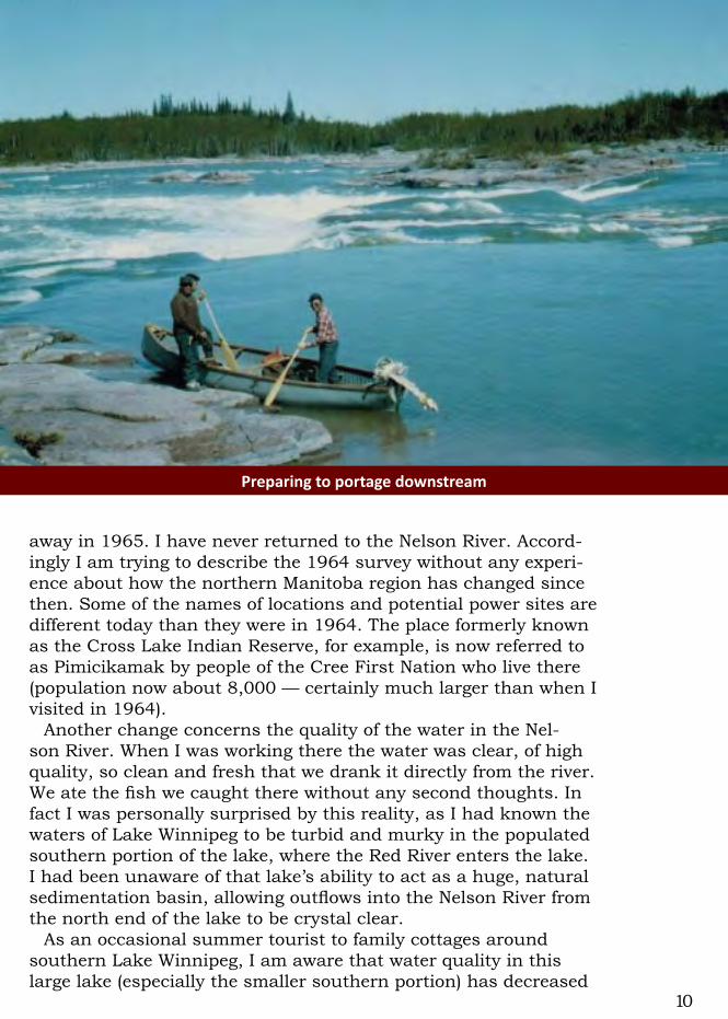
Preparingtoportagedownstream
11
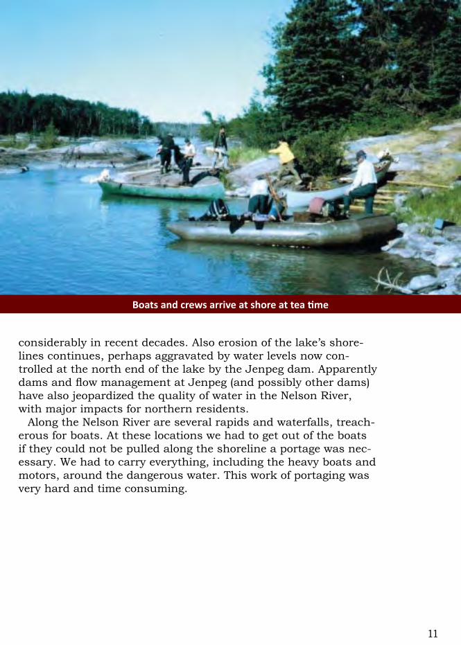
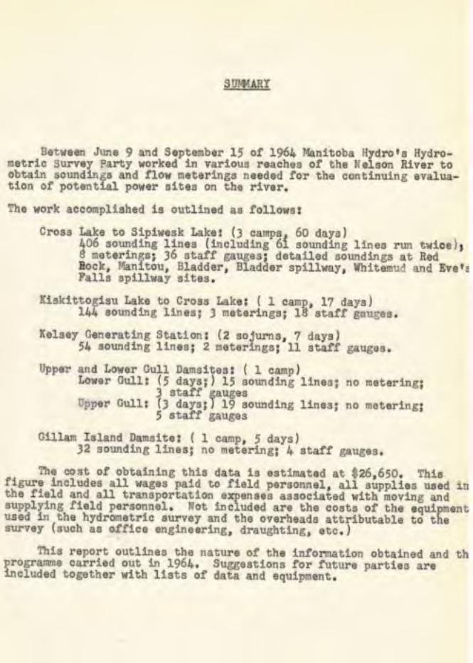
considerably in recent decades. Also erosion of the lake’s shore-lines continues, perhaps aggravated by water levels now con-trolled at the north end of the lake by the Jenpeg dam. Apparently dams and flow management at Jenpeg (and possibly other dams) have also jeopardized the quality of water in the Nelson River, with major impacts for northern residents.
Along the Nelson River are several rapids and waterfalls, treach-erous for boats. At these locations we had to get out of the boats if they could not be pulled along the shoreline a portage was nec-essary. We had to carry everything, including the heavy boats and motors, around the dangerous water. This work of portaging was very hard and time consuming.
Boatsandcrewsarriveatshoreatteatime

12
2. Summary of 1964 hydrometric surveyIn the previous year (1963) the hydrometric crew had been led
by engineer Dave Pashniak. In 1964 he accompanied me to the field to introduce me to the practical realities of this job, and to help the current year’s survey team get started. The chronological record of our work is explained in my 1964 report (in Part C of this document).
Five of us departed Winnipeg by CNR train on June 9: Dave, three engineering students (Peter Quinn, John Westdal and Al Millar) and myself. The next day we disembarked at Wabowden and were flown by Beaver float plane of the Manitoba Government Air Service (MGAS) to our first camp at Red Rock Rapids. There a separate Manitoba Hydro crew, led by John Veen and Jim Field, was exploring a potential dam site.
I flew with Jim Field and Dave Pashniak to Cross Lake on June 11 to recruit Cree boatmen for our summer’s work. The four peo-ple we sought, based on their extensive previous experience, were all available: Charles Osborne, Jack Miley McKay, John Monias & his brother Lazarus Monias. I learned subsequently that only John had attended school (possibly St. Joseph’s Residential
Teatime,lateintheseason:(l-r)Lazarus,Peter,JohnW.,Charlie,JackandBrian

13
School) and was fluent in English, and that none of these four ex-cellent workers ever had jobs under a roof. They had earned great reputations for being reliable, hard working and wise. All four ar-rived at our campsite in their own boats the next morning and our summer’s work began.
Our surveyors were three engineering students plus myself (overall crew leader and sonar operator). Our crew also included an experienced bush cook, Peter Wilchovy, who could make won-derful food on his portable, wood-burning tin stove.
There were four main tasks for our field crew of eight (four hy-drometric surveyors and our four boatmen):
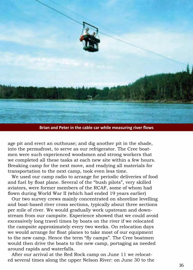
• Estimating river flows by measuring the cross section of the river (by a sonar depth finder) and the speed of the water (by a current meter), usually done from a boat attached to a temporary cable across the river. Also done occasionally from a cable car on a semi-permanent cable across the full width of the river;
• Determining the bottom of the river by sonar depth recorder from the rubber boat (Zodiac type) with 35 HP motor. To indicate the location of each depth measurement obtained by sonar, we used a stadia board on the boat, in radio contact with the sur-veyor using a transit on the shore, to measure the distance to the moving boat as it crossed the river;
DavePashniakandanMGASpilotasthesurveyseasonissettobegin

14
• Installing and reading automatic water level recorders at a few selected locations; and
• Determining the elevation along the shoreline at each water level recorder and cross section by means of a levelling survey crew (two surveyors and two boatmen). This levelling crew moved in a canoe with a 10 HP motor.
We would work long days (typically 10 to 12 hours, or occasion-ally more) from Monday to Saturday. When we worked near Cross Lake, our boatmen would return home for Sundays. Those of us southerners who stayed in camp would relax, go fishing (lots to catch), read, do laundry, write letters, or even go water skiing.
Initially we worked on the upper Nelson River in the general vicinity of Cross Lake, starting at the Red Rock camp, doing hy-drometric surveys to complement the land-based explorations by separate crews. During the summer we worked from seven differ-ent camp sites, as explained in my 1964 report – Section C, which follows.
Each time we relocated to a new campsite we had some rou-tine chores: build a temporary dock for boats and float planes; clear the campsite of unwanted trees; set up our three big tents on freshly cut poles (sleeping quarters for the surveyors and for the boatmen, plus a large cook tent and dining room); dig a sew-
Depth-soundingcrew:(l-r)BrianGrover,CharlieOsborne,LazarusMoniasandPeterQuinn
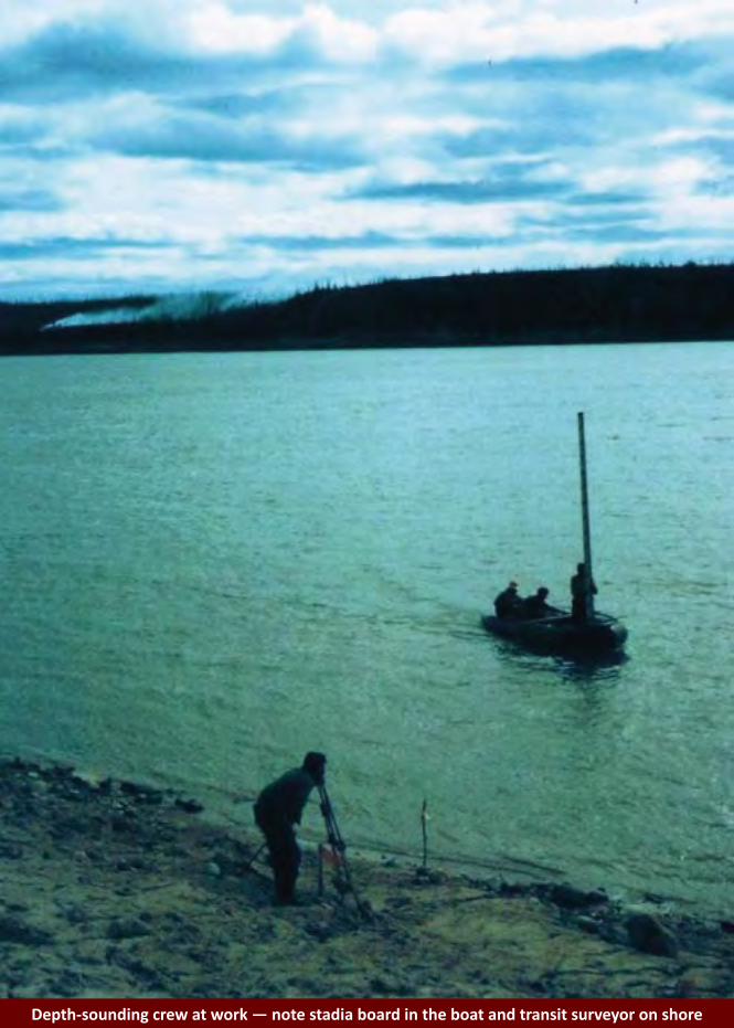
15Depth-soundingcrewatwork—notestadiaboardintheboatandtransitsurveyoronshore
16
BrianandPeterinthecablecarwhilemeasuringriverflows
age pit and erect an outhouse; and dig another pit in the shade, into the permafrost, to serve as our refrigerator. The Cree boat-men were such experienced woodsmen and strong workers that we completed all these tasks at each new site within a few hours. Breaking camp for the next move, and readying all materials for transportation to the next camp, took even less time.
We used our camp radio to arrange for periodic deliveries of food and fuel by float plane. Several of the “bush pilots”, very skilled aviators, were former members of the RCAF, some of whom had flown during World War II (which had ended 19 years earlier)
Our two survey crews mainly concentrated on shoreline levelling and boat-based river cross sections, typically about three sections per mile of river. We would gradually work upstream and down-stream from our campsite. Experience showed that we could avoid excessively long travel times by boats on the river if we relocated the campsite approximately every two weeks. On relocation days we would arrange for float planes to take most of our equipment to the new camp. Hence the term “fly camps”. The Cree boatmen would then drive the boats to the new camp, portaging as needed around rapids and waterfalls.
After our arrival at the Red Rock camp on June 11 we relocat-ed several times along the upper Nelson River: on June 30 to the
17
Whitemud Channel; on July 14 to the Ominawin Channel; and on July 31 to Bladder Rapids, where we stayed longer than usual because we were also requested to survey the “thalweg” (deepest line along the channel).
Treaty time at Cross Lake in 1964 was from August 21 to 23, during which time all of our Cree boatmen returned home. Some of us surveyors also visited Cross Lake then (discovering how diffi-cult it was, without our experienced Cree boatmen, to navigate in the Nelson River). We were treated to wonderful hospitality by the Cross Lake residents during that festive time.
On August 25 and 26 we relocated to the lower Nelson River, near Kelsey, where we completed more detailed surveys of the river around the powerhouse. On August 31 and September 1 it took three loads on the big Otter float plane to deliver all our gear (including the two boats) to our next camp near Gillam Island. On September 5 we flew to our final camp at Gull Rapids.
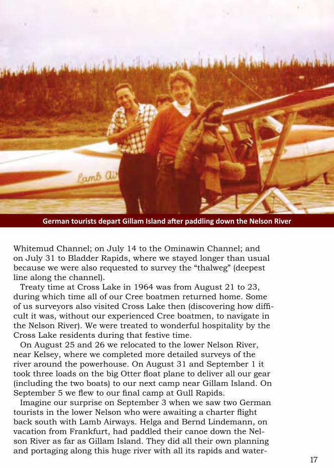
Imagine our surprise on September 3 when we saw two German tourists in the lower Nelson who were awaiting a charter flight back south with Lamb Airways. Helga and Bernd Lindemann, on vacation from Frankfurt, had paddled their canoe down the Nel-son River as far as Gillam Island. They did all their own planning and portaging along this huge river with all its rapids and water-
GermantouristsdepartGillamIslandafterpaddlingdowntheNelsonRiver
18
falls. Brave and energetic people, for sure!The weather in northern Manitoba deteriorated, giving us our
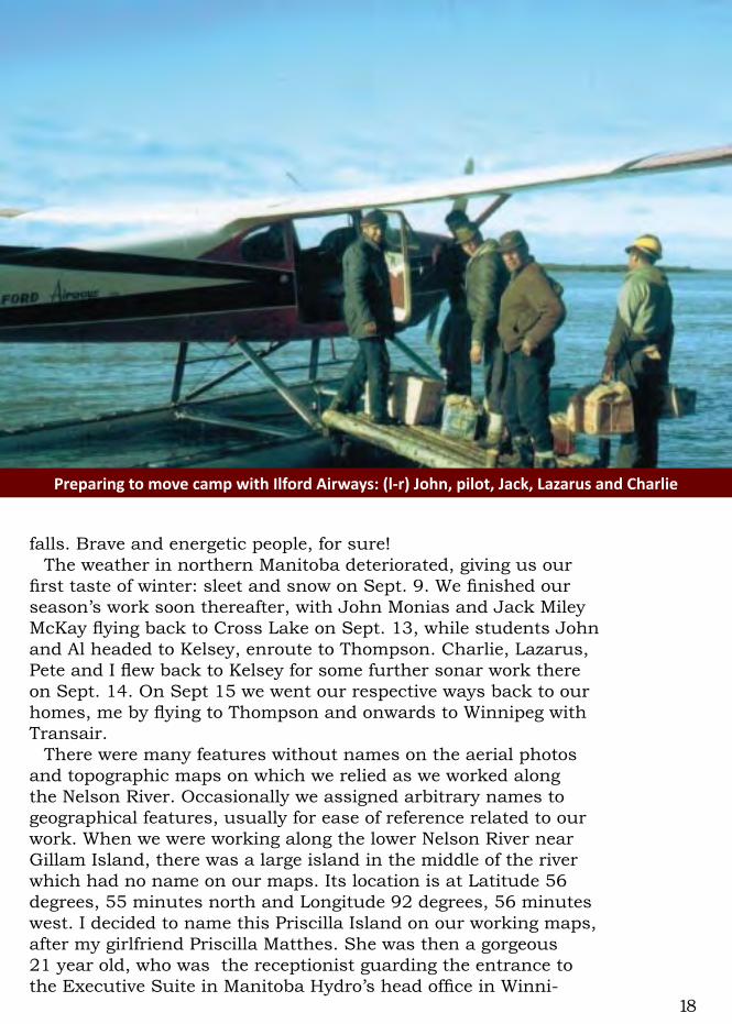
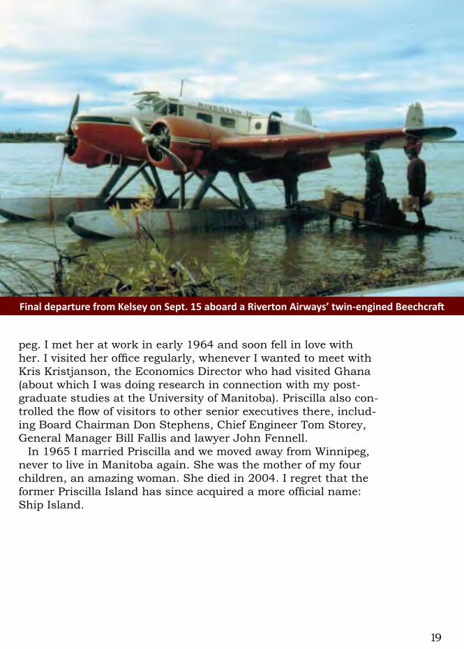
first taste of winter: sleet and snow on Sept. 9. We finished our season’s work soon thereafter, with John Monias and Jack Miley McKay flying back to Cross Lake on Sept. 13, while students John and Al headed to Kelsey, enroute to Thompson. Charlie, Lazarus, Pete and I flew back to Kelsey for some further sonar work there on Sept. 14. On Sept 15 we went our respective ways back to our homes, me by flying to Thompson and onwards to Winnipeg with Transair.
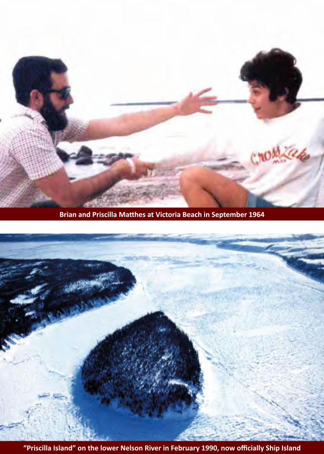
There were many features without names on the aerial photos and topographic maps on which we relied as we worked along the Nelson River. Occasionally we assigned arbitrary names to geographical features, usually for ease of reference related to our work. When we were working along the lower Nelson River near Gillam Island, there was a large island in the middle of the river which had no name on our maps. Its location is at Latitude 56 degrees, 55 minutes north and Longitude 92 degrees, 56 minutes west. I decided to name this Priscilla Island on our working maps, after my girlfriend Priscilla Matthes. She was then a gorgeous 21 year old, who was the receptionist guarding the entrance to the Executive Suite in Manitoba Hydro’s head office in Winni-
PreparingtomovecampwithIlfordAirways:(l-r)John,pilot,Jack,LazarusandCharlie
19
peg. I met her at work in early 1964 and soon fell in love with her. I visited her office regularly, whenever I wanted to meet with Kris Kristjanson, the Economics Director who had visited Ghana (about which I was doing research in connection with my post-graduate studies at the University of Manitoba). Priscilla also con-trolled the flow of visitors to other senior executives there, includ-ing Board Chairman Don Stephens, Chief Engineer Tom Storey, General Manager Bill Fallis and lawyer John Fennell.
In 1965 I married Priscilla and we moved away from Winnipeg, never to live in Manitoba again. She was the mother of my four children, an amazing woman. She died in 2004. I regret that the former Priscilla Island has since acquired a more official name: Ship Island.
FinaldeparturefromKelseyonSept.15aboardaRivertonAirways’twin-enginedBeechcraft

20
3. Personal Observations in 2016Since we parted in mid-September of 1964, I have never seen
any of the men with whom I had enjoyed working on the Nelson River. All four of our boatmen have reportedly died, probably our cook Pete, too. Who knows about those three students, who would all be in their 70s, if still alive.
Our nine man crew had spent just over three months together, working together very well in challenging circumstances, relying on one another for friendship as well as for our survival – espe-cially us southerners, who could not possibly have completed the work without our excellent Cree boatmen. I continue to hold them in my memory with great respect. Charlie, Miley, John and Lazarus taught me much, especially about working hard and cop-ing well in the tough environment of northern Manitoba, where few people lived.
I have since realized that Manitoba Hydro has been well served by many northern residents over many decades. In fact the Cree nation (and others) has been helping foreigners from Europe for more than three centuries, since the Hudson’s Bay Company was
Peter(left)andLazarusliningtherubberboatuptherapids

21
established in 1670. I feel very privileged to have enjoyed working in northern Manitoba with these reliable, friendly Cree workmen on our hydrometric survey crew. Now I realize that I was partici-pating in a process of working with northern Manitoba residents that had begun many generations before, and still continues.
What I also recognize now, but did not fully appreciate in 1964, is that the standard of living in this remote, northern part of Manitoba is significantly lower than that enjoyed in the urban and rural areas of southern Manitoba. Standard measurements of the quality of life include shelter, education, income, diet, drink-ing water supply, sanitation, health services and life expectancy. By these standards, most northern Manitobans (especially First Nations people) live in much worse conditions than other typi-cal Canadians. In fact the quality of life for residents in northern Manitoba – nowadays as in 1964 – is typical of the many poor, de-veloping countries where I mostly worked in my engineering and management career.
We Canadians face huge challenges in creating a just society. First Nations people, who were present long before immigrant settlers arrived from many other countries, should be able to en-joy the high standard of living which most other Canadians have achieved. I scarcely understood this fundamental reality when I
CrewpreparestoportageonthelowerNelsonRiver—notethesnowontheboat
22
worked along the Nelson River in 1964. After departing from Manitoba Hydro in mid-1965, the next step
in my career began in Kenya, where I lived and worked as a water supply manager for 3-1/2 years. Thereafter I moved to Washing-ton DC where I worked for seven years with the World Bank as a sanitary engineer. During this decade and afterwards, I learned much more about the critical importance of enabling poor people to gain access to safe drinking water and proper sanitation, as vital pre-conditions for good health. Although this issue became the focus for most of my career, I was almost always dealing with situations in developing countries, but never in Canada.
When I retired from the World Bank in 1999 and returned to Canada (initially living on a lake in west Quebec, near Ottawa), my only real link with my previous career was though some vol-untary service on the board of WaterCan, a non-governmental organization concentrating on water and sanitation services in developing countries. In other words, still no personal focus on the poverty, poor infrastructure and very low standards of living in First Nations communities across Canada, especially in Cross Lake where I had once worked. Why not? I sincerely wish that I had a good answer to this troubling question.
My belated awareness about the very important and complex
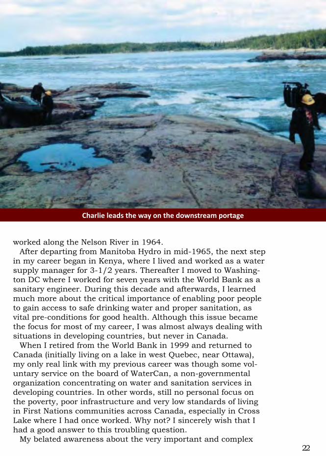
Charlieleadsthewayonthedownstreamportage

23
issues afflicting First Nations people has possibly been stimulated by three factors. The first was moving in 2010 to Vancouver Is-land in British Columbia, where First Nations people and issues are much more central in local politics and social consciousness than I can recall in either Ottawa or Winnipeg. Secondly, the recent work of the Truth and Reconciliation Commission, whose summary report was published in 2015, has compelled me (like many other Canadians) to recognize that racism and wrong-head-ed policies have guided decision making about aboriginal people in Canada from our nation’s earliest days, and still do in many instances. The third possible factor in raising my awareness was the shocking news in March 2016 about the suicide crisis among First Nations youth in Pimicikamak.
In other words, my persistent lack of awareness about so-cial and technical challenges facing First Nations people along the Nelson River was probably due to the fact that I had almost completely forgotten my experience and contacts there in 1964. Furthermore I had not lived in Manitoba since 1965, so had no awareness of the ongoing saga of hydro power developments by Manitoba Hydro, and their impacts on the environment and resi-dents in northern Manitoba.
My recent exercise of thinking about this special stage in my
Twostrongmenportageoneheavyboat

24
life has triggered a belated recognition about such critical issues. I am grateful to have been awakened about them – but unhappy with myself for not having been involved in understanding the challenges much earlier, and becoming involved in efforts to re-dress the problems which I have just begun to recognize.
Through my brother Richard, a retired teacher in Winnipeg, I have established contact with some of the sons of the Cree work-ers who participated in our 1964 survey (as well as much other work for Manitoba Hydro). Two of these men, Jackson and Wil-liam Osborne, are the sons of Charlie Osborne, who passed away in 2006. Jackson and William have explained to me that their father was shocked, towards the end of his life, by the devastation and destruction of land and water resources in the region around Cross Lake. Charlie reportedly told his family that he regretted having done the work he did – with me and with many other tech-nical people from southern communities. He stated that he would not have done this work if he had understood the consequenc-es which followed. I found this testimony – from a man whom I greatly respected – very disturbing.
Richard has advised me that such comments by northern Man-itoba residents have been heard repeatedly by the Interchurch Council on Hydro (formerly the Interfaith Task Force on Northern
CookPeterWilchovywithcrew:(l-r)Lazarus,Jack,Charlie,PeterQ.,JohnW.andJohnM.
25
Hydro Development). Apparently the development and operation of hydro power projects in northern Manitoba has caused many environmental changes which were not anticipated by local peo-ple. One wonders whether staff or consultants of Manitoba Hy-dro, or the governments who have approved these many projects (depicted on the maps which follow in Section B), had predicted and understood such environmental consequences. If so, had they considered appropriate mitigation measures? Has the gen-eral public been made fully aware of both the potential (or actual) problems, as well as alternative measures to mitigate such prob-lems?
Furthermore the massive power developments along the Nelson River, costing many billions of dollars so far (with still more plants planned for the future), provide their electric power benefits pri-marily for residents who mostly live in southern Manitoba. North-ern residents suffer almost all of the environmental costs. An in-dependent outsider can reasonably wonder whether this situation is deliberate, or accidental, or just. More importantly for present and future generations, what actions need to be taken now to remedy these apparently critical problems?
My hope is that all of our society will soon appreciate the unfair and unjust reality that too many people, especially the First Na-
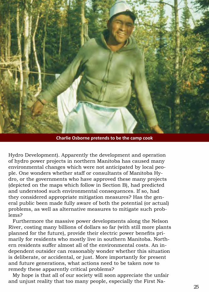
CharlieOsbornepretendstobethecampcook
26
tions, are not yet participating in the prosperity and happiness that accompanies the relatively high standard of living enjoyed by most Canadians. In northern Manitoba there seem to be signifi-cant environmental consequences and costs which should war-rant much public and governmental attention.
I am not sure what I can do personally about this issue, since I still know relatively little about the actual situation, which must surely be complex. Also I probably don’t have enough time or en-ergy to make any significant impact on these major issues at this late stage in my life. Nevertheless I do hope to find some construc-tive role which I can play.
Engineers like me have been trained in the scientific method of problem solving, of which the very first step is to recognize and define the problem. Hopefully some readers of this reflection, including my own children and grandchildren, plus their genera-tion of leaders, will better recognize the issues and opportunities associated with power developments along the Nelson River. The obvious next step will be to take action to help deal with these problems. If such efforts are taken, my belated efforts to create and share this reflection may have been worthwhile.
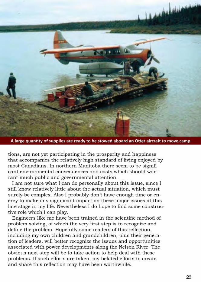
AlargequantityofsuppliesarereadytobestowedaboardanOtteraircrafttomovecamp
27
BrianandPriscillaMatthesatVictoriaBeachinSeptember1964
“PriscillaIsland”onthelowerNelsonRiverinFebruary1990,nowofficiallyShipIsland
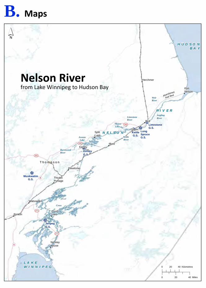
B. Maps
!(6
¾À373
¾À373
!(6
¾À391
¾À280
¾À280
!(
!(
!(
!(
!(
!(
!(
!(
!(
!(
!(
!(
!(
N E L S O N
R I V E R
H U D S O NB A Y
L A K EW I N N I P E G
Wabowden
Ponton
Herchmer
Ilford
Gillam
Kelsey
SplitLake
Pikwitonei
CrossLake
ThicketPortage
NorwayHouse
PortNelson
Bird
Cross
Lake
AsseanLake
LimestoneRiver
BurntwoodRiver
WeirRiver
AnglingRiver
KettleRiver
MooseLake
SplitLake
Abandoned
Rail Bed
T h o m p s o nT h o m p s o n
KelseyG.S.
LongSpruceG.S.
LimestoneG.S.
KettleG.S.
JenpegG.S.
WuskwatimG.S.
´
0 20 40 Miles
0 20 40 Kilometres
NelsonRiverfrom Lake Winnipeg to Hudson Bay

29
!
!
HU
DS
ON
BA
Y
USA
CANA
DA
LAK
EO
F T
HE
WO
OD
S
LA
KE
WI
NN
IP
EG
LA
KE
MA
NI
TO
BA
SO
UTH
ER
NIN
DIA
NLA
KE
AS S I N
I BO
I NE
RIV
ER
BURNTW
OO
D R
IVE
RC
HU
RC
HI L
L R
I VE
R
NO
RTH
SA
SK
AT C
HE
WA
N R
I VE R
SA
SK
AT
CH
EWA
N R
I V
E R
SOU
TH S
ASKA
TC
HE
WA
N R
I VE
R
WI N
NI P
EG
RI V E R
GIL
LAM
CH
UR
CH
ILL
NELSON RIV
ER
RED RIVER
Proj
ectio
n:
NA
D_1
983_
UTM
_Zon
e_15
ND
ata
Sour
ce: M
anito
ba H
ydro
, NTD
B, P
FRA
, ESR
I
±
Wat
ersh
ed A
rea
Con
trib
utin
gto
the
Low
er N
elso
n R
iver
012
525
0M
iles
012
525
0Ki
lom
etre
s
20°W
30°W
50°W
80°W
80°W
90°W
100°
W11
0°W
120°
W
120°
W15
0°W
170°
W18
0°
60°N
50°N
50°N
40°N
40°N
30°N
30°N
20°N
20°N
Lege
ndC
HU
RC
HIL
L R
IVER
DIV
ERSI
ON
WAT
ERSH
EDC
hurc
hilll
Riv
er D
iver
sion
Wat
ersh
ed
Nel
son
Riv
er W
ater
shed
Map
4.3
-1

DATA SOURCE:
DATE CREATED:
CREATED BY:
VERSION NO:
REVISION DATE:
QA/QC:
COORDINATE SYSTEM:
#*
#*
ÚÕ
ÚÕ ÚÕÚÕ
ÚÕÚÕ
ÚÕ
ÚÕ
ÚÕ
ÚÕ
ÚÕ
#*
!(
!(
!(
!(
CEDAR
LAKE
LAKE WIN LAKE
NEL
SON
RI
VER
Gillam
The Pas
Thompson
Churchill
Split Lake RMA
±
UTM NAD 1983 Z15N
1.0 KZM/YYY/ZZZ
17-FEB-12
Stantec Consulting Ltd.
B Size Port rait BTB - DEC 2011
Manitoba Hydro, Province of Manitoba
0 25 50 Kilometres
0 20 40 Miles
14-MAY-12
Fi le Location: G:\_GIS_Project_Folder\00_Hydro\111420017_Kysk_GS_Overal l_EIS\ArcMap\Kysk_Cumulative_Effects_EIS\20120425\Core_CEA _EFFECTS _NorthernHydroDevelopment.mxd
Hydro Developmentin Northern Manitoba
#*ÚÕ
LAKE WINNIPEG
STEPHENS LAKE
SPLIT LAKE
SOUTHERN INDIAN LAKE
Lake Winnipeg
Hudson Bay
CHU R CHILL
RIV
ER
Kiskittogisu Lake
Kiskitto Lake
Playgreen Lake
Playgreen Lake
Jenpeg G.S. and Control Structure
8-Mile Channel
2 Mile Channel
Ominawin Bypass Channel
Cross Lake
Lake Winnipeg Regulation
Kiskitto Dam
Missi FallsControl Structure
NotigiControl Structure
Laurie River 1 G.S.
Laurie River 2 G.S.
Wuskwatim G.S.
Kelsey G.S.ProposedKeeyask
G.S.Kettle G.S.
Long Spruce G.S.
Limestone G.S.
Jenpeg G.S. andControl Structure
South Bay Channel
Churchill River Diversion
PotentialConawapa G.S.
Lake Winnipeg Regulation
Lower Nelson RiverGeneration Projects
Grand RapidsG.S.
Altered Waterways
By Churchill River Diversion (CRD)
By Churchill Reduced Flow
By Lake Winnipeg Regulation (LWR)
By Both CRD and LWR
Resource Management Area
Legend
ÚÕ Generating Station (Planned)
ÚÕ Generating Station (Existing)
Lake Winnipeg Regulation (LWR)
Churchill River Diversion (CRD)
#* Jenpeg Control Structure
#* Missi Falls Control Structure
#* Notigi Control Structure
Diversion Channel
Kiskitto Dam
Map 7A-1
31
C. Reportexcerpts
32
33

34
35

36

37
38

39

40

41
42
43

44

![Welcome [] U.S. 52/IL 64 OVER THE MISSISSIPPI RIVER U.S. 52/IL 64 OVER THE MISSISSIPPI RIVER. ... Proposed Tied-Arch Bridge. U.S. 52/IL 64 OVER THE MISSISSIPPI RIVER](https://img.pdfslide.us/doc/110x75/5ad6b5807f8b9a98098be348/welcome-us-52il-64-over-the-mississippi-river-us-52il-64-over-the-mississippi.jpg)