Embed Size (px)
Citation preview

I:\NCSR\06\NCSR 6-23.docx
E
SUB-COMMITTEE ON NAVIGATION, COMMUNICATIONS AND SEARCH AND RESCUE 6th session Agenda item 23
NCSR 6/23
28 February 2019 Original: ENGLISH
REPORT TO THE MARITIME SAFETY COMMITTEE
Table of contents Section Page No.
1 GENERAL
5
2 DECISIONS OF OTHER IMO BODIES
5
3 ROUTEING MEASURES AND MANDATORY SHIP REPORTING SYSTEMS
6
4 UPDATES TO THE LRIT SYSTEM
10
5 APPLICATION OF THE "INDIAN REGIONAL NAVIGATION SATELLITE SYSTEM (IRNSS)" IN THE MARITIME FIELD AND DEVELOPMENT OF PERFORMANCE STANDARDS FOR SHIPBORNE IRNSS RECEIVER EQUIPMENT
14
6 REVISED GENERAL REQUIREMENTS FOR SHIPBORNE RADIO EQUIPMENT FORMING PART OF THE GMDSS AND FOR ELECTRONIC NAVIGATIONAL AIDS (RESOLUTION A.694(17)) RELATING TO BUILT-IN INTEGRITY TESTING (BIIT) FOR NAVIGATION EQUIPMENT
14
7 GUIDELINES ON STANDARDIZED MODES OF OPERATION, S-MODE
15
8 DEVELOP GUIDANCE ON DEFINITION AND HARMONIZATION OF THE FORMAT AND STRUCTURE OF MARITIME SERVICE PORTFOLIOS (MSPs)
17
9 UPDATING OF THE GMDSS MASTER PLAN AND GUIDELINES ON MSI (MARITIME SAFETY INFORMATION) PROVISIONS
20
10 CONSEQUENTIAL WORK RELATED TO THE NEW POLAR CODE
27

NCSR 6/23 Page 2
I:\NCSR\06\NCSR 6-23.docx
11 REVISION OF SOLAS CHAPTERS III AND IV FOR MODERNIZATION OF THE GLOBAL MARITIME DISTRESS AND SAFETY SYSTEM (GMDSS), INCLUDING RELATED AND CONSEQUENTIAL AMENDMENTS TO OTHER EXISTING INSTRUMENTS
28
12 RESPONSE TO MATTERS RELATED TO THE RADIOCOMMUNICATION ITU-R STUDY GROUP AND ITU WORLD RADIOCOMMUNICATION CONFERENCE
35
13 MEASURES TO PROTECT THE SAFETY OF PERSONS RESCUED AT SEA
40
14 DEVELOPMENTS IN GMDSS SATELLITE SERVICES
41
15 REVISED PERFORMANCE STANDARDS FOR EPIRBs OPERATING ON 406 MHz (RESOLUTION A.810(19)) TO INCLUDE COSPAS-SARSAT MEOSAR AND SECOND GENERATION BEACONS
44
16 FURTHER DEVELOPMENT OF THE PROVISION OF GLOBAL MARITIME SAR SERVICES
46
17 GUIDELINES ON HARMONIZED AERONAUTICAL AND MARITIME SEARCH AND RESCUE PROCEDURES, INCLUDING SAR TRAINING MATTERS
47
18 AMENDMENTS TO THE IAMSAR MANUAL
51
19 UNIFIED INTERPRETATION OF PROVISIONS OF IMO SAFETY, SECURITY, AND ENVIRONMENT-RELATED CONVENTIONS
51
20 BIENNIAL STATUS REPORT AND PROVISIONAL AGENDA FOR NCSR 7
53
21 ELECTION OF CHAIR AND VICE-CHAIR FOR 2020
57
22 ANY OTHER BUSINESS
57
23 ACTION REQUESTED OF THE COMMITTEE
59
LIST OF ANNEXES
ANNEX 1 ROUTEING MEASURES OTHER THAN TRAFFIC SEPARATION
SCHEMES ANNEX 2 NEW TRAFFIC SEPARATION SCHEMES AND ASSOCIATED MEASURES ANNEX 3 DRAFT MSC CIRCULAR – PROCEDURE FOR THE SUBMISSION OF
DOCUMENTS CONTAINING PROPOSALS FOR THE ESTABLISHMENT OF, OR AMENDMENTS TO, SHIPS' ROUTEING SYSTEMS OR SHIP REPORTING SYSTEMS

NCSR 6/23 Page 3
I:\NCSR\06\NCSR 6-23.docx
ANNEX 4 DRAFT AMENDMENT TO THE CONTINUITY OF THE SERVICE PLAN FOR THE LRIT SYSTEM (MSC.1/Circ.1376/Rev.3)
ANNEX 5 DRAFT AMENDMENTS TO THE LRIT SYSTEM TECHNICAL
DOCUMENTATION (PART I) (MSC.1/Circ.1259/Rev.7) ANNEX 6 DRAFT MSC CIRCULAR – PRINCIPLES AND GUIDELINES RELATING TO
THE REVIEW AND AUDIT OF THE PERFORMANCE OF LRIT DATA CENTRES AND THE INTERNATIONAL LRIT DATA EXCHANGE
ANNEX 7 DRAFT MSC CIRCULAR – GUIDELINES FOR THE STANDARDIZATION
OF USER INTERFACE DESIGN FOR NAVIGATION EQUIPMENT* ANNEX 8 DRAFT SN CIRCULAR – GUIDELINES FOR THE PRESENTATION OF
NAVIGATION-RELATED SYMBOLS, TERMS AND ABBREVIATIONS* ANNEX 9 DRAFT MSC RESOLUTION – AMENDMENTS TO THE PERFORMANCE
STANDARDS FOR THE PRESENTATION OF NAVIGATION-RELATED INFORMATION ON SHIPBORNE NAVIGATIONAL DISPLAYS (RESOLUTION MSC.191(79))*
ANNEX 10 DRAFT MSC RESOLUTION – GUIDANCE ON THE DEFINITION AND
HARMONIZATION OF THE FORMAT AND STRUCTURE OF MARITIME SERVICES IN THE CONTEXT OF E-NAVIGATION*
ANNEX 11 DRAFT MSC CIRCULAR – INITIAL DESCRIPTIONS OF MARITIME
SERVICES IN THE CONTEXT OF E-NAVIGATION* ANNEX 12 DRAFT MSC CIRCULAR – AMENDMENTS TO THE REVISED
INTERNATIONAL SAFETYNET MANUAL ANNEX 13 DRAFT MSC CIRCULAR – INTERIM GUIDANCE ON TECHNICAL
REQUIREMENTS FOR FLEET SAFETY ANNEX 14 DRAFT MSC RESOLUTION – AMENDMENTS TO PROMULGATION OF
MARITIME SAFETY INFORMATION (RESOLUTION A.705(17), AS AMENDED)
ANNEX 15 DRAFT MSC RESOLUTION – AMENDMENTS TO WORLD-WIDE
NAVIGATIONAL WARNING SERVICE (RESOLUTION A.706(17), AS AMENDED)
ANNEX 16 DRAFT MSC RESOLUTION – AMENDMENTS TO IMO/WMO
WORLDWIDE MET-OCEAN INFORMATION AND WARNING SERVICE – GUIDANCE DOCUMENT (RESOLUTION A.1051(27))
ANNEX 17 DRAFT MSC CIRCULAR – GUIDANCE FOR NAVIGATION AND
COMMUNICATION EQUIPMENT INTENDED FOR USE ON SHIPS OPERATING IN POLAR WATERS
ANNEX 18 DRAFT IMO POSITION ON WRC-19 AGENDA ITEMS CONCERNING
MATTERS RELATING TO MARITIME SERVICES
* These annexes are contained in document NCSR 6/23/Add.1.

NCSR 6/23 Page 4
I:\NCSR\06\NCSR 6-23.docx
ANNEX 19 DRAFT MSC RESOLUTION – PERFORMANCE STANDARDS FOR FLOAT FREE EMERGENCY POSITION-INDICATING RADIO BEACONS (EPIRBs) OPERATING ON 406 MHz
ANNEX 20 BIENNIAL STATUS REPORT 2018-2019 ANNEX 21 PROPOSED BIENNIAL AGENDA FOR THE 2020-2021 BIENNIUM ANNEX 22 PROPOSED PROVISIONAL AGENDA FOR NCSR 7 ANNEX 23 DRAFT AMENDMENTS TO THE GUIDELINES ON ANNUAL TESTING OF
VOYAGE DATA RECORDERS (VDR) AND SIMPLIFIED VOYAGE DATA RECORDERS (S-VDR) (MSC.1/Circ.1222)
ANNEX 24 STATEMENTS BY DELEGATIONS

NCSR 6/23 Page 5
I:\NCSR\06\NCSR 6-23.docx
1 GENERAL 1.1 The Sub-Committee on Navigation, Communications and Search and Rescue (NCSR) held its sixth session from 16 to 25 January 2019 chaired by Mr. R. Lakeman (Netherlands). The Vice-Chair, Mr. N. Clifford (New Zealand), was also present. 1.2 The session was attended by delegations from Members and Associate Members; by representatives from the United Nations Programmes, specialized agencies and other entities; by observers from intergovernmental organizations with agreements of cooperation; and by observers from non-governmental organizations in consultative status, as listed in document NCSR 6/INF.1. Opening address 1.3 The Secretary-General welcomed participants and delivered his opening address, the full text of which can be downloaded from the IMO website at the following link: http://www.imo.org/en/MediaCentre/SecretaryGeneral/Secretary-GeneralsSpeechesToMeetings Chair's remarks 1.4 In responding, the Chair thanked the Secretary-General for his words of guidance and encouragement and assured him that his advice and requests would be given every consideration in the deliberations of the Sub-Committee. Adoption of the agenda and related matters 1.5 The Sub-Committee adopted the agenda (NCSR 6/1) and agreed to be guided in its work, in general, by the annotations contained in document NCSR 6/1/1 (Secretariat) and the arrangements in documents NCSR 6/1/2 and NCSR 6/1/3 (Secretariat). 2 DECISIONS OF OTHER IMO BODIES 2.1 The Sub-Committee noted the decisions and comments pertaining to its work made by MSC 99, MSC 100 and C 120, as reported in documents NCSR 6/2 and NCSR 6/2/1 (Secretariat), and took them into account in its deliberations under the relevant agenda items. Workload of the Sub-Committee 2.2 Taking into account the decisions of MSC 99 related to the workload of the Sub-Committee (MSC 99/22, paragraph 12.26) and having noted that MSC 100 had requested the Secretariat to report to MSC 101 regarding the effect of the longer duration of NCSR 6 on the workload (MSC 100/20, paragraph 17.35), the Sub-Committee agreed to discuss this matter and the working arrangements for NCSR 7 under agenda item 20 based on experience gained and progress made at this session (see paragraphs 20.12 to 20.17). 2.3 The delegation of the Cook Islands, supported by the delegations of Vanuatu and Palau, expressed the view that sufficient time should be allocated to introduce and discuss all documents in plenary in order to give small delegations the opportunity to participate in the discussions and considerations.

NCSR 6/23 Page 6
I:\NCSR\06\NCSR 6-23.docx
Greater public access to information 2.4 Having noted the decisions of C 120 and MSC 100 related to greater public access to information (MSC 100/20, paragraph 2.3), the Sub-Committee agreed to consider this matter in more detail under agenda item 20 (see paragraphs 20.18 and 20.19). Review of model courses 2.5 The Sub-Committee, having noted the decisions of MSC 100 related to the review of model courses (MSC 100/20, paragraph 10.3):
.1 invited Member States and international organizations to submit proposals to NCSR 7 related to the need to review Model Course 3.08 on Survey of navigational aids and equipment; and
.2 agreed to consider, under agenda item 17, the need to review
Model Courses 3.13 on SAR administration (IAMSAR Manual Volume I) and 3.15 on SAR on-scene coordinator (IAMSAR Manual Volume III) (see paragraphs 17.20 to 17.23).
3 ROUTEING MEASURES AND MANDATORY SHIP REPORTING SYSTEMS Early submission of proposals for ships' routeing systems and ship reporting systems 3.1 The Sub-Committee recalled that NCSR 5 had agreed, in principle, on a requirement for Member States to submit proposals under this output, for initial review, to the Secretariat not later than six months before the next session of the Sub-Committee; and with the aim to formalize this procedure, had requested the Secretariat to develop a relevant draft MSC circular for consideration by NCSR 6, with a view to approval by the Committee (NCSR 5/23, paragraphs 3.5 and 3.6). 3.2 The Sub-Committee considered the draft MSC circular prepared by the Secretariat (NCSR 6/3), on procedures for the submission of documents containing proposals for the establishment of, or amendment to, ships' routeing systems or ship reporting systems. 3.3 During the consideration, views were expressed that, while supporting the draft MSC circular, certain flexibility should be allowed with regard to the six months' requirement for minor amendments or revisions to existing routeing measures or that the requirement could be restricted to proposals submitted for consideration for the first time only; and that additional advice regarding the consideration of marine environmental aspects in connection with ships' routeing measures, as considered at previous sessions (NCSR 5/23, paragraphs 3.34 to 3.36), could also be included in the draft MSC circular. 3.4 After consideration, the Sub-Committee referred the draft MSC circular set out in the annex to document NCSR 6/3 to the Experts Group on Ships' Routeing for review and finalization.

NCSR 6/23 Page 7
I:\NCSR\06\NCSR 6-23.docx
Consequential amendment/revocation of obsolete provisions
Consequential amendments to resolution A.475(XII), as amended, related to the termination of the existing voluntary English Channel and Dover Strait Movement Reporting System (MAREP)
3.5 The Sub-Committee considered a proposal by France and the United Kingdom (NCSR 6/3/1) on consequential amendments to the Recommendation on navigation through the English Channel and Dover Strait (resolution A.475(XII), as amended by SN/Circ.167 and SN.1/Circ.263) related to the termination of the voluntary movement ship reporting system MAREP. After consideration, the Sub-Committee:
.1 approved draft amendments to the Recommendation on navigation through the English Channel and the Dover Strait (resolution A.475(XII), as amended), as set out in annex 1 (Routeing measures other than Traffic Separation Schemes), and invited the Committee to adopt them for dissemination by means of an SN circular, with a view to implementation six months after their adoption; and
.2 noted that other consequential amendments to existing mandatory ship reporting systems arising from the termination of MAREP were under preparation by France and the United Kingdom and that, in the meantime, any reference to MAREP should be disregarded.
Revocation of SN/Circ.232 on TSS off Ushant, associated inshore traffic zone, and Passage de Fromveur, Chenal du Four, Chenal de la Helle and Raz de Sein
3.6 The Sub-Committee considered a proposal by France (NCSR 6/3/2) to revoke SN/Circ.232, as amended, on Traffic separation scheme off Ushant, associated inshore traffic zone, and Passage de Fromveur, Chenal du Four, Chenal de la Helle and Raz de Sein which had become obsolete. After consideration, the Sub-Committee:
.1 approved the revocation of SN/Circ.232 and SN.1/Circ.232/Add.1, with immediate effect; requested the Secretariat to issue SN.1/Circ.232/Add.2 advising on these revocations; and invited the Committee to endorse the above actions; and
.2 noted that the Passage du Fromveur, Chenal du Four, Chenal de la Helle and Raz de Sein remained dangerous for navigation and unsuitable for international traffic, and that appropriate national measures are being taken to warn navigators.
New ships' routeing system proposals
3.7 The Sub-Committee considered ships' routeing proposals, taking into account the preliminary assessment contained in document NCSR 6/WP.3, prepared by the Chair in consultation with the Secretariat and the Chair of the Expert group.
Establishment of a TSS and associated routeing measures in the Sunda Strait, Indonesia
3.8 The Sub-Committee considered a proposal by Indonesia (NCSR 6/3/3) on the establishment of a traffic separation scheme (TSS) and associated routeing measures in the Sunda Strait, Indonesia, aiming at minimizing the risk of collisions between ships and grounding on the Koliot Reefs located in the Sunda Strait.

NCSR 6/23 Page 8
I:\NCSR\06\NCSR 6-23.docx
3.9 In light of recent volcanic activities and a tsunami in the Sunda Strait, the Chair expressed condolences to Indonesia with regard to the many victims of this catastrophic natural disaster. In this connection, as the volcanic activities might have changed the bathymetry of the area, Indonesia provided updates of the current situation of the Strait in relation to their proposal. 3.10 The Sub-Committee noted concerns of some delegations with respect to the impact on shipping of the proposed TSS and that it was not following existing traffic patterns. In this context, a proposal to consider a TSS on both sides of Sangiang Island was noted. 3.11 Having also noted additional information provided by Indonesia and taking into account the general support for the proposal, the Sub-Committee referred it to the Experts Group for further consideration and finalization. Establishment of a TSS and associated routeing measures in the Lombok Strait, Indonesia 3.12 The Sub-Committee considered a proposal by Indonesia (NCSR 6/3/4) on the establishment of a TSS and associated routeing measures in the Lombok Strait, Indonesia, aiming at minimizing the risk of collisions between ships and protecting marine protected areas in the vicinity of the Lombok Strait, namely Nusa Penida Island and the Gili Islands. 3.13 Having noted the general support for the proposal, as well as some concerns regarding utilizing the full navigable width of the Strait, the Sub-Committee referred it to the Experts Group for further consideration and finalization. Geographical coordinates and nautical charts datum references 3.14 In considering the above proposals, the Sub-Committee noted information provided by Indonesia (NCSR 6/INF.19) on the status of Indonesian archipelagic sea lanes (ASL) axis line geographical coordinates and nautical charts datum references which were stated in resolution MSC.72(69) on Adoption, designation and substitution of ASL, confirming that the coordinates used in the designation of archipelagic sea lanes in this resolution remained the same under WGS 1984 datum. Establishment of an area to be avoided off the Brazilian south-east coast
3.15 The Sub-Committee considered a proposal by Brazil (NCSR 6/3/5) on establishment of an area to be avoided (ATBA) off the Brazilian south-east coast, in the Santos Basin region, for ships not engaged in offshore activities, in order to reduce the possibility of incidents by increasing the safety of navigation, and as an additional measure to protect the marine environment in the region. 3.16 The Sub-Committee noted the list of observations in the Chair's preliminary assessment (NCSR 6/WP.3) and, in particular, that the recommendations contained in Safety zones and safety of navigation around offshore installations and structures (resolution A.671(16)) and the Guidelines for safety zones and safety of navigation around offshore installations and structures (SN.1/Circ.295) had not been adhered to in the proposal. 3.17 The delegation of Brazil, having noted the aforementioned list of observations, advised that they would submit a revised proposal to NCSR 7.

NCSR 6/23 Page 9
I:\NCSR\06\NCSR 6-23.docx
Nationally established TSS within the internal waters of Canada – Vancouver and approaches TSS, off the Strait of Georgia 3.18 The Sub-Committee noted information provided by Canada (NCSR 6/INF.2) on the nationally established TSS within the internal waters of Canada – Vancouver and approaches TSS, off the Strait of Georgia.
Result of the questionnaire survey on the recommended route off the western coast of Izu O Shima Island 3.19 The Sub-Committee noted information provided by Japan (NCSR 6/INF.7) related to the results of a questionnaire survey on the recommended route off the western coast of Izu O Shima Island. Establishment of the Experts Group on Ships' Routeing 3.20 The Sub-Committee, having recalled that MSC 97 had authorized it to establish an Experts group on Ships' Routeing at future sessions, as appropriate, and taking into account the submissions received on navigation-related subjects, agreed to establish the Experts Group, chaired by Mr. J. Brouwers (Netherlands), and instructed it, taking into account comments and decisions made in plenary, to:
.1 consider document NCSR 6/3 and finalize the draft MSC circular on Procedure for the submission of documents containing proposals for the establishment of, or amendment to, ships' routeing systems or ship reporting systems, for approval by the Sub-Committee; and
.2 consider documents NCSR 6/3/3 and NCSR 6/3/4, taking into account
document NCSR 6/WP.3, and prepare ships' routeing measures, as appropriate, for approval by the Sub-Committee with a view to adoption by the Committee.
Report of the Experts Group on Ships' Routeing 3.21 Having considered the Experts Group's report (NCSR 6/WP.7), the Sub-Committee approved it in general and took action as summarized in the ensuing paragraphs. Routeing measures other than TSS 3.22 The Sub-Committee approved the establishment of new precautionary areas "In the Sunda Strait" and "In the Lombok Strait" with recommended directions of traffic flow, as set out in annex 1 (Routeing measures other than Traffic Separation Schemes), and invited the Committee to adopt them for circulation by means of an SN circular. TSS and associated measures 3.23 The Sub-Committee approved the establishment of new TSSs and associated measures "In the Sunda Strait" and "In the Lombok Strait", as set out in annex 2 (New Traffic Separation Schemes and associated measures), and invited the Committee to adopt them for circulation by means of a COLREG circular. 3.24 In doing so, the Sub-Committee invited interested Member States to verify the modified coordinates for the TSSs in the Sunda Strait and Lombok Strait and, if necessary, submit relevant comments to MSC 101, as appropriate.

NCSR 6/23 Page 10
I:\NCSR\06\NCSR 6-23.docx
Date of implementation 3.25 The Sub-Committee agreed to recommend to the Committee that the ships' routeing measures detailed in paragraphs 3.22 and 3.24 should be implemented one year after their adoption. Procedures for the submission of documents containing proposals for the establishment of, or amendment to, ships' routeing systems or ship reporting systems 3.26 The Sub-Committee agreed to the draft MSC circular on Procedure for the submission of documents containing proposals for the establishment of, or amendments to, ships' routeing systems or ship reporting systems, as set out in annex 3, for approval by MSC 101.
4 UPDATES TO THE LRIT SYSTEM Developments in relation to the operation of the LRIT system since NCSR 5 4.1 The Sub-Committee noted with appreciation the information provided by the Secretariat (NCSR 6/4) on relevant developments on LRIT since NCSR 5, and took action as indicated in the ensuing paragraphs. Operation of the LRIT Data Distribution Plan server, the Information Distribution Facility and the International LRIT Data Exchange 4.2 The Sub-Committee noted the incidents that had affected the operation of the LRIT Data Distribution Plan (DDP) server and the Information Distribution Facility (IDF), as well as on the disaster recovery exercise conducted according to the requirements set out in the Continuity of service plan for the LRIT system (MSC.1/Circ.1376/Rev.3) (NCSR 6/4, paragraphs 1 to 5). 4.3 The Sub-Committee also noted with appreciation the information provided by the European Commission (NCSR 6/INF.6) related to the status and operation of the International LRIT Data Exchange (IDE). Activities related to the testing, establishment and operation of LRIT Data Centres 4.4 The Sub-Committee noted the information related to the testing, establishment and operation of LRIT Data Centres (DCs) (NCSR 6/4, paragraph 9). Future developments in relation to the third modification testing phase of the LRIT system and the renewal of Public Key Infrastructure certificates 4.5 The Sub-Committee considered future developments in relation to the third modification testing phase of the LRIT system and the renewal of Public Key Infrastructure (PKI) certificates, which are due to expire on 31 December 2019. 4.6 Regarding the PKI certificates, the observer from IMSO advised that testing was being conducted to better protect the information sent by DCs to IMSO for audit purposes by encrypting the data using PKI certificates. The Sub-Committee further noted support from some delegations regarding the implementation of enhanced PKI security standards.
NCSR 6/23 Page 11
I:\NCSR\06\NCSR 6-23.docx
4.7 With respect to modification testing, views were expressed that sufficient time should be allocated for DCs' preparation and development of the necessary amendments before implementation, and that extra time should be allowed for any DC that might not complete the required testing on time. 4.8 The delegations of Brazil, Turkey and the Republic of Korea advised that their respective DCs would be ready to assist with the implementation of the third modification testing phase of the LRIT system. 4.9 The Sub-Committee, recalling the need to implement the draft amendments to the LRIT System Technical documentation (Parts I and II) (MSC.1/Circ.1259/Rev.7 and MSC.1/Circ.1294/Rev.5, respectively) approved by MSC 99, instructed the Navigation Working Group to prepare a plan and procedures for the third modification testing phase of the LRIT system and for the renewal of PKI certificates, as appropriate. Performance review and audit of the LRIT system Audits of DCs and of the IDE 4.10 The Sub-Committee noted information provided by IMSO (NCSR 6/4/1) related to audits of DCs and the IDE concluded between 18 November 2017 and 16 October 2018, along with the summary audit reports which were made available through the DDP module of the Global Integrated Shipping Information System (GISIS). 4.11 In this context, the Sub-Committee noted a statement by the delegation of the Democratic People's Republic of Korea regarding a major non-conformity issued to their National LRIT Data Centre, more specifically on issues related to the suspension of LRIT communication services to ships registered under the DC. The full text of the statement is set out in annex 24. 4.12 After consideration, the Sub-Committee encouraged parties concerned to work collaboratively to resolve and address the above issue and to explore alternative arrangements for the effective implementation of LRIT. Recommendations by the LRIT Coordinator
4.13 The Sub-Committee considered information provided by IMSO (NCSR 6/4/2) related to the overall performance of the LRIT system, including recommendations to improve its efficiency, effectiveness and security. In doing so, the Sub-Committee noted, in particular:
.1 that during the current reporting period, the overall performance of the LRIT system was successful, and that a number of technical and operational issues had been identified and corrected;
.2 the outcomes of the international LRIT seminar organized by IMSO on 15 and 16 February 2018; and
.3 the statistics related to the demand for LRIT information.
4.14 The Sub-Committee further encouraged SOLAS Contracting Governments to:
.1 join the system in order to further expand the global LRIT network; and
.2 cooperate and work with the LRIT Coordinator to address outstanding audits.

NCSR 6/23 Page 12
I:\NCSR\06\NCSR 6-23.docx
4.15 The Sub-Committee considered draft amendments to the Continuity of service plan for the LRIT system (MSC.1/Circ.1376/Rev.3) and the LRIT System Technical documentation (Part I) (MSC.1/Circ.1259/Rev.7) proposed by IMSO (NCSR 6/4/2, annex), in relation to the processing of System status messages by the IDE and, having noted support for the proposed amendments, agreed to forward them to the Navigation Working Group for review and finalization.
Scale of charges to be levied by the LRIT Coordinator during 2019
4.16 The Sub-Committee noted information provided by IMSO (NCSR 6/INF.16) on the scale of charges to be levied by the LRIT Coordinator during 2019.
Proposed amendments to the Principles and guidelines relating to the review and audit of the performance of LRIT Data Centres and of the International LRIT Data Exchange (MSC.1/Circ.1412/Rev.1)
4.17 The Sub-Committee considered draft amendments to the Principles and guidelines relating to the review and audit of the performance of LRIT Data Centres and of the International LRIT Data Exchange (MSC.1/Circ.1412/Rev.1) proposed by IMSO (NCSR 6/4/4) with the aim of updating the information and simplifying the audit procedures. 4.18 After consideration, the Sub-Committee forwarded the draft amendments to MSC.1/Circ.1412/Rev.1 to the Navigation Working Group for review and finalization. Changes to the periodic rate of transmission of LRIT information 4.19 The Sub-Committee recalled that NCSR 3 and NCSR 4 had considered a proposal by Brazil (NCSR 3/7/2 and NCSR 4/4/2), together with the outcome and recommendations of the LRIT Operational Governance Body (NCSR 4/4/1, paragraphs 10 to 15), related to changes to the periodic rate of transmission of LRIT information and that, after consideration, NCSR 4 had:
.1 authorized DCs to implement and test the changes presented in Option A, on an interim basis, and invited them to report their results back to a later session of the Sub-Committee for final consideration of the options presented, together with a cost/benefit analysis; and
.2 requested interested DCs to inform the Organization about their intentions to
implement the changes described in Option A, before any changes were implemented, for information of all DCs.
4.20 The Sub-Committee also recalled that, at NCSR 5, Brazil had provided an oral update on the results of the preliminary tests conducted by the Brazil Regional LRIT Data Centre (NCSR 5/23, paragraph 4.14). 4.21 The Sub-Committee considered information provided by Brazil (NCSR 6/4/3) presenting the test results and analysis of the implementation of Option A regarding the processing of requests to change the periodic rate of transmission of LRIT information and recommending a roadmap for the implementation of the proposed amendments to LRIT-related documentation. 4.22 The delegations that spoke appreciated the information provided by Brazil. A view was expressed that the proposals presented would allow the use of simplified LRIT shipborne terminals (without the need to be reconfigured to transmit at different intervals) and could contribute to reducing the number of issues related to non-reporting terminals. However, the

NCSR 6/23 Page 13
I:\NCSR\06\NCSR 6-23.docx
majority of delegations was of the view that a cost/benefit analysis comparing the two options was required before considering the proposal in detail; and that the systems' compatibility should be ensured if Option B was selected. 4.23 After consideration, the Sub-Committee, having noted the above concerns, invited interested Member States and international organizations to submit additional information or proposals to a future session of the Sub-Committee addressing those concerns. Instructions for the Navigation Working Group 4.24 The Sub-Committee instructed the Navigation Working Group, established under agenda item 10, taking into account comments and decisions made in plenary, to:
.1 prepare a plan and procedures for the third modification testing phase of the LRIT system and for the renewal of PKI certificates, as appropriate, taking into account the information provided in document NCSR 6/4, for approval by the Sub-Committee;
.2 consider the proposed amendments to the Continuity of service plan for the
LRIT system (MSC.1/Circ.1376/Rev.3) and the LRIT system Technical documentation (Part I) (MSC.1/Circ.1259/Rev.7) (NCSR 6/4/2, annex), and prepare draft amendments to those circulars, for approval by the Sub-Committee; and
.3 consider the proposed amendments to the Principles and guidelines relating
to the review and audit of the performance of LRIT Data Centres and the International LRIT Data Exchange (MSC.1/Circ.1412/Rev.1) (NCSR 6/4/4, annex), and prepare a draft revision of this circular, for approval by the Sub-Committee.
Report of the Navigation Working Group 4.25 Having considered the relevant part of the Working Group's report (NCSR 6/WP.4), the Sub-Committee agreed to:
.1 the plan and procedures for the third modification testing phase of the LRIT system and for the renewal of PKI certificates in 2019 (NCSR 6/WP.4, annexes 1 and 2) and requested the Secretariat to take action, as appropriate, to implement them;
.2 draft amendments to the Continuity of service plan for the LRIT system
(MSC.1/Circ.1376/Rev.3) and to the LRIT System Technical documentation (Part I) (MSC.1/Circ.1259/Rev.7), as set out in annexes 4 and 5, respectively, for approval by MSC 101 as MSC.1/Circ.1376/Rev.4 and MSC.1/Circ.1259/Rev.8; and
.3 the draft MSC circular on Principles and guidelines relating to the review and
audit of the performance of LRIT Data Centres and the International LRIT Data Exchange, as set out in annex 6, for approval by MSC 101 as MSC.1/Circ.1412/Rev.2.

NCSR 6/23 Page 14
I:\NCSR\06\NCSR 6-23.docx
5 APPLICATION OF THE "INDIAN REGIONAL NAVIGATION SATELLITE SYSTEM (IRNSS)" IN THE MARITIME FIELD AND DEVELOPMENT OF PERFORMANCE STANDARDS FOR SHIPBORNE IRNSS RECEIVER EQUIPMENT
5.1 The Sub-Committee recalled that NCSR 5 had:
.1 approved a draft MSC resolution on Performance standards for shipborne Indian Regional Navigation Satellite System (IRNSS) receiver equipment, which was subsequently adopted by MSC 99 as resolution MSC.449(99); and
.2 having considered document NCSR 5/5 (India), providing a brief introduction
to the IRNSS, invited India to provide further information and detailed data to NCSR 6, as appropriate, to facilitate the Sub-Committee's evaluation.
5.2 The Sub-Committee further recalled that in order for a new navigation satellite system to be recognized by the Organization, the requirements set out in the following resolutions should be taken into account:
.1 Revised maritime policy and requirements for a future global navigation
satellite system (GNSS) (resolution A.915(22)); and .2 Worldwide Radionavigation System (resolution A.1046(27)).
5.3 The Sub-Committee noted that no documents had been submitted under the agenda item to this session. 5.4 The delegation of India advised that they had not been in a position to meet the deadline for submission of documents to NCSR 6, and that appropriate information, in accordance with the requirements, would be submitted to MSC 101; and that any observations made by Member States on the information submitted to MSC 101 could be addressed in their submission to NCSR 7. Extension of the target completion year for this output 5.5 After consideration and in view of the information provided by India, the Sub-Committee invited the Committee to extend the target completion year for this output to 2020 (see paragraph 20.1). 6 REVISED GENERAL REQUIREMENTS FOR SHIPBORNE RADIO EQUIPMENT
FORMING PART OF THE GMDSS AND FOR ELECTRONIC NAVIGATIONAL AIDS (RESOLUTION A.694(17)) RELATING TO BUILT-IN INTEGRITY TESTING (BIIT) FOR NAVIGATION EQUIPMENT
6.1 The Sub-Committee recalled that MSC 95 had agreed to include, in the post-biennial agenda of the Committee, an output on "Revised General requirements for shipborne radio equipment forming part of the Global Maritime Distress and Safety System (GMDSS) and for electronic navigational aids (resolution A.694(17)) relating to Built-In Integrity Testing (BIIT) for navigation equipment", with two sessions needed to complete the item, assigning the NCSR Sub-Committee as the coordinating organ.

NCSR 6/23 Page 15
I:\NCSR\06\NCSR 6-23.docx
6.2 The Sub-Committee also recalled that the above output was related to the E-navigation strategy implementation plan (MSC.1/Circ.1595), in particular, e-navigation solution 3 "Improved reliability, resilience and integrity of bridge equipment and navigation information", and that according to task number 10 the expected deliverables were:
.1 a revised resolution on the general requirements, including BIIT; and .2 a revised IEC Standard on General requirements, including BIIT.
6.3 Having noted that no documents on this matter had been submitted to this session, the Sub-Committee agreed to refer the matter to the Navigation Working Group for further consideration and advice. Instructions for the Navigation Working Group 6.4 The Sub-Committee instructed the Navigation Working Group to consider the need to revise the General requirements for shipborne radio equipment forming part of the Global Maritime Distress and Safety System (GMDSS) and for electronic navigational aids (resolution A.694(17)) relating to BIIT for navigation equipment and advise on the way forward. Report of the Navigation Working Group 6.5 Having considered the relevant part of the Working Group's report (NCSR 6/WP.4) and noting, in particular, that the introduction of BIIT would not achieve the stated aim, given in the e-navigation strategic implementation plan, of establishing whether navigational equipment was displaying the correct information without manually cross checking with other equipment, the Sub-Committee invited the Committee to delete this output from the biennial agenda (see paragraph 20.1). 7 GUIDELINES ON STANDARDIZED MODES OF OPERATION, S-MODE 7.1 The Sub-Committee recalled that NCSR 5 had established a Correspondence Group on the Development of the draft Guidelines on standardized modes of operation, S-Mode, under the coordination of Australia, with terms of reference as set out in document NCSR 5/WP.4, paragraph 4.7. 7.2 The Sub-Committee considered the report of the Correspondence Group submitted by Australia (NCSR 6/7), containing draft Guidelines for the standardization of user interface design for navigation equipment (the draft guidelines), a draft revision of the Amended guidelines for the presentation of navigational-related symbols, terms and abbreviations (SN.1/Circ.243/Rev.1) and draft amendments to the Performance standards for the presentation of navigation-related information on shipborne navigational displays (resolution MSC.191(79)), together with documents NCSR 6/7/1, NCSR 6/7/2 and NCSR 6/7/3, and took action as summarized in the ensuing paragraphs. Revised table of icons for the control of chart display functions 7.3 The Sub-Committee considered a proposal by Australia and IEC (NCSR 6/7/1) on a revised table of icons for the control of chart display functions, based on S-52 symbology, for inclusion in the draft guidelines. After consideration, the Sub-Committee agreed to refer document NCSR 6/7/1 to the Navigation Working Group, to be taken into account during the finalization of the draft guidelines.

NCSR 6/23 Page 16
I:\NCSR\06\NCSR 6-23.docx
Information about the purpose of icons 7.4 The Sub-Committee further considered a proposal by CIRM and the Nautical Institute (NCSR 6/7/2) on an amendment to the draft guidelines related to information on the purpose of icons. After consideration, the Sub-Committee, having noted support in principle for the proposed amendments, agreed to refer document NCSR 6/7/2 to the Navigation Working Group, to be taken into account during the finalization of the draft guidelines. Use of the terms "generic training" and "familiarization" 7.5 The Sub-Committee also considered comments by ICS (NCSR 6/7/3) regarding the inclusion of definitions of the terms "generic training" and "familiarization" in the draft guidelines. After consideration, the Sub-Committee agreed to the deletion of those definitions from the text of the draft guidelines. 7.6 Having considered the report of the Correspondence Group, together with the aforementioned related documents, the Sub-Committee referred the report, together with documents NCSR 6/7/1, NCSR 6/7/2 and NCSR 6/7/3, to the Navigation Working Group with the view to finalization of the draft guidelines, and development of any consequential amendments to resolution MSC.191(79) and SN.1/Circ.243/Rev.1, as appropriate. Practical user interface test methods for standardization and improvement of navigation equipment 7.7 The Sub-Committee noted information provided by the Republic of Korea (NCSR 6/INF.13) related to practical user interface test methods for standardization and improvement of navigation equipment. Instructions for the Navigation Working Group 7.8 The Sub-Committee instructed the Navigation Working Group, established under agenda item 10, taking into account comments and decisions made in plenary, to:
.1 consider the draft guidelines for the standardization of user interface design for navigation equipment (NCSR 6/7, annex 1), taking into account documents NCSR 6/7/1, NCSR 6/7/2 and NCSR 6/7/3, as appropriate, and finalize the draft MSC circular on Guidelines for the standardization of user interface design for navigation equipment for approval by the Sub-Committee;
.2 consider the proposed revision of SN.1/Circ.243/Rev.1 (NCSR 6/7, annex 4) and prepare a draft revision of this circular for approval by the Sub-Committee; and
.3 consider the proposed amendments to resolution MSC.191(79) (NCSR 6/7, annex 5) and prepare a draft MSC resolution with the necessary amendments to resolution MSC.191(79) for approval by the Sub-Committee.

NCSR 6/23 Page 17
I:\NCSR\06\NCSR 6-23.docx
Report of the Navigation Working Group 7.9 Having considered the relevant part of the Working Group's report (NCSR 6/WP.4), the Sub-Committee:
.1 agreed to the draft MSC circular on Guidelines for the standardization of user interface design for navigation equipment, as set out in annex 7, for approval by MSC 101;
.2 agreed to the draft SN circular on Guidelines for the presentation of
navigation-related symbols, terms and abbreviations, as set out in annex 8, for approval by MSC 101 and circulation as SN.1/Circ.243/Rev.2; and
.3 approved the draft MSC resolution on Amendments to the Performance
standards for the presentation of navigation-related information on shipborne navigational displays (resolution MSC.191(79)), as set out in annex 9, with a view to adoption by MSC 101.
Completion of this output 7.10 Having agreed that the work on this output had been completed, the Sub-Committee invited the Committee to delete it from the Sub-Committee's biennial agenda (see paragraph 20.1).
8 DEVELOP GUIDANCE ON DEFINITION AND HARMONIZATION OF THE FORMAT AND STRUCTURE OF MARITIME SERVICE PORTFOLIOS (MSPs)
8.1 The Sub-Committee recalled that MSC 99 had authorized the holding of the second meeting of the IMO/IHO Harmonization Group on Data Modelling (HGDM 2), from 29 October to 2 November 2018 at IMO Headquarters, with terms of reference as approved by NCSR 5 (NCSR 5/WP.4, annex 5). 8.2 The Sub-Committee further recalled that NCSR 5 had instructed HGDM 2 to consider also the development of a sustainable continuous review process of Maritime Services, without substantive involvement of organs of the Organization, and invited domain coordinating bodies to submit the description of Maritime Services under their remit to HGDM 2.
Report of HGDM 2
8.3 The Sub-Committee considered the report of HGDM 2 (NCSR 6/8), together with documents NCSR 6/8/1, NCSR 6/8/2 and NCSR 6/8/3, and took action as summarized in the ensuing paragraphs.
Proposed two-step approach
8.4 The Sub-Committee agreed with the proposed two-step approach recommended by HGDM 2, i.e. to issue an MSC resolution containing guidance for the definition and harmonization of the format and structure of Maritime Services and an MSC circular containing the descriptions of Maritime Services.
8.5 The Sub-Committee considered the draft guidance on the definition and harmonization of the format and structure of Maritime Services (the draft guidance) and the draft descriptions of Maritime Services (NCSR 6/8, annexes 1 and 2) and, after consideration, referred them to the Navigation Working Group for review and finalization, as appropriate, instructing also the Group to consider whether any of the Maritime Services descriptions should be referred to the FAL Committee for review and advice.

NCSR 6/23 Page 18
I:\NCSR\06\NCSR 6-23.docx
8.6 Due to the technical nature of the information associated with the descriptions of Maritime Services and the need to update it regularly, the Sub-Committee agreed that the annex to the draft MSC circular should be maintained in English only and not be translated into other languages. Renaming of the draft guidance and Maritime Services 8.7 The Sub-Committee considered the proposed renaming of the draft guidance as "Guidance on the definition and harmonization of the format and structure of Maritime Services", together with the proposal by Japan (NCSR 6/8/3) to consider the need to rename the term "Maritime Service", as well as Maritime Services which included actual and physical services, such as "Search and rescue service" or "Tug service", in order to avoid confusion with the use of those terms in general maritime operations and with the actual and physical operational delivery of services to ships. 8.8 After consideration and having noted general support for the renaming of the term "Maritime Service", the Sub-Committee referred the matter to the Navigation Working Group, for further consideration and agreement on the title of the draft guidance and the title of Maritime Services, as appropriate. Maritime Service 9 (MS 9) – Telemedical Assistance Service (TMAS) 8.9 The Sub-Committee considered information provided by IMHA (NCSR 6/8/1) on the requirement in ILO's Maritime Labour Convention that seafarers were given health protection and medical care as comparable as possible to that which was generally available to workers ashore; wishing to ensure appropriate broadband communication to support state-of-the-art telemedical assistance to ships at sea; and proposing to integrate medical needs into the assessment of Maritime Services' communication demands. 8.10 The Sub-Committee noted some support for IMHA's proposals. However, concerns were expressed that the discussion on requirements for appropriate broadband communications falls outside the scope of this output and might affect equipment carriage requirements. 8.11 After consideration, the Sub-Committee referred document NCSR 6/8/1 to the Navigation Working Group to be taken into account during the review of MS 9 – Telemedical Assistance Service (TMAS). Maritime Service 4 (MS 4) – Local port services 8.12 The Sub-Committee considered a proposal by IHMA (NCSR 6/8/2) for inclusion of a draft description of MS 4 in the draft MSC circular containing the descriptions of Maritime Services, including the renaming of MS 4 as "Port Call Support Service" to avoid confusion with the current use of the same term to describe the situation in ports where a VTS was considered not to be necessary. 8.13 After consideration, the Sub-Committee, having noted some support for the renaming of MS 4, agreed to refer the draft description of MS 4 (NCSR 6/8/2, annex) to the Navigation Working Group for review and inclusion in the draft MSC circular on Descriptions of Maritime Services, including further consideration of the title of the Maritime Service.

NCSR 6/23 Page 19
I:\NCSR\06\NCSR 6-23.docx
Continuous review process of Maritime Services 8.14 The Sub-Committee considered the options for the continuous review process of Maritime Services after the adoption of the draft guidance. After consideration, the Sub-Committee agreed:
.1 that the existing output 2.11 (Develop Guidance on definition and harmonization of the format and structure of maritime service portfolios (MSPs)) should be renamed to accommodate future work related to the descriptions of Maritime Services, with two sessions initially required to complete the item;
.2 that this was an interim measure and that the arrangements should be
revised in the future according to progress made in the development of descriptions of Maritime Services; and
.3 to consider the title of the proposed renamed output under agenda item 20,
when considering the biennial agenda for the 2020-2021 biennium (see paragraph 20.3).
Ship-side e-navigation testbed 8.15 The Sub-Committee noted information provided by China (NCSR 6/INF.18) on the design, architecture, data exchange protocol framework, test results and future work of a ship-side e-navigation testbed. Instructions for the Navigation Working Group 8.16 The Sub-Committee instructed the Navigation Working Group, established under agenda item 10, taking into account comments and decisions made in plenary, to:
.1 consider renaming the term "Maritime Service" and the title of Maritime Services that include actual and physical services and advise the Sub-Committee as appropriate;
.2 consider the draft MSC resolution and Guidance on definition and
harmonization of the format and structure of Maritime Services (NCSR 6/8, annex 1) and finalize the guidance for approval by the Sub-Committee; and
.3 consider the draft MSC circular on Descriptions of Maritime Services
(NCSR 6/8, annex 2), taking into account documents NCSR 6/8/1, NCSR 6/8/2 and NCSR 6/8/3, as appropriate, finalize the draft descriptions of Maritime Services for approval by the Sub-Committee, and consider the need for participation of the FAL Committee on this issue.
Report of the Navigation Working Group 8.17 Having considered the relevant part of the Working Group's report (NCSR 6/WP.4), the Sub-Committee took the following actions:
.1 approved the draft MSC resolution on Guidance on the definition and harmonization of the format and structure of Maritime Services in the context of e-navigation, as set out in annex 10, with a view to adoption by MSC 101;

NCSR 6/23 Page 20
I:\NCSR\06\NCSR 6-23.docx
.2 agreed to the draft MSC circular on Initial descriptions of Maritime Services in the context of e-navigation, as set out in annex 11, with a view to approval by MSC 101; and
.3 invited the FAL Committee to consider the descriptions of Maritime
Services 4 (Port Support Service) and 8 (Vessel shore reporting) and provide comments and advice on the best way forward, and invited MSC 101 to endorse this action.
9 UPDATING OF THE GMDSS MASTER PLAN AND GUIDELINES ON MSI
(MARITIME SAFETY INFORMATION) PROVISIONS GMDSS Master Plan 9.1 The Sub-Committee noted information provided by the Secretariat (NCSR 6/9) on updates to the Global Maritime Distress and Safety System (GMDSS) Master Plan, as circulated by GMDSS.1/Circ.22, issued on 30 July 2018. The completion of the development of the new module on Shore-based facilities for the GMDSS as part of GISIS, to replace the existing GMDSS.1 circulars on the GMDSS Master Plan, including the migration process of the information contained in the annexes to GMDSS.1/Circ.22, was also noted. 9.2 The Sub-Committee encouraged Member States to check and verify the accuracy of information migrated into the new GISIS module on Shore-based facilities for the GMDSS and, if necessary, to update the information as soon as possible. Outcome of the tenth session of the IHO World-Wide Navigational Warning Service (WWNWS) Sub-Committee 9.3 The Sub-Committee noted information provided by the Chair of the IHO WWNWS Sub-Committee, Mr. P. Doherty (United States) (NCSR 6/9/1), on the matters discussed and decisions taken at the tenth session of the Sub-Committee, held in August 2018. In doing so, the Sub-Committee encouraged:
.1 the use of the Joint Manual on Maritime Safety Information (MSI) to ensure that correct terminology and formats were used in MSI messages;
.2 closer engagement of the National MSI Coordinators of Member States with
the relevant NAVAREA Coordinator(s); and .3 the attendance of Member States and observers at WWNWS
Sub-Committee meetings. MSI broadcasts monitoring over different recognized mobile satellite service providers 9.4 The Sub-Committee considered any necessary actions to facilitate broadcast monitoring in a multi-provider environment and how the development of multiple system capable terminals could be progressed (NCSR 6/9/1, paragraph 19.2), together with information provided by IMSO (NCSR 6/14/2) related to the broadcast and monitoring of MSI using new communication technologies and services recognized as part of the GMDSS. 9.5 During the discussion, a number of delegations expressed concerns regarding the possible involvement of IMSO in MSI monitoring or in related MSI operational issues since the oversight functions of IMSO are only related to clearly defined communication services provided by recognized mobile satellite service providers.

NCSR 6/23 Page 21
I:\NCSR\06\NCSR 6-23.docx
9.6 The Sub-Committee noted the explanation provided by the Chair of the International SafetyNET Panel, supported by the observer of WMO, that monitoring of MSI messages was the responsibility of the source of the information and that there would be no role for IMSO. 9.7 Support was expressed for a single point of distribution concept, which could be one of the possible solutions to address MSI distribution through multiple recognized mobile satellite service providers, and which should be as simple as possible by using a simple interface. In this context, it was noted that urgent consideration should be given to this issue due to the introduction of new GMDSS satellite service providers. 9.8 In addition, concerns were expressed regarding possible financial implications associated with the introduction of new GMDSS satellite service providers and the distribution of MSI over multiple systems. 9.9 The observer from IMSO advised that document NCSR 6/14/2 had been submitted with the intention to initiate a discussion on this matter to explore possible solutions for MSI distribution over multiple recognized satellite service providers and that IMSO was not proposing to undertake any operational role. 9.10 After consideration, the Sub-Committee agreed that the function of oversight of services and MSI related operational functions could not be performed by the same entity or organization. 9.11 The Sub-Committee further agreed to refer the issue of MSI broadcasts monitoring over multiple satellite services to the Communications Working Group for further consideration, taking into account document NCSR 6/9/1. Update on the Worldwide Met-Ocean Information and Warning Service (WWMIWS) Committee 9.12 The Sub-Committee noted information provided by WMO (NCSR 6/9/8) on a summary of updates, plans and activities undertaken by the newly formed WWMIWS Committee of the WMO-UNESCO IOC Joint Technical Commission for Oceanography and Marine Meteorology (JCOMM) to coordinate the provision of MSI for the WWMIWS. In doing so, the Sub-Committee encouraged:
.1 the use of the Joint IMO/IHO/WMO Manual on MSI and the WMO Manual on Marine Meteorological Services to ensure correct terminology and formats were used in MSI messages; and
.2 Member States to provide feedback on met-ocean services through the relevant METAREA Coordinators, as listed in annex 2 to COMSAR.1/Circ.58/Rev.1.
Proposed amendments to the Revised International SafetyNET Manual (MSC.1/Circ.1364/Rev.1) 9.13 The Sub-Committee considered a proposal by the Chair of the International SafetyNET Coordination Panel, WMO and IHO (NCSR 6/9/2) on draft amendments to the title, terms of reference and authorization process of the International SafetyNET Coordinating Panel, as provided in annexes 1 and 2 of the Revised International SafetyNET Manual (MSC.1/Circ.1364/Rev.1); also noting the proposal for an implementation date of 1 January 2020 to facilitate the process of authorization and certification of potential information providers to conduct operational testing and trials for integration of the Iridium mobile satellite service into WWNWS and WWMIWS.

NCSR 6/23 Page 22
I:\NCSR\06\NCSR 6-23.docx
9.14 The Sub-Committee recalled that NCSR 4 had agreed to unify the amendment procedures for all related MSI documentation and to text to be used in future amendments that "Amendments approved by the Maritime Safety Committee would be notified to all concerned and would come into force on 1 January of the following year, or at another date as decided by the Committee" (NCSR 4/29, paragraphs 11.7 to 11.9). In this context, the Sub-Committee agreed to make the appropriate amendment to the procedure for amending the International SafetyNET Manual (MSC.1/Circ.1364/Rev.1, annex, annex 6) to reflect that decision. As such, the implementation date of the proposed amendments to the International SafetyNET Manual would be 1 January 2020, subject to approval by the Committee. 9.15 During consideration, the proposed amendments to the Revised International SafetyNET Manual were supported in principle by a number of delegations. However, views were expressed that further consideration was required with respect to the certification process for recognized mobile satellite service providers, transitional arrangements for the implementation of related amendments and cost-related issues associated with the delivery of MSI. 9.16 After consideration, the Sub-Committee forwarded the proposed draft amendments to annexes 1 and 2 of the Revised International SafetyNET Manual (NCSR 6/9/2, annexes 1 and 2) to the Communications Working Group for review and finalization, instructing it also to prepare additional amendments to annex 6 related to the deletion of the 12 months' notification requirement, in accordance with the agreement of NCSR 4. Supplementary information on Fleet Safety for inclusion in the International SafetyNET Manual 9.17 The Sub-Committee considered a proposal by the United Kingdom (NCSR 6/9/6) to add a new annex to the International SafetyNET Manual (MSC.1/Circ.1364/Rev.1) addressing the technical requirements for Fleet Safety enhanced group call receivers for SOLAS-compliant mobile earth stations. 9.18 Recognizing that amendments to the International SafetyNET Manual should only be approved by IMO after approval of those amendments by WMO and IHO, the Sub-Committee considered the suggestion of the Chair to circulate the information in an MSC circular containing interim guidance, instead of a new annex to the Manual, pending inclusion of the information in the Manual. 9.19 The delegations that spoke supported the Chair's suggestion. However, views were expressed that a number of issues should be further considered before finalizing the MSC circular, including practical implementation of Fleet Safety, references to global services and IEC standards, and the need to develop new standards. 9.20 After consideration, the Sub-Committee forwarded document NCSR 6/9/6 to the Communications Working Group for finalization as an MSC circular containing interim guidance on technical requirements for Fleet Safety enhanced group call receivers for SOLAS-compliant mobile earth stations. Development of the Iridium global satellite enhanced group calling system Manual 9.21 The Sub-Committee considered information provided by the United States (NCSR 6/9/9) on the progress made in the development of an operational manual for the Iridium mobile satellite enhanced group calling service, including the current draft of the Iridium global satellite enhanced group calling system Manual (NCSR 6/INF.17).

NCSR 6/23 Page 23
I:\NCSR\06\NCSR 6-23.docx
9.22 During consideration, a view was expressed that the use of the abbreviation "EGC" throughout the manual should be avoided to avoid confusion with the general use of the term "enhanced group calling". 9.23 After consideration, the Sub-Committee agreed that, when the draft of the Iridium global satellite enhanced group calling system Manual would be sufficiently developed, the same process as the one agreed for Fleet Safety could be followed, i.e. circulation by means of an MSC circular providing interim guidance. 9.24 In this context, the Sub-Committee noted that the draft of the Iridium global satellite enhanced group calling system Manual was expected to be reviewed by the IHO WWNWS Sub-Committee Document Review Working Group, at its seventeenth meeting, taking place from 29 to 31 January 2019, and that, if the draft was considered to be sufficiently developed, it would be submitted to the Committee for circulation as provisional text. Proposed amendments to Promulgation of Maritime Safety Information (resolution A.705(17), as amended) 9.25 The Sub-Committee considered draft amendments to Promulgation of Maritime Safety Information (resolution A.705(17), as amended), proposed by the Chairs of the IHO WWNWS Sub-Committee and the WWMIWS Committee (NCSR 6/9/3), addressing in particular the Inmarsat migration from the I3 to I4 satellite constellation; the recognition of the Inmarsat Fleet Safety service and the Iridium system as GMDSS mobile satellite service providers; the replacing of references to Inmarsat and the proposed renaming of the SafetyNet Coordinating Panel, and the deletion of the requirement for 12 months' notice before implementation of MSI guidance material. 9.26 In this connection, the Sub-Committee considered comments by IMSO (NCSR 6/9/10) concerning its role as part of the coordination procedures for broadcast of MSI, as provided in resolution A.705(17), as amended. 9.27 During consideration, the Chair of the IHO WWNWS Sub-Committee explained that the removal of IMSO and ITU from the coordination procedures section had been recommended given that those organizations were not involved in standard operational procedures related to the promulgation of MSI. In this context, the observer from IMSO advised that the information presented for consideration in document NCSR 6/9/10 was related to the overseeing role of IMSO, in accordance with resolution A.1001(25). 9.28 After consideration, the Sub-Committee agreed that IMSO and ITU were not required to consider any operational procedures related to the promulgation of MSI and that, therefore, the text in resolution A.705(17), as amended, should be amended as proposed in document NCSR 6/9/3. 9.29 The Sub-Committee also considered a proposal by the United States (NCSR 6/9/12) to include appropriate references to Iridium and its global satellite enhanced group calling system manual in the proposed revisions of resolutions A.705(17), as amended; A.706(17), as amended; and A.1051(27). 9.30 After consideration, the Sub-Committee agreed that appropriate references to IMO manuals of recognized mobile satellite service providers should be included in the proposed revisions of all the above resolutions.

NCSR 6/23 Page 24
I:\NCSR\06\NCSR 6-23.docx
9.31 With regard to the draft amendments to resolution A.705(17), as amended (NCSR 6/9/3, annex), views were expressed that terms already defined in the SOLAS Convention should not be repeated in the text of the annex to the resolution. In addition, it was suggested that the term "recommendation" should be retained in the title to emphasize the recommendatory nature of the resolution. 9.32 Following consideration, and recalling the decision of NCSR 4 regarding the deletion of the 12 months' notification requirement (NCSR 4/29, paragraphs 11.7 to 11.9), the Sub-Committee referred the draft amendments to resolution A.705(17), as amended (NCSR 6/9/3, annex) to the Communications Working Group for review and finalization, taking into account document NCSR 6/9/12. Proposed amendments to World-Wide Navigational Warning Service (resolution A.706(17), as amended) 9.33 The Sub-Committee considered draft amendments to World-Wide Navigational Warning Service (resolution A.706(17), as amended) proposed by the Chair of the WWNWS Sub-Committee (NCSR 6/9/4), addressing similar amendments as proposed in document NCSR 6/9/3 to resolution A.705(17), as amended. 9.34 In line with the relevant previous decisions, the Sub-Committee referred the draft amendments to resolution A.706(17), as amended (NCSR 6/9/4, annex) to the Communications Working Group for review and finalization, taking into account document NCSR 6/9/12. Proposed amendments to IMO/WMO Worldwide Met-Ocean Information and Warning Service - Guidance document (resolution A.1051(27)) 9.35 The Sub-Committee considered the proposal by WMO (NCSR 6/9/5) on amendments to IMO/WMO Worldwide Met-Ocean Information and Warning Service - Guidance document (resolution A.1051(27)), addressing in particular the review of METAREA Coordinator responsibilities, as agreed by WMO; the alignment of the text and structure of section 4 (Meteorological information) with updated service standards; and the harmonization with the draft amendments to resolutions A.705(17), as amended, and A.706(17), as amended. 9.36 The Sub-Committee also considered editorial comments by IMSO (NCSR 6/9/11) on the proposed draft amendments to resolution A.1051(27).
9.37 In line with the relevant previous decisions, the Sub-Committee referred the draft amendments to resolution A.1051(27) (NCSR 6/9/5, annex) to the Communications Working Group for review and finalization, taking into account documents NCSR 6/9/11 and NCSR 6/9/12. Promulgation of Maritime Safety Information – NAVTEX Service 9.38 The Sub-Committee noted information provided by the Chair of the IMO NAVTEX Coordinating Panel, Mr. W. Van Den Bergh (United Kingdom) (NCSR 6/9/7), summarizing the current issues being addressed by the Panel and its actions/activities since NCSR 5. In this connection, the Sub-Committee noted statements by the delegations of Ukraine and the Russian Federation, as set out in annex 24. 9.39 The Sub-Committee also noted information provided by India regarding missing references in paragraph 2.6.1 of document NCSR 6/9/7 with respect to their international NAVTEX station "Muttam Point" as part of NAVAREA VIII.

NCSR 6/23 Page 25
I:\NCSR\06\NCSR 6-23.docx
Instructions for the Communications Working Group 9.40 The Sub-Committee instructed the Communications Working Group, taking into account comments and decisions made in plenary, to:
.1 consider the matter of monitoring MSI broadcasts over different satellite systems, taking into account document NCSR 6/9/1, and advise the Sub-Committee, as appropriate;
.2 consider the proposed amendments to the Revised International SafetyNET
Manual (NCSR 6/9/2, annexes 1 and 2) and prepare draft amendments to MSC.1/Circ.1364/Rev.1, as appropriate, including the necessary amendments related to the deletion of the 12 months' notification requirement, for approval by the Sub-Committee;
.3 consider the proposed supplementary information on Fleet Safety for
inclusion in the International SafetyNET Manual (NCSR 6/9/6, annex) and prepare a draft MSC circular with the aim to circulate the information as interim guidance pending inclusion of it in the Manual, for approval by the Sub-Committee;
.4 consider the draft amendments to Promulgation of Maritime Safety
Information (resolution A.705(17), as amended) (NCSR 6/9/3, annex), taking into account document NCSR 6/9/12, as appropriate, and prepare a draft MSC resolution containing the necessary amendments to this resolution for approval by the Sub-Committee;
.5 consider the draft amendments to World-Wide Navigational Warning Service
(resolution A.706(17), as amended) (NCSR 6/9/4, annex), taking into account document NCSR 6/9/12, as appropriate, and prepare a draft MSC resolution containing the necessary amendments to this resolution for approval by the Sub-Committee; and
.6 consider the draft amendments to IMO/WMO Worldwide Met-Ocean
Information and Warning Service - guidance document (resolution A.1051(27)) (NCSR 6/9/5, annex), taking into account documents NCSR 6/9/11 and NCSR 6/9/12, as appropriate, and prepare a draft MSC resolution containing the necessary amendments to this resolution for approval by the Sub-Committee.
Report of the Communications Working Group 9.41 Having considered the relevant part of the Working Group's report (NCSR 6/WP.5), the Sub-Committee took action as summarized in the ensuing paragraphs. Monitoring MSI broadcasts over different satellite systems 9.42 The Sub-Committee invited Member States and international organizations to submit proposals to a future session of the Sub-Committee to address the issues related to the monitoring of EGC messages in a multi-provider environment.

NCSR 6/23 Page 26
I:\NCSR\06\NCSR 6-23.docx
Draft amendments to the Revised International SafetyNET Manual (MSC.1/Circ.1364/Rev.1) 9.43 The Sub-Committee considered the unresolved issues related to the name of the Coordinating Panel and the certification process provided in the draft amendments to the Revised International SafetyNET Manual (NCSR 6/WP.5, annex 2). In this context, the Sub-Committee agreed with the Chair's suggestions to rename the International SafetyNET Coordinating Panel as "IMO Enhanced Group Call Coordinating Panel" in order to align the name with that of the IMO NAVTEX Coordinating Panel, and consequently to modify the text of the draft amendments to resolutions A.705(17), as amended, A.706(17), as amended, and A.1051(27). 9.44 The Sub-Committee also agreed to additional modifications to the draft amendments to address the issues related to the certification process, as well as additional amendments to the procedures for amending the International SafetyNET Manual (MSC.1/Circ.1364/Rev.1, annex, annex 6) related to the deletion of the 12 months' notification requirement. 9.45 After consideration, the Sub-Committee agreed to the draft MSC circular on Amendments to the Revised International SafetyNET Manual, including the above additional amendments and modifications, as set out in annex 12, for approval by MSC 101 and circulation as MSC.1/Circ.1364/Rev.1/Corr.1. Interim guidance on technical requirements for Fleet Safety 9.46 The Sub-Committee agreed to the draft MSC circular on Interim guidance on technical requirements for Fleet Safety, as set out in annex 13, for approval by MSC 101. Draft amendments to Promulgation of Maritime Safety Information (resolution A.705(17), as amended) 9.47 During the consideration of the draft amendments to Promulgation of Maritime Safety Information (resolution A.705(17), as amended), a delegation proposed the inclusion of an additional paragraph under the section "Coordination procedures", to state that cases of difficulty in the broadcast of MSI and SAR-related information via the recognized mobile satellite systems should be notified to IMSO. 9.48 Several delegations supported the above proposal, indicating, inter alia, that it was not referring to operational aspects and was not connected with the proposal in document NCSR 6/9/10, which had previously been discussed (see paragraphs 9.26 to 9.28). Other delegations did not agree with the proposal and supported the view that any difficulties with broadcasting of MSI and SAR-related information, or the mitigation of any issues, should be dealt with by the IMO Enhanced Group Call Coordinating Panel, the recognized mobile satellite service provider concerned and/or those disseminating that information (NAVAREA, METAREA and/or SAR coordinators). 9.49 Following discussion, the Sub-Committee, being unable to conclude on this matter due to the discrepancies in the views expressed, invited interested Member States and international organizations to submit proposals to either MSC 101 or to a future session of the Sub-Committee addressing this issue. 9.50 Subsequently, the Sub-Committee approved the draft MSC resolution on Amendments to Promulgation of Maritime Safety Information (resolution A.705(17), as amended), as set out in annex 14, with a view to adoption by MSC 101.

NCSR 6/23 Page 27
I:\NCSR\06\NCSR 6-23.docx
Draft amendments to World-Wide Navigational Warning Service (resolution A.706(17), as amended) and IMO/WMO Worldwide Met-Ocean information and Warning Service - Guidance Document (resolution A.1051) 9.51 During consideration of the draft amendments to World-Wide Navigational Warning Service (resolution A.706(17), as amended) and IMO/WMO Worldwide Met-Ocean information and Warning Service – Guidance Document (resolution A.1051) a view was expressed that the inclusion of references to Iridium should be on the understanding that the corresponding Letter of Compliance by IMSO would be issued before the end of 2019 and that it was therefore necessary to consider a possible scenario where, for any reason, the Letter of Compliance might not be issued to start providing GMDSS services as from 1 January 2020. 9.52 In this connection, the Sub-Committee agreed that Member States and international organizations could bring up this issue for consideration at MSC 101 when adopting the amendments to the above resolutions and seek for a solution at that time. 9.53 Consequently, the Sub-Committee approved draft MSC resolutions on Amendments to World-Wide Navigational Warning Service (resolution A.706(17), as amended) and Amendments to IMO/WMO Worldwide Met-Ocean information and Warning Service – Guidance Document (resolution A.1051(27)), as set out in annexes 15 and 16 respectively, with a view to adoption by MSC 101. 10 CONSEQUENTIAL WORK RELATED TO THE NEW POLAR CODE 10.1 The Sub-Committee recalled that NCSR 5 had re-established the Correspondence Group on Consequential Work Related to the Polar Code, under the coordination of Germany, and instructed it to prepare, on the basis of document NCSR 5/10, paragraph 5.3, draft general guidance for navigation and communication equipment intended for use on ships operating in polar waters, taking into account the table on "Overview action items according to carriage requirements", as set out in the annex to document NCSR 5/10, and the outcome of the discussions at NCSR 5, MSC 99 and MSC 100, as appropriate. Report of the Correspondence Group on Consequential work related to the Polar Code 10.2 The Sub-Committee had for its consideration the report of the Correspondence Group submitted by Germany (NCSR 6/10), containing draft Guidance for navigation and communication equipment intended for use on ships operating in polar waters (the draft guidance) in support of the implementation of the Polar Code. 10.3 The Sub-Committee considered the proposed inclusion in the draft guidance of a recommendation that one of the two echo-sounders required by the provisions in the Polar Code, part I-A, paragraph 9.3.2.1.1, should have a forward-looking capability, as well as recommendations relevant to Ship Security Alert Systems (SSAS) (NCSR 6/10, paragraphs 18 to 22). After consideration, the Sub-Committee agreed that these recommendations should not be included in the draft guidance.
10.4 Having noted general support and the urgent need for completion of this work, the Sub-Committee referred document NCSR 6/10 to the Navigation Working Group with the view to finalization of the draft guidance.
10.5 In this connection, the Sub-Committee recalled its instruction for the Navigation Working Group to consider the need for a unified interpretation of the requirements regarding the operation and availability of mandatory communication equipment for survival support required by the Polar Code, together with document NCSR 6/19 (IACS) (see paragraphs 19.2 to 19.6).

NCSR 6/23 Page 28
I:\NCSR\06\NCSR 6-23.docx
Establishment of the Navigation Working Group 10.6 The Sub-Committee established the Navigation Working Group, chaired by Capt. Siu Man Chung (Hong Kong, China), and instructed it, taking into account comments and decisions made in plenary, to consider the draft guidance set out in the annex to document NCSR 6/10, and to finalize a draft MSC circular on Guidance for navigation and communication equipment intended for use on ships operating in polar waters, for approval by the Sub-Committee. Report of the Navigation Working Group 10.7 Having considered the relevant part of the Working Group's report (NCSR 6/WP.4), the Sub-Committee took action as summarized in the ensuing paragraphs. 10.8 In considering the draft Guidance for navigation and communication equipment intended for use on ships operating in polar waters prepared by the Group (NCSR 6/WP.4, annex 11), the Sub-Committee agreed with a proposal to remove appendix 1, containing a table of related equipment. 10.9 Consequently, the Sub-Committee agreed to the draft MSC circular on Guidance for navigation and communication equipment intended for use on ships operating in polar waters, as set out in annex 17, for approval by MSC 101. 10.10 In doing so, the Sub-Committee noted that, following the discussion of the Group on the draft unified interpretation in relation to the requirements in part I-A of the Polar Code regarding the survival craft and rescue boat communications equipment of ships intended to operate in low air temperatures, the interpretation had been integrated into the Guidance (see paragraph 19.7). Completion of the output 10.11 Having agreed that the work on this output had been completed, the Sub-Committee invited the Committee to delete it from the biennial agenda (see paragraph 20.1).
11 REVISION OF SOLAS CHAPTERS III AND IV FOR MODERNIZATION OF THE
GLOBAL MARITIME DISTRESS AND SAFETY SYSTEM (GMDSS), INCLUDING RELATED AND CONSEQUENTIAL AMENDMENTS TO OTHER EXISTING INSTRUMENTS
11.1 The Sub-Committee recalled that NCSR 5 had re-established the Correspondence Group on the Modernization of the GMDSS under the coordination of the United States and instructed it with terms of reference as set out in annex 3 to document NCSR 5/WP.5. 11.2 The Sub-Committee recalled also that NCSR 5 had instructed the fourteenth meeting of the Joint IMO/ITU Experts Group on Maritime radiocommunication matters (EG 14) regarding a number of matters related to this agenda item and to submit a report to the twenty-fifth meeting of the ICAO/IMO Joint Working Group on Harmonization of Aeronautical and Maritime Search and Rescue (JWG 26) to enable it to provide comments and advice (NCSR 5/WP.5, annex 5). 11.3 The Sub-Committee recalled further that, according to the plan of work approved by MSC 98 (NCSR 4/29, annex 11, appendix 1), the second draft of the revision of SOLAS chapters III and IV should be finalized at this session and work on related and consequential amendments to other existing instruments should continue.

NCSR 6/23 Page 29
I:\NCSR\06\NCSR 6-23.docx
Draft amendments to SOLAS chapters III and IV Reports of the Correspondence Group, EG 14 and JWG 25 11.4 The Sub-Committee had for its consideration the report of the Correspondence Group on the Modernization of the GMDSS (NCSR 6/11), submitted by the United States, containing draft amendments to SOLAS chapters III and IV, which had been prepared taking into account the outcome of EG 14 related to the draft amendments (NCSR 6/12, annex, paragraphs 82 to 108 and appendix 5). 11.5 The Sub-Committee also noted that an extract of the report of EG 14 had been forwarded to JWG 25 and that, during the discussion at JWG 25, it was indicated that the Joint Working Group should be actively involved in the revision of SOLAS chapters III and IV and related consequential amendments to other existing instruments (NCSR 6/17, annex, section 7.3). Possible phasing out of the Radar SART 11.6 The Sub-Committee endorsed the view of EG 14, supported by JWG 25, that Radar SART should be retained as part of the requirements of SOLAS regulation IV/7.1.3 (NCSR 6/12, annex, paragraphs 109 to 111, and NCSR 6/17, annex, paragraphs 7.3.3 and 7.3.4). Consideration of proposals for modifications to the draft amendments to SOLAS chapter IV 11.7 The Sub-Committee considered comments submitted by Japan (NCSR 6/11/4) on document NCSR 6/11, proposing modifications to the draft amendments to SOLAS regulations IV/7.1.4, 11.1.4 and 14, in particular related to means for receiving Maritime Safety Information (MSI) and the removal of the requirement for ships to be capable of transmitting and receiving general radiocommunications using direct-printing telegraphy, and recommending a review of the Revised Performance standards for enhanced group call (EGC) equipment (resolution MSC.306(87)) for satellite systems that do not conform to the Performance Standards for a ship earth station for use in the GMDSS (resolution MSC.434(98)). 11.8 After consideration, the Sub-Committee agreed to refer document NCSR 6/11/4 to the Communications Working Group for further consideration and to be taken into account when finalizing the draft amendments to SOLAS chapter IV. 11.9 The Sub-Committee considered comments by the United Kingdom (NCSR 6/11/5) on document NCSR 6/11, proposing modifications to the draft amendments to SOLAS regulations IV/7.1.4 and 5 to clarify the general carriage requirement regarding the reception of MSI. 11.10 After consideration, the Sub-Committee, noting the support in principle of some delegations for the proposed modifications in document NCSR 6/11/5, agreed to forward it to the Communications Working Group for further consideration and to be taken into account when finalizing the draft amendments to SOLAS chapter IV. 11.11 The Sub-Committee further agreed to refer the draft amendments to SOLAS chapters III and IV prepared by the Correspondence Group on the Modernization of the GMDSS (NCSR 6/11, annex) to the Communications Working Group for review and finalization.

NCSR 6/23 Page 30
I:\NCSR\06\NCSR 6-23.docx
Coordinated plan of work for the modernization of the GMDSS 11.12 The Sub-Committee recalled that according to the "Coordinated plan of work for the modernization of the GMDSS" (NCSR 4/29, annex 11, appendix 1), it should consider at this session any necessary actions by SSE 6 and HTW 6 related to the draft amendments to SOLAS chapters III and IV. 11.13 The Sub-Committee noted that the Secretariat, in anticipation of any decisions that might be taken at this session, had submitted document SSE 6/17/2 to SSE 6, which would meet from 4 to 8 March 2019, providing information on the draft amendments to SOLAS chapters III and IV and, in particular, the intended relocation of regulation III/6.2 concerning two-way VHF radiotelephone apparatus under SOLAS chapter IV. 11.14 Accordingly, the Sub-Committee instructed the Communications Working Group to consider any necessary actions by SSE 6 and HTW 6, including any consequential amendments to other existing instruments. Consequential amendments to other existing instruments Report of EG 14 11.15 The Sub-Committee considered the relevant parts of the report of EG 14 (NCSR 6/12) related to consequential amendments to other existing instruments, together with documents NCSR 6/11/1, NCSR 6/11/2, NCSR 6/11/3 and NCSR 6/11/6, and took action as summarized in the ensuing paragraphs. Consequential amendments to existing instruments related to the amendments to SOLAS chapter IV adopted by resolution MSC.436(99) 11.16 The Sub-Committee, noting that the amendments to SOLAS chapter IV adopted by resolution MSC.436(99) were expected to enter into force on 1 January 2020 and that any necessary consequential amendments to existing related instruments should, in principle, be finalized at this session, considered whether there was a need to amend each of the resolutions and circulars listed in paragraph 3.12 of document NCSR 6/12 at this stage or to wait until the review of SOLAS chapters III and IV was completed. 11.17 In this context, the Sub-Committee, having noted that some of the resolutions and circulars listed under paragraph 3.12 of document NCSR 6/12 would also require further consequential amendments related to the modernization of the GMDSS, considered the comments by France (NCSR 6/11/2) recommending to give careful consideration to the need to develop two sets of amendments for some of the instruments. 11.18 After consideration, the Sub-Committee agreed to forward the consequential amendments to existing instruments related to the amendments to SOLAS chapter IV adopted by resolution MSC.436(99) (NCSR 6/12, annex, appendices 6 to 10) to the Communications Working Group for detailed consideration and advice on the way forward.
Consequential amendments to existing instruments related to the modernization of the GMDSS
11.19 The Sub-Committee considered the draft consequential amendments to existing instruments related to the modernization of the GMDSS (NCSR 6/12, annex, appendices 9, and 11 to 17), and, after consideration, referred them to the Communications Working Group, for review and finalization, as appropriate, with the view to approval by the Sub-Committee and future submission to the Committee.

NCSR 6/23 Page 31
I:\NCSR\06\NCSR 6-23.docx
Development of guidelines for the installation of coast stations operated by an RCC 11.20 With regard to the development of guidelines for the installation of coast stations operated by an RCC and the need to consider the world HF DSC coast station network (NCSR 6/12, paragraph 3.13.2), the Sub-Committee invited interested Member States and international organizations to submit proposals to the Committee for a new output. Draft revision of Charges for distress, urgency and safety messages through the Inmarsat system (resolution A.707(17)) 11.21 The Sub-Committee considered the information provided by IMSO (NCSR 6/11/3) addressing the consequences of the introduction of additional mobile satellite service providers in the GMDSS on the existing arrangements for exempting certain classes of radio traffic from charges, i.e. Charges for distress, urgency and safety messages through the Inmarsat system (resolution A.707(17)), and aiming to promote a common basis for exemptions from charges for the future. 11.22 In this context, the Sub-Committee noted the concerns expressed by a number of delegations regarding cost implications with the introduction of new mobile satellite services providers in the GMDSS, as well as other issues which still had to be considered. 11.23 After consideration, the Sub-Committee agreed to refer document NCSR 6/11/3 to the Communications Working Group to be taken into account during the review of resolution A.707(17). Revoking of resolution MSC.131(75) on Maintenance of a continuous listening watch on VHF channel 16 by SOLAS ships whilst at sea after 1 February 1999 and installation of VHF DSC facilities on non-SOLAS ships 11.24 The Sub-Committee noted that, with the revision of SOLAS chapter IV, resolution MSC.131(75) on Maintenance of a continuous listening watch on VHF channel 16 by SOLAS ships whilst at sea after 1 February 1999 and installation of VHF DSC facilities on non-SOLAS ships would no longer be required and, consequently, would be revoked when the new amendments to SOLAS chapter IV enter into force. Draft revision of the Performance standards for the presentation of navigation-related information on shipborne navigational displays (resolution MSC.191(79)) 11.25 The Sub-Committee considered comments by Germany (NCSR 6/11/6) on the draft amendments to the Performance standards for the presentation of navigation-related information on shipborne navigational displays (resolution MSC.191(79)) with regard to the presentation of sensor information (NCSR 6/12, annex, appendix 17). 11.26 Having noted the views expressed by a number of delegations that the proposed amendments to the Performance standards were not directly related to the modernization of the GMDSS, the Sub-Committee agreed that they should not be considered as part of the consequential amendments to existing instruments related to the modernization of the GMDSS and invited interested Member States and international organizations to submit proposals to the Committee for a new output.

NCSR 6/23 Page 32
I:\NCSR\06\NCSR 6-23.docx
Draft amendments to Type approval of satellite emergency position-indicating radio beacons (EPIRBs) operating in the Cospas-Sarsat system (resolution A.696(17)) 11.27 With regard to the draft amendments to Type approval of satellite emergency position-indicating radio beacons (EPIRBs) operating in the Cospas-Sarsat system (resolution A.696(17)) (NCSR 6/12, annex 18), the Sub-Committee agreed to consider them under agenda item 15, together with document NCSR 6/15 (United States) containing a proposed revision of the Performance standards for float-free satellite emergency position-indicating radio beacons (EPIRBs) operating on 406 MHz (resolution A.810(19)), including a proposal to incorporate the requirements set out in resolution A.696(17) (see section 15). Draft revision of the Performance standards for shipborne MF/HF radio installations capable of voice communication, narrow-band direct-printing and digital selective calling (resolution A.806(19), as amended) 11.28 The Sub-Committee considered a proposal by Germany (NCSR 6/11/1) providing a first draft for the revision of the Performance standards for shipborne MF/HF radio installations capable of voice communication, narrow-band direct-printing and digital selective calling (resolution A.806(19), as amended) and agreed to refer the document to the Communications Working Group for review and finalization of the revision. Work plan for the review of existing instruments related to the modernization of the GMDSS 11.29 The Sub-Committee noted the updated work plan for the review of existing instruments related to the modernization of the GMDSS (NCSR 6/12, annex, appendix 19) and instructed the Communications Working Group to update the work plan and to add any other instruments requiring consideration. Re-establishment of the Correspondence Group and related terms of reference for EG 15 and JWG 26 11.30 Having considered the draft amendments to SOLAS chapters III and IV and the consequential amendments to existing instruments, the Sub-Committee instructed the Communications Working Group to consider the need to re-establish the Correspondence Group on the Modernization of the GMDSS and if so, to prepare terms of reference for the Group, including also relevant terms of reference for EG 15 and JWG 26 with respect to the review of existing instruments.
Instructions for the Communications Working Group
11.31 The Sub-Committee instructed the Communications Working Group, established under agenda item 12, taking into account comments and decisions made in plenary, to:
.1 consider the draft amendments to SOLAS chapters III and IV (NCSR 6/11, annex) taking into account documents NCSR 6/11/4, NCSR 6/11/5 and NCSR 6/12, as appropriate, and finalize the draft amendments to SOLAS chapters III and IV for approval by the Sub-Committee and future submission to the Committee;
.2 consider any necessary actions by the HTW and SSE Sub-Committees
in connection with the draft amendments to SOLAS chapters III and IV, including any consequential amendments to existing instruments, and advise the Sub-Committee, as appropriate;

NCSR 6/23 Page 33
I:\NCSR\06\NCSR 6-23.docx
.3 consider the draft revisions or draft amendments to instruments related to the amendments to SOLAS chapter IV adopted by resolution MSC.436(99) (NCSR 6/12, annex, appendices 6 to 10), and advise the Sub-Committee, as appropriate;
.4 consider the draft revisions or draft amendments to instruments related to
the modernization of the GMDSS (NCSR 6/12, annex, appendices 9, and 11 to 16, and NCSR 6/11/1, annex), taking into account document NCSR 6/11/3, and prepare the draft circulars or resolutions containing the necessary revisions or draft amendments, as appropriate, for approval by the Sub-Committee and future submission to the Committee;
.5 update the work plan for the review of existing instruments related to the
modernization of the GMDSS (NCSR 6/12, annex, appendix 19); .6 consider the need to re-establish the Correspondence Group on the
Modernization of the GMDSS and, if so, prepare terms of reference for the Group; and
.7 prepare relevant terms of reference for EG 15 and JWG 26 in respect to the
review of existing instruments related to the modernization of the GMDSS. Report of the Communications Working Group 11.32 Having considered the relevant part of the Working Group's report (NCSR 6/WP.5), the Sub-Committee took action as summarized in the ensuing paragraphs. Draft amendments to SOLAS chapters III and IV 11.33 The Sub-Committee agreed, in principle, to the draft amendments to SOLAS chapters III and IV (NCSR 6/WP.5, annex 7), on the understanding that further work was required in respect to the issues identified in paragraphs 21.5 and 21.6 of document NCSR 6/WP.5. In this connection, the Sub-Committee endorsed the agreement of the Group that the remaining work on the draft amendments to SOLAS chapters III and IV should focus on unresolved issues identified in square brackets and the revision of all footnotes in SOLAS chapter IV. Actions required by the HTW and SSE Sub-Committees 11.34 The Sub-Committee endorsed the agreement of the Group with regard to the actions required to be taken by the SSE Sub-Committee in connection with the draft amendments to SOLAS chapters III and IV, including any consequential amendments to existing instruments, in particular that:
.1 in general, any actions agreed by the Sub-Committee in this regard should only be noted by the SSE Sub-Committee; and
.2 advice should be sought from the SSE Sub-Committee with regard to any
impact on the carriage requirements of radio life-saving appliances that could emanate from the provisions relocated from SOLAS chapter III to chapter IV, in particular, regulations IV/7.2, IV/7.3 and IV/7.4, taking into account the decisions made by NCSR 4 (NCSR 4/29, paragraph 12.37 and annex 11).

NCSR 6/23 Page 34
I:\NCSR\06\NCSR 6-23.docx
11.35 With regard to the actions required of the HTW Sub-Committee, the Sub-Committee noted that:
.1 minor amendments to section B-I/12 of the STCW Code should be considered by the HTW Sub-Committee with regard to the references to Inmarsat; and
.2 any actions required with regard to training should be referred to the HTW Sub-Committee when the modernization of the GMDSS was finalized.
Consequential amendments to existing instruments
11.36 The Sub-Committee noted the progress made by the Group on the consequential amendments to existing instruments related to the amendments to SOLAS chapters III and IV and, in particular, that most of the work had been referred to the Correspondence Group on the Modernization of the GMDSS proposed to be re-established, EG 15 and JWG 26. 11.37 The Sub-Committee agreed that the revision of the performance standards for both MF and MF/HF installations (resolutions A.804(19), as amended, and A.806(19), as amended) should be combined into one instrument. Updated work plan 11.38 The Sub-Committee endorsed the updated work plan for related and consequential amendments to existing instruments other than SOLAS (NCSR 6/WP.5, annex 9). Re-establishment of the Correspondence Group on the Modernization of the GMDSS and related terms of reference for EG 15 and JWG 26 11.39 The Sub-Committee re-established the Correspondence Group on the Modernization of the GMDSS, under the coordination of the United States,1 and, taking into account the outcome of discussions at this session, instructed it to:
.1 consider unresolved issues relating to the draft amendments to SOLAS chapters III and IV with a view to finalization;
.2 further develop related and consequential amendments to existing instruments other than SOLAS through the delegation(s) identified in the updated work plan (NCSR 6/WP.5, annex 9);
.3 update the work plan for the review of existing instruments other than SOLAS (NCSR 6/WP.5, annex 9);
.4 submit an interim report, providing related and consequential amendments to existing instruments, to EG 15 (8 to 12 July 2019) for its consideration; and
1 Coordinator:
Mr. Robert L. Markle Markle Marine Safety Services 206 Johnston Farm Lane Woodstock, GA 30188 United States Tel./Text: +1 703 283-2266 Email: [email protected]

NCSR 6/23 Page 35
I:\NCSR\06\NCSR 6-23.docx
.5 taking into account the outcome of discussions at EG 15, submit a report for consideration at NCSR 7, including updated related and consequential amendments, as appropriate.
11.40 In this context, the Sub-Committee noted that relevant instructions have been included in the terms of reference for EG 15 (NCSR 6/WP.5, annex 15), requesting the Experts Group to submit a report to JWG 26 to enable the JWG to provide comments and advice on related and consequential amendments to NCSR 7.
12 RESPONSE TO MATTERS RELATED TO THE RADIOCOMMUNICATION ITU-R
STUDY GROUP AND ITU WORLD RADIOCOMMUNICATION CONFERENCE Report of the Joint IMO/ITU Experts Group on Maritime radiocommunication matters 12.1 The Sub-Committee considered the report of the fourteenth meeting of the Joint IMO/ITU Experts Group on Maritime radiocommunication matters (EG 14) (NCSR 6/12), which was held from 3 to 7 September 2018, chaired by Mr. C. Rissone (France), and took action as summarized in the ensuing paragraphs. Draft IMO position on relevant WRC-19 agenda items 12.2 The Sub-Committee recalled that NCSR 5 had instructed EG 14 to further develop the draft IMO position on WRC-19 agenda items concerning matters relating to maritime services and submit the updated draft IMO position to MSC 100, for the Committee's approval of the position to be submitted to ITU's Conference Preparatory Meeting (CPM) to be held in February 2019. 12.3 The Sub-Committee noted that MSC 100 had approved the updated draft IMO position prepared by EG 14 (MSC 100/19/2) and that the Secretariat had already submitted it to the ITU's CPM. 12.4 The Sub-Committee also noted the discussions at EG 14 on the further development of the draft IMO position on WRC-19 Agenda items (NCSR 6/12, annex, paragraphs 8 to 38 and appendix 1) and instructed the Communications Working Group to consider and finalize the draft IMO position for approval by MSC 101 and consequential submission to WRC-19. 12.5 The observer from ITU drew the Sub-Committee's attention to the need to review Recommendation 316 (Rev.MOB-87) on Use of ship earth stations within harbours and other waters under national jurisdiction to include appropriate references to ship earth stations and update relevant information related to frequency allocations to the mobile-satellite and maritime mobile-satellite services. After consideration and confirmation of the identified need, the Sub-Committee agreed to forward this matter to the Communications Working Group for consideration when finalizing the draft IMO position on WRC-19 agenda items.
12.6 The Sub-Committee recalled that the finalization of the draft IMO position on WRC-19, in particular concerning the preliminary agenda for WRC-23 and on possible agenda items for future conferences (agenda item 10 of the draft IMO position), would have to take place at this session. In this context, the Sub-Committee considered a liaison note provided by IALA (NCSR 6/12/4) informing on proposed agenda items for WRC-23, and agreed to forward it to the Communications Working Group for consideration and advice.
12.7 The Sub-Committee requested the Secretariat, when proposals were submitted for consideration by the Conference, which had not been foreseen when developing the IMO position, to consult with IMO Member States present at WRC-19 and to take appropriate action on new issues not included in the IMO position to protect IMO's interests.

NCSR 6/23 Page 36
I:\NCSR\06\NCSR 6-23.docx
Protection of L-band maritime satellite communications 12.8 The Sub-Committee recalled that NCSR 5 had instructed EG 14 to prepare the necessary liaison statements on possible interferences with L-band maritime satellite communications, and forward them directly to ITU-R Working Party 5B (WP 5B) and the European Conference of Postal and Telecommunications Administrations (CEPT). 12.9 The Sub-Committee noted that MSC 99 had endorsed the above action and, having noted that the issue of possible interference of terrestrial mobile communications with L-band maritime satellite communications is of great concern to the maritime industry, encouraged maritime administrations to liaise closely with their national authorities attending meetings of ITU and regional bodies concerned with spectrum management, with the aim of addressing this critical safety issue. Furthermore, MSC 99 requested the Secretariat to send a letter to ITU outlining the concerns; stressing the effect on Global Maritime Distress and Safety System (GMDSS) services; and bringing to their attention the concerns of the Organization regarding ensuring safety of life at sea. In this connection, the Sub-Committee noted that the above letter to ITU was sent on 25 May 2018. 12.10 The Sub-Committee noted further the discussions at EG 14 on the protection of L-band maritime satellite communications and that the Experts Group, after extensive consideration, had agreed on a liaison statement and requested the Secretariat to submit it to ITU and CEPT (NCSR 6/12, annex, paragraphs 53 to 61 and appendix 3). 12.11 The Sub-Committee noted also the liaison statements from ITU's Working Party 5D (WP 5D) (NCSR 6/12/2, annex) and Working Party 4C (WP 4C) (NCSR 6/12/3, annex) on working studies related to IMT/MSS compatibility, as required by Resolution 223 (Rev.WRC-15), and on the development of a new ITU-R Recommendation and a new ITU-R Report to address compatibility measures, which might include those Mobile Earth Stations used for GMDSS operations in the band 1 530-1 544 MHz, and the potential interference due to blocking of Mobile Earth Stations operating in the frequency band 1 525-1 559 MHz. List of applications that should be accepted as AMRD Group A 12.12 The Sub-Committee noted the discussion at EG 14 on the list of applications that should be accepted as autonomous maritime radio devices (AMRD) Group A and the invitation to consider this matter with the involvement of navigational experts (NCSR 6/12, annex, paragraphs 65 and 66). 12.13 The Sub-Committee also noted the liaison statement from ITU-R WP 5B (NCSR 6/12/9, annex), explaining that the applications for Group A and Group B AMRD were mutually exclusive and that a list of applications was, therefore, essential, and inviting the Sub-Committee to consider the list of applications and advise on whether they were conditional. 12.14 The Sub-Committee further noted information provided by IALA (NCSR 6/12/5) on the definition of Group A and Group B AMRD. 12.15 After consideration, the Sub-Committee agreed to refer the matter to the Communications Working Group for comments and advice and inclusion in a liaison statement to ITU-R WP 5B, as appropriate. 12.16 The Sub-Committee, noting that the expertise of the Navigation Working Group was also needed to consider this matter appropriately, invited the Navigation Working Group to join the Communications Working Group when discussing this matter. In addition, noting the

NCSR 6/23 Page 37
I:\NCSR\06\NCSR 6-23.docx
relation between documents NCSR 6/12/5 and NCSR 6/12/9, the Sub-Committee agreed that document NCSR 6/12/5 should be considered by the Navigation Working Group, together with document NCSR 6/12/9, in preparation for their combined meeting with the Communications Working Group. Other matters related to AMRDs and identities in the maritime mobile service 12.17 The Sub-Committee noted the discussions at EG 14 on AMRDs and identities in the maritime mobile service and the invitation to consider and finalize the draft liaison statement to ITU-R WP 5B on these matters (NCSR 6/12, annex, paragraphs 62 to 72 and appendix 4). 12.18 After consideration, the Sub-Committee instructed the Communications Working Group to further consider these matters for inclusion in, and finalization of, the draft liaison statement to ITU-R WP 5B. 12.19 The Sub-Committee considered a liaison statement from ITU-R WP 5B (NCSR 6/12/6, annex) concerning a problem related to freeform numbering of location aid devices (AIS-SART, MOB, EPIRB-AIS) and inviting IMO to contribute to the development of a more robust and extensive freeform numbering scheme for these devices, which might also be used for the identification of future devices developed using new technologies.
12.20 The Sub-Committee also considered a liaison statement from ITU-R WP 5B (NCSR 6/12/9, annex) seeking advice with respect to the display of symbols related to AIS message type and maritime identities.
12.21 After consideration, the Sub-Committee referred documents NCSR 6/12/6 and NCSR 6/12/9 to the Communications Working Group, to be taken into account when considering matters related to AMRDs and for inclusion in the liaison statement to WP 5B, as appropriate. 12.22 The Sub-Committee considered further the comments provided by IALA (NCSR 6/12/5) to assist in the effective differentiation between Marine Aid to Navigation (AtoN), Mobile Aid to Navigation (MAtoN) and AMRD. 12.23 Having noted the support of a number of delegations regarding the need to better control and regulate the use of AIS and AMRDs, the Sub-Committee agreed to refer document NCSR 6/12/5 to the Communications Working Group to be taken into account when considering matters related to AMRDs and for inclusion in the liaison statement to WP 5B, as appropriate. Revision of Recommendation ITU-R M.1371-5 12.24 The Sub-Committee considered a liaison statement from ITU-R WP 5B (NCSR 6/12/8, annex) requesting information with respect to the work towards the revision of Recommendation ITU-R M.1371-5 on Technical characteristics for an automatic identification system using time division multiple access in the VHF maritime mobile frequency band. 12.25 After consideration, the Sub-Committee agreed to forward document NCSR 6/12/8 to the Navigation Working Group for consideration and advice and preparation of a liaison statement to ITU-R WP 5B.

NCSR 6/23 Page 38
I:\NCSR\06\NCSR 6-23.docx
Protection criteria for aeronautical and maritime systems 12.26 The Sub-Committee considered a liaison statement from ITU-R WP 5B (NCSR 6/12/1, annex) informing that it had begun development of material on protection criteria for aeronautical and maritime systems in the previous study period (2012-2015) and requesting any information ICAO and IMO could provide to assist in developing a new report, new recommendation, or alternatively a response that would inform WP 5B that development should be halted. 12.27 The Sub-Committee noted that the liaison statement from WP 5B had been considered by EG 14 and that the Experts Group had invited interested Member States and international organizations to submit proposals on this matter to NCSR 6 with the aim of sending a liaison statement back to the May 2019 meeting of WP 5B. 12.28 After consideration, the Sub-Committee agreed to forward document NCSR 6/12/1 to the Communications Working Group for consideration and advice and preparation of a liaison statement on this matter to ITU-R WP 5B. Next meeting of the Joint IMO/ITU Experts Group 12.29 Having noted that MSC 99 had authorized the intersessional meeting of the IMO/ITU EG to be held in 2019 (MSC 99/22, paragraph 20.35.5), and that the Council subsequently had endorsed it, the Sub-Committee agreed to the holding of the fifteenth meeting of the IMO/ITU EG, during the week of 8 to 12 July 2019 at IMO Headquarters in London, and instructed the Communications Working Group to prepare draft terms of reference for that meeting and, based on that, to advise on the number of days required for the meeting. Revision of Recommendation ITU-R M.493-14 12.30 The Sub-Committee noted the liaison statement from ITU-R WP 5B (NCSR 6/12/7, annex) informing that it had finalized the draft revision of Recommendation ITU-R M.493-14 on Digital selective-calling system for use in the maritime mobile service, for approval by ITU-R Study Group 5. Establishment of the Communications Working Group 12.31 The Sub-Committee established the Communications Working Group, chaired by Mr. Alexander Schwarz (Germany), and instructed it, taking into account comments and decisions made in plenary, to:
.1 consider the draft IMO position on relevant WRC-19 agenda items (NCSR 6/12, annex, appendix 1), taking into account document NCSR 6/12/4, and finalize the draft IMO position for approval by the Sub-Committee;
.2 prepare amendments to Recommendation 316 (Rev.MOB-87) on Use of ship earth stations within harbours and other waters under national jurisdiction for approval by the Sub-Committee and subsequent submission to ITU;
.3 during a combined meeting with the Navigation Working Group on Friday morning, 18 January, consider document NCSR 6/12/9, taking into account document NCSR 6/12/5, and provide comments and advice on a list of applications for Group A and Group B AMRD and information on whether these applications are conditional;

NCSR 6/23 Page 39
I:\NCSR\06\NCSR 6-23.docx
.4 consider documents NCSR 6/12/5, NCSR 6/12/6 and NCSR 6/12/9 and, taking also into account the outcome of the combined meeting with the Navigation Working Group, finalize the draft liaison statement on AMRDs and identities in the maritime mobile service to ITU-R WP 5B prepared by EG 14 (NCSR 6/12, annex, appendix 4);
.5 consider document NCSR 6/12/1 containing the liaison statement from ITU-R WP 5B on Protection criteria for aeronautical and maritime systems and prepare a liaison statement to WP 5B, as appropriate; and
.6 prepare draft terms of reference for the fifteenth meeting of the Joint IMO/ITU Experts Group, scheduled to take place during the week of 8 to 12 July 2019 and advise on the number of days required for the meeting.
Instructions for the Navigation Working Group
12.32 The Sub-Committee instructed the Navigation Working Group, established under agenda item 10, taking into account comments and decisions made in plenary, to:
.1 during a combined meeting on Friday morning, 18 January, assist the Communications Working Group in considering document NCSR 6/12/9, taking into account document NCSR 6/12/5, and providing comments and advice on a list of applications for Group A and Group B AMRD and information on whether these applications are conditional;
.2 in preparation for the combined meeting with the Communications Working Group, consider documents NCSR 6/12/5 and NCSR 6/12/9; and
.3 consider document NCSR 6/12/8 on the revision of Recommendation ITU-R M.1371-5 on Technical characteristics for an automatic identification system using time division multiple access in the VHF maritime mobile frequency band and prepare a draft liaison statement to ITU-R WP 5B on this matter.
Report of the Communications Working Group
12.33 Having considered the relevant part of the Working Group's report (NCSR 6/WP.5), the Sub-Committee took action as summarized in the ensuing paragraphs.
Draft IMO position on WRC-19 agenda items
12.34 The Sub-Committee approved the draft IMO position on WRC-19 agenda items concerning matters relating to maritime services, as set out in annex 18, and invited the Committee to approve it for submission to ITU.
Draft liaison statements
12.35 The Sub-Committee approved the draft liaison statements to ITU-R WP 5B on:
.1 autonomous maritime radio devices and identities in the maritime mobile service, prepared by the Communication Working Group with the assistance of the Navigation Working Group (NCSR 6/WP.5, annex 11); and
.2 protection criteria for aeronautical and maritime systems (NCSR 6/WP.5, annex 12),
and requested the Secretariat to convey them to ITU.

NCSR 6/23 Page 40
I:\NCSR\06\NCSR 6-23.docx
Terms of reference for the fifteenth meeting of the Joint IMO/ITU Experts Group 12.36 The Sub-Committee approved the terms of reference for the fifteenth meeting of the Joint IMO/ITU Experts Group on Maritime Radiocommunication Matters (NCSR 6/WP.5, annex 15) and agreed with the advice of the Group that five days were required for the meeting. Consequently, the Sub-Committee agreed that the meeting should be held from 8 to 12 July 2019. Report of the Navigation Working Group 12.37 Having considered the relevant part of the Working Group's report (NCSR 6/WP.4), the Sub-Committee took action as summarized in the ensuing paragraphs. Contribution to the discussions on AMRD-related issues 12.38 The Sub-Committee noted the contributions from the members of the Working Group in the combined meeting with the Communication Working Group for consideration of AMRD-related issues (see paragraph 12.35.1). Revision of Recommendation ITU-R M.1371-5 12.39 The Sub-Committee approved the draft liaison statement to ITU-R WP 5B on revision of Recommendation ITU-R M.1371-5 (NCSR 6/WP.4, annex 12) and requested the Secretariat to convey it to ITU. 13 MEASURES TO PROTECT THE SAFETY OF PERSONS RESCUED AT SEA 13.1 The Sub-Committee noted that United Nations Member States, at an Intergovernmental Conference held on 10 and 11 December 2018 in Marrakech, Morocco, had adopted the Global compact for migration, which was developed through an open, transparent and inclusive process of consultations and negotiations and the effective participation of all relevant stakeholders, including civil society, the private sector, academic institutions, parliaments, diaspora communities and migrant organizations in both the intergovernmental conference and its preparatory process. 13.2 The Sub-Committee also noted that MSC 100 had been advised that formal consultations had taken place during 2018 to discuss the iterative draft texts of the Global compact on refugees, and that the final draft text would be proposed by the High Commissioner for Refugees in his 2018 annual report to the United Nations General Assembly. 13.3 The Sub-Committee noted further that, having noted the low level of reporting of migrant incidents at sea and on suspected smugglers and vessels in the Inter-agency platform for information-sharing on migrant smuggling by sea in GISIS, as requested by the Interim measures for combating unsafe practices associated with the trafficking, smuggling or transport of migrants by sea (MSC.1/Circ.896/Rev.2), MSC 100 and FAL 42 had encouraged Member States to provide and update the information included in the appendix of the circular in the GISIS platform. 13.4 The Sub-Committee recalled that this output had been approved by MSC 84, and after considerable discussions held at MSC, the FAL Committee and the COMSAR and FSI Sub-Committees, the Secretary-General had offered his assistance at COMSAR 14 to develop a draft regional arrangement for the Mediterranean as a "pilot scheme" which, if successful, could be extended to other parts of the world experiencing the same or similar situations.

NCSR 6/23 Page 41
I:\NCSR\06\NCSR 6-23.docx
13.5 The Sub-Committee recalled further that, in this context, IMO had convened eight consultative meetings and one regional meeting, and that the last consultative meeting had been held in April 2015, after which discussion on the development of the draft regional arrangement for the Mediterranean had not continued. 13.6 The Sub-Committee recalled also that only two documents had been submitted by Member States and international organizations since the output had been included in the agenda of the COMSAR Sub-Committee in 2009. 13.7 Having noted the above developments and recognizing that the same kind of issues are considered under the output "Unsafe mixed migration by sea" on the agendas of the MSC and the FAL Committee, the Sub-Committee agreed to invite the Committee to delete this output from the biennial agenda of the Sub-Committee (see paragraph 20.1). 14 DEVELOPMENTS IN GMDSS SATELLITE SERVICES Recognition of maritime mobile satellite services for use in the GMDSS 14.1 The Sub-Committee noted that MSC 99, following consideration of the report of NCSR 5, adopted resolution MSC.450(99) on Statement of recognition of maritime satellite services provided by Inmarsat Global Ltd and, after a lengthy debate, resolution MSC.451(99) on Statement of recognition of the maritime mobile satellite services provided by Iridium Satellite LLC and invited IMSO to monitor the implementation and report to the Committee when the Public Services Agreement (PSA) with Iridium had been concluded and the Letter of Compliance had been issued. Status and plans of the BeiDou Message Service System (BDMSS) for recognition and use in the GMDSS 14.2 The Sub-Committee noted that MSC 99, having considered document MSC 99/12/1 (China), forwarding an application for the recognition of the BeiDou Message Service System (BDMSS) and use in the GMDSS, and informing that, in compliance with the criteria specified in resolution A.1001(25), all necessary information for the evaluation of the satellite system would be made available to the Organization, had referred the application to the NCSR Sub-Committee for evaluation of the detailed information, to be provided in due course, and authorized the Sub-Committee to invite IMSO to conduct the Technical and Operational Assessment, as appropriate. 14.3 The Sub-Committee, having noted information provided by China (NCSR 6/14/3) related to BDMSS, including its status, functional capabilities and development plan, invited China to provide all the necessary information to the Sub-Committee in due course for evaluation of the satellite system in relation to the criteria set out in resolution A.1001(25), taking into account the Guidance to prospective GMDSS satellite service providers (MSC.1/Circ.1414). Annual report on Inmarsat's public service obligations 14.4 The Sub-Committee considered IMSO's annual report on Inmarsat's public service obligations for the provision of recognized mobile satellite communication services in the GMDSS (NCSR 6/14), as overseen by IMSO, covering the period from 1 November 2017 to 30 September 2018.

NCSR 6/23 Page 42
I:\NCSR\06\NCSR 6-23.docx
14.5 After consideration, the Sub-Committee noted:
.1 that during the period covered by the report, Inmarsat Global Ltd. had continued to provide fully operational maritime mobile satellite distress and safety communication services for the GMDSS and fulfilled the company's public service obligation as stated in the PSA; and
.2 concerns about potential interference caused to Inmarsat terminals by
Mobile/Fixed Communications Networks Supplemental Downlink (MFCN SDL) base stations deployed within Europe near to ports and waterways (see also paragraphs 12.8 to 12.11).
14.6 The Sub-Committee noted concerns expressed by the delegation of the Russian Federation regarding the decrease in the coverage area of the Inmarsat system in certain geographic areas, particularly after the migration of services from Inmarsat-3 to Inmarsat-4 satellites in 2018. They referred in particular to the altered service area of the Inmarsat system for the Indian Ocean region and, especially, in the Arctic zone, resulting in a reduction of services in the European part of the Russian Federation, excluding some areas with heavy ship traffic from Inmarsat coverage. They further noted that the Russian Federation and Inmarsat were working together to find mutually acceptable technical solutions to improve the situation and maintain an adequate level of navigation safety in the NAVAREAs under the responsibility of the Russian Federation and advised that they would inform IMO about the results of this work. 14.7 The Sub-Committee also noted concerns expressed by the delegation of the Islamic Republic of Iran stating that, since the service which GMDSS providers deliver would enhance the safety and security of shipping, it would be necessary to ensure that current and future GMDSS service providers deliver such services to all Member States of IMO in a non-discriminatory and impartial manner, without excluding any nationality, to ensure that safety and security of seafarers and shipping in general could be secured. 14.8 The Sub-Committee further noted concerns expressed by the delegation of the United States, referring in particular to the Inmarsat-4 coverage map, as presented in figure 3 of document NCSR 6/14, which showed new coverage gaps in the regions of Alaska and Greenland and in the southern part of the Pacific and Atlantic oceans that did not exist before under the prior satellite constellation. They indicated that Iridium was prepared to support both the Russian Federation and the United States to provide a solution to the coverage issues and that Iridium would prioritize testing in cooperation with these Member States to ensure that Iridium GMDSS services were brought online as soon as possible in areas where current service providers' coverage had been lost. 14.9 The observer from IMSO clarified that the graphs and illustrations used in document NCSR 6/14 were just for information and may not represent the exact area of satellite coverage. Interoperability issues between recognized mobile satellite systems in the GMDSS 14.10 The Sub-Committee noted information provided by IMSO (NCSR 6/INF.3) related to the outcome of IMSO's study on interoperability issues between recognized GMDSS mobile satellite systems and their impact on MSI providers and Rescue Coordination Centres (RCCs).

NCSR 6/23 Page 43
I:\NCSR\06\NCSR 6-23.docx
14.11 The Sub-Committee also noted the discussions at EG 14 related to interoperability issues between recognized GMDSS mobile satellite systems and that the Experts Group had invited interested Member States to consider submitting proposals to the Committee for a new output on these particular issues (NCSR 6/12, annex, paragraphs 151 to 153). 14.12 The Sub-Committee further noted the outcome of the discussion at JWG 25 on future operational requirements for satellite services in the GMDSS and the information related to interoperability, including the dissemination of MSI and distress relay messages (NCSR 6/17, annex, paragraphs 7.3.8 to 7.3.10 and section 7.4). 14.13 After consideration, the Sub-Committee agreed with the Chair's proposal to invite interested Member States and international organizations to submit proposals to the Committee for a new output on these particular issues. Status of the Cospas-Sarsat Programme 14.14 The Sub-Committee considered the status report on the Cospas-Sarsat System provided by Cospas-Sarsat (NCSR 6/14/1) and referred it to the SAR Working Group for comments and advice, as appropriate. Need for RCCs to provide feedback to GMDSS satellite service providers 14.15 The Sub-Committee considered the need for RCCs to provide feedback to GMDSS satellite service providers relating to alert messages received through them, taking into account the discussions at JWG 25 (NCSR 6/17, annex, paragraph 7.5.2), and referred the matter to the SAR Working Group for consideration and advice. Instructions for the SAR Working Group 14.16 The Sub-Committee instructed the SAR Working Group, established under agenda item 17, taking into account comments and decisions made in plenary, to:
.1 consider document NCSR 6/14/1 on the Status of the Cospas-Sarsat
Programme and provide comments and advice, as appropriate; and .2 consider the need for RCCs to provide structural feedback to GMDSS
satellite service providers on actions taken by an RCC relating to an alert message received through a particular service provider, taking into account the comments provided in paragraph 7.5.2 of the annex to document NCSR 6/17.
Report of the SAR Working Group 14.17 Having considered the relevant part of the Working Group's report (NCSR 6/WP.6), the Sub-Committee noted the information provided on the status of the Cospas-Sarsat Programme and:
.1 invited interested Member States and international organizations to provide input on the specification of the International 406-MHz Beacon Registration Database (IBRD) to Cospas-Sarsat and encouraged Member States not using IBRD to take action to ensure that their national databases were able to register Second-Generation beacons; and

NCSR 6/23 Page 44
I:\NCSR\06\NCSR 6-23.docx
.2 invited Member States to continue their efforts to improve communications between Cospas-Sarsat mission control centres (MCCs) and Search and Rescue Points of Contacts (SPOCs) during tests, through training and education, in order to be better prepared for real alerts.
14.18 The Sub-Committee further encouraged Member States and, in particular, their RCCs, to provide feedback to GMDSS satellite service providers on actions taken by an RCC relating to an alert message received and invited JWG 26 to prepare appropriate guidance. 15 REVISED PERFORMANCE STANDARDS FOR EPIRBs OPERATING ON 406 MHz
(RESOLUTION A.810(19)) TO INCLUDE COSPAS-SARSAT MEOSAR AND SECOND GENERATION BEACONS
15.1 The Sub-Committee noted that MSC 99 had extended the target completion year of this output to 2019. 15.2 The Sub-Committee recalled that NCSR 5, after considering the progress made under this agenda item, had invited EG 14 to consider the draft revision of the Performance standards for float-free satellite emergency position-indicating radio beacons (EPIRBs) operating on 406 MHz (resolution A.810(19)) (the draft revised performance standards) (NCSR 5/WP.6, annex 2) and other matters related to this agenda item, and provide advice to NCSR 6 (NCSR 5/23, paragraph 15.11). 15.3 The Sub-Committee also recalled that NCSR 5 had invited JWG 25 to consider the draft revised performance standards, as well as results of testing of the 121.5 MHz reduced duty cycle, and provide advice to NCSR 6 (NCSR 5/23, paragraph 15.13). 15.4 The Sub-Committee noted the discussions at EG 14 on the draft revised performance standards and on type-approval of EPIRBs (resolution A.696(17)) and, in particular, that the United States had been invited to submit an updated proposal to NCSR 6 (NCSR 6/12, annex, paragraphs 45 to 48, 144 to 146 and appendix 18), taking also into account the comments of JWG 25 (NCSR 6/17, annex, paragraph 7.2.4).
15.5 In this context, the Sub-Committee considered a proposal by the United States (NCSR 6/15) on the draft revised performance standards, among others, including an Automatic Identification System (AIS) locating signal, adding a Global Navigation Satellite System (GNSS) receiver, updating outdated references, including the provisions related to type-approval of EPIRBs contained in resolution A.696(17) and including the use of lanyards attached to satellite EPIRBs (MSC/Circ.660).
15.6 During consideration, the delegations that spoke supported in principle the draft revised performance standards, including the proposed merging with resolution A.696(17) (NCSR 6/15, annex). However, a number of issues were highlighted for further consideration before the draft revision of the performance standards could be completed. This included, inter alia, the need to:
.1 take into consideration the amendments to the draft revised performance standards agreed by EG 14 and JWG 25;
.2 correct references to Cospas-Sarsat circulars taking into account the amended provisions; and
.3 consider the application provisions in the covering draft MSC resolution, in particular those related to retroactive application to existing equipment and the implementation time required, taking into account the need to develop associated standards and to complete the type approval process.

NCSR 6/23 Page 45
I:\NCSR\06\NCSR 6-23.docx
15.7 Views were also expressed that the draft revised performance standards should only apply to new EPIRB installations and that sufficient time should be allocated for implementation of the revised provisions; and that state-of-the-art homing devices for helicopters could be required due to the reduced duty cycle of 121.5 MHz homing signals. 15.8 The delegation of the United States advised that due to the deadline for submission of documents to NCSR 6, the amendments to the draft revised performance standards agreed by JWG 25 could not be included in the draft revision set out in the annex to document NCSR 6/15, but that those amendments should also be included. 15.9 The Sub-Committee noted that EG 14, at the request of NCSR 5, had prepared consequential amendments to Recommendation ITU-R M.633-4 on Transmission characteristics of a satellite emergency position-indicating radio beacon (satellite EPIRB) system operating through a satellite system in the 406 MHz band related to the draft revised performance standards with a view to submission to ITU-R Working Party 4C (WP 4C) after the revised performance standards had been adopted (NCSR 6/12, annex, paragraph 50 and appendix 2). 15.10 After consideration, the Sub-Committee instructed the Communications Working Group to finalize the draft revised performance standards and the consequential amendments to Recommendation ITU-R M.633-4 for approval by the Sub-Committee. EPIRB-AIS Dual ID Matching 15.11 The Sub-Committee recalled that NCSR 5 had considered a proposal by Japan (NCSR 5/15/1), providing information on a method to match the two IDs assigned to an EPIRB-AIS to facilitate SAR activities and agreed to forward matters related to the proposed revision of Recommendation ITU-R M.1371-5 to EG 14 for detailed consideration, authorizing the Group to prepare a liaison statement and submit it directly to the November 2018 meeting of ITU-R Working Party 5B (WP 5B), as appropriate. 15.12 The Sub-Committee noted that EG 14 had agreed that a liaison statement to WP 5B on this matter was no longer needed since WP 5B had already included the amendments proposed in paragraph 2 of document NCSR 5/15/1 in the draft revision of Recommendation ITU-R M.1371-5 at its May 2018 meeting (NCSR 6/12, annex, paragraphs 40 to 42). IEC standards 15.13 The Sub-Committee noted information provided by IEC (NCSR 6/22/2) related to the revision of standard IEC 61097-2: Global maritime distress and safety system (GMDSS) – Part 2: COSPAS-SARSAT EPIRB – Satellite emergency position indicating beacon operating on 406 MHz – Operational and performance requirements, methods of testing and required test results to incorporate the new revised performance standards. Instructions for the Communications Working Group 15.14 The Sub-Committee instructed the Communications Working Group, established under agenda item 12, taking into account comments and decisions made in plenary, to:
.1 consider the proposed revision to resolution A.810(19) (NCSR 6/15, annex) and finalize the draft resolution containing the necessary amendments to, or revision of, resolution A.810(19) for approval by the Sub-Committee; and

NCSR 6/23 Page 46
I:\NCSR\06\NCSR 6-23.docx
.2 consider the consequential amendments to Recommendation ITU-R M.633-4 (NCSR 6/12, annex, appendix 2), and finalize the draft consequential amendments to this Recommendation for approval by the Sub-Committee and subsequent submission to ITU-R WP 4C after the revised performance standards for EPIRBs have been adopted.
Report of the Communications Working Group 15.15 Having considered the relevant part of the Working Group's report (NCSR 6/WP.5), the Sub-Committee took the following actions:
.1 approved the draft MSC resolution on Performance standards for float free emergency position-indicating radio beacons (EPIRBs) operating on 406 MHz, as set out in annex 19, with a view to adoption by MSC 101;
.2 noting that the consequential changes required in ITU documents might not
be restricted to Recommendation ITU-R M.633-4 only and that the Group had prepared a draft liaison statement to ITU-R on this matter, approved the draft liaison statement to ITU-R WPs 4C and 5B on transmission characteristics of EPIRB (NCSR 6/WP.5, annex 14) and requested the Secretariat to convey it to ITU; and
.3 invited the Committee to consider the possibility of adopting revised versions
of resolutions by adding "Rev.xx" to the original notation in order to facilitate traceability.
Completion of this output 15.16 Having noted that the work on this output had been completed, the Sub-Committee invited the Committee to delete it from the Sub-Committee's biennial agenda (see paragraph 20.1). 16 FURTHER DEVELOPMENT OF THE PROVISION OF GLOBAL MARITIME SAR
SERVICES Global SAR Plan 16.1 The Sub-Committee noted information provided by the Secretariat on the status of the Global SAR Plan as available in GISIS, in particular that the Global SAR Plan had been updated by several Member States during the time between NCSR 5 and this session of the Sub-Committee; that the status of the availability of SAR services changed day by day and, therefore, providing updated information directly into GISIS was of utmost importance; and that having updated information available would enable RCCs to act promptly without losing precious time when they were dealing with a distress situation. 16.2 In this context, the Sub-Committee encouraged Member States to keep the information on the availability of SAR Services in GISIS up to date. SAR agreements 16.3 The Sub-Committee noted that JWG 25 had agreed to work towards a simplified template for SAR agreements (NCSR 6/17, annex, section 5.2).

NCSR 6/23 Page 47
I:\NCSR\06\NCSR 6-23.docx
Mediterranean maritime search and rescue conference 16.4 The Sub-Committee noted information provided by Italy (NCSR 6/INF.11) on the Mediterranean maritime search and rescue conference, which took place on 11 October 2018 in Rome, Italy, organized within the activities of the Libyan Maritime Coordination Project. Summary report on the activities of the IMRF 16.5 The Sub-Committee noted information provided by IMRF (NCSR 6/INF.15) reporting on their work in support of the further development of global SAR services. Extension of the target completion year for this output 16.6 Recognizing the importance of considering further development of the Global SAR Plan and to provide an opportunity for further proposals, the Sub-Committee agreed to invite the Committee to extend the target completion year for this output to 2021 (see paragraph 20.1). 17 GUIDELINES ON HARMONIZED AERONAUTICAL AND MARITIME SEARCH AND
RESCUE PROCEDURES, INCLUDING SAR TRAINING MATTERS Report of the ICAO/IMO Joint Working Group on Harmonization of Aeronautical and Maritime Search and Rescue 17.1 The Sub-Committee considered the report of the twenty-fifth meeting of the ICAO/IMO Joint Working Group on Harmonization of Aeronautical and Maritime Search and Rescue (JWG 25) (NCSR 6/17), which took place from 17 to 21 September 2018 in Seattle, Washington, United States, chaired by Mr. D. Edwards (United States), and took action as summarized in the ensuing paragraphs. Declaring emergencies phases 17.2 The Sub-Committee considered whether only the safety of, or threat to, a person or persons was to be taken into account when declaring emergency phases (NCSR 6/17, annex, paragraph 3.2.9) and referred the issue to the SAR Working Group for detailed consideration and advice. Next meeting of the ICAO/IMO Joint Working Group 17.3 Having noted that MSC 99 had approved the intersessional meeting of the JWG to be held in 2019 (MSC 99/22, paragraph 20.35.6), and that the Council had subsequently endorsed it, the Sub-Committee agreed to the holding of JWG 26 in Chile, from 9 to 13 September 2019, and instructed the SAR Working Group to finalize the draft provisional agenda for JWG 26, for approval by the Sub-Committee (NCSR 6/17, annex, appendix C). SAR operational procedures and techniques
17.4 The Sub-Committee considered comments by Turkey (NCSR 6/17/4) on two new maritime search patterns and a maritime search and rescue flow chart for watch officers. After consideration, the Sub-Committee referred the document to the SAR Working Group for consideration and advice.

NCSR 6/23 Page 48
I:\NCSR\06\NCSR 6-23.docx
Validation of Model Course 3.14 17.5 The Sub-Committee recalled that NCSR 4 had identified a developer and established a review group with Mr. M. Hill (New Zealand) as the Review Group coordinator, to develop and update Model Course 3.14 on SAR Mission Coordinator (IAMSAR Manual Volume II) and approved the related terms of reference (NCSR 4/29, paragraphs 25.10 and 27.31, and NCSR 4/WP.6, annex 4). 17.6 The Sub-Committee noted the report of the Review Group on the draft revised Model Course 3.14, including the draft revision of the model course developed by the Islamic Republic of Iran (NCSR 6/17/1 and Add.1) in accordance with the Revised guidelines for the development, review and validation of model courses (MSC-MEPC.2/Circ.15/Rev.1). 17.7 The Sub-Committee, having briefly considered the report of the Review Group and the draft revision of Model Course 3.14, forwarded documents NCSR 6/17/1 and Add.1 to the SAR Working Group for review and finalization of the draft revised model course with a view to validation. Review of Model Courses 3.13 and 3.15 17.8 The Sub-Committee noted the discussions at JWG 25 on the development of IMO SAR model courses and, in particular, the proposed review schedule of every six years and the involvement of the JWG in the process (NCSR 6/17, annex, paragraph 8.1). 17.9 The Sub-Committee, recalling the decisions of MSC 100 related to the review of model courses (MSC 100/20, paragraph 10.3), instructed the SAR Working Group, taking into account the comments made by JWG 25 (NCSR 6/17, section 8.1), to consider the need to review Model Courses 3.13 on SAR Administration (IAMSAR Manual Volume I) and 3.15 on SAR On-scene Coordinator (IAMSAR Manual Volume III) and advise the Sub-Committee, as appropriate. List of documents and publications which should be held by an MRCC or JRCC 17.10 The Sub-Committee referred document NCSR 6/17/2 (Secretariat) providing the draft revised SAR.7 circular on List of documents and publications which should be held by a Maritime or Joint Rescue Coordination Centre to the SAR Working Group for review and finalization. In this context, the Sub-Committee noted that all IMO documents listed in the SAR.7 circular, with the exception of those copyright protected, can be downloaded from the "Search and Rescue" section under "Our Work" on the IMO public website.
Update on implementation of the ICAO Global Aeronautical Distress and Safety System (GADSS) functions 17.11 The Sub-Committee considered information provided by the United States (NCSR 6/17/3), outlining an overview of the implementation of the functions of ICAO GADSS and the need to update SAR practices and procedures in the near future, and referred the document to the SAR Working Group for detailed consideration and advice. Detection by night vision devices of Marine Aids to Navigation fitted with light emitting diode (LED) sources 17.12 The Sub-Committee noted information provided by IALA (NCSR 6/INF.8) related to detection by night vision devices of Marine Aids to Navigation fitted with light emitting diode (LED) sources.

NCSR 6/23 Page 49
I:\NCSR\06\NCSR 6-23.docx
Report on the twentieth Combined Antarctic Naval Patrol 2017-2018 17.13 The Sub-Committee noted information provided by Argentina and Chile (NCSR 6/INF.12) on activities of the twentieth Combined Antarctic Naval Patrol 2017-2018. Establishment of the SAR Working Group 17.14 The Sub-Committee established the SAR Working Group, chaired by Mr. N. Clifford (New Zealand), and instructed it, taking into account comments and decisions made in plenary, to:
.1 consider document NCSR 6/17, containing the report of JWG 25, in
particular paragraphs 2.2 and 2.11, and provide comments and advice, as appropriate;
.2 consider document NCSR 6/17/4 on two new maritime search patterns and
a maritime search and rescue flow chart for watch officers, and provide comments and advice;
.3 finalize the provisional agenda for JWG 26 (NCSR 6/17, annex, appendix C),
for approval by the Sub-Committee; .4 consider documents NCSR 6/17/1 and NCSR 6/17/1/Add.1 on draft Model
Course 3.14 on SAR Mission Coordinator (IAMSAR Manual Volume II), and finalize the draft model course with the view to validation;
.5 taking into account the comments made by JWG 25 (NCSR 6/17,
section 8.1), consider the need to review Model Courses 3.13 on SAR Administration (IAMSAR Manual Volume I) and 3.15 on SAR On-scene Coordinator (IAMSAR Manual Volume III), and advise the Sub-Committee accordingly;
.6 consider document NCSR 6/17/2 and finalize the revision of the SAR.7
circular on List of documents and publications which should be held by a Maritime or Joint Rescue Coordination Centre, for approval by the Sub-Committee; and
.7 consider document NCSR 6/17/3 on the perceived need to update SAR
practices and procedures in the near future in relation to the implementation of the functions of the ICAO Global Aeronautical Distress and Safety System, and provide comments and advice, as appropriate.
Report of the SAR Working Group 17.15 Having considered the relevant part of the Working Group's report (NCSR 6/WP.6), the Sub-Committee approved it in general and took action as summarized in the ensuing paragraphs. Definitions of the phases of emergency 17.16 The Sub-Committee endorsed the decision of the Group that only the safety of, or threat to, a person or persons should be taken into account when declaring SAR emergency phases and requested the Secretariat to inform ICAO of this decision accordingly.

NCSR 6/23 Page 50
I:\NCSR\06\NCSR 6-23.docx
17.17 The Sub-Committee noted that the definitions of the phases of emergency might have possible impacts on the ongoing work related to the regulatory scoping exercise for the use of maritime autonomous surface ships. Distribution of digital distress alerts 17.18 The Sub-Committee also noted the ongoing discussion on the potential to use Cospas-Sarsat's ground data distribution system to distribute digital distress alerts from other GMDSS-approved satellite service providers and invited Cospas-Sarsat to continue to explore this possibility. SAR operational procedures and techniques 17.19 The Sub-Committee agreed with the recommendation of the Group to refer document NCSR 6/17/4 outlining two new maritime search patterns and a maritime search and rescue flow chart to JWG 26 for further consideration, in particular regarding whether it could be incorporated in future revisions of the IAMSAR Manual. Validation and review of model courses 17.20 The Sub-Committee validated the revised Model Course 3.14 on SAR Mission Coordinator (IAMSAR Manual Volume II) and agreed to initiate the review of Model Courses 3.13 on SAR Administration (IAMSAR Manual Volume I) and 3.15 on SAR On-scene Coordinator (IAMSAR Manual Volume III), with the view to validation by NCSR 8. 17.21 In this connection, the Sub-Committee expressed appreciation for the following offers as course developers and review group coordinators for the aforementioned model courses:
.1 Mr. M. Hill (New Zealand), as course developer for the review of Model Course 3.13, and Mr. P. Bostock (United Kingdom), as coordinator of the Review Group; and
.2 Mr. D. Edwards (United States), as course developer for the review of
Model Course 3.15, and Mr. M. Hill (New Zealand), as coordinator of the Review Group,
and approved the terms of reference for the course developers and review groups for the revision of the two model courses (NCSR 6/WP.6, annexes 2 and 3). 17.22 In accordance with section 5 of the Revised guidelines for the development, review and validation of model courses (MSC-MEPC.2/Circ.15/Rev.1), the Sub-Committee established the review groups, to work intersessionally by correspondence to review the model courses planned for validation by NCSR 8, and encouraged interested Member States, international organizations and other experts to participate as members of the groups and notify their contact details to [email protected] by 28 February 2019 (see paragraph 20.9).
17.23 The Sub-Committee, taking into account that the IAMSAR Manual was reviewed every three years, agreed with the recommendation of the Group that the review schedule for SAR Model Courses (3.13, 3.14 and 3.15) should be every six years.

NCSR 6/23 Page 51
I:\NCSR\06\NCSR 6-23.docx
List of documents and publications which should be held by an MRCC or JRCC 17.24 The Sub-Committee approved SAR.7/Circ.14, revising SAR.7/Circ.13, on List of documents and publications which should be held by a Maritime or Joint Rescue Coordination Centre, as set out in annex 4 to document NCSR 6/WP.6, and requested the Secretariat to circulate it. Implementation of the ICAO GADSS functions 17.25 The Sub-Committee urged national Administrations to engage in the ongoing ICAO GADSS implementation work and to put in place any appropriate processes and procedures to coordinate the search and rescue operations related to GADSS distress alerts before 1 January 2021; invited JWG 26 to prepare an amendment to the IAMSAR Manual on search and rescue operations related to GADSS distress alerts; and encouraged national Administrations to take follow-up actions on the outputs of the future GADSS Advisory Group sessions, as appropriate. Provisional agenda for JWG 26 17.26 The Sub-Committee approved the provisional agenda for JWG 26 (NCSR 6/WP.6, annex 5). Extension of the target completion year for this output 17.27 Recognizing the importance of further consideration of the Guidelines on harmonized aeronautical and maritime search and rescue procedures, including SAR training matters and expecting proposals to be submitted, in particular by the ICAO/IMO Joint Working Group, the Sub-Committee agreed to invite the Committee to extend the target completion year for this output to 2021 (see paragraph 20.1). 18 AMENDMENTS TO THE IAMSAR MANUAL 18.1 The Sub-Committee noted that MSC 99 had approved amendments to the IAMSAR Manual, prepared by JWG 22, JWG 23 and JWG 24, and subsequently endorsed by NCSR 3, NCSR 4 and NCSR 5, which were circulated by means of MSC.1/Circ.1594 and will become applicable on 1 July 2019, at which IMO and ICAO would publish the 2019 version of the IAMSAR Manual. 18.2 The Sub-Committee also noted information provided by JWG 25 on items identified to be amended for the 2022 edition of the IAMSAR Manual and which were included in the list of pending and new action items for the JWG (NCSR 6/17, annex, paragraph 3.1.1 and appendix B). 19 UNIFIED INTERPRETATION OF PROVISIONS OF IMO SAFETY, SECURITY, AND
ENVIRONMENT-RELATED CONVENTIONS 19.1 The Sub-Committee recalled that this was a continuous item on the biennial agenda and that the Assembly, at its twenty-eighth session, had expanded the output to include all proposed unified interpretations of provisions of IMO safety, security and environment-related conventions, so that any newly developed or updated draft unified interpretation could be submitted for consideration by the Sub-Committee, with a view to developing an appropriate IMO interpretation.
NCSR 6/23 Page 52
I:\NCSR\06\NCSR 6-23.docx
Requirements in part I-A of the Polar Code regarding survival craft and rescue boat communication equipment of ships intended to operate in low air temperatures 19.2 The Sub-Committee considered a proposal by IACS (NCSR 6/19) providing a draft unified interpretation in relation to the requirements in part I-A of the Polar Code on survival craft and rescue boat communication equipment of ships intended to operate in low air temperatures, with a view to facilitating the global and consistent implementation of these mandatory requirements in a practical manner. 19.3 In this context, the Sub-Committee noted the discussion of the Correspondence Group on Consequential work related to the Polar Code (NCSR 6/10, paragraphs 13 to 17) regarding the operation and availability of mandatory communication equipment for survival support required by the provisions in the Code, part I-A, paragraphs 10.2.2.3 and 10.3.2.3, and the need for a unified interpretation of the requirements.
19.4 During consideration, some delegations supported the draft unified interpretation set out in the annex to document NCSR 6/19, while others recommended addressing the issues identified as part of the draft Guidance for navigation and communication equipment intended for use on ships operating in polar waters, considered under agenda item 10; and some delegations supported both options.
19.5 After consideration, the Sub-Committee referred document NCSR 6/19 to the Navigation Working Group for further consideration and action as appropriate.
Instructions for the Navigation Working Group
19.6 The Sub-Committee instructed the Navigation Working Group, established under agenda item 10, taking into account comments and decisions made in plenary, to consider the proposed draft unified interpretation in document NCSR 6/19 and prepare an unified interpretation and an associated draft MSC circular, and/or address the issues to be included as part of the draft Guidance for navigation and communication equipment intended for use on ships operating in polar waters (NCSR 6/10, annex), as appropriate.
Report of the Navigation Working Group
19.7 Having considered the relevant part of the Working Group's report (NCSR 6/WP.4), the Sub-Committee agreed with the decision of the Group to integrate the draft unified interpretation in the draft MSC circular on Guidance for navigation and communication equipment intended for use on ships operating in polar waters (see paragraphs 10.4 and 10.10).
Battery validity dates for survival craft portable two-way VHF radios 19.8 The Sub-Committee considered a proposal by CIRM (NCSR 6/19/1) providing a unified interpretation of the Revised Performance standards for survival craft portable two-way VHF radiotelephone apparatus (resolution MSC.149(77)) relating to battery validity dates for survival craft portable two-way VHF radios.
19.9 During consideration, some delegations supported the draft unified interpretation, while others were of the view that the issue could be addressed by amending resolution MSC.149(77) or through the development of appropriate IEC or ETSI standards. Views were further expressed that there might also be a need to address similar issues for other types of batteries, such as those used for SARTs and EPIRBs.

NCSR 6/23 Page 53
I:\NCSR\06\NCSR 6-23.docx
19.10 After consideration, the Sub-Committee referred document NCSR 6/19/1 to the Communications Working Group for further consideration and advice.
Instructions for the Communications Working Group
19.11 The Sub-Committee instructed the Communications Working Group, established under agenda item 12, taking into account comments and decisions made in plenary, to consider the proposed unified interpretation in document NCSR 6/19/1 and advise the Sub-Committee, as appropriate. Report of the Communications Working Group 19.12 Having considered the relevant part of the Working Group's report (NCSR 6/WP.5), the Sub-Committee noted that, due to time constraints, the Group had not been able to consider document NCSR 6/19/1, and agreed to consider the matter further at its next session. 20 BIENNIAL STATUS REPORT AND PROVISIONAL AGENDA FOR NCSR 7 Biennial status report for the 2018-2019 biennium 20.1 Taking into account the progress made at this session, the Sub-Committee prepared the biennial status report for the 2018-2019 biennium, as set out in annex 20, including outputs on the post-biennial agenda of the Committee assigned to the NCSR Sub-Committee, for approval by MSC 101. In this context, the Sub-Committee noted that at this session the work on three outputs had been completed and that two outputs had been proposed to be deleted from the biennial agenda. 20.2 The Sub-Committee also noted that MSC 100 had included a new output in the biennial agenda on "Validation of model training courses". 20.3 The Sub-Committee further noted that output 2.11 on "Develop guidance on definition and harmonization of the format and structure of Maritime Service Portfolios (MSPs)" had been partially concluded at this session and was proposed to be renamed as "Consideration of descriptions of Maritime Services in the context of e-navigation" in order to enable the continuation of the review process of Maritime Service descriptions and the harmonization of related services. Post-biennial agenda of the Committee 20.4 The Sub-Committee noted that MSC 99 and MSC 100 had included six new outputs falling under the purview of the NCSR Sub-Committee in the Committee's post-biennial agenda. Proposed biennial agenda for the 2020-2021 biennium 20.5 Taking into account the progress made at this session, the Sub-Committee prepared its proposed biennial agenda for the 2020-2021 biennium, as set out in annex 21, for approval by MSC 101, including three outputs from the post-biennial agenda of the Committee.

NCSR 6/23 Page 54
I:\NCSR\06\NCSR 6-23.docx
Proposed provisional agenda for NCSR 7 20.6 Taking into account the progress made at this session, the Sub-Committee prepared the proposed provisional agenda for NCSR 7, as set out in annex 22, for approval by MSC 101, noting that not all outputs in the proposed biennial agenda for the 2020-2021 biennium had been included in the provisional agenda for the next session. Arrangements for working, experts and drafting groups during the next session 20.7 The Sub-Committee agreed to establish at its next session working, experts and drafting groups on subjects to be selected from the following:
.1 routeing measures and mandatory ship reporting systems; .2 updates to the LRIT system;
.3 recognition of the Japanese regional navigation satellite system Quasi-Zenith Satellite System (QZSS) and development of performance standards for shipborne satellite navigation system receiver equipment;
.4 revision of the Guidelines for Vessel Traffic Services;
.5 consideration of descriptions of Maritime Services in the context of e-navigation;
.6 revision of SOLAS chapters III and IV for Modernization of the Global Maritime Distress and Safety System (GMDSS), including related and consequential amendments to other existing instruments;
.7 ITU related matters;
.8 developments in GMDSS satellite services;
.9 Revision of the Guidelines on places of refuge for ships in need of assistance (resolution A.949(23));
.10 SAR matters; and
.11 unified interpretation of provisions of IMO safety, security, and environment related Conventions,
whereby the Chair, taking into account the submissions received on the respective subjects, would advise the Sub-Committee well in time before NCSR 7 on the final selection of such groups.
Correspondence Group established at this session 20.8 The Sub-Committee established a Correspondence Group on the Modernization of the GMDSS, due to report to NCSR 7 (see paragraph 11.39).

NCSR 6/23 Page 55
I:\NCSR\06\NCSR 6-23.docx
Review groups for model courses 20.9 The Sub-Committee established review groups to develop and update the following model courses, due to report to NCSR 8:
.1 Model Course 3.13 on SAR Administration (IAMSAR Manual Volume I); and .2 Model Course 3.15 on SAR On-scene Coordinator (IAMSAR Manual
Volume III). Intersessional meetings 20.10 Having noted the intersessional meetings taking place in 2019, the Sub-Committee invited the Committee to authorize, subject to endorsement of the Council, the holding of the following meetings in 2020:
.1 the sixteenth meeting of the Joint IMO/ITU Experts Group; and .2 the twenty-seventh meeting of the ICAO/IMO Joint Working Group.
Date of the next session 20.11 The Sub-Committee noted that its seventh session had been tentatively scheduled to take place from 15 to 24 January 2020. Workload of the Sub-Committee and arrangements for NCSR 7 20.12 The Sub-Committee recalled the decision of MSC 99 to extend the meeting time of NCSR 6 and NCSR 7 to eight days, for a trial period of two sessions, keeping the arrangement for interpretation unchanged at the current level of four days per session. 20.13 The Sub-Committee noted the information provided orally by the Secretariat related to the evaluation of the working arrangements at this session, in particular on the arrangements for plenary sessions, working over the weekend and the processing of documents. In this context, the Sub-Committee noted, in particular, that:
.1 holding plenary sessions during the first three meeting days permitted the consideration of all agenda items before releasing the working and expert groups to conduct their work;
.2 the weekend provided an opportunity for interested parties to meet and
discuss issues amongst themselves, facilitating the work of the working groups; and
.3 the processing of documents (i.e. reports of working and expert groups) had
been facilitated by distributing the work more evenly throughout the session (e.g. by the early consideration of the report of the SAR Working Group, by progressing the work over the weekend and by the early finalization of the report of the Experts Group on Ships' Routeing).

NCSR 6/23 Page 56
I:\NCSR\06\NCSR 6-23.docx
20.14 The Sub-Committee noted further information provided orally by the Chairs of the working and expert groups, in particular that:
.1 the groups benefited in general from the extended working arrangements, which provided more time for discussion and consideration of the many items on the agenda; however, due to the increase of the volume of work, the preparation of the final report of the groups required extra time and effort from the Chairs and Secretaries of the groups; to address this problem, sufficient time should be allocated for the preparation of the final report of the groups;
.2 the work done by interested parties on specific subjects during the weekend
facilitated the work of the groups considerably and was seen as an efficient and effective way of expediting the discussions; however, working arrangements could be better organized to facilitate the participation of small delegations; moreover, working during the weekend should, if possible, be avoided, using instead the time during the week days as effectively as possible;
.3 recognizing the overlap of navigation, communications and search and
rescue issues, further consideration should be given to alternative arrangements to balance the work of the working groups as far as possible; and
.4 an 8-day Sub-Committee session starting on a Tuesday or a Wednesday
(i.e. a 3-5 day or a 4-4 day arrangement) was considered to be more appropriate in terms of working arrangements than a session starting on a Monday (i.e. 5-3 day arrangement).
20.15 In addition, the delegations that spoke indicated that:
.1 consideration should be given to a 5-3 day arrangement or shifting the proposed meeting days in 2020 due to the Chinese lunar New Year; and
.2 the extended working arrangements had helped, but had not resolved the
base problem related to the overload of work. 20.16 The Sub-Committee, taking into account the experience gained at this session, agreed to maintain similar working arrangements for NCSR 7, starting the session on a Wednesday, noting that, due to the busy schedule of IMO meetings, it would be difficult to change the provisional dates for NCSR 7 (i.e. 15 to 24 January 2020). The Sub-Committee also agreed that the 8-day extended arrangement had provided additional time for discussion and consideration, but had not addressed the core problem of the overload of work of the Sub-Committee. 2.17 Recalling that MSC 100 had requested the Secretariat to report to MSC 101 regarding the effect of the longer duration of NCSR 6 on the workload, the Sub-Committee invited the Committee to note the discussions and decisions made in relation to its workload and the arrangements for NCSR 7 and take any necessary actions, as appropriate.

NCSR 6/23 Page 57
I:\NCSR\06\NCSR 6-23.docx
Greater public access to information 20.18 The Sub-Committee recalled that MSC 100 had agreed that notes by the Secretariat should be made publicly available via IMODOCS prior to a meeting, unless decided otherwise in advance, and that sub-committees should follow the same practice. 20.19 Having considered whether any of the notes to be submitted by the Secretariat to NCSR 7 should be kept private, in particular the reports of joint intersessional meetings or related liaison statements, the Sub-Committee:
.1 requested the Secretariat to liaise with ITU and ICAO and seek their views on this matter; and
.2 invited the Committee to agree that the reports of intersessional meetings
organized jointly with other international organizations should be made publicly available via IMODOCS, unless the organizations concerned would advise otherwise.
21 ELECTION OF CHAIR AND VICE-CHAIR FOR 2020 21.1 In accordance with the Rules of Procedure of the Maritime Safety Committee, the Sub-Committee unanimously re-elected Mr. R. Lakeman (Netherlands) as Chair and Mr. N. Clifford (New Zealand) as Vice-Chair, both for 2020. 22 ANY OTHER BUSINESS Requirements of smart management of supply services in smart port 22.1 The Sub-Committee considered document NCSR 6/22 (Secretariat) containing a liaison statement from ITU-T Study Group 20 related to the development of a draft new Recommendation ITU-T [Y.smartport] "Requirements of smart management of supply services in smart port". 22.2 After consideration, the Sub-Committee requested the Secretariat to send a liaison statement back to ITU, informing that IMO had no comments at this point in time but would like to be kept informed on the progress of this matter in ITU-T. Testing of float-free recording medium capsules 22.3 The Sub-Committee considered a proposal by IACS (NCSR 6/22/1) on amendments to the Guidelines on annual testing of voyage data recorders (VDRs) and simplified voyage data recorders (S-VDRs) (MSC.1/Circ.1222) to resolve apparent gaps in MSC.1/Circ.1040/Rev.1 regarding the testing of the float-free recording medium capsule in VDRs systems as per resolution MSC.333(90). 22.4 During consideration, the observer from CIRM advised that manufacturers were following all requirements for EPIRBs when developing VDR float-free capsules; that the requirements for VDR float-free capsules in resolution MSC.333(90) exceeded the requirements for EPIRBs in resolution A.810(19) and that manufacturers recommended that both sets of annual tests were carried out on VDR float-free capsules, i.e. MSC.1/Circ.1040/Rev.1 for EPIRB and MSC.1/Circ.1222 for VDR; and proposed an alternative amendment to MSC.1/Circ.1222 to reflect that VDR float-free capsules should also be tested in accordance with MSC.1/Circ.1040/Rev.1.
NCSR 6/23 Page 58
I:\NCSR\06\NCSR 6-23.docx
22.5 In this connection, the Sub-Committee noted that MSC.1/Circ.1040/Rev.1 was in the process of being revised as part of the modernization of the GMDSS and that a draft revision had already been prepared by EG 15 (NCSR 6/12, annex, appendix 15). 22.6 Having considered the proposal and having noted general support for a clarification of the testing requirements for VDR float-free capsules, the Sub-Committee referred the matter to the Navigation Working Group for detailed consideration. Instructions for the Navigation Working Group 22.7 The Sub-Committee instructed the Navigation Working Group, established under agenda item 10, taking into account comments and decisions made in plenary, to consider document NCSR 6/22/1 and advise the Sub-Committee, as appropriate. Report of the Navigation Working Group 22.8 Having considered the relevant part of the Working Group's report (NCSR 6/WP.4), the Sub-Committee agreed to the draft amendments to MSC.1/Circ.1222, as set out in annex 23, for approval by MSC 101 and circulation as MSC.1/Circ.1222/Rev.1.
Progress on standards development by IEC 22.9 The Sub-Committee noted the information provided by IEC (NCSR 6/22/2) related to the preparation of standards by IEC TC80 to support the performance standards developed by the Organization. Conduct of search and rescue operations in the maritime areas appertaining to the temporarily occupied Autonomous Republic of Crimea and the city of Sevastopol, Ukraine 22.10 The Sub-Committee noted information provided by Ukraine (NCSR 6/22/3), drawing its attention to the Russian Federation's unlawful unilateral actions in the temporarily occupied Autonomous Republic of Crimea and city of Sevastopol, Ukraine, and the implications of such unlawful actions for conducting search and rescue operations. Comments on document NCSR 6/22/3 22.11 The Sub-Committee also noted information provided by the Russian Federation (NCSR 6/22/4) commenting on document NCSR 6/22/3 (Ukraine). Statements made 22.12 The Sub-Committee further noted a statement made by the delegation of Romania in connection with documents NCSR 6/22/3 and NCSR 6/22/4, supported by the European Commission, as set out in annex 24. Information on the twenty-fifth meeting of the Baltic/Barents Sea regional cooperation on matters relating to NCSR (BBRC) 22.13 The Sub-Committee noted information provided by Germany (NCSR 6/INF.4) related to the twenty-fifth meeting of the Baltic/Barents Sea regional cooperation on matters relating to NCSR (BBRC).

NCSR 6/23 Page 59
I:\NCSR\06\NCSR 6-23.docx
United Kingdom Marine Accident Investigation Branch (MAIB) and Danish Maritime Accident Investigation Board (DMAIB) safety study on use of ECDIS on board ships 22.14 The Sub-Committee noted information provided by Denmark and the United Kingdom (NCSR 6/INF.5) related to the United Kingdom Marine Accident Investigation Branch (MAIB) and Danish Maritime Accident Investigation Board (DMAIB) safety study on use of ECDIS on board ships. Review of Guidelines for Vessel Traffic Services (resolution A.857(20)) 22.15 The Sub-Committee noted information provided by IALA (NCSR 6/INF.9) related to the activities undertaken by the IALA Vessel Traffic Services (VTS) Committee with respect to the revision of the Guidelines for vessel traffic services (resolution A.857(20)). Improved safety of pilot transfer arrangements 22.16 The Sub-Committee noted information provided by IMPA (NCSR 6/INF.10) on the results of the 2018 Safety Campaign on pilot transfer arrangements carried out by IMPA. Report on the activities of the Amver Program
22.17 The Sub-Committee noted information provided by the United States (NCSR 6/INF.14) related to the results of the 2017 Amver annual report and performance metrics.
23 ACTION REQUESTED OF THE COMMITTEE
23.1 The Maritime Safety Committee, at its 101st session, is invited to:
.1 adopt, in accordance with resolution A.858(20), routeing measures other than traffic separation schemes, for circulation by means of an SN circular, as follows:
.1 draft amendments to the Recommendation on navigation through the English Channel and the Dover Strait (resolution A.475(XII), as amended), to be implemented six months after their adoption (paragraph 3.5.1 and annex 1); and
.2 new precautionary areas "In the Sunda Strait" and "In the Lombok Strait" with recommended directions of traffic flow, to be implemented one year after their adoption (paragraphs 3.22 and 3.25 and annex 1);
.2 adopt, in accordance with resolution A.858(20), new traffic separation schemes and associated measures "In the Sunda Strait" and "In the Lombok Strait", to be implemented one year after their adoption, for circulation by means of a COLREG circular (paragraphs 3.23 and 3.25 and annex 2);
.3 endorse the action taken by the Sub-Committee in requesting the Secretariat
to issue SN.1/Circ.232/Add.2 advising on the revocations of SN/Circ.232 and SN.1/Circ.232/Add.1 on Traffic separation scheme off Ushant, associated inshore traffic zone, and Passage de Fromveur, Chenal du Four, Chenal de la Helle and Raz de Sein which had become obsolete (paragraph 3.6.1);

NCSR 6/23 Page 60
I:\NCSR\06\NCSR 6-23.docx
.4 approve the draft MSC circular on Procedure for the submission of documents containing proposals for the establishment of, or amendments to, ships' routeing systems or ship reporting systems (paragraph 3.26 and annex 3);
.5 approve the draft amendments to the Continuity of service plan for the LRIT
system for circulation as MSC.1/Circ.1376/Rev.4 (paragraph 4.25.2 and annex 4);
.6 approve the draft amendments to the LRIT system Technical documentation
(Part I) and for circulation as MSC.1/Circ.1259/Rev.82 (paragraph 4.25.2 and annex 5);
.7 approve the draft MSC circular on Principles and guidelines relating to the
review and audit of the performance of LRIT Data Centres and the International LRIT Data Exchange for circulation as MSC.1/Circ.1412/Rev.2 (paragraph 4.25.3 and annex 6);
.8 approve the draft MSC circular on Guidelines for the standardization of user
interface design for navigation equipment (paragraph 7.9.1 and annex 7); .9 approve the draft SN circular on Guidelines for the presentation of
navigation-related symbols, terms and abbreviations for circulation as SN.1/Circ.243/Rev.2 (paragraph 7.9.2 and annex 8);
.10 adopt the draft MSC resolution on Amendments to the Performance
standards for the presentation of navigation-related information on shipborne navigational displays (resolution MSC.191(79)) (paragraph 7.9.3 and annex 9);
.11 adopt the draft MSC resolution on Guidance on the definition and
harmonization of the format and structure of Maritime Services in the context of e-navigation (paragraph 8.17.1 and annex 10);
.12 approve the draft MSC circular on Initial descriptions of Maritime Services in
the context of e-navigation (paragraph 8.17.2 and annex 11); .13 endorse the action taken by the Sub-Committee in inviting the
FAL Committee to consider the descriptions of Maritime Services 4 (Port Support Service) and 8 (Vessel shore reporting) and provide comments and advice on the best way forward (paragraph 8.17.3);
.14 approve the draft MSC Circular on Amendments to the Revised International
SafetyNET Manual for circulation as MSC.1/Circ.1364/Rev.1/Corr.1 (paragraph 9.45 and annex 12);
.15 approve the draft MSC circular on Interim guidance on technical
requirements for Fleet Safety (paragraph 9.46 and annex 13);
2 MSC 99 requested the Secretariat to publish MSC.1/Circ.1259/Rev.8 after the third modification testing
phase of the LRIT system had been conducted (MSC 99/22, paragraph 12.6).

NCSR 6/23 Page 61
I:\NCSR\06\NCSR 6-23.docx
.16 adopt the draft MSC resolution on Amendments to Promulgation of Maritime Safety Information (resolution A.705(17), as amended) (paragraph 9.50 and annex 14);
.17 adopt the draft MSC resolution on Amendments to World-Wide Navigational
Warning Service (resolution A.706(17), as amended) (paragraph 9.53 and annex 15);
.18 adopt the draft MSC resolution on Amendments to IMO/WMO Worldwide
Met-Ocean Information and Warning Service – Guidance Document (resolution A.1051(27)) (paragraph 9.53 and annex 16);
.19 approve the draft MSC circular on Guidance for navigation and
communication equipment intended for use on ships operating in polar waters (paragraph 10.9 and annex 17);
.20 approve the draft IMO position on World Radiocommunication
Conference 2019 (WRC-19) agenda items concerning matters relating to maritime services and request the Secretariat to submit it to ITU (paragraph 12.34 and annex 18);
.21 note the action taken by the Sub-Committee in requesting the Secretariat to
convey liaison statements to ITU on:
.1 autonomous maritime radio devices and identities in the maritime mobile service (paragraph 12.35.1 and NCSR 6/WP.5, annex 11);
.2 protection criteria for aeronautical and maritime systems
(paragraph 12.35.2 and NCSR 6/WP.5, annex 12); .3 revision of Recommendation ITU-R M.1371-5 (paragraph 12.39 and
NCSR 6/WP.4, annex 12); .4 transmission characteristics of EPIRB (paragraph 15.15.2 and
NCSR 6/WP.5, annex 14); and .5 development of a draft new Recommendation ITU-T [Y.smartport]
"Requirements of smart management of supply services in smart port" (paragraph 22.2);
.22 adopt the draft MSC resolution on Performance standards for float free
emergency position-indicating radio beacons (EPIRBs) operating on 406 MHz (paragraph 15.15.1 and annex 19);
.23 consider the possibility of adopting revised versions of resolutions in the
future by adding "Rev.xx" to the original notation in order to facilitate traceability (paragraph 15.15.3);
.24 approve the biennial status report of the Sub-Committee (paragraph 20.1 and
annex 20); .25 approve the proposed biennial agenda of the Sub-Committee for
the 2020- 2021 biennium (paragraph 20.5 and annex 21);

NCSR 6/23 Page 62
I:\NCSR\06\NCSR 6-23.docx
.26 approve the proposed provisional agenda for NCSR 7 (paragraph 20.6 and annex 22);
.27 authorize the holding of the sixteenth meeting of the Joint IMO/ITU Experts
Group and the twenty-seventh meeting of the ICAO/IMO Joint Working Group in 2020, subject to endorsement by the Council (paragraph 20.10);
.28 note the discussions and decisions made in relation to the workload of the
Sub-Committee and arrangements for NCSR 7 and take any necessary actions, as appropriate (paragraphs 20.12 to 20.17);
.29 agree that the reports of intersessional meetings organized jointly with other
international organizations should be made publicly available via IMODOCS, unless the organization(s) concerned would advise otherwise (paragraph 20.19.2);
.30 approve the draft amendments to the Guidelines on annual testing of voyage
data recorders (VDR) and simplified voyage data recorders (S-VDR) for circulation as MSC.1/Circ.1222/Rev.1 (paragraph 22.8 and annex 23); and
.31 approve the report in general.
***

NCSR 6/23 Annex 1, page 1
I:\NCSR\06\NCSR 6-23.docx
ANNEX 1
ROUTEING MEASURES OTHER THAN TRAFFIC SEPARATION SCHEMES
AMENDMENTS TO "RECOMMENDATION ON NAVIGATION THROUGH THE ENGLISH CHANNEL AND THE DOVER STRAIT"
(resolution A.475(XII), annex 1, section 4, as amended by SN/Circ.167 and SN.1/Circ.263)
1 The title and the text of section 7 are amended, as follows:
"7 Mandatory and voluntary ship movement reporting schemes 7.1 A mandatory ship movement reporting scheme (CALDOVREP) has been jointly operated by the Governments of the United Kingdom and France in the English Channel and the Dover Strait since 1 July 1999. It is compulsory for all merchant ships of 300 gross tonnage and over to participate in the scheme. 7.2 Ships of less than 300 gross tonnage should continue to make reports under the existing voluntary MAREP CALDOVREP scheme in circumstances where they:
• are "not under command" or at anchor in the traffic separation scheme or its inshore traffic zones;
• are "restricted in their ability to manoeuvre"; or • have defective navigational aids.
The MAREP arrangements outside the coverage area remain unchanged."
2 In section 8, paragraph 8.1: "or by participating in the MAREP scheme" is deleted. 3 In section 9, paragraph 9.1: "and MAREP schemes" is replaced by "scheme".
ESTABLISHMENT OF A PRECAUTIONARY AREA WITH RECOMMENDED DIRECTIONS OF TRAFFIC FLOW IN "THE SUNDA STRAIT"
(Reference chart: Indonesian Nautical Chart No. 170 second edition of June 2018. Note: This chart is based on World Geodetic System 1984 datum (WGS84).) Precautionary area with recommended directions of traffic flow A precautionary area with recommended directions of traffic flow is established bounded by a line joining the following geographical positions:
(5) 05° 51′.94 S, 105° 51′.13 E (9) 05° 53′.34 S, 105° 48′.06 E (10) 05° 53′.97 S, 105° 49′.09 E (8) 05° 50′.57 S, 105° 48′.92 E

NCSR 6/23 Annex 1, page 2
I:\NCSR\06\NCSR 6-23.docx
ESTABLISHMENT OF PRECAUTIONARY AREAS WITH RECOMMENDED DIRECTIONS OF TRAFFIC FLOW IN "THE LOMBOK STRAIT"
(Reference chart: Indonesian Nautical Chart No.291, ninth edition, May 2018. Note: This chart is based on World Geodetic System 1984 datum (WGS84).)
Precautionary areas with recommended directions of traffic flow A northern precautionary area with recommended directions of traffic flow is established bounded by a line joining the following geographical positions:
(8) 08° 24′.29 S, 115° 53′.56 E (12) 08° 27′.12 S, 115° 46′.82 E (9) 08° 29′.10 S, 115° 51′.90 E (5) 08° 22′.37 S, 115° 48′.46 E
A southern precautionary area with recommended directions of traffic flow is established bounded by a line joining the following geographical positions:
(16) 08° 36′.25 S, 115° 49′.42 E (20) 08° 39′.71 S, 115° 42′.45 E (17) 08° 41′.53 S, 115° 47′.58 E (13) 08° 34′.36 S, 115° 44′.31 E
***

NCSR 6/23 Annex 2, page 1
I:\NCSR\06\NCSR 6-23.docx
ANNEX 2
NEW TRAFFIC SEPARATION SCHEMES AND ASSOCIATED MEASURES
"IN THE SUNDA STRAIT" (Reference chart: Indonesian Nautical Chart No. 170, second edition of June 2018. Note: This chart is based on World Geodetic System 1984 datum (WGS84).) General description of the traffic separation scheme (a) A separation zone, 0.3 nautical miles wide, is centred upon the following geographical
positions:
(2) 05° 48′.89 S, 105° 51′.31 E (6) 05° 51′.34 S, 105° 50′.16 E
(3) 05° 49′.06 S, 105° 51′.58 E (7) 05° 51′.17 S, 105° 49′.89 E
(b) A traffic lane for north-east bound traffic is established between the separation zone and a line connecting the following geographical positions:
(4) 05° 49′.66 S, 105° 52′.54 E (5) 05° 51′.94 S, 105° 51′.13 E
(c) A traffic lane for south-west bound traffic is established between the separation zone and a line connecting the following geographical positions:
(1) 05° 48′.30 S, 105° 50′.35 E (8) 05° 50′.57 S, 105° 48′.92 E
(d) A separation line connects the following geographic positions:
(15) 05° 53′.65 S, 105° 48′.56 E (16) 05° 57′.04 S, 105° 46′.46 E
(e) A traffic lane for north-east bound traffic is established between the separation line
and a line connecting the following geographical positions:
(10) 05° 53′.97 S, 105° 49′.09 E (14) 05° 57′.76 S, 105° 47′.32 E
(11) 05° 55′.03 S, 105° 48′.43 E
(f) A traffic lane for south-west bound traffic is established between the separation line and a line connecting the following geographical positions:
(9) 05° 53′.34 S, 105° 48′.06 E (13) 05° 56′.38 S, 105° 45′.51 E
(12) 05° 54′.41 S, 105° 47′.39 E Inshore Traffic Zone
Western inshore traffic zone, the area between the traffic separation scheme from position (1) to Ujung Kanggalan Point (05° 47′.54 S, 105° 48′.00 E) with direction 288°, and a line drawn from position (13) to Tanjung Tua Point (05° 54′.49 S, 105° 43′.05 E) with direction 308° is designated as an inshore traffic zone.

NCSR 6/23 Annex 2, page 2
I:\NCSR\06\NCSR 6-23.docx
"IN THE LOMBOK STRAIT"
(Reference chart: Indonesian Nautical Chart No.291, ninth edition, May 2018. Note: This chart is based on World Geodetic System 1984 datum (WGS84).) Description of the traffic separation scheme (a) A separation zone, 0.5 nautical miles wide, is centred upon the following geographical
positions:
(3) 08° 18′.94 S, 115° 52′.83 E (6) 08° 23′.24 S, 115° 50′.76 E (7) 08° 23′.43 S, 115° 51′.27 E (2) 08° 18′.73 S, 115° 52′.32 E
(b) A traffic lane for north-east bound traffic is established between the separation zone and a line connecting the following geographical positions:
(4) 08° 19′.89 S, 115° 55′.09 E (8) 08° 24′.29 S, 115° 53′.56 E
(c) A traffic lane for south-west bound traffic is established between the separation zone
and a line connecting the following geographical positions:
(1) 08° 17′.84 S, 115° 50′.04 E (5) 08° 22′.37 S, 115° 48′.46 E
(d) A separation zone, 0.5 nautical miles wide, is centred upon the following geographical
positions:
(10) 08° 28′.21 S, 115° 49′.61 E (14) 08° 35′.21 S, 115° 46′.61 E (11) 08° 28′.01 S, 115° 49′.10 E (15) 08° 35′.40 S, 115° 47′.12 E
(e) A traffic lane for north-east bound traffic is established between the separation line
and a line connecting the following geographical positions:
(9) 08° 29′.10 S, 115° 51′.90 E (16) 08° 36′.25 S, 115° 49′.42 E
(f) A traffic lane for south-west bound traffic is established between the separation line
and a line connecting the following geographical positions:
(12) 08° 27′.12 S, 115° 46′.82 E (13) 08° 34′.36 S, 115° 44′.31 E
(g) A separation zone, 0.5 nautical miles wide, is centred upon the following geographical positions:
(18) 08° 40′.71 S, 115° 45′.27 E (22) 08° 53′.73 S, 115° 40′.18 E (19) 08° 40′.53 S, 115° 44′.76 E (23) 08° 53′.89 S, 115° 40′.70 E
(h) A traffic lane for north-east bound traffic is established between the separation zone
and a line connecting the following geographical positions:
(17) 08° 41′.53 S, 115° 47′.58 E (24) 08° 55′.41 S, 115° 46′.26 E (25) 08° 45′.50 S, 115° 46′.21 E

NCSR 5/23 Annex 2, page 3
I:\NCSR\06\NCSR 6-23.docx
(i) A traffic lane for south-west bound traffic is established between the separation zone and a line connecting the following geographical positions:
(20) 08° 39′.71 S, 115° 42′.45 E (21) 08° 52′.99 S, 115° 37′.85 E
Inshore Traffic Zone The area east side between the traffic separation scheme from position (4) to Tanjung Kecinan Point (08° 24′.21 S, 116° 03′.45 E) with direction 118°, and a line drawn from position (24) to Batu Gendang Light Beacon (08° 45′.17 S, 115° 49′.27 E) with direction 16° is designated as an inshore traffic zone.
***


NCSR 6/23 Annex 3, page 1
I:\NCSR\06\NCSR 6-23.docx
ANNEX 3
DRAFT MSC CIRCULAR
PROCEDURE FOR THE SUBMISSION OF DOCUMENTS CONTAINING PROPOSALS FOR THE ESTABLISHMENT OF, OR AMENDMENTS TO,
SHIPS' ROUTEING SYSTEMS OR SHIP REPORTING SYSTEMS Background 1 The Sub-Committee on Navigation, Communications and Search and Rescue (NCSR), at its sixth session (16 to 25 January 2019), noted that some ships' routeing and ship reporting systems proposals submitted in recent years were not in conformity with the criteria outlined, in particular, in the General Provisions of Ships' Routeing (resolution A.572(14), as amended) and the associated Guidance Note on the Preparation of Proposals on Ships' Routeing Systems and Ship Reporting Systems for submission to the Sub-Committee on Safety of Navigation (MSC/Circ.1060, as amended), as well as in the Guidelines and criteria for ship reporting systems (resolution MSC.433(98)). 2 Therefore, NCSR 6 agreed on a procedure which would allow the Secretariat, in consultation with the Chair, ample time to have proposals reviewed and provide advice on draft proposals for the establishment of, or amendments to, ships' routeing systems or ship reporting systems; and allow the proponent ample time to amend their proposals, as appropriate, before the deadline of submission of documents. Procedure 3 The Maritime Safety Committee, at its [one hundred and first session], with a view to ensuring the proper development, drafting and submission of proposals for the establishment of, or amendments to, ships' routeing systems or ship reporting systems, approved the following procedure for the submission of documents containing such proposals:
.1 for proposals primarily related to matters of the protection of the marine environment and wildlife, proponents should consider a submission first to the Marine Environment Protection Committee (MEPC) with a view to establishing Particularly Sensitive Sea Areas (PSSAs), and/or associated protective measures, as appropriate;
.2 Member States intending to submit a document proposing the establishment
of, or amendments to, ships' routeing systems or ship reporting systems should submit a draft document to the Secretariat for initial review not later than six months before the opening of the session of the NCSR Sub-Committee;
.3 the requirement outlined in paragraph .2 above should not be applicable for
minor amendments to ships' routeing systems and ship reporting systems; and
.4 the Secretariat should only accept a document containing a proposal when
it has been submitted for initial review, as outlined in paragraph .2 above, or otherwise, if it contains proposals for minor amendments as stated in paragraph. 3 above.

NCSR 6/23 Annex 3, page 2
I:\NCSR\06\NCSR 6-23.docx
Explanatory notes 4 The Committee further decided that the procedure set out in paragraph 3 above would be included in the explanatory notes of the provisional agenda of sessions of the NCSR Sub-Committee, along with other notes on the submission deadlines.
***

NCSR 6/23 Annex 4, page 1
I:\NCSR\06\NCSR 6-23.docx
ANNEX 4
(ENGLISH ONLY)
DRAFT AMENDMENT TO THE CONTINUITY OF THE SERVICE PLAN FOR THE LRIT SYSTEM
(MSC.1/Circ.1376/Rev.3) Paragraph 3.14 is amended as follows:
"3.14 If the IDE does not receive eight (8) consecutive System status messages from a specific DC or the DDP server, or receives eight (8) consecutive System status messages with SystemStatus value '1' (not able to provide functionality), unrecognized values or an incorrect DDP version number, or if the IDE cannot successfully send eight (8) consecutive System status messages to a specific DC or the DDP server due to a problem at the receiving end, and there has been no scheduled or unscheduled notification or advisory notice posted on the IDE Administrative interface by the DC concerned or the DDP server, then the IDE operator should post an advisory notice to the IDE Administrative interface and follow the procedures specified in paragraph 3.12 above. Upon notification, the DC concerned or the DDP server should follow the procedures specified in paragraph 3.9 above."
***


NCSR 6/23 Annex 5, page 1
I:\NCSR\06\NCSR 6-23.docx
ANNEX 5
(ENGLISH ONLY)
DRAFT AMENDMENTS TO THE LRIT SYSTEM TECHNICAL DOCUMENTATION (PART I)
(MSC.1/Circ.1259/Rev.7) MSC.1/Circ.1259/Rev.7, annex, annex 1 Paragraph 3.3.61 is amended as follows:
"3.3.6.1 The IDE should:
.1 send out a system status message (Message 11) every 30 min to each DC and the DDP server advising them on the health of the IDE, and archive the transmitted message in the Journal(s); and
.2 on receipt of a system status message from the DCs and the DDP
server, update the process all system status information messages by processing updating the system status SystemStatus parameter in the messages (i.e. if no message from a DC or the DDP server, or message with unrecognized values or incorrect DDP version number, generate a warning to the IDE Operator), and archive archiving everything in the messages in the Journal(s)."
***


NCSR 6/23 Annex 6, page 1
I:\NCSR\06\NCSR 6-23.docx
ANNEX 6
DRAFT MSC CIRCULAR
PRINCIPLES AND GUIDELINES RELATING TO THE REVIEW AND AUDIT OF THE PERFORMANCE OF LRIT DATA CENTRES AND
OF THE INTERNATIONAL LRIT DATA EXCHANGE
1 The Maritime Safety Committee, at its [one hundred and first session (5 to 14 June 2019)], approved amendments to the Principles and guidelines relating to the review and audit of the performance of LRIT Data Centres and the International LRIT Data Exchange (Principles and guidelines) (MSC.1/Circ.1412/Rev.1), prepared by the Sub-Committee on Navigation, Communications and Search and Rescue, at its sixth session (16 to 25 January 2019). This circular incorporates the aforesaid amendments. 2 The Principles and guidelines, as amended, provide the criteria, procedures and arrangements for the establishment, review and audit of the provision of long-range identification and tracking information to SOLAS Contracting Governments pursuant to the provisions of regulation V/19-1 and the Revised performance standards and functional requirements for the long-range identification and tracking (LRIT) of ships, adopted by resolution MSC.263(84), as amended. 3 The Committee agreed to keep the Principles and guidelines under review and to amend it as and when the circumstances so warrant. 4 SOLAS Contracting Governments are invited to bring the present circular to the attention of those engaged in the operation of LRIT Data Centres and the International LRIT Data Exchange. 5 SOLAS Contracting Governments and the LRIT Coordinator are also invited to bring to the attention of the Committee, at the earliest opportunity, the results of the experience gained from the use of the Principles and guidelines for consideration of any appropriate action to be taken. 6 This circular revokes MSC.1/Circ.1412/Rev.1 issued on 21 November 2014. Any reference to MSC.1/Circ.1412 or MSC.1/Circ.1412/Rev.1 should henceforth be read only as a reference to this circular.

NCSR 6/23 Annex 6, page 2
I:\NCSR\06\NCSR 6-23.docx
ANNEX
PRINCIPLES AND GUIDELINES RELATING TO THE REVIEW AND AUDIT OF THE PERFORMANCE OF LRIT DATA CENTRES AND
OF THE INTERNATIONAL LRIT DATA EXCHANGE1 General 1 The Maritime Safety Committee, pursuant to the provisions of SOLAS regulation2 V/19-1.14 and subject to the relevant provisions of section 14 of the Revised performance standards,3 has determined the following in relation to the review and audit of the performance of LRIT Data Centres and of the International LRIT Data Exchange. Audit client4 2 The audit client is all Contracting Governments to the 1974 SOLAS Convention (Contracting Governments) acting through the Committee. Auditor 3 The auditor is the LRIT Coordinator. Auditee(s) 4 The auditees are all LRIT Data Centres (DCs) and the International LRIT Data Exchange (IDE). Audit programme 5 The audit programme is a third-party audit conducted by the LRIT Coordinator annually. Audit programme objectives 6 The objectives of the review and audit of the performance of DCs and of the IDE are:
.1 to verify that the LRIT system operates in accordance with the provisions of SOLAS regulation V/19-1 and of the Revised performance standards, taking into account the related provisions of the Technical specifications for the LRIT system and any relevant decisions of the Committee;
1 Terms not otherwise defined in this document should have the same meaning as the meaning attributed to
them in chapters I and V of the International Convention for the Safety of Life at Sea, 1974, as amended, and in the Revised performance standards and functional requirements for the long-range identification and tracking of ships (resolution MSC.263(84), as amended).
2 Regulation means a regulation of the annex to the International Convention for the Safety of Life at Sea, 1974,
as amended. 3 Revised performance standards means the Revised performance standards and functional requirements for
the long-range identification and tracking of ships (resolution MSC.263(84), as amended). 4 All audit-related terms used in this document have the same meaning as in ISO 19011:2018 on
Guidelines for auditing management systems.

NCSR 6/23 Annex 6, page 3
I:\NCSR\06\NCSR 6-23.docx
.2 to verify that Contracting Governments and Search and rescue services receive only the LRIT information they have requested and are entitled to receive;
.3 to verify that DCs operate in accordance with the provisions of SOLAS
regulation V/19-1 and of the Revised performance standards, taking into account the related provisions of the Technical specifications for the LRIT system and any relevant decisions of the Committee;
.4 to verify that the IDE operates in accordance with the provisions of SOLAS
regulation V/19-1 and of the Revised performance standards, taking into account the related provisions of the Technical specifications for the LRIT system and any relevant decisions of the Committee;
.5 to identify any need for initiating corrective and/or preventative actions in the
LRIT system or in any of its components; and .6 to identify opportunities for improving the efficiency, effectiveness and
security of the LRIT system or in any of its components. Audit criteria 7.1 The main criteria are SOLAS regulation V/19-1 and the Revised performance standards. 7.2 The supplementary criteria are the Technical specifications for the LRIT system,5 guidance, guidelines and recommendations approved or adopted by the Committee in relation to the LRIT system; and instructions of the Committee to the LRIT Coordinator in connection with the review and audit of the performance of the auditees. 7.3 After each session of the Committee and when amendments to any of the audit criteria are agreed, the Secretariat should make the updated information available to the LRIT Coordinator and to all auditees on the IMO public website. Audit scope 8.1 The scope of the audit is limited to matters relating to the operation of the DCs and of the IDE to the extent such matters can be reasonably and with confidence verified through the audit evidence. 8.2 Matters relating to the implementation of the provisions of SOLAS regulation V/19-1 and of the Revised performance standards by Contracting Governments are outside the scope of the audit and fall within the scope of the Framework and procedures for the IMO Member State Audit Scheme (resolution A.1067(28)). 8.3 Specifically all matters which would require the provision to the LRIT Coordinator of list(s) of ships which at any particular time are required to transmit LRIT information in accordance with the provisions of SOLAS regulation V/19-1.4.1 are outside the scope of the audit. For example, questions such as whether all such ships have in fact been integrated and are transmitting LRIT information or whether or how the provisions of SOLAS regulation V/19-1.7 are implemented.
5 Refer to MSC.1/Circ.1259, as revised, and MSC.1/Circ.1294, as revised, on LRIT system technical
documentation (parts I and II, respectively).

NCSR 6/23 Annex 6, page 4
I:\NCSR\06\NCSR 6-23.docx
8.4 Unless the Committee decides otherwise, the LRIT Coordinator is not required to audit the fee structure of DCs or of the IDE.
Responsibilities
9.1 The LRIT Coordinator and the auditee should be well aware of the importance of the task they are about to perform and should act with care and professionalism when discharging their responsibilities related to the review and audit.
9.2 In this context, the LRIT Coordinator should:
.1 conduct a fair, consistent, professional, independent and evidence-based audit;
.2 discharge its responsibilities in relation to the audit in a timely manner;
.3 cooperate and provide assistance to the auditee on any matters related to the audit;
.4 establish communication with the auditee and provide the auditee with necessary information related to the audit;
.5 make audit findings available to the auditee and seek contributions of the auditee within an established time frame;
.6 prepare a complete, accurate, concise and clear record of the audit and make copies available to the auditee;
.7 submit a report of the audit to the Secretary-General of IMO; and
.8 make available copies of the completed audit reports to the NCSR Sub-Committee, for consideration.
9.3 On its part, the auditee will be expected to:
.1 cooperate with the LRIT Coordinator and to discharge its responsibilities in relation to the audit in a timely manner;
.2 conclude a contractual agreement with the LRIT Coordinator with respect to the legal, operational and financial commitments of the audit;
.3 settle its financial obligations vis-à-vis the LRIT Coordinator in accordance with the agreement it has made with the LRIT Coordinator;
.4 cooperate and make available to the LRIT Coordinator the information and audit evidence required to enable the satisfactory completion of an audit of its performance;
.5 determine and propose corrective actions to address any significant audit findings; and
.6 keep the LRIT Coordinator informed of the status of their non-conformities.

NCSR 6/23 Annex 6, page 5
I:\NCSR\06\NCSR 6-23.docx
Audit evidence
10.1 The LRIT Coordinator should establish the details of the audit evidence it requires to be submitted for the review and audit of the performance of DCs and of the IDE.
10.2 The audit evidence should, at least, consist of:
.1 replies to questionnaire(s) developed by the LRIT Coordinator taking into account the audit objectives, criteria and scope;
.2 samples of LRIT information and samples of LRIT messages, including related samples of journals, where such ones are required;
.3 statistics compiled by DCs and the IDE, as appropriate;
.4 records of communications between the LRIT Coordinator and DCs and/or the IDE;
.5 data and information contained in the production environment of the LRIT Data Distribution Plan; and
.6 data and information that may be obtained from Search and rescue services.
10.3 The LRIT Coordinator should put in place the necessary arrangements to ensure that all audit evidence is protected from unauthorized access or disclosure as from the time such evidence is received by the LRIT Coordinator.
10.4 The LRIT Coordinator is not normally required to submit for the consideration of the NCSR Sub-Committee any of the audit evidence.
10.5 The LRIT Coordinator should keep the audit evidence relating to the review and audit of the performance of a DC or of the IDE for a period not exceeding five years as from the date of completion of the audit it referred to and afterwards should destroy this information, provided there are no outstanding or pending issues and that the NCSR Sub-Committee has reviewed and accepted its related report. The method for the destruction of the audit evidence remains at the discretion of the LRIT Coordinator.
10.6 All DCs are required to provide to the LRIT Coordinator at least one sample of LRIT information and LRIT messages which covers 30 consecutive calendar days (the 30-day sample) during the period which is to be covered by the audit. The LRIT Coordinator should determine, in consultation with the DC concerned, the first and last date to be covered by the samples. The DC and the LRIT Coordinator should endeavour to reach a mutual understanding on the dates to be covered by the sample in cases of any difference of opinion. If such consultations do not yield an agreed approach, then the decisions of the LRIT Coordinator shall prevail.
10.7 Taking into account the number of DCs subject to audit and review in a given calendar year, it is recognized that the IDE may be required to provide to the LRIT Coordinator the journal(s) of all transactions for the whole calendar year. The LRIT Coordinator and the IDE should consider and agree practical arrangements for the provision of the IDE Journals to the LRIT Coordinator for the purpose of review and audit of the performance of DC and of the IDE. The LRIT Coordinator should provide relevant information to the NCSR Sub-Committee, as appropriate.

NCSR 6/23 Annex 6, page 6
I:\NCSR\06\NCSR 6-23.docx
10.8 The LRIT Coordinator may, if it finds it fit and appropriate, require the submission of further audit evidence as the circumstances may warrant. 10.9 The LRIT Coordinator should establish and make known to all DCs and to the IDE the method(s) and format(s) to be used for providing the audit evidence and in particular the samples. The LRIT Coordinator should provide information to this end to the NCSR Sub-Committee. 10.10 Notwithstanding the related provisions of the Revised performance standards, the LRIT Coordinator should seek the provision of audit evidence from Search and rescue services if it finds it fit and appropriate. Audit plan and procedures 11 The LRIT Coordinator should develop the audit plans and procedures and should provide details of these to all DCs and the IDE. The LRIT Coordinator should provide information to this end to the NCSR Sub-Committee. Audit findings and corrective actions 12.1 The LRIT Coordinator should evaluate the audit evidence against the audit criteria and generate audit findings. Audit findings can indicate either conformity or non-conformity with the audit criteria. Additionally, some audit findings can lead to the identification of risks, opportunities for improvements or recording good practices. 12.2 The LRIT Coordinator should determine and grade all non-conformities as either major non-conformities, non-conformities or observations, as appropriate. 12.3 The DC concerned or the IDE should, in consultation with the LRIT Coordinator, determine and propose the corrective action(s) and the period within which the non-conformities should be dealt with and closed. DCs and the IDE should always keep the LRIT Coordinator informed of the status of their non-conformities. The completion and effectiveness of corrective actions should be verified by the LRIT Coordinator, normally at the next audit. 12.4 The LRIT Coordinator should, if it finds it appropriate, require the submission of further audit evidence or samples with a view to ascertaining that the agreed corrective action(s) have been implemented and the non-conformity has been dealt with and/or that any further non-conformities have not occurred. If the LRIT Coordinator does not see a compelling need to request submission of further audit evidence, the verification of the corrective actions should be undertaken at the next audit of the DC concerned or of the IDE. 12.5 In case a DC or the IDE is issued with a major non-conformity note or any identified non-conformity affects the continuity of the LRIT system, the LRIT Coordinator should inform, as soon as is practically possible, the members of the Operational governance body, as defined in MSC.1/Circ.1376, as revised, and should provide to them relevant details in order to enable them to determine the actions to be taken in accordance to the instructions of the Committee. Audit date 13.1 Audit date should be considered as the date on which the LRIT Coordinator received the required audit evidence.

NCSR 6/23 Annex 6, page 7
I:\NCSR\06\NCSR 6-23.docx
13.2 In this context, the LRIT Coordinator should, in consultation with the auditee, determine and confirm the audit date prior to audit. The auditee and the LRIT Coordinator should make every attempt to resolve any diverging opinions concerning the audit date. However, if an agreement cannot be reached, then the decisions of the LRIT Coordinator shall prevail. Audit language 14 All correspondence, records, communications, audit evidence and audit plans and procedures should be in the English language. Reporting 15.1 For each audit, the LRIT Coordinator should prepare a report providing a complete, accurate, concise and clear record of the audit. The audit report should include or refer to the following: the audit objectives; the audit criteria; the audit scope, particularly identification of the unit or processes audited and the time period covered; a list of the auditee representative(s); the dates when the audit activities were conducted; the audit findings, including information on non-conformities and their status; the audit conclusions; any uncertainties and/or obstacles encountered that could decrease the reliability of the audit conclusions; any areas not covered although within the scope of the audit; any unresolved diverging opinions between the LRIT Coordinator and the auditee; recommendations for improvement, if any; and agreed follow-up action plans, if any. Any statement of a confidential nature should be excluded from the audit report and communicated separately to the Secretary-General. 15.2 Prior to completion of the audit, the LRIT Coordinator should prepare and forward a draft audit report to the auditee for its perusal and comments, if any. 15.3 Any comments of the auditee should be submitted to the LRIT Coordinator within 15 days after the date of which the draft audit report has been sent to the auditee and, unless the LRIT Coordinator and the auditee agree otherwise, these should be included in the audit report. 15.4 The LRIT Coordinator and the auditee should endeavour to resolve any difference of opinion in relation to the contents of the audit report within five days after the date the auditee has submitted its comments. If the matter cannot be resolved, the comments of the auditee should be included in the audit report for consideration of the issue by the NCSR Sub-Committee. 15.5 The LRIT Coordinator should provide a copy of the audit report to the auditee concerned upon completion of the audit provided that the auditee has no other outstanding financial obligations against the LRIT Coordinator. The audit report should be in the English language. 15.6 The LRIT Coordinator should make audit reports available to the NCSR Sub-Committee in accordance with the arrangements to be agreed between the Organization and the LRIT Coordinator. The LRIT Coordinator should also provide information at each session of the NCSR Sub-Committee, in accordance with the Organization and method of work of the Maritime Safety Committee and the Marine Environment Protection Committee and their subsidiary bodies (MSC-MEPC.1/Circ.5/Rev.1), on the audits that have been completed since the previous session of the Sub-Committee.

NCSR 6/23 Annex 6, page 8
I:\NCSR\06\NCSR 6-23.docx
15.7 The audit reports should not be translated in the three working languages of the Organization and should be made available as documents containing information in the English language only. 15.8 The Secretary-General should protect the audit reports and any other communication of a confidential nature received from the LRIT Coordinator in relation to the audits of the DCs and of the IDE from unauthorized access or disclosure and should keep these for a period not exceeding five years as from the date of completion of the audit they referred to and afterwards should destroy these, provided there are no outstanding or pending issues. 15.9 The Secretary-General should make available to the Committee or the NCSR Sub-Committee any communication of a confidential nature received from the LRIT Coordinator in relation to the audits of the DCs and of the IDE, if requested, in the English language only. Managing the review and audit dates of DCs and/or of the IDE 16.1 The anniversary date of the IDE is 15 October of each year. 16.2 The anniversary date of a DC is the date on which it became part of the production environment of the LRIT system after participating in the prototype testing phase or completing the integration testing phase, whichever applies. 16.3 In addition, the anniversary date of an existing DC may change in the way specified below if the DC concerned undergoes additional testing for any of the following reasons:
.1 if a NDC is to start providing services to Contracting Government(s) other than that which established the centre – Anniversary date remains unchanged;
.2 if a NDC is to become an RDC or a CDC – Anniversary date becomes the
date on which the new testing was completed;
.3 if a NDC that is already providing services to other Contracting Government(s), or a RDC or a CDC is to start providing services to Contracting Government(s) which was/were not included in previous testing – Anniversary date remains unchanged; and
.4 if a Contracting Government is to become part of the establishment of an
existing RDC or CDC – Anniversary date remains unchanged; 16.4 The review and audit of the performance of DCs and of the IDE should be carried out within three months before or after the anniversary date, provided the period between two consecutive audits does not exceed 15 months. A DC or the IDE may still be liable for review and audit of its performance even after it has ceased its operations provided that it had been operational in the production system at least six months since its first integration or anniversary date, whichever applies. 16.5 A DC may request the LRIT Coordinator to review and audit its performance on any date within three months before or after the anniversary date referred to in paragraph 16.2 or 16.3, provided the first audit is not held more than 15 months after the date referred to in paragraph 16.2. If the audit, upon request of the DC and subject to acceptance of the LRIT Coordinator, is carried out more than three months before the anniversary date, the new audit date should be considered thereafter as being the new anniversary date. The LRIT Coordinator should provide to the NCSR Sub-Committee information to this end as appropriate.

NCSR 6/23 Annex 6, page 9
I:\NCSR\06\NCSR 6-23.docx
16.6 If the first audit of a DC cannot be carried out within 15 months after the date referred to in paragraph 16.2 or 16.3, or if the period between two consecutive audits exceeds 15 months, the DC concerned should remain liable to complete that audit at the earliest opportunity. This liability should accumulate until all outstanding annual audits have been completed. The LRIT Coordinator should provide to the NCSR Sub-Committee information to this end, as appropriate. The audit will additionally report on the reason(s) that led the DC to be audited after the maximum 15-month period, and will recommend that the DC concerned takes all necessary measures to avoid the need to conduct further audits in the future which exceed the maximum 15-month period. Technical issues 17 The appendix provides relevant information on a number of matters in connection with the review and audit of the performance of DCs and of the IDE of a technical nature. Audit programme review and monitoring 18 Contracting Governments acting through the Committee should monitor the implementation of the audit programme and, at appropriate intervals, should review it to assess whether its objectives have been met and identify opportunities for improvement or to initiate corrective or preventative actions.

NCSR 6/23 Annex 6, page 10
I:\NCSR\06\NCSR 6-23.docx
APPENDIX
TECHNICAL MATTERS 1 The LRIT Coordinator is not expected to engage in any audit, verification or investigation as to the existence, accuracy or veracity of Notices of Arrival in connection with requests for the provision of LRIT information pursuant to the provisions of regulation V/19-1.8.1.2 and in this respect Notices of Arrival should be considered as being outside the scope of the review and audit. 2 In order to verify compliance with the provisions of paragraph 13.1 of the Revised performance standards, TimeStamp1 and TimeStamp4 of the LRIT position report message should be used. The time duration established by the difference between TimeStamp1 and TimeStamp4 of the LRIT position report message should be less than 15 min. Furthermore, the latency between the transmitting DC sending the LRIT information to the end user should be considered as being negligible (i.e. of the order of seconds). 3 In order to verify compliance with the provisions of paragraph 13.2 of the Revised performance standards, on-demand LRIT information should be considered as a poll request and the TimeStamp parameter of the LRIT position request and the TimeStamp4 of the LRIT position report should be used. The time duration established by the difference between TimeStamp parameter of the LRIT position request and TimeStamp4 of the LRIT position report message should be less than 30 min. Furthermore, the latency between the transmitting DC sending the report to the end user should be considered as being negligible (i.e. of the order of seconds). Additionally, if for any reason it is found necessary to use alternative sources to verify such compliance, the LRIT Coordinator should use the Rx and Tx TimeStamps contained in the IDE's journal for the LRIT position request and LRIT position report messages. 4 Each port, port facility or place under the jurisdiction of a Contracting Government should be considered as the centre of a circle and the distance indicated in the LRIT position request as corresponding with the radius of the circle. The difference on the calculation of the distances using different chart projections should be considered as being irrelevant, in terms of the precision required by the LRIT system as in most cases the ships are in motion when transmitting LRIT information. 5 When the entitlement of Contracting Governments to LRIT information is verified, it should be taken into account that different DCs and the LRIT Coordinator may utilize different GIS implementations, which may occasionally yield slightly different interpretations of where a ship is located in relation to DDP-defined polygons. This may result in occasional, legitimate technical differences between the LRIT Coordinator and the audited DC when determining which Contracting Governments are entitled to a particular ship position. 6 If DCs and the LRIT Coordinator use industry-standard GIS software applications, or custom-coded solutions that implement well-established computational geometric algorithms, the occurrence should be rare. The LRIT Coordinator may determine, on a case-by-case basis, if the differences between its own entitlement determinations and those of the audited DC are sufficient to warrant detailed analysis. 7 DCs should provide to the LRIT Coordinator all LRIT Messages with the exception of the file attachments associated with Message 10 (DDP Update), Message 12 (Journal) and Message Type 16 (Geographical area update). All LRIT messages are required to have a unique Message Id.

NCSR 6/23 Annex 6, page 11
I:\NCSR\06\NCSR 6-23.docx
8 LRIT information that had not been provided to an external LRIT Data User within the 30-day sample should be classified as Message type 1 with Response type 2 when provided to the LRIT Coordinator. The DDPVersionNum parameter in these messages should refer to the DDPVersionNum that was used by the DC for entitlement verification. Furthermore, the TimeStamp5, DataUserRequestor and PositionSent parameters of these messages should be generated as follows:
.1 TimeStamp5 = "1000-01-01T00:00:00Z"; .2 DataUserRequestor = "0003" (the LRIT ID of the LRIT Coordinator); and .3 positionSent = "false"
9 The IDE should provide its journal with the exception of the file attachments associated with Message 10 (DDP Update), Message 12 (Journal) and Message Type 16 (Geographical area update). The Latitude, Longitude, TimeStamp1 and ShipborneEquipmentId parameters of the LRIT position reports should be generated as follows:
.1 Latitude = "00.00.00.N"; .2 Longitude = "000.00.00.W"; .3 TimeStamp1 = "1000-01-01T00:00:00Z"; and .4 ShipborneEquipmentId = "N/A"
10 All information contained in the audit files should be in XML and in the English language encoded in UTF-8. 11 DCs should provide to the LRIT Coordinator, upon request, a file LRITMessageLog_<LRIT ID of the DC>.xml, according to the format defined in the XML schemas. 12 The IDE should provide the LRIT Coordinator, upon request, a file LRITMessageLog_<LRIT ID of the IDE>.xml, according to the format defined in the XML schemas.
***


NCSR 6/23 Annex 12, page 1
I:\NCSR\06\NCSR 6-23.docx
ANNEX 12
DRAFT MSC CIRCULAR
AMENDMENTS TO THE REVISED INTERNATIONAL SAFETYNET MANUAL 1 The Maritime Safety Committee, at its [one hundred and first session (5 to 14 June 2019)], approved amendments to the Revised International SafetyNET Manual (MSC.1/Circ.1364/Rev.1), as set out in the annex, prepared by the Sub-Committee on Navigation, Communications and Search and Rescue (NCSR), at its sixth session (16 to 25 January 2019). 2 Member States are invited to use the revised Manual, as appropriate, and to bring it to the attention of all parties concerned. 3 Member States are also invited to note that the annexed amendments to the revised Manual should become effective on [1 January 2020]. 4 This circular amends MSC.1/Circ.1364/Rev.1.

NCSR 6/23 Annex 12, page 2
I:\NCSR\06\NCSR 6-23.docx
ANNEX
REVISED INTERNATIONAL SAFETYNET MANUAL
ANNEX
1 Annex 1 is replaced with the following:
"ANNEX 1
IMO Enhanced Group Call3 Coordinating Panel
1 Terms of reference To coordinate the development and use of the International Enhanced Group Call (EGC) service, and in particular to:
.1 develop operating methods for the effective use of the EGC services, including consideration of the need for scheduled broadcasts;
.2 develop documentation in support of the EGC services, in particular the IMO manuals of the recognized mobile satellite service provider;
.3 advise recognized mobile satellite service providers and potential registered information providers on all aspects of the EGC services, including system access and effective operation;
.4 develop criteria and establish means for the approval and registration of potential information providers to ensure world-wide coverage is achieved, maintained, and ensure agreements are conducted with all recognized mobile satellite service providers serving the required sea area;
.5 coordinate the registration of potential information providers; and
.6 promote a proper understanding of the benefits and use of the EGC services amongst the wider maritime community.
2 Contact address
The IMO Enhanced Group Call Coordinating Panel can be contacted at the following address:
The Chair IMO Enhanced Group Call Coordinating Panel International Maritime Organization 4 Albert Embankment London SE1 7SR United Kingdom Telephone: +44 (0)20 7735 7611, Fax: +44 (0)20 7587 3210 Email: [email protected] (in subject line add: for Chair, IMO Enhanced Group Call Coordinating Panel)
3 Enhanced Group Call (EGC) means the broadcast of coordinated Maritime Safety Information and Search
and Rescue related information, to a defined geographical area using a recognized mobile satellite service.

NCSR 6/23 Annex 12, page 3
I:\NCSR\06\NCSR 6-23.docx
3 Panel membership 3.1 The IMO Enhanced Group Call Coordinating Panel is open to membership by all Member Governments and also includes one member nominated by each of the following international organizations:
.1 International Maritime Organization (IMO)
.2 International Hydrographic Organization (IHO)
.3 World Meteorological Organization (WMO)
.4 International Mobile Satellite Organization (IMSO)
3.2 The following may be represented as observers on the panel:
.1 IHO World-Wide Navigational Warning Service Sub-Committee
.2 IMO NAVTEX Coordinating Panel
.3 World-Wide Met-Ocean Information and Warning Service Committee (WWMIWS-C) of the Joint WMO-IOC Technical Commission for Oceanography and Marine Meteorology (JCOMM)
.4 Single representative from each recognized mobile satellite service provider."
2 Annex 2 is replaced with the following:
"ANNEX 2
Authorization, certification and registration of Enhanced Group Call information providers
Two distinct and separate processes, Authorization and Certification, should be completed before an information provider will be granted Registration to access the International Enhanced Group Call (EGC) service. They have been established to protect the integrity of the EGC information service and clearly establish a qualification to the special EGC tariff.
1 Authorization
1.1 Authorization is carried out by IMO in consultation with IHO and WMO, as appropriate.
1.2 In order to obtain authorization to broadcast maritime safety information and/or search and rescue related information through the International Enhanced Group Call service, an information provider should apply to the relevant international organization for approval to participate in the internationally coordinated service:
Hydrographic authorities – to IHO; Meteorological authorities – to WMO; Search and rescue authorities – to IMO; The International Ice Patrol – to IMO; Others – to IMO.

NCSR 6/23 Annex 12, page 4
I:\NCSR\06\NCSR 6-23.docx
1.3 In considering such applications, the relevant international organizations will take into account:
.1 the established and expected availability of other information
sources for the area concerned; and .2 the need to minimize duplication of information as much as possible.
1.4 The relevant international organization will inform IMO of endorsed applications. 2 Certification 2.1 On receipt of IMO authorization, the IMO Enhanced Group Call Coordinating Panel will issue a Certificate of Authorization to participate in the International Enhanced Group Call service directly to the information provider with a copy to IMO or IHO or WMO, as well as to the recognized mobile satellite service provider concerned. A specimen Certificate of Authorization is shown at the end of this annex. 2.2 The IMO Enhanced Group Call Coordinating Panel will maintain the master list of all registered information providers and circulate it to IMO, IHO and WMO Secretariats, and [the recognized mobile satellite service provider concerned]. 3 Registration 3.1 After receiving a Certificate of Authorization, an information provider should conclude an agreement with [the recognized mobile satellite service provider concerned], serving the required sea area(s), to obtain access to the system. 3.2 This will involve, in addition to the contractual aspects, registration of the information provider's identity which should be programmed into the control equipment of the recognized mobile satellite service provider. 3.3 Recognized mobile satellite service providers will only register information providers who have received a Certificate of Authorization from the IMO Enhanced Group Call Coordinating Panel. 4 Contact addresses
International Maritime Organization The Chair [IMO Enhanced Group Call Coordinating Panel 4 Albert Embankment London SE1 7SR United Kingdom Telephone: +44 (0)20 7735 7611 Fax: +44 (0)20 7587 3210 Email: [email protected] (in subject line add: for Chair, IMO Enhanced Group Call Coordinating Panel)

NCSR 6/23 Annex 12, page 5
I:\NCSR\06\NCSR 6-23.docx
International Hydrographic Organization 4b quai Antoine 1er BP445 MC98011 Monaco Cedex Principauté de MONACO
Telephone: +377 93 10 81 00 Fax: +377 93 10 81 40 Email: [email protected] World Meteorological Organization 7bis, avenue de la Paix Case postale 2300 CH-1211 Geneva 2 Switzerland Telephone: + 41(0) 22 730 81 11 Fax: + 41(0) 22 730 81 81 Email: [email protected]
5 Sample Certificate of Authorization [Sample to be developed, as appropriate]"
3 Annex 6 is replaced with the following:
"ANNEX 6
Procedure for amending the International SafetyNET Manual
1 Proposals for amendment or enhancement of the International SafetyNET Manual should be submitted to the IMO Maritime Safety Committee through the Sub-Committee on Navigation, Communications and Search and Rescue (NCSR). 2 Amendments to this Manual should be approved at intervals as determined by the Maritime Safety Committee. Amendments adopted by the Maritime Safety Committee will be notified to all concerned and will come into force on 1 January of the following year, or at another date as decided by the Committee. 3 The agreement of the International Hydrographic Organization, International Mobile Satellite Organization, the World Meteorological Organization and the active participation of other bodies should be sought, according to the nature of the proposed amendments."
***


NCSR 6/23 Annex 13, page 1
I:\NCSR\06\NCSR 6-23.docx
ANNEX 13
DRAFT MSC CIRCULAR
INTERIM GUIDANCE ON TECHNICAL REQUIREMENTS FOR FLEET SAFETY
1 The Maritime Safety Committee, [at its one hundred and first session (5 to 14 June 2019)], approved Interim Guidance on Technical requirements for Fleet Safety, as set out in the annex, prepared by the Sub-Committee on Navigation, Communications and Search and Rescue, at its sixth session (16 to 25 January 2019). 2 Member States are invited to use the annexed Interim Guidance until its inclusion in the Revised International SafetyNET Manual (MSC.1/Circ.1364/Rev.1), as may be revised, and to bring it to the attention of all parties concerned.

NCSR 6/23 Annex 13, page 2
I:\NCSR\06\NCSR 6-23.docx
ANNEX
TECHNICAL REQUIREMENTS FOR FLEET SAFETY ENHANCED GROUP CALL RECEIVERS FOR SOLAS-COMPLIANT MOBILE EARTH STATIONS (MES)
1 SafetyNET receivers for SOLAS installations 1.1 Background The Global Maritime Distress and Safety System (GMDSS) is a radiocommunication system based on satellite and terrestrial technology, designed to improve communications relating to distress and safety of life at sea. It was adopted by the International Maritime Organization (IMO) in 1988, in the form of Amendments to the International Convention for the Safety of Life at Sea (SOLAS), 1974 and came into effect on 1 February 1992. Implementation was completed on 1 February 1999. IMO's Maritime Safety Committee at its ninety-ninth session recognized the maritime mobile satellite service provided by the Inmarsat Fleet Safety Service for use in the GMDSS. Although Fleet Safety works globally, it is, as yet only recognized for use in the GMDSS in the coverage area under the Inmarsat-4 Middle East and Asia (MEAS) region satellite as shown in figure 1.
Figure 1 – Fleet Safety GMDSS approved area until Inmarsat 6 satellite constellation deployed
It is the responsibility of national Administrations to determine whether a radio installation on board a ship meets the SOLAS requirements. This is done by national Type Acceptance or Approval testing of the sub-systems included in the installation and by inspection of the complete installation by a radio surveyor. National Type Acceptance testing for SOLAS equipment is usually based on GMDSS specifications and procedures prepared by IMO and the International Electrotechnical Commission (IEC) on their behalf, although other national or regional specifications may be invoked as well.

NCSR 6/23 Annex 13, page 3
I:\NCSR\06\NCSR 6-23.docx
IMO and IEC documents, which are identified in section 1.2, do not only summarize the general requirements for GMDSS equipment, but also the special requirements for EGC receivers for use in SOLAS installations, as specified by IMO/IEC. A number of the Inmarsat specifications have been completely revised to reflect the latest IMO/IEC requirements, for example, electromagnetic compatibility and environmental requirements. 1.2 Principal relevant documents For Inmarsat Fleet Safety GMDSS SES with EGC capability, the principal relevant documents in addition to the Inmarsat Broadband Global Area Network (BGAN) System Definition Manual (SDM) are:
.1 Performance Standards for Enhanced Group Call Equipment - Annex: Recommendation on Performance Standards for Enhanced Group Call Equipment (resolution A.664(16), as amended).
.2 Amendments to the Revised Performance Standards for Enhanced Group
Call (EGC) equipment (resolution MSC.431(98), as amended). .3 General Requirements for Shipborne Radio Equipment Forming Part of the
Global Maritime Distress and Safety System (GMDSS) and for Electronic Navigational Aids (resolution A.694(17)).
.4 Performance standards for a Ship Earth Station for use in the GMDSS
(resolution MSC.434(98), as amended). .5 Shipborne Radio Equipment forming part of the Global Maritime Distress and
Safety System and Marine Navigational Equipment (IEC 60945 standard). .6 Global Maritime Distress and Safety System (GMDSS) – Part 4: Inmarsat-C
Ship Earth Station and Inmarsat Enhanced Group Call Equipment – Operational and Performance Requirements, Methods of Testing and Required Test Results (IEC 61097-4 standard).
.7 Maritime Design and Installation Guidelines (DIGs), Annex B, issue 6 of
April 2008 published by Inmarsat at: http://www.inmarsat.com/Maritimesafety/DIGs.pdf
2 Introduction 2.1 EGC (Enhanced Group Call) Enhanced Group Call is the broadcast of coordinated Maritime Safety Information and Search and Rescue related information, to a defined geographical area using a recognized mobile satellite service. The Inmarsat SafetyNET (II) system allows terrestrial information providers to broadcast messages or data to an approved Inmarsat SES with EGC receivers. 2.2 EGC receiver An EGC receiver is defined as a receiver function in the Maritime Safety Terminal (MST) connected to the FleetBroadband Terminal via the MST interface (MSTI). This MST provides an EGC capability in addition to ship to-ship and ship-to-shore messaging capabilities.

NCSR 6/23 Annex 13, page 4
I:\NCSR\06\NCSR 6-23.docx
2.3 Inmarsat type approval The Inmarsat BGAN SDM presents the technical requirements and recommendations for a MST. These requirements should be satisfied before the equipment can be utilized in the Inmarsat system. Procedures for type approval by Inmarsat of a manufacturer's design are provided in a complementary document, entitled FleetBroadband Alpha Beta Testing, produced by Inmarsat.
Figure 2 – Extended Architecture of the User Equipment (FleetBroadband Terminal)
3 General requirements 3.1 Mandatory capabilities The mandatory capabilities of EGC receivers for SOLAS applications are:
.1 continuous reception of broadcast channel and processing of the information according to the EGC message protocol;
.2 automatic recognition of messages directed to fixed and defined absolute
geographical areas and service codes as selected by the receiver operator or based upon input(s) from navigational equipment;
.3 SafetyNET receivers which meet the requirements of IEC 61097-4 and
IEC 60945 standard; and .4 where automatic updates are not available, provision is made for a visual
indication if the ship's position has not been updated during the last 12 hours. It is only possible to reset this indication by revalidating the ship's position.
4 Broadcast channel selection
4.1 General
EGC receivers are a function of the MST that is connected to a FleetBroadband terminal. FleetBroadband terminals permanently monitor the broadcast system information based on a dynamic allocation of channel frequencies.
PRINTER
UE
DDB
MST
TE UTLAN
IAI2R
MSTI
DDBI

NCSR 6/23 Annex 13, page 5
I:\NCSR\06\NCSR 6-23.docx
4.2 Global broadcast scanning
Automatic scanning of the system information and automated satellite selection is a mandatory feature of all FleetBroadband User Terminal (UTs). In the event of loss of forward carrier connectivity from the satellite exceeding 30s, the UT attempts to retune to another satellite and re-establish the link to the ground automatically.
5 Message-processing requirements
5.1 General
Acceptance or rejection of the EGC service code types is under operator control, except that receivers always receive; navigational warnings; meteorological warnings and forecast; SAR related information and shore-to-ship distress alerts; directed to a fixed or defined geographical area within which the receiver is situated. The user can also select additional areas, see 5.9 below.
5.2 Display devices
5.2.1 Message display
The display is capable of presenting at least 40 characters per line of text. The EGC receiver ensures that if a word cannot be accommodated in full on one line it is transferred to the next line.
5.2.2 Status display
The MST is able to provide indication on the link status, i.e. various level of connectivity to the Inmarsat network, which could trigger alarms to the users.
5.3 Printer requirements
A printer is required for an EGC receiver. Received EGC messages may be stored for later printing with an indication to the operator that the message has been received. However, distress or urgency priority calls are directly printed as well as stored. Means are also provided not to print or store the same EGC message after it has been received error-free and printed.
Messages are not printed until completely received.
A local audible alarm is sounded to give advance warning of a printer "paper-low" condition.
All EGC messages are annotated with the date and time (UTC) of reception. This information is displayed or printed with the message.
5.4 Character codes
For the EGC service, the International Reference Version of the International Alphabet 5 (IA5), also known as ASCII (a standard alphanumerical character set based on 7-bit codes) is used. 5.5 Operator control The following control functions and displays are provided as a minimum:
.1 selection of EGC carrier frequency;

NCSR 6/23 Annex 13, page 6
I:\NCSR\06\NCSR 6-23.docx
For SafetyNET receivers:
.2 means of inputting the following information:
.1 MES's position coordinates; .2 current and planned (additional) NAVAREA(s)/METAREA(s); .3 current and planned coastal warning area (B1 Code); and .4 coastal warning subject indicator character (B2 Code).
Receivers are fitted with operator controls to allow the operator to select desired geographical areas and message categories. Details of the geographical areas and message categories which have been selected for reception by the operator are readily available. 5.6 EGC receiver memory capacity requirements The EGC receiver should be capable of storing safety related activity and messages. Information stored should include:
.1 date/time of activity; .2 activity type (message received, etc. plus priority); .3 message header information; .4 message size and contents; .5 date/time of operator acknowledgement for received Distress and Urgency
messages; .6 date/time when operator read received messages (no date/time means not
read); and .7 message history.
The database can record at least 500 messages of average 500 characters (printable and non-printable). It should not be possible for the user to erase messages from the memory. If the database becomes full the oldest messages are overwritten by new messages. The user can tag individual messages for permanent retention. These messages may occupy up to 25% of the available database and should not be overwritten by new messages. When no longer required, the user should be able to remove the tag on these 'saved' messages which may then be overwritten in the normal manner. 5.7 EGC receiver addressing The five basic methods of addressing EGC receivers are:
.1 all-mobiles call (Inmarsat only); .2 Inmarsat system message addressing (Inmarsat only);

NCSR 6/23 Annex 13, page 7
I:\NCSR\06\NCSR 6-23.docx
.3 fixed geographical area (NAV/METAREA); .4 defined geographical area determined by the information provider - circular
or rectangular; and .5 coastal warning area.
The type of address used in the header of the information provided is uniquely determined by the "C2" service code field. 5.8 Message identification All messages are transmitted with a unique reference number and originating ID. Each subsequent transmission of the message contains the original sequence number. This facility allows multiple printing of repeated messages to be inhibited. 5.9 Geographical area addressing Geographical area addressing refers to messages transmitted to EGC receivers in a particular area. The area may be expressed in terms of a fixed, pre-defined area such as the NAVAREA/METAREA, or satellite coastal warning area, or in terms of a defined geographical address expressed as latitude and longitude coordinates on the surface of the earth. A defined geographical area address is a representation of a closed boundary on the surface of the earth given in the address field of the message header. The EGC receiver recognizes two forms of defined geographical addressing: rectangular and circular. Each form is specified in terms of an absolute position in latitude and longitude and further parameters that completely specify the boundary. In order to process a geographical area address, the EGC receiver should be provided with its current position. The position may be entered automatically from an integrated or external navigation aid or entered manually. The EGC receiver provides notification to the operator when the position has not been updated for four hours. If the position has not been updated
for more than 12 hours or is unknown, All EGC messages will be printed or stored in the
memory. A geographical area address is considered valid for a particular EGC receiver if its current position falls inside or on the boundary specified by the address. It is a mandatory requirement that the operator be able to select more than one area, so that messages directed to other area(s) of interest can be provided. It is recommended that the operator be able to select at least four areas. 6 Link performance monitoring The EGC receiver continuously monitors the received bulletin board whenever it is tuned and synchronized to the Satellite Access Station (SAS). The EGC receiver stores at least 500 messages of average length 500 characters (printable and non-printable) in this database. It should not be possible for the user to erase messages from the memory. If the database becomes full, the oldest messages should be overwritten by new messages. 7 Alarms and indications The following alarms and indications are provided at an EGC receiver and meet the operational requirements for alarms stated in IEC 61097-4 standard.
NCSR 6/23 Annex 13, page 8
I:\NCSR\06\NCSR 6-23.docx
7.1 Distress/Urgency priority call alarm For EGC receivers: Provision is made for a specific audible alarm and visual indication at the position from which the ship is normally navigated to indicate receipt of EGC messages with distress or urgency priority. It is not possible to disable this alarm and it is only possible to re-set it manually, and then only from the position where the message is displayed or printed. 7.2 Other alarms and indications
.1 User's SIM card not present .2 Registration Failure .3 Loss of Signal .4 Packet Switch connection failure .5 Circuit Switch connection failure .6 Distress Voice Call Failure .7 Printer Failure
Additional alarms and indications may be provided at the manufacturer's discretion. 8 Electromagnetic compatibility The interference and electromagnetic compatibility requirements of IEC 60945 standard applies. 9 Environmental conditions EGC receivers should operate satisfactorily under the environmental conditions specified in the SDM. The latest issues of IEC 61097-4 and IEC 60945 standards apply. 10 Navigational interface In order that an EGC receiver's position may be automatically updated, receivers may be equipped with an interface to navigational instruments. A suggested standard interface is in IEC 61162 standard, Part 1 (NMEA 0183) Standard for Interfacing Electronic Marine Navigational Devices. Note: All FleetBroadbands have an integrated navigational receiver.

NCSR 6/23 Annex 13, page 9
I:\NCSR\06\NCSR 6-23.docx
APPENDIX
TECHNICAL REQUIREMENTS FOR FLEET SAFETY RADIO INSTALLATIONS ON BOARD SOLAS SHIPS
1 Satellite communication antennas 1.1 General
.1 In general, satellite antennas should be located so that they have a 360 free view for the satellite at all times. In practice terms this can be difficult to achieve due to shadow sectors from nearby structures.
.2 For Fleet Safety (BGAN antenna) it is recommended that communication
should be maintained with the satellite down to an elevation of minus 5 in
the fore and aft direction and minus 15 in the port and starboard direction.
1.2 Satellite communication antenna installation The following guidelines should be observed in order to fulfil the above recommendations:
.1 The antenna should be located at the top of the radar mast; or .2 On a pedestal, in the radar mast, or on the top deck so that:
.1 for directive antenna; shadows from constructions, especially within
a distance of 10 metres, is maximum 6; and .2 for omnidirectional antennas; shadows from constructions,
especially within a distance of 1 metre, is maximum 2. .3 Antenna should be installed in a readily accessible location. .4 Satellite antenna should not be located in an area where they can be
damaged by heat and smoke. .5 The satellite antenna should not be located on the same plane as the ships'
radar antenna. .6 GNSS antenna should not be located close to or on the same plane as the
Inmarsat antenna. .7 Consideration should be given to installing the Inmarsat antenna on a
suitable pedestal.
(Resolutions A.663(16), A.698(17), A.807(19), as amended, A.808(19) and MSC.130(75) and Inmarsat Design and Installation Guidelines) Note: The mast/or pedestal should be constructed so that vibrations are reduced as much as possible.

NCSR 6/23 Annex 13, page 10
I:\NCSR\06\NCSR 6-23.docx
1.3 Safe antenna distances The following "safe distance" from Inmarsat antennas to other antennas and to the compass are recommended:
.1 Distance to the HF antenna should be more than 5 metres. .2 Distance to VHF antennas should be more than 4 metres. .3 Distance to the magnetic compass should be more than 3 metres.
(The installation manual for the equipment and Inmarsat guidelines) 1.4 Fleet Safety 1.4.1 Antenna Fleet Safety antenna are 2-axis stabilized BGAN antenna varying in size and throughput: FleetBroadband 150, FleetBroadband 250, FleetBroadband 500 and Fleet One. All FleetBroadband antenna rotate 360° and down to –25° in pitch and roll, to allow for continuous pointing even in heavy sea conditions. Any obstructions within this volume can cause signal degradation. 1.4.2 Obstructions The antenna should be mounted as far away as possible from the ship's radar and high power radio transmitters (including other Inmarsat based systems), because they may compromise the antenna performance. RF emission from radars might actually damage the antenna. Since a radar radiates a fan beam with a horizontal beam width of a few degrees and a vertical beam width of up to +/- 15°, the worst interference can be avoided by mounting the antenna at a different level, i.e. the antenna is installed minimum 15° above or below the radar antenna.
The FleetBroadband antenna itself may also interfere with other radio systems. Especially other Inmarsat systems and GNSS receivers with poor frequency discrimination are vulnerable to the radiation generated by the FleetBroadband antennas.
NCSR 6/23 Annex 13, page 11
I:\NCSR\06\NCSR 6-23.docx
1.4.3 Antenna cable A coaxial cable for connection between the antenna and terminal is delivered with the system. The manufacturers specifications regarding total attenuation and maximum DC resistance (short-circuit in one end) should be complied with. The maximum allowed RF-loss in the antenna cable is 20 dB at 1660 MHz. This is to ensure the performance of the system. 1.5 Antennas for voluntary radio equipment Antennas for voluntary radio equipment may be located on deck, provided its use does not interfere with antennas of mandatory radio equipment. When mobile telephone is installed on board ships, special attention should be made to the facts that some types of mobile telephones (especially GSM telephone equipment) may interfere with the ship's navigational equipment (especially GNSS) and other electronic equipment.
***


NCSR 6/23 Annex 14, page 1
I:\NCSR\06\NCSR 6-23.docx
ANNEX 14
DRAFT MSC RESOLUTION
AMENDMENTS TO PROMULGATION OF MARITIME SAFETY INFORMATION (RESOLUTION A.705(17), AS AMENDED)
THE MARITIME SAFETY COMMITTEE, RECALLING Article 28(b) of the Convention on the International Maritime Organization concerning the functions of the Committee, RECALLING ALSO that, by resolution A.705(17), the Assembly adopted the Recommendation on promulgation of Maritime Safety Information, RECALLING FURTHER that the Committee, at its eighty-fifth and ninety-second sessions, approved MSC.1/Circ.1287 and MSC.1/Circ.1287/Rev.1, respectively, on Amendments to resolution A.705(17) – Promulgation of Maritime Safety Information, NOTING that the Assembly, at its seventeenth session, resolved that the procedures for the provision and promulgation of maritime safety information should be in accordance with resolution A.705(17) on the Recommendation on promulgation of Maritime Safety Information, NOTING ALSO that the said Assembly resolution urged Member States to co-operate in providing maritime safety information in accordance with the structure established by the aforementioned Recommendation, HAVING CONSIDERED the recommendation made by the Sub-Committee on Navigation, Communications and Search and Rescue at its sixth session, 1 ADOPTS the Revised recommendation on promulgation of Maritime Safety Information, set out in the annex to the present resolution, which revises in its entirety the existing text of the annex to resolution A.705(17), as amended by MSC.1/Circ.1287 and MSC.1/Circ.1287/Rev.1; 2 RESOLVES that the procedures for the provision and promulgation of maritime safety information should be in accordance with the Revised recommendation on promulgation of Maritime Safety Information set out in the annex to the present resolution; 3 DETERMINES that the Revised recommendation on promulgation of Maritime Safety Information should become effective on [1 January 2020].

NCSR 6/23 Annex 14, page 2
I:\NCSR\06\NCSR 6-23.docx
ANNEX
REVISED RECOMMENDATION ON PROMULGATION OF MARITIME SAFETY INFORMATION
1 INTRODUCTION 1.1 The purpose of this document is to set out the organization, standards and methods which should be used for the promulgation and reception of Maritime Safety Information (MSI). 1.2 The Maritime Safety Information service of the Global Maritime Distress and Safety System (GMDSS) is the internationally and nationally coordinated network of broadcasts containing information which is necessary for safe navigation, received on ships by equipment which automatically monitors the appropriate transmissions, displays information which is relevant to the ship and provides a print capability. This concept is illustrated in figure 1.
Figure 1 – The Maritime Safety Information service of the Global Maritime Distress and Safety System
1.3 Maritime Safety Information is of vital concern to all ships. It is therefore essential that common standards are applied to the collection, editing and dissemination of this information. Only by doing so will the mariners be assured of receiving the information they need, in a form which they understand, at the earliest possible time.
INF
OR
MA
TIO
N
SE
RV
ICE
S
BR
OA
DC
AS
T S
ER
VIC
ES
S
HIP
BO
AR
D
EQ
UIP
ME
NT
Navigational
Warning
Meteorological
Information
Other Urgent Safety-related
Information
SAR
related
Information
COORDINATED BROADCAST SERVICES
NAVTEX Enhanced Group Call (EGC)
NAVTEX Service
Area
NAVTEX Receiver
NAVAREA METAREA Sub-area
Coastal Warning
Area
User Defined
Area
Satellite Ocean Region
EGC Receiver
MARITIME SAFETY INFORMATION
(International and National Coordination)

NCSR 6/23 Annex 14, page 3
I:\NCSR\06\NCSR 6-23.docx
2 DEFINITIONS 2.1 For the purposes of this document, the following definitions apply:
.1 Coastal warning means a navigational warning or in-force bulletin promulgated as part of a numbered series by a National Coordinator. Broadcast should be made by the International NAVTEX service to defined NAVTEX service areas and/or by an International Enhanced Group Call service to the coastal warning area (in addition, Administrations may issue coastal warnings by other means).
.2 Coastal warning area means a unique and precisely defined sea area within
a NAVAREA/METAREA or Sub-area established by a coastal State for the purpose of coordinating the broadcast of coastal Maritime Safety Information through an International Enhanced Group Call service.
.3 Enhanced Group Call (EGC) means the broadcast of coordinated
Maritime Safety Information and Search and Rescue related information, to a defined geographical area using a recognized mobile satellite service.
.4 Global Maritime Distress and Safety System (GMDSS) means a system that
performs the functions set out in SOLAS regulation IV/4, as amended. .5 HF NBDP means High Frequency narrow-band direct-printing, using radio
telegraphy as defined in Recommendation ITU-R M.688. .6 In-force bulletin means a list of serial numbers of those NAVAREA, Sub-area
or coastal warnings in force issued and broadcast by the NAVAREA Coordinator, Sub-area Coordinator or National Coordinator.
.7 International Enhanced Group Call service means the coordinated broadcast
and automatic reception of Maritime Safety Information and Search and Rescue related information via Enhanced Group Call, using the English language.
.8 International NAVTEX service means the coordinated broadcast and
automatic reception on 518 kHz of Maritime Safety Information by means of narrow-band direct-printing telegraphy using the English language.4
.9 Maritime Safety Information (MSI)5 means navigational and meteorological
warnings, meteorological forecasts and other urgent safety-related messages broadcast to ships.
.10 Maritime Safety Information service means the internationally and nationally
coordinated network of broadcasts containing information which is necessary for safe navigation.
4 As set out in the IMO NAVTEX Manual.
5 As defined in SOLAS regulation IV/2.

NCSR 6/23 Annex 14, page 4
I:\NCSR\06\NCSR 6-23.docx
.11 METAREA means a geographical sea area5 established for the purpose of coordinating the broadcast of marine meteorological information. The term METAREA followed by a roman numeral may be used to identify a particular sea area. The delimitation of such areas is not related to and should not prejudice the delimitation of any boundaries between States.
.12 Meteorological information means the marine meteorological warning and
forecast information in accordance with the provisions of the International Convention for the Safety of Life at Sea, 1974, as amended.
.13 National NAVTEX service means the broadcast and automatic reception of
Maritime Safety Information by means of narrow-band direct-printing telegraphy using frequencies other than 518 kHz and languages as decided by the Administration concerned.
.14 National Enhanced Group Call service means the broadcast and automatic
reception of Maritime Safety Information via the EGC system, using languages as decided by the Administration concerned.
.15 NAVAREA means a geographical sea area6 established for the purpose of
coordinating the broadcast of navigational warnings. The term NAVAREA followed by a roman numeral may be used to identify a particular sea area. The delimitation of such areas is not related to and should not prejudice the delimitation of any boundaries between States.
.16 Navigational warning means a message containing urgent information
relevant to safe navigation broadcast to ships in accordance with the provisions of the International Convention for the Safety of Life at Sea, 1974, as amended.
.17 NAVTEX means the system for the broadcast and automatic reception of
Maritime Safety Information by means of narrow-band direct-printing telegraphy.
.18 NAVTEX coverage area means an area defined by an arc of a circle having
a radius from the transmitter calculated according to the method and criteria given in resolution A.801(19), as amended.
.19 NAVTEX service area means a unique and precisely defined sea area,
wholly contained within the NAVTEX coverage area, for which Maritime Safety Information is provided from a particular NAVTEX transmitter. It is normally defined by a line that takes full account of local propagation conditions and the character and volume of information and maritime traffic patterns in the region, as given in resolution A.801(19), as amended.
.20 Other urgent safety-related information means Maritime Safety Information
broadcast to ships that is not defined as a navigational warning or meteorological information. This may include, but is not limited to, significant malfunctions or changes to maritime communications systems, and new or amended mandatory ship reporting systems or maritime regulations affecting ships at sea.
6 Which may include inland seas, lakes and waterways navigable by seagoing ships.

NCSR 6/23 Annex 14, page 5
I:\NCSR\06\NCSR 6-23.docx
.21 Recognized mobile satellite service means any service which operates through a satellite system and is recognized by IMO, for use in the GMDSS.
.22 Search and Rescue (SAR) related information means distress alert relays
and other urgent search and rescue related information broadcast to ships. .23 Sub-area means a subdivision of a NAVAREA/METAREA in which a number
of countries have established a coordinated system for the promulgation of Maritime Safety Information. The delimitation of such areas is not related to and should not prejudice the delimitation of any boundaries between States.
.24 User defined area means a temporary geographic area, either circular or
rectangular, to which Maritime Safety Information or Search and Rescue related information is addressed.
.25 World-Wide Met-Ocean Information and Warning Service (WWMIWS)7
means the internationally coordinated service for the promulgation of meteorological warnings and forecasts.
.26 World-Wide Navigational Warning Service (WWNWS)8 means the
internationally and nationally coordinated service for the promulgation of navigational warnings.
.27 In the operating procedures, coordination means that the allocation of the
time for data broadcast is centralized, the format and criteria of data transmissions are compliant as described in the Joint IMO/IHO/WMO Manual on Maritime Safety Information and that all services are managed as set out in resolutions A.705(17), as amended, A.706(17), as amended, and A.1051(27), as amended.
3 BROADCAST METHODS 3.1 The two principal methods used for broadcasting MSI in accordance with the provisions of the International Convention for the Safety of Life at Sea, 1974, as amended, in the areas covered by these methods, are as follows:
.1 NAVTEX: broadcasts to coastal waters; and .2 Enhanced Group Call: broadcasts to the geographical sea areas covered
by a recognized mobile satellite service. 3.2 Information should be provided for unique and precisely defined sea areas, each being served only by the most appropriate of the above methods. Although there will be some duplication to allow a ship to change from one method to another, the majority of MSI will be broadcast either on NAVTEX or by EGC. 3.3 NAVTEX broadcasts should be made in accordance with the standards and procedures set out in the NAVTEX Manual.
7 As set out in resolution A.1051(27), as amended.
8 As set out in resolution A.706(17), as amended.

NCSR 6/23 Annex 14, page 6
I:\NCSR\06\NCSR 6-23.docx
3.4 EGC broadcasts should be made in accordance with the standards and procedures set out in the IMO manuals of the recognized mobile satellite service provider. 3.5 HF NBDP may be used to promulgate MSI in areas outside EGC and NAVTEX coverage (SOLAS regulation IV/7.1.5). 3.6 In addition, Administrations may also provide MSI by other means. 3.7 In the event of failure of normal transmission facilities, an alternative means of transmission should be utilized. A NAVAREA/METAREA warning and a coastal warning, if possible, should be issued detailing the failure, its duration and, if known, the alternative route for the dissemination of MSI. 4 SHIPBOARD EQUIPMENT 4.1 Ships are required to be capable of receiving MSI broadcasts for the area in which they operate in accordance with the provisions of the International Convention for the Safety of Life at Sea, 1974, as amended. 4.2 The NAVTEX receiver should operate in accordance with the technical specifications set out in Recommendation ITU-R M.540. Resolution MSC.148(77) recommends Governments to ensure that NAVTEX receiver equipment, if installed on or after 1 July 2005, conforms to performance standards not inferior to those specified in resolution MSC.148(77), and if installed before 1 July 2005, conforms to performance standards not inferior to those specified in the annex to resolution A.525(13). 4.3 Performance standards for EGC equipment are provided in resolution MSC.306(87), as amended by resolution MSC.431(98), for equipment installed on or after 1 July 2019; resolution MSC.306(87) for equipment installed on or after 1 July 2012 and before 1 July 2019; and resolution A.664(16) for equipment installed before 1 July 2012. 4.4 In sea area A4, outside of the coverage of NAVTEX, where MSI may be received using HF NBDP, the HF NBDP receiver should operate in accordance with the technical specifications set out in Recommendation ITU-R M.688 and should meet the performance standards adopted by the Organization by resolution A.700(17), as amended. 5 PROVISION OF INFORMATION 5.1 Navigational warnings should be provided in accordance with the standards, organization and procedures of WWNWS under the functional guidance of the International Hydrographic Organization (IHO) through its World-Wide Navigational Warning Service Sub-Committee (WWNWS-SC). 5.2 Meteorological information should be provided in accordance with the World Meteorological Organization (WMO) technical regulations, recommendations, and procedures defined for the World-Wide Met-Ocean Information and Warning Service (WWMIWS) through the World-Wide Met-Ocean Information and Warning Service Committee (WWMIWS-C) of the Joint WMO-IOC9 Technical Commission for Oceanography and Marine Meteorology (JCOMM). 5.3 Other urgent safety-related information should be provided by the relevant national or international authority responsible for managing the system or scheme.
9 IOC is the Intergovernmental Oceanographic Commission of UNESCO.

NCSR 6/23 Annex 14, page 7
I:\NCSR\06\NCSR 6-23.docx
5.4 SAR related information should be provided by the various authorities responsible for coordinating maritime search and rescue operations in accordance with the standards and procedures established by the Organization. 5.5 Relevant national or international authorities should take into account the need for contingency planning. 6 COORDINATION PROCEDURES 6.1 In order to make the best use of automated reception facilities, and to ensure that the mariner receives at least the minimum information necessary for safe navigation, careful coordination is required. 6.2 In general, this requirement for coordination will be met by the standard operational procedures of IMO, IHO and WMO. Coordination issues should be referred, in the first instance, to the most appropriate parent body. 6.3 Administrations broadcasting MSI should provide details of services to the Organization, which will maintain and publish this as part of the GMDSS Master Plan. 6.4 The coordination of changes to operational NAVTEX services and of the establishment of new stations is undertaken by the IMO NAVTEX Coordinating Panel on behalf of the Maritime Safety Committee. 6.5 The coordination of changes to operational EGC services and of the authorization and registration of information providers is undertaken by the IMO Enhanced Group Call Coordinating Panel on behalf of the Maritime Safety Committee. 6.6 Administrations should design their broadcasts to suit specific service areas.10 The designation of service areas is an important part of the coordination process since it is intended that a ship should be able to obtain all the information relevant to a given area from a single source. The Maritime Safety Committee approves NAVAREAs/METAREAs and service areas for the International NAVTEX and EGC services as advised by IHO and WMO. 7 PROCEDURE FOR AMENDING THE MARITIME SAFETY INFORMATION SERVICE 7.1 Proposals for amendment or enhancement of the MSI service should be submitted for evaluation by the Sub-Committee on Navigation, Communications and Search and Rescue (NCSR). Amendments should only be adopted after consideration and approval by the NCSR Sub-Committee. 7.2 Amendments to the service should be adopted at intervals as determined by the Maritime Safety Committee. Amendments adopted by the Maritime Safety Committee will be notified to all concerned and will come into force on 1 January of the following year, or at another date as decided by the Committee. 7.3 The agreement of IHO, WMO, IMSO and ITU, as appropriate, and the active participation of other bodies should be sought, according to the nature of the proposed amendments.
***
10 Coordination of HF NBDP broadcasts in the Arctic should be undertaken by relevant MSI service providers.


NCSR 6/23 Annex 15, page 1
I:\NCSR\06\NCSR 6-23.docx
ANNEX 15
DRAFT MSC RESOLUTION
AMENDMENTS TO WORLD-WIDE NAVIGATIONAL WARNING SERVICE (RESOLUTION A.706(17), AS AMENDED)
THE MARITIME SAFETY COMMITTEE, RECALLING Article 28(b) of the Convention on the International Maritime Organization concerning the functions of the Committee, RECALLING ALSO that, by resolution A.706(17), the Assembly adopted the World-Wide Navigational Warning Service, RECALLING FURTHER that the Committee, at its eighty-fifth and ninety-second sessions, approved MSC.1/Circ.1288 and MSC.1/Circ.1288/Rev.1, respectively, on Amendments to resolution A.706(17) – World-Wide Navigational Warning Service, NOTING that the Assembly, at its seventeenth session, recommended that Member States implement the world-wide navigational warning service and authorized the Committee to amend the world-wide navigational warning service, as might be necessary, HAVING CONSIDERED the recommendation made by the Sub-Committee on Navigation, Communications and Search and Rescue at its sixth session, 1 ADOPTS the Revised IMO/IHO World-Wide Navigational Warning Service – Guidance Document, set out in the annex to the present resolution, which revises in its entirety the existing text of annex 1, annex 2 and appendix to resolution A.706(17), as amended by MSC.1/Circ.1288 and MSC.1/Circ.1288/Rev.1; 2 RECOMMENDS that Member States continue implementing the World-Wide Navigational Warning Service, taking into account the Revised Guidance Document set out in the annex to the present resolution; 3 DETERMINES that the Revised IMO/IHO World-Wide Navigational Warning Service – Guidance Document should become effective on [1 January 2020].

NCSR 6/23 Annex 15, page 2
I:\NCSR\06\NCSR 6-23.docx
ANNEX
REVISED IMO/IHO WORLD-WIDE NAVIGATIONAL WARNING SERVICE GUIDANCE DOCUMENT
1 INTRODUCTION 1.1 The World-Wide Navigational Warning Service (WWNWS) is the internationally and nationally coordinated service for the promulgation of navigational warnings. 1.2 The purpose of this document is to provide specific guidance for the promulgation of internationally coordinated NAVAREA and coastal warnings. Its guidance does not apply to purely national warning services which supplement these internationally coordinated services. 1.3 The original resolution of the tenth International Hydrographic Conference in 1972 recommended the formation of an ad hoc joint IMO/IHO Commission to study the "establishment of a coordinated, efficient global radio navigational warning service". Subsequently, this became a purely IHO Commission known as the Commission on Promulgation of Radio Navigational Warnings, which in January 2009 became the IHO World-Wide Navigational Warning Service Sub-Committee (WWNWS-SC) but nevertheless consults continuously with IMO. In its report to the eleventh International Hydrographic Conference in 1977, the Commission submitted a Draft Plan for the Establishment of a World-Wide Navigational Warning System, also referred to as Plan for the Establishment of a coordinated Radio Navigational Warning Service. The title World-Wide Navigational Warning Service or WWNWS used for this revised edition of the document reflects the evolution of the system from a proposed action to an effective and fully operational coordinated service. This revised edition reflects the evolution of the WWNWS since the advent of the Global Maritime Distress and Safety System (GMDSS), as adopted by the Conference of Contracting Governments to the International Convention for the Safety of Life at Sea, 1974, on the Global Maritime Distress and Safety System in November 1988, effective on 1 February 1992. 1.4 Future amendments to this guidance document will be considered formally and approved by both IHO and IMO in accordance with the procedures set out in section 7. Proposed amendments should be evaluated by the IHO WWNWS-SC, which includes an ex-officio representative of the IMO Secretariat, prior to any extensive IHO or IMO consideration. 2 DEFINITIONS 2.1 For the purposes of the WWNWS, the following definitions apply:
.1 Coastal warning means a navigational warning or in-force bulletin promulgated as part of a numbered series by a National Coordinator. Broadcast should be made by the International NAVTEX service to defined NAVTEX service areas and/or by an International Enhanced Group Call service to the coastal warning area (in addition, Administrations may issue coastal warnings by other means).
.2 Coastal warning area means a unique and precisely defined sea area within
a NAVAREA/METAREA or Sub-area established by a coastal State for the purpose of coordinating the broadcast of coastal Maritime Safety Information through the Enhanced Group Call service.

NCSR 6/23 Annex 15, page 3
I:\NCSR\06\NCSR 6-23.docx
.3 Enhanced Group Call (EGC) means the broadcast of coordinated Maritime Safety Information and Search and Rescue related information, to a defined geographical area using a recognized mobile satellite service.
.4 Global Maritime Distress and Safety System (GMDSS) means a system that
performs the functions set out in SOLAS regulation IV/4, as amended. .5 HF NBDP means High Frequency narrow-band direct-printing, using radio
telegraphy as defined in Recommendation ITU-R M.688. .6 In-force bulletin means a list of serial numbers of those NAVAREA, Sub-area
or coastal warnings in force issued and broadcast by the NAVAREA Coordinator, Sub-area Coordinator or National Coordinator.
.7 International Iridium service mean the coordinated broadcast and automatic
reception of Maritime Safety Information and Search and Rescue related information via Enhanced Group Call, using the English language.
.8 International Enhanced Group Call service means the coordinated broadcast
and automatic reception of Maritime Safety Information and Search and Rescue related information via Enhanced Group Call, using the English language.
.9 International NAVTEX service means the coordinated broadcast and
automatic reception on 518 kHz of Maritime Safety Information by means of narrow-band direct-printing telegraphy using the English language.1
.10 International SafetyNET service means the coordinated broadcast and
automatic reception of Maritime Safety Information and Search and Rescue related information via Enhanced Group Call, using the English language.
.11 Local warning means a navigational warning which covers inshore waters,
often within the limits of jurisdiction of a harbour or port authority. .12 Maritime Safety Information (MSI)2 means navigational and meteorological
warnings, meteorological forecasts and other urgent safety-related messages broadcast to ships.
.13 Maritime Safety Information service means the internationally and nationally
coordinated network of broadcasts containing information, which is necessary for safe navigation.
.14 METAREA means a geographical sea area3 established for the purpose of
coordinating the broadcast of marine meteorological information. The term METAREA followed by a roman numeral may be used to identify a particular sea area. The delimitation of such areas is not related to and should not prejudice the delimitation of any boundaries between States.
1 As set out in the IMO NAVTEX Manual. 2 As defined in regulation SOLAS regulation IV/2. 3 Which may include inland seas, lakes and waterways navigable by seagoing ships.

NCSR 6/23 Annex 15, page 4
I:\NCSR\06\NCSR 6-23.docx
.15 National Coordinator means the national authority charged with collating and issuing coastal warnings within a national area of responsibility.
.16 National NAVTEX service means the broadcast and automatic reception of
Maritime Safety Information by means of narrow-band direct-printing telegraphy using frequencies other than 518 kHz and languages as decided by the Administration concerned.
.17 National Enhanced Group Call service means the broadcast and automatic
reception of Maritime Safety Information via the EGC system, using languages as decided by the Administration concerned.
.18 NAVAREA means a geographical sea area3 established for the purpose of
coordinating the broadcast of navigational warnings. The term NAVAREA followed by a roman numeral may be used to identify a particular sea area. The delimitation of such areas is not related to and should not prejudice the delimitation of any boundaries between States.
.19 NAVAREA Coordinator means the authority charged with coordinating,
collating and issuing NAVAREA warnings for a designated NAVAREA. .20 NAVAREA warning means a navigational warning or in-force bulletin
promulgated as part of a numbered series by a NAVAREA Coordinator. .21 Navigational warning means a message containing urgent information relevant
to safe navigation broadcast to ships in accordance with the provisions of the International Convention for the Safety of Life at Sea, 1974, as amended.
.22 NAVTEX means the system for the broadcast and automatic reception of
Maritime Safety Information by means of narrow-band direct-printing telegraphy.
.23 NAVTEX Coordinator means the authority charged with operating and
managing one or more NAVTEX stations broadcasting Maritime Safety Information as part of the International NAVTEX service.
.24 NAVTEX coverage area means an area defined by an arc of a circle having
a radius from the transmitter calculated according to the method and criteria given in resolution A.801(19), as amended.
.25 NAVTEX service area means a unique and precisely defined sea area,
wholly contained within the NAVTEX coverage area, for which Maritime Safety Information is provided from a particular NAVTEX transmitter. It is normally defined by a line that takes full account of local propagation conditions and the character and volume of information and maritime traffic patterns in the region, as given in resolution A.801(19), as amended.
.26 Other urgent safety-related information means Maritime Safety Information
broadcast to ships that is not defined as a navigational warning or meteorological information. This may include, but is not limited to, significant malfunctions or changes to maritime communications systems, and new or amended mandatory ship reporting systems or maritime regulations affecting ships at sea.

NCSR 6/23 Annex 15, page 5
I:\NCSR\06\NCSR 6-23.docx
.27 Recognized mobile satellite service means any service which operates through a satellite system and is recognized by IMO, for use in the GMDSS.
.28 Sub-area means a subdivision of a NAVAREA/METAREA in which a number
of countries have established a coordinated system for the promulgation of navigational warnings. The delimitation of such areas is not related to and should not prejudice the delimitation of any boundaries between States.
.29 Sub-area Coordinator means the authority charged with coordinating,
collating and issuing Sub-area warnings for a designated Sub-area. .30 Sub-area warning means a navigational warning or in-force bulletin
promulgated as part of a numbered series by a Sub-area Coordinator. Broadcast should be made by the International NAVTEX service to defined NAVTEX service areas or by the International Enhanced Group Call service (through the appropriate NAVAREA Coordinator).
.31 User defined area means a temporary geographic area, either circular or
rectangular, to which Maritime Safety Information or Search and Rescue related information is addressed.
.32 In the operating procedures, coordination means that the allocation of the
time for data broadcast is centralized, the format and criteria of data transmissions are compliant as described in the Joint IMO/IHO/WMO Manual on Maritime Safety Information and that all services are managed as set out in resolutions A.705(17), as amended, A.706(17), as amended, and A.1051(27), as amended.
3 NAVIGATIONAL WARNING BROADCASTS 3.1 Methods 3.1.1 The two principal methods used for broadcasting navigational warnings as part of MSI in accordance with the provisions of the International Convention for the Safety of Life at Sea, 1974, as amended, in the areas covered by these methods, are as follows:
.1 NAVTEX: broadcasts to coastal waters; and .2 Enhanced Group Call: broadcasts to the geographical sea areas covered by
a recognized mobile satellite service.
3.1.2 Information should be provided for unique and precisely defined sea areas, each being served only by the most appropriate of the above methods. Although there will be some duplication to allow a ship to change from one method to another, the majority of warnings will be broadcast either on NAVTEX or by EGC. 3.1.3 NAVTEX broadcasts should be made in accordance with the standards and procedures set out in the NAVTEX Manual. 3.1.4 EGC broadcasts should be made in accordance with the standards and procedures set out in the IMO manuals of the recognized mobile satellite service provider. 3.1.5 HF NBDP may be used to promulgate MSI in areas outside EGC and NAVTEX coverage (SOLAS regulation IV/7.1.5).

NCSR 6/23 Annex 15, page 6
I:\NCSR\06\NCSR 6-23.docx
3.1.6 In addition, Administrations may also provide navigational warnings by other means. 3.1.7 In the event of failure of normal transmission facilities, an alternative means of transmission should be utilized. A NAVAREA/METAREA warning and a coastal warning, if possible, should be issued detailing the failure, its duration and, if known, the alternative route for the dissemination of MSI. 3.2 Scheduling 3.2.1 Automated methods (NAVTEX/Enhanced Group Call) 3.2.1.1 Navigational warnings should be broadcast as soon as possible or as dictated by the nature and timing of the event. Normally, the initial broadcast should be made as follows:
.1 for NAVTEX, at the next scheduled broadcast, unless circumstances indicate the use of procedures for VITAL or IMPORTANT warnings; and
.2 for EGC, within 30 minutes of receipt of original information, or at the next
scheduled broadcast.
3.2.1.2 Navigational warnings should be repeated in scheduled broadcasts in accordance with the guidelines promulgated in the NAVTEX Manual and in the IMO manuals of the recognized mobile satellite service provider, as appropriate. 3.2.1.3 At least two scheduled daily broadcast times are necessary to provide adequate promulgation of NAVAREA warnings. When NAVAREAs extend across more than six time zones, more than two broadcasts should be considered to ensure that warnings can be received. When using EGC in lieu of NAVTEX for coastal warnings, Administrations may need to consider an increase in the number of scheduled daily broadcasts compared with the requirement for NAVAREA warnings. 3.2.2 Schedule changes 3.2.2.1 Broadcast times for NAVTEX are defined by the B1 transmitter identification character of the station, allocated by the IMO NAVTEX Coordinating Panel. 3.2.2.2 Times of scheduled broadcasts under the International EGC service are coordinated through the IMO Enhanced Group Call Coordinating Panel. 4 NAVIGATIONAL WARNINGS 4.1 General 4.1.1 There are four types of navigational warnings: NAVAREA warnings, Sub-area warnings, coastal warnings and local warnings. The WWNWS guidance and coordination are involved with only three of them:
.1 NAVAREA warnings; .2 Sub-area warnings; and .3 Coastal warnings.

NCSR 6/23 Annex 15, page 7
I:\NCSR\06\NCSR 6-23.docx
4.1.2 Navigational warnings should remain in force until cancelled by the originating coordinator. Navigational warnings should be broadcast for as long as the information is valid; however, if they are readily available to mariners by other official means, for example in Notices to Mariners, then after a period of six weeks they may no longer be broadcast. 4.1.3 The minimum information in a navigational warning which a mariner requires is "hazard" and "position". It is usual, however, to include sufficient extra detail to allow some freedom of action in the vicinity of the hazard. This means that the message should give enough extra data for the mariner to be able to recognize the hazard and assess its effect upon their navigation. 4.1.4 If known, the duration of the event causing a navigational warning should be given in the text. 4.1.5 Some of the subjects for navigational warnings listed in paragraph 4.2.1.3 (e.g. drifting ice and tsunami warnings) may also be suitable for inclusion as METAREA warnings or forecasts. In this event, appropriate coordination between the relevant NAVAREA and METAREA Coordinator should occur. 4.2 The four types of navigational warnings 4.2.1 NAVAREA warnings 4.2.1.1 NAVAREA warnings are concerned with the information detailed below which oceangoing mariners require for their safe navigation. This includes, in particular, new navigational hazards and failures of important aids to navigation as well as information which may require changes to planned navigational routes. 4.2.1.2 Coastal warnings are broadcast by the International NAVTEX service, or by International EGC service when implemented in lieu of NAVTEX. They are not normally rebroadcast as NAVAREA warnings unless deemed of such significance that the mariner should be aware of them before entering a NAVTEX service area. The National Coordinator will evaluate the significance of the information for consideration as a NAVAREA warning while the NAVAREA Coordinator will make the final determination. 4.2.1.3 The following subjects are considered suitable for broadcast as NAVAREA warnings. This list is not exhaustive and should be regarded only as a guideline. Furthermore, it presupposes that sufficiently precise information about the item has not previously been disseminated in a Notice to Mariners:
.1 casualties to lights, fog signals, buoys and other aids to navigation affecting main shipping lanes;
.2 the presence of dangerous wrecks in or near main shipping lanes and,
if relevant, their marking; .3 establishment of major new aids to navigation or significant changes to
existing ones when such establishment or change, might be misleading to shipping;
.4 the presence of large unwieldy tows in congested waters; .5 drifting hazards (including derelict ships, ice, mines, containers, other large
items over 6 metres in length, etc.);

NCSR 6/23 Annex 15, page 8
I:\NCSR\06\NCSR 6-23.docx
.6 areas where Search and Rescue (SAR) and anti-pollution operations are being carried out (for avoidance of such areas);
.7 the presence of newly discovered rocks, shoals, reefs and wrecks likely to
constitute a danger to shipping, and, if relevant, their marking; .8 unexpected alteration or suspension of established routes; .9 cable or pipe-laying activities, the towing of large submerged objects for
research or exploration purposes, the employment of manned or unmanned submersibles, or other underwater operations constituting potential dangers in or near shipping lanes;
.10 the establishment of research or scientific instruments in or near shipping
lanes; .11 the establishment of offshore structures in or near shipping lanes; .12 significant malfunctioning of radionavigation services and shore-based
Maritime Safety Information radio or satellite services; .13 information concerning events which might affect the safety of shipping,
sometimes over wide areas, e.g. naval exercises, missile firings, space missions, nuclear tests and ordnance dumping zones. It is important that where the degree of hazard is known, this information is included in the relevant warning. Whenever possible such warnings should be originated not less than five days in advance of the scheduled event and reference may be made to relevant national publications in the warning;
.14 operating anomalies identified within Electronic Chart Display and
Information System (ECDIS) including Electronic Navigational Chart (ENC) issues;
.15 acts of piracy and armed robbery against ships; .16 tsunamis and other natural phenomena, such as abnormal changes to sea
level; .17 World Health Organization (WHO) health advisory information; and .18 security-related requirements.4
4.2.2 Sub-area warnings 4.2.2.1 Sub-area warnings broadcast information which is necessary for safe navigation within a Sub-area. They will normally include all subjects listed in 4.2.1.3 above, but will usually affect only the Sub-area.
4 In accordance with the requirements of the International Ship and Port Facility Security Code.

NCSR 6/23 Annex 15, page 9
I:\NCSR\06\NCSR 6-23.docx
4.2.3 Coastal warnings 4.2.3.1 Coastal warnings broadcast information which is necessary for safe navigation within areas seaward of the fairway buoy or pilot station, should not be restricted to main shipping lanes. Where the area is served by International NAVTEX, it should provide navigational warnings for the entire NAVTEX service area. Where the area is not served by International NAVTEX, it is necessary to include all warnings relevant to the coastal waters up to 250 miles from the coast in the International EGC service broadcast. 4.2.3.2 Coastal warnings should include at least the subjects in 4.2.1.3. 4.2.4 Local warnings
4.2.4.1 Local warnings broadcast information which cover inshore waters, often within the limits of jurisdiction of a harbour or port authority. They are broadcast by means other than NAVTEX or EGC, and supplement coastal warnings by giving detailed information within inshore waters. 5 NAVIGATIONAL WARNING REQUIREMENTS 5.1 Guidance 5.1.1 Operational guidance for handling and formatting navigational warnings is given in the Joint IMO/IHO/WMO Manual on Maritime Safety Information, the IMO NAVTEX Manual and the IMO manuals of the recognized mobile satellite service provider. 5.2 Numbering 5.2.1 Navigational warnings in each series should be consecutively numbered throughout the calendar year, commencing with 1/YY at 0000 UTC on 1 January. 5.2.2 Navigational warnings should be transmitted in reverse numerical order on scheduled broadcasts. 5.3 Language 5.3.1 All NAVAREA, Sub-area and coastal warnings should be broadcast only in English in the International NAVTEX and International EGC services. 5.3.2 In addition to the required broadcasts in English, NAVAREA, Sub-area and coastal warnings may be broadcast in a national language using National NAVTEX and National EGC services and/or other means. 5.3.3 Local warnings may be issued in the national language and/or in English. 5.4 "No warnings" message 5.4.1 When there are no navigational warnings to be disseminated at a scheduled broadcast time, a brief unnumbered message should be transmitted to identify the broadcast and advise the mariner that there is no navigational warning message traffic on hand.

NCSR 6/23 Annex 15, page 10
I:\NCSR\06\NCSR 6-23.docx
6 COORDINATOR RESOURCES AND RESPONSIBILITIES 6.1 NAVAREA Coordinator resources 6.1.1 The NAVAREA Coordinator should have:
.1 the expertise and information sources of a well-established national hydrographic service;
.2 effective communications, e.g. telephone, email, facsimile and internet, with
Sub-area and National Coordinators in the NAVAREA, with other NAVAREA Coordinators and with other data providers; and
.3 access to broadcast systems for transmission to the navigable waters of
the NAVAREA. As a minimum, this should include those described in paragraph 3.1.1. Reception should normally be possible at least 300 nautical miles beyond the limit of the NAVAREA.
6.2 NAVAREA Coordinator responsibilities 6.2.1 The NAVAREA Coordinator should:
.1 endeavour to be informed of all events that could significantly affect the safety of navigation within the NAVAREA;
.2 assess all information immediately upon receipt for relevance to navigation
in the NAVAREA; .3 select information for broadcast in accordance with the guidance given in
paragraph 4.2.1 above; .4 draft NAVAREA warnings in accordance with the Joint IMO/IHO/WMO
Manual on Maritime Safety Information; .5 direct and control the broadcast of NAVAREA warnings, in accordance with
the provisions of the 1974 SOLAS Convention, as amended; .6 forward NAVAREA warnings and relevant associated information which may
require wider promulgation directly to adjacent NAVAREA Coordinators and/or others as appropriate, using the quickest possible means;
.7 ensure that NAVAREA warnings which remain in force for more than six
weeks are made available immediately to NAVAREA Coordinators, other authorities and mariners in general, as appropriate;
.8 ensure that information concerning all navigational warning subject areas
listed in paragraph 4.2.1.3 that may not require a NAVAREA warning within their own NAVAREA is forwarded immediately to the appropriate National and NAVAREA Coordinators affected by the event;
.9 broadcast in-force bulletins not less than once per week at a regular
scheduled time;

NCSR 6/23 Annex 15, page 11
I:\NCSR\06\NCSR 6-23.docx
.10 promulgate the cancellation of NAVAREA warnings which are no longer valid;
.11 act as the central point of contact on matters relating to navigational warnings
within the NAVAREA; .12 promote and oversee the use of established international standards and
practices in the promulgation of navigational warnings throughout the NAVAREA;
.13 when notified by the authority designated to act on reports of piracy and
armed robbery against ships, arrange for the broadcast of a suitable NAVAREA warning. Additionally, keep the national or regional piracy control centre informed of long-term broadcast action(s);
.14 when notified by the appropriate authorities, arrange for the broadcast of
suitable NAVAREA warnings to promulgate World Health Organization (WHO) health advisories, tsunami-related warnings, and other information which is necessary for safe navigation;
.15 monitor the broadcasts which they originate to ensure that the warnings have
been correctly broadcast; .16 maintain records of source data relating to NAVAREA warnings in
accordance with the requirement of the national Administration of the NAVAREA Coordinator;
.17 coordinate preliminary discussions between neighbouring Member States,
seeking to establish or amend NAVTEX services, and with other adjacent Administrations, prior to formal application;
.18 contribute to the development of international standards and practices
through attendance and participation in the IHO World-Wide Navigational Warning Service Sub-Committee meetings, and also participate in relevant IMO, IHO and WMO fora as appropriate; and
.19 take into account the need for contingency planning.
6.3 Sub-area Coordinator resources 6.3.1 The Sub-area Coordinator should have, or have access to:
.1 the expertise and information sources of a well-established national hydrographic service;
.2 effective communications, e.g. telephone, email, facsimile and Internet, with
National Coordinators in the Sub-area, with the NAVAREA Coordinator, and with other data providers; and
.3 broadcast systems for transmission to the entire Sub-area.

NCSR 6/23 Annex 15, page 12
I:\NCSR\06\NCSR 6-23.docx
6.4 Sub-area Coordinator responsibilities 6.4.1 The Sub-area Coordinator should:
.1 endeavour to be informed of all events that could significantly affect the safety of navigation within the Sub-area;
.2 assess all information immediately upon receipt for relevance to navigation
in the Sub-area; .3 select information for broadcast in accordance with the guidance given in
paragraph 4.2.1 above; .4 draft Sub-area warnings in accordance with the Joint IMO/IHO/WMO Manual
on Maritime Safety Information; .5 direct and control the broadcast of Sub-area warnings, in accordance with the
provisions of the 1974 SOLAS Convention, as amended; .6 forward Sub-area warnings and relevant associated information which may
require wider promulgation directly to their own NAVAREA Coordinator using the quickest possible means;
.7 broadcast in-force bulletins not less than once per week at a regular
scheduled time; .8 promulgate the cancellation of Sub-area warnings which are no longer valid; .9 act as the central point of contact on matters relating to navigational warnings
within the Sub-area; .10 promote the use of established international standards and practices in the
promulgation of navigational warnings within the Sub-area; .11 monitor the broadcasts which they originate to ensure that the warnings have
been correctly broadcast; .12 maintain records of source data relating to Sub-area warnings in accordance
with the requirement of the national Administration of the Sub-area Coordinator;
.13 contribute to the development of international standards and practices
through attendance and participation in the IHO World-Wide Navigational Warning Service Sub-Committee meetings, and also participate in relevant IMO, IHO and WMO fora as appropriate; and
.14 take into account the need for contingency planning.

NCSR 6/23 Annex 15, page 13
I:\NCSR\06\NCSR 6-23.docx
6.5 National Coordinator resources 6.5.1 The national Coordinator should have:
.1 established sources of information relevant to the safety of navigation within national waters;
.2 effective communications, e.g. telephone, email, facsimile and Internet, with
the NAVAREA/Sub-area Coordinator and adjacent national Coordinators; and
.3 access to broadcast systems for transmission to their area of national responsibility.
6.6 National Coordinator responsibilities 6.6.1 The national Coordinator should:
.1 endeavour to be informed of all events that could significantly affect the safety of navigation within their area of national responsibility;
.2 assess all information immediately upon receipt for relevance to navigation
in their area of national responsibility; .3 select information for broadcast in accordance with the guidance given in
paragraph 4.2.1 above; .4 draft coastal warnings in accordance with the Joint IMO/IHO/WMO Manual
on Maritime Safety Information; .5 direct and control the broadcast of coastal warnings, in accordance with the
provisions of the 1974 SOLAS Convention, as amended; .6 forward coastal warnings and relevant associated information which may
require wider promulgation directly to their NAVAREA/Sub-area Coordinator and/or adjacent national Coordinators as appropriate, using the quickest possible means;
.7 broadcast in-force bulletins not less than once per week at a regular
scheduled time; .8 promulgate the cancellation of coastal warnings which are no longer valid; .9 act as the central point of contact on matters relating to navigational warnings
within their area of national responsibility; .10 promote the use of established international standards and practices in the
promulgation of navigational warnings within their area of national responsibility;
.11 monitor the broadcasts which they originate to ensure that the warnings have
been correctly broadcast;

NCSR 6/23 Annex 15, page 14
I:\NCSR\06\NCSR 6-23.docx
.12 maintain records of source data relating to coastal warnings in accordance with the requirement of the national Administration of the national Coordinator; and
.13 take into account the need for contingency planning.
7 PROCEDURE FOR AMENDING THE WORLD-WIDE NAVIGATION WARNING
SERVICE 7.1 Proposals for amendment or enhancement of the World-Wide Navigational Warning Service should be submitted for evaluation by the Sub-Committee on Navigation, Communications and Search and Rescue (NCSR). Amendments should only be adopted after consideration and approval by the NCSR Sub-Committee. 7.2 Amendments to the service should be adopted at intervals as determined by the Maritime Safety Committee. Amendments adopted by the Maritime Safety Committee will be notified to all concerned and will come into force on 1 January of the following year, or at another date as decided by the Committee. 7.3 The agreement of the International Hydrographic Organization and the active participation of other bodies should be sought according to the nature of the proposed amendments. 7.4 The schedule of broadcast times and frequencies for the WWNWS, being subject to frequent changes, will not be subject to these amendment procedures, but should be coordinated through the IMO Enhanced Group Call Coordinating Panel or the IMO NAVTEX Coordinating Panel, as appropriate.

NCSR 6/23 Annex 15, page 15
I:\NCSR\06\NCSR 6-23.docx
APPENDIX
GEOGRAPHICAL AREAS FOR COORDINATING AND PROMULGATING NAVAREA WARNINGS
The delimitation of these NAVAREAs is not related to and should not prejudice the delimitations of any boundaries between States.
***


NCSR 6/23 Annex 16, page 1
I:\NCSR\06\NCSR 6-23.docx
ANNEX 16
DRAFT MSC RESOLUTION
AMENDMENTS TO IMO/WMO WORLDWIDE MET-OCEAN INFORMATION AND WARNING SERVICE – GUIDANCE DOCUMENT
(RESOLUTION A.1051(27))
THE MARITIME SAFETY COMMITTEE, RECALLING Article 28(b) of the Convention on the International Maritime Organization concerning the functions of the Committee, RECALLING ALSO that, by resolution A.1051(27), the Assembly adopted the IMO/WMO World-Wide Met-Ocean Information and Warning Service ‒ Guidance Document, NOTING that the Assembly, at its twenty-seventh session, recommended that Member States implement the IMO/WMO World-Wide Met-Ocean Information and Warning Service and authorized the Committee to keep the aforementioned guidance document under review and update it as necessary in light of experience gained in its application, HAVING CONSIDERED the recommendation made by the Sub-Committee on Navigation, Communications and Search and Rescue at its sixth session, 1 ADOPTS the Revised IMO/WMO Worldwide Met-Ocean Information and Warning Service ‒ Guidance Document, set out in the annex to the present resolution, which revises in its entirety the existing text of the annex to resolution A.1051(27); 2 RECOMMENDS that Member States continue implementing the Worldwide Met-Ocean Information and Warning Service, taking into account the Revised Guidance Document set out in the annex to the present resolution; 3 DETERMINES that the Revised IMO/WMO Worldwide Met-Ocean Information and Warning Service ‒ Guidance Document should become effective on [1 January 2020].

NCSR 6/23 Annex 16, page 2
I:\NCSR\06\NCSR 6-23.docx
ANNEX
REVISED IMO/WMO WORLDWIDE MET-OCEAN INFORMATION AND WARNING SERVICE – GUIDANCE DOCUMENT
1 INTRODUCTION 1.1 The IMO/WMO Worldwide Met-Ocean Information and Warning Service (WWMIWS) is the internationally coordinated service for the promulgation of meteorological warnings and forecasts to vessels undertaking international or national voyages.
1.2 The purpose of this document is to provide specific guidance for the promulgation of meteorological warnings and forecasts. Its guidance does not apply to purely national services which supplement these internationally coordinated services. 1.3 WWMIWS coordinates the necessary meteorological information requirements outlined in the International Convention for the Safety of Life at Sea, 1974, as amended, regulation V/5 (Meteorological services and warnings), which states:
"2 In particular, Contracting Governments undertake to carry out, in cooperation, the following meteorological arrangements:
.10 To endeavour to obtain a uniform procedure in regard to the
international meteorological services already specified, and, as far as is practicable, to conform to the Technical Regulations and recommendations made by the World Meteorological Organization, to which the Contracting Governments may refer for study and advice any meteorological question which may arise in carrying out the present Convention."
1.4 Resolution A.705(17), as amended, on the promulgation of Maritime Safety Information, sets out the organization, standards and methods which should be used for the promulgation and reception of Maritime Safety Information, including navigational and meteorological warnings, meteorological forecasts and other urgent safety-related messages broadcast to ships, as documented in the 1974 SOLAS Convention, as amended. The WMO Executive Council, at its sixty-first session (June 2009), requested WMO to establish and develop, in collaboration with IMO, terms of reference for the development of an IMO/WMO World-Wide Met-Ocean Information and Warning Service guidance document, to complement the existing IMO/IHO World-Wide Navigational Warning Services guidance document, provided in resolution A.706(17), as amended. 1.5 The regulatory framework for the provision of marine meteorological services within the new WMO GMDSS Marine Broadcast System was developed from Recommendation 3 (CMM-XI) in 1993, endorsed by the WMO Executive Council at its forty-fourth session. This new system reflects the evolution since the advent of the GMDSS, as adopted by the Conference of Contracting Governments to the 1974 SOLAS Convention on the Global Maritime Distress and Safety System in November 1988, effective on 1 February 1992. The WMO GMDSS Marine Broadcast System is an integral part of WWMIWS. 1.6 Future amendments to this guidance document will be considered formally and approved by both WMO and IMO in accordance with the procedure set out in section 8. Proposed amendments should be evaluated by the World-Wide Met-Ocean Information and Warning Service Committee (WWMIWS-C) of the Joint WMO-IOC Technical Commission for
NCSR 6/23 Annex 16, page 3
I:\NCSR\06\NCSR 6-23.docx
Oceanography and Marine Meteorology (JCOMM), which includes an ex-officio representative of the IMO Secretariat, prior to any extensive WMO and IMO consideration. 2 DEFINITIONS For the purposes of WWMIWS, the following definitions apply:
.1 Coastal and offshore waters apply to areas for which WMO Members issue weather and sea bulletins, governed by the procedures in the Manual on Marine Meteorological Services (WMO-No. 558).
.2 Enhanced Group Call (EGC) means the broadcast of coordinated Maritime
Safety Information and Search and Rescue related information, to a defined geographical area using a recognized mobile satellite service.
.3 Global Maritime Distress and Safety System (GMDSS) means a system that
performs the functions set out in SOLAS regulation IV/4, as amended. .4 HF NBDP means High Frequency narrow-band direct-printing, using radio
telegraphy as defined in Recommendation ITU-R M.688. .5 International Enhanced Group Call service means the coordinated broadcast
of Maritime Safety Information and Search and Rescue related information, via Enhanced Group Call, using the English language.
.6 International Iridium service means the coordinated broadcast and automatic
reception of Maritime Safety Information and Search and Rescue related information via Enhanced Group Call, using the English language.
.7 International NAVTEX service means the coordinated broadcast and
automatic reception on 518 kHz of Maritime Safety Information by means of narrow-band direct-printing telegraphy using the English language.1
.8 International SafetyNET service means the coordinated broadcast and
automatic reception of Maritime Safety Information and Search and Rescue related information via Enhanced Group Call, using the English language.
.9 Issuing Service means a National Meteorological and Hydrological Service
(NMHS) or National Authority which has accepted responsibility for ensuring that meteorological warnings and forecasts for shipping are disseminated through the International EGC service to the designated METAREA for which the NMHS or National Authority has accepted responsibility under the broadcast requirements of the GMDSS.2
.10 Maritime Safety Information (MSI)3 means navigational and meteorological
warnings, meteorological forecasts and other urgent safety-related messages broadcast to ships.
1 As set out in the IMO NAVTEX Manual.
2 As defined in WMO-No. 558.
3 As defined in regulation IV/2 of the International Convention for the Safety of Life at Sea, 1974, as amended.

NCSR 6/23 Annex 16, page 4
I:\NCSR\06\NCSR 6-23.docx
.11 Maritime Safety Information service means the internationally and nationally coordinated network of broadcasts containing information, which is necessary for safe navigation.
.12 METAREA means a geographical sea area4 established for the purpose of
coordinating the broadcast of marine meteorological information. The term METAREA followed by a roman numeral may be used to identify a particular sea area. The delimitation of such areas is not related to and should not prejudice the delimitation of any boundaries between States.
.13 METAREA Coordinator means the individual with the authority to coordinate
marine meteorological information broadcasts by one or more National Meteorological and Hydrological Services acting as Preparation or Issuing Services within the METAREA.
.14 Meteorological information means the marine meteorological warning and
forecast information in accordance with the provisions of the International Convention for the Safety of Life at Sea, 1974, as amended.
.15 National NAVTEX service means the broadcast and automatic reception of
Maritime Safety Information by means of narrow-band direct-printing telegraphy using frequencies other than 518 kHz and languages as decided by the Administration concerned.
.16 National Enhanced Group Call service means the broadcasting and
automated reception of Maritime Safety Information via EGC, using languages as decided by the Administration concerned.
.17 NAVAREA means a geographical sea area4 established for the purpose of
coordinating the broadcast of navigational warnings. The term NAVAREA followed by a roman numeral may be used to identify a particular sea area. The delimitation of such areas is not related to and should not prejudice the delimitation of any boundaries between States.
.18 NAVTEX means the system for the broadcast and automatic reception of
Maritime Safety Information by means of narrow-band direct-printing telegraphy.
.19 NAVTEX Coordinator means the authority charged with operating and
managing one or more NAVTEX stations broadcasting Maritime Safety Information as part of the International NAVTEX service.
.20 NAVTEX coverage area means an area defined by an arc of a circle having
a radius from the transmitter calculated according to the method and criteria given in resolution A.801(19), as amended.
.21 NAVTEX service area means a unique and precisely defined sea area,
wholly contained within the NAVTEX coverage area, for which Maritime Safety Information is provided from a particular NAVTEX transmitter. It is normally defined by a line that takes full account of local propagation conditions and the character and volume of information and maritime traffic patterns in the region, as given in resolution A.801(19), as amended.
4 Which may include inland seas, lakes and waterways navigable by seagoing ships.
NCSR 6/23 Annex 16, page 5
I:\NCSR\06\NCSR 6-23.docx
.22 Other urgent safety-related information means Maritime Safety Information broadcast to ships that is not defined as a navigational warning or meteorological information. This may include, but is not limited to, significant malfunctions or changes to maritime communications systems, and new or amended mandatory ship reporting systems or maritime regulations affecting ships at sea.
.23 Preparation Service means a National Meteorological and Hydrological
Service or National Authority which has accepted responsibility for the preparation of warnings and forecasts for parts of or an entire METAREA in the WMO system for the dissemination of meteorological forecasts and warnings to shipping under the GMDSS and for their transfer to the relevant Issuing Service for broadcast.
.24 Recognized mobile satellite service means any service which operates
through a satellite system and is recognized by IMO, for use in the GMDSS. .25 Sub-area means a subdivision of a NAVAREA/METAREA in which a number
of countries have established a coordinated system for the promulgation of Maritime Safety Information. The delimitation of such areas is not related to and should not prejudice the delimitation of any boundaries between States.
.26 Sub-area Coordinator means the authority charged with coordinating,
collating and issuing Sub-area warnings for a designated Sub-area.
.27 User defined area means a temporary geographic area, either circular or rectangular, to which Maritime Safety Information or Search and Rescue related information is addressed.
.28 UTC means Coordinated Universal Time which is equivalent to GMT (or
ZULU) as the international time standard. .29 In the operating procedures, coordination means that the allocation of the
time for data broadcast is centralized, the format and criteria of data transmissions are compliant as described in the Joint IMO/IHO/WMO Manual on Maritime Safety Information and that all services are managed as set out in resolutions A.705(17), as amended, A.706(17), as amended, and A.1051(27), as amended.
3 METEOROLOGICAL INFORMATION BROADCASTS 3.1 Methods 3.1.1 The two principal methods used for broadcasting marine meteorological information as part of MSI in accordance with the provisions of the International Convention for the Safety of Life at Sea, 1974, as amended, in the areas covered by these methods, are as follows:
.1 NAVTEX: broadcasts to coastal waters; and .2 Enhanced Group Call: broadcasts to the geographical sea areas covered by
a recognized mobile satellite service. 3.1.3 Information should be provided for unique and precisely defined sea areas, each being served only by the most appropriate of the above methods. Although there will be some

NCSR 6/23 Annex 16, page 6
I:\NCSR\06\NCSR 6-23.docx
duplication to allow a ship to change from one method to another, the majority of MSI will be broadcast either on NAVTEX or by EGC. 3.1.4 NAVTEX broadcasts should be made in accordance with the standards and procedures set out in the NAVTEX Manual. 3.1.5 EGC broadcasts should be made in accordance with the standards and procedures set out in the IMO Manuals of the recognized mobile satellite service provider. 3.1.6 HF NBDP may be used to promulgate MSI in areas outside EGC and NAVTEX coverage (SOLAS regulation IV/7.1.5). 3.1.7 In addition, Administrations may also provide meteorological warnings and forecasts by other means. WMO has organized an Internet-based website portal to display MSI bulletins for each METAREA and some national services. 3.1.8 In the event of failure of normal transmission facilities, an alternative means of transmission should be utilized. A NAVAREA/METAREA warning and a coastal warning, if possible, should be issued detailing the failure, its duration and, if known, the alternative route for the dissemination of MSI. 3.2 Scheduling 3.2.1 Automated methods (NAVTEX/Enhanced Group Call) 3.2.1.1 At least two scheduled daily broadcast times are necessary to provide adequate promulgation for routine meteorological information. 3.2.1.2 Meteorological warnings are issued in a timely manner when hazardous conditions are expected to reach documented threshold values and updated, amended or cancelled, as appropriate, according to documented criteria. Normally, the initial broadcast should be made as follows:
.1 for NAVTEX, at the next scheduled broadcast, unless circumstances indicate the use of procedures for VITAL or IMPORTANT warnings; and
.2 for EGC, broadcast is immediate.
3.2.1.3 Meteorological warnings should be repeated in scheduled broadcasts in accordance with the guidelines promulgated in the NAVTEX Manual and in the IMO manuals of the recognized mobile satellite service provider, as appropriate. 3.2.2 Schedule changes 3.2.2.1 Broadcast times for NAVTEX are defined by the B1 character of the station, allocated by the IMO NAVTEX Coordinating Panel. 3.2.2.2 Times of scheduled broadcasts under the International EGC service are coordinated through the IMO Enhanced Group Call Coordinating Panel. 3.2.2.3 Information on broadcast schedules for WWMIWS bulletins are contained in WMO-No. 9, Volume D, Information for shipping.

NCSR 6/23 Annex 16, page 7
I:\NCSR\06\NCSR 6-23.docx
4 METEOROLOGICAL INFORMATION 4.1 General 4.1.1 Marine meteorological services are provided to satisfy the requirements for information on marine environmental conditions and phenomena, established by national practices and international conventions in relation to marine operations. 4.1.2 Marine meteorological services are designed for the safety of marine operations and to promote, where possible, the efficiency and economy of marine activities. 4.1.3 The WWMIWS guidance and coordination for marine meteorological MSI messages issued on EGC, NAVTEX and HF NBDP communication systems covers the following areas:
.1 warnings and forecasts for the high seas;
.2 warnings and forecasts for coastal, offshore and local waters (including ports, lakes and harbour areas).
4.1.4 Operational guidance for formatting meteorological information is given in detail in the WMO Manual on Marine Meteorological Services (WMO-No. 558) and the Joint IMO/IHO/WMO Manual on Maritime Safety Information. 4.2 Services for the High Seas Marine meteorological services for the high seas include provision of:
.1 meteorological warnings; .2 marine forecasts; and .3 sea-ice information services.
4.2.1 Meteorological Warnings 4.2.1.1 Warnings are issued for the following phenomena:
.1 wind warnings of gale force (Beaufort force 8) and above; and .2 ice accretion.
4.2.1.2 The severity of wind warnings will use the following categories: .1 gale-force (Beaufort force 8 or 9); .2 storm-force (Beaufort force 10 or 11); and .3 hurricane-force (Beaufort force 12 or over).
4.2.1.3 Warnings for dangerous sea states and unusual and hazardous sea-ice conditions could be issued within some METAREAs.

NCSR 6/23 Annex 16, page 8
I:\NCSR\06\NCSR 6-23.docx
4.2.1.4 Warnings will include the following information:
.1 type and severity of warning; .2 date and time of reference in UTC; .3 location of disturbance in terms of latitude and longitude or with reference to
well-known landmarks; .4 extent of affected area; and .5 description of the warning phenomenon characteristics.
4.2.2 Marine Forecasts 4.2.2.1 Marine forecasts for the high seas are structured in three parts:
Part I: Warnings Part II: Synopsis of major features Part III: Forecasts
4.2.2.2 The valid period of the forecast will be at least 24 hours. 4.2.2.3 Part I will include a reference to current warnings issued for the area. This reference should be in the form of an identifier for a uniquely numbered or named warning, or include the relevant contents of the warning. 4.2.2.4 When no wind warnings are in effect, this fact will be explicitly stated within Part I of the marine forecast. 4.2.2.5 The synopsis of major features in Part II of the marine forecast will include details of significant low-pressure systems, significant fronts and tropical disturbances that are affecting, or are expected to affect, the area within or near the valid period of the forecast. The central pressure and/or intensity, location, movement and changes of intensity will be given for each system. 4.2.2.6 The forecast information provided in Part III of marine forecasts will include:
.1 wind speed or force and direction; .2 sea state; and .3 visibility when forecast is less than six nautical miles.
4.2.2.7 The forecasts could include expected significant changes during the forecast period, significant hydrometeors such as freezing precipitation, snowfall or rainfall. 4.2.3 Sea-ice information 4.2.3.1 Sea-ice information services will provide the limits of sea ice and icebergs, where ice conditions pose a hazard to navigation.

NCSR 6/23 Annex 16, page 9
I:\NCSR\06\NCSR 6-23.docx
4.2.3.2 Sea-ice information services could include information about sea-ice concentration and stage of development. 4.2.3.3 Descriptions of the limit of all known ice, ice edge or iceberg risk are given using latitude and longitude coordinates. The location of the ice, ice edge or iceberg risk are given relative to the limit. 4.3 Services for the coastal, offshore and local waters areas 4.3.1 Marine meteorological services for coastal, offshore and local waters areas are similar to those for the high seas, but modified according to local requirements. 4.3.2 Naming conventions, the extent of inshore and offshore boundaries, and land boundary reference points, for areas referenced in marine forecasts will be clearly defined and documented in relevant publications. 4.3.3 Forecasts and warnings for coastal, offshore and local waters should be considered as complementary to the high seas forecasts and warnings for ships navigating close to the coast. 5 METEOROLOGICAL WARNING BROADCAST REQUIREMENTS 5.1 Language 5.1.1 All meteorological information should be broadcast only in English in the International NAVTEX and International EGC services. 5.1.2 In addition to the required broadcasts in English, meteorological information may be broadcast in a national language using National NAVTEX and National EGC services and/or other means. 5.1.3 Marine meteorological services for broadcast on NAVTEX should be prepared using the accepted abbreviations outlined in appendix 1.2 within the WMO Manual on Marine Meteorological Services (WMO-No. 558). 5.2 Guidance 5.2.1 Operational guidance for handling and formatting meteorological information is given in the Joint IMO/IHO/WMO Manual on Maritime Safety Information, the IMO NAVTEX Manual, the IMO manuals of the recognized mobile satellite service provider and the WMO Manual on Marine Meteorological Services (WMO-No. 558). 6 ISSUING AND PREPARATION SERVICES 6.1 Responsibilities 6.1.1 The Issuing Service is responsible for composing a complete broadcast bulletin on the basis of information input from the relevant Preparation Services and for broadcasting this in accordance with the guidelines contained within the IMO manuals of the recognized mobile satellite service provider and the IMO NAVTEX Manual. 6.1.2 The Issuing Service is also responsible for monitoring the broadcasts of their MSI to their designated area of responsibility.

NCSR 6/23 Annex 16, page 10
I:\NCSR\06\NCSR 6-23.docx
6.1.3 The Preparation Service is responsible for providing the relevant information to the Issuing Service. 7 METAREA COORDINATOR RESOURCES AND RESPONSIBILITIES 7.1 METAREA Coordinator resources 7.1.1 The METAREA Coordinator should have:
.1 the expertise and information resources of NMHS or equivalent National Authority;
.2 effective means of communication such as telephone, email, facsimile and
Internet, with NMHS and National Authorities in the METAREA, with other METAREA Coordinators and with other data providers; and
.3 access to broadcast systems for transmission to the navigable waters of the
METAREA. As a minimum, this should include those described in paragraph 3.1.1. Reception should normally be possible at least 300 nautical miles beyond the limit of the METAREA.
7.2 METAREA Coordinator responsibilities 7.2.1 The METAREA Coordinator should:
.1 act as the central point of contact on matters relating to meteorological information and warnings within the METAREA;
.2 promote and oversee the use of established international standards and
practices in the dissemination of meteorological information and warnings throughout the METAREA;
.3 coordinate preliminary discussions between neighbouring Members, seeking
to establish and operate NAVTEX services, prior to formal application; .4 coordinate the dissemination of meteorological bulletins on the WMO
Information System (WIS), and ensure the correct display of MSI messages on the WWMIWS website;
.5 liaise with entities that have responsibility for maritime safety, marine
communications, port authorities and other relevant maritime responsibilities on the effective use of meteorological information and warning services;
.6 act as a coordination point for implementation of WMO strategic initiatives
under the WMO Services Delivery Framework, including verification, quality management, Marine Forecaster Competency framework and resilience activities;
.7 be responsible for maintaining details of marine weather services and marine
communications relevant for international service documentation such as Weather Reporting (WMO No-9), Volume D – Information for Shipping, IMO GMDSS Master Plan, ITU List IV – List of Coast Stations and Special Service Stations or other relevant nautical publications of national Administrations;

NCSR 6/23 Annex 16, page 11
I:\NCSR\06\NCSR 6-23.docx
.8 contribute to the development of international standards and practices through attendance and participation in the meetings of the WWMIWS-C of JCOMM, and also attend and participate in relevant IMO, IHO and WMO meetings as appropriate and required;
.9 monitor the broadcasts which they originate, to ensure that the information
has been correctly broadcast; and .10 take into account the need for contingency planning.
7.2.2 The METAREA Coordinator has to also ensure that within their METAREA, NMHS and National Authorities that act as Issuing Services have the capability to:
.1 select meteorological information and warnings for broadcast in accordance with the guidance given in the WMO Manual on Marine Meteorological Services (WMO-No. 558);
.2 provide insights and monitor changes in customer requirements for updates
to the WMO Guide on Marine Meteorological Services (WMO-No. 471); .3 ensure meteorological information is drafted in accordance with the
Joint IMO/IHO/WMO Manual on Maritime Safety Information; and .4 monitor the MSI transmission of the bulletins that are broadcast by the
Issuing Service within the respective METAREA. 7.2.3 The METAREA Coordinator has to further ensure that within their METAREA, NMHS and National Authorities that act as Preparation Services have the capability to:
.1 be informed of/gather information on all meteorological events that could significantly affect the safety of navigation within their area of responsibility;
.2 assess all meteorological information immediately upon receipt in the light of
expert knowledge for relevance to navigation within their area of responsibility;
.3 forward marine meteorological information that may require wider
promulgation directly to adjacent METAREA Coordinators and/or others as appropriate, using the quickest possible means;
.4 ensure that information concerning all meteorological warning subject areas
listed in the Manual on Marine Meteorological Services (WMO-No. 558) that may require a METAREA warning within their own area of responsibility is forwarded immediately to the appropriate National Meteorological Services and METAREA Coordinators affected by the meteorological event;
.5 provide insights and monitor changes in customer requirements for updates
to the WMO Guide on Marine Meteorological Services (WMO-No. 471); and .6 maintain records of source data relating to METAREA warnings and
forecasts in accordance with the requirement of the national Administration of the METAREA Coordinator.

NCSR 6/23 Annex 16, page 12
I:\NCSR\06\NCSR 6-23.docx
8 PROCEDURE FOR AMENDING THE WORLD-WIDE MET-OCEAN INFORMATION AND WARNING SERVICE
8.1 Proposals for amendment or enhancement of the IMO/WMO World-Wide Met-Ocean Information and Warning Service should be submitted for evaluation by the Sub-Committee on Navigation, Communications and Search and Rescue (NCSR Sub-Committee). Amendments will only be adopted after the consideration and approval by the NCSR Sub-Committee. 8.2 Amendments to the service should be adopted at intervals as determined by the Maritime Safety Committee. Amendments adopted by the Maritime Safety Committee will be notified to all concerned and will come into force on 1 January of the following year, or at another date as decided by the Committee. 8.3 The agreement of the WMO and the active participation of other bodies should be sought according to the nature of the proposed amendments. 8.4 The schedule of broadcast times and frequencies for WWMIWS, being subject to frequent changes, will not be subject to these amendment procedures, but should be coordinated through the IMO Enhanced Group Call Coordinating Panel or the IMO NAVTEX Coordinating Panel, as appropriate.

NCSR 6/23 Annex 16, page 13
I:\NCSR\06\NCSR 6-23.docx
APPENDIX
GEOGRAPHICAL AREAS FOR COORDINATING AND PROMULGATING METAREA WARNINGS AND FORECASTS
The delimitation of these METAREAs is not related to and should not prejudice the delimitations of any boundaries between States
***

NCSR 6/23 Annex 17, page 1
I:\NCSR\06\NCSR 6-23.docx
ANNEX 17
DRAFT MSC CIRCULAR
GUIDANCE FOR NAVIGATION AND COMMUNICATION EQUIPMENT INTENDED FOR USE ON SHIPS OPERATING IN POLAR WATERS
1 The Maritime Safety Committee (MSC), [at its one hundred and first session (5 to 14 June 2019)], approved the Guidance for navigation and communication equipment intended for use on ships operating in polar waters, as set out in the annex, prepared by the Sub-Committee on Navigation, Communications and Search and Rescue (NCSR), at its sixth session (16 to 25 January 2019). 2 MSC 97 (November 2016) instructed the NCSR Sub-Committee to consider the current navigation and communication requirements in SOLAS and the need for any amendments, taking into account the extended duration requirements in the International Code for Ships Operating in Polar Waters (Polar Code), as the consequential work related to the Polar Code. 3 The aim of this guidance is to enhance the safety and efficiency of navigation and communication equipment intended for use on ships operating in polar waters by giving recommendations on general requirements and specific performance standards for navigation and communication equipment. 4 Member States and international organizations are invited to bring the guidance to the attention of all parties concerned.

NCSR 6/23 Annex 17, page 2
I:\NCSR\06\NCSR 6-23.docx
ANNEX
GUIDANCE FOR NAVIGATION AND COMMUNICATION EQUIPMENT INTENDED FOR USE ON SHIPS OPERATING IN POLAR WATERS
Purpose 1 The purpose of this Guidance is to enhance the safety and efficiency of navigation and communication equipment intended for use on ships operating in polar waters:
.1 It gives recommendations on general requirements and specific performance
standards for navigation and communication equipment intended for use on ships operating in polar waters.
.2 It covers:
.1 generally, all navigation and communication equipment, where
equipment or parts of it are exposed to the specific environmental conditions of the polar waters; and
.2 specific requirements for equipment which may be influenced by
regional effects. .3 It aims to establish requirements to facilitate different approaches (e.g.
built-in protection, handling requirements etc.).
Scope 2 This Guidance provides:
.1 recommendations on requirements for navigation and communication
equipment intended for use on ships operating in polar waters, where technical provisions could reduce the listed effects;
.2 recommendations on rules to operate navigation and communication
equipment intended for use on ships operating in polar waters, if technical provisions could not protect the equipment from the listed effects; and
.3 recommendations on additional requirements for navigation and
communication equipment intended for use on ships operating in polar waters, if the equipment is influenced by incorrect data of impaired equipment only.
Structure of the Guidance 3 This Guidance has a modular structure:
.1 It starts with the general part which should be applied for equipment or parts
from it, which is intended for use exposed to the environmental conditions of the polar waters.
.2 The second module is addressed to equipment specific topics.

NCSR 6/23 Annex 17, page 3
I:\NCSR\06\NCSR 6-23.docx
.3 The third module is addressed to the handling of incorrect data of impaired equipment.
.4 In addition, this Guidance has an appendix providing information on survival
craft and rescue boat communications capabilities. Application of this Guidance 4 This Guidance is applicable to navigation and communication equipment intended for use on ships operating in polar waters.

NCSR 6/23 Annex 17, page 4
I:\NCSR\06\NCSR 6-23.docx
Annex ABBREVIATIONS
AIS - Automatic Identification System DSC - Digital Selective Calling ECDIS - Electronic Chart Display and Information System EGC - Enhanced Group Call ENC - Electronic Navigational Chart GNSS - Global Navigation Satellite System HF - High Frequency LRIT - Long Range Identification and Tracking MF - Medium Frequency PST - Polar Service Temperature (defined by Polar Code, part I-A, para. 1.2.11) PWOM - Polar Water Operational Manual RADAR - Radio Detection and Ranging SART - Search and Rescue Radar Transponder SOLAS - International Convention for the Safety of Life at Sea THD - Transmitting Heading Device VDR - Voyage Data Recorder VHF - Very High Frequency
Module A – General part related to equipment, which is exposed to the specific environmental conditions of the Polar waters Generally limitations due to environmental conditions should be documented in the Polar Water Operational Manual (PWOM) A.1 Temperature If equipment or parts thereof is exposed to the environmental conditions of the Polar waters, the navigation and communication equipment should keep its specific performance requirements as far as possible.
The exposed and portable equipment should be subjected to test according to recognized procedure1 except that the temperature of the chamber should be reduced to, and maintained at the specified PST. In addition, test condition provisions in paragraphs not related to exposure temperature should follow resolution A.694(17). A.2 Ice accretion If equipment or parts thereof is exposed to ice accretion dependent to the polar water and season, the navigation and communication equipment should keep its specific performance requirements as far as possible. According to the Polar Code, part I-A, paragraph 4.3.1.1.1, the icing allowance as stability criteria is 30 kg/m² (around 30 mm) on horizontal parts or 7.5 kg/m² (around 7.5 mm) on vertical parts and should be used as maximum criteria for icing for the ship and related navigation and communication equipment exposed to icing with respect to its design and placement on board.
1 Refer to low temperature test procedure in paragraph 8.4 of IEC 60945.

NCSR 6/23 Annex 17, page 5
I:\NCSR\06\NCSR 6-23.docx
The performance could be granted by:
physical protection (e.g. heating);
operational protection (e.g. removing); or
design (e.g. location can be easily accessed for removing of ice or the design reduces possible covering of ice).
Where facilities to de-ice equipment are provided, these should result in the performance being met within two hours from power on. According to the Polar Code the physical and operational measures should be part of the PWOM. A.3 Handling of equipment dependent on batteries According the Polar Code, part I-A, paragraph 1.2.7 (MSC.385(94)), the maximum expected time of rescue means the time adopted for the design of equipment and system that provide survival support. It shall never be less than 5 days (120 h). This requirement may be difficult to be met by some specific equipment requirements, design requirements or handling requirements. Based on the interpretation provided in the appendix, the performance of equipment and systems that provide survival support may be maintained throughout the maximum expected time of rescue using design requirements, operational requirements and any other means documented in the PWOM or a combination of these.
Module B – Specific Part: Effects to specific equipment Any procedures or measures taken to address ice accretion or the handling of equipment dependent on batteries as outlined in section A.2 and section A.3 respectively should be included in the PWOM. B.1 Magnetic compass If the magnetic compass is intended for use in polar waters, the performance in latitudes beyond 70 should be additionally validated with the requirements of resolution A.382(10). The magnetic compass fitted on deck without tarpaulin should be protected against ice accretion as described in section A.2, if the magnetic compass is intended for use in its specified latitudes during the relevant trip within polar waters. B.2 Pelorus, compass bearing device or heading repeater (gyro, magnetic or
GNSS-THD compass) If the related compass device is intended for use in polar waters and exposed to the weather, the pelorus or compass bearing device including their means of correction should be protected against ice accretion as described in section A.2.

NCSR 6/23 Annex 17, page 6
I:\NCSR\06\NCSR 6-23.docx
B.3 ECDIS The ECDIS should be capable to display ENCs in a projection suitable for higher latitudes as applicable for the intended route. Input data of critical input sensors should be handled as described in module C. B.4 GNSS-receiver The GNSS-antenna should be protected against ice accretion as described in section A.2. B.5 RADAR-reflector The RADAR-reflector should be protected against ice accretion as described in section A.2. B.6 Sound reception system The outdoor microphones of the sound reception system should be protected against ice accretion as described in section A.2. B.7 Daylight signalling lamp (if fitted on deck) The daylight signalling lamp (if fitted on deck) should be protected against ice accretion as described in section A.2. B.8 RADAR The RADAR-antenna should be protected against ice accretion as described in section A.2. Input data of critical input sensors should be handled as described in module C. B.9 Speed and distance measuring equipment If underwater sensors are used for measuring speed through water, the performance in very clean water conditions with a significant reduced number of particles in the water, as expected in polar waters, should be validated within the requirements resolution A.824(19). B.10 GNSS-THD The GNSS-THD antenna should be protected against ice accretion as described in section A.2. The performance in latitudes beyond 70° should be additionally validated with the requirements of resolution MSC.116(73). B.11 AIS The AIS-antennas should be protected against ice accretion as described in section A.2. Input data of critical input sensors should be handled as described in module C. B.12 Gyro compass If the gyro compass is intended for use in polar waters, the performance in latitudes beyond 70° should be additionally validated with the requirements of resolution A.424(11). B.13 Heading or track control system Input data of critical input sensors should be handled as described in module C.

NCSR 6/23 Annex 17, page 7
I:\NCSR\06\NCSR 6-23.docx
B.14 LRIT The function may be limited depended on latitude and selected system (Inmarsat C is limited where Iridium may offer a full coverage). The LRIT antennas should be protected against ice accretion as described in section A.2. B.15 VDR (if fitted on deck) The float-free release mechanism of the VDR fitted on deck should be protected against ice accretion as described in section A.2. B.16 Navigation bridge visibility The navigation bridge windows should be protected against ice accretion as described in section A.2. B.17 Pilot ladder The pilot ladder should be protected against ice accretion as described in section A.2. B.18 Antennas for all radiocommunication equipment The antennas for radiocommunication equipment should be protected against ice accretion as described in section A.2. B. 19 EGC receiver The function may be limited, in the case of Inmarsat EGC, depending on latitude. The EGC receiver antennas should be protected against ice accretion as described in section A.2. B.20 EPIRB The EPIRB should be protected against ice accretion as described in section A.2. B.21 Two-way VHF radiophones for use in survival crafts Two-way VHF radiophones for use in survival crafts should be included in the PWOM. B.22 Navigation lights / 360° Search light The navigation and search lights should be protected against ice accretion as described in section A.2. B.24 Sound signalling equipment The sound signalling equipment should be protected against ice accretion as described in section A.2. B.25 Search and rescue locating device (SART/AIS-SART) The SART/AIS-SART should be protected against ice accretion as described in section A.2.

NCSR 6/23 Annex 17, page 8
I:\NCSR\06\NCSR 6-23.docx
Module C – Handling of incorrect data Depending on the region (latitude) some sensors (e.g. heading, speed) may not work with the accuracy defined in the relevant standards. There should be an automatic warning or a clear indication, that the bridge crew is able to decide to use the information for display or for use in any other calculation of connected equipment.

NCSR 6/23 Annex 17, page 9
I:\NCSR\06\NCSR 6-23.docx
APPENDIX
SURVIVAL CRAFT AND RESCUE BOAT COMMUNICATIONS CAPABILITIES 1 All rescue boats, all lifeboats and all other survival craft carried by the ship, notwithstanding the redundancy in aggregate capacity of survival craft required by SOLAS regulations III/21 and III/31 and, taking into account the different possible distress scenarios, are considered able to be released for evacuation simultaneously and should be provided with mandatory communication equipment accordingly. 2 The expressions "shall maintain capability for", "shall be capable of operation during the maximum expected time of rescue" and "are available for operation during the maximum expected time of rescue" used in paragraphs 10.2.2.1, 10.2.2.2, 10.2.2.3 and 10.3.2.3 of part I-A of the Polar Code mean the ability of mandatory communication equipment for use in survival craft, including liferafts, and rescue boats to maintain the ready for operation state within the maximum expected time of rescue at the PST assigned to the ship, and, after that, to be capable to perform its functions at the PST assigned to the ship for the operating time
not less than that specified in respective existing performance standards.
Note: For example, it is not required that EPIRB being used for distress alerting continues distress messaging for maximum expected time of rescue and two-way VHF radiotelephone apparatus being used for transmitting and receiving on-scene communications does not need to be technically in operation at its highest rated power with a duty cycle of 1:9 for maximum expected time of rescue.
3 Procedures referred to in paragraph 10.3.2.3 can include both operational requirements and any other means including technical solutions i.e. thermal insulation, chemical heat sources, additional batteries, rechargeable batteries with respective chargers, etc., and should be documented in the PWOM.
***
EPIRB - resolution A.810(19); Radar transponder - resolution A.802(19); AIS-SART -
resolution MSC.246(83); Two-way VHF radiotelephone apparatus - resolution MSC.149(77).


NCSR 6/23 Annex 18, page 1
I:\NCSR\06\NCSR 6-23.docx
ANNEX 18
DRAFT IMO POSITION ON WRC-19 AGENDA ITEMS CONCERNING MATTERS RELATING TO MARITIME SERVICES
General Over 80% of world trade is transported by sea. This totals some 10 billion tonnes (53,600 billion tonne miles), of which about 29% is oil and gas, 30% is bulk (ore, coal, grain and phosphates), the remaining 41% being general cargo. Operating these merchant ships generates an estimated annual income of $380 billion in freight rates within the global economy, amounting to 5% of total world trade. The industry employs over 1.5 million seafarers. Agenda item 1.3 1.3 to consider possible upgrading of the secondary allocation to the meteorological-satellite service (space-to-Earth) to primary status and a possible primary allocation to the Earth exploration-satellite service (space-to-Earth) in the frequency band 460-470 MHz, in accordance with Resolution 766 (WRC-15);
Background
Part of the frequency band 460-470 MHz is used by maritime mobile service for on board communication stations in accordance with RR 5.287. The functions of these type of on-board communication include anchoring, berthing, damage control parties, security patrols, terrorism threats, fire-fighter communication etc. The use of this frequency band is considered very important for maritime community.
Draft IMO position
Protection of the existing maritime mobile service used for on board communication stations to which the frequency band is already allocated on a primary basis should be ensured, and no additional constraints should be imposed.
Agenda item 1.5 1.5 to consider the use of the frequency bands 17.7-19.7 GHz (space-to-Earth) and 27.5-29.5 GHz (Earth-to-space) by earth stations in motion communicating with geostationary space stations in the fixed-satellite service and take appropriate action, in accordance with Resolution 158 (WRC15);
Background
Currently, there is a growing need for global broadband satellite communications by the maritime community for commercial, public and operational purposes. Some of this need can be met by allowing earth stations in motion to communicate with space stations of the FSS operating in the frequency bands 17.7-19.7 GHz (space-to-Earth) and 27.5-29.5 GHz (Earth-to-space).
NCSR 6/23 Annex 18, page 2
I:\NCSR\06\NCSR 6-23.docx
Draft IMO position Recognizing the growing need for global broadband satellite communications in motion by the maritime community, IMO supports the establishment of appropriate operational and technical conditions for Earth Stations In Motion.
Agenda item 1.7
1.7 to study the spectrum needs for telemetry, tracking and command in the space operation service for non-GSO satellites with short duration missions, to assess the suitability of existing allocations to the space operation service and, if necessary, to consider new allocations, in accordance with Resolution 659 (WRC-15);
Background Resolution 659 (WRC-15) invites ITU-R to consider possible new allocations or an upgrade of the existing allocations to the space operation service within the frequency ranges 150.05-174 MHz and 400.15-420 MHz. In the parts of the frequency band 150.05-174 MHz priority is given to the maritime mobile service in accordance with RR 5.226 (see also RR articles 31 and 52, and RR appendix 18). The provision of RR 5.266 specifies the use of the band 406-406.1 MHz by the mobile-satellite service is limited to low power satellite emergency position-indicating radio beacons (see also article 31). The following frequency bands within 150.05-174 MHz and 400.15-420 MHz are listed in appendix 15 as frequencies for distress and safety communications for the Global Maritime Distress and Safety System (GMDSS), in which any emission causing harmful interference is prohibited: - 156.2975 MHz - 156.3125 MHz (AP18 CH06): be used for communication
between ship stations and aircraft stations engaged in coordinated search and rescue operations. It may also be used by aircraft stations to communicate with ship stations for other safety purposes;
- 156.5125MHz - 156.5275 MHz (AP18 CH70): be exclusively used in the maritime mobile service for distress and safety calls using digital selective calling;
- 156.6475MHz - 156.6625 MHz (AP18 CH13): be used for ship-to-ship
communications relating to the safety of navigation; - 156.7875 MHz - 156.8125 MHz (AP18 CH16): be used for distress and safety
communications by radiotelephony. Additionally, the frequency 156.8 MHz may be used by aircraft stations for safety purposes only;
- 161.9625 MHz - 161.9875MHz (AP18 AIS 1) and 162.0125 MHz - 162.0375 MHz (AP18 AIS 2): be used for AIS search and rescue transmitters (AIS-SART) for use in search and rescue operations;
- 406.000 MHz - 406.100 MHz: be used exclusively by satellite emergency position
indicating radio beacons in the Earth-to-space direction.

NCSR 6/23 Annex 18, page 3
I:\NCSR\06\NCSR 6-23.docx
Draft IMO position The integrity of GMDSS should be protected, and the following frequency bands should not be included in the study: - 156.000 MHz -157.450 MHz, 160.600 -160.975 MHz and 161.475-162.050 MHz;
and - 405.900 MHz -406.200MHz. Taking account of the relevance on the frequency bands with agenda items 1.9.1 and 1.9.2 the coordination with these agenda items needs to be considered.
Agenda item 1.8 1.8 to consider possible regulatory actions to support Global Maritime Distress Safety Systems (GMDSS) modernization and to support the introduction of additional satellite systems into the GMDSS, in accordance with Resolution 359 (Rev.WRC-15);
Background Issue A IMO is in the process of GMDSS modernization. The modernization plan of the GMDSS has been endorsed by NCSR 4 and approved by MSC 98. Some new technologies are introduced for consideration in the modernization plan of the GMDSS, such as MF/HF NAVDAT. Meanwhile, ITU is continuing the study on NAVDAT, including revisions to ITU-R recommendations, as well as spectrum and regulatory issues, under this agenda item 1.8.
Issue B At MSC 98 the Committee adopted resolution MSC.434(98) on Performance standards for a ship earth station for use in the GMDSS and approved amendments to SOLAS chapter IV, enabling, when adopted at MSC 99, the introduction of additional GMDSS mobile satellite service providers. This followed the IMSO report to NCSR 4 noting the suggested timeline provided by Iridium for completing the technical and operational assessment of Iridium in 2018.
At MSC 99 the Committee adopted resolution MSC.451(99), Statement Of Recognition of Maritime Mobile Satellite Services Provided by Iridium Satellite LLC.
MSC 99 also adopted resolution MSC.436(99) on Amendments to the International Convention for the Safety of Life at Sea, including amendments through chapter IV to replace references to "Inmarsat" with the term "recognized mobile satellite service". The change reflects the ability of recognized providers of mobile satellite services to meet the GMDSS carriage requirements effective 1 January 2020.

NCSR 6/23 Annex 18, page 4
I:\NCSR\06\NCSR 6-23.docx
Draft IMO position IMO invites ITU to:
.1 when considering resolves 1, consider frequency allocations for NAVDAT which IMO supports but without committing the Organization regarding future requirements on the use of NAVDAT;
.2 when considering resolves 2 to take regulatory measures to ensure full
protection and availability of the frequency bands to be used by recognized GMDSS satellite service providers for the provision of GMDSS services by 1 January 2020; and
.3 resolve any issues under Resolution 359 (Rev.WRC-15), in relation to the
future operation of newly recognized GMDSS satellite service providers.
Agenda item 1.9.1 1.9.1 regulatory actions within the frequency band 156-162.05 MHz for autonomous maritime radio devices to protect the GMDSS and automatic identifications system (AIS), in accordance with Resolution 362 (WRC-15);
Background There are some types of autonomous maritime radio devices using automatic identification system (AIS) technology or digital selective calling (DSC) technology, or transmitting synthetic voice messages, or with a combination of those technologies, which have been developed for, and are operating in, the maritime environment, and their number is expected to increase. Some of these devices do not enhance the safety of navigation or serve the purpose of communication between coast stations and ship stations, or between ship stations, or between associated on board communication stations, or survival craft stations and emergency position-indicating radio beacon stations, but occupy the spectrum and identities of the maritime mobile service. There is a need to categorize and regulate the usage of autonomous maritime radio devices. ITU at its seventeenth WP 5B session adopted the preliminary draft definition of AMRD developed at the twelfth Joint IMO/ITU Experts Group meeting and finalized the definition at its eighteenth WP 5B session in May 2017. The categorization of AMRD and relevant information are contained in the draft new recommendation ITU-R M.[AMRD]. Draft IMO position: .1 the integrity of AIS and the Global Maritime Distress and Safety System
(GMDSS) should be protected; .2 autonomous maritime radio devices which enhance the safety of navigation
should be regulated for the use of frequencies and identities of the maritime mobile service; and

NCSR 6/23 Annex 18, page 5
I:\NCSR\06\NCSR 6-23.docx
.3 for autonomous maritime radio devices which do not enhance the safety of navigation, regulation of the use of frequencies, and technical and operational characteristics, should benefit both the user of devices as well as maritime safety. A new numbering scheme which is different from those in the existing maritime mobile service should be considered.
Agenda item 1.9.2 1.9.2 modifications of the Radio Regulations, including new spectrum allocations to the maritime mobile-satellite service (Earth-to-space and space-to-Earth), preferably within the frequency bands 156.0125-157.4375 MHz and 160.6125-162.0375 MHz of appendix 18, to enable a new VHF data exchange system (VDES) satellite component, while ensuring that this component will not degrade the current terrestrial VDES components, applications specific messages (ASM) and AIS operations and not impose any additional constraints on existing services in these and adjacent frequency bands as stated in recognizing d) and e) of Resolution 360 (Rev.WRC-15);
Background The concept of VDES includes the function of AIS, ASM, VDE terrestrial and VDE satellite. The VDES is one of the potential elements of e-navigation. According to IALA Guideline 1117 "VDES Overview", the following potential VDES use cases are identified: Search and rescue communications; Maritime Safety Information; Ship Reporting; Vessel Traffic Services; Charts and Publications; Route Exchange; and Logistics.
VDES satellite component would offer additional communications in polar regions and
other remote areas for the above use cases. These use cases are all cross referenced to Maritime Service Portfolios identified in IMO e-navigation Strategic Implementation Plan and possibly also to modernization of GMDSS in future. Insufficient study on sharing and compatibility between the VDES satellite component and incumbent services in the same and adjacent frequency bands was the cause that the spectrum issue could not be resolved at WRC-15. As a consequence, VDES is still not a complete functional system as a whole. The study of the candidate frequency bands 156.0125-157.4375 MHz and 160.6125-162.0375 MHz would mainly concern the relationship with the existing services primarily allocated for the land mobile service and maritime mobile service, and with the services within lower adjacent frequency band from 154 MHz to 156 MHz and for the higher adjacent frequency band from 162 MHz to 164 MHz.

NCSR 6/23 Annex 18, page 6
I:\NCSR\06\NCSR 6-23.docx
Draft IMO position .1 Recognizing that the VDES satellite component should not bring any harmful
interference:
.1 modifications should not be required to existing AIS equipment on board existing vessels;
.2 the integrity of the GMDSS should be protected; and .3 an identification of the frequencies for the VDES satellite component
should protect the integrity of the original operational purpose of AIS on the existing AIS frequencies.
.2 IMO supports the availability of VDES including both terrestrial and satellite
components. Agenda item 1.10 1.10 to consider spectrum needs and regulatory provisions for the introduction and use of the Global Aeronautical Distress and Safety System (GADSS), in accordance with Resolution 426 (WRC-15);
Background The Global Aeronautical Distress and Safety System (GADSS) is intended to address the timely identification and location of an aircraft during all phases of flight as well as distress and emergency situations; and also intended to use existing and new applications to support search and rescue (SAR) and flight data retrieval. The full concept of GADSS is still to be defined by the International Civil Aviation Organization (ICAO), and some of the applications may be developed after 2019. Draft IMO position The integrity of the GMDSS should be protected. The regulations for GADSS should be kept in a separate Article from the provisions on GMDSS contained within Chapter VII of the Radio Regulations.
Agenda item 2 2 to examine the revised ITU-R Recommendations incorporated by reference in the Radio Regulations communicated by the Radiocommunication Assembly, in accordance with Resolution 28 (Rev.WRC-15), and to decide whether or not to update the corresponding references in the Radio Regulations, in accordance with the principles contained in annex 1 to Resolution 27 (Rev.WRC-12);
Background There are a number of Recommendations incorporated by reference in the Radio Regulations. IMO has reviewed all these Recommendations.

NCSR 6/23 Annex 18, page 7
I:\NCSR\06\NCSR 6-23.docx
Draft IMO position IMO has studied the Recommendations of relevance and commented on each as given in annex 1. Incorporation by reference is of importance to IMO because of the close relationship between many of the ITU-R Recommendations related to GMDSS equipment and its operation, and to IMO performance standards. IMO requests prompt indication of any changes proposed by ITU to the mechanism of incorporation by reference and to the list of incorporated Recommendations.
Agenda item 4 4 in accordance with Resolution 95 (Rev.WRC-07), to review the Resolutions and recommendations of previous conferences with a view to their possible revision, replacement or abrogation;
Background There are a number of Resolutions and Recommendations in the Radio Regulations. IMO has reviewed all these Resolutions and Recommendations.
Draft IMO position
IMO has studied the Resolutions and Recommendations of relevance and commented on each as given in annex 2.
Agenda item 9 9 to consider and approve the Report of the Director of the Radiocommunication Bureau, in accordance with article 7 of the Convention; 9.1 on the activities of the Radiocommunication Sector since WRC 15; 9.2 on any difficulties or inconsistencies encountered in the application of the Radio Regulations; and 9.3 on action in response to Resolution 80 (Rev.WRC-07) Issue 9.1.3: Study of technical and operational issues and regulatory provisions for new non-geostationary-satellite orbit systems in the 3700-4200 MHz, 4500-4800 MHz, 5925-6425 MHz and 6725-7025 MHz frequency bands allocated to the fixed-satellite service.
Background It is noted that the frequency band 6 424- 6 454 MHz is in use for the feeder links of Inmarsat. Draft IMO position Non-GSO systems shall not cause harmful interference to or claim protection from GSO FSS networks.
NCSR 6/23 Annex 18, page 8
I:\NCSR\06\NCSR 6-23.docx
Agenda item 10 10 to recommend to the Council items for inclusion in the agenda for the next WRC, and to give its views on the preliminary agenda for the subsequent conference and on possible agenda items for future conferences, in accordance with article 7 of the Convention.
Background Resolution 810 (WRC-15) containing the preliminary agenda for WRC-23, lists as item 2.1 for inclusion in the agenda for WRC-23, to consider possible spectrum needs and regulatory actions to support Global Maritime Distress and Safety System (GMDSS) modernization and the implementation of e-navigation, in accordance with Resolution 361 (WRC-15). As a consequence of GMDSS modernization, the SOLAS Convention will be revised, which is preliminarily planned to be finalized by June 2022 and to enter into force in 2024. MSC 99 has received an application to recognize an existing mobile satellite system as part of the GMDSS and instructed the NCSR Sub-Committee to undertake the technical and operational evaluation. Draft IMO position Retain agenda item 2.1 of resolution 810 (WRC-15) containing the preliminary agenda for WRC-23, to consider possible spectrum needs and regulatory actions to support Global Maritime Distress and Safety System (GMDSS) modernization and the implementation of e-navigation, in accordance with Resolution 361 (WRC-15), which may need to be amended.

NCSR 6/23 Annex 18, page 9
I:\NCSR\06\NCSR 6-23.docx
ANNEX 1
RECOMMENDATION ITU-R M.476-5
Direct-printing telegraph equipment in the maritime mobile service (Question ITU-R 5/8)
(1970-1974-1978-1982-1986-1995)
Required by the maritime community.
RECOMMENDATION ITU-R M.489-2
Technical characteristics of VHF radiotelephone equipment operating in the maritime mobile service in channels spaced by 25 kHz
(1974-1978-1995)
Needed by IMO to support the carriage requirements of SOLAS chapter IV and needed by the maritime community in general. Will likely be needed into the foreseeable future.
RECOMMENDATION ITU-R M.492-6
Operational procedures for the use of direct-printing telegraph equipment in the maritime mobile service
(Question ITU-R 5/8)
(1974-1978-1982-1986-1990-1992-1995) Currently needed by IMO to support the NBDP carriage requirement in SOLAS chapter IV, although the system is little used.
RECOMMENDATION ITU-R M.541-10
Operational procedures for the use of digital selective-calling equipment
in the maritime mobile service (Question ITU-R 9/8)
(1978-1982-1986-1990-1992-1994-1995-1996-1997-2004-2015)
Needed by IMO. Likely to be needed into the foreseeable future.
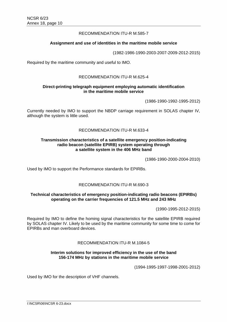
NCSR 6/23 Annex 18, page 10
I:\NCSR\06\NCSR 6-23.docx
RECOMMENDATION ITU-R M.585-7
Assignment and use of identities in the maritime mobile service
(1982-1986-1990-2003-2007-2009-2012-2015)
Required by the maritime community and useful to IMO.
RECOMMENDATION ITU-R M.625-4
Direct-printing telegraph equipment employing automatic identification in the maritime mobile service
(1986-1990-1992-1995-2012)
Currently needed by IMO to support the NBDP carriage requirement in SOLAS chapter IV, although the system is little used.
RECOMMENDATION ITU-R M.633-4
Transmission characteristics of a satellite emergency position-indicating radio beacon (satellite EPIRB) system operating through
a satellite system in the 406 MHz band
(1986-1990-2000-2004-2010) Used by IMO to support the Performance standards for EPIRBs.
RECOMMENDATION ITU-R M.690-3
Technical characteristics of emergency position-indicating radio beacons (EPIRBs)
operating on the carrier frequencies of 121.5 MHz and 243 MHz
(1990-1995-2012-2015) Required by IMO to define the homing signal characteristics for the satellite EPIRB required by SOLAS chapter IV. Likely to be used by the maritime community for some time to come for EPIRBs and man overboard devices.
RECOMMENDATION ITU-R M.1084-5
Interim solutions for improved efficiency in the use of the band 156-174 MHz by stations in the maritime mobile service
(1994-1995-1997-1998-2001-2012)
Used by IMO for the description of VHF channels.

NCSR 6/23 Annex 18, page 11
I:\NCSR\06\NCSR 6-23.docx
RECOMMENDATION ITU-R M.1171-0
Radiotelephony procedures in the maritime mobile service
(1995) Required by IMO and the maritime community as long as coast stations offer a public correspondence service. The number of such coast stations is however declining.
RECOMMENDATION ITU-R M.1172-0
Miscellaneous abbreviations and signals to be used for radiocommunications in the maritime mobile service
(1995)
Required by the maritime community.
RECOMMENDATION ITU-R M.1173-1
Technical characteristics of single-sideband transmitters used in the maritime mobile
service for radiotelephony in the bands between 1 606.5 kHz (1 605 kHz Region 2) and 4 000 kHz and between 4 000 kHz and 27 500 kHz
(1995 -2012)
Required by IMO and the maritime community and likely to be required into the foreseeable future.
RECOMMENDATION ITU-R M.1174-3
Technical characteristics of equipment used for onboard vessel communications in
the bands between 450 and 470 MHz
(1995-1998- 2004-2015) Required by the maritime community and useful to IMO.
RECOMMENDATION ITU-R M.1638-0
Characteristics of and protection criteria for sharing studies for radiolocation,
aeronautical radionavigation and meteorological radars operating in the frequency bands between 5 250 and 5 850 MHz
(2003)
Not required by IMO but may be required by the maritime community where radars in this band are used.

NCSR 6/23 Annex 18, page 12
I:\NCSR\06\NCSR 6-23.docx
ANNEX 2
RESOLUTION 13 (REV.WRC-97)
Formation of call signs and allocation of new international series Retain.
RESOLUTION 18 (REV.WRC-15)
Relating to the procedure for identifying and announcing the position of ships and aircraft of States not parties to an armed conflict
Retain.
RESOLUTION 205 (REV.WRC-15)
Protection of the systems operating in the mobile- satellite service in the frequency band 406-406.1 MHz
Retain.
RESOLUTION 207 (REV.WRC-15)
Measures to address unauthorized use of and interference to frequencies in the bands allocated to the maritime mobile service and
to the aeronautical mobile (R) service Retain.
RESOLUTION 222 (REV.WRC-12)
Use of the bands 1 525-1 559 MHz and 1 626.5-1 660.5 MHz by the mobile-satellite service, and procedures to ensure long-term spectrum access
for the aeronautical mobile-satellite (R) service Retain.
RESOLUTION 331 (REV.WRC-12)
Operation of the Global Maritime Distress and Safety System Retain.
RESOLUTION 339 (REV.WRC-07)
Coordination of NAVTEX services Retain.
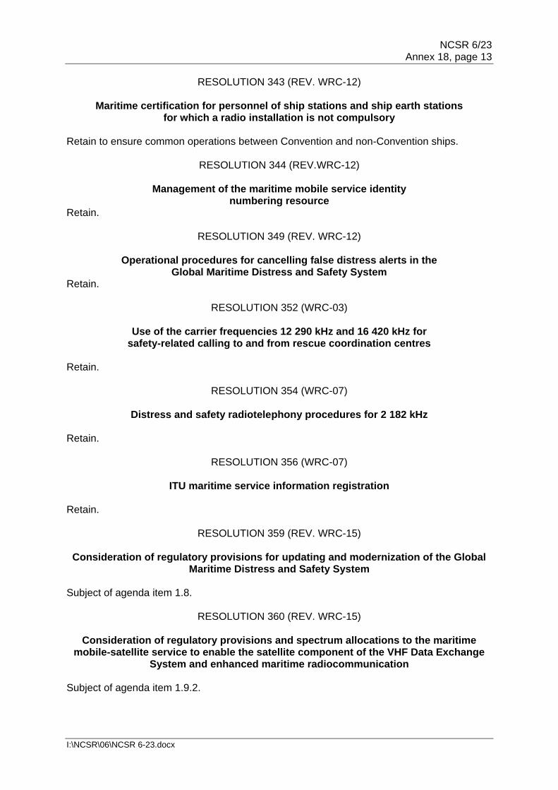
NCSR 6/23 Annex 18, page 13
I:\NCSR\06\NCSR 6-23.docx
RESOLUTION 343 (REV. WRC-12)
Maritime certification for personnel of ship stations and ship earth stations for which a radio installation is not compulsory
Retain to ensure common operations between Convention and non-Convention ships.
RESOLUTION 344 (REV.WRC-12)
Management of the maritime mobile service identity numbering resource
Retain.
RESOLUTION 349 (REV. WRC-12)
Operational procedures for cancelling false distress alerts in the Global Maritime Distress and Safety System
Retain.
RESOLUTION 352 (WRC-03)
Use of the carrier frequencies 12 290 kHz and 16 420 kHz for safety-related calling to and from rescue coordination centres
Retain.
RESOLUTION 354 (WRC-07)
Distress and safety radiotelephony procedures for 2 182 kHz Retain.
RESOLUTION 356 (WRC-07)
ITU maritime service information registration Retain.
RESOLUTION 359 (REV. WRC-15)
Consideration of regulatory provisions for updating and modernization of the Global Maritime Distress and Safety System
Subject of agenda item 1.8.
RESOLUTION 360 (REV. WRC-15)
Consideration of regulatory provisions and spectrum allocations to the maritime mobile-satellite service to enable the satellite component of the VHF Data Exchange
System and enhanced maritime radiocommunication Subject of agenda item 1.9.2.

NCSR 6/23 Annex 18, page 14
I:\NCSR\06\NCSR 6-23.docx
RESOLUTION 361 (WRC-15)
Consideration of regulatory provisions for modernization of the Global Maritime Distress and Safety System and
related to the implementation of e-navigation In the preliminary agenda for WRC-23.
RESOLUTION 362 (WRC-15)
Autonomous maritime radio devices operating in the frequency band 156-162.05 MHz
Subject of agenda item 1.9.1.
RESOLUTION 612 (REV. WRC-12)
Use of the radiolocation service between 3 and 50 MHz to support high-frequency oceanographic radar operations
Retain.
RECOMMENDATION 7 (REV.WRC-97)
Adoption of standard forms for ship station and ship earth station licences and aircraft station and aircraft earth station licences
Retain.
RECOMMENDATION 37 (WRC-03)
Operational procedures for earth stations on board vessels (ESVs) use
Retain.
RECOMMENDATION 316 (REV.MOB-87)
Use of ship earth stations within harbours and other waters under national jurisdiction
Amend.
***

NCSR 6/23 Annex 19, page 1
I:\NCSR\06\NCSR 6-23.docx
ANNEX 19
DRAFT MSC RESOLUTION
PERFORMANCE STANDARDS FOR FLOAT-FREE EMERGENCY POSITION-INDICATING RADIO BEACONS (EPIRBs)
OPERATING ON 406 MHz THE MARITIME SAFETY COMMITTEE, RECALLING Article 28(b) of the Convention on the International Maritime Organization concerning the functions of the Committee, RECALLING ALSO regulations IV/7.1 and 14.1 of the International Convention for the Safely of Life at Sea (SOLAS), 1974, as amended, concerning radiocommunications for the Global Maritime Distress and Safety System (GMDSS), which require, inter alia, that ships be provided with an emergency position-indicating radio beacon (EPIRB), which shall conform to appropriate performance standards not inferior to those adopted by the Organization, RECOGNIZING the need to prepare performance standards for float-free EPIRBs operating on 406 MHz through the Cospas-Sarsat System of low-altitude earth orbiting, medium-altitude earth orbiting, and geostationary earth orbiting satellites to be used in the GMDSS, in order to ensure the operational reliability of such equipment and to avoid, as far as practicable, adverse interaction between such equipment and other communication and navigation equipment on board ships, RECOGNIZING ALSO that EPIRBs, as a component of the GMDSS and operating through the Cospas-Sarsat System in the frequency band 406-406.1 MHz, should be type-approved to ensure the integrity of the Cospas-Sarsat satellite system, avoid harmful interference to the spaceborne equipment, exclude unauthorized transmissions, and to provide reliable data to rescue coordination centres,
HAVING CONSIDERED the recommendation made by Sub-Committee on Navigation, Communications and Search and Rescue at its sixth session, 1 ADOPTS the Recommendation on performance standards for float-free Emergency Position-Indicating Radio Beacons (EPIRBs) operating on 406 MHz set out in the annex to the present resolution; 2 RECOMMENDS that Member States ensure that float-free EPIRBs operating on the frequency 406 MHz, which form part of the GMDSS:
(a) if installed on or after [effective date, recommended three years after the adoption of the resolution], conform to performance standards and type-approval standards not inferior to those specified in the annex to the present resolution;
(b) if installed before [effective date], conform to performance standards not inferior to those specified in the annex to resolution A.810(19), as amended by resolutions MSC.56(66) and MSC.120(74), and type-approval standards not inferior to those specified in resolution A.696(17);

NCSR 6/23 Annex 19, page 2
I:\NCSR\06\NCSR 6-23.docx
3 INVITES the Cospas-Sarsat partners to ensure that any amendments to the specification for Cospas-Sarsat 406 MHz distress beacons that could impact on this performance standard are agreed with the Organization prior to their adoption; 4 AGREES that any proposed amendments to this resolution are agreed with the Cospas-Sarsat partners prior to their adoption; 5 AGREES FURTHER to keep these Performance Standards under review and to adopt amendments thereto, as necessary.

NCSR 6/23 Annex 19, page 3
I:\NCSR\06\NCSR 6-23.docx
ANNEX
RECOMMENDATION ON PERFORMANCE STANDARDS FOR FLOAT-FREE EMERGENCY POSITION-INDICATING RADIO
BEACONS (EPIRBs) OPERATING ON 406 MHz
Part A – GENERAL
1 INTRODUCTION The emergency position-indicating radio beacon (EPIRB) should, in addition to meeting the requirements of the Radio Regulations, the relevant ITU-R Recommendations and the general requirements set out in resolution A.694(17), comply with the following performance standards. 2 GENERAL 2.1 The EPIRB should be capable of transmitting a distress alert, including encoded position information from a receiver using a recognised global navigation satellite system (GNSS) with global coverage, to satellites equipped with a search and rescue 406 MHz processor or repeater. 2.2 The EPIRB should be of an automatic float-free type. The equipment, mounting and releasing arrangements should be reliable, and should operate satisfactorily under the most extreme conditions likely to be met with at sea. 2.3 The EPIRB should:
.1 be fitted with adequate means to prevent inadvertent activation;
.2 be so designed that the electrical portions are watertight at a depth of 10 m
for at least 5 min. Consideration should be given to a temperature variation of 45°C during transitions from the mounted position to immersion. The harmful effects of a marine environment, condensation and water leakage should not affect the performance of the beacon;
.3 be automatically activated after floating free; .4 be capable of manual activation and deactivation; .5 be provided with means to indicate that signals are being emitted; .6 be capable of floating upright in calm water and have positive stability and
sufficient buoyancy in all sea conditions; .7 be capable of being dropped into the water without damage from a height
of 20 m; .8 be capable of being tested, without using the satellite system, to determine
that the EPIRB is capable of operating properly; .9 be of highly visible yellow/orange colour and be fitted with retroreflecting
material;

NCSR 6/23 Annex 19, page 4
I:\NCSR\06\NCSR 6-23.docx
.10 be equipped with a buoyant lanyard suitable for use as a tether (to a liferaft, lifeboat or person in the water but not to the ship), which should be so arranged as to prevent its being trapped in the ship's structure when floating free;
.11 be provided with a low duty cycle light (0.75 cd), active during darkness,
visible to the human eye and detectable by all types of night vision devices, to indicate its position to nearby survivors and to rescue units;
.12 not be unduly affected by seawater or oil or both; .13 be resistant to deterioration in prolonged exposure to sunlight; .14 be provided with a 121.5 MHz beacon primarily for homing by aircraft; .15 be provided with a GNSS receiver for position fixes and an associated
indication that GNSS signal reception is satisfactory or unsatisfactory; and .16 be provided with an Automatic Identification System (AIS) locating signal in
accordance with the Recommendation ITU-R M.1371, Technical characteristics for an automatic identification system using time division multiple access in the VHF maritime mobile frequency band.
2.4 The battery should have sufficient capacity to operate the EPIRB for a period of at least 48 h. 2.5 The EPIRB should be so designed as to operate under any of the following environmental conditions:
.1 ambient temperatures of -20°C to +55°C; .2 icing; .3 relative wind speeds up to 100 knots; and .4 after stowage, at temperatures between -30°C and +70°C.
2.6 The installed EPIRB should:
.1 have local manual activation; remote activation may also be provided from the navigating bridge, while the device is installed in the float-free mounting;
.2 be capable, while mounted on board, of operating properly over the ranges
of shock and vibration and other environmental conditions normally encountered above deck on seagoing ships; and
.3 be designed to release itself and float free before reaching a depth of 4 m at
a list or trim of any angle.
3 DISTRESS FUNCTION 3.1 When the EPIRB is manually operated a distress alert should be initiated only by means of a dedicated distress alert activator.

NCSR 6/23 Annex 19, page 5
I:\NCSR\06\NCSR 6-23.docx
3.2 The dedicated activator should:
.1 be clearly identified; and .2 be protected against inadvertent operation.
3.3 Manual distress alert initiation should require at least two independent actions. 3.4 The EPIRB should not be automatically activated after being manually removed from the release mechanism.
4 GNSS RECEIVER POSITION REPORTING When the EPIRB is activated:
.1 the GNSS position fix shall be updated at intervals of no more than 5 minutes;
and .2 when an updated fix is transmitted in the AIS message for the first time, the
error between the transmitted and the actual position shall not exceed 30 m assuming a drift rate of 3 kn.
5 LABELLING
5.1 Labelling for operation controls and indicators should, as far as possible, be
understood through graphical images and symbols without the need for text. 5.2 In addition to the items specified in resolution A.694(17) on general requirements, the following should be clearly indicated on the exterior of the equipment:
.1 brief operating instructions; .2 expiry date for the primary battery used; and .3 the identity codes programmed into the transmitters.
Part B – RADIO-FREQUENCY SIGNALS 1 The technical characteristics of the transmitted signal and the message format should be in accordance with the requirements of the Cospas-Sarsat System document C/S T.001 or C/S T.018. 2 Provisions should be included for storing the fixed portion of the distress message in the satellite EPIRB using non-volatile memory. 3 A unique beacon identification code should be made part of all 406 MHz messages. For EPIRBs compliant with C/S T.001 this identification code should include a 3-digit maritime identification digits (MID) code to denote the country in which the beacon is registered, followed by either:
.1 the trailing 6 digits of the ship station identity in accordance with Appendix 43
of ITU Radio Regulations Recommendation ITU-R M.585, Assignment and use of identities in the maritime mobile service; or

NCSR 6/23 Annex 19, page 6
I:\NCSR\06\NCSR 6-23.docx
.2 a unique serial number; or .3 a radio call sign.
Preference is given to method in sub-paragraph .1 above.
For EPIRBs compliant with C/S T.018 this identification code should include a 3-digit maritime identification digits (MID) code to denote the country in which the beacon is registered, followed by a unique serial number and either the maritime mobile service identity or a radio call sign. 4 The 121.5 MHz homing signal should:
.1 have a 121.5 MHz transmitting duty cycle not less than 50% (1.125 seconds on, 1.125 seconds off) and if more than 50%, the on time should be increased beyond 1.125 seconds and the off time reduced accordingly; and
.2 with the exception of the sweep direction, meet the technical characteristics
of Appendix 15 of the Radio Regulations. The sweep may be either upward or downward.
5 The AIS locating signal should:
.1 transmit in accordance with recommendation ITU-R Rec M.1371; .2 start after the first 406 MHz satellite message and ensure the AIS signal does
not conflict with a scheduled 406 MHz satellite signal; .3 when the AIS signal coincides with a scheduled 121.5 MHz homing signal,
then the 121.5 MHz homing signal may be interrupted for the transmission of the AIS signal, provided the minimum 50% duty cycle is maintained;
.4 broadcast the Cospas-Sarsat beacon 15 HEX-ID in the AIS message 14,
alternating with the text " "EPIRB ACTIVE" on AIS1 and AIS2; and .5 indicate in the transmitted AIS locating signal when the included position fix
is more than 5 minutes old.
Part C –TYPE APPROVAL OF EPIRBS OPERATING IN THE Cospas-Sarsat SYSTEM 1 EPIRBs forming an integral component of the global maritime distress and safety system and operating through the Cospas-Sarsat satellite system in the frequency band 406 - 406.1 MHz should be type approved to ensure the integrity of the Cospas-Sarsat satellite system, avoid harmful interference to the spaceborne equipment, exclude unauthorized transmissions, and to provide reliable data to rescue coordination centres. 2 National administrations should:
.1 ensure, as part of national type approval procedures, that any new type of EPIRB to be deployed on board ships is tested to confirm that it is in accordance with the performance standards for EPIRBs; confirmation that the EPIRB meets part B of this performance standard can be achieved by either:

NCSR 6/23 Annex 19, page 7
I:\NCSR\06\NCSR 6-23.docx
.1 performing, or having performed, under national procedures, all appropriate tests; and/or
.2 accepting type approval test results obtained through the
Cospas-Sarsat type approval procedure for first generation beacons (Cospas-Sarsat document C/S T.007) or the Cospas-Sarsat type approval procedure for second generation beacons (Cospas-Sarsat document C/S T.021) and confirmed by the delivery of a Cospas-Sarsat Type Approval Certificate; and
.2 encourage national type approval authorities to develop test procedures
compatible, to the extent possible, with Cospas-Sarsat System document C/S T.007 or C/S T.021 as appropriate and, if necessary, in consultation with the Cospas-Sarsat Secretariat.
***


NCSR 6/23 Annex 20, page 1
I:\NCSR\06\NCSR 6-23.docx
ANNEX 20
BIENNIAL STATUS REPORT 2018-2019
Sub-Committee on Navigation, Communications and Search and Rescue (NCSR)
Reference to SD, if applicable
Output number
Description Target completion year
Parent organ(s)
Associated organ(s)
Coordinating organ
Status of output for Year 1
Status of output for Year 2
References
1. Improve implementation
1.3 Validated model training courses
Continuous MSC / MEPC
III / HTW / PPR / CCC / SDC / SSE/NCSR
N/A N/A MSC 100/20, paragraphs 10.3 to 10.6 and 17.25
Notes: MSC 100 agreed to include the CCC, III, NCSR, SDC and SSE Sub-Committees as associated organs in output 1.3 on "Validated model training courses".
2. Integrate new and advancing technologies in the regulatory framework
2.1 Response to matters related to the Radiocommunication ITU-R Study Group and ITU World Radiocommunication Conference
Annual MSC NCSR Completed Completed MSC 97/22, paragraph 7.6; MSC 99/22, paragraphs 12.11 to 12.15; NCSR 5/23, section 12; NCSR 6/23, section 12
2. Integrate new and advancing technologies in the regulatory framework
2.9 Application of the Indian Regional Navigation Satellite System (IRNSS) in the maritime field and development of performance standards for shipborne IRNSS receiver equipment
2019 MSC NCSR In progress
In progress
MSC 96/25, paragraph 23.17; MSC 98/23, paragraphs 11.8 and 11.9; MSC 99/22, paragraph 12.7; NCSR 5/23, section 5; NCSR 6/23, section 5
Notes: Recognizing that the evaluation of the Indian Regional Navigation Satellite System (IRNSS) had not been completed and that further work was required, the Sub-Committee agreed to invite the Committee to extend the target completion year for this output to 2020.

NCSR 6/23 Annex 20, page 2
I:\NCSR\06\NCSR 6-23.docx
Sub-Committee on Navigation, Communications and Search and Rescue (NCSR)
Reference to SD, if applicable
Output number
Description Target completion year
Parent organ(s)
Associated organ(s)
Coordinating organ
Status of output for Year 1
Status of output for Year 2
References
2. Integrate new and advancing technologies in the regulatory framework
2.10 Revision of SOLAS chapters III and IV for Modernization of the GMDSS, including related and consequential amendments to other existing instruments
2021 MSC HTW / SSE NCSR In progress
In progress
MSC 98/23, paragraph 20.27; NCSR 4/29, annex 12; NCSR 5/23, section 11; NCSR 6/23, section 11
2. Integrate new and advancing technologies in the regulatory framework
2.11 Develop guidance on definition and harmonization of the format and structure of Maritime Service Portfolios (MSPs)
2019 MSC NCSR In progress
Completed MSC 96/25, paragraph 23.14; NCSR 5/23, section 8 NCSR 6/23, section 8
Notes: Having completed the work on the development of guidance on definition and harmonization of the format and structure of Maritime Services within the context of e-navigation and recognizing the need for a continuous review process of maritime service descriptions and the harmonization of related services, the Sub-Committee agreed to invite the Committee to rename this output as "Consideration of descriptions of Maritime Services in the context of e-navigation" with a target completion year of 2021.
2. Integrate new and advancing technologies in the regulatory framework
2.12 Guidelines on standardized modes of operation, S mode
2019 MSC NCSR In progress
Completed MSC 95/22, paragraph 19.12.1; NCSR 5/23, section 7; NCSR 6/23, section 7

NCSR 6/23 Annex 20, page 3
I:\NCSR\06\NCSR 6-23.docx
Sub-Committee on Navigation, Communications and Search and Rescue (NCSR)
Reference to SD, if applicable
Output number
Description Target completion year
Parent organ(s)
Associated organ(s)
Coordinating organ
Status of output for Year 1
Status of output for Year 2
References
2. Integrate new and advancing technologies in the regulatory framework
2.15 Revised Performance Standards for EPIRBs operating on 406 MHz (resolution A.810(19)) to include Cospas-Sarsat MEOSAR and second generation beacons
2019 MSC NCSR Extended Completed NCSR 3/29, section 20; NCSR 4/29, section 19; NCSR 5/23, section 15; NCSR 6/23, section 15
2. Integrate new and advancing technologies in the regulatory framework
2.16 Guidelines for the harmonized display of navigation information received via communications equipment
2018 MSC NCSR Completed N/A MSC 95/22, paragraph 19.12.5; MSC 99/22, paragraph 12.8; NCSR 3/29, section 9; NCSR 4/29, section 8; NCSR 5/23, section 6

NCSR 6/23 Annex 20, page 4
I:\NCSR\06\NCSR 6-23.docx
Sub-Committee on Navigation, Communications and Search and Rescue (NCSR)
Reference to SD, if applicable
Output number
Description Target completion year
Parent organ(s)
Associated organ(s)
Coordinating organ
Status of output for Year 1
Status of output for Year 2
References
2. Integrate new and advancing technologies in the regulatory framework
2.20 Revised General requirements for shipborne radio equipment forming part of the Global Maritime Distress and Safety System (GMDSS) and for electronic navigational aids (resolution A.694(17)) relating to Built-In Integrity Testing (BIIT) for navigation equipment
2020 MSC NCSR In progress
No longer required
MSC 95/22, paragraph 19.12.4; NCSR 6/23, section 6
Notes: No longer required. Superseded by events.
4. Engage in ocean governance
4.1 Designated Special Areas, Emission Control Areas and PSSAs and associated protective measures
Continuous MEPC NCSR No work requested
No work requested
MEPC 68/21, paragraph 10.11; MSC 98/23, paragraph 11.6

NCSR 6/23 Annex 20, page 5
I:\NCSR\06\NCSR 6-23.docx
Sub-Committee on Navigation, Communications and Search and Rescue (NCSR)
Reference to SD, if applicable
Output number
Description Target completion year
Parent organ(s)
Associated organ(s)
Coordinating organ
Status of output for Year 1
Status of output for Year 2
References
6. Ensure regulatory effectiveness
6.1 Unified interpretation of provisions of IMO safety, security and environment-related conventions
Continuous MSC / MEPC
III / PPR / CCC / SDC / SSE / NCSR
No work requested
Ongoing MSC 76/23, paragraph 20.3; MSC 78/26, paragraph 22.12; NCSR 6/23, section 19
Notes: A 28 expanded the output to include all proposed unified interpretations to provisions of IMO safety, security, and environment-related conventions.
6. Ensure regulatory effectiveness
6.2 Developments in GMDSS satellite services
Continuous MSC NCSR Ongoing Ongoing MSC 99/22, paragraphs 12.16 to 12.21; NCSR 5/23, section 14; NCSR 6/23, section 14
6. Ensure regulatory effectiveness
6.15 Role of the human element
Continuous MSC / MEPC
III / PPR / CCC / SDC / SSE / NCSR
HTW No work requested
No work requested
MSC 89/25, paragraphs 10.10, 10.16 and 22.39; and annex 21; MSC 100/20, paragraph 10.8
OW. Other work
OW 1 Amendments to the IAMSAR Manual
Continuous MSC NCSR Ongoing Ongoing MSC 99/22, paragraph 12.23; NCSR 5/23, section 18; NCSR 6/23, section 18
OW. Other work
OW 4 Routeing measures and mandatory ship reporting systems
Continuous MSC NCSR Ongoing Ongoing MSC 98/23, paragraphs 11.2 to 14.5 MSC 99/22, paragraphs 12.1 to 12.4; NCSR 5/23, section 3; NCSR 6/23, section 3
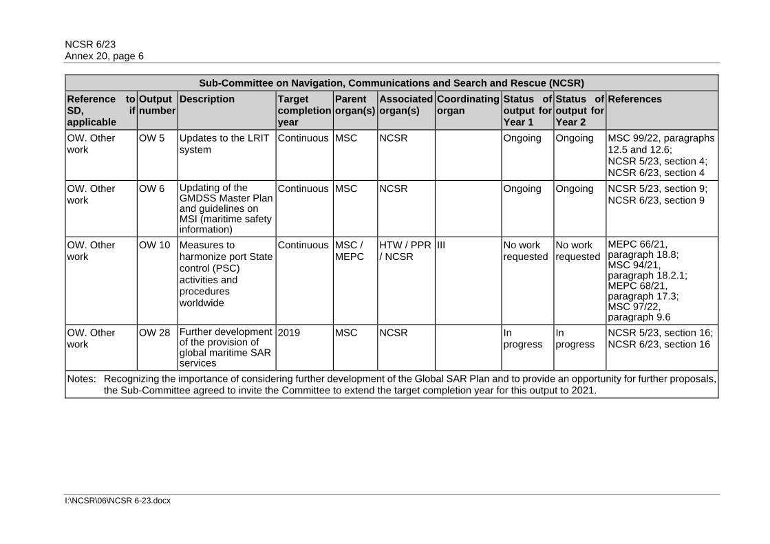
NCSR 6/23 Annex 20, page 6
I:\NCSR\06\NCSR 6-23.docx
Sub-Committee on Navigation, Communications and Search and Rescue (NCSR)
Reference to SD, if applicable
Output number
Description Target completion year
Parent organ(s)
Associated organ(s)
Coordinating organ
Status of output for Year 1
Status of output for Year 2
References
OW. Other work
OW 5 Updates to the LRIT system
Continuous MSC NCSR Ongoing Ongoing MSC 99/22, paragraphs 12.5 and 12.6; NCSR 5/23, section 4; NCSR 6/23, section 4
OW. Other work
OW 6 Updating of the GMDSS Master Plan and guidelines on MSI (maritime safety information)
Continuous MSC NCSR Ongoing Ongoing NCSR 5/23, section 9; NCSR 6/23, section 9
OW. Other work
OW 10 Measures to harmonize port State control (PSC) activities and procedures worldwide
Continuous MSC / MEPC
HTW / PPR / NCSR
III No work requested
No work requested
MEPC 66/21, paragraph 18.8; MSC 94/21, paragraph 18.2.1; MEPC 68/21, paragraph 17.3; MSC 97/22, paragraph 9.6
OW. Other work
OW 28 Further development of the provision of global maritime SAR services
2019 MSC NCSR In progress
In progress
NCSR 5/23, section 16; NCSR 6/23, section 16
Notes: Recognizing the importance of considering further development of the Global SAR Plan and to provide an opportunity for further proposals, the Sub-Committee agreed to invite the Committee to extend the target completion year for this output to 2021.

NCSR 6/23 Annex 20, page 7
I:\NCSR\06\NCSR 6-23.docx
Sub-Committee on Navigation, Communications and Search and Rescue (NCSR)
Reference to SD, if applicable
Output number
Description Target completion year
Parent organ(s)
Associated organ(s)
Coordinating organ
Status of output for Year 1
Status of output for Year 2
References
OW. Other work
OW 29 Guidelines on harmonized aeronautical and maritime search and rescue procedures, including SAR training matters
2019 MSC NCSR In progress
In progress
NCSR 5/23, section 17; NCSR 6/23, section 17
Notes: Recognizing the importance of further consideration of the Guidelines on harmonized aeronautical and maritime search and rescue procedures, including SAR training matters and expecting proposals to be submitted, in particular by the ICAO/IMO Joint Working Group, the Sub-Committee agreed to invite the Committee to extend the target completion year for this output to 2021.
OW. Other work
OW 30 Measures to protect the safety of persons rescued at sea
2019 MSC III NCSR In progress
Completed MSC 98/23, paragraph 11.1; NCSR 5/23, section 13; NCSR 6/23, section 13
Notes: Noting that only two documents had been submitted by Member States and international organizations since the output was included in the agenda of the COMSAR Sub-Committee in 2009 and that the same kind of issues were considered under the output OW 44 "IMO's contribution to addressing unsafe mixed migration by sea", which was on the biennial agendas of the MSC and the FAL and LEG Committees, the Sub-Committee agreed to invite the Committee to delete this output from the biennial agenda of the Sub-Committee.
OW. Other work
OW 43 Consequential work related to the new International Code for Ships Operating in Polar Waters
2019 MSC SSE / NCSR
SDC In progress
Completed MSC 93/22, paragraphs 10.44, 10.50 and 20.12; MSC 96/25, paragraph 3.77; MSC 97/22, paragraphs 8.32 and 19.25; NCSR 5/23, section 10; NCSR 6/23, section 10

NCSR 6/23 Annex 20, page 8
I:\NCSR\06\NCSR 6-23.docx
OUTPUTS ON THE COMMITTEE'S POST-BIENNIAL AGENDA THAT FALL UNDER THE PURVIEW OF THE SUB-COMMITTEE
Sub-Committee on Navigation, Communications and Search and Rescue (NCSR)
ACCEPTED POST-BIENNIAL OUTPUTS
Parent organ(s)
Associated organs(s)
Coordinating organ(s)
Timescale (sessions)
References Number
Biennium (when the output was placed on the post-biennial agenda)
Reference to strategic direction, if applicable
Description
161 2018-2019 1 Revision of the Guidelines on places of refuge for ships in need of assistance (resolution A.949(23))
MSC NCSR 2 MSC 100/20, paragraph 17.1
Note: Included in the proposed biennial agenda for the 2020-2021 biennium.
160 2018-2019 2 Recognition of the Japanese regional navigation satellite system Quasi-Zenith Satellite System (QZSS) and development of performance standards for shipborne satellite navigation system receiver equipment
MSC NCSR 2 MSC 99/22, paragraph 20.11
Note: Included in the proposed biennial agenda for the 2020-2021 biennium.

NCSR 6/23 Annex 20, page 9
I:\NCSR\06\NCSR 6-23.docx
Sub-Committee on Navigation, Communications and Search and Rescue (NCSR)
ACCEPTED POST-BIENNIAL OUTPUTS
Parent organ(s)
Associated organs(s)
Coordinating organ(s)
Timescale (sessions)
References Number
Biennium (when the output was placed on the post-biennial agenda)
Reference to strategic direction, if applicable
Description
159 2018-2019 6 Revision of the Guidelines for vessel traffic services (resolution A.857(20))
MSC NCSR 1 MSC 99/22, paragraph 20.9
Note: Included in the proposed biennial agenda for the 2020-2021 biennium.
164 2018-2019 6 Revision of ECDIS – Guidance for good practice (MSC.1/Circ.1503/Rev.1)
MSC III NCSR 2 MSC 100/20, paragraph 17.9
163 2018-2019 OW Guidance on the training on and operation of Emergency Personal Radio Devices in multiple casualty situations
MSC NCSR 1 MSC 100/20, paragraph 17.5
42 2012-2013 OW Review of the 2009 Code on Alerts and Indicators
MSC NCSR SSE 2 MSC 89/25, paragraph 22.25
***


NCSR 6/23 Annex 21, page 1
I:\NCSR\06\NCSR 6-23.docx
ANNEX 21
PROPOSED BIENNIAL AGENDA FOR THE 2020-2021 BIENNIUM1
Reference to SD, if applicable
Output number
Description Parent organ(s) Associated organ(s)
Coordinating organ
Target completion year
1. Improve implementation
1.3 Validated model training courses MSC / MEPC III / HTW / PPR / CCC / SDC / SSE / NCSR
Continuous
Notes: MSC 100 agreed to include the CCC, III, NCSR, SDC and SSE Sub-Committees as associated organs in output 1.3 on "Validated model training courses".
1. Improve implementation
1.[…] Revision of the Guidelines on places of refuge for ships in need of assistance (resolution A.949(23))
MSC NCSR 2021
Note: Included from the post-biennial agenda (number 161)
2. Integrate new and advancing technologies in the regulatory framework
2.1 Response to matters related to the Radiocommunication ITU-R Study Group and ITU World Radiocommunication Conference
MSC NCSR Annual
2. Integrate new and advancing technologies in the regulatory framework
2.9 Application of the Indian Regional Navigation Satellite System (IRNSS) in the maritime field and development of performance standards for shipborne IRNSS receiver equipment
MSC NCSR 2019 2020
Notes: Recognizing that the evaluation of the Indian Regional Navigation Satellite System (IRNSS) has not been completed and that further work is required, the Sub-Committee agreed to invite the Committee to extend the target completion year for this output to 2020.
1 Outputs printed in bold have been selected for the draft provisional agenda for NCSR 7, as shown in annex 3. No new outputs have been added from the post-biennial agenda,
according to the decision of MSC 99 (MSC 99/22, paragraph 12.26.2). Struck-out text indicates proposed deletions against the current biennial agenda.

NCSR 6/23 Annex 21, page 2
I:\NCSR\06\NCSR 6-23.docx
Reference to SD, if applicable
Output number
Description Parent organ(s) Associated organ(s)
Coordinating organ
Target completion year
2. Integrate new and advancing technologies in the regulatory framework
2.10 Revision of SOLAS chapters III and IV for Modernization of the GMDSS, including related and consequential amendments to other existing instruments
MSC HTW / SSE NCSR 2021
2. Integrate new and advancing technologies in the regulatory framework
2.11 Develop guidance on definition and harmonization of the format and structure of Maritime Service Portfolios (MSPs) Consideration of descriptions of Maritime Services in the context of e-navigation
MSC NCSR 2019 2021
Notes: Having completed the work on the development of guidance on definition and harmonization of the format and structure of Maritime Services within the context of e-navigation and recognizing the need for a continuous review process of maritime service descriptions and the harmonization of related services, the Sub-Committee agreed to invite the Committee to rename this output as "Consideration of descriptions of Maritime Services in the context of e-navigation" with a target completion year of 2021.
2. Integrate new and advancing technologies in the regulatory framework
2.[…] Recognition of the Japanese regional navigation satellite system Quasi-Zenith Satellite System (QZSS) and development of performance standards for shipborne satellite navigation system receiver equipment
MSC NCSR 2021
Note: Included from the post-biennial agenda (number 160)
2. Integrate new and advancing technologies in the regulatory framework
2.12 Guidelines on standardized modes of operation, S mode
MSC NCSR 2019

NCSR 6/23 Annex 21, page 3
I:\NCSR\06\NCSR 6-23.docx
Reference to SD, if applicable
Output number
Description Parent organ(s) Associated organ(s)
Coordinating organ
Target completion year
2. Integrate new and advancing technologies in the regulatory framework
2.15 Revised Performance Standards for EPIRBs operating on 406 MHz (resolution A.810(19)) to include Cospas-Sarsat MEOSAR and second generation beacons
MSC NCSR 2019
2. Integrate new and advancing technologies in the regulatory framework
2.16 Guidelines for the harmonized display of navigation information received via communications equipment
MSC NCSR 2018
2. Integrate new and advancing technologies in the regulatory framework
2.20 Revised General requirements for shipborne radio equipment forming part of the Global Maritime Distress and Safety System (GMDSS) and for electronic navigational aids (resolution A.694(17)) relating to Built-In Integrity Testing (BIIT) for navigation equipment
MSC NCSR 2020
4. Engage in ocean governance
4.1 Designated Special Areas, Emission Control Areas and PSSAs and associated protective measures
MEPC NCSR Continuous
6. Ensure regulatory effectiveness
6.1 Unified interpretation of provisions of IMO safety, security and environment-related conventions
MSC / MEPC III / PPR / CCC / SDC / SSE / NCSR
Continuous
Notes: A 28 expanded the output to include all proposed unified interpretations to provisions of IMO safety, security, and environment-related conventions.
6. Ensure regulatory effectiveness
6.2 Developments in GMDSS satellite services
MSC NCSR Continuous

NCSR 6/23 Annex 21, page 4
I:\NCSR\06\NCSR 6-23.docx
Reference to SD, if applicable
Output number
Description Parent organ(s) Associated organ(s)
Coordinating organ
Target completion year
6. Ensure regulatory effectiveness
6.15 Role of the human element MSC / MEPC III / PPR / CCC / SDC / SSE / NCSR
HTW Continuous
6. Ensure regulatory effectiveness
6.[…] Revision of the Guidelines for Vessel Traffic Services (resolution A.857(20))
MSC NCSR 2020
Note: Included from the post-biennial agenda (number 159)
OW. Other work OW 1 Amendments to the IAMSAR Manual MSC NCSR Continuous
OW. Other work OW 4 Routeing measures and mandatory ship reporting systems
MSC NCSR Continuous
OW. Other work OW 5 Updates to the LRIT system MSC NCSR Continuous
OW. Other work OW 6 Updating of the GMDSS Master Plan and guidelines on MSI (maritime safety information)
MSC NCSR Continuous
OW. Other work OW 10 Measures to harmonize port State control (PSC) activities and procedures worldwide
MSC / MEPC HTW / PPR / NCSR
III Continuous
OW. Other work OW 28 Further development of the provision of global maritime SAR services
MSC NCSR 2019 2021
Notes: Recognizing the importance of considering further development of the Global SAR Plan and to provide an opportunity for further proposals, the Sub-Committee agreed to invite the Committee to extend the target completion year for this output to 2021.

NCSR 6/23 Annex 21, page 5
I:\NCSR\06\NCSR 6-23.docx
Reference to SD, if applicable
Output number
Description Parent organ(s) Associated organ(s)
Coordinating organ
Target completion year
OW. Other work OW 29 Guidelines on harmonized aeronautical and maritime search and rescue procedures, including SAR training matters
MSC NCSR 2019 2021
Notes: Recognizing the importance of further consideration of the Guidelines on harmonized aeronautical and maritime search and rescue procedures, including SAR training matters and expecting proposals to be submitted, in particular by the ICAO/IMO Joint Working Group, the Sub-Committee agreed to invite the Committee to extend the target completion year for this output to 2021.
OW. Other work OW 30 Measures to protect the safety of persons rescued at sea
MSC III NCSR 2019
OW. Other work OW 43 Consequential work related to the new International Code for Ships Operating in Polar Waters
MSC SSE / NCSR SDC 2019
***


NCSR 6/23 Annex 22, page 1
I:\NCSR\06\NCSR 6-23.docx
ANNEX 22
PROPOSED PROVISIONAL AGENDA FOR NCSR 7
Opening of the session 1 Adoption of the agenda 2 Decisions of other IMO bodies 3 Routeing measures and mandatory ship reporting systems (OW 4) 4 Updates to the LRIT system (OW 5) 5 Application of the "Indian Regional Navigation Satellite System (IRNSS)" in the
maritime field and development of performance standards for shipborne IRNSS receiver equipment (2.9)
6 Recognition of the Japanese regional navigation satellite system Quasi-Zenith
Satellite System (QZSS) and development of performance standards for shipborne satellite navigation system receiver equipment (2.[…])1
7 Revision of the Guidelines for Vessel Traffic Services (resolution A.857(20)) (6.[…])1 8 Consideration of descriptions of Maritime Services in the context of
e-navigation (2.11) 9 Updating of the GMDSS master plan and guidelines on Maritime Safety Information
(MSI) (OW 6) 10 Revision of the Guidelines on places of refuge for ships in need of assistance
(resolution A.949(23)) (1.[…])1 11 Revision of SOLAS chapters III and IV for Modernization of the GMDSS, including
related and consequential amendments to other existing instruments (2021) (2.10) 12 Response to matters related to the Radiocommunication ITU R Study Group and ITU
World Radiocommunication Conference (2.1) 13 Developments in GMDSS satellite services (6.2)
14 Further development of the provision of global maritime SAR services (OW 28) 15 Guidelines on harmonized aeronautical and maritime search and rescue procedures,
including SAR training matters (OW 29) 16 Amendments to the IAMSAR Manual (OW 1) 17 Unified interpretation of provisions of IMO safety, security, and environment-related
conventions (6.1)
1 Output number pending to be allocated.

NCSR 6/23 Annex 22, page 2
I:\NCSR\06\NCSR 6-23.docx
18 Validated model training courses (1.3) 19 Biennial status report and provisional agenda for NCSR 8 20 Election of Chair and Vice-Chair for 2021 21 Any other business 22 Report to the Maritime Safety Committee
***

NCSR 6/23 Annex 23, page 1
I:\NCSR\06\NCSR 6-23.docx
ANNEX 23
DRAFT AMENDMENTS TO THE GUIDELINES ON ANNUAL TESTING OF VOYAGE DATA RECORDERS (VDR) AND SIMPLIFIED
VOYAGE DATA RECORDERS (S-VDR) (MSC.1/Circ.1222)
ANNEX
1 Paragraph 2.7 is replaced by the following:
".7 confirmation that the capsule float-free arrangements, where required or fitted, are satisfactory as originally accepted at commissioning; and that any battery, release mechanism or other datable items are within their expiry date. In addition, for float-free capsules approved in accordance with resolution MSC.333(90), the examination should be carried out in accordance with MSC.1/Circ.1040/Rev.1; and,"
APPENDIX VOYAGE DATA RECORDER PERFORMANCE TEST REPORT
8. Interfaces: Operation and recording
2 In the existing section 8, insert the following new rows between "Radar data - post display selection" and "Water depth" rows:
"
… …
Radar data - post display selection
Master radar display (both radars, where applicable)
ECDIS ECDIS display in use, where fitted
AIS All AIS data
Rolling motion Electronic inclinometer, where fitted
Configuration data Where applicable
Electronic logbook Where fitted
Water depth Echo sounder
… … "
3 After the existing section 8 "Interfaces: Operation and recording", insert the following new section 8bis:
"8bis. Float-free capsule [Yes] [No] [N/A]
" ***
For float-free capsules approved in accordance with resolution MSC.333(90): an examination according to MSC.1/Circ.1040/Rev.1 has been conducted


NCSR 6/23 Annex 24, page 1
I:\NCSR\06\NCSR 6-23.docx
ANNEX 24
STATEMENTS BY DELEGATIONS* AGENDA ITEM 4
Statement by the delegation of the Democratic People's Republic of Korea
Thank you, Mr. Chair, Good afternoon distinguished delegates, We thank IMSO for the submission of the document. Regarding Major non-conformity in paragraphs 38 to 45, in advance, the DPR Korea appreciates the efforts of the Director-General and Secretariat of the IMSO for resolving the suspension of LRIT communication service as requested by the Maritime Administration of the DPR Korea. As mentioned in the document, since November 2017, the Kemilinks Communication Company has suspended its LRIT communication service to the DPR Korea flagged vessels under the instruction of its Government to implement the UN Security Council resolutions against the DPR Korea. As a result, the DPR Korea has been unable to implement LRIT and failed to ensure safety, security and search and rescue of the DPR Korea flagged vessels. As you know well, the worldwide LRIT system had been established, for enhancing the safety and security, including humanitarian service for search and rescue, rather than for shipping business for profit-making. In this context, it is natural that LRIT communication service is not involved in the scope of UN Security Council sanctions against the DPR Korea. In addition, this delegation insists that any resolution, decision and instruction of any Organization or Member States, should never affect the safety, security and humanity as well as implementation of the IMO instruments of other Member State. This delegation is of view that this case should be regarded as the important and urgent issue to be resolved for the worldwide implementation of the LRIT, but not as a commercial issue between the service provider and its Government. In this connection, this delegation reiterates that all Member States of the IMO and IMSO should cooperate for the safety, security and worldwide implementation of the IMO instruments including LRIT implementation.
* Statements have been included in this annex as provided by delegations, sorted by agenda item, and in the
language of submission (including translation into any other language if such translation was provided). Statements are accessible in all official languages on audio file at http://docs.imo.org/meetings/media.aspx.

NCSR 6/23 Annex 24, page 2
I:\NCSR\06\NCSR 6-23.docx
Finally, the DPR Korea would like to take this opportunity to request further cooperation of the relevant Member States, the IMO and IMSO Secretariats so that the DPR Korea can fully implement the LRIT. Thank you, Mr. Chair. AGENDA ITEM 9
Statement by the delegation of Ukraine Thank you, Mr. Chair. First of all, I'd like to thank the Chair of the International NAVTEX Coordinating Panel for the delivered summary of the current issues being addressed by the IMO NAVTEX Coordinating Panel and its activities since the fifth session of the Sub-Committee. As Ukraine informed IMO Member States at NCSR 4, starting from 23 October 2015 the Russian Federation unilaterally ceased to forward to the State Hydrographic Service of Ukraine (SHSU) any relevant MSI on coastal warnings for the maritime waters around the Crimean peninsula, in the Sea of Azov, the Kerch Strait or the north-western part of the Black Sea to be transmitted by Odesa NAVTEX station for the north-western part of the Black Sea and Berdiansk NAVTEX station for the Sea of Azov and the Kerch Strait. Such unilateral actions of the Russian Federation violate the National coordinator responsibilities as defined by section 3.6 of the Joint IHO/IMO/WMO S-53 Manual on MSI. It also has negative repercussions for the safety of navigation in the Black Sea, the Sea of Azov and the Kerch Strait. In this regard, Ukraine appreciates the IMO NAVTEX Coordinating Panel's efforts to facilitate the transfer of MSI between Ukraine and Russian Federation. On the other hand, in October 2018 Ukraine had to request the IMO NAVTEX Coordinating Panel to consider yet another unauthorized unilateral actions of the Russian Federation concerning a non-compliance by the Novorossiysk NAVTEX station with its service area. Specifically, the Russian Federation claimed in document MSC 100/19/11, paragraph 8, that "the Novorossiysk NAVTEX station carries out transmission of navigational warnings for sea areas around the Crimean peninsula, for the north-eastern part of the Black Sea, the Sea of Azov and the Kerch Strait". But in reality only the Berdiansk NAVTEX station of Ukraine has full responsibility for broadcasting MSI into the Sea of Azov and the Kerch Strait, which was once again confirmed by NAVAREA III Coordinator at the 14th Meeting of the Black and Azov Seas Working Group on 3-4 May 2018 in Constanta, Romania. The Russian Federation cannot unilaterally claim a particular area as its service area and must conform to MSC.1/Circ.1403/Rev.1 paragraph 4.2.9.2. Specifically, if a national Administration wishes to amend the limits of its NAVTEX service area it shall undertake preliminary discussions with the NAVAREA Coordinator, METAREA Coordinator and neighbouring Administrations prior to formal application to IMO through the IMO NAVTEX Coordinating Panel, keeping the NAVTEX Coordinating Panel informed at all times. Moreover, my delegation recalls that the first discussion on this subject took place three years ago at NCSR 3. The delegation of the Russian Federation provided information on its intention

NCSR 6/23 Annex 24, page 3
I:\NCSR\06\NCSR 6-23.docx
to establish a NAVTEX station on 518 kHz in the area of Taganrog port to ensure safety of navigation in the Sea of Azov, but that it had been advised by the NAVAREA III, METAREA III Coordinators and the IMO NAVTEX Coordinating Panel that transmission in that area and on that frequency would not be appropriate under the current arrangements for the area concerned. Therefore, the IMO NAVTEX Coordinating Panel recommended that the Russian Federation should implement a National 490 kHz NAVTEX station only. Instead, the Russian Federation decided unilaterally to carry out transmission of navigational warnings into the Sea of Azov and the Kerch Strait from the Novorossiysk NAVTEX station by changing its service area without any discussions with the NAVAREA III, METAREA III Coordinators, neighbouring Administrations and authorization of the IMO NAVTEX Coordinating Panel. Given reported circumstances, the delegation of Ukraine expects the IMO NAVTEX Coordinating Panel to consider the recent unauthorized unilateral actions of the Russian Federation in the Sea of Azov and the Kerch Strait, take appropriate measures and report back on its relevant activities to NCSR 7. Finally, Mr. Chair, we would appreciate if this statement is included in the report of the Sub-Committee. Thank you.
Statement by the delegation of the Russian Federation В отношении заявления делегации Украины делегация Российской Федерации хотела бы в очередной раз повторить то, что нами говорилось на NCSR4, что все станции НАВТЕКС работают в полном соответствии с Руководством по НАВТЕКС, как указано в генеральном плане ГМССБ. Касательно заявления Украинской стороны о нарушениях времени вещания станции НАВТЕКС Новороссийск, а также касательно передачи информации по безопасности мореплавания между Российской стороной и Украиной, мы хотели бы отметить следующее. До октября 2015 года существовала практика доставки гидрографической информации на станции Одесса и Бердянск через Центр навигационно-гидрографической информации на Украине, но с 12 октября 2015 года все существовавшие на тот момент виды связи между отделением сбора и обработки информации Гидрографической службы Черноморского флота Российской Федерации и Центром навигационно-гидрографической информации Украины были заблокированы Украинской стороной и, соответственно, прием информации вышеуказанным Центром прекратился. Делегация Российской Федерации также хотела бы отметить, что по результатам нашего мониторинга информации, передаваемой базовой станцией НАВТЕКС Бердянск выявлено, что сообщения от этой станции проходят с большими ошибками, информация зачастую не читается мореплавателями. В этой связи делегация Российской Федерации хотела бы отметить, что в настоящее время Российская сторона предпринимает все усилия, чтобы восстановить доставку информации через страну-координатора района NAVAREA III, и это осуществляется в сотрудничестве с председателем Координирующей панели НАВТЕКС ИМО.

NCSR 6/23 Annex 24, page 4
I:\NCSR\06\NCSR 6-23.docx
Translation into English provided by the Russian Federation With regard to the statement of the delegation of Ukraine, the Russian Federation would like to reiterate what was expressed at NCSR 4 that all NAVTEX stations in the Russian Federation operate fully in accordance of the NAVTEX Manual as indicated in the GMDSS Master Plan. Regarding the violations of time slots of broadcasting of the Novorossiysk NAVTEX station as stated by the delegation of Ukraine and regarding the transmission of MSI from Russia to Ukraine we would like to emphasize as follows. Until October 2015 the hydrographical information was transmitted by the Russian Federation through the Center of hydrographical information of Ukraine to NAVTEX stations in Odessa and Berdyansk. However, as from 12 October 2015 all existing at the moment means of communication between the body in charge of collecting and processing of hydrographical information of the Hydrographic Service of the Russian Black Sea Navy and the Center of hydrographical information of Ukraine have been blocked by the Ukrainian side and the receipt of information by the above mentioned Center has been terminated. The delegation of the Russian Federation wishes also to point out that as a result of our monitoring of the information transmitted by the NAVTEX base station in Berdyansk, it has been revealed that the messages transmitted by that station contain a lot of errors, the information is not readable in certain cases by seafarers. In that respect the delegation of the Russian Federation would like to state that all efforts are being made at present to restore the transmission of information via the State - coordinator of NAVAREA III, which is done in cooperation with the IMO NAVTEX Coordinating Panel Chairman. AGENDA ITEM 22
Statement by the delegation of Romania (European Union) Mr. Chair, distinguished delegates, More than four years on from the illegal annexation of the Autonomous Republic of Crimea and the city of Sevastopol by the Russian Federation, the European Union remains firmly committed to Ukraine's sovereignty and territorial integrity. The European Union reiterates that it does not recognize and continues to condemn this violation of international law. It remains a direct challenge to international security, with grave implications for the international legal order that protects the unity and sovereignty of all States. The European Union remains committed to fully implementing its non-recognition policy, including through restrictive measures. The EU calls again on UN Member States to consider similar non-recognition measures in line with United Nations General Assembly Resolution 68/262. I would ask for this statement to be included in the report of the Committee. Thank you, Sir.
___________


![Maritime Navigation v1 - Indico [Home]indico.ictp.it/event/a09138/session/57/contribution/36/material/0/...Maritime Navigation Jim Doherty 15 April 2010 Trieste, Italy ... Alidade](https://img.pdfslide.us/doc/110x75/5c8c1f6709d3f236358b6bb8/maritime-navigation-v1-indico-home-navigation-jim-doherty-15-april-2010-trieste.jpg)