Embed Size (px)
Citation preview
Study Group
Ralph David
Abernathy Blvd
Complete Street
April 17, 2017
@atlantabeltline
@atlantabeltline
@atlantabeltline
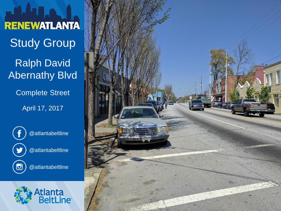
• Framework for a multi-use trail and transit corridor in the heart of the region
• Links many of Atlanta’s historical landmarks and cultural destinations
• Connects four historic rail corridors
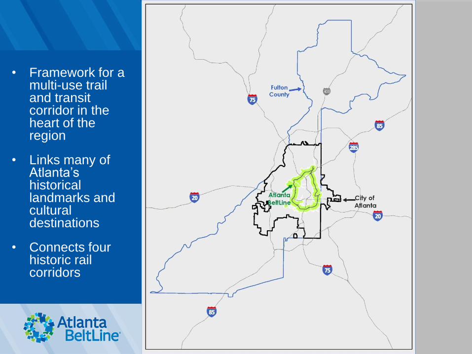
Bringing 45 Neighborhoods Together
22 MILES
of transit
46 MILES
of streetscapes and complete streets
33
MILES of urban trails
1,300 ACRES
of new greenspace
700 ACRES
of renovated greenspace
1,100 ACRES
of environmental clean-up
$10-20B in economic development
28,000 new housing units
5,600 affordable units
48,000 construction
jobs
30,000 permanent
jobs
CORRIDOR-
WIDE public art,
historic preservation,
and arboretum
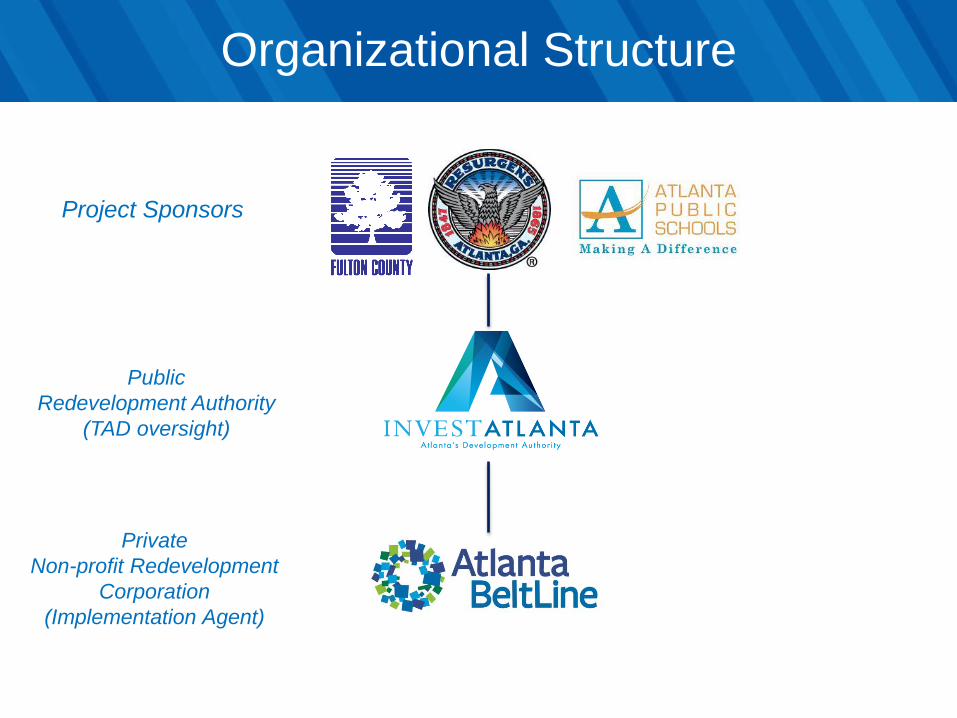
Organizational Structure
Project Sponsors
Private
Non-profit Redevelopment
Corporation
(Implementation Agent)
Public
Redevelopment Authority
(TAD oversight)
Strategic Partnerships

Atlanta BeltLine Planning Area
• 15,000 acres
• 22% of the City of Atlanta population
• 19% of the City’s land
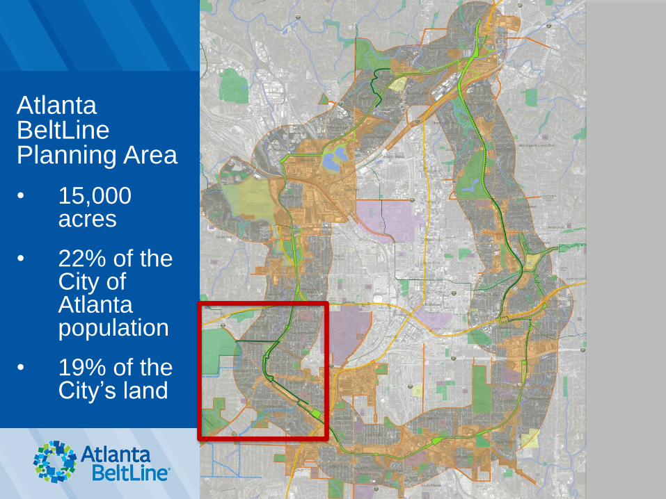
Atlanta BeltLine Planning Area
• 15,000 acres
• 22% of the City of Atlanta population
• 19% of the City’s land
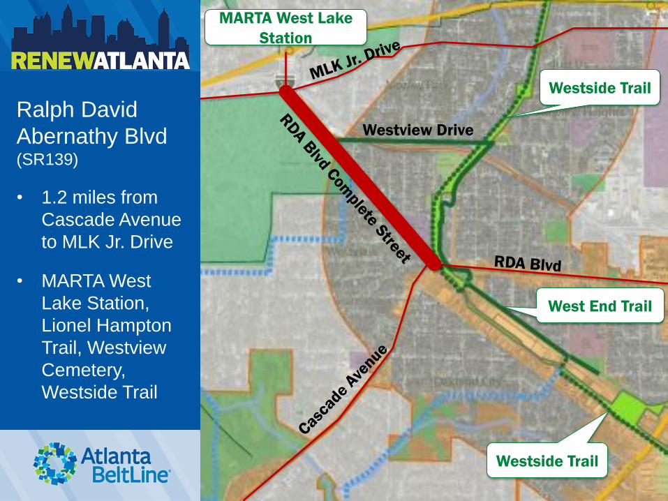
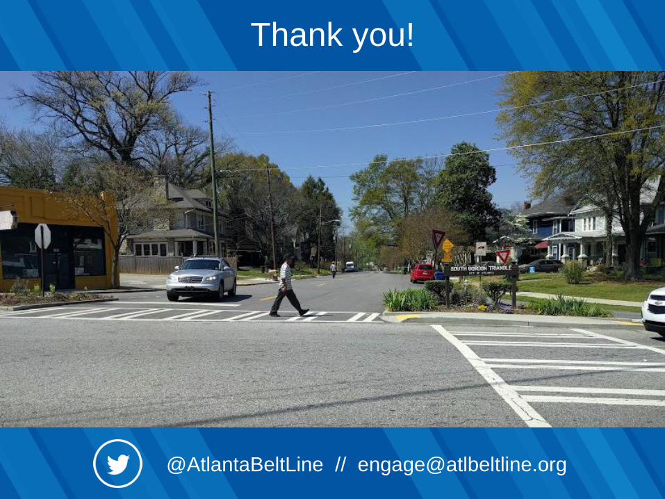
Ralph David
Abernathy Blvd (SR139)
• 1.2 miles from
Cascade Avenue
to MLK Jr. Drive
• MARTA West
Lake Station,
Lionel Hampton
Trail, Westview
Cemetery,
Westside Trail
Westview Drive
Westside Trail
West End Trail
Westside Trail
MARTA West Lake
Station
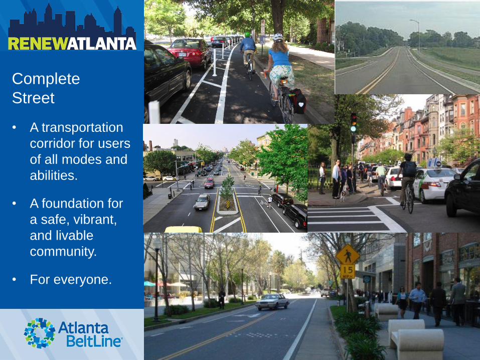
Complete
Street
• A transportation
corridor for users
of all modes and
abilities.
• A foundation for
a safe, vibrant,
and livable
community.
• For everyone.
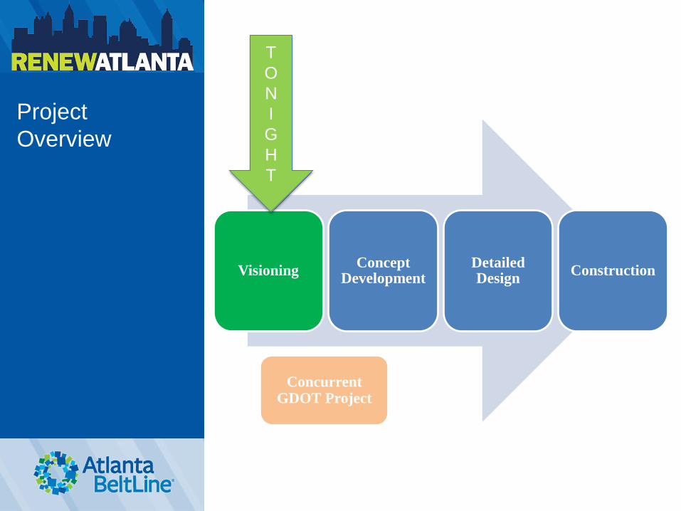
Project
Overview
Visioning Concept
Development Detailed Design
Construction
T
O
N
I
G
H
T
Concurrent GDOT Project
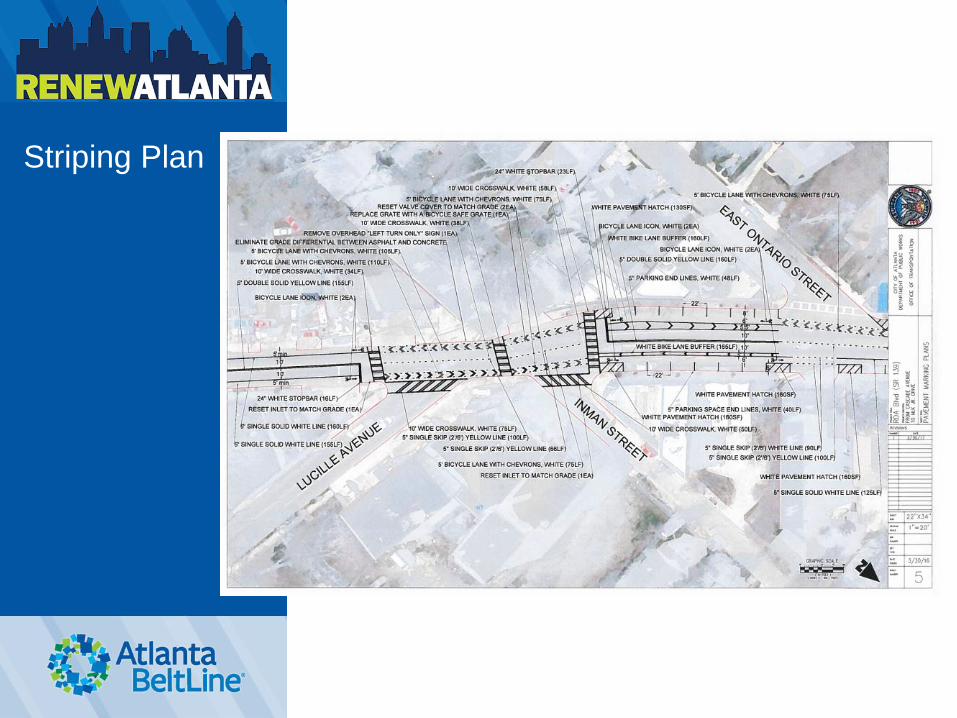
Striping Plan
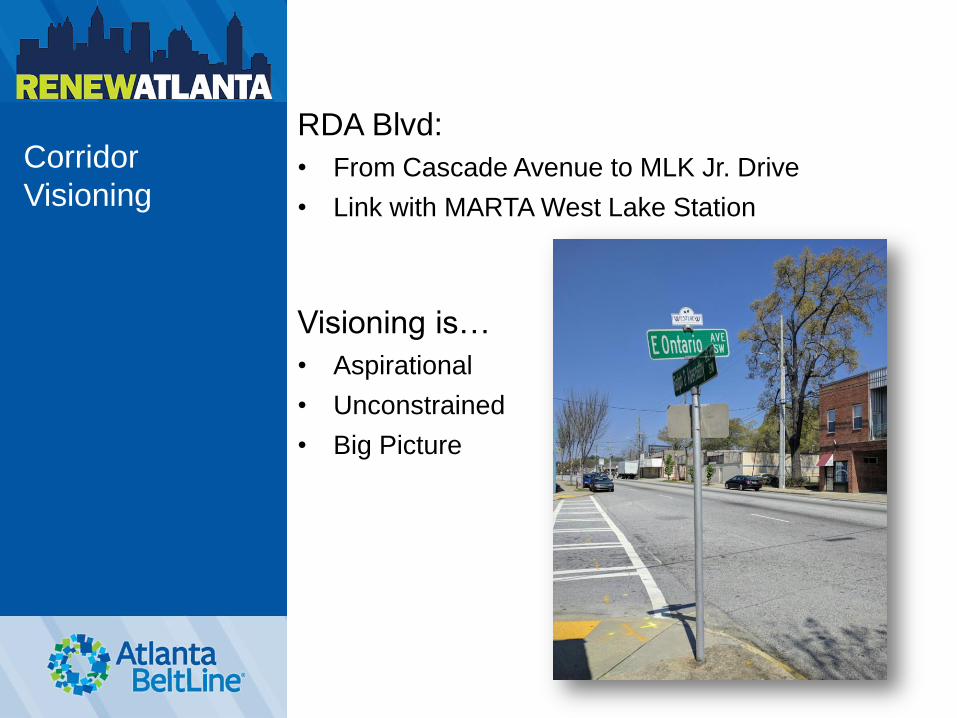
Corridor
Visioning
RDA Blvd:
• From Cascade Avenue to MLK Jr. Drive
• Link with MARTA West Lake Station
Visioning is…
• Aspirational
• Unconstrained
• Big Picture
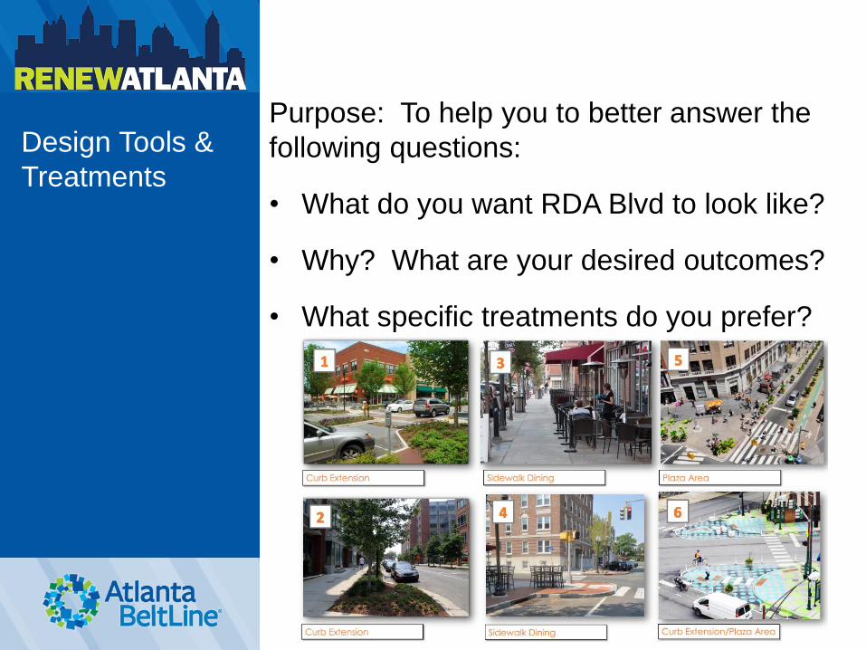
Design Tools &
Treatments
Purpose: To help you to better answer the
following questions:
• What do you want RDA Blvd to look like?
• Why? What are your desired outcomes?
• What specific treatments do you prefer?
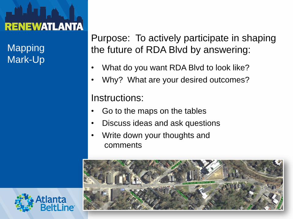
Mapping
Mark-Up
Purpose: To actively participate in shaping
the future of RDA Blvd by answering:
• What do you want RDA Blvd to look like?
• Why? What are your desired outcomes?
Instructions:
• Go to the maps on the tables
• Discuss ideas and ask questions
• Write down your thoughts and
comments
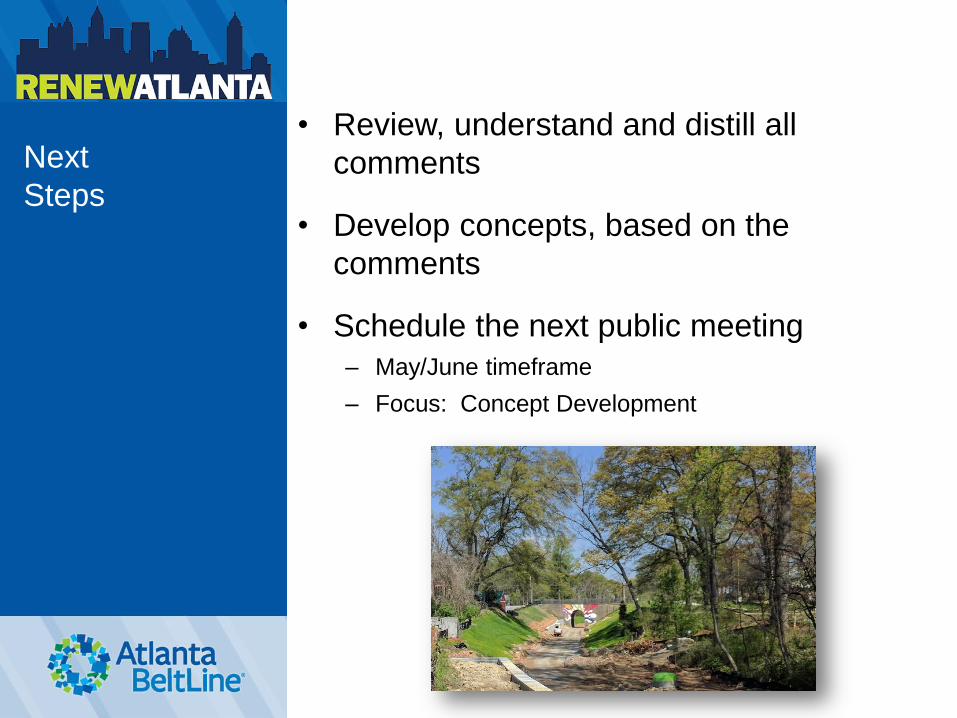
Next
Steps
• Review, understand and distill all
comments
• Develop concepts, based on the
comments
• Schedule the next public meeting
– May/June timeframe
– Focus: Concept Development


![Welcome [cdn0.vox-cdn.com]](https://img.pdfslide.us/doc/110x75/61760ba9b147146c9c747c8b/welcome-cdn0vox-cdncom.jpg)


![Welcome [1bnzr72wf2sdbsell2gosxfj.wpengine.netdna-cdn.com]](https://img.pdfslide.us/doc/110x75/620167a27b61ce5d584c974c/welcome-1bnz-.jpg)