Embed Size (px)
Citation preview
DG Joint Research Center
6th of May 2014
Study and guidelines on Geospatial Linked Data as part of ISA Action 1.17 Resource Description Framework
Danny Vandenbroucke
Diederik Tirry
Click to edit Master title style
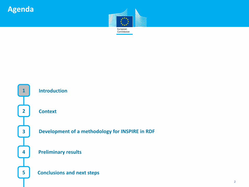
Agenda
Introduction
Context
3
2
2
Development of a methodology for INSPIRE in RDF
4
5
Preliminary results
1
Conclusions and next steps
Click to edit Master title style
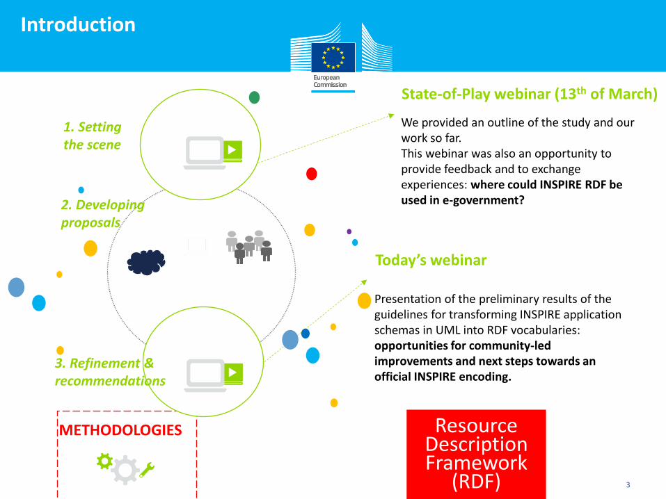
Introduction
3
We provided an outline of the study and our work so far. This webinar was also an opportunity to provide feedback and to exchange experiences: where could INSPIRE RDF be used in e-government?
METHODOLOGIES
Today’s webinar
Presentation of the preliminary results of the guidelines for transforming INSPIRE application schemas in UML into RDF vocabularies: opportunities for community-led improvements and next steps towards an official INSPIRE encoding.
State-of-Play webinar (13th of March)
1. Setting the scene
2. Developing proposals
3. Refinement & recommendations
Resource Description Framework
(RDF)
Click to edit Master title style
Agenda
Introduction
Context
3
2
4
Development of a methodology for INSPIRE in RDF
4
5
Preliminary results
1
Conclusions and next steps
Click to edit Master title style
Context
5
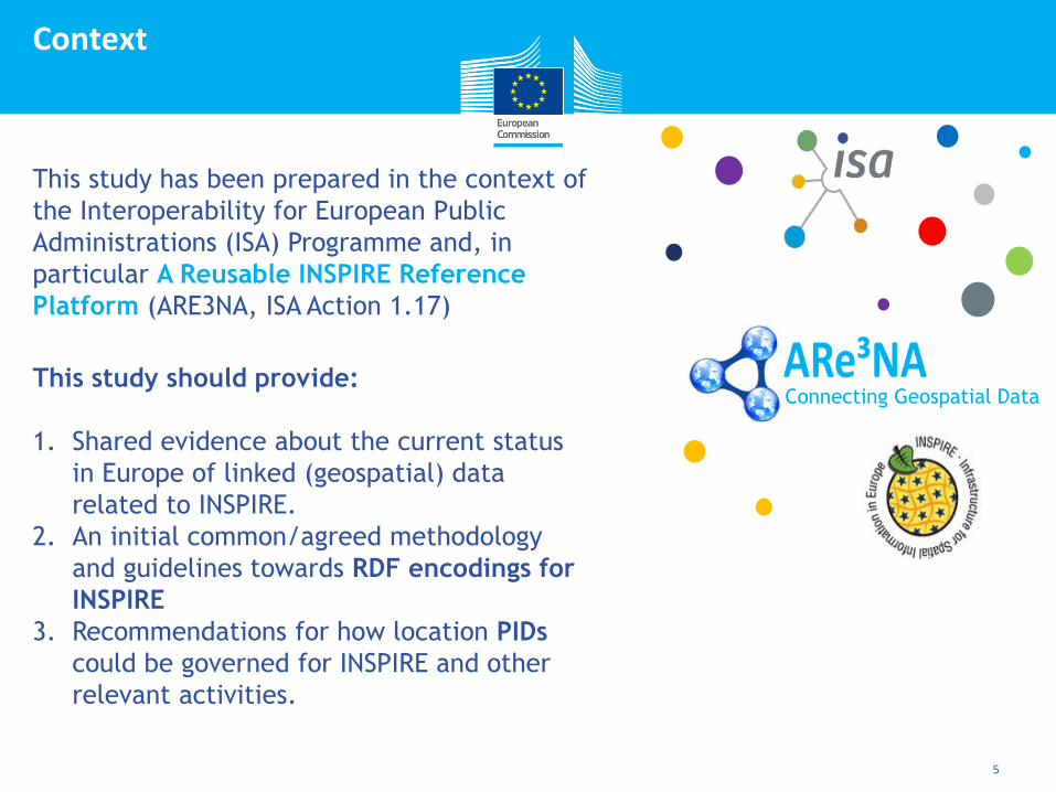
This study has been prepared in the context of
the Interoperability for European Public
Administrations (ISA) Programme and, in
particular A Reusable INSPIRE Reference
Platform (ARE3NA, ISA Action 1.17)
Connecting Geospatial Data This study should provide:
1. Shared evidence about the current status
in Europe of linked (geospatial) data
related to INSPIRE.
2. An initial common/agreed methodology
and guidelines towards RDF encodings for
INSPIRE
3. Recommendations for how location PIDs
could be governed for INSPIRE and other
relevant activities.
Click to edit Master title style
Context
12/12
6
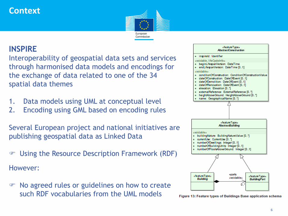
INSPIRE Interoperability of geospatial data sets and services
through harmonised data models and encodings for
the exchange of data related to one of the 34
spatial data themes
1. Data models using UML at conceptual level
2. Encoding using GML based on encoding rules
Several European project and national initiatives are
publishing geospatial data as Linked Data
Using the Resource Description Framework (RDF)
However:
No agreed rules or guidelines on how to create
such RDF vocabularies from the UML models
Click to edit Master title style
Agenda
Introduction
Context
3
2
7
Development of a methodology for INSPIRE in RDF
4
5
Preliminary results
1
Conclusions and next steps
Click to edit Master title style
Development of a methodology
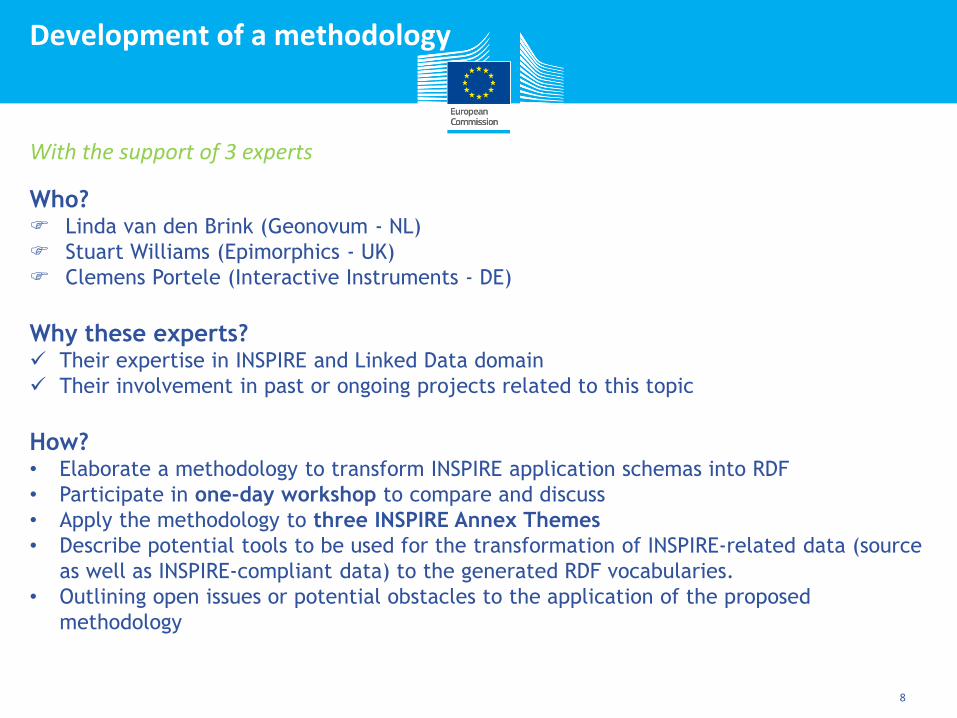
8
With the support of 3 experts
Who? Linda van den Brink (Geonovum - NL)
Stuart Williams (Epimorphics - UK)
Clemens Portele (Interactive Instruments - DE)
Why these experts? Their expertise in INSPIRE and Linked Data domain
Their involvement in past or ongoing projects related to this topic
How? • Elaborate a methodology to transform INSPIRE application schemas into RDF
• Participate in one-day workshop to compare and discuss
• Apply the methodology to three INSPIRE Annex Themes
• Describe potential tools to be used for the transformation of INSPIRE-related data (source
as well as INSPIRE-compliant data) to the generated RDF vocabularies.
• Outlining open issues or potential obstacles to the application of the proposed
methodology
Click to edit Master title style
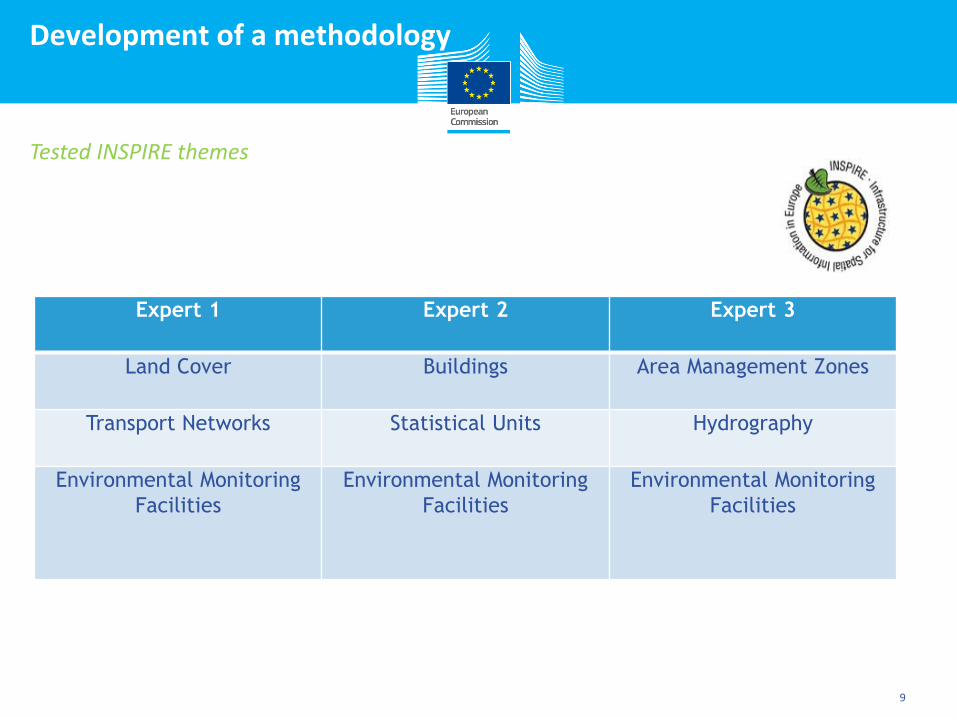
Development of a methodology
9
Tested INSPIRE themes
Expert 1 Expert 2 Expert 3
Land Cover Buildings Area Management Zones
Transport Networks Statistical Units Hydrography
Environmental Monitoring
Facilities
Environmental Monitoring
Facilities
Environmental Monitoring
Facilities
Click to edit Master title style
Agenda
Introduction
Context
3
2
10
Development of a methodology for INSPIRE in RDF
4
5
Preliminary results
1
Conclusions and next steps
Click to edit Master title style
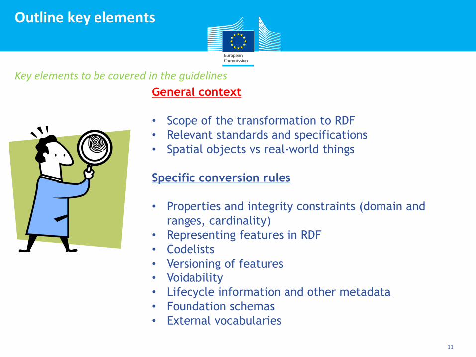
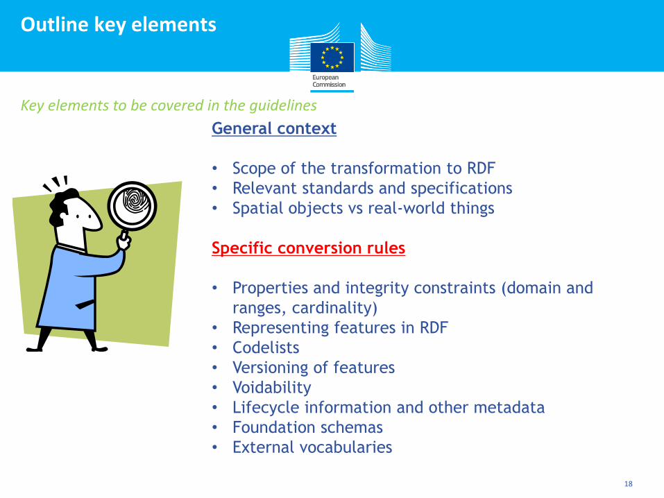
Outline key elements
11
Key elements to be covered in the guidelines
General context
• Scope of the transformation to RDF
• Relevant standards and specifications
• Spatial objects vs real-world things
Specific conversion rules
• Properties and integrity constraints (domain and
ranges, cardinality)
• Representing features in RDF
• Codelists
• Versioning of features
• Voidability
• Lifecycle information and other metadata
• Foundation schemas
• External vocabularies
Click to edit Master title style
General context
12
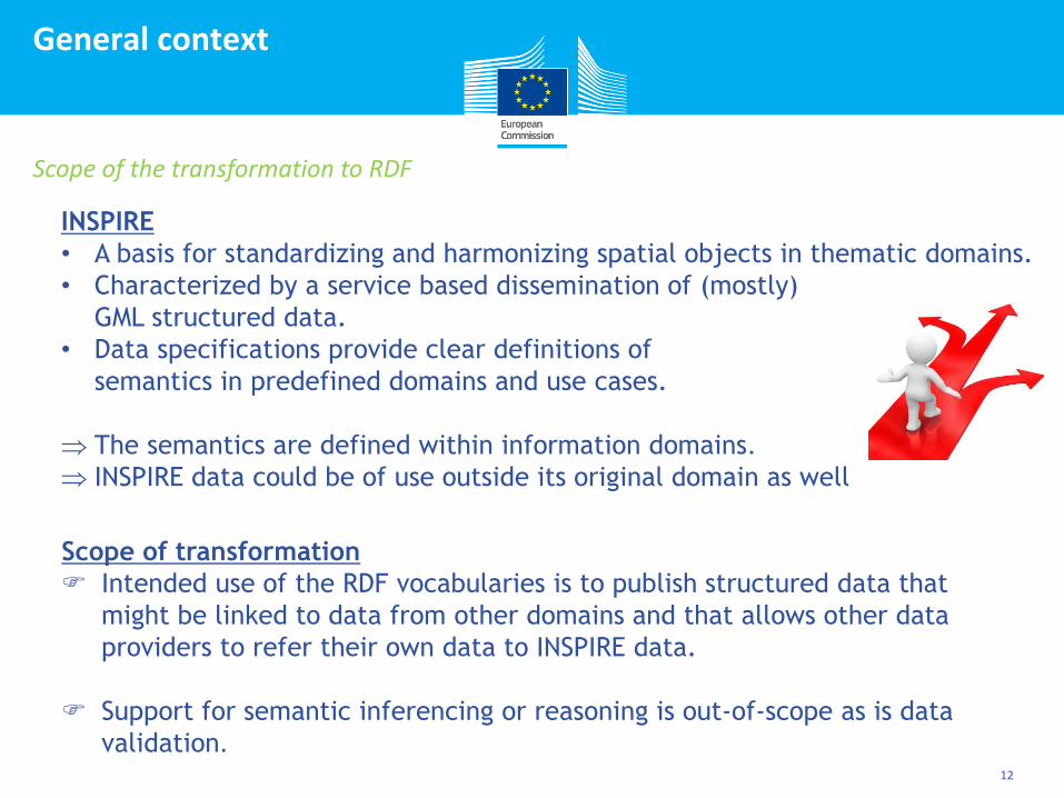
Scope of the transformation to RDF
INSPIRE
• A basis for standardizing and harmonizing spatial objects in thematic domains.
• Characterized by a service based dissemination of (mostly)
GML structured data.
• Data specifications provide clear definitions of
semantics in predefined domains and use cases.
The semantics are defined within information domains.
INSPIRE data could be of use outside its original domain as well
Scope of transformation
Intended use of the RDF vocabularies is to publish structured data that
might be linked to data from other domains and that allows other data
providers to refer their own data to INSPIRE data.
Support for semantic inferencing or reasoning is out-of-scope as is data
validation.

Click to edit Master title style
General context
13
Relevant standards and specifications
ISO/DIS 19150-2 – Geographic information — Ontology — Part 2: Rules for
developing ontologies in the Web Ontology Language (OWL) • Schema conversion rules as starting point
• ISO/DIS 19150-2 is not finalized and technical comments have been submitted
to ISO/TC 211 as part of the DIS vote
• Show strongly the UML roots and not really reflect common practice in the
linked open data world
• Changes are proposed, but require broader review, discussion and testing
Other relevant standards • ISO/DIS 19103:2013 (Conceptual Schema Language), ISO/DIS 19109:2013 (Rules
for application schema), ISO 19118:2010 (Encoding)
• Cool URIs for the Semantic Web, W3C Interest Group Note, 03.12.2008,
http://www.w3.org/TR/cooluris/
• INSPIRE Generic Conceptual Model, INSPIRE Guidelines for the encoding of
spatial data
• GeoSPARQL, NeoGEO, FOAF, ORG, Location Core, Person Core……
Click to edit Master title style
General context
14
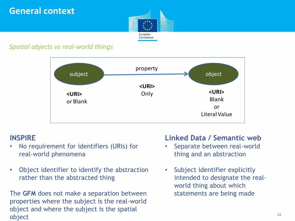
Spatial objects vs real-world things
Linked Data / Semantic web • Separate between real-world
thing and an abstraction
• Subject identifier explicitly
intended to designate the real-
world thing about which
statements are being made
INSPIRE • No requirement for identifiers (URIs) for
real-world phenomena
• Object identifier to identify the abstraction
rather than the abstracted thing
The GFM does not make a separation between
properties where the subject is the real-world
object and where the subject is the spatial
object
subject objectproperty
<URI>or Blank
<URI>Only <URI>
Blankor
Literal Value

Click to edit Master title style
General context
15
Spatial objects vs real-world things
An Area on a Map A Node in a Transport Network
A thing in the world
models
models
Spatial Object: abstract representation of a real-world
phenomenon related to a specific location or
geographical area [INSPIRE Directive]
NOTE It should be noted that the term has a different
meaning in the ISO 19100 series. It is also synonymous
with "(geographic) feature" as used in the ISO 19100
series.
From:
INSPIRE Generic Conceptual Model D2.5 v3.3
Source: Stuart Williams
Click to edit Master title style
General context
Common practice in Linked Data is to be clear about ‘subjects’ and avoid
conflation of object with real-world thing i.e. two persistent URIs for each
feature
1. URI for the INSPIRE feature document
(collection of triples with the real-world phenomenon or the feature as
subject)
2. URI for the real-world phenomenon
Conclusions and good practices have been documented in the W3C document
"Cool URIs for the Semantic Web".
No requirement that only a single URI is used for the real-world phenomenon -
it is fine to use different URIs if there are no reference sets around.
Related to other key issue ‘Lifecycle information and other metadata’
Spatial objects vs real-world things
Click to edit Master title style
General context
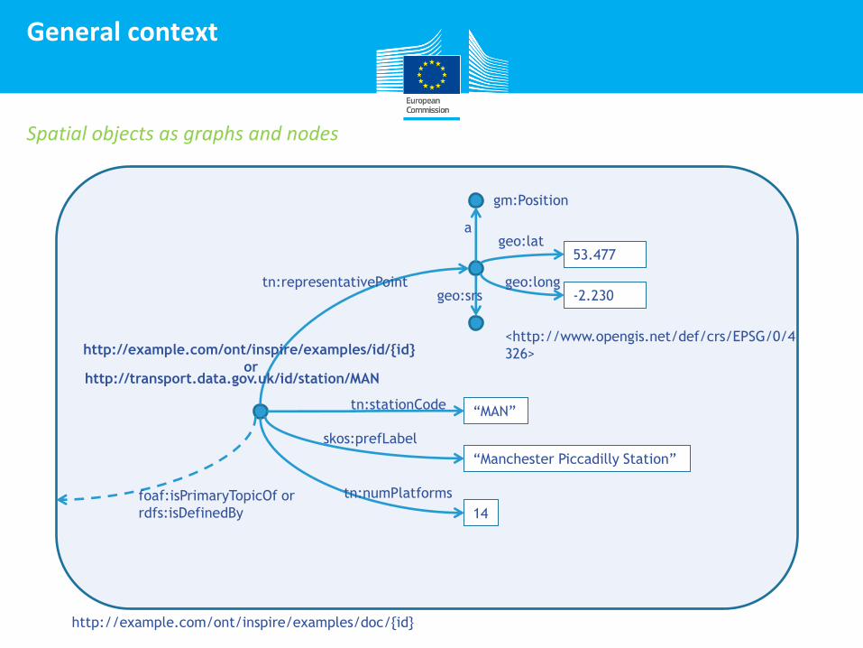
Spatial objects as graphs and nodes
53.477
-2.230
gm:Position
a geo:lat
geo:long geo:srs
<http://www.opengis.net/def/crs/EPSG/0/4
326>
tn:representativePoint
“Manchester Piccadilly Station”
14
“MAN” tn:stationCode
skos:prefLabel
tn:numPlatforms
http://example.com/ont/inspire/examples/doc/{id}
http://transport.data.gov.uk/id/station/MAN
http://example.com/ont/inspire/examples/id/{id}
or
foaf:isPrimaryTopicOf or
rdfs:isDefinedBy
Click to edit Master title style
Outline key elements
18
Key elements to be covered in the guidelines
General context
• Scope of the transformation to RDF
• Relevant standards and specifications
• Spatial objects vs real-world things
Specific conversion rules
• Properties and integrity constraints (domain and
ranges, cardinality)
• Representing features in RDF
• Codelists
• Versioning of features
• Voidability
• Lifecycle information and other metadata
• Foundation schemas
• External vocabularies
Click to edit Master title style
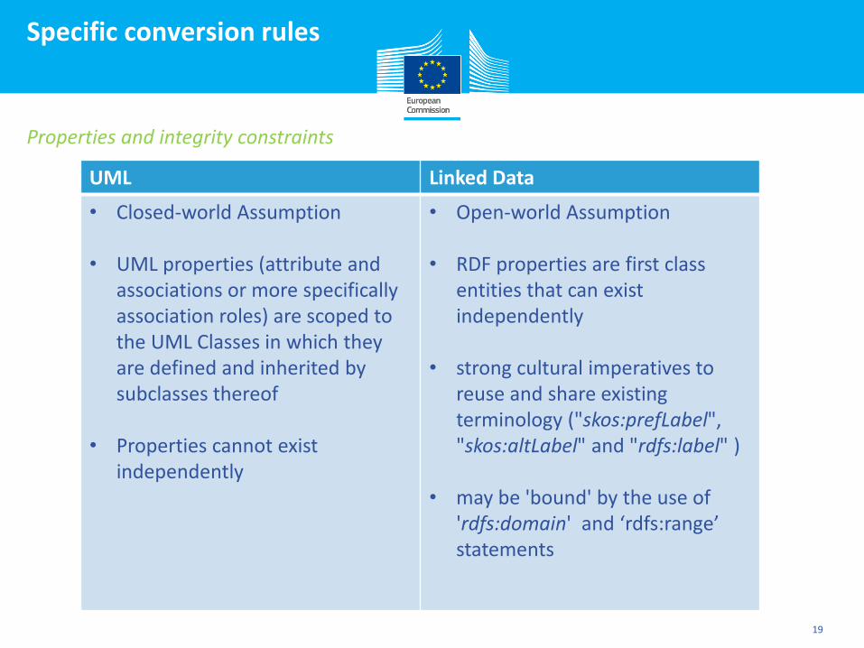
Specific conversion rules
19
Properties and integrity constraints
UML Linked Data
• Closed-world Assumption
• UML properties (attribute and associations or more specifically association roles) are scoped to the UML Classes in which they are defined and inherited by subclasses thereof
• Properties cannot exist independently
• Open-world Assumption
• RDF properties are first class entities that can exist independently
• strong cultural imperatives to reuse and share existing terminology ("skos:prefLabel", "skos:altLabel" and "rdfs:label" )
• may be 'bound' by the use of 'rdfs:domain' and ‘rdfs:range’ statements
Click to edit Master title style
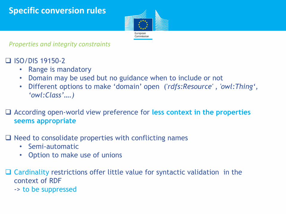
Specific conversion rules
ISO/DIS 19150-2
• Range is mandatory
• Domain may be used but no guidance when to include or not
• Different options to make ‘domain’ open ('rdfs:Resource' , 'owl:Thing‘,
‘owl:Class’….)
According open-world view preference for less context in the properties
seems appropriate
Need to consolidate properties with conflicting names
• Semi-automatic
• Option to make use of unions
Cardinality restrictions offer little value for syntactic validation in the
context of RDF
-> to be suppressed
Properties and integrity constraints
Click to edit Master title style
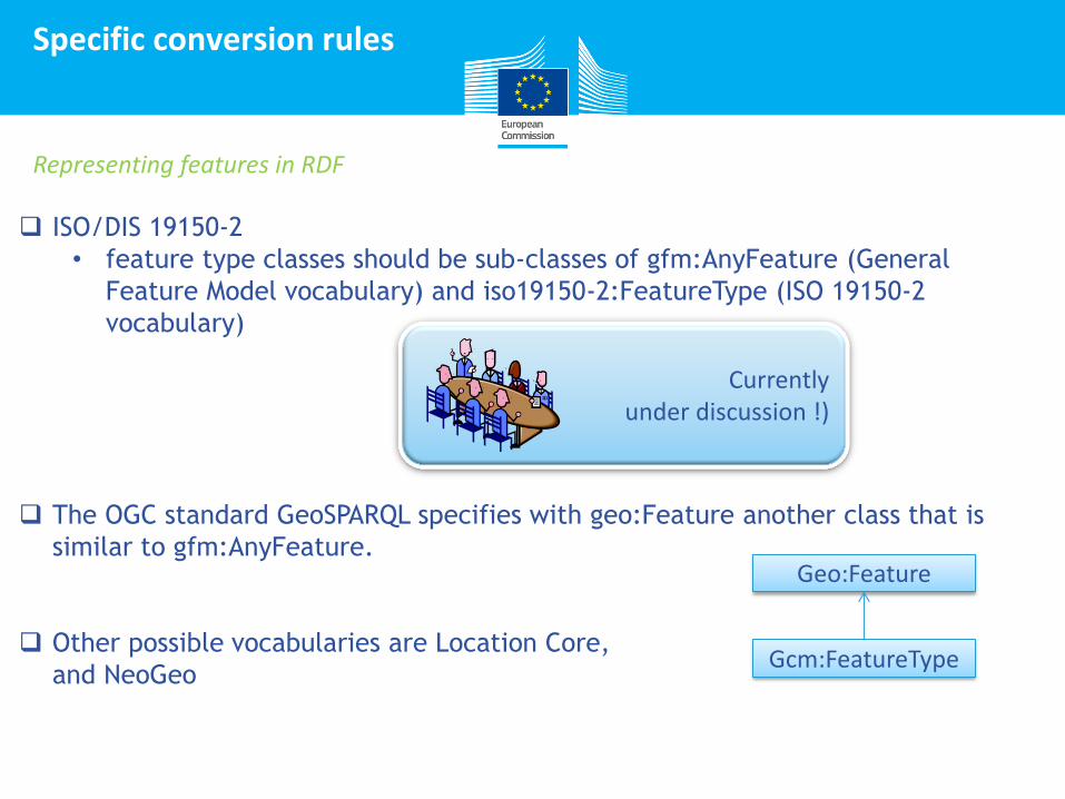
Specific conversion rules
ISO/DIS 19150-2
• feature type classes should be sub-classes of gfm:AnyFeature (General
Feature Model vocabulary) and iso19150-2:FeatureType (ISO 19150-2
vocabulary)
The OGC standard GeoSPARQL specifies with geo:Feature another class that is
similar to gfm:AnyFeature.
Other possible vocabularies are Location Core,
and NeoGeo
Representing features in RDF
Currently under discussion !)
Geo:Feature
Gcm:FeatureType
Click to edit Master title style
Specific conversion rules
Conversion depends whether they are part of the application schema
1. INSPIRE core application schema
• Codelists are managed separately from application schemas and are
managed in the INSPIRE code list register and other registers. It is
therefore inappropriate to include classes and SKOS concept schemes for
code lists in the RDF vocabularies.
• Use skos:Concept as their range unless the tagged values "vocabulary" is a
http or https URI.
• The INSPIRE registry currently does not support a SKOS representation of
the INSPIRE code lists.
Codelists
Click to edit Master title style
Specific conversion rules
Conversion depends whether they are part of the application schema
2. Embedded in application schema (e.g. extension)
• Codelist and controlled vocabularies can be transformed into SKOS
concept schemes.
• All code points are members of the scheme using skos:inScheme.
• They are also made instances of a distinguished subclass of skos:Concept
which can be use to restrict the range of a property.
• An open domained property can be defined to make use of the code with
an arbitrary entity.
• Linked to properties can be done using “owl:oneof” although this is more
appropriate to enumerations.
Codelists
Click to edit Master title style
Specific conversion rules
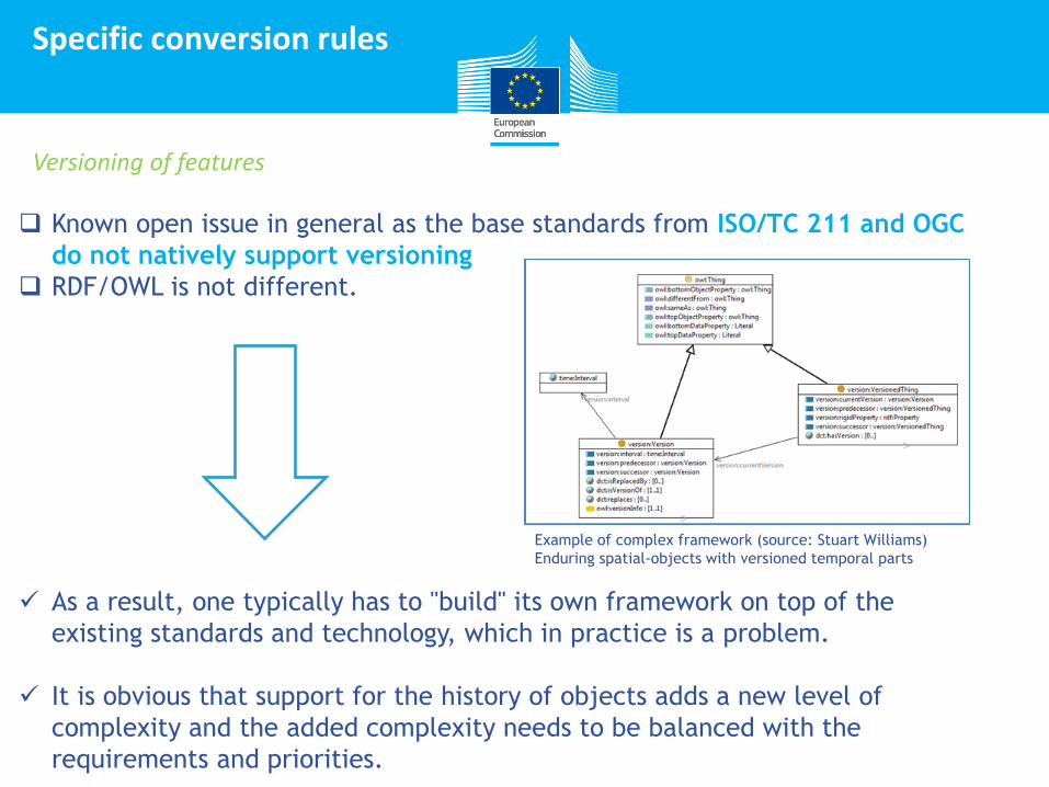
Known open issue in general as the base standards from ISO/TC 211 and OGC
do not natively support versioning
RDF/OWL is not different.
As a result, one typically has to "build" its own framework on top of the
existing standards and technology, which in practice is a problem.
It is obvious that support for the history of objects adds a new level of
complexity and the added complexity needs to be balanced with the
requirements and priorities.
Versioning of features
Example of complex framework (source: Stuart Williams)
Enduring spatial-objects with versioned temporal parts
Click to edit Master title style
Specific conversion rules
Allows to state explicitly that
• something, for example the name of a road, is not known
• a road is known to have no name.
INSPIRE application schemas, although generally based on the closed-
world assumption, support unknown facts.
Voidable properties present a certain amount of difficulty to RDF under the
open-world assumption. Just because the value of a property may not be given
does not mean that there is no value for that property that could be given
elsewhere. RDF has no proper mechanism (that we are aware of) to state that a
road is known to have no name.
As a result, one typically has to "build" its own framework on top of the
existing standards and technology, which in practice is a problem.
It is obvious that support for the history of objects adds a new level of
complexity and the added complexity needs to be balanced with the
requirements and priorities.
Voidability
No conversion rule needed for concept of voidability
If voidreason is required a possible approach relies on the creation of a codelist for void reasons through SKOS

Click to edit Master title style
Specific conversion rules
In INSPIRE, most properties are properties that
describe the real-world phenomenon. However,
there are exceptions:
• Properties that represent life-cycle
information
• Properties that have a value type from ISO
19115 are often feature metadata.
• Properties that require a closer review to
identify them as feature metadata.
Examples are
CadastralZoning.estimatedAccuracy or
CadastralZoning.
originalMapScaleDenominator that are not
properties of the real-world phenomenon,
but of the feature.
Lifecycle information and other metadata
From the perspective of the RDF vocabularies there is no distinction between the two types of properties, because the rdfs:domain is not included
Impacts how instances are represented in RDF as it is important in linked data and the semantic web to be clear about the subjects.
Click to edit Master title style
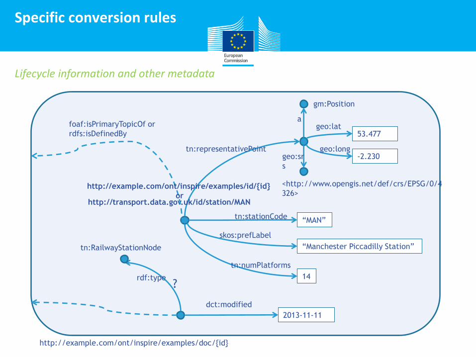
Specific conversion rules
Lifecycle information and other metadata
53.477
-2.230
gm:Position
a geo:lat
geo:long geo:sr
s
<http://www.opengis.net/def/crs/EPSG/0/4
326>
tn:representativePoint
“Manchester Piccadilly Station”
14
“MAN” tn:stationCode
skos:prefLabel
tn:numPlatforms
http://example.com/ont/inspire/examples/doc/{id}
http://transport.data.gov.uk/id/station/MAN
http://example.com/ont/inspire/examples/id/{id}
or
foaf:isPrimaryTopicOf or
rdfs:isDefinedBy
2013-11-11
dct:modified
rdf:type
tn:RailwayStationNode
?
Click to edit Master title style
Specific conversion rules
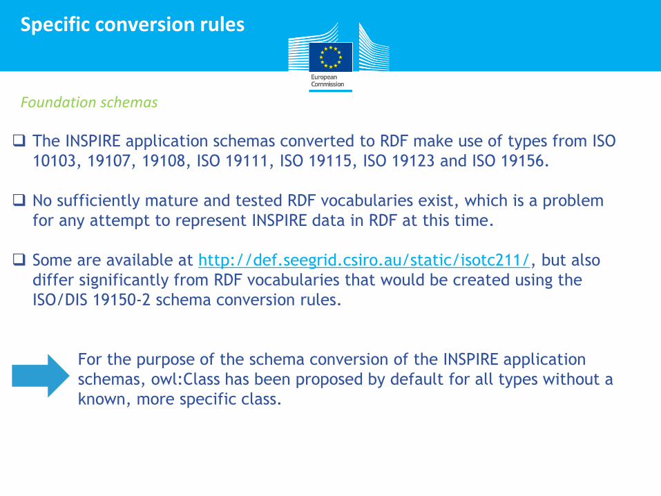
Foundation schemas
The INSPIRE application schemas converted to RDF make use of types from ISO
10103, 19107, 19108, ISO 19111, ISO 19115, ISO 19123 and ISO 19156.
No sufficiently mature and tested RDF vocabularies exist, which is a problem
for any attempt to represent INSPIRE data in RDF at this time.
Some are available at http://def.seegrid.csiro.au/static/isotc211/, but also
differ significantly from RDF vocabularies that would be created using the
ISO/DIS 19150-2 schema conversion rules.
For the purpose of the schema conversion of the INSPIRE application
schemas, owl:Class has been proposed by default for all types without a
known, more specific class.
Click to edit Master title style
Specific conversion rules
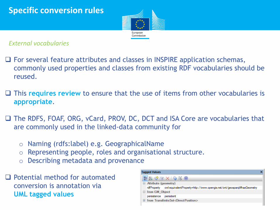
External vocabularies
For several feature attributes and classes in INSPIRE application schemas,
commonly used properties and classes from existing RDF vocabularies should be
reused.
This requires review to ensure that the use of items from other vocabularies is
appropriate.
The RDFS, FOAF, ORG, vCard, PROV, DC, DCT and ISA Core are vocabularies that
are commonly used in the linked-data community for
o Naming (rdfs:label) e.g. GeographicalName
o Representing people, roles and organisational structure.
o Describing metadata and provenance
Potential method for automated
conversion is annotation via
UML tagged values
Click to edit Master title style
Open issues
Known open issues
modelling conventions in UML may result in complex UML constructions (e.g.
multiple inheritance) which might be difficult to map to other representations.
Modelling conventions do not make any sense in the OWL domain and
could be expressed in a better way in OWL, representing the real world
more closely than is possible in UML.
The schema conversion rules in ISO/DIS 19150-2 are inappropriate or
incomplete for:
• Composition and aggregation
• For union data types
• Association classes
• OCL constraints
Generation of instance data
vocabulary management issues, etc….
Click to edit Master title style
Agenda
Introduction
Context
3
2
31
Development of a methodology for INSPIRE in RDF
4
5
Preliminary results
1
Conclusions and next steps
Click to edit Master title style
Conclusions
32
12/12
ISO/DIS 19150-2 is not finalized
o Disposition of the DIS comments should be taken into account
o Series of issues from experiment that are not part of ISO/DIS19150-2
RDF vocabularies that strongly show UML roots do not really reflect common
practice in the linked open data world.
Any automatically generated RDF vocabulary will require reviewing and
additional edits due to their specific context.
Common practice needed with respect to the use of external vocabularies e.g.
geometry representation in RDF. Dependency on other communities.
Mentioned issues require broader review and discussion as well as testing in
applications.
Good guidance and examples are needed that illustrate how feature instances
should be represented in RDF as this information is not immediately accessible
from the RDF vocabularies.
Click to edit Master title style
The results of the experiment gave insight into the challenges of transforming INSPIRE data in RDF.
Given the difficulties faced it is not surprising therefore that a definitive set of guidelines on how to transform INSPIRE to RDF cannot be given yet.
Further review and discussion is needed.
Conclusions
33
12/12
Click to edit Master title style
Feedback
34
If there is anything relevant missing from our first list of issues/questions to be
tackled please say so
What are the priorities?
contact us: [email protected]
Click to edit Master title style
Next steps
35
Processing the results of the experts
Compiling and consolidating input received
Final document “Guidelines on methodologies
for the creation of RDF vocabularies
representing the INSPIRE data models and the
transformation of INSPIRE data into RDF” by
end of May
Guidelines on
methodology
AND….
At any time, your feedback is very appreciated.
Click to edit Master title style
Next steps
36
Join the collaborative platforms in
other areas of Open Source &
Semantic Interoperability on
https://joinup.ec.europa.eu/
Connecting Geospatial Data
Thank you for your participation!