Embed Size (px)
Citation preview
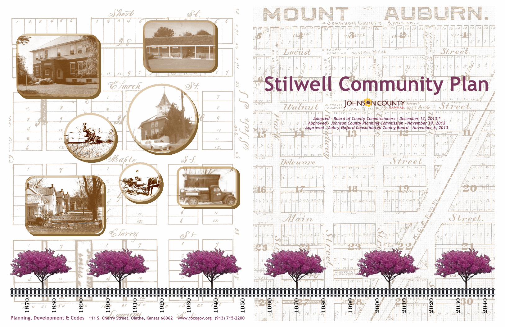
Stilwell Community Plan
Adopted - Board of County Commissioners - December 12, 2013 * Approved - Johnson County Planning Commission - November 19, 2013
Approved - Aubry-Oxford Consolidated Zoning Board - November 6, 2013
Planning, Development & Codes 111 S. Cherry Street, Olathe, Kansas 66062 www.jocogov.org (913) 715-2200
18
70
18
80
19
00
18
90
19
10
19
20
19
30
19
40
19
50
19
60
19
70
19
80
19
90
20
00
20
10
20
20
20
30
20
40
C o m m u n i t y V i s i o n C o m m u n i t y Pa r t i c i p a n t s
Stilwell Community Plan
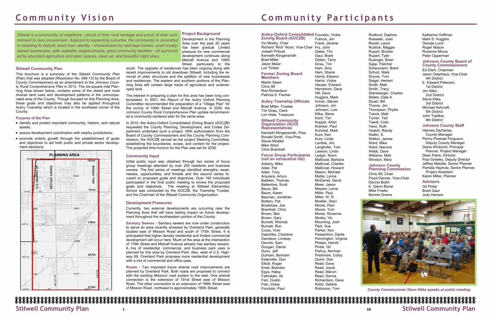
This brochure is a summary of the Stilwell Community Plan (Plan) that was adopted (Resolution No. 068-13) by the Board of County Commissioners as an amendment to the Johnson Coun-ty Rural Comprehensive Plan in 2013. The six-square mile Plan-ning Area shown below, contains some of the oldest and most diverse land uses and development patterns in the unincorpo-rated area of the County. Though focused on this Planning Area, these goals and objectives may also be applied throughout Aubry Township which is located in the southeast corner of the County.
Purpose of the Plan
identify and protect important community, historic, and natural
assets;
assure development coordination with nearby jurisdictions;
promote orderly growth through the establishment of goals
and objectives to aid both public and private sector develop-ment decisions.
Project Background
Development in the Planning Area over the past 20 years has been gradual. Limited pressure for new commercial development continues along Metcalf Avenue and 199th Street, particularly to the
south. The upgrade of residences has been ongoing along with recent improvements to old downtown Stilwell, including the re-moval of older structures and the addition of new businesses and residences. The eastern and southern portions of the Plan-ning Area still contain large tracts of agriculture and undevel-oped land.
The interest in preparing a plan for this area has been long con-templated. In 2001, the Report of the Aubry Oxford Planning Committee recommended the preparation of a “Village Plan” for the vicinity of 199th Street and Metcalf Avenue. In 2004, the Johnson County Rural Comprehensive Plan update recommend-ed a community-centered plan for the same area.
In 2010, the Aubry-Oxford Consolidated Zoning Board (AOCZB) requested the County Planning, Development, and Codes De-partment undertake such a project. With authorization from the Board of County Commissioners and the County Planning Com-mission, the AOCZB served as the project Steering Committee, establishing the boundaries, scope, and content for the project. The projected time horizon for the Plan was set for 2030.
Community Input
Initial public input was obtained through two series of focus group meetings attended by over 200 residents and business owners. The first series of meetings identified strengths, weak-nesses, opportunities, and threats and the second series fo-cused on proposed goals and objectives. Over 160 individuals participated in the final public meeting to review the proposed goals and objectives. The meeting at Stillwell Elementary School was conducted by the AOCZB, the Township Trustee, and the Chairman of the Stilwell Community Organization.
Development Pressures
Currently, two external developments are occurring near the Planning Area that will have lasting impact on future develop-ment throughout the southeastern portion of the County:
Sanitary Sewers - Sanitary sewers are now under construction to serve an area recently annexed by Overland Park, generally located east of Mission Road and south of 175th Street. It is anticipated that higher density residential and limited commercial development will occur here. Much of the area at the intersection of 179th Street and Metcalf Avenue already has sanitary sewers. A mix of residential, commercial, and business park uses is planned for this area by Overland Park. Also, west of U.S. High-way 69, Overland Park proposes more residential development with a mix of commercial and office uses.
Roads - Two important future arterial road improvements are planned by Overland Park. Both roads are proposed to connect with the existing Missouri road system to the east. One arterial connection is the extension of 191st Street east of Mission Road. The other connection is an extension of 199th Street east of Mission Road, northeast to approximately 195th Street.
Aubry-Oxford Consolidated Zoning Board (AOCZB)
Vic Mosby, Chair Richard “Rick” Noon, Vice-Chair Joseph Pribula Kenneth Klingensmith Brad Miller Jason Meier Lori Tinkler
Former Zoning Board Members
Martin Seem Chris Illif Rod Richardson Patricia S. Fischer
Aubry Township Officials
Brad Miller, Trustee Tim Gnau, Clerk Lori Hisle, Treasurer
Stilwell Community Organization (SCO) Representatives
Kenneth Klingensmith, Pres. Ronald Smith, Vice-Pres. Stacie Moeller Mike Ward Chris Bramhall
Focus Group Participants (not an exhaustive list)
Ackerly, Mike Adair, Pat Adair, Tony Arquiera, Arturo Baldwin, Thomas Ballentine, Scott Baum, Bill Baum, Karen Bauman, Jonathan Bottaro, Pat Bradshaw, Joe Bramhall, Chris Brown, Ben Brown, Gary Burnett, Rhonda Burnett, Ron Cross, Vicki Daschlke, Charlene Davidson, Lindsay Devinki, Sam Dougan, Darrel Dunn, Jeff Durham, Benham Eidemiller, Don Elliott, Roger Emel, Brandon Epps, Haley Fathollahi, Ali Fish, Dustin Fish, Vickie Fountain, Paul
Fountain, Vickie Francis, Jim Frank, Jerame Fry, John Gates, Tim Gaul, Brant Gliden, Terry Gnau, Tim Ham, Amy Ham, Shane Harris, Eleanor Harris, Vickie Hauser, Edward Hernstrom, Dave Hill, Dave Huggins, Mark Inman, Steven Johnson, Jim Johnson, Lois Klika, Steve Koch, Tim Koppel, Arlan Kranker, Paul Kuhnkal, Mark Kure, Ken Kure, Linda Lambie, Jim Langhofer, Tom Lawson, Linda Ledgin, Norm Mallicoat, Barbara Mallicoat, Charles Mallicoat, Howard Mason, Michael Matile, Lynne McDaniel, David Meier, Jason Meyers, Lorna Miller, Paul Miller, W. R. Moeller, Staci Moore, Pam Moore, Tom Morse, Roxanne Mosby, Vic Mourning, Josh Park, Sue Parker, Ken Passantino, Dante Pennington, Virginia Phelps, Harold Pintar, Gil Pishny, Norman Predmore, Corby Quinn, Dan Read, Dave Read, Joyce Read, Marvin Reed, Donna Richardson, Dave Robb, Debbie Robinson, Tom
Rodlund, Daphne Roeseler, Joan Rozell, Laura Rudrick, Maggie Rupert, Brooke Rupert, Tyler Rusinger, Brian Sapp, Fletcher Scheumann, Brent Schulz, Mark Shyver, Tom Siegel, Herbert Smith, Matt Smith, Tracy Stansbarger, Charles Staten, Dale A. Stuart, Bill Thome, Jim Thompson, Phyllis Tulock, Matt Turner, Ted Twedt, Colin Vano, Ruth Veatch, Randy Waltin, S. Walton, James Ward, Mike Ward, Nacona Webb, Dave Williams, Matt Winston, Mary
Johnson County Planning Commission
Chris Illif, Chair Floyd Danner, Vice-Chair Dennis Bollin E. Glenn Bonar Mike Fowks Bonnie Givens
Katherine Hoffman Mark S. Huggins George Lund Roger Mason Roxanne Morse Peter Opperman
Johnson County Board of County Commissioners
Ed Eilert, Chairman Jason Osterhaus, Vice-Chair
4th District E. Edward Peterson,
1st District Jim Allen,
2nd District Steve Klika,
3rd District Michael Ashcraft,
5th District John Toplikar,
6th District
Johnson County Staff
Hannes Zacharias, County Manager
Penny Postoak Ferguson, Deputy County Manager
Diane Wicklund, Principal Planner, Project Manager
Dean Palos, Director Paul Greeley, Deputy Director Jeffrey Malotte, Senior Planner Pamela Hayhow, Senior Planner,
Project Assistant Karen Miller, Planner
Advisors
Gil Pintar Brant Gaul Jody Hanson
1 10
PLANNING AREA
191st
183rd
199th
207th
215th
MET
CA
LF A
VEN
UE
NA
LL A
VEN
UE
U.S
. H
IGH
WA
Y 6
9
Stilwell is a community of neighbors - proud of their rural heritage and proud of their com-
mitment to civic involvement. Adjacent to expanding suburbia, the community is committed
to retaining its historic small town identity - characterized by well-kept homes, small locally-
owned businesses, safe walkable neighborhoods, great community facilities - all surround-
ed by abundant agriculture and open spaces, clean air, and beautiful night skies.
Stilwell Community Plan Stilwell Community Plan
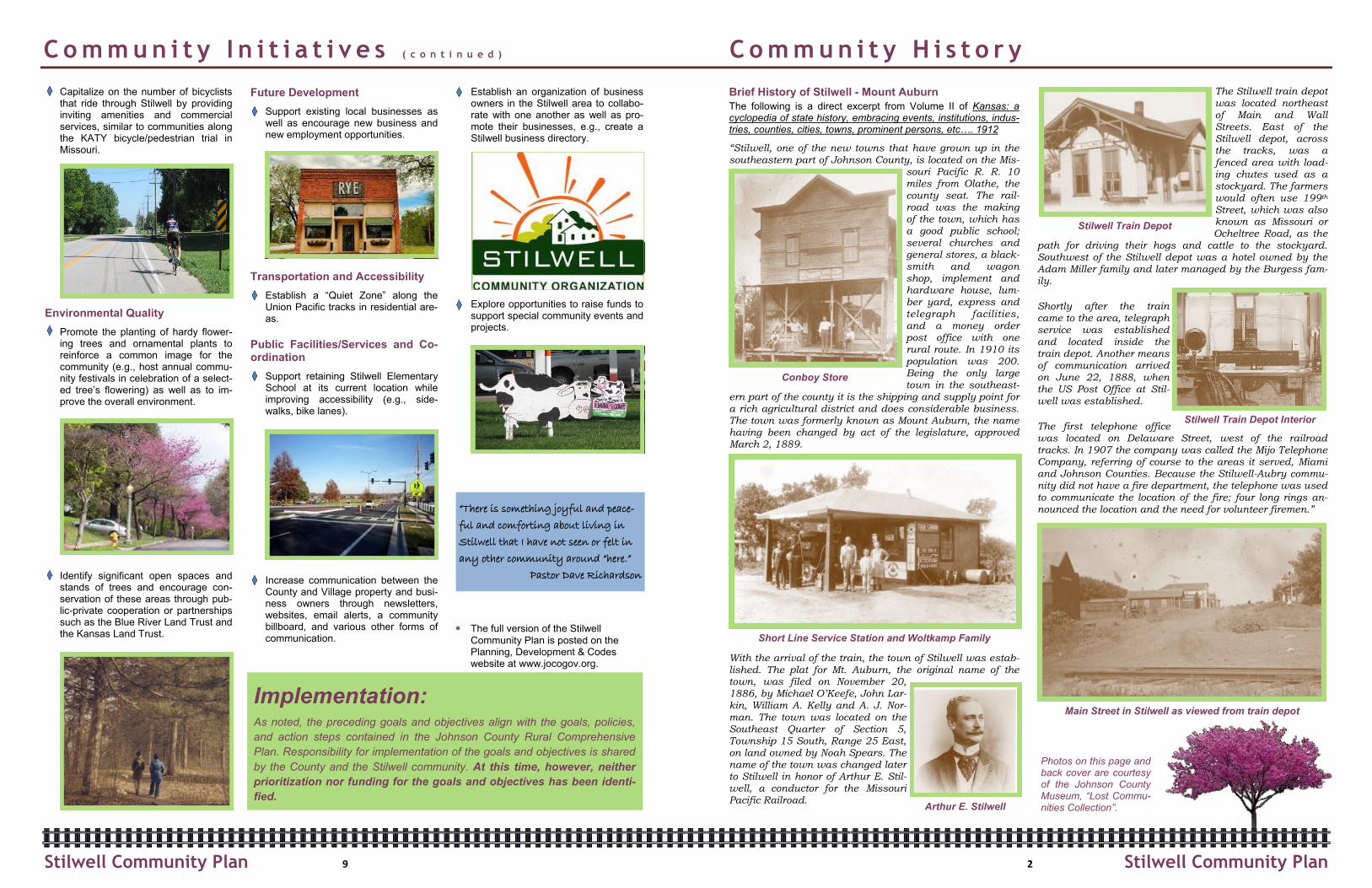
County Commissioner Steve Klika speaks at public meeting
C o m m u n i t y I n i t i a t i v e s ( c o n t i n u e d ) C o m m u n i t y H i s t o r y
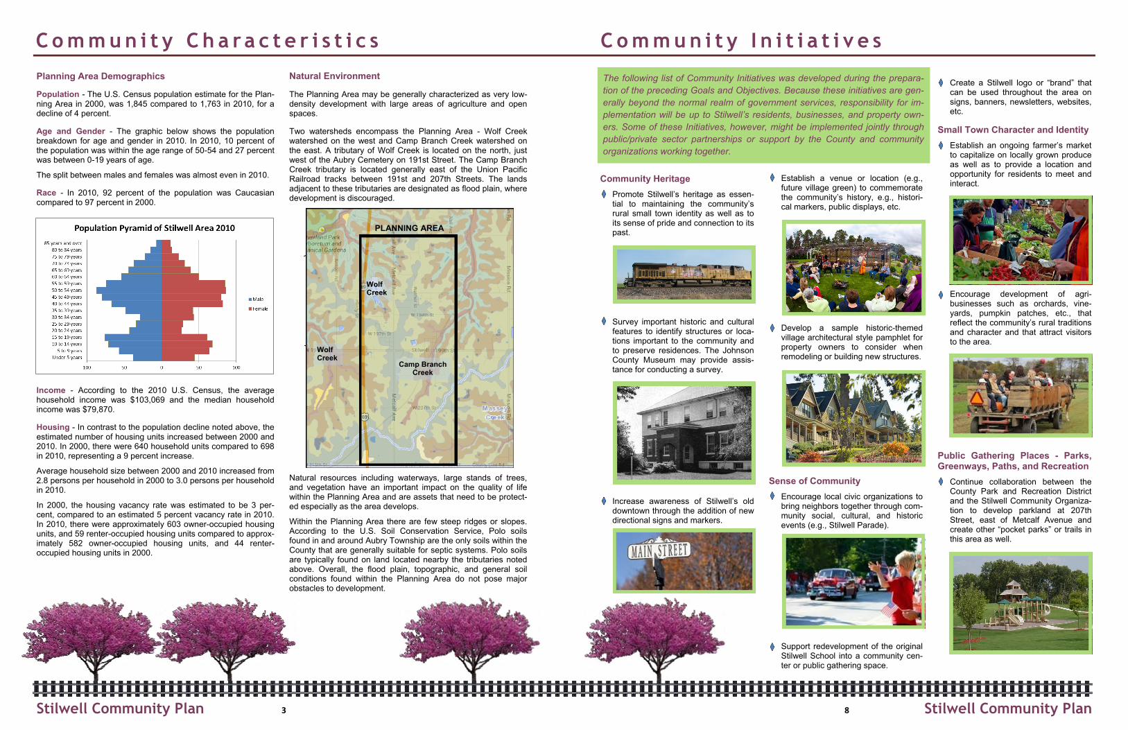
Brief History of Stilwell - Mount Auburn
The following is a direct excerpt from Volume II of Kansas: a cyclopedia of state history, embracing events, institutions, indus-tries, counties, cities, towns, prominent persons, etc…. 1912
“Stilwell, one of the new towns that have grown up in the southeastern part of Johnson County, is located on the Mis-
souri Pacific R. R. 10 miles from Olathe, the county seat. The rail-road was the making of the town, which has a good public school; several churches and general stores, a black-smith and wagon shop, implement and hardware house, lum-ber yard, express and telegraph facilities, and a money order post office with one rural route. In 1910 its population was 200. Being the only large town in the southeast-
ern part of the county it is the shipping and supply point for a rich agricultural district and does considerable business. The town was formerly known as Mount Auburn, the name having been changed by act of the legislature, approved March 2, 1889.
With the arrival of the train, the town of Stilwell was estab-lished. The plat for Mt. Auburn, the original name of the town, was filed on November 20, 1886, by Michael O’Keefe, John Lar-kin, William A. Kelly and A. J. Nor-man. The town was located on the Southeast Quarter of Section 5, Township 15 South, Range 25 East, on land owned by Noah Spears. The name of the town was changed later to Stilwell in honor of Arthur E. Stil-well, a conductor for the Missouri Pacific Railroad.
The Stilwell train depot was located northeast of Main and Wall Streets. East of the Stilwell depot, across the tracks, was a fenced area with load-ing chutes used as a stockyard. The farmers would often use 199th Street, which was also known as Missouri or Ocheltree Road, as the
path for driving their hogs and cattle to the stockyard. Southwest of the Stilwell depot was a hotel owned by the Adam Miller family and later managed by the Burgess fam-ily.
Shortly after the train came to the area, telegraph service was established and located inside the train depot. Another means of communication arrived on June 22, 1888, when the US Post Office at Stil-well was established.
The first telephone office was located on Delaware Street, west of the railroad tracks. In 1907 the company was called the Mijo Telephone Company, referring of course to the areas it served, Miami and Johnson Counties. Because the Stilwell-Aubry commu-nity did not have a fire department, the telephone was used to communicate the location of the fire; four long rings an-nounced the location and the need for volunteer firemen.”
Capitalize on the number of bicyclists that ride through Stilwell by providing inviting amenities and commercial services, similar to communities along the KATY bicycle/pedestrian trial in Missouri.
Environmental Quality
Promote the planting of hardy flower-ing trees and ornamental plants to reinforce a common image for the community (e.g., host annual commu-nity festivals in celebration of a select-ed tree’s flowering) as well as to im-prove the overall environment.
Identify significant open spaces and stands of trees and encourage con-servation of these areas through pub-lic-private cooperation or partnerships such as the Blue River Land Trust and the Kansas Land Trust.
Future Development
Support existing local businesses as well as encourage new business and new employment opportunities.
Transportation and Accessibility
Establish a “Quiet Zone” along the Union Pacific tracks in residential are-as.
Public Facilities/Services and Co-ordination
Support retaining Stilwell Elementary School at its current location while improving accessibility (e.g., side-walks, bike lanes).
Increase communication between the County and Village property and busi-ness owners through newsletters, websites, email alerts, a community billboard, and various other forms of communication.
Establish an organization of business owners in the Stilwell area to collabo-rate with one another as well as pro-mote their businesses, e.g., create a Stilwell business directory.
Explore opportunities to raise funds to support special community events and projects.
The full version of the Stilwell
Community Plan is posted on the Planning, Development & Codes website at www.jocogov.org.
Photos on this page and back cover are courtesy of the Johnson County Museum, “Lost Commu-nities Collection”. Arthur E. Stilwell
Conboy Store
Main Street in Stilwell as viewed from train depot
Stilwell Train Depot
Stilwell Train Depot Interior
Short Line Service Station and Woltkamp Family
2 9
Implementation: As noted, the preceding goals and objectives align with the goals, policies,
and action steps contained in the Johnson County Rural Comprehensive
Plan. Responsibility for implementation of the goals and objectives is shared
by the County and the Stilwell community. At this time, however, neither
prioritization nor funding for the goals and objectives has been identi-
fied.
Stilwell Community Plan Stilwell Community Plan
“There is something joyful and peace-
ful and comforting about living in
Stilwell that I have not seen or felt in
any other community around “here.”
Pastor Dave Richardson
C o m m u n i t y C h a ra c t e r i s t i c s C o m m u n i t y I n i t i a t i v e s
Community Heritage
Promote Stilwell’s heritage as essen-tial to maintaining the community’s rural small town identity as well as to its sense of pride and connection to its past.
Survey important historic and cultural features to identify structures or loca-tions important to the community and to preserve residences. The Johnson County Museum may provide assis-tance for conducting a survey.
Increase awareness of Stilwell’s old downtown through the addition of new directional signs and markers.
Establish a venue or location (e.g., future village green) to commemorate the community’s history, e.g., histori-cal markers, public displays, etc.
Develop a sample historic-themed village architectural style pamphlet for property owners to consider when remodeling or building new structures.
Sense of Community
Encourage local civic organizations to bring neighbors together through com-munity social, cultural, and historic events (e.g., Stilwell Parade).
Support redevelopment of the original Stilwell School into a community cen-ter or public gathering space.
Create a Stilwell logo or “brand” that can be used throughout the area on signs, banners, newsletters, websites, etc.
Small Town Character and Identity
Establish an ongoing farmer’s market to capitalize on locally grown produce as well as to provide a location and opportunity for residents to meet and interact.
Encourage development of agri-businesses such as orchards, vine-yards, pumpkin patches, etc., that reflect the community’s rural traditions and character and that attract visitors to the area.
Public Gathering Places - Parks, Greenways, Paths, and Recreation
Continue collaboration between the County Park and Recreation District and the Stilwell Community Organiza-tion to develop parkland at 207th Street, east of Metcalf Avenue and create other “pocket parks” or trails in this area as well.
The following list of Community Initiatives was developed during the prepara-
tion of the preceding Goals and Objectives. Because these initiatives are gen-
erally beyond the normal realm of government services, responsibility for im-
plementation will be up to Stilwell’s residents, businesses, and property own-
ers. Some of these Initiatives, however, might be implemented jointly through
public/private sector partnerships or support by the County and community
organizations working together.
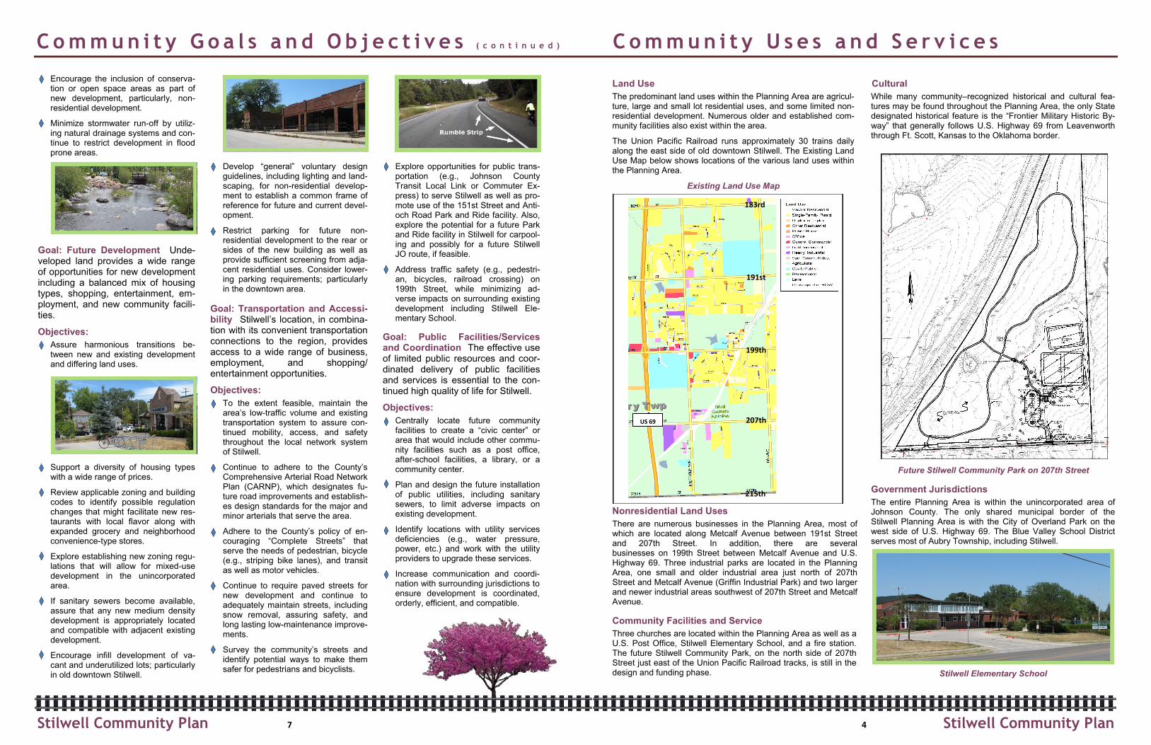
Planning Area Demographics
Population - The U.S. Census population estimate for the Plan-ning Area in 2000, was 1,845 compared to 1,763 in 2010, for a decline of 4 percent.
Age and Gender - The graphic below shows the population breakdown for age and gender in 2010. In 2010, 10 percent of the population was within the age range of 50-54 and 27 percent was between 0-19 years of age.
The split between males and females was almost even in 2010.
Race - In 2010, 92 percent of the population was Caucasian compared to 97 percent in 2000.
Income - According to the 2010 U.S. Census, the average household income was $103,069 and the median household income was $79,870.
Housing - In contrast to the population decline noted above, the estimated number of housing units increased between 2000 and 2010. In 2000, there were 640 household units compared to 698 in 2010, representing a 9 percent increase.
Average household size between 2000 and 2010 increased from 2.8 persons per household in 2000 to 3.0 persons per household in 2010.
In 2000, the housing vacancy rate was estimated to be 3 per-cent, compared to an estimated 5 percent vacancy rate in 2010. In 2010, there were approximately 603 owner-occupied housing units, and 59 renter-occupied housing units compared to approx-imately 582 owner-occupied housing units, and 44 renter-occupied housing units in 2000.
Natural Environment
The Planning Area may be generally characterized as very low-density development with large areas of agriculture and open spaces.
Two watersheds encompass the Planning Area - Wolf Creek watershed on the west and Camp Branch Creek watershed on the east. A tributary of Wolf Creek is located on the north, just west of the Aubry Cemetery on 191st Street. The Camp Branch Creek tributary is located generally east of the Union Pacific Railroad tracks between 191st and 207th Streets. The lands adjacent to these tributaries are designated as flood plain, where development is discouraged.
Natural resources including waterways, large stands of trees, and vegetation have an important impact on the quality of life within the Planning Area and are assets that need to be protect-ed especially as the area develops.
Within the Planning Area there are few steep ridges or slopes. According to the U.S. Soil Conservation Service, Polo soils found in and around Aubry Township are the only soils within the County that are generally suitable for septic systems. Polo soils are typically found on land located nearby the tributaries noted above. Overall, the flood plain, topographic, and general soil conditions found within the Planning Area do not pose major obstacles to development.
Camp Branch Creek
Wolf Creek
Wolf Creek
PLANNING AREA
3 8 Stilwell Community Plan Stilwell Community Plan
Land Use
The predominant land uses within the Planning Area are agricul-ture, large and small lot residential uses, and some limited non-residential development. Numerous older and established com-munity facilities also exist within the area.
The Union Pacific Railroad runs approximately 30 trains daily along the east side of old downtown Stilwell. The Existing Land Use Map below shows locations of the various land uses within the Planning Area.
Existing Land Use Map
Nonresidential Land Uses
There are numerous businesses in the Planning Area, most of which are located along Metcalf Avenue between 191st Street and 207th Street. In addition, there are several businesses on 199th Street between Metcalf Avenue and U.S. Highway 69. Three industrial parks are located in the Planning Area, one small and older industrial area just north of 207th Street and Metcalf Avenue (Griffin Industrial Park) and two larger and newer industrial areas southwest of 207th Street and Metcalf Avenue.
Community Facilities and Service
Three churches are located within the Planning Area as well as a U.S. Post Office, Stilwell Elementary School, and a fire station. The future Stilwell Community Park, on the north side of 207th Street just east of the Union Pacific Railroad tracks, is still in the design and funding phase.
Cultural
While many community–recognized historical and cultural fea-tures may be found throughout the Planning Area, the only State designated historical feature is the “Frontier Military Historic By-way” that generally follows U.S. Highway 69 from Leavenworth through Ft. Scott, Kansas to the Oklahoma border.
Future Stilwell Community Park on 207th Street
Government Jurisdictions
The entire Planning Area is within the unincorporated area of Johnson County. The only shared municipal border of the Stilwell Planning Area is with the City of Overland Park on the west side of U.S. Highway 69. The Blue Valley School District serves most of Aubry Township, including Stilwell.
Stilwell Elementary School
US 69
183rd
191st
199th
207th
215th
Encourage the inclusion of conserva-tion or open space areas as part of new development, particularly, non-residential development.
Minimize stormwater run-off by utiliz-ing natural drainage systems and con-tinue to restrict development in flood prone areas.
Goal: Future Development Unde-veloped land provides a wide range of opportunities for new development including a balanced mix of housing types, shopping, entertainment, em-ployment, and new community facili-ties.
Objectives:
Assure harmonious transitions be-tween new and existing development and differing land uses.
Support a diversity of housing types with a wide range of prices.
Review applicable zoning and building codes to identify possible regulation changes that might facilitate new res-taurants with local flavor along with expanded grocery and neighborhood convenience-type stores.
Explore establishing new zoning regu-lations that will allow for mixed-use development in the unincorporated area.
If sanitary sewers become available, assure that any new medium density development is appropriately located and compatible with adjacent existing development.
Encourage infill development of va-cant and underutilized lots; particularly in old downtown Stilwell.
Develop “general” voluntary design guidelines, including lighting and land-scaping, for non-residential develop-ment to establish a common frame of reference for future and current devel-opment.
Restrict parking for future non-residential development to the rear or sides of the new building as well as provide sufficient screening from adja-cent residential uses. Consider lower-ing parking requirements; particularly in the downtown area.
Goal: Transportation and Accessi-bility Stilwell’s location, in combina-tion with its convenient transportation connections to the region, provides access to a wide range of business, employment, and shopping/entertainment opportunities.
Objectives:
To the extent feasible, maintain the area’s low-traffic volume and existing transportation system to assure con-tinued mobility, access, and safety throughout the local network system of Stilwell.
Continue to adhere to the County’s Comprehensive Arterial Road Network Plan (CARNP), which designates fu-ture road improvements and establish-es design standards for the major and minor arterials that serve the area.
Adhere to the County’s policy of en-couraging “Complete Streets” that serve the needs of pedestrian, bicycle (e.g., striping bike lanes), and transit as well as motor vehicles.
Continue to require paved streets for new development and continue to adequately maintain streets, including snow removal, assuring safety, and long lasting low-maintenance improve-ments.
Survey the community’s streets and identify potential ways to make them safer for pedestrians and bicyclists.
Explore opportunities for public trans-portation (e.g., Johnson County Transit Local Link or Commuter Ex-press) to serve Stilwell as well as pro-mote use of the 151st Street and Anti-och Road Park and Ride facility. Also, explore the potential for a future Park and Ride facility in Stilwell for carpool-ing and possibly for a future Stilwell JO route, if feasible.
Address traffic safety (e.g., pedestri-an, bicycles, railroad crossing) on 199th Street, while minimizing ad-verse impacts on surrounding existing development including Stilwell Ele-mentary School.
Goal: Public Facilities/Services and Coordination The effective use of limited public resources and coor-dinated delivery of public facilities and services is essential to the con-tinued high quality of life for Stilwell.
Objectives:
Centrally locate future community facilities to create a “civic center” or area that would include other commu-nity facilities such as a post office, after-school facilities, a library, or a community center.
Plan and design the future installation of public utilities, including sanitary sewers, to limit adverse impacts on existing development.
Identify locations with utility services deficiencies (e.g., water pressure, power, etc.) and work with the utility providers to upgrade these services.
Increase communication and coordi-nation with surrounding jurisdictions to ensure development is coordinated, orderly, efficient, and compatible.
C o m m u n i t y G o a l s a n d O b j e c t i v e s ( c o n t i n u e d ) C o m m u n i t y U s e s a n d S e r v i c e s
4 7 Stilwell Community Plan Stilwell Community Plan
Goal: Historic Small Town Charac-ter and Sense of Community Stil-well residents are proud of their com-munity and share a strong sense of commitment to enhancing as well as preserving its rural traditions and small town character.
Objectives:
Encourage new development, particu-larly nonresidential structures and uses, to be appropriately scaled and designed to be compatible with and embrace the community’s character.
Establish guidelines to restrict exces-sive lighting, particularly on new non-residential development. Undertake voluntary efforts to encourage busi-nesses and residents to limit their outdoor lighting to be sufficient for safety and promote the use of new lighting technologies to reduce glare, e.g., LED when and if this lighting option becomes available.
Encourage multigenerational develop-ment that supports residents in all stages of their lives and particularly support efforts to enable the elderly to “age in place” with access to essential services (e.g., groceries, medical, and health services).
Increase efforts to improve property maintenance; particularly with absen-tee property owners and initiate a campaign to promote a “litter-free” community.
Upgrade streetscapes of all major roadways into Stilwell to be inviting gateways, e.g., 199th Street, and Metcalf Avenue north and south from 199th Street.
Upgrade the intersection of 199th Street and Metcalf Avenue to be a community focal point with welcoming signs, street fixtures, and landscaping in keeping with Stilwell’s character.
Increase opportunities for residents to meet and interact, including the addi-tion of sidewalks or safe walking are-as.
Encourage redevelopment and adap-tive reuse of older structures by re-viewing applicable zoning and building codes to identify possible regulation changes that might facilitate redevel-opment; particularly within old down-town Stilwell.
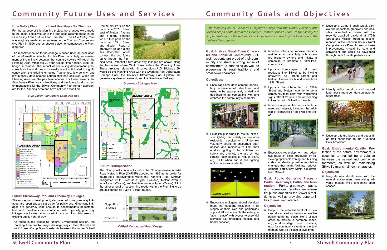
Goal: Public Gathering Places - Parks, Greenways, Paths, and Rec-reation Parks, greenways, paths, and recreational facilities are essen-tial public amenities for Stilwell’s resi-dents as well as providing opportuni-ties to meet and interact.
Objectives:
Support the establishment of a new centrally located and easily accessible public gathering place like a village green to provide a common space, e.g., outdoor stage, picnic shelters, etc., for community events and enjoy-ment as well as a place of civic pride.
Develop a Camp Branch Creek bicy-cle and pedestrian greenway and pos-sibly horse trail to connect with the recently acquired parkland at 175th Street and Mission Road as recom-mended in the Johnson County Rural Comprehensive Plan. Access to these improvements should be safe and convenient and could be developed through public/private partnerships.
Identify utility corridors and unused land near stream corridors suitable for future trails.
Develop a future bicycle and pedestri-an trail connection to the Overland Park Arboretum.
Goal: Environmental Quality Pro-tection of the natural environment is essential to maintaining a balance between the natural and built envi-ronments, as well as, maintaining Stilwell’s rural small town character.
Objectives:
Integrate new development with the natural environment, minimizing ad-verse impacts while conserving open spaces.
C o m m u n i t y Fu t u r e U s e s a n d S e r v i c e s C o m m u n i t y G o a l s a n d O b j e c t i v e s
Blue Valley Plan Future Land Use Map - No Changes
For the purpose of this planning project, no changes were made to the goals, objectives, or to the land uses recommended in the Blue Valley Plan “Future Land Use Map.” The Blue Valley Plan was originally made an amendment to the County’s Comprehen-sive Plan in 1996 and as shown below, encompasses the Plan-ning Area.
The recommendation for no change is based upon an evaluation of the information collected for this Plan; particularly an assess-ment of the unlikely potential that sanitary sewers will reach the Planning Area within the 20-year project time horizon. Also, alt-hough substantial, the impact of continuing development pres-sures from the north, east, or west are not anticipated to signifi-cantly alter the existing on-going fragmented, low-density, and low-intensity development pattern that has occurred within the Planning Area over the past two decades. For these reasons, the Blue Valley Plan goals, objectives, and the future land use rec-ommendations for the Stilwell Community Plan remain appropri-ate for the Planning Area and have not been modified.
Blue Valley Plan Future Land Use Map
Future Streamway Park and Greenway Linkages
Streamway park development, also referred to as greenway link-ages, are open spaces set aside for public use. Greenway link-ages are generally wide enough to accommodate pedestrian, bike, and sometimes even equestrian trials. Typically, greenway linkages are located along or within existing floodplain areas or existing public right-of-way.
As noted in the preceding Natural Environment section, the Planning Area has two major drainage ways: Camp Branch and Wolf Creek. Camp Branch extends between the future Stilwell
Community Park on the north side 207th Street east of Metcalf Avenue and property donated for a future park on the north at 183rd Street and Mission Road. A greenway linkage along this floodplain would connect the two future parks through the Plan-ning Area. Potential future greenway linkages are shown along the two areas where Wolf Creek enters the Planning Area. These linkages, along with linkages along U.S. Highway 69, would tie the Planning Area with the Overland Park Arboretum, Heritage Park, the County’s Streamway Park System, the greenway system in Leawood, and the Blue River Parkway.
Greenway Linkages Map
Future Transportation
The County will continue to utilize the Comprehensive Arterial Road Network Plan (CARNP) adopted in 1999 as its guide for future road improvements within the Planning Area. CARNP designates 199th Street as a Type III (4-lane), Metcalf Avenue as a Type II (2-lane), and Nall Avenue as a Type I (2-lane). All of the other arterial or section line roads within the Planning Area are designated as Type I (2-lane) routes.
CARNP Conceptual Road Design
PLANNING AREA
5 6
The following list of Goals and Objectives align with the Goals, Policies, and
Action Steps contained in the County’s Comprehensive Plan. Responsibility for
implementation of these Goals and Objectives is shared by the County and the
Stilwell Community.
PLANNING AREA
Stilwell Community Plan Stilwell Community Plan