Embed Size (px)
Citation preview
STATEMENT OF EVIDENCE AND
REPORT TO PLANNING PANEL MANNINGHAM PLANNING SCHEME
AMENDMENT C101
Prepared for
Manningham City Council
May 2014
LOVELL CHEN 1
Table of Contents
1.0 Introduction 6
1.1 Background and relevant documents 6
2.0 Summary history and description 7
3.0 Significance 17
3.1 Discussion 17 3.2 Conclusion 17 3.3 Revised Statement of Significance 18
4.0 Current Heritage Controls 21
4.1 HO43 – Eastern Golf Club “Tullamore” – 463 Doncaster Road, Doncaster 21 4.2 MSS & LPPF for heritage 21
4.2.1 Municipal Strategic Statement 21
4.2.2 Local Planning Policies 22
4.2.3 City of Doncaster and Templestowe Heritage Study 23
4.2.4 Doncaster & Templestowe Heritage Study – Additional Historical Research23
4.2.5 Manningham Heritage Study Review 24
4.2.6 Eastern Golf Club Conservation Analysis and Policy 24
5.0 Amendment C101 26
5.1 Changes to HO43 26 5.1.1 Exhibited Amendment C101 26
5.1.2 Council’s proposed changes following exhibition period 27
5.1.3 Urbis on behalf of Mirvac 28
5.2 Development Plan Overlay Schedule 3 30
6.0 Comment on the heritage issues 32
6.1 Discussion 32 6.2 Findings and Recommendations 38
7.0 Responses to submissions 43
8.0 Conclusion and recommendations 44
2 LOVELL CHEN
Table of Figures
Figure 1 Early view of Tullamore homestead, showing the original two-storey
timber verandah to its north and west sides. 10
Figure 2 View of the north and west elevations of Tullamore following the addition
of single-storey Clubrooms to the east and changerooms to the south. 10
Figure 3 1912 plan of Doncaster Road and surrounding area. There appears to be
a track between the Tullamore homestead and stables (indicated). 11
Figure 4 1913 plan of Doncaster Road and surrounding area. The track between
the Tullamore homestead and stables (indicated) also appears on this
plan. 11
Figure 5 1931 aerial image of the southern portion of the golf course. A track
between the Tullamore homestead (in use by this time as the clubhouse)
and stables is evident in this image, as is a second track to the stables
from the secondary entrance off Doncaster Road. (NB. The numbers
shown relate to plantings identified in Mr Patrick’s report). 12
Figure 6 1945 aerial image of the southern portion of the golf course. The
clubhouse and stables building are visible in the centre of the image. The
track to the stables from Doncaster Road has been removed by this time
to accommodate the establishment of the fairway. 12
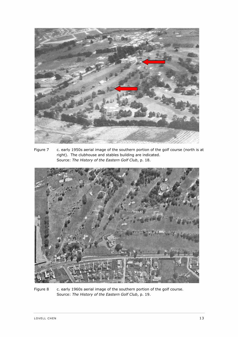
Figure 7 c. early 1950s aerial image of the southern portion of the golf course
(north is at right). The clubhouse and stables building are indicated. 13
Figure 8 c. early 1960s aerial image of the southern portion of the golf course. 13
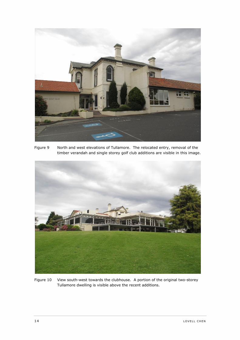
Figure 9 North and west elevations of Tullamore. The relocated entry, removal of
the timber verandah and single storey golf club additions are visible in
this image. 14
Figure 10 View south-west towards the clubhouse. A portion of the original two-
storey Tullamore dwelling is visible above the recent additions. 14
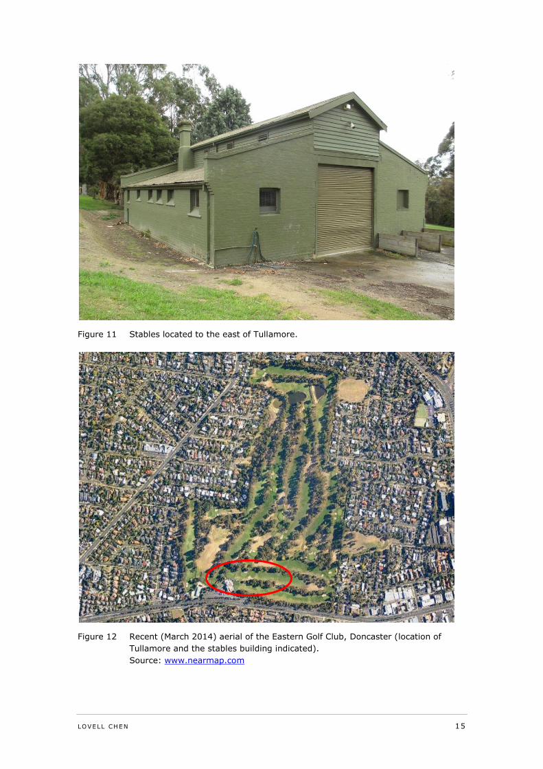
Figure 11 Stables located to the east of Tullamore. 15
Figure 12 Recent (March 2014) aerial of the Eastern Golf Club, Doncaster (location
of Tullamore and the stables building indicated). 15
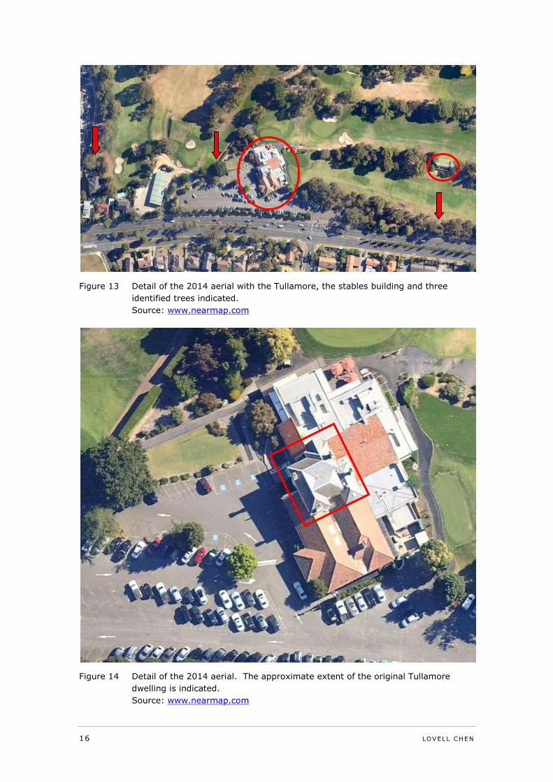
Figure 13 Detail of the 2014 aerial with the Tullamore, the stables building and
three identified trees indicated. 16
Figure 14 Detail of the 2014 aerial. The approximate extent of the original
Tullamore dwelling is indicated. 16
Figure 15 Eastern Golf Club (HO43) in the Heritage Overlay to the Manningham
Planning Scheme. 21
Figure 16 Proposed reduced extent of HO43 as part of Amendment C101. 26
Figure 17 Proposed amended HO43 as per Council report 24 March 2014. 28
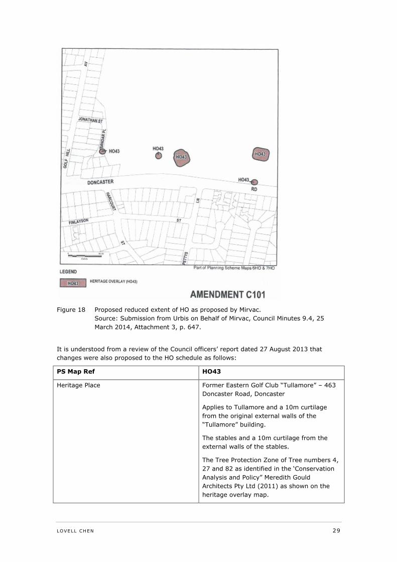
Figure 18 Proposed reduced extent of HO as proposed by Mirvac. 29
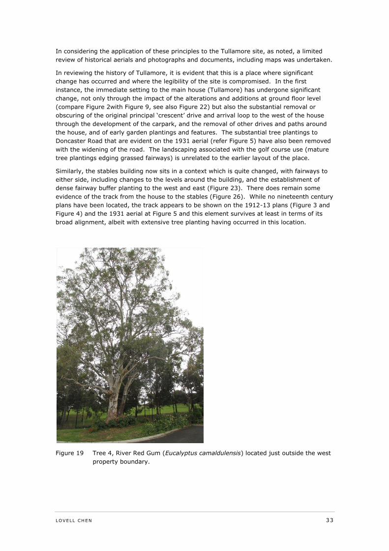
Figure 20 Tree 4, River Red Gum (Eucalyptus camaldulensis) located just outside
the west property boundary. 33
LOVELL CHEN 3
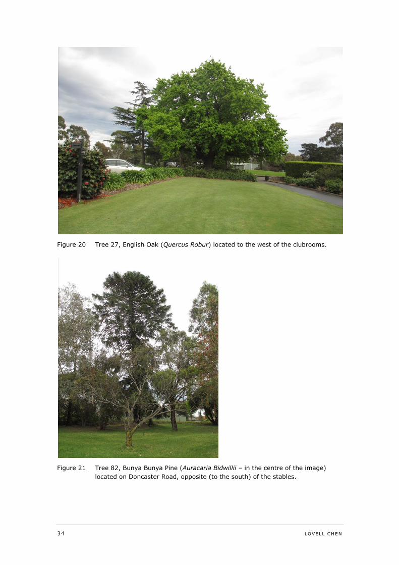
Figure 21 Tree 27, English Oak (Quercus Robur) located to the west of the
clubrooms. 34
Figure 22 Tree 82, Bunya Bunya Pine (Auracaria Bidwillii – in the centre of the
image) located on Doncaster Road, opposite (to the south) of the stables. 34
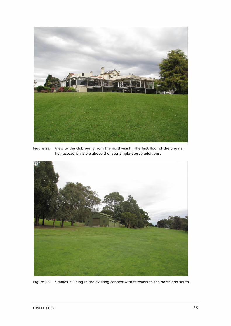
Figure 23 View to the clubrooms from the north-east. The first floor of the original
homestead is visible above the later single-storey additions. 35
Figure 24 Stables building in the existing context with fairways to the north and
south. 35
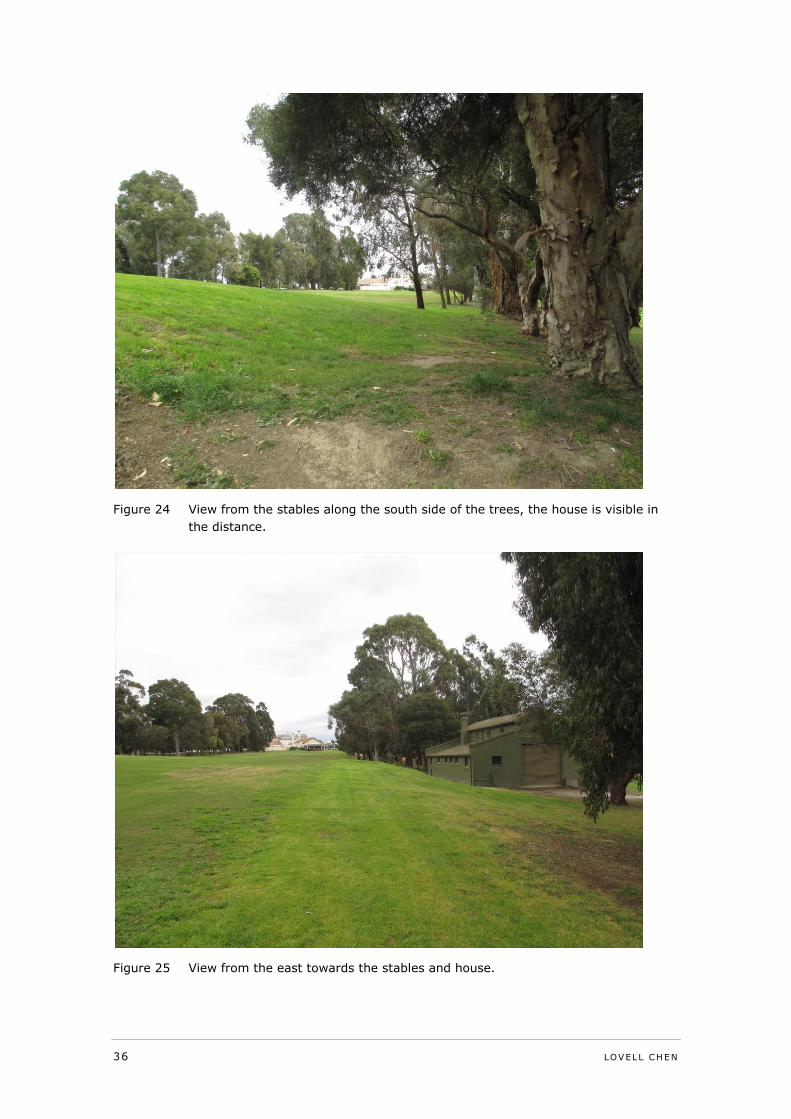
Figure 25 View from the stables along the south side of the trees, the house is
visible in the distance. 36
Figure 26 View from the east towards the stables and house. 36
Figure 27 View along the track from the stables to the house, largely obscured by
trees 37
Figure 28 View from the house towards the stables, obscured by fairway buffer
planting 37
Figure 29 View across the fairway towards the stables 38
Figure 30 Proposed extent of HO43, not to scale 39
4 LOVELL CHEN
Statement of Instruction, Qualifications and Experience, and Declaration
Instructions
This statement has been prepared for the Manningham City Council and provides expert
evidence in relation to Amendment C101 to the Manningham Planning Scheme.
Authorship
This statement has been prepared by Ms Kate Gray, Associate Director of Lovell Chen Pty
Ltd, Architects and Heritage Consultants, Level 5, 176 Wellington Parade, East Melbourne
with assistance from Ms Michelle Knehans, heritage consultant. The views expressed in this
statement are those of Ms Kate Gray.
The statement incorporates material from an earlier report prepared by Lovell Chen in
relation to the subject site as follows:
Eastern Golf Club – Tullamore, prepared for Manningham City Council, December
2013
Qualifications and Experience
I hold a Bachelor of Arts (Hons) and Masters of Arts (History), both from The University of
Melbourne. I also hold a Post-Graduate Diploma in Heritage Planning and Management from
Victoria University.
I joined Lovell Chen (then Allom Lovell & Associates) in 1989 and have been involved in
heritage practice and management for over 20 years. This experience includes the
preparation of numerous heritage appraisals and assessments of significance for individual
sites and larger complexes, areas and precincts. I also have extensive experience in
strategic planning and policy development for heritage places, and the assessment of
impacts on heritage places. In my current role as Associate Director (from July 2005) I am
responsible for leading multi-disciplinary teams with expertise in architecture, history and
planning.
I have contributed in a variety of roles to numerous municipal heritage reviews including
those for the former Cities of Fitzroy and Port Melbourne, the City of Boroondara, the City of
Port Phillip and the Borough of Queenscliffe. Extensive work for the City of Boroondara
undertaken since 2006 has included managing a major project to review, assess and
document a large number of individual B-graded predominantly residential buildings, advice
on the development of a new local Heritage Policy and input into the review of precinct
citations and building gradings. In 2008-9 I managed the preparation of the Queenscliffe
Heritage Review for the Borough of Queenscliffe. I also managed a review of a large HO
precinct in Port Melbourne (HO1) in 2010 for the City of Port Phillip; this work included
revisions to the boundaries of the area, the establishment of sub-precincts within it and
recommendations for controls over individual sites in the area.
In recent years I have also managed a number of other major strategic heritage projects
including a Heritage Management Strategy for the University of Melbourne (2004-5, review
2009), and a Heritage Strategy and related heritage management framework for the Port of
Melbourne Corporation (2006-8, review 2013). In 2008-9 I managed a national survey and
heritage assessment of air traffic control towers (undertaken under the Environment
Protection and Biodiversity Conservation Act) for Airservices Australia.
I have also been involved in the preparation of numerous conservation management plans,
conservation analyses and heritage appraisals for places as diverse as the Melbourne Cricket
Ground, the Esplanade Hotel, St Kilda, the Shrine of Remembrance, the Melbourne Club,
State Library of Victoria, Camp Street precinct in Ballarat, Wesley Central Mission and Church
complex, Echuca Wharf, and the former Canberra Brickworks in Yarralumla in the ACT. I
LOVELL CHEN 5
have also undertaken heritage appraisals of residential buildings, industrial sites and
institutional complexes across Melbourne.
Expertise
I have expertise in (non-indigenous) cultural heritage identification, assessment and
management, and in heritage planning.
Instructions (commissioning of statement)
The statement was commissioned by the Manningham City Council by correspondence from
Ms Vivien Williamson and dated 11 March 2014.
Declaration
In submitting this report I declare that I have made all the inquiries that I believe are
desirable and appropriate and that no matters of significance which I regard as relevant have
to my knowledge been withheld from the Panel.
Kate Gray
6 LOVELL CHEN
1.0 Introduction
This statement of evidence addresses the heritage issues associated with Amendment C101
to the Manningham Planning Scheme, primarily the proposal to reduce the extent of the
existing Heritage Overlay that applies to the site as a whole.
While the focus of the statement is on the proposed changes to the Heritage Overlay HO43,
this statement also makes limited comment on other aspects of Amendment C101 which
address heritage issues, including the Development Plan Overlay Schedule 3.
Limited reference is also made to the Eastern Golf Course Development Plan October 2013
submitted by Mirvac and the supporting document Heritage Assessment in accordance with
Schedule to the Development Plan Overlay, Bryce Raworth, July 2013.
1.1 Background and relevant documents
In September 2013, Lovell Chen was commissioned by the City of Manningham to advise on
a proposal to reduce the existing Heritage Overlay (HO) over the Eastern Golf Course, 463-
535 Doncaster Road, Doncaster. The scope of this work included a review of earlier heritage
assessments and a site visit. Additional historical research was also undertaken. A
statement of cultural heritage significance for the place was prepared as part of this scope of
work. The Lovell Chen advice was finalised in early December 2013.
This statement follows on from the earlier advice and addresses the heritage issues
associated with Amendment C101 to the Manningham Planning Scheme which proposes,
inter alia to rezone the site, to reduce the extent of the Heritage Overlay (HO43) affecting
the site, to introduce a Development Plan Overlay Schedule 3 over the site, and to make
changes to Clause 22.17 ‘Eastern Golf Course Key Redevelopment Site Policy’.
The statement incorporates material from the December 2013 Lovell Chen report and also
makes reference to a number of earlier Council heritage assessments and studies as follows:
City of Doncaster and Templestowe Heritage Study, prepared by Context Pty Ltd,
1991.
Doncaster & Templestowe Heritage Study – Additional Historical Research, prepared
by Carlotta Kellaway, 1994.
Manningham Heritage Study Review, prepared by Context Pty Ltd, 2006.
The Doncaster site of the Eastern Golf Club Conservation Analysis and Policy,
prepared by Meredith Gould Architects Pty Ltd, February 2011.
LOVELL CHEN 7
2.0 Summary history and description
Tullamore
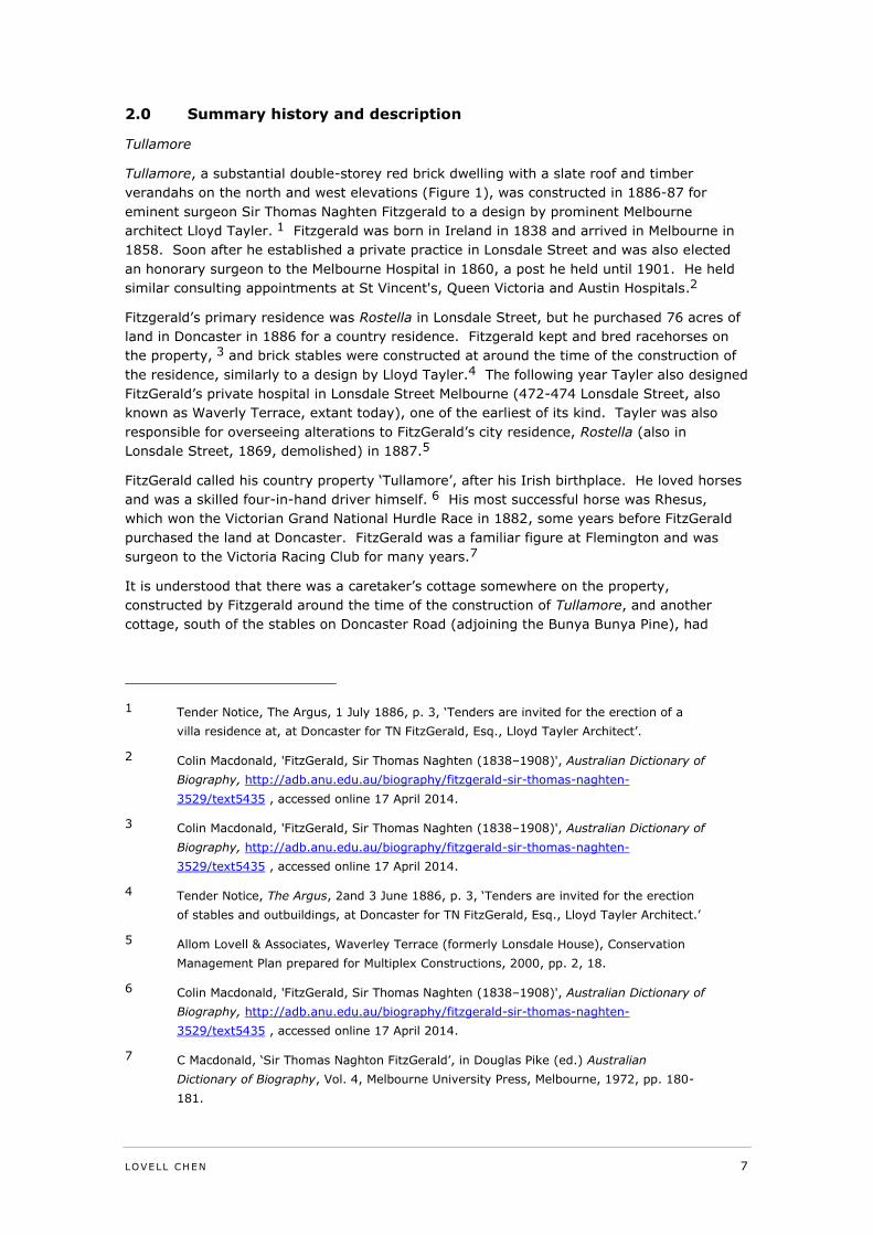
Tullamore, a substantial double-storey red brick dwelling with a slate roof and timber
verandahs on the north and west elevations (Figure 1), was constructed in 1886-87 for
eminent surgeon Sir Thomas Naghten Fitzgerald to a design by prominent Melbourne
architect Lloyd Tayler. 1 Fitzgerald was born in Ireland in 1838 and arrived in Melbourne in
1858. Soon after he established a private practice in Lonsdale Street and was also elected
an honorary surgeon to the Melbourne Hospital in 1860, a post he held until 1901. He held
similar consulting appointments at St Vincent's, Queen Victoria and Austin Hospitals.2
Fitzgerald’s primary residence was Rostella in Lonsdale Street, but he purchased 76 acres of
land in Doncaster in 1886 for a country residence. Fitzgerald kept and bred racehorses on
the property, 3 and brick stables were constructed at around the time of the construction of
the residence, similarly to a design by Lloyd Tayler.4 The following year Tayler also designed
FitzGerald’s private hospital in Lonsdale Street Melbourne (472-474 Lonsdale Street, also
known as Waverly Terrace, extant today), one of the earliest of its kind. Tayler was also
responsible for overseeing alterations to FitzGerald’s city residence, Rostella (also in
Lonsdale Street, 1869, demolished) in 1887.5
FitzGerald called his country property ‘Tullamore’, after his Irish birthplace. He loved horses
and was a skilled four-in-hand driver himself. 6 His most successful horse was Rhesus,
which won the Victorian Grand National Hurdle Race in 1882, some years before FitzGerald
purchased the land at Doncaster. FitzGerald was a familiar figure at Flemington and was
surgeon to the Victoria Racing Club for many years.7
It is understood that there was a caretaker’s cottage somewhere on the property,
constructed by Fitzgerald around the time of the construction of Tullamore, and another
cottage, south of the stables on Doncaster Road (adjoining the Bunya Bunya Pine), had
1 Tender Notice, The Argus, 1 July 1886, p. 3, ‘Tenders are invited for the erection of a
villa residence at, at Doncaster for TN FitzGerald, Esq., Lloyd Tayler Architect’.
2 Colin Macdonald, 'FitzGerald, Sir Thomas Naghten (1838–1908)', Australian Dictionary of
Biography, http://adb.anu.edu.au/biography/fitzgerald-sir-thomas-naghten-
3529/text5435 , accessed online 17 April 2014.
3 Colin Macdonald, 'FitzGerald, Sir Thomas Naghten (1838–1908)', Australian Dictionary of
Biography, http://adb.anu.edu.au/biography/fitzgerald-sir-thomas-naghten-
3529/text5435 , accessed online 17 April 2014.
4 Tender Notice, The Argus, 2and 3 June 1886, p. 3, ‘Tenders are invited for the erection
of stables and outbuildings, at Doncaster for TN FitzGerald, Esq., Lloyd Tayler Architect.’
5 Allom Lovell & Associates, Waverley Terrace (formerly Lonsdale House), Conservation
Management Plan prepared for Multiplex Constructions, 2000, pp. 2, 18.
6 Colin Macdonald, 'FitzGerald, Sir Thomas Naghten (1838–1908)', Australian Dictionary of
Biography, http://adb.anu.edu.au/biography/fitzgerald-sir-thomas-naghten-
3529/text5435 , accessed online 17 April 2014.
7 C Macdonald, ‘Sir Thomas Naghton FitzGerald’, in Douglas Pike (ed.) Australian
Dictionary of Biography, Vol. 4, Melbourne University Press, Melbourne, 1972, pp. 180-
181.
8 LOVELL CHEN
previously been constructed by David Mitchell. Neither of these cottages remain within the
property.8
After FitzGerald’s death in 1908, Tullamore was sold to William Stutt, local councillor,
chairman of the racing club and former MP for South Grant, near Geelong.9 Stutt, with his
wife Julia, ran the Doncaster Hotel and purchased Tullamore for his retirement. Stutt died in
1912, and Tullamore remained in the Stutt family for another 40 years.10
While there are some early photographs of the house (refer Figure 1, Figure 2), very little
documentation has been located related to the layout of the property in the period it was
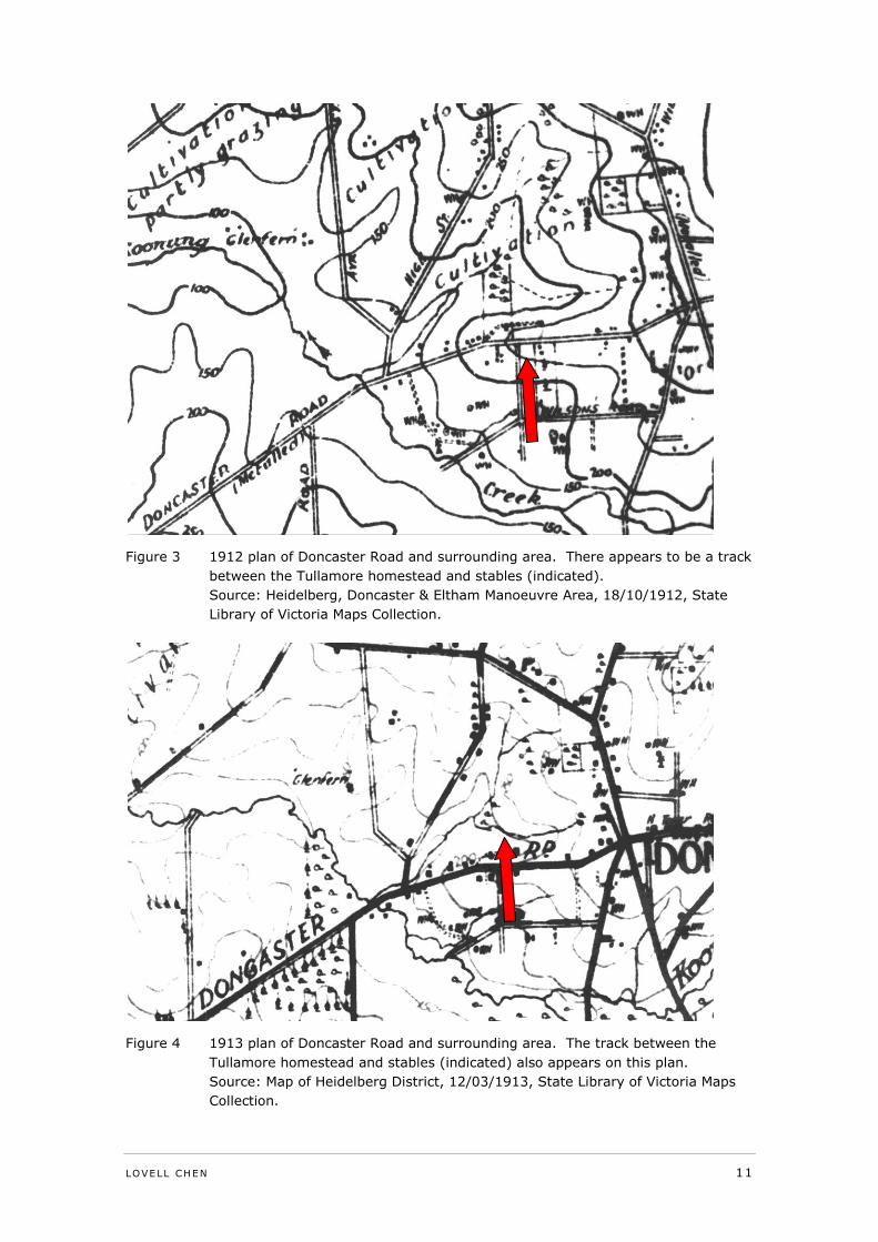
used by FitzGerald and William Stutt after him. Plans of 1912 and 1913, prior to the
development of the golf course, indicate the primary driveway entrance to the property
(south-west of the homestead) off Doncaster Road and also suggest a track continuing
eastward between the Tullamore homestead and the stables building. Refer to Figure 3 and
Figure 4.
Eastern Golf Club
The Eastern Golf Club was formed in 1914, and soon leased Tullamore from Julia Stutt. An
18 hole golf course was laid out by leading golf architect Sam Berriman. In 1924, the
Committee took over the assets of the Box Hill Club and re-established it at Tullamore under
the name of the Eastern Golf Club.11 The Club was officially opened on 14 June 1924 by
then Prime Minister Mr Stanley Bruce, and was described in The Argus as follows:
The Prime Minister (Mr. Bruce) on Saturday opened the new links of the
Eastern Golf Club at Tullamore, Doncaster road, Doncaster, in the
presence of a large assemblage of enthusiasts. The new links which
extend of 78 acres, face a wide vista of open country towards
Macedon.12
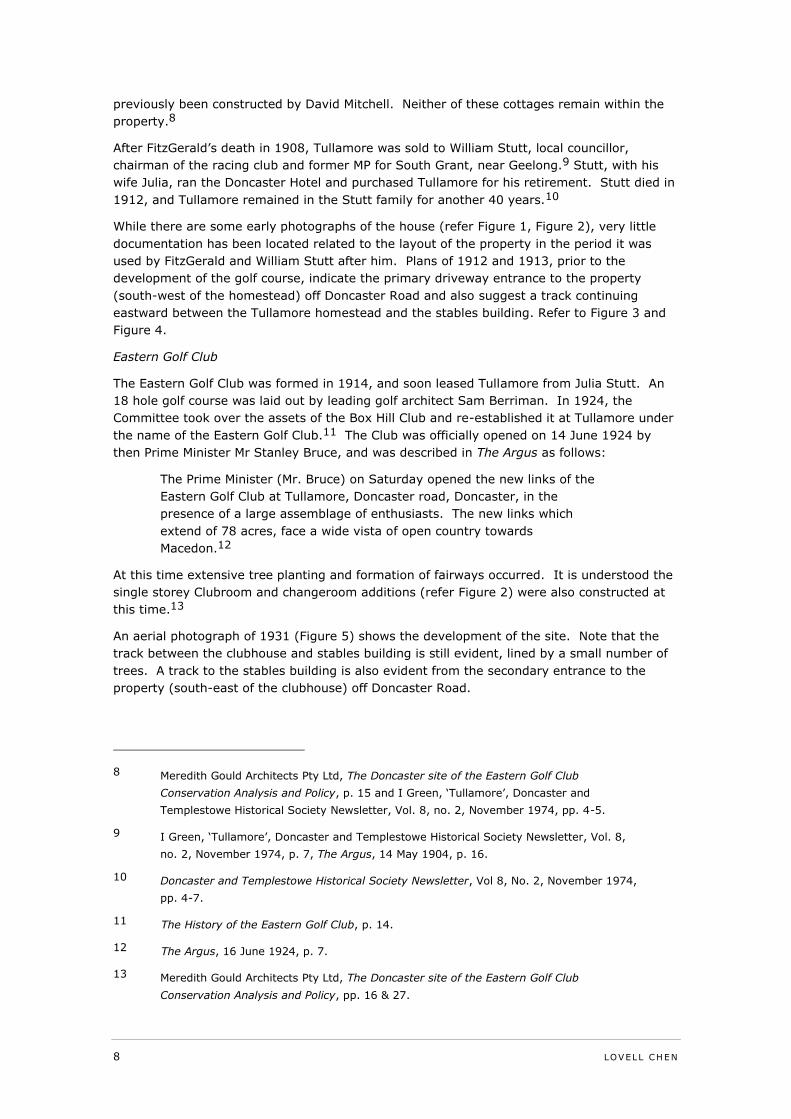
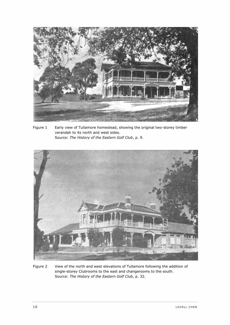
At this time extensive tree planting and formation of fairways occurred. It is understood the
single storey Clubroom and changeroom additions (refer Figure 2) were also constructed at
this time.13
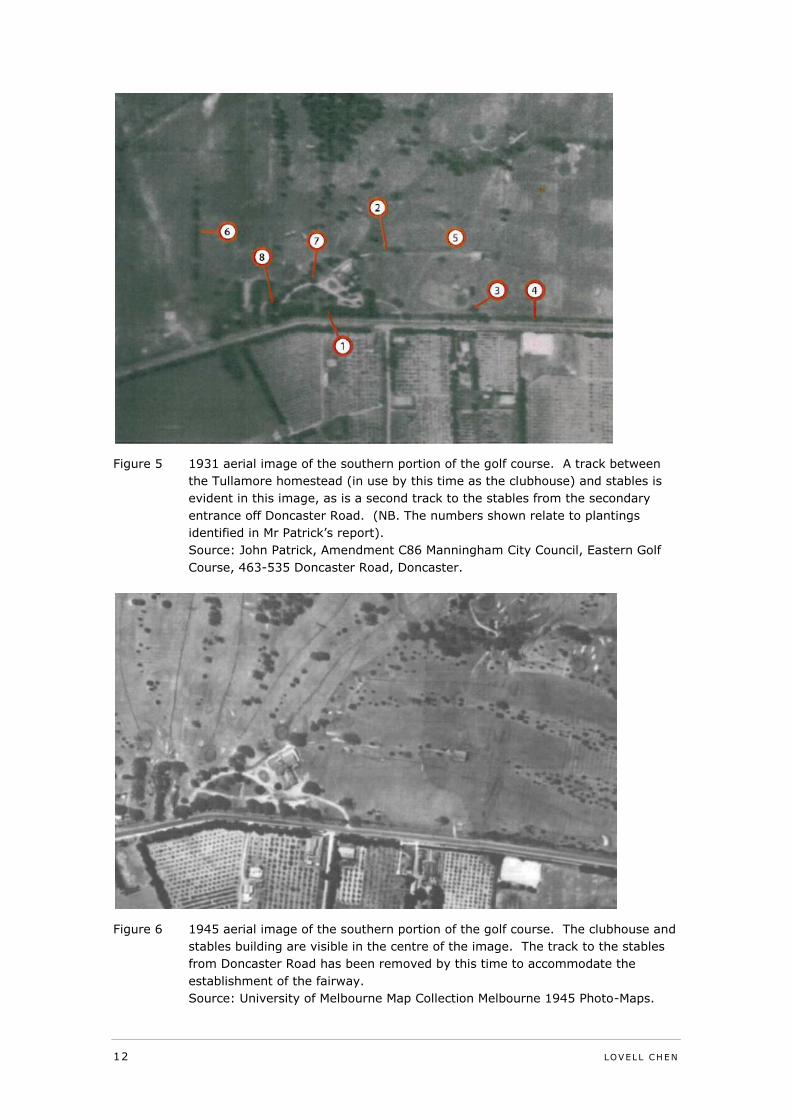
An aerial photograph of 1931 (Figure 5) shows the development of the site. Note that the
track between the clubhouse and stables building is still evident, lined by a small number of
trees. A track to the stables building is also evident from the secondary entrance to the
property (south-east of the clubhouse) off Doncaster Road.
8 Meredith Gould Architects Pty Ltd, The Doncaster site of the Eastern Golf Club
Conservation Analysis and Policy, p. 15 and I Green, ‘Tullamore’, Doncaster and
Templestowe Historical Society Newsletter, Vol. 8, no. 2, November 1974, pp. 4-5.
9 I Green, ‘Tullamore’, Doncaster and Templestowe Historical Society Newsletter, Vol. 8,
no. 2, November 1974, p. 7, The Argus, 14 May 1904, p. 16.
10 Doncaster and Templestowe Historical Society Newsletter, Vol 8, No. 2, November 1974,
pp. 4-7.
11 The History of the Eastern Golf Club, p. 14.
12 The Argus, 16 June 1924, p. 7.
13 Meredith Gould Architects Pty Ltd, The Doncaster site of the Eastern Golf Club
Conservation Analysis and Policy, pp. 16 & 27.
LOVELL CHEN 9
The Eastern Golf Club remained at Tullamore until 1941 when it relocated to a new course at
East Oakleigh, named Huntingdale. In 1943 a new committee of the Eastern Golf Club was
formed and took over the lease of Tullamore from Huntingdale.
Following the death of Julia Stutt, the Eastern Golf Club Committee purchased the Tullamore
property, and extensive alterations have been made to the Tullamore dwelling since this
time.14 From 1948, further extensions were made to the changerooms to the south,
encompassing the original entrance to Tullamore on the west elevation. The original timber
verandah was also removed.15 Between 1964 and 1970, the carpark south of the clubhouse
expanded, encompassing the garden area between the entry drive and the southern property
boundary. In 1979 an addition was constructed on the north side of the building, and in
1985 a new golf shop was constructed under the main building.
The next major development of the Clubhouse was undertaken in 2002, creating a new
dining room, bar, shop, balcony and locker room facilities to the north and east of the main
building. The Eastern Golf Club remains at the Doncaster site, but will relocate to Yering in
mid-2015.16
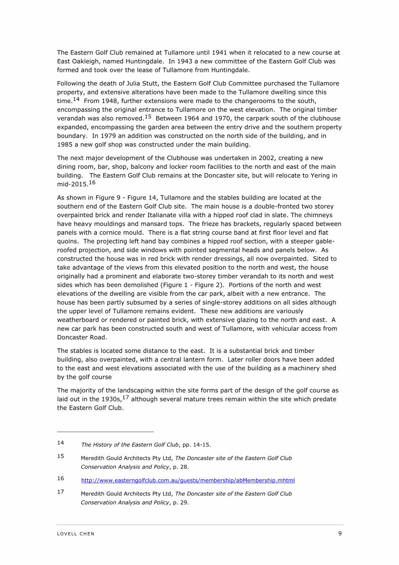
As shown in Figure 9 - Figure 14, Tullamore and the stables building are located at the
southern end of the Eastern Golf Club site. The main house is a double-fronted two storey
overpainted brick and render Italianate villa with a hipped roof clad in slate. The chimneys
have heavy mouldings and mansard tops. The frieze has brackets, regularly spaced between
panels with a cornice mould. There is a flat string course band at first floor level and flat
quoins. The projecting left hand bay combines a hipped roof section, with a steeper gable-
roofed projection, and side windows with pointed segmental heads and panels below. As
constructed the house was in red brick with render dressings, all now overpainted. Sited to
take advantage of the views from this elevated position to the north and west, the house
originally had a prominent and elaborate two-storey timber verandah to its north and west
sides which has been demolished (Figure 1 - Figure 2). Portions of the north and west
elevations of the dwelling are visible from the car park, albeit with a new entrance. The
house has been partly subsumed by a series of single-storey additions on all sides although
the upper level of Tullamore remains evident. These new additions are variously
weatherboard or rendered or painted brick, with extensive glazing to the north and east. A
new car park has been constructed south and west of Tullamore, with vehicular access from
Doncaster Road.
The stables is located some distance to the east. It is a substantial brick and timber
building, also overpainted, with a central lantern form. Later roller doors have been added
to the east and west elevations associated with the use of the building as a machinery shed
by the golf course
The majority of the landscaping within the site forms part of the design of the golf course as
laid out in the 1930s,17 although several mature trees remain within the site which predate
the Eastern Golf Club.
14 The History of the Eastern Golf Club, pp. 14-15.
15 Meredith Gould Architects Pty Ltd, The Doncaster site of the Eastern Golf Club
Conservation Analysis and Policy, p. 28.
16 http://www.easterngolfclub.com.au/guests/membership/abMembership.mhtml
17 Meredith Gould Architects Pty Ltd, The Doncaster site of the Eastern Golf Club
Conservation Analysis and Policy, p. 29.
10 LOVELL CHEN
Figure 1 Early view of Tullamore homestead, showing the original two-storey timber
verandah to its north and west sides.
Source: The History of the Eastern Golf Club, p. 9.
Figure 2 View of the north and west elevations of Tullamore following the addition of
single-storey Clubrooms to the east and changerooms to the south.
Source: The History of the Eastern Golf Club, p. 32.
LOVELL CHEN 11
Figure 3 1912 plan of Doncaster Road and surrounding area. There appears to be a track
between the Tullamore homestead and stables (indicated).
Source: Heidelberg, Doncaster & Eltham Manoeuvre Area, 18/10/1912, State
Library of Victoria Maps Collection.
Figure 4 1913 plan of Doncaster Road and surrounding area. The track between the
Tullamore homestead and stables (indicated) also appears on this plan.
Source: Map of Heidelberg District, 12/03/1913, State Library of Victoria Maps
Collection.
12 LOVELL CHEN
Figure 5 1931 aerial image of the southern portion of the golf course. A track between
the Tullamore homestead (in use by this time as the clubhouse) and stables is
evident in this image, as is a second track to the stables from the secondary
entrance off Doncaster Road. (NB. The numbers shown relate to plantings
identified in Mr Patrick’s report).
Source: John Patrick, Amendment C86 Manningham City Council, Eastern Golf
Course, 463-535 Doncaster Road, Doncaster.
Figure 6 1945 aerial image of the southern portion of the golf course. The clubhouse and
stables building are visible in the centre of the image. The track to the stables
from Doncaster Road has been removed by this time to accommodate the
establishment of the fairway.
Source: University of Melbourne Map Collection Melbourne 1945 Photo-Maps.
LOVELL CHEN 13
Figure 7 c. early 1950s aerial image of the southern portion of the golf course (north is at
right). The clubhouse and stables building are indicated.
Source: The History of the Eastern Golf Club, p. 18.
Figure 8 c. early 1960s aerial image of the southern portion of the golf course.
Source: The History of the Eastern Golf Club, p. 19.
14 LOVELL CHEN
Figure 9 North and west elevations of Tullamore. The relocated entry, removal of the
timber verandah and single storey golf club additions are visible in this image.
Figure 10 View south-west towards the clubhouse. A portion of the original two-storey
Tullamore dwelling is visible above the recent additions.
LOVELL CHEN 15
Figure 11 Stables located to the east of Tullamore.
Figure 12 Recent (March 2014) aerial of the Eastern Golf Club, Doncaster (location of
Tullamore and the stables building indicated).
Source: www.nearmap.com
16 LOVELL CHEN
Figure 13 Detail of the 2014 aerial with the Tullamore, the stables building and three
identified trees indicated.
Source: www.nearmap.com
Figure 14 Detail of the 2014 aerial. The approximate extent of the original Tullamore
dwelling is indicated.
Source: www.nearmap.com
LOVELL CHEN 17
3.0 Significance
3.1 Discussion
There have been a number of assessments of the significance of the place.
The existing Heritage Overlay was applied to the site based on an assessment (Context
1991) that the place was of significance for its surviving nineteenth century fabric, as
evidence of a country property established by a prominent and wealthy member of the
professional class, and for its historical associations with Thomas FitzGerald and subsequent
owner William Stutt. This assessment is considered to be an appropriate one.
Following this original assessment, the HO was applied in a wholesale manner to the site in
its entirety with no detailed commentary on significant elements beyond the house and
stables, other than for including a general reference to other site features (trees and dams).
This has led to a lack of clarity around what is significant, though it was clear that the later
golf club use was not considered in the Context assessment to contribute to significance.
Meredith Gould (2011) drew the conclusion that later phases of development on the site
(relating to the golf club use) were also significant.
Bryce Raworth’s assessment of the site in reports prepared in March 2011(Heritage Issues
report and statement of evidence to the Panel for Amendment C86) and July 2013 (Heritage
Assessment in accordance with Schedule to the Development Plan Overlay) is more
consistent with the Context assessment, ie: that its significance is related to its nineteenth
century origins and fabric, and specifically the main house and stables building.
3.2 Conclusion
It is the conclusion of this review that the site is of historical significance in the local context
essentially for the reasons set out in the Context assessment of 1991, as a remnant of a late
nineteenth century country residence including its ability to reflect aspects of such country
properties, for its association with the eminent surgeon Thomas FitzGerald and to a lesser
extent with William Stutt. Both the stables and the house were designed for FitzGerald by
prominent Melbourne architect, Lloyd Tayler and this is also of interest.
The private golf club use of the site is of local historical and social interest given the length of
the association of the Eastern Golf Club with the site (1924-present). These values are
strongly associated with the history and activities Club itself, however, and given the club’s
impending relocation from the site, they are not considered to warrant recognition in terms
of the heritage values of the place or in terms of an alternative extent of HO43. Additionally,
it is commented that the re-use and development of the site by the Club has resulted in
changes that in many respects are unsympathetic to an appreciation of the nineteenth
century form of the place, particularly the major alterations and additions to the house, and
the changes to the driveway and other landscape features. In relation to the broader course
plantings, these are a valued characteristic of the site but are not considered to be of
heritage significance.
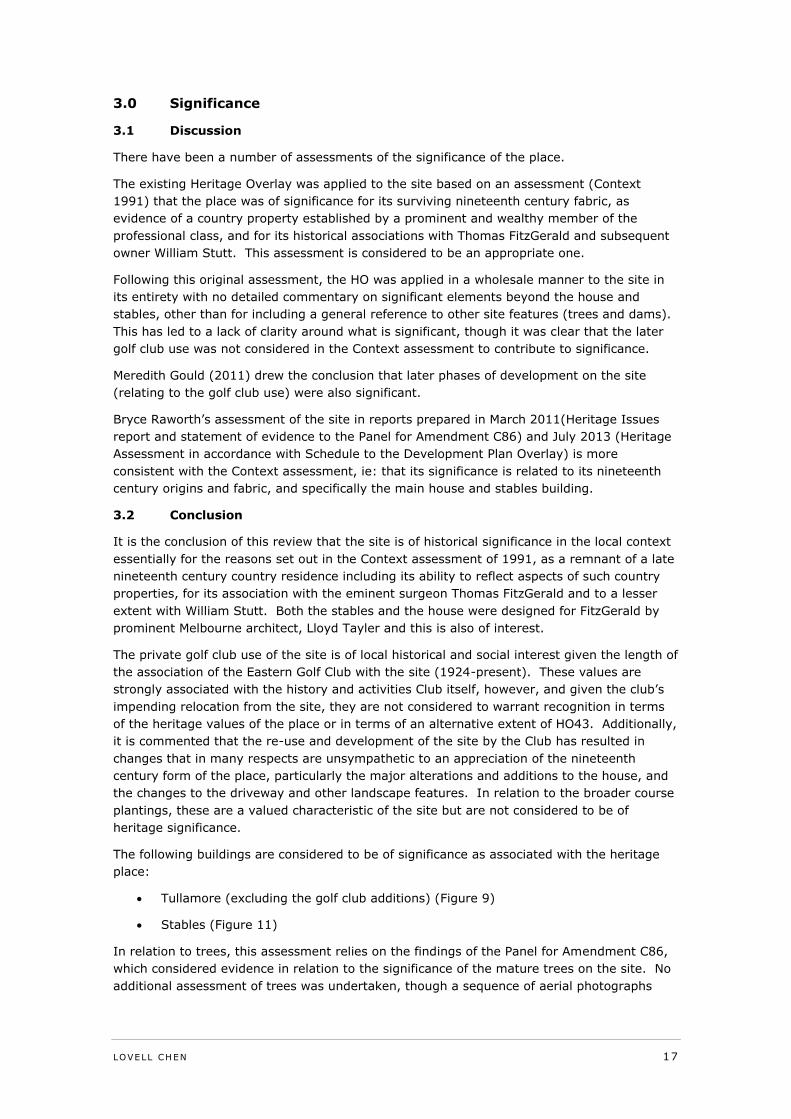
The following buildings are considered to be of significance as associated with the heritage
place:
Tullamore (excluding the golf club additions) (Figure 9)
Stables (Figure 11)
In relation to trees, this assessment relies on the findings of the Panel for Amendment C86,
which considered evidence in relation to the significance of the mature trees on the site. No
additional assessment of trees was undertaken, though a sequence of aerial photographs
18 LOVELL CHEN
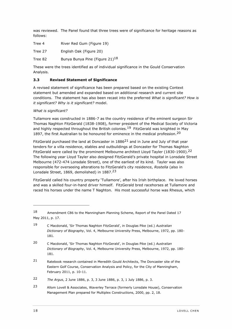
was reviewed. The Panel found that three trees were of significance for heritage reasons as
follows:
Tree 4 River Red Gum (Figure 19)
Tree 27 English Oak (Figure 20)
Tree 82 Bunya Bunya Pine (Figure 21)18
These were the trees identified as of individual significance in the Gould Conservation
Analysis.
3.3 Revised Statement of Significance
A revised statement of significance has been prepared based on the existing Context
statement but amended and expanded based on additional research and current site
conditions. The statement has also been recast into the preferred What is significant? How is
it significant? Why is it significant? model.
What is significant?
Tullamore was constructed in 1886-7 as the country residence of the eminent surgeon Sir
Thomas Naghton FitzGerald (1838-1908), former president of the Medical Society of Victoria
and highly respected throughout the British colonies.19 FitzGerald was knighted in May
1897, the first Australian to be honoured for eminence in the medical profession.20
FitzGerald purchased the land at Doncaster in 188621 and in June and July of that year
tenders for a villa residence, stables and outbuildings at Doncaster for Thomas Naghton
FitzGerald were called by the prominent Melbourne architect Lloyd Tayler (1830-1900).22
The following year Lloyd Tayler also designed FitzGerald’s private hospital in Lonsdale Street
Melbourne (472-474 Lonsdale Street), one of the earliest of its kind. Tayler was also
responsible for overseeing alterations to FitzGerald’s city residence, Rostella (also in
Lonsdale Street, 1869, demolished) in 1887.23
FitzGerald called his country property ‘Tullamore’, after his Irish birthplace. He loved horses
and was a skilled four-in-hand driver himself. FitzGerald bred racehorses at Tullamore and
raced his horses under the name T Naghton. His most successful horse was Rhesus, which
18 Amendment C86 to the Manningham Planning Scheme, Report of the Panel Dated 17
May 2011, p. 17.
19 C Macdonald, ‘Sir Thomas Naghton FitzGerald’, in Douglas Pike (ed.) Australian
Dictionary of Biography, Vol. 4, Melbourne University Press, Melbourne, 1972, pp. 180-
181.
20 C Macdonald, ‘Sir Thomas Naghton FitzGerald’, in Douglas Pike (ed.) Australian
Dictionary of Biography, Vol. 4, Melbourne University Press, Melbourne, 1972, pp. 180-
181.
21 Ratebook research contained in Meredith Gould Architects, The Doncaster site of the
Eastern Golf Course, Conservation Analysis and Policy, for the City of Manningham,
February 2011, p. 10-11.
22 The Argus, 2 June 1886, p. 3, 3 June 1886, p. 3, 1 July 1886, p. 3.
23 Allom Lovell & Associates, Waverley Terrace (formerly Lonsdale House), Conservation
Management Plan prepared for Multiplex Constructions, 2000, pp. 2, 18.
LOVELL CHEN 19
won the Victorian Grand National Hurdle Race in 1882. FitzGerald was a familiar figure at
Flemington and was surgeon to the Victoria Racing Club for many years.24
After FitzGerald’s death in 1908, the property was sold to William Stutt, local councillor,
chairman of the racing club and former MP for South Grant, near Geelong.25
From 1924, but possibly earlier, the Eastern Golf Club took over the property, leasing it from
the Stutt family. The new golf links which covered 78 acres ‘facing a wide vista of open
country towards Macedon’ were opened by the Prime Minister Stanley Bruce in June 1924.26
The house was converted for use as clubrooms and extensive additions and alterations were
constructed in a series of stages in the c.1920s, c. 1959, 1979, 1985 and 2002.27 The
stables building was retained and adapted for use as a machinery shed from the c.1940s.28
Other buildings on the site and subsequently demolished included a caretaker’s house to the
east of the main house, also built for FitzGerald, and an earlier cottage to the east on
Doncaster Road (thought to have been constructed by the builder David Mitchell).29
The main house is a double-fronted two storey overpainted brick and render Italianate villa
with a hipped roof clad in slate. The chimneys have heavy mouldings and mansard tops. The
frieze has brackets, regularly spaced between panels with a cornice mould. There is a flat
string course band at first floor level and flat quoins. The projecting left hand bay combines a
hipped roof section, with a steeper gable-roofed projection, and side windows with pointed
segmental heads and panels below. As constructed the house was in red brick with render
dressings, all now overpainted. Sited to take advantage of the views from this elevated
position to the north and west, the house had a prominent and elaborate two-storey timber
verandah to its north and west sides. This has been demolished and the house has been
partly subsumed by a series of single-storey additions on all sides. These works have had a
major adverse impact on its presentation, though the upper sections of the house remain
and are legible.
The stables is located some distance to the east. It is a substantial brick and timber
building, also overpainted, with a central lantern form. Later doors have been added
associated with the use of the building as a machinery shed.
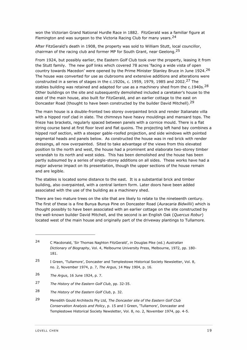
There are two mature trees on the site that are likely to relate to the nineteenth century.
The first of these is a fine Bunya Bunya Pine on Doncaster Road (Auracaria Bidwillii) which is
thought possibly to have been associated with an earlier cottage on the site constructed by
the well-known builder David Mitchell, and the second is an English Oak (Quercus Robur)
located west of the main house and originally part of the driveway plantings to Tullamore.
24 C Macdonald, ‘Sir Thomas Naghton FitzGerald’, in Douglas Pike (ed.) Australian
Dictionary of Biography, Vol. 4, Melbourne University Press, Melbourne, 1972, pp. 180-
181.
25 I Green, ‘Tullamore’, Doncaster and Templestowe Historical Society Newsletter, Vol. 8,
no. 2, November 1974, p. 7, The Argus, 14 May 1904, p. 16.
26 The Argus, 16 June 1924, p. 7.
27 The History of the Eastern Golf Club, pp. 32-35.
28 The History of the Eastern Golf Club, p. 32.
29 Meredith Gould Architects Pty Ltd, The Doncaster site of the Eastern Golf Club
Conservation Analysis and Policy, p. 15 and I Green, ‘Tullamore’, Doncaster and
Templestowe Historical Society Newsletter, Vol. 8, no. 2, November 1974, pp. 4-5.
20 LOVELL CHEN
The impact of works associated with the golf course use has been to substantially alter the
setting to the main house and the layout of the wider property, including the substantial loss
of the original drive to the west, the removal of the original garden areas for carparking and
clubhouse additions, and the introduction of fairways and buffer plantings for the course
itself.
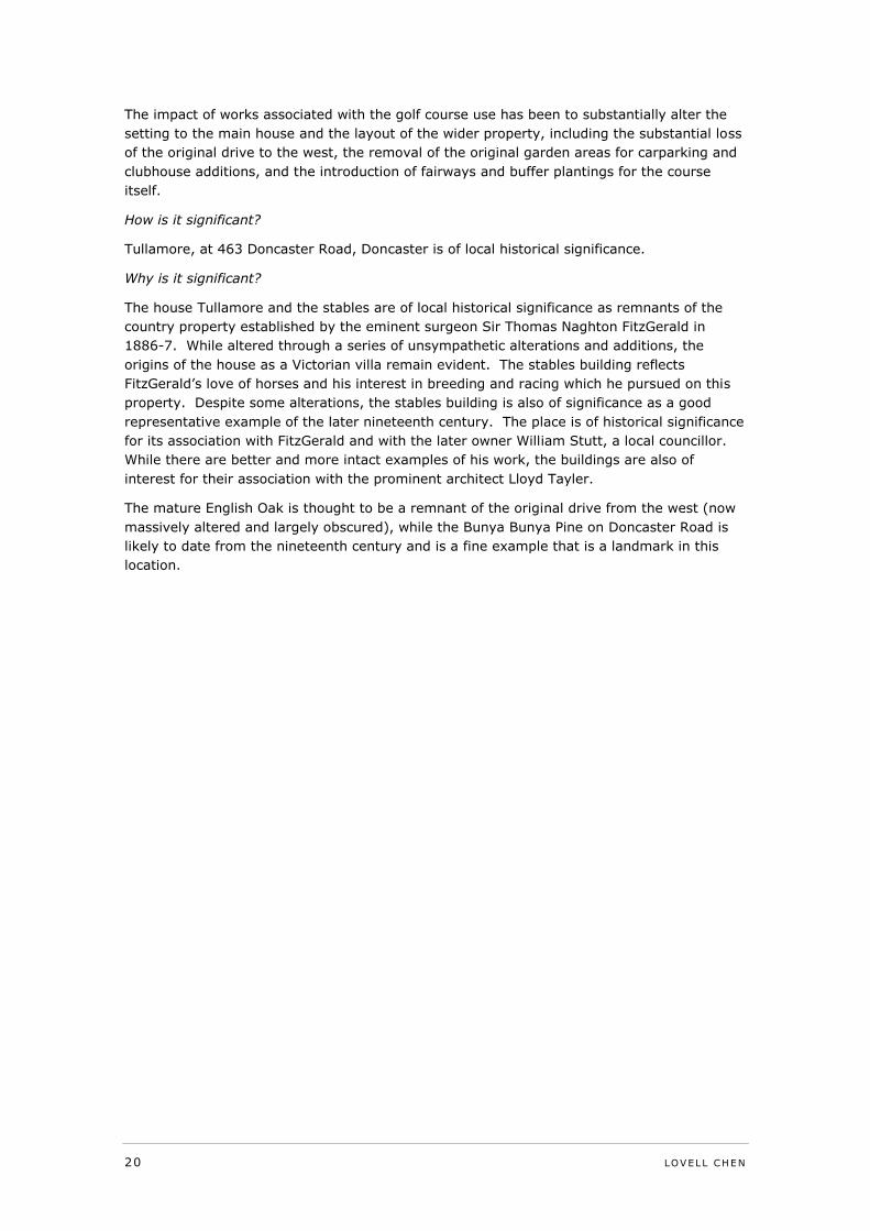
How is it significant?
Tullamore, at 463 Doncaster Road, Doncaster is of local historical significance.
Why is it significant?
The house Tullamore and the stables are of local historical significance as remnants of the
country property established by the eminent surgeon Sir Thomas Naghton FitzGerald in
1886-7. While altered through a series of unsympathetic alterations and additions, the
origins of the house as a Victorian villa remain evident. The stables building reflects
FitzGerald’s love of horses and his interest in breeding and racing which he pursued on this
property. Despite some alterations, the stables building is also of significance as a good
representative example of the later nineteenth century. The place is of historical significance
for its association with FitzGerald and with the later owner William Stutt, a local councillor.
While there are better and more intact examples of his work, the buildings are also of
interest for their association with the prominent architect Lloyd Tayler.
The mature English Oak is thought to be a remnant of the original drive from the west (now
massively altered and largely obscured), while the Bunya Bunya Pine on Doncaster Road is
likely to date from the nineteenth century and is a fine example that is a landmark in this
location.
LOVELL CHEN 21
4.0 Current Heritage Controls
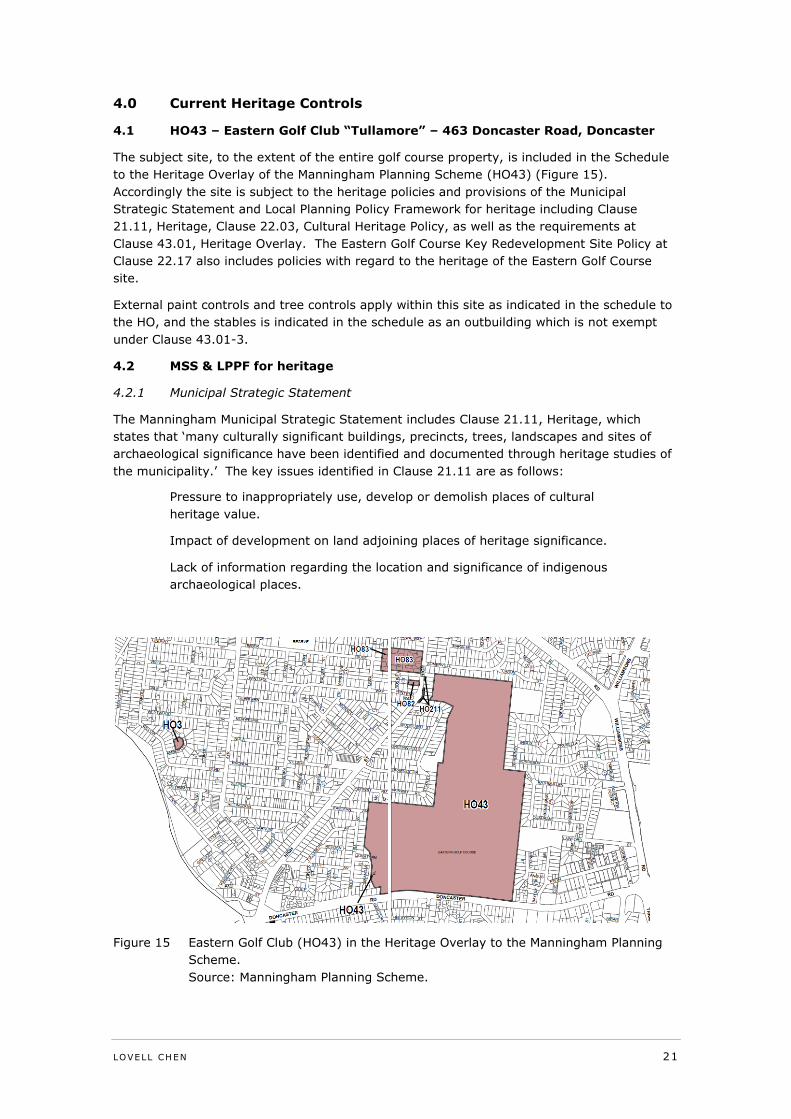
4.1 HO43 – Eastern Golf Club “Tullamore” – 463 Doncaster Road, Doncaster
The subject site, to the extent of the entire golf course property, is included in the Schedule
to the Heritage Overlay of the Manningham Planning Scheme (HO43) (Figure 15).
Accordingly the site is subject to the heritage policies and provisions of the Municipal
Strategic Statement and Local Planning Policy Framework for heritage including Clause
21.11, Heritage, Clause 22.03, Cultural Heritage Policy, as well as the requirements at
Clause 43.01, Heritage Overlay. The Eastern Golf Course Key Redevelopment Site Policy at
Clause 22.17 also includes policies with regard to the heritage of the Eastern Golf Course
site.
External paint controls and tree controls apply within this site as indicated in the schedule to
the HO, and the stables is indicated in the schedule as an outbuilding which is not exempt
under Clause 43.01-3.
4.2 MSS & LPPF for heritage
4.2.1 Municipal Strategic Statement
The Manningham Municipal Strategic Statement includes Clause 21.11, Heritage, which
states that ‘many culturally significant buildings, precincts, trees, landscapes and sites of
archaeological significance have been identified and documented through heritage studies of
the municipality.’ The key issues identified in Clause 21.11 are as follows:
Pressure to inappropriately use, develop or demolish places of cultural
heritage value.
Impact of development on land adjoining places of heritage significance.
Lack of information regarding the location and significance of indigenous
archaeological places.
Figure 15 Eastern Golf Club (HO43) in the Heritage Overlay to the Manningham Planning
Scheme.
Source: Manningham Planning Scheme.
22 LOVELL CHEN
The objectives of Clause 21.11 are as follows:
To enhance cultural heritage through the retention and protection of
significant buildings, precincts, trees and landscapes.
To minimise impacts on heritage places as a result of changes to adjoining
land uses and development.
To protect sites of archaeological significance.
4.2.2 Local Planning Policies
The Manningham LPPF includes a general Cultural Heritage Policy (Clause 22.03), as well as
a site specific Eastern Golf Course Key Redevelopment Site Policy (Clause 22.17), which
addresses key characteristics of the site, including heritage.
Clause 22.03, Cultural Heritage Policy, includes the following objectives:
To recognise, protect, conserve, manage and enhance identified cultural
heritage places.
To ensure that the significance of cultural heritage places involving the
aesthetic, historic, scientific, architectural or social value of a heritage
asset to past, present and future generations, is assessed and used to
guide planning decisions.
To encourage the retention of cultural heritage places and ensure that
these places are recognised and afforded appropriate protection to enrich
the character, identity and heritage of the municipality.
To ensure that the subdivision of a cultural heritage place does not
adversely affect the identified aesthetic, historic, scientific, architectural or
social value of the heritage place or other features identified in the
Schedule to the Heritage Overlay.
To promote the identification, protection and management of sites and
areas of archaeological significance including aboriginal cultural heritage.
The Decision Guidelines at Clause 22.03-5 state that, when considering an application, the
Responsible Authority will consider, inter alia,
The extent to which the application meets the objectives and directions of
this policy.
The significance of the cultural heritage place.
Heritage studies and all available documentation.
Clause 22.17, Eastern Golf Course Key Redevelopment Site Policy, was implemented as part
of Planning Scheme Amendment C86. The policy ‘provides a strategic policy framework for
any future redevelopment of the Eastern Golf Course site’, including flora and fauna,
heritage, open space, built form, urban consolidation opportunities, access and circulation
and ecologically sustainable development principles. With regard to the heritage of the golf
course site, the policy objectives are as follows:
To ensure that any future subdivision and development are situated in
areas that will have limited adverse impact on existing environmental and
cultural values.
To provide an interconnected public open space network that incorporates
natural heritage and cultural features including large old indigenous trees,
LOVELL CHEN 23
remnant vegetation, habitat values and important features such as dams
and gullies.
The policy with regard to heritage is as follows:
Protect the existing Club House ‘Tullamore’ and stables as identified in the
Doncaster and Templestowe ‘City of Doncaster and Templestowe Heritage
Study’ Context Pty Ltd, Peterson R, Stafford B (1991) Manningham City
Council Heritage Study, Context.
Encourage the retention of trees and groups of trees of heritage
significance. Identified periods of significance are:
Pre-homestead indigenous trees
Mature, possibly self-sown indigenous trees
Homestead plantings (c1885 – 1920 approx)
Early golf course plantings (1920 to WW2 approx)
Post WW2 plantings up to the 1970’s with cultural landscape values.
Retain and apply a Tree Protection Zone to trees numbers 4, 27 and 82 as
identified in “Eastern Golf Course Conservation Analysis and Policy”,
Meredith Gould Architects Pty Ltd (2011).
Allocate open space and / or roads and / or allotment boundaries so that
reasonable development is possible without intrusion into any Tree
Protection Zone (TPZ).
Locate open space, roads and allotment boundaries so that heritage
buildings have an open landscape context and are visually prominent.
Site open space and / or roads so that the house and the stables are
visually connected.
Reference Documents
4.2.3 City of Doncaster and Templestowe Heritage Study
The City of Doncaster and Templestowe Heritage Study, prepared by Context Pty Ltd in
association with Richard Peterson and Brian Stafford in 1991, is a reference document to
Clause 22.03 and includes the following statement of significance for Tullamore (The Eastern
Golf Club):
The house ‘Tullamore’, the stables and some plantings and site features
are of local historical significance as remnants of the ‘country property’
established in 1887 by Thomas Fitzgerald, demonstrating the lifestyle
available to professional men in the nineteenth century, and later for its
association with William Stutt.30
4.2.4 Doncaster & Templestowe Heritage Study – Additional Historical Research
The Doncaster & Templestowe Heritage Study – Additional Historical Research, prepared by
Carlotta Kellaway in 1994, is a reference document to Clause 22.03 and includes the
following statement of significance for Tullamore (The Eastern Golf Club):
30 Context Pty Ltd, City of Doncaster and Templestowe Heritage Study, p. 130.
24 LOVELL CHEN
Tullamore and its stables are of regional historical significance as the
country home in 1887 of Sir T. N. Fitzgerald, surgeon, a leader of the
medical profession in the Australian colonies, and as demonstrating the
lifestyle of successful professional men and their families in the nineteenth
century. It was important later for its associations with William Stutt, MLA
and publican.31
4.2.5 Manningham Heritage Study Review
The Manningham Heritage Study Review, prepared by Context Pty Ltd in 2006, is a reference
document to Clause 22.03 and includes the following statement of significance for Tullamore
(The Eastern Golf Club):
The house “Tullamore”, the stables and some plantings and site features
are of local historical significance as remnants of the “country property”
established in 1887 by Thomas Fitzgerald – demonstrating the lifestyle
available to professional men in the C19th – and later for its associations
with William Stutt.32
4.2.6 Eastern Golf Club Conservation Analysis and Policy
The Doncaster site of the Eastern Golf Club Conservation Analysis and Policy, prepared by
Meredith Gould Architects Pty Ltd for the City of Manningham in 2011, is a reference
document to Clause 22.17. This report found that the Eastern Golf Club is of historical,
aesthetic, architectural and scientific significance as follows:
Historical Significance
The land is historically significant as the last large open landscape hill
holding in Doncaster. Originally part of Unwin’s Special Survey and then
the ‘Carlton Estate’, subdivision into small agricultural allotments was not
undertaken by the government, probably contributing to the survival of
this large remnant 185 years after the settlement of Melbourne. The
cultural landscape illustrates the continuity in the layers of connection
between the land and the community from pre 1835 to the present day
including indigenous culture, nineteenth century social privilege for the
wealthy and recreation as part of twentieth century society.
Tullamore homestead precinct, comprising the house, stables and
associated land, is historically significant for the association with the
eminent surgeon Fitzgerald, and for the physical representation of the
lifestyle available to the successful professional class in Melbourne at the
end of the nineteenth century.
Aesthetic Significance
The Eastern Golf Club has aesthetic significance for its mature tree
plantings primarily from the early plantings at the site. Three trees are of
local (horticultural) significance as fine examples of their species in the
31 C Kellaway, Doncaster & Templestowe Heritage Study – Additional Historical Research, p.
20,http://www.manningham.vic.gov.au/live/heritage/heritage_online.html?s=15862668
44 viewed 22 April 2014.
32 Context Pty Ltd, Manningham Heritage Study Review, p. 47,
http://www.manningham.vic.gov.au/live/heritage/heritage_online.html?s=1586266844
viewed 22 April 2014.
LOVELL CHEN 25
City of Manningham. The Araucaria bidwillii has aesthetic significance as a
local landmark in Doncaster Road. The central crescent drive is significant
as part of the landscape design for the country house. The substantial
tree canopy and the open landscape are locally significant to the
surrounding area and within Doncaster Road.
Architectural Significance
The house at Tullamore is architecturally significant for its 1887 design for
a country house particularly adapted to the views and landform of the site
to fit within its landscape setting; and for the relatively early use of red
brick and timber decoration.
The stables have architectural significance for their large size and the
reasonably intact 1887 design, adapted to the landform of the site to
produce a pleasing country setting.
Scientific (horticultural) Significance
The three trees numbered 4, 27 and 82, are substantial mature examples
of their species in the City of Manningham. They [have] individual
significance at the local level independent of their context at the Eastern
Golf Course site.33
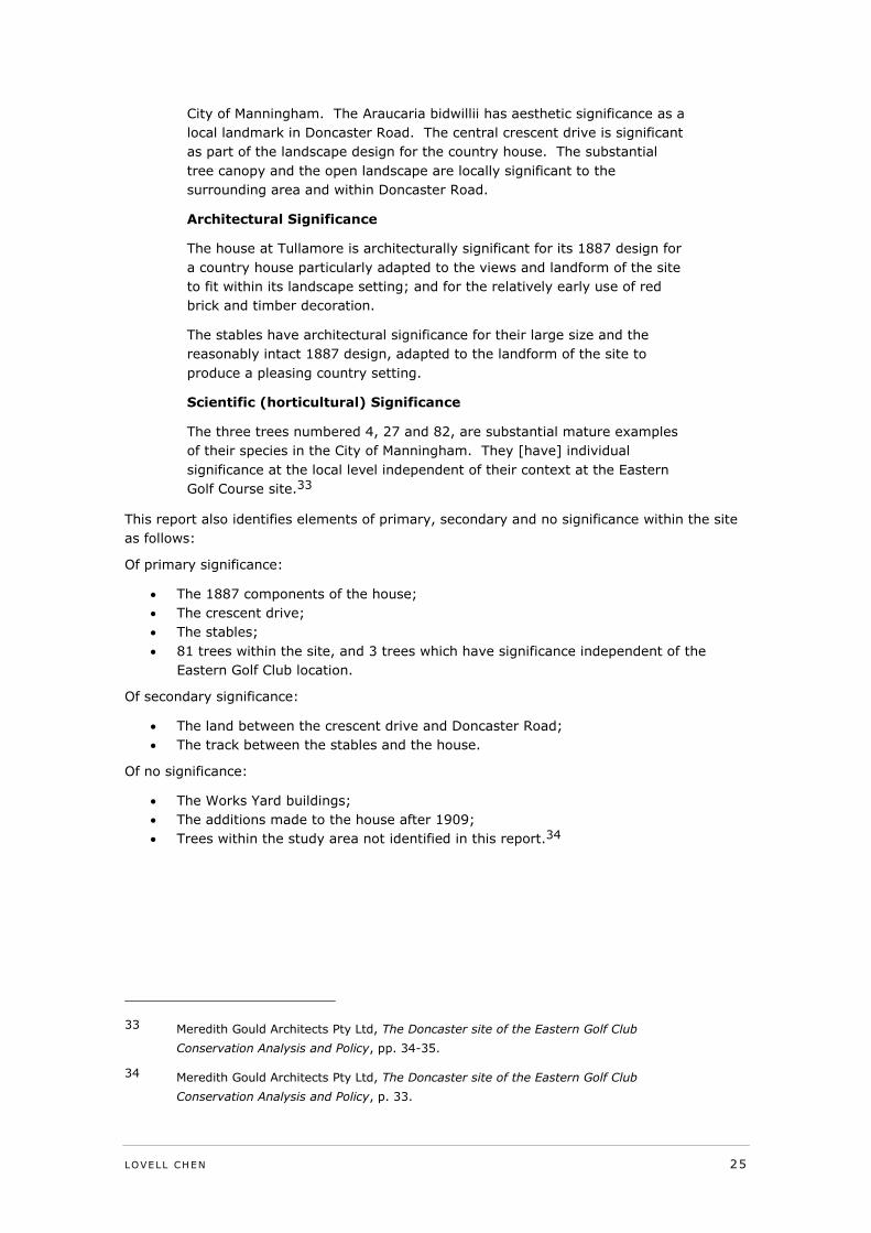
This report also identifies elements of primary, secondary and no significance within the site
as follows:
Of primary significance:
The 1887 components of the house;
The crescent drive;
The stables;
81 trees within the site, and 3 trees which have significance independent of the
Eastern Golf Club location.
Of secondary significance:
The land between the crescent drive and Doncaster Road;
The track between the stables and the house.
Of no significance:
The Works Yard buildings;
The additions made to the house after 1909;
Trees within the study area not identified in this report.34
33 Meredith Gould Architects Pty Ltd, The Doncaster site of the Eastern Golf Club
Conservation Analysis and Policy, pp. 34-35.
34 Meredith Gould Architects Pty Ltd, The Doncaster site of the Eastern Golf Club
Conservation Analysis and Policy, p. 33.
26 LOVELL CHEN
5.0 Amendment C101
Amendment C101 proposes a number of changes to the Manningham Planning Scheme in
relation to the Eastern Golf Course site.
Of these, the principal change related to the heritage of the site is the proposed reduction in
the extent of the Heritage Overlay (HO43) and amendments to the Schedule to the Heritage
Overlay to specify that tree controls to apply to three trees.
It is also proposed to applying a Development Plan Overlay (Schedule 3) to the site and this
contains a number of heritage-related objectives and provisions. On this basis it is also
relevant to a consideration of the heritage implications of the amendment.
The local policy Eastern Golf Course Key Redevelopment Site Policy remains in place with
some amendments.
5.1 Changes to HO43
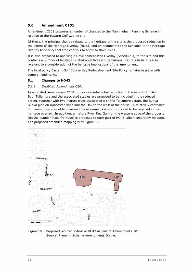
5.1.1 Exhibited Amendment C101
As exhibited, Amendment C101 proposes a substantial reduction in the extent of HO43.
Both Tullamore and the associated stables are proposed to be included in the reduced
extent, together with two mature trees associated with the Tullamore estate, the Bunya
Bunya pine on Doncaster Road and the Oak to the west of the house. A relatively contained
but contiguous area of land around these elements is also proposed to be retained in the
heritage overlay. In addition, a mature River Red Gum on the western edge of the property
(on the Isandar Place frontage) is proposed to form part of HO43, albeit separately mapped.
The proposed amended mapping is at Figure 16 .
Figure 16 Proposed reduced extent of HO43 as part of Amendment C101.
Source: Planning Scheme Amendments Online.
LOVELL CHEN 27
Amendments are also proposed to the schedule to the Heritage Overlay to identify that HO43
applies as follows:
PS Map Ref HO43
Heritage Place Former Eastern Golf Club “Tullamore” – 463
Doncaster Road, Doncaster
The Tree Protection Zone of Tree numbers 4,
27 and 82 as identified in the ‘Conservation
Analysis and Policy” Meredith Gould
Architects Pty Ltd (2011) as shown on the
heritage overlay map.
External Paint Controls Apply Yes
Internal Alteration Controls Apply No
Tree Controls Apply Yes
Tree numbers 4, 27 and 82 as identified in
the “Conservation Analysis and Policy”
Meredith Gould Architects Pty Ltd (2011)
Outbuildings or fences which are not exempt
under Clause 43.01-3
Yes – stables
Included on the Victorian Heritage Register
under the Heritage Act 1995?
No
Prohibited uses may be permitted? No
Name of Incorporated Plan under Clause
43.01-2
-
Aboriginal heritage place? No
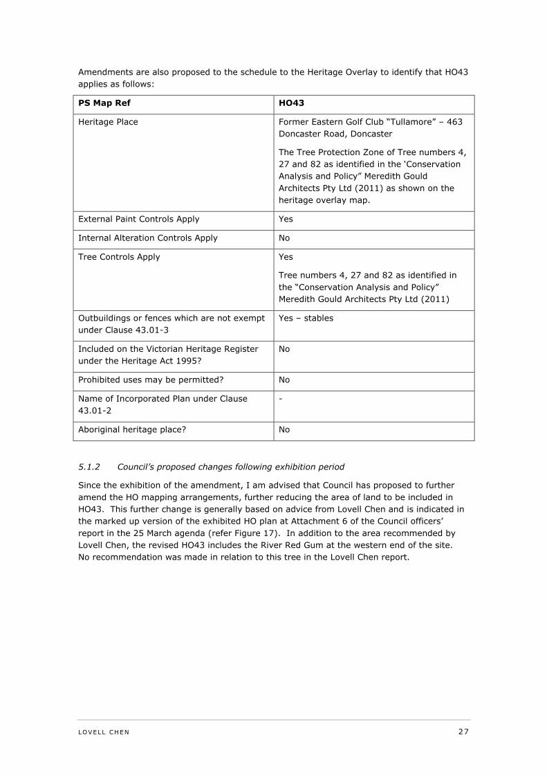
5.1.2 Council’s proposed changes following exhibition period
Since the exhibition of the amendment, I am advised that Council has proposed to further
amend the HO mapping arrangements, further reducing the area of land to be included in
HO43. This further change is generally based on advice from Lovell Chen and is indicated in
the marked up version of the exhibited HO plan at Attachment 6 of the Council officers’
report in the 25 March agenda (refer Figure 17). In addition to the area recommended by
Lovell Chen, the revised HO43 includes the River Red Gum at the western end of the site.
No recommendation was made in relation to this tree in the Lovell Chen report.
28 LOVELL CHEN
Figure 17 Proposed amended HO43 as per Council report 24 March 2014.
Source: Proposed Change to the exhibited Heritage Overlay (HO43) map,
Council Minutes 9.4, 25 March 2014, Attachment 6, p. 702.
5.1.3 Urbis on behalf of Mirvac
Both versions of the amended plan for HO43 as prepared by Council (exhibited version and
post-exhibition version) vary from the arrangement proposed by the proponent for
Amendment C101.
This version is as referenced in the submission made on behalf of Mirvac by Urbis (dated 13
December 2013, Figure 18) and is for a non-contiguous HO43 comprising the following:
The 1886 house, Tullamore, with a 10m curtilage of land (measured from the
alignment of the original external walls of the house);
The stables building with a 10m curtilage (measured from the external walls of the
building); and
Tree nos 4 (River Red Gum), 27 (English Oak), 82 (Bunya Bunya Pine) – it is
assumed that the mapping includes a Tree Protection Zone for each of these.
LOVELL CHEN 29
Figure 18 Proposed reduced extent of HO as proposed by Mirvac.
Source: Submission from Urbis on Behalf of Mirvac, Council Minutes 9.4, 25
March 2014, Attachment 3, p. 647.
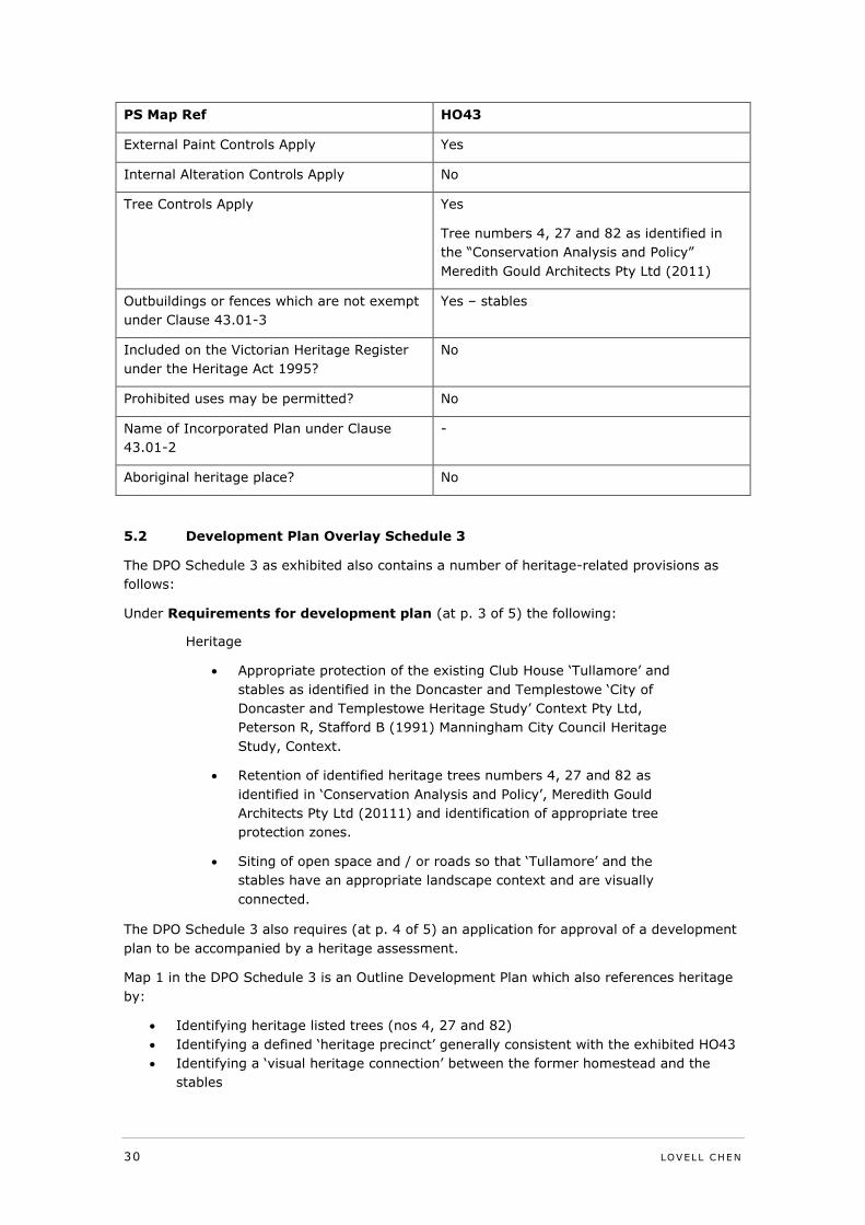
It is understood from a review of the Council officers’ report dated 27 August 2013 that
changes were also proposed to the HO schedule as follows:
PS Map Ref HO43
Heritage Place Former Eastern Golf Club “Tullamore” – 463
Doncaster Road, Doncaster
Applies to Tullamore and a 10m curtilage
from the original external walls of the
“Tullamore” building.
The stables and a 10m curtilage from the
external walls of the stables.
The Tree Protection Zone of Tree numbers 4,
27 and 82 as identified in the ‘Conservation
Analysis and Policy” Meredith Gould
Architects Pty Ltd (2011) as shown on the
heritage overlay map.
30 LOVELL CHEN
PS Map Ref HO43
External Paint Controls Apply Yes
Internal Alteration Controls Apply No
Tree Controls Apply Yes
Tree numbers 4, 27 and 82 as identified in
the “Conservation Analysis and Policy”
Meredith Gould Architects Pty Ltd (2011)
Outbuildings or fences which are not exempt
under Clause 43.01-3
Yes – stables
Included on the Victorian Heritage Register
under the Heritage Act 1995?
No
Prohibited uses may be permitted? No
Name of Incorporated Plan under Clause
43.01-2
-
Aboriginal heritage place? No
5.2 Development Plan Overlay Schedule 3
The DPO Schedule 3 as exhibited also contains a number of heritage-related provisions as
follows:
Under Requirements for development plan (at p. 3 of 5) the following:
Heritage
Appropriate protection of the existing Club House ‘Tullamore’ and
stables as identified in the Doncaster and Templestowe ‘City of
Doncaster and Templestowe Heritage Study’ Context Pty Ltd,
Peterson R, Stafford B (1991) Manningham City Council Heritage
Study, Context.
Retention of identified heritage trees numbers 4, 27 and 82 as
identified in ‘Conservation Analysis and Policy’, Meredith Gould
Architects Pty Ltd (20111) and identification of appropriate tree
protection zones.
Siting of open space and / or roads so that ‘Tullamore’ and the
stables have an appropriate landscape context and are visually
connected.
The DPO Schedule 3 also requires (at p. 4 of 5) an application for approval of a development
plan to be accompanied by a heritage assessment.
Map 1 in the DPO Schedule 3 is an Outline Development Plan which also references heritage
by:
Identifying heritage listed trees (nos 4, 27 and 82)
Identifying a defined ‘heritage precinct’ generally consistent with the exhibited HO43
Identifying a ‘visual heritage connection’ between the former homestead and the
stables
LOVELL CHEN 31
I note that Council in its post-exhibition marked up DPO Schedule 3 (refer Appendix 7 to the
report of 24 February) has proposed a further change, which is the addition of a reference
under the first dot point above to the statement of significance prepared by Lovell Chen.
... and the Statement of Significance in ‘Eastern Golf Club - Tullamore, 463 Doncaster Road,
Doncaster’, Lovell Chen, 2013
32 LOVELL CHEN
6.0 Comment on the heritage issues
6.1 Discussion
The original HO (HO43 as existing) was applied to the site in its entirety in a way whereby
the boundaries did not specifically reflect the heritage values of the place assessed nor the
location of elements that contribute to those values. Conversely in reducing the HO, care
needs to be taken to ensure that sufficient land is retained in the HO to ensure appropriate
management of the heritage values. The HO should include all elements which contribute to
the significance of the place but beyond this, should also include land associated with the
place that requires management in order to retain and interpret the significance of the place.
This is consistent with the explanation of the importance of setting as defined in the Burra
Charter 2013 (Definitions, Article 1.12) as ‘the immediate and extended environment of a
place that is part of or contributes to its cultural significance and distinctive character.’ The
Charter’s Conservation Principles for ‘setting’ (Article 8) expand on the definition:
Conservation requires the retention of an appropriate setting. This
includes retention of the visual and sensory setting, as well as the
retention of spiritual and other cultural relationships that contribute to the
cultural significance of the place.
New construction, demolition, intrusions or other changes which would
adversely affect the setting or relationships are not appropriate.
The Explanatory Notes to the Burra Charter provide more detail:
Setting may include: structures, spaces, land, water and sky; the visual
setting including views to and from the place, and along a cultural route;
and other sensory aspects of the setting such as smells and sounds.
Setting may also include historical and contemporary relationships, such
as use and activities, social and spiritual practices, and relationships with
other places, both tangible and intangible.
In a similar vein, the ‘heritage curtilage’ for a building, complex or site has been defined by
the former Heritage Office of the Department of Urban Affairs and Planning, New South
Wales, as:
… the area of land (including land covered by water) surrounding an
item or area of heritage significance which is essential for retaining and
interpreting its heritage significance. It can apply to either:
o land which is integral to the heritage significance of items of the
built heritage; or
o a precinct which includes buildings, works, relics, trees or places
and their setting.35
In summary, heritage curtilages should include all significant elements and establish an area
which is necessarily managed to ensure the maintenance of heritage significance.
Identification of land to be included within a heritage curtilage (or an HO) does not preclude
change within this area; rather, any change needs to be managed so as not to adversely
impact on setting, presentation or significance of the place.
35 Heritage Office, Heritage Curtilages, Department of Urban Affairs and Planning, New
South Wales, 1996, p.3.
LOVELL CHEN 33
In considering the application of these principles to the Tullamore site, as noted, a limited
review of historical aerials and photographs and documents, including maps was undertaken.
In reviewing the history of Tullamore, it is evident that this is a place where significant
change has occurred and where the legibility of the site is compromised. In the first
instance, the immediate setting to the main house (Tullamore) has undergone significant
change, not only through the impact of the alterations and additions at ground floor level
(compare Figure 2with Figure 9, see also Figure 22) but also the substantial removal or
obscuring of the original principal ‘crescent’ drive and arrival loop to the west of the house
through the development of the carpark, and the removal of other drives and paths around
the house, and of early garden plantings and features. The substantial tree plantings to
Doncaster Road that are evident on the 1931 aerial (refer Figure 5) have also been removed
with the widening of the road. The landscaping associated with the golf course use (mature
tree plantings edging grassed fairways) is unrelated to the earlier layout of the place.
Similarly, the stables building now sits in a context which is quite changed, with fairways to
either side, including changes to the levels around the building, and the establishment of
dense fairway buffer planting to the west and east (Figure 23). There does remain some
evidence of the track from the house to the stables (Figure 26). While no nineteenth century
plans have been located, the track appears to be shown on the 1912-13 plans (Figure 3 and
Figure 4) and the 1931 aerial at Figure 5 and this element survives at least in terms of its
broad alignment, albeit with extensive tree planting having occurred in this location.
Figure 19 Tree 4, River Red Gum (Eucalyptus camaldulensis) located just outside the west
property boundary.
34 LOVELL CHEN
Figure 20 Tree 27, English Oak (Quercus Robur) located to the west of the clubrooms.
Figure 21 Tree 82, Bunya Bunya Pine (Auracaria Bidwillii – in the centre of the image)
located on Doncaster Road, opposite (to the south) of the stables.
LOVELL CHEN 35
Figure 22 View to the clubrooms from the north-east. The first floor of the original
homestead is visible above the later single-storey additions.
Figure 23 Stables building in the existing context with fairways to the north and south.
36 LOVELL CHEN
Figure 24 View from the stables along the south side of the trees, the house is visible in
the distance.
Figure 25 View from the east towards the stables and house.
LOVELL CHEN 37
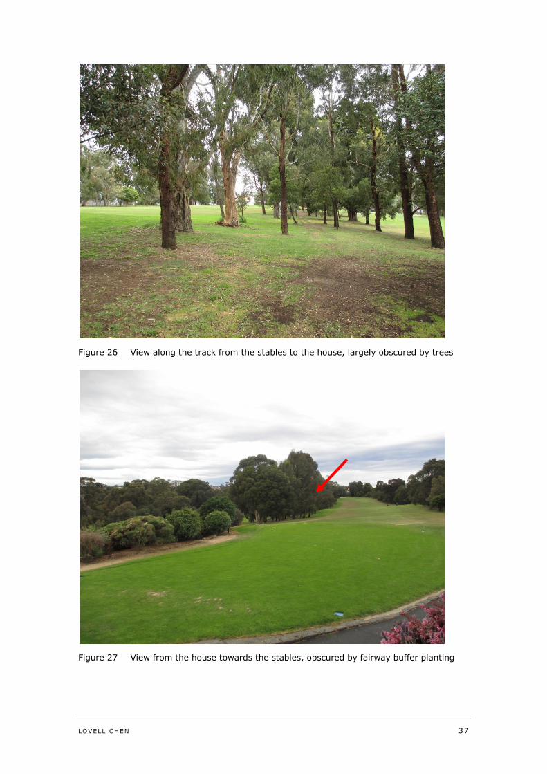
Figure 26 View along the track from the stables to the house, largely obscured by trees
Figure 27 View from the house towards the stables, obscured by fairway buffer planting
38 LOVELL CHEN
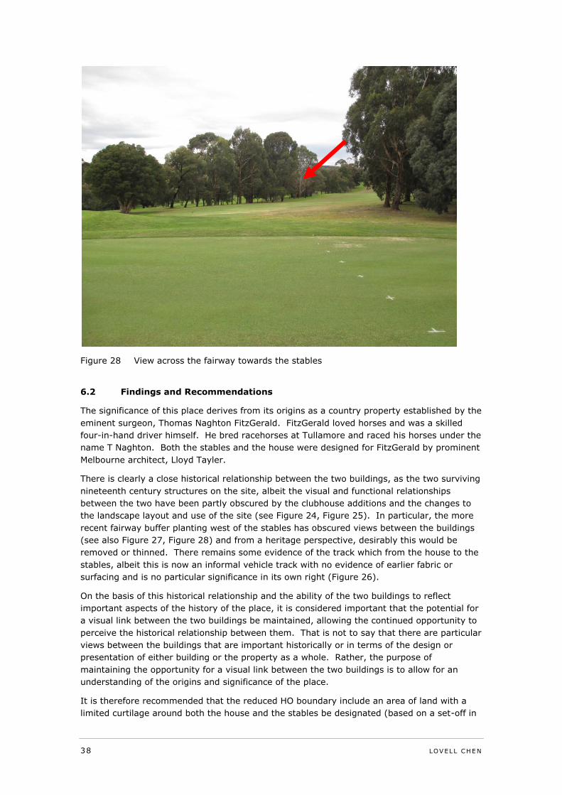
Figure 28 View across the fairway towards the stables
6.2 Findings and Recommendations
The significance of this place derives from its origins as a country property established by the
eminent surgeon, Thomas Naghton FitzGerald. FitzGerald loved horses and was a skilled
four-in-hand driver himself. He bred racehorses at Tullamore and raced his horses under the
name T Naghton. Both the stables and the house were designed for FitzGerald by prominent
Melbourne architect, Lloyd Tayler.
There is clearly a close historical relationship between the two buildings, as the two surviving
nineteenth century structures on the site, albeit the visual and functional relationships
between the two have been partly obscured by the clubhouse additions and the changes to
the landscape layout and use of the site (see Figure 24, Figure 25). In particular, the more
recent fairway buffer planting west of the stables has obscured views between the buildings
(see also Figure 27, Figure 28) and from a heritage perspective, desirably this would be
removed or thinned. There remains some evidence of the track which from the house to the
stables, albeit this is now an informal vehicle track with no evidence of earlier fabric or
surfacing and is no particular significance in its own right (Figure 26).
On the basis of this historical relationship and the ability of the two buildings to reflect
important aspects of the history of the place, it is considered important that the potential for
a visual link between the two buildings be maintained, allowing the continued opportunity to
perceive the historical relationship between them. That is not to say that there are particular
views between the buildings that are important historically or in terms of the design or
presentation of either building or the property as a whole. Rather, the purpose of
maintaining the opportunity for a visual link between the two buildings is to allow for an
understanding of the origins and significance of the place.
It is therefore recommended that the reduced HO boundary include an area of land with a
limited curtilage around both the house and the stables be designated (based on a set-off in
LOVELL CHEN 39
the order of 15m off the north side of the original extent of the house, and a 10m curtilage
around the stables. In addition, it is proposed that an area of land between the two
buildings be included in the HO. This will allow for the management of the immediate setting
of both buildings and the space between them generally with general reference to the
alignment of the track between the two buildings. It is further recommended that an area
land to the south of the original and house extending to Doncaster Road be included within
the reduced HO, to allow for a consideration of any impacts on the closer views to the house
from this main road. It is not considered necessary to include a large area of land to the
south of the stables as this building does not have a visual presence on Doncaster Road. The
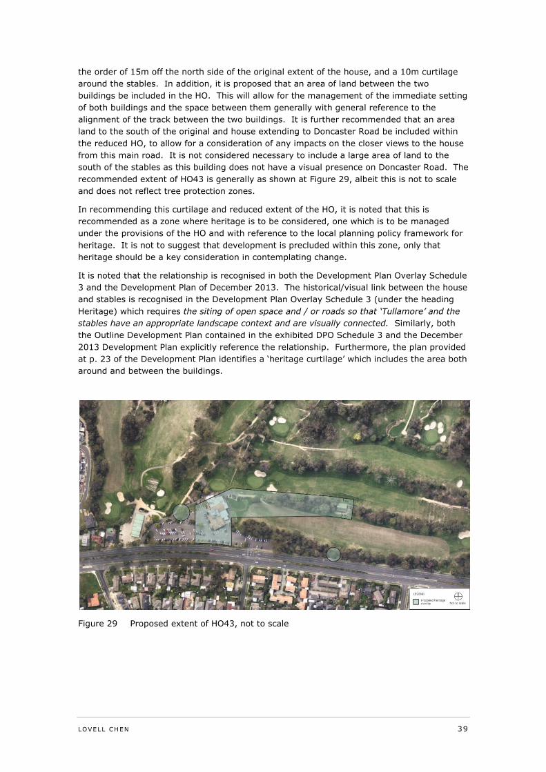
recommended extent of HO43 is generally as shown at Figure 29, albeit this is not to scale
and does not reflect tree protection zones.
In recommending this curtilage and reduced extent of the HO, it is noted that this is
recommended as a zone where heritage is to be considered, one which is to be managed
under the provisions of the HO and with reference to the local planning policy framework for
heritage. It is not to suggest that development is precluded within this zone, only that
heritage should be a key consideration in contemplating change.
It is noted that the relationship is recognised in both the Development Plan Overlay Schedule
3 and the Development Plan of December 2013. The historical/visual link between the house
and stables is recognised in the Development Plan Overlay Schedule 3 (under the heading
Heritage) which requires the siting of open space and / or roads so that ‘Tullamore’ and the
stables have an appropriate landscape context and are visually connected. Similarly, both
the Outline Development Plan contained in the exhibited DPO Schedule 3 and the December
2013 Development Plan explicitly reference the relationship. Furthermore, the plan provided
at p. 23 of the Development Plan identifies a ‘heritage curtilage’ which includes the area both
around and between the buildings.
Figure 29 Proposed extent of HO43, not to scale
40 LOVELL CHEN
These broad requirements and concepts are generally appropriate and consistent with the
conclusions of this review of the heritage significance of the place. Notwithstanding this, my
view is that the heritage values of the place should be addressed in the first instance through
the Heritage Overlay provisions of the Planning Scheme, and the HO should not be removed
from land which is required to be managed for heritage reasons. As indicated earlier, the
relationship is an important aspect of the heritage significance of the place and this is should
be recognised in determining an appropriate revised Heritage Overlay area. It is on this
basis that the land between the buildings is recommended to be retained in the HO. The
alternative proposal to reduce the extent of the Heritage Overlay to a 10 metre curtilage
around the extent of the original homestead of ‘Tullamore’, and 10 metre curtilage around
the extent of the external stable walls and three individual trees is not supported. Such an
arrangement would not allow for the specific consideration of heritage issues and impacts
under the Heritage Overlay provisions of the scheme in the area between the two buildings
or between the house and Doncaster Road. As noted, that is not to say that appropriate
development could not occur within these areas, simply that the Heritage Overlay and its
decision guidelines are the most appropriate mechanism through which proposals for change
can be considered.
In relation to the area between the house and the stables, it is recognised that this
recommendation differs in some respects from that of the Panel for Amendment C86, which
found as follows:
The Panel accepts the view of Mr Raworth that the stables served a
farming rather than domestic function. This view is supported by the
distance between the two buildings. The Panel therefore sees no need for
there to be the declaration of a heritage precinct to encompass these
buildings and three significant trees. (Panel Report, p. 17)
Since the Panel’s findings, however, further historical research has allowed for a better
understanding of the history of the place including the fact that the stables and residence
both appear on the available evidence to have been designed for Thomas FitzGerald by the
noted Melbourne architect Lloyd Tayler as related to his considerable interest in horse racing.
There is also some historical evidence of the track between the house and stables, as would
be expected. My view is that this material supports an assessment that the historical links
between the two buildings are important and the nature of future development that might be
contemplated in the space between them is a heritage issue and one that should be dealt
with through the Heritage Overlay provisions of the planning scheme.
In relation to the trees on the site, these have been assessed by others (Meredith Gould
Architects, 2011) as significant specimens in their own right and as warranting the
application of the HO on this basis. Three trees have been identified as of individual
significance:
Based on size and maturity, an assessment has been made that the Bunya
Bunya Pine on Doncaster Road (tree 82) dates from the nineteenth century
and may mark the location of an earlier cottage constructed by David
Mitchell.
The English Oak to the west of the house (tree 27) is likely to be a remnant
planting from the crescent drive.
The River Red Gum (tree 4) just east of the property boundary has been
assessed by Meredith Gould as of local significance in its own right and as a
possible pre-settlement survivor, but is noted on the tree data sheets in the
same report as a mature indigenous tree, but not as homestead or pre-
homestead planting.
LOVELL CHEN 41
Of these, the evidence seems reasonably clear that the Bunya Bunya Pine and the English
Oak are both related to the nineteenth century Tullamore property. This was confirmed by
Mr John Patrick in evidence to the Panel for C86.36
Accepting this, neither the Bunya Bunya Pine nor the English Oak are considered to have a
particularly strong visual relationship to the buildings or to contribute to the setting of either
building. In the case of the Bunya Bunya Pine it has been suggested that this may have
been associated with the earlier cottage constructed by David Mitchell. While an early
element on the site, and a tree which is a landmark on Doncaster Road, it stands as an
isolated element and does not have a strong link to either the stables or the main house.
The English Oak has a more direct link to the house in that it is thought to have formed part
of the driveway plantings. In the context of the changes to the landscape in this part of the
site, however, it appears as an isolated remnant.
On this basis, it is recommended these two trees be included in HO43 but mapped
separately. Sufficient land is required around the trees to protect them (including a TPZ
expanded to allow for future growth, based on an arboricultural assessment). The mapping
at Figure 29 is nominal only.
The origins of the River Red Gum are less clear in terms of the history of the Tullamore
property. I note this is also proposed for inclusion in HO43 and this seems likely to be
justified based on its age and natural/cultural values and would appear to be supported by
Ms Gould and Mr Patrick’s assessments.
In relation to the proposed changes to the HO schedule, the schedule listing as exhibited
seems appropriate.
In relation to the Development Plan Overlay Schedule 3, the heritage-related provisions in
the exhibited DPO are supported. In addition, the proposal (one of the changes proposed by
Council following the exhibition period, refer Attachment 7 to the 24 March report) to add a
reference to the Statement of Significance prepared by Lovell Chen in 2013 is supported.
The statement represents an updated assessment of significance based on additional
research and current site conditions.
In addition, however, the statement of significance should also be listed as a Reference
Document at Clause 22.03 (Cultural Heritage Policy) which is applicable to ‘cultural heritage
places which are places of aesthetic, historical, scientific, architectural or social significance’
including individually significant buildings and places, trees, groups of trees, gardens and
landscapes, heritage precincts, sites and areas of archaeological significance and Aboriginal
cultural heritage places, objects and landscapes. Both the Cultural Heritage Policy and the
Heritage Overlay recognise an understanding of significance as a key input to the decision
making process. The HO decision explicitly also require the Responsible Authority to
consider, inter alia:
Any applicable statement of significance, heritage study and any
applicable conservation policy.
On this basis it would be appropriate to confirm the relevance of the Lovell Chen statement
of significance to applications made under the Heritage Overlay through listing it at Cl.
22.03. This would make it clear that the statement should be given weight in decisions
made under the Heritage Overlay and (given the other heritage studies are identified as
Reference Documents at this clause), would avoid confusion about what statement is
relevant.
36 John Patrick, Evidence on Amendment C86, March 2011, p. 5.
42 LOVELL CHEN
In relation to the local planning policy framework, the Eastern Golf Course Key
Redevelopment Policy at Cl. 22.17 would stand and no change is proposed to the heritage-
related provisions of this policy. For consistency, consideration could also be given to adding
a reference to the Lovell Chen Statement of Significance at the first dot point under Heritage,
as follows:
Protect the existing Club House ‘Tullamore’ and stables as identified in the
Doncaster and Templestowe ‘City of Doncaster and Templestowe Heritage
Study’ Context Pty Ltd, Peterson R, Stafford B (1991) Manningham City
Council Heritage Study, Context and the Statement of Significance in
‘Eastern Golf Club - Tullamore, 463 Doncaster Road, Doncaster’, Lovell
Chen, 2013
LOVELL CHEN 43
7.0 Responses to submissions
Relatively few submissions to the amendment are focused on heritage issues.
1 Local residents
Three submissions from local residents expressed a general concern over reduction of the
Heritage Overlay and the environmental significance overlay.
Response: No specific issues are raised and so no response has been provided.
2 Urbis on behalf of Mirvac (submission dated December 2013)
A further reduction in the Heritage Overlay is supported as a non-contiguous arrangement
with a 10m curtilage around the original envelope of the house and the same around the
stables and the three trees to be included with their protection zones, as per Figure 18.
Heritage Overlay - the reduction of the extent of the heritage overlay
currently across the entire site is welcomed. However it is our position
that the extent of Heritage Overlay appropriate for the site is shown in the
attached HO map which includes 10 metres beyond the curtilage of the
two buildings and include the Tree Protection Zone of the three nominated
trees. This position is based on the heritage advice of Bryce Raworth. We
also note the Panel considering Amendment C86 made the specific
commentary against applying a precinct wide heritage overlay stating:
The Panel therefore sees no need for there to be a physical or functional
connection between Tullamore and the stables, or for there to be the
declaration of a heritage precinct to encompass these buildings and the
three significant trees.
The submitted Development Plan shows the Stables and Tullamore
visually connected through open space and road network to achieve
Council’s policy desire. The impost of a heritage overlay creates
unnecessary permit triggers for Council and future development of the
land.
The issues raised related to significance and the establishment of an appropriate curtilage
are addressed earlier in this report, including the comments of the Panel for Amendment
C86. As noted, the additional research and assessment undertaken since that Panel in my
view supports an alternative position on the extent of the Heritage Overlay.
In relation to the issue of permit triggers, these apply across the entire site at present. In
considering a reduction in the Heritage Overlay, care should be taken to include sufficient
land to provide for the appropriate future management of the heritage place. When the
requirement for a permit is triggered, the Heritage Overlay decision guidelines and relevant
local policies and reference documents provide the most appropriate framework for
considering proposals for change.
44 LOVELL CHEN
8.0 Conclusion and recommendations
It is the conclusion of this assessment that Amendment C101 should be supported with the
following revisions:
HO43 should be amended generally in accordance with the plan at Figure 29, but
with the addition of Tree no. 4 and an appropriate Tree Protection Zone
the Statement of Significance as at section 6.3 of this report should be referenced in
the Development Plan Overlay Schedule 3 and in the local planning policy
framework, including at Clauses 22.03 and 22.17.