Embed Size (px)
Citation preview

UNCLASSIFIED
Space Environment Network Display
AFTER INITIATIVE REPORT
Kenney Class Initiative
Air Force Space Battlelab 730 Irwin Ave, Ste 83
Schriever AFB CO 00912*7383
July 1999
UNCtASSIFICD mm vnxgff txmxxm *
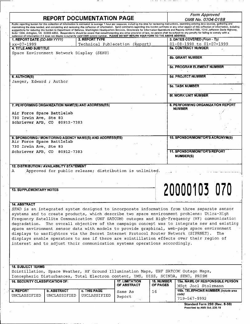
REPORT DOCUMENTATION PAGE Form Approved
OMB No. 0704-0188 Public reporting burden for this collection of information is estimated to average 1 hour per response, including the time for reviewing instructions, searching existing data sources, gathering and maintaining the data needed, and completing and reviewing this collection of information. Send comments regarding this burden estimate or any other aspect of this collection of information, including suggestions for reducing this burden to Department of Defense, Washington Headquarters Services, Directorate for Information Operations and Reports (0704-0188), 1215 Jefferson Davis Highway, Suite 1204, Arlington, VA 22202-4302. Respondents should be aware that notwithstanding any other provision of law, no person shall be subject to any penalty for falling to comply with a collection of information If it does not display a currently valid OMB control number. PLEASE DO NOT RETURN YOUR FORM TO THE ABOVE ADDRESS.
1. REPORT DATE (DD-MM-YYYY) xx-07-1999
2. REPORT TYPE Technical Publecation (Report)
3. DATES COVERED (From - To) 01-08-1998 to 01-07-1999
4. TITLE AND SUBTITLE Space Environment Network Display (SEND)
Sa. CONTRACT NUMBER
5b. GRANT NUMBER
Sc. PROGRAM ELEMENT NUMBER
6. AUTHOR(S) Jaeger, Edward Author
5d. PROJECT NUMBER
Se. TASK NUMBER
5f. WORK UNIT NUMBER
7. PERFORMING ORGANIZATION NAME(S) AND ADDRESS(ES)
Air Force Space Battlelab 730 Irwin Ave, Ste 83 Schriever AFB, CO 80912-7383
8. PERFORMING ORGANIZATION REPORT NUMBER
9. SPONSORING / MONITORING AGENCY NAME(S) AND ADDRESS(ES) Air Force Space Battlelab 73 0 Irwin Ave, Ste 83 Schriever AFB, CO 80912-7383
10. SPONSOR/MONITOR'S ACRONYM(S)
11. SPONSOR/MONITOR'S REPORT NUMBER(S)
12. DISTRIBUTION / AVAILABILITY STATEMENT A Approved for public release; distribution is unlimited.
13. SUPPLEMENTARY NOTES 20000103 070 14. ABSTRACT SEND is an integrated system designed to incorporate information from three separate sensor systems and to create products, which describe two space environment problems: Utlra-High Frequency Satellite Communication (UHF SATCOM) outages and High-Frequency (HF) communication degradation. The overall objective of the campaign concept was to integrate new and existing space environment sensor data with models to provide graphical, web-page space environment displays to warfighters via the Secret Internet Protocol Router Network (SIPRNET). The displays enable operators to see if there are scintillation effects over their region of interest and to adjust their communication systems operations accordingly.
15. SUBJECT TERMS Scintillation, Space Weather, HF Ground Illumination Maps, UHF SATCOM Outage Maps, Ionospheric Disturbances, Total Electron content, IMS, DISS, SCINDA, SEND, PRISM 16. SECURITY CLASSIFICATION OF:
a. REPORT UNCLASSIFIED
b. ABSTRACT UNCLASSIFIED
c. THIS PAGE UNCLASSIFIED
17. LIMITATION OF ABSTRACT
Same As Report
18. NUMBER OF PAGES
16
19a. NAME OF RESPONSIBLE PERSON MSgt Joel Stolzmann 19b. TELEPHONE NUMBER (include area code) 719-567-9992
Standard Form 298 (Rev. 8-98) Prescribed by ANSI Std. Z39.18

DEPARTMENT OF THE AIR FORCE HEADQUARTERS AIR FORCE SPACE COMMAND
15 June 1999 MEMORANDUM FOR SEE DISTRIBUTION LIST
FROM: USAFSB/CC 730 Irwin Ave Ste 83 Schriever AFB CO 80912-7383
SUBJECT: Space Environment Network Display (SEND) After Initiative Report
1. The enclosed Battlelab After Initiative Report is forwarded for your information and/or action as appropriate.
2. If you have questions concerning any information contained in this document, please contact Major Ed Jaeger, Initiative Demonstration Team, USAF SB, DSN 560-0416 or commercial (719) 5676-0416. E-mail: [email protected].
fo'Vw/
EDWARD G. MORROW, Colonel, USAF Commander
Attachment: After Initiative Report Det 1 AFOTEC Final Report
GUARDIANS OF THE HIGH FRONTIER
UNCLASSIFIED
Distribution List
HQAFSPC/DRS(6) Det 1 AFOTEC (6) (Mr. Dave Tracy, Mr. BJ.Lyden) AFRIiVSBS (10) (Mr. Greg Bishop, Dr. Terry Bullett, Dr. Keith Groves) 55 SWXS (2) ARSPACE (3) (Mr. James Tooker) SMC/SSSG (4)(Mr. Kevin Scro) USAF/XORPB (2) SB/CC (5) AEFB/CC (1) C2B/CC (1) FPB/CC (1) IWB/CC (1) UAVB/CC (1) USSPACECOM J/33W (2) SWC/CC (2)
UNCLASSIFIED

UNCLASSIFIED
EXECUTIVE SUMMARY
The Air Force Space Battlelab (SB) sponsored a campaign concept directing the assessment of the Space Environment Network Display (SEND) initiative. SEND is an integrated system designed to incorporate information from three separate sensor systems and to create products, which describe two space environment problems: Ultra- High Frequency Satellite Communication (UHF SATCOM) outages and High-Frequency (HF) communication degradation. The overall objective of the campaign concept was to integrate new and existing space environment sensor data with models to provide graphical, web-page space environment displays to warfighters via the Secret Internet Protocol Router Network (SIPRNET). The displays enable operators to see if there are scintillation effects over their region of interest and to adjust their communication systems operations accordingly.
SB designated the Air Force Operational Test & Evaluation Center, Detachment 1 (Det 1) to conduct the military utility assessment. The SEND system sensors were placed at Ascension Island from 1 through 17 April 1999 in support of this assessment.
According to the potential users polled during this assessment, the SEND space environment product presentations have military utility in mission execution. Users agreed that it was easy to understand the SEND displays. HF Illumination maps were placed onto the Internet 99% of the time; UHF SATCOM Outage maps were placed onto the Internet 94% of the time. It took an average of 16.5 minutes to transfer UHF SATCOM scintillation information from the sensor field site to the SEND product display on the Internet. It took no more than one hour to transfer HF Illumination propagation information.
Based upon the performance demonstrated during the Limited Military Utility Assessment (LMUA) and upon the requests for space environment information which surfaced after the LMUA, Det 1
concluded that both the SEND system and concept have military utility.
The SEND system uses ground-based antennae to collect ionospheric data and to predict scintillation effects on communication links.
UNCLASSIFIED
UNCLASSIFIED
TABLE OF CONTENTS
Section Page
EXECUTIVE SUMMARY 4
TABLE OF CONTENTS 5
DEMONSTRATION MISSION STATEMENT 6
COURSE OF ACTION 7
RESULTS 9
RECOMMENDATIONS 13
APPENDIX 15 A: Acronyms and Abbreviations
UNCLASSIFIED

UNCLASSIFIED
AFTER INITIATIVE REPORT FOR KENNEY BATTLELAB INITIATIVE Space Environment Network Display (SEND)
DEMONSTRATION MISSION STATEMENT
Purpose: The Space Environment Network Display (SEND) integrated three existing space environment sensor systems and networked them to produce near real-time data on local space environment. SEND processed that data to produce theater High Frequency (HF) ground illumination and Ultra High Frequency Satellite Communication (UHF SATCOM) outage color-coded maps to aid in the selection of in-theater radio frequencies.
Background: Ionospheric disturbances at both low and high latitudes routinely degrade the performance and reliability of space-based communication, navigation, and RF (Radio Frequency) systems. Although warfighters have access to some space environmental data, the current format (textual) makes it difficult to interpret. SEND was developed to convert textual information into an easy to read, user-friendly graphical display (color coded maps). The purpose of the SEND demonstration was to assess the utility of providing graphical theater space environment information to the warfighter.
The SEND system integrates three sensor systems; the Digital Ionospheric Sounding System (DISS), the Ionospheric Measuring System (IMS), and the Scintillation Network Decision Aid (SCINDA) - along with algorithms resident on the Parameterized Real Time Ionospheric Specification Model (PRISM) to create and disseminate space environment descriptions of ionospheric disturbance effects on UHF SATCOM and HF communications. The DISS, IMS, and SCINDA sensor systems were placed in the field at Ascension Island; the Silicon Graphics Octane processor, which hosted the PRISM, SCINDA, and HF Raytrace applications used, was located at the 55th Space Weather Squadron (SWXS) at Schriever AFB, Colorado.
Once sensor data was collected, it was placed into a software file. The software file was then placed onto a Non-classified Internet Protocol Router Network (NIPRNET)- accessible processor. The processed files were then pulled through the Schriever AFB firewall into the Unclassified Operations Cluster. Once placed into the database, the data was pulled through a one-way gate and sent to the central processing computer.
SEND system components were placed at Ascension Island in xurmnrt nfthp TMTIA
UNCLASSIFIED
UNCLASSIFIED
Upon completion of model and product generation, the most recent products were placed onto a classified web server, making them available worldwide via the SIPRNET. All products were placed onto a classified image archive processor, available for assessment data analysis, as required.
SEND received General Officer's Advisory Group (GOAG) approval for demonstration execution in August 1998. The demonstration plan was for a two-part demonstration. Part one was designed to be a technology risk mitigator. The CONUS pre-deployment demonstration showed that the three sensors, hardware and software and PRISM model could be integrated and operates in an end-to-end configuration. The second part of the demonstration was to be a deployment to Saudi Arabia. Due to SB's inability to gain host-nation approval for equipment entry into the country, SB had to cancel the original plan and execute the back-up plan in order to preserve the 1998 event and funding schedule. The back-up plan was to deploy and perform the demonstration at Ascension Island.
Length of Time: The SEND initiative was approved for execution by the GOAG in August 1998. The CONUS demonstration was accomplished in January 1999 at Hanscom AFB. The actual SEND OCONUS LMUA was conducted from 1 April through 17 April 1999 at Ascension Island. The After Initiative Report was completed in July 1999.
Objectives: To assess the military utility of SEND. Five assessment objectives were developed:
1. Determine the utility of the SEND space environment product presentations in mission planning and conduct.
2. Determine the ease with which new users can effectively operate the SEND system.
3. Determine the percentage of time SEND products were available for global distribution on the SIPRNET web page.
4. Determine the elapsed time from sensor site data collection to displaying the SEND products on the SIPRNET.
5. Determine SEND reliability, as a function of time system was available to time possible during the demonstration.
COURSE OF ACTION
Strategy: In January 1999, a pre-deployment demonstration was conducted at Hanscom AFB, Massachusetts to verify integration/operations checkout. The actual SEND demonstration was conducted using a remote sensor suite at Ascension Island to collect local space environment data.
Participants: The Air Force Operational Test & Evaluation Center (AFOTEC), Detachment 1 (Det 1) acted as the independent military utility assessor for the LMUA
UNCLASSIFIED
UNCLASSIFIED
under SB supervision and guidance. The Air Force Research Laboratory Space Vehicles Branch (AFRL/VSB) provided the technical expertise to set-up, integrate and operate the remote sensor suite. SB provided the oversight of the initiative demonstration. Using homestation and deployed personnel, Det 1 assisted in the transportation, set-up and overall assessment of the SEND demonstration. Utilizing surveys and personal interviews, Det 1 also determined the benefits of providing graphical space environment products to the warfighter.
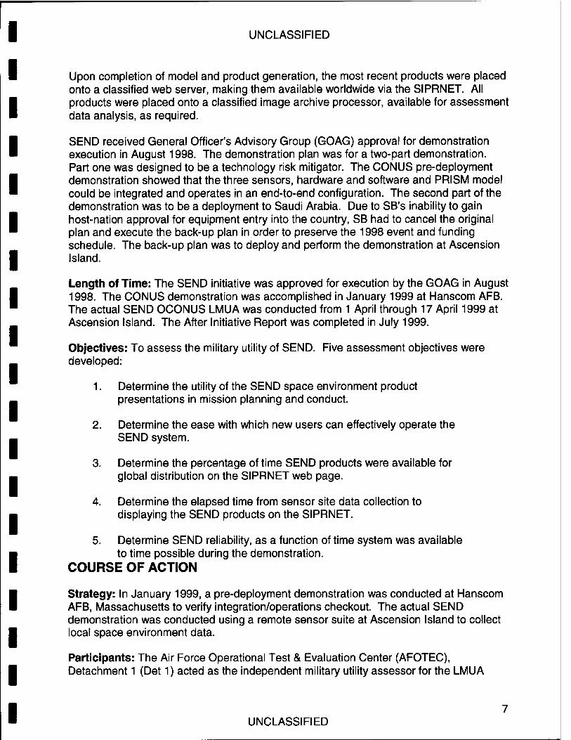
Assessment Methodology: The equipment sent to Ascension Island consisted of 14 pieces (8,146 lbs., 692 cubic feet). The equipment was shipped from Hanscom AFB to Patrick AFB, Florida, via commercial truck for airlift by Air Mobility Command to Ascension Island. The SEND demonstration sensor placement team - one SB, one Det 1, and six AFRL personnel - departed for Ascension Island on 23 March 1999. Set up and integration of the DISS, IMS, and SCINDA systems was completed by 29 March 1999. Data collected by the sensors was sent to the Defense Meteorological Satellite and Space Environment System Program Office (DMSASESPO) at Schriever AFB on 30 March 1999. Space environment products were generated at the DMSASESPO and made available on the SIPRNET to the warfighter/user the same day. The SEND system was declared ready-for- assessment on 31 March 1999; the SEND
.. . * SEND system components were housed in a dedicated shelter on Ascension April 1999. Mand
y
To collect the data required to meet the assessment goals, the following data collection methodology was implemented:
• To measure the improvement with respect to mission performance (increase in military utility), a simple post-mission questionnaire was provided to users, operators and decision-makers once they viewed the SEND products on the SIPRNET web page.
• The questionnaire also measured user and decision-maker impressions concerning the ease of use of the SEND system.
8 UNCLASSIFIED

UNCLASSIFIED
• To document the availability of the SEND products, assessment team personnel checked whether those products were present on the SEND SIPRNET web page during the demonstration.
• To measure the timeliness of the SEND products, assessment team personnel collected file data latency information off the SEND products to estimate the elapsed time from environmental data event until presentation on the web page.
• To qualify SEND system dependability, assessment team personnel collected component status information.
While sensor and processor preparation was underway, Det 1 personnel began soliciting inputs from potential users. Users were introduced to the SEND concept and products, then requested to fill out the LMUA questionnaire. Det 1 personnel also tracked processor and communication link status, and SEND product availability at Schriever AFB. Finally, Det 1 personnel disseminated E-mail and voice-mail messages soliciting military utility inputs from potential users worldwide.
RESULTS
Objective 1
Measure: Determine the utility of the SEND space environment product presentations in mission planning and conduct.
Finding: Potential users unanimously agreed that the HF Illumination maps were useful. Nearly 70% of potential users also agreed that the UHF SATCOM Outage map was useful. Those who did not feel the UHF SATCOM Outage map was useful cited two specific reasons for their belief: 1.) The UHF SATCOM system is only a backup communications method for some potential users, and 2.) Some UHF SATCOM questionnaire respondents believed that the lack of a long- range forecasting capability made SEND not useful.
Salient comments extracted from questionnaires included:
• Can be used to order timely frequency shifts.
• Can be used for real- time frequency selection and command & control.
SCINDA Produced 2-D UHF SATCOM Outage maps for the SEND Demonstration.
UNCLASSIFIED
UNCLASSIFIED
Potential users agreed that SEND information would be useful during mission execution. Though not as enthusiastically, they also agreed that SEND information would change mission execution. This less enthusiastic response arose because most potential users did not have the opportunity to actually employ SEND product information during one of their missions, and so could not readily judge whether it indeed did change their execution activities.
According to potential users, the SEND space environment products are not of great value in mission planning. Three separate questionnaires pinpointed why this is so: each said that mission planning (from a frequency management standpoint) was usually done 30 days in advance of mission execution. Systems like SEND, which are currently incapable of long-range forecasting, simply cannot support such planning requirements.
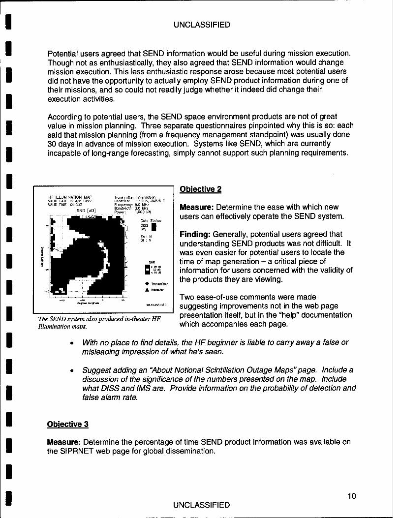
HF ILLUMINATION MAP VAUD GATE 12 Apr 1999 VAUD TIME 09:30Z
SNR [dB]
-20 Degrees mngrajde
Transmitter Information Location: -7.9 N, 345.6 E Frequency: 6.0 MHz Bandwidth: 3.0 kHz Power: 1,000 kW
Dato Status DISS | IMS ■
E« Sf :
♦ Transmitter
A R»c»Hv>r
The SEND system also produced in-theater HF Illumination maps.
Objective 2
Measure: Determine the ease with which new users can effectively operate the SEND system.
Finding: Generally, potential users agreed that understanding SEND products was not difficult. It was even easier for potential users to locate the time of map generation - a critical piece of information for users concerned with the validity of the products they are viewing.
Two ease-of-use comments were made suggesting improvements not in the web page presentation itself, but in the "help" documentation which accompanies each page.
• With no place to find details, the HF beginner is liable to carry away a false or misleading impression of what he's seen.
• Suggest adding an "About Notional Scintillation Outage Maps"page. Include a discussion of the significance of the numbers presented on the map. Include what DISS and IMS are. Provide information on the probability of detection and false alarm rate.
Objective 3
Measure: Determine the percentage of time SEND product information was available on the SIPRNET web page for global dissemination.
10 UNCLASSIFIED

UNCLASSIFIED
Finding: SEND system performance was determined objectively. Every thirty minutes during the demonstration, new HF Illumination and UHF SATCOM Outage maps were to be generated and placed onto the SEND SIPRNET web page archive. (This equates to 816 total map generation opportunities for the HF products. Since UHF SATCOM Outage maps would only represent scintillation between the hours of 2200Z and 0600Z, the number of total available UHF generation opportunities was lower.) Valid HF Illumination maps were available on the SIPRNET web page 388 times of the 816 opportunities (48%). Valid UHF SATCOM Outage maps were available 75 times of the 272 opportunities (28%).
Valid HF Illumination Map Available? (289 Opportunities)
No valid map available
(30)
Valid map available
(259)
Valid UHF Illumination Map Available? (98 Applicable Opportunities)
No valid map available (21)
Valid map available (77)
Based upon the unavailability of presentable SEND data on the SIPRNET web page (due to Meteorological Dissemination System (MDS) anomalies and Information Condition BRAVO restrictions), AFRL generated notional (unclassified) UHF SATCOM Outage and HF Illumination maps at Hanscom AFB and place them onto an Internet web page. Starting 11 April 1999, valid HF Illumination maps were available on the Internet web page 259 times of the 289 opportunities (90%), and UHF SATCOM Outage maps were available 77 times of the 98 opportunities (79%).
Because of classification issues, it will never be possible to completely ignore secure communications systems and to place UHF SATCOM Outage maps (that contain all of each map's appropriate information) on an open network like the Internet. Yet, it should also be assumed that the SIPRNET/MDS communications network to the 55th SWXS will probably never again be as fickle as it was during the LMUA demonstration period. The global dissemination metric assessing the percentage of time when space weather products are available is probably some number between the SIPRNET and Internet percentages outlined above.
HF Illumination and UHF SATCOM Outage maps were often available on the Internet.
11 UNCLASSIFIED
UNCLASSIFIED
Objective 4
Measure: Determine the time required to transfer space environment information from the sensor field site to the SEND product display on the SIPRNET.
Finding: The timeliness of SEND space environment products was determined objectively for the UHF SATCOM outage maps. The average latency from the end of data collection to UNCLASSIFIED INTERNET map generation was 16.5 minutes. The average latency for maps placed on the SIPRNET was 21.3 minutes.
The timeliness of the HF Illumination maps was measured using the data status lights included on each map. During the period when the Internet web page was operational, the IMS status light was yellow only once (signaling that the most recent data set was more than one hour old, but less than two hours old). During the rest of that period, the DISS and IMS data status lights were green, signifying that the map presented had used a data set less than one hour old.
Objective 5
Measure: Determine the percentage of time that the SEND system was operational compare with total time available during the demonstration
Finding: Performance can be estimated by analyzing the global dissemination data collected for Objective 3. During the last week of the LMUA demonstration, the SEND system components generated Internet space environment HF Illumination maps 90% of the time; they generated UHF SATCOM Outage maps 79% of the time. Dismissing the pre-scheduled Ascension Island power outage and other activities required to prepare to leave the DISS behind - which should not be considered reflective of SEND component reliability - those numbers climb as follows:
• Valid HF Illumination maps were generated 286 of 289 opportunities (99%). • Valid UHF SATCOM Outage maps were generated 60 of 64 opportunities
(94%).
The performance presented does not paint a full picture of the percentage of operational time. If the components had failed intermittently between map generation times, that would not appear in the data. Nonetheless, the percentage of maps generated reflects favorably upon the capabilities of the SEND system components.
Overall:
The principal purpose of the SEND LMUA was to ascertain whether the SEND system and concept had military utility. The strong performance demonstrated with respect to all
12 UNCLASSIFIED
UNCLASSIFIED
the LMUA objectives is a good signal of military utility. Incontrovertible additional evidence of the SEND system and concept military utility was, however, presented in the form of the two memoranda. The first memorandum was from the Air Force Space Command Weather and Space Environment Operations Branch Directorate of Operations, stating that future gathering of ionospheric information in the equatorial region is critical, they requested that SEND system components be left behind at Ascension Island. The second memorandum was from the Joint Task Force - Southwest Asia Director for C4 Systems, stating that scintillation and propagation forecasts are critical data sets, and requested 55th SWXS support in the development of those forecasts.
According to the potential users polled during this LMUA, the SEND space environment product presentations have military utility in mission execution. This is based on the performance demonstrated during the LMUA and upon the requests for space environment information which surfaced after the LMUA, Det 1 concluded that the SEND system and concept both have military utility.
RECOMMENDATIONS
1. The accuracy of the data presented on the SEND space environment products has never been rigorously determined. During any follow-on development activity, a concentrated effort should be made to verify that the signal-to-noise ratio (SNR) presented on the HF Illumination maps match the SNR degradation in the real world.
2. There are large discrepancies between the current scintillation and propagation predictions and the scintillation and propagation levels measured by the SEND system. Det 1 recommends undertaking a focused effort to improve model fidelity using measured data.
3. The quality of space environment data is intimately tied to the speed of data transfer. The SIPRNET/MDS network employed during the SEND LMUA was a critical node, which consistently failed during the demonstration. Efforts to make the data transmission path more robust and the product displays more accessible should be undertaken. Efforts to increase processor speed to accommodate map generation every fifteen minutes (vice the thirty-minute interval demonstrated during the LMUA) should also be undertaken.
4. Though intentionally not included as part of the LMUA, potential users expressed great interest in also obtaining scintillation-based single channel GPS navigation error information. Detailed user requirements must still be obtained, but the interest in this type of product warrants further examination.
5. Space environment information will be much more valuable to warfighters when it can be provided in advance of missions. As currently configured, however, the SEND system is incapable of accurately forecasting space environment conditions. Though much work - development of a more rapid and robust data transfer method, and improvement of existing models through comparison to measured data - must still be
13 UNCLASSIFIED

UNCLASSIFIED
accomplished before build-up of a reliable forecasting method can be started. This forecasting capability should be paramount in any follow-on development activities.
6. One of the most difficult aspects of the LMUA was that there was no pre-defined user population (and hence, no pre-defined user requirements to test to). Now that the LMUA has helped locate a set of potential users, it should be possible, by polling those users and developing a consensus among them, to finally develop a formal set of space environment product information requirements. This should be done prior to the start of any follow-on development activities.
14 UNCLASSIFIED
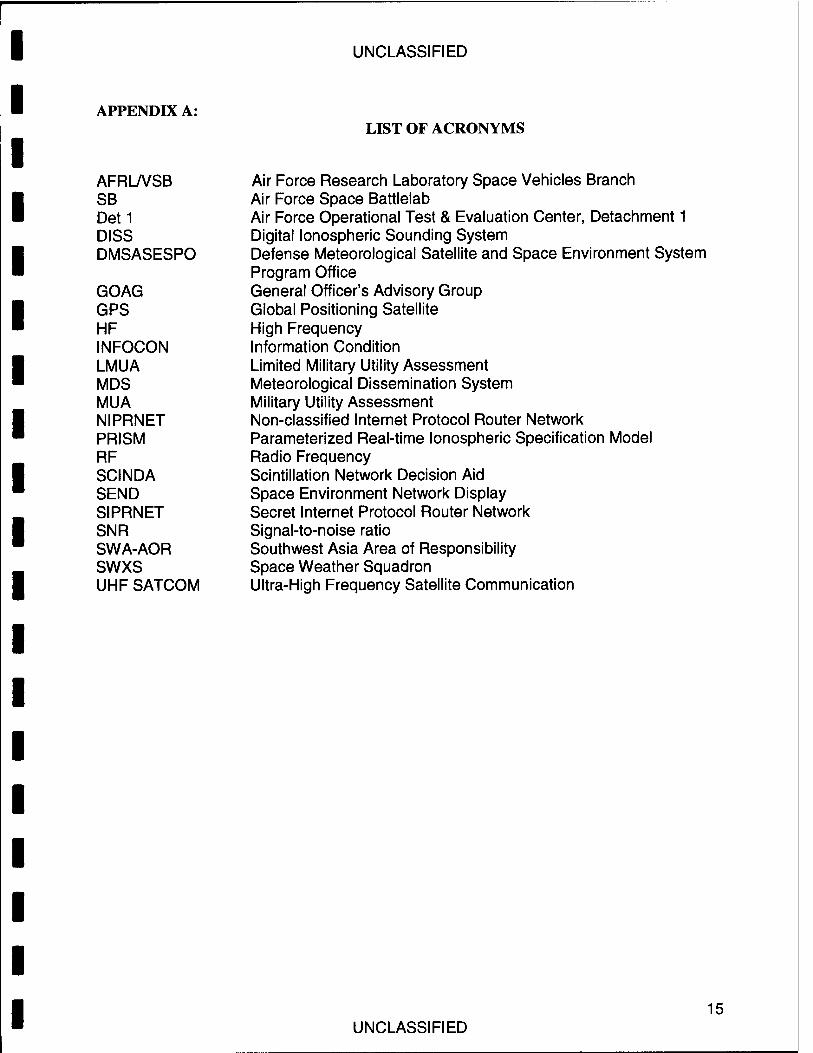
APPENDIX A:
UNCLASSIFIED
LIST OF ACRONYMS
AFRL/VSB SB Det1 DISS DMSASESPO
GOAG GPS HF INFOCON LMUA MDS MUA NIPRNET PRISM RF SCINDA SEND SIPRNET SNR SWA-AOR SWXS UHF SATCOM
Air Force Research Laboratory Space Vehicles Branch Air Force Space Battlelab Air Force Operational Test & Evaluation Center, Detachment 1 Digital Ionospheric Sounding System Defense Meteorological Satellite and Space Environment System Program Office General Officer's Advisory Group Global Positioning Satellite High Frequency Information Condition Limited Military Utility Assessment Meteorological Dissemination System Military Utility Assessment Non-classified Internet Protocol Router Network Parameterized Real-time Ionospheric Specification Model Radio Frequency Scintillation Network Decision Aid Space Environment Network Display Secret Internet Protocol Router Network Signal-to-noise ratio Southwest Asia Area of Responsibility Space Weather Squadron Ultra-High Frequency Satellite Communication
15 UNCLASSIFIED
UNCLASSIFIED
Space Environment Network Display (SEND)
DET 1 AFOTEC FINAL REPORT AVAILABLE UPON REQUEST
Kenney Class Initiative
Air Force Space Battlelab 730 Irwin Ave, Ste 83
Schriever AFB CO 80912-7383
July 1999
UNCLASSIFIED