Embed Size (px)
Citation preview

10/16/2015
i
Dams:(Good advice.)With Historic Rain: Lower Dams Earlywltx.com, 10/3/15
Columbia, SC (WLTX) - With the historic rain we'reexpecting DHEC is now asking people to lower dams on their property. The biggest dam people usually think about is at Lake Murray. SCE&G has already started lowering the water levels there. As for private dams across our state, DHEC is advising people to take action early. To start lettingsome water go below the dam and allow space for the 14 inches of rain expected throughout the weekend. "The lake that we live on is drained as you can see but the lake on the other side is already pretty high as it is so I’m kind-of worried" said Tiffany Dugan who lives between Lower Rock
Ford Lake has been completely drained as a safety measure because the spillway tore during the
Copy obtained from the National Performance of Dams Program: http://npdp.stanford.edu
Some Dam – Hydro News TM
And Other Stuff
1
Quote of Note: “Early t bed and early t rise makes a man healty, wealty, and wise.” - - Benjamin Franklin
Some Dam - Hydro News Newsletter Archive for Back Issues and Search http://npdp.stanford.edu/Click on Link (Some Dam - Hydro News) Bottom Right - Under Perspectives
“Good wine is a necessity of life.” - -Thomas JeffersonRon’s wine pick of the week: 2013 Tablas Creek US Red Blend "Patelin de Tablas" “ No nation was ever drunk when wine was cheap. ” - - Thomas Jefferson
last rain. "It was already passed our brick wall down at the edge and we have stuff down there so I know my fiancé was worried if they wouldn’t have drained it his stuff would have gotten swept away" said Dugan. The Rock Ford lake that's across the street from her, isn't completely drained and Dugan says that's the one that worries her. "We want to make sure that right now is the time that they’re letting a little water go below their dam so that they’re ready for the influx of more water coming in" said Robert Yanity is with DHEC who regulates over 2-thousand dams across the state. He wants to make sure all private dams are taking steps early. "Letting water out now when you can do it on a very easy bases is much better than waiting and letting them flow or evenin worst case scenario letting it breach and cause significant damage" said Yanity.
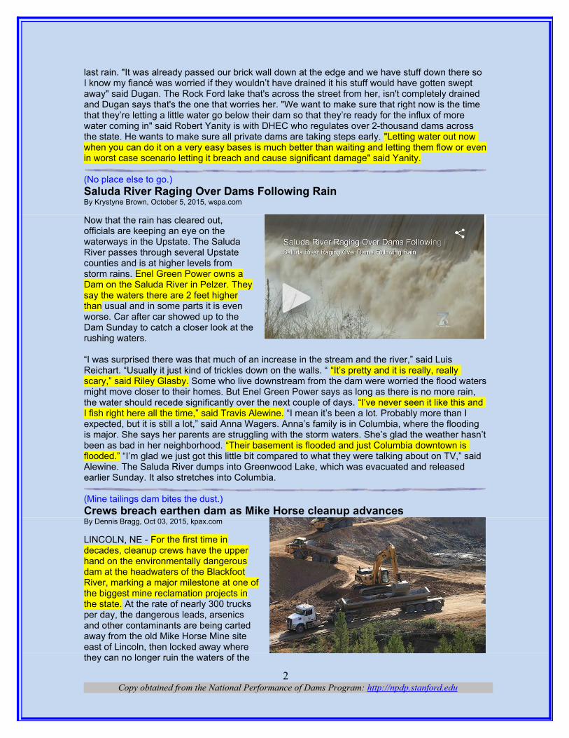
(No place else to go.)Saluda River Raging Over Dams Following RainBy Krystyne Brown, October 5, 2015, wspa.com
Now that the rain has cleared out,officials are keeping an eye on thewaterways in the Upstate. The SaludaRiver passes through several Upstatecounties and is at higher levels fromstorm rains. Enel Green Power owns aDam on the Saluda River in Pelzer. Theysay the waters there are 2 feet higherthan usual and in some parts it is evenworse. Car after car showed up to theDam Sunday to catch a closer look at therushing waters.
“I was surprised there was that much of an increase in the stream and the river,” said Luis Reichart. “Usually it just kind of trickles down on the walls. “ “It’s pretty and it is really, really scary,” said Riley Glasby. Some who live downstream from the dam were worried the flood watersmight move closer to their homes. But Enel Green Power says as long as there is no more rain, the water should recede significantly over the next couple of days. “I’ve never seen it like this and I fish right here all the time,” said Travis Alewine. “I mean it’s been a lot. Probably more than I expected, but it is still a lot,” said Anna Wagers. Anna’s family is in Columbia, where the flooding is major. She says her parents are struggling with the storm waters. She’s glad the weather hasn’tbeen as bad in her neighborhood. “Their basement is flooded and just Columbia downtown is flooded.” “I’m glad we just got this little bit compared to what they were talking about on TV,” said Alewine. The Saluda River dumps into Greenwood Lake, which was evacuated and released earlier Sunday. It also stretches into Columbia.
(Mine tailings dam bites the dust.)Crews breach earthen dam as Mike Horse cleanup advancesBy Dennis Bragg, Oct 03, 2015, kpax.com
LINCOLN, NE - For the first time indecades, cleanup crews have the upperhand on the environmentally dangerousdam at the headwaters of the BlackfootRiver, marking a major milestone at one ofthe biggest mine reclamation projects inthe state. At the rate of nearly 300 trucksper day, the dangerous leads, arsenicsand other contaminants are being cartedaway from the old Mike Horse Mine siteeast of Lincoln, then locked away wherethey can no longer ruin the waters of the
Copy obtained from the National Performance of Dams Program: http://npdp.stanford.edu2
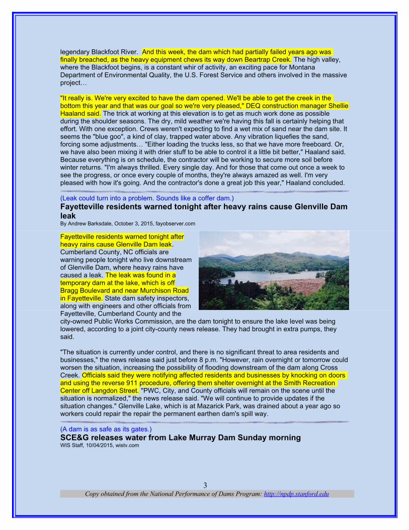
legendary Blackfoot River. And this week, the dam which had partially failed years ago was finally breached, as the heavy equipment chews its way down Beartrap Creek. The high valley, where the Blackfoot begins, is a constant whir of activity, an exciting pace for Montana Department of Environmental Quality, the U.S. Forest Service and others involved in the massive project…
"It really is. We're very excited to have the dam opened. We'll be able to get the creek in the bottom this year and that was our goal so we're very pleased," DEQ construction manager ShellieHaaland said. The trick at working at this elevation is to get as much work done as possible during the shoulder seasons. The dry, mild weather we're having this fall is certainly helping that effort. With one exception. Crews weren't expecting to find a wet mix of sand near the dam site. It seems the "blue goo", a kind of clay, trapped water above. Any vibration liquefies the sand, forcing some adjustments… "Either loading the trucks less, so that we have more freeboard. Or, we have also been mixing it with drier stuff to be able to control it a little bit better," Haaland said. Because everything is on schedule, the contractor will be working to secure more soil before winter returns. "I'm always thrilled. Every single day. And for those that come out once a week to see the progress, or once every couple of months, they're always amazed as well. I'm very pleased with how it's going. And the contractor's done a great job this year," Haaland concluded.
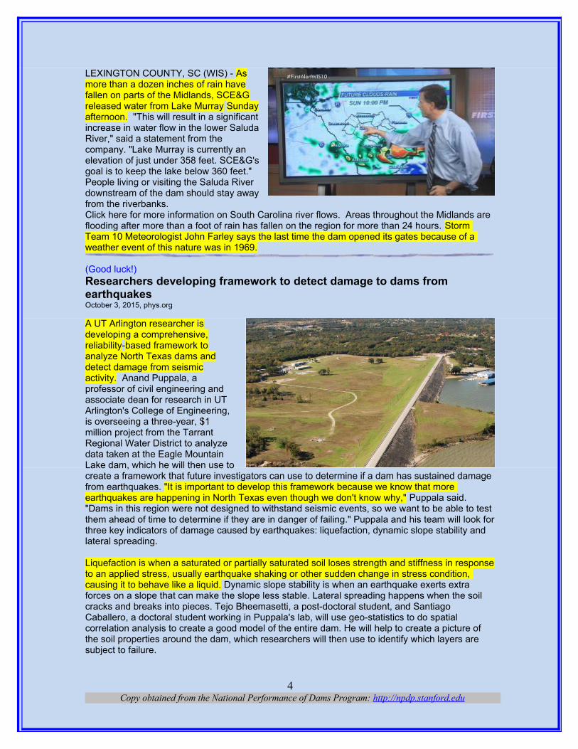
(Leak could turn into a problem. Sounds like a coffer dam.)Fayetteville residents warned tonight after heavy rains cause Glenville Dam leak By Andrew Barksdale, October 3, 2015, fayobserver.com
Fayetteville residents warned tonight afterheavy rains cause Glenville Dam leak.Cumberland County, NC officials arewarning people tonight who live downstreamof Glenville Dam, where heavy rains havecaused a leak. The leak was found in atemporary dam at the lake, which is offBragg Boulevard and near Murchison Roadin Fayetteville. State dam safety inspectors,along with engineers and other officials fromFayetteville, Cumberland County and thecity-owned Public Works Commission, are the dam tonight to ensure the lake level was being lowered, according to a joint city-county news release. They had brought in extra pumps, they said.
"The situation is currently under control, and there is no significant threat to area residents and businesses," the news release said just before 8 p.m. "However, rain overnight or tomorrow could worsen the situation, increasing the possibility of flooding downstream of the dam along Cross Creek. Officials said they were notifying affected residents and businesses by knocking on doors and using the reverse 911 procedure, offering them shelter overnight at the Smith Recreation Center off Langdon Street. "PWC, City, and County officials will remain on the scene until the situation is normalized," the news release said. "We will continue to provide updates if the situation changes." Glenville Lake, which is at Mazarick Park, was drained about a year ago so workers could repair the repair the permanent earthen dam's spill way.
(A dam is as safe as its gates.)SCE&G releases water from Lake Murray Dam Sunday morningWIS Staff, 10/04/2015, wistv.com
Copy obtained from the National Performance of Dams Program: http://npdp.stanford.edu3
LEXINGTON COUNTY, SC (WIS) - Asmore than a dozen inches of rain havefallen on parts of the Midlands, SCE&Greleased water from Lake Murray Sundayafternoon. "This will result in a significantincrease in water flow in the lower SaludaRiver," said a statement from thecompany. "Lake Murray is currently anelevation of just under 358 feet. SCE&G'sgoal is to keep the lake below 360 feet."People living or visiting the Saluda Riverdownstream of the dam should stay awayfrom the riverbanks.Click here for more information on South Carolina river flows. Areas throughout the Midlands are flooding after more than a foot of rain has fallen on the region for more than 24 hours. Storm Team 10 Meteorologist John Farley says the last time the dam opened its gates because of a weather event of this nature was in 1969.
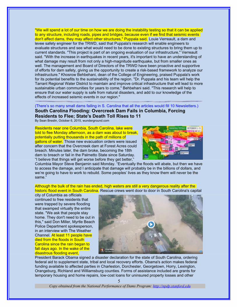
(Good luck!)Researchers developing framework to detect damage to dams from earthquakesOctober 3, 2015, phys.org
A UT Arlington researcher isdeveloping a comprehensive,reliability-based framework toanalyze North Texas dams anddetect damage from seismicactivity. Anand Puppala, aprofessor of civil engineering andassociate dean for research in UTArlington's College of Engineering,is overseeing a three-year, $1million project from the TarrantRegional Water District to analyzedata taken at the Eagle MountainLake dam, which he will then use tocreate a framework that future investigators can use to determine if a dam has sustained damage from earthquakes. "It is important to develop this framework because we know that more earthquakes are happening in North Texas even though we don't know why," Puppala said. "Dams in this region were not designed to withstand seismic events, so we want to be able to test them ahead of time to determine if they are in danger of failing." Puppala and his team will look forthree key indicators of damage caused by earthquakes: liquefaction, dynamic slope stability and lateral spreading.
Liquefaction is when a saturated or partially saturated soil loses strength and stiffness in responseto an applied stress, usually earthquake shaking or other sudden change in stress condition, causing it to behave like a liquid. Dynamic slope stability is when an earthquake exerts extra forces on a slope that can make the slope less stable. Lateral spreading happens when the soil cracks and breaks into pieces. Tejo Bheemasetti, a post-doctoral student, and Santiago Caballero, a doctoral student working in Puppala's lab, will use geo-statistics to do spatial correlation analysis to create a good model of the entire dam. He will help to create a picture of the soil properties around the dam, which researchers will then use to identify which layers are subject to failure.
Copy obtained from the National Performance of Dams Program: http://npdp.stanford.edu4
"We will spend a lot of our time on how we are doing the instability testing so that it can be appliedto any structure, including roads, pipes and bridges, because even if we find that seismic events don't affect dams, they may affect other structures," Puppala said. Louie Verreault, a dam and levee safety engineer for the TRWD, said that Puppala's research will enable engineers to evaluate structures and see what would need to be done to existing structures to bring them up tocurrent standards. "This project is part of an ongoing evaluation of our infrastructure," Verreault said. "With the increase in earthquakes in recent years, it's important to have an understanding of what damage may result from not only a high-magnitude earthquake, but from smaller ones as well. The management and Board of Directors of the TRWD have been proactive and supportive of efforts for dam safety, giving us the opportunity to create a risk-based framework to analyze ourinfrastructure." Khosrow Behbehani, dean of the College of Engineering, praised Puppala's work for its potential benefits to the sustainability of the region. "Dr. Puppala and his team will help the Tarrant Regional Water District to maintain and improve critical infrastructure that will lead to moresustainable urban communities for years to come," Behbehani said. "This research will help to ensure that our water supply is safe from natural disasters, and add to our knowledge of the effects of increased seismic events in our region."
(There’s so many small dams failing in S. Carolina that all the articles would fill 10 Newsletters.)South Carolina Flooding: Overcreek Dam Fails in Columbia, Forcing Residents to Flee; State's Death Toll Rises to 11By Sean Breslin, October 6, 2015, wunderground.com
Residents near one Columbia, South Carolina, lake weretold to flee Monday afternoon, as a dam was about to break,potentially putting thousands in the path of millions ofgallons of water. Those new evacuation orders were issuedafter concern that the Overcreek dam at Forest Acres couldbreach. Minutes later, the dam broke, becoming the 18thdam to breach or fail in the Palmetto State since Saturday.“I believe that things will get worse before they get better,”Columbia Mayor Steve Benjamin said Monday. “Eventually the floods will abate, but then we haveto access the damage, and I anticipate that damage will probably be in the billions of dollars, and we’re going to have to work to rebuild. Some peoples’ lives as they know them will never be the same.”
Although the bulk of the rain has ended, high waters are still a very dangerous reality after the historic flood event in South Carolina. Rescue crews went door to door in South Carolina's capital city of Columbia as officialscontinued to free residents thatwere trapped by severe floodingthat swamped virtually the entirestate. "We ask that people stayhome. They don't need to be out inthis," said Don Miller, Myrtle BeachPolice Department spokesperson,in an interview with The WeatherChannel. At least 11 people havedied from the floods in SouthCarolina since the rain began tofall days ago. In the wake of thedisastrous flooding event,President Barack Obama signed a disaster declaration for the state of South Carolina, ordering federal aid to supplement state, tribal and local recovery efforts. Obama's action makes federal funding available to affected parties in Charleston, Dorchester, Georgetown, Horry, Lexington, Orangeburg, Richland and Williamsburg counties. Forms of assistance included are grants for temporary housing and home repairs, low-cost loans for uninsured property losses and other
Copy obtained from the National Performance of Dams Program: http://npdp.stanford.edu5
South Carolina Rain Totals
programs to help individuals and business owners recover. The rain event has set records all overthe state, flooding entire towns. For some locations, this historic rainfall qualifies as a 1,000-year rain event, meaning in a given year there is a 1 in 1,000 chance of observing rainfall totals of this magnitude. "The flooding is unprecedented and historical," said Dr. Marshall Shepherd, a meteorologist and director of the atmospheric sciences program at the University of Georgia, in an email to The Associated Press.
The University of South Carolina announced Tuesday classes will be canceled due to the floods. Parts of Columbia, including the USC campus, lost water service, and plans were being made to deliver bottled water and portable restrooms to the students Monday morning. As a result, officialsare begging residents from other areas to donate water for Columbia residents who lack running water. Collections have been set up all over the state for citizens to bring extra bottled water that will be delivered to the Midlands, according to the AP. Columbia city officials have released a statement issuing a boil water advisory to all 375,000 of its water customers, advising them to vigorously boil their water for at least a full minute. Any ice made from water that was not boiled beforehand should also not be used. Swift-water rescue teams plucked hundreds of residents from stranded cars and flooded homes all over the state. Officials say it may take weeks or months to assess all of the closed roads and bridges. A 75-mile stretch of I-95, the freeway that connects Miami to Washington, D.C. to New York, remains closed Tuesday morning.Hundreds of roads will remain shut down across the state Tuesday; the South Carolina Department of Transportation has a full list here.
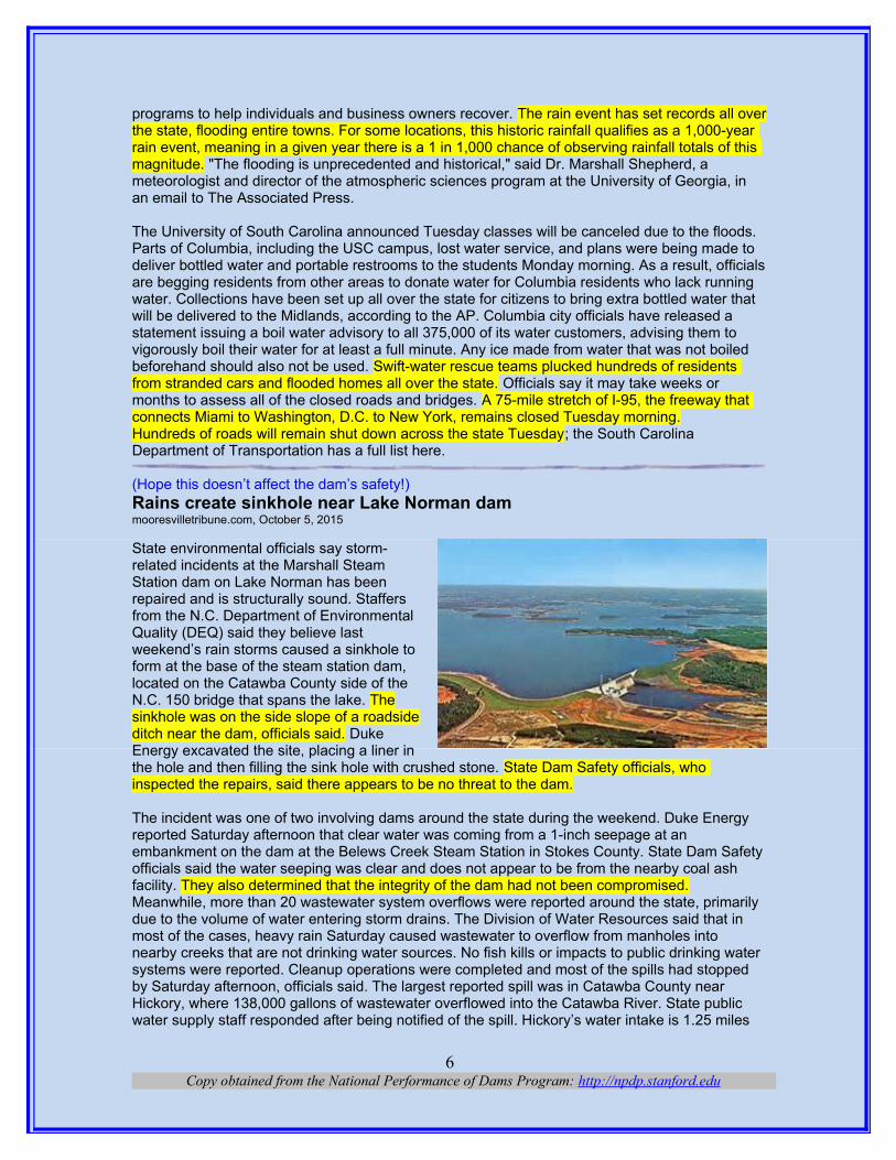
(Hope this doesn’t affect the dam’s safety!)Rains create sinkhole near Lake Norman dam mooresvilletribune.com, October 5, 2015
State environmental officials say storm-related incidents at the Marshall SteamStation dam on Lake Norman has beenrepaired and is structurally sound. Staffersfrom the N.C. Department of EnvironmentalQuality (DEQ) said they believe lastweekend’s rain storms caused a sinkhole toform at the base of the steam station dam,located on the Catawba County side of theN.C. 150 bridge that spans the lake. Thesinkhole was on the side slope of a roadsideditch near the dam, officials said. DukeEnergy excavated the site, placing a liner inthe hole and then filling the sink hole with crushed stone. State Dam Safety officials, who inspected the repairs, said there appears to be no threat to the dam.
The incident was one of two involving dams around the state during the weekend. Duke Energy reported Saturday afternoon that clear water was coming from a 1-inch seepage at an embankment on the dam at the Belews Creek Steam Station in Stokes County. State Dam Safetyofficials said the water seeping was clear and does not appear to be from the nearby coal ash facility. They also determined that the integrity of the dam had not been compromised.Meanwhile, more than 20 wastewater system overflows were reported around the state, primarily due to the volume of water entering storm drains. The Division of Water Resources said that in most of the cases, heavy rain Saturday caused wastewater to overflow from manholes into nearby creeks that are not drinking water sources. No fish kills or impacts to public drinking water systems were reported. Cleanup operations were completed and most of the spills had stopped by Saturday afternoon, officials said. The largest reported spill was in Catawba County near Hickory, where 138,000 gallons of wastewater overflowed into the Catawba River. State public water supply staff responded after being notified of the spill. Hickory’s water intake is 1.25 miles
Copy obtained from the National Performance of Dams Program: http://npdp.stanford.edu6
upstream, but state officials said there were no reported impacts to drinking water systems downstream.
(The attack dogs are at it again. Some must go.)Environmentalists Eye Some 200 'Deadbeat Dams' For Removal By MITCH WERTLIEB & KATHLEEN MASTERSON • OCT 6, 2015, digital.vpr.net
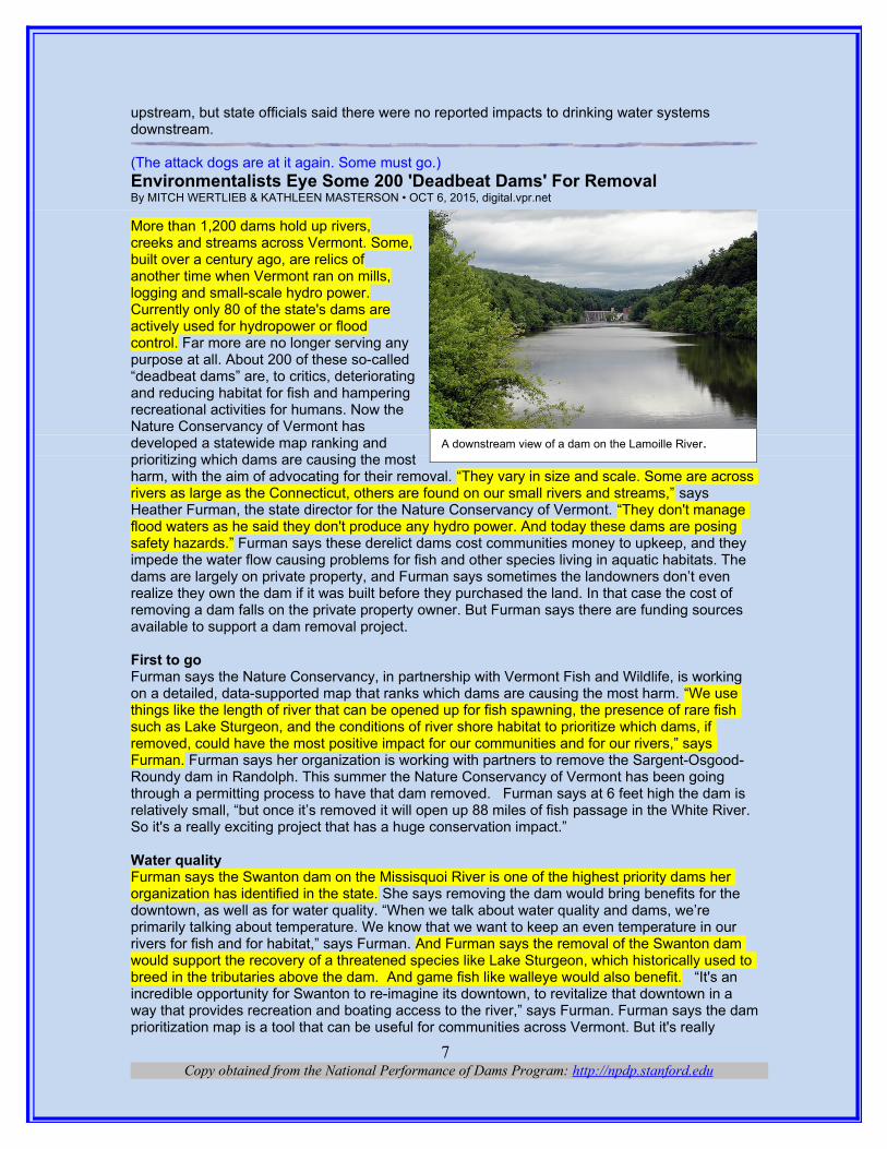
More than 1,200 dams hold up rivers,creeks and streams across Vermont. Some,built over a century ago, are relics ofanother time when Vermont ran on mills, logging and small-scale hydro power. Currently only 80 of the state's dams areactively used for hydropower or floodcontrol. Far more are no longer serving anypurpose at all. About 200 of these so-called“deadbeat dams” are, to critics, deterioratingand reducing habitat for fish and hamperingrecreational activities for humans. Now theNature Conservancy of Vermont hasdeveloped a statewide map ranking andprioritizing which dams are causing the mostharm, with the aim of advocating for their removal. “They vary in size and scale. Some are across rivers as large as the Connecticut, others are found on our small rivers and streams,” says Heather Furman, the state director for the Nature Conservancy of Vermont. “They don't manage flood waters as he said they don't produce any hydro power. And today these dams are posing safety hazards.” Furman says these derelict dams cost communities money to upkeep, and they impede the water flow causing problems for fish and other species living in aquatic habitats. The dams are largely on private property, and Furman says sometimes the landowners don’t even realize they own the dam if it was built before they purchased the land. In that case the cost of removing a dam falls on the private property owner. But Furman says there are funding sources available to support a dam removal project.
First to go Furman says the Nature Conservancy, in partnership with Vermont Fish and Wildlife, is working on a detailed, data-supported map that ranks which dams are causing the most harm. “We use things like the length of river that can be opened up for fish spawning, the presence of rare fish such as Lake Sturgeon, and the conditions of river shore habitat to prioritize which dams, if removed, could have the most positive impact for our communities and for our rivers,” says Furman. Furman says her organization is working with partners to remove the Sargent-Osgood-Roundy dam in Randolph. This summer the Nature Conservancy of Vermont has been going through a permitting process to have that dam removed. Furman says at 6 feet high the dam is relatively small, “but once it’s removed it will open up 88 miles of fish passage in the White River. So it's a really exciting project that has a huge conservation impact.”
Water qualityFurman says the Swanton dam on the Missisquoi River is one of the highest priority dams her organization has identified in the state. She says removing the dam would bring benefits for the downtown, as well as for water quality. “When we talk about water quality and dams, we’re primarily talking about temperature. We know that we want to keep an even temperature in our rivers for fish and for habitat,” says Furman. And Furman says the removal of the Swanton dam would support the recovery of a threatened species like Lake Sturgeon, which historically used to breed in the tributaries above the dam. And game fish like walleye would also benefit. “It's an incredible opportunity for Swanton to re-imagine its downtown, to revitalize that downtown in a way that provides recreation and boating access to the river,” says Furman. Furman says the damprioritization map is a tool that can be useful for communities across Vermont. But it's really
Copy obtained from the National Performance of Dams Program: http://npdp.stanford.edu7
A downstream view of a dam on the Lamoille River.
important for us to be able to go into communities and have these conversations with select boardand planning commissions about how the dam is serving the community today, and what the benefits might be for removal,” she says. Furman says it’s important for Vermont to consider what additional benefits these rivers could be providing for both the environment and communities across the state. “This isn't a mandate to remove dams,” she says. “And it's certainly not a mandate to remove all dams. But it is an opportunity to have these conversations about how the dam is serving the community today.”
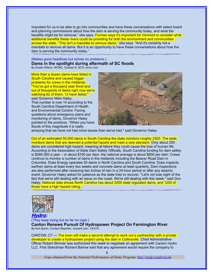
(Makes good headlines but solves no problems.)Dams in the spotlight during aftermath of SC floodsBy Dustin Wilson, WCNC, October 8, 2015, wcnc.com
More than a dozen dams have failed inSouth Carolina and caused biggerproblems for crews in the midlands."You've got a thousand year flood andout of thousands of dams right now we'rewatching 62 of them, 13 have failed,"said Governor Nikki Haley.That number is now 14 according to theSouth Carolina Department of Healthand Environmental Control. Facingquestions about emergency plans andmonitoring of dams, Governor Haleypointed to the positives. "When you havefloods of this magnitude it is reallyamazing that we have not had more issues than we've had," said Governor Haley.
Out of an estimated 50,000 dams in South Carolina the state monitors roughly 2500. The state monitors dams that are deemed a potential hazard and meet a size standard. Only about 200 dams are considered high hazard, meaning at failure they could cause the loss of human life. According to the Association of State Dam Safety Officials, South Carolina funding for dam safety is $260,000 a year – or about $100 per dam, the national average is about $600 per dam. Crews continue to monitor a number of dams in the midlands including the Beaver Road Dam in Columbia. Duke Energy operates 55 dams in North Carolina and South Carolina. Duke inspects earthen dams at least every two weeks and concrete dams at least quarterly. Dam inspections are also performed after receiving two inches of rain in a 24-hour period or after any seismic event. Governor Haley asked for patience as the state tries to recover. "Let's not lose sight of the fact that we're still dealing with an issue on the coast. We're still dealing with this week," said Gov.Haley. National data shows North Carolina has about 3200 state regulated dams, and 1200 of those have a high hazard rating.
Hydro: (They keep trying but so far no cigar.)Canton Renews Pursuit Of Hydropower Project On Farmington RiverBy Ken Byron, Contact Reporter, courant.com, 10/3/15
CANTON, CT — The town will make a second attempt to work out a partnership with a private developer to create a hydropower project using the dam in Collinsville. Chief Administrative Officer Robert Skinner was authorized this week to negotiate an agreement with Canton Hydro LLC. First Selectman Richard Barlow said that any agreement would require the company to
Copy obtained from the National Performance of Dams Program: http://npdp.stanford.edu8

assume all the costs and risks for theproject. He said Canton Hydro wouldalso have to put $10,000 in an escrowaccount the town would use to pay forits own consultant. "We are all veryencouraged," Barlow said. "It's been along process, but I think we haveidentified a partner who can bring theproject to completion."
Town officials have said a privatepartner is crucial for the project becauseof its anticipated cost. A 2012 estimatefrom when the town unsuccessfully sought a $500,000 state grant for the project put developmentcosts at $17.3 million. But that estimate included a second dam downstream that is not expected to be part of the revised project. Canton Hydro is a company formed by Maier, Moehrle and ScullyGroup of North Bennington, Vt., to work on the project. The group was one of three companies that submitted offers to the town in July to work on the project.The town tried to reach an agreement with other developers earlier this year, but the negotiations fell through. That prompted officials to solicit more proposals. William Scully, a member of the group that formed Canton Hydro, said he has worked on similar projects in Vermont that also involved partnerships with municipalities. "I get a good feel from this, and I see a lot of potential in it," Scully said about the Canton project. "The benefits go on and on." While Canton Hydro would fund the project and oversee it, the town must get a license from the Federal Energy Regulatory Commission. Barlow said the intent is to have an agreement with Canton Hydro ready by the end of the month, shortly before the terms expire for four of five selectmen who are not seeking re-election.
(Guess it got old and decrepit like me.)After 111 years, hydroelectric power plant near Provo shuts downTHE ASSOCIATED PRESS, 10/5/15. therepublic.com OREM, Utah — Several people recentlygathered near Provo to recognize theOlmsted Hydroelectric Power Plant as it isretired after 111 years of operation. The DailyHerald reports (http://bit.ly/1j9edcd ) thatofficials and history buffs gathered Friday tocelebrate the Orem plant, which stands at themouth of Provo Canyon. Rocky MountainPower spokesman David Eskelsen says theplant generated its last kilowatts on Sept. 21.It served customers in Utah, southeasternIdaho and Wyoming. Daryl Devey of theCentral Utah Water Conservancy Districtsays the plant also supplied water to Utahansbeginning in 1987. Devey says they decided to close the Olmsted plant when a study showed it would cost more to rehabilitate the facility than to build a new one. He says the old plant will become a by-appointment museum.
(There’s a lot of wasted power at locks and dams.)Dubuque asks agency to let city look into hydropower damBy Associated Press, October 6, 2015 | kcrg.com
Copy obtained from the National Performance of Dams Program: http://npdp.stanford.edu9
DUBUQUE, IA (AP) — Dubuque officialshave asked a federal agency to let the citystudy the feasibility of putting a hydropowerplant on the Mississippi River.The Dubuque Telegraph Herald reports thecity made the request to the FederalEnergy Regulatory Commission. AssistantCity Manager Teri Goodmann says there’s“nothing concrete right now” and that thecity wants to continue to research it.Energy Resources USA Inc. has applied fora preliminary permit to study the feasibilityof putting a hydropower plant at the site.The city asked for more information aboutthe company’s plans in its request to thefederal agency, and also to assure the city can do a separate review.The City Council in 2013 set a goal to cut community greenhouse gas emissions to 50 percent below 2003 levels by 2030.
(What will they think of next?)Capturing A River's Energy With Wings By AMBAR ESPINOZA • OCT 6, 2015, arpa-e.energy.gov
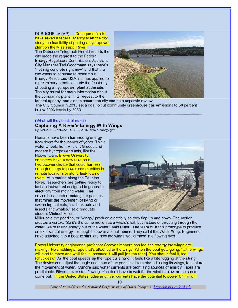
Humans have been harnessing energyfrom rivers for thousands of years. Thinkwater wheels from Ancient Greece andmodern hydropower plants, like theHoover Dam. Brown Universityengineers have a new take on ahydropower device that could harnessenough energy to power communities inremote locations or along fast-flowingrivers. At a marina along the TauntonRiver, researchers are getting ready totest an instrument designed to generateelectricity from moving water. Thedevice has slender rectangular paddlesthat mimic the movement of flying orswimming animals, “such as bats andinsects and whales,” said graduatestudent Michael Miller. Miller said the paddles, or “wings,” produce electricity as they flap up and down. The motion creates a vortex. “So it’s the same motion as a whale’s tail, but instead of thrusting through the water, we’re taking energy out of the water,” said Miller. The team built this prototype to produce one kilowatt of energy – enough to power a small house. They call it the Water Wing. Engineers have attached it to a boat to simulate how the wings would move in a flowing river.
Brown University engineering professor Shreyas Mandre can feel the energy the wings are making. He’s holding a rope that’s attached to the wings. When the boat gets going, “…the wingswill start to move and we'll feel it, because it will pull [on the rope]. You should feel it, too (chuckles).” As the boat speeds up the rope pulls hard. It feels like a kite tugging at the string. The device can adjust the angle and span of the paddles, like a bird adjusting its wings, to capturethe movement of water. Mandre said water currents are promising sources of energy. Tides are predictable. Rivers never stop flowing. You don’t have to wait for the wind to blow or the sun to come out. In the United States, tides and river currents have the potential to power 67 million
Copy obtained from the National Performance of Dams Program: http://npdp.stanford.edu10
homes. But keep in mind. It’s an energy source that still remains largely untapped because it’s been hard to design a device that works efficiently underwater. Mandre thinks the Water Wing is the answer. It’s working exactly as he expected. “Our wings – they don't have a special shape,” said Mandre. “They can just be a blade of steel, a blade of metal, a rectangular blade of metal. Sowe can make them as long as we want and intercept a large area of the flow, even if the flow is moving slowly, we can generate more power with relatively simple machinery.” Relatively simple machinery also keeps costs down, said Mandre. Many of the existing tidal energy devices are expensive to make because they’re big and bulky, often with rotating parts. The Water Wing team converted a pontoon party boat into a research vessel for this project. Theygot rid of the couches, coolers and speakers. In their place, engineers from BluSource Energy made a large opening at the bow of the boat from where they lower a pole with two rectangular paddles, or wings, mounted to it. The Water Wing’s simple, but efficient design appeals to Tom Derecktor, who’s partnered up with Brown University on this project. His small business BluSource Energy engineers and manufactures renewable energy projects. Derecktor built the Water Wing and finds the paddles easy to work with. “If they were damaged, you could snap them off, you could replace them with a new one,” said Derecktor. “You can work on the generator – all those things. It swings up and swings down. So ease of maintenance is a great strong suit and a great selling point of all of this.” Many states, including Rhode Island, are trying to mix up their energy portfolio. But Derecktor thinks this type of tidal energy device is more promising for communities in remote locations or along riverbanks, where the flow of water is fastest in shallow areas. “You know you're not going to compete with natural gas the way it's selling in this country,” he said. “But at locations where your fuel costs are challenging or where you have a steady flow, it seems criminal not to harness that.” The Water Wing is still in a test phase. The team’s goal is to build one that produces 50 kilowatts. They want to take it to the Amazon River, where that amount of energy can power an entire village. George Hagerman, a renewable energy expert at Virginia Tech University, thinks starting out in a river, instead of the ocean, is wise. “[It] gives them a chance to look at the viability of their technology,” said Hagerman. “Will it hold up over time? What kind of maintenance schedules? What needs to be replaced periodically? What pieces and components? I think their strategy makes a lot of sense.” Hagerman agrees the Water Wing’s design sets it apart from other devices that have been developed so far. The U.S. Department of Energy is funding this project through a program that’scompetitive to snag. The team’s challenge in the next couple of years will be to figure out how to attach a bigger version of the Water Wing to the bottom of a river – and make sure it works. If they can accomplish that, then it’s off to the Amazon.
(First thing you’ll know is the gobbled up everything,)PRESS RELEASE
Brookfield Renewable to Acquire 292 MW Hydroelectric Portfolio in Pennsylvania Oct 8, 2015, marketwatch.com
- High-quality hydro portfolio in northeastern U.S. - Average annual generation of 1.1 million MWh - Synergies with existing assets operated by Brookfield Renewable on same river - Long term operating licenses
HAMILTON, BERMUDA, Oct 08, 2015 (Marketwired via COMTEX) -- All amounts in U.S. dollars unless stated otherwise Brookfield Renewable Energy Partners L.P. (BEP.UN) BEP, -0.91% ("Brookfield Renewable") today announced an agreement to acquire a hydroelectric portfolio in Pennsylvania from Talen Energy for $860 million. Brookfield Renewable will acquire and fund the transaction with institutional partners and maintain an economic interest in the portfolio of approximately 40 percent. A portion of the purchase price will be funded with third party investment grade, non-recourse financing expected to close concurrently with the transaction. The portfolio consists of two facilities, the 252 MW Holtwood station on the Susquehanna River and the 40 MW Wallenpaupack station on Lake Wallenpaupack in the Pocono Mountains, with a combined expected average annual generation of approximately 1.1 million megawatt hours. The
Copy obtained from the National Performance of Dams Program: http://npdp.stanford.edu11
acquisition provides a strong fit with Brookfield Renewable's 417 MW Safe Harbor facility located eight miles upstream from Holtwood. All output is currently sold into PJM and the portfolio benefitsfrom a diverse revenue stream including energy, capacity, renewable energy credits and ancillary services. Both Holtwood and Wallenpaupack have long-term FERC operating licenses through 2030 and 2045, respectively.
"These high-quality assets provide a unique opportunity to leverage our operating platform and hydroelectric expertise in a market facing significant coal retirements and increasing reliance on renewables," said Sachin Shah, Chief Executive Officer of Brookfield Renewable. The transaction is subject to regulatory approvals and other customary closing conditions and is expected to close in the first quarter of 2016. Brookfield Renewable Energy Partners (BEP.UN) BEP, -0.91% operates one of the largest publicly-traded, pure-play renewable power platforms globally. Diversified across 75 river systems and 14 power markets in North America, Latin America and Europe, its portfolio is primarily hydroelectric and totals more than 7,000 megawatts of installed capacity. With a portfolio of high-quality assets and strong growth prospects, the business is positioned to generate stable, long-term cash flows supporting regular and growing cash distributions to shareholders. For more information, please visit www.brookfieldrenewable.com.
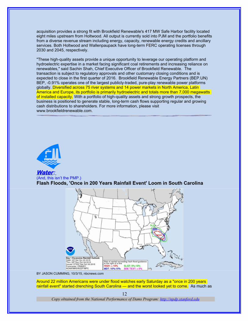
Water: (And, this isn’t the PMP.)Flash Floods, 'Once in 200 Years Rainfall Event' Loom in South Carolina
BY JASON CUMMING, 10/3/15, nbcnews.com
Around 22 million Americans were under flood watches early Saturday as a "once in 200 years rainfall event" started drenching South Carolina — and the worst looked yet to come. As much as
Copy obtained from the National Performance of Dams Program: http://npdp.stanford.edu12
12 inches of rain fell overnight in Wilmington, North Carolina, and numerous water rescues were reported. Heavy rain was expected over South Carolina cities including Charleston and Columbia and in Charlotte, North Carolina. NBC News meteorologist Bill Karins said the National Weather Service was referring to the drenching facing South Carolina this weekend as a "once in 200 years rainfall event" — and it had potential to be as bad as a only seen every 500 years storm. The NWS added that "record rainfall and life-threatening flash flooding" were possible through Sunday. Up to 15 inches of rain were possible in some parts of the Carolinas, according to forecasters. A stretch from Charleston to Washington, D.C., is expected to be deluged as a result of a weatherpattern called a "Rex Block," which is forecast to bring heavy rain to the area's already-oversaturated grounds. "A significant flooding event is developing across southern South Carolina and portions of eastern Georgia," the NWS said. "A powerful low-pressure system over the southeast United States will slowly move northeast across the area through Sunday. Accompanying this storm will be several weather hazards, most notably the potential for dangerous flooding from heavy rainfall and high tides." By 8 a.m. ET, police said no flood-related injuries had been reported in Charleston. The NWS predicted "several rounds of abnormally high tides" in South Carolina and Georgia from Friday night through Sunday. "The highest tides are expected early Saturday afternoon, potentially into Saturday night," it added. "Periods of heavy rain will affect southern South Carolina and eastern portions of Georgia," the NWS said. "There is increasing confidence that a significant heavy rainfall event will occur through Sunday with some locations seeing record rainfall amounts."
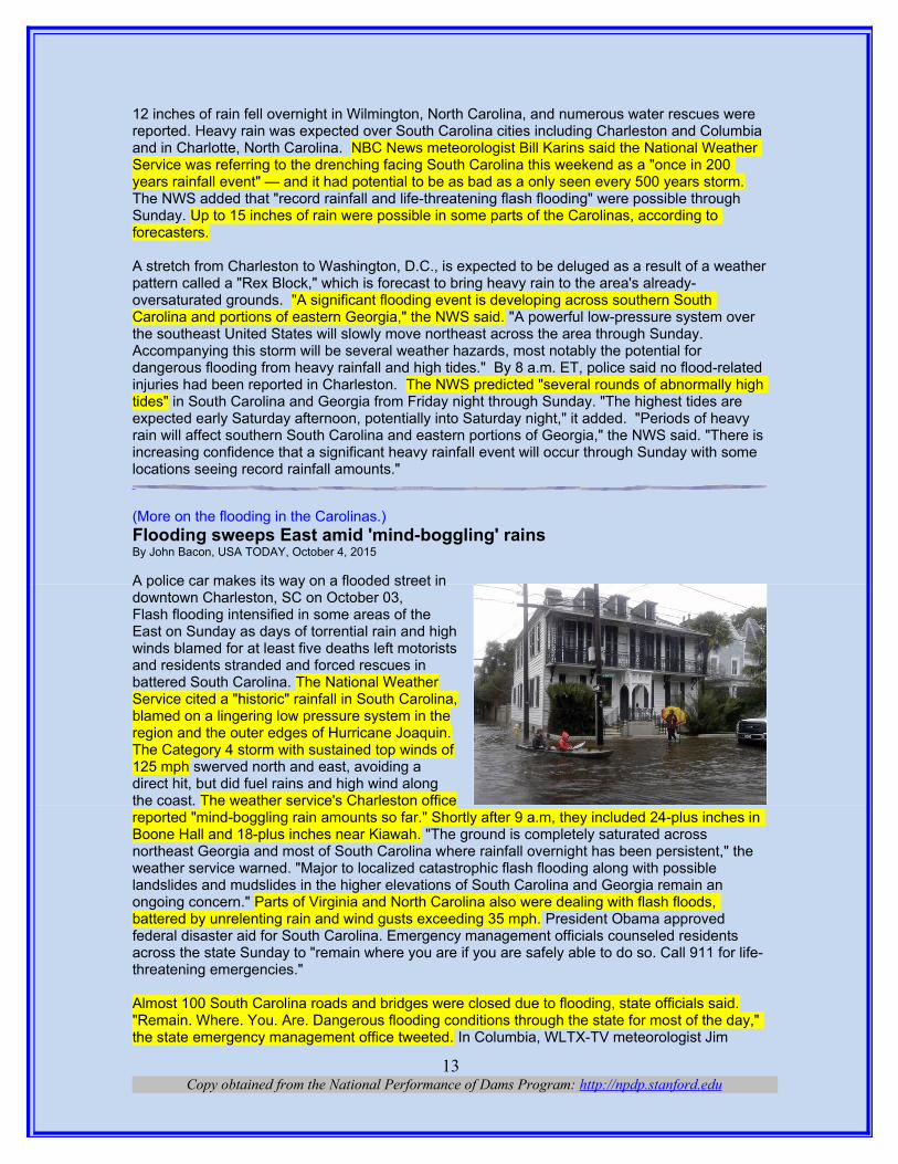
(More on the flooding in the Carolinas.)Flooding sweeps East amid 'mind-boggling' rainsBy John Bacon, USA TODAY, October 4, 2015 A police car makes its way on a flooded street indowntown Charleston, SC on October 03, Flash flooding intensified in some areas of theEast on Sunday as days of torrential rain and highwinds blamed for at least five deaths left motoristsand residents stranded and forced rescues inbattered South Carolina. The National WeatherService cited a "historic" rainfall in South Carolina,blamed on a lingering low pressure system in theregion and the outer edges of Hurricane Joaquin.The Category 4 storm with sustained top winds of125 mph swerved north and east, avoiding adirect hit, but did fuel rains and high wind alongthe coast. The weather service's Charleston officereported "mind-boggling rain amounts so far." Shortly after 9 a.m, they included 24-plus inches in Boone Hall and 18-plus inches near Kiawah. "The ground is completely saturated across northeast Georgia and most of South Carolina where rainfall overnight has been persistent," the weather service warned. "Major to localized catastrophic flash flooding along with possible landslides and mudslides in the higher elevations of South Carolina and Georgia remain an ongoing concern." Parts of Virginia and North Carolina also were dealing with flash floods, battered by unrelenting rain and wind gusts exceeding 35 mph. President Obama approved federal disaster aid for South Carolina. Emergency management officials counseled residents across the state Sunday to "remain where you are if you are safely able to do so. Call 911 for life-threatening emergencies."
Almost 100 South Carolina roads and bridges were closed due to flooding, state officials said."Remain. Where. You. Are. Dangerous flooding conditions through the state for most of the day," the state emergency management office tweeted. In Columbia, WLTX-TV meteorologist Jim
Copy obtained from the National Performance of Dams Program: http://npdp.stanford.edu13
Gandy said the Village of Sandhill had received 11 inches of rain by 6 a.m. On I-95 in Clarendon County, a 32 mile stretch of road was closed, from mile marker 100 to 132. Parts of Interstate 77 and Interstate 20 in Richland County were covered in water. "We are asking people to avoid the roads," Columbia Fire Chief Aubrey Jenkins told CNN. "We are being inundated with calls. My message to people is to stay inside. If you have any issues, call 9-1-1 and we will come get you."Police shut down traffic onto the low-lying area of Charleston between the Ashley and Cooper rivers where the historic downtown area is located. Abandoned cars dotted many of the roads as cars stalled out.
(Unbelievable amount of rain.)South Carolina governor calls deadly rain a 'thousand-year' event By Kevin Conlon and Nick Valen, October 4, 2015 | cnn.com
Charleston, South Carolina (CNN)South Carolina Gov. Nikki Haley didn't mince any words Sunday about just how dangerous a situation the weather -- which was blamed for five deaths in the state by Sunday night -- had become in her state. "We are at a 1,000-year level of rain," Haley said at an afternoon news conference. "That's how big this is." It wasn't hyperbole. Since weather records don't go back far enough to know if it's rained this much in South Carolina in a 1,000 years, a "thousand-year rainfall" means that the amount of rainfall in South Carolina has a 1-in-1,000 chance of happening in any given year, explained CNN meteorologist Taylor Ward. Certain areas of South Carolina had never before been deluged with such eye-popping rainfall tallies: more than 24 inches in Mount Pleasant, nearly 20 inches in areas around Charleston and more than 18 inches in the Gills Creek area of Columbia, according to Ward. Steven Pfaff of the National Weather Service said the "phenomenal amount of rainfall" was "a very dangerous situation."
"Flash flood warnings have been issued and many areas that received a large amount of rainfall 24 hours ago are being hit hard again," said Plaff. "This is an extremely dangerous situation in those areas." Haley: keep off the roads. But the torrential rain was more than just dangerous. It was deadly. The weather is being blamed for five deaths along South Carolina roadways, according to Derrec Becker of the South Carolina Emergency Management Division.Three of those deaths were reported by the South Carolina Highway Patrol, and two by the Richland County Sheriff's Department, according to Becker. The weather service issued a public service announcement video reminding people not to drive through rushing waters, no matter howshallow the water appears to be. "Do not attempt to drive into flooded roadways ... it takes just 12 inches of flowing water to carry off a small car. Turn around, don't drown," it said. "Regardless of where you are in the state, stay home," implored the governor. "Stay off the roadways." But many didn't heed their call. Becker said that 315 vehicle collisions occurred in one 12-hour period on Sunday, and Haley said that more than 750 motorists called for assistance during that same stretch. Perhaps that is why Haley went beyond simply urging South Carolinians to stay off the roads in some areas. In Columbia, for example -- a city that had the rainiest day in its history Sunday according to the National Weather Service -- Haley made sure ofit by closing all interstates in and around the capital city. "This is an incident we've never dealt with before," she said.
Copy obtained from the National Performance of Dams Program: http://npdp.stanford.edu14

(Where’s it going to rain?)
(Something ain’t right? Here’s a part of a quote of a statement by The Water Agency, Inc.:“In 1987-90, precipitation in those years produced enough water to give 100% CVP South of Delta Ag water allocations for the first three years and 50% in the fourth year of that drought. In this current drought, the CVP South of Delta Ag water allocations have been a measly 40%, 20%, 0% and 0%. Noteworthy is that precipitation amounts in 1986 and 2011 were both 144% and 145% of average years. The antecedent conditions were basically the same. ----------.”)
Copy obtained from the National Performance of Dams Program: http://npdp.stanford.edu15

Copy obtained from the National Performance of Dams Program: http://npdp.stanford.edu16

iThis compilation of articles and other information is provided at no cost for those interested in hydropower, dams, and water resourcesissues and development, and should not be used for any commercial or other purpose. Any copyrighted material herein is distributed withoutprofit or payment from those who have an interest in receiving this information for non-profit and educational purposes only.