Embed Size (px)
Citation preview
SL900 GNSS ReceiverData Specifications
No. of Channels 555
MEASUREMENT PERFORMANCEReal-time KinematicNetwork RTKPost Processing KinematicHigh-precision StaticStatic and Fast StaticDGPS Position AccuracySBAS Position AccuracyCode DifferentialInitializing TimeInitializing Reliability
H: 8mm + 1ppm RMS / V: 15mm + 1ppm RMSH: 8mm + 0.5ppm RMS / V: 15mm + 0.5ppm RMSH:8mm + 1ppm RMS / V:15mm + 1ppm RMSH: 2.5mm + 0.1ppm RMS / V: 3.5mm + 0.4ppm RMSH: 2.5mm + 0.5ppm RMS / V: 5mm + 0.5ppm RMSH: 25cm RMS / V: 50cm RMSH: 50cm RMS / V: 85cm RMSDGPS/RTCM2-10s99.9%
COMMUNICATIONSCommunication Ports Internal 4G Mobile Network
TDD-LTE/FDD-LTE/WCDMA/GPRS/GSMBluetooth: V2.1 + EDR, NFCWi-Fi: 2.4G ,802.11b/g/nInternal Radio: Satel radio for Tx/Rx
GENERALEnvironmental IP67 environmental protection
Waterproof to 1m (3.28ft) depthTemporary SubmersionShock resistant body to 2m (6.5ft) pole dropTemperature -40°C to 65°C Operating -40°C to 85°C Storage
Physical Properties Size: 170mm x 95mmWeight: 1.2kg including batteryBattery: 5,000mAh Lithium-Ion BatteryBattery Life: 10 hours (RTK Rover)
DATA MANAGEMENT5 Hz Update (up to 100 Hz4)CMR, RTCM2.X, RTCM3.0, RTCM3.2GNS, RinexTerraStar® and RTK Assist Service
SYSTEMOperation SystemStart-up TimeData Storage
Linux3sCirculating 16GB Internal Storage;Supports 32G SD card
GNSS Signal Tracking GPS (L1C/A, L1C, L2C, L2P, L5)
GLONASS¹ (L1C/A, L2C, L2P, L3, L5)BeiDou² (B1, B2, B3)Galileo³ (E1, E5AltBOC, E5a, E5b, E6)IRNSS (L5)QZSS (L1C/A, L1C, L2C, L5, L6)SBAS (L1, L5)L-Band (Up to 5 Channels) TerraStar® SL900
GNSS Receiver
Note
¹ Hardware ready for L3 and L5² Designed for BeiDou phase 2 and 3, B1 and B2 compatibility. B3 conditionally supported and subject to change.³ E1bc support only. Hardware ready for E6bc4 Optional
Headquarters:Datavägen 21BSE-436 32 Askim,[email protected]
Regional O�ces:Warsaw, PolandJičín, Czech RepublicAnkara, TurkeyScottsdale, USASingaporeHong Kong, ChinaDubai, UAE
www.satlab.com.se
Made by Sweden19J326
SL900 GNSS Receiver
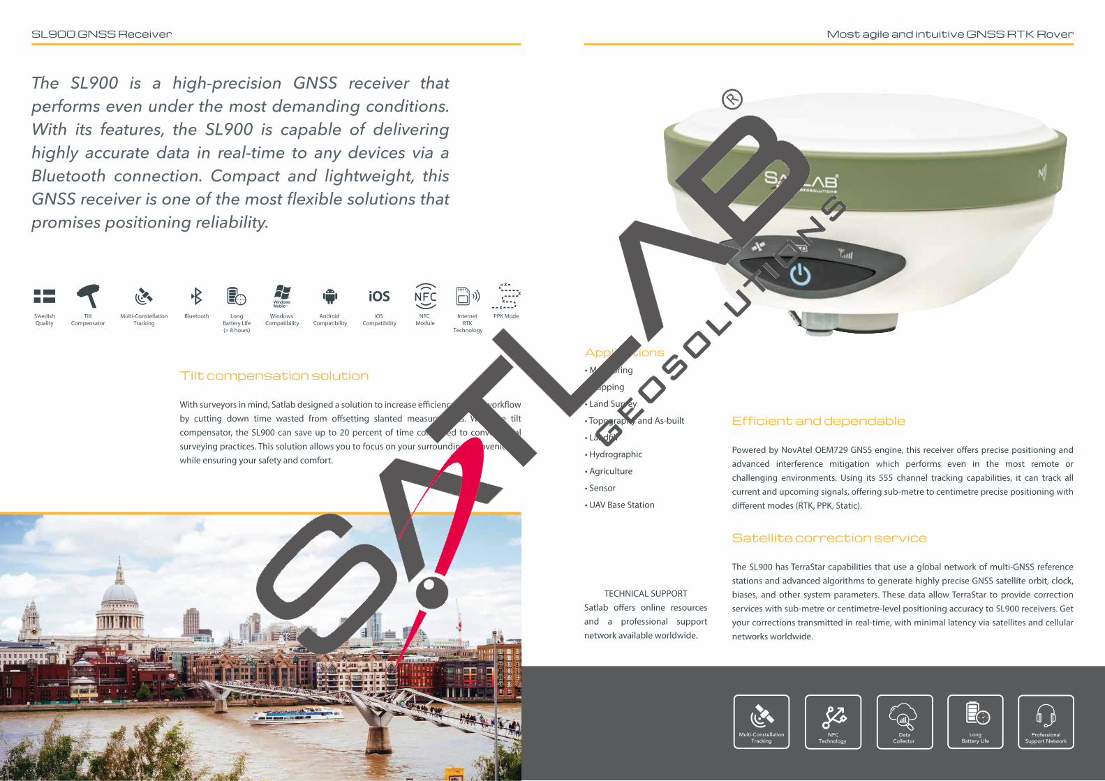
The SL900 is a high-precision GNSS receiver that performs even under the most demanding conditions. With its features, the SL900 is capable of delivering highly accurate data in real-time to any devices via a Bluetooth connection. Compact and lightweight, this GNSS receiver is one of the most flexible solutions that promises positioning reliability.
Tilt compensation solution
With surveyors in mind, Satlab designed a solution to increase e�ciency in your work�ow by cutting down time wasted from o�setting slanted measurements. With the tilt compensator, the SL900 can save up to 20 percent of time compared to conventional surveying practices. This solution allows you to focus on your surroundings conveniently while ensuring your safety and comfort.
NFCTechnology
LongBattery Life
Multi-ConstellationTracking
DataCollector
ProfessionalSupport Network
Efficient and dependable
Powered by NovAtel OEM729 GNSS engine, this receiver o�ers precise positioning and advanced interference mitigation which performs even in the most remote or challenging environments. Using its 555 channel tracking capabilities, it can track all current and upcoming signals, o�ering sub-metre to centimetre precise positioning with di�erent modes (RTK, PPK, Static).
Satellite correction service
The SL900 has TerraStar capabilities that use a global network of multi-GNSS reference stations and advanced algorithms to generate highly precise GNSS satellite orbit, clock, biases, and other system parameters. These data allow TerraStar to provide correction services with sub-metre or centimetre-level positioning accuracy to SL900 receivers. Get your corrections transmitted in real-time, with minimal latency via satellites and cellular networks worldwide.
Bluetooth LongBattery Life(> 8 hours)
Windows Compatibility
Android Compatibility
iOS Compatibility
Internet RTK
Technology
NFC Module
Multi-ConstellationTracking
TiltCompensator
SwedishQuality
PPK Mode
Most agile and intuitive GNSS RTK Rover
Applications• Monitoring
• Mapping
• Land Survey
• Topography and As-built
• Land�ll
• Hydrographic
• Agriculture
• Sensor
• UAV Base Station
TECHNICAL SUPPORTSatlab o�ers online resources and a professional support network available worldwide.