Embed Size (px)
Citation preview

SITE INVESTIGATION REPORT FORMER GORHAM MANUFACTURING SITE
PHASE II AREA – MASHAPAUG POND AND COVE, PHASE III AREA – NORTHEAST UPLAND,
AND PARCEL C 333 ADELAIDE AVENUE
PROVIDENCE, RHODE ISLAND
Prepared for: Textron, Inc.
40 Westminster Street Providence, Rhode Island 02903
Prepared by: AMEC Environment & Infrastructure, Inc.
2 Robbins Road Westford, MA 01886
November 2013
Project: 3652130029
_______________________ _______________________ David E. Heislein Michael J. Murphy
Senior Project Manager Principal Risk Assessor

Textron, Inc. Former Gorham Manufacturing Site Site Investigation Report – Phase II, Phase III and Parcel C Areas Providence, Rhode Island Project No.: 3652130029 November 2013
i
TABLE OF CONTENTS PAGE
1.0 INTRODUCTION ............................................................................................................... 1-1 1.1 Parcel C .................................................................................................................... 1-1
1.1.1 Final Remedy ............................................................................................... 1-1 1.2 Parcel C-1 ................................................................................................................ 1-3
2.0 GENERAL SITE INFORMATION ..................................................................................... 2-1 2.1 Property and Site History ......................................................................................... 2-1
2.1.1 Zoning/Land Use .......................................................................................... 2-1 2.2 Physical Setting ........................................................................................................ 2-2
2.2.1 Phase I Area of Parcel C-1 ........................................................................... 2-2 2.2.2 Phase II Area of Parcel C-1 - Mashapaug Cove .......................................... 2-3 2.2.3 Phase III Area of Parcel C-1 ......................................................................... 2-4 2.2.4 Parcel C ........................................................................................................ 2-5 2.2.5 Groundwater ................................................................................................. 2-5
2.3 Regulatory Background and Previous Investigations ............................................... 2-6
3.0 SUPPLEMENTAL SITE INVESTIGATION ACTIVITIES .................................................. 3-1 3.1 Soil Sampling ........................................................................................................... 3-1
3.1.1 2006 .............................................................................................................. 3-1 3.1.2 July 2006 – Slag Removal Action ................................................................. 3-2 3.1.3 February 2007 – Supplemental Soil Sampling for Dioxin ............................. 3-3 3.1.4 June 2013 – Phase III Area Pre-Design Soil Sampling ................................ 3-3
3.2 Mashapaug Pond Investigation and Surface Water and Sediment Sampling .......... 3-4 3.2.1 Geophysical and Hydrographic Surveys ...................................................... 3-4 3.2.2 Bathymetric Survey ...................................................................................... 3-5 3.2.3 Magnetic Survey ........................................................................................... 3-5 3.2.4 Side Scan Sonar Survey .............................................................................. 3-6 3.2.5 Collection of Sediment Cores ....................................................................... 3-6 3.2.6 Collection of Surface Water Samples ........................................................... 3-7 3.2.7 Characterization of Sediment Cores ............................................................. 3-8 3.2.8 Collection of Sediment Samples ................................................................... 3-9
3.3 Groundwater ........................................................................................................... 3-10 3.4 Quality Assurance/Quality Control ......................................................................... 3-11
4.0 SUPPLEMENTAL SITE INVESTIGATION FINDINGS ..................................................... 4-1 4.1 Soil ........................................................................................................................... 4-1
4.1.1 Surficial Geology and Soils ........................................................................... 4-1 4.1.2 Bedrock Geology .......................................................................................... 4-1 4.1.3 Analytical Results and Chemical Characteristics ......................................... 4-1
4.2 Surface Water Results ............................................................................................. 4-2

Textron, Inc. Former Gorham Manufacturing Site Site Investigation Report – Phase II, Phase III and Parcel C Areas Providence, Rhode Island Project No.: 3652130029 November 2013
ii
4.2.1 VOCs ............................................................................................................ 4-3 4.2.2 SVOCs .......................................................................................................... 4-4 4.2.3 Metals/Inorganics ......................................................................................... 4-4 4.2.4 PCBs ............................................................................................................ 4-4 4.2.5 Pesticides ..................................................................................................... 4-5 4.2.6 Dioxins .......................................................................................................... 4-5
4.3 Sediment Investigation Results ................................................................................ 4-5 4.3.1 Physical Characterization of Sediments in Mashapaug Cove ...................... 4-6 4.3.2 Chemical Characterization of Sediments in Mashapaug Pond .................... 4-6 4.3.3 VOCs ............................................................................................................ 4-7 4.3.4 SVOCs and TPH .......................................................................................... 4-9 4.3.5 Metals/Inorganics ......................................................................................... 4-9 4.3.6 PCBs .......................................................................................................... 4-11 4.3.7 Pesticides ................................................................................................... 4-12 4.3.8 Organic Carbon .......................................................................................... 4-12 4.3.9 Dioxins and Furans ..................................................................................... 4-13 4.3.10 AVS/SEM .................................................................................................... 4-13
4.4 Groundwater ........................................................................................................... 4-14 4.4.1 Groundwater Resource .............................................................................. 4-14 4.4.2 Groundwater Hydrology .............................................................................. 4-15 4.4.3 Groundwater Quality and Potential Chemical Transport ............................ 4-15 4.4.4 Potential Groundwater/Sediment Interaction .............................................. 4-17
4.5 Conceptual Site Model ........................................................................................... 4-17 4.5.1 Migration Pathways and Receiving Media .................................................. 4-18
4.6 Potentially Complete Exposure Pathways .............................................................. 4-19
5.0 SUMMARY OF RISK ASSESSMENT .............................................................................. 5-1 5.1 Human Health Risk Summary .................................................................................. 5-2
5.1.1 Sediment, Surface Water, and Soil .............................................................. 5-2 5.1.2 Trespasser/Future Site Visitor ...................................................................... 5-4 5.1.3 Uncertainty ................................................................................................... 5-6
5.2 Ecological Risk Assessment For Mashapaug Cove ................................................. 5-7
6.0 REMEDIAL ALTERNATIVE EVALUATION ..................................................................... 6-1 6.1 Overview .................................................................................................................. 6-1 6.2 Phase II Area Remedial Alternatives ........................................................................ 6-2
6.2.1 Alternative 1: Monitored Natural Attenuation ................................................ 6-2 6.2.2 Alternative 2: Capping in Place .................................................................... 6-3 6.2.3 Alternative 3: Removal of Impacted Sediment and Capping on the
Phase III Area ............................................................................................... 6-4 6.3 Phase III Area Remedial Alternatives ....................................................................... 6-8
6.3.1 Alternative 1: No Action ................................................................................ 6-8 6.3.2 Alternative 2: Capping in Place ................................................................... 6-8

Textron, Inc. Former Gorham Manufacturing Site Site Investigation Report – Phase II, Phase III and Parcel C Areas Providence, Rhode Island Project No.: 3652130029 November 2013
iii
6.3.3 Alternative 3: Soil Stabilization .................................................................. 6-10 6.4 Parcel C Remedial Alternatives .............................................................................. 6-11 6.5 Remediation Alternative Recommendation ............................................................ 6-11
6.5.1 Phase II Area Sediment Remediation ........................................................ 6-11 6.5.2 Phase III Area Soil Remediation ................................................................. 6-12 6.5.3 Parcel C Soil Remediation .......................................................................... 6-13
7.0 SUMMARY, CONCLUSIONS AND RECOMMENDATIONS ............................................ 7-1 7.1 Site Investigation Summary and Conclusions .......................................................... 7-1
7.1.1 Environmental Sampling and Analysis ......................................................... 7-1 7.1.2 Nature and Extent of Contamination ............................................................ 7-3 7.1.3 Fate and Transport ....................................................................................... 7-6 7.1.4 Risk Characterization and Remedial Requirements ..................................... 7-8 7.1.5 Evaluation of Remedial Alternatives ............................................................. 7-9 7.1.6 Schedule for Remedy Implementation ....................................................... 7-11
7.2 Conclusions of the Supplemental Site Investigation Report ................................... 7-11 7.3 Recommendations for Further Evaluation .............................................................. 7-12
8.0 CERTIFICATIONS ............................................................................................................ 8-1
9.0 REFERENCES .................................................................................................................. 9-1
LIST OF TABLES Table 3.1 Summary of 2011 Sediment Samples and Analytical Methods Table 3.2 Summary of 2011 Surface Water Samples and Analytical Methods Table 4.1 Summary of Analytical Results for Surface Water – Inner Cove Table 4.2 Summary of Analytical Results for Surface Water – Outer Cove Study Area Table 4.3 Summary of Analytical Results for Surface Water – Remainder of the Pond Table 4.4 Summary of Analytical Results Detected in Shallow Sediment (0-1 ft) – Inner
Cove Table 4.5 Summary of Analytical Results Detected in Shallow Sediment (0-1 ft) – Outer
Cove Study Area Table 4.6 Summary of Analytical Results Detected in Shallow Sediment (0-1 ft) –
Remainder of the Pond Table 4.7 Summary of Analytical Results Detected in Sediment 1-8 ft – Inner Cove Table 4.8 Comparison of Analytical Results Detected in Surficial (0-1 ft) and Deep (1-8 ft)
Sediment – Inner Cove Table 4.9 Calculation of Human Dioxin Toxic Equivalents (TEQ) for Surface Water
Samples Table 4.10 Comparison of Inner Cove Surface Sediment and Upland Soil Analytical Data Table 4.11 Calculation of “Fish Dioxin Toxic Equivalence” (TEQ) for Surface Water Samples

Textron, Inc. Former Gorham Manufacturing Site Site Investigation Report – Phase II, Phase III and Parcel C Areas Providence, Rhode Island Project No.: 3652130029 November 2013
iv
Table 5.1 Exposure Point Concentration and Risk Summary – Outer Cove Sediment Table 5.2 Summary of Comparison of Soil Detections to RDEC in Soil to be Capped –
Phase III Area Table 5.3 Summary of Comparison of Soil Detections in June 2013 Phase III Area Pre-
Design Soil Samples to RDEC Table 6.1 Cost Estimate for Phase II Mashapaug Inner Cove Remediation Table 6.2 Cost Estimate for Phase III Northeast Upland and Parcel C Remediation LIST OF FIGURES Figure 1.1 Site Location Map Figure 1.2 Site Plan Figure 1.3 Parcel C-1 Three-Phased Remediation Former Gorham Manufacturing Site Figure 1.4 Park Parcel Boundaries Per Exhibit A, March 2006 Consent Order Figure 2.1 Historic Surface Water and Sediment Sample Locations Figure 2.2 Groundwater Elevation Contour Map – December 2009 Figure 3.1 Summary of 1994-2007 Soil Investigation Locations Figure 3.2 Supplemental Soil Excavation, Former Slag Pile Figure 3.3 2005-2012 Supplemental SI Pond Sample Locations Figure 3.4 2006 Bathymetric Contours Mashapaug Inner Cove Figure 3.5 2006 Magnetic Survey Results Mashapaug Inner Cove Figure 3.6 2006 Side Scan Sonar Mosaic Mashapaug Inner Cove Figure 3.7 2011 Bathymetric Contours Mashapaug Pond Figure 3.8 Groundwater Sample Locations Figure 4.1 Sediment Core SED-50 – Inner Cove Figure 4.2 Sediment Core SED-50 – Inner Cove Figure 4.3 Sediment Core SED-50 – Inner Cove Figure 4.4 Sediment Core SED-36 – Outer Cove in Channel Figure 4.5 Sediment Core SED-36 – Outer Cove in Channel Figure 4.6 Sediment Core SED-36 – Outer Cove in Channel Figure 4.7 Sediment Core SED-52 – Mashapaug Pond Figure 4.8 Sediment Core SED-52 – Mashapaug Pond Figure 4.9 Concentrations of Arsenic in Surficial Sediment Figure 4.10 Concentrations of Chromium in Surficial Sediment Figure 4.11 Concentrations of Copper in Surficial Sediment Figure 4.12 Concentrations of Lead in Surficial Sediment Figure 4.13 Concentrations of Nickel in Surficial Sediment Figure 4.14 Concentrations of Silver in Surficial Sediment

Textron, Inc. Former Gorham Manufacturing Site Site Investigation Report – Phase II, Phase III and Parcel C Areas Providence, Rhode Island Project No.: 3652130029 November 2013
v
Figure 4.15 Concentrations of Total Organic Carbon in Surficial Sediment Figure 4.16 AVS-SEM Results Figure 4.17 Conceptual Site Model Figure 5.1 Inner Cove and Outer Cove Figure 5.2 Proposed Phase III Area Cap and June 2013 Pre-Design Sampling Locations LIST OF APPENDICES Appendix A RIDEM Parcel C Approval Documents Appendix B Historic Tables Appendix C Historic Figures Appendix D Field Data Records for December 2011 Surface Water and Sediment Sampling
and June 2013 Phase III Area Pre-Design Soil Sampling Appendix E Laboratory Reports for December 2011 Surface Water and Sediment Sampling
and June 2013 Phase III Area Pre-Design Soil Sampling Appendix F Screening Level Ecological Risk Assessment Appendix G Box Plots of Metals in Sediment Appendix H Human Health Risk Assessment
Textron, Inc. Former Gorham Manufacturing Site Site Investigation Report – Phase II, Phase III and Parcel C Areas Providence, Rhode Island Project No.: 3652130029 November 2013
vi
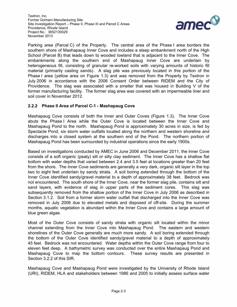
LIST OF ACRONYMS ABB-ES ABB Environmental Services, Inc. (ABB-ES) AMEC AMEC Environment & Infrastructure, Inc. ASI Aqua Survey, Inc. ASTs above-ground storage tanks AVS/SEM acid volatile sulfides/simultaneously extracted metals BaA benzo(a)anthracene BaF benzo(b)fluoranthene BaP benzo(a)pyrene bgs below ground surface COC contaminants of concern CSM conceptual site model CT Central Tendency cy cubic yard 1,1-DCA 1,1-Dichloroethane cis 1,2-DCE cis 1,2-Dichloroethene DO dissolved oxygen DGPS Differential Global Positioning System ELCR excess lifetime cancer risk EPD Effective Prediction Domain GPS Global Positioning System GZA GZA Environmental HLA Harding Lawson Associates I/CDEC Industrial/Commercial Direct Exposure Criteria LOAEL Lowest Observed Adverse Effect Level LOR Letter of Responsibility MACTEC MACTEC Engineering and Consulting, Inc. mg/kg milligrams per kilogram mg/L milligrams per liter ng/kg nanogram per kilogram NOAEL No Observed Adverse Effect Level ORP Oxidation Reduction Potential PA Preliminary Assessment

Textron, Inc. Former Gorham Manufacturing Site Site Investigation Report – Phase II, Phase III and Parcel C Areas Providence, Rhode Island Project No.: 3652130029 November 2013
vii
PAH polynuclear aromatic hydrocarbons PCBs polychlorinated biphenyls PCE tetrachloroethene PID photoionization detector PP priority pollutant metals ppm parts per million ppq parts per quadrillion ppt parts per trillion QA/QC quality assurance/quality control RAWP Remedial Action Work Plan RDEC Residential Direct Exposure Criteria RIDEM Rhode Island Department of Environmental Management RIDOH Rhode Island Department of Health RME Reasonable Maximum Exposure ROW Right of Way RTKDGPS real-time kinematic differential global positioning SI Site Inspection SIR Site Investigation Report SLERA screening level ecological risk assessment SSI Supplemental Site Investigation SSIR Supplemental Site Investigation Report SVOCs semi-volatile organic compounds 1,1,1-TCA 1,1,1-trichloroethane TCE trichloroethene TEQ toxic equivalence Textron Textron, Inc. TMDL Total Maximum Daily Load TOC total organic carbon TPH total petroleum hydrocarbons UCL Upper Concentration Limit URI University of Rhode Island USACE U.S. Army Corps of Engineers USEPA United States Environmental Protection Agency USTs underground storage tanks µg/L microgram per liter VOCs volatile organic compounds YMCA YMCA of Greater Providence

Textron, Inc. Former Gorham Manufacturing Site Site Investigation Report – Phase II, Phase III and Parcel C Areas Providence, Rhode Island Project No.: 3652130029 November 2013
viii
Section 7 of the “Remediation Regulations” Site Investigation Report (SIR) Checklist Contact Name: Greg Simpson Contact Address: Contact Telephone: Site Name: Former Gorham Manufacturing Facility, Phase II Area – Mashapaug Pond and
Cove, Phase III Area – Northeast Upland, and Parcel C Site Address: 333 Adelaide Avenue
OFFICE USE ONLY SITE INVESTIGATION REPORT (SIR) Site: PROJECT CODE: SIR SUBMITTAL DATE: CHECKLIST SUBMITTAL DATE:
7.03.A List specific objectives of the SIR related to characterization of the release,
impacts of the release and remedy. Investigation Objectives are described in Section 1.0 Sampling Results are presented in Section 4.0 Impacts are summarized in Section 7.0 Remedy Alternatives are discussed in Section 6.0
7.03.B Include information reported in the Notification Of Release. A copy of the release notification form should be included in the SIR. Include information relating to short-term response, if applicable.
Not applicable. The Site is an inactive hazardous waste site. Manufacturing operations ceased in 1986. Environmental investigations performed from 1986 to present have documented historic Site-related impacts to media.
7.03.C Include documentation of any past incidents or releases. Impacts to Site media that are presented in Section 4.0 are considered evidence of releases from historic (pre-1986) manufacturing activities.
7.03.D Include list of prior property owners and operators, as well as sequencing of property transfers and time periods of occupancy.
Site History is discussed in Section 2.1. 7.03.E Include previously existing environmental information which characterizes the
contaminated-site and all information that led to the discovery of the contaminated-site.
This report references previous comprehensive environmental investigations in Section 2.3. The sampling completed in 2006 through 2013 provides a comprehensive picture of current conditions for the Phase II and Phase III Areas, and Parcel C.

Textron, Inc. Former Gorham Manufacturing Site Site Investigation Report – Phase II, Phase III and Parcel C Areas Providence, Rhode Island Project No.: 3652130029 November 2013
ix
7.03.F Include current uses and zoning of the contaminated site, including brief statements of operations, processes employed, waste generated, hazardous materials handled, and any residential activities on the site, if applicable. (This section should be linked to the specific objectives section demonstrating how the compounds of concern in the investigation are those that are used or may have been used on the site or are those that may have impacted the site from an off-site source.)
The portions of the Site that are the focus of this SIR are the Phase II and Phase III Areas, and Parcel C which have no current use. Compounds of concern are described in Section 5.0.
7.03.G Include a locus map showing the location of the site using US Geological Survey 7.5-min quadrangle map or a copy of a section of that USGS map.
Included as Figure 1.1. 7.03.H Include a site plan, to scale, showing:
Recent conditions of the Phase II and Phase III Areas, and Parcel C and the surrounding areas of the Site are shown on the aerial photo presented as Figure 1.2.
Buildings The Phase II and Phase III Areas, and Parcel C contain no buildings.
Activities Not Applicable – There are no activities in the Phase II and III Areas and on Parcel C.
Structures Not applicable – There are no structures in the Phase II and III Areas and on Parcel C.
North Arrow All figures included in this report include a north arrow.
Wells Historic wells located on the Site are shown on Figure 3.8.
UIC Systems, septic tanks, underground storage tanks (UST), piping and other underground structures:
Not Applicable – There are no existing underground structures on the Site. Water intake and storm water discharge pipes were identified by historical plans and site observations. These were incorporated into the Supplemental SI activities.
Outdoor hazardous materials storage and handling areas: Not Applicable
Extent of paved areas: Not Applicable – the Phase II Area does not contained paved areas. The Phase III Area contains an access road, Amtrak property, paved parking areas, and remnants of a historic brick building. Parcel C contains remnants of construction debris, and crushed asphalt, concrete, and rock intermingled with soil.

Textron, Inc. Former Gorham Manufacturing Site Site Investigation Report – Phase II, Phase III and Parcel C Areas Providence, Rhode Island Project No.: 3652130029 November 2013
x
Location of environmental samples previously taken with analytical results: Historic sampling locations for the Phase II and III Areas and the surrounding area are shown on Figures 3.1 through 3.7. Historic results are included in Tables contained in Appendix B. A comprehensive discussion of historic results is presented in the 2006 SSIR (MACTEC, 2006b), 2007 Supplemental SIR Addendum (MACTEC, 2007), and are summarized in Section 4.0 of this report as they appear pertinent to the Phase II and Phase III Areas. The GZA 2003 SIR contains figures and tables showing historic sampling locations and summaries of analytical results for those samples associated with Parcel C.
Waste management and disposal areas. No waste management or disposal areas are present in the Phase II and Phase III Areas. Remnants of construction debris, and crushed asphalt, concrete, and rock are present on Parcel C
Property lines. The property lines for the Parcel C-1 and Parcel C are shown on Figure 1.2. As shown on the Figure, the Parcel C-1 follows the shoreline of Mashapaug Pond on the north and west sides of the 333 Adelaide Avenue property. Mashapaug Cove (Phase II Area) is a small portion of Mashapaug Pond and is surrounded on three sides by the Park. The northern boundary of Mashapaug Cove is the property line for 333 Adelaide Avenue (see Figure 2.1). For the purposes of this SIR, the Phase II Area includes the Inner and Outer Cove. The Inner Cove is considered to be the southern portion of Mashapaug Cove, and the Outer Cove is the northern portion of Mashapaug Cove. The Phase III Area is the northeast upland portion of Parcel C-1 (Figure 1.3).
7.03.I Include a general characterization of the property surrounding the area including, but not limited to.
Location and distance to any surface water bodies within 500 ft of the site. Location and distance to any environmentally sensitive areas within 500 ft of
the site. Actual source of potable water for all properties immediately abutting the site. Location and distance to all public water supplies, which have been active
within the previous 2 years and within one mile of the site. Determination as to whether the release impacts any off-site area utilized for
residential or industrial/commercial property or both. Determination of the underlying groundwater classification and if the
classification is GB, the distance to the nearest GA area. This information is presented in Section 2.0.
7.03.J Include classifications of surface and ground water at and surrounding the site that could be impacted by the release.

Textron, Inc. Former Gorham Manufacturing Site Site Investigation Report – Phase II, Phase III and Parcel C Areas Providence, Rhode Island Project No.: 3652130029 November 2013
xi
Presented in Section 2.0. 7.03.K Include a description of the contamination from the release, including. Free liquids on the surface
Not Applicable – There are no free liquids. LNAPL and DNAPL
Not Applicable – There are no known or suspected LNAPL or DNAPL release within the Phase II and Phase III Areas, and Parcel C.
Concentrations of hazardous substances which can be shown to present an actual or potential threat to human health and any concentrations in excess of any of the remedial objectives.
Human Health Risk has been assessed and is summarized in Section 5.1 and described in Appendix H for Phase II and III Areas. Reports previously submitted to RIDEM and cited in the Parcel C 2003 SIR and the 2010 RAWP summarize the human health risks. Since the remedial alternative no longer includes the construction of structures and pavement on the Parcel C, the human health risks remain unchanged.
Impact to environmentally sensitive areas Impact to Mashapaug Cove and Pond and northeast upland area is described in Section 4.0. Ecological Risk has been assessed and is summarized in Section 5.2 and described in Appendix F. No environmentally sensitive areas are present on Parcel C.
Contamination of man-made structures Not applicable.
Odors or stained soil Observations from the 2011 surface water and sediment sampling within Mashapaug Cove and Pond are provided on field logs (Appendix D). Field logs for previous investigations were provided in submittals to RIDEM as cited in this report.
Stressed vegetation Not applicable to the Phase II and Phase III Areas, or Parcel C. In the immediate areas surrounding the Phase II and Phase III Areas and Parcel C, there are no areas of stressed vegetation that are considered to be a potential indicator of a release to surface soils.
Presence of excavated or stockpiled material and an estimate of its total volume
No areas of excavated or stockpiled materials in the Phase II and Phase III Areas. Parcel C contains remnants of construction debris, and crushed asphalt, concrete, and rock intermingled with soil and vegetation.
Environmental sampling locations, procedures and copies of the results of any analytical testing at the site:

Textron, Inc. Former Gorham Manufacturing Site Site Investigation Report – Phase II, Phase III and Parcel C Areas Providence, Rhode Island Project No.: 3652130029 November 2013
xii
The scopes of work for previous investigations relevant to the Phase II and Phase III Areas, and the 2011 surface water and sediment sampling program and the 2013 Phase III Area pre-design soil sampling are described in Section 3.0. A summary of analytical testing results from previous investigations as they apply to the Phase II and Phase III Areas, and the 2011 surface water and sediment sampling program and the 2013 Phase III Area pre-design soil sampling is provided in Section 4.0. The scopes of and results for previous investigations of Parcel C are summarized in previously submitted reports as cited in the 2003 SIR and 2010 RAWP for Parcel C.
List of hazardous substances at the site: Not Applicable. The Site is inactive and there are no stored hazardous substances on the property. Impacts to the Phase II and Phase III Areas from historic activities are the focus of this report and are described in Sections 2.0 and 4.0.
Discuss if the contamination falls outside of the jurisdiction of the Remediation Regulations, including but not limited to USTs, UICs, and wetlands:
As described in the July 2006 SSIR and this SIR, the methods used to assess contamination impacts to the Phase II and Phase III Areas sampling are presented in the updated Human Health Risk Assessment and an Ecological Risk Assessment that are included in Sections 5.1 and 5.2, and in Appendices F and G of this report. The GZA 2003 SIR describes the methods used to assess contamination impacts to Parcel C. Reports previously submitted to RIDEM as cited in the 2003 SIR and 2010 RAWP for Parcel C summarize the human health risks. Since the remedial alternative no longer includes the construction of structures or installation of pavement on Parcel C, the potential human health risks would be reduced due to the elimination of potential exposure routes.
7.03.L Include the concentration gradients of hazardous substances throughout the site for each media impacted by the release:
Figures detailing the extent of impact to the Phase II and Phase III Areas are provided in Section 4.0. Parcel C
7.03.M Include the methodology and results of any investigation conducted to determine background concentrations of hazardous substances identified at the contaminated site:
Section 5.1 describes the methodology and the results from 2006 to 2011 soil and previous surface water and sediment sampling programs that were used to determine background concentrations of hazardous substances in the Phase II and Phase III Areas. Previous reports have summarized the methodology and results of

Textron, Inc. Former Gorham Manufacturing Site Site Investigation Report – Phase II, Phase III and Parcel C Areas Providence, Rhode Island Project No.: 3652130029 November 2013
xiii
historic soil sampling conducted at Parcel C as cited in the Parcel C 2003 SIR and subsequent submittals.
7.03.N Include a listing and evaluation of the site specific hydrogeological properties which could influence the migration of hazardous substances throughout and away from the site, including but not limited to, where appropriate:
Previous reports have documented hydrogeological conditions. Depth to GW
Depth to groundwater varies across the Property as described in Section 2.2.4 of this report.
Presence and effects of both the natural and man-made barriers to and conduits for containment migration.
Other than the surface water intake and storm water discharge pipes identified by historical plans and site observations and incorporated into the investigation activities to date, there are no other known man-made barriers or conduits to contaminant migration in the Phase II Area. Paved parking areas located within the Phase III Area are considered a barrier to contaminate migration. Remnants of asphalt, concrete and rock may be considered a partial barrier to contaminant migration.
Characterization of bedrock Not applicable.
Groundwater contours, flow rates and gradients throughout the site Extensive groundwater investigations have been conducted between May 2006 and February 2010 at the Property. Groundwater contours, flow rates, and gradients as they apply to the Phase II and Phase III Areas and Parcel C are described in Section 4.4 of this report.
7.03.O Include a characterization of the topography, surface water and run-off flow patterns, including the flooding potential, of the site
Site topography is shown on Figure 3.1. 7.03.P Include the potential for hazardous substances from the site to volatilize and
any and all potential impacts of the volatilization to structures within the site. Not applicable. There are no occupied structures in the Phase II and Phase III Areas and Parcel C.
7.03.Q Include the potential for entrainment of hazardous substances from the site by wind or erosion actions.
Since the Phase II Area consists of the Mashapaug Cove and Pond, potential for mobilization of sediment wind and erosion is extremely unlikely. The Phase I Cap installation has also been completed eliminating the potential migration pathway of contaminated surface soils into the Inner Cove.

Textron, Inc. Former Gorham Manufacturing Site Site Investigation Report – Phase II, Phase III and Parcel C Areas Providence, Rhode Island Project No.: 3652130029 November 2013
xiv
The Phase III Area consists mainly of paved parking areas. Since Parcel C has remained untouched for a long period of time, a natural layer of vegetation growth and rock which is intermingled with the soil pile that is present on Parcel C reduces the potential for entrainment by wind or erosion actions.
7.03.R Include detailed protocols for all fate and transport models used in the Site Investigation.
Not applicable. 7.03.S Include a complete list of all samples taken, the location of all samples,
parameters tested for and analytical methods used during the Site Investigation. (Be sure to include the samples locations and analytical results on a site figure).
Historic sample locations are shown on Figures 3.1 through 3.8. The 2011 surface water and sediment sample locations are shown on Figure 3.3. A list of sediment and surface water samples collected during the 2011 investigation, analytical parameters, and methods is provided in Tables 3.1 and 3.2, respectively. The June 2013 Phase III Area pre-design soil sample locations are shown on Figure 5.2. For Parcel C, documents previously submitted to RIDEM show the extent of sampling conducted on the parcel. These reports are cited within this SIR as appropriate.
7.03.T Include construction plans and development procedures for all monitoring wells. Well construction must be consistent with the requirements of Appendix H of the Groundwater Quality Regulations.
Not applicable. Construction plans for wells installed in the vicinity of the Phase II and Phase III Areas and Parcel C were included in previously submitted reports as cited within this report.
7.03.U Include procedures for handling, storage and disposal of wastes derived from and during the investigation.
Surface water and sediment sampling activities did not generate any surface water or sediment waste that required disposal. Small quantities of excess sediment that was left over after collection of the cores and sampling was consolidated and returned to the Cove. The June 2013 pre-design soil sampling program did not generate wastes that required handling, storage, or disposal. The minimal amount of excess sample volume was left in place at the sampling point.
7.03.V Include a quality assurance/quality control (QA/QC) evaluation summary report for sample handling and analytical procedures, including, but not limited to, chain-of-custody procedures and sample preservation techniques.
This discussion is provided in Section 3.4.

Textron, Inc. Former Gorham Manufacturing Site Site Investigation Report – Phase II, Phase III and Parcel C Areas Providence, Rhode Island Project No.: 3652130029 November 2013
xv
7.03.W Include any other site-specific factor, that the Director believes, is necessary to make an accurate decision as to the appropriate remedial action to be take at the site.
Not applicable. 7.04 Include Remedial Alternatives. The Site Investigation Report must contain a
minimum of 2 remedial alternatives other than no action/natural attenuation alternative, unless this requirement is waived by the Department. It should be clear which of these alternatives is most preferable. All alternatives must be supported by relevant data contained in the Site Investigation Report and consistent with the current and reasonably foreseeable land usage, and documentation of the following:
Compliance with Section 8 (RISK MANAGEMENT); Technical feasibility of the preferred remedial alternative; Compliance with Federal, State and local laws or other public concerns; and The ability of the performing party to perform the preferred remedial
alternative. Remedial alternatives are discussed in Section 6.0.
7.05 Certification Requirements: The Site Investigation Report and all associated progress reports must include the following statements signed by an authorized representative of the party specified:
A statement signed by an authorized representative of the person who prepared the Site Investigation Report certifying the completeness and accuracy of the information contained in that report to the best of their knowledge; and
A statement signed by the performing party responsible for the submittal of the Site Investigation Report certifying that the report is a complete and accurate representation of the site and the release and contains all known facts surrounding the release to the best of their knowledge
The certifications are provided in Section 8.0. 7.06 Progress Reports: If the Site Investigation is not complete, include a
schedule for the submission of periodic progress reports on the status of the investigation and interim reports on any milestones achieved in the project.
Not Applicable. Investigation activities are complete. Sampling related to the remedial alternative design and permitting is proposed in Section 6.2
7.07 Public Notice: Be prepared to implement public notice requirements per Section 7.07 and 7.09 of the Remediation Regulations when the Department deems the Site Investigation Report to be complete.
Public notice requirements will be implemented when the Department deems this SIR to be complete.

Textron, Inc. Former Gorham Manufacturing Site Site Investigation Report – Phase II, Phase III and Parcel C Areas Providence, Rhode Island Project No.: 3652130029 November 2013
Page 1-1
1.0 INTRODUCTION
This Site Investigation Report (SIR) describes the nature and extent of contamination, characterizes human health and ecological risks, and identifies and evaluates remedial objectives for the Phase II and Phase III Areas of the Parcel C-1 of the Former Gorham Manufacturing Facility site located at 333 Adelaide Avenue in Providence, Rhode Island (Figure 1.1). As a collateral function, this SIR serves as the framework to formally document the change to the final remedy selected for Parcel C (former YMCA main parcel) (Figure 1.2) of the site as stated in May 29, 2003 SIR submitted by GZA GeoEnvironmental, Inc. (GZA, 2003) on behalf of the City of Providence. Summaries of the final remedy and the regulatory status of Parcel C are provided below.
The change in final remedy for Parcel C is not substantive as the capping alternative is still being implemented. By incorporating the Parcel C SIR herein, it is Textron's intent to clarify and document the decision process for the site ensuring that the public and other stakeholders understand the rationale for and scope of the final remedy. Construction of the Parcel C remedy will be completed as part of the Phase II and Phase III Area remediation.
1.1 Parcel C
1.1.1 Final Remedy
Parcel C is one of the four parcels that comprise the 333 Adelaide Avenue Former Gorham Manufacturing Facility property as identified in the 2006 Consent Order between Rhode Island Department of Environmental Management (RIDEM) and the City of Providence (Figure 1.4), and is currently owned by the City of Providence.
RIDEM issued a Program Letter (RIDEM, 2004a) approving the completion of the SIR for Parcel C (GZA, 2003) and authorized the Providence YMCA to develop a Remedial Action Work Plan (RAWP) for the selected remedy. The evaluation of cleanup alternatives required by the Remediation Regulations was presented in the 2003 SIR and included a public participation process. The final remedy included engineering controls in the form of the capping of all regulated soils and installation and continuous operation of an active sub-slab ventilation system designed to extract low, but detectable soil vapors from beneath the proposed YMCA building. The remedy also stipulated implementation and recording of an institutional control in the form of an Environmental Land Usage Restriction (ELUR) at remedy completion. Annual maintenance, inspection, and certification of those engineering and institutional controls were required components of the final remedy. RIDEM issued a Remedial Decision Letter (RIDEM, 2004b) formally approving the conceptual remedy proposed by GZA in the 2003 SIR (GZA, 2003).
In 2005, GZA submitted a RAWP (GZA, 2005a) to RIDEM which incorporated engineering and institutional controls for the construction of the proposed Providence YMCA headquarters building. GZA conducted soil sampling to characterize the existing stockpile of construction

Textron, Inc. Former Gorham Manufacturing Site Site Investigation Report – Phase II, Phase III and Parcel C Areas Providence, Rhode Island Project No.: 3652130029 November 2013
Page 1-2
debris and crushed asphalt, concrete and rock that exists on Parcel C. GZA submitted the testing results, which showed PAHs and TPH at elevated concentrations, to RIDEM in September 2005 (GZA, 2005b). On December 21, 2005, RIDEM issued comments to GZA/YMCA (RIDEM, 2005b). RIDEM’s comments were related to the proposed “campground” area of the Site (Phase III Area), exposure to sediments during remediation of the same, providing access for groundwater sampling activities, building indoor air monitoring, and soil and dust monitoring during construction/remediation activities. GZA responded to RIDEM’s comments in a February 16, 2006 letter (GZA, 2006). RIDEM issued an Order of Approval for the RAWP on April 24, 2006 (RIDEM, 2006b) with the stipulation that the RAWP address RIDEM’s comments. However, it should be noted that many of RIDEM’s comments no longer apply to the Parcel C remedy since Parcel C will not be developed into a YMCA headquarters building and a “campground” won’t be constructed on the Phase III Area. The City of Providence now plans to redevelop Parcel C as open recreational space for the adjacent Alvarez High School and the surrounding community. Therefore, all of the comments pertaining to monitoring of the building and indoor air are mute.
In August 2010, VHB on behalf of the City submitted a draft RAWP (VHB, 2010) for Parcel C incorporating responses to and addressing comments on the 2003 SIR. The 2010 draft RAWP also documented a change in remedy for Parcel C. The 2010 draft RAWP proposed the construction of an engineered cap consisting of roadways, walkways, paved parking areas, and vegetative cover to address potential direct contact concerns to soils. The institutional controls (i.e., ELUR) and annual certifications as identified in the 2003 SIR (GZA, 2003) remained part of the remedy. RIDEM reviewed the draft 2010 RAWP and issued a comment letter (RIDEM, 2011a). RIDEM comments related to SIR requirements for Parcel C are addressed and cited within this SIR. RIDEM comments associated with RAWP activities or requirements will be addressed in the Phase II Area, Phase III Area and Parcel C draft RAWP, which is to be developed following RIDEM’s approval of this SIR.
The remedy for Parcel C that is now contemplated within this document consists of a vegetative soil cap for the entire parcel that will be used for open recreational space for the public and adjacent high school. The elimination of the proposed building and improvements previously proposed for the parcel in the prior 2003 RAWP will allow the integration of the capping of Parcel C (as proposed within this document) with the remediation of the Phase II and capping of the Phase III Areas, alleviating a potentially more costly factional implementation of the final remedy for the remainder of the Site. This will also expedite the soil remedy for the entire former Gorham site.
The remainder of this SIR focuses on the Phase II and Phase III Areas in order to complete RIDEM's SIR requirements for those areas of the site. Since Parcel C has already completed the SIR process and received RIDEM approval, any discussion of Parcel C in subsequent sections is included for clarity or to address RIDEM's comments (RIDEM, 2011a) on the draft RAWP (VHB, 2010) for Parcel C.

Textron, Inc. Former Gorham Manufacturing Site Site Investigation Report – Phase II, Phase III and Parcel C Areas Providence, Rhode Island Project No.: 3652130029 November 2013
Page 1-3
Copies RIDEM approval documents for Parcel C as cited in the paragraphs above are provided in Appendix A.
1.2 Parcel C-1
Parcel C-1 is identified in Figure 1.2 and extends from the corner of Adelaide Avenue and Crescent Street north along Mashapaug Pond, east along the shoreline of Mashapaug Cove and north/east behind the Parcel A retail building. Parcel C-1 includes Mashapaug Inner and Outer Cove and the northeast upland area. The City of Providence currently owns the property at 333 Adelaide Avenue, and Parcel C-1 is a small portion of the property. For clarity, when discussing issues/topics that pertain to both the Phase II Area and the Phase III Area in this SIR, AMEC uses the word “Site,” but does not incorporate Parcel C into that definition.
The 2006 Consent Order between the RIDEM and the City of Providence previously identified the Phase II and Phase III Areas as the Park Parcel (Figure 1-4); however, based on property deeds filed by the City, this area is now defined as Parcel C-1. The northern boundary of Mashapaug Cove is the property line for 333 Adelaide Avenue. For the purposes of this Phase II and Phase III Areas SIR, the Inner Cove is considered to be the southern portion of Mashapaug Cove, and the Outer Cove is the northern portion of Mashapaug Cove (Figure 1.3). Mashapaug Cove has an area of approximately 4.6 acres, with the Inner Cove approximately 2.6 acres and the Outer Cove 2.0 acres in size. The northeast upland area of Parcel C-1 (i.e., Phase III Area to be capped) is approximately 3.25 acres.
A phased approach to remediating Parcel C-1 was developed such that the area along Mashapaug Pond and Cove west and north of the Alvarez High School (Figure 1.2) would be addressed first (under Phase I), followed by Mashapaug Cove (Phase II), and the northern portion of Parcel C-1 (Phase III). The Phase I Area of Parcel C-1 is the upland area of Parcel C-1 (Figure 1.3) where the construction of a soil cap was completed in November 2012. (Remedial Action Work Plan, Phase I Soil Capping; Parcel C-1 (AMEC, 2012)). The Phase II Area of Parcel C-1 is the Mashapaug Cove area, including both the Inner and Outer Cove (Figure 1.3). The Phase III area is located behind the Parcel A retail building and will be remediated concurrently with the Phase II Mashapaug Cove area.
To reduce confusion, we have provided a list of company names that developed the historical reports for this Site and are cited within this SIR. This list of company names have all been incorporated under AMEC Environment & Infrastructure, Inc. (AMEC). Please note that when citing a report/document, we use the appropriate company name as listed on the document/report at the time it was published/submitted.
● ABB Environmental Services, Inc. (ABB-ES) ● Harding Lawson Associates (HLA) ● Harding ESE ● MACTEC Engineering and Consulting, Inc. (MACTEC) ● AMEC Environment & Infrastructure, Inc. (AMEC)

Textron, Inc. Former Gorham Manufacturing Site Site Investigation Report – Phase II, Phase III and Parcel C Areas Providence, Rhode Island Project No.: 3652130029 November 2013
Page 1-4
In addition, when this report discusses activities conducted by AMEC or its predecessors listed above (i.e., submittal of work plans, reports, response to comments, or conducting investigation activities), it is inferred that AMEC submitted the document or conducted the activities on behalf of Textron.
Site investigations were conducted between 1994 and 2004. Supplemental Site investigation (SSI) activities were then conducted between December 2005 and February 2007 to support the nature and extent of contamination and completion of a human health and ecological risk assessment for Parcel C-1 for all three areas of the Site, including Mashapaug Cove and the Phase III Area (MACTEC, 2006b and 2007). Based on the results of these sampling events, soils exhibiting contaminant concentrations exceeding RIDEM Industrial/Commercial Direct Exposure Criteria (I/CDEC) for metals, polynuclear aromatic hydrocarbons (PAHs), and dioxin within the Parcel C-1 soils were identified. The 2006 Supplemental Site Investigation Report (SSIR) (MACTEC, 2006b) and 2007 SSIR Addendum (MACTEC, 2007), summarized herein, recommended the construction of a soil cap in the Phase I and Phase III areas of Parcel C-1. The 2012 Remedial Action Work Plan (RAWP) (AMEC, 2012) detailed the construction of a soil cap on the Phase I area to address contamination exceeding the Residential Direct Exposure Criteria (RDEC) to support a passive recreational use of Parcel C-1. It should be noted that such a remedy exceeds Textron’s obligations in the previously mentioned 2006 Consent Order which called for completion of an industrial/commercial compliant remedy. This soil cap on the Parcel C-1 Phase I area was completed in November 2012. A soil cap will also be constructed on the Phase III area of Parcel C-1 to address contamination exceeding the RDEC following the remediation of Mashapaug Cove (Phase II).
The data collection and risk assessment of the Mashapaug Inner Cove was completed in the 2006 SSIR. The 2006 human health risk assessment (HHRA) concluded that risks associated with the potential exposure to surface water and sediment for the Industrial/Commercial worker scenario for Mashapaug Inner Cove met the RIDEM criteria for individual chemicals and cumulative risk. The HHRA did not identify any human risks with surface water that exceeded risk management criteria for the Trespasser; however, the Inner Cove sediment did exceed the risk management criteria for the Trespasser scenario (excess lifetime cancer risk). The ecological risk assessment (See Section 5.2) also concluded that the sediments within the Inner Cove posed an unacceptable risk and required remediation. Textron has proposed to remediate Parcel C-1 sediments which pose an unacceptable risk to human and ecological receptors.
The sediment data set in 2006 included a limited number of sediment samples from the Mashapaug Outer Cove (MACTEC, 2006b), and the Outer Cove sediment samples were found to contain metals and dioxin similar to that found in Site soils at lower concentrations than those found in the Inner Cove. Textron and RIDEM concluded that additional assessment of the Outer Cove was required (MACTEC, 2006b). Textron proposed and conducted additional sediment and surface water investigation activities in November – December 2011 to complete the investigation of sediments in the Mashapaug Outer Cove.
The primary focus of this SIR is to define the nature and extent of contamination, characterize human health and ecological risks, and identify and evaluate remedial objectives for the

Textron, Inc. Former Gorham Manufacturing Site Site Investigation Report – Phase II, Phase III and Parcel C Areas Providence, Rhode Island Project No.: 3652130029 November 2013
Page 1-5
Phase II and Phase III Areas. Therefore, AMEC has combined the findings from the July 2006 SSIR with findings from recent investigations conducted in Mashapaug Cove to complete the Site Investigation activities as they pertain to the Phase II and III Areas. The remediation of the Mashapaug Cove will involve the onsite placement of sediment beneath a soil cap within the former Carriage House area of the Phase III Area.
This SIR has been prepared pursuant to Sections 7.0 (Site Investigation) and 8.0 (Risk Management) of the RIDEM Rules and Regulations for the Investigation and Remediation of Hazardous Materials Releases (hereafter referred to as the Remediation Regulations) on behalf of Textron, Inc. (Textron) by AMEC.
This SIR is organized as outlined below. For clarity, information pertaining to Parcel C is provided in a section as is applicable and relevant to the context.
• Section 2.0 provides General Site Information including additional details on Site History, Physical Setting, and Previous Environmental Investigations of the Phase II and Phase III Areas and Parcel C.
• Section 3.0 describes the investigations at the Site as they pertain to the Phase II and Phase III Areas.
• Section 4.0 summarizes the findings of investigations conducted and laboratory analysis that pertain to the Phase II and Phase III Areas.
• Section 5.0 summarizes the findings of and updates to the 2006 Risk Assessment based on data collected after the submittal of the 2006 Supplemental SIR.
• Section 6.0 presents the Remedial Alternatives Evaluation based on the updated Risk Assessment. This section includes the evaluation of remedial alternatives for both Phase II and Phase III Areas. This section also includes a summary of the Parcel C remediation to be conducted concurrently with Parcel C-1 Phase II and III Areas.
• Section 7.0 presents summary of conclusions and recommendations based on the risk assessments for remedial actions at the Parcel C-1 Phase II and III Areas and Parcel C.
• Section 8.0 presents Certifications required by the Remediation Regulations.
• Section 9.0 identifies reference documents used in the preparation of this SIR.
To reduce redundancy, this Phase II Area, Phase III Area and Parcel C SIR summarizes and captures pertinent facts and information from the 2006 SSIR and 2007 SSIR Addendum and from previously submitted Parcel C documents, but does not republish the entire discussion and supporting documentation from previous investigations as presented in historic reports. We have cited appropriate references within the text, and have included the complete citation for each report in Section 9.0.

Textron, Inc. Former Gorham Manufacturing Site Site Investigation Report – Phase II, Phase III and Parcel C Areas Providence, Rhode Island Project No.: 3652130029 November 2013
Page 2-1
2.0 GENERAL SITE INFORMATION
2.1 Property and Site History
The Former Gorham Manufacturing Facility site (the Property) was a 37-acre parcel of land where Gorham Silver manufactured silverware, both sterling and plated, and bronze castings from approximately 1890 to 1985. Operations included casting, rolling, polishing, lacquering, forging, plating, annealing, soldering, degreasing, machining, and melting. Vapor degreasers reportedly used trichloroethene (TCE), tetrachloroethene (PCE), and 1,1,1-trichloroethane (1,1,1-TCA). The Property is shown in Figure 1.1 as the area north of Adelaide Avenue. The Property includes the former manufacturing area (the southern portion of the property) as well as the Western Peninsula, the area bordering the southern and eastern portions of Mashapaug Cove, and further to the north, the northeast portion of the Property. Slag material from a former smelting operation was previously identified on the southern bank of Mashapaug Inner Cove, and was characterized and removed for off-site disposal as part of prior site investigations in 2006. An impermeable liner and soil cap was constructed over the former slag area in November 2012. Other than some historical groundwater pumping wells used for industrial purposes, no other industrial or commercial activities are known to have occurred along the banks and shore of Mashapaug Pond or Mashapaug Cove.
In 1967, the business and Property were purchased by Textron, and operated as a division of that company until 1985, when Textron relocated the Gorham Division. The Property was subsequently sold to the Winoker Group in 1986. The Winoker Group sold the Property to another group of investors, the Adelaide Development Corporation, which in turn sold the Property to the Seaman Equity Group. In 1990, Seaman defaulted on its taxes and the City of Providence foreclosed on the Property. The City of Providence currently owns the Property.
More recent Site conditions are shown in the aerial photograph in Figure 1.2 (prior to the construction of the Phase I soil cap). In this figure, the Site is located immediately north of Adelaide Avenue and west of the Amtrak railroad tracks. The former manufacturing facility was razed in 2001. The retail building on Parcel A was completed in 2002 while the High School on Parcel B was completed in 2007. Parcel C remains undeveloped to date.
2.1.1 Zoning/Land Use
The Property is currently zoned as Industrial/Commercial. Consistent with the 2006 Consent Order between RIDEM and the City of Providence, the portions of the shoreline and upland areas to the south and east of Mashapaug Cove were to be capped to bring those areas into compliance with RIDEM I/CDEC. However, Textron voluntarily remediated these areas to RDEC to be protective of the proposed passive recreational use of Parcel C-1, in accordance with the August 10, 2012 Remedial Approval Letter. As shown in Figure 1.2, the southeastern portion (Parcel A) of former manufacturing area of the Property has been redeveloped as a retail establishment which included a large retail space, several smaller retail spaces, and a gasoline station. The eastern portion of the large retail space is occupied by a fitness center. A

Textron, Inc. Former Gorham Manufacturing Site Site Investigation Report – Phase II, Phase III and Parcel C Areas Providence, Rhode Island Project No.: 3652130029 November 2013
Page 2-2
church has occupied the western most retail space for approximately two years. The other retail spaces are currently vacant. The former Stop & Shop gas station was closed in 2005 and the underground storage tanks (USTs) were removed in 2008. The area surrounding the retail facilities is currently paved parking lots and roadways. The City of Providence Alvarez High School was constructed on Parcel B of the Property in 2007. The western portion of the former manufacturing area (Parcel C) is proposed to be open space for the adjacent Alvarez High School.
An ELUR will be filed at the completion of the remediation activities proposed within this document to designate Parcels C-1 and C to be used for passive recreational use only and will “run with the land” in perpetuity. The ELUR will ensure that Parcels C-1 and C will be used in a safe manner while being protective of human health and the environment. This ELUR will include Mashapaug Inner and Outer Cove and the upland areas of Parcel C-1, and Parcel C. Any changes in the land use of Parcels C-1 or C will require coordination with RIDEM. The draft ELUR for Parcel C-1 was previously submitted to and is currently under review by RIDEM. That draft ELUR will be updated to incorporate Parcel C, and the revised draft ELUR will then be incorporated into the Phase II Area, Phase III Area, and Parcel C draft RAWP.
2.2 Physical Setting
The Property is bordered to the east by railroad tracks (Figure 1.2) and by Adelaide Avenue and by a residential neighborhood to the south. As described in Section 1.0 of this SIR and depicted on Figure 1.2, Parcel C-1 constitutes the northern portions of the Property, and is bounded to the north and west by Mashapaug Pond. Parcel C abuts Parcel C-1 to the east and south. Three phases of remediation of Parcel C-1 were proposed in the 2006 SSIR and 2007 SSIR Addendum (MACTEC, 2006b and 2007). The 2012 RAWP (AMEC, 2012) addressed the remediation of the Parcel C-1 Phase I area and was completed in November 2012. This was a combination of soil excavation and the construction of a soil cap on the central and western portions of upland area of Parcel C-1. Phase II is the remediation of sediments of Mashapaug Cove (Figure 1-3). Phase III is the construction of a soil cap on the eastern portions of upland area of Parcel C-1. The capping of Parcel C will be incorporated into the Phase II and III capping activities.
A description of the physical setting of the Phase II and Phase III Areas, and Parcel C are provided in subsequent sections below.
2.2.1 Phase I Area of Parcel C-1
The Phase I Area of Parcel C-1, as shown on Figure 1.3, extends from the corner of Adelaide Avenue and Crescent Street, northward along Mashapaug Pond to the western peninsula and east along the southern shoreline of Mashapaug Inner Cove. As previously mentioned, the Phase I Area was remediated in 2012 to address soil impacts above the RDEC. Areas that were addressed in 2012 were cleared, capped and are currently vegetated with native grasses. Areas that did not require capping are heavily wooded. The western area of Phase I has moderate to steep slopes that descend to the Pond. The top of the slope contains areas of historic fill material (primarily casting sands) used to level the area for the former Western
Textron, Inc. Former Gorham Manufacturing Site Site Investigation Report – Phase II, Phase III and Parcel C Areas Providence, Rhode Island Project No.: 3652130029 November 2013
Page 2-3
Parking area (Parcel C) of the Property. The central area of the Phase I area borders the southern shore of Mashapaug Inner Cove and includes a steep embankment north of the High School (Parcel B) that leads down to wooded lowland that is adjacent to the Inner Cove. The embankments along the southern end of Mashapaug Inner Cove are underlain by heterogeneous fill, consisting of granular re-worked soils with varying amounts of historic fill material (primarily casting sands). A slag pile was previously located in this portion of the Phase I area (yellow area on Figure 1.3) and was removed from the Property by Textron in July 2006 in accordance with the 2006 Consent Order between RIDEM and the City of Providence. The slag was associated with a smelter that was housed in Building V of the former manufacturing facility. The former slag area was covered with an impermeable liner and soil cover in November 2012.
2.2.2 Phase II Area of Parcel C-1 - Mashapaug Cove
Mashapaug Cove consists of both the Inner and Outer Coves (Figure 1.3). The Inner Cove abuts the Phase I Area while the Outer Cove is located between the Inner Cove and Mashapaug Pond to the north. Mashapaug Pond is approximately 30 acres in size, is fed by Spectacle Pond, six storm water outfalls located along the northern and western shoreline and discharges into a closed system at the southern end of the Pond. The northern portion of Mashapaug Pond has been surrounded by industrial operations since the early 1900s.
Based on investigations conducted by AMEC in June 2006 and December 2011, the Inner Cove consists of a soft organic (peaty) silt or silty clay sediment. The Inner Cove has a shallow flat bottom with water depths that varied between 2.4 and 3.5 feet at locations greater than 20 feet from the shore. The Inner Cove sediments are generally a very dark, organic silt layer in the top two to eight feet underlain by sandy strata. A soil boring extended through the bottom of the Inner Cove identified sandy/gravel material to a depth of approximately 38 feet. Bedrock was not encountered. The south shore of the Inner Cove, near the former slag pile, contains silt and sand layers, with evidence of slag in upper parts of the sediment cores. This slag was subsequently removed from the shallow portion of the Inner Cove in July 2006 as described in Section 3.1.2. Soil from a former storm water outfall that discharged into the Inner Cove was removed in July 2006 due to elevated metals and disposed of off-site. During the summer months, aquatic vegetation is abundant within the Inner Cove and contains a large amount of blue green algae.
Most of the Outer Cove consists of sandy strata with organic silt located within the minor channel extending from the Inner Cove into Mashapaug Pond. The eastern and western shorelines of the Outer Cove generally are much more sandy. A soil boring extended through the bottom of the Outer Cove identified sandy/gravel material to a depth of approximately 45 feet. Bedrock was not encountered. Water depths within the Outer Cove range from four to eleven feet deep. A bathymetric survey was conducted over the entire Mashapaug Pond and Mashapaug Cove to map the bottom contours. These survey results are presented in Section 3.2.2 of this SIR.
Mashapaug Cove and Mashapaug Pond were investigated by the University of Rhode Island (URI), RIDEM, HLA and stakeholders between 1986 and 2005 to initially assess surface water

Textron, Inc. Former Gorham Manufacturing Site Site Investigation Report – Phase II, Phase III and Parcel C Areas Providence, Rhode Island Project No.: 3652130029 November 2013
Page 2-4
and sediment quality (Figure 2.1). Mashapaug Pond was previously classified as Class C water quality or eutrophic conditions (low dissolved oxygen [DO] and excessive algae/nutrients). In August 2002, RIDEM and the Rhode Island Department of Health (RIDOH) issued a letter (RIDEM and RIDOH, 2002a) to inform the public that fish caught from Mashapaug Pond was not safe to eat due to contamination by Polychlorinated biphenyls (PCBs), dioxins, and/or high bacteria levels, and that the pond was unsafe for direct contact and consumption. None of these conditions has been attributed to conditions at the Site itself or the former Gorham manufacturing facility (MACTEC, 2006b). An advisory released to the public by RIDEM and RIDOH during that same time frame indicated that catch and release fishing and boating were safe activities for Mashapaug Pond, and that a Site visitor should be unlikely to have significant exposures to Site-related constituents during recreational activities at the pond (minimal exposure to Cove surface water and sediment) (RIDEM and RIDOH, 2002b).
In 2006, RIDEM reclassified Mashapaug Pond (including Mashapaug Cove) as Class B surface water (RIDEM, 2006d). RIDEM considers Class B waters as designated for fish and wildlife habitat and primary and secondary contact recreational activities. These waters should be suitable for compatible industrial process and cooling, hydropower, aqua-cultural uses, navigation, and irrigation and other agricultural uses, and are expected to have good aesthetic value. In 2007, RIDEM published a Total Maximum Daily Load (TMDL) for DO and phosphorus for Mashapaug Pond (RIDEM, 2007). This report identified that area surrounding the Pond is entirely urban and that phosphorus loading within storm water discharge points and surface water runoff is causing a low DO and growth of blue green algae blooms that are hazardous to humans and reduced aquatic habitat. Neither issue is related to the former Gorham manufacturing facility. Tributaries to Mashapaug Pond include Spectacle Pond (including runoff from Route 10) and Mashapaug Brook and six storm water discharge points.
2.2.3 Phase III Area of Parcel C-1
The Phase III area of Parcel C-1 is located in the northeast corner of the Property. This area borders both the eastern shore of the Inner and Outer Coves and shoreline of Mashapaug Pond (Figure 1.3). There is a steep slope along the eastern shore of the Inner and Outer Coves and the eastern peninsula separating these coves. To the east of Mashapaug Cove is a flat upland area that formerly housed an employee recreational building (known as the ‘Casino’) and associated parking lots. There are no visible building foundations or debris within this former Casino area. In addition, in the northeast corner of the Phase III area is a separate plot of land that is an active Amtrak High Speed railroad maintenance shed. A Victorian brick building was located adjacent to the Amtrak railroad behind the existing retail building (Figure 1.2) and was identified as a garage or “carriage house” in the historical records. The city proposed to use this building as a museum, however, the building burned down in 2009 and was not reconstructed. Building debris is spread around this immediate area. An approximate 20-foot difference in elevation exists between the former manufacturing facility “Casino” and parking lots upland parcel and the lower shoreline of Mashapaug Cove. A City sewer easement is also located in the southeast corner of the Phase III area between the Amtrak access road and the railroad right of way (ROW).

Textron, Inc. Former Gorham Manufacturing Site Site Investigation Report – Phase II, Phase III and Parcel C Areas Providence, Rhode Island Project No.: 3652130029 November 2013
Page 2-5
The Eastern Peninsula has trees and vegetation, but is generally more open and accessible than the Western Peninsula. The Phase I and Phase III Areas of Parcel C-1 are enclosed by a chain-link fence installed and maintained by the City in accordance with the 2006 Consent Order.
2.2.4 Parcel C
Parcel C is an undeveloped, relatively flat 6-acre portion of the Former Gorham Manufacturing Facility property located in the western area of the property, adjacent to the Alvarez High School (Parcel B). Buildings on Parcel C associated with historic operations at Gorham Silver were not used for production or manufacturing, but only for storage. The historic buildings and structures on Parcel C were demolished in 2001. Remnants of construction debris crushed asphalt, concrete and rock are present in a pile on the parcel.
2.2.5 Groundwater
Groundwater beneath the Property is classified by RIDEM as Class GB, not suitable for public or private drinking water use. Groundwater beneath or near the Property is not used as a source of drinking water. No public or private wells exist within a four-mile radius of the Property (ABB-ES 1995a and 1995b). The nearest public water supply, the Scituate Reservoir, is located approximately nine miles to the west and is considered the source of public drinking water for the City of Providence.
As described in the April 2010 Data Summary Report for the Mashapaug Cove Groundwater Investigation (MACTEC, 2010a), MACTEC gauged the groundwater level at 41 wells located on Property in December 2009 and an additional 6 wells in the northern corner of the Parcel C in February 2010. This gauging confirmed that the groundwater flow at the Property is north towards the Mashapaug Inner Cove and that the groundwater divide for the Property exists at Adelaide Avenue (approximately parallel to the eastern Property boundary) (MACTEC, 2010a). During these gauging events, the depth to groundwater was observed to be approximately 22 to 26 feet below ground surface (bgs) in the upland area of Parcel C-1 and 2 to 5 feet bgs along the Cove shoreline flowing in a northwesterly direction. The gradient was calculated to be approximately 0.004 feet/feet. The groundwater flow direction and gradient were determined to be consistent with previous observations presented the July 2006 SSIR (MACTEC, 2006a). Figure 2.2 presents the groundwater elevation data collected during the December 2009 groundwater investigation.
Historical investigations identified low levels of volatile organic compounds (VOCs) (PCE, TCE and 1,1,1-TCA) in groundwater immediately upgradient of the Inner Cove along the southern shore as described in Section 4.4. Based on the 2006-2010 groundwater data, three identifiable VOC groundwater plumes exist on Property:
• PCE plume originates from the former Building W area (coincides with the location of the former gasoline station),
• 1, 1, 1-TCA and TCE plume originates immediately south of the retail building, and

Textron, Inc. Former Gorham Manufacturing Site Site Investigation Report – Phase II, Phase III and Parcel C Areas Providence, Rhode Island Project No.: 3652130029 November 2013
Page 2-6
• Historic low-level PCE/TCE plume originates from the fill material in the northwestern corner of Parcel C (currently planned as lawn area/playing fields). VOC concentrations associated with this plume are much lower than the prior two identified above. Only one groundwater monitoring well had one exceedance (TCE) above the RIDEM GB criteria in 2010 (MW-236S) located near the Inner Cove shoreline.
All of these plumes extend into the Mashapaug Inner Cove. The Building W groundwater plume also extends east towards the railroad line and was treated using in-situ chemical oxidation to lower the contaminant concentrations in 2002 and again in 2004. Additional information about the historical groundwater investigations and a description of the three plumes is provided in Section 3.3.
A Remedial Decision Letter was issued by RIDEM, dated October 17, 2012 (RIDEM, 2012a) that approved the groundwater SIR and directed that a RAWP be prepared to address Parcel A groundwater contamination. In accordance with the December 17, 2012 (RIDEM, 2012b) RIDEM Order of Approval, a groundwater extraction and treatment system was constructed on Parcel A to address the former Building W and retail building groundwater plumes. Groundwater is being pumped from three extraction wells providing hydraulic containment of the plumes and eliminating their discharge into the Inner Cove. The extracted groundwater is being treated by an air stripper (to remove VOCs from groundwater), an air treatment vessel (to remove VOCs from the air flowing out of the air stripper before it is discharged to ambient air), and the treated groundwater is polished with granular activated carbon and ion exchange resin before being discharged into the storm water detention basin due north of the retail building (Figure 1.2). The groundwater treatment system initially began operating in May 2013 in a startup mode and commenced full-time operation in October 2013 after startup issues were addressed. Quarterly groundwater sampling, analysis, and reporting will be conducted consistent with the December 2012 Order of Approval. Groundwater samples will be analyzed for VOCs at RIDEM approved locations. The western low-level VOC plume (Parcel C) exceeds GB criteria in only one well near the shorelines and has been shown to be degrading as it discharges up through the sediment within the Inner Cove. These VOCs will continue to degrade naturally and don’t pose an unacceptable human health or ecological risk to the environment (MACTEC, 2010b). Further discussion of the historic groundwater data and degradation of VOCs is presented in subsections 3.3, 4.4.5 and 4.4.6 of this SIR.
2.3 Regulatory Background and Previous Investigations
The Property, particularly the former manufacturing facility, has been the subject of environmental investigations and remedial activities beginning in 1985. Mashapaug Pond water and sediment samples were first collected from several locations by URI in 1986. A consultant (GZA Environmental [GZA]) also collected a surface water sample from Mashapaug Cove in 1986. Approximate locations of historic surface water and sediment samples collected from Mashapaug Pond are shown on Figure 2.1.
RIDEM completed a United States Environmental Protection Agency (USEPA) Potential Hazardous Waste Site Identification Form in 1987 in response to a complaint by the Providence Police Department. This occurred after the facility ceased operations in 1986. RIDEM

Textron, Inc. Former Gorham Manufacturing Site Site Investigation Report – Phase II, Phase III and Parcel C Areas Providence, Rhode Island Project No.: 3652130029 November 2013
Page 2-7
completed a Preliminary Assessment (PA) of the 333 Adelaide Avenue property in 1989 which designated the property as a Medium Priority for a Site Inspection (SI). An SI Report was prepared by Camp Dresser & McKee in 1993 under contract to RIDEM. The SI recommended further investigation of the property.
ABB-ES, HLA, Harding ESE, and MACTEC, all now known as AMEC, completed several environmental investigations at the Property on behalf of Textron. The following is a bulleted summary of some of the key events and investigations that have occurred at the Property and the Site, and that include the collection and analysis of samples from locations that have the potential to impact the Cove surface water and/or sediment;
1995. Remedial Investigation Report (ABB-ES, 1995a) and a Supplemental Remedial Investigation Report (ABB-ES, 1995b) were prepared to assess Property conditions, including the Park Parcel (Parcel C-1) and Mashapaug Cove.
1998. A Supplemental Investigation Report (HLA, 1998a) was prepared in 1998 for the Park Parcel (Parcel C-1).
1999. A Site Investigation Summary Report and Risk Assessment (HLA, 1999) was prepared and submitted to RIDEM that addressed the entire 333 Adelaide Avenue property, including the Site and Parcel C, with a follow-up Response to RIDEM Comments submittal in 2000 (HLA, 2000). This report was formally approved by RIDEM in a June 15, 2001 RIDEM Remedial Decision Letter (RIDEM, 2001).
April 2001. Harding ESE submitted a Remedial Action Work Plan (Harding ESE, 2001) for the Property. This RAWP proposed to construct a pavement/retail building and landscaped area cap on Parcel A and stabilize LNAPL fuel oil found between the western end of the retail building and the high school. Investigation/remediation activities detailed in this work plan were conducted by Harding ESE in 2001 and 2002, including additional surface soil sampling along the bank of the Inner Cove.
November 2002. MACTEC submitted a Method 3 Risk Assessment Work Plan (MACTEC, 2002) to RIDEM to assess the proposed redevelopment of the undeveloped portion of the Property as a park with walking trails.
May 2003. GZA submitted a Site Investigation Report for Parcel C.
April 28, 2004. RIDEM issues a Program Letter for Parcel C approving the completion of the SIR for Parcel C.
May 24, 2004. RIDEM issues a Remedial Decision Letter for Parcel C to formally approve the Parcel C SIR and the conceptual remedy presented in GZA’s May 2003 SIR.

Textron, Inc. Former Gorham Manufacturing Site Site Investigation Report – Phase II, Phase III and Parcel C Areas Providence, Rhode Island Project No.: 3652130029 November 2013
Page 2-8
August 2004. Following review comments from RIDEM in September 2003, MACTEC submitted the Method 3 Human Health Risk Assessment – Park Parcel (MACTEC, 2004) to RIDEM.
February 2005. GZA prepared a RAWP detailing the preferred remedy for Parcel C as specified in the RIDEM Program Letter (April 28, 2004) and the Remedial Decision Letter (May 24, 2004).
August 2, 2005. RIDEM issued a Letter of Responsibility to Textron, Inc. that required the investigation of Mashapaug Cove in a manner consistent with the Remediation Regulations.
September 7, 2005. GZA submits testing results for a soil stockpile located on Parcel C per RIDEMs verbal request.
September 28, 2005. A meeting was held with RIDEM to discuss the August 2, 2005 Letter of Responsibility. The meeting was attended by representatives of the City of Providence, Textron Inc., RIDEM, and RIDOH.
November 2005. Subsequent to the September 28, 2005 meeting at RIDEM’s offices, Textron submitted to RIDEM the November 2005 Supplemental Site Investigation Work Plan (MACTEC, 2005) to Support Human Health and Ecological Risk Assessment Activities for the Park Parcel (Parcel C-1)/Mashapaug Cove.
December 2005. Fuss & O’Neil, on behalf of RIDEM, investigated the soil conditions at selected locations within the Site, material from the slag pile, and sediment conditions at selected locations in Mashapaug Cove. Fuss & O’Neil submitted an SIR to RIDEM in April 2006.
December 21, 2005. RIDEM requests clarification on GZA’s September 7, 2005 stockpile testing and the February 2005 remedial action work plan.
February 6, 2006. GZA submits response to RIDEM’s December 21, 2005 letter regarding clarification on the stockpile testing and the February 5, 2005 remedial action work plan.
March 14, 2006. RIDEM forwarded a letter to Textron in response to the November 2005 Work Plan. On March 29, 2006 two Consent Orders were executed with respect to the Property. The Consent Orders addressed “Parcels B & C” and the “Park Parcel” respectively. The Consent Order for “Parcels B & C” primarily addressed concerns related to the construction of a new high school by the City of Providence and new YMCA facilities to be constructed on land owned by the City of Providence. The Consent Order for the “Park Parcel” addressed concerns related to the remaining portions of the Property (excluding the area already developed for retail use, the area of the high school, and the area of the then proposed YMCA facilities). That Consent Order required the preparation of the July 2006 Supplemental SIR.

Textron, Inc. Former Gorham Manufacturing Site Site Investigation Report – Phase II, Phase III and Parcel C Areas Providence, Rhode Island Project No.: 3652130029 November 2013
Page 2-9
April 2006. Fuss & O’Neil submitted an SIR (Fuss & O’Neil, 2006) for their December 2005 investigation.
April 5, 2006. RIDEM issued an Amended Letter of Responsibility to Textron and the City of Providence with respect to the Park Parcel (Parcel C-1). That letter amended the requirements for the preparation of an SIR to include Mashapaug Cove.
April 24, 2006. RIDEM issued an Order of Approval to approve the February 5, 2005 RAWP for Parcel C, incorporating GZA’s September 7, 2005 stockpile testing memo and GZA’s February 16, 2006 response to comments memo.
May 25, 2006. RIDEM provided a letter response to the conceptual approach for sampling and analysis of the uplands area and Mashapaug Cove.
May 28, 2006. MACTEC submitted a Slag Removal Work Plan to RIDEM detailing the planned removal activities for the removal of metal debris, site preparation, slag excavation and off-site transport and disposal, confirmatory soil sampling, and site restoration. On June 2, 2006. RIDEM responded to the Slag Removal Work Plan with review comments in a letter.
June 2006. MACTEC submitted a Supplemental Site Investigation Work Plan (MACTEC, 2006a) for the Site to RIDEM on behalf of Textron which included surface water, soil, and sediment sampling on the Site. This work plan incorporated comments provided by RIDEM on a previous work plan as well as comments provided by RIDEM during and after a meeting held on May 2, 2006 and attended by RIDEM, Textron, and MACTEC (RIDEM, 2006c).
July 2006. MACTEC submitted the SSIR (MACTEC, 2006b) for the work identified in the June 2006 Work Plan and the Slag Removal Work Plan. The SSIR documented the findings of the Supplemental SI, and combined that information with previous information collected for the Site. The July 2006 SSIR also included a HHRA and screening level ecological risk assessment (SLERA), and evaluated Remedial Alternatives for the Site. The assessment considered all of the available analytical data for Mashapaug Cove, and considered the analytical data that were collected during the Phase I and Phase II site investigations, pre-design investigations, and supplemental investigations, including those investigations conducted by RIDEM in 2005 and by MACTEC in 2006. The investigation results as described in the July 2006 SIR are not repeated herein but rather are summarized in Section 4.0 as they pertain to the Site.
September 2006. MACTEC submitted a Slag Removal Report (MACTEC, 2006c) to RIDEM summarizing the slag removal activities. The slag pile was excavated to visible extents of slag and over-excavated to include soil in contact with slag, and confirmatory soil sampling conducted with all results below upper concentration limits (UCLs). Confirmatory samples from the excavation indicated exceedances of RIDEM I/CDEC. As required by RIDEM, the areas that exhibited exceedances are included in the capping of the Phase I Area.

Textron, Inc. Former Gorham Manufacturing Site Site Investigation Report – Phase II, Phase III and Parcel C Areas Providence, Rhode Island Project No.: 3652130029 November 2013
Page 2-10
January 16, 2007. MACTEC submitted a detailed scope of work to RIDEM describing the additional excavation, test pitting, and sampling within the location of the former slag pile. RIDEM provided comments on the January 16, 2007 scope of work on February 2, 2007.
February 26, 2007. MACTEC submitted a final response to comments to RIDEM concurring with the additional soil sampling requested. This work at the former slag pile has been incorporated into the Phase I Area cap activities as described in the Phase I RAWP (AMEC, 2012).
June 2007. On June 28, 2007 MACTEC submitted an addendum to the 2006 SSIR to RIDEM. The Addendum detailed compliance soil sampling performed in February 2007 and the associated analytical results. These results and other soil sampling outside the proposed Phase I Area cap supported the regulatory compliance of the remedial alternative selected for the Phase I Area.
Between 2007 and 2008 a supplemental groundwater investigation was conducted in response to the findings of the indoor air and soil vapor investigations within the retail complex (MACTEC, December 2007 and May 2008). These investigations identified additional VOCs in the groundwater and a new source area immediately south of the retail complex extending down to Mashapaug Inner Cove (MACTEC, 2008). Compounds detected in groundwater in order of decreasing concentrations included 1,1,1-TCA, TCE, PCE, 1,1-1,1-Dichloroethane (1,1-DCA), and cis-1,2 dichloroethene (cis 1,2-DCE). The horizontal and vertical extent of these chlorinated VOCs within the upland area of the Site had already been delineated, but had not been delineated within the Inner Cove. Further groundwater investigations were proposed in work plans dated December 2008 and October 2009 consistent with the response to comments on the July 2006 Supplemental SIR.
December 12, 2008. MACTEC submitted a work plan to RIDEM for the Mashapaug Cove groundwater investigation consistent with the response to comments in the July 2006 SSIR. Further work was also required to characterize the interaction between the groundwater and Mashapaug Cove sediment in order to further refine the Conceptual Site Model (CSM). These groundwater investigations, including the installation of diffusion bag samplers along the southern shoreline to collect pore water within the sediment, were completed in December 2008.
October 14, 2009. MACTEC submitted a supplemental work plan to RIDEM to include additional investigation areas based on the results of the December 2008 Site investigations. The supplemental groundwater investigations outlined in the December 2008 and the October 2009 work plans were conducted between December 2008 and February 2010 to complete the delineation of chlorinated solvents and other VOCs in groundwater upgradient and within Mashapaug Cove, and to refine the CSM. Additional information about these investigations is provided in Section 3.3.

Textron, Inc. Former Gorham Manufacturing Site Site Investigation Report – Phase II, Phase III and Parcel C Areas Providence, Rhode Island Project No.: 3652130029 November 2013
Page 2-11
April 7, 2010. MACTEC submitted the Data Summary Report Mashapaug Cove Groundwater Investigation which summarized the groundwater investigation results to date. Additional information is included in Section 3.3.
July 7, 2010. MACTEC submitted a work plan to RIDEM for the Parcel C groundwater investigation, to define groundwater infiltration into the Inner Cove and provide design information for future remediation of Cove. Additional information about these results is provided in Section 3.3.
August 26, 2010. VHB submitted a RAWP for Parcel C, which removed the construction of any structures from the final remedy. On September 21, 2010, the Environmental Justice League submitted a letter to RIDEM commenting on the VHB RAWP.
May 11, 2011. RIDEM provided comments on the draft VHB RAWP based on their review of the RAWP and comments from the public and the Environmental Justice League. AMEC has addressed comments that apply to the SIR process within this SIR. AMEC will address comments related to the RAWP during our development of the draft RAWP for the Phase II and III Areas, which will incorporate Parcel C.
September 28, 2010. MACTEC submitted the Data Summary Report for the Parcel C Groundwater Investigation that completed the delineation of contaminated groundwater on the western portion of the Property (Parcel C and Parcel C-1). This VOC plume is discharging into the Inner Cove and the VOCs are naturally biodegrading as they pass through the sediment and into the surface water. These results are discussed in Section 3.3 of this SIR.
November 2011. AMEC prepared a work plan to complete the sediment investigation of the Mashapaug Outer Cove, including a bathymetric survey of the Outer Cove and Pond, and background sampling of Mashapaug Pond (AMEC, 2011). This work was conducted to complete the delineation of nature and extent of contaminated sediments in the Mashapaug Outer Cove, collect background sediment data from Mashapaug Pond, and collect engineering data from the Inner and Outer Cove to support the identification and evaluation of potential response actions. RIDEM provided review comments on the work plan. AMEC performed the sediment investigation between December 12 and December 21, 2011.
August 2012. AMEC prepared a RAWP that detailed the preferred remedial alternative for Phase I Area of Parcel C-1 as specified in the RIDEM Program Letter issued May 18, 2011 (RIDEM, 2011b), and Remedial Decision letter dated December 12, 2011 (RIDEM, 2011d) for Case No. 2005-059 for Phase I of Parcel C-1 (formerly known as Parcel D or Park Parcel). This construction of the Phase I Area cap was completed on November 16, 2012. Note that the wetland area identified along the shore line of the Inner Cove that requires capping under the Phase I Remediation Approval Letter will be conducted as part of the Phase II remediation activities to provide a smooth transition between the upland area, through the wetland to the surface water body.

Textron, Inc. Former Gorham Manufacturing Site Site Investigation Report – Phase II, Phase III and Parcel C Areas Providence, Rhode Island Project No.: 3652130029 November 2013
Page 2-12
April 2013. AMEC submitted a Remedial Action Closure Report for the Phase I Area of Parcel C-1. Completion of the Phase I Area cap, prevents direct-contact human exposure to contaminated material exceeding RDEC, and minimizes the unlikely potential for leaching of metals from vadose zone soil to groundwater at the location of the former slag pile.

Textron, Inc. Former Gorham Manufacturing Site Site Investigation Report – Phase II, Phase III and Parcel C Areas Providence, Rhode Island Project No.: 3652130029 November 2013
Page 3-1
3.0 SUPPLEMENTAL SITE INVESTIGATION ACTIVITIES
The following sections describe the key investigations that were conducted to complete the delineation of nature and extent of contamination of the Phase II and Phase III Areas of the Property. These sections summarize the sampling programs, but do not include detailed discussions of the methods of sampling or laboratory analytical data packages contained in reports previously submitted to RIDEM.
The 2006 investigations of the Site are summarized here and details of the investigations and results can be found within prior SSIR documents (MACTEC, 2006b and 2007). The 2011 sediment investigation sampling program is explained in detail below, and copies of pertinent support documentation (e.g., field records, analytical packages) are provided in the Appendices attached to this report. Analytical data from the 2006 investigations have been included with the 2011 data tables to support the review of this SIR.
3.1 Soil Sampling
Since the focus of this SIR is the Phase II and Phase III Areas of the Property, the following sections only describe soil sampling events that include the collection and analysis of surface soil samples from locations that have the potential to impact the Cove surface water and/or sediment, and sampling conducted in the northeast upland area to provide spatial coverage across this portion of the property to determine the extent of a soil cap. AMEC assumes that contaminants detected in surface soil from upland areas in close proximity to the Cove may have been conveyed via storm water runoff into the Cove. However, these Phase I Area soils have now been capped, and overland transport of impacted surface soil to the Inner Cove is no longer considered a potential transport pathway.
The characterization of Parcel C soil was completed during previous site investigations, the results of which are presented in previously submitted reports as cited in the 2003 SIR (GZA, 2003).
3.1.1 2006
During the June 2006 Site investigation activities, MACTEC collected 31 surface soil samples (0 to 12-inches bgs). The laboratory analyses included VOCs, semi-volatile organic compounds [SVOCs], total petroleum hydrocarbon [TPH], metals, PCBs and pesticides to augment the data collected from previously sampled locations. The sampling locations, rationale, collection methods, and the analytical program are described in the Supplemental SI Work Plan (MACTEC 2006a). A copy of Table 3.2 Summary of Historic and 2006 Soil Samples from the July 2006 SSIR listing the soil samples and the analytical program for the 2006 soil investigation is included in Appendix B. The soil samples were collected to fill data gaps for the nature and extent of contamination, to evaluate the potential for exposures to soil, and to support completion of a human health and ecological risk assessment for Parcel C-1. The soil sample locations collected between 1994 and 2007 are shown in Figure 3.1. In particular to the potential discharge of contamination to the Inner Cove via storm water runoff, MACTEC collected surface

Textron, Inc. Former Gorham Manufacturing Site Site Investigation Report – Phase II, Phase III and Parcel C Areas Providence, Rhode Island Project No.: 3652130029 November 2013
Page 3-2
soil samples (SS-SI007, SS-SI008, SS-SI010, and SS-SI011) from two historic discharge pipes and drainage pathways located to the south of Mashapaug Cove (Figure 3.1). MACTEC also identified two historic drainage pathways leading from the northeastern area of the Site to the Inner Cove, and also collected surface soil samples from below each of the pipes (SS-SI002 and SS-SI021). Following a sampling grid consisting of nine, 70- by 70-foot squares placed across the former parking area at the northeast most portion of the Site (i.e., Phase III area), MACTEC collected a surface soil sample from the center of each grid square (SS-SI012 through SS-SI020) and from a localized depression (SS-SI012) as shown in Figure 3.1. These samples were collected to provide spatial coverage across the northern portion of Parcel C-1 and to determine if the planned soil cap should be extended across a portion of this northern area. MACTEC collected additional surface soil samples (SS-SI022, SS-SI023, and SS-SI024) from beneath a large debris pile located in that area. This debris pile was subsequently removed by the city of Providence. The results of this soil sampling program are discussed in detail in the July 2006 SSIR (MACTEC, 2006b). A summary of the results from this soil sampling program as they pertain to the Phase II and Phase III Areas is provided in Section 4.1 of this SIR.
3.1.2 July 2006 – Slag Removal Action
In July 2006, the slag pile (Figure 3.2) was excavated to visible extents of slag and over-excavated to include soil in contact with slag. This excavation extended approximately 50 feet into the Inner Cove. Approximately 1,300 cubic yards (cy) of slag was removed from the Site and transported for off-site recycling. A total of 51 confirmatory soil samples were submitted for laboratory analysis (SVOCs, priority pollutant [PP-13] metals, and TPH). A summary of the confirmatory soil sampling results is provided in Table 5 of the September 2006 Slag Removal Action Summary Report (MACTEC, 2006c). A copy of the table is provided in Appendix B. Some of these confirmatory soil samples exceeded the RIDEM I/CDEC for one or more of the metals (lead, arsenic and beryllium) and SVOCs in soil (Figure 3.2 from the Slag Removal Action Summary Report (MACTEC, 2006c)).
Since the confirmatory samples exceeded the I/C DEC, the former slag pile area was included within the Phase I Area Cap activities as described in the Parcel C-1 Phase I RAWP that AMEC submitted to RIDEM (AMEC, 2012).
Based on the 2006 confirmatory soil sampling results, soil having elevated concentrations of lead was removed from two locations within the former slag area during the capping of the Phase I Area in October 2012. Approximately 10 cy of site soil was loaded into a roll-off container, characterized, and disposed of off-site at a permitted facility (AMEC, 2013a).
A small area of soil exceeding the UCL for copper was identified during this supplemental site investigation. Soil sample SS-SI0008 was found to contain 14,100 mg/kg copper exceeding the UCL of 10,000 mg/kg. The SS-SI008 soil sample was located at the outlet of a former storm water discharge pipe in a drainage swale immediately above soil samples SD-007 and -008 (Figure 3.1). Soil samples SD-007 and -008 did not contain any UCL exceedances and were used to define the extent of soil removal completed in 2006. These soils were removed and confirmatory samples verified that the UCL exceedance was addressed.

Textron, Inc. Former Gorham Manufacturing Site Site Investigation Report – Phase II, Phase III and Parcel C Areas Providence, Rhode Island Project No.: 3652130029 November 2013
Page 3-3
3.1.3 February 2007 – Supplemental Soil Sampling for Dioxin
To support completion of a human health and ecological risk assessment for the Site (Parcel C-1, which includes Mashapaug Cove), MACTEC collected surface soil samples for dioxin analysis from 0 to 6 inches bgs to augment the dioxin data set for the Site. These sampling locations were selected to provide representative coverage for surface soils along the Western Peninsula (Figure 3.1) and augment the existing data set for areas of the Site that are outside of the Phase I Cap. Results of this dioxin sampling program were provided in the June 28, 2007 SSIR Addendum (MACTEC, 2007). Results of this dioxin sampling program as they pertain to the Phase II Area are summarized in Section 4.1 of this SIR.
3.1.4 June 2013 – Phase III Area Pre-Design Soil Sampling
The 2006 SIR (MACTEC, 2006b) concluded that additional soil sampling was required along the eastern side of the Phase III Area to further define the extent of the proposed soil cap and to fill data gaps on the most northern end, and south and east ends of the Phase III Area. Since the Phase III Area cap will also incorporate the area of the former Carriage House and the area up to the access road easement located along the railroad right-of-way (ROW) and the abutting Amtrak parcel (Figure 3.3), AMEC completed pre-design soil sampling in June 2013 to close those data gaps.
AMEC collected soil samples from eight locations (SS-500 through SS-507) within the Phase III Area as shown in Figure 3.3. To be consistent with historical contamination depths, soil samples were collected from two depth intervals, 0-1 foot and 1-2 feet below the ground surface, at each location using handcore samplers. Sample observations were recorded on a field sampling record (Appendix D), including whether pavement was encountered at the sample location. Soil samples were also screened in the field using a photoionization detector (PID), and the sample locations were documented using global positioning system (GPS) technology. Samples from both depth intervals (0-1 foot and 1-2 feet) from each location were submitted to ESS Laboratory (Cranston, RI) on the same day as the samples were collected, under standard sample preservation and chain-of-custody requirements. Requested analyses included PAHs, metals (arsenic and lead only), and dioxins/furans based on the 2006 SSIR sampling and human health risk assessment results. Soil samples from locations SS-503 and SS-504 were initially held at the laboratory pending analytical results of the soil samples to the west. Consistent with historic results, only the samples from the 0-1 foot interval were submitted for analysis for dioxins/furans. One field duplicate sample and one matrix spike/matrix spike duplicate sample were collected and submitted for analysis for quality control purposes. Results of the Phase III Area pre-design soil sampling are discussed in Section 4.1 of this SIR. Copies of the laboratory reports are provided in Appendix E.
Textron, Inc. Former Gorham Manufacturing Site Site Investigation Report – Phase II, Phase III and Parcel C Areas Providence, Rhode Island Project No.: 3652130029 November 2013
Page 3-4
3.2 Mashapaug Pond Investigation and Surface Water and Sediment Sampling
3.2.1 Geophysical and Hydrographic Surveys
3.2.1.1 2006
In June 2006, Aqua Survey, Inc. (ASI) completed geophysical and hydrographic surveying in the Mashapaug Inner Cove and surface water and sediment sampling in the Inner and Outer Coves (Figure 3.3). ASI employed side scan sonar, sub-bottom profiler, fathometer, magnetometer, real-time kinematic differential global positioning (RTKDGPS), and vibra coring technologies to complete the work. The geophysical survey work was conducted to determine the presence or absence of metallic debris (e.g., drums, outfall pipes, metal debris, etc.) in the Inner Cove, to define the surface or bathymetry of the bottom of the Inner Cove, and to determine sub-bottom conditions such as stratigraphy and depth to bedrock below the Inner Cove. These geophysical and hydrographic surveys are shown in Figures 3.4 through 3.6. Following the geophysical survey, ASI collected sediment cores and surface water samples from Mashapaug Inner and Outer Coves and Mashapaug Pond as shown in Figure 3.3 (MACTEC, 2006a).
The results and findings of the survey were documented in the ASI’s Technical Report - Geophysical Survey dated September 29, 2006, which was submitted to RIDEM by MACTEC on October 2, 2006 (MACTEC, 2006d) and are not republished herein. A summary of the pertinent information is provided in subsequent sections below.
3.2.1.2 2011 – Supplemental Site Investigation of Mashapaug Pond/Cove
AMEC submitted a work plan for the supplemental investigation of Mashapaug Pond (AMEC, 2011) to complete the delineation of the nature and extent of contaminated sediments, specifically for metals and dioxin, and to support an ecological risk assessment of the Outer Cove. The work plan proposed collecting background sediment data from Mashapaug Pond and engineering data (grain size, % solids, total organic carbon [TOC]) from the Inner and Outer Cove Study Area to support the identification and evaluation of potential response actions and to prepare an updated SSIR. Collection of surface water samples was also proposed to evaluate the potential transfer of total and dissolved metals (PP-13) from the sediment into the surface water within the Cove.
In December 2011, TG&B Marine Services, Inc. (TG&B), contracted by AMEC, conducted a bathymetric survey of the Outer Cove and Mashapaug Pond. The objective of the survey was to locate potential channels in the bottom surface which may be the path of preferential surface water flow within the Cove (Figure 3.7). Based on the results of that bathymetric survey, TG&B and AMEC collected surface water and sediment samples from within the Mashapaug Inner Cove, Outer Cove Study Area in Mashapaug Pond as described in Section 3.4.2 and 3.4.3 and shown in Figure 3.3. It is important to note that the surface water samples were collected prior to the sediment samples to limit the potential sediment impacts on the surface water samples.
The following sections discuss the geophysical and hydrographic surveys completed in 2006 and 2011.

Textron, Inc. Former Gorham Manufacturing Site Site Investigation Report – Phase II, Phase III and Parcel C Areas Providence, Rhode Island Project No.: 3652130029 November 2013
Page 3-5
3.2.2 Bathymetric Survey
3.2.2.1 2006
ASI conducted a bathymetric survey in June 2006 of the Inner Cove. Survey lines were spaced 10 feet apart to achieve a high-resolution coverage of the entire survey area. Horizontal positioning was collected from the RTKDGPS and electronically paired with soundings from an Innerspace Technologies IT-455 single beam fathometer in Hypack Max 4.3a survey control software at a rate of 10 points per second. The survey was conducted in Rhode Island State Plane feet NAD83 horizontal datum and vertical datum NAVD88. ASI processed the data, removing bad sounding points created by gas and aquatic vegetation, and then eliminating points closer than 10 feet apart. The final data set was point plotted and contoured on geo-referenced AutoCAD and GIS drawings. The results of the survey showed that the bottom of the Inner Cove was fairly flat, with the deepest point being 3.8 feet near the mouth between the two peninsulas (Figure 3.4). Additional details of the survey are presented in the July 2006 SSIR (MACTEC, 2006b).
3.2.2.2 December 2011
In December 2011, TG&B, conducted a bathymetric survey of the Mashapaug Pond and Cove (Inner and Outer) using a Differential Global Positioning System (DGPS) unit, a Hypack integrated survey system software package, and a high precision survey quality depth sounder. TG&B established topographic survey controls and lay out transects within the Mashapaug Cove and Mashapaug Pond. This allowed the bathymetric data to be tied to Site elevation data. Figure 3.7 presents the results of the 2011 bathymetric survey.
Surface water discharge points and pathways from the Site into the Inner and Outer Coves were found to be limited to overland sheet flow and four defined storm water outfalls. One of these drainage outfalls had the surface soil removed in 2006 due to UCL exceedances and was subsequently capped as part of the Phase I Area cap in November 2012 (SD-007/SD-008) (Figure 3.1). Two other outfalls (SD-002 and SD-003/SD-004/SD-005) were also capped as part of the Phase I Area Cap construction. The last outfall into the Inner Cove (SS-102) extends from the storm water detention basin north of the retail building. This outfall from the detention basin was maintained as part of the Phase I Area cap construction to continue to support storm water management for Parcels A and B.
TG&B also collected vibra cores at each sediment sampling location (Figure 3.3), as specified in the work plan (AMEC, 2011), to determine thickness of sediment and to collect sediment for laboratory analysis. The collection of sediment cores is described in Section 3.2.5 below.
3.2.3 Magnetic Survey
In June 2006, a magnetometer survey was conducted in order to detect the presence of submerged ferrous debris that could pose a hazard to future dredging operations, if any. The magnetometer survey complemented and aided in the interpretation of the side scan sonar survey results regarding debris and potentially significant historic submerged resources. The
Textron, Inc. Former Gorham Manufacturing Site Site Investigation Report – Phase II, Phase III and Parcel C Areas Providence, Rhode Island Project No.: 3652130029 November 2013
Page 3-6
survey methodology is described in detail in the Section 3.4 of the July 2006 SSIR (MACTEC, 2006b).
The magnetometer survey revealed 16 distinct magnetic anomalies, 3 of which were associated with side scan sonar targets (Figure 3.5). ASI applied a screening value equivalent to a 55-gallon metal drum to the survey results to determine if any anomaly might represent a possible drum present in the sediment or buried beneath the sediment. ASI’s data did not identify any metal drums present in the Inner Cove. Instead they identified buried pipes and small metallic objects within the sediment. Several of these pipes were visually observed by ASI and were known intake pipes of Cove surface water for process operations and fire protection at the former Gorham manufacturing facility. These intake pipes were located along the western and southern shores of the Inner Cove.
The largest anomaly, Mag-6, was determined to be made up of several small objects scattered along the shore. Surface water and sediment samples were collected from this general area as identified by SW/SED-19 and SW/SED-26. Figure 3.5 includes a summary description of the 16 distinct anomalies identified by ASI based on the metallic signature and visual observations of the objects. For example, Mag-10 on Figure 3.5 is located in the vicinity of the former slag pile and the location of two former water intake pipes identified during the slag pile removal. Mag-10 likely represents those former water intake pipes.
3.2.4 Side Scan Sonar Survey
During the June 2006 Supplemental SI activities, ASI conducted a side scan sonar survey along the same 20-foot intervals as the magnetometer survey to supplement the results of the magnetic survey as described in detail in the Section 3.4 of the July 2006 SSIR (MACTEC, 2006b). Four sonar targets were found during the survey. Three of the four sonar targets were likely pieces of pipe and were associated with the magnetic anomalies. The fourth sonar target appeared to be a cluster of small targets at location SED-26. Figure 3.6 of this SIR shows a photo-mosaic image of the side scan sonar results. The magnetic survey and side sonar survey of Mashapaug Cove did not identify any metal drums present in the Inner Cove.
3.2.5 Collection of Sediment Cores
3.2.5.1 2006
In June 2006, MACTEC and ASI collected, characterized, and sampled sediment cores from 23 locations (SED-10 through SED-32) as specified in the work plan (MACTEC, 2006a). Figure 3.3 shows these 2006 sediment sampling locations. ASI used Vibra core equipment that was equipped with GPS technology to locate and sample the sediment. Additional details describing the collection of the sediment cores are provided in Section 3.4.2 of the July 2006 Supplemental SIR (MACTEC, 2006b). The depth of penetration into the sediment varied depending on the nature of the substrate, and the depths achieved ranged from 6.8 to 9 feet below the sediment surface. The characterization and sampling of these sediment cores is explained in Sections 3.2.7 and 3.2.8 respectively.

Textron, Inc. Former Gorham Manufacturing Site Site Investigation Report – Phase II, Phase III and Parcel C Areas Providence, Rhode Island Project No.: 3652130029 November 2013
Page 3-7
3.2.5.2 2011
In December 2011, TG&B used a barge-mounted Vibra core system to collect sediment cores within the Inner and Outer Cove and Mashapaug Pond. Using 25/8-inch inside diameter polycarbonate core tubes, TG&B advanced the sediment cores to a target depth of 8 feet below the sediment surface at the locations identified in the work plan (AMEC, 2011). These locations are depicted on Figure 3.3 and are listed in Table 3.1. TG&B logged each sediment core location using a DGPS with a stated accuracy of 1-3 meters.
Prior to conducting the surface water and sediment sampling in the Outer Cove Study Area, TG&B completed the bathymetric survey to define the channel leading from the Inner Cove to Mashapaug Pond. The proposed surface water and sediment sample locations were adjusted as shown on Figure 3.3, so sampling points SW/SED-33, SW/SED-39, SW/SED-41, SW/SED-44 and SW/SED-47 were located in the channel between the Inner Cove and the Pond, and along the path of SED-14 and SW/SED-11, points collected during the June 2006 SI (MACTEC, 2006b).
Surface water samples were first collected to minimize the potential impacts of sediment on the surface water samples. Following the completion of the surface water sampling, sediment sampling was conducted at the same sample locations using the DGPS locations. Sediment samples within the Outer Cove (SED-35 through SED-42) and immediately outside the Outer Cove (Outer Cove Study Area) (SED-43 through SED-48) were collected to provide data to evaluate the nature and extent of contamination and physical characteristics of the sediment, to support the risk assessments, and to evaluate potential remediation alternatives.
The sediment cores were retrieved and processed as described in Section 3.2.8 below. In addition to sediment core sampling, TG&B extended a steel rod down to locate the depth of refusal at the two sample locations bordering the Inner and Outer Cove (SED-33 and SED-34). SED-33 was extended to a depth of 37.4 feet below the bottom of the pond while SED-34 was extended to a depth of 44.7 feet below the bottom of the pond. Bedrock was not encountered at these depths. This data is used to provide engineering data on sediment/subsurface stability for evaluation of remedial alternatives, as discussed in Section 6.0 of this report.
3.2.6 Collection of Surface Water Samples
3.2.6.1 2006
During the June 2006 investigation, ASI located 15 sampling points (MACTEC, 2006a) using a GPS, and measured the water depth and collected surface water samples directly from the Inner and Outer Coves at each of those locations (SW-10, SW-11, SW-12, and SW-16 through SW-27) (Figure 3.3). Surface water samples were analyzed for VOCs, PAHs and the PP-13 metals (both total and dissolved). Three locations, SED-19 and SW-27 within the Inner Cove and SW-11 (Outer Cove Study Area), were also analyzed for dioxins plus furans, pesticides and PCBs. These additional analyses were added after discussions with RIDEM. MACTEC noted heavy rainfall in early June 2006 and estimated that the Pond water level was higher than would be considered an average condition. Additional details describing this sampling program are

Textron, Inc. Former Gorham Manufacturing Site Site Investigation Report – Phase II, Phase III and Parcel C Areas Providence, Rhode Island Project No.: 3652130029 November 2013
Page 3-8
included in the July 2006 SSIR (MACTEC, 2006b). A copy of the table of analytical methods for this sampling program from the July 2006 SSIR (Table 3.4 Summary of Recent Surface Water Samples in Mashapaug Cove) is included in Appendix B. A summary of the results is presented in Section 4.2 of this SIR.
3.2.6.2 2011
AMEC collected surface water samples on December 13 through 16 and on December 19 through 21 in 2011 at the sediment sampling locations as shown on Figure 3.3 and as listed on Table 3.2. Surface water samples were collected prior to sediment samples in order to minimize the potential impact sediment might have on the surface water samples.
Surface water samples SW-33 through SW-48 were collected to evaluate the potential transfer of total and dissolved metals (PP-13) from the sediment into the surface water, to supplement the existing surface water and sediment data needed to refine the nature and extent of contamination within the Phase II Area, and to support the statistical data evaluation and ecological risk assessment for the Outer Cove Study Area.
Once the barge was anchored at a sample location, AMEC collected the surface water sample using a peristaltic pump equipped with PVC tubing. The PVC tubing was attached to a rod with the intake of the tubing located approximately one foot above the bottom of the rod. AMEC lowered the rod within the water column to the sediment interface so that the tubing intake was approximately one foot above the surface water/sediment interface.
AMEC also measured and recorded the water and sample depth, and water quality parameters including specific conductivity, DO, oxidation reduction potential (ORP), and temperature prior to sample collection at each surface water sample location. Copies of the surface water sampling records containing these measurements are included in Appendix D.
Surface water samples were submitted to ESS Laboratory in December 2011 under chain-of-custody control, and analyzed for % solids, hardness, dissolved and TOC, acid volatile sulfides and simultaneously extracted metals (AVS/SEM), and/or total and dissolved PP-13 metals as shown in Table 3.2. Copies of the chains-of-custody for the samples are included with the laboratory reports in Appendix E of this report. Results of the laboratory analysis are provided in Section 4.2.
3.2.7 Characterization of Sediment Cores
3.2.7.1 2006
ASI advanced the sampling tube until resistance prevented further progress. The depth of penetrations varied depending on the nature of the substrate. The depths achieved ranged from 6.8 to 9 feet below the sediment surface. The tube was retrieved and the liner removed and sealed. Each retrieved core was ferried to shore where MACTEC field personnel processed the cores and collected samples for laboratory analysis (see Section 3.4.5).

Textron, Inc. Former Gorham Manufacturing Site Site Investigation Report – Phase II, Phase III and Parcel C Areas Providence, Rhode Island Project No.: 3652130029 November 2013
Page 3-9
MACTEC opened and screened each sediment core for volatile vapors using a PID. Cores were then visually observed and results recorded and photo-documented. The strata in each core were identified and described and included the depths and thickness, color, texture, and estimated silt, sand, and clay content. The presence of decaying organic matter (plants stems, branches, leaves) and/or peat-like material and non-sediment material (clinkers or pieces of slag) were also identified and documented. Sediment Core Logs were presented in Appendix C of the July 2006 SSIR (MACTEC, 2006b).
3.2.7.2 2011
At each sediment sample location (Figure 3.3), TG&B removed the sample liner from the sampling tube and transferred the liner containing the sediment sample to the AMEC person. AMEC opened and screened each sediment core for volatile vapors using a PID. AMEC processed the sediment cores and collected samples for laboratory analyses as described in Section 3.2.8 below. Cores were then visually observed and results recorded and photo-documented. The strata in each core were identified and described and included the depths and thickness, color, texture, and estimated silt, sand, and clay content. The presence of decaying organic matter (plants stems, branches, leaves) and/or peat-like material and non-sediment material (urban fill and brick fragments) were also identified and documented. Copies of sediment core logs, and selected of the photographs collected are presented in Appendix D.
3.2.8 Collection of Sediment Samples
3.2.8.1 2006
MACTEC submitted samples from within the upper foot of each sediment core for analysis in order to assess potential human health and ecological receptor exposures and risks. To gain an understanding of the contaminant distribution within the Inner and Outer Cove, MACTEC submitted deeper samples from each core, the majority of which were from a depth of approximately 3 feet below the top of the core. When the MACTEC scientist visually observed atypical sediments from a particular interval, that interval was also sampled and submitted for analysis. Surficial sediment samples were analyzed for PAHs, PP-13 metals, TPH, dioxins/furans, PCBs, pesticides, and TOC. The deeper samples were analyzed for the principal Site-related contaminants of interest (VOCs, PP-13 metals, and PAHs). MACTEC collected five additional sediment samples (SED-15, SED-20, SED-22, SED-24, and SED-26) near shore later in June 2006 for analysis for AVS/SEM to evaluate the bioavailability of divalent metals in sediment, and to address possible historic pipe discharge points along the south shore of the Inner Cove. A copy of Table 3.5 Summary of 2006 Sediment Samples in Mashapaug Cove from the July 2006 SSIR which identifies the sediment samples that were collected and the analytical parameters associated with each sample is provided in Appendix B.
3.2.8.2 2011
From each sediment core installed in December 2011 (Sections 3.4.3 and 3.4.4), AMEC collected a sample from the 0 to 1 foot interval for chemical analysis (dioxins/furans, PP-13 metals, AVS/SEM, % solids, grain size, TOC) as identified in Table 3.1. Samples were

Textron, Inc. Former Gorham Manufacturing Site Site Investigation Report – Phase II, Phase III and Parcel C Areas Providence, Rhode Island Project No.: 3652130029 November 2013
Page 3-10
analyzed for AVS/SEM to evaluate the bioavailability of divalent metals in sediment. A sample from the remaining sediment core was collected for TOC and physical analysis (grain size, % solids). The depth selected for physical analysis was a field decision and considered factors such as the presence of different sediment strata and/or observations of impact (e.g., discoloration, odor, or the presence of debris). As shown in Table 3.1, in general the depth selected for physical analysis was from 1 foot to the depth of sampling reached at each location (estimated at 8 feet).
All samples were submitted and delivered to ESS Laboratory, Cranston, RI. ESS repackaged and forwarded the sediment samples to the following subcontracted laboratories for grain size, dioxin, and TOC analysis as described in the laboratory analytical packages (Appendix E):
● CTS - Cranston, RI for Grain Size Analysis ● Pace Analytical - Minneapolis, MN Dioxins/Furans - Full List ● Test America Laboratories, Inc. - Westfield, MA Total Organic Carbon
Results of the 2011 sediment sampling are provided in Section 4.3 of this Report.
3.3 Groundwater
Extensive groundwater investigations were previously conducted throughout the upland portions of the Property, including Parcel C, and Mashapaug Inner and Outer Coves (MACTEC, 2006b) which identified low levels of VOCs in groundwater immediately upgradient of the Inner Cove along the southern shore (Section 4.5). Based on the 2006-2010 groundwater data, three identifiable VOC groundwater plumes exist on Property:
• PCE plume originates from the former Building W area (coincides with the location of the former gasoline station),
• 1, 1, 1-TCA and TCE plume originates immediately south of the retail building, and
• Historic low-level PCE/TCE plume (western plume) originates from the fill material in the northwestern corner of Parcel C.
All of these plumes extend into the Mashapaug Inner Cove. Sediment investigations of the Inner Cove in 2006 (see Section 3.2.8 above) also identified a similar suite of VOCs to that detected in the upland area groundwater (MACTEC, 2006b). A summary of the groundwater results as they pertain to the Phase II and III Areas and Parcel C, and Conceptual Site Model (CSM) is provided in Section 4.5 of this SIR.
Diffusion bag samplers installed along the southern shoreline of the Inner Cove were used to identify trace VOC concentrations in the sediment pore water (MACTEC, 2010a) indicating that groundwater discharge occurred primarily within the depths of the Inner Cove and not near the shoreline.
The Building W groundwater plume was treated using in-situ chemical oxidation to lower the contaminant concentrations in 2002 and again in 2004. Based on the RIDEM Order of Approval

Textron, Inc. Former Gorham Manufacturing Site Site Investigation Report – Phase II, Phase III and Parcel C Areas Providence, Rhode Island Project No.: 3652130029 November 2013
Page 3-11
(RIDEM, 2012b) a groundwater extraction and treatment system was constructed on Parcel A to address the former Building W and retail building groundwater plumes. Groundwater is being pumped from three extraction wells providing hydraulic containment of the plumes and eliminating the discharge of groundwater from Parcel A into the Inner Cove. The treated groundwater is discharged into the storm water detention basin due north of the retail building (Figure 1.2). As described previously in this report, quarterly groundwater sampling, analysis, and reporting is being conducted consistent with the RIDEM Order of Approval.
The western plume (Parcel C) flows primarily towards the Inner Cove as described in the 2006 SSIR. Historic Property groundwater data collected between 2006 and 2010 confirm that once the groundwater reaches the Inner Cove there is an upward gradient such that the plume discharges into the Inner Cove through the sediment and into the surface water. These data were presented in the April 7, 2010 Data Summary Report Mashapaug Cove Groundwater Investigation (MACTEC, 2010a) and updated in the September 28, 2010 Data Summary Report Parcel C Groundwater Investigation (MACTEC, 2010b). These data include the sediment data collected by MACTEC in 2006 (Supplemental SIR dated July 2006), Building W source area groundwater data collected by ENSR in 2008 (February 2008 Source Area Delineation Report), groundwater data collected by Shaw in September 2009 (August and September 2009 Status Report) and MACTEC’s groundwater investigations conducted between 2008 and 2010. The 2010 groundwater data show that the western plume exceeds GB criteria in only one well near the shoreline (TCE in MW-236S). A copy of the updated Figures 3 through 10 from the September 2010 report which show the four primary VOCs (1, 1, 1-TCA, PCE, TCE and cis 1,2-DCE) detected in the shallow (water table) and deep groundwater, respectively, is included in Appendix C. As summarized in the 2006 SSIR, VOCs being discharged via the western plume to the Inner Cover are not a risk driver. Property data support the fact that the western plume is undergoing biodegradation, demonstrating a clear trend of decreasing contaminant concentrations over time, and that the minimal risk present at the time of remedy selection will only decrease further over time.
3.4 Quality Assurance/Quality Control
During the Property sampling events, AMEC’s (and MACTEC’s) sample collection included field duplicate samples of soil, surface water, sediment, and groundwater as described in the work plan associated with the sampling event. At least one matrix spike/matrix spike duplicate pair was analyzed for soil, sediment, and groundwater data sets.
Chemical analysis of Property samples was performed primarily by ESS Laboratory while the dioxin/furans, AVS/SEM, grain size, TOC analyses were subcontracted to other laboratories by ESS Laboratory. On-site VOC analysis of the vertical profile samples was performed by Pine & Swallow.
Samples for off-site analysis were submitted and delivered to ESS Laboratory, Cranston, RI at the end of each sampling day. For the analyses that ESS subcontracted (dioxin/furans, AVS/SEM, grain size, and TOC), ESS repackaged and forwarded those affected containers directly to the subcontracted laboratory upon sample receipt.

Textron, Inc. Former Gorham Manufacturing Site Site Investigation Report – Phase II, Phase III and Parcel C Areas Providence, Rhode Island Project No.: 3652130029 November 2013
Page 3-12
Once the laboratory data was received, AMEC reviewed the data packages for completeness and compliance with the project data quality objectives as described in the affected work plans. AMEC did not identify any QA/QC issues that would reduce the usability of the data.

Textron, Inc. Former Gorham Manufacturing Site Site Investigation Report – Phase II, Phase III and Parcel C Areas Providence, Rhode Island Project No.: 3652130029 November 2013
Page 4-1
4.0 SUPPLEMENTAL SITE INVESTIGATION FINDINGS
This section presents investigation findings and analytical results for the Site soil and groundwater samples as they pertain to the Phase II and Phase III Areas and Parcel C of the Property, and Mashapaug Cove Study Area and Pond surface water and sediment samples for sampling programs described in Section 3.0 above. AMEC has summarized the key information for those investigations conducted prior to November 2011. Since the results of these historic investigations are documented in previously submitted reports as cited in Section 3.0 above, we did not include copies of supporting documentation (field records, laboratory analytical packages, etc.) for those reports.
Discussion of groundwater conditions and potential interactions between groundwater and surface water and sediment of Mashapaug Cove is also included at the end of this section.
4.1 Soil
4.1.1 Surficial Geology and Soils
Based on soil borings data collected at the Property, the Property lies on a glacial outwash plain which consists of sorted sands and local deposits of gravel. The Property is underlain by approximately 55 feet of brown, fine to medium sand. The top portion of the fine to medium sand unit in the area immediately south of the southern shore of Mashapaug Cove (North Bank) and the West Parking Areas (outside of the Site) consists mostly of re-worked soil fill with lesser proportions of casting sands and other miscellaneous fill material. This fill material gradually increases in thickness from approximately 1 foot in the southern portion of the West Parking Area to approximately 20 feet at the embankment of the Inner Cove. Underlying the fine to medium sand unit is grey, fine sand with silt. North Bank and West Parking Areas were constructed over an embankment that was filled over time. A stockpile comprised of crushed asphalt, concrete and rock is present on Parcel C.
4.1.2 Bedrock Geology
Bedrock underlying the Property has been mapped as the Rhode Island Formation (Quinn, 1959), and has been described as an interbedded graywacke, conglomerate, sandstone, shale and meta-anthracite, whose beds are greatly folded and faulted. The depth to bedrock in the vicinity of the Property is approximately 200 feet below sea level.
4.1.3 Analytical Results and Chemical Characteristics
Soil analytical data are important to the CSM for the Inner Cove and Outer Cove Study Area from a fate and transport perspective. The available information indicates that possible direct piped storm water discharges to the Inner Cove (no longer active) and overland transport of impacted soils from Parcel C-1 by storm water runoff and erosion to the Cove were the sources
Textron, Inc. Former Gorham Manufacturing Site Site Investigation Report – Phase II, Phase III and Parcel C Areas Providence, Rhode Island Project No.: 3652130029 November 2013
Page 4-2
to the Cove sediment. Additional discussion on sediment characterization is included in Section 4.3 below.
Soil analytical data are also important to the CSM to identify potential sources of impacted soils present in the northeast upland area of the Site (i.e., Phase III Area). Historic investigations indicate that generally, a layer of soil overlies the original native soil in the Phase III Area . This upper soil layer contains varying amounts of construction debris and arsenic and PAHs. A copy of Table 4.1 Compounds Detected In Soil from the July 2006 SSIR is included in Appendix B.
Consistent with the 2006 SIR and the analytical data collected in the 2007 Supplemental SIR activities, the Remedial Action Work Plan, Phase I Soil Capping: Parcel C-1 was prepared (AMEC, 2012). The Work Plan identified soil capping of large portions of Parcel C-1 as the remedy to bring the Parcel C-1 soils into compliance with RDEC. The soil capping was identified as Phase I (western portion and south-central portion of Parcel C-1) and Phase III (eastern portion of Parcel C-1) of the remedy. Phase II of the remedy is the remediation of sediments of Mashapaug Cove.
As discussed previously in this SIR, Textron has voluntarily agreed to remediate Parcel C-1 consistent with residential soil criteria (RDEC), per the Remediation Regulations. Since the Phase I cap has been constructed with material that also meets RDECs and the Phase III cap will be constructed with material that meets RDECs, the soils both inside and outside the footprint of the Recreational Use Cap (Phase I Area, Phase III Area, and Parcel C) will be in compliance with the health protective RDECs, and Parcel C-1 soils will represent a health protective condition for recreational use by the community. The Phase III cap will be constructed as part of the Phase II sediment remediation. Therefore, continued migration of site contaminants via storm water runoff from Parcel C-1 soil into the Cove will not be a future issue.
In August 2010, VHB developed a draft RAWP for the capping of Parcel C to address soil contamination at concentrations above RDEC as described in the 2003 SIR (GZA, 2003). The draft RAWP was based on the results of environmental investigations conducted by GZA (for the YMCA) and previous investigations by Harding Lawson Associates, Inc. (for Textron), and specified that all soils on Parcel C be capped with asphalt pavement, one foot of clean soil overlying a geotextile fabric, or two feet of clean soil to meet RDECs. As explained in Section 1.1 of this SIR, the remedy for Parcel C no longer includes pavement or the construction of structures and instead includes a soil cap over soils that are not compliant with RDECs.
4.2 Surface Water Results
MACTEC collected a total of 15 surface water samples from Mashapaug Pond for analysis during the 2006 Supplemental SI as described in Section 3.2.6. These data are included in Tables 4.1 and 4.2. A copy of the table of analytical results for this sampling program from the July 2006 SSIR (Table 3.4 Summary of Recent Surface Water Samples in Mashapaug Cove) is also included in Appendix B.

Textron, Inc. Former Gorham Manufacturing Site Site Investigation Report – Phase II, Phase III and Parcel C Areas Providence, Rhode Island Project No.: 3652130029 November 2013
Page 4-3
In December 2011, AMEC collected 12 surface water samples from the Outer Cove and 6 surface water samples from Mashapaug Pond outside the area of the Outer Cove as described in Section 3.2.6.
Tables 4.1, 4.2, and 4.3 provide summary statistics and the analytical data for all surface water samples collected from the Inner Cove, Outer Cove Study Area, and the Remainder of the Pond, respectively.
Summaries of the results of the 2006 and 2011 sampling programs are provided by chemical class in subsequent sections below.
4.2.1 VOCs
VOCs were reported at low concentrations in the 15 samples of surface water collected in 2006. Frequency of detection varied from 15/15 for cis 1,2-Dichloroethene (cis 1,2-DCE) to 1/15 for PCE. Six chlorinated VOCs previously detected in groundwater samples collected from monitoring wells located upgradient of Mashapaug Cove were detected in at least one surface water sample collected from the Inner Cove, mostly at trace levels (single-digit µg/liter concentrations). For surface water samples collected from the Outer Cove Study Area and the Remainder of the Pond, cis 1,2-DCE was the only chlorinated VOC that was detected. Groundwater will be discussed in Section 4.4.
In general, the maximum concentrations of detected VOCs were found in surface water samples collected from within the Inner Cove (SW-19, SW-25, and SW-27). An exception is cis 1,2-DCE, which was reported at consistent levels of around 5 micrograms per liter (µg/L) in 12 samples collected from locations within the Inner Cove, but had the highest reported concentration of any VOC in surface water at locations SW-11 (10.8 µg/L), located in the Outer Cove Study Area. Samples further from the Outer Cove, (SW-10 and SW-12) had lower, but detectable levels of chlorinated VOCs. Figure 4.13 of the 2006 SSIR shows the spatial distribution of total VOC concentrations in surface water samples (Appendix C). Total VOC concentrations in surface water samples were low, ranging from 1.8 µg/liter to 22.1 µg/liter.
The 2006 Screening Level Ecological Risk Assessment concluded that the detected chlorinated VOC concentrations in surface water samples did not warrant further evaluation (concentrations were below corresponding RIDEM aquatic life criteria and other surface water benchmarks as shown in Tables 4.1 and 4.3 of the SLERA (Appendix F) and the chlorinated VOC risks to ecological receptors are negligible.
The chlorinated VOCs detected in surface water samples include low levels of degradation products of PCE, TCE, and 1,1,1-TCA (cis 1,2-DCE, vinyl chloride, and1,1-DCA). This is an indication that anaerobic degradation of the chlorinated VOCs is occurring in the groundwater/ sediment/surface water system. It is expected that chlorinated VOC concentrations in groundwater immediately upgradient and beneath the Cove will be dramatically reduced as a result of continued operation of the groundwater extraction system that was installed in May 2013. The on-going migration of VOCs from groundwater to sediment and subsequently to surface water is also envisioned to be reduced dramatically and eventually eliminated as a

Textron, Inc. Former Gorham Manufacturing Site Site Investigation Report – Phase II, Phase III and Parcel C Areas Providence, Rhode Island Project No.: 3652130029 November 2013
Page 4-4
result of operation of the groundwater extraction system. This is also true for the western VOC plume (Parcel C) where only one monitoring well near the Inner Cove shoreline had TCE greater than the RIDEM GB criteria in 2010.
4.2.2 SVOCs
PAHs were reported in only one of the 15 surface water samples (SW-19) collected in 2006 at levels <3 µg/L or just above the laboratory quantitation limit. The 2006 SSIR concluded that PAHs in surface water posed negligible risks to human and ecological receptors and did not require further evaluation.
4.2.3 Metals/Inorganics
Up to five metals were reported above the laboratory quantitation level of 0.2 µg/L in five of the 15 surface water samples collected during the 2006 SI. Chromium, copper, lead, silver, and/or zinc were reported at locations within the Cove (SW-18, SW-19, SW-21, SW-22 and SW-23). No dissolved metals/inorganics were detected in the surface water samples collected during the 2006 SI. The 2006 SSIR SLERA concluded that ecological risks associated with metals in surface water (Inner Cove and Outer Cove Study Area) are negligible and no further evaluation is required. The 2006 human health risk assessment concluded that risks associated with metals in surface water in the Inner Cove and Outer Cove were negligible and required no further evaluation.
All of the surface water metals/inorganics analytical data are summarized and presented in Tables 4.1, 4.2, and 4.3 for the Inner Cove, Outer Cove Study Area, and Remainder of the Pond, respectively. Those tables include, for comparison, the relevant Rhode Island ambient water quality criteria for aquatic life as well as human health criteria (consumption of organisms only). No metals were detected in 12 filtered surface water samples collected from the Inner Cove. Zinc was the only metal detected in 19 filtered surface water samples collected from the Outer Cove Study Area. All of the detected zinc concentrations were below the RIDEM AWQC (acute and chronic and for consumption of organisms). No metals were detected in two filtered surface water samples collected from the Remainder of the Pond. Of the 19 unfiltered surface water samples collected within the Outer Cove Study Area, only two metals (copper and zinc) were reported above the laboratory quantitation limits (Table 4.2). Copper was detected at SW-19 at 0.15 mg/L. Zinc was detected in 8 of the 12 samples (SW-33, SW-34, SW-35, SW-37, SW-39, SW-40, SW-41, and SW-59) at concentrations ranging from 0.026 to 0.059 mg/L. Dissolved organic carbon concentrations detected in the 12 surface water samples from the Outer Cove ranged from 2.7 to 4.8 mg/L.
4.2.4 PCBs
PCBs were analyzed in two samples from the Inner Cove (SW-19 and SW-27) and one location in the Outer Cove (SW-11) in 2006 (Figure 3.3). No PCBs were detected in these samples. The 2006 SSIR concluded that risks to PCBs in surface water in the Inner Cove and Outer Cove were negligible and required no further evaluation. PCBs have been demonstrated not to be a contaminant associated with the Site.

Textron, Inc. Former Gorham Manufacturing Site Site Investigation Report – Phase II, Phase III and Parcel C Areas Providence, Rhode Island Project No.: 3652130029 November 2013
Page 4-5
4.2.5 Pesticides
Pesticides were analyzed in two samples from the Inner Cove (SW-19 and SW-27) and one location from Outer Cove Study Area (SW-11) in 2006 (Figure 3.3). Pesticides were essentially non-detect in the surface water samples from the 2006 SI. The 2006 SSIR concluded that human health and ecological risks to pesticides in surface water in the Inner Cove and Outer Cove were negligible and required no further evaluation.
4.2.6 Dioxins
Dioxin analysis was conducted on three unfiltered surface water samples from the 2006 SI (SW-11 (Outer Cove Study Area), SW-19 (Inner Cove), and SW-27 (Inner Cove)). At least one dioxin/furan congener was detected in each of the three samples (Figure 3.3).
As shown in Table 4.9, the calculated mammalian toxicity equivalence (TEQ) of the three surface water samples based on the detected congeners ranged from 2.94 x 10⁻¹⁰ mg/L to 5.69 x 10⁻⁸ mg/L. When one-half the reporting limit for non-detected congeners was used to calculate the TEQ, the TEQ concentrations for the three samples ranged from 1.28 x 10⁻⁸ mg/L (1.8 parts per quadrillion [ppq]) to 6.22 x 10⁻⁸ mg/L [6.22 ppq]). The 2006 human health risk assessment concluded that risks for surface water for the evaluated receptors (industrial commercial worker and trespasser) met Remediation Regulations risk management criteria.
The 2006 SLERA concluded that further evaluation of dioxins and furans reported in surface water is required to determine if ecological risks warrant remedial action. As shown in Table 4.9, the 2,3,7,8-TCDD congener (generally considered the most toxic of the dioxin and furan congeners) was detected in only one of the three surface water samples (SW-27 located in the Inner Cove). Also, as shown in Table 4.11, the calculated “fish TEQ” concentrations for detected congeners for the surface water samples range from 4.20 x 10⁻¹¹ mg/L (SW-11 located in the Outer Cove Study Area) to 5.03 x 10⁻⁸ mg/L (SW-27). Only the result for surface water sample SW-27 was greater than the 2006 SLERA surface water screening benchmark of 1 x 10⁻⁸ mg/l (0.0000001 mg/l). As has been discussed previously, dioxins and furans are virtually insoluble in water, so the reported surface water concentrations are likely associated with suspended particulate matter (likely sediment). When the remediation of sediments of the Inner Cove is completed, it is expected that surface water concentrations of dioxins and furans would be lower than reported for SW-27, and would be expected to be similar to that reported for SW-11 (below the SLERA surface water screening benchmark. This indicates that upon completion of sediment remediation in the Inner Cove, dioxins and furans in surface water would be associated with negligible risk to ecological receptors.
4.3 Sediment Investigation Results
The sediment investigations are described in Section 3.2. A copy of Table 3.5 Summary of Recent Sediment Samples in Mashapaug Cove from the July 2006 SSIR listing the sediment samples and the analytical program for the 2006 sediment investigation is included in Appendix B. Table 3.1 presents the sample locations and analyses for the December 2011 sediment investigation.

Textron, Inc. Former Gorham Manufacturing Site Site Investigation Report – Phase II, Phase III and Parcel C Areas Providence, Rhode Island Project No.: 3652130029 November 2013
Page 4-6
4.3.1 Physical Characterization of Sediments in Mashapaug Cove
Results of the visual screening of the sediment strata collected in 2006 and 2011 indicate that the locations in the eastern half of the Cove often have soft organic (peaty) silt or silty clay, while locations in the north or western portion of the Cove have higher frequency of sandy strata.
Generally, the upper three feet of sediment within the Outer Cove is predominantly sand with silt and clay layers present deeper at some locations. The Inner Cove has a shallow flat bottom with water depths that vary between 2.4 and 3.5 feet at locations greater than 20 feet from the shore.
The Inner Cove sediments are generally a very dark, organic silt layer in the top two feet underlain by sandy strata. Only one location from 2006 sampling program, SED-26, showed a much thicker organic silty layer and contained evidence found of non-native material (clinkers and some undetermined foreign material). Sediment location SED-34 conducted in December 2011 (Figure 3.8), showed the presence of brick fragments. This is the only evidence of non-native material in any of the cores collected in 2006 and 2011.
Figures 4.1 through 4.3 present photographs of the sediment core from location SED-50 collected from the southwest portion of the Inner Cove in December 2011 (Figure 3.8). This core was collected north of the previous sediment core sample SED-23 (2006) near the reported outwash area. Unlike the SED-23 core collected in 2006, SED-50 core contained the typical dark, organic silty layer that was found at the top of the cores from many locations within the Inner Cove. PID readings within SED-50 were non-detect (≤0.1 parts per million [ppm]).
Figures 4.4 through 4.6 are photographs of the sediment core from location SED-36 collected from the Outer Cove Study Area in the channel between the Inner and Outer Cove in December 2011 (Figure 3.8). This core, with a very dark, organic silt layer in the top two feet underlain by sandy strata, is similar to the other two cores collected from within channel (SED-39, SED-41). PID readings in SED-36 were essentially background (≤0.2 ppm).
Figures 4.7 and 4.8 are photographs of the core from SED-52 collected in Mashapaug Pond, which is located in the northeast portion of the Outer Cove Study Area (Figure 3.3) and further northeast of the SED-12 sample collected in 2006 (Figure 3.3). PID readings ranged from 1.3 to 2.2 ppm in SED-52 core.
4.3.2 Chemical Characterization of Sediments in Mashapaug Pond
Tables 4.4, 4.5, and 4.6 provide summary statistics and the analytical data for all surficial sediment samples collected from the Inner Cove, Outer Cove Study Area, and the Remainder of the Pond, respectively.
In general, concentrations of site-related parameters in surficial sediment samples clearly decrease from the Inner Cove to the Outer Cove Study Area to the Remainder of the Pond.

Textron, Inc. Former Gorham Manufacturing Site Site Investigation Report – Phase II, Phase III and Parcel C Areas Providence, Rhode Island Project No.: 3652130029 November 2013
Page 4-7
A total of 48 sediment samples were analyzed from 23 locations within Mashapaug Cove during the 2006 Supplemental SI (Table 4.7 in Appendix B). MACTEC included four samples collected by RIDEM in 2005 in the discussion of chemical characterization of sediments within Mashapaug Pond in the July 2006 SSIR (MACTEC, 2006b).
In December 2011 a total of 46 sediment samples were collected from 28 locations within Mashapaug Cove and Pond (Tables 4.3 through 4.5 and Figure 3.8). These included three Inner Cove sample locations SED-49, SED-50, and SED-51 analyzed for physical parameters only (Table 4.3); nineteen Outer Cove Study Area locations (SED-33 through SED-42, SED-59, SED-60, SED-43 through SED-48); and six locations SED-52 through SED-58 within Remainder of the Pond.
The results of the push probe advanced by TG&B to refusal at the two sample locations bordering the Inner and Outer Cove (SED-33 and SED-34), ranged from 37.4 to 44.7 feet below the bottom of the Cove, were used to provide engineering data on sediment/ subsurface stability for evaluation of remedial alternatives, as discussed in Section 6.0 of this report.
Results of the sediment sampling programs are discussed by chemical class below.
4.3.3 VOCs
VOCs were analyzed in 47 sediment samples from the 2006 Supplemental SI plus five shallow samples collected by RIDEM in 2005 (Figure 2.1). Sediment samples collected in 2011 were not analyzed for VOCs because the Inner Cove sediments had been adequately characterized. The 2006 SSIR concluded that risk from VOCs to ecological receptors from sediment along the property line (Outer Cove) and in the channel between the Inner Cove and property line is negligible. The 2006 SSIR human health risk assessment concluded that risk associated with VOCs in sediment in the Outer Cove were negligible for human receptors.
Tables 4.4, 4.5, and 4.6 provide summary statistics and the analytical data for all surficial sediment samples collected from the Inner Cove, Outer Cove Study Area, and the Remainder of the Pond, respectively.
Fifteen different VOCs were reported in one or more sediment samples. Results for all VOCs detected in these 52 samples were presented in Table 4.7 Compounds Detected in Sediment (0-7 ft) of the July 2006 SSIR. A copy of this Table is presented in Appendix B. The principal VOCs reported in sediments are chlorinated hydrocarbons, including compounds previously reported in groundwater (TCE, PCE, and 1,1,1-TCA) and their biodegradation products such as 1,2-DCE and vinyl chloride. The most frequently detected chlorinated VOCs in surficial sediment samples from the Inner Cove are TCE (8 of 22 samples), cis 1,2-DCE (8 of 22 samples), 1,1-DCA (8 of 22 samples), vinyl chloride (7 of 22 samples), and PCE (3 of 22 samples). The highest VOC concentrations were nearly all reported from the shallowest sampling interval at each location. VOC analysis was conducted for four surficial sediment samples collected from the Outer Cove Study Area. Chlorinated VOCs were detected in only one of those samples (SED-15, located at the southern end of the outer Cove Study Area). As shown in Figures 4.17, 4.18, 4.19, and 4.20 from the July 2006 SSIR (attached in Appendix C

Textron, Inc. Former Gorham Manufacturing Site Site Investigation Report – Phase II, Phase III and Parcel C Areas Providence, Rhode Island Project No.: 3652130029 November 2013
Page 4-8
of this document), chlorinated VOCs were detected primarily in surficial sediment samples at locations in the central and south central portions of the Inner Cove (near-shore locations SED-31, SED-25, and SED-23 and open water locations SED-19, SED-27, and SD-1003) and location SED-15 in the southern portion of the Outer Cove (this is the northern-most sediment sample with detectable chlorinated VOCs). The highest concentrations of chlorinated VOCs in surficial sediments were reported at the sample locations in the central and south central portions of the Inner Cove. VOCs were generally not detected in surficial sediment samples collected from the eastern and western portions of the Inner Cove or in the northern portion of the Outer Cove. Concentrations of chlorinated VOCs in sediment samples with detected VOCs from the Outer Cove Study Area are orders of magnitude lower than corresponding concentrations for samples from the Inner Cove. The distribution of chlorinated VOCs is reasonably consistent with the footprint of chlorinated VOC detections identified in the groundwater investigations conducted from 2007 through 2010 (as shown in Figures 3 through 10 of Appendix C).
As shown in Table 4.1, the degradation products of TCE and PCE (cis 1,2-DCE and vinyl chloride) and of 1,1,1-TCA (1,1-dichloroethane) were detected in Inner Cove sediment samples at concentrations that are indicative of a substantial degree of on-going biodegradation. This is consistent with observations of analytical data for groundwater samples collected upgradient and beneath the Inner Cove. With continued operation of a groundwater containment system upgradient of the Inner Cove, it is expected that chlorinated VOC concentrations in groundwater immediately upgradient and beneath the Cove will be dramatically reduced and in the longer term be eliminated. The on-going migration of VOCs from groundwater to sediment and also surface water would be reduced dramatically and eventually eliminated. With the migration reduced/eliminated, it is expected that chlorinated VOC concentrations in sediments will also decline, given the clear evidence of biodegradation in sediments (concentrations of degradation products cis 1,2-DCE and vinyl chloride present in sediment samples) and the expectation that biodegradation will continue in both groundwater and sediments.
As discussed in Section 3.2.5, the 2006 Supplemental SI sediment samples were collected from two or three depths to profile differences with depth. Table 4.7 summarizes and presents the analytical data (including VOCs) for sediment samples collected in the Inner Cove from depths greater than 1 foot below the sediment surface. Table 4.8 compares the surficial sediment sample data (including VOCs) to corresponding data associated with deeper sediment samples collected from the Inner Cove.
The same seven chlorinated VOCs were detected in both surficial and deeper sediment samples from the Inner Cove. The frequency of detection was similar for surficial and deeper sediment samples. In general, where detected, concentrations of parent compounds (PCE, TCE, and 1,1,1-TCA) were higher in deeper sediment samples than in the surficial sediment samples. Conversely, the concentrations of degradation products (cis 1,2-DCE, vinyl chloride, 1,1-DCA, and 1,1-DCE), where detected, were generally higher in the surficial sediment samples compared to the deeper samples. This suggests the sediments are the focus of degradation of the parent compounds in conjunction with groundwater discharge upwards through the sediment.

Textron, Inc. Former Gorham Manufacturing Site Site Investigation Report – Phase II, Phase III and Parcel C Areas Providence, Rhode Island Project No.: 3652130029 November 2013
Page 4-9
4.3.4 SVOCs and TPH
SVOCs were analyzed in 48 samples from the 2006 Supplemental SI and five shallow samples collected by RIDEM in 2005. Results for all SVOCs detected in these 53 samples are presented in Table 4.7 Compounds Detected in Sediment (0-7 ft) of the July 2006 SSIR. A copy of this Table is presented in Appendix B. Most SVOC compounds were reported in shallow sediment samples, while SVOCs were generally not reported for samples collected from deeper than two feet. The 2006 SSIR concluded that health risks for the receptors evaluated associated with SVOCs in sediment in the Outer Cove were negligible and required no further evaluation. The 2006 SSIR also concluded that risks to ecological receptors associated with SVOCs in sediment samples from the Outer Cove Study area were negligible. No additional sediment samples were analyzed for SVOCs since the submittal of the 2006 SSIR. Therefore, these conclusions concerning human health and ecological risks remain unchanged.
As shown in Tables 4.4, 4.5, and 4.6 and in Appendix C Figures 4.21, 4.22, and 4.23 respectively, SVOCs detected with the greatest frequency in shallow sediment include: benzo(a)pyrene (BaP), benzo(a)anthracene (BaA), and benzo(b)fluoranthene (BaF) as shown. The pattern of impact shown on each figure indicates elevated PAHs concentrated near the southeastern shore of the Inner Cove, with the maximum reported concentrations at SD-20 (Figure 3.3). Storm water from the large retail development and High School discharges (through the detention basin) near this location and this may be indicative of an influence from the large paved areas that drain from this area. PAH impacted surficial sediments are primarily limited to the eastern half of the Inner Cove. In the Outer Cove Study Area, PAHs are either not detected or detected at very low concentrations. With the planned remediation of Inner Cove sediments, negligible PAH impacts to sediment will remain. Table 4.7 includes summary statistics and the SVOC analytical results for sediment samples collected from deeper than 1 foot within the Inner Cove. Frequency of detection and reported concentrations of PAHs are substantially lower for the deeper sediment samples than for the surficial samples as shown in Table 4.8.
TPH concentrations in the shallow sediment samples (Figure 4.24 in Appendix C) indicate a distribution pattern of TPH concentrations in surficial sediment samples. Three of the four highest TPH levels were observed at or adjacent to SD-20 on the west side of the Inner Cove (Figure 3.3). Again, this may reflect impact from storm water run-off from the large area of pavement and related vehicular traffic in the retail and High School area. TPH impacted surficial sediments are primarily limited to the eastern half of the Inner Cove. TPH was not detected in the Outer Cove Study Area. With the planned remediation of Inner Cove sediments, negligible PAH impacts to sediment will remain.
4.3.5 Metals/Inorganics
Metals/inorganic analysis, specifically the list of 13 priority pollutant metals (13-PP Metals), was conducted for 48 samples (17 Inner Cove surficial samples, 19 Inner Cove deeper sediment samples, 4 Outer Cove Study Area surficial samples, 4 Outer Cove Study Area deeper sediment samples, 2 Remainder of Pond surficial samples, and 2 Remainder of Pond deeper sediment samples) from the 2006 Supplemental SI plus five shallow samples collected by
Textron, Inc. Former Gorham Manufacturing Site Site Investigation Report – Phase II, Phase III and Parcel C Areas Providence, Rhode Island Project No.: 3652130029 November 2013
Page 4-10
RIDEM in 2005. In addition, metals/inorganics data are available for 18 Outer Cove surficial sediment samples and 7 Remainder of the Pond surficial sediment samples collected in 2011. The sediment analytical data associated with samples collected from 2005 through 2011 have been compiled and summarized by investigation area. Tables 4.4, 4.5, and 4.6 provide summary statistics and the metals/inorganics analytical data for all surficial sediment samples collected from the Inner Cove, Outer Cove Study Area, and the Remainder of the Pond, respectively. Table 4.7 includes summary statistics and the metals analytical results for sediment samples collected from deeper than 1 foot within the Inner Cove. Table 4.8 compares the surficial sediment sample metals data to corresponding data associated with deeper sediment samples collected from the Inner Cove.
As can be seen by comparing the information in Tables 4.4, 4.5, and 4.6, for the Inner Cove surficial sediments (Table 4.4), average concentrations of barium, cadmium, chromium, copper, lead, nickel, silver, and zinc were higher than corresponding concentrations for the surficial sediment samples in the Outer Cove Study Area (Table 4.5) and the Remainder of the Pond (Table 4.6). The 2006 SLERA concluded that risk to ecological receptors associated with metals in surficial sediments of the Inner Cove could not be ruled out. In the SLERA, silver, copper, nickel, lead, zinc, chromium, and mercury in surficial sediments of the Inner Cove were identified as potential ecological risk concerns (listed in decreasing order of potential risk). Subsequently, Textron has proposed to remediate those sediments rather than conduct a comprehensive ecological risk assessment to evaluate the need for remediation of those sediments. Section 6.0 of this report identifies remedial alternatives for the Inner Cove sediments. When the Inner Cove sediments are remediated and replaced, the Inner Cove sediments will be “clean” material and the sediments of the Outer Cove Study Area will remain. Metals concentrations in those sediments will be expected to remain relatively constant, since overland flow, via storm water, of soils from the Site will no longer be a migration pathway (Phase I capping of Parcel C-1 has been completed and Phase III capping will be completed at the time of the sediment remediation).
Unlike VOCs, the metals identified above are almost universally detected in aquatic sediments, even those that are unimpacted by human activities. Therefore, comparison of two different areas with respect to metals is usually accomplished by comparison of the distribution of detected concentrations rather than a comparison of frequency of detection or presence/absence. The metals concentrations in surficial sediments of the Outer Cove Study Area are, overall, substantially lower than those in surficial sediments of the Inner Cove. These metals concentrations in sediment of the Outer Cove Study Area are representative of expected post-remediation conditions in the Outer Cove Study Area (and “clean” material replacing excavated sediment of the Inner Cove will represent post-remediation conditions there). Each of the Box Plot figures in Appendix G compares, for one of the metals of potential concern identified in the 2006 SLERA, the distribution of concentrations in surficial sediments for the Inner Cove, Outer Cove Study Area, and the Remainder of the Pond. Each figure includes a box plot that identifies for each area, the median concentration, the interquartile range (25th percentile to 75th percentile), the range of concentrations, and the diamond shows the arithmetic mean concentration and the 95th percent confidence limit on that mean.

Textron, Inc. Former Gorham Manufacturing Site Site Investigation Report – Phase II, Phase III and Parcel C Areas Providence, Rhode Island Project No.: 3652130029 November 2013
Page 4-11
The box plots for barium, cadmium, chromium, copper, lead, nickel, silver, and zinc in surficial sediments show that concentrations are dramatically lower in the Outer Cove Study Area compared to the Inner Cove, and also that the concentration distributions for the Outer Cove Study Area and the Remainder of the Pond are quite similar. The box plot for arsenic concentrations in surficial sediments, which was included because the most recent investigation collected additional arsenic sediment data for Outer Cove Study Area, indicates that the distributions of arsenic among the Inner Cove, the Outer Cove Study Area, and the remainder of the Pond are all very similar, suggesting that there has not been a substantial or widespread release of arsenic to the sediments.
Figures 4.9 through 4.14 display the concentrations of arsenic, chromium, copper, lead, nickel, and silver in surficial sediment samples.
Tables 4.7 and 4.8 present the summary statistics and analytical data for sediment samples collected from deeper than 2 feet within the Inner Cove and compare the surficial sediment data to the deeper sediment data for the Inner Cove, respectively. Overall, for most of the metals, the maximum and average concentrations of the deeper sediment samples are dramatically lower (at least an order of magnitude) than the corresponding values for the surficial sediment samples. One notable exception to this observation is the arsenic concentrations in the two intervals. However, the mean and maximum concentrations of arsenic in the deeper sediment samples are affected by samples from SED-19, SED-25, SED-26, and SED-28. It appears there is a localized volume of deeper sediment in the area of these samples with higher concentrations of arsenic. Outside of this area, the arsenic concentrations are lower in deeper samples than in surficial samples. The area encompassing sample locations SED-19, SED-25, SED-26, and SED-28 is also the area with the highest arsenic concentrations among surficial sediment samples.
Metals impacts to sediments appear to be predominantly confined to the upper foot of the sediment column. Both the lateral and vertical concentration distribution suggests that metals concentrations in surficial sediments within the Cove may have resulted from storm water-related erosion of soils from the areas to the south of Mashapaug Cove. The upland area surface soils associated with the Inner Cove were addressed as part of the Phase I Area remediation (AMEC, 2013a).
4.3.6 PCBs
PCBs were analyzed in all of the 23 shallow sediment samples (between 0 and 2 feet) collected from the Inner Cove, Outer Cove Study Area, and the Pond beyond the Outer Cove Study Area during the 2006 Supplemental SI along with the five shallow samples collected by RIDEM in 2005. Tables 4.4, 4.5, and 4.6 show the PCB analytical data for the Inner Cove, Outer Cove Study Area, and the Remainder of the Pond. PCBs were detected in only 3 of the 28 samples. One Aroclor was reported in samples SD-19, SD-24, and SD-30, with all results less than 0.61 mg/kg (Figure 3.3). The 2006 SSIR concluded that health risks for the receptors evaluated associated with PCBs in sediment in the Inner Cove and Outer Cove were negligible and required no further evaluation. The 2006 SSIR also concluded that risks to ecological receptors associated with PCBs in sediment samples from the Inner Cove and Outer Cove Study area

Textron, Inc. Former Gorham Manufacturing Site Site Investigation Report – Phase II, Phase III and Parcel C Areas Providence, Rhode Island Project No.: 3652130029 November 2013
Page 4-12
was negligible. No additional sediment samples were analyzed for PCBs since the submittal of the 2006 SSIR. Therefore, these conclusions concerning human health and ecological risks remain unchanged.
Based on the low frequency of detection and the low concentrations reported, PCBs are not a significant concern in Mashapaug Cove sediment.
4.3.7 Pesticides
Pesticides were analyzed in all of the 23 shallow samples (between 0 and 2 feet) collected during the 2006 Supplemental SI and the five samples collected by RIDEM in 2005. Results are shown in Table 4.7 in Appendix B. Pesticides were detected in only three samples at very low concentrations (SD-12, SD-20, and SD-32) (Figure 3.3). These samples are spatially separate and one (SD-12) is located beyond the Outer Cove Study Area (remainder of Pond). The 2006 SSIR concluded that health risks for the receptors evaluated associated with pesticides in sediment in the Inner Cove and Outer Cove Study Area were negligible and required no further evaluation. The 2006 SSIR also concluded that risks to ecological receptors associated with pesticides in sediment samples from the Inner Cove and Outer Cove Study Area was negligible. No additional sediment samples were analyzed for PCBs since the submittal of the 2006 SSIR. Based on the distribution and general absence of detection, pesticides are not a significant concern in Mashapaug Cove sediment.
4.3.8 Organic Carbon
The organic carbon content of the sediments within Mashapaug Cove is important to the understanding of fate and transport of other chemical species within the Cove. Hydrophobic chemicals readily sorb to organic carbon in sediments. As a result, VOCs, SVOCs, dioxins and furans, and metals to some extent may bind to and accumulate in sediments that have higher TOC content. Organic carbon measurements are used to estimate the bioavailability of those chemicals.
As shown in Table 4.9 (Appendix B), organic carbon content of the surficial sediments collected during the 2006 Supplemental SI varied widely throughout the Cove. The 2006 Supplemental SI sample locations with the highest TOC sediment concentrations were SED-18, SED-16, SED-19, SED-11, SED-25, SED-27, SED-31, SED-29, SED-28, SED-14, and SED-26 (Figure 3.3). The TOC content of theses samples range from 2.9% to as high as 11.5%. With the exception of SED-11 and SED-14, where the locations are within the Inner Cove, SED-11 and SED-14 are located in a deeper channel in the Outer Cove Study Area. The Outer Cove Study Area sample locations (with the exception of SED-11 and SED-14) generally had the lowest TOC sediment content, with TOC content less than 1%.
TOC concentrations measured in the December 2011 sediment samples ranged from less than 1% to as much as 14% in the shallow sample (0-1 ft) from location SED-39 collected from within the Outer Cove (Table 4.2). Similar concentrations (13%) were found in the shallow sample (0-1 ft) from SED-41 and from the deeper sample interval (1-8 ft) at SED-36 (Table 4.2). These high results were measured in the same general area (deeper channel) as the highest

Textron, Inc. Former Gorham Manufacturing Site Site Investigation Report – Phase II, Phase III and Parcel C Areas Providence, Rhode Island Project No.: 3652130029 November 2013
Page 4-13
measured TOC result from the 2006 samples (SED-14) as depicted in Figure 4.15. On this figure, the size of the symbol (yellow circle) is proportional to the concentration of TOC measured at each sediment location.
4.3.9 Dioxins and Furans
As can be seen by comparing the information in Tables 4.4, 4.5, and 4.6, for the Inner Cove surficial sediments (Table 4.4), average concentration of dioxin TEQ (0.00044 mg/kg) was higher than corresponding concentrations for the surficial sediment samples in the Outer Cove Study Area (0.000052 mg/kg) as shown in Table 4.5 and the Remainder of the Pond (0.000033 mg/kg) as shown in Table 4.6. It should be noted that the TEQ for each sample was calculated using one half the reporting limit for non-detected congeners. The figure for dioxin TEQ in surficial sediments in Appendix G indicates that dioxin TEQ concentrations in surficial sediments of the Inner Cove are substantially higher than the corresponding concentrations in both the Outer Cove Study Area and the Remainder of the Pond. As shown in that figure, the distributions (range and central tendency) of dioxin TEQ concentration in surficial sediments are quite similar between the Outer Cove Study Area and the Remainder of the Pond.
Dioxin and furan analysis was conducted for all 28 surficial sediment samples collected during the 2006 Supplemental SI. As shown in Table 4.7 (Appendix B), dioxins and furans were detected in all of the samples. Consistent with the procedure for soil and surface water dioxin data, MACTEC calculated a TEQ for each sediment sample as shown in Table 4.8 (Appendix B). The maximum TEQ concentration is reported for the shallow interval (0-1 ft) sample from SED-19 (within the Inner Cove) and the lowest TEQ concentration is reported for surficial (0-1 ft) sediment sample from SED-10 (outside the Outer Cove). MACTEC concluded that the distribution dioxin and furan homolog groups within the Inner Cove sample collected from SED-19 was similar to the distribution shown for the surface soil sample SS-SI007 collected on the Inner Cove shoreline. The predominant homolog groups reported in that sample are the tetra-, penta-, and hexa-chlorinated furans. The sample from SED-12 (Mashapaug Pond outside the Outer Cove) showed a very different signature, with predominant homolog groups octa-chlorinated dioxin and the octa-chlorinated furan, with no other significant contributors. The concentrations of dioxins and furans are also much lower than the Inner Cove.
Dioxins and furans were detected in three of the 12 sediment samples collected in December 2011 from the Outer Cove Study Area (Table 4.2) and in all 13 sediment samples collected from Mashapaug Pond outside the Outer Cove (Figure 3.3). The calculated TEQ for each sediment sample collected during the December 2011 sediment samples are presented in Table 4.6 and were used in the Human Health and Ecological Risk sections of this report.
4.3.10 AVS/SEM
As described in Section 3.2.8, five sediment samples collected during the 2006 Supplemental SI and all of the December 2011 sediment samples from the 0-1 foot sample interval were analyzed for AVS/SEM to evaluate bioavailability of divalent metals in sediment (USEPA, 2005).

Textron, Inc. Former Gorham Manufacturing Site Site Investigation Report – Phase II, Phase III and Parcel C Areas Providence, Rhode Island Project No.: 3652130029 November 2013
Page 4-14
The bioavailability of metals in sediment can significantly affect their potential toxicity to benthic organisms. Bioavailability of certain divalent metals (cadmium, copper, lead, nickel, silver, and zinc) is influenced by the amount of sulfide contained within the substrate. If the amount of acid-volatile sulfide (AVS) exceeds the amount of simultaneously extracted metals (SEM), then the divalent metals are considered unavailable for leaching from the substrate into pore water or the overlying water column. The comparison between SEM and AVS consisted of calculating the amount of SEM and AVS in units of µmol/g, subtracting the AVS value from the SEM value, and then normalizing this difference by the amount of organic carbon (expressed as a fraction) in the sediment (USEPA, 2005):
Normalized Value =(SEM-AVS)
Foc
Equation 1
Where;
Normalized Value = µmol/gOC SEM = measured concentration of SEM metals (µmol/g) AVS = measured concentrations of AVS (µmol/g) Foc = fraction of organic carbon in sediment (gOC/gsed)
Per USEPA Guidance (USEPA, 2005), if the normalized value is less than 130 µmol/gOC, then divalent metals in the sample are unlikely to be bioavailable. If the normalized value is between 130 µmol/gOC and 3,000 µmol/gOC, then sample bioavailability is uncertain. If the normalized value exceeds 3,000 µmol/gOC, then samples are likely to be bioavailable. A negative value indicates that AVS exceeds SEM, thus the divalent metals are unavailable for leaching into pore water or the overlying water column.
AVS/SEM results are presented in Tables 4.4, 4.5, and 4.6, are shown in Figure 4.16 and discussed further in Section 5.2 and Appendix F of this report.
4.4 Groundwater
Geology and groundwater quality, elevation, flow directions, and hydraulic gradients in areas upgradient of the Site and within the Site have been evaluated during previous investigations, and were described in detail in the July 2006 Supplemental SIR (MACTEC, 2006b) and in the September 28, 2010 Data Summary Report Parcel C Groundwater Investigation (MACTEC, 2010b). This section provides an overview of the information, but does not repeat the detailed discussion provided in those reports.
4.4.1 Groundwater Resource
Groundwater beneath the Property and surrounding areas is classified GB, as it has been designated as not being suitable for public or private drinking water use. The local aquifer is designated by RIDEM as a groundwater reservoir, but it is not used as a source of drinking

Textron, Inc. Former Gorham Manufacturing Site Site Investigation Report – Phase II, Phase III and Parcel C Areas Providence, Rhode Island Project No.: 3652130029 November 2013
Page 4-15
water. According to information gathered during the initial site inspection (CDM, 1993), no public or private wells exist within a four mile radius of the Property. The nearest public water supply is the Scituate Reservoir located approximately nine miles to the west.
4.4.2 Groundwater Hydrology
Based on previous groundwater investigations conducted at the Property as described in detail in the July 2006 Supplemental SIR (MACTEC, 2006b) and the September 28, 2010 Data Summary Report Parcel C Groundwater Investigation (MACTEC, 2010b), groundwater beneath the Property flows predominantly northward toward the Cove and discharges to the Inner Cove. Historic monitoring results from the 1995 RI show that there is a groundwater divide approximately parallel to the eastern Property boundary, in the southeastern portion of the property. East of this divide, groundwater flows east toward the railroad tracks, consistent with the regional groundwater flow pattern (MACTEC, 2006b). A groundwater elevation contour map for the December 2009 groundwater gauging activities is provided in Figure 2.2 and shows that the groundwater flow direction towards Mashapaug Cove.
Hydraulic conductivities obtained from slug tests conducted during the historic investigations ranged from 3.22 x 10⁻³ to 3.77 x 10⁻² cm/s (9.1 to 107 ft/d) in wells MW-108S, located in the central portion of the Property and MW-101S, located in the southeast portion of the Property, respectively (Figure 3.8). The variability in hydraulic conductivities is attributable to the heterogeneity in the outwash deposits beneath the Property. The hydraulic conductivity in monitoring well MW-109D and MW-110D (both located immediately upgradient of Mashapaug Pond) was reported to be 1.12 x 10⁻³ cm/s and 5 x 10⁻⁴ cm/s (MACTEC, 2006b). Based on these data, the interstitial velocity of groundwater flow across the Property towards the Cove ranges from 0.12 ft/d to 1.39 ft/d (44 to 507 ft/yr) assuming an effective porosity of 0.20. Using these estimates, groundwater could traverse the entire property within a range of approximately one to 18 years.
The 2008 diffusion bag sampler investigation along the southern shoreline of the Inner Cove identified only trace VOC concentrations in the pore water samples. This indicates that contaminated groundwater primarily discharges into the deeper areas of the Inner Cove and not near the shoreline.
Data from the 2010 investigations indicate that the depth to groundwater in the upland area of Parcel C was observed to be approximately 19 to 25 feet bgs and 2 to 5 feet bgs along the shoreline (MACTEC, 2010b), and the gradient is approximately 0.004 feet/feet.
4.4.3 Groundwater Quality and Potential Chemical Transport
In order to fully represent the horizontal and vertical extent of groundwater VOC contamination at the Property, including the Cove, MACTEC combined the data from several sediment and groundwater investigations conducted between 2006 and 2010. These data include the sediment data collected by MACTEC during the Supplemental SI in 2006, Building W source area groundwater data collected by ENSR in 2008 (February 2008 Source Area Delineation
Textron, Inc. Former Gorham Manufacturing Site Site Investigation Report – Phase II, Phase III and Parcel C Areas Providence, Rhode Island Project No.: 3652130029 November 2013
Page 4-16
Report), groundwater data collected by Shaw in September 2009 (August and September 2009 Status Report) and MACTEC’s groundwater investigations conducted between 2008 and 2010.
Summaries of the groundwater data were presented as Figures 3 through 10 of the September 28, 2010 Data Summary Report Parcel C Groundwater Investigation (MACTEC, 2010b) for the four primary VOCs (1, 1, 1-TCA, PCE, TCE and cis 1,2-DCE) detected in the shallow (water table) and deep groundwater, respectively. Copies of these figures are provided in Appendix C.
Each groundwater and sediment sample location is identified on the figures. The detected concentration in mg/kg is included with the sample identification number. These figures also outline the approximate horizontal boundary of the groundwater plumes for each of the four compounds in both the shallow (water table) and deep depths.
Based on review of the 2006 – 2010 data, three identifiable VOC groundwater plumes exist on Property:
● PCE plume originates from the former Building W area, ● 1, 1, 1-TCA and TCE plume originates immediately south of the retail building, and ● Historic low-level PCE/TCE plume originates from the fill material in the northwestern
corner of Parcel C.
All of these plumes extend into the Mashapaug Inner Cove. The Building W groundwater plume also extends east towards the railroad line and was successfully treated using in-situ chemical oxidation in 2002 and again in 2004 to lower the contaminant concentrations. The horizontal extent of these plumes is shown on Figures 3 through 10 (Appendix C).
Shallow groundwater has a vertical component such that the Building W PCE plume and its degradation products have migrated to a depth of 65 feet bgs on the north side of the retail building at MW-234D (90 feet bgs) (MACTEC, 2010b). Both the Building W and TCA/TCE plumes are merging and migrating to a similar depth of 65 bgs (70 feet bgs) at the shoreline (MW-232D). The downgradient limit of TCA, PCE and TCE in the deep groundwater is in the middle of the Inner Cove (DP-E) where degradation products, including DCE, extend out to the boundary of the Inner and Outer Cove. This confirms that once the groundwater reaches the Inner Cove there is an upward gradient such that the plume discharges into the Inner Cove through the sediment and into the surface water.
The western plume has much lower contaminant concentrations as compared to the other two plumes and flows northeasterly towards Mashapaug Inner Cove while migrating down to a depth of 35 feet bgs before it discharges into the Inner Cove and degrades within the sediment. As the western plume migrates to the northeast the PCE degrades into TCE and cis 1,2-DCE. The highest reported concentrations of contaminants in this plume are in the shallow groundwater at the Inner Cove shoreline (MW-236S) at 10-15 feet below the water table. Low concentrations of PCE/TCE and DCE were found in MW-C and MW-D. TCA was also found in the shoreline monitoring well and vertical profile points, but at trace levels (1 µg/L). The Parcel C PCE/TCE shallow groundwater plume discharges through the sediment near the east-

Textron, Inc. Former Gorham Manufacturing Site Site Investigation Report – Phase II, Phase III and Parcel C Areas Providence, Rhode Island Project No.: 3652130029 November 2013
Page 4-17
west channel of the Inner Cove. The June 2010 groundwater data indicate that only one VOC (i.e., TCE) exceeds GB criteria near the Inner Cove shoreline.
4.4.4 Potential Groundwater/Sediment Interaction
The sediment sampling and analysis program within Mashapaug Cove indicates that sediments at several sampling locations within the Inner Cove contain a similar suite of VOCs as has been reported in groundwater upgradient of the Inner Cove. Concentrations in sediment samples of TCE, PCE, 1,1,1-TCA, cis 1,2-DCE, vinyl chloride, and other chlorinated VOCs degradation products were reported to be greater than 1 mg/kg, with several compounds having at least one reported concentration greater than 10 mg/kg. The maximum reported concentrations of cis 1,2-DCE and TCE were 175 mg/kg and 88 mg/kg respectively. Cis 1,2-DCE and TCE had the highest (among VOCs) arithmetic mean concentrations in sediments from Mashapaug Cove (5.9 mg/kg and 3.3 mg/kg respectively). The data indicate that the sediments have in the past and continue to sorb chlorinated VOCs from the groundwater that is discharging through them. In addition, as discussed previously, the data also indicate that the sediments are a zone of active degradation of the chlorinated VOCs. The low levels of VOCs in surface water samples collected from close to the surface water/sediment interface also indicate sorption and biodegradation in the sediments.
The east to west channel in the Inner Cove (approximately 4 foot depth of water) influences the upward migration of the comingled plumes into the surface water. The diffusion bag sample and sediment sample results together confirm that this discharge of groundwater is occurring primarily towards the middle of the Inner Cove and not at the southern shoreline of the Inner Cove.
4.5 Conceptual Site Model
The CSM identifies the nature and sources of releases, migration mechanisms, receiving media, potential receptors, and potential exposure pathways. The CSM information is used in scoping the risk assessment activities and in the identification of remedial objectives. The following text describes the CSM for the evaluation of the sediment of Mashapaug Cove and soils in the northeast upland area of the Site. Please refer to Figure 4.17 for a summary of the CSM.
Many of the sources at the former facility have been addressed through remedial actions and may no longer represent a source from which contaminants could migrate presently or in the future.
The sources of the Cove sediment and surface water contamination are from soil and groundwater impacts at the Property as well as possible direct historic storm water discharge via piping to the Cove. Investigations of the former Gorham Manufacturing Facility have identified evidence of releases of contaminants associated with the former facilities to soils and groundwater. Historic releases or potential release (not all related to the Cove) include the following: the bronze casting, silverware manufacturing, and plating activities have resulted releases of metals (in particular lead and copper) to soils on Parcels A, B, and C. The specific source of the dioxins and furans reported in soil and sediment is not known. However, the

Textron, Inc. Former Gorham Manufacturing Site Site Investigation Report – Phase II, Phase III and Parcel C Areas Providence, Rhode Island Project No.: 3652130029 November 2013
Page 4-18
distribution of dioxin and furan homolog groups in soil and sediment appears to be consistent with the signature associated with municipal waste incineration. In addition, a slag pile formerly located immediately south of Mashapaug Cove appears to have been accumulated from smelter operations that were performed in Building V of the former facility. Chlorinated VOCs have been detected in groundwater in the areas of former Buildings W and T. The Building W area is a probable source area for PCE in groundwater. Other VOCs in groundwater were found to originate immediately south of the retail building (TCE/TCA) and the northern end of Parcel C (TCE).
4.5.1 Migration Pathways and Receiving Media
Investigations to date indicate that metals, PAHs and other persistent materials in surficial soils and fill material have the potential to migrate with soil material via overland flow during and immediately after precipitation events. It appears that soils from the former facility area and along the filled area immediately to the south of Mashapaug Inner Cove have been subjected to this mechanism. A number of drainage swales were identified between the higher elevation former facility area and the shoreline of Mashapaug Inner Cove prior to the Parcel C-1 Phase I being capped in November 2012. Table 4.10 shows a comparison of analytical data for pre-remediation upland soil and sediment of the Inner Cove as an indication of the migration of impacted soil to the Inner Cove. These drainage swales previously served as migration pathways for storm water and suspended solids. However, the recent Phase 1 soil capping has eliminated this migration pathway.
Surface water and groundwater samples collected within and immediately downgradient of the former slag pile did not contain elevated metals indicating that the slag did not leach metals into a dissolved state.
Persistent and bioaccumulating substances that are present in sediments have the potential to accumulate in biota and be biomagnified via food chain (both human and ecological) mechanisms. There are few persistent and bioaccumulating substances detected in sediments that may need to be evaluated for this type of migration/exposure pathway. USEPA identified a list of priority persistent and bioaccumulating substances. The list includes aldrin/dieldrin; BaP; chlordane; DDT, DDD, DDE; hexachlorobenzene; alkyl-lead; mercury; mirex; octachlorostyrene; PCBs; dioxins and furans; and toxaphene. From that list of compounds, only BaP and dioxins and furans have been reported in sediments frequently and at concentrations that are indicative of a release. The highest concentrations of these compounds in sediment were reported in the Inner Cove. The planned remediation of the Inner Cove sediments will substantially reduce the potential for bioaccumulation of those substances into biota from the pond and subsequent consumption of the biota by predators and people. There are three plumes of chlorinated VOCs in groundwater which flow in a northerly direction from the higher elevation former facility area in the direction of Mashapaug Cove. The groundwater discharges into Mashapaug Inner Cove, passing through the sediments of the Cove in the process. Available data indicate that minimal transfer of chlorinated VOCs from groundwater to surface water is occurring. The highly organic sediments of the Inner Cove appear to be acting as a sink for VOCs in groundwater that passes through the sediment.

Textron, Inc. Former Gorham Manufacturing Site Site Investigation Report – Phase II, Phase III and Parcel C Areas Providence, Rhode Island Project No.: 3652130029 November 2013
Page 4-19
There are currently no occupied buildings within Parcel C-1 or Parcel C and therefore there is no current or potential migration pathway involving vapor migration from groundwater to indoor air. There have not been highly leachable materials identified in soils within the Property that might migrate to groundwater via leaching or infiltration.
Since the majority of contaminated soil present in the (Phase III Area) is covered by pavement and no highly leachable materials have been identified in Property soils, there is no migration pathway from soils to groundwater via leaching or infiltration. The Phase III Area soil capping will eliminate the future potential for this migration pathway.
4.6 Potentially Complete Exposure Pathways
A complete exposure pathway requires four elements: 1) a source or mechanism of chemical release; 2) a transport or retention medium; 3) a point of potential human contact with the contaminated medium; and 4) a route of exposure at the point of contact (USEPA, 1989). Potential exposure pathways were determined by first identifying all sources of contamination and the receiving media. Once sources were identified, relevant fate and transport mechanisms were evaluated to identify potential exposure media. Exposure points and exposure routes were then identified by determining the areas where receptors may potentially come in contact with contaminated media (i.e., the exposure points), and the likely mechanisms of exposure (i.e., exposure routes). Exposure pathways that have these four elements (i.e., a source or mechanism of release, a transport or retention medium, an exposure point where contact can occur, and an exposure route at the point of contact) are considered potentially complete pathways (USEPA, 1989).
A source of sediment contamination appears to be groundwater discharges to Mashapaug Inner Cove and surface runoff or storm water discharge from the former parking lot located in the northeast upland area of the Site. VOCs, particularly chlorinated solvent compounds, are present in groundwater and sediment, but at low concentrations in surface water. Upwelling groundwater flow through the sediment has impacted sediment and to a much lesser degree the surface water with VOCs (parent compounds and degradation products).
The Cove sediments also contain inorganics and metals, PAHs, and dioxins and furans. Industrial workers might be exposed to constituents in surface water and sediment (covered by two feet of water or less) during infrequent wading activities within the Cove. Trespassers or site visitors might hypothetically be exposed to constituents in surface water and sediments that are covered by surface water two feet or less in depth during wading and/or swimming activities. It should be noted that because of storm water related bacterial contamination (fecal coliform) and the presence of blue green algae that produce toxins (neither issue related to the former Gorham manufacturing facility), the RIDOH issued in 2002 the following recommendations:
● Do not drink pond water ● Do not swim, wade, play, or bathe in pond water ● Do not boat whenever thick scum, algal mats, or foul odors occur at the pond ● Do not eat fish caught in the pond (catch and release only)

Textron, Inc. Former Gorham Manufacturing Site Site Investigation Report – Phase II, Phase III and Parcel C Areas Providence, Rhode Island Project No.: 3652130029 November 2013
Page 4-20
● Wash your hands with soap and water if you come in contact with pond water
Given those recommendations, wading and swimming by site visitors should be infrequent or non-existent at the present time. At some point in the future, the bacterial and blue green algae issues may be resolved, and wading and possibly swimming might be more likely. With the planned remediation of the Inner Cove sediments, even if the bacterial and blue green algae problems were resolved, potential wading and swimming exposures to contamination would be limited to the Outer Cove Study Area. Sediment contaminant concentrations in the Outer Cove Study Area are lower along the shoreline where exposure is possible than they are in areas of deeper water where exposure would be very unlikely to occur.
Environmental receptors (aquatic life (plants and animals), wildlife, birds) might be exposed to constituents in surface water and sediment by direct exposure and via food chain mechanisms.
Potential bioaccumulation of BaP and dioxins and furans from sediment into biota could be of potential concern for people ingesting fish or for ecological receptors (such as large fish or predatory birds) that consume biota from the Cove. Currently, there is a fish consumption advisory prohibiting consumption of fish from Mashapaug Pond because of PCBs and dioxins reported in fish tissue. The 2002 ESS report Mashapaug Pond Data Report and Analysis contains limited fish tissue data (one carp sample and one bass sample) collected by anglers in 2001 from Mashapaug Pond. The report does not indicate fish sampling locations (so it is not known if samples were collected from the Cove) and the report does not indicate what the sample preparation procedures were and whether whole body or fillets were analyzed. Samples were analyzed for pesticides and PCBs, metals, and dioxins and furans. The dioxin TEQ concentrations (based on detected congeners) were 1.736 ng/kg (ppt) for carp and 0.345 ng/kg (ppt) for bass. The USEPA Regional Screening Levels for fish tissue (human consumption are 1) at 10-6 cancer risk, 0.024 ppt; and 2) at HI = 1, 1.6 ppt.
It should be noted that the PCB concentrations reported for the 2001 fish samples are also greater (by a factor of approximately 56 for carp and by a factor of approximately 3 for bass) than the EPA RSLs. So even in the absence of dioxins and furans, the fish advisory would still be in place for PCBs.
Biota in the Cove might be exposed directly to pore water that is in equilibrium with sediment with subsequent uptake into tissues and/or by consuming other biota with subsequent accumulation of the contamination into tissue.
The Phase III Area contains metals (arsenic and lead), PAHs, and dioxins and furans. These impacts largely appear to be surficial in nature and likely attributable to historic manufacturing activities that occurred on nearby properties. A Method 1 human health risk assessment conducted on the surface and subsurface soil (MACTEC, 2006 and 2007) indicated that an industrial worker could potentially be exposed to surface soil. Also, utility or construction workers could be exposed to soil during utility or construction work at the Site. Trespassers could potentially be exposed to soils at the Site through incidental soil ingestion, dermal contact, and inhalation of soil-derived dust. Upon further review of the 2006 risk assessment and considering the potential future use of Parcel C-1 and Parcel C, the Trespasser scenario that

Textron, Inc. Former Gorham Manufacturing Site Site Investigation Report – Phase II, Phase III and Parcel C Areas Providence, Rhode Island Project No.: 3652130029 November 2013
Page 4-21
was evaluated would also be appropriate for assessing soil exposure/risks for a potential future “site visitor”.
In summary, the following potentially complete future (not current because of advisories from Department of Health and current fencing) exposure pathways for humans and current and future exposure pathways for environmental receptors have been identified for the Site (i.e., soils in Parcel C-1):
Adolescent and adult trespasser or site visitor:
○ potential incidental ingestion and dermal contact with surface water and sediment in Mashapaug Cove during wading/swimming activities (Inner Cove sediments removed and replaced with clean material)
○ potential consumption of fish or other biota obtained from Mashapaug Cove (Inner Cove sediments removed and replaced)
○ potential soil incidental ingestion, dermal contact, and inhalation of soil-derived dust (after capping, all surface soils will meet RDEC)
Industrial worker:
○ potential soil incidental ingestion, dermal contact, and inhalation of soil-derived dust (after capping, all surface soils will meet RDEC)
○ potential incidental ingestion and dermal contact with surface water and sediment in Mashapaug Cove during wading (Inner Cove sediments removed and replaced with clean material)
Construction worker and utility worker:
○ potential soil incidental ingestion, dermal contact, and inhalation of soil-derived dust (after capping, all surface soils will meet RDEC)
Benthic invertebrates:
○ potential direct contact with surface water and sediment (Inner Cove sediments removed and replaced with clean material)
Aquatic organisms (aquatic invertebrates, fish, aquatic birds and mammals):
○ potential direct contact with surface water and sediment (Inner Cove sediments removed and replaced with clean material)
○ potential consumption of prey items

Textron, Inc. Former Gorham Manufacturing Site Site Investigation Report – Phase II, Phase III and Parcel C Areas Providence, Rhode Island Project No.: 3652130029 November 2013
Page 5-1
5.0 SUMMARY OF RISK ASSESSMENT
This section of the report summarizes the updated risk assessments based on the site investigation information that has been collected since the submittal of the 2006 SSIR, the completed Phase I capping of Parcel C-1, the installed groundwater containment system that will eliminate further migration of VOCs from Parcel A groundwater to Mashapaug Cove, as well as the planned remediation of removal and replacement of surficial sediments of the Inner Cove as recommended in Section 6.0 of this document. Given Textron’s decision to remove and replace the sediments of the Inner Cove, the objective of the risk assessment update is to re-evaluate risks for the Outer Cove Study Area in order to demonstrate that with the Inner Cove sediments remediated, no actionable human health and ecological risks remain for the Mashapaug Cove. Figure 5.1 shows the Inner Cove (to be remediated during Phase II) and the Outer Cove, which is the focus of this updated risk assessment.
The human health risk assessment has been updated in a streamlined manner, essentially recalculating sediment exposure point concentrations (EPCs) for chemicals of potential concern (COPCs) for the Outer Cove Study Area (expanded from the “Outer Cove” identified in the 2006 SSIR) and using a ratio approach to calculate cancer risks for the Outer Cove Study Area. The human health risk assessment for surface water of the Inner Cove has not been re-evaluated, since no additional surface water data have been collected within the Inner Cove since the submittal of the previous risk assessment in 2006. The updates to the human health risk assessment are documented in the text below and the associated tables. The ecological risks have been re-evaluated in a separate document that is summarized in the text below. To assist the reader, the 2006 Human Health Risk Assessment and the updated 2012 Ecological Risk Assessment are presented in Appendix H and Appendix F, respectively.
For soil, the 2006 SIR evaluated risk for commercial/industrial use of the Site by comparing the soil analytical data to Industrial/Commercial Method 1 Direct Exposure Criteria and the Method 1 Leachability Criteria (or Method 2 Direct Exposure Criteria for those compounds without a Method 1 criteria) of the RIDEM Remediation Regulations. That assessment found that the majority of compounds detected in Site soils are in compliance with the RIDEM I/CDEC and the leachability criteria. A copy of Table 4.2 Comparison of Soil Data to Method 1 Criteria from the 2006 SSIR which documents the comparison of environmental data to the direct exposure criteria and leachability criteria is included in Appendix B. However, as stated previously, Textron is voluntarily remediating the northeast upland area to RDEC to be protective of the proposed passive recreational use of Parcel C-1, in accordance with the August 10, 2012 Remedial Approval Letter. The Phase I Area capping has been completed. With that capping complete, there are no contaminant concentrations in surface soil above Residential DECs in the Phase I area. Therefore, Table 5.2 is provided to summarize the comparison of Site soil data from the Phase III Area to the RDEC. In the Phase III Area, Textron proposes to construct a cap that will eliminate potential exposure to contaminant concentrations greater than RDECs. Note that Textron also proposes to place the dewatered sediment from the Inner Cove within the former Carriage House area in the southeast corner of the Phase III Area and then construct a one-foot soil cap and marker fabric to meet RDEC (Figure 5-2). Parcel C is also being remediated to RDEC in accordance with the April 24, 2006

Textron, Inc. Former Gorham Manufacturing Site Site Investigation Report – Phase II, Phase III and Parcel C Areas Providence, Rhode Island Project No.: 3652130029 November 2013
Page 5-2
Order of Approval for Parcel C (RIDEM, 2006b), except that the installation and operation and maintenance of an active sub-slab ventilation system is no longer required since no buildings will be constructed on Parcel C.
The following text summarizes the risk assessments and comparison to published standards useful for the evaluation of the need for and extent of remediation.
5.1 Human Health Risk Summary
The 2006 Mashapaug Cove human health risk assessment evaluated potential future Industrial Worker and current/future Trespasser exposures and risks associated with potential contact (incidental ingestion and dermal contact)with surface water and sediment of the Inner Cove and Outer Cove. Although the Phase I soil capping has been completed, a perimeter chain link fence remains at Parcel C-1, restricting access to Parcel C-1 (including the Cove) from the south and east. There is no land-based access to Parcel C-1 from the west or north (Mashapaug Pond). Therefore, the evaluation of a Trespasser for current site conditions at and adjacent to Mashapaug Cove remains appropriate. Upon further review of the 2006 risk assessment and considering the potential future use of Parcel C-1, the Trespasser scenario that was evaluated is also appropriate for assessing surface water and sediment exposure/risks for a potential future “site visitor”. Once the Phase I and Phase III soil capping is completed there will be no contaminant concentrations above RDECs in the Phase I Area or the Phase III Area adjacent to the Cove and pond and the Phase II sediment remediation is also completed, the perimeter fence to prevent access will no longer be necessary. At that time, people entering this City-owned property would no longer be trespassers, but rather site visitors.
5.1.1 Sediment, Surface Water, and Soil
5.1.1.1 Sediment and Surface Water
As part of the 2006 SIR a Method 3 HHRA for Mashapaug Cove was conducted in accordance with the Amended Letter of Responsibility (RIDEM, 2006a). The 2006 HHRA evaluated both the Inner and Outer Cove. Additional surface water and sediment data were collected in the Outer Cove in 2011. The 2011 data have been incorporated into the 2006 HHRA data set to update the human health risk assessment for the Outer Cove Study Area.
The updated Mashapaug Cove risk assessment includes the assessment of human health risk at the Site subject to the requirements of the Rules and Regulations for the Investigation and Remediation of Hazardous Material Releases (hereafter referred to as the Remediation Regulations) dated March 31, 1993 and as amended in August 1996, February 2004 (RIDEM, 2004c) and November 2011, including RIDEM’s Office of Waste Management requirements for arsenic in soil (section 12.0 of the Remediation Regulations). The risk characterization has been performed in accordance with Rule 8.04 of the Remediation Regulations. As required by Rule 8.04, the methodology used here is consistent with scientifically acceptable risk assessment practices and the fundamentals of risk assessment under EPA’s Risk Assessment Guidance for Superfund. Supplemental guidance for this risk assessment was provided by the “Risk Assessment Guidance for Superfund, Volume I, Human

Textron, Inc. Former Gorham Manufacturing Site Site Investigation Report – Phase II, Phase III and Parcel C Areas Providence, Rhode Island Project No.: 3652130029 November 2013
Page 5-3
Health Evaluation Manual (Part A), Interim Final” (USEPA, 1989), the "Human Health Evaluation Manual, Supplemental Guidance: Standard Default Exposure Factors" (USEPA, 1991), and USEPA Region I guidance (USEPA Region I, 1995a and 1996a), and the Exposure Factors Handbook (USEPA, 1997b).
The 2006 HHRA utilized the surface water samples collected in June 2006 by MACTEC to evaluate the risk from surface water. There are some historical surface water samples which were collected by URI, RIDEM and HLA, but the most recent of those samples were collected in 1999. It is assumed that the recent data from 2006 and 2011 are most representative of the current conditions of the Inner Cove.
The 2006 HHRA utilized sediment data collected in June, 2006 by MACTEC and sediment data collected in December 2005 by RIDEM. The sediment data collected by MACTEC was collected at locations SED-10 through SED-32. Multiple depth intervals were sampled during this event, but only the 0–1 foot interval was used to represent exposures in this HHRA. The sediment data from RIDEM were collected at locations SD-1001 thru SD-1005 at an interval of 0-2 feet and have also been used in this HHRA.
Additional sediment samples were collected in the Outer Cove by AMEC in December 2011. This Outer Cove sediment data was collected at locations SED-33 through SED-48 and SED-59 and SED-60 from the 0–1 foot interval. The 2011 sediment data were combined with the 2006 sediment data for the Outer Cove in this risk update.
The 2006 HHRA exposures were evaluated based on two scenarios, the Reasonable Maximum Exposure (RME) and Central Tendency (CT) scenarios. The RME and CT scenarios are characterized by coupling the contaminant concentrations with conservative exposure parameters developed for each exposure scenario. The RME is the highest exposure that is reasonably expected to occur at a site. The CT exposure is the typical or average exposure that would be expected in a population.
This risk update evaluates the surface water and sediment risk to receptors in the Outer Cove only. As previously stated, remediation of sediments of the Inner Cove is planned (removal and replacement with uncontaminated material), and therefore, human health risks associated with the Inner Cove are not re-evaluated in this report. It is assumed that human health risks for industrial workers and trespassers/site visitors will be negligible after completion of the Inner Cove sediment remediation.
5.1.1.2 Soil
As shown in Table 5.2, a comparison of Site soils data in the northeast upland area to the RDEC was conducted. Figure 5.2 shows the locations within the northeast upland area (i.e., Phase III Area) where concentrations of contaminants exceed RDEC. Additional soil sampling was completed on the eastern side of the Phase III Area in June 2013 as part of the pre-design in order to refine the eastern border of the area to be capped. The areas where surface soil exceeds the RDEC have been included under the proposed Phase III Area recreational cap. The Phase I Area cap has been completed (RDECs). Therefore, when the Phase III cap is

Textron, Inc. Former Gorham Manufacturing Site Site Investigation Report – Phase II, Phase III and Parcel C Areas Providence, Rhode Island Project No.: 3652130029 November 2013
Page 5-4
completed (also to RDECs), the surface soil adjacent to Mashapaug Cove (beneath the two caps as well as the areas outside the two caps) will meet RDECs. Concentrations of contaminants (i.e., PAHs and metals) present on Parcel C that exceed RDECs will also be capped (GZA, 2003; VHB, 2010). The caps designed to meet RDECs are considered protective for soil exposures for trespassers, site visitors, industrial workers, construction workers, utility workers, and any other potential future receptors. Therefore, no additional risk assessment activities have been conducted in this risk assessment update.
5.1.1.3 Industrial/Commercial Worker
Consistent with the 2006 Consent Order, Industrial/Commercial land use has been evaluated. Although it would be unlikely, it has been assumed that Industrial/Commercial workers could potentially wade in Mashapaug Pond. Potential exposures to surface water and aquatic (submerged) sediment by incidental ingestion and dermal contact could occur during wading. Only those sediments at locations with two feet or less of standing water have been considered accessible to human receptors. This assumption is consistent with USEPA Region 1 risk assessment practice.
Cancer and non-cancer risk estimates were calculated separately for each of the exposure media and exposure points identified. The risks for each medium are summed to derive a total risk for surface water and sediment at each exposure point. The total risk for surface water and sediment are then summed to derive a total risk to the Industrial/Commercial worker. It is assumed that an Industrial/Commercial worker visits the water bodies for wading only mid May through mid September. It is further assumed that during summer months, wading is defined as standing or walking in water to a depth of the knees. The RME scenario assumes that a Industrial/Commercial worker wades in the Outer Cove once a week from mid May to mid September for a total of 17 times per year. The CT scenario assumes that an Industrial/Commercial worker wades in the Cove once every other week from mid May to mid September for a total of 9 times per year.
5.1.2 Trespasser/Future Site Visitor
The upland portion of the Site is currently surrounded by a fence, and signs are posted along the fence advising people not to enter the Site. Trespassers could potentially circumvent the fence and enter the Site for various activities. It is assumed that area trespassers would include older children (ages 7 through 18), and adults (assumed ages 19 through 30). It is also assumed that a younger child (ages 1 through 6) would not trespass onto the Site and therefore were not evaluated in this HHRA. Potential exposures to surface water and aquatic (submerged) sediment by incidental ingestion and dermal contact may occur during wading and/or swimming. It is assumed that a potential trespasser could swim or wade in the Outer Cove. The Inner Cove was found to be only two to four feet deep and has a thick organic layer of sediment making it undesirable to wade or swim in. This Inner Cove sediment will be removed as discussed in Section 6.
Cancer and non-cancer risk estimates are calculated separately for each of the exposure media and exposure point. The risks for each medium were summed to derive a total risk for surface

Textron, Inc. Former Gorham Manufacturing Site Site Investigation Report – Phase II, Phase III and Parcel C Areas Providence, Rhode Island Project No.: 3652130029 November 2013
Page 5-5
water and sediment at each exposure point. The total risk for surface water and sediment were then summed to derive a total risk to the each receptor. It is assumed that a trespasser/future site visitor visits the water bodies for wading and swimming mid May through mid September. It is further assumed that during summer months, wading (defined as standing or walking in water to a depth of the knees) occurs more frequently than swimming (defined as total submersion of the body in water). For the RME scenario it is assumed a trespasser/future site visitor visits the Outer Cove 3 times a week. Also it is assumed that wading occurs all three times and swimming occurs once a week. For the CT scenario it is assumed a trespasser visits the Outer Cove 2 times a week. Also it is assumed that wading occurs both times and swimming occurs once a week.
Contact with submerged sediment is not likely to be substantial under any of the scenarios. However, if contact with sediment were to occur, it would be during wading activities when a person is standing in the water (i.e., standing in the sediment), and not when a person is actively swimming (i.e., when body parts do not contact the sediment for more than a minute or two). However, it is assumed here that on days when swimming occurs, sediment is contacted at the same rate as on those days when only wading occurs. A person would likely contact sediment on swimming days when he/she wades into and out of the water and as he/she takes breaks from active swimming. During the breaks from active swimming, a person may be standing in water, with most of their body immersed, with feet contacting sediment. Therefore, the exposure frequency for sediment is based on the exposure frequency for wading (51 RME and 34 CT days per year for adults/older child). The exposure frequency for surface water is based on the total frequency for wading and swimming (51 RME and 34 CT days per year).
Calculated risks to each receptor were then compared to the remedial objectives as outlined in the Remediation Regulations (RIDEM, 2011c):
• The excess lifetime cancer risk (ELCR) for each carcinogenic substance does not exceed 1x10⁻⁶ and the cumulative posed by the Site does not exceed 1 x 10⁻⁵;
• The hazard index for each substance does not exceed a hazard index of 1 and the cumulative hazard index posed by the contaminated-site does not exceed 1 for any target organ.
Risk summaries for both the RME and CT scenarios are presented in Tables 14 and Table 15 of Appendix H HHRA, respectively.
As previously stated this risk update has evaluated the Outer Cove Study Area (Figure 3.3) in order to evaluate risks upon completion of the Inner Cove sediment remediation. Additionally, since both cancer and non cancer risks for the trespasser were greater than the Industrial/Commercial worker as calculated in 2006, the risk update only evaluated the trespasser/future site visitor. If calculated risks for the trespasser meet the remedial objectives as outline above, then calculated risks for an Industrial/Commercial worker would also meet the remedial objectives. Also for the risk update, only the RME scenario was evaluated.

Textron, Inc. Former Gorham Manufacturing Site Site Investigation Report – Phase II, Phase III and Parcel C Areas Providence, Rhode Island Project No.: 3652130029 November 2013
Page 5-6
The results of the 2006 Mashapaug Cove human health risk assessment were as follows: the RME and CT cumulative and individual chemical HI for trespasser exposures in the Outer Cove are below the target risk level. Also, the cumulative RME and CT ELCR for the Trespasser in the Outer Cove meet the target risk level of 1 x 10⁻⁵. As calculated in 2006, the Trespasser RME individual chemical cancer risk for arsenic in sediment was greater than the individual chemical risk limit of 1 x 10⁻⁶.
This Mashapaug Cove risk assessment update incorporates additional sediment data that were collected in 2011 in the Outer Cove Study Area. Two sediment samples (SED-33 and SED-34) were collected from locations with less than six feet of water. These two sediment samples were analyzed for metals and dioxins. Dioxins were not detected at either sampling location. A small group of metals were detected at both locations. The metals data collected in 2011 were added to the data collected in 2006. Using this combined data set updated EPCs were calculated for the Outer Cove exposure area. The EPCs used in the 2006 HHRA and the updated EPCs are shown in Table 5.1. EPCs for arsenic and chromium are lower than those from 2006 based on the new data set. EPCs for copper, nickel and silver are higher than corresponding values from 2006. Cancer and non cancer risks were calculated for the metals listed above using the new data set. A ratio approach, as shown in Table 5.1, was used to calculate the updated risks for the Trespasser/Site Visitor scenario. The trespasser updated RME individual chemical cancer risk for each chemical evaluated (including arsenic) does not exceed 1 x 10⁻⁶. Also, the updated RME cumulative cancer and non cancer risks for the Outer Cove are below the target risk level. Therefore, as indicated above, the corresponding individual chemical and cumulative risks for the Industrial Worker are below the risk management criteria.
Therefore the Outer Cove Study Area risks meet the risk management criteria and no remediation would be required for the Outer Cove RME and CT Trespasser/site Visitor and RME and CR Industrial/Commercial worker scenarios. This supports the proposed remediation of the sediments of the Inner Cove.
In summary, the RME and CT ELCR and Hazard Index values for the Trespasser and Industrial/Commercial Worker for the Outer Cove meet the Remediation Regulations risk limits.
5.1.3 Uncertainty
Due to the uncertainty associated with the potential human skin contact (dermal) exposure for PAHs and dioxins and furans in surface water, the dermal exposure pathway for PAHs and dioxins and furans in surface water was not evaluated in the this report. There are a number of uncertainties associated with the dermal exposure pathway for dioxins and furans in surface water, including:
• Surface water is a dynamic exposure medium. As flow rates vary with precipitation events, the amount of suspended particulate matter (aquatic sediments especially) also varies. Sampling of surface water at a few points in time provides snapshots of conditions, but may not provide representative data for long-term exposure.

Textron, Inc. Former Gorham Manufacturing Site Site Investigation Report – Phase II, Phase III and Parcel C Areas Providence, Rhode Island Project No.: 3652130029 November 2013
Page 5-7
• PAHs, dioxins and furans have low water solubility and have an affinity for particulate matter and organic carbon. Dioxins and furans could be associated with suspended particulate matter as well as the dissolved phase. The available surface water samples were not filtered and, therefore, represent PAH and dioxin and furan concentrations that are not specifically representative of dissolved phase concentrations.
• The diffusion-based dermal exposure assessment model is based on an assumed dissolved-phase compound being present in water that is contacting the skin. The available surface water data may over-estimate the dissolved phase concentrations in surface water.
• The diffusion-based dermal exposure assessment model (from RAGS Part E) utilizes estimated permeability constants (Kp) for PAHs and dioxin and furan compounds. However, PAHs and dioxin’s physical characteristics are identified by USEPA as being outside the Effective Prediction Domain (EPD) for the model used to estimate Kp values.
Due to the current fish consumption advisories established by Department of Health, the ingestion exposure route pathway for PAHs and dioxins and furans in biota was not evaluated.
5.2 Ecological Risk Assessment For Mashapaug Cove
The update to the 2006 SLERA for Mashapaug Cove was performed in accordance with the following regulations and guidelines:
● RIDEM Remediation Regulations, as amended, February 2004 and November 2011. ● Framework for Ecological Risk Assessment. EPA-630-R-92-001. February, 1992. ● Guidance for Ecological Risk Assessment. EPA-630-R-95-002F. April, 1998.
The update to the SLERA is presented in Appendix F of this report. The following text summarizes the update to the SLERA. This SLERA addresses surface water and sediment within the Outer Cove Study Area (see Figure 5.1). The previous SLERA evaluated the entire portion of Mashapaug Cove. It has been determined that the sediment in the Inner Cove is impacted and a remedial action is required for the Inner Cove. In accordance with §8.05 of the Rhode Island Remediation Regulation (RIDEM, 2011c) and following the definition of “environmentally sensitive areas” in §3.16, this SLERA does not evaluate soil in upland areas surrounding the Cove. Soil exceeding the RDEC within the Phase I Area has already been capped and the contaminated soil greater than RDEC in the Phase III Area and Parcel C is also planned to be capped as part of this SIR remedy.
Assessment endpoints for the SLERA were based on generic assessment endpoints associated with screening ecotoxicity endpoints. Chemical parameters that were not eliminated from further consideration using the generic assessment endpoint were evaluated further using additional screening tools. The endpoints are considered generic because they are based on a variety of organisms and are therefore considered to be representative of entire communities.

Textron, Inc. Former Gorham Manufacturing Site Site Investigation Report – Phase II, Phase III and Parcel C Areas Providence, Rhode Island Project No.: 3652130029 November 2013
Page 5-8
Assessment and measurement endpoints for the SLERA were:
SLERA Assessment and Measurement Endpoints
Assessment Endpoint Measurement Endpoint
Sustainability (survival, growth, reproduction) of local populations of aquatic organisms (e.g. aquatic plants, invertebrates, fish, aquatic birds and mammals) in surface water
Comparison of surface water concentrations to surface water quality benchmarks
Sustainability (survival, growth, reproduction) of local populations of benthic invertebrates in sediment
Comparison of sediment concentrations to sediment quality benchmarks
Data evaluated in this SLERA are associated with surface water and sediment samples collected in June 2006 and December 2011 from the Outer Cove Study Area. Maximum detected concentrations in surface water and sediment were compared to media-specific benchmarks for aquatic life and benthic macro invertebrates. Additional screening tools used as part of the SLERA include: evaluation of AVS/SEM data to determine bioavailability of metals in sediment, evaluation of bioavailability of PAHs using the ΣPAH method (USEPA, 2003b; Procedures for the Derivation of Equilibrium Partitioning Sediment Benchmarks (ESBs) for the Protection of Benthic Organisms: PAH Mixtures), and food chain modeling.
VOCs, SVOCs, pesticides, PCBs, metals, and dioxins/furans in Outer Cove Study Area surface water were eliminated from further review (risks were characterized as negligible) using screening benchmarks.
VOCs, pesticides, and PCBs in Outer Cove Study Area sediment were eliminated from further review (risks were characterized as negligible) using screening benchmarks.
Two PAHs were detected in sediment at concentrations above benchmarks (BaF, and pyrene). However, the ΣPAH calculations indicate that PAH concentrations in the Outer Cove (SED-11, SED-12, SED-14, and SED-15), would be unlikely to be toxic to benthic organisms. Therefore it is recommended that PAHs be eliminated from further review of sediment in the Outer Cove Study Area (ecological risks are negligible).
Eleven metals were detected in at least one sediment sample at concentrations above corresponding benchmarks. Based on further refinement using the AVS-SEM data, the conclusion is that divalent metals in sediment of the Outer Cove Study Area are not likely to be bioavailable. Since metals are not bioavailable in sediment, it is recommended that metals be eliminated from further review in sediment in the Outer Cove Study Area (ecological risks are negligible.
Dioxin TEQ was identified as a COPC in sediment because concentrations are greater than the screening benchmark. Dioxin TEQ in sediment was evaluated further using food chain

Textron, Inc. Former Gorham Manufacturing Site Site Investigation Report – Phase II, Phase III and Parcel C Areas Providence, Rhode Island Project No.: 3652130029 November 2013
Page 5-9
modeling (Appendix F). The results of the food chain modeling showed no observed adverse effect level (NOAEL) and lowest observed adverse effect level (LOAEL) HQs for dioxin TEQ are less than one for the great blue heron. Therefore, it is recommended that dioxin be eliminated from further review in sediment in the Outer Cove Study Area.
The updated SLERA concludes that in the Outer Cove surface water, VOCs, PAHs, pesticides, PCBs, metals, and dioxins pose negligible risk and thus do not require further evaluation. The SLERA also concludes that in the Outer Cove sediment, VOCs, PAHs, pesticides, PCBs, metals and dioxins pose negligible risk and thus do not require further evaluation. Therefore, with the planned remediation of the Inner Cove sediments and the finding that ecological risks for surface water and sediment of the Outer Cove Study Area are negligible, there is no need for further evaluation of ecological risks and no need for any additional remediation of the Cove.

Textron, Inc. Former Gorham Manufacturing Site Site Investigation Report – Phase II, Phase III and Parcel C Areas Providence, Rhode Island Project No.: 3652130029 November 2013
Page 6-1
6.0 REMEDIAL ALTERNATIVE EVALUATION
6.1 Overview
The 2006 SSIR (MACTEC, 2006b) concluded that a cap was required on the Phase III Area of the Site to address PAHs, metals, and dioxin in surface soils. This SIR summarized the investigation of upland soils and groundwater that are the primary source of contamination and migration pathway to the Mashapaug Inner Cove. This SIR also presented the detailed investigation of the surface water and sediment within the Mashapaug Cove and Pond. Based on the results of the 2006 HHRA (Trespasser) and the SLERA, Textron proposes to remediate the Mashapaug Inner Cove sediments (Phase II Area of Parcel C-1). This remediation is required to address the unacceptable risks posed by the sediment. There are VOCs, PAHs, metals and dioxin present in the sediment and pore water within the Inner Cove, however, only the metals were found to be the risk driver for the Phase II Area. These metals include barium, cadmium, chromium, copper, lead, nickel, silver, and zinc.
The Parcel C SIR (GZA, 2003) and corresponding RIDEM Program Letter (RIDEM, 2004a) and RIDEM Remedial Decision Letter (RIDEM, 2004b), specified a final remedy for Parcel C that included engineering and institutional controls. Engineering controls included the capping of all regulated soils to meet RDEC and the installation and continuous operation of an active sub-slab ventilation system to extract soil vapor from beneath the proposed YMCA building. Institutional controls stipulated implementation and recording of an institutional control in the form of an ELUR at remedy completion. However, since the planned use of Parcel C has changed in that no buildings will be constructed on that parcel, remedial actions that address that exposure route (i.e., installation and maintenance of a sub-slab ventilation system) are no longer applicable and are not included in the final remedy for Parcel C. Institutional controls (i.e., ELUR) remain a component of the final remedy for Parcel C, and will be incorporated into a “Property-wide” ELUR to be implemented at the completion of the Property capping activities and Inner Cove sediment remediation.
Remedial actions already completed or ongoing at the Property include the chemical oxidation of groundwater at the former Building W (former retail gas station), capping of Parcels A and B, stabilization of the petroleum contaminated soils on Parcels A and B, removal of the former slag pile, construction of the Phase I Area Cap (Parcel C-1) and construction and startup of the Parcel A groundwater treatment system.
The 2006 SSIR recommended the construction of a soil cap on the Phase III Area. Three remedial alternatives for the Phase II Area Inner Cove and Phase III Area are proposed in this report to coincide with the Parcel C remediation. This meets the RIDEM minimum requirement of evaluating two remedial alternatives (DEM-DSR-01-93, 7.04). AMEC reviewed a range of emerging and proven sediment treatment and soil treatment technologies to develop the three remedial alternatives for each area evaluated in this SIR. While showing promise, emerging technologies such as activated carbon treatment of sediment provide insufficient data to justify their use at the Site. The range of Site contaminants each respond differently to treatment

Textron, Inc. Former Gorham Manufacturing Site Site Investigation Report – Phase II, Phase III and Parcel C Areas Providence, Rhode Island Project No.: 3652130029 November 2013
Page 6-2
technologies. Therefore proven technologies are best suited for remediating the Site contaminants.
6.2 Phase II Area Remedial Alternatives
The three remedial alternatives evaluated for the Phase II sediment include the following:
Alternative 1: Monitored Natural Attenuation of Cove Sediment Alternative 2: Capping in Place of Cove Sediment Alternative 3: Removal of Impacted Cove Sediment and Capping on the Phase III Area
o Option A: Dredging Via Hydraulic Pumping (wet method) o Option B: PortaDam Placement and Sediment Excavation (dry method)
It should be noted that Alternative 3 includes the placement of dewatered sediment on the Parcel C-1 Phase III Area within the former Carriage House area along the railroad right of way (Figure 5.2). This cap will be a one-foot soil cap and high-visibility (e.g., orange) marker fabric to meet RDEC. This will be installed in the area located between the Amtrak access road to the west, Amtrak Maintenance Facility to the north, high speed rail ROW to the east and City sewer easement to the south.
The three remedial alternatives evaluated for the Phase III Area soil include the following:
● Alternative 1: No Action ● Alternative 2: Capping in Place ● Alternative 3: Soil Stabilization
As part of the overall remediation of the Site, the wetland area defined along the shore line of the Inner and Outer Cove (Figure 1.3) will also be remediated during the Phase II/Phase III remediation. This wetland restoration was originally planned to be accomplished under the Phase I and Phase III remedial actions; however, this approach will provide the best access and construction for a clear transition from the Parcel C-1 upland area through the wetlands and into the Mashapaug Cove.
The following subsections detail these alternatives and evaluate them on compliance with risk management, technical feasibility, compliance with applicable regulations or public concerns and the ability of Textron to perform the remedial alternative. The remedial objective is to limit access to impacted sediments within the Inner Cove that present ecological risks and eliminate RDEC exposures on the Phase III Area and Parcel C.
6.2.1 Alternative 1: Monitored Natural Attenuation
The first remedial alternative is monitored natural attenuation (MNA). Site COCs will be monitored annually in sediment and surface water. Additional sampling may be performed to further define the location of Site COCs and to monitor the concentrations of COCs over time.

Textron, Inc. Former Gorham Manufacturing Site Site Investigation Report – Phase II, Phase III and Parcel C Areas Providence, Rhode Island Project No.: 3652130029 November 2013
Page 6-3
Organic COCs including PAHs and chlorinated solvents have been shown to naturally degrade over time through biological and chemical degradation as the Property groundwater discharges through the sediment upwards into the surface water of the Inner Cove. Annual groundwater and pore water sampling within the sediment will monitor this ongoing degradation. The groundwater treatment system installed on Parcel A will treat the extracted groundwater and provide hydraulic containment of the Parcel A groundwater plume, supporting the remediation of the Inner Cove sediment. The Inner Cove sediment will continue to degrade the remaining VOCs and PAHs within the groundwater and sediment, respectively.
Capping of the Parcel C-1 Phase I Area, completed in November 2012, has eliminated the potential migration of surface soils containing PAHs and metals into the Inner Cove sediment. However, residual inorganics within the Inner Cove sediment, specifically metals, do not degrade over time and are anticipated to remain in sediment. These inorganics would continue to pose an unacceptable ecological risk at the Site.
This alternative provides limited risk management. The organic contaminants (VOCs and PAHs) will continue to biodegrade within the groundwater and Inner Cove sediment; however, inorganic contaminants will remain in sediment. The accessibility of impacted sediments is also not addressed with this alternative. The technical feasibility of this alternative is high as this alternative can be readily implemented. This alternative provides limited compliance with applicable regulations as accessibility of impacted sediment remains unchanged. Textron can readily perform this remedial alternative.
The primary cost components of this alternative are:
● Annual Sampling ● Sampling boat rental ● Analytical costs ● Sampling Labor ● Equipment ● Regulatory reporting
The estimated cost of this alternative for the first five years is $130,000 and is within plus 50 percent and minus 30 percent of the anticipated actual price.
6.2.2 Alternative 2: Capping in Place
This remedial alternative removes the exposure pathways to contaminated sediment within the Inner Cove by capping in place. Impacted sediment will be overlain with a one-foot soil cover. The soil cover will limit access to impacted sediment and provide non-impacted substrate for pond flora and fauna. The positive impacts of the groundwater treatment/hydraulic containment on Parcel A and the completed soil cap on the Parcel C-1 Phase I Area will support the effectiveness of this remedial alternative by eliminating any further contamination of the Inner Cove sediment through groundwater discharge and capping of upland soil. However, based on the shallow water depths of approximately 3 to 4 feet within the Inner Cove, the addition of a

Textron, Inc. Former Gorham Manufacturing Site Site Investigation Report – Phase II, Phase III and Parcel C Areas Providence, Rhode Island Project No.: 3652130029 November 2013
Page 6-4
one-foot cap would greatly reduce the functionality of the Inner Cove as a surface water body and associated ecological habitat.
This alternative provides a moderate to high level of risk management as access to impacted sediment is limited by the Parcel C-1 Phase I Area cap so the cap construction within the Inner Cove must be done through the Parcel C-1 Phase III Area and over water. Permitting for the filling of the Inner Cove will also require extensive coordination and permitting with RIDEM and the U.S. Army Corps of Engineers (USACE), New England District. The technical feasibility of this alternative is moderate as cap placement can be implemented with proper planning and equipment. This alternative provides for regulatory compliance of the RIDEM Remediation Regulations, but does not meet public or regulatory concerns for the future of the Inner Cove. The Inner Cove would be functionally converted from a surface water body to a shallow wetland. Based on the final cap construction pricing, Textron would be able to perform the remedial alternative.
The significant cost components of this alternative are:
● Regulatory permitting with RIDEM and the USACE. ● Removal of any debris, branches, large obstacles from the bottom of the Inner Cove ● Equipment and material access ● Placement of one foot of clean soil (equipment, materials) ● Construction oversight ● Long-term monitoring
The estimated cost of this alternative is $740,000 and is within plus 50 percent and minus 30 percent of the anticipated actual price. This doesn’t include the wetland restoration on Parcel C-1 Phase I and Phase III areas. Costs for the wetland restoration are not necessary to support this alternative and therefore were included in the Phase III Area remedial alternative evaluation.
6.2.3 Alternative 3: Removal of Impacted Sediment and Capping on the Phase III Area
This remedial alternative includes sediment removal, dewatering, and stabilization; sediment placement within the former Carriage House footprint of the Phase III Area by land spreading and grading; and then capping (Figure 5.2). This area is proposed to be capped as described in Section 6.3.2. Impacted sediment in the Phase II Area (i.e., Inner Cove) will be removed down to the natural sandy layer. For this remedial alternative, up to two feet of sediment will be removed across the Phase II Area, dewatered, and a stabilization agent (i.e., concrete dust) applied to the dewatered sediment to assist with solidification and odor control. This remedy would also require the replacement of clean sand within the Inner Cove (Phase II Area). The characteristics of the Inner Cove (there is very little wave action or current that would have the potential to erode or mix the near surface sediments within the Inner Cove) and the one-foot soil cap within the Inner Cove would provide protection for human and ecological exposures, while allowing for additional capacity for flood storage and future sediment deposition with the Inner Cove.

Textron, Inc. Former Gorham Manufacturing Site Site Investigation Report – Phase II, Phase III and Parcel C Areas Providence, Rhode Island Project No.: 3652130029 November 2013
Page 6-5
As discussed in Section 4.5.1 and in Table 4.10 the upland soils in Parcel C-1 and the Inner Cove surface sediments have the same chemical makeup of contamination. An evaluation of the Inner Cove sediment (0-1 ft) indicates that it would not exceed TCLP criteria (“20 times rule”) and would not leach metals. This would support a marker material to be placed over the compacted sediment prior to the one- foot soil cap installation over the former Carriage House building area. This area is located alongside the Amtrak Maintenance Facility and railroad ROW. An ELUR is already planned for the Property to restrict soil excavation within the capped areas. All future site work would be done in accordance with an approved Soil Management Plan.
Textron will defer to the construction contractor to identify the most effective method for sediment removal (i.e., wet or dry method) based on the contractor’s sediment removal and handling expertise and site-specific conditions. Therefore, Textron has included two potential options for sediment removal, dewatering, and stabilization as described in detail below. Option A, a wet method, will involve dredging via hydraulic pumping of sediment from the Inner Cove. Option B, considered a dry method, will involve placement of a portadam within the Cove and then excavation of sediment from the Inner Cove.
SPLP analysis of Inner Cove surface sediment is required to evaluate the leaching potential of the dewatered sediment and potential need for an impermeable liner over the sediment disposal area on Parcel C-1former Carriage House area. Textron and AMEC will coordinate with RIDEM and the USACE to determine sediment data requirements and will prepare a letter work plan to collect the required data. This work plan will be implemented and the results of SPLP sampling will be incorporated into the Draft RAWP developed for the Parcel C-1 Phase II and Phase III Areas and Parcel C.
6.2.3.1 Alternative 3/Option A: Dredging Via Hydraulic Pumping
Dredging would be performed via hydraulic pumping of sediment from the Inner Cove bottom. The dredged slurry will be dewatered with dewatering liquid being treated and pumped into the Site detention basin prior to being returned to Mashapaug Pond via infiltration into the groundwater table. Water treatment will include sediment filtration and granular activated carbon. An equalization tank will be used to regulate treatment flow rates. Concrete dust, lime kiln dust or other drying agent will be applied to the dewatered sediment to assist with the stabilization of material going under the cap. The dewatered, stabilized sediment will be placed within the former Carriage House building of the Phase III Area by land spreading and grading; and then capping (Figure 5.2). This area is proposed to be capped as described in Section 6.3.2.
Alternative 3/Option A provides high compliance with risk management. The Inner Cove sediment is removed and the remaining sediments are capped with one foot of clean sand. The technical feasibility of this alternative is moderate; dredging will require a silt curtain, dewatering, handling of dewatering fluid and management of dredged sediment for placement as subgrade within the former Carriage House area within Phase III. Compliance with applicable regulations or public concerns is high with removal of impacted sediment, protection of the surface water quality within the Pond and the installation of a cap barrier. Contractor pricing, regulatory

Textron, Inc. Former Gorham Manufacturing Site Site Investigation Report – Phase II, Phase III and Parcel C Areas Providence, Rhode Island Project No.: 3652130029 November 2013
Page 6-6
permitting and the potential need for an impermeable liner over the dewatered sediment will determine Textron’s ability to perform the remedial alternative.
The significant cost components of Alternative 3/Option A are:
● Permitting with RIDEM and USACE ● Removal of any debris, branches, large obstacles ● Dredging of sediment ● Dewatering of sediment and water treatment/discharge ● Application of a stabilization agent (e.g., concrete dust) to the dewatered sediment ● Spreading and grading of dewatered, stabilized sediment within the former Carriage
House area on Parcel C-1 Phase III upland area ● Construction of a 1-foot soil cap and high-visibility marker fabric over the dewatered
sediment placed in the former Carriage House in of the Phase III Area ● Placement of Inner Cove sediment cap, one foot of clean soil (equipment, materials) ● Construction oversight ● Long-term monitoring and reporting
The estimated cost of Alternative 3/Option A alternative is $2,190,000. The restoration of the Phase I and Phase III wetland area are included within this cost estimate as the wetland restoration is best achieved as part of the Inner Cove remediation (Table 6.1). This estimated cost is within plus 50 percent and minus 30 percent of the anticipated actual price. This estimate assumes dredged sediments do not leach and will require a high-visibility marker fabric over the dewatered sediments as part of the cap at the former Carriage House area.
6.2.3.2 Alternative 3/Option B: PortaDam, Sediment Excavation
Alternative 3/Option B includes the placement of a PortaDam between the Inner Cove and Outer Cove. Alternative dam configurations were evaluated and a PortaDam was found to be the most cost-effective. Once the dam is installed, the Inner Cove will be drained of water and excavating equipment will remove the contaminated sediment. Pumps will be placed within the excavation area to remove infiltrating groundwater. Dewatering liquid will be filtered and treated prior to being returned to Mashapaug Pond. A dewatering system will also be used on excavated sediment to reduce residual water from within the excavated sediment. Water treatment for sediment dewatering liquid will include sediment filtration and granular activated carbon. An equalization tank will be used to regulate treatment flow rates. Concrete dust, lime kiln dust or other drying agent will be applied to the dewatered sediment to assist with stabilization and odor control of material going under the cap. The dewatered, stabilized sediment will be spread within the former Carriage House area on the Parcel C-1 Phase III upland area (Figure 5.2) and the area capped with a one-foot soil cap and high-visibility marker fabric. Depending on the results of the SPLP testing of the sediment, an impermeable liner may be required over the dewatered sediment.

Textron, Inc. Former Gorham Manufacturing Site Site Investigation Report – Phase II, Phase III and Parcel C Areas Providence, Rhode Island Project No.: 3652130029 November 2013
Page 6-7
The technical feasibility of Alternative 3/Option B is moderate to high. The shallow water depths of three to four feet lend themselves to damming and drainage. Working in a drained cove with groundwater infiltration presents dewatering difficulties and would require construction mats to keep excavators from sinking into sediment.
The excavation of sediment and capping of the excavation complies with applicable regulations and public concerns. Safety and limiting access to the drained Inner Cove is paramount during the construction phase. Contractor pricing, regulatory permitting and the potential need for an impermeable liner over the sediment will determine Textron’s ability to perform the remedial alternative.
The significant cost components of Alternative 3/Option B are:
● Permitting with RIDEM and USACE ● Construction and placement of PortaDam ● Draining of the Inner Cove ● Construction of sump area to pump out infiltrating groundwater. ● Removal of any debris, branches, large obstacles from the Inner Cove ● Excavation of sediment ● Dewatering of excavated sediment ● Application of a stabilization agent (e.g., concrete dust) to the dewatered sediment ● Spreading and grading of dewatered, stabilized sediment within the former Carriage
House area on Parcel C-1 Phase III upland area ● Construction of a 1-foot soil cap and high-visibility (e.g., orange) marker fabric over the
dewatered sediment at the former Carriage House area of the Phase III Area ● Placement of Inner Cove sediment cap, one foot of clean soil (equipment, materials) ● Dam removal ● Construction oversight ● Long-term monitoring
The estimated cost of Alternative 3 – Option B is $1,680,000 (Table 6.1). There will be additional costs incurred for the restoration of the Phase I wetland and the Phase III Area cap totaling approximately $1,360,000. This results in a total estimated cost of $1,600,000 and is within plus 50 percent and minus 30 percent of the anticipated actual price. This estimate assumes dredged sediments do not leach and will require a high-visibility marker fabric over the dewatered sediments as part of the cap at the former Carriage House area. The estimated costs for the remediation of the Phase I and Phase III wetland areas are included within this cost estimate as the wetland restoration is best achieved as part of the Inner Cove remediation (Table 6.1).

Textron, Inc. Former Gorham Manufacturing Site Site Investigation Report – Phase II, Phase III and Parcel C Areas Providence, Rhode Island Project No.: 3652130029 November 2013
Page 6-8
6.3 Phase III Area Remedial Alternatives
The three remedial alternatives evaluated for the Phase III Area soil include the following:
● Alternative 1: No Action ● Alternative 2: Capping in Place ● Alternative 3: Soil Stabilization
6.3.1 Alternative 1: No Action
The No Action alternative has been included to evaluate the Site conditions and potential risks to human health and the environment should no remediation be conducted on the Phase III Area surface soils. Investigations conducted through June 2013 identified surface soil containing metals, PAHs and dioxin that exceed the RIDEM RDECs and pose a risk to a current trespasser and future recreational use of the area. The No Action alternative does include the application of an ELUR on the entire Parcel C-1 and Parcel C areas thereby encompassing this Phase III Area.
Alternative 1 provides limited risk management since the metals, PAHs and dioxin will remain in the surface soil and the potential exposure pathway to these soils will not be eliminated. The technical feasibility of this alternative is high as it can be readily implemented. Alternative 1 provides limited compliance with applicable regulations as accessibility of impacted soil remains unchanged except for the filing of an ELUR to restrict access and disturbance of the Phase III Area surface soils. Textron can readily perform this remedial alternative.
The primary cost components of this alternative include the site survey and filing of an ELUR in the Registry of Deeds. The estimated cost of this alternative is $10,000 (Table 6.2).
6.3.2 Alternative 2: Capping in Place
Site investigations conducted by MACTEC through 2006 identified surface soils exceeding RDECs. The 2006 SSIR (MACTEC, 2006b) concluded that additional soil sampling was required in the eastern portion of the Phase III Area to further define the extent of contamination and area to be capped. As part of the pre-design activities performed in June 2013, additional soil sampling was conducted in accordance with a RIDEM-approved work plan (AMEC, 2013b), and the results incorporated into this SIR (Section 3.1.4). Figure 5.2 identifies the surface soil area to be capped. As shown on the figure, the soils in the area immediately west of the Amtrak property did not exceed RDEC and therefore do not require remediation. However, Textron will use a 10-foot transition zone to create a smooth grade transition between that area and the Phase III Area capped soils.
The northeast slope, access road and area immediately west of the Amtrak property do not require capping. The existing access road is maintained by the City of Providence and allows access to the Amtrak parcel on the northeast corner of the Site. The former Carriage House was not sampled as part of the June 2013 investigation, but it was determined that the area should be capped due to the burned structure and likelihood that it would not meet RDECs.

Textron, Inc. Former Gorham Manufacturing Site Site Investigation Report – Phase II, Phase III and Parcel C Areas Providence, Rhode Island Project No.: 3652130029 November 2013
Page 6-9
The former Carriage House area will either be capped as part of the sediment remediation Phase II Area Alternatives 3A and 3B (Section 6.2.3) or as part of this soil remediation alternative. This will ensure that the area is addressed and the Site remediation is complete (Figure 5.2).
The capping alternative will include the clearing of the wooded area along the western slope of the Phase III Area, and grading of the slope and subgrade using GPS technology. The pavement within the capped area will be broken up to allow for infiltration of storm water. A permeable high-visibility marker fabric will be placed over the compacted surface soil, and then overlain by 12 inches of topsoil. Top soil will be seeded using an appropriate seed mix applied with fertilizer, mulch, and a bonded fiber mat to stabilize soils and provide structural integrity. Soil components of the cap (imported soil) will be sampled to meet RIDEM RDEC. Specifications of the cap design and construction, including quality control/quality assurance testing requirements, will be documented in the Draft RAWP for the Parcel C-1 Phase III Area.
The technical feasibility of Alternative 2 is high. The cap will be constructed in a similar fashion to the Parcel C-1 Phase I Area, completed in November 2012 (AMEC, 2013b). The extent of the capped area has already been defined and the majority of the 3.2-acre area (not including wetlands) is relatively flat with easy access for construction equipment. Construction materials and off-site soil meeting RDECs is readily available. This alternative also readily supports the sediment remediation alternatives 3A and 3B (Section 6.2.3) to concurrently cap the former Carriage House area and restore the wetlands within the Phase I and Phase III Areas. The restoration of the wetlands has been assumed to be part of the sediment remediation alternatives 3A and 3B (Section 6.2.3).
The capping alternative is a proven technology and complies with applicable regulations and addresses public concerns. Safety and limiting access to the construction area is readily supported by the existing chain link fencing and locking gates.
The significant cost components of Alternative 2 are:
● Permitting with RIDEM ● Clearing of vegetation and upland area ● Breaking up of the pavement surface in the former “Casino” area ● Grading the surface soil and slopes ● Installation of the high-visibility marker fabric material ● Placement of loam and seed ● Construction oversight ● Long-term monitoring
The estimated cost of Alternative 2 is $1,320,000 (Table 6.2). The additional costs incurred for the restoration of the Phase I and Phase III wetlands were included in the sediment remediation alternatives (Section 6.2.3). This estimated cost is within plus 50 percent and minus 30 percent of the anticipated actual price.
Textron, Inc. Former Gorham Manufacturing Site Site Investigation Report – Phase II, Phase III and Parcel C Areas Providence, Rhode Island Project No.: 3652130029 November 2013
Page 6-10
6.3.3 Alternative 3: Soil Stabilization
Site investigations conducted by MACTEC and AMEC identified the Phase III Area surface soils exceed RDECs (Figure 5.2). Treatment of these surface soils contaminated with metals, PAHs and dioxin can be achieved by soil stabilization and reuse on Site. This would involve the removal of the pavement for reuse off-site, removal of the surface soil and screening to remove construction debris, etc., and mixing with a lime kiln dust or other chemical to stabilize the contaminants within the residual soil. The stabilized soil would then be returned to and spread on the Phase III Area. Loam and seed would be applied over the disturbed areas to provide erosion control.
The northeast slope, access road and area immediately west of the Amtrak property do not require remediation; however, the former Carriage House area, and the Phase I and Phase III wetland areas would need to be capped as part of the sediment remediation alternative (Section 6.2.3) to ensure that it will be addressed and complete the Site remediation (Figure 5.2).
This alternative will include the clearing of the wooded area along the western slope of the Phase III Area, and grading of the slope and subgrade using GPS technology. The pavement within the capped area will be broken up and stockpiled for off-site reuse. The surface soil will be removed to a depth of approximately 2 feet bgs, and stockpiled for on-site screening to remove construction debris, rocks and sticks, etc. The remaining soil will be mixed with lime kiln dust or similar material to chemically stabilize the contaminants within the Site soil. This stabilized soil will then be spread on Site, compacted and graded. Four inches of cover soil for grading and six inches of topsoil will be placed over the compacted soil. The topsoil will then be seeded using an appropriate seed mix applied with fertilizer, mulch, and a bonded fiber mat to stabilize soils and provide structural integrity. Soil components of the cap (imported soil) will be sampled to meet RIDEM RDEC. Specifications of the cap design and construction, including quality control/quality assurance testing requirements, will be documented in the Draft RAWP for the Parcel C-1 Phase III Area.
The technical feasibility of Alternative 3 is high. The Phase III Area surface will be loamed and seeded to protect the area from potential erosion. The extent of the treated area has already been defined and the majority of the Phase III Area is relatively flat with easy access for construction equipment. Construction materials and off-site soil meeting RDECs is readily available. This alternative also readily supports the sediment remediation alternatives 3A and 3B (Section 6.2.3) to concurrently cap the former Carriage House area and restore the wetlands within Phase I and Phase III Areas. The restoration of the wetlands has been assumed to be part of the sediment remediation alternatives 3A and 3B (Section 6.2.3).
Soil stabilization of the Site contaminants is a proven technology and the treated soils will remain on Site. Alternative 3 complies with applicable regulations and addresses public concerns. Safety and limiting access to the construction area is readily supported by the existing chain link fencing and locking gates.

Textron, Inc. Former Gorham Manufacturing Site Site Investigation Report – Phase II, Phase III and Parcel C Areas Providence, Rhode Island Project No.: 3652130029 November 2013
Page 6-11
The significant cost components of Alternative 3 are:
● Permitting with RIDEM ● Clearing of vegetation and upland area ● Breaking up of the pavement surface and stockpiling for off-Site reuse ● Excavation of the top two foot Site soils ● Screen soils to remove debris ● Spread and compact debris on flat area of Phase III Area ● Soil stabilization and placement across the Phase III Area ● Grading and compaction of the surface soil and slopes ● Installation of the high-visibility marker fabric material ● Placement of cover soil and loam and seed ● Construction oversight ● Long-term monitoring
The estimated cost of Alternative 3 is $1,790,000 (Table 6.2). The additional costs incurred for the restoration of the Phase I and Phase III wetlands were included in the sediment remediation alternatives 3A and 3B (Section 6.2.3). This estimated cost is within plus 50 percent and minus 30 percent of the anticipated actual price.
6.4 Parcel C Remedial Alternatives
The 2003 SIR (GZA, 2003) evaluated potential remedial options and recommended the capping of Parcel C. RIDEM approved this SIR in May 2004 (RIDEM, 2004b). The proposed Parcel C capping area will be graded to achieve sub-grade elevation by using GPS technology. The pavement within the capped areas will be broken up to allow for infiltration of storm water. The soil and debris pile found on Parcel C will be spread on Site, graded and compacted. A permeable, high-visibility marker fabric will be placed over the compacted, surface soil, and then overlain by 12-inches of topsoil. Top soil will be seeded using an appropriate seed mix applied with fertilizer, mulch, and a bonded fiber mat to stabilize soils and provide structural integrity. Soil components of the cap (imported soil) will be sampled to meet RIDEM RDEC. Specifications of the cap design and construction, including quality control/quality assurance testing requirements, will be documented in the Draft RAWP for the Parcel C.
6.5 Remediation Alternative Recommendation
6.5.1 Phase II Area Sediment Remediation
Of the three remedial alternatives considered in this SIR for the Inner Cove sediment, Textron recommends Alternative 3 as the most effective alternative. Alternatives 1 and 2 do not adequately address impacted sediment. Alternative 1 takes no active means to treat impacted sediment; however improvements to sediment conditions are anticipated over time based on the

Textron, Inc. Former Gorham Manufacturing Site Site Investigation Report – Phase II, Phase III and Parcel C Areas Providence, Rhode Island Project No.: 3652130029 November 2013
Page 6-12
operating groundwater treatment system and the completion of the Phase I Cap. Alternative 2 would adversely change the function of the Inner Cove from a surface water body to a wetland.
Alternative 3 (Options A or B) includes the placement of dewatered, stabilized sediment within the former Carriage House area on the Parcel C-1 Phase III Area as subgrade material before the planned capping of this area. A one-foot soil cap and high-visibility marker fabric will be installed on the former Carriage House area within the Phase III Area.
The most effective alternative is Alternative 3, which removes impacted sediment and replaces it with clean fill. The configuration of Mashapaug Cove is well-suited for damming (Alternative 3/Option B) the Inner Cove and working in relatively dry conditions. Dredging in wet conditions (Alternative 3/Option A) may present logistical challenges but is also a feasible approach. Textron and AMEC will rely on the expertise of qualified sediment removal contractors to propose the most effective method (Option A or Option B) to remove sediment from the Inner Cove and replace this with clean material based on site-specific conditions. Regardless of the actual sediment removal mechanism, Textron and AMEC recommend Alternative 3 to remediate the impacted Inner Cove sediments.
Textron will conduct pre-design activities to support the recommended alternative. These activities will include SPLP analysis of Inner Cove surface sediment to evaluate the leaching potential of the dewatered sediment and the potential need for an impermeable liner over the sediment to be placed on the former Carriage House area of Parcel C-1 Phase III. Other sampling or field activities may be required to support the various design and permitting requirements that are needed to implement the recommended Alternative 3. Textron and AMEC will coordinate with RIDEM and the USACE to determine the permitting and data requirements to support this permitting process and will prepare a letter work plan(s) to collect the required data. This work plan(s) will be implemented and the data incorporated into the Draft RAWP for the Parcel C-1 Phase II and Phase III Areas and Parcel C.
6.5.2 Phase III Area Soil Remediation
Of the three alternatives evaluated for the Phase III Area, Textron recommends Alternative 2 as the most effective alternative. Alternatives 1 and 3 do not adequately address impacted surface soil or provide an increased level of protection, respectively. The Alternative 2 capping approach is consistent with the capping of sediment on the former Carriage House area, Phase I and Phase III Area wetlands and the completed soil cap on the Phase I Area of Parcel C-1. Equipment and off-site soil meeting RDECs required to complete this remedial alternative will already be on-Site to support the former Carriage House sediment and Parcel C soil capping. As stated previously, the area immediately west of the Amtrak property does not require remediation (Figure 5.2). Textron will use a 10-foot transition zone to create a smooth grade between that area and the Phase III Area cap. As requested by the City of Providence, Textron will solicit input from the City regarding final design grades for the Phase III Area in order to satisfy the slope requirements for the parcel’s final use.

Textron, Inc. Former Gorham Manufacturing Site Site Investigation Report – Phase II, Phase III and Parcel C Areas Providence, Rhode Island Project No.: 3652130029 November 2013
Page 6-13
As part of the remediation of the Parcel C-1 Phase III Area, the wetland area defined along the shore line of the Inner and Outer Cove (Figure 1.3) will also be remediated. This wetland restoration was originally planned to be accomplished under the Phase I and Phase III remedial actions; however, this approach will provide the best access and construction for a clear transition from the Parcel C-1 upland area through the wetlands and into the Mashapaug Cove.
Alternative 1 is a No Action alternative that doesn’t address the impacted soil identified in the Phase III Area surface soil. An ELUR will be implemented for the entire Parcel C-1 and Parcel C areas, including this Phase III Area to reduce the potential exposure to the soil.
Alternative 3 provides treatment of the contaminated soil prior to reuse on Site. This requires the removal of the pavement for off-site reuse and removal of the surface soil for screening and stabilization. The screened debris will be consolidated and then spread and compacted on Site. The additional handling of construction debris, contaminated soil, and lime kiln dust will require an increased effort to manage potential dust control while working near the high school and residents and has an increased cost of $470,000 to achieve the same level of protection as Alternative 2.
6.5.3 Parcel C Soil Remediation
The capping of Parcel C was originally planned to take place during the construction of a YMCA facility on that parcel; however, as explained previously, the cap remedy will be constructed to provide open recreational space for the public and adjacent high school. Therefore, Textron will incorporate the capping of Parcel C with the capping of the Phase III Area. As requested by the City of Providence, Textron will solicit input from the City regarding final design grades for the Parcel C in order to satisfy the slope requirements for the parcel’s final use.
This SIR completes the site investigation activities of the Mashapaug Cove Phase II and northeast upland Phase III Areas in accordance with the RIDEM Remediation Regulations, and incorporates the Parcel C SIR by reference.

Textron, Inc. Former Gorham Manufacturing Site Site Investigation Report – Phase II, Phase III and Parcel C Areas Providence, Rhode Island Project No.: 3652130029 November 2013
Page 7-1
7.0 SUMMARY, CONCLUSIONS AND RECOMMENDATIONS
7.1 Site Investigation Summary and Conclusions
This Phase II Area and Phase III Area SIR has been conducted in accordance with the requirements of the March 29, 2006 Consent Order, the August 2, 2005 Letter of Responsibility from RIDEM to Textron, Inc., the April 5, 2006 Amended Letter of Responsibility to Textron, Inc. and the 2006 Consent Order between RIDEM and the City of Providence with respect to the Site and Mashapaug Cove. These activities also incorporated the comments provided by RIDEM on the November 18, 2011 Mashapaug Cove Investigation Work Plan (AMEC, 2011), dated December 9, 2011.
This SIR documents the implementation of the Mashapaug Cove site investigation (AMEC, 2011) and associated analytical results, and incorporates historical Site investigation information and results to define the nature and extent of contamination at the Phase II Area of Parcel C-1. This SIR also summarizes historical Site investigation information and recent investigation results to define the nature and extent of contamination at the Phase III Area of Parcel C-1. Based on these results, the ecological risk assessment was updated for the Cove sediment, a comparison of Site soil with RDEC was conducted, remedial alternatives were evaluated for the Mashapaug Cove and upland area, and remedial alternatives were recommended completing the SIR process under the RIDEM Remediation Regulations. This information is summarized below along with the proposed actions to support the remedial design and permitting process for the Parcel C-1 Phase II and Phase III Area Draft RAWPs. As a collateral function, this SIR also serves as the framework to formally document the non-substantive change to the final remedy selected for Parcel C (former YMCA main parcel) of the Property as stated in 2003 SIR (GZA, 2003) and to incorporate that SIR by reference on behalf of the City of Providence.
7.1.1 Environmental Sampling and Analysis
7.1.1.1 Northeast Upland Soil
Between 1994 and 2006, over 40 soil samples were collected from the Phase III Area (Table 5.2). These soil sample locations are shown on Figure 5.2. Analytical parameters for each sample location include (to the extent possible) the full suite of analyses (VOCs, SVOCs, TPH, metals, PCBs and pesticides, and dioxins and furans). A copy of Table 3.2 Summary of Historic and 2006 Soil Samples from the July 2006 SSIR listing the soil samples and the analytical program for the 2006 soil investigation is included in Appendix B. In 2013 an additional 16 surface soil samples were collected from 0 to 1 and 1 to 2 feet bgs and were analyzed for SVOCs, arsenic and lead (Figure 5.2). Soil sample SS-502-01 was also analyzed for dioxin. The detected concentrations are shown in Table 5.3 This extensive Site soil data set is representative of Site conditions and is adequate for the delineation of nature and extent of contamination for evaluating risks for passive recreational land use, and for identifying and evaluating remedial alternatives for Site soil.

Textron, Inc. Former Gorham Manufacturing Site Site Investigation Report – Phase II, Phase III and Parcel C Areas Providence, Rhode Island Project No.: 3652130029 November 2013
Page 7-2
7.1.1.2 Mashapaug Cove Sediments
In 2006 sediment cores were extended to a depth of 9 feet below the bottom of the Inner and Outer Cove. Sediment samples were collected from within the upper foot of each sediment core for analysis in order to assess potential human health and ecological receptor exposures and risks. To gain an understanding of the contaminant distribution within the Cove, MACTEC also collected deeper samples from each core, the majority of which were from a depth of approximately 3 feet below the top of the core. When the MACTEC scientist visually observed atypical sediments from a particular interval, that interval was also sampled and submitted for analysis. Surficial sediment samples were analyzed for PAHs, PP-13 metals, TPH, dioxins/furans, PCBs, pesticides, and TOC. The deeper samples were analyzed for the principal Site-related contaminants of interest (VOCs, PP-13 metals, and PAHs). A limited number of samples were also analyzed for AVS/SEM.
In 2011 a sediment sampling and analysis program was conducted to refine the delineation of nature and extent of impacts to sediments in the Mashapaug Outer Cove Area and background sampling in Mashapaug Pond. A bathymetric survey was first conducted of the Outer Cove and Mashapaug Pond to locate a row of sediment samples within the channel leading from the Inner Cove to Mashapaug Pond. This program included sediment sampling from the top foot and to depths of 8-feet below the bottom of the Outer Cove and Pond. The analytical program also focused on Site related contaminants including metals, dioxin, AVS/SEM and TOC to address data gaps and update the existing ecological risk assessment within the Outer Cove
7.1.1.3 Mashapaug Cove Surface Water
During the June 2006 investigation, ASI located and collected 15 surface water sampling samples (MACTEC, 2006a). Surface water samples were analyzed for VOCs, PAHs and PP-13 metals (both total and dissolved). Three locations, SED-19 and SW-27 within the Inner Cove and SW-11 (Outer Cove Study Area), were also analyzed for dioxins plus furans, pesticides and PCBs. These additional analyses were added after discussions with RIDEM. MACTEC noted heavy rainfall in early June 2006 and estimated that the Pond water level was higher than would be considered an average condition.
In December 2011, AMEC and TG&B collected a total of 18 surface water samples within the Outer Cove Study Area. Surface water samples were collected prior to sediment samples in order to minimize the potential impact sediment might have on the surface water samples. These samples were collected to evaluate the potential transfer of total and dissolved metals (PP-13) from the sediment into the surface water, to supplement the existing surface water and sediment data needed to refine the nature and extent of contamination within the Phase II Area, and to support the statistical data evaluation and ecological risk assessment for the Outer Cove.
7.1.1.4 Bathymetric and Geophysical Surveys of Mashapaug Cove
In June 2006, ASI completed geophysical and hydrographic survey in the Mashapaug Inner Cove. The geophysical survey work was conducted to determine the presence or absence of metallic debris (e.g., drums) in the Inner Cove, to define the surface of the bottom of the Cove,

Textron, Inc. Former Gorham Manufacturing Site Site Investigation Report – Phase II, Phase III and Parcel C Areas Providence, Rhode Island Project No.: 3652130029 November 2013
Page 7-3
and to determine sub-bottom conditions such as stratigraphy and depth to bedrock below the Cove. The results and findings of the survey were documented in the ASI’s Technical Report (MACTEC, 2006d).
The magnetometer and side scan sonar survey together revealed 16 distinct magnetic anomalies, but no metal drums within the Inner Cove. Instead they identified buried pipes and small metallic objects within the sediment. Several of these pipes were visually observed by ASI and were known intake pipes of Cove surface water for process operations and fire protection. These intake pipes were located along the western and southern shores of the Inner Cove. The largest anomaly, Mag-6, was determined to be made up of several small objects scattered along the shore.
In December 2011, TG&B conducted a bathymetric survey of the Outer Cove and Mashapaug Pond. The objective of the survey was to locate potential channels in the bottom surface which may be the path of preferential surface water flow within the Cove. Based on the results of that bathymetric survey, the surface water and sediment sampling grid was adjusted to collect a row of samples within the channel between the Inner Cove and Mashapaug Pond.
7.1.2 Nature and Extent of Contamination
7.1.2.1 Site Soil
The investigation of Parcel C-1 Site soils was completed in 2007. These investigations were presented in the 2006 SSIR (MACTEC, 2006b) and 2007 Addendum (MACTEC, 2007). A HHRA was conducted on the surface and subsurface soil by comparing concentrations of contaminants detected in Site soils to the Industrial / Commercial Method 1 I/C DEC and the Method 1 Leachability Criteria (or Method 2 Direct Exposure Criteria for those compounds without a Method 1 criteria) of the RIDEM Remediation Regulations. Results of that comparison found that the majority of compounds detected in Site soils are in compliance with the I/C DEC and the leachability criteria, but a few including arsenic, lead and several PAHs were not. The SSIR recommended the capping of the surface soil exceeding the Industrial/Commercial Direct Exposure Criteria. However, as stated previously, Textron is voluntarily remediating the northeast upland area to RDEC to be protective of the proposed passive recreational use of Parcel C-1. The construction of this Phase I Area soil cap was completed in November 2012 eliminating the potential migration of contaminated surface soils into the Inner Cove sediment. A similar cap is proposed for the Phase III Area of Parcel C-1 and Parcel C, and has been proposed to be constructed in conjunction with the Phase II sediment remediation. As discussed previously, the Phase III Area cap will be extended to cover soils that exceed RDEC based on the results of the June 2013 Phase III Area pre-design soil sampling (Figure 5.2). Note that Textron will also construct a one-foot soil cap with high-visibility marker fabric meeting RDEC over the former Carriage House area alongside the Amtrak Maintenance Facility and railroad ROW for the placement of dewatered sediment and surface capping with a foot of soil over marker fabric.

Textron, Inc. Former Gorham Manufacturing Site Site Investigation Report – Phase II, Phase III and Parcel C Areas Providence, Rhode Island Project No.: 3652130029 November 2013
Page 7-4
7.1.2.2 Mashapaug Cove Sediments
Sediment samples were collected from the Inner Cove, Outer Cove and Mashapaug Pond between 2005 and 2011. The results of the sediment strata collected in 2006 and 2011 indicate that the locations in the eastern half of the Inner Cove often have soft organic (peaty) silt or silty clay and a high TOC, while locations in the north or western portion of the Cove have higher frequency of sandy strata with a low TOC. Generally, the upper two feet of sediment within the Outer Cove is predominantly sand with silt and clay layers present deeper within the channel extending between the Inner Cove and Mashapaug Pond. In general, concentrations of Site-related parameters in surficial sediment samples clearly decrease from the Inner Cove to the Outer Cove Study Area to Mashapaug Pond.
The sediment samples were analyzed for VOCs, SVOCs, metals, PCBs/pesticides and dioxin/furans. The principal VOCs reported in sediments are chlorinated hydrocarbons, including compounds previously reported in groundwater (TCE, PCE, and 1,1,1-TCA) and their biodegradation products such as 1,2-DCE and vinyl chloride. These were all found within the Inner Cove extending out to the two peninsulas. The degradation products of TCE and PCE (cis 1,2-DCE and vinyl chloride) and of 1,1,1-TCA (1,1-DCA) were detected in Inner Cove sediment samples at concentrations that are indicative of a substantial degree of on-going biodegradation. This is consistent with observations of analytical data for groundwater samples collected upgradient and beneath the Inner Cove. With the installation and operation of a groundwater treatment system upgradient of the Inner Cove, it is expected that chlorinated VOC concentrations in groundwater immediately upgradient and beneath the Inner Cove will be dramatically reduced and in the longer term be eliminated. With the migration reduced/eliminated, it is expected that chlorinated VOC concentrations in sediments will also decline, given the clear evidence of biodegradation in sediments (substantial concentrations of degradation products cis 1,2-DCE and vinyl chloride present in sediment samples) and the expectation that biodegradation will continue in both groundwater and sediments.
Most SVOC compounds were reported in shallow sediment samples, while SVOCs were generally not reported for samples collected from deeper than two feet. Based on the results of the 2006 HHRA (Trespasser) and SLERA of the Inner Cove, Textron proposes to remediate the Mashapaug Inner Cove sediments (Phase II Area of Parcel C-1). The 2006 SSIR also concluded that ecological risks associated with SVOCs in sediment samples in the Outer Cove Study Area were negligible. No additional sediment samples were analyzed for SVOCs since the submittal of the 2006 SSIR.
The PAH/TPH impacted sediment is concentrated near the southeastern shore of the Inner Cove. Storm water from the large retail development and High School (Parcels A and B) discharges (through the detention basin) near this location and may be indicative of an influence from the large paved areas that drain from this area. In the Outer Cove Study Area, PAHs are either not detected or detected at very low concentrations. With the planned remediation of Inner Cove sediments, negligible PAH impacts to sediment will remain.
Average concentrations of metals found within the Inner Cove surficial sediments (barium, cadmium, chromium, copper, lead, nickel, silver, and zinc) were higher than corresponding

Textron, Inc. Former Gorham Manufacturing Site Site Investigation Report – Phase II, Phase III and Parcel C Areas Providence, Rhode Island Project No.: 3652130029 November 2013
Page 7-5
concentrations for the surficial sediment samples in the Outer Cove Study Area and the remainder of the Pond. The 2006 HHRA and SLERA concluded that risks from metals in surficial sediments of the Inner Cove could not be ruled out; Textron has therefore proposed to remediate the Inner Cove sediments. When the Inner Cove sediments are removed and replaced with clean backfill, the Inner Cove sediments will be “clean” material and the sediments of the Outer Cove Study Area will remain. Metals concentrations in those sediments will be expected to remain relatively constant, since overland flow, via storm water, of soils from the Site will no longer be a migration pathway (Phase I capping of Parcel C-1 has been completed and Phase III capping will be completed at the time of the sediment remediation). It should also be noted that the TOC found in the Outer Cove Study Area was much lower than the Inner Cove such that the metals are not found in the Outer Cove sediment, except within the channel between the Inner Cove and Mashapaug Pond.
PCBs and pesticides were found in only three sediment samples each within the Inner Cove. The concentrations within the Inner Cove were low and found not to pose an unacceptable risk. Based on the limited detection of PCBs in the 2006 investigations of the Inner and Outer Cove Study Area, no further investigation of PCBs was conducted in 2011. These sediments will be removed as part of the Inner Cove remediation.
Dioxin and furan analysis was conducted for all 28 surficial sediment samples collected during the 2006 Supplemental SI and were detected in all of the samples. Consistent with the procedure for soil and surface water dioxin data, MACTEC calculated a TEQ for each sediment sample. The maximum TEQ concentration is reported for the shallow interval (0-1 ft) within the Inner Cove and the lowest TEQ concentration is reported for surficial (0-1 ft) sediment outside the Outer Cove. MACTEC concluded that the distribution dioxin and furan homolog groups, within the Inner Cove, was similar to the distribution shown for the surface soil sample SS-SI007 collected on the Inner Cove shoreline. The predominant homolog groups reported in that sample are the tetra-, penta-, and hexa-chlorinated furans. The sample from Mashapaug Pond, outside the Outer Cove, showed a very different signature, with predominant homolog groups octa-chlorinated dioxin and the octa-chlorinated furan, with no other significant contributors. The concentrations of dioxins and furans are also much lower than the Inner Cove. Based on the HHRA and SLERA, Textron proposes to remediate the Inner Cove sediments.
Dioxins and furans were detected in three of the 12 sediment samples collected in December 2011 from the Outer Cove and in all 13 sediment samples collected from Mashapaug Pond, outside the Outer Cove. The calculated TEQ for each sediment sample collected during the December 2011 sediment samples were used in the human health and ecological risk assessments for the Outer Cove. These were found not to pose an unacceptable risk to human health or the environment in this SIR.
7.1.2.3 Mashapaug Cove Surface Water
The 2006 and 2011 surface water investigations evaluated the concentrations of VOCs, SVOCs, metals, dioxins/furans and PCBs/pesticides found in the Mashapaug Inner and Outer Cove. There were trace concentrations of VOCs found at the interface with the sediment and surface water. These are the residual dissolved VOCs from the groundwater discharge into the

Textron, Inc. Former Gorham Manufacturing Site Site Investigation Report – Phase II, Phase III and Parcel C Areas Providence, Rhode Island Project No.: 3652130029 November 2013
Page 7-6
Inner Cove and confirm their biodegradation as they pass through the sediment and into the surface water. PAHs were found in only one sample (2006 Inner Cove) and posed negligible risks to human and ecological receptors and did not require further evaluation.
In 2006 chromium, copper, lead, silver, and zinc were reported at locations within the Inner and Outer Cove surface water, however, no dissolved metals were found in these samples. In 2011 additional data were collected for total and dissolved metals in the Inner and Outer Cove and Mashapaug Pond. Only copper and zinc were found in the total metals analysis above the laboratory quantitation limit. The only dissolved metal found above the laboratory quantitation limit was zinc.
Dioxins were found in the three unfiltered surface water samples in 2006. Only one of these detections was greater than the 2006 SLERA surface water screening benchmark. As has been discussed previously, dioxins and furans are virtually insoluble in water, so the reported surface water concentrations are likely associated with suspended particulate matter (likely sediment). When the remediation of sediments of the Inner Cove is completed, it is expected that surface water concentrations of dioxins and furans would be lower this ecological screening value.
No PCBs or pesticides were found in the surface water samples.
7.1.3 Fate and Transport
7.1.3.1 Soil
The identified fate and transport mechanism associated with the northeast upland area soils is the overland transport of impacted surface soil (primarily metals, dioxins and furans, and PAHs) associated with storm water flow within the area and to the Cove. Since the majority of the northeast upland area of Parcel C-1 is covered by pavement and no highly leachable materials have been identified in Site soils, there is no leaching from the soil with infiltrating water.
7.1.3.2 Sediment and Surface Water
The identified fate and transport mechanisms associated with the Cove area sediment and surface water include:
Overland transport of impacted surface soil (primarily metals, dioxins and furans, and PAHs) associated with storm water flow from the former manufacturing facility and the northeastern portion of Parcel C-1 to the surface water and sediment of the Inner Cove. Upon entering the Cove, the impacted soil-derived material was likely deposited on, and incorporated into, the surficial sediments of the Inner Cove. In addition, the storm water entering the Inner Cove may also have flowed further north to the Outer Cove, where remaining soil-derived material may have been deposited on, and incorporated into the surficial sediments. Concentrations of site-related metals (chromium, copper, lead, nickel, and silver) in sediments generally decrease from south to north, with concentrations generally substantially lower in the Outer Cove than in the Inner Cove. With the completion of the Phase I soil cap for impacted surface soils on Parcel C-1, this migration pathway has been eliminated for the Phase I Area of Parcel C-1.

Textron, Inc. Former Gorham Manufacturing Site Site Investigation Report – Phase II, Phase III and Parcel C Areas Providence, Rhode Island Project No.: 3652130029 November 2013
Page 7-7
Historical storm water discharge to the Inner Cove during the time period that the Gorham facility was in operation. The storm water discharge outfalls into the Inner Cove were eliminated during the Phase I Cap construction except for the detention basin that supports the storm water management for Parcels A and B.
Three VOC groundwater plumes have been identified and delineated: (1)the PCE plume that originates from the former Building W area; (2) the 1,1,1-TCA and TCE plume that originates immediately south of the retail building, and (3) the historic low-level PCE/TCE plume that originates from the fill material in the northwestern corner of Parcel C. All three plumes extend beneath, and with upward gradients, into sediment and to a limited extent, into the surface water of Mashapaug Inner Cove.
The groundwater quality data, sediment data, and surface water data indicate that degradation of chlorinated VOCs within these plumes is an on-going process. Degradation products rather than parent compounds are the predominant compounds present in the downgradient (northern) portions of all three plumes.
The available sediment and surface water data also suggest that the sediments of the Cove sorb VOCs from groundwater flowing through them, minimizing the mass and concentrations of VOCs entering the water column. It is likely that biodegradation of these chlorinated VOC compounds is occurring within the sediments of the Cove.
A groundwater pump and treat system was constructed to capture contaminated groundwater flow and to eliminate future migration of chlorinated VOCs via groundwater flow to the Inner Cove. This system intercepts the PCE plume that originates from the former Building W area and the 1,1,1-TCA and TCE plume that originates immediately south of the retail building, and prevents the plumes from contributing VOCs to sediment and surface water of the Cove. Given the ongoing degradation of VOCs within these plumes and the dispersion and dilution mechanisms that will continue to affect these downgradient plumes, it is expected that the VOC concentrations in the plumes downgradient of the treatment system will steadily decrease to non-detectable levels. Quarterly groundwater sampling, analysis, and reporting will be conducted for the first year of system operation to confirm that hydraulic containment of the plumes is being maintained. It is expected there will be no further transfer of VOCs to sediments or surface water of the Inner Cove. As a result, concentrations of chlorinated VOCs in sediments will also decrease as the result of continuing degradation processes. The western plume, which flows primarily towards the Inner Cove and once there, discharges into the sediment and surface water via an upward gradient. Based on the most recent groundwater data from 2010, only one groundwater monitoring well exceeds GB criteria (TCE) and is located near the shoreline of the Inner Cove (MW-236S). This groundwater plume is undergoing biodegradation. Site data support the fact that concentrations of residual VOCs being discharged via the western plume have decreased over time, and that the plume will remediate itself by way of natural attenuation.

Textron, Inc. Former Gorham Manufacturing Site Site Investigation Report – Phase II, Phase III and Parcel C Areas Providence, Rhode Island Project No.: 3652130029 November 2013
Page 7-8
7.1.4 Risk Characterization and Remedial Requirements
7.1.4.1 Soil
In the July 2006 SSIR, a risk assessment was conducted by comparing the concentrations of contaminants detected in Site soils to the I/C DEC and the Method 1 Leachability Criteria (or Method 2 DCEC for those compounds without a Method 1 criteria) of the RIDEM Remediation Regulations. Results of that comparison found that the majority of compounds detected in Site soils are in compliance with the I/C DEC and the leachability criteria, but a few including arsenic, lead and several PAHs were not. The SSIR recommended the capping of the surface soil exceeding the I/C DEC. However, as stated previously, Textron is voluntarily remediating the northeast upland area and Parcel C to the more stringent RDEC to be protective of the proposed passive recreational use of Parcel C-1. A comparison of Site soil contaminant concentrations to RDEC was conducted the results of which are presented in Tables 5.2 and 5.3. For the Phase III Area and Parcel C, a marker fabric and one foot of top soil will be placed over the contaminated soil to eliminate potential for contact with surface soil, and is proposed to be constructed in conjunction with the Phase II sediment remediation. Locations where RDEC were exceeded will be included under the Phase III Area soil cap as shown in Figure 5.2. Textron will also construct a one-foot soil cap and marker fabric meeting RDEC over the former Carriage House area alongside the Amtrak Maintenance Facility and railroad ROW to address the dewatered sediment from the Phase II Area.
7.1.4.2 Sediment and Surface Water
Human health risks for the Inner Cove sediment were previously evaluated in the 2006 SSIR. The evaluation of the Industrial/Commercial Worker exposure scenario did not identify human health risks in excess of the Remediation Regulations Risk limits; however, the Inner Cove sediment did pose a risk to the Trespasser. The 2006 SLERA also identified ecological risks from the Inner Cove sediment. Textron proposes to remediate these Inner Cove sediments.
As determined in this document, the Outer Cove sediment risks meet the Remediation Regulations risk management criteria and no remediation would be required for the Outer Cove RME and CT Trespasser/Site Visitor and RME and CR Industrial/Commercial worker scenarios.
The SLERA concludes that in the Outer Cove surface water, VOCs, PAHs, pesticides, PCBs, metals, and dioxins pose negligible risk and thus do not require further evaluation. The SLERA also concludes that in the Outer Cove sediment, VOCs, PAHs, pesticides, PCBs, metals and dioxins pose negligible risk and thus do not require further evaluation. The proposed excavation and replacement of surficial sediments within the Inner Cove will eliminate the potential risks to environmental receptors that were identified in the 2006 SSIR.
Textron, Inc. Former Gorham Manufacturing Site Site Investigation Report – Phase II, Phase III and Parcel C Areas Providence, Rhode Island Project No.: 3652130029 November 2013
Page 7-9
7.1.5 Evaluation of Remedial Alternatives
7.1.5.1 Phase II Area Sediment Remediation
AMEC reviewed a range of emerging and proven sediment treatment technologies to develop the three remedial alternatives for evaluation in this SIR including:
● Alternative 1: Monitored Natural Attenuation ● Alternative 2: Capping in Place ● Alternative 3: Removal of Impacted Cove Sediment and Capping on the Phase III Area
○ Option A: Dredging Via Hydraulic Pumping (wet method) and Capping ○ Option B: PortaDam Placement and Sediment Excavation (dry method)
and Capping
It should be noted that Alternative3/Option A and Alternative 3/Option B include the placement of dewatered sediment on the Parcel C-1 Phase III Area (former Carriage House area) as subgrade material before the planned capping. Maker fabric and one foot of top soil will also be constructed over the Parcel C and Phase III Areas where soil concentrations exceed RDEC. As part of the overall remediation of the Site, the wetland area defined along the shore line of the Inner and Outer Cove (Figure 1.3) will also be remediated during the Phase II/Phase III remediation. This wetland restoration was originally planned to be accomplished under the Phase I and Phase III remedial actions; however, this approach will provide the best access and construction for a clear transition from the Parcel C-1 upland area through the wetlands and into Mashapaug Cove.
Of the three remedial alternatives considered in this SIR for the Inner Cove sediment, Textron recommends Alternative 3 as the most effective alternative. Alternatives 1 and 2 do not adequately address impacted sediment. Alternative 1 takes no active means to treat impacted sediment; however improvements to sediment conditions are anticipated overtime based on the implementation of groundwater treatment system and the completion of the Phase I Cap. Alternative 2 would adversely change the function of the Inner Cove from a surface water body to a wetland.
The most effective alternative is Alternative 3, which removes impacted sediment and replaces it with clean fill. The configuration of Mashapaug Cove is well-suited for damming ( 3/Option B) the Inner Cove and working in relatively dry conditions. Dredging in wet conditions (Alternative 3/Option A) may present logistical challenges but is also a feasible approach. Textron and AMEC will rely on the expertise of qualified sediment removal contractors to propose the most effective method (Option A or Option B) to remove sediment from the Inner Cove and replace this with clean material based on site-specific conditions. Regardless of the actual sediment removal mechanism, Textron and AMEC recommend Alternative 3 to remediate the impacted Inner Cove sediments.
Pre-design activities to support the recommended alternative will be conducted by Textron. These activities will include SPLP analysis of Inner Cove surface sediment to evaluate the

Textron, Inc. Former Gorham Manufacturing Site Site Investigation Report – Phase II, Phase III and Parcel C Areas Providence, Rhode Island Project No.: 3652130029 November 2013
Page 7-10
leaching potential of the dewatered sediment and potential need for an impermeable liner over the sediment to be placed on the former Carriage House area of Parcel C-1 Phase III. Other sampling or field activities may be required to support the various design and permitting requirements required for recommended Alternative 3. Textron and AMEC will coordinate with RIDEM and the USACE to determine the permitting and data requirements to support this permitting process and will prepare a letter work plan(s) to collect the required data. This work plan(s) will be implemented and the data incorporated into the Draft RAWP for the Parcel C-1 Phase II and Phase III Areas and Parcel C.
7.1.5.2 Phase III Area Soil Remediation
The three remedial alternatives evaluated for the Phase III Area soil include the following:
● Alternative 1: No Action ● Alternative 2: Capping in Place ● Alternative 3: Soil Stabilization
Of the three alternatives evaluated for the Phase III Area, Textron recommends Alternative 2 as the most effective alternative or provide an increased level of protection. Alternatives 1 and 3 do not adequately address impacted surface soil. The Alternative 2 capping approach is consistent with the capping of sediment on the former Carriage House area, Phase I and Phase III Area wetlands and the completed soil cap on the Phase I Area of Parcel C-1. Equipment and off-site soil meeting RDECs required to complete this remedial alternative will already be on-Site to support the former Carriage House sediment and Parcel C soil capping.
As part of the remediation of the Parcel C-1 Phase III Area, the wetland area defined along the shore line of the Inner and Outer Cove (Figure 1.3) will also be remediated. This wetland restoration was originally planned to be accomplished under the Phase I and Phase III remedial actions; however, this approach will provide the best access and construction for a clear transition from the Parcel C-1 upland area through the wetlands and into the Mashapaug Cove.
Alternative 1 is a No Action alternative that doesn’t address the impacted soil identified in the Phase III Area surface soil. Alternative 3 provides treatment of the contaminated soil prior to reuse on Site. This requires the removal of the pavement for off-site reuse and removal of the surface soil for screening and stabilization. The screened debris will be consolidated and then spread and compacted on Site. The additional handling of construction debris, contaminated soil, and lime kiln dust will require an increased effort to manage potential dust control while working near the high school and residents and has an increased cost of $470,000 to achieve the same level of protection as Alternative 2. Textron will use a 10-foot transition zone to create a smooth grade between the area west of the Amtrak facility and the Phase III Area cap. As requested by the City of Providence, Textron will solicit input from the City regarding final design grades for the Phase III Area in order to satisfy the slope requirements for the parcel’s final use.

Textron, Inc. Former Gorham Manufacturing Site Site Investigation Report – Phase II, Phase III and Parcel C Areas Providence, Rhode Island Project No.: 3652130029 November 2013
Page 7-11
7.1.5.3 Parcel C Remediation
The capping of Parcel C was originally planned to take place during the construction of a YMCA facility on that parcel; however, as explained previously, the cap remedy will be constructed to provide open recreational space for the public and adjacent high school. Therefore, Textron will integrate the capping of Parcel C with the capping of the Phase III Area, and incorporate the City’s input regarding final design grades for Parcel C in order to satisfy the slope requirements for the parcel’s final use.
7.1.6 Schedule for Remedy Implementation
The following tentative schedule for Phase II and Phase III Areas and Parcel C remedy implementation is proposed to minimize conflicts with the construction and seeding seasons, and may be adjusted to reflect the actual timing of approvals. Note that it is Textron’s intent to complete as much of the work as possible during the 2014 construction season, and we welcome guidance and any feedback on how to expedite the review process within the technical constraints of the regulations.
Description Completion Date
Submit Draft SIR to RIDEM November 8, 2013
Submit Final SIR to RIDEM February 2014
Advertise/Hold Public Meeting March 2014
Response to public comments May 2014
Draft RAWP to RIDEM June 2014
Submit NOI to RIDEM June 2014
Final RAWP to RIDEM July 2014
Solicit Qualified Sediment Contractors June 2014
Submit General Contractor Information August 2014
Mobilization September 2014
Seed/Complete Construction May 2015
Construction Completion Report July 2015
7.2 Conclusions of the Supplemental Site Investigation Report
The Method 1 soil objective approach was updated from 2006 to compare contaminants detected in Site soils with RDEC. The site investigations and nature and extent of contamination within the surface water and sediment of the Mashapaug Inner Cove and Outer Cove Study Area have been completed. The COCs evaluated within this SIR included VOCs, SVOCs, metals, dioxins and PCBs. The ecological risk assessments were updated from 2006

Textron, Inc. Former Gorham Manufacturing Site Site Investigation Report – Phase II, Phase III and Parcel C Areas Providence, Rhode Island Project No.: 3652130029 November 2013
Page 7-12
to incorporate this new surface water and sediment data. These risk assessments concluded that the Inner Cove sediments pose an unacceptable human health (Trespasser) and ecological risk and require remediation. The COCs requiring the remediation are dioxin (TEQ), VOCs and metals.
Three remedial alternatives were evaluated to address the Inner Cove sediment and the Phase III Area surface soils. The recommended Alternative 3 – Removal of Impacted Cove Sediment and Alternative 2 - Capping on the Phase III Area involves the mechanical removal of the sediment, dewatering and placement within the former Carriage House area on the Parcel C-1, Phase III Area and capping of the Phase III Area and Parcel C. The specific method of sediment removal, Option A (wet) or Option B (dry), will be selected by the sediment removal contractor based on their sediment removal and handling expertise and site-specific conditions. In addition, the wetlands surrounding the Inner and Outer Cove will also be restored and the cap on the Phase III Area constructed by placing one foot of topsoil over marker fabric and seeding to complete the Parcel C-1 remediation. Additional sampling and analysis is required to support the design and permitting requirements for the Draft RAWP on the Phase II and Phase III Areas and Parcel C, as discussed below.
This SIR completes the site investigation activities of the Mashapaug Cove Phase II and Phase III Areas in accordance with the RIDEM Remediation Regulations. This SIR also incorporates the previously completed Parcel C SIR (GZA, 2003; VHB, 2010) with the proposed spreading of the soil pile on Parcel C and placement of marker fabric and one foot of topsoil and seeding to create open recreational space for use by the high school and City residents.
7.3 Recommendations for Further Evaluation
Pre-design soil sampling was completed in June 2013 on the eastern side of the Phase III Area to further define the extent of upland soil contamination and the area to be capped. SPLP analysis of Inner Cove surface sediment is required to evaluate the leaching potential of the dewatered sediment and potential need for an impermeable liner over the sediment to be placed on the upland area of Parcel C-1 Phase III. Other sampling or field activities may be required to support the permitting requirements that are needed to support the recommended Alternative 3, Sediment Excavation and Capping. Textron and AMEC will coordinate with RIDEM and the USACE to determine the permitting and data requirements to support this permitting process and will prepare a pre-design letter work plan(s) to collect the required data. This work plan(s) will be implemented and the results incorporated into the Draft RAWP for the Parcel C-1 Phase II and Phase III Areas and Parcel C.

Textron, Inc. Former Gorham Manufacturing Site Site Investigation Report – Phase II, Phase III and Parcel C Areas Providence, Rhode Island Project No.: 3652130029 November 2013
Page 8-1
8.0 CERTIFICATIONS
The following certifications are provided pursuant to Rule 7.05 of the Remediation Regulations.
I, David E. Heislein, as an authorized representative of AMEC Environment & Infrastructure, Inc. preparer of this SIR, certify that the information contained in this report is complete and accurate to the best of my knowledge.
David E. Heislein Senior Project Manager
Date
We, Textron, Inc., as the party responsible for submittal of this SIR, certify that this document is complete and accurate and contains all known facts pertaining to the site investigation activities performed through December 2012 and the Phase III Area pre-design sampling completed in June 2013, to the best of my knowledge.
Certification on behalf of Textron, Inc.
Greg Simpson Senior Project Manager
Date

Textron, Inc. Former Gorham Manufacturing Site Site Investigation Report – Phase II, Phase III and Parcel C Areas Providence, Rhode Island Project No.: 3652130029 November 2013
Page 9-1
9.0 REFERENCES
ABB-ES, 1995a. Remedial Investigation Report, Gorham Manufacturing Facility, May.
ABB-ES, 1995b. Supplemental Remedial Investigation Report, Gorham Manufacturing Facility, December.
ABB-ES, 1997. Short-Term Response Action Report, Former Gorham Manufacturing Facility, July.
AMEC Environment & Infrastructure, Inc. (AMEC), 2010. RE: Data Summary Report, Mashapaug Cove Groundwater Investigation, Former Gorham Manufacturing Facility, 333 Adelaide Avenue, Providence, Rhode Island. April.
AMEC, 2011. Mashapaug Cove Supplemental Site Investigation Work Plan, Former Gorham Manufacturing Facility, 333 Adelaide Avenue, Providence, Rhode Island. November 18.
AMEC, 2012. Remedial Action Work Plan, Phase I Soil Capping: Parcel C-1Former Gorham Manufacturing Facility, 333 Adelaide Avenue, Providence, Rhode Island. August 10.
AMEC, 2013a. Remedial Action Closure Report, Parcel C-1 Phase I Cap, Former Gorham Manufacturing Facility, 333 Adelaide Avenue, Providence, Rhode Island. April.
AMEC, 2013b. Parcel C-1 Phase III Area - Pre-Design Soil Sampling Work Plan, Former Gorham Manufacturing Facility, 333 Adelaide Avenue, Providence, Rhode Island. June 19.
EJLRI, 2010. Letter from Environmental Justice League of Rhode Island to RIDEM Regarding the 2010 RAWP for Parcel C. September 21.
GEI, 2010. Technical Review of Proposed Remedial Action Work Plan, Parcel C, Former Gorham Site, 425 Adelaide Avenue, Providence, Rhode Island. Prepared by GEI Consultants, Inc. (GEI) for the Environmental Justice League of Rhode Island. October 19.
GZA, 2003. Site Investigation Report, Parcel C, Former Gorham Manufacturing Property, 425 Adelaide Avenue, Providence, Rhode Island (SIR) prepared by GZA GeoEnvironmental, Inc. (GZA). May 29.
GZA, 2005a. Remedial Action Work Plan, Parcel C, Former Gorham Manufacturing Property, 425 Adelaide Avenue, Providence, Rhode Island (SIR) prepared by GZA GeoEnvironmental, Inc. for YMCA of Greater Providence, Rhode Island. February.

Textron, Inc. Former Gorham Manufacturing Site Site Investigation Report – Phase II, Phase III and Parcel C Areas Providence, Rhode Island Project No.: 3652130029 November 2013
Page 9-2
GZA, 2005b. Remedial Action Work Plan – Addendum, Former Gorham Manufacturing Property, 425 Adelaide Avenue, Providence, Rhode Island (SIR) prepared by GZA GeoEnvironmental, Inc. for YMCA of Greater Providence, Rhode Island. September 7.
GZA, 2006. Remedial Action Work Plan – Addendum, Former Gorham Manufacturing Property, 425 Adelaide Avenue, Providence, Rhode Island (SIR) prepared by GZA GeoEnvironmental, Inc. for YMCA of Greater Providence, Rhode Island. Response to RIDEM Comments. February 16.
Harding Lawson Associates (HLA), 1998a. Supplemental Site Investigation Report, Proposed Park Subdivision, Former Gorham Manufacturing Property, Adelaide Avenue, Providence, Rhode Island, October.
HLA, 1999. Site Investigation Summary Report and Risk Assessment, Former Gorham Manufacturing Site, 333 Adelaide Avenue, Providence, Rhode Island. July.
MACTEC Engineering and Consulting, Inc. (MACTEC), 2002. Method 3 Risk Assessment Work Plan. November.
MACTEC, 2004. Method 3 Human Health Risk Assessment – Park Parcel, Former Gorham Manufacturing Facility, 333 Adelaide Avenue, Providence, Rhode Island. August.
MACTEC, 2006a. Supplemental Site Investigation Work Plan, Park Parcel/Mashapaug Cove, Former Gorham Manufacturing Facility, 333 Adelaide Avenue, Providence, Rhode Island. June.
MACTEC, 2006b. Supplemental Site Investigation Report, Former Gorham Manufacturing Site, 333 Adelaide Avenue, Providence, Rhode Island. July.
MACTEC, 2006c. Slag Removal Action Summary Report, Former Gorham Manufacturing Site, 333 Adelaide Avenue, Providence, Rhode Island, September.
MACTEC, 2006d. ASI’s Technical Report - Geophysical Survey dated September 29, 2006, which was submitted to RIDEM by MACTEC on October 2, 2006 (MACTEC, 2006d)
MACTEC, 2007. Supplemental Site Investigation Report (Letter Addendum), Former Gorham Manufacturing Site, 333 Adelaide Avenue, Providence, Rhode Island. June 28.
MACTEC, 2008. Mashapaug Cove Groundwater Investigation, Former Gorham Manufacturing Site, 333 Adelaide Avenue, Providence, Rhode Island. December 12.
MACTEC, 2009. Groundwater Investigation Work Plan, Former Gorham Manufacturing Site, 333 Adelaide Avenue, Providence, Rhode Island. October 14.

Textron, Inc. Former Gorham Manufacturing Site Site Investigation Report – Phase II, Phase III and Parcel C Areas Providence, Rhode Island Project No.: 3652130029 November 2013
Page 9-3
MACTEC, 2010a. Data Summary Report Mashapaug Cove Groundwater Investigation Former Gorham Manufacturing Facility 333 Adelaide Avenue, Providence, Rhode Island. April 7.
MACTEC, 2010b. Data Summary Report Parcel C Groundwater Investigation Former Gorham Manufacturing Facility 333 Adelaide Avenue, Providence, Rhode Island. September 28.
Rhode Island Department of Environmental Management (RIDEM), 1996. Rules and Regulations for the Investigation and Remediation of Hazardous Materials Releases. August.
PRA, 2012. Application for an EPA Brownfields Cleanup Grant—Parcel C, Former Gorham Manufacturing Property, Providence, Rhode Island. Providence Redevelopment Agency to Environmental Management Support, Inc. November 28.
RIDEM, 2004a. Rhode Island Department of Environmental Management (RIDEM) Program Letter. Case No. 2004-014 (Formerly part of Case No. 97-030). Providence YMCA – Parcel C (Formerly a portion of the Gorham/Textron Dump site), 333 Adelaide Avenue, Providence, RI. April 28.
RIDEM, 2004b. Remedial Decision Letter. Case No. 2004-014 (Formerly part of Case No. 97-030). Providence YMCA – Parcel C (Formerly a portion of the Gorham/Textron Dump site), 333 Adelaide Avenue, Providence, RI. May 24.
RIDEM, 2004c. Rules and Regulations for the Investigation and Remediation of Hazardous Materials Releases (Remediation Regulations). Office of Waste Management. 1993. As amended February 24. See also RIDEM, 2011c.
RIDEM, 2005a. RIDEM Letter of Responsibility to Textron. August 2.
RIDEM, 2005b. RIDEM Comments. YMCA of Greater Providence – Parcel C Case No. 2004-014 (Formerly part of Case No. 97-030). Providence YMCA – Parcel C (Formerly a portion of the Gorham/Textron Dump site), 333 Adelaide Avenue, Providence, RI. December 21.
RIDEM, 2006a. Amended Letter of Responsibility. April 5, 2006.
RIDEM, 2006b. Order of Approval. YMCA of Greater Providence – Parcel C Case No. 2004-014 (Formerly part of Case No. 97-030). Providence YMCA – Parcel C (Formerly a portion of the Gorham/Textron Dump site), 333 Adelaide Avenue, Providence, RI. April 24.
RIDEM, 2006c. Comments following the May 2, 2006 meeting in a letter dated May 25, 2006.
RIDEM, 2006d. Water Quality Regulations. July 2006.
Textron, Inc. Former Gorham Manufacturing Site Site Investigation Report – Phase II, Phase III and Parcel C Areas Providence, Rhode Island Project No.: 3652130029 November 2013
Page 9-4
RIDEM, 2007. TMDL for Dissolved Oxygen and Phosphorus for Mashapaug Pond, Rhode Island. Rhode Island Department of Environmental Management. September.
RIDEM, 2011a. Remedial Action Work Plan – Comments. Gorham – Parcel C (Formerly a portion of the Gorham/Textron Dump site) 425 Adelaide Avenue, Providence, RI. August 26, 2010 Prepared by VHB for YMCA of Greater Providence. May 11.
RIDEM, 2011b. Approval of Site Investigation Summary Report and Risk Assessment, Program Letter, Case No. 2005-059 for Phase I of Parcel C-1 (formerly known as Parcel D or Park Parcel). May 18.
RIDEM, 2011c. Rules and Regulations for the Investigation and Remediation of Hazardous Materials Releases (Remediation Regulations). Office of Waste Management. 1993. As amended November.
RIDEM, 2011d. Approval of AMEC Remedial Action Work Plan, Remedial Decision Letter. Case No. 2005-059 for Phase I of Parcel C-1 (formerly known as Parcel D or Park Parcel). Phase I Area of Parcel C-1. December 12.
RIDEM, 2012a. Remedial Decision Letter, Parcel A Retail Complex, Former Gorham Manufacturing Facility, 333 Adelaide Avenue, Providence, Rhode Island. October 17.
RIDEM, 2012b. Order of Approval, Parcel A Groundwater Pump and Treat System, Former Gorham Manufacturing Facility, 333 Adelaide Avenue, Providence, Rhode Island. December 17.
United States Environmental Protection Agency (USEPA), 2005. Procedures for the Derivation of Equilibrium Partitioning Sediment Benchmarks (ESBs) for the Protection of Benthic Organisms: Metal Mixtures. Office of Research and Development. EPA-600-R-02-011. January, 2005.
VHB, 2010. Remedial Action Work Plan, Parcel C, Former Gorham Manufacturing Property, 425 Adelaide Avenue, Providence, Rhode Island (RAWP) prepared by VHB. August 26.

Textron, Inc. Former Gorham Manufacturing Site Site Investigation Report – Phase II, Phase III and Parcel C Areas Providence, Rhode Island Project No.: 3652130029 November 2013
FIGURES

Textron, Inc. Former Gorham Manufacturing Site Site Investigation Report – Phase II, Phase III and Parcel C Areas Providence, Rhode Island Project No.: 3652130029 November 2013
TABLES

Textron, Inc. Former Gorham Manufacturing Site Site Investigation Report – Phase II, Phase III and Parcel C Areas Providence, Rhode Island Project No.: 3652130029 November 2013
APPENDIX A
RIDEM PARCEL C APPROVAL DOCUMENTS

Textron, Inc. Former Gorham Manufacturing Site Site Investigation Report – Phase II, Phase III and Parcel C Areas Providence, Rhode Island Project No.: 3652130029 November 2013
APPENDIX B
HISTORIC TABLES

Textron, Inc. Former Gorham Manufacturing Site Site Investigation Report – Phase II, Phase III and Parcel C Areas Providence, Rhode Island Project No.: 3652130029 November 2013
APPENDIX C
HISTORIC FIGURES

Textron, Inc. Former Gorham Manufacturing Site Site Investigation Report – Phase II, Phase III and Parcel C Areas Providence, Rhode Island Project No.: 3652130029 November 2013
APPENDIX D
FIELD DATA RECORDS FOR DECEMBER 2011 SURFACE WATER AND SEDIMENT SAMPLING
AND JUNE 2013 PHASE III AREA PRE-DESIGN SOIL SAMPLING

Textron, Inc. Former Gorham Manufacturing Site Site Investigation Report – Phase II, Phase III and Parcel C Areas Providence, Rhode Island Project No.: 3652130029 November 2013
APPENDIX E
LABORATORY REPORTS FOR DECEMBER 2011 SURFACE WATER AND SEDIMENT SAMPLING
AND JUNE 2013 PHASE III AREA PRE-DESIGN SOIL SAMPLING
(PROVIDED ON CD)

Textron, Inc. Former Gorham Manufacturing Site Site Investigation Report – Phase II, Phase III and Parcel C Areas Providence, Rhode Island Project No.: 3652130029 November 2013
APPENDIX F
SCREENING LEVEL ECOLOGICAL RISK ASSESSMENT

Textron, Inc. Former Gorham Manufacturing Site Site Investigation Report – Phase II, Phase III and Parcel C Areas Providence, Rhode Island Project No.: 3652130029 November 2013
APPENDIX G
BOX PLOTS OF METALS IN SEDIMENT

Textron, Inc. Former Gorham Manufacturing Site Site Investigation Report – Phase II, Phase III and Parcel C Areas Providence, Rhode Island Project No.: 3652130029 November 2013
APPENDIX H
HUMAN HEALTH RISK ASSESSMENT