Embed Size (px)
DESCRIPTION
Â
Citation preview
Page | 1
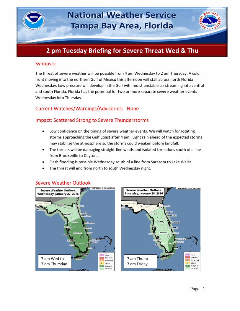
2 pm Tuesday Briefing for Severe Threat Wed & Thu
Synopsis:
The threat of severe weather will be possible from 4 am Wednesday to 2 am Thursday. A cold
front moving into the northern Gulf of Mexico this afternoon will stall across north Florida
Wednesday. Low pressure will develop in the Gulf with moist unstable air streaming into central
and south Florida. Florida has the potential for two or more separate severe weather events
Wednesday into Thursday.
Current Watches/Warnings/Advisories: None
Impact: Scattered Strong to Severe Thunderstorms
Low confidence on the timing of severe weather events. We will watch for rotating
storms approaching the Gulf Coast after 4 am. Light rain ahead of the expected storms
may stabilize the atmosphere so the storms could weaken before landfall.
The threats will be damaging straight-line winds and isolated tornadoes south of a line
from Brooksville to Daytona.
Flash flooding is possible Wednesday south of a line from Sarasota to Lake Wales
The threat will end from north to south Wednesday night.
Severe Weather Outlook
7 am Wed to 7 am Thursday
7 am Thu to 7 am Friday
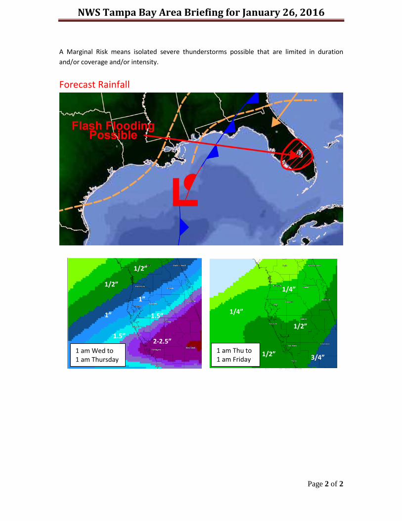
NWS Tampa Bay Area Briefing for January 26, 2016
Page 2 of 2
A Marginal Risk means isolated severe thunderstorms possible that are limited in duration
and/or coverage and/or intensity.
Forecast Rainfall
1 am Wed to 1 am Thursday
1”
1”
1.5”
1.5”
2-2.5”
1/2”
1/2”
1 am Thu to 1 am Friday
1/2”
1/2”
3/4”
1/4”
1/4”