Embed Size (px)
Citation preview
SEVERE WEATHER
Lecture 9
Definition of a Severe Thunderstorm
• The National Weather Service defines a severe thunderstorm as a thunderstorm that produces– Hail of 1 inch diameter or largerAnd/or– Wind gusts 58 mph or greater– A tornado• Note: this does not include lightning or heavy
rain!
When do thunderstorms occur?
• During the spring and summer, certain atmospheric conditions can be set up which drive severe convective storms:
• Conditionally unstable atmosphere
• Moisture
• Upward vertical motion (“Lifting”)
• Wind shear
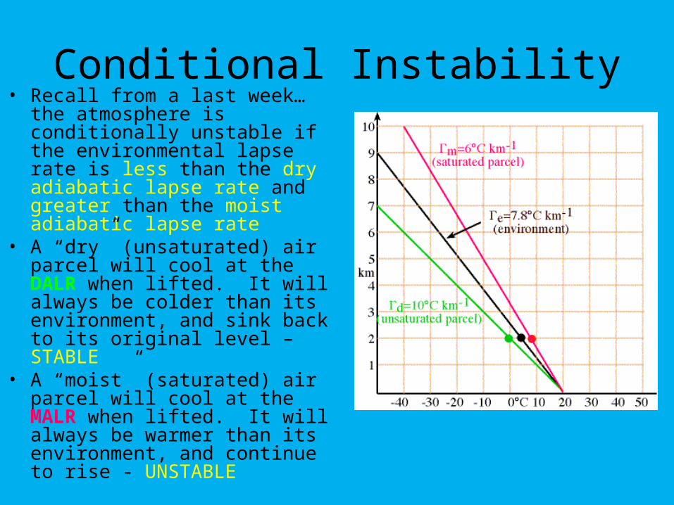
Conditional Instability• Recall from a last week…the
atmosphere is conditionally unstable if the environmental lapse rate is less than the dry adiabatic lapse rate and greater than the moist adiabatic lapse rate
• A “dry” (unsaturated) air parcel will cool at the DALR when lifted. It will always be colder than its environment, and sink back to its original level – STABLE
• A “moist” (saturated) air parcel will cool at the MALR when lifted. It will always be warmer than its environment, and continue to rise - UNSTABLE
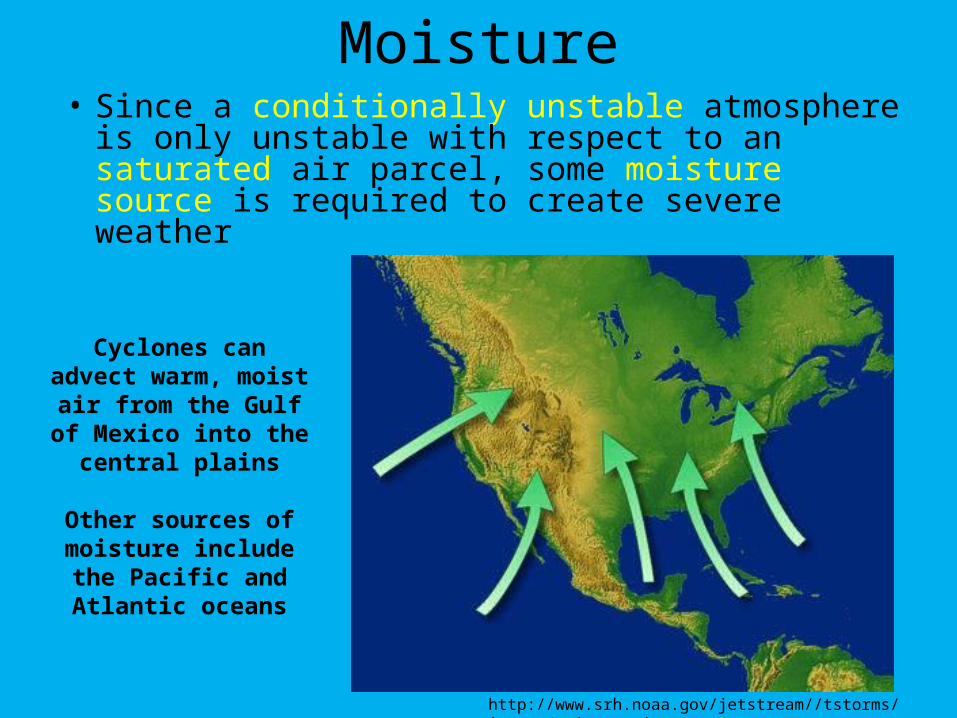
Moisture• Since a conditionally unstable atmosphere is
only unstable with respect to an saturated air parcel, some moisture source is required to create severe weather
http://www.srh.noaa.gov/jetstream//tstorms/images/moisture.jpg
Cyclones can advect warm, moist air from
the Gulf of Mexico into the central plains
Other sources of moisture include the Pacific and Atlantic
oceans
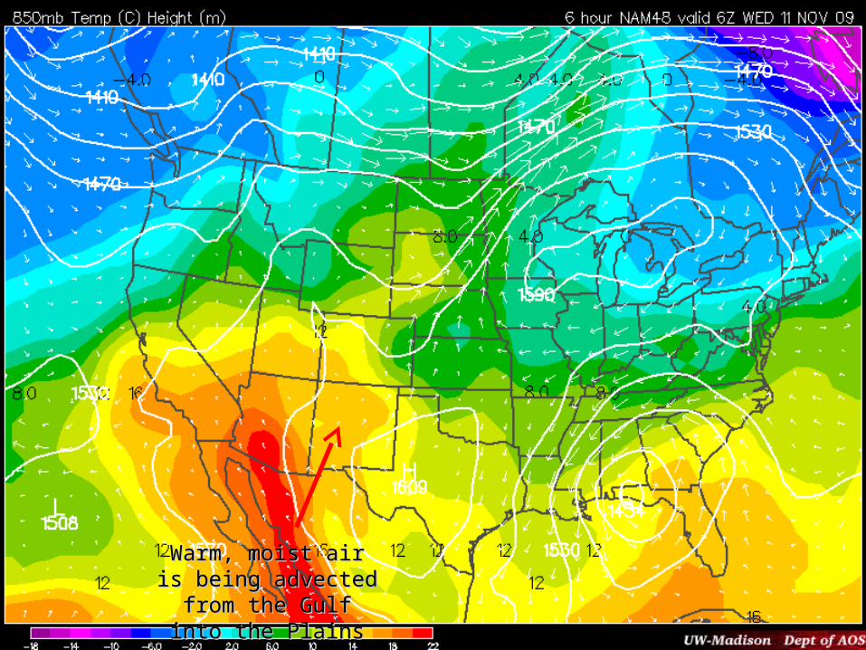
Warm, moist air is Warm, moist air is being advected from being advected from
the Gulf into the Plainsthe Gulf into the Plains
Vertical Lifting
• An unstable atmosphere will only generate severe weather when it is given a “push”
• Unstable air parcels can be lifted by the following mechanisms:– Convection– Convergence– Frontal forcing– Topography
Wind Shear
• Wind shear is a term which describes how the speed and direction of the wind change with height
• It is critically important for the formation of severe weather, because wind shear will keep upward motion and downward motion in the storm separated, allowing the storm to survive
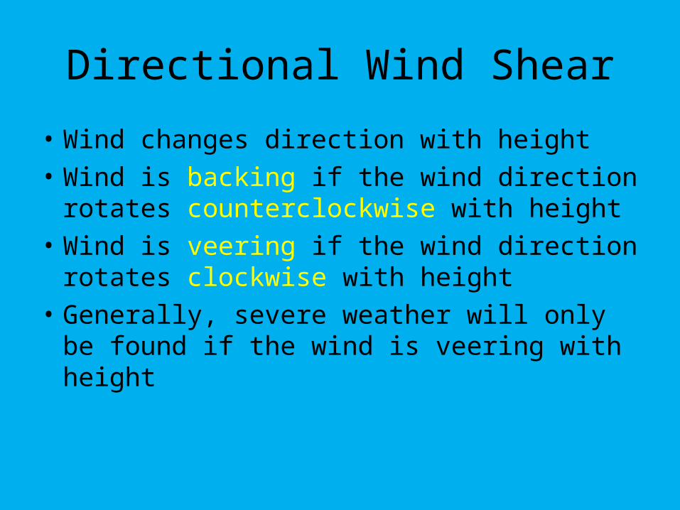
Directional Wind Shear
• Wind changes direction with height
• Wind is backing if the wind direction rotates counterclockwise with height
• Wind is veering if the wind direction rotates clockwise with height
• Generally, severe weather will only be found if the wind is veering with height
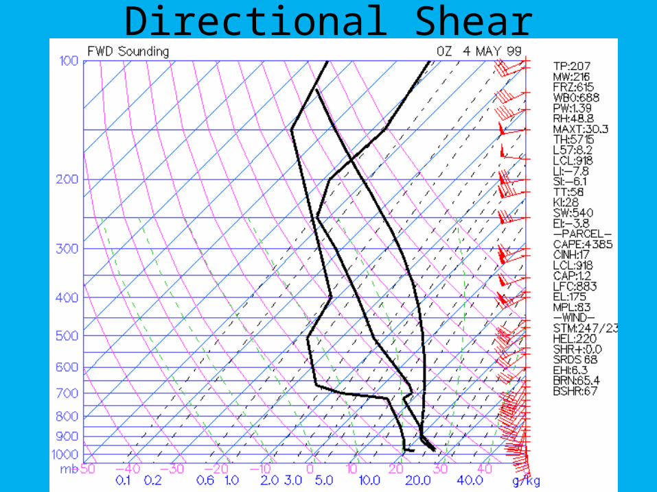
Directional Shear

Speed shear often causes severe weather with strong straight-line winds
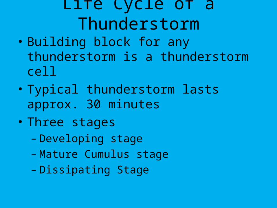
Life Cycle of a Thunderstorm
• Building block for any thunderstorm is a thunderstorm cell
• Typical thunderstorm lasts approx. 30 minutes
• Three stages– Developing stage– Mature Cumulus stage– Dissipating Stage
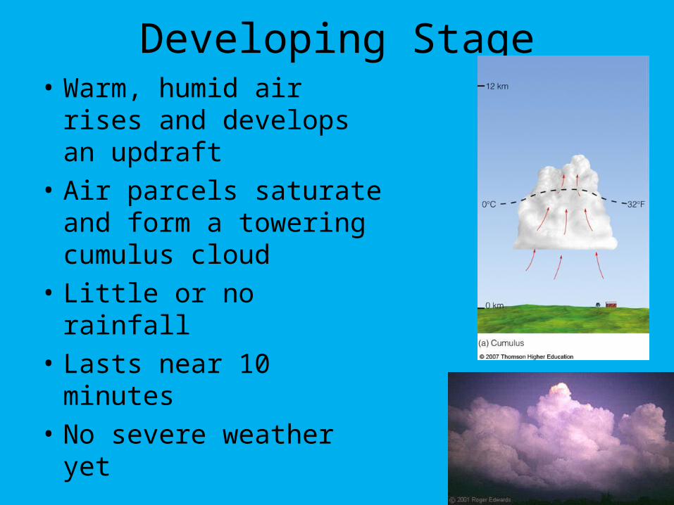
Developing Stage• Warm, humid air rises
and develops an updraft
• Air parcels saturate and form a towering cumulus cloud
• Little or no rainfall
• Lasts near 10 minutes
• No severe weather yet
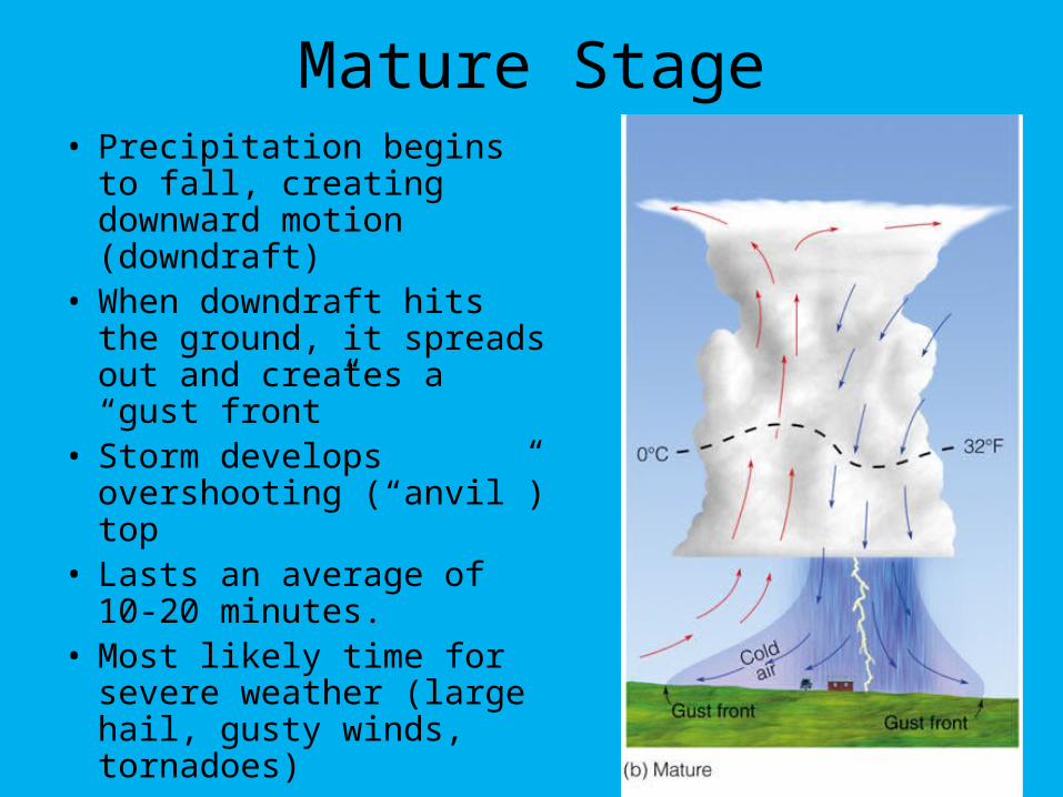
Mature Stage• Precipitation begins to
fall, creating downward motion (downdraft)
• When downdraft hits the ground, it spreads out and creates a “gust front”
• Storm develops overshooting (“anvil”) top
• Lasts an average of 10-20 minutes.
• Most likely time for severe weather (large hail, gusty winds, tornadoes)
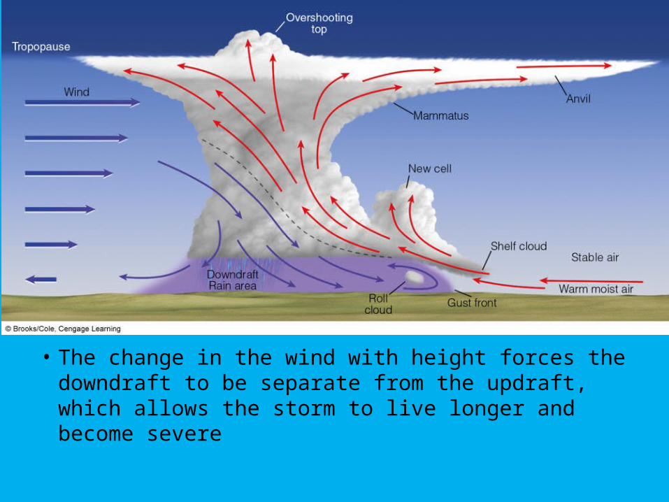
• The change in the wind with height forces the downdraft to be separate from the updraft, which allows the storm to live longer and become severe
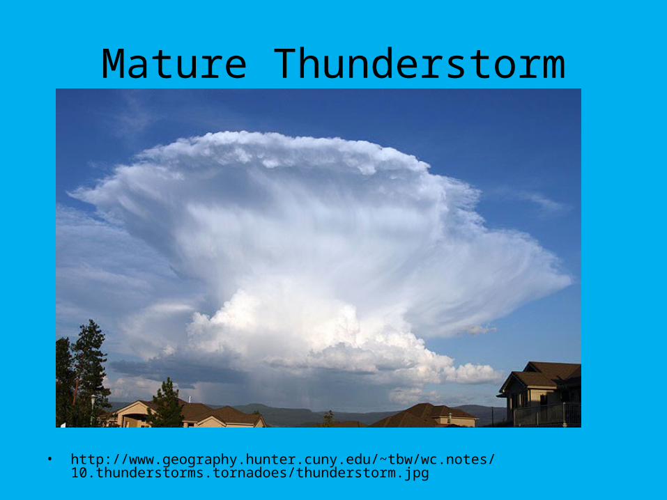
Mature Thunderstorm
• http://www.geography.hunter.cuny.edu/~tbw/wc.notes/10.thunderstorms.tornadoes/thunderstorm.jpg
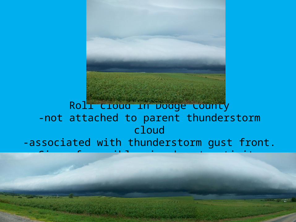
Roll cloud in Dodge County-not attached to parent thunderstorm cloud
-associated with thunderstorm gust front. Sign of possible microburst activity
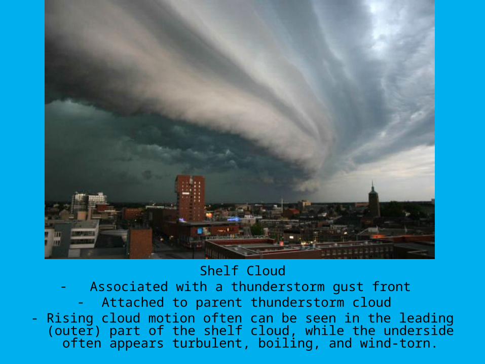
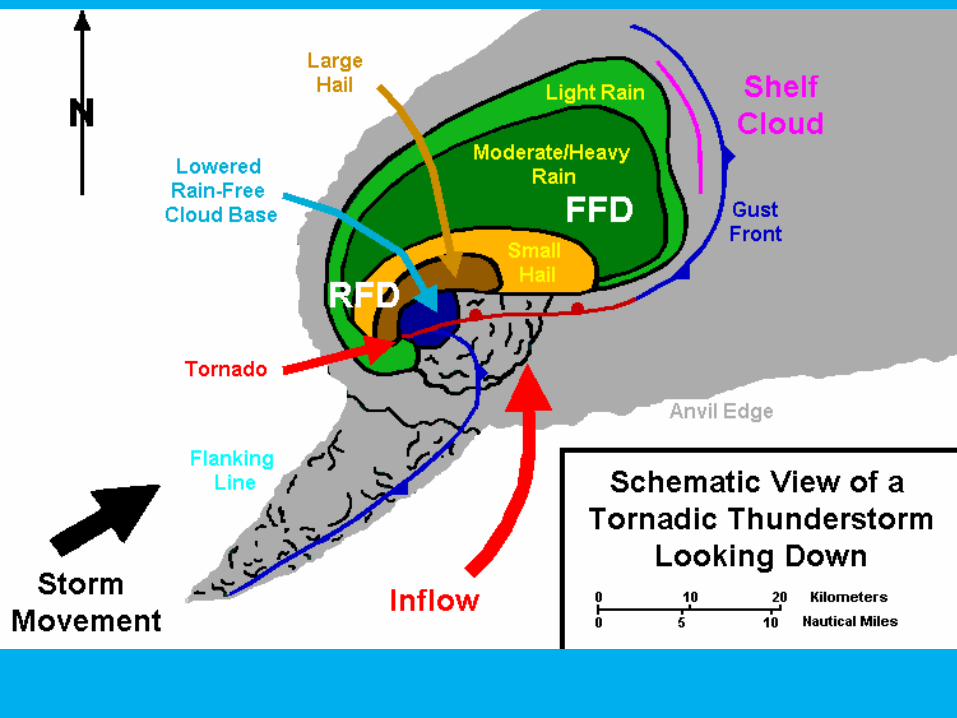
Shelf Cloud- Associated with a thunderstorm gust front
- Attached to parent thunderstorm cloud - Rising cloud motion often can be seen in the leading (outer)
part of the shelf cloud, while the underside often appears turbulent, boiling, and wind-torn.
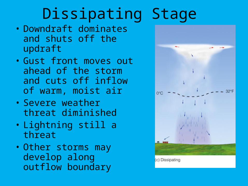
Dissipating Stage • Downdraft dominates
and shuts off the updraft• Gust front moves out
ahead of the storm and cuts off inflow of warm, moist air
• Severe weather threat diminished
• Lightning still a threat• Other storms may
develop along outflow boundary
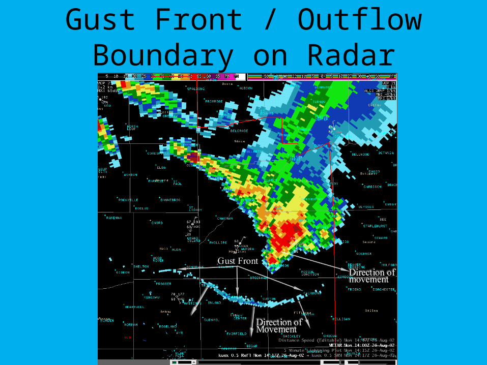
Gust Front / Outflow Boundary on Radar
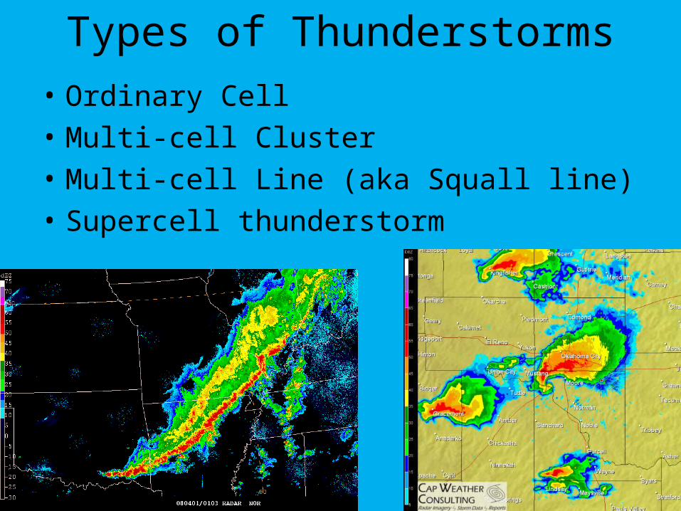
Types of Thunderstorms
• Ordinary Cell
• Multi-cell Cluster
• Multi-cell Line (aka Squall line)
• Supercell thunderstorm
Tornadoes• A tornado is defined as “a violently rotating
column of air descending from a thunderstorm and IN CONTACT with the ground.” -NWS
• Can sometimes last for more than an hour and travel several miles
• Most violent tornadoes are capable of tremendous destruction with wind speeds of 250 mph or more
What causes tornadoes?• Tornadoes in the winter and early spring
are often associated with strong frontal systems that form in the Central US and move east
• During the spring in the Central Plains, thunderstorms develop along a dryline – separates very warm, moist area to the east from hot, dry air to the west.
• Tornadoes may form as thunderstorms fire along the dryline during the afternoon hours
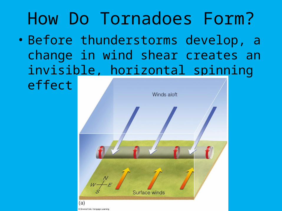
How Do Tornadoes Form?• Before thunderstorms develop, a change
in wind shear creates an invisible, horizontal spinning effect near the surface.
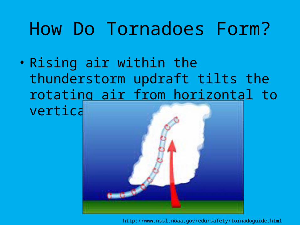
• Rising air within the thunderstorm updraft tilts the rotating air from horizontal to vertical
How Do Tornadoes Form?
http://www.nssl.noaa.gov/edu/safety/tornadoguide.html
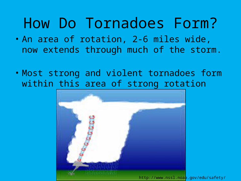
• An area of rotation, 2-6 miles wide, now extends through much of the storm.
• Most strong and violent tornadoes form within this area of strong rotation
How Do Tornadoes Form?
http://www.nssl.noaa.gov/edu/safety/tornadoguide.html
Tornado Facts
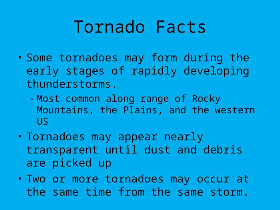
• Some tornadoes may form during the early stages of rapidly developing thunderstorms. – Most common along range of Rocky
Mountains, the Plains, and the western US
• Tornadoes may appear nearly transparent until dust and debris are picked up
• Two or more tornadoes may occur at the same time from the same storm.
Tornado Facts
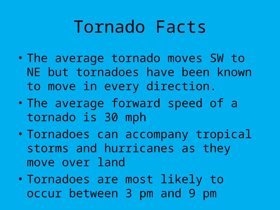
• The average tornado moves SW to NE but tornadoes have been known to move in every direction.
• The average forward speed of a tornado is 30 mph
• Tornadoes can accompany tropical storms and hurricanes as they move over land
• Tornadoes are most likely to occur between 3 pm and 9 pm
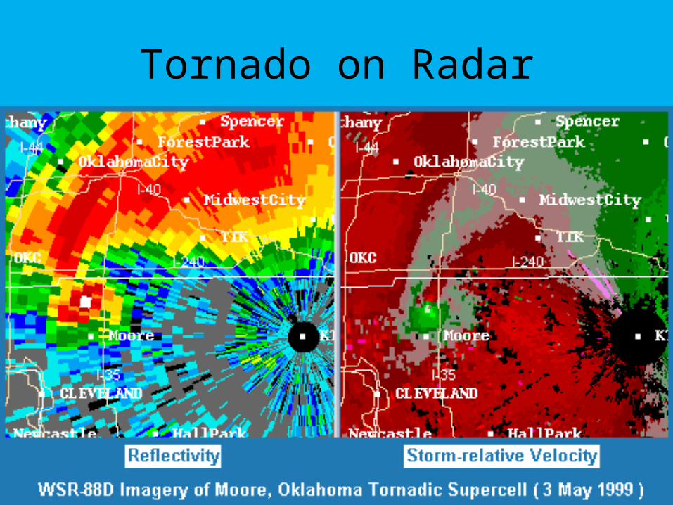
Tornado on Radar
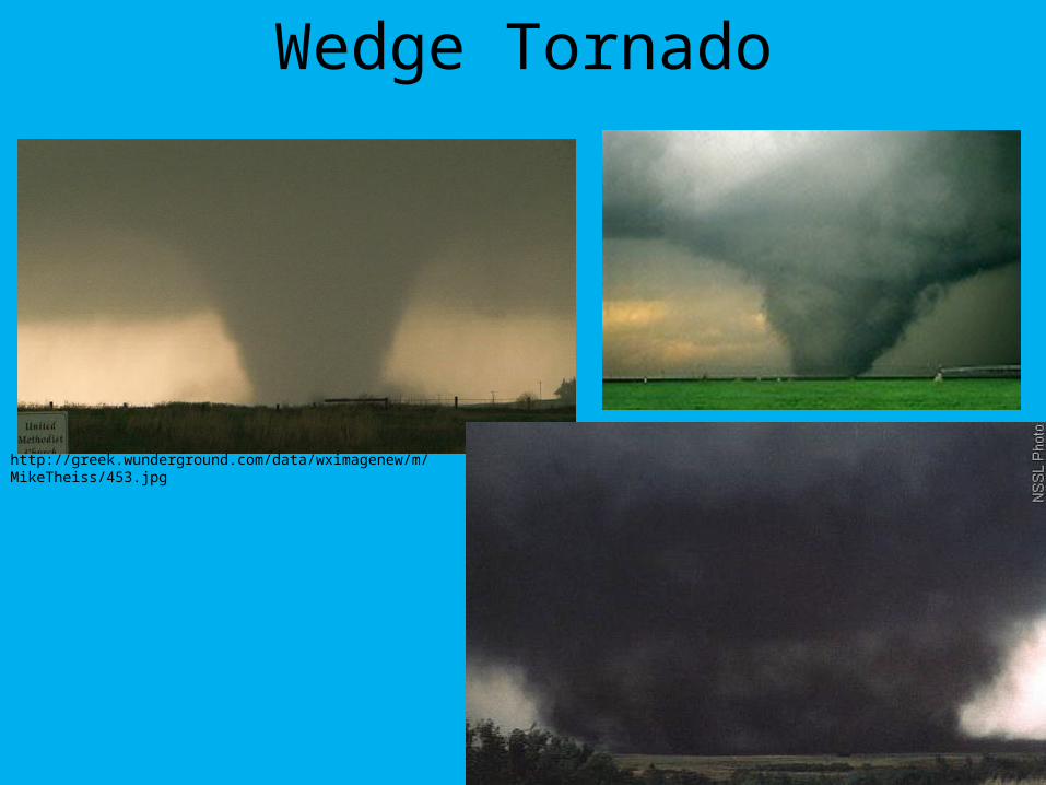
Wedge Tornado
http://greek.wunderground.com/data/wximagenew/m/MikeTheiss/453.jpg
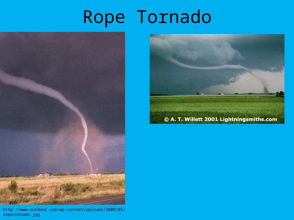
Rope Tornado
http://www.outdoor.com/wp-content/uploads/2008/01/ropetornado.jpg
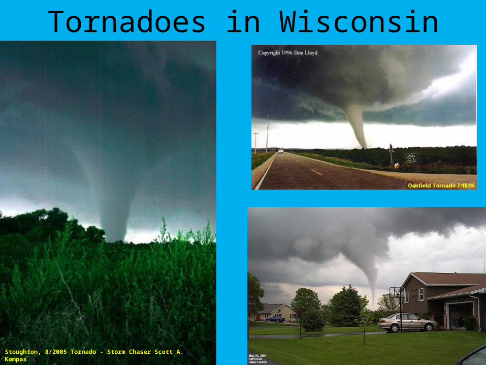
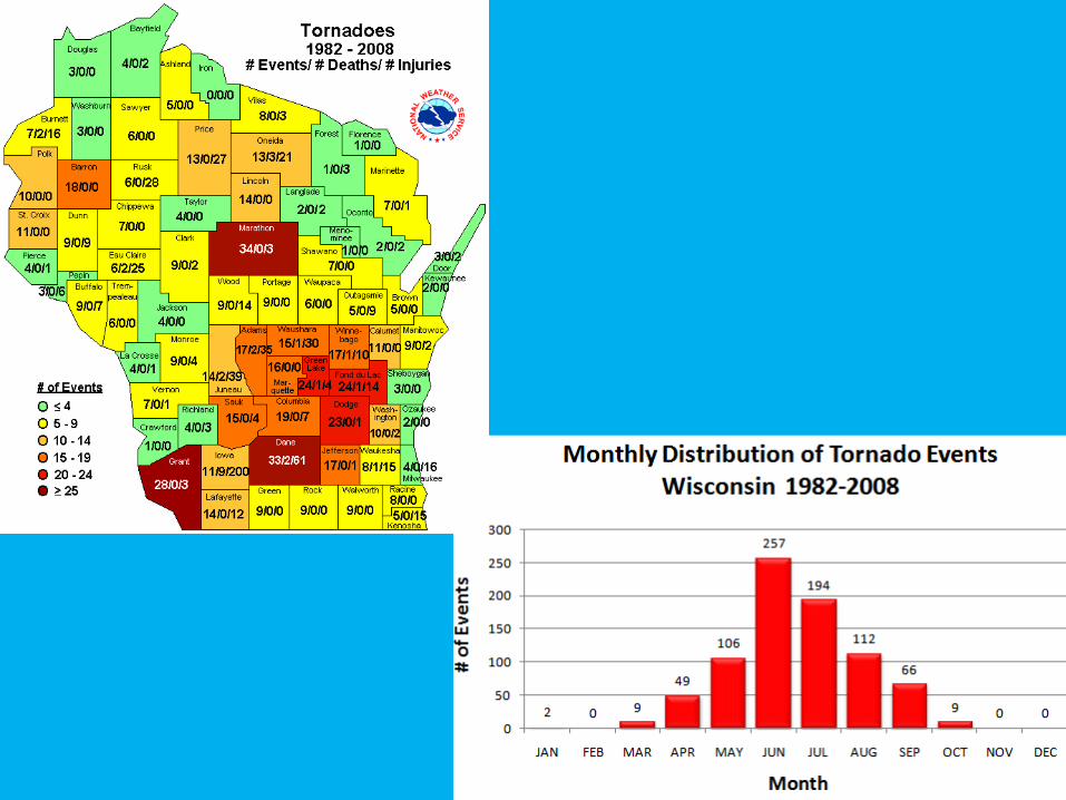
Tornadoes in Wisconsin
Stoughton, 8/2005 Tornado - Storm Chaser Scott A. Kampas
Cool Tornado Video
• http://www.weather.com/multimedia/videoplayer.html?clip=14517&from=tv_program_vortex
Tropical Cyclones
• A tropical cyclone is a low pressure system that develops over tropical or subtropical waters (between 30º N and 30º S)
• Develop in areas without a horizontal temperature gradient
• Does not have fronts• Has a warm core center• Has an organized circulation
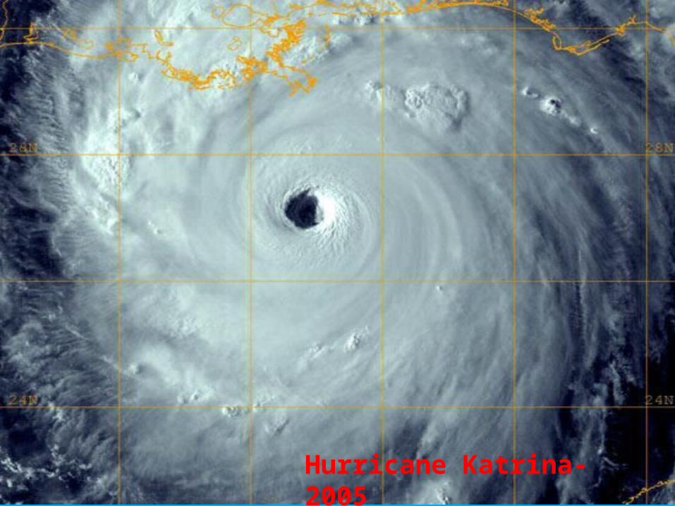
Hurricane Katrina- 2005
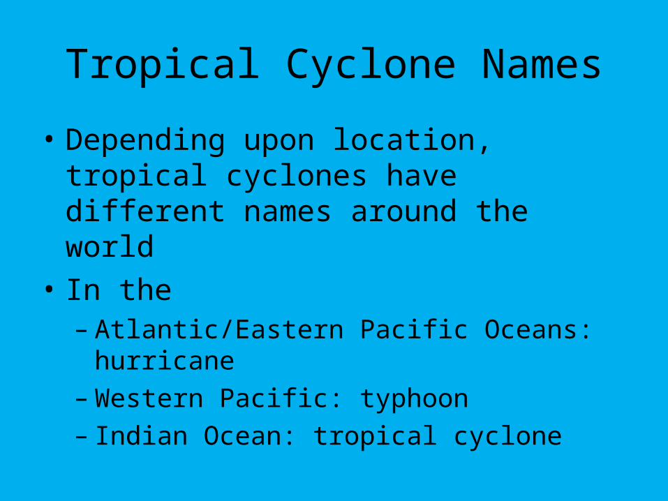
Tropical Cyclone Names
• Depending upon location, tropical cyclones have different names around the world
• In the – Atlantic/Eastern Pacific Oceans: hurricane– Western Pacific: typhoon– Indian Ocean: tropical cyclone
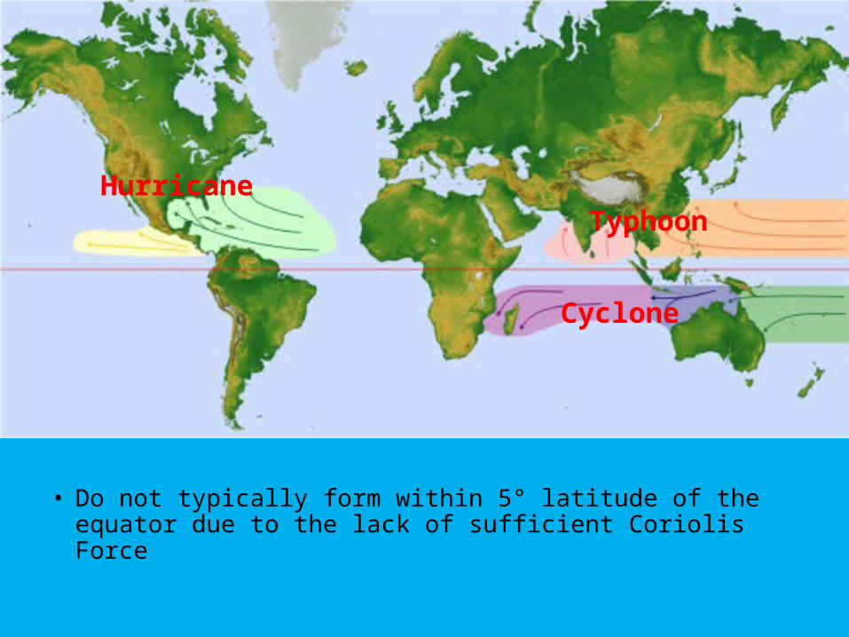
• Do not typically form within 5° latitude of the equator due to the lack of sufficient Coriolis Force
Hurricane
Cyclone
Typhoon
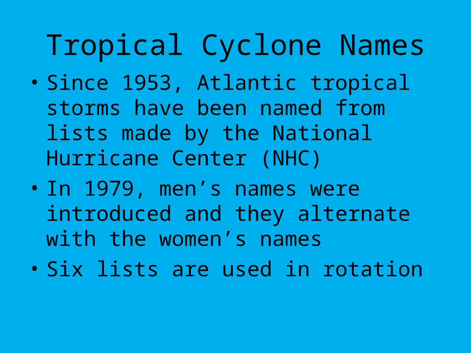
Tropical Cyclone Names• Since 1953, Atlantic tropical storms have
been named from lists made by the National Hurricane Center (NHC)
• In 1979, men’s names were introduced and they alternate with the women’s names
• Six lists are used in rotation
Tropical Cyclone Names• The only time that there is a change in the
list is if a storm is so deadly or costly that future use of its name would be inappropriate– Essentially the storm name is “retired”– For example, Andrew 1992, Katrina 2005,
Gustav and Ike 2008
• In the event that more than 21 tropical cyclones occur in a season, additional storms will take names from the Greek alphabet– Alpha, Beta, Gamma, Delta, etc
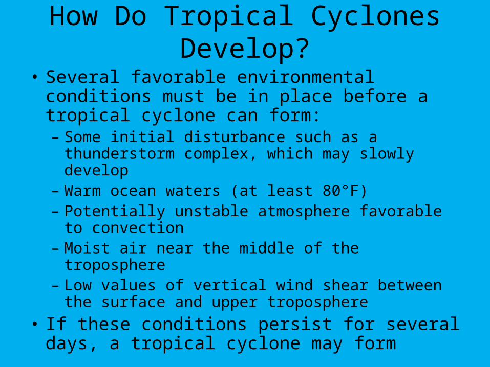
How Do Tropical Cyclones Develop?
• Several favorable environmental conditions must be in place before a tropical cyclone can form:– Some initial disturbance such as a thunderstorm
complex, which may slowly develop– Warm ocean waters (at least 80°F)– Potentially unstable atmosphere favorable to
convection– Moist air near the middle of the troposphere– Low values of vertical wind shear between the
surface and upper troposphere
• If these conditions persist for several days, a tropical cyclone may form
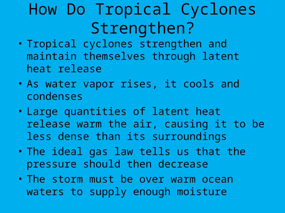
How Do Tropical Cyclones Strengthen?
• Tropical cyclones strengthen and maintain themselves through latent heat release
• As water vapor rises, it cools and condenses
• Large quantities of latent heat release warm the air, causing it to be less dense than its surroundings
• The ideal gas law tells us that the pressure should then decrease
• The storm must be over warm ocean waters to supply enough moisture
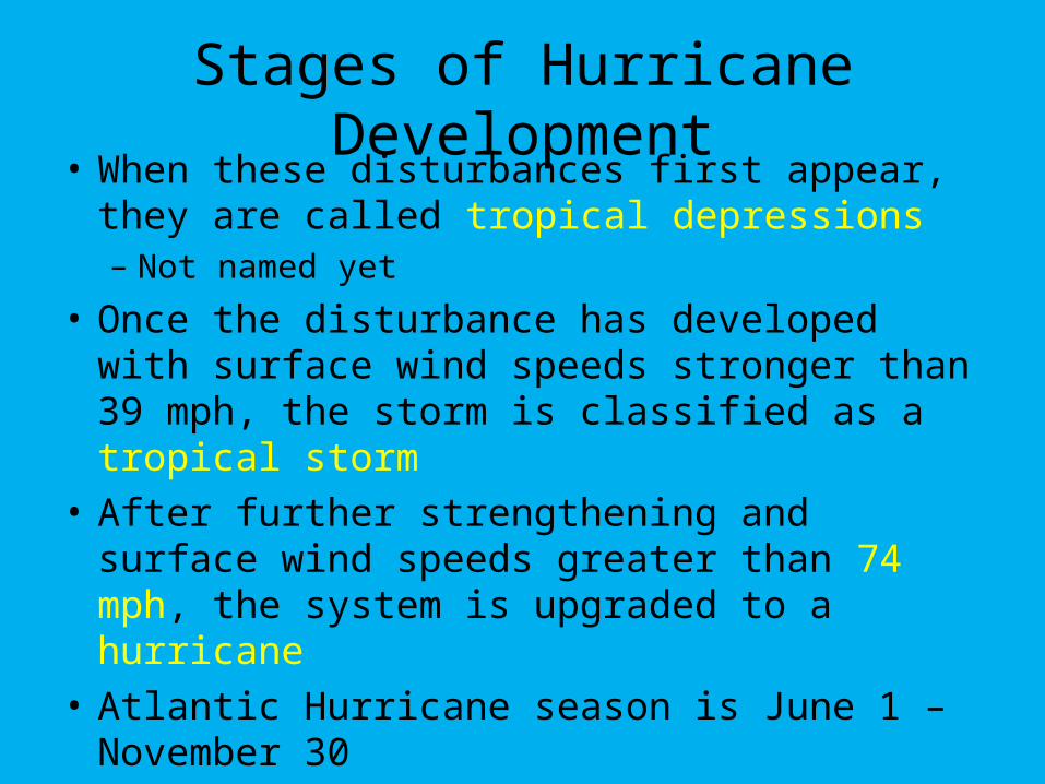
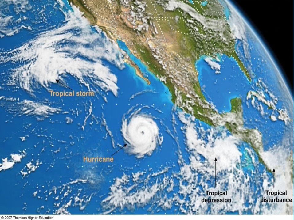
Stages of Hurricane Development• When these disturbances first appear, they
are called tropical depressions– Not named yet
• Once the disturbance has developed with surface wind speeds stronger than 39 mph, the storm is classified as a tropical storm
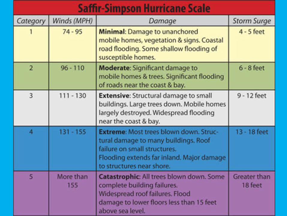
• After further strengthening and surface wind speeds greater than 74 mph, the system is upgraded to a hurricane
• Atlantic Hurricane season is June 1 – November 30
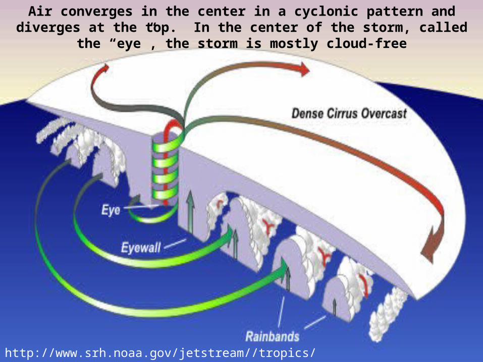
http://www.srh.noaa.gov/jetstream//tropics/tc_structure.htm
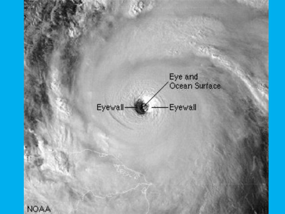
Air converges in the center in a cyclonic pattern and diverges at the top. In the center of the storm, called the “eye”, the storm is mostly cloud-free
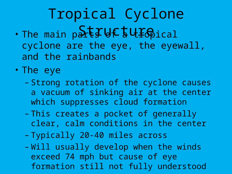
Tropical Cyclone Structure• The main parts of a tropical cyclone are
the eye, the eyewall, and the rainbands
• The eye – Strong rotation of the cyclone causes a
vacuum of sinking air at the center which suppresses cloud formation
– This creates a pocket of generally clear, calm conditions in the center
– Typically 20-40 miles across– Will usually develop when the winds exceed
74 mph but cause of eye formation still not fully understood
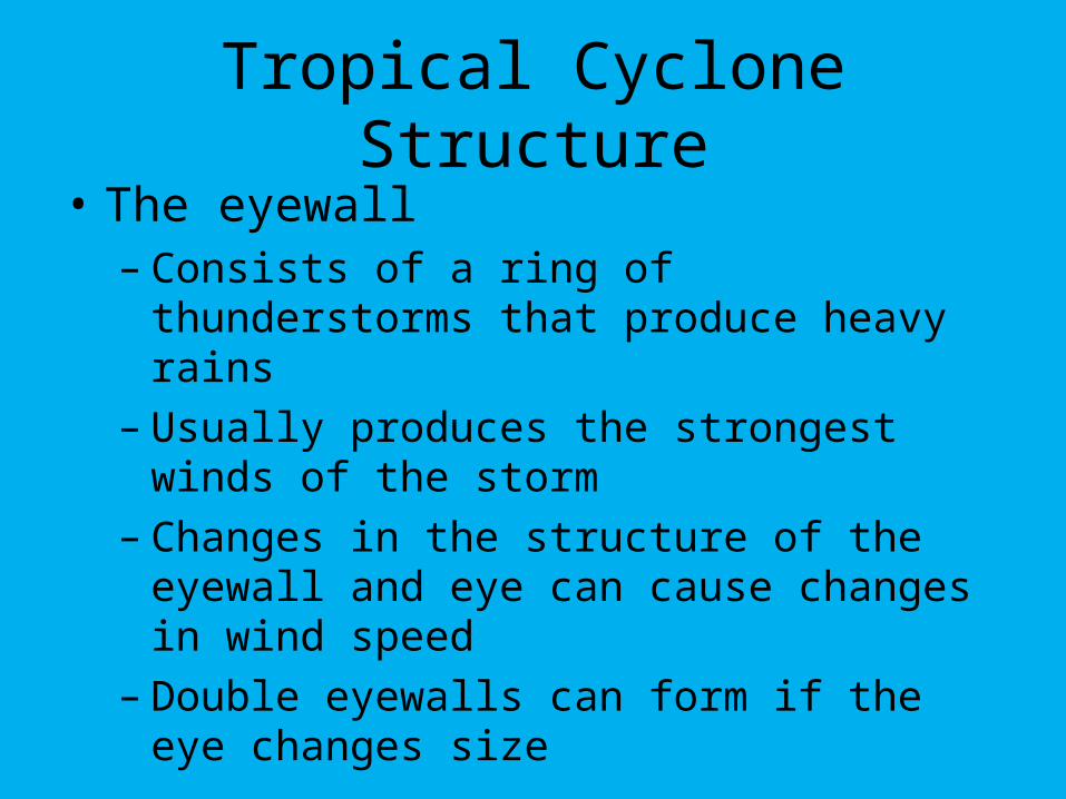
Tropical Cyclone Structure
• The eyewall– Consists of a ring of thunderstorms that
produce heavy rains– Usually produces the strongest winds of the
storm– Changes in the structure of the eyewall and
eye can cause changes in wind speed– Double eyewalls can form if the eye changes
size
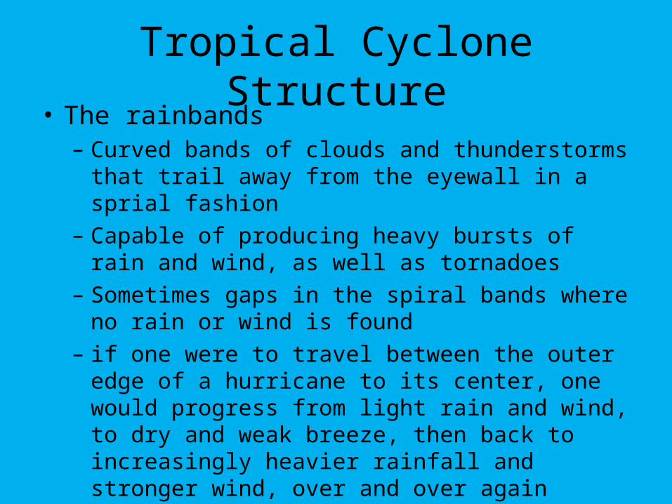
Tropical Cyclone Structure• The rainbands
– Curved bands of clouds and thunderstorms that trail away from the eyewall in a sprial fashion
– Capable of producing heavy bursts of rain and wind, as well as tornadoes
– Sometimes gaps in the spiral bands where no rain or wind is found
– if one were to travel between the outer edge of a hurricane to its center, one would progress from light rain and wind, to dry and weak breeze, then back to increasingly heavier rainfall and stronger wind, over and over again
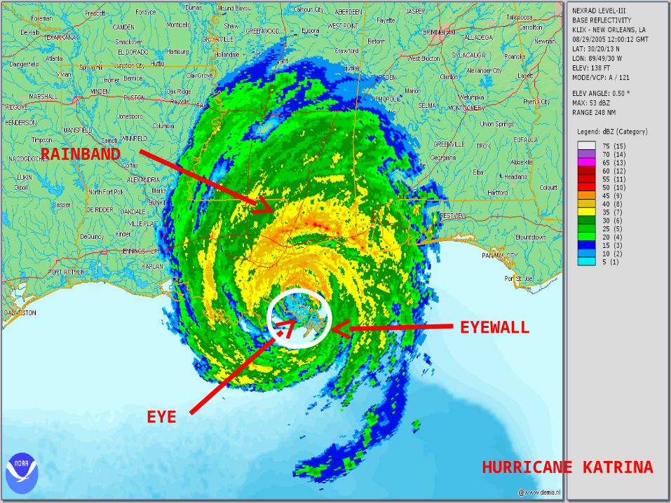
EYE
EYEWALL
RAINBAND
HURRICANE KATRINA
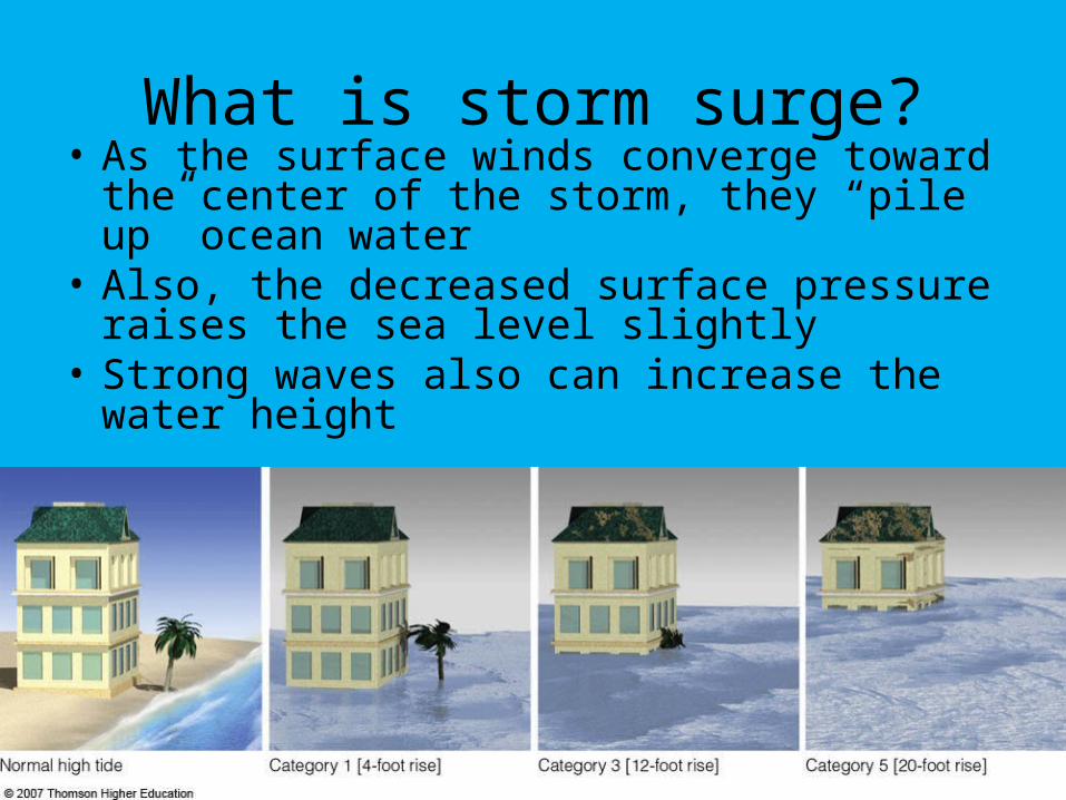
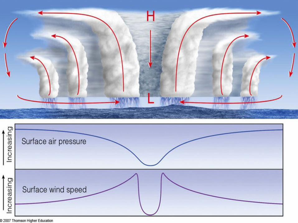
What is storm surge?• As the surface winds converge toward the
center of the storm, they “pile up” ocean water
• Also, the decreased surface pressure raises the sea level slightly
• Strong waves also can increase the water height
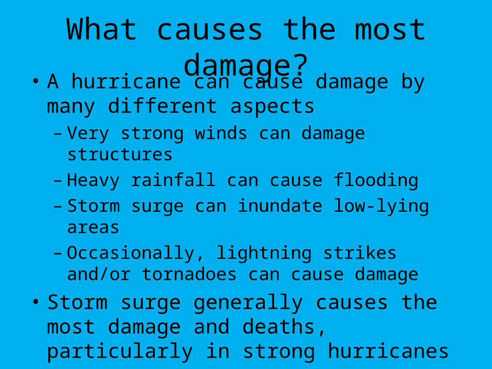
What causes the most damage?• A hurricane can cause damage by many
different aspects– Very strong winds can damage structures– Heavy rainfall can cause flooding– Storm surge can inundate low-lying areas– Occasionally, lightning strikes and/or
tornadoes can cause damage
• Storm surge generally causes the most damage and deaths, particularly in strong hurricanes
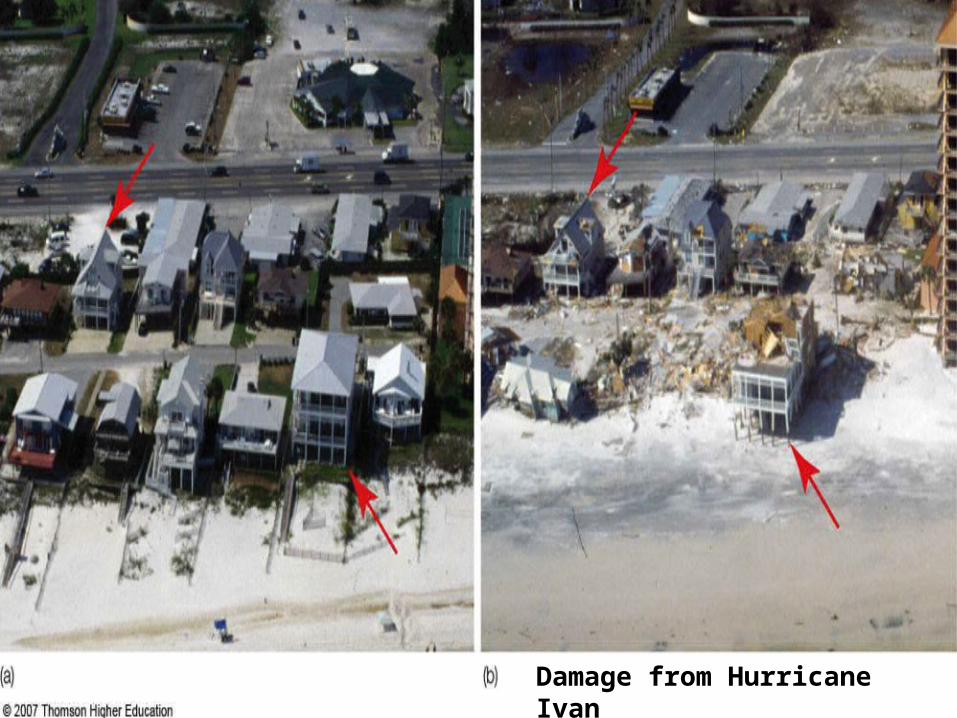
Damage from Hurricane Ivan
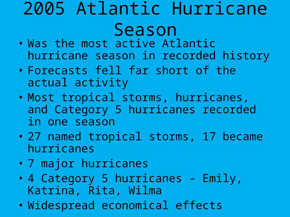
2005 Atlantic Hurricane Season• Was the most active Atlantic hurricane
season in recorded history• Forecasts fell far short of the actual activity• Most tropical storms, hurricanes, and
Category 5 hurricanes recorded in one season
• 27 named tropical storms, 17 became hurricanes
• 7 major hurricanes• 4 Category 5 hurricanes – Emily, Katrina,
Rita, Wilma • Widespread economical effects
Hurricane Katrina - 2005• Katrina was the 6th strongest hurricane on
record for the Atlantic Ocean• After entering the Gulf, rapidly intensified
from Cat. 3 to Cat. 5 in 9 hours on August 28
• Lowest pressure as Cat. 5 storm was 902 mb with max sustained winds of 175 mph
• Weakened slightly before landfall to a Category 3
• Hurricane force winds extended 120 miles from the center
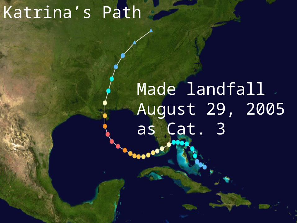
Katrina’s Path
Made landfall August 29, 2005 as Cat. 3
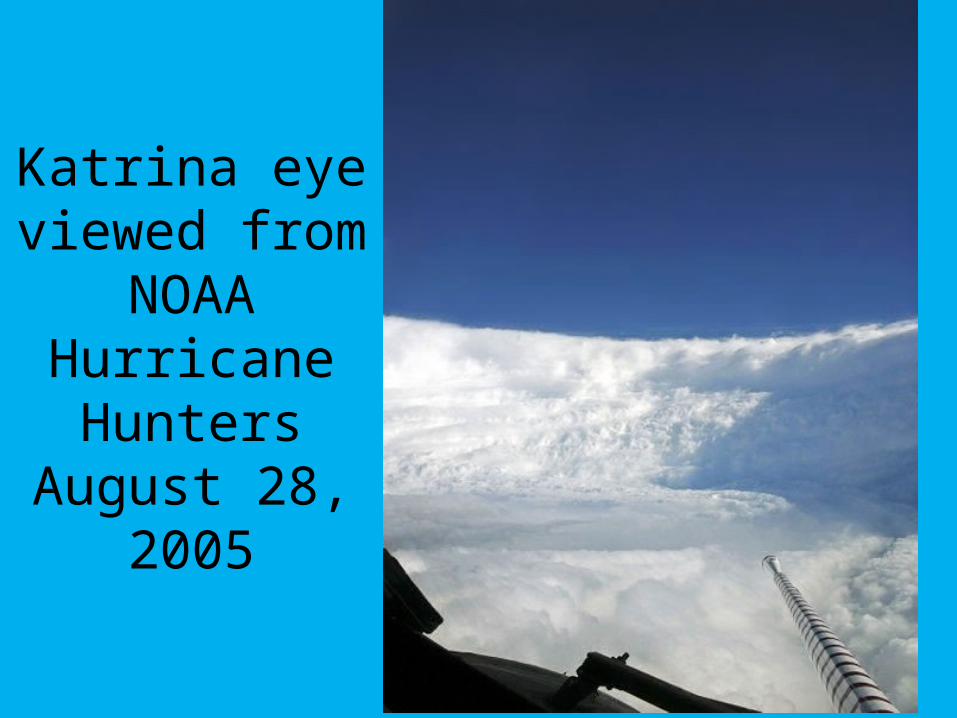
Katrina eye viewed from
NOAA Hurricane Hunters
August 28, 2005
Katrina’s Impact• Largest natural disaster in the history of
the U.S.
• Attributed to over 1830 deaths and 700 missing people, mostly in Louisiana and Mississippi
• Damages well in excess of $100 billion
• Federal disaster declarations covered 90,000 sq miles (size of United Kingdom)
• 8-16 inches of rain
• Breaching of levees caused 80% of New Orleans to be flooded
Time Lapse of Hurricane Katrina
• http://www.youtube.com/watch?v=_SLXYRJnYm0&feature=related
• http://www.youtube.com/watch?v=wFQyX73eeOA&NR=1