Embed Size (px)
Citation preview

Settlement Boundaries
Where do they come from?What do they do?
What is the future?
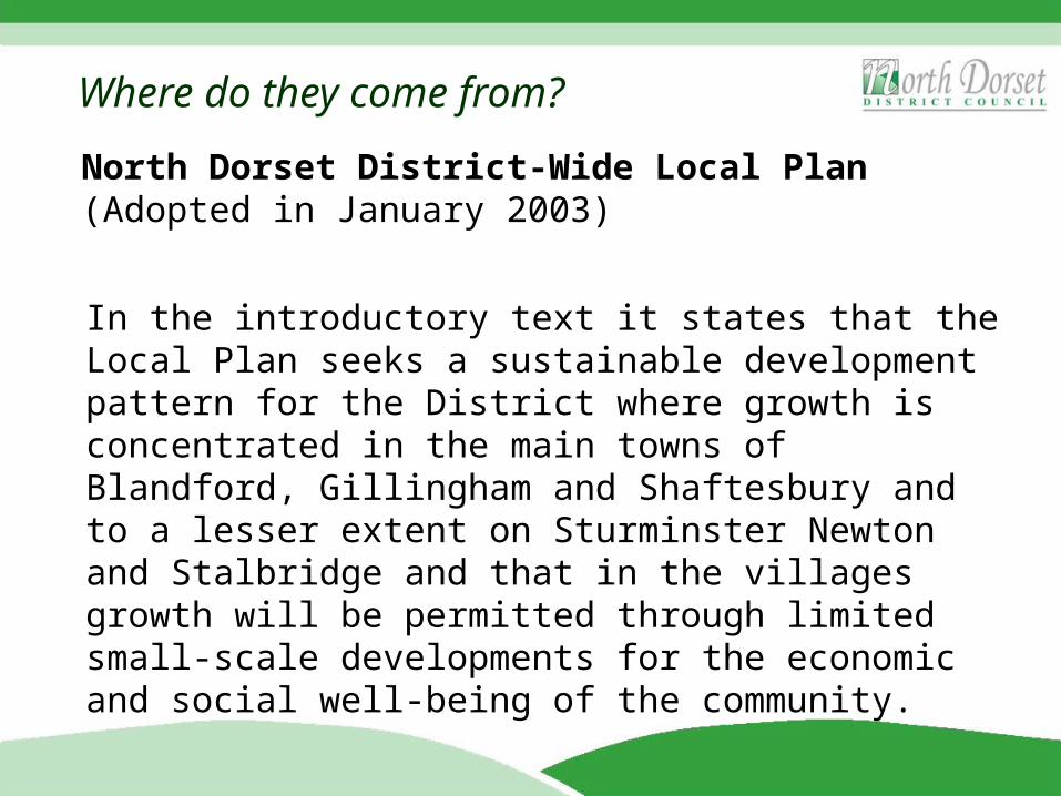
North Dorset District-Wide Local Plan (Adopted in January 2003)
In the introductory text it states that the Local Plan seeks a sustainable development pattern for the District where growth is concentrated in the main towns of Blandford, Gillingham and Shaftesbury and to a lesser extent on Sturminster Newton and Stalbridge and that in the villages growth will be permitted through limited small-scale developments for the economic and social well-being of the community.
Where do they come from?
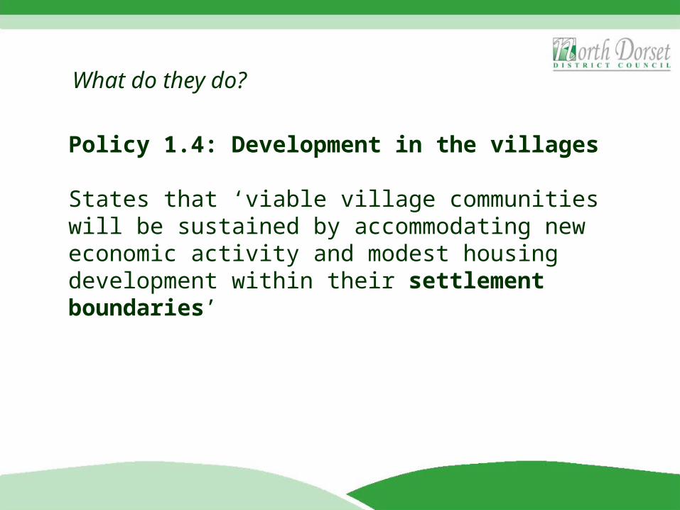
Policy 1.4: Development in the villages
States that ‘viable village communities will be sustained by accommodating new economic activity and modest housing development within their settlement boundaries’
What do they do?
Policy 1.6: Development in the Countryside
In the areas beyond the defined settlement boundaries, most forms of residential and commercial development for general needs will not be permitted.
What do they do?
However, the following uses may be granted permission, subject to the relevant policy and assessment criteria:• Development required for Agriculture and Forestry• Rural Buildings: Re-use & Adaption• Rural “Exception” sites for Affordable Housing for Local
Needs• Housing for Agricultural & Forestry Needs• Housing: Dwelling extensions and replacement• Employment Development for Local Needs• Countryside Tourism• Countryside Recreation• Infrastructure (e.g. roads, sewers, energy, telecoms etc)
What do they do?
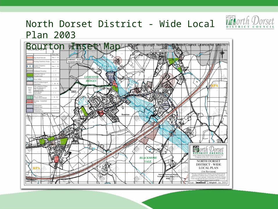
North Dorset District - Wide Local Plan 2003Bourton Inset Map
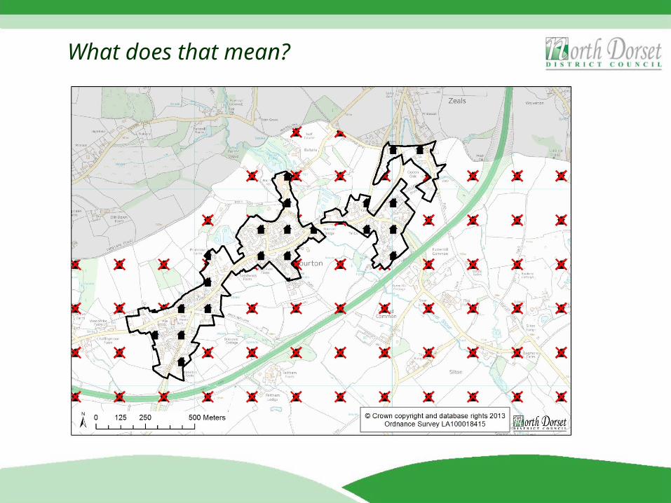
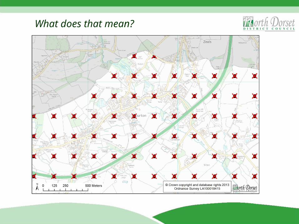
What does that mean?
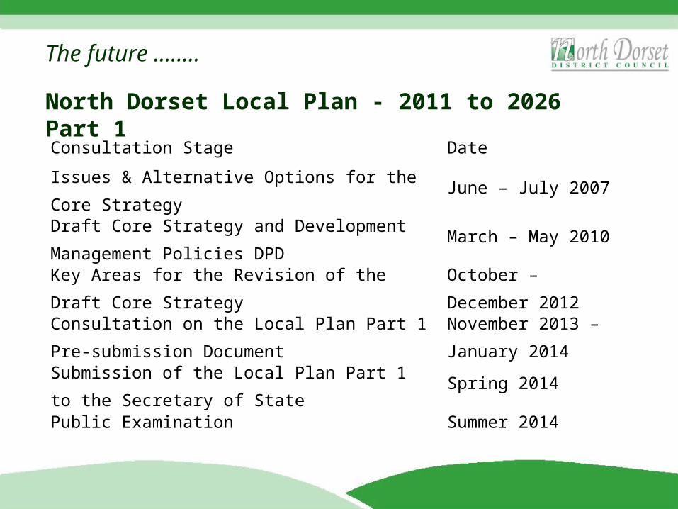
North Dorset Local Plan - 2011 to 2026 Part 1
Consultation Stage Date
Issues & Alternative Options for the Core Strategy
June – July 2007
Draft Core Strategy and Development Management Policies DPD
March – May 2010
Key Areas for the Revision of the Draft Core Strategy
October – December 2012
Consultation on the Local Plan Part 1 Pre-submission Document
November 2013 – January 2014
Submission of the Local Plan Part 1 to the Secretary of State
Spring 2014
Public Examination Summer 2014
The future ……..
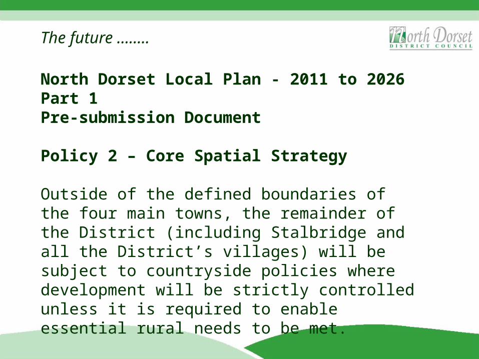
North Dorset Local Plan - 2011 to 2026 Part 1Pre-submission Document
Policy 2 – Core Spatial Strategy
Outside of the defined boundaries of the four main towns, the remainder of the District (including Stalbridge and all the District’s villages) will be subject to countryside policies where development will be strictly controlled unless it is required to enable essential rural needs to be met.
The future ……..
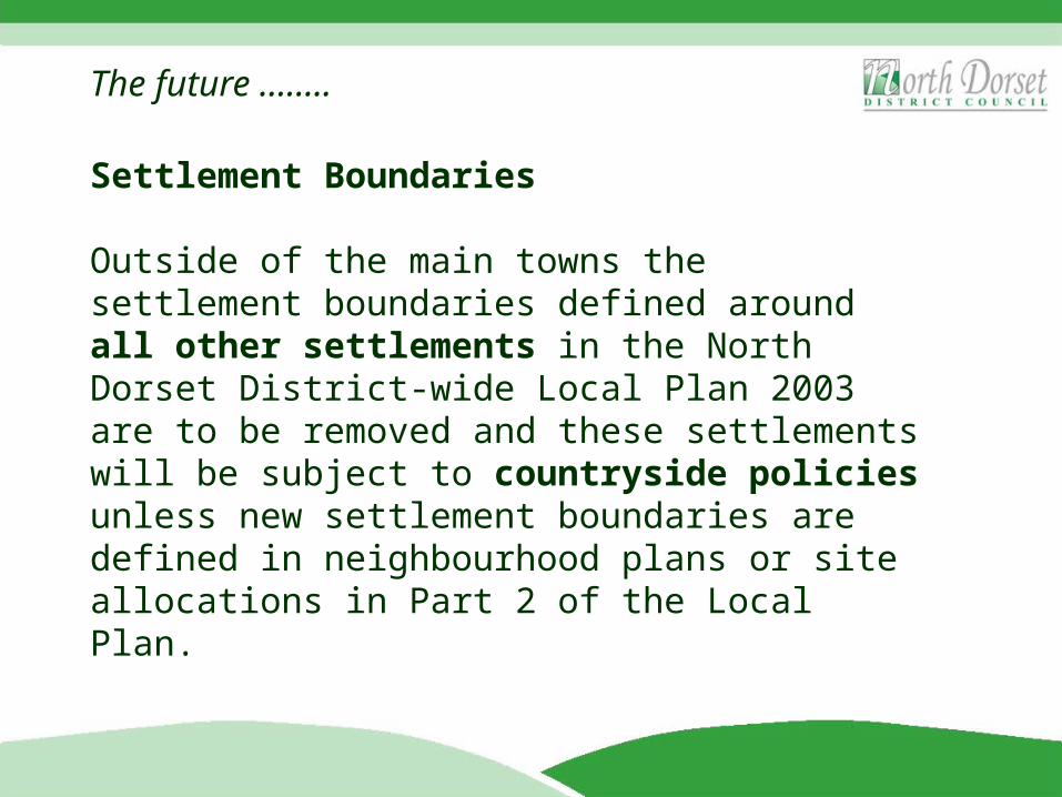
Settlement Boundaries
Outside of the main towns the settlement boundaries defined around all other settlements in the North Dorset District-wide Local Plan 2003 are to be removed and these settlements will be subject to countryside policies unless new settlement boundaries are defined in neighbourhood plans or site allocations in Part 2 of the Local Plan.
The future ……..
What does that mean?
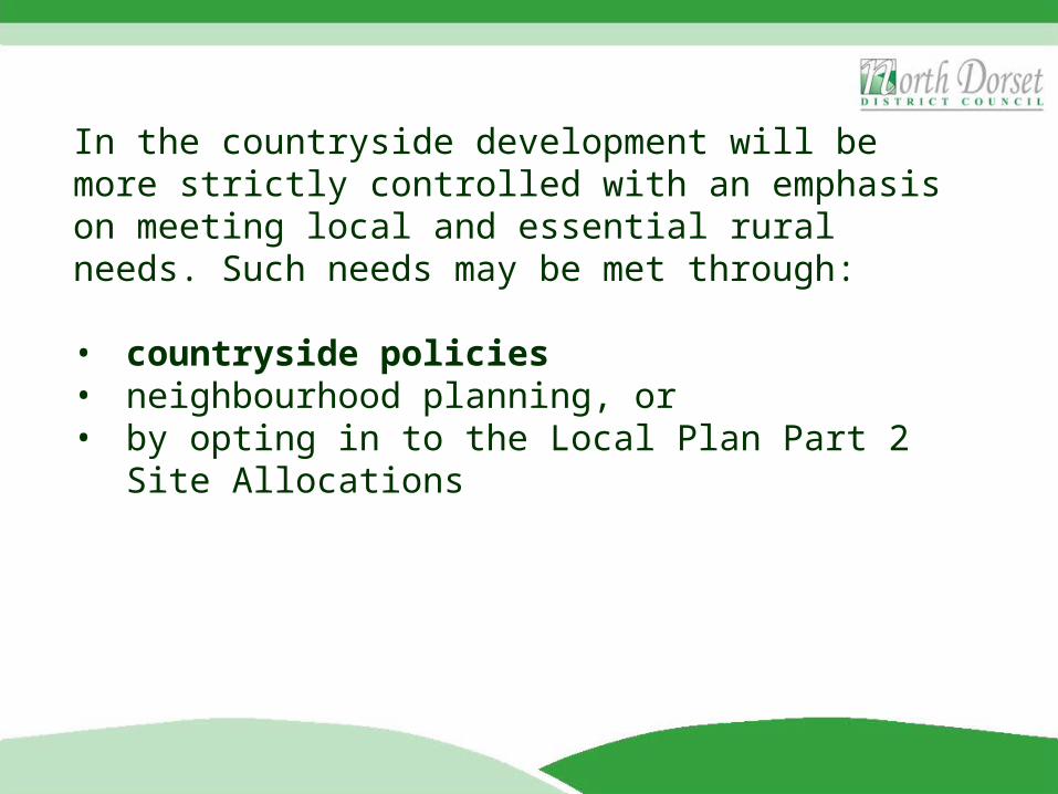
In the countryside development will be more strictly controlled with an emphasis on meeting local and essential rural needs. Such needs may be met through:
• countryside policies• neighbourhood planning, or• by opting in to the Local Plan Part 2 Site Allocations
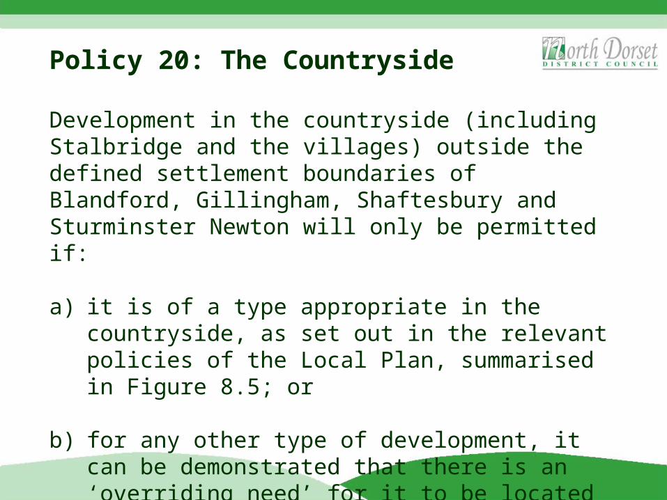
Policy 20: The Countryside
Development in the countryside (including Stalbridge and the villages) outside the defined settlement boundaries of Blandford, Gillingham, Shaftesbury and Sturminster Newton will only be permitted if:
a) it is of a type appropriate in the countryside, as set out in the relevant policies of the Local Plan, summarised in Figure 8.5; or
b) for any other type of development, it can be demonstrated that there is an ‘overriding need’ for it to be located in the countryside.
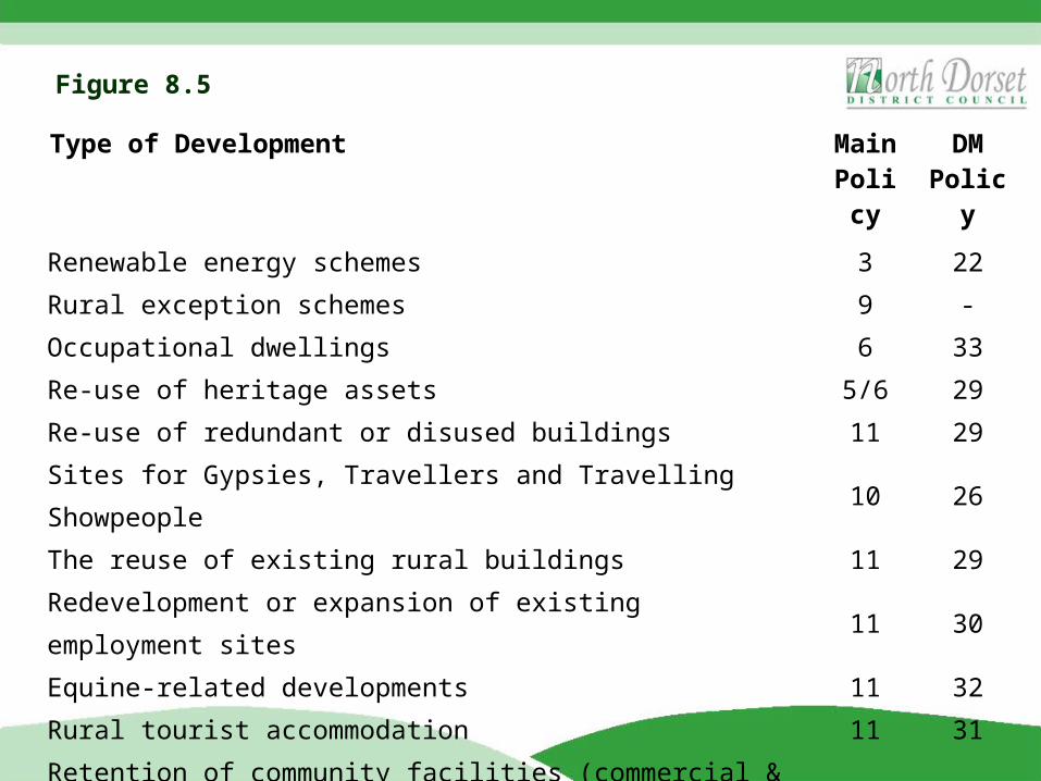
Type of Development Main Policy
DM Policy
Renewable energy schemes 3 22
Rural exception schemes 9 -
Occupational dwellings 6 33
Re-use of heritage assets 5/6 29
Re-use of redundant or disused buildings 11 29
Sites for Gypsies, Travellers and Travelling Showpeople 10 26
The reuse of existing rural buildings 11 29
Redevelopment or expansion of existing employment sites 11 30
Equine-related developments 11 32
Rural tourist accommodation 11 31
Retention of community facilities (commercial & non-commercial) 14 27
New community facilities (non-commercial) 14 -
Figure 8.5
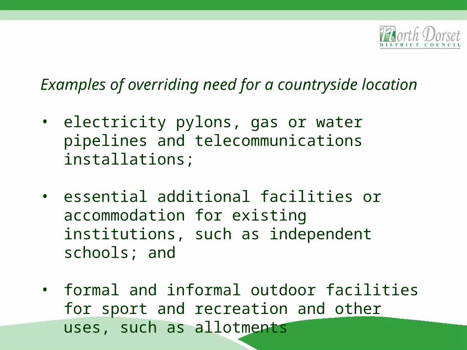
Examples of overriding need for a countryside location
• electricity pylons, gas or water pipelines and telecommunications installations;
• essential additional facilities or accommodation for existing institutions, such as independent schools; and
• formal and informal outdoor facilities for sport and recreation and other uses, such as allotments
In the countryside development will be more strictly controlled with an emphasis on meeting local and essential rural needs. Such needs may be met through:
• countryside policies• neighbourhood planning, or• by opting in to the Local Plan Part 2 Site Allocations
Neighbourhood Planning
Neighbourhood plans help local communities:
• to develop a shared vision for their neighbourhood;• choose where new homes, shops, offices and other
development should be built (in addition to development that is permitted under countryside policies, as discussed above);
• identify and protect Local Green Spaces or include policies to protect local character; and
• influence what new buildings should look like.
Neighbourhood plans are about meeting local needs, which could be achieved in different ways.
Local communities have choices
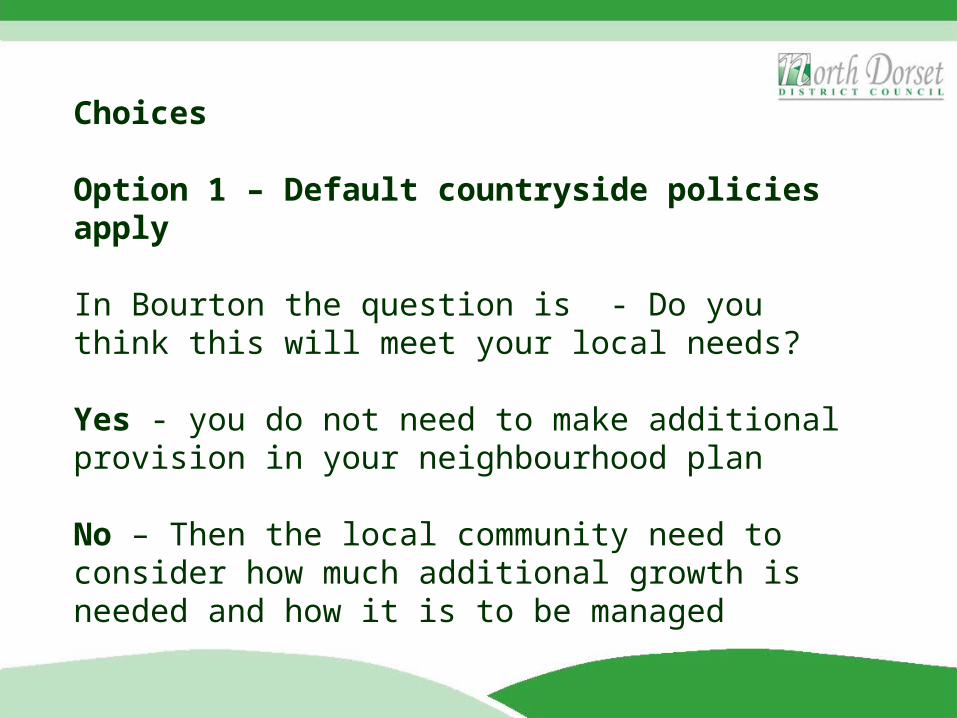
Choices
Option 1 – Default countryside policies apply
In Bourton the question is - Do you think this will meet your local needs?
Yes - you do not need to make additional provision in your neighbourhood plan
No – Then the local community need to consider how much additional growth is needed and how it is to be managed
Option 2 – Review the settlement boundary and have a policy of infilling
However, this is not a simple case of reinstating the 2003 Local Plan boundary as the village of Bourton has changed since this boundary was created in the late 1990s .
A settlement boundary needs to be based on up to date evidence and assessed using a standard criteria.
Option 3 – Allocate specific sites for growth
Identify specific sites throughout the village for growth (this can include market housing and employment land)
The Council suggest that the local community use SHLAA as a basis for identifying sites but you can also call for more sites to be included as part of the appraisal process.
Remember sites need to be deliverable so the land owners need to be on board.
Option 4 - A combination of Options 2 and 3
A settlement boundary with an infilling policy and allocated sites
Option 5 - Meeting Local Needs in the Countryside by ‘Opting in’ to the Local Plan Part 2
As an alternative, or in addition to, meeting local needs for housing, employment or other forms of development through countryside policies and neighbourhood planning communities in Stalbridge and all the District’s villages will be able to ‘opt in’ to Part 2 of the Local Plan that allocates specific sites for housing and employment growth together with other land allocations.
In summary there are 5 choices
Option 1 – Rely on the default countryside policyOption 2 – Additional local growth using a settlement boundary and infilling policiesOption 3 – Additional local growth by allocating specific sites for growthOption 4 – Combination of Option 2 and 3Option 5 – Opting in to the Local Plan Part 2 prepared by the Council for certain types of growth
All options for additional growth will need to be explored through the plan making process and subject to Strategic Environment Assessment (SEA) if one is necessary.
The future ……..