Embed Size (px)
Citation preview
Sea BreezeThe Invisible Tsunami
For the area of NJ & Southeastern PA
By Todd Nixon
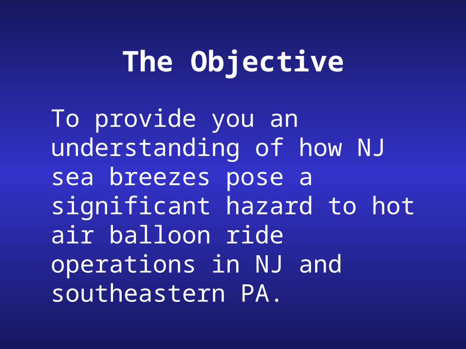
The Objective
To provide you an understanding of how NJ sea breezes pose a significant hazard to hot air balloon ride operations in NJ and southeastern PA.
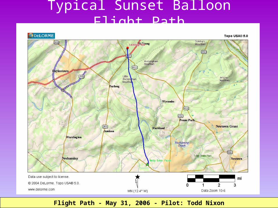
Typical Sunset Balloon Flight Path
Flight Path - May 31, 2006 - Pilot: Todd NixonFlight Path - May 31, 2006 - Pilot: Todd Nixon
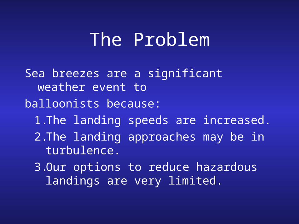
The Problem
Sea breezes are a significant weather event to
balloonists because: 1.The landing speeds are increased.2.The landing approaches may be in
turbulence. 3.Our options to reduce hazardous
landings are very limited.
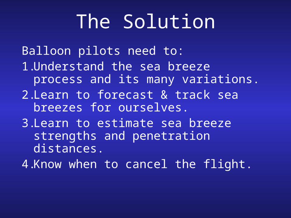
The SolutionBalloon pilots need to: 1.Understand the sea breeze
process and its many variations. 2.Learn to forecast & track sea
breezes for ourselves. 3.Learn to estimate sea breeze
strengths and penetration distances.
4.Know when to cancel the flight.
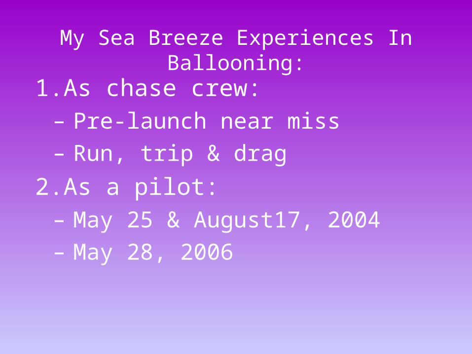
1.As chase crew: – Pre-launch near miss– Run, trip & drag
2.As a pilot: – May 25 & August17, 2004– May 28, 2006
My Sea Breeze Experiences In Ballooning:
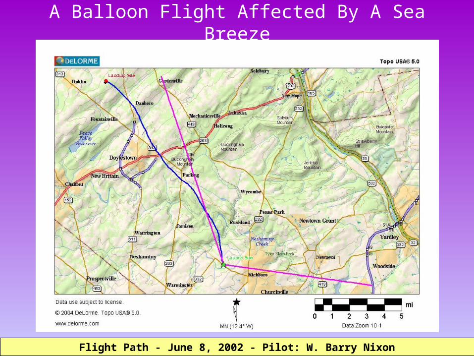
A Balloon Flight Affected By A Sea Breeze
Flight Path - June 8, 2002 - Pilot: W. Barry NixonFlight Path - June 8, 2002 - Pilot: W. Barry Nixon
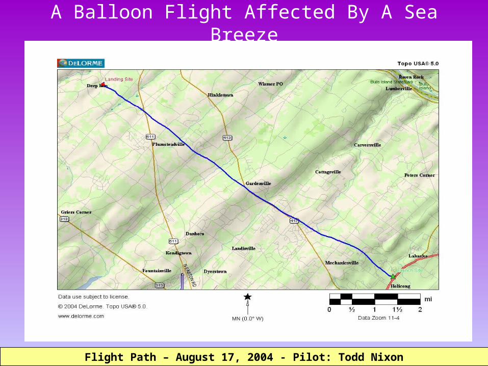
A Balloon Flight Affected By A Sea Breeze
Flight Path – August 17, 2004 - Pilot: Todd NixonFlight Path – August 17, 2004 - Pilot: Todd Nixon

Flying In A Sea BreezeAltitude Speed Bearing
8/17/2004 18:59:23 565 ft 241 ft 00:01:05 2.5 mph 277° true
8/17/2004 19:05:09 1253 ft 266 ft 00:00:25 7.2 mph 318° true
8/17/2004 19:15:22 485 ft 262 ft 00:00:40 4.5 mph 291° true
8/17/2004 19:26:09 846 ft 278 ft 00:00:24 7.9 mph 315° true
8/17/2004 19:31:28 843 ft 285 ft 00:00:22 8.8 mph 305° true
8/17/2004 19:35:10 843 ft 263 ft 00:00:20 9.0 mph 313° true
8/17/2004 19:43:53 833 ft 280 ft 00:00:21 9.1 mph 310° true
8/17/2004 19:56:28 552 ft 266 ft 00:00:31 5.9 mph 304° true
8/17/2004 19:59:44 656 ft 265 ft 00:00:14 12.9 mph 326° true
8/17/2004 20:00:00 600 ft 247 ft 00:00:16 10.5 mph 305° true
8/17/2004 20:00:19 538 ft 257 ft 00:00:19 9.2 mph 305° true
8/17/2004 20:00:56 508 ft 145 ft 00:00:37 2.7 mph 296° true
8/17/2004 20:02:24 494 ft 263 ft 00:01:28 2.0 mph 295° true
8/17/2004 20:03:31 474 ft 260 ft 00:01:07 2.6 mph 293° true
8/17/2004 20:04:36 450 ft 266 ft 00:01:05 2.8 mph 310° true
8/17/2004 20:05:30 436 ft 271 ft 00:00:54 3.4 mph 312° true
8/17/2004 20:10:07 422 ft 153 ft 00:04:37 0.4 mph 14° true
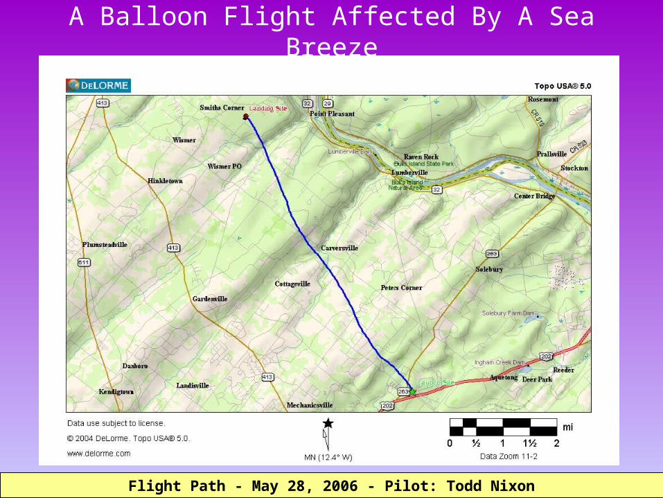
A Balloon Flight Affected By A Sea Breeze
Flight Path - May 28, 2006 - Pilot: Todd NixonFlight Path - May 28, 2006 - Pilot: Todd Nixon
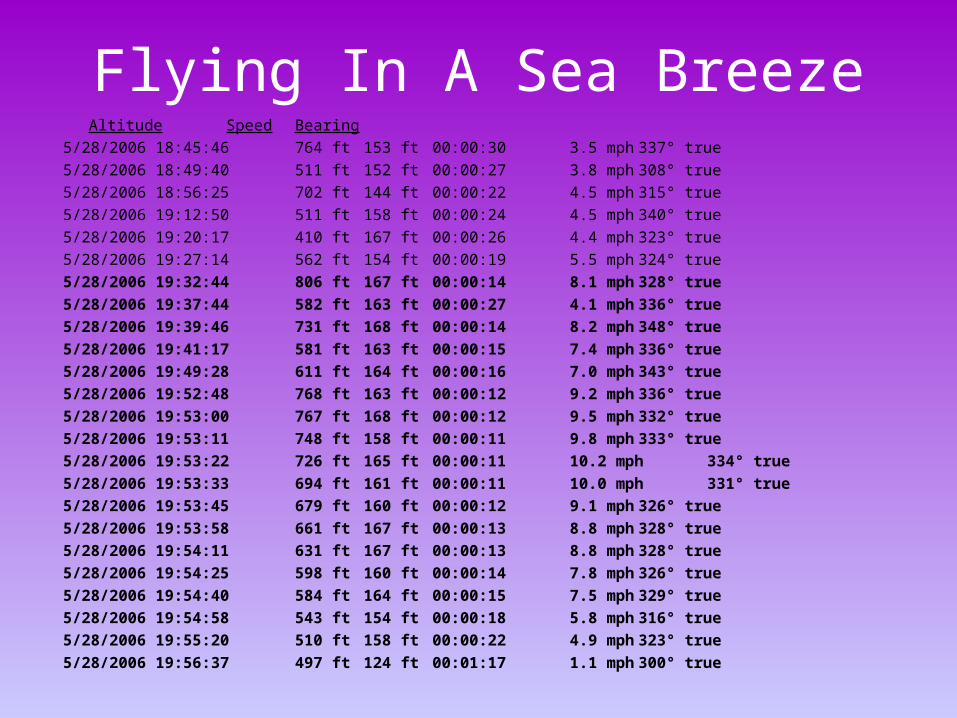
Flying In A Sea BreezeAltitude Speed Bearing
5/28/2006 18:45:46 764 ft 153 ft 00:00:30 3.5 mph 337° true
5/28/2006 18:49:40 511 ft 152 ft 00:00:27 3.8 mph 308° true
5/28/2006 18:56:25 702 ft 144 ft 00:00:22 4.5 mph 315° true
5/28/2006 19:12:50 511 ft 158 ft 00:00:24 4.5 mph 340° true
5/28/2006 19:20:17 410 ft 167 ft 00:00:26 4.4 mph 323° true
5/28/2006 19:27:14 562 ft 154 ft 00:00:19 5.5 mph 324° true
5/28/2006 19:32:44 806 ft 167 ft 00:00:14 8.1 mph 328° true
5/28/2006 19:37:44 582 ft 163 ft 00:00:27 4.1 mph 336° true
5/28/2006 19:39:46 731 ft 168 ft 00:00:14 8.2 mph 348° true
5/28/2006 19:41:17 581 ft 163 ft 00:00:15 7.4 mph 336° true
5/28/2006 19:49:28 611 ft 164 ft 00:00:16 7.0 mph 343° true
5/28/2006 19:52:48 768 ft 163 ft 00:00:12 9.2 mph 336° true
5/28/2006 19:53:00 767 ft 168 ft 00:00:12 9.5 mph 332° true
5/28/2006 19:53:11 748 ft 158 ft 00:00:11 9.8 mph 333° true
5/28/2006 19:53:22 726 ft 165 ft 00:00:11 10.2 mph 334° true
5/28/2006 19:53:33 694 ft 161 ft 00:00:11 10.0 mph 331° true
5/28/2006 19:53:45 679 ft 160 ft 00:00:12 9.1 mph 326° true
5/28/2006 19:53:58 661 ft 167 ft 00:00:13 8.8 mph 328° true
5/28/2006 19:54:11 631 ft 167 ft 00:00:13 8.8 mph 328° true
5/28/2006 19:54:25 598 ft 160 ft 00:00:14 7.8 mph 326° true
5/28/2006 19:54:40 584 ft 164 ft 00:00:15 7.5 mph 329° true
5/28/2006 19:54:58 543 ft 154 ft 00:00:18 5.8 mph 316° true
5/28/2006 19:55:20 510 ft 158 ft 00:00:22 4.9 mph 323° true
5/28/2006 19:56:37 497 ft 124 ft 00:01:17 1.1 mph 300° true
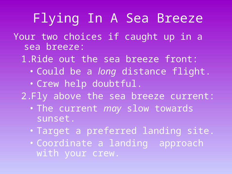
Flying In A Sea BreezeYour two choices if caught up in a sea
breeze: 1.Ride out the sea breeze front:
• Could be a long distance flight.• Crew help doubtful.
2.Fly above the sea breeze current: • The current may slow towards
sunset. • Target a preferred landing site. • Coordinate a landing approach
with your crew.
Flying In A Sea Breeze
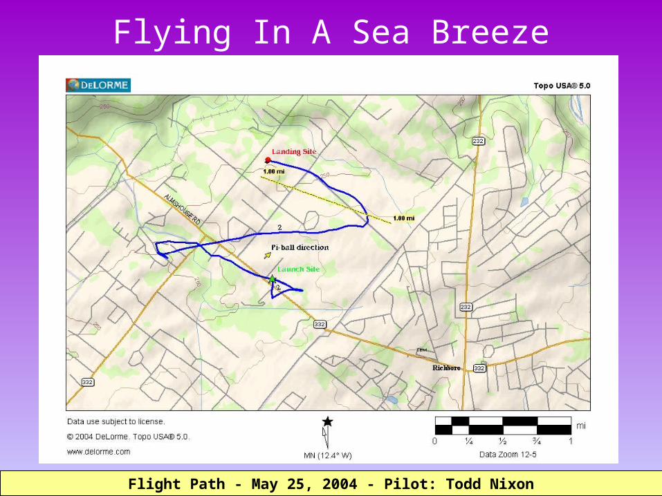
Flight Path - May 25, 2004 - Pilot: Todd NixonFlight Path - May 25, 2004 - Pilot: Todd Nixon

Flying In A Sea Breeze
3D Flight Path - May 25, 2004 - Pilot: Todd Nixon - Image created by Keith Sproul3D Flight Path - May 25, 2004 - Pilot: Todd Nixon - Image created by Keith Sproul
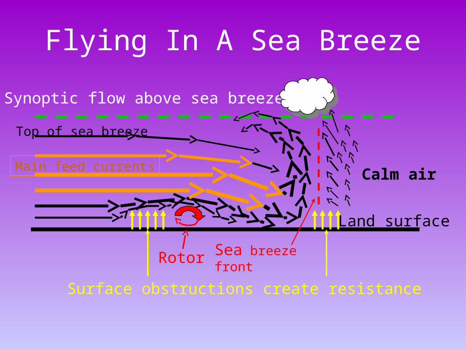
Surface obstructions create resistance
Top of sea breeze
Sea breeze front
Main feed currents
Synoptic flow above sea breeze
Rotor
Calm air
Land surface
Flying In A Sea Breeze
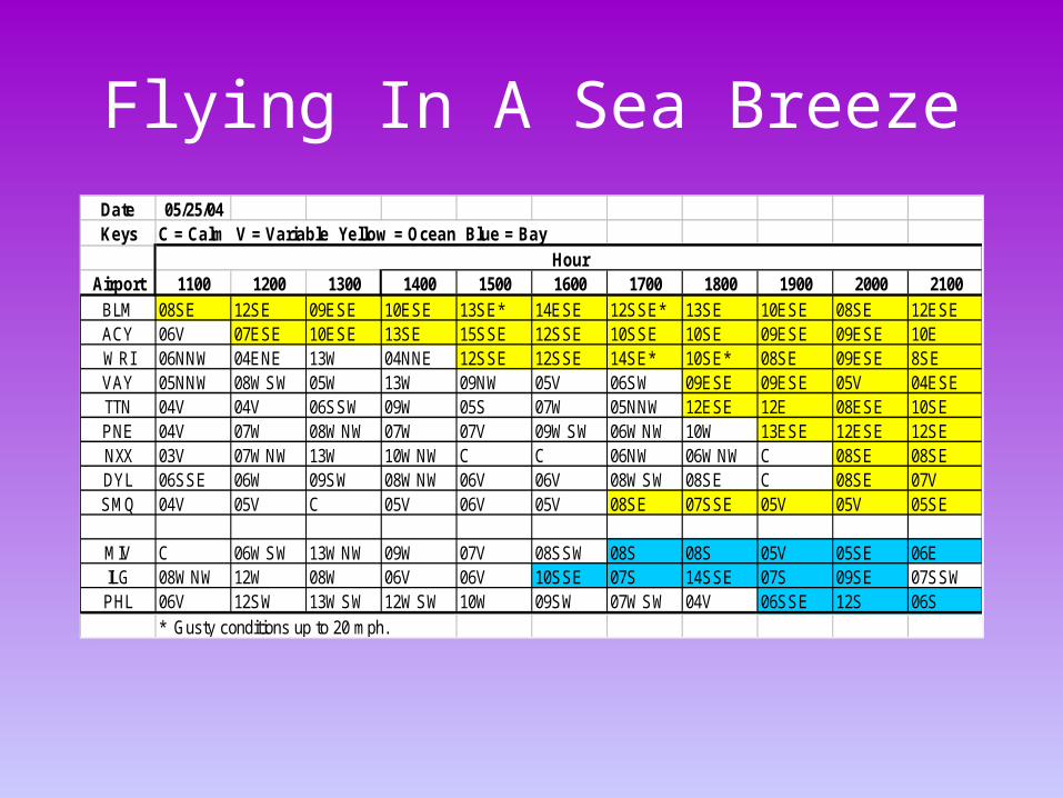
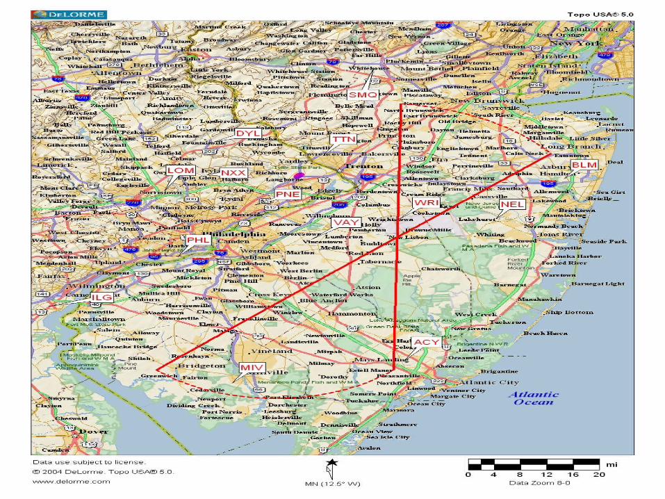
Date 05/25/04Keys C = Calm V = Variable Yellow = Ocean Blue = Bay
Airport 1100 1200 1300 1400 1500 1600 1700 1800 1900 2000 2100BLM 08SE 12SE 09ESE 10ESE 13SE* 14ESE 12SSE* 13SE 10ESE 08SE 12ESEACY 06V 07ESE 10ESE 13SE 15SSE 12SSE 10SSE 10SE 09ESE 09ESE 10EWRI 06NNW 04ENE 13W 04NNE 12SSE 12SSE 14SE* 10SE* 08SE 09ESE 8SEVAY 05NNW 08WSW 05W 13W 09NW 05V 06SW 09ESE 09ESE 05V 04ESETTN 04V 04V 06SSW 09W 05S 07W 05NNW 12ESE 12E 08ESE 10SEPNE 04V 07W 08WNW 07W 07V 09WSW 06WNW 10W 13ESE 12ESE 12SENXX 03V 07WNW 13W 10WNW C C 06NW 06WNW C 08SE 08SEDYL 06SSE 06W 09SW 08WNW 06V 06V 08WSW 08SE C 08SE 07VSMQ 04V 05V C 05V 06V 05V 08SE 07SSE 05V 05V 05SE
MIV C 06WSW 13WNW 09W 07V 08SSW 08S 08S 05V 05SE 06EILG 08WNW 12W 08W 06V 06V 10SSE 07S 14SSE 07S 09SE 07SSWPHL 06V 12SW 13WSW 12WSW 10W 09SW 07WSW 04V 06SSE 12S 06S
* Gusty conditions up to 20 mph.
Hour
Flying In A Sea Breeze

Flying In A Sea Breeze
Flight characteristics vary with each sea breeze:• The strongest current in a sea breeze is typically
between 500 to 1200 feet AGL• Strong sea breezes will have significant turbulence
at the surface and usually advance quickly• Even slow moving sea breeze fronts can still have
significant turbulence • Weak or dissipating sea breezes can become a
gentle wind shift or even decouple from the surface and go unnoticed

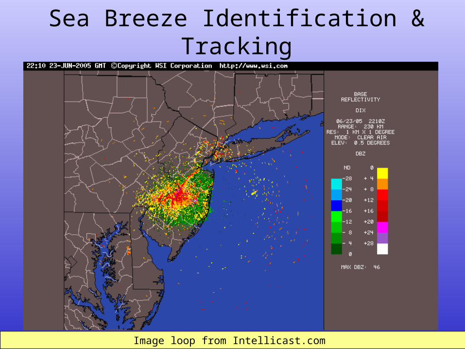
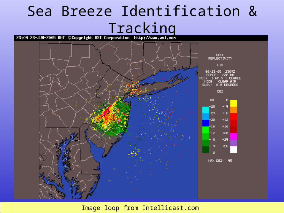
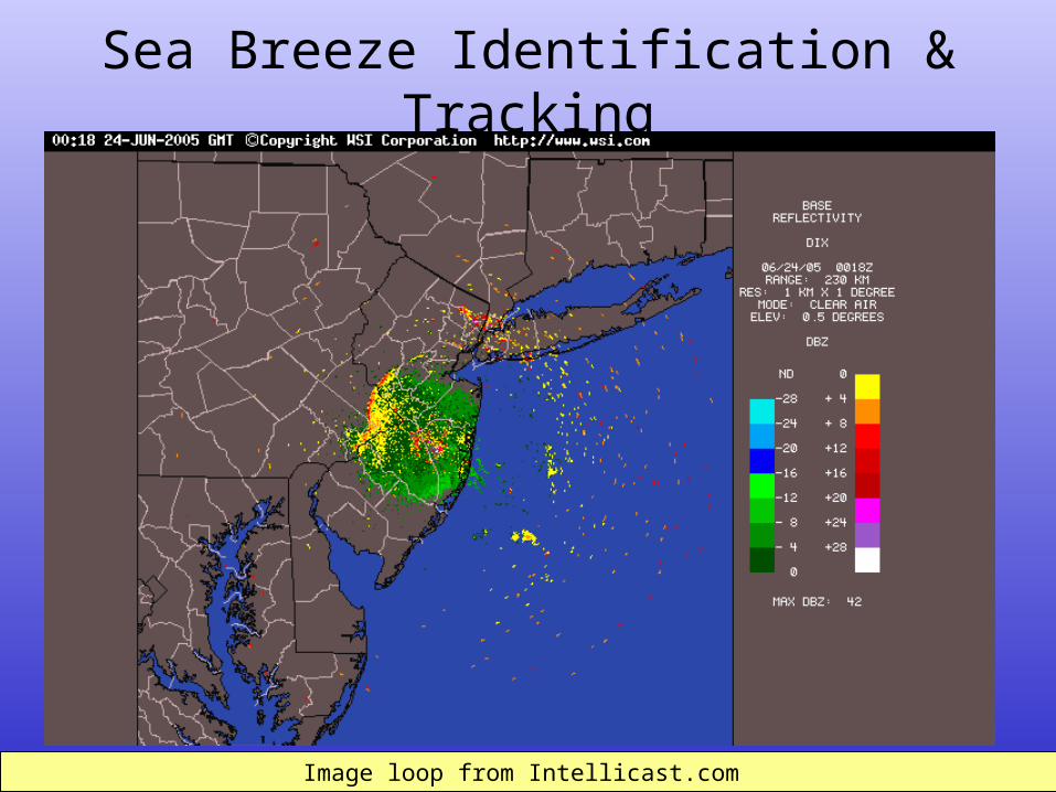
Sea Breeze Identification & Tracking
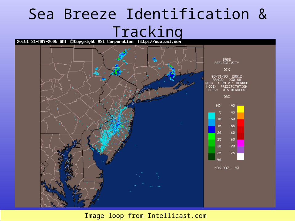
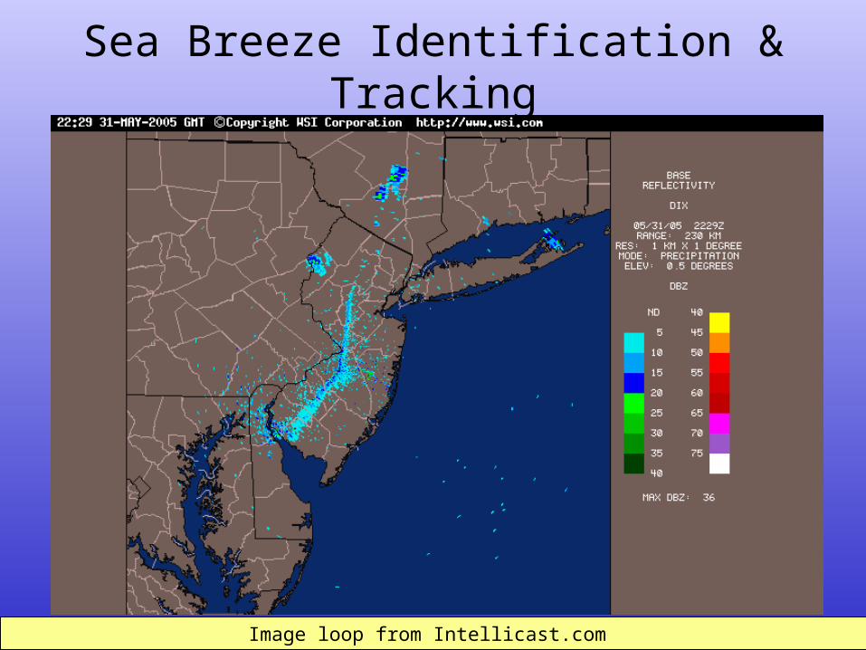
Methods•NEXRAD - Doppler radar •Visual satellite images •Surface weather observations
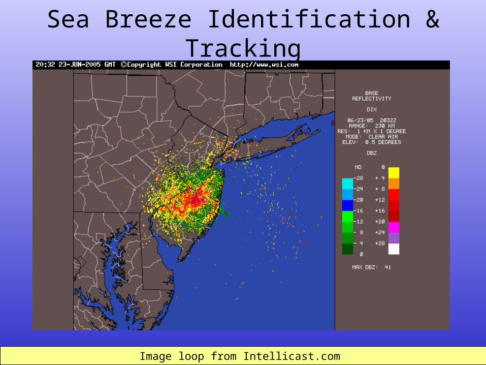
Image loop from Intellicast.com Image loop from Intellicast.com
Sea Breeze Identification & Tracking
Sea Breeze Identification & Tracking
Image loop from Intellicast.com Image loop from Intellicast.com
Sea Breeze Identification & Tracking
Image loop from Intellicast.com Image loop from Intellicast.com
Sea Breeze Identification & Tracking
Image loop from Intellicast.com Image loop from Intellicast.com
Sea Breeze Identification & Tracking
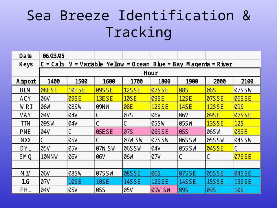
Date 06/23/05Keys
Airport 1400 1500 1600 1700 1800 1900 2000 2100BLM 08ESE 10ESE 09SSE 12SSE 07SSE 08S 06S 07SSWACY 06V 09SE 13ESE 10SE 09SE 12SE 07SSE 06SSEWRI 06W 08SW 09NW 08E 12SSE 14SE 12SSE 09SVAY 04V 04V C 07S 06V 06V 09SE 07SSETTN 09SW 04V C C 05SW 05SW 13SSE 12SPNE 04V C 05ESE 07S 06SSE 05S 06SW 08SENXX C 05V C 07WSW 07SSW 06SSW 05SSW 04SSWDYL 05V 05V 07WSW 06SSW 04V 05SSW 04SSE CSMQ 10NNW 06V 06V 06W 07V C C 07SSE
MIV 06V 08SW 07SSW 08SSE 06S 07SSE 05SSE 04SSEILG 07V 10SE 10SE 14SSE 12SSE 14SSE 15SSE 15SSEPHL 04V 05V 05S 05V 09WSW 09S 09S 10S
HourC = Calm V = Variable Yellow = Ocean Blue = Bay Magenta = River
Sea Breeze Identification & Tracking
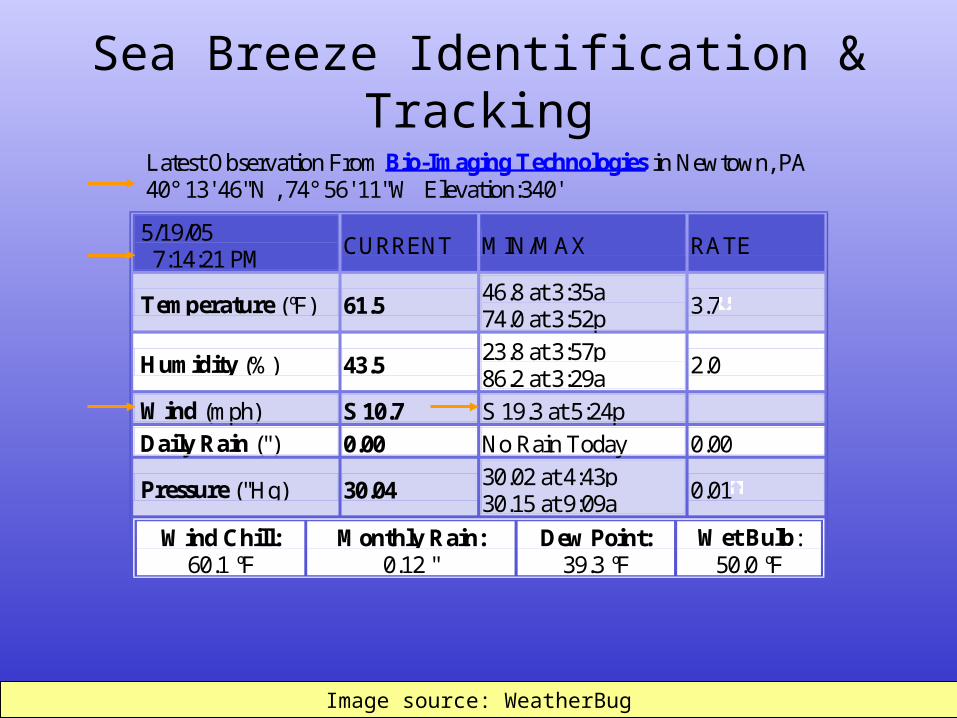
Latest Observation From Bio-Imaging Technologies in Newtown, PA 40° 13' 46"N , 74° 56' 11"W Elevation:340'
5/19/05 7:14:21 PM CURRENT MIN/MAX RATE
Temperature (ºF) 61.5 46.8 at 3:35a 74.0 at 3:52p 3.7
Humidity (%) 43.5 23.8 at 3:57p 86.2 at 3:29a 2.0
Wind (mph) S 10.7 S 19.3 at 5:24p
Daily Rain (") 0.00 No Rain Today 0.00
Pressure ("Hg) 30.04 30.02 at 4:43p 30.15 at 9:09a 0.01
Wind Chill: 60.1 ºF
Monthly Rain: 0.12 "
Dew Point: 39.3 ºF
Wet Bulb: 50.0 ºF
Image source: WeatherBugImage source: WeatherBug
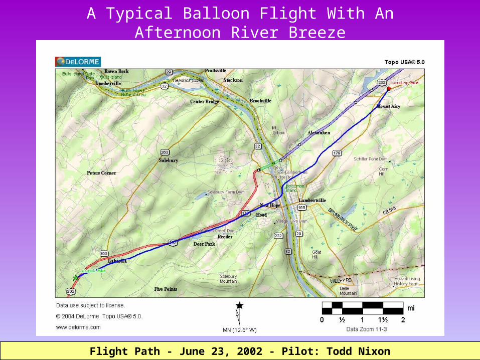
A Typical Balloon Flight With An Afternoon River Breeze
Flight Path - June 23, 2002 - Pilot: Todd NixonFlight Path - June 23, 2002 - Pilot: Todd Nixon
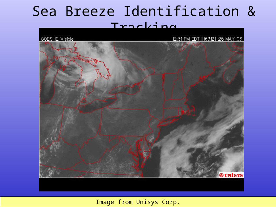
Sea Breeze Identification & Tracking
Image from Unisys Corp.Image from Unisys Corp.
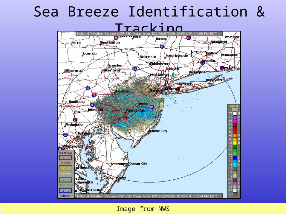
Sea Breeze Identification & Tracking
Image from NWSImage from NWS

Sea Breeze Identification & Tracking
Image from Unisys Corp.Image from Unisys Corp.
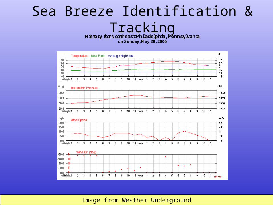
Sea Breeze Identification & Tracking
Image from Weather UndergroundImage from Weather Underground
History for Northeast Philadelphia, Pennsylvania
on Sunday, May 28, 2006
Sea Breeze Identification & Tracking
Image loop from Intellicast.com Image loop from Intellicast.com
Sea Breeze Identification & Tracking
Image loop from Intellicast.com Image loop from Intellicast.com
Closing Remarks
•Sea breezes and other onshore breezes are a dynamic weather event.
•Onshore breeze analysis is time consuming.
•Predicting sea breeze penetration distances is challenging.
• Internet access is vital to the success of my detection and tracking methods.
Closing Remarks
•Wireless Internet access is a great asset on the launch site with an approaching sea breeze.
•Sea breeze spotters are second best to wireless Internet and a great asset while piloting a balloon.
• It would be very helpful if more information about onshore breezes could be included in the afternoon forecast discussions from local NWS offices.

Sea breeze information provided by James Eberwine
National Weather Service – Mt. Holly
Sea breeze research data provided by
Louis Bowers of
Acknowledgements