Embed Size (px)
Citation preview
1
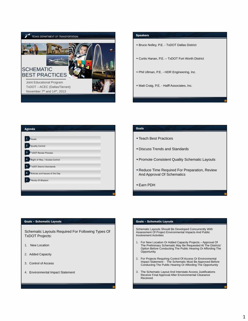
SCHEMATICBEST PRACTICES
Joint Educational Program
TxDOT – ACEC (Dallas/Tarrant)
November 7th and 14th, 2013
Speakers
Bruce Nolley, P.E. - TxDOT Dallas District
Curtis Hanan, P.E. – TxDOT Fort Worth District
Phil Ullman, P.E. - HDR Engineering, Inc.
Matt Craig, P.E. - Halff Associates, Inc.
Agenda
Goals
Quality Control
TxDOT Review Process
Right of Way / Access Control
TxDOT District Standards
Policies and Issues of the Day
Words Of Wisdom
1
2
3
4
5
6
7
Goals
Teach Best Practices
Discuss Trends and Standards
Promote Consistent Quality Schematic Layouts
Reduce Time Required For Preparation, Review And Approval Of Schematics
Earn PDH
Goals – Schematic Layouts
Schematic Layouts Required For Following Types Of TxDOT Projects:
1. New Location
2. Added Capacity
3. Control of Access
4. Environmental Impact Statement
Goals – Schematic Layouts
Schematic Layouts Should Be Developed Concurrently With Assessment Of Project Environmental Impacts And Public Involvement Activities
1. For New Location Or Added Capacity Projects – Approval Of The Preliminary Schematic May Be Requested At The Districts’ Option Before Conducting The Public Hearing Or Affording The Opportunity.
2. For Projects Requiring Control Of Access Or Environmental Impact Statement - The Schematic Must Be Approved Before Conducting The Public Hearing Or Affording The Opportunity
3. The Schematic Layout And Interstate Access Justifications Receive Final Approval After Environmental Clearance Received.
2
Quality Control – Schematic Consistency
Ensure Information Provided On Schematic Is Consistent With Design Intent
1. TxDOT District Schematic Checklist
2. Design Summary Report And Design Criteria Table
3. Ensure Project Limits on Title Block Are Consistent With Limits Shown on Plan And Profile Views
4. Ensure Typical Sections Are Consistent With Existing And Proposed Roadways Shown in Plan View
5. Ensure Horizontal Alignment Data (Tabular) Is Consistent With Plan View
Quality Control - Basic Schematic Requirements
• The Submission Of Schematic Layouts Should Include
The Basic Information Necessary For The Proper Review
And Evaluation Of The Proposed Improvements.
• Project Limits, Functional Classification, Design Speed
• Location Of Mainlanes, Frontage Roads, Cross Streets,
And Ramps
• Existing And Proposed Profiles And Horizontal Alignments
Of Mainlanes, Ramps, And Cross Streets
• Major Guide Signs
Quality Control - Basic Schematic Requirements (cont’d)
Existing And Proposed Right Of Way Limits And
Easements
Bridges And Bridge Class Culverts
Typical Sections
Location Of Retaining Walls And Noise Walls
Existing And Proposed Traffic Volumes (ADT)
Existing And Proposed Control Of Access Lines
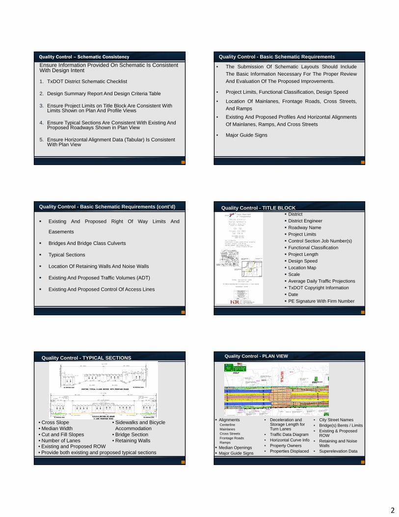
Quality Control - TITLE BLOCK District
District Engineer
Roadway Name
Project Limits
Control Section Job Number(s)
Functional Classification
Project Length
Design Speed
Location Map
Scale
Average Daily Traffic Projections
TxDOT Copyright Information
Date
PE Signature With Firm Number
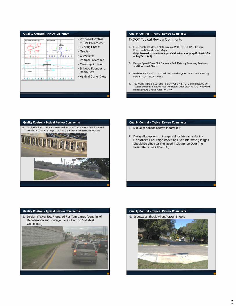
Quality Control - TYPICAL SECTIONS
• Existing and Proposed ROW• Provide both existing and proposed typical sections
• Cross Slope• Median Width• Cut and Fill Slopes• Number of Lanes
• Sidewalks and Bicycle Accommodation
• Bridge Section• Retaining Walls
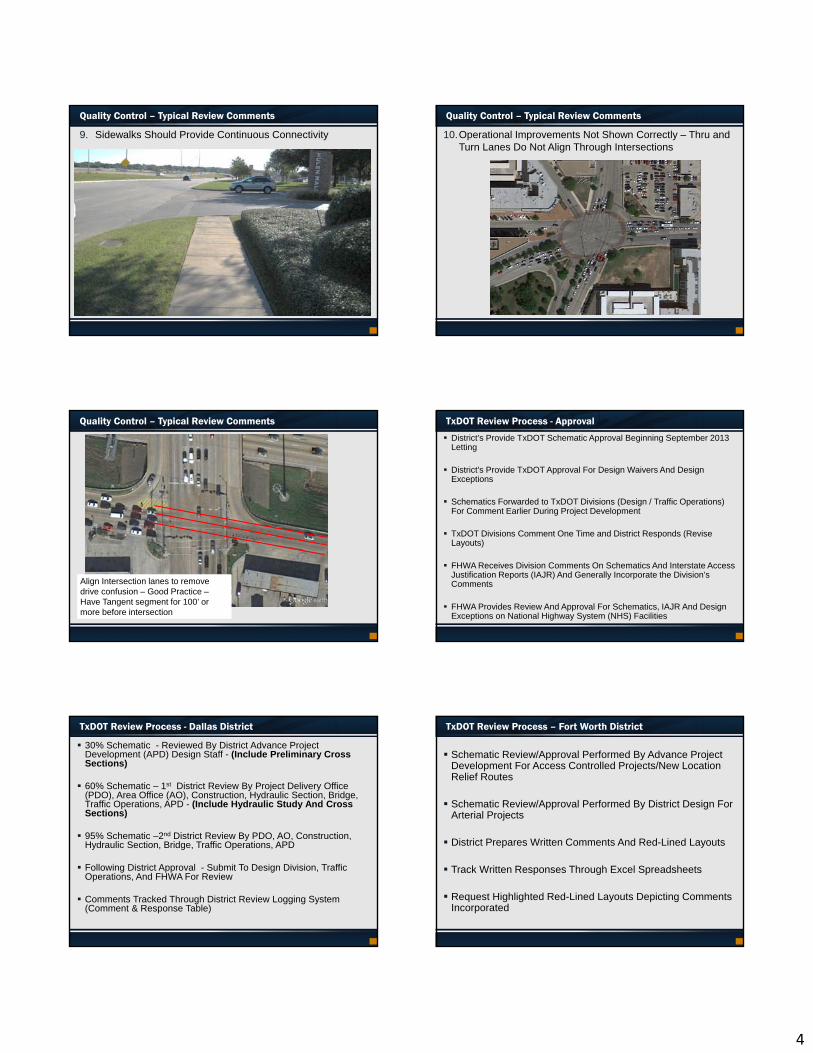
Quality Control - PLAN VIEW
AlignmentsCenterline MainlanesCross StreetsFrontage RoadsRamps
Median Openings Major Guide Signs
• Deceleration and Storage Length for Turn Lanes
• Traffic Data Diagram• Horizontal Curve Info• Property Owners• Properties Displaced
• City Street Names• Bridge(s) Bents / Limits• Existing & Proposed
ROW• Retaining and Noise
Walls• Superelevation Data
3
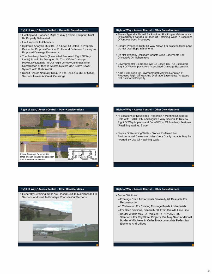
Quality Control - PROFILE VIEW
• Proposed Profiles For All Roadways
• Existing Profile
• Grades
• Elevations
• Vertical Clearance
• Crossing Profiles
• Bridges Spans and Beam Size
• Vertical Curve Data
Quality Control – Typical Review Comments
TxDOT Typical Review Comments
1. Functional Class Does Not Correlate With TxDOT TPP Division Functional Classification Maps (http://www.dot.state.tx.us/apps/statewide_mapping/StatewidePlanningMap.html)
2. Design Speed Does Not Correlate With Existing Roadway Features And Functional Class
3. Horizontal Alignments For Existing Roadways Do Not Match Existing Data In Construction Plans
4. Too Many Typical Sections – Nearly One Half Of Comments Are On Typical Sections That Are Not Consistent With Existing And Proposed Roadways As Shown On Plan View
Quality Control – Typical Review Comments
5. Design Vehicle – Ensure Intersections and Turnarounds Provide Ample Turning Room So Bridge Columns / Barriers / Medians Are Not Hit
Quality Control – Typical Review Comments
6. Denial of Access Shown Incorrectly
7. Design Exceptions not prepared for Minimum Vertical Clearances For Bridge Widening Over Interstate (Bridges Should Be Lifted Or Replaced If Clearance Over The Interstate Is Less Than 16’).
Quality Control – Typical Review Comments
8. Design Waiver Not Prepared For Turn Lanes (Lengths of Deceleration and Storage Lanes That Do Not Meet Guidelines)
9. Sidewalks Should Align Across Streets
Quality Control – Typical Review Comments
4
9. Sidewalks Should Provide Continuous Connectivity
Quality Control – Typical Review Comments Quality Control – Typical Review Comments
10.Operational Improvements Not Shown Correctly – Thru and Turn Lanes Do Not Align Through Intersections
Align Intersection lanes to remove drive confusion – Good Practice –Have Tangent segment for 100’ or more before intersection
Quality Control – Typical Review Comments TxDOT Review Process - Approval
District’s Provide TxDOT Schematic Approval Beginning September 2013 Letting
District’s Provide TxDOT Approval For Design Waivers And Design Exceptions
Schematics Forwarded to TxDOT Divisions (Design / Traffic Operations) For Comment Earlier During Project Development
TxDOT Divisions Comment One Time and District Responds (Revise Layouts)
FHWA Receives Division Comments On Schematics And Interstate Access Justification Reports (IAJR) And Generally Incorporate the Division’s Comments
FHWA Provides Review And Approval For Schematics, IAJR And Design Exceptions on National Highway System (NHS) Facilities
TxDOT Review Process - Dallas District
30% Schematic - Reviewed By District Advance Project Development (APD) Design Staff - (Include Preliminary Cross Sections)
60% Schematic – 1st District Review By Project Delivery Office (PDO), Area Office (AO), Construction, Hydraulic Section, Bridge, Traffic Operations, APD - (Include Hydraulic Study And Cross Sections)
95% Schematic –2nd District Review By PDO, AO, Construction, Hydraulic Section, Bridge, Traffic Operations, APD
Following District Approval - Submit To Design Division, Traffic Operations, And FHWA For Review
Comments Tracked Through District Review Logging System (Comment & Response Table)
TxDOT Review Process – Fort Worth District
Schematic Review/Approval Performed By Advance Project Development For Access Controlled Projects/New Location Relief Routes
Schematic Review/Approval Performed By District Design For Arterial Projects
District Prepares Written Comments And Red-Lined Layouts
Track Written Responses Through Excel Spreadsheets
Request Highlighted Red-Lined Layouts Depicting Comments Incorporated
5
Right of Way / Access Control – Hydraulic Considerations
Existing And Proposed Right of Way (Project Footprint) Must Be Properly Delineated
Limit Impacts To Channels
Hydraulic Analysis Must Be To A Level Of Detail To Properly Define the Proposed Vertical Profile and Delineate Existing and Proposed Drainage Easements
The Roadway Profile (Associated Proposed Right Of Way Limits) Should Be Designed So That Offsite Drainage Previously Draining To Our Right Of Way Continues After Construction (Either To A Ditch System Or A Storm Sewer System With Curb Inlets)
Runoff Should Normally Drain To The Top Of Curb For Urban Sections Unless At Creek Crossings
Right of Way / Access Control – Other Considerations
Slopes Typically Should Be Provided For Proper Maintenance Of Roadway Features In Place Of Retaining Walls In Locations Of Undeveloped Properties
Ensure Proposed Right Of Way Allows For Slopes/Ditches And Do Not Use Slope Easements
Do Not Typically Delineate Construction Easements For Driveways On Schematics
Environmental Clearance Will Be Based On The Estimated Right Of Way Impacts And Associated Drainage Easements
A Re-Evaluation for Environmental May Be Required If Proposed Right Of Way And Drainage Easements Acreages Not Estimated Properly
Right of Way / Access Control – Other Considerations
Insure Drainage Easement is large enough to allow construction and maintenance access.
Right of Way / Access Control – Other Considerations
At Locations of Developed Properties A Meeting Should Be Held With TxDOT PM and Right Of Way Section To Review Right Of Way Impacts and Benefit/Cost Of Roadway Features (Retaining Wall vs. Slope)
Slopes Or Retaining Walls – Slopes Preferred For Environmental Clearance Unless Very Costly Impacts May Be Averted By Use Of Retaining Walls
Right of Way / Access Control – Other Considerations
Generally Retaining Walls Are Placed Next To Mainlanes In Fill Sections And Next To Frontage Roads In Cut Sections
Right of Way / Access Control – Other Considerations
Border Widths –
– Frontage Road And Arterials Generally 20’ Desirable For Reconstruction
– 15’ Minimum For Existing Frontage Roads And Arterials
– For Ditch Sections, Generally 30’ From Outside Lane Line
– Border Widths May Be Reduced To 8’ By AASHTOStandards For City Street Projects But May Need Additional Border Width Areas In Order To Accommodate Pedestrian Elements And Utilities
6
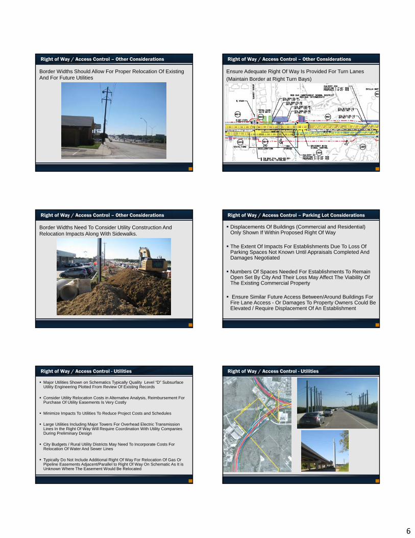
Right of Way / Access Control – Other Considerations
Border Widths Should Allow For Proper Relocation Of Existing And For Future Utilities
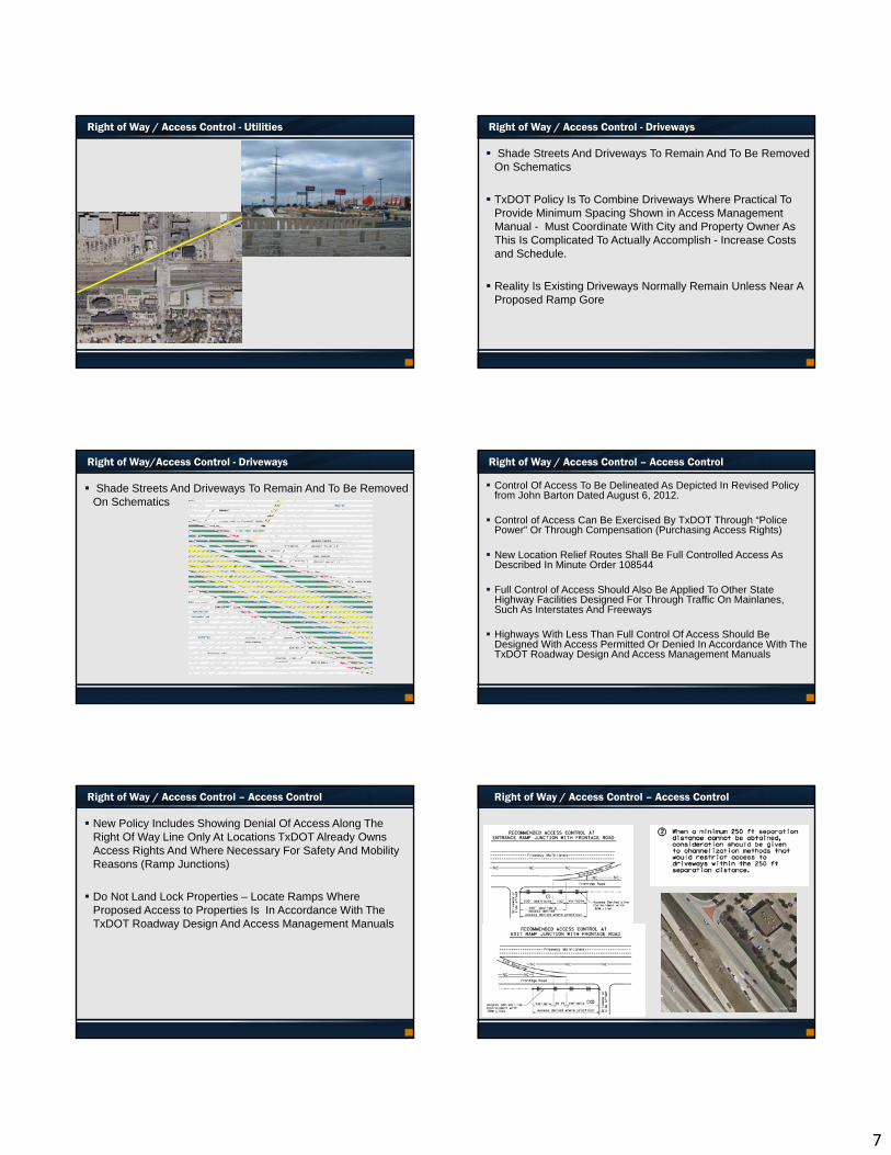
Right of Way / Access Control – Other Considerations
Ensure Adequate Right Of Way Is Provided For Turn Lanes
(Maintain Border at Right Turn Bays)
Right of Way / Access Control – Other Considerations
Border Widths Need To Consider Utility Construction And Relocation Impacts Along With Sidewalks.
Right of Way / Access Control – Parking Lot Considerations
Displacements Of Buildings (Commercial and Residential) Only Shown If Within Proposed Right Of Way
The Extent Of Impacts For Establishments Due To Loss Of Parking Spaces Not Known Until Appraisals Completed And Damages Negotiated
Numbers Of Spaces Needed For Establishments To Remain Open Set By City And Their Loss May Affect The Viability Of The Existing Commercial Property
Ensure Similar Future Access Between/Around Buildings For Fire Lane Access - Or Damages To Property Owners Could Be Elevated / Require Displacement Of An Establishment
Right of Way / Access Control - Utilities
Major Utilities Shown on Schematics Typically Quality Level “D” Subsurface Utility Engineering Plotted From Review Of Existing Records
Consider Utility Relocation Costs in Alternative Analysis, Reimbursement For Purchase Of Utility Easements Is Very Costly
Minimize Impacts To Utilities To Reduce Project Costs and Schedules
Large Utilities Including Major Towers For Overhead Electric Transmission Lines In the Right Of Way Will Require Coordination With Utility Companies During Preliminary Design
City Budgets / Rural Utility Districts May Need To Incorporate Costs For Relocation Of Water And Sewer Lines
Typically Do Not Include Additional Right Of Way For Relocation Of Gas Or Pipeline Easements Adjacent/Parallel to Right Of Way On Schematic As It is Unknown Where The Easement Would Be Relocated
Right of Way / Access Control - Utilities
7
Right of Way / Access Control - Utilities Right of Way / Access Control - Driveways
Shade Streets And Driveways To Remain And To Be Removed On Schematics
TxDOT Policy Is To Combine Driveways Where Practical To Provide Minimum Spacing Shown in Access Management Manual - Must Coordinate With City and Property Owner As This Is Complicated To Actually Accomplish - Increase Costs and Schedule.
Reality Is Existing Driveways Normally Remain Unless Near A Proposed Ramp Gore
Right of Way/Access Control - Driveways
Shade Streets And Driveways To Remain And To Be Removed On Schematics
Right of Way / Access Control – Access Control
Control Of Access To Be Delineated As Depicted In Revised Policy from John Barton Dated August 6, 2012.
Control of Access Can Be Exercised By TxDOT Through “Police Power” Or Through Compensation (Purchasing Access Rights)
New Location Relief Routes Shall Be Full Controlled Access As Described In Minute Order 108544
Full Control of Access Should Also Be Applied To Other State Highway Facilities Designed For Through Traffic On Mainlanes, Such As Interstates And Freeways
Highways With Less Than Full Control Of Access Should Be Designed With Access Permitted Or Denied In Accordance With The TxDOT Roadway Design And Access Management Manuals
Right of Way / Access Control – Access Control
New Policy Includes Showing Denial Of Access Along The Right Of Way Line Only At Locations TxDOT Already Owns Access Rights And Where Necessary For Safety And Mobility Reasons (Ramp Junctions)
Do Not Land Lock Properties – Locate Ramps Where Proposed Access to Properties Is In Accordance With The TxDOT Roadway Design And Access Management Manuals
Right of Way / Access Control – Access Control

8
Right of Way / Access Control – Examples of Channelization Right of Way / Access Control – Examples of Channelization
Right of Way / Access Control – Examples of Channelization Right of Way / Access Control – Access Control
Policies For Determining If Compensation Should Be Paid To Abutting Property Owner Due To Control Of Access Rights
Scenario 1 –Land Acquired And New Access Locations Shown To Be Denied The Access Control Line Must Be Appraised Using The Standard Of Material Impairment And Described In The Legal description And Survey Plat Attached To Deed.
Scenario 2 – No Land Acquired And New Access Locations Shown To Be Denied The Access Control Line Must Be Appraised Using The Standard Of Material Impairment. There Will Only Be A Purchase And Acquisition Of An Access Only Parcel If There Is A “Material Impairment Of Direct Access On Or Off The Remaining Property That Affects The Market Value Of The Remaining Property”. Otherwise The Access Will Be Controlled Through “Police Powers”
Consider Workshop With TxDOT Project Manager (PM), City Staff And Right Of Way Appraiser During Initial Phases Of Project Development
Right of Way / Access Control – Access Control Right of Way / Access Control – Access Control
ACCESS CONTROL AT NORTH END OF PROJECT
ACCESS CONTROL AT SOUTH END OF PROJECT
9
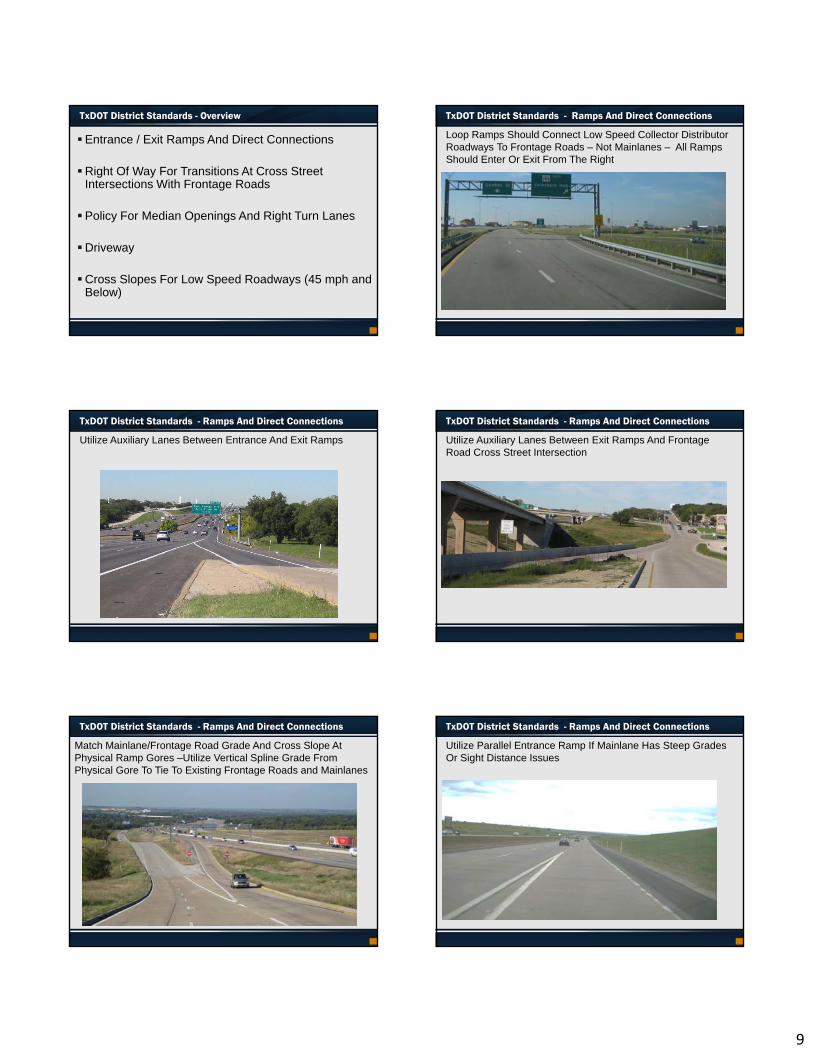
TxDOT District Standards - Overview
Entrance / Exit Ramps And Direct Connections
Right Of Way For Transitions At Cross Street Intersections With Frontage Roads
Policy For Median Openings And Right Turn Lanes
Driveway
Cross Slopes For Low Speed Roadways (45 mph and Below)
TxDOT District Standards - Ramps And Direct Connections
Loop Ramps Should Connect Low Speed Collector Distributor Roadways To Frontage Roads – Not Mainlanes – All Ramps Should Enter Or Exit From The Right
TxDOT District Standards - Ramps And Direct Connections
Utilize Auxiliary Lanes Between Entrance And Exit Ramps
TxDOT District Standards - Ramps And Direct Connections
Utilize Auxiliary Lanes Between Exit Ramps And Frontage Road Cross Street Intersection
TxDOT District Standards - Ramps And Direct Connections
Match Mainlane/Frontage Road Grade And Cross Slope At Physical Ramp Gores –Utilize Vertical Spline Grade From Physical Gore To Tie To Existing Frontage Roads and Mainlanes
TxDOT District Standards - Ramps And Direct Connections
Utilize Parallel Entrance Ramp If Mainlane Has Steep Grades Or Sight Distance Issues
10
TxDOT District Standards - Ramps And Direct Connections
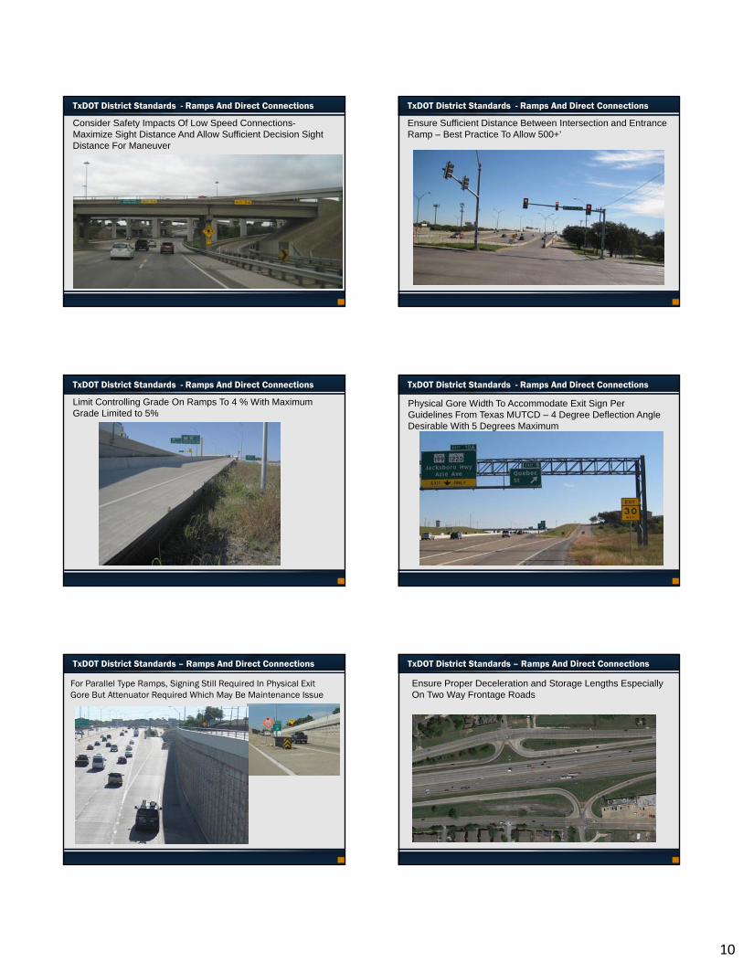
Consider Safety Impacts Of Low Speed Connections-Maximize Sight Distance And Allow Sufficient Decision Sight Distance For Maneuver
TxDOT District Standards - Ramps And Direct Connections
Ensure Sufficient Distance Between Intersection and Entrance Ramp – Best Practice To Allow 500+’
TxDOT District Standards - Ramps And Direct Connections
Limit Controlling Grade On Ramps To 4 % With Maximum Grade Limited to 5%
Physical Gore Width To Accommodate Exit Sign Per Guidelines From Texas MUTCD – 4 Degree Deflection Angle Desirable With 5 Degrees Maximum
TxDOT District Standards - Ramps And Direct Connections
TxDOT District Standards – Ramps And Direct Connections
For Parallel Type Ramps, Signing Still Required In Physical Exit Gore But Attenuator Required Which May Be Maintenance Issue
Ensure Proper Deceleration and Storage Lengths Especially On Two Way Frontage Roads
TxDOT District Standards – Ramps And Direct Connections
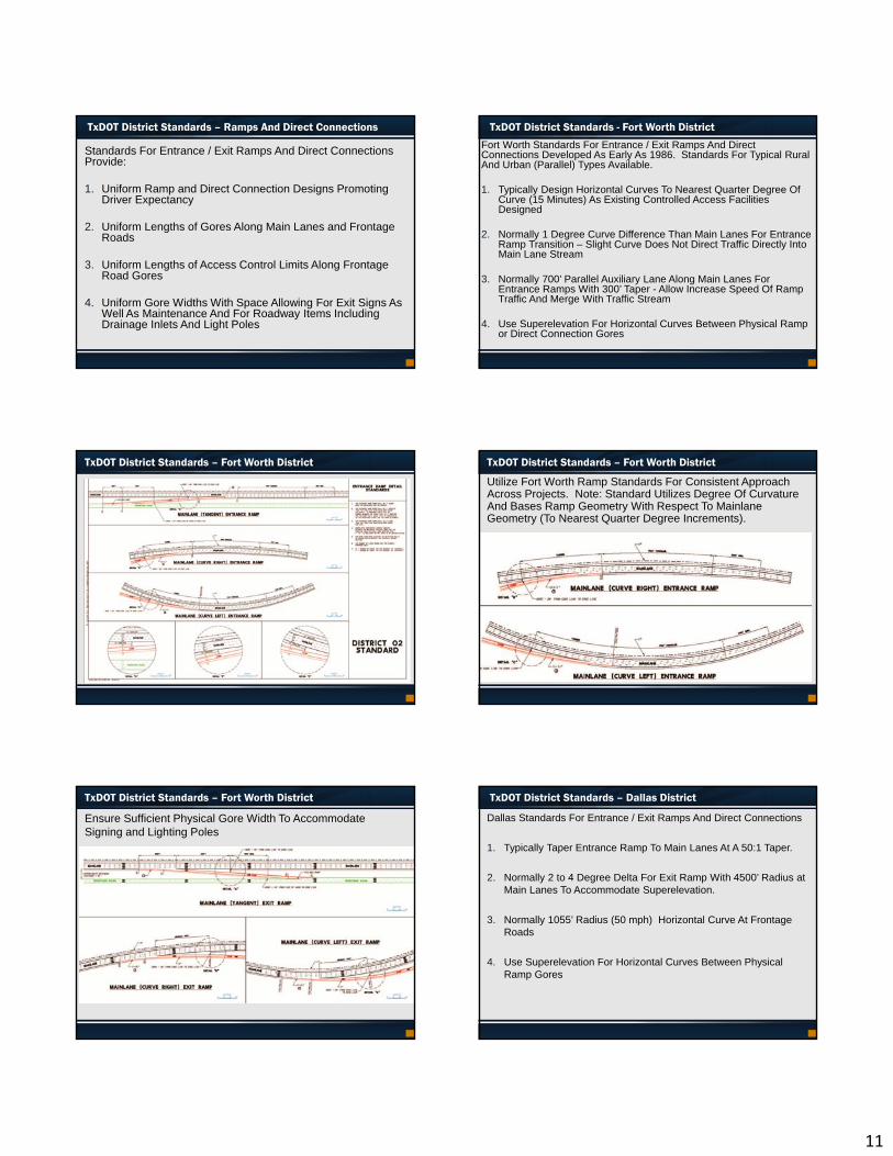
11
TxDOT District Standards – Ramps And Direct Connections
Standards For Entrance / Exit Ramps And Direct Connections Provide:
1. Uniform Ramp and Direct Connection Designs Promoting Driver Expectancy
2. Uniform Lengths of Gores Along Main Lanes and Frontage Roads
3. Uniform Lengths of Access Control Limits Along Frontage Road Gores
4. Uniform Gore Widths With Space Allowing For Exit Signs As Well As Maintenance And For Roadway Items Including Drainage Inlets And Light Poles
TxDOT District Standards - Fort Worth District
Fort Worth Standards For Entrance / Exit Ramps And Direct Connections Developed As Early As 1986. Standards For Typical Rural And Urban (Parallel) Types Available.
1. Typically Design Horizontal Curves To Nearest Quarter Degree Of Curve (15 Minutes) As Existing Controlled Access Facilities Designed
2. Normally 1 Degree Curve Difference Than Main Lanes For Entrance Ramp Transition – Slight Curve Does Not Direct Traffic Directly Into Main Lane Stream
3. Normally 700’ Parallel Auxiliary Lane Along Main Lanes For Entrance Ramps With 300’ Taper - Allow Increase Speed Of Ramp Traffic And Merge With Traffic Stream
4. Use Superelevation For Horizontal Curves Between Physical Ramp or Direct Connection Gores
TxDOT District Standards – Fort Worth District
Utilize Fort Worth Ramp Standards For Consistent Approach Across Projects. Note: Standard Utilizes Degree Of Curvature And Bases Ramp Geometry With Respect To Mainlane Geometry (To Nearest Quarter Degree Increments).
TxDOT District Standards – Fort Worth District
TxDOT District Standards – Fort Worth District
Ensure Sufficient Physical Gore Width To Accommodate Signing and Lighting Poles
TxDOT District Standards – Dallas District
Dallas Standards For Entrance / Exit Ramps And Direct Connections
1. Typically Taper Entrance Ramp To Main Lanes At A 50:1 Taper.
2. Normally 2 to 4 Degree Delta For Exit Ramp With 4500’ Radius at Main Lanes To Accommodate Superelevation.
3. Normally 1055’ Radius (50 mph) Horizontal Curve At Frontage Roads
4. Use Superelevation For Horizontal Curves Between Physical Ramp Gores
12
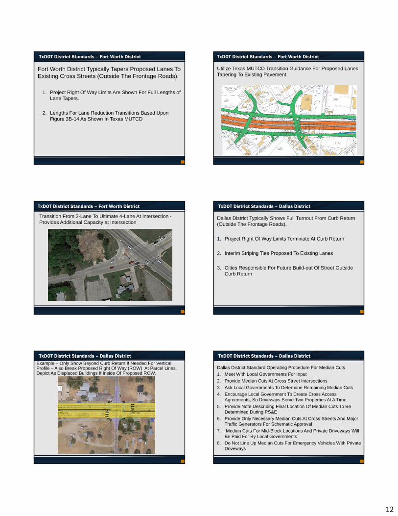
TxDOT District Standards – Fort Worth District
Fort Worth District Typically Tapers Proposed Lanes To Existing Cross Streets (Outside The Frontage Roads).
1. Project Right Of Way Limits Are Shown For Full Lengths of Lane Tapers.
2. Lengths For Lane Reduction Transitions Based Upon Figure 3B-14 As Shown In Texas MUTCD
Utilize Texas MUTCD Transition Guidance For Proposed Lanes Tapering To Existing Pavement
TxDOT District Standards – Fort Worth District
TxDOT District Standards – Fort Worth District
Transition From 2-Lane To Ultimate 4-Lane At Intersection -Provides Additional Capacity at Intersection
TxDOT District Standards – Dallas District
Dallas District Typically Shows Full Turnout From Curb Return (Outside The Frontage Roads).
1. Project Right Of Way Limits Terminate At Curb Return
2. Interim Striping Ties Proposed To Existing Lanes
3. Cities Responsible For Future Build-out Of Street Outside Curb Return
TxDOT District Standards – Dallas DistrictExample – Only Show Beyond Curb Return If Needed For Vertical Profile – Also Break Proposed Right Of Way (ROW) At Parcel Lines. Depict As Displaced Buildings If Inside Of Proposed ROW.
TxDOT District Standards – Dallas District
Dallas District Standard Operating Procedure For Median Cuts
1. Meet With Local Governments For Input
2. Provide Median Cuts At Cross Street Intersections
3. Ask Local Governments To Determine Remaining Median Cuts
4. Encourage Local Government To Create Cross Access Agreements, So Driveways Serve Two Properties At A Time
5. Provide Note Describing Final Location Of Median Cuts To Be Determined During PS&E
6. Provide Only Necessary Median Cuts At Cross Streets And Major Traffic Generators For Schematic Approval
7. Median Cuts For Mid-Block Locations And Private Driveways Will Be Paid For By Local Governments
8. Do Not Line Up Median Cuts For Emergency Vehicles With Private Driveways
13
TxDOT District Standards – Dallas District
Dallas District Standard Operating Procedure For Turn Lanes
1. Meet With Local Government For Input
2. Consider Providing Turn Lanes For Malls Or Other High Traffic Generators
3. Level Of Service Analysis And TxDOT TPP Traffic Volumes Are Required
4. Also Use Engineering Judgment
5. Non-Warranted Extra Turn Lanes Will Be Paid For By Local Governments
6. Ensure Adequate Right Of Way Is Provided For Turn Lanes
7. Consider Increasing Storage Lengths At Texas U-Turns
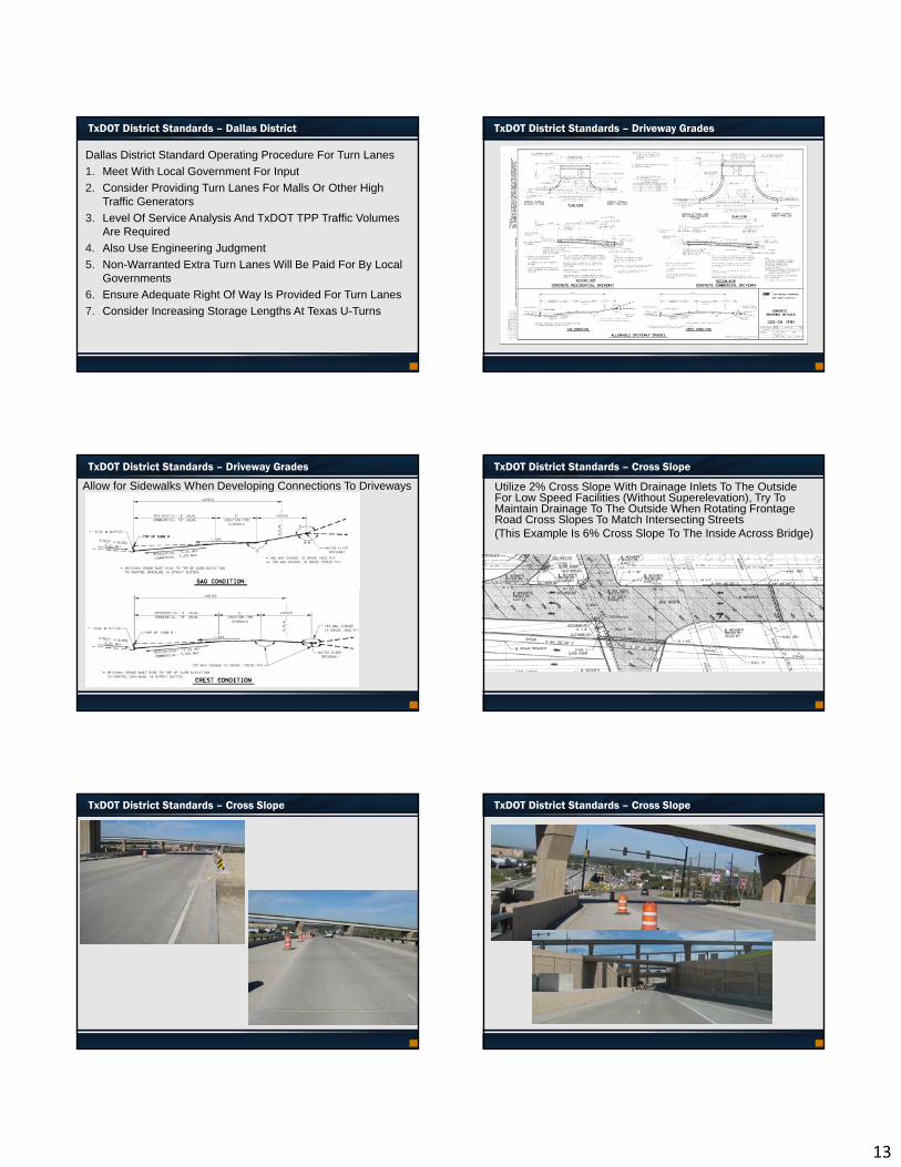
TxDOT District Standards – Driveway Grades
TxDOT District Standards – Driveway Grades
Allow for Sidewalks When Developing Connections To Driveways
TxDOT District Standards – Cross Slope
Utilize 2% Cross Slope With Drainage Inlets To The Outside For Low Speed Facilities (Without Superelevation), Try To Maintain Drainage To The Outside When Rotating Frontage Road Cross Slopes To Match Intersecting Streets (This Example Is 6% Cross Slope To The Inside Across Bridge)
TxDOT District Standards – Cross Slope TxDOT District Standards – Cross Slope
14
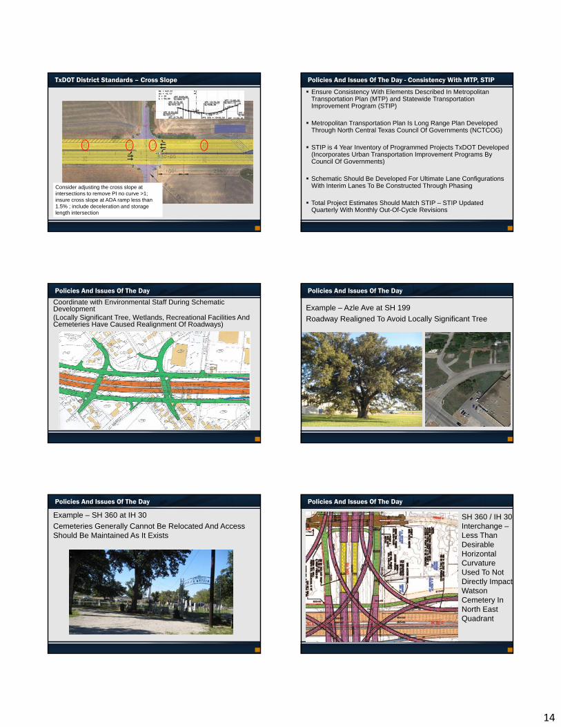
TxDOT District Standards – Cross Slope
Consider adjusting the cross slope at intersections to remove PI no curve >1; insure cross slope at ADA ramp less than 1.5% ; include deceleration and storage length intersection
Policies And Issues Of The Day - Consistency With MTP, STIP
Ensure Consistency With Elements Described In Metropolitan Transportation Plan (MTP) and Statewide Transportation Improvement Program (STIP)
Metropolitan Transportation Plan Is Long Range Plan Developed Through North Central Texas Council Of Governments (NCTCOG)
STIP is 4 Year Inventory of Programmed Projects TxDOT Developed (Incorporates Urban Transportation Improvement Programs By Council Of Governments)
Schematic Should Be Developed For Ultimate Lane Configurations With Interim Lanes To Be Constructed Through Phasing
Total Project Estimates Should Match STIP – STIP Updated Quarterly With Monthly Out-Of-Cycle Revisions
Policies And Issues Of The Day
Coordinate with Environmental Staff During Schematic Development (Locally Significant Tree, Wetlands, Recreational Facilities And Cemeteries Have Caused Realignment Of Roadways)
Policies And Issues Of The Day
Example – Azle Ave at SH 199
Roadway Realigned To Avoid Locally Significant Tree
Policies And Issues Of The Day
Example – SH 360 at IH 30
Cemeteries Generally Cannot Be Relocated And Access Should Be Maintained As It Exists
Policies And Issues Of The Day
SH 360 / IH 30 Interchange –Less Than Desirable Horizontal Curvature Used To Not Directly Impact Watson Cemetery In North East Quadrant
15
Policies And Issues Of The Day
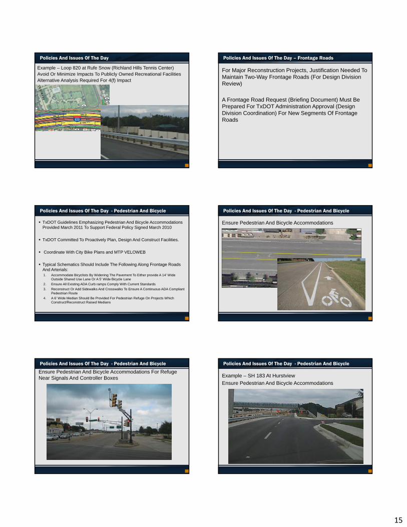
Example – Loop 820 at Rufe Snow (Richland Hills Tennis Center)Avoid Or Minimize Impacts To Publicly Owned Recreational FacilitiesAlternative Analysis Required For 4(f) Impact
Policies And Issues Of The Day – Frontage Roads
For Major Reconstruction Projects, Justification Needed To Maintain Two-Way Frontage Roads (For Design Division Review)
A Frontage Road Request (Briefing Document) Must Be Prepared For TxDOT Administration Approval (Design Division Coordination) For New Segments Of Frontage Roads
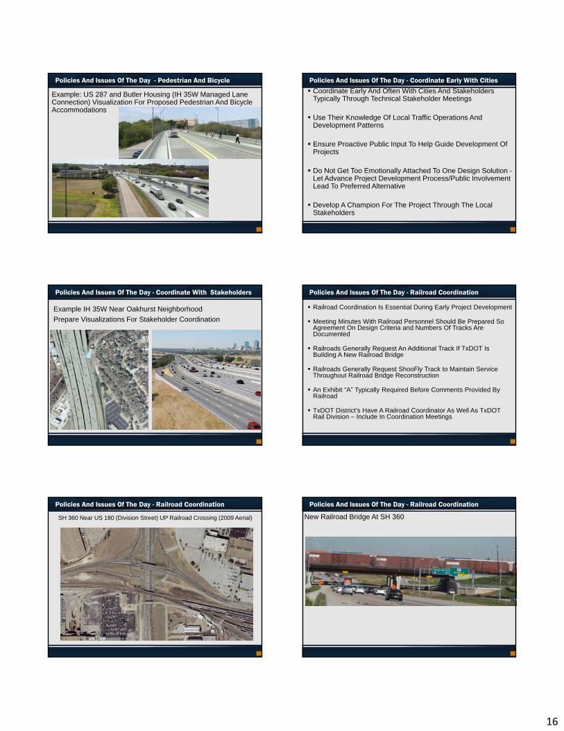
Policies And Issues Of The Day - Pedestrian And Bicycle
TxDOT Guidelines Emphasizing Pedestrian And Bicycle Accommodations Provided March 2011 To Support Federal Policy Signed March 2010
TxDOT Committed To Proactively Plan, Design And Construct Facilities.
Coordinate With City Bike Plans and MTP VELOWEB
Typical Schematics Should Include The Following Along Frontage Roads And Arterials:1. Accommodate Bicyclists By Widening The Pavement To Either provide A 14’ Wide
Outside Shared Use Lane Or A 5’ Wide Bicycle Lane
2. Ensure All Existing ADA Curb ramps Comply With Current Standards
3. Reconstruct Or Add Sidewalks And Crosswalks To Ensure A Continuous ADA Compliant Pedestrian Route
4. A 6’ Wide Median Should Be Provided For Pedestrian Refuge On Projects Which Construct/Reconstruct Raised Medians
Policies And Issues Of The Day - Pedestrian And Bicycle
Ensure Pedestrian And Bicycle Accommodations
Policies And Issues Of The Day - Pedestrian And Bicycle
Ensure Pedestrian And Bicycle Accommodations For Refuge Near Signals And Controller Boxes
Policies And Issues Of The Day - Pedestrian And Bicycle
Example – SH 183 At Hurstview
Ensure Pedestrian And Bicycle Accommodations
16
Policies And Issues Of The Day - Pedestrian And Bicycle
Example: US 287 and Butler Housing (IH 35W Managed Lane Connection) Visualization For Proposed Pedestrian And Bicycle Accommodations
Policies And Issues Of The Day - Coordinate Early With Cities
Coordinate Early And Often With Cities And Stakeholders Typically Through Technical Stakeholder Meetings
Use Their Knowledge Of Local Traffic Operations And Development Patterns
Ensure Proactive Public Input To Help Guide Development Of Projects
Do Not Get Too Emotionally Attached To One Design Solution -Let Advance Project Development Process/Public Involvement Lead To Preferred Alternative
Develop A Champion For The Project Through The Local Stakeholders
Policies And Issues Of The Day - Coordinate With Stakeholders
Example IH 35W Near Oakhurst Neighborhood
Prepare Visualizations For Stakeholder Coordination
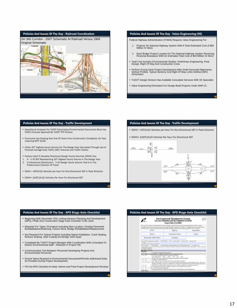
Policies And Issues Of The Day - Railroad Coordination
Railroad Coordination Is Essential During Early Project Development
Meeting Minutes With Railroad Personnel Should Be Prepared So Agreement On Design Criteria and Numbers Of Tracks Are Documented
Railroads Generally Request An Additional Track If TxDOT Is Building A New Railroad Bridge
Railroads Generally Request ShooFly Track to Maintain Service Throughout Railroad Bridge Reconstruction
An Exhibit “A” Typically Required Before Comments Provided By Railroad
TxDOT District’s Have A Railroad Coordinator As Well As TxDOT Rail Division – Include In Coordination Meetings
Policies And Issues Of The Day - Railroad Coordination
SH 360 Near US 180 (Division Street) UP Railroad Crossing (2009 Aerial)
Policies And Issues Of The Day - Railroad Coordination
New Railroad Bridge At SH 360
17
Policies And Issues Of The Day - Railroad Coordination
SH 360 Corridor - 2007 Schematic At Railroad Versus 1969 Original Schematic
Policies And Issues Of The Day - Value Engineering (VE)
Federal Highway Administration (FHWA) Requires Value Engineering For:
1. Projects On National Highway System With A Total Estimated Cost of $50 Million Or More
2. Each Bridge Project Located On The National Highway System Receiving Financial Assistance With An Estimated Total Cost of $40 Million Or More
Total Cost Includes Environmental Studies, Preliminary Engineering, Final Design, Right Of Way And Construction Costs
Perform During Early Project Development After Draft Horizontal Alignments, Vertical Profiles, Typical Sections And Right Of Way Limits Defined (60% Schematic)
TxDOT Design Division Has Available Consultant Services With VE Specialist
Value Engineering Eliminated For Design-Build Projects Under MAP-21
Policies And Issues Of The Day - Traffic Development
Operational Analyses For TxDOT Schematics/Environmental Documents Must Use Traffic Forecast Approved By TxDOT TPP Division
Commonly Use Existing Year And 20 Years From Construction Completion (Or Year matching MTP 2035)
Utilize 30th Highest Hourly Volume For The Design Year Calculated Through Use of Forecast Average Daily Traffic (ADT) Volumes and Traffic Factors
Factors Used To Develop Directional Design Hourly Volumes (DDHV) Are:1. K - % Of ADT Representing 30th Highest Hourly Volume In The Design Year2. D (Directional Distribution) - % Of Design Hourly Volume That Is In The
Predominant Direction Of Travel
DDHV = ADT(K)(D) Vehicles per Hour For Non-Directional ADT in Peak Direction
DDHV= 2(ADT)(K)(D) Vehicles Per Hour For Directional ADT
Policies And Issues Of The Day - Traffic Development
DDHV = ADT(K)(D) Vehicles per Hour For Non-Directional ADT in Peak Direction
DDHV= 2(ADT)(K)(D) Vehicles Per Hour For Directional ADT
Policies And Issues Of The Day - APD Stage Gate Checklist
Beginning With December 2011 Letting Advance Planning And Development (APD), PS&E And Construction Stage Gate Checklist To Be Used
Required For Types Of projects Including New Location, Existing Pavement Rehabilitations/Widening, Culvert Work, Bridge Rehabilitation/Replacement
Not Required For Typical Projects Including Signal Installation, Crack Sealing, Retrace Striping, Seal Coating And Bridge Joint repair
Completed By TxDOT Project Manager With Coordination With Consultant Or District Environmental Staff – Retained In Project File
Communication Tool Between Personnel Developing Projects And Environmental Personnel
Ensure Items Required In Environmental Documents/Permits Addressed Early As Possible During Project Development.
Fill Out APD Checklist At Initial, Interim and Final Project Development Reviews
Policies And Issues Of The Day - APD Stage Gate Checklist
18
Words of Wisdom
• Do Not Get Too Emotionally Attached To One Design Solution - Let Advance Project Development Process/Public Involvement Lead To Preferred Alternative
• Develop A Champion For The Project Through The Local Stakeholders
• Coordinate with Environmental Staff Early
• Consider Right Of Way Workshop With TxDOT PM And Right Of Way Appraiser In Initial Phases Of Project Development
• A Re-Evaluation for Environmental May Be required If Proposed Right Of Way And Drainage Easements Acreages Not Estimated Properly
• Include Detailed Design Aspects So That Schematic Design Corresponds To 30% PSE (Drainage, Traffic Control Plan, Structures)
• Review Constructability for Retaining / Noise Wall and Bridges
Other related Issues
Questions