Embed Size (px)
Citation preview
Libreville, March, 20-21, 2013
Conférence internationale sur les changements d’occupation
du sol et de biomasse forestière en Afrique centrale
Presented by Dr. Landing MANE
Satellite data availability
My thanks to some people who have provided me some slides: David Roy (SDSU),
Katarzyna Wisniewska (DMCI) and Giovani Rum (GEO), Alice Altstatt (UMD)
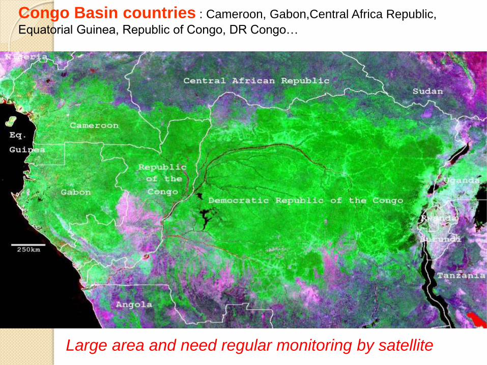
Congo Basin countries : Cameroon, Gabon,Central Africa Republic,
Equatorial Guinea, Republic of Congo, DR Congo…
Large area and need regular monitoring by satellite
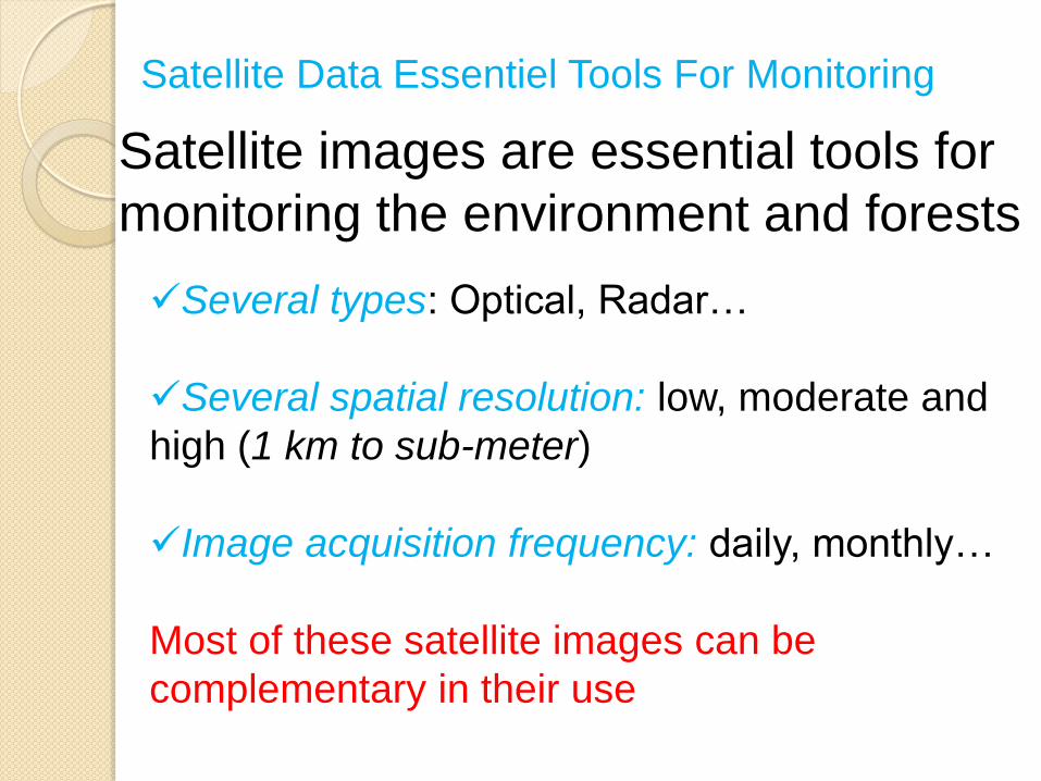
Satellite Data Essentiel Tools For Monitoring
Satellite images are essential tools for
monitoring the environment and forests Several types: Optical, Radar…
Several spatial resolution: low, moderate and
high (1 km to sub-meter)
Image acquisition frequency: daily, monthly…
Most of these satellite images can be
complementary in their use
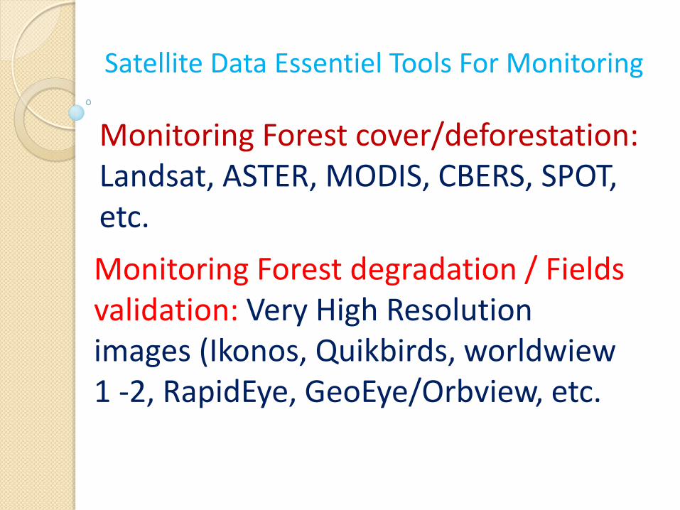
Satellite Data Essentiel Tools For Monitoring
Monitoring Forest cover/deforestation: Landsat, ASTER, MODIS, CBERS, SPOT, etc.
Monitoring Forest degradation / Fields validation: Very High Resolution images (Ikonos, Quikbirds, worldwiew 1 -2, RapidEye, GeoEye/Orbview, etc.
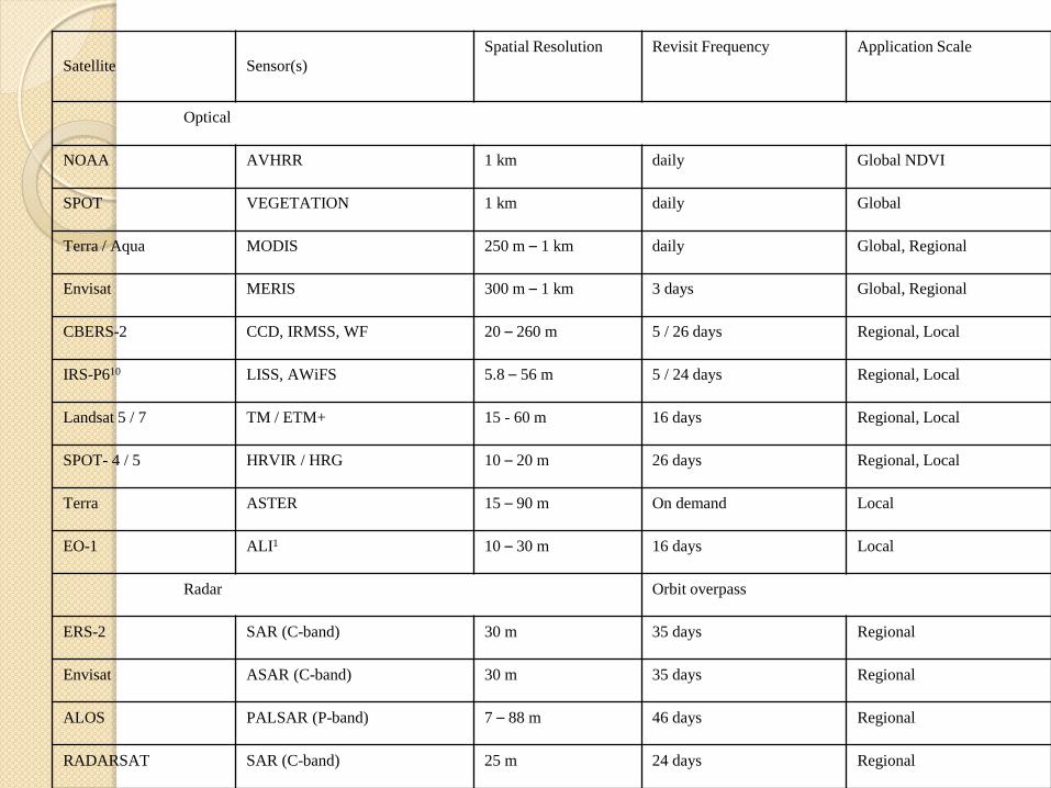
Satellite
Sensor(s) Spatial Resolution Revisit Frequency Application Scale
Optical
NOAA AVHRR 1 km daily Global NDVI
SPOT VEGETATION 1 km daily Global
Terra / Aqua MODIS 250 m – 1 km daily Global, Regional
Envisat MERIS 300 m – 1 km 3 days Global, Regional
CBERS-2 CCD, IRMSS, WF 20 – 260 m 5 / 26 days Regional, Local
IRS-P610 LISS, AWiFS 5.8 – 56 m 5 / 24 days Regional, Local
Landsat 5 / 7 TM / ETM+ 15 - 60 m 16 days Regional, Local
SPOT- 4 / 5 HRVIR / HRG 10 – 20 m 26 days Regional, Local
Terra ASTER 15 – 90 m On demand Local
EO-1 ALI1 10 – 30 m 16 days Local
Radar Orbit overpass
ERS-2 SAR (C-band) 30 m 35 days Regional
Envisat ASAR (C-band) 30 m 35 days Regional
ALOS PALSAR (P-band) 7 – 88 m 46 days Regional
RADARSAT SAR (C-band) 25 m 24 days Regional
Current initiatives for Satellite
Data availibility
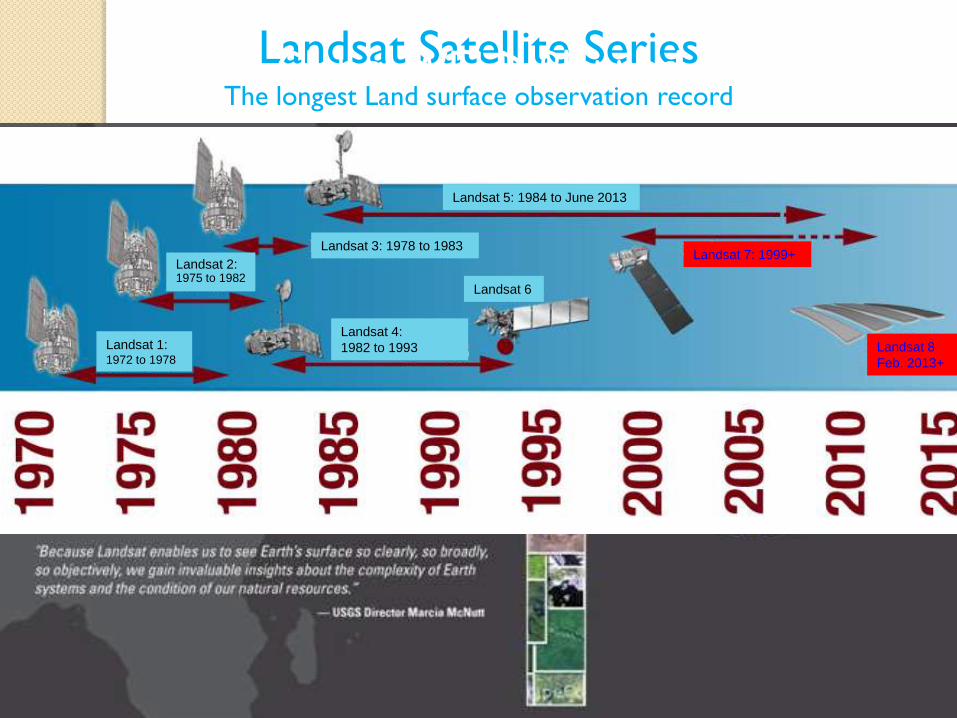
Landsat 8
Feb. 2013+
Landsat 5: 1984 to June 2013
Landsat 7: 1999+ Landsat 3: 1978 to 1983
Landsat 4:
1982 to 1993
Landsat 2: 1975 to 1982
Landsat 1: 1972 to 1978
Landsat 6
Landsat Satellite Series
The longest Land surface observation record
Landsat 8
Feb. 2013+
Landsat 5: 1984 to June 2013
Landsat 7: 1999+ Landsat 3: 1978 to 1983
Landsat 4:
1982 to 1993
Landsat 2: 1975 to 1982
Landsat 1: 1972 to 1978
Landsat 6
Global WELD Planned
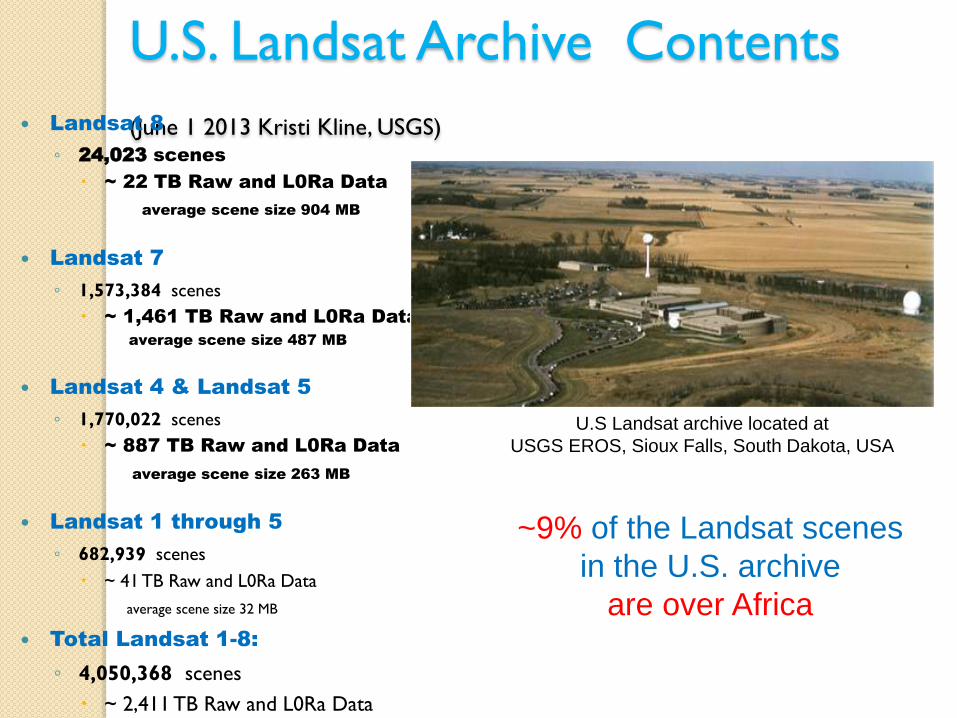
U.S. Landsat Archive Contents
(June 1 2013 Kristi Kline, USGS) Landsat 8
◦ 24,023 scenes
~ 22 TB Raw and L0Ra Data
average scene size 904 MB
Landsat 7
◦ 1,573,384 scenes
~ 1,461 TB Raw and L0Ra Data
average scene size 487 MB
Landsat 4 & Landsat 5
◦ 1,770,022 scenes
~ 887 TB Raw and L0Ra Data
average scene size 263 MB
Landsat 1 through 5
◦ 682,939 scenes
~ 41 TB Raw and L0Ra Data
average scene size 32 MB
Total Landsat 1-8:
◦ 4,050,368 scenes
~ 2,411 TB Raw and L0Ra Data
U.S Landsat archive located at
USGS EROS, Sioux Falls, South Dakota, USA
~9% of the Landsat scenes
in the U.S. archive
are over Africa
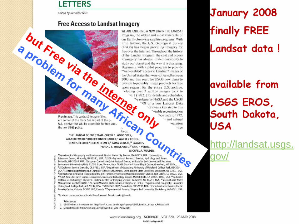
January 2008
finally FREE
Landsat data !
available from
USGS EROS, South Dakota, USA
http://landsat.usgs.
gov/
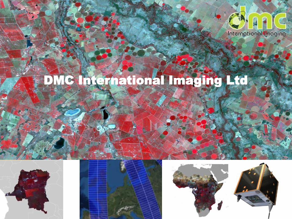
DMC International Imaging Ltd
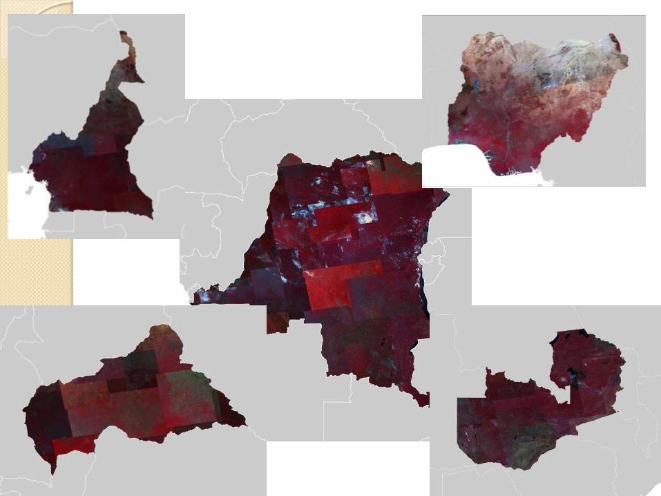
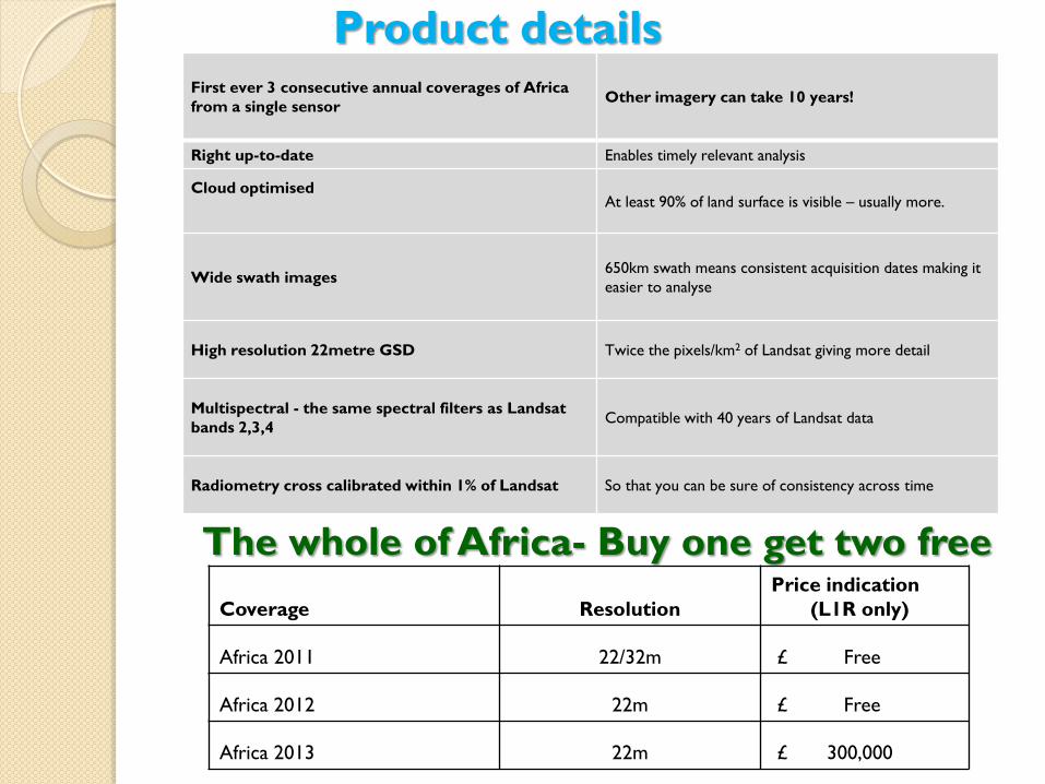
The whole of Africa- Buy one get two free
Coverage Resolution
Price indication
(L1R only)
Africa 2011 22/32m £ Free
Africa 2012 22m £ Free
Africa 2013 22m £ 300,000
Product details First ever 3 consecutive annual coverages of Africa
from a single sensor Other imagery can take 10 years!
Right up-to-date Enables timely relevant analysis
Cloud optimised
At least 90% of land surface is visible – usually more.
Wide swath images 650km swath means consistent acquisition dates making it
easier to analyse
High resolution 22metre GSD Twice the pixels/km2 of Landsat giving more detail
Multispectral - the same spectral filters as Landsat
bands 2,3,4 Compatible with 40 years of Landsat data
Radiometry cross calibrated within 1% of Landsat So that you can be sure of consistency across time
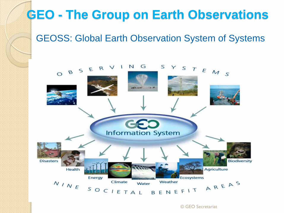
© GEO Secretariat
GEOSS: Global Earth Observation System of Systems
GEO - The Group on Earth Observations
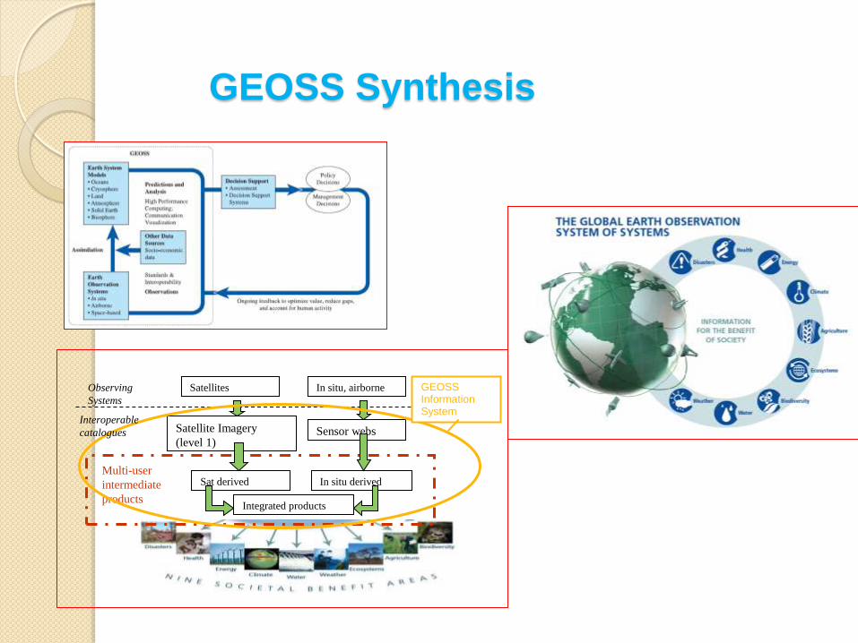
GEOSS Synthesis
Satellites In situ, airborne
Satellite Imagery
(level 1) Sensor webs
Sat derived In situ derived
Integrated products
Multi-user
intermediate
products
Observing
Systems
GEOSS Information System
Interoperable
catalogues
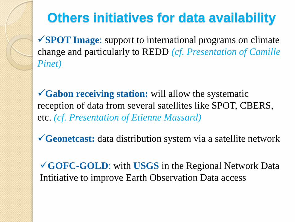
SPOT Image: support to international programs on climate
change and particularly to REDD (cf. Presentation of Camille
Pinet)
Others initiatives for data availability
Gabon receiving station: will allow the systematic
reception of data from several satellites like SPOT, CBERS,
etc. (cf. Presentation of Etienne Massard)
Geonetcast: data distribution system via a satellite network
GOFC-GOLD: with USGS in the Regional Network Data
Intitiative to improve Earth Observation Data access
Current initiative for Satellite Data
access in Central Africa
…example of OSFAC
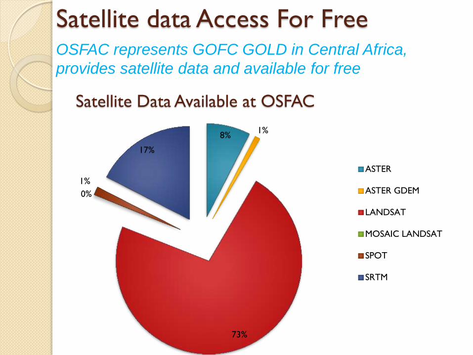
Satellite data Access For Free OSFAC represents GOFC GOLD in Central Africa,
provides satellite data and available for free
8% 1%
73%
0%
1%
17%
ASTER
ASTER GDEM
LANDSAT
MOSAIC LANDSAT
SPOT
SRTM
Satellite Data Available at OSFAC
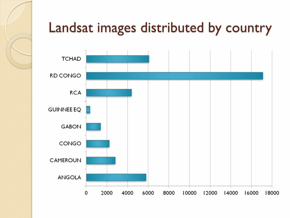
Landsat images distributed by country
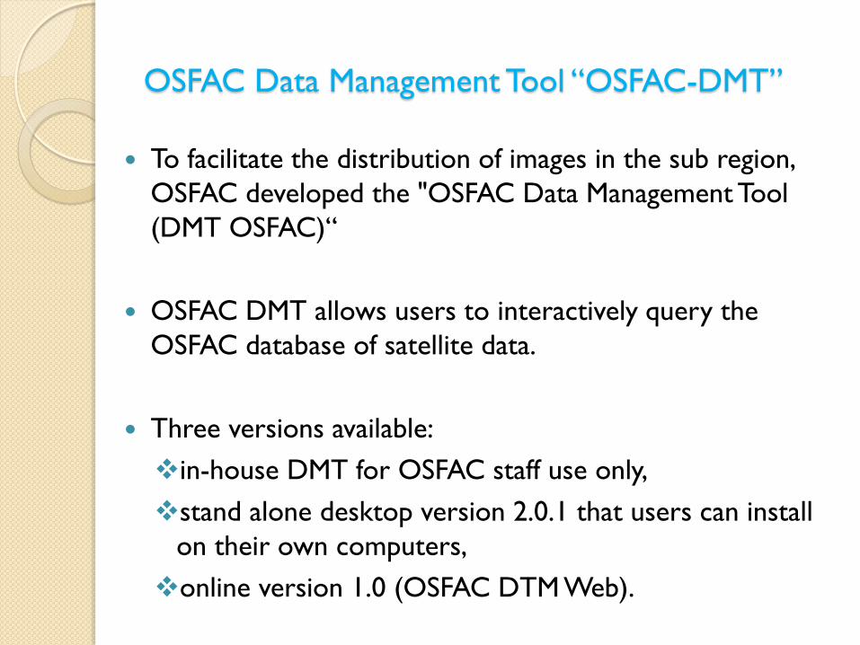
OSFAC Data Management Tool “OSFAC-DMT”
To facilitate the distribution of images in the sub region,
OSFAC developed the "OSFAC Data Management Tool
(DMT OSFAC)“
OSFAC DMT allows users to interactively query the
OSFAC database of satellite data.
Three versions available:
in-house DMT for OSFAC staff use only,
stand alone desktop version 2.0.1 that users can install
on their own computers,
online version 1.0 (OSFAC DTM Web).
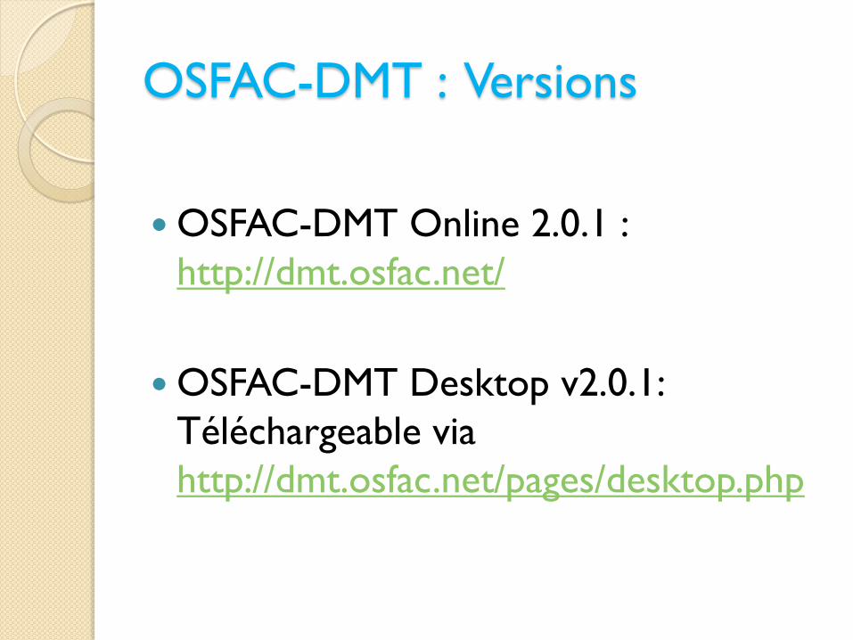
OSFAC-DMT : Versions
OSFAC-DMT Online 2.0.1 :
http://dmt.osfac.net/
OSFAC-DMT Desktop v2.0.1:
Téléchargeable via
http://dmt.osfac.net/pages/desktop.php
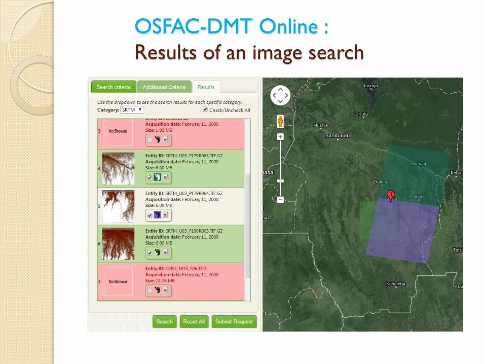
OSFAC-DMT Online :
Results of an image search
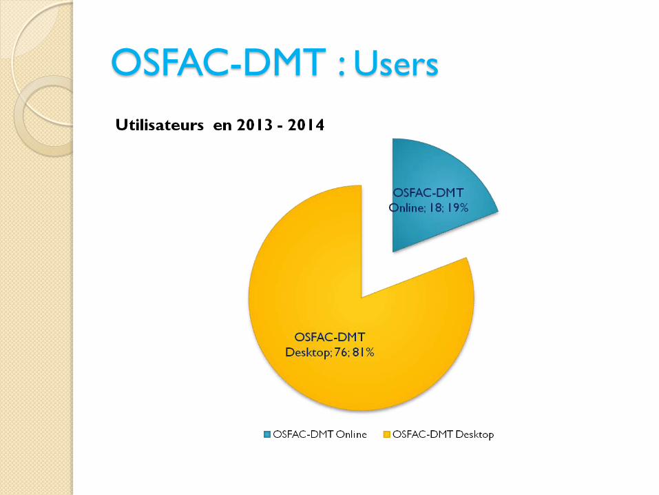
OSFAC-DMT : Users
CONCLUSION & RECOMMENDATIONS
An effective data distribution system is created within
regional centers;
Installation of new fibre-optic cables continues, which
will open up access to broadband connectivity and
Internet use;
Satellite data reception stations are established in the
Congo Basin region where there is active demand for
earth observation data;
Use the PUMA stations of Meteorological services in
the region to receive data through GEONETCast
Network System;
Data providers continue to make access to satellite data
easier in favorable conditions.