Embed Size (px)
Citation preview
application sheet
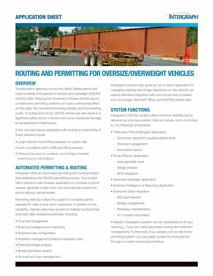
OverviewTransportation agencies across the United States permit and
route hundreds of thousands of oversize and overweight (OS/OW)
vehicles daily. Delaying the movement of these vehicles due to
cumbersome permitting systems can have a detrimental effect
on the state, the commercial trucking industry, and the traveling
public. A routing error for an OS/OW vehicle can also result in a
significant safety risk for motorists and cause substantial damage
to transportation infrastructure.
A few common issues associated with routing and permitting of
these vehicles include:
•Large volume of permitting requests on a given day
•Lack of qualified staff to fulfill permitting requests
•Delayed access to roadway and bridge hazards
(restrictions) information
AutOmAted Permitting & rOutingIntergraph offers an automated permitting and routing solution
that streamlines the OS/OW permitting process. This solution
offers carriers a web-browser application to complete a permit
request, generate a safe route, and automatically receive the
permit without manual review.
Permitting staff also utilize this system to complete permit
requests for walk-in and call-in customers. In addition to this
capability, internal users have access to multiple functions that
automate daily operational activities, including:
•Financial management
•Business intelligence and reporting
•Business rules configuration
•Workflow management based on business rules
•Extensive bridge analysis
•Broad information search
•Account and user management
Intergraph’s solution also gives you an in-depth application for
managing roadway and bridge restrictions on the network, as
well as seamless integration with commercial map providers
such as Google, Microsoft® Bing, and NAVTEQ streets data.
SyStem FunctiOnSIntergraph’s OS/OW solution offers maximum flexibility and is
delivered as a turnkey solution that can include, but is not limited
to, the following components:
•Third-party Permit Manager Application
- Document upload for required attachments
- Financial management
- Information search
•Route Planner Application
- Auto-generate route
- Bridge analysis
- GPS integration
•Restriction Manager Application
•Business Intelligence & Reporting Application
•Enterprise Data Integration
- GIS road network
- Bridge management
- Roadway characteristics
- 511 incident information
If desired, Intergraph’s solution can be modularized to fit your
need (e.g., if you only need automated routing and restriction
management). Furthermore, if you already own an electronic
permitting system, you can easily access the route planner
through a modern web-based interface.
rOuting And Permitting FOr OverSize/Overweight vehicleS
Permit mAnAger APPlicAtiOnIf you need a permitting solution, Intergraph offers a third-party
permitting application which includes a robust web-based
interface for capturing vehicle and load information related to
the requested permit. The Permit Manager applies business
rules while automating the permitting process. Once all required
workfl ow steps are completed, this application allows carriers to make
payments and the staff to automatically issue a permit.
Other key functions of the permit manager include, but are not
limited to:
•Financial management
•Document loading for required schematics
•Workfl ow accountability to ensure proper approvals and
enforcement of business rules
•Integration with disparate systems, such as CVIEW
•User and account management
rOute PlAnner APPlicAtiOnIntergraph’s Route Planner application provides automated
restrictive routing capabilities using a sleek graphical interface.
Its GIS-enabled mapping function is useful for defi ning, testing,
and visualizing the desired route. When performing route analysis,
this application evaluates the vehicle parameters against the
restrictions on the network to ensure the vehicle can safely pass.
A number of optional workfl ow components are also offered
based on your workfl ow requirements. These include, but are
not limited to:
•Advanced bridge analysis (bending moment, VIRTIS, etc.)
•Output to GPS
•Integration with commercial map viewers (Google, Microsoft
Bing, etc.)
The route planner offers a variety of intuitive input options for
route origins and destination points, such as “street address,”
“coordinates,” “street intersection,” or “select from map.” You
can also save commonly used routes and recall them to expedite
the routing process.
Intergraph is the leading global provider of engineering and geospatial software that enables customers to visualize complex data. Businesses and governments in more than 60 countries rely on Intergraph’s industry-specifi c software to organize vast amounts of data to make processes and infrastructure better, safer and smarter. The company’s software and services empower customers to build and operate more effi cient plants and ships, create intelligent maps, and protect critical infrastructure and millions of people around the world.
Intergraph operates through two divisions: Process, Power & Marine (PP&M) and Security, Government & Infrastructure (SG&I). Intergraph PP&M provides enterprise engineering software for the design, construction, operation and data management of plants, ships and offshore facilities. Intergraph SG&I provides
geospatially powered solutions, including ERDAS technologies, to the public safety and security, defense and intelligence, government, transportation, photo-grammetry, and utilities and communications industries. Intergraph Government Solutions (IGS) is a wholly owned subsidiary of Intergraph Corporation respon-sible for the SG&I U.S. federal business.
Intergraph is a wholly owned subsidiary of Hexagon AB (Nordic exchange: HEXA B). For more information, visit www.intergraph.com and www.hexagon.com.
aBoUt inteRGRaph
©2012 Intergraph Corporation. All rights reserved. Intergraph and the Intergraph logo are registered trademarks of Intergraph Corporation or its subsidiaries in the United States and in other countries. Microsoft is a registered trademark of Microsoft Corporation. Other products and brand names are trademarks of their respective owners. 8/12 TRN-US-0001D-ENG
To ensure the selected route is accurate, the Route Planner
displays the generated route and driving directions directly in the
application window for review.
As an added value, all approved routes generated by the system
are saved in the database for reporting and asset planning purposes.
This allows you to plan long-term maintenance activities by helping
you evaluate which roadways are traveled most often.
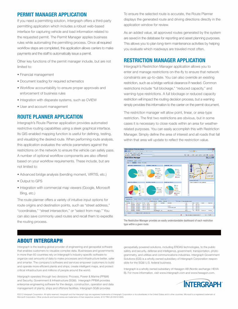
reStrictiOn mAnAger APPlicAtiOnIntergraph’s Restriction Manager application allows you to
enter and manage restrictions on-the-fl y to ensure that network
constraints are up-to-date. You can also override an existing
restriction, such as a bridge vertical clearance if needed. Common
restrictions include “full blockage,” “reduced capacity,” and
warning-type restrictions. A full blockage or reduced capacity
restriction will impact the routing decision process, but a warning
simply provides this information to the carrier on the permit document.
The restriction manager will allow point, linear, or area-type
restriction. The fi rst two restrictions are obvious, but in some
cases it is necessary to close roads within an area for weather-
related purposes. You can easily accomplish this with Restriction
Manager. Simply defi ne the area of interest and all roads that fall
within that area will update to refl ect the restriction value.
The Restriction Manager provides an easily understandable dashboard of each restriction type within a given route.