Embed Size (px)
Citation preview
ROLE OF LANDSCAPE
CONSERVATION COOPERATIVES IN
EVERGLADES RESTORATION
GEERApril 2017
Steve Traxler1, Todd Hopkins1, Beth Stys2
1US Fish and Wildlife Service2Florida Fish & Wildlife Conservation Commission,
Peninsular Florida Landscape Conservation Cooperative
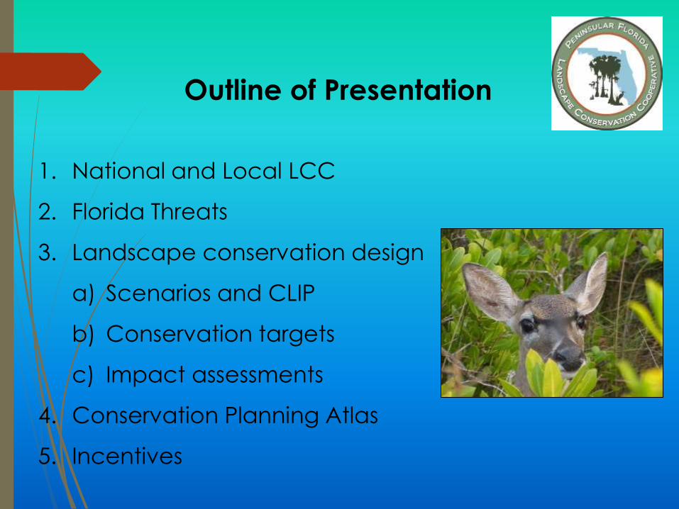
1. National and Local LCC
2. Florida Threats
3. Landscape conservation design
a) Scenarios and CLIP
b) Conservation targets
c) Impact assessments
4. Conservation Planning Atlas
5. Incentives
Outline of Presentation
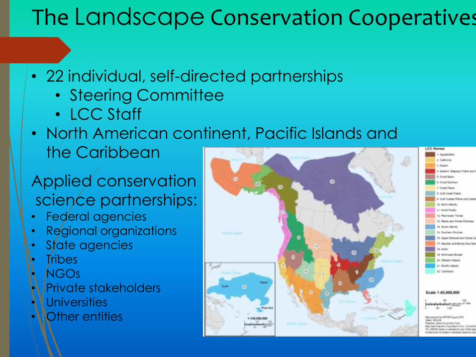
• 22 individual, self-directed partnerships
• Steering Committee
• LCC Staff
• North American continent, Pacific Islands and
the Caribbean
Applied conservation
science partnerships:• Federal agencies
• Regional organizations
• State agencies
• Tribes
• NGOs
• Private stakeholders
• Universities
• Other entities
The Landscape Conservation Cooperatives
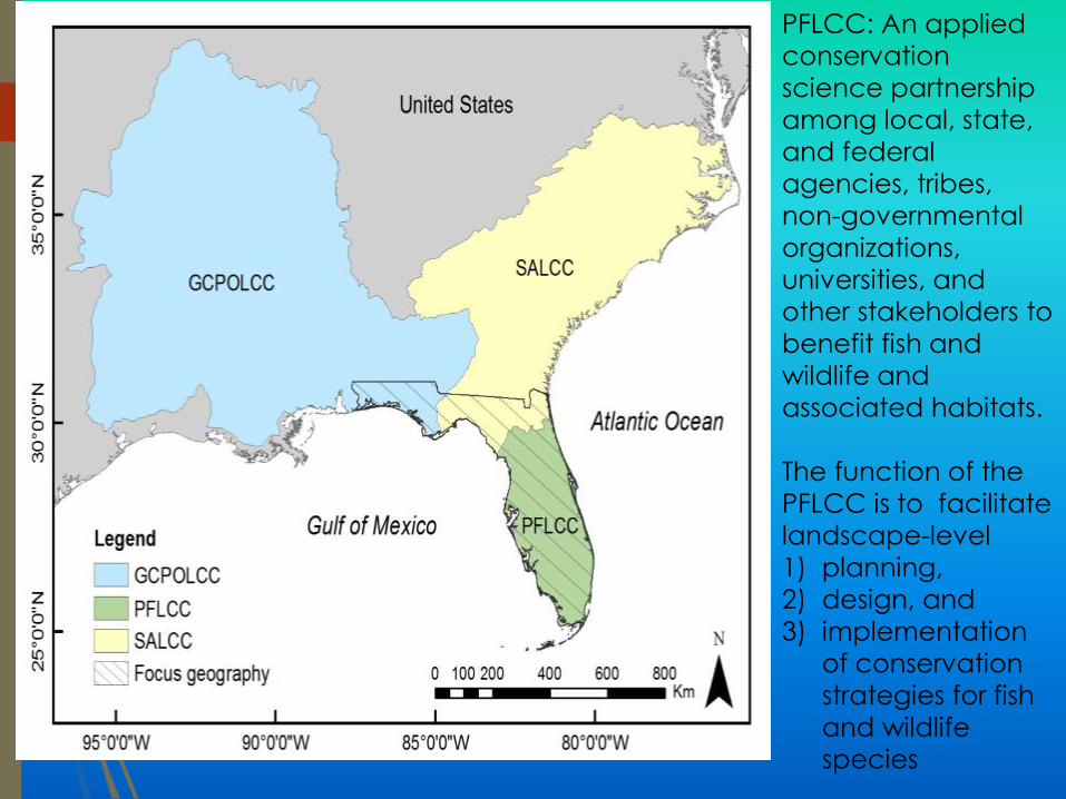
PFLCC: An applied
conservation
science partnership
among local, state,
and federal
agencies, tribes,
non-governmental
organizations,
universities, and
other stakeholders to
benefit fish and
wildlife and
associated habitats.
The function of the
PFLCC is to facilitate
landscape-level
1) planning,
2) design, and
3) implementation
of conservation
strategies for fish
and wildlife
species

Family Lands Remember, LLC
The Nature Conservancy
FL Fish & Wildlife Conservation
Commission
U.S. Fish & Wildlife Service
National Parks Service (Everglades)
National Wildlife Refuge Association
Florida Natural Areas Inventory
SW FL Water Management District
FL Sea Grant Extension
FL Dept. of Ag. And Consumer
Services
Southeast Aquatic Resources
Partnership
Florida DOT
US Forest Service
Florida Forest Service
Nature Coast Biological
Station
University of Florida
Florida Farm Bureau
Federation
The Conservation Fund
Plum Creek
Florida Forestry Association
NOAA
USGS
USDA NRCS
PFLCC Steering Committee Organizations
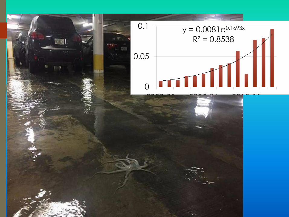
y = 0.0081e0.1693x
R² = 0.8538
0
0.05
0.1
2000-01 2005-06 2010-11
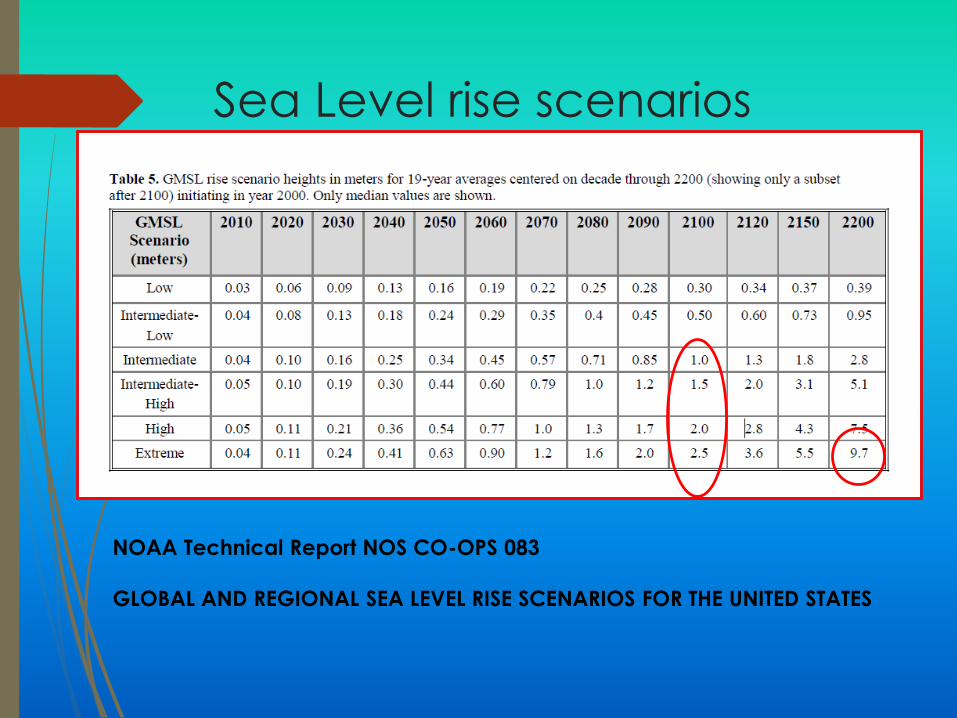
Sea Level rise scenarios
NOAA Technical Report NOS CO-OPS 083
GLOBAL AND REGIONAL SEA LEVEL RISE SCENARIOS FOR THE UNITED STATES
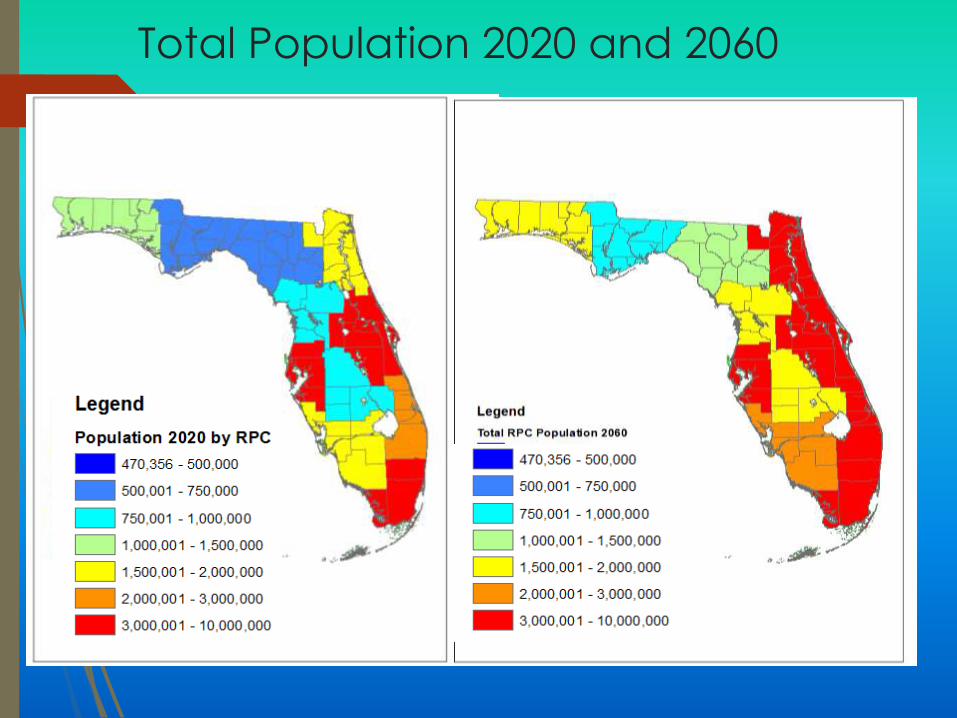
Total Population 2020 and 2060
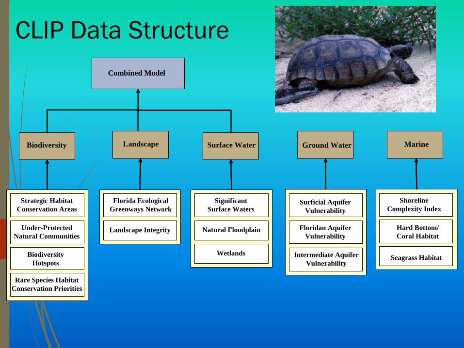
Biodiversity Surface WaterLandscape Ground Water
Combined Model
Strategic Habitat
Conservation Areas
Under-Protected
Natural Communities
Biodiversity
Hotspots
Rare Species Habitat
Conservation Priorities
Landscape Integrity
Florida Ecological
Greenways Network
Intermediate Aquifer
Vulnerability
Shoreline
Complexity IndexSurficial Aquifer
Vulnerability
Hard Bottom/
Coral Habitat
Floridan Aquifer
Vulnerability
Seagrass Habitat
Significant
Surface Waters
Natural Floodplain
Wetlands
MarineBiodiversityBiodiversity Surface WaterSurface WaterLandscapeLandscape Ground WaterGround Water
Combined Model
Strategic Habitat
Conservation Areas
Under-Protected
Natural Communities
Biodiversity
Hotspots
Rare Species Habitat
Conservation Priorities
Landscape Integrity
Florida Ecological
Greenways Network
Intermediate Aquifer
Vulnerability
Shoreline
Complexity IndexSurficial Aquifer
Vulnerability
Hard Bottom/
Coral Habitat
Floridan Aquifer
Vulnerability
Seagrass Habitat
Significant
Surface Waters
Natural Floodplain
Wetlands
Marine
CLIP Data Structure
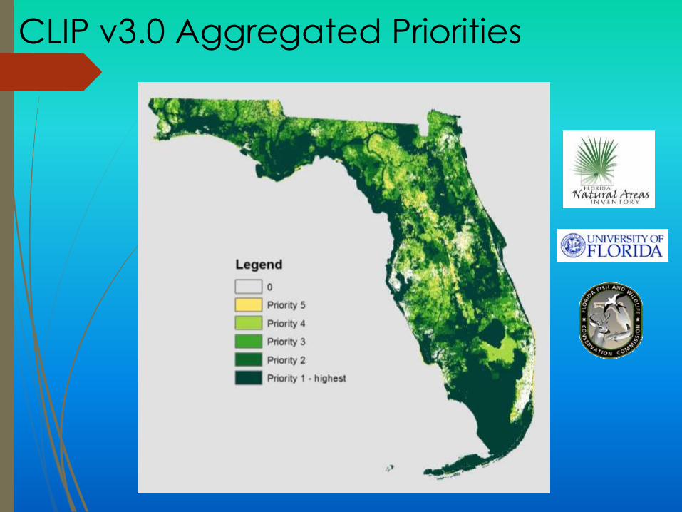
CLIP v3.0 Aggregated Priorities
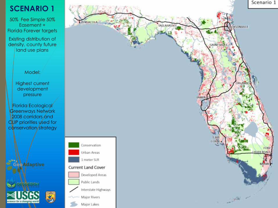
SCENARIO 1
50% Fee Simple 50%
Easement +
Florida Forever targets
Existing distribution of
density, county future
land use plans
Model:
Highest current
development
pressure
Florida Ecological
Greenways Network
2008 corridors and
CLIP priorities used for
conservation strategy
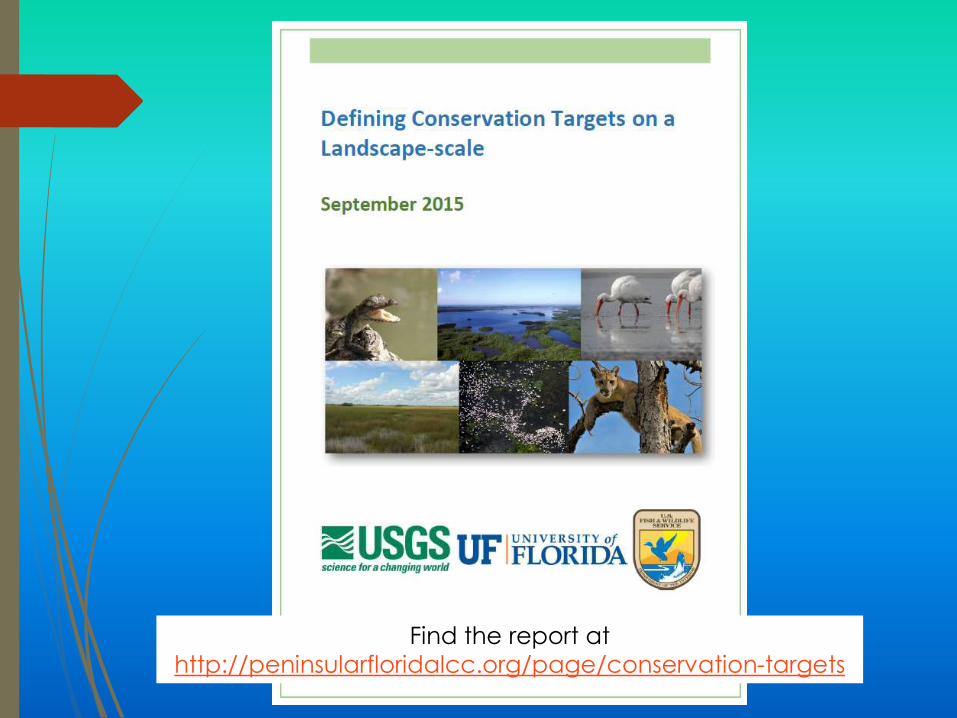
Find the report at
http://peninsularfloridalcc.org/page/conservation-targets
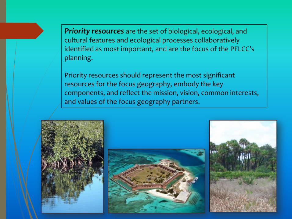
Priority resources are the set of biological, ecological, and cultural features and ecological processes collaboratively identified as most important, and are the focus of the PFLCC’s planning.
Priority resources should represent the most significant resources for the focus geography, embody the key components, and reflect the mission, vision, common interests, and values of the focus geography partners.
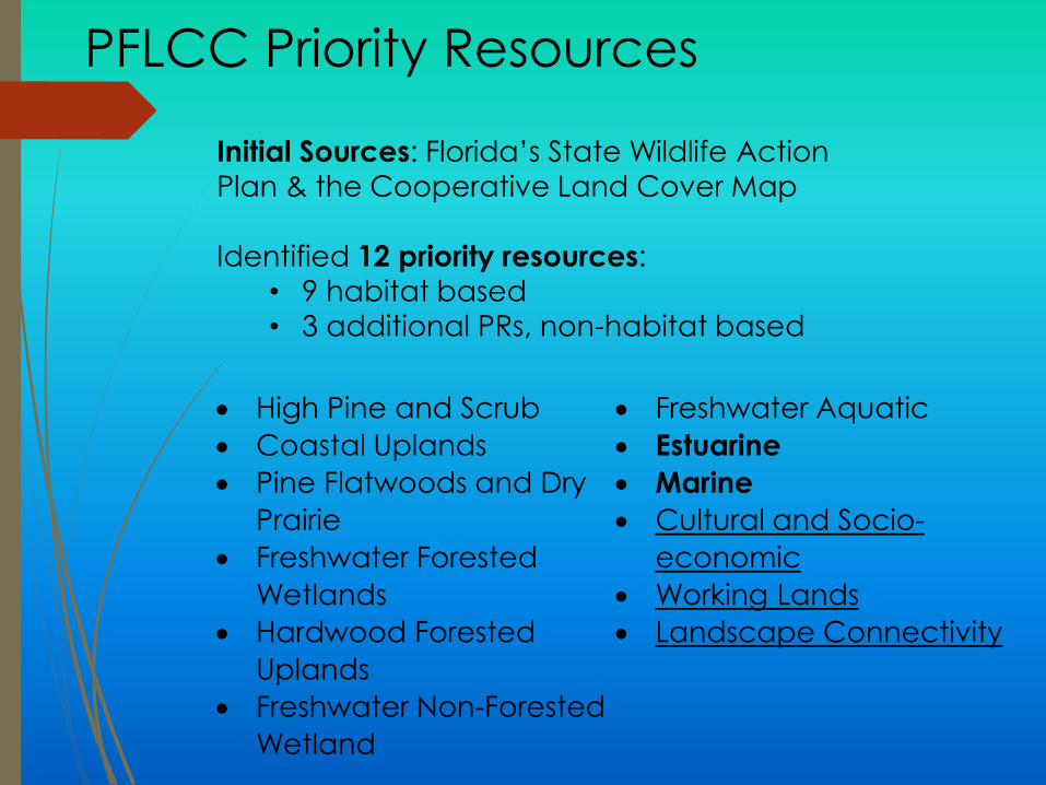
PFLCC Priority Resources
Initial Sources: Florida’s State Wildlife Action
Plan & the Cooperative Land Cover Map
Identified 12 priority resources:
• 9 habitat based
• 3 additional PRs, non-habitat based
High Pine and Scrub
Coastal Uplands
Pine Flatwoods and Dry
Prairie
Freshwater Forested
Wetlands
Hardwood Forested
Uplands
Freshwater Non-Forested
Wetland
Freshwater Aquatic
Estuarine
Marine
Cultural and Socio-
economic
Working Lands
Landscape Connectivity
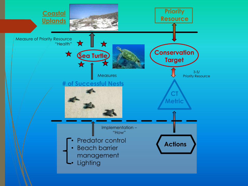
Coastal
Uplands
Priority
Resource
Sea Turtle
# of Successful Nests
• Predator control
• Beach barrier
management
• Lighting
Conservation
Target
CT
Metric
Actions
Measure of Priority Resource
“Health”
Measures
Implementation –
“How”
3-5/
Priority Resource
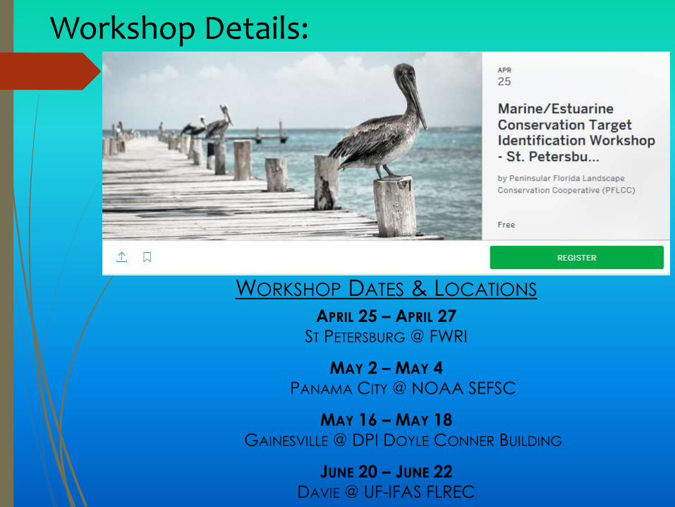
Workshop Details:
WORKSHOP DATES & LOCATIONS
APRIL 25 – APRIL 27
ST PETERSBURG @ FWRI
MAY 2 – MAY 4
PANAMA CITY @ NOAA SEFSC
MAY 16 – MAY 18
GAINESVILLE @ DPI DOYLE CONNER BUILDING
JUNE 20 – JUNE 22
DAVIE @ UF-IFAS FLREC

State Wildlife Action Plan 2017
State Wildlife Grant Program
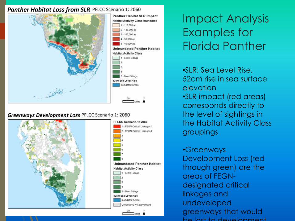
Impact Analysis
Examples for
Florida Panther
•SLR: Sea Level Rise,
52cm rise in sea surface
elevation
•SLR impact (red areas)
corresponds directly to
the level of sightings in
the Habitat Activity Class
groupings
•Greenways
Development Loss (red
through green) are the
areas of FEGN-
designated critical
linkages and
undeveloped
greenways that would
be lost to development

Taking the CCB to LCD
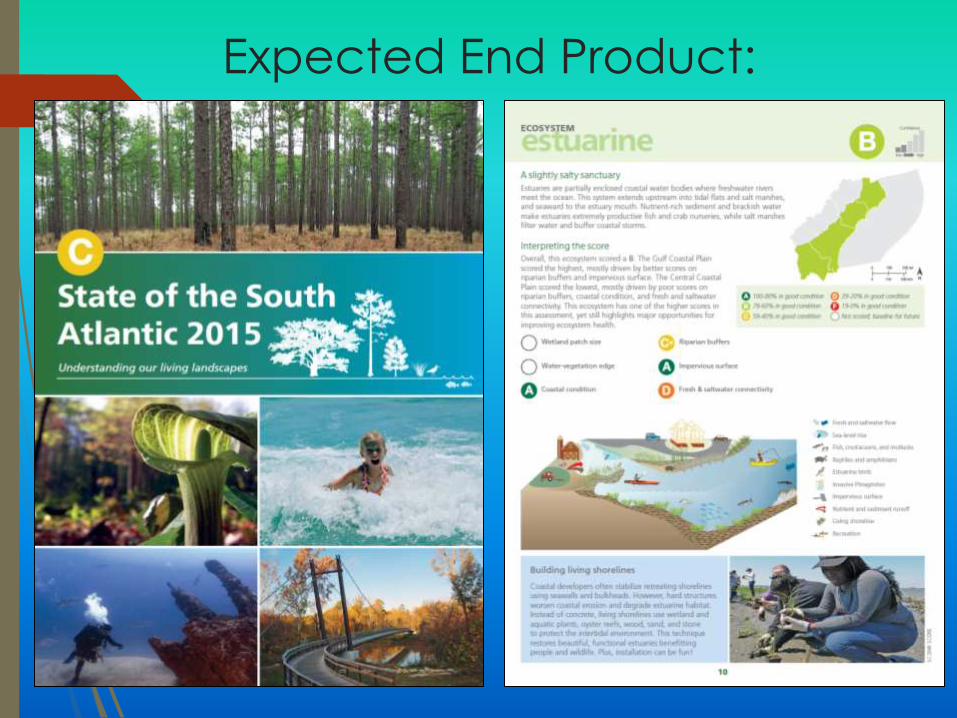
Expected End Product:
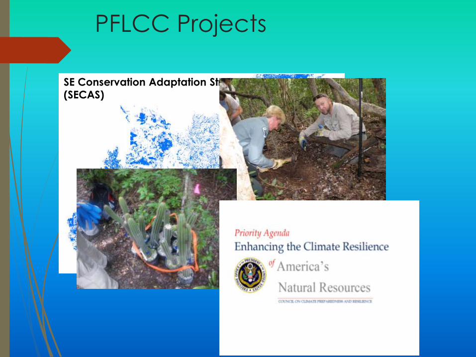
PFLCC Projects
SE Conservation Adaptation Strategy
(SECAS)
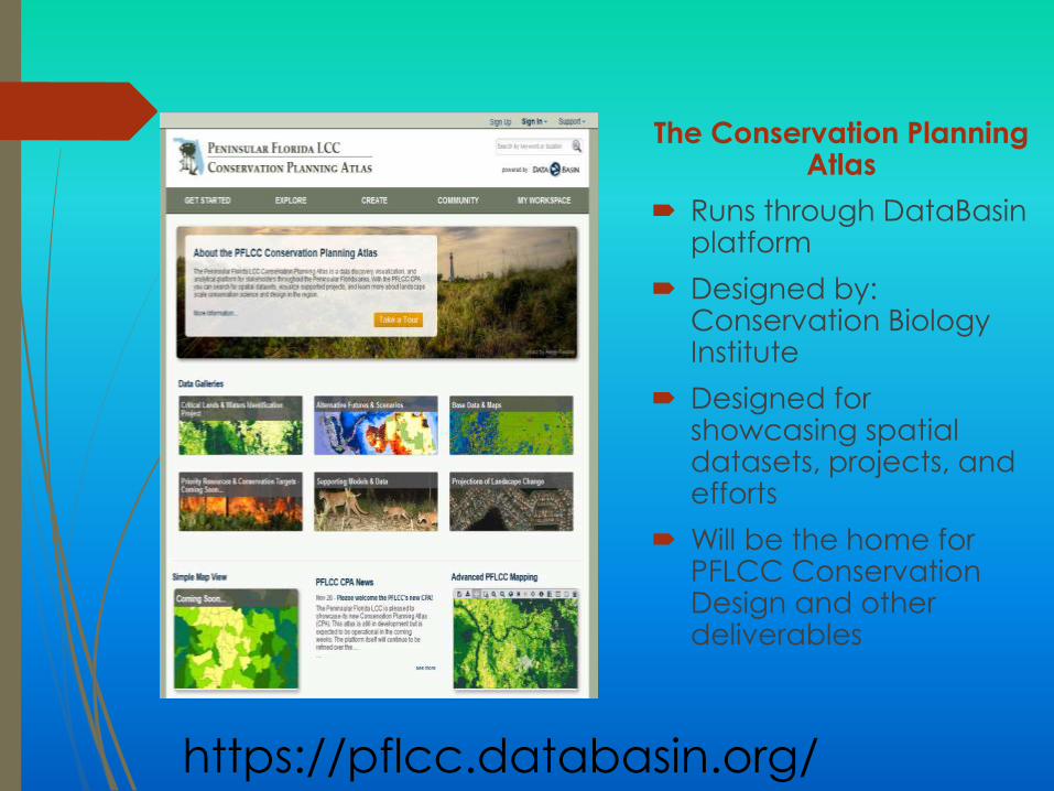
The Conservation Planning Atlas
Runs through DataBasinplatform
Designed by: Conservation Biology Institute
Designed for showcasing spatial datasets, projects, and efforts
Will be the home for PFLCC Conservation Design and other deliverables
https://pflcc.databasin.org/
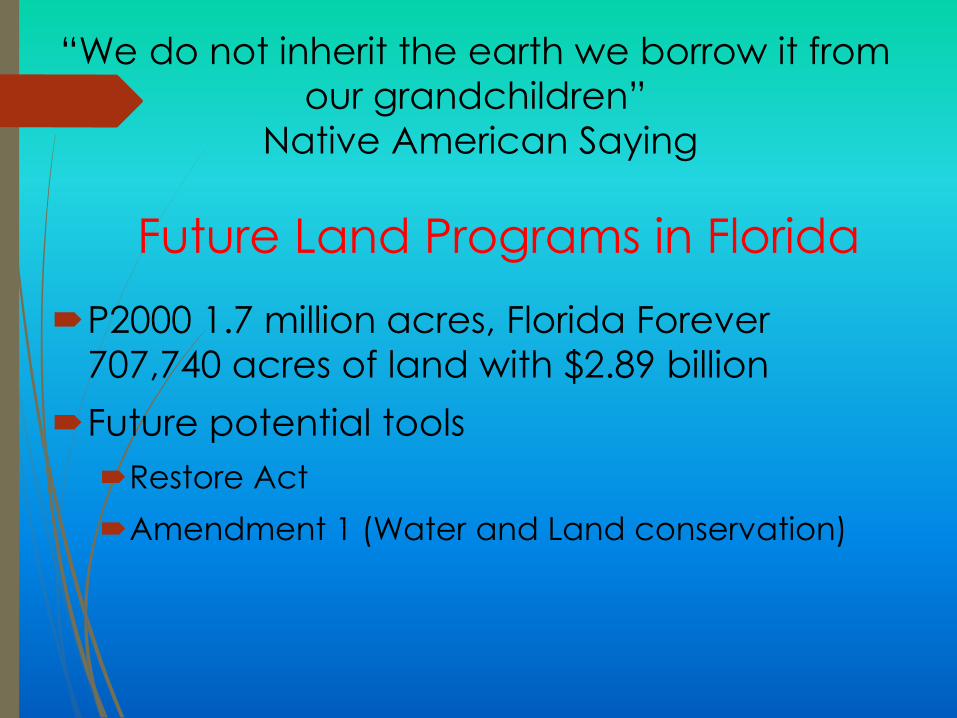
“We do not inherit the earth we borrow it from
our grandchildren”
Native American Saying
P2000 1.7 million acres, Florida Forever
707,740 acres of land with $2.89 billion
Future potential tools
Restore Act
Amendment 1 (Water and Land conservation)
Future Land Programs in Florida
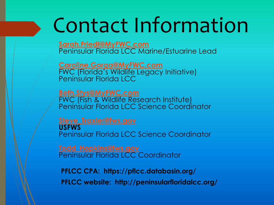
Contact [email protected] Florida LCC Marine/Estuarine Lead
[email protected] (Florida’s Wildlife Legacy Initiative)Peninsular Florida LCC
[email protected] (Fish & Wildlife Research Institute)Peninsular Florida LCC Science Coordinator
[email protected] Florida LCC Science Coordinator
[email protected] Florida LCC Coordinator
PFLCC CPA: https://pflcc.databasin.org/
PFLCC website: http://peninsularfloridalcc.org/

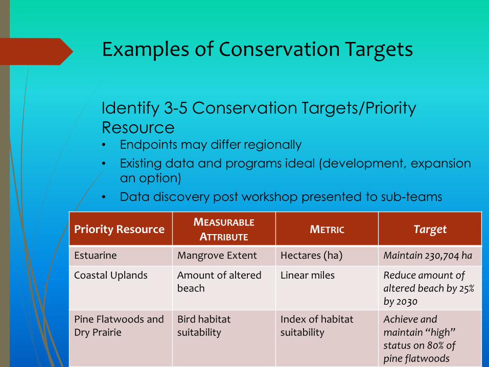
Examples of Conservation Targets
Priority ResourceMEASURABLE
ATTRIBUTEMETRIC Target
Estuarine Mangrove Extent Hectares (ha) Maintain 230,704 ha
Coastal Uplands Amount of altered beach
Linear miles Reduce amount of altered beach by 25% by 2030
Pine Flatwoods and Dry Prairie
Bird habitat suitability
Index of habitatsuitability
Achieve and maintain “high” status on 80% of pine flatwoods
Identify 3-5 Conservation Targets/Priority
Resource• Endpoints may differ regionally
• Existing data and programs ideal (development, expansion
an option)
• Data discovery post workshop presented to sub-teams
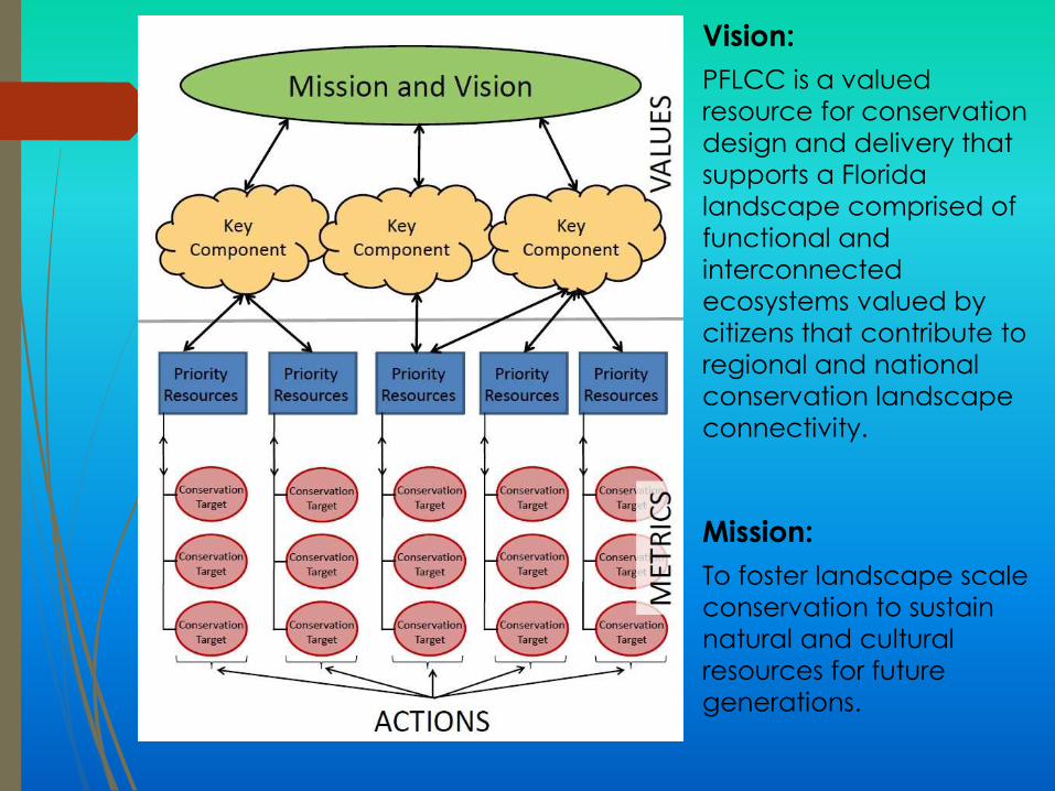
Vision:
PFLCC is a valued
resource for conservation
design and delivery that
supports a Florida
landscape comprised of
functional and
interconnected
ecosystems valued by
citizens that contribute to
regional and national
conservation landscape
connectivity.
Mission:
To foster landscape scale
conservation to sustain
natural and cultural
resources for future
generations.