Embed Size (px)
Citation preview
Roadmap Phase 2EAD & AICMBy: Eduard Porosnicu, AIM Expert
7-8 October 2009ACAC – AIM Workshop
2
Content
• AICM in the ICAO Roadmap• AICM
• Why necessary• How it has been developed• Version 4.5• Version 5.1• Content overview• Training

3
ICAO AIS to AIM Roadmap
• Phase 2 — Going digital• (52) “During Phase 2 of the transition to AIM, the main focus
will be on the establishment of data-driven processes for the production of the current products in all States. States that have not yet done so will be encouraged “to go digital” by using computer technology or digital communications and introducing structured digital data from databases into their production processes. The emphasis will, therefore, not be on the introduction of new products or services but will be on the introduction of highly structured databases and tools such as geographic information systems.”
• (53) “An aeronautical information conceptual model will provide guidance for States to implement such digital databases. Guidance material will include advice on a minimum data set to begin a phased development of the database.”

4
P-04 — Monitoring of diff Annex
P-05 — WGS-84 implementation
P-13 — Terrain
P-14 — Obstacles
P-01 — Data quality monitoring
P-02 — Data integrity monitoring
P-03 — AIRAC adherence monitoring
P-11 — Electronic AIP
P-15 — Aerodrome mapping
P-09 — Aeronautical data exchange
P-10 — Communication networks
P-12 — Aeronautical information briefing
P-16 — Training
P-17 — Quality
P-18 —Agreements with data originators
P-19 — Interoperability with meteorological products
P-20 — Electronic aeronautical charts
P-21 — Digital NOTAM
P-06 — Integrated aeronautical information database
P-07 — Unique identifiers
P-08 — Aeronautical information conceptual model
Phase 1
Phase 2
Phase 3
time
Transition from AIS to AIM

5
European AIS Database
Not CommittedNot Committed1
Fully MigratedFully Migrated
Partially MigratedPartially Migrated
CommittedCommitted7
11
23
Out of 44 ECAC StatesOut of 44 ECAC States
Single, centralised repository of aeronautical information

6
Connecting with the world …
Connected Canada, Australia, New ZealandCommitted/testing Egypt, Jordan, Syria, Kazakhstan
Japan, PhilippinesDiscussing Tunisia, Algeria, FAA, NGA
Singapore, Taiwan
7
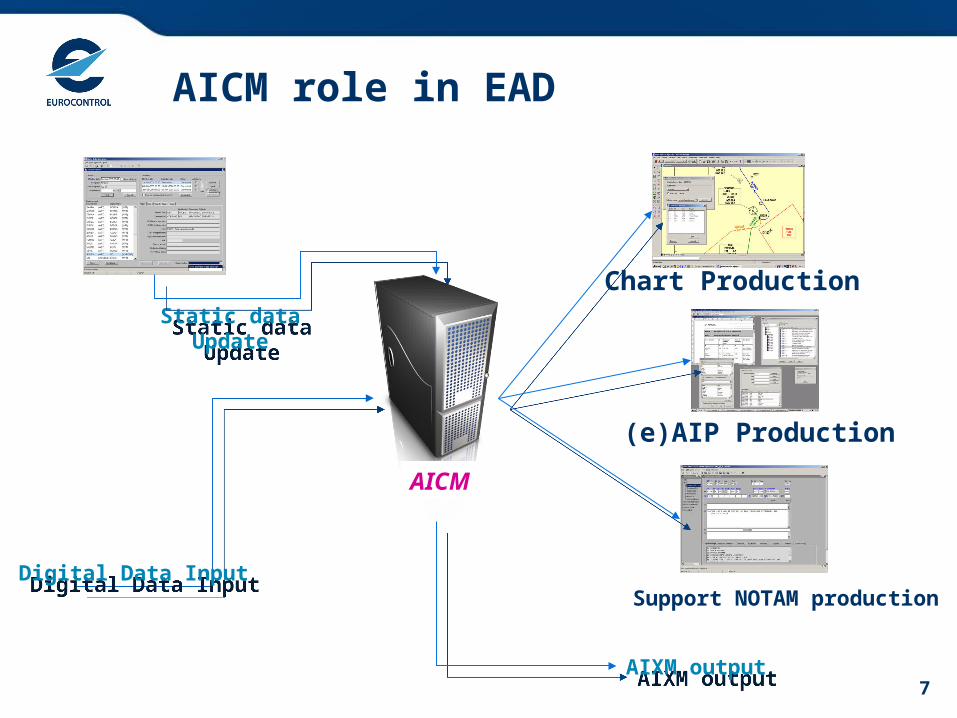
AICM role in EAD
Static dataUpdate
Static dataUpdate
(e)AIP Production
Chart Production
Support NOTAM productionDigital Data InputDigital Data Input
AIXM outputAIXM output
AICM
8
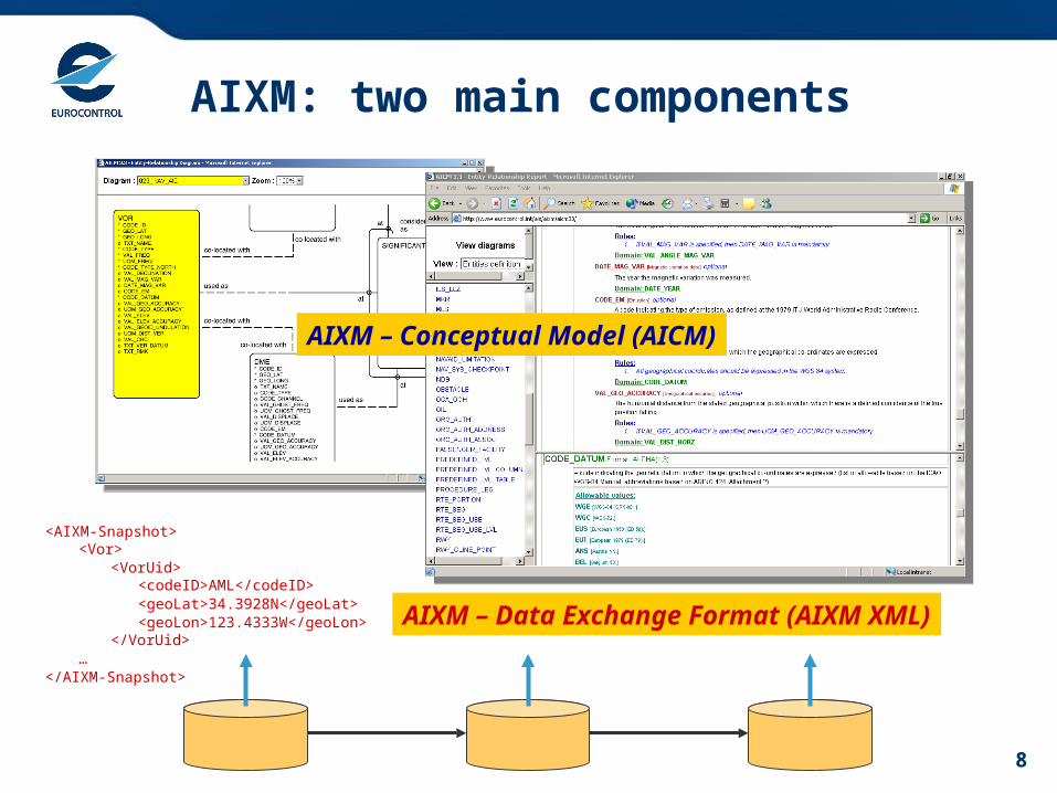
<AIXM-Snapshot><Vor>
<VorUid><codeID>AML</codeID><geoLat>34.3928N</geoLat><geoLon>123.4333W</geoLon>
</VorUid>…
</AIXM-Snapshot>
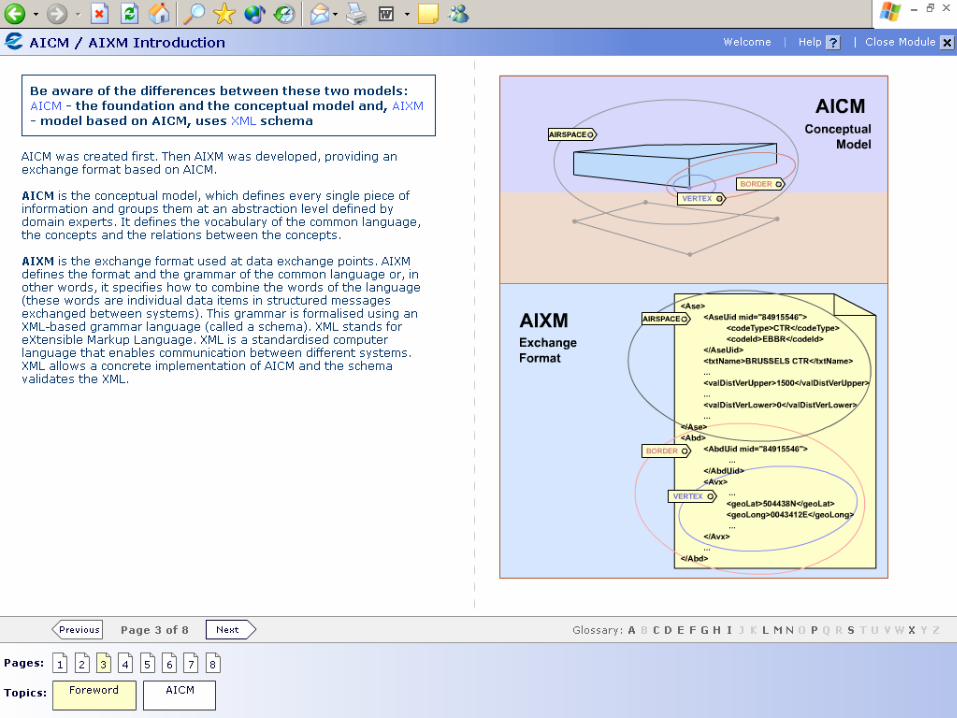
AIXM: two main components
AIXM – Conceptual Model (AICM)
<AIXM-Update> <AIXM-Update>
<AIXM-Snapshot> <AIXM-Snapshot> <AIXM-Snapshot>
AIXM – Data Exchange Format (AIXM XML)

9
AICM/AIXM development
AIP
10
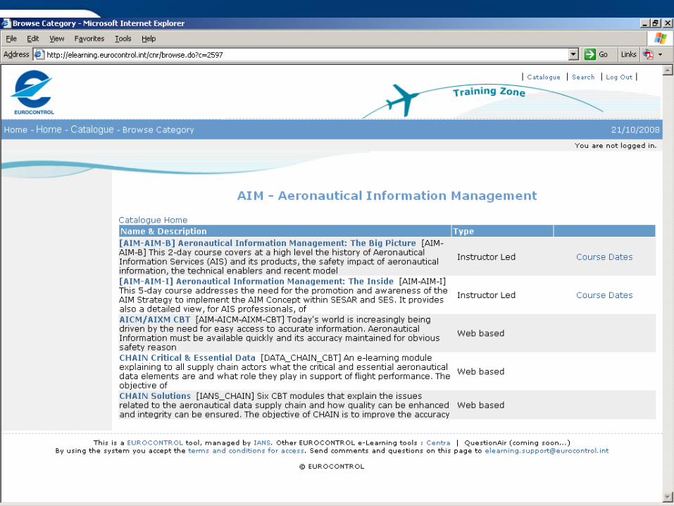
AICM Web Based Training
11
12
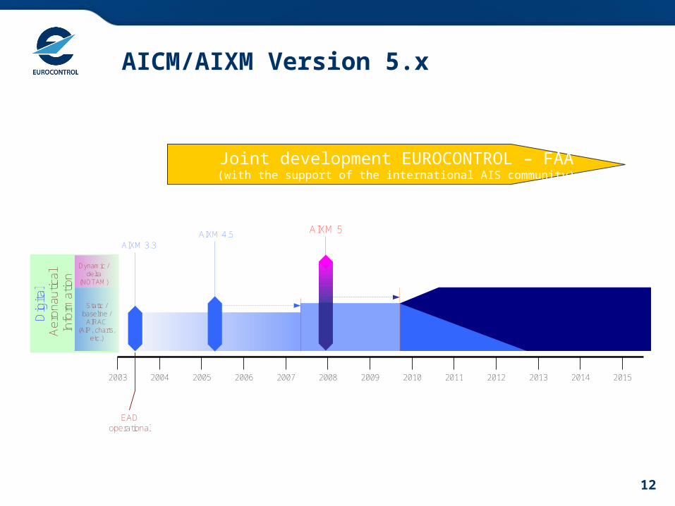
AICM/AIXM Version 5.xA
ero
na
utic
al
Info
rma
tion
Dynamic /delta
(NOTAM)
Static /baseline /
AIRAC(AIP, charts,
etc.)
Dig
ital
2003 2004 2005 2006 2007 2008 2009 2010 2011 2012 2013 2014 2015
AIXM 3.3
EADoperational
AIXM 4.5 AIXM 5
Joint development EUROCONTROL – FAA(with the support of the international AIS community)

13
AIXM 5 Design Objectives
New capabilities
Extensibility
FlexibleExchange
FlexibleMessages
Static and Dynamic
Expand/Refresh Domain Model
TerminalProcedures
Obstacles
Aerodrome Mapping
Metadata Integrity
External Constraints
UML
ISO19100series
GML 3.2
Technical Design DecisionsModularity
14
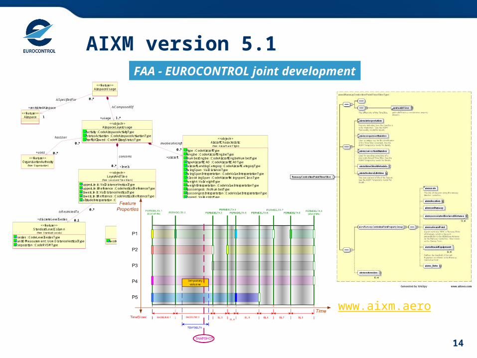
AIXM version 5.1
Airspace<<feature>>
OrganisationAuthority(f rom Organisation)
<<feature>>
AircraftCharacteristic
type : CodeAircraftTypeengine : CodeAircraftEngineTypenumberEngine : CodeAircraftEngineNumberTypetypeAircraftICAO : CodeAircraftICAOTypeaircraftLandingCategory : CodeAircraftCategoryTypewingSpan : ValDistanceTypewingSpanInterpretation : CodeValueInterpretationTypeclassWingSpan : CodeAircraftWingspanClassTypeweight : ValWeightTypeweightInterpretation : CodeValueInterpretationTypepassengers : NoNumberTypepassengersInterpretation : CodeValueInterpretationTypespeed : ValWeightTypespeedInterpretation : CodeValueInterpretationTypewakeTurbulence : CodeWakeTurbulenceType
(f rom Aircraf t and Flight)
<<object>>
AirspaceUsage<<feature>>
1
0..*
+restrictedAirspace
1
0..*isSpecifiedFor
AirspaceLayerUsage
activity : CodeAirspaceActivityTypestatusActivation : CodeAirspaceActivationTypetrafficAllowed : CodeMilitaryStatusType
<<object>>
0..*
0..*
0..*
+user 0..*
hasUser
0..*
+aircraft
0..*
involvesAircraft
1..*+usage 1..*
isComposedOf
Timetable
workingHours : CodeTimetableType
(f rom Time Management)
<<object>>
LayerAndTime
upperLimit : ValDistanceVerticalTypeupperLimitReference : CodeVerticalReferenceTypelowerLimit : ValDistanceVerticalTypelowerLimitReference : CodeVerticalReferenceTypealtitudeInterpretation : CodeAltitudeUseType
(f rom Lev el and Time Block)
<<object>>
0..* +levels0..*
concerns
0..1 +schedule0..1
isActiveBy
StandardLevelColumn
series : CodeLevelSeriesTypeunitOfMeasurement : UomDistanceVerticalTypeseparation : CodeRVSMType
(f rom Standard Lev els)
<<feature>>
0..*
0..1
0..*
+discreteLevelSeries 0..1
isRestrictedTo
FAA - EUROCONTROL joint development
UML
XSD
Temporality Concept
www.aixm.aero
15
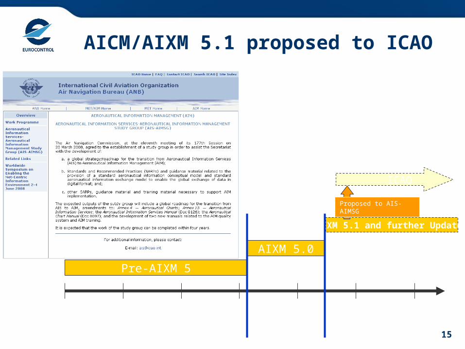
AICM/AIXM 5.1 proposed to ICAO
Pre-AIXM 5
2005 2006 2007 2008 2009 2010 2010
AIXM 5.0
AIXM 5.1 and further Updates
ICAO
Proposed to AIS-AIMSG
16
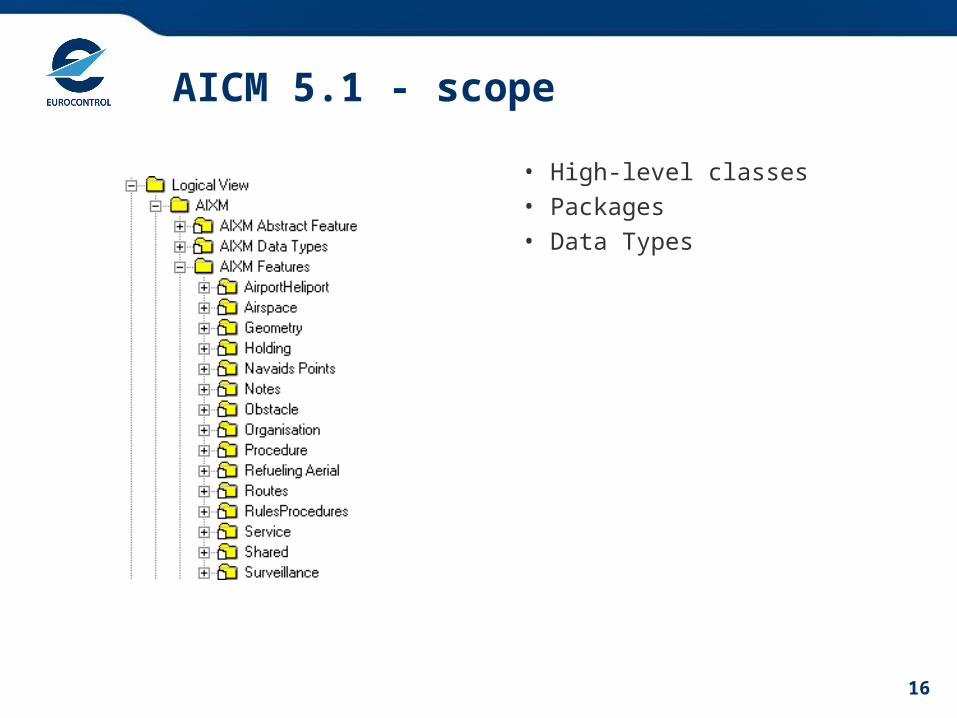
AICM 5.1 - scope
• High-level classes
• Packages
• Data Types
17
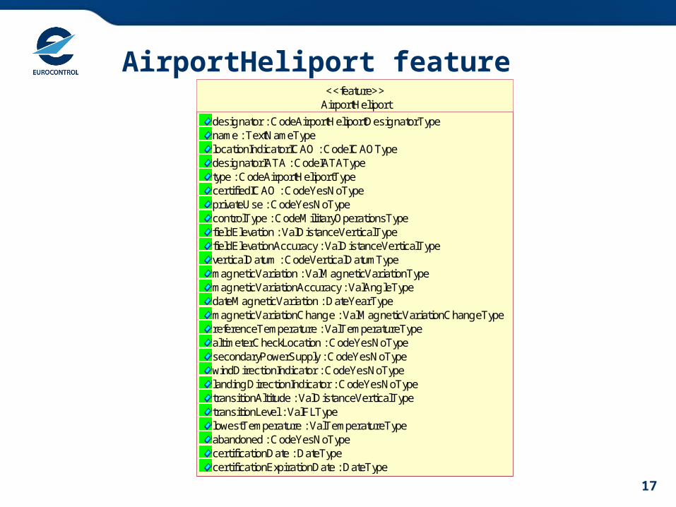
AirportHeliport featureAirportHeliport
designator : CodeAirportHeliportDesignatorTypename : TextNameTypelocationIndicatorICAO : CodeICAOTypedesignatorIATA : CodeIATATypetype : CodeAirportHeliportTypecertifiedICAO : CodeYesNoTypeprivateUse : CodeYesNoTypecontrolType : CodeMilitaryOperationsTypefieldElevation : ValDistanceVerticalTypefieldElevationAccuracy : ValDistanceVerticalTypeverticalDatum : CodeVerticalDatumTypemagneticVariation : ValMagneticVariationTypemagneticVariationAccuracy : ValAngleTypedateMagneticVariation : DateYearTypemagneticVariationChange : ValMagneticVariationChangeTypereferenceTemperature : ValTemperatureTypealtimeterCheckLocation : CodeYesNoTypesecondaryPowerSupply : CodeYesNoTypewindDirectionIndicator : CodeYesNoTypelandingDirectionIndicator : CodeYesNoTypetransitionAltitude : ValDistanceVerticalTypetransitionLevel : ValFLTypelowestTemperature : ValTemperatureTypeabandoned : CodeYesNoTypecertificationDate : DateTypecertificationExpirationDate : DateType
<<feature>>
18
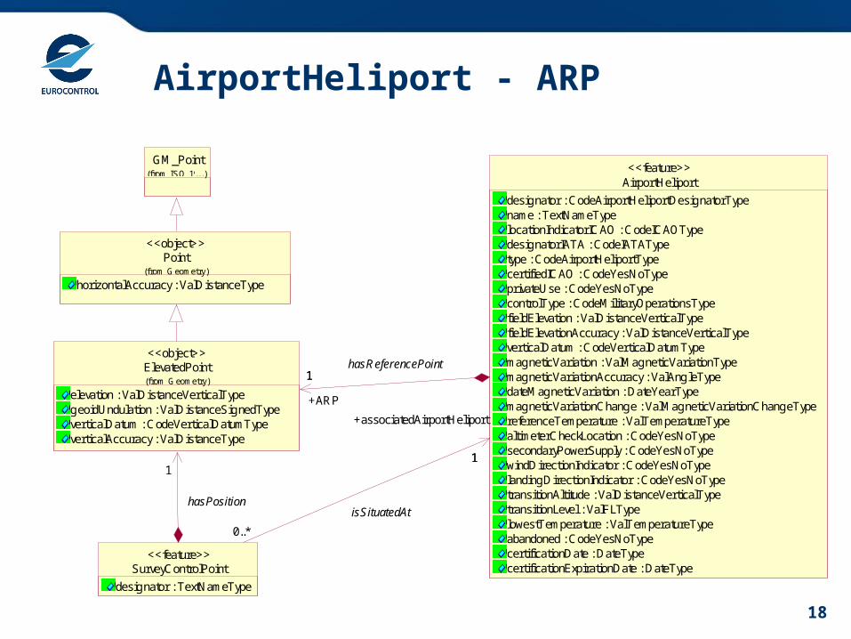
AirportHeliport - ARP
Point
horizontalAccuracy : ValDistanceType(from Geometry)
<<object>>
GM_Point(from ISO 19107 Geometry)...)
ElevatedPoint
elevation : ValDistanceVerticalTypegeoidUndulation : ValDistanceSignedTypeverticalDatum : CodeVerticalDatumTypeverticalAccuracy : ValDistanceType
(from Geometry)
<<object>>
1
AirportHeliport
designator : CodeAirportHeliportDesignatorTypename : TextNameTypelocationIndicatorICAO : CodeICAOTypedesignatorIATA : CodeIATATypetype : CodeAirportHeliportTypecertifiedICAO : CodeYesNoTypeprivateUse : CodeYesNoTypecontrolType : CodeMilitaryOperationsTypefieldElevation : ValDistanceVerticalTypefieldElevationAccuracy : ValDistanceVerticalTypeverticalDatum : CodeVerticalDatumTypemagneticVariation : ValMagneticVariationTypemagneticVariationAccuracy : ValAngleTypedateMagneticVariation : DateYearTypemagneticVariationChange : ValMagneticVariationChangeTypereferenceTemperature : ValTemperatureTypealtimeterCheckLocation : CodeYesNoTypesecondaryPowerSupply : CodeYesNoTypewindDirectionIndicator : CodeYesNoTypelandingDirectionIndicator : CodeYesNoTypetransitionAltitude : ValDistanceVerticalTypetransitionLevel : ValFLTypelowestTemperature : ValTemperatureTypeabandoned : CodeYesNoTypecertificationDate : DateTypecertificationExpirationDate : DateType
<<feature>>
1
+ARP
1hasReferencePoint
0..*
1
+associatedAirportHeliport
1
SurveyControlPoint
designator : TextNameType
<<feature>>
isSituatedAthasPosition

19
AirportHeliport – other associations
Point
horizontalAccuracy : ValDistanceType(from Geometry)
<<object>>
GM_Point(from ISO 19107 Geometry)...)
AirportHeliportResponsibilityOrganisation
role : CodeAuthorityRoleType
<<object>>
ElevatedPoint
elevation : ValDistanceVerticalTypegeoidUndulation : ValDistanceSignedTypeverticalDatum : CodeVerticalDatumTypeverticalAccuracy : ValDistanceType
(from Geometry)
<<object>>
SurveyControlPoint
designator : TextNameType
<<feature>>
1 +location1
hasPosition
OrganisationAuthority
name : TextNameTypedesignator : CodeOrganisationDesignatorTypetype : CodeOrganisationTypemilitary : CodeMilitaryOperationsType
(from Organisation)
<<feature>>
City
name : TextNameType...
<<object>>
NonMovementArea<<feature>>
ContactInformation
name : TextNameTypetitle : TextNameType
(from Address)
<<object>>
0..*
+contact
0..*
isContactedAt ElevatedSurface
elevation : ValDistanceVerticalTypegeoidUndulation : ValDistanceSignedType...verticalDatum : CodeVerticalDatumType...verticalAccuracy : ValDistanceType
(from Geometry)
<<object>>
0..1
+extent
0..1
hasExtent
AirportHotSpot
designator : TextDesignatorTypeinstruction : TextInstructionType
<<feature>>
0..1
+area
0..1
hasShape
AirportHeliport
designator : CodeAirportHeliportDesignatorTypename : TextNameTypelocationIndicatorICAO : CodeICAOTypedesignatorIATA : CodeIATATypetype : CodeAirportHeliportTypecertifiedICAO : CodeYesNoTypeprivateUse : CodeYesNoTypecontrolType : CodeMilitaryOperationsTypefieldElevation : ValDistanceVerticalTypefieldElevationAccuracy : ValDistanceVerticalTypeverticalDatum : CodeVerticalDatumTypemagneticVariation : ValMagneticVariationTypemagneticVariationAccuracy : ValAngleTypedateMagneticVariation : DateYearTypemagneticVariationChange : ValMagneticVariationChangeTypereferenceTemperature : ValTemperatureTypealtimeterCheckLocation : CodeYesNoTypesecondaryPowerSupply : CodeYesNoTypewindDirectionIndicator : CodeYesNoTypelandingDirectionIndicator : CodeYesNoTypetransitionAltitude : ValDistanceVerticalTypetransitionLevel : ValFLTypelowestTemperature : ValTemperatureTypeabandoned : CodeYesNoTypecertificationDate : DateTypecertificationExpirationDate : DateType
<<feature>>
1
+ARP
1hasReferencePoint
0..*
1
0..*
+associatedAirportHeliport
1
isSituatedAt
0..*
1
0..*
+responsibleOrganisation1
isUnderResponsibilityOf0..*
+servedCity0..*
serves
0..*
1
0..*
+associatedAirportHeliport
1
isSituatedAt
0..*+contact 0..*
isContactedAt
0..1+aviationBoundary
0..1
hasBoundaryForAviationPurposes
1
0..*
+affectedAirport1
0..*
isLocatedAt
PropertiesWithSchedule(from Schedules)
<<object>>

20
Navaid
NavaidComponent
collocationGroup : NoSequenceTypemarkerPosition : CodePositionInILSTypeprovidesNavigableLocation : CodeYesNoType
<<object>>
AuthorityForNavaidEquipment
type : CodeAuthorityRoleType
<<object>>
PropertiesWithSchedule(from Schedules)
<<object>>
RunwayDirection(from Runway)
<<feature>>
TouchDownLiftOff(from Helicopter Surfaces)
<<feature>>
AirportHeliport(from Airport/Hel iport)
<<feature>>
OrganisationAuthority(from Organisation)
<<feature>>
ElevatedPoint(from Geometry)
<<object>>
Navaid
type : CodeNavaidServiceTypedesignator : CodeNavaidDesignatorTypename : TextNameTypeflightChecked : CodeYesNoTypepurpose : CodeNavaidPurposeTypesignalPerformance : CodeSignalPerformanceILSTypecourseQuality : CodeCourseQualityILSTypeintegrityLevel : CodeIntegrityLevelILSType
<<feature>>
0..*
0..*
+runwayDirection
0..*
0..*isInstalledAt
0..1+location
0..1
isNavigableBy
0..*
0..*
+touchDownLiftOff
0..*
0..* isInstalledAt
0..*0..*
+servedAirport
0..*0..*
usedForHomingAt
NavaidEquipmentMonitoring
monitored : CodeYesNoType
<<object>>
NavaidOperationalStatus
operationalStatus : CodeStatusNavaidTypesignalType : CodeRadioSignalType
<<object>> 0..*
+availability
0..*
worksBy
NavaidEquipment
designator : CodeNavaidDesignatorTypename : TextNameTypeemissionClass : CodeRadioEmissionTypemobile : CodeYesNoTypemagneticVariation : ValMagneticVariationTypemagneticVariationAccuracy : ValAngleTypedateMagneticVariation : DateYearTypeflightChecked : CodeYesNoType
<<feature>>
0..*0..*
+authority
0..*0..*
isUnderResponsibilityOf
0..1+location
0..1
isPlacedAt0..*
0..*
+navaidEquipment0..*
0..*
isComposedOf
0..*
+monitoring
0..*
isUnmonitoredBy
0..*
+availability
0..*
worksBy
21
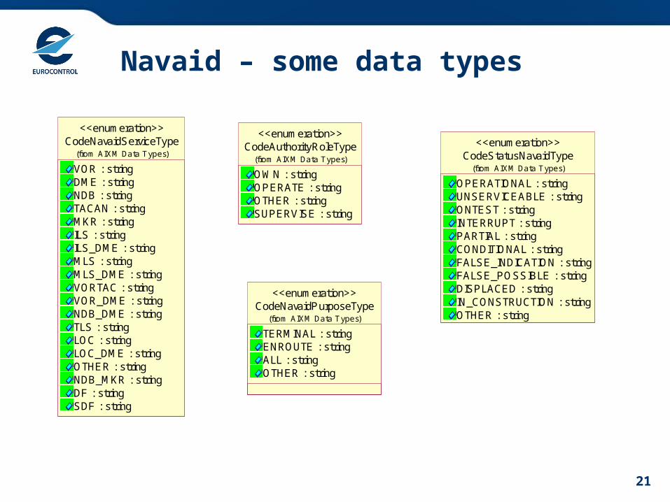
Navaid – some data types
CodeNavaidServiceType
VOR : stringDME : stringNDB : stringTACAN : stringMKR : stringILS : stringILS_DME : stringMLS : stringMLS_DME : stringVORTAC : stringVOR_DME : stringNDB_DME : stringTLS : stringLOC : stringLOC_DME : stringOTHER : stringNDB_MKR : stringDF : stringSDF : string
(from AIXM Data Types)
<<enumeration>>
CodeAuthorityRoleType
OWN : stringOPERATE : stringOTHER : stringSUPERVISE : string
(from AIXM Data Types)
<<enumeration>>
CodeStatusNavaidType
OPERATIONAL : stringUNSERVICEABLE : stringONTEST : stringINTERRUPT : stringPARTIAL : stringCONDITIONAL : stringFALSE_INDICATION : stringFALSE_POSSIBLE : stringDISPLACED : stringIN_CONSTRUCTION : stringOTHER : string
(from AIXM Data Types)
<<enumeration>>
CodeNavaidPurposeType
TERMINAL : stringENROUTE : stringALL : stringOTHER : string
(from AIXM Data Types)
<<enumeration>>

22
Application – an example of forms
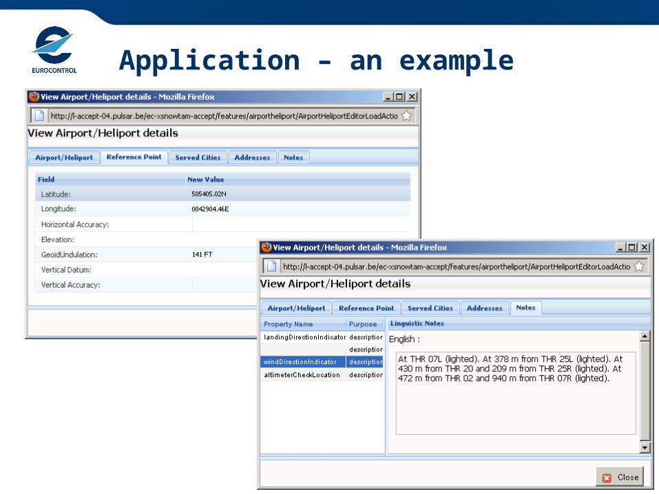
23
Application – an example
24
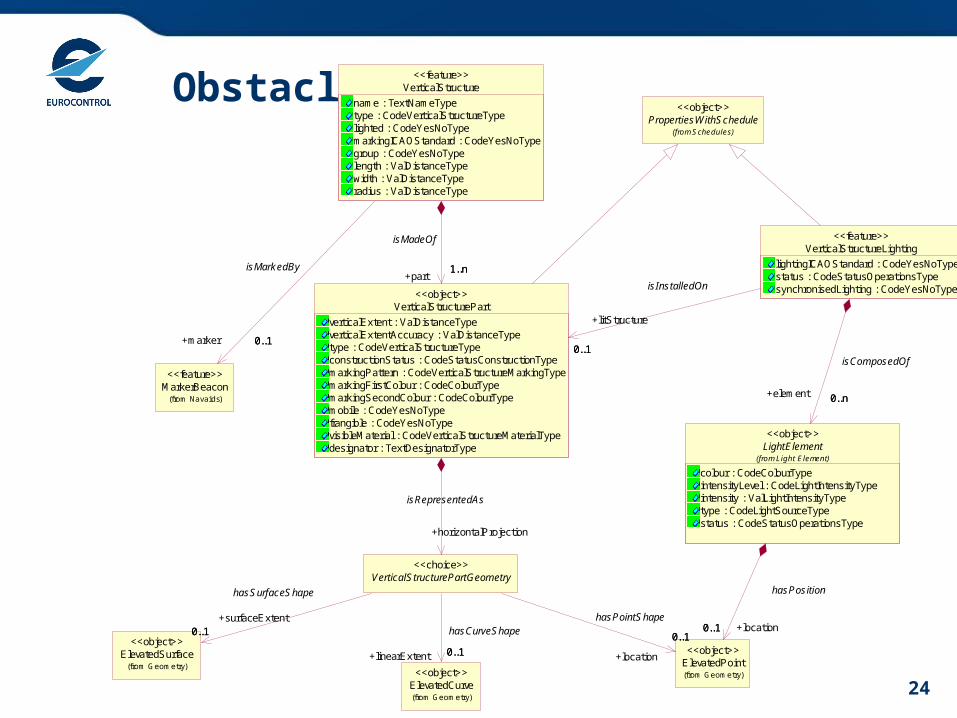
ObstaclePropertiesWithSchedule
(from Schedules)
<<object>>
ElevatedCurve(from Geometry)
<<object>>
ElevatedSurface(from Geometry)
<<object>>
ElevatedPoint(from Geometry)
<<object>>
MarkerBeacon(from Navaids)
<<feature>>
LightElement
colour : CodeColourTypeintensityLevel : CodeLightIntensityTypeintensity : ValLightIntensityTypetype : CodeLightSourceTypestatus : CodeStatusOperationsType
(from Light Element)
<<object>>
0..1 +location0..1
hasPositionVerticalStructurePartGeometry
<<choice>>
0..1+linearExtent 0..1
hasCurveShape0..1+surfaceExtent
0..1
hasSurfaceShape
0..1
+location
0..1
hasPointShape
VerticalStructure
name : TextNameTypetype : CodeVerticalStructureTypelighted : CodeYesNoTypemarkingICAOStandard : CodeYesNoTypegroup : CodeYesNoTypelength : ValDistanceTypewidth : ValDistanceTyperadius : ValDistanceType
<<feature>>
0..1+marker 0..1
isMarkedBy
VerticalStructureLighting
lightingICAOStandard : CodeYesNoTypestatus : CodeStatusOperationsTypesynchronisedLighting : CodeYesNoType
<<feature>>
0..n+element 0..n
isComposedOf
VerticalStructurePart
verticalExtent : ValDistanceTypeverticalExtentAccuracy : ValDistanceTypetype : CodeVerticalStructureTypeconstructionStatus : CodeStatusConstructionTypemarkingPattern : CodeVerticalStructureMarkingTypemarkingFirstColour : CodeColourTypemarkingSecondColour : CodeColourTypemobile : CodeYesNoTypefrangible : CodeYesNoTypevisibleMaterial : CodeVerticalStructureMaterialTypedesignator : TextDesignatorType
<<object>>
+horizontalProjection
isRepresentedAs
1..n+part
1..n
isMadeOf
0..1
+litStructure
0..1
isInstalledOn

25
Obstacle area
Surface(from Geometry)
<<object>>
VerticalStructure<<feature>>
RunwayDirection(from Runway)
<<feature>>
ObstacleArea
type : CodeObstacleAreaTypeobstructionIdSurfaceCondition : CodeObstacleAssessmentSurfaceType
<<feature>>
0..1
+surfaceExtent
0..1
hasExtent
0..*
0..*
0..*
+obstacle0..*
hasObstacle
AirportHeliport(from Airport/Heliport)
<<feature>>OrganisationAuthority
(from Organisation)
<<feature>>
ObstacleAreaOrigin<<choice>>
0..1+ownerRunway
0..1
isRunway
0..1+reference 0..1
isDefinedFor
0..1+ownerAirport
0..1
isAirport
0..1 +ownerOrganisation0..1
isOrganisation
27
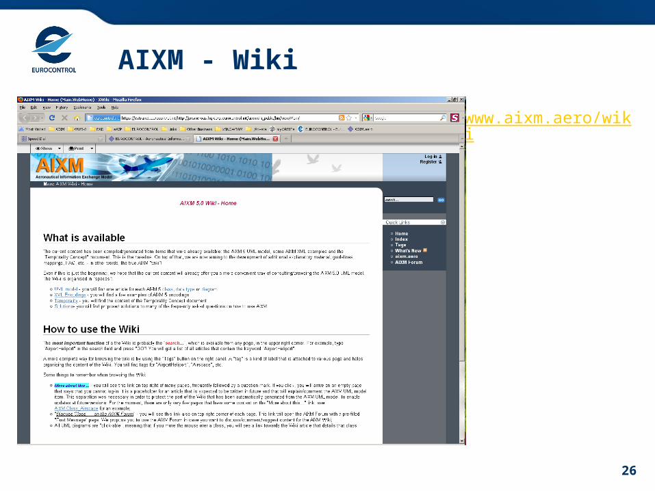
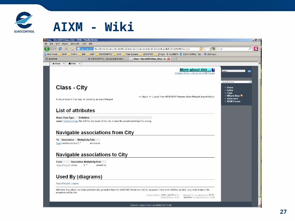
AIXM - Wiki
28
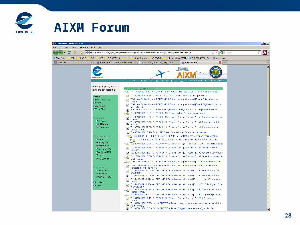
AIXM Forum

Conclusion
30
Conclusions
• AICM is needed for AIS automation
• Phase 2 – already in operations in many regions
• At the core of the EAD “static data operations”
• More info ?• http://www.eurocontrol.int/aim • www.aixm.aero • www.ead.eurocontrol.int

31
Questions?Questions?


![} u Z v ] À ' µ ] } / D > v ] v P v À o } u v - AICM · Title: Microsoft Word - A comprehesive guide to AICM Learning and Development v3 May 2019 Author: Andrew Created Date: 5/17/2019](https://img.pdfslide.us/doc/110x75/5ffff7185d8afa15f279d8c0/-u-z-v-d-v-v-p-v-o-u-v-aicm-title-microsoft-word.jpg)