Embed Size (px)
Citation preview
RICS LAND JOURNAL
1 M A R C H /A P R I L 2 0 1 4 Images ©
Head
T
Land Journal
August/September 2017 rics.org/journals
First among equalsThe story of the first woman to qualify as a surveyor
PG. 24
Pushed o their landAiming to help the millions displaced by development
PG. 18
A sensitive areaAssessing viability of land for a�ordable housing
PG. 16
How to put an economic value on what nature does for us PG. 6
Selling nature
2 A U G U S T/ S E P T E M B E R 2 0 1 7
Changing the Skyline for 70 YearsProviding Award-Winning* services to the built environment & construction sector
A Culture of Safety
• Demolition• Asbestos Removal• Site Reclamation,
Remediation & Clearance• Earthworks• Aggregates - Quarried
& Recycled
Please call us on:Tel: 01661 832422E-mail: [email protected]
*Construction News’ Demolition Specialists of the Year 2014
Brownfield Development Specialists
To advert ise contact James Cannon +44(0)20 7101 2777 or [email protected]
Joint Planning Law Conference OxfordThe leading annual planning law conference 15-17 September 2017
At the forefront of planning Once again, the JPLC provides the setting for vibrant multi-disciplinary discussion of the latest issues affecting the planning industry.
This year’s programmes includes:
Guest speaker:Will Self, Writer and Professor at Brunel University
Keynote address Friday night:Helen Hayes MP
Opening address: Kate Raworth author of ‘Doughnut Economics’
Planning beyond Brexit: Prof Janice Morphet, UCL
Creating a better housing market: Nick Walkley, Homes England
Local authority planning in context: Kathryn Hall, Mid Sussex District Council
Breaking down the barriers to housing delivery: Prof. Christine Whitehead, LSE
Compulsory purchase between a rock and a hard place?: Lucy Thomas, Ashurst LLP
What future for the historic environment?: Dr Chris Miele, Montagu Evans LLP
Legal update: Jenny Wigley, No5 Chambers
HOW TO BOOKOn-line www.jplc.orgEmail [email protected]
“Fantastic venue and consistently superb quality of speakers, the JPLC is a ‘must-attend’ for anyone currently involved with planning and development in the UK.’’ Dr Louise Brooke-Smith, Partner, Arcadis LLP, UK Head of Town Planning and Head of Social Value, RICS Past Global President (2014-15)
RICS LANDJOURNAL
A DV E RT I S I N G
While every reasonable e�ort has been made to ensure the accuracy of all content in the journal, RICS will have no responsibility for any errors or omissions in the content. The views expressed in the journal are not necessarily those of RICS. RICS cannot accept any liability for any loss or damage su�ered by any person as a result of the content and the opinions expressed in the journal, or by any person acting or refraining to act as a result of the material included in the journal. All rights in the journal, including full copyright or publishing right, content and design, are owned by RICS, except where otherwise described. Any dispute arising out of the journal is subject to the law and jurisdiction of England and Wales. Crown copyright material is reproduced under the Open Government Licence v1.0 for public sector information: www.nationalarchives.gov.uk/doc/open-government-licence
contentsCONTACTS
RICS LAND JOURNAL
ST R A P L I N E
2 4 M A R C H /A P R I L 2 0 1 4 Images ©
Author AuthorStandfirst
Head
T
RICS LAND JOURNAL
ST R A P L I N E
2 4 M A R C H /A P R I L 2 0 1 4 Images ©
Head
T
Land Journal
August/September 2017 rics.org/journals
First among equalsThe story of the first woman to qualify as a surveyor
PG. 24
Pushed off the landAiming to help the millions displaced by development
PG. 18
A sensitive areaAssessing viability of land for a�ordable housing
PG. 16
How to put an economic value on what nature does for us PG. 6
Selling nature
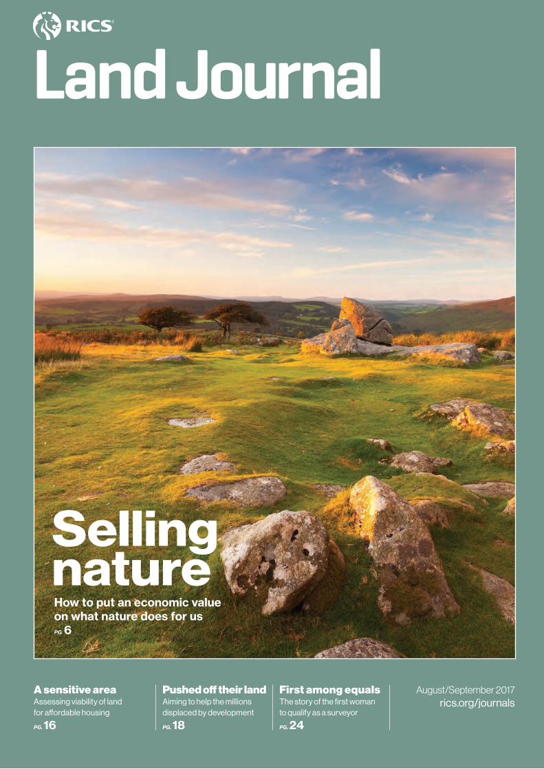
Front cover: Dartmoor © iStock
LAND JOURNAL
Editor: Mike Swain T +44 (0)20 7695 1595 E [email protected]
Editorial team: James Kavanagh, Fiona Mannix, Tony Mulhall (Land Group)
Land Journal is the journal of the Environment, Geomatics, Minerals and Waste, Planning and Development and Rural Professional Groups
Advisory group: Tim Andrews (Stephenson Harwood LLP), Philip Leverton (College of Estate Management), Rob Yorke (rural chartered surveyor), Michael Rocks (Michael Rocks Surveying), Tim Woodward (rural chartered surveyor), Michael Birnie (Buccleuch Estates), Marion Payne-Bird (consultant), Frances Plimmer (FIG – The International Federation of Surveyors), Duncan Moss (Ordnance Survey), Kevin Biggs (Royal Bank of Scotland)
The Land Journal is available on annual subscription. All enquiries from non-RICS members for institutional or company subscriptions should be directed to: Proquest – Online Institutional Access E [email protected] T +44 (0)1223 215512 for online subscriptions
To take out a personal subscription, members and non-members should contact licensing manager Louise Weale E [email protected]
Published by: Royal Institution of Chartered Surveyors, Parliament Square, London SW1P 3AD T +44 (0)24 7686 8555 www.rics.org ISSN: ISSN 1754-9094 (Print) ISSN 1754-9108 (Online)
Editorial and production manager: Toni Gill
Sub-editor: Matthew Gri�ths
Designer: Nicola Skowronek
Advertising: James Cannon T +44(0)20 7101 2777 E [email protected]
Design by: Redactive Media Group Printed by: Page Bros
4 From the chairmen
5Update
6 Selling natureHow do we put an economic value on what nature does for us? Charles Cowap examines the opportunities for rural surveyors and valuers 9 Beyond the farmWhat should rural policy look like after Brexit? Fiona Mannix reports from an event that considered the priorities
10 Defining accuracyJames Kavanagh explains what accuracy means in the context of Level 2 BIM
12 Ancient and modernJamie Quartermaine relates his experience of scanning three heritage buildings in Israel in just two days
14 Forecasting floodsAs extreme weather is set to become more frequent, geographical data can play an essential role in predicting floods and protecting property, says Faith Clark
16 A sensitive areaSurveying professionals have come in for criticism for their role in viability assessments of development land for a¬ordable housing. Tony Mulhall explains how RICS standards and regulation underpin their work
18 Pushed o� their landA new study aims to monitor government adoption of voluntary guidelines on land expropriation, compensation and resettlement, as Nicholas Tagliarino explains
20 A 30-year warTim Howard reports on archaeologists’ ongoing fight to get historic sites in England recognised and evaluated when threatened by development
22 Creatures of habitatsCassie Todd looks at the key laws and policies that protect biodiversity in planning proposals, reviewing ecology surveys and changes to protected species licensing
24 First among equalsCarrie de Silva tells the inspirational life story of Irene Barclay, the first woman to qualify as a chartered surveyor who went on to do pioneering work in social housing and slums
26 Vancouver’s housing crisisJessica Devlin looks at the housing market in Vancouver, Canada – which is one of the least a¬ordable places to live on the planet
A U G U S T/ S E P T E M B E R 2 0 17 3
RICS LANDJOURNAL
C O N T E N TS
FROM THE CHAIRMEN
Barney Pilgrim FRICS
LAND & RESOURCES GLOBAL BOARD
The stand-out article in another very strong issue of the Land Journal focuses on the often conflict-riven process of expropriation of land (p.18), and highlights several key issues motivating the development of the International Land Measurement Standards (ILMS).
Compulsory purchase, or “eminent domain” in the USA, has featured in several recent issues (see Land Journal June/July p.22, for instance), and the latest piece brings home the reality of expropriation in the developing world, pointing out that 10m people are displaced by development each year.
Land acquisition and expropriation are key issues for UN agencies, and RICS shared the stage with UN Habitat, Global Land Tool Network and the Food and Agriculture Organization at the recent FIG Helsinki Working Week (www.fig.net/fig2017) during a session on unregistered land, transfer, standards and valuation. RICS was well represented
I was very pleased to be part of the working group for the first edition of the Rural arbitration guidance note. RICS is grateful to Philip Meade, the primary author, who was ably assisted by a number of other rural chartered surveyors. This guidance is designed to help both the rural chartered surveyor who might be appointed to act or is contemplating arbitration, as well as those qualified as arbitrators. The two sections of the guidance deal specifically with rural assets and property, whether a surveyor is appointed as advocate, expert or the arbitrator.
RICS has also had interesting conversations with universities o¬ering accredited courses about the need to promote rural chartered surveying as a profession. The rural professional group’s YouTube video, “What surveyors do – Land” (http://bit.ly/2s9K2Zx) has been proving popular in highlighting their role in the countryside.
Promotion of the profession was also the focus of the most recent board meeting. We discussed employers’ needs and wants and we are in talks with our colleagues in education, the Future Talent team and careers marketing on this.
RURAL
GerardSmithFRICS
We held another successful GeoBusiness event in London in May. Earlier this year, I noted how some disruptive technologies may not have any significant impact on our daily lives for some time. One such technology is augmented reality (AR), which was part of the theme of the FIG Working Week this year, “Surveying the world of tomorrow – from digitalisation to augmented reality”.
But AR is already being used in sports media with advertising on and around pitches, and tracking ball landings and flightpaths in goal-line technology and in tennis. In surveying, it is also part of building information modelling (BIM) and related processes, risk scenario and analysis planning as well as other visualisations, and it will become a key technology. It could also revolutionise the way ships and other vessels navigate ports and harbours.
A new tranche of apprenticeships begins in September, and the future surveying practitioners it produces may undertake surveys in a very di¬erent way given these advances in robotics and automation. But, fundamentally, we need reliable, accurate data as a basis for informed decisions.
GEOMATICS
GordonJohnston FRICS
ENVIRONMENT & RESOURCES
StephenMcKenna MRICS
at the event with numerous professional papers, workshops, special sessions and keynote speeches. There were three presentations on ILMS, a workshop session, UN session and increased interest and involvement from the global surveying community.
The ILMS Standards Setting Committee is also getting to grips with its scope and focus, and it expects to begin a worldwide consultation in late autumn, before launching the suite in the first half of next year.
C H A I R M E N
4 A U G U S T/ S E P T E M B E R 2 0 17
RICS LANDJOURNAL
their clients, which will have a wide scope and update contaminated land guidance.
We will also be preparing a market insight paper on environmental planning, as a companion to the Environmental impact assessment guidance note. Other suggestions for insight paper topics would be welcome.
Our next conference is in Bristol in October and we are getting our speakers lined up. However, while we were already concerned about Brexit and its e¬ects on our profession, political uncertainty seems even greater following the inconclusive general election.
Finally, changes are afoot in the RICS professional groups, and the recent chairs day explored the views of membership. More will follow in the pages of the Land Journal.
The recent board meeting considered market insight papers, new guidance and education. We are starting work on revised guidance on environmental risks and issues for property professionals and
UPDATE
Final drafts and consultations of the APC review are being completed before sign-o¬, which is scheduled for autumn. In addition to reviewing and rationalising existing competencies, this process has brought forward new ones.
One new optional competency is Masterplanning and urban design, which is principally aimed at planning and development surveyors. Inclusive design is another new competency, and this will be mandatory at Level 1, requiring all new surveyors to: “demonstrate knowledge and understanding of the context for inclusive environments, including the legislative, economic, ethical and moral cases”. Other Level 2 and 3 optional competencies may also be developed.
Meanwhile, the following principles are included in the Construction Industry Council’s report Essentials Principles for Built Environment Professionals: contribute to building an inclusive society; apply professional and responsible judgement and take a leadership role; apply and integrate the principles of inclusive design from the outset of a project; do more than just comply with legislation and codes; seek multiple views to ensure accessibility and inclusivity; and acquire the skills, knowledge, understanding and confidence to make inclusion the norm, not the exception. RICS and other bodies have endorsed these principles and the logic is to commit to competencies relating to them.
Some of these principles are not strictly speaking competencies; however, existing pathway guides make clear that “RICS competencies are ... based on attitudes and behaviours”. Upholding the right attitudes and behaviours in support of expert knowledge and skills is, arguably, what defines a professional.
PLANNING & DEVELOPMENT
Paul CollinsMRICS
James Kavanagh writes: The geospatial profession and its connection to other land sectors was a key theme at this year’s World Bank Conference on Land and Poverty in Washington DC in March.
Speakers from the World Bank, academia, the UN and NGOs underlined the important role of geospatial information and technologies in land administration, management and policy.
The conference had several themes: b research on land governance and
rigorous evaluation of impacts b providing land administration services
at scale b harnessing geospatial data, cloud
platforms and other data technologies b land and urbanisation b land for infrastructure, investment
and disaster risk reduction b securing land rights for equity,
sustainability and resilience.
Several academic sessions focused on the need for a combined land curriculum and how to encourage the next generation of surveyors. But a particular theme was the need for a more holistic and less specialised global geospatial profession, with an emphasis on the education of well-rounded, generalist land professionals.
The sessions on the use of drones for cadastre and on land management
were popular; it became apparent that drones are particularly good at change detection and the identification of illegal or unregulated building. Blockchain also provoked a lot of debate.
There were presentations on the International Land Measurement Standards (ILMS) initiative, and the ILMS coalition held a special session with the Standards Setting Committee. The committee is starting to gain traction with related land programmes such as UN-Habitat’s Fit-for-Purpose Land Administration initiative.
RICS took part in several well-attended presentations, joint lectures with Thomson Reuters, roundtables and masterclasses with UN-Habitat on our ground-breaking research paper Valuation of Unregistered Land, due for publication later this year.
But the takeaway conference message was the importance of seeing land in a holistic and interconnected manner, from mapping to tenure security to taxation and acquisition. The technology is there – we just have to use it appropriately, focusing on the purpose, flexibility and scaleability of proposed solutions to what are often enormous problems. The feeling I get is that geospatial is coming of age.n Papers and videos are available at http://bit.ly/2fZCB2x
RICS Rural Conference 11 October, Hexham Auction Martn www.rics.org/northrural
Future Foresters Technology Day 20 October, Moulton College, Northamptonn www.rfs.org.uk/events/ future-foresters
World Bank land and poverty conference highlights key role of geospatial profession
Conference dates
A U G U S T/ S E P T E M B E R 2 0 17 5
RICS LAND JOURNAL
Irish society president elected Colin Bray has been elected President of the Society of Chartered Surveyors, Ireland. Bray is the CEO and Chief Surveyor of Ordnance Survey Ireland, the national mapping agency. He is also the first geomatics or land surveyor to become president of the society, which represents more than 5,000 chartered surveyors practising in the Republic of Ireland.
E C O S YST E M S E RV I C E S
6 A U G U S T/ S E P T E M B E R 2 0 17
RICS LANDJOURNAL
A global company with a market capitalisation in excess of £200bn has made a commercial agreement with
a group of farmers, under which they will stop growing intensive crops such as maize and revert to traditional pastoral methods of farming.
This is no softly-softly response to the demands of corporate social responsibility, but a hard-nosed business decision to protect a vital asset. The company has seen a 6% annual growth in its share value over the past 10 years – from £36 to £66 a share – and regularly generates a dividend yield of 3%. The company is Nestlé, and the brand being protected is Vittel mineral water.
French law provides that natural mineral waters cannot be treated or blended before they are bottled. Vittel relies for its natural taste on very low levels of both nitrates and a complete absence of nitrites – well below the maximum levels permitted by law. Local farming activities were threatening the unique aquifer from which Vittel water is drawn, and Nestlé spent 10 years working to understand the nature of the problem and how to resolve it. More than 20 farmers – the whole of the catchment – now have contracts of up to 30 years with an intermediary sponsored by Vittel to farm the land in ways that will benefit rather than damage the Grande Source.
The Vittel scheme is not unique. For example, at a National Trust estate in Somerset, there has been an extensive trial to modify water flows and farming practices to protect the village of Holnicote from flooding. Early indications are that this work has been successful, in a place where the Environment Agency would not be able to justify hard flood defence works. Water and flooding are not the only examples; nationally and
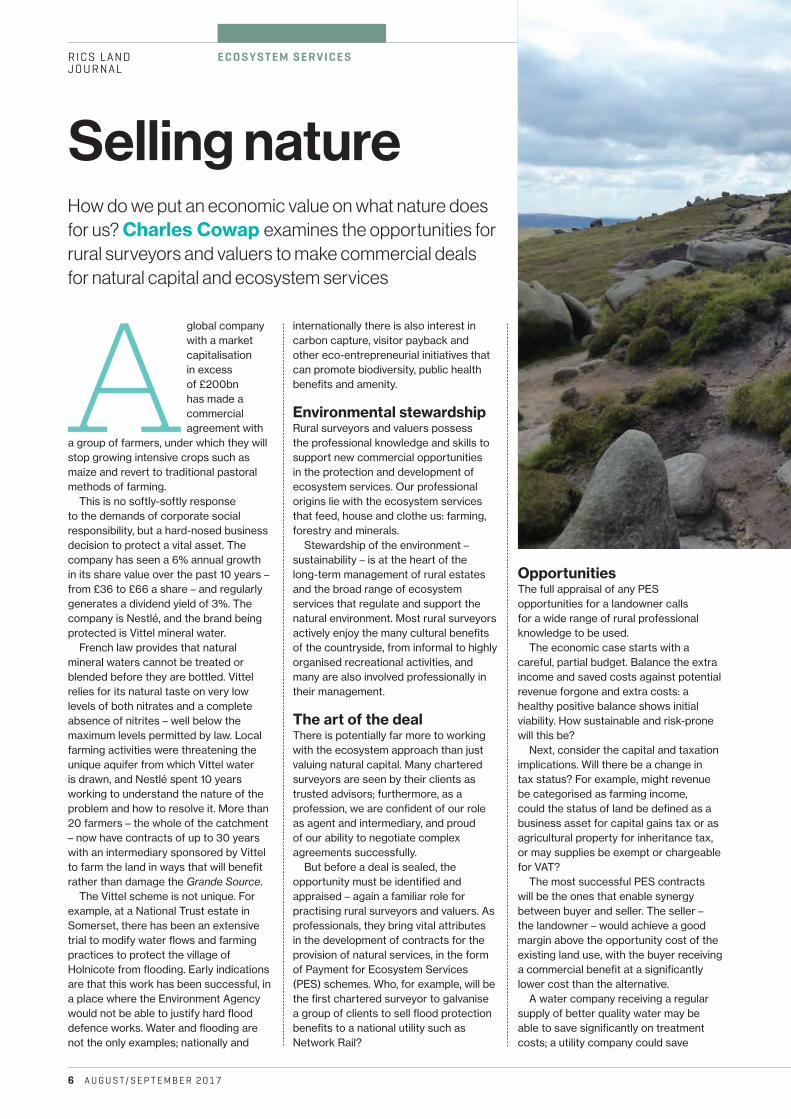
How do we put an economic value on what nature does for us? Charles Cowap examines the opportunities for rural surveyors and valuers to make commercial deals for natural capital and ecosystem services
Selling nature
internationally there is also interest in carbon capture, visitor payback and other eco-entrepreneurial initiatives that can promote biodiversity, public health benefits and amenity.
Environmental stewardshipRural surveyors and valuers possess the professional knowledge and skills to support new commercial opportunities in the protection and development of ecosystem services. Our professional origins lie with the ecosystem services that feed, house and clothe us: farming, forestry and minerals.
Stewardship of the environment – sustainability – is at the heart of the long-term management of rural estates and the broad range of ecosystem services that regulate and support the natural environment. Most rural surveyors actively enjoy the many cultural benefits of the countryside, from informal to highly organised recreational activities, and many are also involved professionally in their management.
The art of the dealThere is potentially far more to working with the ecosystem approach than just valuing natural capital. Many chartered surveyors are seen by their clients as trusted advisors; furthermore, as a profession, we are confident of our role as agent and intermediary, and proud of our ability to negotiate complex agreements successfully.
But before a deal is sealed, the opportunity must be identified and appraised – again a familiar role for practising rural surveyors and valuers. As professionals, they bring vital attributes in the development of contracts for the provision of natural services, in the form of Payment for Ecosystem Services (PES) schemes. Who, for example, will be the first chartered surveyor to galvanise a group of clients to sell flood protection benefits to a national utility such as Network Rail?
OpportunitiesThe full appraisal of any PES opportunities for a landowner calls for a wide range of rural professional knowledge to be used.
The economic case starts with a careful, partial budget. Balance the extra income and saved costs against potential revenue forgone and extra costs: a healthy positive balance shows initial viability. How sustainable and risk-prone will this be?
Next, consider the capital and taxation implications. Will there be a change in tax status? For example, might revenue be categorised as farming income, could the status of land be defined as a business asset for capital gains tax or as agricultural property for inheritance tax, or may supplies be exempt or chargeable for VAT?
The most successful PES contracts will be the ones that enable synergy between buyer and seller. The seller – the landowner – would achieve a good margin above the opportunity cost of the existing land use, with the buyer receiving a commercial benefit at a significantly lower cost than the alternative.
A water company receiving a regular supply of better quality water may be able to save significantly on treatment costs; a utility company could save
Images © Charles Cowap A U G U S T/ S E P T E M B E R 2 0 17 7
of the PES contract, for example in the maintenance of natural channels and other features.
b Are there any animal welfare considerations? Some PES contracts may result in land lying wetter for more of the year, so footcare may need more attention, or a PES contract may be the source of capital funding for new buildings to house livestock over the winter for longer. In certain areas, bog asphodel Narthecium ossifragum has become a problem for some stock; the circumstances in which this plant can become toxic to some animals but not others are complex, and contracts
RICS LAND JOURNAL
n
Broadly speaking, ecosystem services are what nature does for people. There are various ways to classify them, but one common framework, adopted for the UK National Ecosystem Assessment, is:
b provisioning services: these services, such as farming, forestry, minerals and energy, are how nature sustains our physical needs
b regulating services: the water and carbon cycles are examples of the ways that natural resources are maintained in balance
b supporting services: pollination by insects is one instance of the functions that are essential to natural lifecycles
b cultural services: benefits we take from the environment for our health and welfare include the countryside as a place to relax and play, and as inspiration for art and poetry.
Natural capital approaches acknowledge that ecosystem services have an economic value to humans, and seek to recognise this value. The UK has a Natural Capital Committee that is developing our understanding of these areas with a remit to generate reliable values for the national accounts. These values will play an increasing role in development and management decisions – especially as companies are required to account for their relationship with the environment. Rural land managers will need to understand these approaches and be expected to use them.
Ecosystem services and natural capital
under the Countryside Stewardship scheme? Who needs to be consulted, and with what degree of formality?
b Are there planning and other development opportunities? Consideration must be given to any potential hindrance these may cause. Equally, development may be a potential source of PES contracts, for example through natural flood protection or sustainable drainage schemes.
b What are the implications for farming? Stocking rates will need to be considered, along with all other elements of the partial budget. There may be opportunities to use farm machinery and labour as part
big sums on flood damage repair, and on compensation to customers for service disruption. Large companies are increasingly aware of their dependence on the environment, and are being expected to account for these values in their annual reporting.
Entering a PES contract is likely to be a long-term commitment. Clients will need extensive due diligence advice before they can proceed, for example, on the following issues.
b Are legal or other interests such as loans secured on the land? What form does ownership take – outright simple ownership or trustees? Are there other interests – covenants and easements, for example? Are the land’s occupiers tenants, licensees or commoners? Are there sporting and mineral rights? What are the interests of beneficiaries?
b Do any designations apply, such as Site of Special Scientific Interest (SSSI), National Park, Access Land or the designations under the Countryside and Rights of Way Act 2000? There will be others. Do the requirements of a PES contract heighten the prospect of SSSI designation, and what would be the consequences? It is easy to see this as a threat, but are there also opportunities?
b How will a new PES contract interact with existing commitments such as those
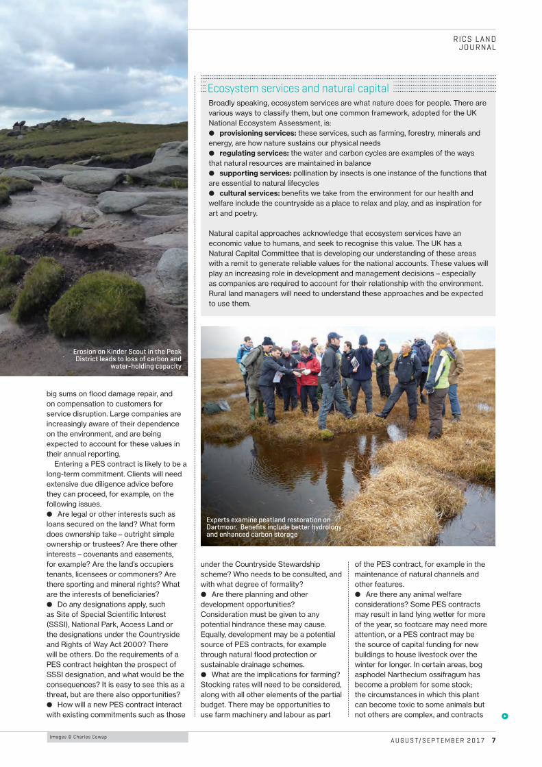
Erosion on Kinder Scout in the Peak District leads to loss of carbon and
water-holding capacity
Experts examine peatland restoration on Dartmoor. Benefits include better hydrology and enhanced carbon storage
E C O S YST E M S E RV I C E S
8 A U G U S T/ S E P T E M B E R 2 0 17
RICS LANDJOURNAL
Charles Cowap MRICS is Principal Lecturer in Land Management at Harper
Adams University and runs his own consultancy specialising in training and innovation for rural
surveyors. He is author of the RICS insight paper Value of natural capital – the need for
chartered surveyors www.rics.org/valuenaturalcapital
may need suitable terms to cover contingencies such as this.
b Careful consideration is required of land’s eligibility, both in principle and in detail, for basic payment purposes, with regard to its availability for farming and the requirements of cross-compliance. Looking beyond Brexit, it seems likely that public support for farming will take on more of the characteristics of a PES contract. Given the vagaries of public support schemes, is a commercial contract with a private company that derives a clear commercial profit from the arrangement actually a better prospect in the long term?
b Public liability and insurance questions will be at the fore where any degree of public access is involved, whether as part of the PES arrangement itself, or because land is already open to the public under the 2000 act access designations or as footpaths and bridleways. Closely allied to this will be risk assessment for health and safety purposes.
Form of contractThere is no set form for a commercial PES contract. Some agreements may take e¬ect as a lease or licence, others as a positive or restrictive covenant. It will be vital to ensure that it is framed carefully – for example, an agreement that gives or implies exclusive possession of land in return for a payment may be interpreted as a lease for a rent at some future date, even if this was not the original intention.
The security of longer-term contracts regarding future changes in ownership will also need to be considered. Currently, only restrictive covenants can be enforced against successors in title in England and Wales. Scotland
has a system of conservation covenants under which positive terms can be enforced against successors, but use and experience of these is minimal. There are various roundabout ways of securing succession, but they too will need to be carefully framed.
The Law Commission has proposed a mechanism for conservation covenants in England and Wales, but further legislation is still required. The scope for such covenants will nevertheless be limited, with their use by commercial organisations denied, for example.
There will be a need for specialised legal advice in the early years as well. Rural surveyors are well placed to frame this requirement and work with the other professionals whose input will be needed, including access to barristers through the licensed access arrangements, formerly Direct Professional Access.
Whatever form a legal contract eventually takes, it is almost inevitable
that there will be both short- and long-term aspects to the agreement. The shorter-term aspects may be covered in a separate document committing the parties to regular reviews of management activity, progress with the intended outcomes of the agreement, renewal of capital works and other day-to-day aspects of management.
Our experience with agricultural licences and leases, as well as management agreements, stewardship agreements and the like, will all provide a valuable background in enabling us to undertake this work with confidence. We have a duty both to our clients and ourselves to engage fully with these new ways of thinking in the management of rural assets. b
n
Sustainability The Vittel payments for ecosystem services: a
“perfect” PES case? by Danièle Perrot-Maître, published by International
Institute for Environment and Development and the UK Department for International
Development, September 2006http://pubs.iied.org/pdfs/G00388.pdf
Fiona Mannix, Associate Director RICS Land Group, writes: Our first paper on ecosystem services, Challenges for international professional practice: from market value to natural value (www.rics.org/mvtonv) outlined how new approaches to the appraisal, valuation and management of natural capital and nature’s services – ecosystem services – promise to transform the way land is managed, development is undertaken, assets are appraised and valued, and payment is made for a range of goods and services previously taken for granted.
Our second paper Value of natural capital – the need for chartered surveyors (www.rics.org/valuenaturalcapital) develops our thinking in this area. While the paper outlines case studies that involve grasslands and woodlands, the approaches can be applied across a range of natural assets. The paper was launched at our Rural Conference in Cirencester on 20 June.
RICS encourages all chartered surveyors working in land and natural resources to familiarise themselves with this paper and other relevant industry publications, while staying abreast of developments in ecosystem services.
Value of natural capital RICS insight paper
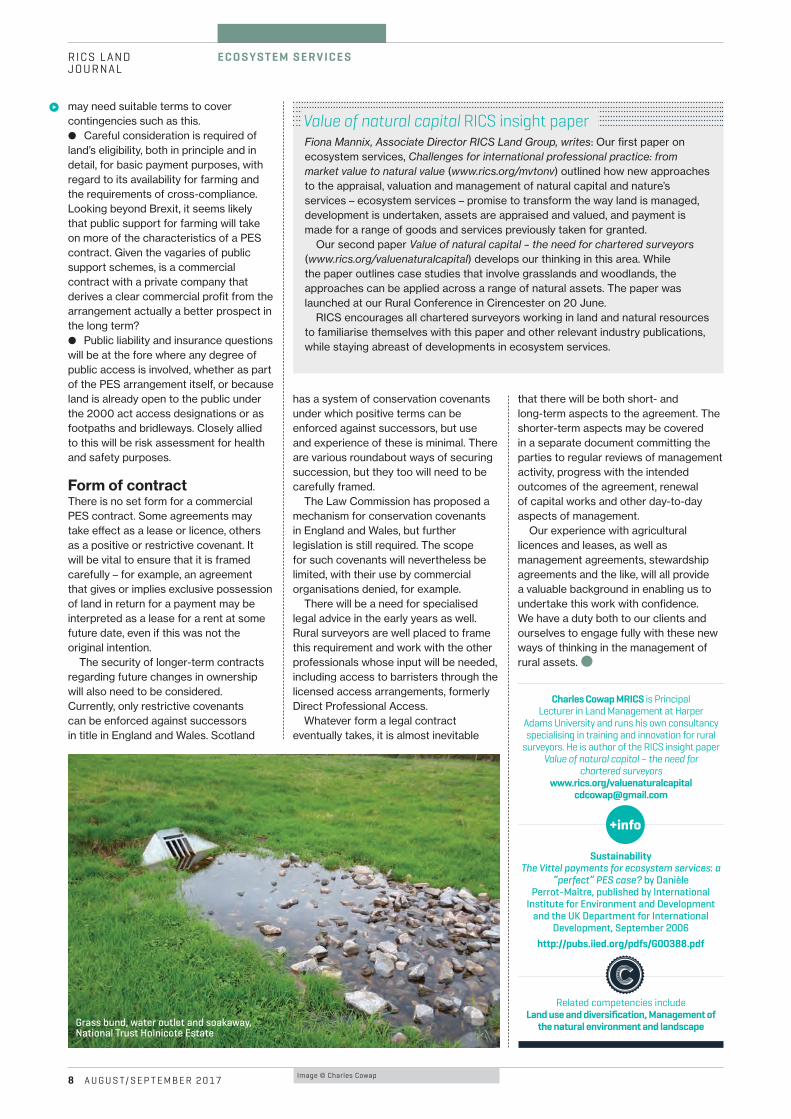
Grass bund, water outlet and soakaway, National Trust Holnicote Estate
Related competencies include Land use and diversification, Management of
the natural environment and landscape
Image © Charles Cowap
R U R A L B R E X I T RICS LANDJOURNAL
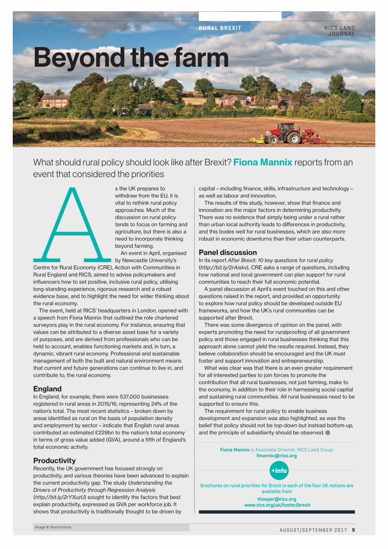
Beyond the farm
What should rural policy should look like after Brexit? Fiona Mannix reports from an event that considered the priorities
A s the UK prepares to withdraw from the EU, it is vital to rethink rural policy approaches. Much of the discussion on rural policy tends to focus on farming and agriculture, but there is also a need to incorporate thinking beyond farming.
An event in April, organised by Newcastle University’s
Centre for Rural Economy (CRE), Action with Communities in Rural England and RICS, aimed to advise policymakers and influencers how to set positive, inclusive rural policy, utilising long-standing experience, rigorous research and a robust evidence base, and to highlight the need for wider thinking about the rural economy.
The event, held at RICS’ headquarters in London, opened with a speech from Fiona Mannix that outlined the role chartered surveyors play in the rural economy. For instance, ensuring that values can be attributed to a diverse asset base for a variety of purposes, and are derived from professionals who can be held to account, enables functioning markets and, in turn, a dynamic, vibrant rural economy. Professional and sustainable management of both the built and natural environment means that current and future generations can continue to live in, and contribute to, the rural economy.
EnglandIn England, for example, there were 537,000 businesses registered in rural areas in 2015/16, representing 24% of the nation’s total. The most recent statistics – broken down by areas identified as rural on the basis of population density and employment by sector – indicate that English rural areas contributed an estimated £229bn to the nation’s total economy in terms of gross value added (GVA), around a fifth of England’s total economic activity.
ProductivityRecently, the UK government has focused strongly on productivity, and various theories have been advanced to explain the current productivity gap. The study Understanding the Drivers of Productivity through Regression Analysis (http://bit.ly/2rYXuzU) sought to identify the factors that best explain productivity, expressed as GVA per workforce job. It shows that productivity is traditionally thought to be driven by
capital – including finance, skills, infrastructure and technology – as well as labour and innovation.
The results of this study, however, show that finance and innovation are the major factors in determining productivity. There was no evidence that simply being under a rural rather than urban local authority leads to di¬erences in productivity, and this bodes well for rural businesses, which are also more robust in economic downturns than their urban counterparts.
Panel discussionIn its report After Brexit: 10 key questions for rural policy (http://bit.ly/2rAiskv), CRE asks a range of questions, including how national and local government can plan support for rural communities to reach their full economic potential.
A panel discussion at April’s event touched on this and other questions raised in the report, and provided an opportunity to explore how rural policy should be developed outside EU frameworks, and how the UK’s rural communities can be supported after Brexit.
There was some divergence of opinion on the panel, with experts promoting the need for ruralproofing of all government policy and those engaged in rural businesses thinking that this approach alone cannot yield the results required. Instead, they believe collaboration should be encouraged and the UK must foster and support innovation and entrepreneurship.
What was clear was that there is an even greater requirement for all interested parties to join forces to promote the contribution that all rural businesses, not just farming, make to the economy, in addition to their role in harnessing social capital and sustaining rural communities. All rural businesses need to be supported to ensure this.
The requirement for rural policy to enable business development and expansion was also highlighted, as was the belief that policy should not be top-down but instead bottom-up, and the principle of subsidiarity should be observed. C
Fiona Mannix is Associate Director, RICS Land [email protected]
A U G U S T/ S E P T E M B E R 2 0 17 9Image © Shutterstock
Brochures on rural priorities for Brexit in each of the four UK nations are available from
[email protected] www.rics.org/uk/footer/brexit
B I M
1 0 A U G U S T/ S E P T E M B E R 2 0 17
RICS LANDJOURNAL
James Kavanagh explains what accuracy means in the context of Level 2 BIM
Defining accuracy
Across-industry collaborative group has been working hard to reach consensus on the five geospatial issues that threaten the adoption of Level 2 building information modelling (BIM; see Land Journal October/November 2016, pp.14–15), and deciding on how to communicate this to the wider professional community. These
critical five issues are accuracy; interoperability; metadata; level of detail; and generalisation.
Survey4BIM, a collective of geospatial professionals, has formed a number of smaller groups that have focused on each of these issues, and recently presented at the GeoBusiness 2017 event. The first issue to be tackled is an old geospatial chestnut – namely, accuracy – and was agreed by all involved as the most important to get right.
MisunderstandingsThere is a general misunderstanding of what accuracy means even among expert geospatial surveyors, never mind civil engineers, architects, cost estimators and any of the other related professions involved in BIM – and this is not even to touch on the confusion between relative and absolute accuracy.
These definitions can also be applied to other aspects of surveying, such as International Property Measurement Standards, topographic surveys, boundary definition and many more. Understanding the di¬erences between the terms is therefore essential for surveyors making any kind of spatial or physical measurements.
The Survey4BIM accuracy group has produced a comprehensive wording for what accuracy, tolerance and precision mean in the context of surveying and its application to BIM. This common understanding is an essential building block in both Level 2 BIM adoption and e¬ective collaboration. The group was led and managed e¬ectively by geospatial expert Bernhard Becker, CEO at GeoLearn.
AccuracyThe term “accuracy” is often used to describe the way work conforms to a predefined standard or specification. This interpretation includes completeness of information as well as how true or accurate that information is.
The completeness of information can, however, be treated separately from accuracy. In a BIM context, the level of detail or definition and generalisation of information can be used to deal with completeness. Therefore, the accuracy in a geospatial sense can be defined as: “The degree to which a survey measurement and/or calculation conforms to its true value.”
There is a considerable body of study and reference material devoted to defining accuracy. For definition in BIM systems, three principal di¸culties arise.1. We can never know with absolute certainty what the true value of an observed quantity actually is. We can only derive a most probable value using multiple observations and statistical calculations such as standard deviation.2. Measurement and location has to be related to a co-ordinate system. For BIM, the same system should be used from project feasibility to operation. The co-ordinate system is realised using co-ordinated survey control stations, such as benchmarks and control markers. Inaccuracies in the survey control will find their way into survey detail, for instance, in the form of scanned points. It must be possible to describe geospatial accuracy in digital BIM systems to enable e¬ective co-ordination.3. There are many situations where the accuracy of measurements – distances, bearings and height di¬erences – between specific points or objects is more important than the absolute accuracy of each point in a co-ordinate system. For example, when considering a dimension between two corners of a room or the front and rear elevation of a building, such as overall floor span, the accuracy of that derived distance may be more important than the accuracy in its co-ordinate system. This is known as relative accuracy, and also needs to be understood in a BIM system.
So in geospatial terms, “absolute accuracy” is the extent to which an object or point conforms to its true location in a chosen co-ordinate system, while “relative accuracy” is the comparison of a measurement derived from specific surveyed points or objects and their true measure.
Absolute accuracy can be expressed as the three-dimensional co-ordinate or individual co-ordinate component di¬erence between its reported most probable value in a defined survey co-ordinate system – that is, x, y or z – and its true position in that co-ordinate system.
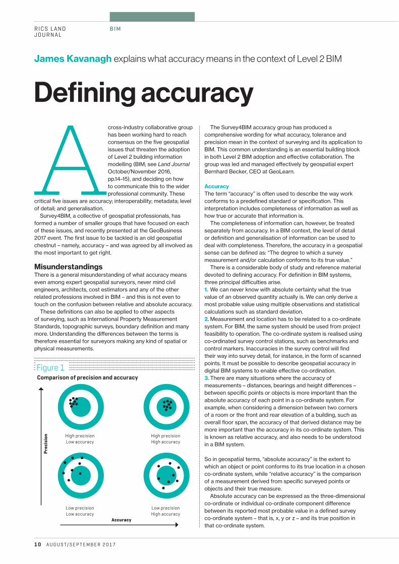
Figure 1Comparison of precision and accuracy
High precisionLow accuracy
High precisionHigh accuracy
Low precisionLow accuracy
Low precisionHigh accuracy
Precision
Accuracy
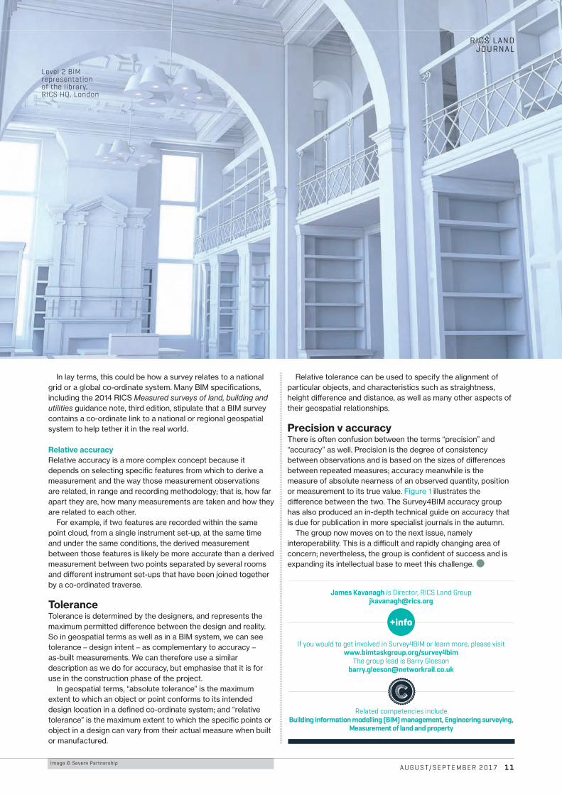
Image © Severn PartnershipA U G U S T/ S E P T E M B E R 2 0 17 1 1
RICS LAND JOURNAL
In lay terms, this could be how a survey relates to a national grid or a global co-ordinate system. Many BIM specifications, including the 2014 RICS Measured surveys of land, building and utilities guidance note, third edition, stipulate that a BIM survey contains a co-ordinate link to a national or regional geospatial system to help tether it in the real world.
Relative accuracyRelative accuracy is a more complex concept because it depends on selecting specific features from which to derive a measurement and the way those measurement observations are related, in range and recording methodology; that is, how far apart they are, how many measurements are taken and how they are related to each other.
For example, if two features are recorded within the same point cloud, from a single instrument set-up, at the same time and under the same conditions, the derived measurement between those features is likely be more accurate than a derived measurement between two points separated by several rooms and di¬erent instrument set-ups that have been joined together by a co-ordinated traverse.
ToleranceTolerance is determined by the designers, and represents the maximum permitted di¬erence between the design and reality. So in geospatial terms as well as in a BIM system, we can see tolerance – design intent – as complementary to accuracy – as-built measurements. We can therefore use a similar description as we do for accuracy, but emphasise that it is for use in the construction phase of the project.
In geospatial terms, “absolute tolerance” is the maximum extent to which an object or point conforms to its intended design location in a defined co-ordinate system; and “relative tolerance” is the maximum extent to which the specific points or object in a design can vary from their actual measure when built or manufactured.
Relative tolerance can be used to specify the alignment of particular objects, and characteristics such as straightness, height di¬erence and distance, as well as many other aspects of their geospatial relationships.
Precision v accuracyThere is often confusion between the terms “precision” and “accuracy” as well. Precision is the degree of consistency between observations and is based on the sizes of di¬erences between repeated measures; accuracy meanwhile is the measure of absolute nearness of an observed quantity, position or measurement to its true value. Figure 1 illustrates the di¬erence between the two. The Survey4BIM accuracy group has also produced an in-depth technical guide on accuracy that is due for publication in more specialist journals in the autumn.
The group now moves on to the next issue, namely interoperability. This is a di¸cult and rapidly changing area of concern; nevertheless, the group is confident of success and is expanding its intellectual base to meet this challenge. b
If you would to get involved in Survey4BIM or learn more, please visit www.bimtaskgroup.org/survey4bim
The group lead is Barry [email protected]
James Kavanagh is Director, RICS Land [email protected]
Related competencies include Building information modelling (BIM) management, Engineering surveying,
Measurement of land and property
Level 2 BIM representation of the library, RICS HQ, London

L AS E R S C A N N I N G
1 2 A U G U S T/ S E P T E M B E R 2 0 17
RICS LANDJOURNAL
Scans of heritage buildings that used to take weeks can now be done in hours thanks to mobile mapping technology. Jamie Quartermaine relates his experience of scanning three such buildings in Israel in just two days
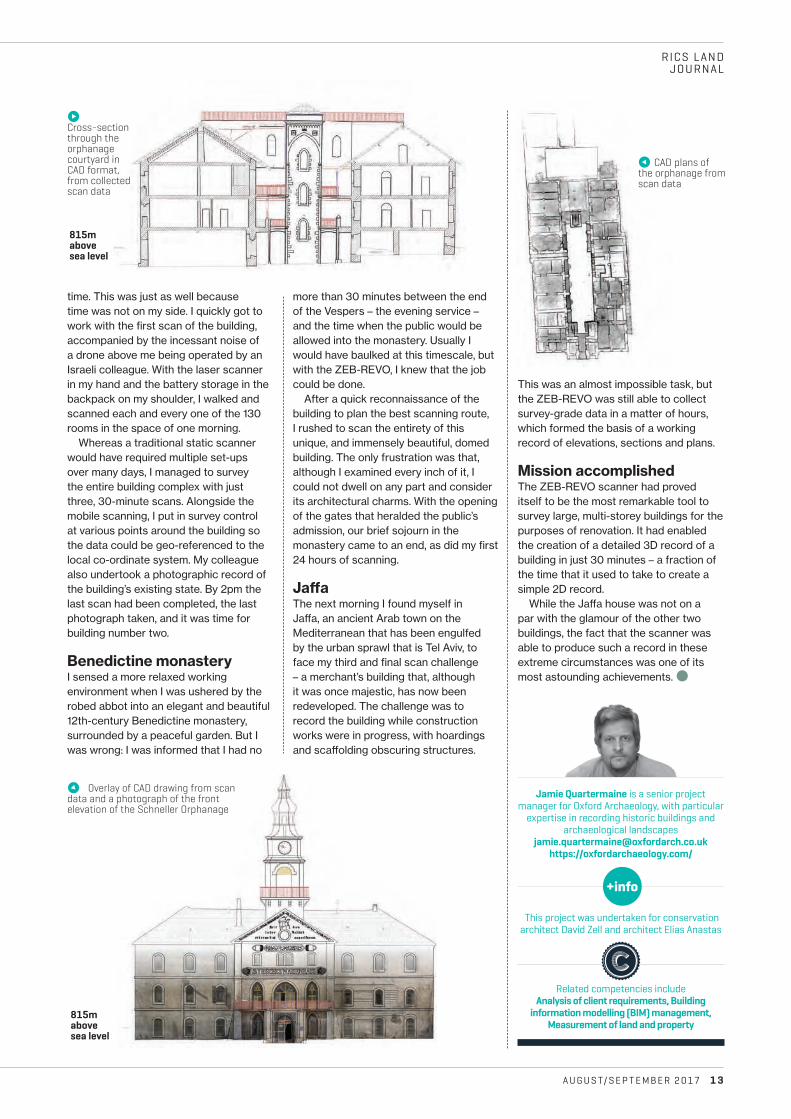
k Courtyard of the orphanage with its distinctive onion-dome tower
Ancient and modern
Images © Jamie Quartermaine
Iwas invited to undertake a very rapid 3D survey of the large Schneller orphanage in Jerusalem (see the photo, left), using a handheld ZEB-REVO laser scanner manufactured
by GeoSLAM, which I had hired in the UK. To minimise the cost of the hire charges, I had to get in and out in just two days.
While I was there it was suggested, if I had a little spare time, that I might also survey a 12th-century monastery and an elegant 19th-century merchant’s house in Ja¬a; the latter has been largely redeveloped and is now covered in sca¬olding. At that stage I should have backed away, but I didn’t.
I arrived in Jerusalem at 1.30am, and the clock was ticking. I went to the orphanage at 7am, and realised what I had let myself in for: it was huge. It had four floors and a roof, 130 rooms, an outer courtyard and a number of stables.
A colourful historyThrough my Israeli colleague, I discovered a little more about the history of the orphanage. Built in 1855, it was one of the earliest and largest buildings to be constructed outside the walled Old City of Jerusalem.
It was built by a German missionary to the Holy Land and intended to propagate the influence of Christianity among the local Muslim population; it also had massive outer walls for protection. During its 80 years of service, the building had housed children from across the Middle East, who had engaged in activities that included printmaking, carpentry, pottery and stonemasonry.
In the 1948 Arab–Israeli war the site was occupied by the British, who had it modified into a barracks. It was believed to have housed the largest ammunition arsenal in the Middle East, and was repeatedly attacked by Jewish paramilitary force the Irgun. The site then operated as an Israeli army barracks for the next 60 years until 2008, when it was vacated. Just last year, an archaeological team unearthed the remains of a Roman bath house and winery underneath the site. The next stage of the building’s long and eventful history is conversion into a museum of Judaism – hence the requirement for a complete, high-accuracy survey of the site.
Having used the ZEB-REVO scanner back in the UK, I was already well aware of its simplicity, e¸ciency and ability to conduct large-scale surveys in minimal
A U G U S T/ S E P T E M B E R 2 0 17 1 3
RICS LAND JOURNAL
time. This was just as well because time was not on my side. I quickly got to work with the first scan of the building, accompanied by the incessant noise of a drone above me being operated by an Israeli colleague. With the laser scanner in my hand and the battery storage in the backpack on my shoulder, I walked and scanned each and every one of the 130 rooms in the space of one morning.
Whereas a traditional static scanner would have required multiple set-ups over many days, I managed to survey the entire building complex with just three, 30-minute scans. Alongside the mobile scanning, I put in survey control at various points around the building so the data could be geo-referenced to the local co-ordinate system. My colleague also undertook a photographic record of the building’s existing state. By 2pm the last scan had been completed, the last photograph taken, and it was time for building number two.
Benedictine monasteryI sensed a more relaxed working environment when I was ushered by the robed abbot into an elegant and beautiful 12th-century Benedictine monastery, surrounded by a peaceful garden. But I was wrong: I was informed that I had no
This project was undertaken for conservation architect David Zell and architect Elias Anastas
Jamie Quartermaine is a senior project manager for Oxford Archaeology, with particular
expertise in recording historic buildings and archaeological landscapes
[email protected]://oxfordarchaeology.com/
Related competencies include Analysis of client requirements, Building
information modelling (BIM) management, Measurement of land and property
more than 30 minutes between the end of the Vespers – the evening service – and the time when the public would be allowed into the monastery. Usually I would have baulked at this timescale, but with the ZEB-REVO, I knew that the job could be done.
After a quick reconnaissance of the building to plan the best scanning route, I rushed to scan the entirety of this unique, and immensely beautiful, domed building. The only frustration was that, although I examined every inch of it, I could not dwell on any part and consider its architectural charms. With the opening of the gates that heralded the public’s admission, our brief sojourn in the monastery came to an end, as did my first 24 hours of scanning.
Ja�aThe next morning I found myself in Ja¬a, an ancient Arab town on the Mediterranean that has been engulfed by the urban sprawl that is Tel Aviv, to face my third and final scan challenge – a merchant’s building that, although it was once majestic, has now been redeveloped. The challenge was to record the building while construction works were in progress, with hoardings and sca¬olding obscuring structures.
This was an almost impossible task, but the ZEB-REVO was still able to collect survey-grade data in a matter of hours, which formed the basis of a working record of elevations, sections and plans.
Mission accomplishedThe ZEB-REVO scanner had proved itself to be the most remarkable tool to survey large, multi-storey buildings for the purposes of renovation. It had enabled the creation of a detailed 3D record of a building in just 30 minutes – a fraction of the time that it used to take to create a simple 2D record.
While the Ja¬a house was not on a par with the glamour of the other two buildings, the fact that the scanner was able to produce such a record in these extreme circumstances was one of its most astounding achievements. b
m CAD plans of the orphanage from scan data
n Cross-section through the orphanage courtyard in CAD format, from collected scan data
q Overlay of CAD drawing from scan data and a photograph of the front elevation of the Schneller Orphanage
815m above sea level
815m above sea level
Forecasting floodsAs extreme weather is set to become more frequent, geographical data can play an essential role in predicting floods and protecting property, says Faith Clark
Climate change, global warming, rising sea levels, overdevelopment, extreme weather events, failing infrastructure, overpopulation, poor
planning – whatever the cause, there is general agreement that flooding in the UK is becoming more common and extreme.
One way to classify floods is according to their source. The UK’s Environmental Law Association website uses the following set of classifications, for instance: coastal, river, flash, groundwater and sewer.
mapping company Bluesky argues that if we cannot prevent flooding, we can be better at predicting flood events and protecting people, property and the environment from their e¬ect, and that geographical data has an essential part to play in this process.
Bluesky has been working with hazard-mapping specialist JBA to improve access to essential flood risk data for some time. In 2015, JBA’s GB Flood Map was launched on Bluesky’s Mapshop (www.blueskymapshop.com). Detailing peril from six di¬erent types of flooding, the map is a tool for flood insurance underwriters and is used by the majority of the UK profession.
O¬ering 5m resolution, the GB Flood Map is highly detailed and covers six flood perils throughout Great Britain – river, coastal, surface water, groundwater, canal failure and dam break – and three in Ireland – river, coastal and surface water. The map is modelled using JFlow, JBA’s proprietary flood modelling software, and has benefited from many years of updates, use, feedback and validation against actual flood claims.
More recently, Bluesky published a new stand-alone groundwater flood map taking into account all sources of groundwater flooding throughout England, Wales and Scotland. Designed
Whichever the source, the costs can be huge. Following the winter of 2015–16, when storms Desmond, Eva and Frank battered the UK during December and into January, the Association of British Insurers (ABI) reported a headline figure of £1.3bn paid by members to customers a¬ected by flood damage. The ABI claimed that 3,000 families were in alternative accommodation and the average expected pay-out was £50,000, compared to an average of £31,000 from the 2013–14 winter storms.
Prediction and protectionSo, what can be done to combat the rising threat of flooding in the UK? Aerial
1 4 A U G U S T/ S E P T E M B E R 2 0 17
RICS LAND JOURNAL
DATA
Image © Bluesky
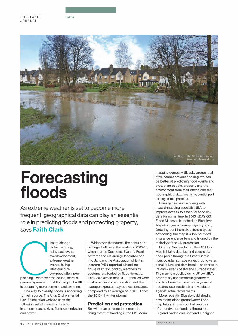
Flooding in the Wiltshire market town of Malmesbury
risk of flash flooding. In research focusing on the Lake District National Park, the imagery is helping to map region-wide river erosion and sedimentation patterns. Aerial maps from 2003 and 2009 are being used alongside older aerial photographs and historic Ordnance Survey maps to understand river channel change from 1850 to the present day.
Rivers in upland regions are associated with greater rates of erosion and sediment transfer due to steep channel gradients, concentrated storm discharges and an active supply of material from surrounding hillsides. This can lead to changes in channel patterns and morphology, increase flood risk and have an impact on the surrounding landscape and environment.
Using geographical information systems (GIS), digital maps of river channel banks and gravel bars are being created using the imagery from di¬erent points in time. The data will be overlaid to quantify channel changes and movements. This information will be compared for all rivers in the central Lake District National Park and applied to other upland areas for improved understanding and management of river sediment and erosion. Designed to inform targeted management strategies that will address current engineering problems and mitigate future flood risks, the Bluesky imagery is being used by a partnership between Durham and Newcastle Universities and the Lake District National Park Authority, funded by the Natural Environment Research Council.
Simulating surface and sewerWater companies are also playing their part. Mott MacDonald Bentley (MMB) recently commissioned Bluesky to generate highly detailed 3D maps to model overland flood routes. Working on behalf of Yorkshire Water as part of the current £1bn asset management framework, MMB is investigating catchment flooding from the public sewer network. The light detection and
ranging (LiDAR) data is being used to create accurate models of the terrain and ground features in relation to the sewers. These models help MMB assess predicted flooding, understand its potential impact and replicate reported flood events to develop holistic solutions.
“Using the LiDAR data, we can obtain a more accurate understanding of overland flood routes and have a better understanding of structures that might have an impact on the movement of flood water and properties that might be a¬ected by a flood event,” comments Danielle Carr, Senior Hydraulic Modeller at MMB. “This enables us to design robust solutions to prevent flooding and therefore protect properties, their residents and the local environment.”
MMB commissioned Bluesky to carry out a LiDAR survey for two catchment areas in Yorkshire at a resolution of four points per metre. The raw point cloud data was then used to create 50cm digital terrain models of the bare earth surface, as well as digital surface models, which include features such as buildings and trees. MMB imported these into the modelling software to create a surface mesh of the terrain and review surface structures that would alter flood routes, such as buildings, walls and watercourses. The simulations, which include the full sewer network and the surface mesh, help MMB assess overland flood routes, and therefore understand which properties are likely to be a¬ected, and they accurately replicate any reported flooding.
Planning potentialThese are just a few examples of the way in which geographical data is playing its part in the fight against flooding. Providing evidence of previous river paths, accurately modelling complex 3D environments and recording previous flood events, geographical data should be an essential tool for planning and protecting against the growing threat of flooding in the UK. b
to help homeowners, developers and risk management authorities to understand the threat of groundwater flooding, this colour-coded map is easy to use and complements other types of flood map.
The 5m groundwater flood map was created by JBA and provides comprehensive coverage of all aquifers in England, Wales and Scotland. It uses a range of data, including the known locations of past groundwater flooding events, rainfall measurements and aquifer properties, and classifies hazards on a 5m grid. The three-tiered methodology used to create the map – comprising derivation of baseline water table, derivation of water table surface, and definition of hazard zones – allows for quick and e¸cient updates and refinements for local areas of interest.
“Groundwater flooding occurs when the groundwater table in permeable rock types rises to enter basements and cellars or presents as excess water emerging at the surface,” says Rachel Tidmarsh, Bluesky’s Managing Director.
“Often overlooked or confused with other causes of flooding, it can pose considerable economic and social threat. As groundwater levels are generally highest following prolonged periods of rainfall, groundwater flooding is a growing threat, as the UK is expected to experience considerably higher amounts of rainfall because of climate change.”
Dr Maxine Zaidman, Technical Director for Hydrology and Hydrometry at JBA, adds: “These maps will support flood risk management activities at a national or local scale, and will help risk management authorities to meet their responsibilities under the Flood and Water Management Act 2010.”
Bluesky’s own data is also helping to understand the causes of upland river flooding, which can a¬ect land boundaries, damage infrastructure and habitat diversity and have an impact further downstream.
A look at the LakesAerial photography is being used to identify changes in sediment movement in upland river courses to help assess the
A U G U S T/ S E P T E M B E R 2 0 17 1 5
RICS LAND JOURNAL
Faith Clark is Marketing Consultant at Marketing Edge
Related competencies include Environmental assessment, Remote sensing and photogrammetry, Spatial data capture
and presentation (advanced mapping)
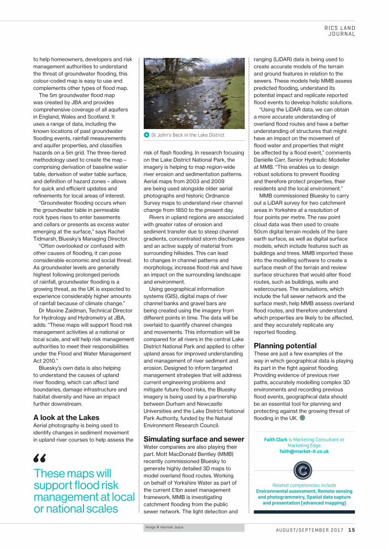
k St John's Beck in the Lake District
Image © Hannah Joyce
“These maps will support flood risk management at local or national scales
Image © Alamy
RICS LANDJOURNAL
V I A B I L I T Y
1 6 A U G U S T/ S E P T E M B E R 2 0 17
A sensitive areaSurveying professionals have come in for criticism for their role in viability assessments of development land and its capacity for affordable housing. Tony Mulhall explains how RICS standards and regulation underpin their work
The delivery of adequate and a¬ordable housing is an important public policy objective, which RICS, as the leading body for the
development and regulation of standards in land, property and infrastructure, supports. RICS also recognises that the measures adopted by the government, regional and local authorities have not succeeded in addressing the shortfall in housing of all kinds, particularly in areas of high demand. The organisation has consistently made representations to government concerning the di¸culties of addressing the issue through conventional approaches.
Provision of a¬ordable housing through the planning process is a complex and at times contentious area of practice and public policy. It is important to be aware of the legal and planning policy requirements imposed on chartered surveyors when providing objective viability advice.
A chartered surveyor’s role in undertaking viability assessments on behalf of applicants, or reviewing them on behalf of public authorities to support planning determination, is just one contribution to the decision-making process. Indeed, the negotiation of
planning obligations – including those on a¬ordable housing – between an applicant and an authority will often involve other professionals and of course the principal parties themselves, and this may result in an outcome that di¬ers significantly from that of the viability assessment itself.
Nonetheless, surveyors acting in this sensitive area play an important role in informing these negotiations, and as such their work is inevitably subject to increasing levels of public attention. RICS professionals have come in for criticism about the way they carry out their role in the planning process where issues of development viability have been assessed, and the organisation has had occasion to investigate complaints that have been made about the conduct of regulated firms and practitioners.
Any complaint we receive regarding the conduct or competence of an RICS-regulated professional or firm is considered seriously through the independent regulatory process, described below; however, public criticism of the profession has been made without an explanation of the full context.
Guidance noteIn 2012, the government produced the National Planning Policy Framework (NPPF) for England, with the aim of achieving growth by attracting investment
and development. While it acknowledges the primacy of the plan-led system, the framework emphasises practical approaches to housing provision in a market context that can enable sustainable development.
RICS professionals provide objective advice to both private developers and public-sector bodies engaged with planning and development in the context of the NPPF. In response to requests from practitioners, it published the Financial viability in planning guidance note in 2012, which advises professionals on how the viability test that the NPPF requires can be satisfied.
Other methods have been adopted, and the government has accepted that there are di¬erent approaches. The main one preferred by some local authorities employs a site value that is based on existing use value (EUV), plus a fixed percentage uplift.
The guidance note advocates an approach based on market value, with an assumption that regard will be given to planning policy. Planning application decisions, planning inquiries and court decisions all rely on this guidance.
Many people reading critical comments may not also have read that RICS has published such guidance, and so they will not be aware of the advice provided to practising professionals. But it is under this guidance and other ethical
RICS LAND JOURNAL
A U G U S T/ S E P T E M B E R 2 0 17 17
requirements that chartered surveyors are regulated.
Principal criticismsThe principal criticism of the RICS guidance is that starting with market value, subject to certain assumptions, results in a higher land value in the appraisal than if this were entered in the appraisal as EUV plus a percentage uplift. The di¸culty with this latter approach is that the percentage uplift is arbitrary unless it is pegged to market conditions – as required by the NPPF and planning practice guidance (PPG) – to encourage the land to be brought forward.
There is also concern that without appropriate analysis and interpretation of comparable evidence there is a risk of valuers relying on transactional evidence that may not comply with policy in terms of a¬ordable housing provision. Much of this arises from a lack of understanding of the ordinary competencies of the valuation profession in analysing and disaggregating comparable evidence.
Legal and policy frameworksThe guidance note is grounded in the statutory and regulatory planning regime for England. It is also consistent with government PPG first published in 2014. RICS guidance does not seek to determine policy; rather, it tries to bring clarity to decision-making by enabling
evaluation of the critical elements that may have an impact on viability, and therefore on development, in an open and explicit way.
In setting the basis on which viability is to be assessed, the NPPF states that: “to ensure viability the costs of any requirement likely to be applied to development, such as requirements for a¬ordable housing, standards, infrastructure contributions or other requirements should, when taking account of the normal costs of development and mitigation, provide competitive returns to a willing landowner and willing developer to enable the development to be deliverable.”
This is the basis for RICS advice on viability in a planning context. RICS guidance also recognises the wider role of the planning authority in achieving sustainable development, and acknowledges that the authority may refuse planning permission to achieve its wider objectives.
ReviewsViability appraisals are mainly used in planning to determine whether an otherwise viable development is made unviable by the extent of planning obligations or other requirements. In accordance with the NPPF, financial viability for planning purposes is defined by RICS guidance as follows: “An objective financial viability test of the ability of a development project to meet its cost including the cost of planning obligations, while ensuring an appropriate site value for the landowner and a market-risk-adjusted return to the developer in delivering that project.”
Site value is not just market value, as some have misrepresented it, but defined as “the market value subject to the following assumption: that the value has regard to development plan policies and all other material planning considerations and disregards that which is contrary to the development plan”.
Judgements are often based on valuation and informed by experience and expertise. The RICS approach satisfies the fundamental requirements of the NPPF and the PPG in relation to viability testing. Objectivity and reasonableness are always advocated in the conduct of initiating viability appraisals and in reviewing them.
Review of RICS guidanceRICS will shortly consult on amendments for a second edition of the Financial viability in planning guidance note.
RICS recognises the di¸culty community groups have to understand figures provided in viability appraisals. It is intended that all reports be provided with a non-technical summary and that critical figures are set out with clear definitions for ease of comparison.
RICS will also require that a statement of objectivity and impartiality be included in professionals’ terms and conditions of engagement when undertaking viability assessments and reviews. Confirmation must be provided by consultants acting on behalf of parties that no conflict of interest exists either.
Increasingly, the costs of viability consultants undertaking reviews for public authorities are recouped from applicants. The contractual relationship and therefore duty of care, however, is strictly between the public authority and the consultant and should never be a¬ected or influenced by the source of payment, directly or indirectly. In many cases, payment of the authorities’ consultant by the applicant is sought before the viability exercise.
RICS recommends transparency and fairness, albeit noting the need for confidentiality in certain circumstances if a scheme is to be successfully completed. Following a review, all third-party inputs on which reports rely will need to comply with the same requirements for objectiveness, impartiality and non-interference as apply to those undertaking and reviewing viability assessments.
Regulation RICS regulation is governed by an independently led board. Its disciplinary regime always includes at least one non-surveyor on its panels and is also independently chaired. Last year, more than 1,200 complaints were considered and in excess of 430 sanctions issued to RICS members and regulated firms. b
Related competencies include Development appraisals, Planning
Tony Mulhall is Associate Director of RICS Land Group
Financial viability in planning guidance note, first edition
rics.org/financialviability

RICS LANDJOURNAL
L A N D E X P R O P R I AT I O N
1 8 A U G U S T/ S E P T E M B E R 2 0 17
The complex web of interests attached to land makes it di¸cult to implement development projects without a¬ecting property rights and livelihoods. An estimated 10–15m people are displaced from development projects each year; in China, around 80m people were displaced between 1950 and 2015, and in India, 65m between 1950 and 2005.
As governments respond to resource scarcity, urbanisation and population growth, these increases in land acquisitions and forced displacement for infrastructure expansion, natural resource extraction and other development projects are likely be more dramatic in coming years.
The exercise of expropriation, a broad legal authority of governments to take land from citizens for public purposes, poses a threat to land tenure, human rights and livelihoods.
When land is expropriated for development projects, a¬ected landholders can su¬er serious impoverishment and other socio-economic impacts.
Studies in many developing countries show that displaced populations su¬er not only from income loss and a reduced standard of living, but also landlessness, joblessness, homelessness, marginalisation, food insecurity, increased morbidity and mortality, loss of access to common property and services, and a reduced sense of community.
The legality principle calls for government actions to be limited by laws that are written with adequate precision and clarity; governments should not be allowed to make arbitrary decisions that depart from established law. To limit government authority for expropriation, countries should enact laws that clearly define the public purpose of any project requiring displacement of people, and establish legal procedures for compensating, resettling and reconstructing the livelihoods of landholders who are pushed o¬ their land.
These laws should enable landholders to challenge government and private-sector expropriation decisions that violate their rights to fair compensation and resettlement assistance. If these rights are violated, then displaced populations should be able to seek redress in court.
Tenure governance guidelinesCurrent PhD research at the University of Groningen in the Netherlands, published on the Land Portal’s Land Book (http://landportal.info/book), is monitoring progress on government adoption of international standards for expropriation, compensation and resettlement.
The study is assessing national laws in 50 countries across Asia, Africa, and Latin America against a set of legal indicators that are based on section 16 of the Voluntary Guidelines on the Responsible Governance of Tenure (VGGTs), which were o¸cially endorsed by the Committee on World Food Security, a body consisting of 193 countries, in 2012. The VGGTs are the first internationally agreed guiding principles on land tenure governance. Section 16 calls for states to:
b provide a clear definition of “public purpose” in law to allow for judicial review
b identify, inform and consult a¬ected populations at all stages of the expropriation process
b pay fair and prompt compensation to all legitimate tenure rights-holders
b provide productive alternative land and adequate housing b explore feasible alternatives to forced eviction in
consultations with a¬ected landholders b avoid or minimise the need for evictions.
For this study, a broad range of legally binding instruments, including constitutions, statutes and regulations, were assessed to determine to what extent they adopt VGGTs’ standards. The
An estimated 10m people are displaced from development projects every year. A new study aims to monitor government adoption of voluntary guidelines on expropriation, compensation and resettlement, Nicholas Tagliarino reveals
Pushed o� their land
Development in Pakistan
Image © iStock
A U G U S T/ S E P T E M B E R 2 0 17 1 9
RICS LAND JOURNAL
CompensationThe PhD study examines compensation procedures to determine whether communities with customary tenure must first register their lands to be eligible for compensation. The indicators show that only seven of 50 countries provide compensation regardless of whether customary land is formally registered. In these countries, the law on the books is strong, though enforcement may remain a key challenge.
In the remaining 42 countries assessed, communities remain vulnerable to expropriation without fair compensation, since the government is not legally obliged to recognise unregistered customary rights as eligible. Laws should acknowledge such rights regardless of registration, or streamline the process of the registration to widen the eligibility requirements for compensation and ensure that vulnerable groups, including indigenous and local communities with customary tenure, receive fair compensation for being pushed o¬ their land.
Assisting the displaced The VGGTs call for states to provide adequate alternative housing and productive alternative land to displaced populations, and to explore feasible alternatives to forced evictions in consultation with a¬ected populations. However, of the 50 countries assessed, only China, Vietnam, the Philippines, India and Laos have enacted binding legal requirements that provide displaced populations with adequate resettlement and rehabilitation assistance.
In Brazil, Sri Lanka and several other countries, resettlement policies are not legally binding and thus do not provide the displaced with legal recourse. Due to the severity of impoverishment and other risks associated with forced displacement, countries would be wise to mitigate these by a¬ording displaced populations adequate legal protection.
Strong laws neededThis study establishes a benchmark for monitoring national progress on the adoption and implementation of the VGGTs’ standards. With a greater understanding of the ways in which current national laws fall short of international standards, land activists and policymakers are better equipped to advocate legal reforms that strengthen tenure security and limit government expropriation power. Strong laws coupled with e¬ective government implementation may reduce the risk of arbitrary expropriation, forced eviction and landholder impoverishment, ensuring that development projects appropriately balance property rights with the public interest. b
Nicholas Tagliarino is a PhD candidate in the University of Groningen Faculty of Law and a research analyst at the Land Portal Foundation
results are displayed in an infographic on the Land Portal’s Land Book country pages that provides colour-coded indicator scores and a detailed explanation box.
Abuse of powerGaps and ambiguities in the law potentially open the door for governments to abuse or misuse expropriation power, posing a risk to the tenure security, human rights and livelihoods of a¬ected landholders. Unless laws define the circumstances in which land can be expropriated, governments might arbitrarily justify the expropriation of land, or falsely justify expropriation under the pretext of a public purpose; for instance, they may use expropriation power to acquire land for a company or extractive industry that will not actually support local economic growth or otherwise serve the public interest.
The VGGTs call for states to: b expropriate only where land is needed for a public purpose b clearly define “public purpose” in law b only acquire the minimum resources necessary b follow a transparent and participatory process that involves
surveying, informing and consulting a¬ected landholders.
But research shows that many country laws fail to adopt these principles. A preliminary assessment conducted at the World Resources Institute in 2016 found that only four of 30 countries in Asia and Africa have laws that clearly define public purpose to allow for judicial review, and only three countries require governments to survey, inform and consult a¬ected populations before implementing a project. In most of the countries analysed, governments have broad discretion to determine what constitutes public purpose and to take land without consulting a¬ected landholders.
Displacing landholders without consultation can lead to disputes that can cause long delays, increased costs and financial risks for developers. A study by TMP Systems and the Rights and Resources Initiative found that the vast majority of land disputes examined in Africa were caused by community displacement and insu¸cient compensation, and that more than two-thirds of the cases involved significant work stoppages or legal intervention. Conflicts over land in India have also delayed projects worth billions of dollars.
Customary landsAccording to the World Bank, 70% of land and property in developing countries is unregistered and sits outside formal markets. Due to the expansive nature of informal land markets, determining fair compensation based on market value may be problematic. To address this issue, RICS and the Global Land Tool Network are developing fit-for-purpose guidelines for valuing unregistered lands. Additionally, the University of Groningen and True Price are developing a protocol on fair compensation that aims to provide guidance to governments, project developers and other stakeholders in cases of land tenure change where fair compensation needs to be assessed.
The VGGTs call for fair and prompt compensation to be paid to holders of “all legitimate tenure rights” and to consider non-market land values, including social, cultural, religious, spiritual and environmental values. While the term “legitimate tenure” is not defined by the VGGTs, the word “legitimate” has often been interpreted to include rights that are legally or socially accepted; for example, customary rights. The VGGTs call for states to respect legitimate tenure rights whether they are formally recorded or not, including the rights of indigenous peoples and local communities with customary tenure.
Related competencies include Cadastre and land management, Planning, Valuation
The study and other information can be found on Land Portal’s Land Book http://landportal.info/book
http://bit.ly/2tnO6E5
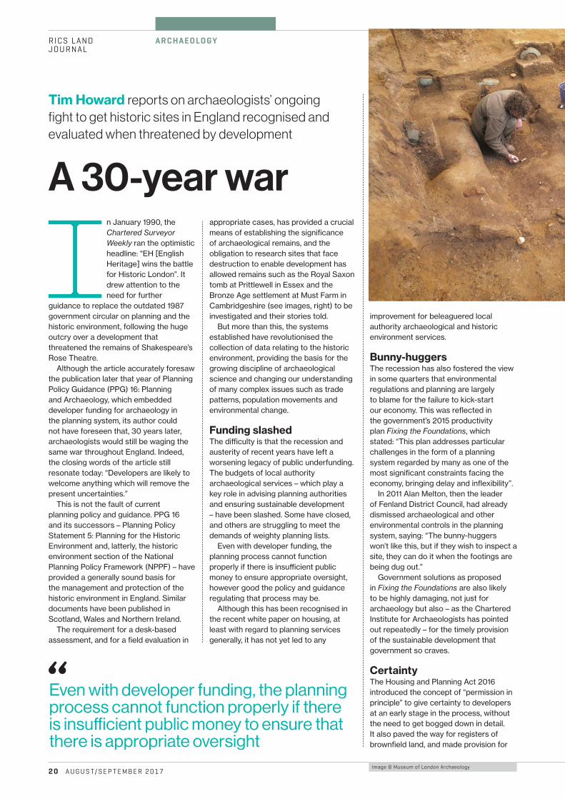
Tim Howard reports on archaeologists’ ongoing fight to get historic sites in England recognised and evaluated when threatened by development
A 30-year war
RICS LAND JOURNAL
2 0 A U G U S T/ S E P T E M B E R 2 0 17
A R C H A E O LO G Y
Image © Museum of London Archaeology
In January 1990, the Chartered Surveyor Weekly ran the optimistic headline: “EH [English Heritage] wins the battle for Historic London”. It drew attention to the need for further
guidance to replace the outdated 1987 government circular on planning and the historic environment, following the huge outcry over a development that threatened the remains of Shakespeare’s Rose Theatre.
Although the article accurately foresaw the publication later that year of Planning Policy Guidance (PPG) 16: Planning and Archaeology, which embedded developer funding for archaeology in the planning system, its author could not have foreseen that, 30 years later, archaeologists would still be waging the same war throughout England. Indeed, the closing words of the article still resonate today: “Developers are likely to welcome anything which will remove the present uncertainties.”
This is not the fault of current planning policy and guidance. PPG 16 and its successors – Planning Policy Statement 5: Planning for the Historic Environment and, latterly, the historic environment section of the National Planning Policy Framework (NPPF) – have provided a generally sound basis for the management and protection of the historic environment in England. Similar documents have been published in Scotland, Wales and Northern Ireland.
The requirement for a desk-based assessment, and for a field evaluation in
appropriate cases, has provided a crucial means of establishing the significance of archaeological remains, and the obligation to research sites that face destruction to enable development has allowed remains such as the Royal Saxon tomb at Prittlewell in Essex and the Bronze Age settlement at Must Farm in Cambridgeshire (see images, right) to be investigated and their stories told.
But more than this, the systems established have revolutionised the collection of data relating to the historic environment, providing the basis for the growing discipline of archaeological science and changing our understanding of many complex issues such as trade patterns, population movements and environmental change.
Funding slashed The di¸culty is that the recession and austerity of recent years have left a worsening legacy of public underfunding. The budgets of local authority archaeological services – which play a key role in advising planning authorities and ensuring sustainable development – have been slashed. Some have closed, and others are struggling to meet the demands of weighty planning lists.
Even with developer funding, the planning process cannot function properly if there is insu¸cient public money to ensure appropriate oversight, however good the policy and guidance regulating that process may be.
Although this has been recognised in the recent white paper on housing, at least with regard to planning services generally, it has not yet led to any
improvement for beleaguered local authority archaeological and historic environment services.
Bunny-huggersThe recession has also fostered the view in some quarters that environmental regulations and planning are largely to blame for the failure to kick-start our economy. This was reflected in the government’s 2015 productivity plan Fixing the Foundations, which stated: “This plan addresses particular challenges in the form of a planning system regarded by many as one of the most significant constraints facing the economy, bringing delay and inflexibility”.
In 2011 Alan Melton, then the leader of Fenland District Council, had already dismissed archaeological and other environmental controls in the planning system, saying: “The bunny-huggers won’t like this, but if they wish to inspect a site, they can do it when the footings are being dug out.”
Government solutions as proposed in Fixing the Foundations are also likely to be highly damaging, not just for archaeology but also – as the Chartered Institute for Archaeologists has pointed out repeatedly – for the timely provision of the sustainable development that government so craves.
CertaintyThe Housing and Planning Act 2016 introduced the concept of “permission in principle” to give certainty to developers at an early stage in the process, without the need to get bogged down in detail. It also paved the way for registers of brownfield land, and made provision for
“Even with developer funding, the planning process cannot function properly if there is insu�cient public money to ensure that there is appropriate oversight
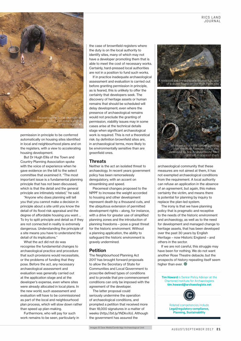
A U G U S T/ S E P T E M B E R 2 0 17 2 1
RICS LAND JOURNAL
permission in principle to be conferred automatically on housing sites identified in local and neighbourhood plans and on the registers, with a view to accelerating housing development.
But Dr Hugh Ellis of the Town and Country Planning Association spoke with the voice of experience when he gave evidence on the bill to the select committee that examined it. “The most important issue is a fundamental planning principle that has not been discussed, which is that the detail and the general principle are intimately related,” he said.
“Anyone who does planning will tell you that you cannot make a decision in principle about a site until you know the detail of its flood risk appraisal and the degree of a¬ordable housing you want ... To try to split principle and detail as if they are not connected in reality is extremely dangerous. Understanding the principle of a site means you have to understand the detail of its implications.”
What the act did not do was recognise the fundamental changes to archaeological practice and procedure that such provisions would necessitate, or the problems of funding that they pose. Before the act, any necessary archaeological assessment and evaluation was generally carried out at the application stage and at the developer’s expense, even where sites were already allocated in local plans. In the new world, such assessment and evaluation will have to be commissioned as part of the local and neighbourhood plan process, which will slow down rather than speed up plan-making.
Furthermore, who will pay for such work remains to be seen, particularly in
the case of brownfield registers where the duty is on the local authority to identify sites, many of which may not have a developer promoting them that is able to meet the cost of necessary works. Certainly, hard-pressed local authorities are not in a position to fund such works.
If in practice inadequate archaeological assessment and evaluation is carried out before granting permission in principle, as is feared, this is unlikely to o¬er the certainty that developers seek. The discovery of heritage assets or human remains that should be scheduled will delay development; even where the presence of archaeological remains would not preclude the granting of permission, viability issues may in some cases arise at the technical details stage when significant archaeological work is required. This is not a theoretical risk: by definition brownfield sites are, in archaeological terms, more likely to be environmentally sensitive than are greenfield ones.
ThreatsNeither is the act an isolated threat to archaeology. In recent years government policy has been remorselessly deregulatory, with an accent on streamlining and speed.
Piecemeal changes proposed to the NPPF to increase the weight accorded to housing and other development represent death by a thousand cuts, and the ubiquitous extension of permitted development rights – along, for instance, with a drive for greater use of simplified planning zones and the introduction of planning freedoms – pose a great threat for the historic environment. Without a planning application, the ability to safeguard the historic environment is gravely undermined.
PetitionThe Neighbourhood Planning Act 2017 has brought forward proposals to allow the Secretary of State for Communities and Local Government to proscribe defined types of conditions and to provide that pre-commencement conditions can only be imposed with the agreement of the developer.
The latter proposal could seriously undermine the operation of archaeological conditions, and prompted a petition that received more than 18,000 signatures in a matter of weeks (http://bit.ly/1NDkxXo). Although the government has assured the
archaeological community that these measures are not aimed at them, it has not exempted archaeological conditions from the requirement. A local authority can refuse an application in the absence of an agreement, but again, this makes certainty the victim, and means there is potential for planning by inquiry to replace the plan-led system.
The irony is that we have planning policy that is pragmatic and receptive to the needs of the historic environment and archaeology, as well as to the need for development and managed change to heritage assets, that has been developed over the past 30 years by English Heritage – now Historic England – and others in the sector.
If we are not careful, this struggle may have been for nothing. We do not want another Rose Theatre debacle; but the prospects of history repeating itself seem higher than ever. b
Images © Dave Webb/Cambridge Archaeological Unit
Tim Howard is Senior Policy Advisor at the Chartered Institute for Archaeologists
Related competencies include Legal/regulatory compliance,
Planning, Sustainability
A socketed axe from the late Bronze Age, one of a dozen found on the Must Farm site
Whole pots from the timber dwelling after the Must Farm structure was
destroyed by fire. Analysis found food still left in some of them
Excavating the burial chamber at Prittlewell; a folding iron stool is visible
in the foreground
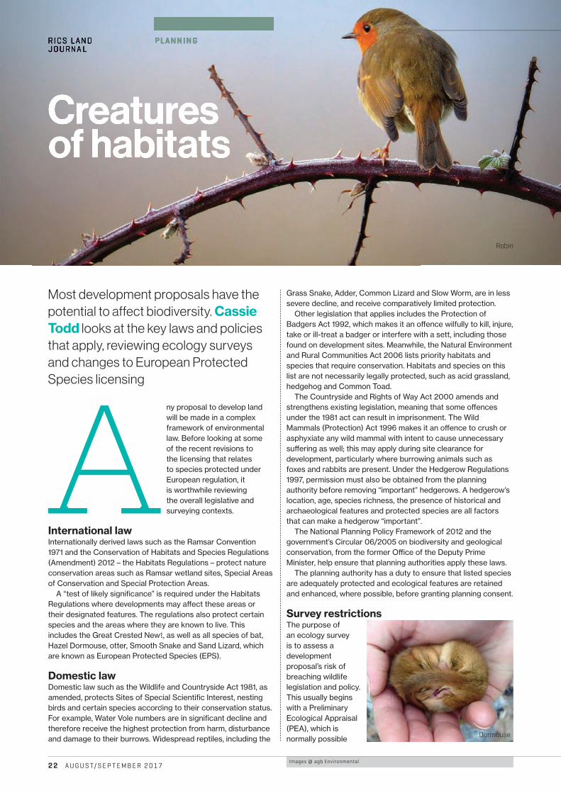
Images @ agb Environmental
R ICS LANDJOURNAL
P L A N N I N G
2 2 A U G U S T/ S E P T E M B E R 2 0 17
A ny proposal to develop land will be made in a complex framework of environmental law. Before looking at some of the recent revisions to the licensing that relates to species protected under European regulation, it is worthwhile reviewing the overall legislative and surveying contexts.
International lawInternationally derived laws such as the Ramsar Convention 1971 and the Conservation of Habitats and Species Regulations (Amendment) 2012 – the Habitats Regulations – protect nature conservation areas such as Ramsar wetland sites, Special Areas of Conservation and Special Protection Areas.
A “test of likely significance” is required under the Habitats Regulations where developments may a¬ect these areas or their designated features. The regulations also protect certain species and the areas where they are known to live. This includes the Great Crested Newt, as well as all species of bat, Hazel Dormouse, otter, Smooth Snake and Sand Lizard, which are known as European Protected Species (EPS).
Domestic lawDomestic law such as the Wildlife and Countryside Act 1981, as amended, protects Sites of Special Scientific Interest, nesting birds and certain species according to their conservation status. For example, Water Vole numbers are in significant decline and therefore receive the highest protection from harm, disturbance and damage to their burrows. Widespread reptiles, including the
Grass Snake, Adder, Common Lizard and Slow Worm, are in less severe decline, and receive comparatively limited protection.
Other legislation that applies includes the Protection of Badgers Act 1992, which makes it an o¬ence wilfully to kill, injure, take or ill-treat a badger or interfere with a sett, including those found on development sites. Meanwhile, the Natural Environment and Rural Communities Act 2006 lists priority habitats and species that require conservation. Habitats and species on this list are not necessarily legally protected, such as acid grassland, hedgehog and Common Toad.
The Countryside and Rights of Way Act 2000 amends and strengthens existing legislation, meaning that some o¬ences under the 1981 act can result in imprisonment. The Wild Mammals (Protection) Act 1996 makes it an o¬ence to crush or asphyxiate any wild mammal with intent to cause unnecessary su¬ering as well; this may apply during site clearance for development, particularly where burrowing animals such as foxes and rabbits are present. Under the Hedgerow Regulations 1997, permission must also be obtained from the planning authority before removing “important” hedgerows. A hedgerow’s location, age, species richness, the presence of historical and archaeological features and protected species are all factors that can make a hedgerow “important”.
The National Planning Policy Framework of 2012 and the government’s Circular 06/2005 on biodiversity and geological conservation, from the former O¸ce of the Deputy Prime Minister, help ensure that planning authorities apply these laws.
The planning authority has a duty to ensure that listed species are adequately protected and ecological features are retained and enhanced, where possible, before granting planning consent.
Survey restrictionsThe purpose of an ecology survey is to assess a development proposal’s risk of breaching wildlife legislation and policy. This usually begins with a Preliminary Ecological Appraisal (PEA), which is normally possible
Most development proposals have the potential to affect biodiversity. Cassie Todd looks at the key laws and policies that apply, reviewing ecology surveys and changes to European Protected Species licensing
Creatures of habitats
Robin
Dormouse
RICS LANDJOURNAL
P L A N N I N G
Creatures of habitats
RICS LAND JOURNAL
A U G U S T/ S E P T E M B E R 2 0 17 2 3
throughout the year. The PEA may recommend further surveys or mitigation to avoid legal o¬ences if suitable habitats and potential for protected species are identified.
Ecology surveys are highly seasonal, according to a species’ lifecycle. But broadly speaking, the ecology survey season is between April and September. Some seasons are very tight; for example, the Great Crested Newt season is between mid-March and mid-June. Others, such as the reptile season, are broad, lying between mid-March and September. However, wintering bird surveys are only possible between October and March. Badgers and otters can be surveyed any time. The best advice is to consider ecology surveys as early as possible to avoid delays to projects.
Guidance and standardsPlanning authorities will expect to see a report prepared by a qualified ecologist to accompany planning applications, where there is potential for proposals to have an impact on protected species or valuable habitats.
The following will increase the chance of obtaining planning consent, in an ecological context.
b The project ecologist is a full member of the Chartered Institute of Ecology and Environmental Management and holds the relevant species survey licences issued by a statutory nature conservation organisation (SNCO).
b Standard published methods for data collection, interpretation and mitigation design are used.
b The ecology report meets the Biodiversity Code of Practice for Planning and Development, BS 42020: 2013.
Protected species licensingDevelopers must obtain a mitigation licence from the relevant SNCO before there are impacts on certain species, including EPS, Water Vole, badger and the Smooth Newt in Northern Ireland. The UK SNCOs include Natural England, Natural Resources Wales, Scottish Natural Heritage and the Northern Ireland Environment Agency.
There has been a substantial change in the approach to licensing for EPS. Natural England has introduced four policies designed to benefit such species’ conservation, as well as cutting delays and costs. It has not been confirmed whether the other SNCOs will adopt these policies.
Developers and consultants are expected to use the policies for Great Crested Newts and bats in the first place, with other EPS to follow.
Policy 1 The first new policy allows greater flexibility when excluding and relocating EPS from development sites. It focuses on conservation at the level of population, rather than protection of individual animals.
The development site must provide significantly better habitat quality, a greater area and improved connectivity for newts. This will mean fewer delays and require less money to be spent on amphibian exclusion and more on ponds and terrestrial habitat.
Policy 2 The second policy permits greater flexibility in the location of newly created habitats compensating for habitats that will be lost. This works naturally with the first policy, but allows habitat creation on land outside the development site.
However, in this case it must benefit newts more than if mitigation is kept on site. This may involve initial surveys over
a broader area, and result in habitat creation, enhancement or restoration for the species concerned.
Developers will be able to contribute to habitat creation and enhancement projects across the local authority area, allowing development to continue without lengthy measures for amphibian exclusion.
Policy 3This policy allows EPS to have access to temporary habitats that will be developed later. This applies particularly to quarries, which tend to have high populations of Great Crested Newt. Natural England wants to keep newts in quarries, and prevent the extensive use of exclusion fencing and time spent relocating newts, because the habitat provided for newts by quarries far outweighs newt mortality during quarrying activities.
A management plan to cover the life of the quarry, as well as restoration and aftercare once it is decommissioned, will need to be agreed.
Policy 4This allows ecologists to depart from standard best practice survey methods – such as the guidance documents produced by the Bat Conservation Trust 2016 and by English Nature for the Great Crested Newt in 2001 – and conduct appropriate and relevant surveys where the impacts of development can be confidently predicted, in the expert judgement of the ecologist.
A single bat roost inspection, which is possible all year round, or a habitat assessment with an environmental-DNA water sample to detect Great Crested Newt DNA – possible between mid-April and the end of June – may be all that is required.
In the use of this policy, Natural England will also expect the mitigation package to cover a worst-case scenario as a trade-o¬ for the reduced project delays.
This policy could apply where there are significant health, safety and access constraints or an urgent development need.
Traditional standardThe traditional approach to licensing remains in place. However, these new policies provide more flexibility if the criteria can be met, and they can be used independently or in combination. Natural England strongly advises use of its Discretionary Advice Service (DAS) before invoking one of the policies, at least until they become embedded in the process. It takes up to 15 working days for Natural England to respond to a DAS request, and it charges £110 per hour plus VAT for doing so.
Biodiversity can be complex to manage for developments in planning and construction. This complexity will only increase with the changes that are taking place. Commissioning a PEA at the start of a development project will identify the ecological constraints and viable mitigation measures for a development proposal, which may save significant time and cost further down the line. b
Cassie Todd is Principal Ecologist, South West region (Dorset) at agb Environmental
www.agbenvironmental.co.uk [email protected]
Related competencies include Management of the natural environment and landscape, Sustainability
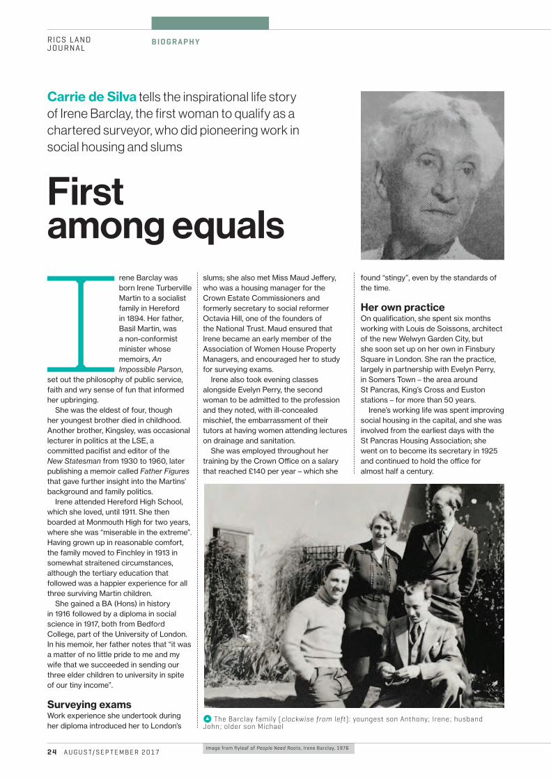
Image from flyleaf of People Need Roots, Irene Barclay, 1976
k The Barclay family (clockwise from left): youngest son Anthony; Irene; husband John; older son Michael
RICS LANDJOURNAL
B I O G R A P H Y
2 4 A U G U S T/ S E P T E M B E R 2 0 17
Irene Barclay was born Irene Turberville Martin to a socialist family in Hereford in 1894. Her father, Basil Martin, was a non-conformist minister whose memoirs, An Impossible Parson,
set out the philosophy of public service, faith and wry sense of fun that informed her upbringing.
She was the eldest of four, though her youngest brother died in childhood. Another brother, Kingsley, was occasional lecturer in politics at the LSE, a committed pacifist and editor of the New Statesman from 1930 to 1960, later publishing a memoir called Father Figures that gave further insight into the Martins’ background and family politics.
Irene attended Hereford High School, which she loved, until 1911. She then boarded at Monmouth High for two years, where she was “miserable in the extreme”. Having grown up in reasonable comfort, the family moved to Finchley in 1913 in somewhat straitened circumstances, although the tertiary education that followed was a happier experience for all three surviving Martin children.
She gained a BA (Hons) in history in 1916 followed by a diploma in social science in 1917, both from Bedford College, part of the University of London. In his memoir, her father notes that “it was a matter of no little pride to me and my wife that we succeeded in sending our three elder children to university in spite of our tiny income”.
Surveying examsWork experience she undertook during her diploma introduced her to London’s
slums; she also met Miss Maud Je¬ery, who was a housing manager for the Crown Estate Commissioners and formerly secretary to social reformer Octavia Hill, one of the founders of the National Trust. Maud ensured that Irene became an early member of the Association of Women House Property Managers, and encouraged her to study for surveying exams.
Irene also took evening classes alongside Evelyn Perry, the second woman to be admitted to the profession and they noted, with ill-concealed mischief, the embarrassment of their tutors at having women attending lectures on drainage and sanitation.
She was employed throughout her training by the Crown O¸ce on a salary that reached £140 per year – which she
Carrie de Silva tells the inspirational life story of Irene Barclay, the first woman to qualify as a chartered surveyor, who did pioneering work in social housing and slums
First among equals
found “stingy”, even by the standards of the time.
Her own practiceOn qualification, she spent six months working with Louis de Soissons, architect of the new Welwyn Garden City, but she soon set up on her own in Finsbury Square in London. She ran the practice, largely in partnership with Evelyn Perry, in Somers Town – the area around St Pancras, King’s Cross and Euston stations – for more than 50 years.
Irene’s working life was spent improving social housing in the capital, and she was involved from the earliest days with the St Pancras Housing Association; she went on to become its secretary in 1925 and continued to hold the o¸ce for almost half a century.
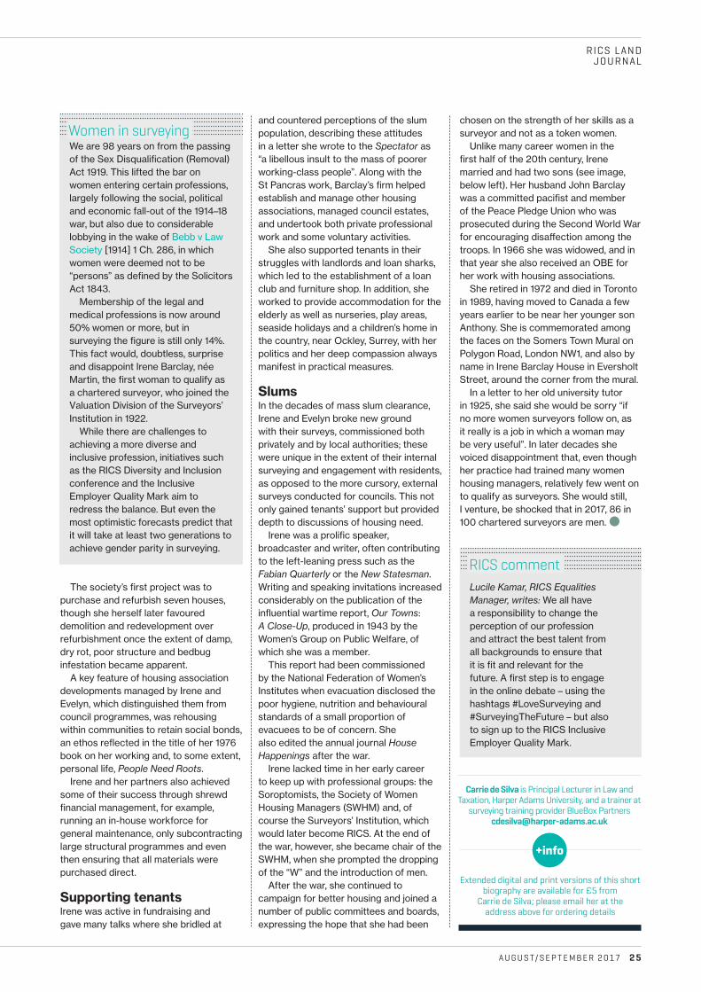
Lucile Kamar, RICS Equalities Manager, writes: We all have a responsibility to change the perception of our profession and attract the best talent from all backgrounds to ensure that it is fit and relevant for the future. A first step is to engage in the online debate – using the hashtags #LoveSurveying and #SurveyingTheFuture – but also to sign up to the RICS Inclusive Employer Quality Mark.
RICS LAND JOURNAL
A U G U S T/ S E P T E M B E R 2 0 17 2 5
We are 98 years on from the passing of the Sex Disqualification (Removal) Act 1919. This lifted the bar on women entering certain professions, largely following the social, political and economic fall-out of the 1914–18 war, but also due to considerable lobbying in the wake of Bebb v Law Society [1914] 1 Ch. 286, in which women were deemed not to be “persons” as defined by the Solicitors Act 1843.
Membership of the legal and medical professions is now around 50% women or more, but in surveying the figure is still only 14%. This fact would, doubtless, surprise and disappoint Irene Barclay, née Martin, the first woman to qualify as a chartered surveyor, who joined the Valuation Division of the Surveyors’ Institution in 1922.
While there are challenges to achieving a more diverse and inclusive profession, initiatives such as the RICS Diversity and Inclusion conference and the Inclusive Employer Quality Mark aim to redress the balance. But even the most optimistic forecasts predict that it will take at least two generations to achieve gender parity in surveying.
The society’s first project was to purchase and refurbish seven houses, though she herself later favoured demolition and redevelopment over refurbishment once the extent of damp, dry rot, poor structure and bedbug infestation became apparent.
A key feature of housing association developments managed by Irene and Evelyn, which distinguished them from council programmes, was rehousing within communities to retain social bonds, an ethos reflected in the title of her 1976 book on her working and, to some extent, personal life, People Need Roots.
Irene and her partners also achieved some of their success through shrewd financial management, for example, running an in-house workforce for general maintenance, only subcontracting large structural programmes and even then ensuring that all materials were purchased direct.
Supporting tenantsIrene was active in fundraising and gave many talks where she bridled at
and countered perceptions of the slum population, describing these attitudes in a letter she wrote to the Spectator as “a libellous insult to the mass of poorer working-class people”. Along with the St Pancras work, Barclay’s firm helped establish and manage other housing associations, managed council estates, and undertook both private professional work and some voluntary activities.
She also supported tenants in their struggles with landlords and loan sharks, which led to the establishment of a loan club and furniture shop. In addition, she worked to provide accommodation for the elderly as well as nurseries, play areas, seaside holidays and a children’s home in the country, near Ockley, Surrey, with her politics and her deep compassion always manifest in practical measures.
SlumsIn the decades of mass slum clearance, Irene and Evelyn broke new ground with their surveys, commissioned both privately and by local authorities; these were unique in the extent of their internal surveying and engagement with residents, as opposed to the more cursory, external surveys conducted for councils. This not only gained tenants’ support but provided depth to discussions of housing need.
Irene was a prolific speaker, broadcaster and writer, often contributing to the left-leaning press such as the Fabian Quarterly or the New Statesman. Writing and speaking invitations increased considerably on the publication of the influential wartime report, Our Towns: A Close-Up, produced in 1943 by the Women’s Group on Public Welfare, of which she was a member.
This report had been commissioned by the National Federation of Women’s Institutes when evacuation disclosed the poor hygiene, nutrition and behavioural standards of a small proportion of evacuees to be of concern. She also edited the annual journal House Happenings after the war.
Irene lacked time in her early career to keep up with professional groups: the Soroptomists, the Society of Women Housing Managers (SWHM) and, of course the Surveyors’ Institution, which would later become RICS. At the end of the war, however, she became chair of the SWHM, when she prompted the dropping of the “W” and the introduction of men.
After the war, she continued to campaign for better housing and joined a number of public committees and boards, expressing the hope that she had been
Extended digital and print versions of this short biography are available for £5 from
Carrie de Silva; please email her at the address above for ordering details
Carrie de Silva is Principal Lecturer in Law and Taxation, Harper Adams University, and a trainer at
surveying training provider BlueBox Partners [email protected]
chosen on the strength of her skills as a surveyor and not as a token women.
Unlike many career women in the first half of the 20th century, Irene married and had two sons (see image, below left). Her husband John Barclay was a committed pacifist and member of the Peace Pledge Union who was prosecuted during the Second World War for encouraging disa¬ection among the troops. In 1966 she was widowed, and in that year she also received an OBE for her work with housing associations.
She retired in 1972 and died in Toronto in 1989, having moved to Canada a few years earlier to be near her younger son Anthony. She is commemorated among the faces on the Somers Town Mural on Polygon Road, London NW1, and also by name in Irene Barclay House in Eversholt Street, around the corner from the mural.
In a letter to her old university tutor in 1925, she said she would be sorry “if no more women surveyors follow on, as it really is a job in which a woman may be very useful”. In later decades she voiced disappointment that, even though her practice had trained many women housing managers, relatively few went on to qualify as surveyors. She would still, I venture, be shocked that in 2017, 86 in 100 chartered surveyors are men. b
Women in surveying
RICS comment
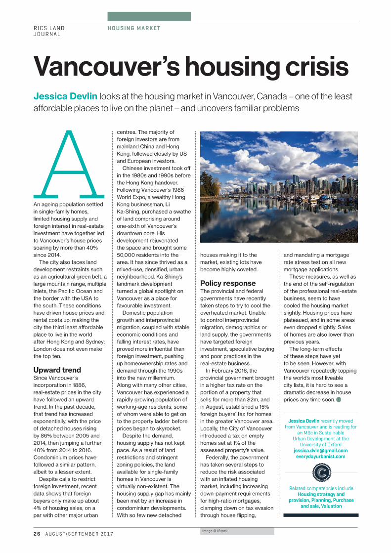
Image © iStock
RICS LAND JOURNAL
H O U S I N G M A R K E T
2 6 A U G U S T/ S E P T E M B E R 2 0 17
Jessica Devlin looks at the housing market in Vancouver, Canada – one of the least affordable places to live on the planet – and uncovers familiar problems
Vancouver’s housing crisis
AAn ageing population settled in single-family homes, limited housing supply and foreign interest in real-estate investment have together led to Vancouver’s house prices soaring by more than 40% since 2014.
The city also faces land development restraints such as an agricultural green belt, a large mountain range, multiple inlets, the Pacific Ocean and the border with the USA to the south. These conditions have driven house prices and rental costs up, making the city the third least a¬ordable place to live in the world after Hong Kong and Sydney; London does not even make the top ten.
Upward trendSince Vancouver’s incorporation in 1886, real-estate prices in the city have followed an upward trend. In the past decade, that trend has increased exponentially, with the price of detached houses rising by 86% between 2005 and 2014, then jumping a further 40% from 2014 to 2016. Condominium prices have followed a similar pattern, albeit to a lesser extent.
Despite calls to restrict foreign investment, recent data shows that foreign buyers only make up about 4% of housing sales, on a par with other major urban
centres. The majority of foreign investors are from mainland China and Hong Kong, followed closely by US and European investors.
Chinese investment took o¬ in the 1980s and 1990s before the Hong Kong handover. Following Vancouver’s 1986 World Expo, a wealthy Hong Kong businessman, Li Ka-Shing, purchased a swathe of land comprising around one-sixth of Vancouver’s downtown core. His development rejuvenated the space and brought some 50,000 residents into the area. It has since thrived as a mixed-use, densified, urban neighbourhood. Ka-Shing’s landmark development turned a global spotlight on Vancouver as a place for favourable investment.
Domestic population growth and interprovincial migration, coupled with stable economic conditions and falling interest rates, have proved more influential than foreign investment, pushing up homeownership rates and demand through the 1990s into the new millennium. Along with many other cities, Vancouver has experienced a rapidly growing population of working-age residents, some of whom were able to get on to the property ladder before prices began to skyrocket.
Despite the demand, housing supply has not kept pace. As a result of land restrictions and stringent zoning policies, the land available for single-family homes in Vancouver is virtually non-existent. The housing supply gap has mainly been met by an increase in condominium developments. With so few new detached
houses making it to the market, existing lots have become highly coveted.
Policy responseThe provincial and federal governments have recently taken steps to try to cool the overheated market. Unable to control interprovincial migration, demographics or land supply, the governments have targeted foreign investment, speculative buying and poor practices in the real-estate business.
In February 2016, the provincial government brought in a higher tax rate on the portion of a property that sells for more than $2m, and in August, established a 15% foreign buyers’ tax for homes in the greater Vancouver area. Locally, the City of Vancouver introduced a tax on empty homes set at 1% of the assessed property’s value.
Federally, the government has taken several steps to reduce the risk associated with an inflated housing market, including increasing down-payment requirements for high-ratio mortgages, clamping down on tax evasion through house flipping,
and mandating a mortgage rate stress test on all new mortgage applications.
These measures, as well as the end of the self-regulation of the professional real-estate business, seem to have cooled the housing market slightly. Housing prices have plateaued, and in some areas even dropped slightly. Sales of homes are also lower than previous years.
The long-term e¬ects of these steps have yet to be seen. However, with Vancouver repeatedly topping the world’s most liveable city lists, it is hard to see a dramatic decrease in house prices any time soon. C
Jessica Devlin recently moved from Vancouver and is reading for
an MSc in Sustainable Urban Development at the
University of Oxford [email protected]
everydayurbanist.com
Related competencies include Housing strategy and
provision, Planning, Purchase and sale, Valuation
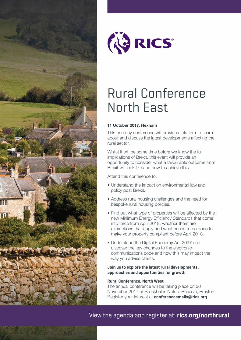
A U G U S T/ S E P T E M B E R 2 0 1 7 2 7
RICS LANDJOURNAL
A DV E RT I S I N G
To advert ise contact James Cannon +44(0)20 7101 2777 or [email protected]
Rural Conference North East11 October 2017, Hexham
This one day conference will provide a platform to learn about and discuss the latest developments affecting the rural sector.
Whilst it will be some time before we know the full implications of Brexit, this event will provide an opportunity to consider what a favourable outcome from Brexit will look like and how to achieve this.
Attend this conference to:
• Understand the impact on environmental law and policy post Brexit.
• Address rural housing challenges and the need for bespoke rural housing policies.
• Find out what type of properties will be affected by the new Minimum Energy Efficiency Standards that come into force from April 2018, whether there are exemptions that apply and what needs to be done to make your property compliant before April 2018.
• Understand the Digital Economy Act 2017 and discover the key changes to the electronic communications code and how this may impact the way you advise clients.
Join us to explore the latest rural developments, approaches and opportunities for growth.
Rural Conference, North WestThe annual conference will be taking place on 30 November 2017 at Brockholes Nature Reserve, Preston. Register your interest at [email protected]
View the agenda and register at: rics.org/northrural
Untitled - Page: 1 2017-07-03 12:53:07 +0000

H y d raulic M
od
ell
i ng
In frastructu
re
H eritage
U r b a n P
lan
nin
g
BS0
164A
D/R
ICS/
0717
C a l l u s w i t h y o u r L I D A R s u r v e y r e q u i r e m e n t s
T h e h i g h l y a c c u r a t e a n d c o s t - e f f e c t i v e s u r v e y s o l u t i o n
T h i n k
T h i n k
P l u s , t h e U K ’ s l a r g e s t L i DA R d a t a b a s e a v a i l a b l e f o r i n s t a n t d o w n l o a d
www. b l u e s k y - w o r l d . c om
www.bluesky-world.com/lidar 01530 518 518 [email protected]


!["Deleuze's Encounter With Whitehead" [Chapter 2 of Whitehead book]](https://img.pdfslide.us/doc/110x75/589d92621a28ab494a8bb804/deleuzes-encounter-with-whitehead-chapter-2-of-whitehead-book.jpg)