Embed Size (px)
Citation preview

REVIEW OF PHASE I AND PLAN OF PHASE II
- CCOP-KIGAM UnCon Project -
by Byeong-Kook Son
from KOREA INSTITUTE OF GEOSCIENCE AND
MINERAL RESOURCES (KIGAM)
UnCon Phase II, UCM10

CCOP-KIGAM Unconventional Oil and Gas Project: 1st Phase: Mapping of black shale formations for the prediction of shale resources
UnCon Project, Phase I
Purpose: Identifying and mapping of potentially prospective shale resource basins in the CCOP region Duration: Three years from 2015 to 2017

Process
Prospective shale basin and formation selection
Shale basins and formations mapping on GIS
Shale formation data collection
field trip
Data Collection and Analysis Capacity Building
Assessment methodology
Mineral quantification method
QGIS mapping method
XRD mineral quantification
Rock-Eval Organic matter analysis
Sample Collection and Analysis
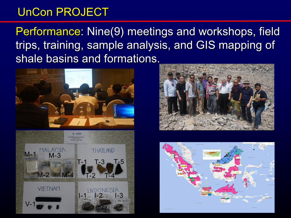
UnCon PROJECT Performance: Nine(9) meetings and workshops, field trips, training, sample analysis, and GIS mapping of shale basins and formations.
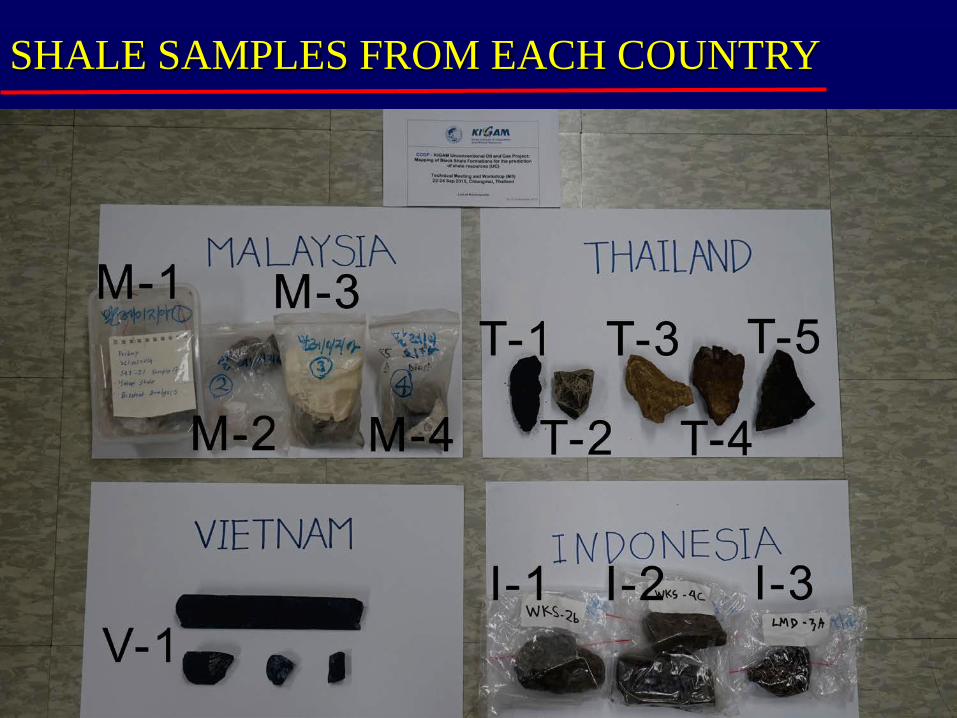
SHALE SAMPLES FROM EACH COUNTRY
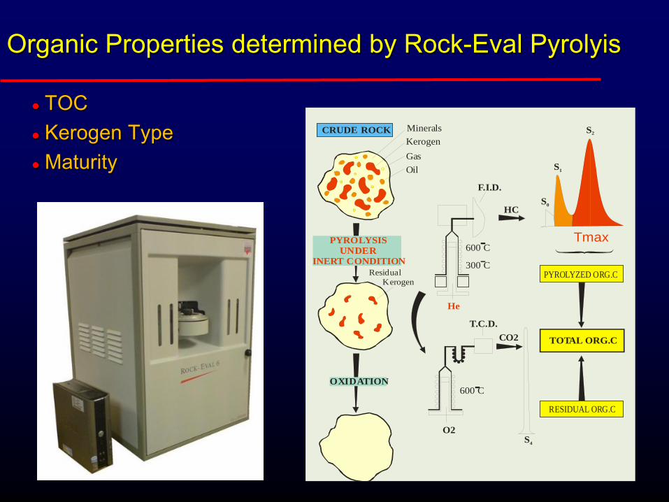
Organic Properties determined by Rock-Eval Pyrolyis
TOC Kerogen Type Maturity
CRUDE ROCK MineralsKerogenGasOil
PYROLYSIS UNDERINERT CONDITION
OXIDATION
Residual Kerogen
He
O2
CO2
600 C
300 C
600 C
F.I.D.
T.C.D.
HCS0
S4
S1
S2
PYROLYZED ORG.C
RESIDUAL ORG.C
TOTAL ORG.C
Tmax
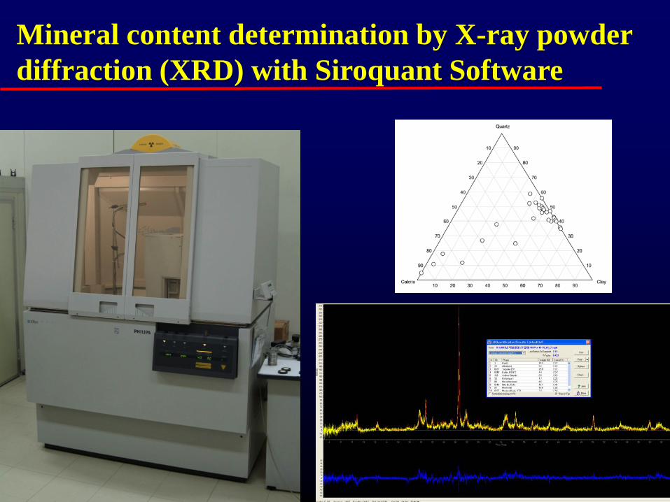
Mineral content determination by X-ray powder diffraction (XRD) with Siroquant Software

Tmax
Cambodia
Indonesia
Malaysia
Thailand
Japan
Lao PDR
Philippines
Vietnam
0 100 200 300 400 500 600 700
C-1
C-2
C-3
I-1
I-2
I-3
J-1
J-2
J-3
L-1
L-2
M-1
M-2
M-3
M-4
T-1
T-2
T-3
T-4
T-5
V-1
P-1
Overmature (?) Good
Bad
Bad
Bad

Carbonate minerals
0 0.2 0.4 0.6 0.8 1
1
0.8
0.6
0.4
0.2
01
0.8
0.6
0.4
0.2
0
CambodiaInodesia Malaysia JapanThailand Lao PDRPhilippineVietnam
Clay minerals
Quartz+ Feldspar
calcareous or dolomite mudstone
argillaceous marlstone
siliceous marlstone
argillaceous mudstone
siliceous mudstone
Comparison with US Shales
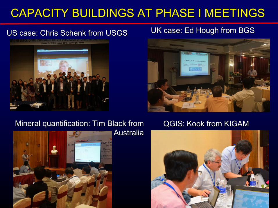
CAPACITY BUILDINGS AT PHASE I MEETINGS US case: Chris Schenk from USGS UK case: Ed Hough from BGS
Mineral quantification: Tim Black from Australia
QGIS: Kook from KIGAM

Mapping with freely downloadable SW, QGIS

ACHIVEMENTS: USB Publication

INSIDE USB
QGIS software - 64 bit and 32 bit MAP GUIDE - How to display the GIS map of shale basins
GIS maps of Shale Basins - shape files Basin Description - 46 shale basins identified
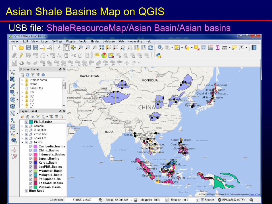
Asian Shale Basins Map on QGIS USB file: ShaleResourceMap/Asian Basin/Asian basins
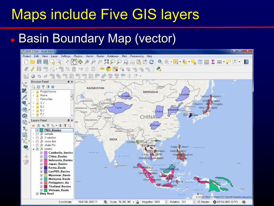
Maps include Five GIS layers Basin Boundary Map (vector)
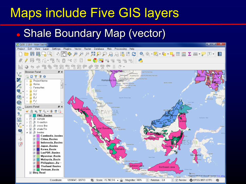
Maps include Five GIS layers Shale Boundary Map (vector)

Maps include Five GIS layers Cross Section (raster)

Maps include Five GIS layers Sample Location and Analysis Data(vector, delimited text)

Description of the Shale Basins Identified
Description of 46 Shale Basins: Basin Location Geological Setting Stratigraphy Shale Formation

MAP GUIDE
Description about How to display maps on QGIS software Install QGIS Getting Started How to display maps

WORKS for SHALE RESOURCES ASSESSMENT
Shale Formation Mapping – volume calculation Characterization – sweet spot areas determination Assessment – resources calculation
PLAN OF PHASE II Asian shale basin map has been
successfully completed in the form of USB as a result of the first phase of UnCon project.
The UnCon project has come to the second phase, which will be a shale resources calculation and assessment on the identified shale basins.
Shale Resources Calculation and Assessment
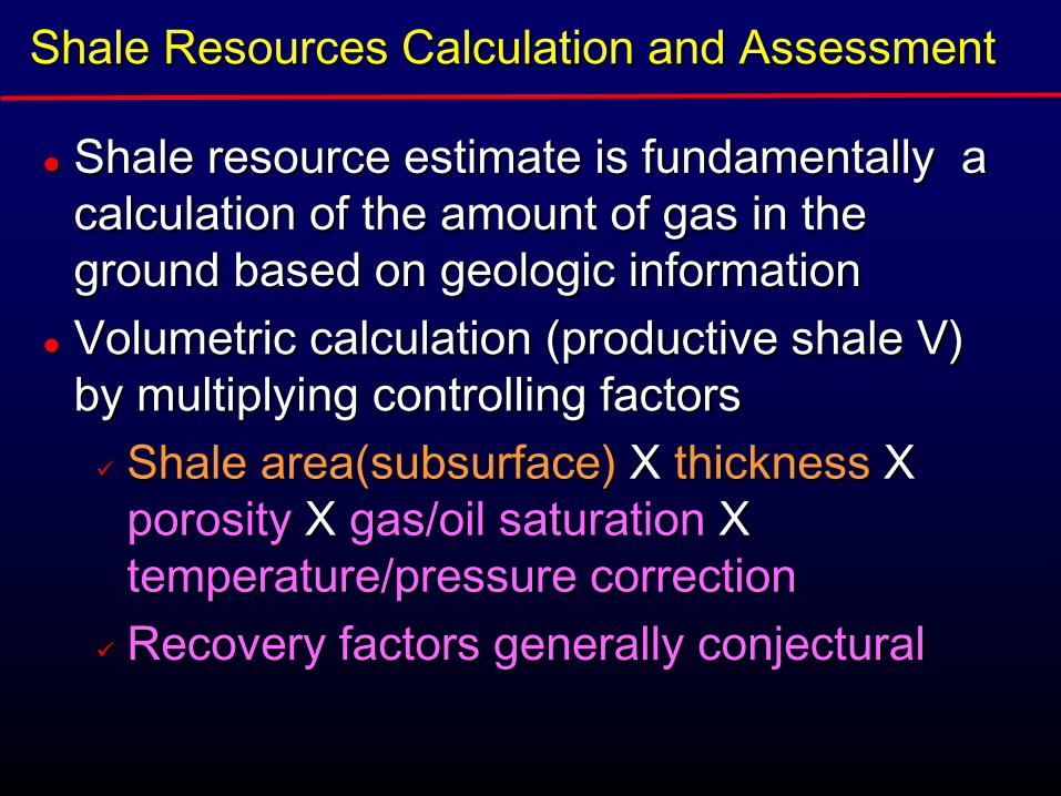
Shale resource estimate is fundamentally a calculation of the amount of gas in the ground based on geologic information
Volumetric calculation (productive shale V) by multiplying controlling factors Shale area(subsurface) X thickness X
porosity X gas/oil saturation X temperature/pressure correction
Recovery factors generally conjectural

TWO DIFFERENT METHODOLOGY
USGS Methodology: Top-down approach Technically recoverable resource estimates based on
well technology, well performance, and well density
EIA/BGS Methodology: Bottom-up approach In-place resource estimates based on a geological
model, volumetrics and gas contents
In the Phase I, the UnCon Project has ever decided to follow the EIA/BGS methodology. No production data are yet available in Asia

Shale Resources Calculation and Assessment
In general, the total volume of potentially productive shale can be estimated using a 3D geological model, which is generated using seismic mapping, integrated with outcrop and deep borehole information.
The volume of potentially productive shale was used as one of the input parameters for a statistical calculation (using a Monte Carlo simulation) of the in-place gas resource.

DATA and TECHNOLOGY required Seismic Data for detailed mapping of
target shale formations Outcrop maps for shale formations Well Data down to the target shale
formations (including gammy-ray logs) Geochemical (TOC and Maturity) and
Mineralogy Data Geology Modeling Technique Monte Carlo Simulation

CCOP-KIGAM shale resources project DATA AND LIMITATION
Need geological information and reservoir properties collected from data, even though there can be a limitation to gather for proprietary reason.
Probably publically available or non-confidential literature and data
Additional company data would be required to enhance the quality

Problems with Resources Assessment
Knowledge gap between countries Compensated by training and resource persons
Difference in Data availability between data-rich and data-poor countries Countries should be grouped into two for the
resources calculation: high-uncertainty data-poor countries and low-uncertainty data-rich countries
Korean case can be a good example of the high uncertainty country

HOW TO ESTIMATE SHALE RESOURCES
We can learn from EIA, USGS, and BGS reports
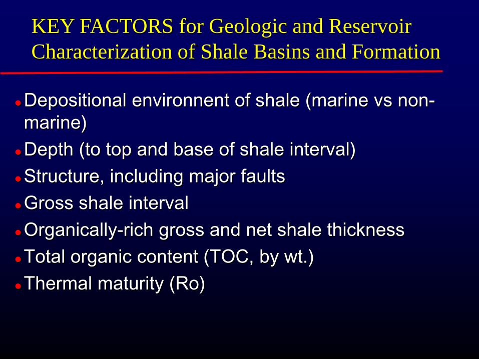
KEY FACTORS for Geologic and Reservoir Characterization of Shale Basins and Formation
Depositional environnent of shale (marine vs non-marine)
Depth (to top and base of shale interval) Structure, including major faults Gross shale interval Organically-rich gross and net shale thickness Total organic content (TOC, by wt.) Thermal maturity (Ro)

Establishing the Areal Extent of Major Shale Gas and Shale Oil Formations The regional cross-sections can be used to define the
lateral extent of the shale formation in the basin and/or to identify the regional depth and gross interval of the shale formation

BGS Methodology for estimating the in-place shale gas resource

SHALE VOLUME CALCULATION (UK CASE)
Identification and mapping of potentially-prospective shale gas units from well information Mapping the top and base of units to enter into a
3D model Mapping the shale component as a proportion of
the seismically mapped unit Minimum cut-off where Ro > 1.1% (max cutoff of
Ro > 3.5% never exceeded) Minimum depth cut-off
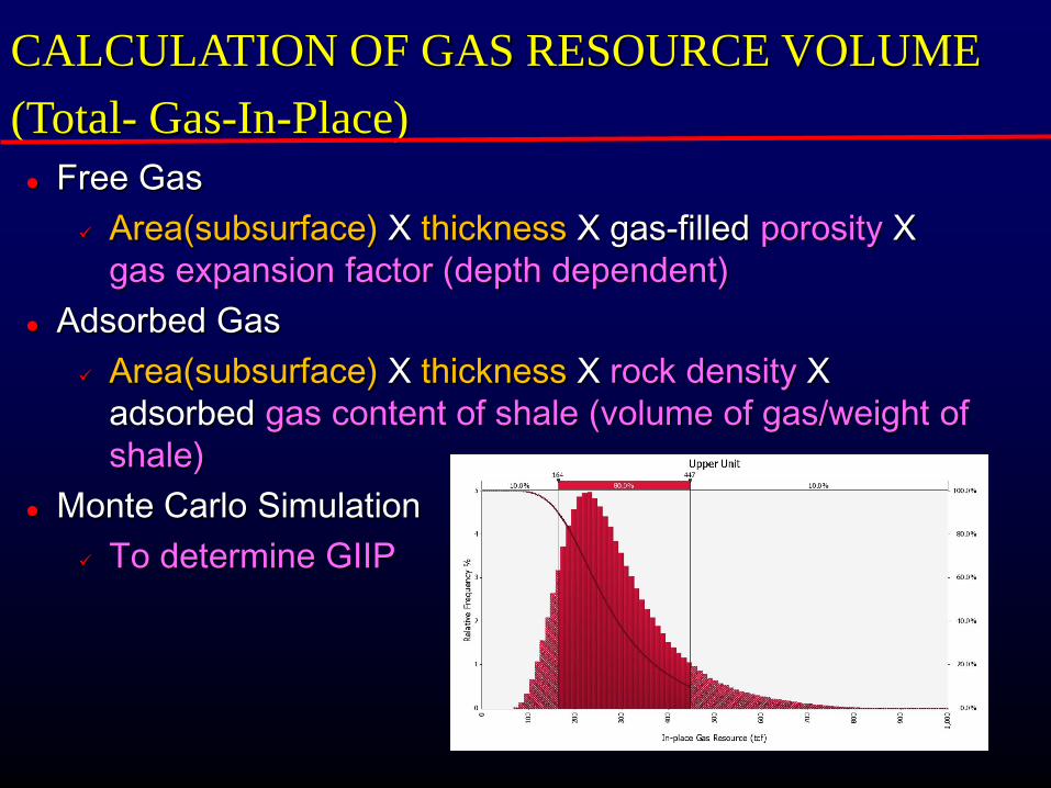
CALCULATION OF GAS RESOURCE VOLUME (Total- Gas-In-Place) Free Gas
Area(subsurface) X thickness X gas-filled porosity X gas expansion factor (depth dependent)
Adsorbed Gas Area(subsurface) X thickness X rock density X
adsorbed gas content of shale (volume of gas/weight of shale)
Monte Carlo Simulation To determine GIIP

CALCULATION OF GAS RESOURCE VOLUME (Gas-In-Place)
adsorbed gas content of shale (volume of gas/weight of shale) G = (Gl X P)/(Pl + P)
Where , Gl = Langmuir volume [volume of adsorbed gas at infinite pressure] Pl = Langmuir pressure [pressure where one-half of the gas at infinite pressure has been desorbed] P = Reservoir pressure
References The Carboniferous Bowland Shale Gas Study: geology and
resource estimation Appendix A: Estimation of the total in-place gas resource in the
Bowland-hodder shale, central Britain

We have come into the Phase II of the UnCon project
Knowledge can be gotten from the UK case. Some basins can be selected for preliminary study Coordinators should decide how many and which
basins will be assessed at this meetings, even though forty six basins has identified in the first phase
CONCLUSION AND SUGGESTION

MANY THANKS FOR ATTENTION!
UnCon Phase II, UCM10