Embed Size (px)
Citation preview

MEDIA / ASX RELEASE
5 February 2015 ASX Code: RER
UPGRADED JORC RESOURCE AT KALONGWE 302,000t COPPER AND 42,700t COBALT
HIGHLIGHTS
Updated and re-classified JORC Mineral Resource estimate for Kalongwe Cu-Co Deposit incorporating all Phase II results has resulted in a significant upgrade in the quality and quantity of the July 2014 Mineral Resource estimate.
The new Measured, Indicated and Inferred Mineral Resource totals:
• 11.17Mt @ 2.70% Cu (0.5% Cu cut off) including 29.700t Co, and
• 2.29Mt @ 0.57% Co (using 0.2% Co cut off).
There is almost a 75% conversion of the previous Inferred resource in to Measured & Indicated categories.
Average grade for the Measured Mineral Resource is 3.61% Cu, located in the upper 50m of the Mineral Resource emphasising the very high grade nature of the near surface Cu mineralisation.
There is a 10% increase in Cu metal content from the 2014 Mineral Resource, to 302,000 tonnes contained Cu.
The Mineral Resource is predominantly oxide mineralisation occurring within 150m depth of the surface.
The Mineral Resource at Kalongwe is not closed off, with potential to expand resource both down dip and plunge.
There remains excellent potential to discover additional zones of mineralisation by drill-testing the other fragments of Roan rocks that occur along strike from the Kalongwe deposit.
The updated Mineral Resource estimate forms part of the Company’s optimised development strategy and provides additional support to fast track the establishment of a stand-alone open pit mining operation at Kalongwe.
11 Ventnor Avenue, Ground Floor, West Perth, Western Australia, Australia 6872 P: 618 6355 6888 | www.regalresources.com.au | ACN 106 294 106
1

MEDIA / ASX RELEASE
Kalongwe Resource Upgrade
The Directors of Regal Resources Limited (ASX:RER) (“Regal” or “the Company”) are pleased to announce an upgrade of the Mineral Resource estimate, for the Kalongwe deposit, Figure 1, with significantly improved confidence levels including a 75% conversion of the previous Inferred resource to a Measured and Indicated category. The upgrade follows a re-estimation by CSA Global Pty Ltd and is classified in accordance with the JORC Code (2012 Edition).
Figure 1: Kalongwe JV Project location map and significant copper deposits.
The upgraded Mineral Resource estimate incorporates all drilling results for the Phase II infill programme which targeted the upper part of the deposit in the areas considered to be amenable to open pit mining.
The new Mineral Resource estimate represents a substantial increase in both the quality and quantity of the Kalongwe Mineral Resource compared to the previous estimate announced in July 2014 (ASX
11 Ventnor Avenue, Ground Floor, West Perth, Western Australia, Australia 6872 P: 618 6355 6888 | www.regalresources.com.au | ACN 106 294 106
2
MEDIA / ASX RELEASE
Release 11 July 2014), and reinforces the excellent coherence and strong continuity of the very high grade oxide Copper (“Cu” or “Copper”) mineralisation in the near surface portion of the deposit, and is expected to deliver copper grades above the average resource grade early in the mine life.
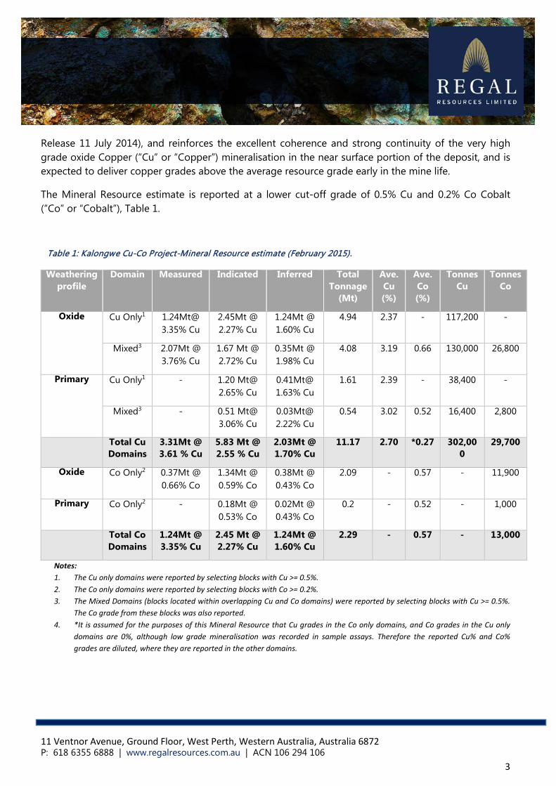
The Mineral Resource estimate is reported at a lower cut-off grade of 0.5% Cu and 0.2% Co Cobalt (“Co” or “Cobalt”), Table 1.
Table 1: Kalongwe Cu-Co Project-Mineral Resource estimate (February 2015).
Weathering profile
Domain Measured Indicated Inferred Total Tonnage
(Mt)
Ave. Cu (%)
Ave. Co (%)
Tonnes Cu
Tonnes Co
Oxide Cu Only1 1.24Mt@ 3.35% Cu
2.45Mt @ 2.27% Cu
1.24Mt @ 1.60% Cu
4.94 2.37 - 117,200 -
Mixed3 2.07Mt @ 3.76% Cu
1.67 Mt @ 2.72% Cu
0.35Mt @ 1.98% Cu
4.08 3.19 0.66 130,000 26,800
Primary Cu Only1 - 1.20 Mt@ 2.65% Cu
0.41Mt@ 1.63% Cu
1.61 2.39 - 38,400 -
Mixed3 - 0.51 Mt@ 3.06% Cu
0.03Mt@ 2.22% Cu
0.54 3.02 0.52 16,400 2,800
Total Cu Domains
3.31Mt @ 3.61 % Cu
5.83 Mt @ 2.55 % Cu
2.03Mt @ 1.70% Cu
11.17 2.70 *0.27 302,000
29,700
Oxide Co Only2 0.37Mt @ 0.66% Co
1.34Mt @ 0.59% Co
0.38Mt @ 0.43% Co
2.09 - 0.57 - 11,900
Primary Co Only2 - 0.18Mt @ 0.53% Co
0.02Mt @ 0.43% Co
0.2 - 0.52 - 1,000
Total Co Domains
1.24Mt @ 3.35% Cu
2.45 Mt @ 2.27% Cu
1.24Mt @ 1.60% Cu
2.29 - 0.57 - 13,000
Notes: 1. The Cu only domains were reported by selecting blocks with Cu >= 0.5%. 2. The Co only domains were reported by selecting blocks with Co >= 0.2%. 3. The Mixed Domains (blocks located within overlapping Cu and Co domains) were reported by selecting blocks with Cu >= 0.5%.
The Co grade from these blocks was also reported. 4. *It is assumed for the purposes of this Mineral Resource that Cu grades in the Co only domains, and Co grades in the Cu only
domains are 0%, although low grade mineralisation was recorded in sample assays. Therefore the reported Cu% and Co% grades are diluted, where they are reported in the other domains.
11 Ventnor Avenue, Ground Floor, West Perth, Western Australia, Australia 6872 P: 618 6355 6888 | www.regalresources.com.au | ACN 106 294 106
3

MEDIA / ASX RELEASE
Commenting on the release of the revised Mineral Resource estimate, David Young, Managing Director of Regal Resources said:
“The updated Mineral Resource estimate for the Kalongwe Mining Joint Venture (JV) Project is confirmation of the robustness of the Kalongwe Project and a major step forward in realising the ambitious objective of developing a mining operation for the Kalongwe JV partners. The quality of the resource estimate is of special significance as it has confirmed and underpinned by some way the initial estimate of the resource potential inferred by the exploration team.”
“With the completion of updated resource estimate the JV is now in a position to complete the scoping level work to examine various production scenarios including staged development aimed at minimizing upfront capital expenditure.”
Geology
The mineralisation at Kalongwe deposit is predominantly secondary, and is primarily fracture controlled and hosted within two stratigraphic units. The principal copper oxide minerals above the base of oxidation are malachite and chrysocolla, with minor amounts of azurite. Cobalt occurs as heterogenite. Below the base of oxidation chalcocite and minor bornite and chalcopyrite have been observed. The base of oxidation varies from 25m to 180m vertically below the surface, with the depth of weathering deepening from west to east.
Mineralisation is found in veins and breccias and as disseminated blebs and grains in stratabound horizons. Broad zones of high-grade copper-cobalt mineralisation extend down-dip, broadly conformable with dipping strata. Minor structural stratigraphic offsets are present, however local re-mobilisation of mineralisation during weathering has resulted in reasonably good lateral and down-dip continuity of supergene mineralisation.
Long section displays the potential for additional mineralisation both down dip to the northeast and along strike. Mineralisation also remains open at depth.
The mineralisation occurs in folded and structurally replicated strata and has been modelled in the shape of three principal, moderately northeast-dipping lenses.
The mineralisation averages 20m to 40m true width and reaches up to 70m true width in places, plunges to the northeast and is exposed over a wide interval at surface (Figure 3).
The deposit has distinct near surface high-grade copper zones with copper grades commonly exceeding 3.00% Cu (Figure 3). The Co mineralisation shows more distribution variability in that there are multiple high grade cobalt concentrations that have a range smaller than the current drill hole spacing.
The Mineral Resource update provides additional support for the viability of processing the high grade oxide copper ore by commercial HMS plant and for further evaluation by moving to a feasibility study
11 Ventnor Avenue, Ground Floor, West Perth, Western Australia, Australia 6872 P: 618 6355 6888 | www.regalresources.com.au | ACN 106 294 106
4

MEDIA / ASX RELEASE
programme.
Figure 3: Screen-prints of 3D view of the block model. LHS: Colour coded by classification (Green=Measured, Blue=Indicated, Yellow=Inferred. RHS: Colour-coded grade distribution greater than 2.5% Cu within the Cu
mineralisation shell showing the near surface high grade mineralisation in the Measured category.
Mineral Resource Estimate
The Kalongwe Mineral Resource estimate was prepared by independent geological consulting group CSA Global Pty Ltd (‘CSA Global’) and is reported in accordance with the principles of the Australian Code for Reporting of Exploration Results, Mineral Resources and Ore Reserves, 2012 edition (JORC 2012).
A summary of the parameters on which the Mineral Resource estimate is based including all technical parameters and criteria relating to data and resource estimation process is provided in Appendix 1.
The revised Mineral Resource estimate is based on the results of almost one hundred (100) diamond holes completed over the Kalongwe deposit for approximately 16,000m. The drilling was undertaken by Ivanhoe Mines and the Kalongwe JV over the period 2006 to 2015 (Figure 2).
11 Ventnor Avenue, Ground Floor, West Perth, Western Australia, Australia 6872 P: 618 6355 6888 | www.regalresources.com.au | ACN 106 294 106
5

MEDIA / ASX RELEASE
Figure 2: Geological map of the Kalongwe Cu-Co deposit showing
mineralisation outline and work completed by the JV.
The basis for the current Mineral Resource estimate upgrade are the drilling results of the recently completed Phase l and Phase II programmes and a comprehensive review and validation of historic drilling data obtained from Ivanhoe Mines. Using this information detailed 3D geological and mineralisation models of the Kalongwe deposit were completed.
Mineralised wireframes were generated by CSA Global using lower cut-off grades of 0.30% Cu and 0.20% Co. The wireframes were created by joining mineralisation polygons based upon geological
11 Ventnor Avenue, Ground Floor, West Perth, Western Australia, Australia 6872 P: 618 6355 6888 | www.regalresources.com.au | ACN 106 294 106
6

MEDIA / ASX RELEASE
knowledge of the deposit, derived from drill core logs and geological observations on surface. CSA Global maintained the approach used for the maiden Mineral Resource estimate whereby the Cu-Co mineralisation within the deposit was modelled as three different metal domains, each reflecting the significant metal content of that particular mineralised domain within the overall block model.
Domain 1 - has Cu but no significant Cobalt, Domain 2 - has Co but no significant Copper and Domain 3 - has significant Cu and Co mineralisation.
The distribution of the mineralisation can be partially explained by the relative differences in the mobility characteristics of Cu and Co in the weathered (oxide) profile.
The increased data density through the tighter drill holes spacing provide a more accurate definition on the base of oxidation below which Cu and Co sulphide mineralisation only occurs. The Cu sulphide mineralisation is included into the Mineral Resource and accounts for about 20% of the total.
The exploration work completed to date and the resulting data, the QAQC information, quality of bulk density data and overall geological understanding is of a sufficient degree to allow classification of part of the Mineral Resource to be Measured and Indicated under the JORC Code(2012 Edition). The Inferred Mineral Resource is located in regions with wider spaced drilling (Figure 3, LHS).
The Measured portion of the Mineral Resource encompasses the top 50m from surface and included the highest grades of the deposit (3.61% Cu, Figure 3 RHS).
The revised Mineral Resource estimate has resulted in a net increase of Cu metal of about 10% as a result of an increase in the overall volume/tonnes grade in the near surface area. The cobalt metal content only slightly increased as a result of a better delineation of Co grade distribution.
Overall, the outcome of the revised estimate is an improvement on the maiden Mineral Resource and is a confirmation of the robustness of the initial interpretation and grade distribution, as nearly 100% of the Phase II drilling was conducted inside the maiden Mineral Resource volume.
Kalongwe Project Overview
The Kalongwe Project (“Project”), Figure 1, is covered by permit PR12198 located towards the western end of the world class central African Copperbelt. It is situated some 15km south from the Kamoa deposit controlled by Ivanhoe Mines (considered to be Africa’s largest recent high-grade copper discovery) and is approximately 45km from the historic copper mining and processing centre at Kolwezi (Figure 1).
Ownership of the Project is held by Kalongwe Mining SA (“Kalongwe Mining”), a company currently owned by Regal (30%), the international commodities trading company Traxys (30%) and La Generale Industrielle et Commerciale au Congo SPRL (“GICC”) (40%). Exploration and development costs are jointly funded by Regal and Traxys. Under the terms of a binding agreement with GICC, Regal and
11 Ventnor Avenue, Ground Floor, West Perth, Western Australia, Australia 6872 P: 618 6355 6888 | www.regalresources.com.au | ACN 106 294 106
7
MEDIA / ASX RELEASE
Traxys have the right to acquire an additional 20% interest on completion of a bankable feasibility study (BFS).
The Company is investigating options to increase its interest in Kalongwe and is in advanced negotiations with Traxys Europe SA ("Traxys") to acquire Traxys’ 30% interest in Kalongwe. This transaction would increase Regal’s interest in Kalongwe from 30% to 60% and result in Traxys becoming a significant shareholder in Regal
Competent Persons Statement
Scientific or technical information in this release that relates to Exploration Results has been prepared by Mr David Young and Dr Simon Dorling, the Company’s Managing and Technical Directors. Mr David Young is a member of the Australian Institute of Mining and Metallurgy (AusIMM) and Dr Simon Dorling is a member of the Australasian Institute of Geoscientists (MAIG) and both have sufficient experience which is relevant to the style of mineralisation under consideration and to the activity which they are undertaking to qualify as a Competent Person as defined in the 2012 Edition of the “Australasian Code for Reporting of Exploration Results, Mineral Resources and Ore Reserves” (the JORC Code). Mr David Young and Dr Simon Dorling consent to the inclusion in this report of the Information, in the form and context in which it appears.
The information in this report that relates to Mineral Resources is based on information compiled by Mr David Williams, a Competent Person, who is a Member of The Australasian Institute of Mining and Metallurgy. David Williams is employed by CSA Global Pty Ltd, an independent consulting company. Mr Williams has sufficient experience which is relevant to the style of mineralisation and type of deposit under consideration and to the activity which he is undertaking to qualify as a Competent Person as defined in the 2012 Edition of the “Australasian Code for Reporting of Exploration Results, Mineral Resources and Ore Reserves”. David Williams consents to the inclusion in the report of the matters based on his information in the form and context in which it appears.
Forward-looking Statements
This release contains statements that are "forward-looking". Generally, the words "expect," "intend," "estimate," "will" and similar expressions identify forward-looking statements. By their very nature, forward-looking statements are subject to known and unknown risks and uncertainties that may cause our actual results, performance or achievements, or that of our industry, to differ materially from those expressed or implied in any of our forward-looking statements. Statements in this release regarding the Company's business or proposed business, which are not historical facts, are "forward looking" statements that involve risks and uncertainties, such as estimates and statements that describe the Company's future plans, objectives or goals, including words to the effect that the Company or management expects a stated condition or result to occur. Since forward-looking statements address future events and conditions, by their very nature, they involve inherent risks and uncertainties. Actual results in each case could differ materially from those currently anticipated in such statements.
11 Ventnor Avenue, Ground Floor, West Perth, Western Australia, Australia 6872 P: 618 6355 6888 | www.regalresources.com.au | ACN 106 294 106
8
MEDIA / ASX RELEASE
Investors are cautioned not to place undue reliance on forward-looking statements, which speak only as of the date they are made.
On behalf of the Board of Directors,
David Young Managing Director
For further information, please contact:
David Young Managing Director / CEO Regal Resources Limited Ph: +61 3 8610 8633
Ian Pamensky Company Secretary / Financial & Commercial Manager Regal Resources Limited Ph: +61 3 8610 8610 Email: [email protected]
11 Ventnor Avenue, Ground Floor, West Perth, Western Australia, Australia 6872 P: 618 6355 6888 | www.regalresources.com.au | ACN 106 294 106
9

APPENDIX 1
CSA Resource Statement

Summary report Kalongwe February 2015 Page 1 of 7
MEMORANDUM
To: David Young Date: February 2nd 2015 From: David Williams Re: Kalongwe Cu-Co Mineral Resource
CSA Global Pty Ltd (CSA) was engaged by Regal Resources Limited (Regal) to update a Mineral Resource estimate for the Kalongwe copper-cobalt deposit, located approximately 60 km south-west of Kolwezi, in the Democratic Republic of Congo (DRC). The Mineral Resource estimate is an update to the Inferred Mineral Resource reporting in July 2014, following the infill drilling of 42 additional diamond drill holes (for 5,315 m) in the second half of 2014. There is now sufficient confidence in the geological understanding of the deposit, sound QA\QC performance results from drilling and sampling, a comprehensive density database, tighter drill hole spacing such that a significant volume of the Mineral Resource can be classified as Measured or Indicated, as per the JORC (2012) Code 1 for the reporting of Mineral Resources and Ore Reserves. The Mineral Resource is presented in Table 1.
The mineralisation at Kalongwe is preferentially hosted in deformed sedimentary units of the Lower Mine Series (R2) of the Roan Group. Principal host lithologies include stromatolitic dolomites and siltstones. Resource definition drilling has confirmed that the geology of the deposit has characteristics typical of the majority of the stratabound Congolese copperbelt type deposits which host over 90% of operating mines in the Katanga Province, DRC.
Mineralisation is predominantly secondary, and is primarily stratabound. The principal copper oxide minerals above the base of oxidation are malachite and chrysocolla, with minor amounts of azurite. Cobalt occurs as heterogenite. Below the base of oxidation chalcocite and minor bornite and chalcopyrite have been observed. The base of oxidation varies from 25 m to 180 m vertically below the surface, with the depth of weathering deepening from west to east. Mineralisation is found in veins and breccias and as disseminated blebs and grains in stratigraphic horizons. Broad zones of high-grade copper-cobalt mineralisation extend down-dip, broadly conformable with dipping strata, from the surface exposure of what has been interpreted to be the lower limb of a tight recumbent fold. Minor structural stratigraphic 1 Australasian Code for Reporting of Exploration Results, Mineral Resources and Ore Reserves. The JORC Code, 2012 Edition. Prepared by: The Joint Ore Reserves Committee of The Australasian Institute of Mining and Metallurgy, Australian Institute of Geoscientists and Minerals Council of Australia (JORC).

Summary report Kalongwe February 2015 Page 2 of 7
offsets are present; however there is good lateral and down-dip continuity of supergene mineralisation along both limbs of the fold suggesting that supergene remobilisation is primarily controlled by stratigraphy. The mineralisation is constrained within a core of a regional west-south-west and north-north-east striking anticline. The mineralisation appears open down-dip.
The Mineral Resource is based upon data obtained from 98 historic and recent diamond drill holes (16,471 m) drilled across the deposit footprint. A total of 46 holes (6,016 m) were drilled by Regal in 2014, including four diamond holes twinning selected historical holes. All drill hole collars were surveyed by DGPS, including historical collars. Down hole surveys were obtained using a down hole single shot camera tool within the drill rods every 20 m. Drill core was sampled at Regal’s secure sample storage facility, with either half core or quarter core samples (when a duplicate quarter core sample was required for QAQC monitoring) samples cut from the original core. The core samples were dispatched to ALS Laboratories in Johannesburg where they were analysed using the ICP-AES technique with a four acid digest for both Cu% and Co%. QA\QC protocols were implemented to monitor the precision and accuracy of the analyses, using Certified Reference Materials, field duplicates (quarter core samples) and lab duplicates. Selected laboratory pulp samples were dispatched to independent analytical laboratories for umpire analyses.
The Mineral Resource is classified as a combination of Measured, Indicated and Inferred, and has been reported in accordance with the JORC (2012) Code, with geological evidence sufficient to confirm geological and grade continuity for the Measured Mineral Resource. Classification of the Mineral Resource estimates was carried out taking into account the geological understanding of the deposit, quality of the sampling and density data and drill hole spacing. The results of the Mineral Resource estimate are presented in Table 1, based upon a reporting cut-off grade of 0.5% Cu and 0.2% Co.
Table 1. Kalongwe Mineral Resource estimate, February 2015
1. The Cu only domains were reported by selecting blocks with Cu >= 0.5%. 2. The Co only domains were reported by selecting blocks with Co >= 0.2%. 3. The Mixed Domains (blocks located within overlapping Cu and Co domains) were reported by
selecting blocks with Cu >= 0.5%. The Co grade from these blocks was also reported. 4. It is assumed for the purposes of this Mineral Resource that Cu grades in the Co only domains, and
Co grades in the Cu only domains are 0%, although low grade mineralisation was recorded in sample assays. Therefore Cu% and Co% grades are diluted.
JORC Classification Domain Measured Indicated InferredTotal Tonnage
(Mt)Ave. Cu
(%) Ave. Co
(%)Cu Only 1 1.24Mt @ 3.35 % Cu 2.45 Mt @ 2.27 % Cu 1.24Mt @ 1.60 % Cu 4.94 2.37 -
Mixed 3 2.07Mt @ 3.76 % Cu 1.67 Mt @ 2.72 % Cu 0.35Mt @ 1.98 % Cu 4.08 3.19 0.66
Cu Only 1 - 1.20 Mt @ 2.65 % Cu 0.41Mt @ 1.63 % Cu 1.61 2.39 -
Mixed 3 - 0.51 Mt @ 3.06 % Cu 0.03Mt @ 2.22 % Cu 0.54 3.02 0.52Total Cu Domains 3.31Mt @ 3.61 % Cu 5.83 Mt @ 2.55 % Cu 2.03Mt @ 1.70 % Cu 11.17 2.70 0.27
Oxide Co Only 2 0.37Mt @ 0.66 % Co 1.34Mt @ 0.59 % Co 0.38Mt @ 0.43 % Co 2.09 - 0.57Primary Co Only 2 - 0.18Mt @ 0.53 % Co 0.02Mt @ 0.43 % Co 0.2 - 0.52
Total Co Domains 0.37Mt @ 0.66 % Co 1.52Mt @ 0.58 % Co 0.40Mt @ 0.43 % Co 2.29 - 0.57
Oxide
Primary

Summary report Kalongwe February 2015 Page 3 of 7
Figure 1. Geological cross section 8,781,750mN of the Kalongwe Cu-Co mineralisation.
Information pertaining to drilling, sampling, assaying, tenure of the property, and technical aspects of the Mineral Resource estimate are provided in JORC Table 1, Sections 1–3, presented as an appendix to this announcement.
Drill holes are located on a nominal 50 m x 50 m, in places 25 m x 50 m, grid with drilling direction a combination of vertical and inclined across the dip of mineralisation. The dip angle of the drill holes was designed to intersect the mineralisation at the most optimal angle, to minimise sampling bias.
The drill hole data is maintained in a secure relational database by CSA (UK). Sufficient quality control data has been collected to verify the integrity of the assay data for the 2014 drilling. Quality assurance measures included the insertion of certified standards and blanks at selected drill hole intervals, and the submission of laboratory pulp and coarse residue duplicates. Selected intervals of diamond core were selected for field duplicates and were sampled as quarter core.
Geological models were prepared for total copper (TCu) and cobalt (Co) using lower cut-off grades of 0.3% TCu and 0.2% Co. Wireframes were created joining mineralisation polygons based upon a geological model of the deposit, derived from drill core logs and geological observations on surface. A total of 6 wireframes encapsulating TCu mineralisation and 7 wireframes encapsulating Co mineralisation were created. The Kalongwe Mineral Resource estimate is approximately 390m in strike, 550m in plan width, plunges to 510m down dip and reaches 260m depth below surface.
A weathering profile representing top of fresh rock (TOFR) was modelled based upon the occurrence of sulphide mineralisation in 2014 diamond drill core and logging of weathering in the drill core. Stratigraphic (geological) domains were interpreted based upon host lithologies logged in the drill core, and wireframes created representing the lower surface of the stratigraphic units.

Summary report Kalongwe February 2015 Page 4 of 7
Topographic contours and spot heights were surveyed by a licensed surveyor, with a topographic digital terrain model (DTM) provided. The DTM captured shallow artisanal pits currently being mined in the project area, with the topographic survey date stamped as November 2014.
A block model was constructed in Datamine Studio using a parent cell size of 20 m (E) by 20 m (N) by 10 m (Z). The drill hole files were flagged according to the mineralisation domains they intersected, and statistical analysis of the data followed. This study resulted in the application of a 1 m composite length applied to all drill hole data, and the use of top cuts for both Cu and Co for selected mineralisation domains. A variographic analysis of the domained drill hole data provided variogram parameters for grade interpolation by ordinary kriging. Composited sample grades for Cu were interpolated into the block model Cu domains, and Co composited data were interpolated into the Co domains.
The grade interpolation was validated by means of swath plots, overlapping histograms of sample and block model data, and comparison of mean sample and block model Cu and Co grades for each domain. Cross sections of the block model with drill hole data superimposed were also reviewed.
Regal supplied density data to CSA, which was statistically analysed to determine the appropriate density value to apply to the model. The Mineral Resource estimate used density values assigned to the block model based upon mineralisation domain and weathering profile. Within the oxide zone, copper mineralisation domains were assigned a density value of 2.32 t/m3; cobalt domains 2.08 t/m3 and ‘mixed’ zones (copper and cobalt domains overlapping) 2.19 t/m3. Within the primary zone, copper mineralisation domains were assigned a density value of 2.58 t/m3; cobalt domains 2.48 t/m3 and ‘mixed’ zones (copper and cobalt domains overlapping) 2.68 t/m3.Waste blocks were assigned density values of 2.24 t/m3 (oxide) and 2.58 t/m3 (fresh rock). The Competent Person considers the density values to be appropriate for the host lithology and the intensity of weathering exhibited in each weathering domain.
The Mineral Resource was reported for both Cu and Co, as per the footnote to Table 1.
Grade tonnage tables for Cu and Co are presented in Figure 2 to Figure 4. The reporting for these figures are identical to the criteria listed above for the reporting of the Mineral Resource, and were used to verify the Mineral Resource statement in Table 1.
The information in this report that relates to Mineral Resources is based on information compiled by Mr David Williams, a Competent Person, who is a Member of The Australasian Institute of Mining and Metallurgy. David Williams is employed by CSA Global Pty Ltd, an independent consulting company. Mr Williams has sufficient experience which is relevant to the style of mineralisation and type of deposit under consideration and to the activity which he is undertaking to qualify as a Competent Person as defined in the 2012 Edition of the “Australasian Code for Reporting of Exploration Results, Mineral Resources and Ore Reserves”. David Williams consents to the inclusion in the report of the matters based on his information in the form and context in which it appears.
Summary report Kalongwe February 2015 Page 5 of 7
CUTOFF VOLUME TONNES CU METAL DENSITY7 112,168 252,822 8.37 21,152 2.25
6.5 178,744 406,279 7.75 31,504 2.276 260,328 595,466 7.27 43,281 2.29
5.5 357,696 818,076 6.85 56,050 2.295 523,344 1,199,677 6.34 76,039 2.29
4.75 630,784 1,445,060 6.09 87,944 2.294.5 735,620 1,683,541 5.88 98,977 2.29
4.25 862,036 1,973,075 5.66 111,700 2.294 982,612 2,249,530 5.47 123,118 2.29
3.75 1,075,696 2,463,025 5.33 131,345 2.293.5 1,252,560 2,870,165 5.09 146,072 2.29
3.25 1,461,932 3,348,296 4.84 162,186 2.293 1,688,200 3,872,475 4.61 178,594 2.29
2.75 1,924,300 4,422,051 4.40 194,356 2.302.5 2,197,084 5,058,114 4.17 210,998 2.30
2.25 2,496,660 5,753,535 3.96 227,600 2.302 2,785,864 6,427,432 3.76 241,923 2.31
1.75 3,171,824 7,326,749 3.53 258,829 2.311.5 3,512,308 8,121,926 3.35 271,744 2.31
1.25 3,841,036 8,892,324 3.17 282,296 2.321 4,152,528 9,611,521 3.02 290,425 2.31
0.75 4,460,724 10,336,081 2.87 296,713 2.320.5 4,817,872 11,170,078 2.70 301,955 2.32
0 5,006,432 11,624,624 2.61 303,351 2.32
Kalongwe Cu Co DepositMineral Resource - Cu
0.00
1.00
2.00
3.00
4.00
5.00
6.00
7.00
8.00
9.00
-
2,000,000
4,000,000
6,000,000
8,000,000
10,000,000
12,000,000
14,000,000
0 1 2 3 4 5 6 7 8
TCu %Tonnes
Cutoff TCu %
TCu % Grade Tonnage CurveTONNES CU

Summary report Kalongwe February 2015 Page 6 of 7
Figure 2. Grade Tonnage Table, Mineral Resource, Cu zones
Figure 3. Grade Tonnage Table, Mineral Resource, Co zones
CUTOFF VOLUME TONNES CO METAL DENSITY2 1,624 3,378 2.26 76 2.08
1.9 1,624 3,378 2.26 76 2.081.8 1,800 3,744 2.21 83 2.081.7 1,800 3,744 2.21 83 2.081.6 1,808 3,761 2.21 83 2.081.5 3,676 7,646 1.89 145 2.081.4 7,240 15,059 1.68 253 2.081.3 16,456 34,228 1.50 512 2.081.2 23,192 48,239 1.43 689 2.081.1 47,472 98,742 1.28 1,265 2.08
1 74,072 154,071 1.20 1,845 2.080.9 108,356 226,380 1.12 2,532 2.090.8 167,388 349,823 1.02 3,580 2.090.7 232,196 484,654 0.95 4,594 2.090.6 365,400 767,264 0.84 6,411 2.100.5 572,980 1,206,958 0.73 8,851 2.110.4 797,212 1,685,030 0.65 11,026 2.110.3 999,532 2,110,915 0.59 12,513 2.110.2 1,084,120 2,286,859 0.57 12,975 2.11
0 1,105,328 2,335,007 0.56 12,996 2.11
Kalongwe Cu Co DepositMineral Resource - Co
0.00
0.50
1.00
1.50
2.00
2.50
-
500,000
1,000,000
1,500,000
2,000,000
2,500,000
0 0.5 1 1.5 2 2.5
Co %Tonnes
Cutoff Co %
Co % Grade Tonnage CurveTONNES CO

Summary report Kalongwe February 2015 Page 7 of 7
Figure 4. Grade Tonnage Table, Mineral Resource. Mixed Zone
CUTOFF (Cu %) VOLUME TONNES CU METAL CO CO MetalDENSITY7 71,452 157,401 8.25 12,990 0.73 1,153 2.20
6.5 109,068 241,503 7.73 18,676 0.76 1,829 2.216 158,680 352,878 7.25 25,586 0.75 2,664 2.22
5.5 218,904 487,559 6.83 33,319 0.76 3,686 2.235 316,252 706,220 6.34 44,747 0.75 5,272 2.23
4.75 383,088 855,617 6.08 51,984 0.77 6,546 2.234.5 442,560 987,299 5.88 58,066 0.76 7,509 2.23
4.25 509,448 1,136,994 5.69 64,667 0.75 8,576 2.234 567,516 1,266,057 5.53 69,998 0.75 9,520 2.23
3.75 611,296 1,363,007 5.41 73,735 0.75 10,275 2.233.5 706,228 1,574,505 5.17 81,381 0.74 11,667 2.23
3.25 826,964 1,843,178 4.91 90,430 0.73 13,414 2.233 943,424 2,104,395 4.69 98,595 0.71 15,039 2.23
2.75 1,063,288 2,376,758 4.48 106,428 0.70 16,742 2.242.5 1,193,560 2,668,702 4.27 114,064 0.69 18,519 2.24
2.25 1,322,836 2,958,737 4.09 121,013 0.69 20,310 2.242 1,444,932 3,232,801 3.92 126,872 0.68 22,103 2.24
1.75 1,612,100 3,610,206 3.71 133,992 0.67 24,250 2.241.5 1,739,028 3,895,401 3.56 138,626 0.66 25,883 2.24
1.25 1,849,280 4,145,771 3.43 142,061 0.66 27,212 2.241 1,932,976 4,330,284 3.33 144,164 0.65 28,253 2.24
0.75 2,002,764 4,483,883 3.24 145,494 0.65 29,013 2.240.5 2,065,384 4,622,341 3.17 146,391 0.64 29,679 2.24
0 2,094,536 4,687,166 3.13 146,626 0.64 29,969 2.24
Kalongwe Cu Co Deposit Mineral Resource - Mixed Zone
0.00
1.00
2.00
3.00
4.00
5.00
6.00
7.00
8.00
9.00
-
500,000
1,000,000
1,500,000
2,000,000
2,500,000
3,000,000
3,500,000
4,000,000
4,500,000
5,000,000
0 1 2 3 4 5 6 7 8
TCu %Tonnes
Cutoff TCu %
TCu % Grade Tonnage CurveTONNES CU

APPENDIX 2
JORC Table 1

JORC Code, 2012 Edition – Table 1 Section 1 Sampling Techniques and Data (Criteria in this section apply to all succeeding sections.)
Criteria JORC Code explanation Commentary
Sampling techniques
• Nature and quality of sampling (eg cut channels, random chips, or specific specialised industry standard measurement tools appropriate to the minerals under investigation, such as down hole gamma sondes, or handheld XRF instruments, etc). These examples should not be taken as limiting the broad meaning of sampling.
• Include reference to measures taken to ensure sample representivity and the appropriate calibration of any measurement tools or systems used.
• Aspects of the determination of mineralisation that are Material to the Public Report.
• In cases where ‘industry standard’ work has been done this would be relatively simple (eg ‘reverse circulation drilling was used to obtain 1 m samples from which 3 kg was pulverised to produce a 30 g charge for fire assay’). In other cases more explanation may be required, such as where there is coarse gold that has inherent sampling problems. Unusual commodities or mineralisation types (eg submarine nodules)
• Historical drilling was undertaken using diamond core and RC percussion methods to obtain samples for geological logging and sampling. However details of the sampling techniques for the historical drill holes are not known.
• Regal used diamond core drilling to obtain samples for geological logging and analysis and applied industry standard practice QAQC procedures by inserting standards and blacks into the sample stream
• Diamond drilling was used to obtain samples of about 1 m length. The diamond core was half-cored from crushed to <-3mm and from which a 500g subsample was pulverised to produce a 50 g charge ICP
• Geochemical (soil) sampling conducted by the previous owners was carried on 200by 400m and locally on 100 by 50 spacing. It is not clear what sub-sampling treatment was applied, however, the previous owner submitted all soil samples to ALS laboratories in South Africa where they were analysed by ICP.
• Regals infill soil sampling programme included collecting of about 2kg of soil material was collected from the base of a 40 by 40 by 50cm pit. Material was dried, crushed and sieved to-80mesh. This material was subjected to analysis by XRF analyser using factory standard analytical settings.

Criteria JORC Code explanation Commentary
may warrant disclosure of detailed information. No calibration was applied to the XRF instrument.
Drilling techniques • Drill type (eg core, reverse circulation, open-hole hammer, rotary air blast, auger, Bangka, sonic, etc) and details (eg core diameter, triple or standard tube, depth of diamond tails, face-sampling bit or other type, whether core is oriented and if so, by what method, etc).
• Historical drilling used a combination of diamond and RC percussion. Details of the core and face-sampling bit size are unknown at this stage.
• Regal diamond core drilling used a combination of PQ and HQ (8.5cm and 5.6cm diameter respectively) triple tube.
• No core orientations were completed.
Drill sample recovery
• Method of recording and assessing core and chip sample recoveries and results assessed.
• • Measures taken to maximise sample recovery
and ensure representative nature of the samples.
• Whether a relationship exists between sample recovery and grade and whether sample bias may have occurred due to preferential loss/gain of fine/coarse material.
• Historical drilling recoveries are not known. • For Regal diamond drilling, core recoveries were recorded
by the drillers in the field at the time of drilling and checked by a geologist.
• Diamond core was reconstructed into continuous runs for orientation marking, depths being checked against the depth marked on the core blocks. Core recoveries were calculated by measuring core recovered in the core trays versus measured drill run.
• Triple tube method was used to maximise core recoveries. • Sample recovery is generally high (80-90%) within the
mineralised zone but is variable in places due to broken ground conditions and strong weathering.
• It is not known at this stage, whether a sampling bias related to recovery is present.
Logging • Whether core and chip samples have been geologically and geotechnically logged to a level of detail to support appropriate Mineral Resource estimation, mining studies and metallurgical studies.
• Historical core and drill chips were recorded manually on paper logs by the on-site geologists. Selective re-logging of this data was conducted preceding entry onto an Excel spreadsheet. This data include geology, weathering, alteration and information on visible mineralisation

Criteria JORC Code explanation Commentary
• Whether logging is qualitative or quantitative in nature. Core (or costean, channel, etc) photography.
• The total length and percentage of the relevant intersections logged.
identified. • Geological logging of the Regal core is conducted on paper
by on-site geologists recording lithology, formation, weathering, alteration, visible mineralisation and geotechnical properties of the drill core.
• All diamond core was geologically logged in full.
Sub-sampling techniques and sample preparation
• If core, whether cut or sawn and whether quarter, half or all core taken.
• If non-core, whether riffled, tube sampled, rotary split, etc and whether sampled wet or dry.
• For all sample types, the nature, quality and appropriateness of the sample preparation technique.
• Quality control procedures adopted for all sub-sampling stages to maximise representivity of samples.
• Measures taken to ensure that the sampling is representative of the in situ material collected, including for instance results for field duplicate/second-half sampling.
• Whether sample sizes are appropriate to the grain size of the material being sampled.
• The sub-sampling techniques and sample preparation details for the historical drilling are not known.
• Regal drill core was cut with a core saw and half core (PQ) taken or quarter core (HQ).
• Quarter core samples were cut and submitted to the assay laboratory for the purposes of field duplicates at the rate of 1:53.
• The sample size is considered appropriate and representative for the grain size and style of mineralisation. Regal determined that the sample sizes from the PQ and HQ core were of similar mass
• Every ten’s soil sample from Regal’s geochemical soil sampling programme will be submitted to ALS laboratories for emission spectroscopy (ICP-AES) with a four acid digest. In order to calibrate the XRF results.
Quality of assay data and laboratory tests
• The nature, quality and appropriateness of the assaying and laboratory procedures used and whether the technique is considered partial or total.
• For geophysical tools, spectrometers, handheld
• Quality assurance data are not available for the historical drilling.
• ALS Chemex Laboratories (Johannesburg) was used for all analysis work carried out on the 1m drill core samples. The laboratory techniques below are for all samples submitted

Criteria JORC Code explanation Commentary
XRF instruments, etc, the parameters used in determining the analysis including instrument make and model, reading times, calibrations factors applied and their derivation, etc.
• Nature of quality control procedures adopted (eg standards, blanks, duplicates, external laboratory checks) and whether acceptable levels of accuracy (ie lack of bias) and precision have been established.
to ALS and are considered appropriate for the style of mineralisation defined at the Kalongwe prospect:
• Samples were analysed using inductively coupled plasma atomic emission spectroscopy (ICP-AES) with a four acid digest.
• Routine Cu and Co analysis had a range of 1 to 10,000 ppm with over range samples reanalysed using an ore grade method (range 0.001 – 20% for Co and 0.001 - 40% for Cu).
• The QA comprised use of standards (Certified Reference Materials), blanks and laboratory checks (pulp repeats, coarse crush duplicates, internal reference standards).
• No significant issues or fatal flaws were identified from the QA programme.
• The XRF results were determined using a NITON XRF analyser accepting the calibration factors supplied by the manufactures for the use for base metal analysis.
Verification of sampling and assaying
• The verification of significant intersections by either independent or alternative company personnel.
• The use of twinned holes. • Documentation of primary data, data entry
procedures, data verification, data storage (physical and electronic) protocols.
• Discuss any adjustment to assay data.
• A number of historical drill intersections have been verified by the drilling of twin holes by Regal.
• Regal completed four twin core holes in the most recent programme. A direct comparison of drill hole pairs gave very satisfactory analytical and geological results confirming the historical drilling results.
• Geological information recorded on paper logs is transferred into digital spreadsheets on site. This information and laboratory assay files were sent directly to CSA Global (UK) for validation and compilation into the existing database. The master database is kept off site at CSA’s UK office.

Criteria JORC Code explanation Commentary
• No adjustments of assay data are considered necessary.
Location of data points
• Accuracy and quality of surveys used to locate drill holes (collar and down-hole surveys), trenches, mine workings and other locations used in Mineral Resource estimation.
• Specification of the grid system used. • Quality and adequacy of topographic control.
• Historical holes have UTM (WGS84) and local grid coordinates. Based on drill hole collar coordinates in the database, Regal geologists located each historical drill hole within a radius of approximately 2 to 4m from the indicated position.
• Regal drill hole collar positions were surveyed using a differential GPS at the conclusion of the programme with centimetre accuracy.
• Grid system used is UTM (WGS84).
Data spacing and distribution
• Data spacing for reporting of Exploration Results.
• Whether the data spacing and distribution is sufficient to establish the degree of geological and grade continuity appropriate for the Mineral Resource and Ore Reserve estimation procedure(s) and classifications applied.
• Whether sample compositing has been applied.
• Data /drill-hole spacing is broadly at 100m centres with local infill drilling and some close spaced (<10m) twin holes to confirm Historical results.
• The drill spacing, particularly in the more densely drilled areas, has confirmed the initial geological and mineralisation model.
• The use of compositing in historical work in unknown. • No sample compositing was used for the Regal drilling; all
results detailed are the product of 1m down hole sample intervals.
Orientation of data in relation to geological structure
• Whether the orientation of sampling achieves unbiased sampling of possible structures and the extent to which this is known, considering the deposit type.
• If the relationship between the drilling orientation and the orientation of key mineralised structures is considered to have
• The supergene-style mineralisation is often irregular and Regal’s drilling was designed to intersect mineralisation as perpendicularly as possible to the gross strike and dip of the deposit. A small number of 60 degree inclined holes were used to test the lateral variability zones and any steeper structural mineralisation.
• No material sampling bias is considered to have been

Criteria JORC Code explanation Commentary
introduced a sampling bias, this should be assessed and reported if material.
introduced by the drilling direction. •
Sample security • The measures taken to ensure sample security. • Historical sampling security protocols are not available. • Kalongwe Mining SA maintains a drill core collection
register signed off on by the driller and geologist when drill core is collected at the drill site and a core shed register signed off by the geologist when core is received at the core shed.
Audits or reviews • The results of any audits or reviews of sampling techniques and data.
• No audits and reviews are detailed for the historical drilling. • Regal data is provided to independent consulting group
CSA Global (UK) where it is stored, validated and regularly audited.
Section 2 Reporting of Exploration Results (Criteria listed in the preceding section also apply to this section.)
Criteria JORC Code explanation Commentary
Mineral tenement and land tenure status
• Type, reference name/number, location and ownership including agreements or material issues with third parties such as joint ventures, partnerships, overriding royalties, native title interests, Historical sites, wilderness or national park and environmental settings.
• The security of the tenure held at the time of reporting along with any known impediments to
• The ownership of PR 12198 was transferred from GICC to Kalongwe Mining SA (“Kalongwe Mining”), effective 17 June 2014. The transfer of title was endorsed by CAMI (the DRC Mining Register). Kalongwe Mining is a DRC registered company. Shares in Kalongwe Mining are currently held 30% by Regal, 30% by Traxys Europe SA (“Traxys”) and 40% by GICC.

Criteria JORC Code explanation Commentary
obtaining a license to operate in the area. Exploration done by other parties
• Acknowledgment and appraisal of exploration by other parties.
• Between 2005 and 2007 African Minerals (Barbados) SPRL (now Ivanplats) completed two core and RC percussion drilling programmes.
• Approximately 57 drill holes fall within the Kalongwe deposit area for approximately 12,000m, of which approximately 10,000m was diamond drilling and the remaining RC holes.
Geology • Deposit type, geological setting and style of mineralisation.
• The mineralisation at Kalongwe is considered a typical example of a deeply weathered, sediment-hosted copper deposit typical for the Congolese part of the Central African Copper Belt. Primary sulphide mineralisation is re-distributed during weathering in ex-dolomitic siltstones and stromatolitic dolostone and siltstones host rocks. The host rocks are deformed and occur as fragments within the core of anticlines within the Lufilian Fold Belt.
• Mineralisation appears to be preferentially hosted in deformed sedimentary rocks of the Lower Mines Series of the Roan Group of rocks.
• Mineralisation is predominantly secondary, and is mostly fracture controlled and in part stratabound. The principle copper oxide mineral is malachite, with minor amounts of azurite and chrysocolla. Cobalt occurs as heterogenite. Mineralisation is also found in veins and breccias.
Drill hole Information
• A summary of all information material to the understanding of the exploration results including a tabulation of the following
• The Company has verified and documented the location of the majority of historical drill holes by differential GPS (Garmin CS60 model). It was found that the reported

Criteria JORC Code explanation Commentary
information for all Material drill holes: o easting and northing of the drill hole collar o elevation or RL (Reduced Level – elevation
above sea level in metres) of the drill hole collar
o dip and azimuth of the hole o down hole length and interception depth o hole length.
• If the exclusion of this information is justified on the basis that the information is not Material and this exclusion does not detract from the understanding of the report, the Competent Person should clearly explain why this is the case.
coordinates corresponded well with the results of the re-surveyed collar position. The coordinates are acceptable and within the accuracy margins of the handheld instrument.
• Subsequently drill collars recorded by Regal as well as 23 historic drill hole collars were surveyed using a differential GPS at the conclusion of the Phase 1 programme.
• Dip and azimuth were recorded using “in rod” down hole orientation measurements collected approximately every 20m. The survey points were verified for anomalous readings and azimuth corrected for declination before transfer to the database.
Data aggregation methods
• In reporting Exploration Results, weighting averaging techniques, maximum and/or minimum grade truncations (eg cutting of high grades) and cut-off grades are usually Material and should be stated.
• Where aggregate intercepts incorporate short lengths of high grade results and longer lengths of low grade results, the procedure used for such aggregation should be stated and some typical examples of such aggregations should be shown in detail.
• The assumptions used for any reporting of metal equivalent values should be clearly stated.
• Down hole intercepts are quoted to two decimal places using a >0.5% lower cut-off for Cu and 0.2% cut off for Co which includes no more than 5m of internal dilution but rarely exceeds 2m (>0.5% Cu).
• No high cut-off grade has been applied. • No metal equivalent grades are reported.
Relationship between
• These relationships are particularly important in the reporting of Exploration Results.
• In general down hole lengths are reported due to the vertical nature of drill holes.

Criteria JORC Code explanation Commentary
mineralisation widths and intercept lengths
• If the geometry of the mineralisation with respect to the drill hole angle is known, its nature should be reported.
• If it is not known and only the down hole lengths are reported, there should be a clear statement to this effect (e.g. ‘down hole length, true width not known’).
• True widths are approximately 80-90% of the reported down-hole interval.
Diagrams • Appropriate maps and sections (with scales) and tabulations of intercepts should be included for any significant discovery being reported These should include, but not be limited to a plan view of drill hole collar locations and appropriate sectional views.
• Plan and section views of the mineralisation are included in this report and in various announcements made between March and January 2015 by the company.
Balanced reporting • Where comprehensive reporting of all Exploration Results is not practicable, representative reporting of both low and high grades and/or widths should be practiced to avoid misleading reporting of Exploration Results.
• Historical drill intersections were previously reported using a 0.5% Cu and Co cut off. A summary of historic results were presented in previous Press releases.
• All recent Regal drill results are reported in a Press Release on 30th January 2015.
Other substantive exploration data
• Other exploration data, if meaningful and material, should be reported including (but not limited to): geological observations; geophysical survey results; geochemical survey results; bulk samples – size and method of treatment; metallurgical test results; bulk density, groundwater, geotechnical and rock characteristics; potential deleterious or contaminating substances.
• Regal has completed a Phase II diamond drilling programme to reduce drill hole spacing and for verification of the mineralisation and geological models. Regal presents in Figure 2 the location details of the new drill holes.
• The Central African Copperbelt mineral system is known to contain alongside Cu and Co also anomalous concentrations of Ni, Au, Ag, Pb, U, and Zn. Kalongwe has in the past been explored for Au and for U. The

Criteria JORC Code explanation Commentary
western contact of the deposit contains sporadic U minerals veinlets that affect about 3-5% of the deposit. The remainder or the deposit has U min below detection. In this regard Kalongwe is similar to the major deposits at Kolwezi.
Further work • The nature and scale of planned further work (eg tests for lateral extensions or depth extensions or large-scale step-out drilling).
• Diagrams clearly highlighting the areas of possible extensions, including the main geological interpretations and future drilling areas, provided this information is not commercially sensitive.
• A large batch of crushed drill core, representative of the different mineralisation domains, has been dispatched to the Mintek laboratory, South Africa to determine the suitability of mineralisation for processing by Heavy Media Separation (HMS) to produce a high-grade copper concentrate. The preliminary results indicate that a concentrate of >20% can be achieved.
• Based on the geological and mineralogical interpretation at he end of Phase II drilling, three specifically planned PQ diameter metallurgical test work holes have been completed and have been shipped to ALS in South Africa. The second phase metallurgical test work is under the supervision of metallurgical consultancy MMS, Brisbase

Section 3 Estimation and Reporting of Mineral Resources (Criteria listed in section 1, and where relevant in section 2, also apply to this section.)
Criteria JORC Code explanation Commentary
Database integrity • Measures taken to ensure that data has not been
corrupted by, for example, transcription or keying errors, between its initial collection and its use for Mineral Resource estimation purposes.
• Data validation procedures used.
• Data used in the Mineral Resource estimate is sourced from a data base dump, provided in the form of an MS Access database, maintained by CSA Global (UK). Relevant tables from the data base are exported to MS Excel format and converted to csv format for import into Datamine Studio 3 software for use in the Mineral Resource estimate.
• Validation of the data import include checks for overlapping intervals, missing survey data, missing assay data, missing lithological data, and missing collars.
Site visits • Comment on any site visits undertaken by the Competent Person and the outcome of those visits.
• If no site visits have been undertaken indicate why this is the case.
• No site visit has been conducted by the competent person (Mineral Resources). The competent persons for exploration results (Mr David Young and Dr Simon Dorling) have both visited site on numerous occasions.
• Dr Dorling is an employee of CSA Global and a non-executive director of Regal Resources, and his site assessment and validation of exploration data has satisfied the CP (Mineral Resources) that there are no known problems with the data.
Geological interpretation
• Confidence in (or conversely, the uncertainty of the geological interpretation of the mineral
• There is a high level of confidence in the geological interpretation, based upon lithological logging of drill core (16,741 m). Deposit scale geological mapping provide a

Criteria JORC Code explanation Commentary
deposit. • Nature of the data used and of any assumptions
made. • The effect, if any, of alternative interpretations on
Mineral Resource estimation. • The use of geology in guiding and controlling
Mineral Resource estimation. • The factors affecting continuity both of grade and
geology.
geological framework for the interpretation. The Competent Person (Exploration Results) has extensive experience in the geology and mineralisation of the local copper belt extending through the DRC, within which Kalongwe is located.
• Drill hole intercept logging and assay results, stratigraphic and structural interpretations from drill core have formed the basis for the geological interpretation.
• The depth of the weathering profile at Kalongwe is based upon logged occurrences of sulphide mineralisation in the 2014 drilling, and geological logging from all diamond core.
• The interpretation of the mineralisation domains is based upon pre-determined lower cut-off grades for Cu and Co. A variation to the cut-off grades will affect the volume and average grade of the domains.
• Geological mapping and logging of drill samples control the interpretation of the mineralisation domains.
• Grade continuity is affected by drill hole assay results, resulting in mineralisation domains being pinched out along strike and up or down plunge.
Dimensions • The extent and variability of the Mineral Resource
expressed as length (along strike or otherwise), plan width, and depth below surface to the upper and lower limits of the Mineral Resource.
The Kalongwe Mineral Resource estimate is approximately 390m in strike, 550m in plan width, plunges to 510m down dip and reaches 260m depth below surface.

Criteria JORC Code explanation Commentary
Estimation and modelling techniques
• The nature and appropriateness of the estimation technique(s) applied and key assumptions, including treatment of extreme grade values, domaining, interpolation parameters and maximum distance of extrapolation from data points. If a computer assisted estimation method was chosen include a description of computer software and parameters used.
• The availability of check estimates, previous estimates and/or mine production records and whether the Mineral Resource estimate takes appropriate account of such data.
• The assumptions made regarding recovery of by-products.
• Estimation of deleterious elements or other non-grade variables of economic significance (eg sulphur for acid mine drainage characterisation).
• In the case of block model interpolation, the block size in relation to the average sample spacing and the search employed.
• Any assumptions behind modelling of selective mining units.
• Any assumptions about correlation between variables.
• Description of how the geological interpretation
• Datamine Studio 3 software was used for all geological modelling, block modelling, grade interpolation, MRE classification and reporting. GeoAccess Professional and Snowden Supervisor were used for geostatistical analyses of data. The Cu interpretations were based upon a lower cut-off of 0.3% TCu (total copper). The Co interpretations were based upon a lower cut-off of 0.2% Co. The modelling cut-off grades were determined from the assessment of log probability plots of the sample populations, and supported by cut-off grades used by other Cu projects in the Copper Belt. The Mineral Resource model consists of 6 zones of Cu mineralisation, 7 zones of Co mineralisation and two weathering domains (oxide and fresh). Mineralisation domains were encapsulated by means of 3D wireframed envelopes. Domains were extrapolated along strike or down plunge to half a section spacing or if a barren hole cut the plunge extension before this limit. Top cuts were used to constrain extreme grade values if it was determined that the extreme high grades would potentially over-estimate local block estimates, either due to limited sample numbers, or if the individual assay result was considered too high compared to the rest of the domain’s population. Top cuts vary according to the host mineralisation domain. All samples were composited to 1m intervals, flowing a review of sample length distribution that showed less than 10% of sample lengths

Criteria JORC Code explanation Commentary
was used to control the resource estimates. • Discussion of basis for using or not using grade
cutting or capping. • The process of validation, the checking process
used, the comparison of model data to drill hole data, and use of reconciliation data if available.
inside mineralisation domains were >1m. All drill hole data (Diamond core only) were utilised in the grade interpolation. A Quality Assurance study of the historical drilling coupled with a 4 hole due diligence twin drilling programme confirmed the historical drill hole database could be used as part of the grade interpolation.
• A block model with parent cell sizes 20m x 20m x 10m was constructed, compared to typical drill spacing of 50m x 25m within the volume classified as Measured. The majority of the Mineral Resource was drilled on a 50 m by 50 m pattern.
• Grade estimation was by Ordinary Kriging (OK) with Inverse Distance Squared (IDS) estimation concurrently run as a check estimate. A minimum of 4 and maximum of 16 composited (1m) samples were used in any one block estimate for Cu, with 8 to 24 samples used for the Co grade interpolation. A maximum of 4 composited samples per drill hole were used in any one block estimate. Cell Discretisation of 10 x 10 x 10 was used. Grade interpolation was run within the individual mineralisation domains, acting as hard boundaries.
• The current Mineral Resource was checked against the previously reported Mineral Resource (July 2014) and found to be of similar tonnage and grade.
• The Mineral Resource was depleted by the volume of the shallow open pits (circa 1930’s, and recent artisanal
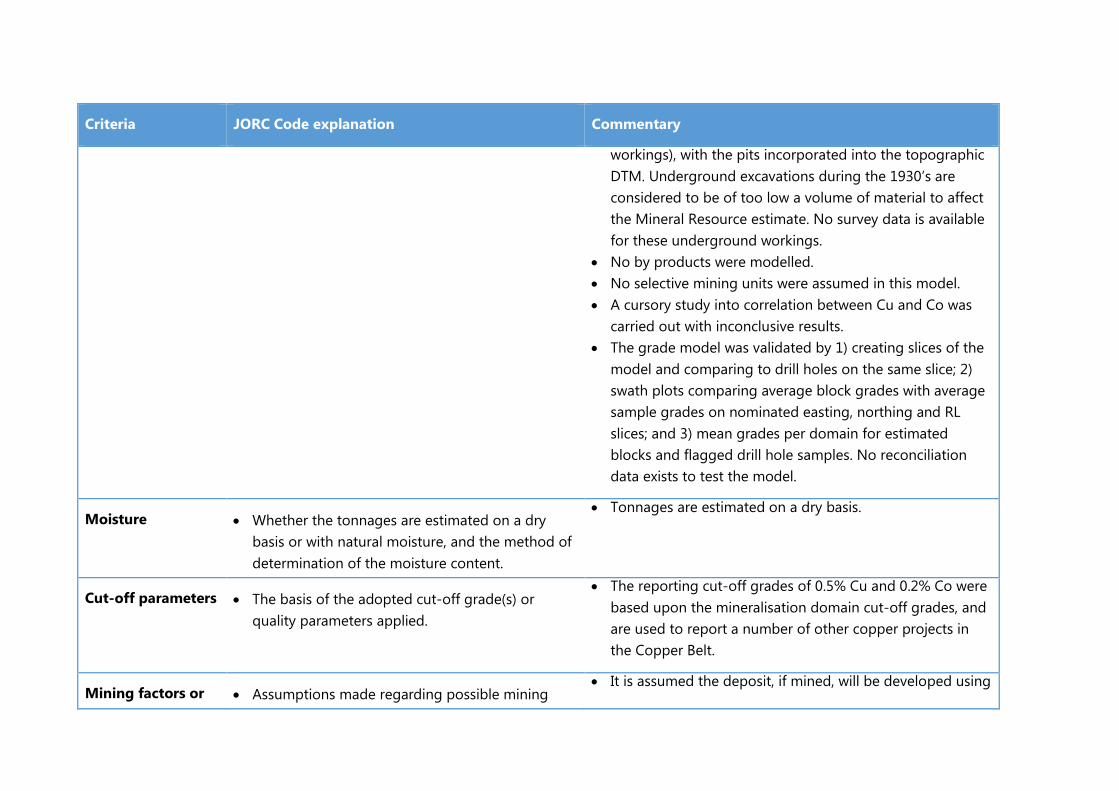
Criteria JORC Code explanation Commentary
workings), with the pits incorporated into the topographic DTM. Underground excavations during the 1930’s are considered to be of too low a volume of material to affect the Mineral Resource estimate. No survey data is available for these underground workings.
• No by products were modelled. • No selective mining units were assumed in this model. • A cursory study into correlation between Cu and Co was
carried out with inconclusive results. • The grade model was validated by 1) creating slices of the
model and comparing to drill holes on the same slice; 2) swath plots comparing average block grades with average sample grades on nominated easting, northing and RL slices; and 3) mean grades per domain for estimated blocks and flagged drill hole samples. No reconciliation data exists to test the model.
Moisture • Whether the tonnages are estimated on a dry basis or with natural moisture, and the method of determination of the moisture content.
• Tonnages are estimated on a dry basis.
Cut-off parameters • The basis of the adopted cut-off grade(s) or quality parameters applied.
• The reporting cut-off grades of 0.5% Cu and 0.2% Co were based upon the mineralisation domain cut-off grades, and are used to report a number of other copper projects in the Copper Belt.
Mining factors or • Assumptions made regarding possible mining • It is assumed the deposit, if mined, will be developed using

Criteria JORC Code explanation Commentary
assumptions methods, minimum mining dimensions and internal (or, if applicable, external) mining dilution. It is always necessary as part of the process of determining reasonable prospects for eventual economic extraction to consider potential mining methods, but the assumptions made regarding mining methods and parameters when estimating Mineral Resources may not always be rigorous. Where this is the case, this should be reported with an explanation of the basis of the mining assumptions made.
open pit mining methods. No assumptions have been made to date regarding minimum mining widths or dilution.
• The largest mineralisation domains in plan view have an apparent width of over 80m which may result in less selective mining methods, as opposed to (for example) mining equipment that would need to be used to mine narrow veins in a gold mine.
Metallurgical factors or assumptions
• The basis for assumptions or predictions regarding metallurgical amenability. It is always necessary as part of the process of determining reasonable prospects for eventual economic extraction to consider potential metallurgical methods, but the assumptions regarding metallurgical treatment processes and parameters made when reporting Mineral Resources may not always be rigorous. Where this is the case, this should be reported with an explanation of the basis of the metallurgical assumptions made.
• Three diamond holes were drilled in late 2014 for the purposes of collecting samples for metallurgical test-work. Approximately 1,100 kg of large diameter whole core samples were dispatched to ALS Laboratory in Perth for the test work.
• Regal have commenced analysing drill samples for acid soluble copper, however these results have not been assessed as part of the current Mineral Resource estimate.
Environmental factors or
• Assumptions made regarding possible waste and process residue disposal options. It is always necessary as part of the process of determining
• No assumptions have been made to date regarding possible waste and process residue disposal options.
• Waste and low grade stockpiles from the historical open

Criteria JORC Code explanation Commentary
assumptions reasonable prospects for eventual economic extraction to consider the potential environmental impacts of the mining and processing operation. While at this stage the determination of potential environmental impacts, particularly for a greenfields project, may not always be well advanced, the status of early consideration of these potential environmental impacts should be reported. Where these aspects have not been considered this should be reported with an explanation of the environmental assumptions made.
pit mining are located to the west of the deposit with minimal revegetation occurring.
Bulk density • Whether assumed or determined. If assumed, the basis for the assumptions. If determined, the method used, whether wet or dry, the frequency of the measurements, the nature, size and representativeness of the samples.
• The bulk density for bulk material must have been measured by methods that adequately account for void spaces (vugs, porosity, etc), moisture and differences between rock and alteration zones within the deposit.
• Discuss assumptions for bulk density estimates used in the evaluation process of the different materials.
The Mineral Resource estimate used density values assigned to the block model based upon mineralisation domain and weathering profile. Within the oxide zone, copper mineralisation domains were assigned a density value of 2.32 t/m3; cobalt domains 2.08 t/m3 and ‘mixed’ zones (copper and cobalt domains overlapping) 2.19 t/m3. Within the primary zone, copper mineralisation domains were assigned a density value of 2.58 t/m3; cobalt domains 2.48 t/m3 and ‘mixed’ zones (copper and cobalt domains overlapping) 2.68 t/m3.Waste blocks were assigned density values of 2.24 t/m3 (oxide) and 2.58 t/m3 (fresh rock). The Competent Person considers the density values to be appropriate for the host lithology and the intensity of weathering exhibited in each

Criteria JORC Code explanation Commentary
weathering domain.
• Densities were measured from selected intervals of diamond drill core, using a wet immersion technique. Core samples were wrapped in cling wrap prior to immersion to prevent water intake into sample.
Classification • The basis for the classification of the Mineral Resources into varying confidence categories.
• Whether appropriate account has been taken of all relevant factors (ie relative confidence in tonnage/grade estimations, reliability of input data, confidence in continuity of geology and metal values, quality, quantity and distribution of the data).
• Whether the result appropriately reflects the Competent Person’s view of the deposit.
• Classification of the Mineral Resource estimates was carried out taking into account the geological understanding of the deposit, QAQC of the samples, density data and drill hole spacing.
• The Mineral Resource is classified as a combination of Measured, Indicated and Inferred, with geological evidence sufficient to confirm geological and grade continuity for the Measured Mineral Resource.
• All available data was assessed and the competent persons ‘ relative confidence in the data was used to assist in the classification of the Mineral Resource.
• The current classification assignment appropriately reflects the Competent Person’s view of the deposit.
Audits or reviews • The results of any audits or reviews of Mineral Resource estimates.
• No audits or reviews of the current Mineral Resource estimate have been undertaken.
Discussion of relative accuracy/ confidence
• Where appropriate a statement of the relative accuracy and confidence level in the Mineral Resource estimate using an approach or
• An inverse distance estimation algorithm was used in parallel with the ordinary Kriged interpolation, with results very similar to the Kriged results.
• No other estimation method or geostatistical analysis has
Criteria JORC Code explanation Commentary
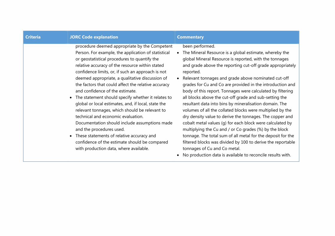
procedure deemed appropriate by the Competent Person. For example, the application of statistical or geostatistical procedures to quantify the relative accuracy of the resource within stated confidence limits, or, if such an approach is not deemed appropriate, a qualitative discussion of the factors that could affect the relative accuracy and confidence of the estimate.
• The statement should specify whether it relates to global or local estimates, and, if local, state the relevant tonnages, which should be relevant to technical and economic evaluation. Documentation should include assumptions made and the procedures used.
• These statements of relative accuracy and confidence of the estimate should be compared with production data, where available.
been performed. • The Mineral Resource is a global estimate, whereby the
global Mineral Resource is reported, with the tonnages and grade above the reporting cut-off grade appropriately reported.
• Relevant tonnages and grade above nominated cut-off grades for Cu and Co are provided in the introduction and body of this report. Tonnages were calculated by filtering all blocks above the cut-off grade and sub-setting the resultant data into bins by mineralisation domain. The volumes of all the collated blocks were multiplied by the dry density value to derive the tonnages. The copper and cobalt metal values (g) for each block were calculated by multiplying the Cu and / or Co grades (%) by the block tonnage. The total sum of all metal for the deposit for the filtered blocks was divided by 100 to derive the reportable tonnages of Cu and Co metal.
• No production data is available to reconcile results with.